| Critical Data with Normal Counts |
|---|
| Type | Description | Hourly Count | Monthly Average | Percent (%) of Monthly Mean | UTC Time Window |
1bamua |
NOAA 15-19 & METOP 1-2 AMSU-A NCEP-proc. br.temps |
44303 |
42023 |
105.4 % |
0806.00-0811.99 |
1bhrs4 |
NOAA 18-19 & METOP 1-2 HIRS-4 NCEP-proc. br.temps |
39364 |
39177 |
100.5 % |
0806.00-0811.99 |
1bmhs |
NOAA 18-19 & METOP 1-2 MHS NCEP-proces. br. temps |
212860 |
248383 |
85.7 % |
0806.00-0811.99 |
acars |
MDCRS ACARS acft data from ARINC(dcded from BUFR) |
14743 |
24725 |
59.6 % |
0805.75-0812.25 |
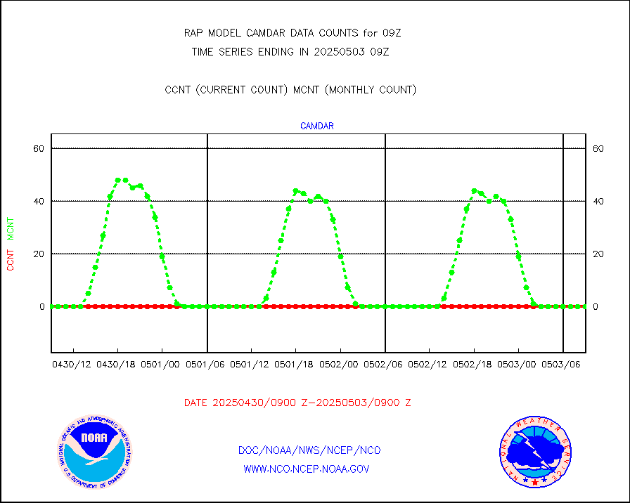
camdar |
Canadian AMDAR aircraft data (decoded from BUFR) |
0 |
0 |
n/a |
0805.75-0812.25 |
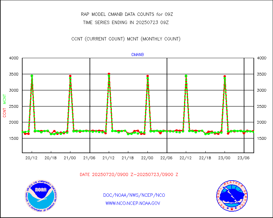
cmanb |
Surface Marine CMAN rpts decoded from BUFR format |
1725 |
1673 |
103.1 % |
0808.50-0809.50 |
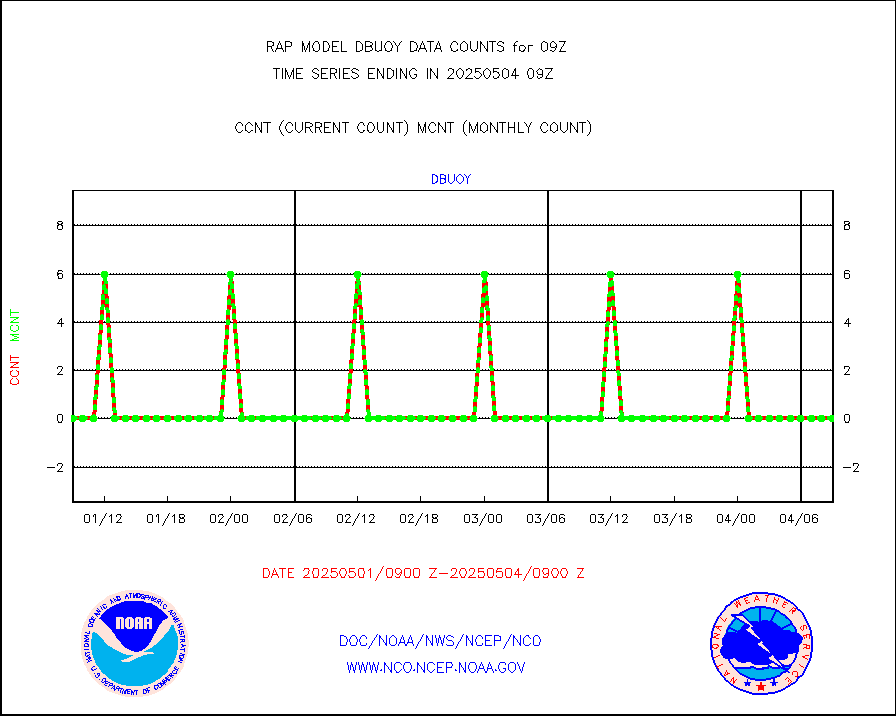
dbuoy |
Buoys decoded from FM-18 fmt (moored or drifting) |
0 |
0 |
n/a |
0808.50-0809.50 |
gnss |
Grnd-based Gbl Navigation Sat System (GNSS) data |
2375 |
2590 |
91.7 % |
0807.95-0808.05 |
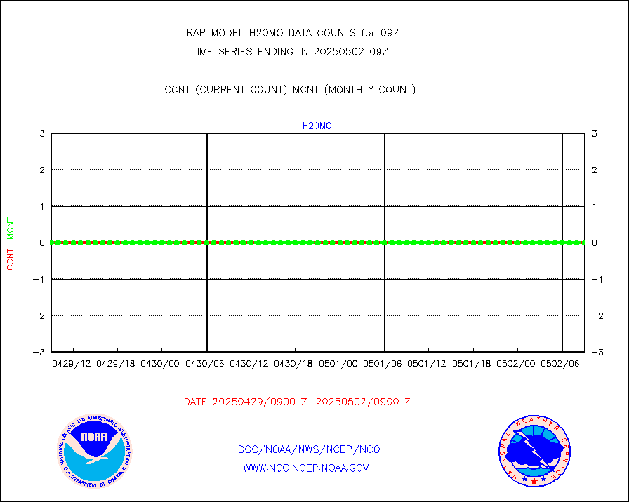
h20mo |
MODIS (AQUA/TERRA) wvpr imager derived cld motion |
0 |
0 |
n/a |
0806.50-0811.50 |
infmo |
MODIS (AQUA/TERRA) ir l-wave derived cloud motion |
0 |
0 |
n/a |
0806.50-0811.50 |
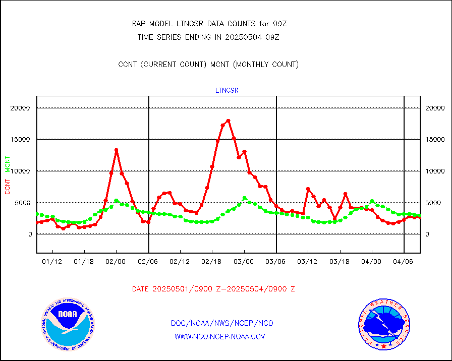
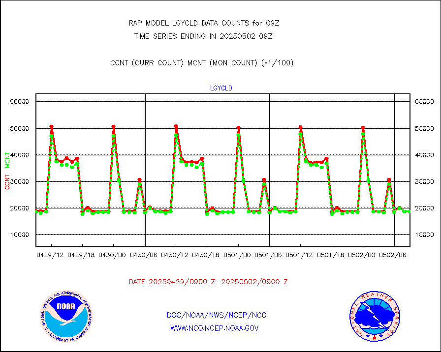
lgycld |
GOES/NASA(Langley) hi-res. (1x1 f-o-v) cloud data |
3733970 |
3077633 |
121.3 % |
0808.50-0809.50 |
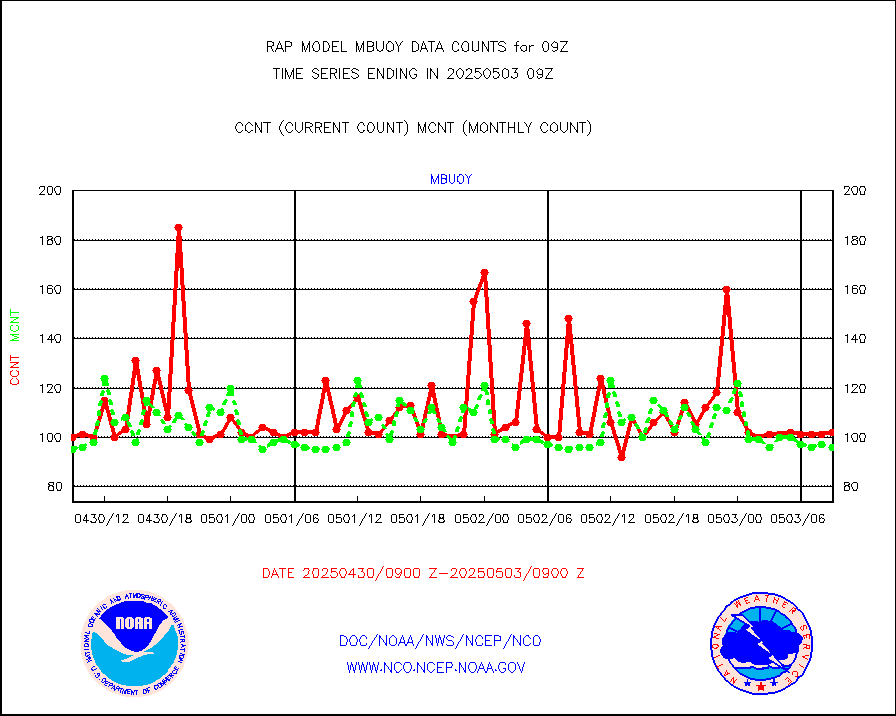
mbuoy |
Buoys decoded from FM-13 format (moored) |
70 |
52 |
134.6 % |
0808.50-0809.50 |
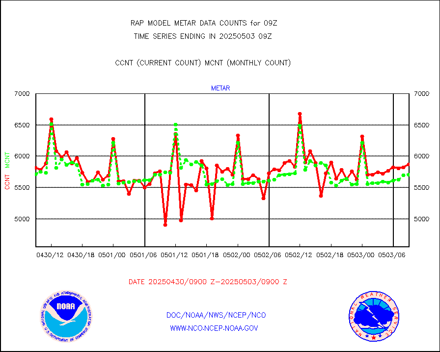
metar |
Aviation - METAR |
5977 |
5869 |
101.8 % |
0808.50-0809.50 |
nxrdw |
NEXRAD Vel Azm Dsp(VAD) winds via radar coded msg |
0 |
0 |
n/a |
0808.00-0810.00 |
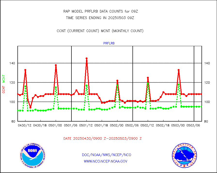
prflrb |
Multi-Agency Profiler (MAP) and SODAR winds |
97 |
80 |
121.2 % |
0807.50-0810.50 |
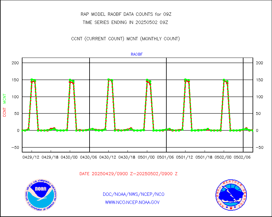
raobf |
Rawinsonde - fixed land (from TEMP or PILOT) |
0 |
0 |
n/a |
0808.00-0810.00 |
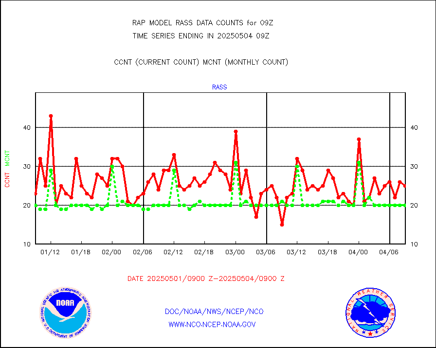
rass |
RASS temperatures (NOAA and Multi-Agency) |
21 |
19 |
110.5 % |
0808.50-0809.50 |
shipsb |
Ship - manual and automatic, restricted (BUFR) |
0 |
0 |
n/a |
0808.50-0809.50 |
shipsu |
Ship - manual and automatic, unrestricted |
69 |
51 |
135.3 % |
0808.50-0809.50 |
shipub |
Ship - manual and automatic, unrestricted (BUFR) |
196 |
290 |
67.6 % |
0808.50-0809.50 |
synop |
Synoptic - fixed manual and automatic |
440 |
446 |
98.7 % |
0808.50-0809.50 |
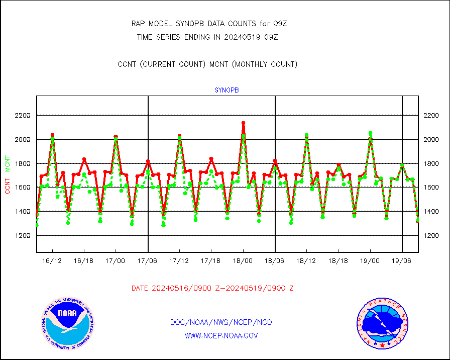
synopb |
Synoptic - fixed manual & auto (decoded fr BUFR) |
817 |
1304 |
62.7 % |
0808.50-0809.50 |
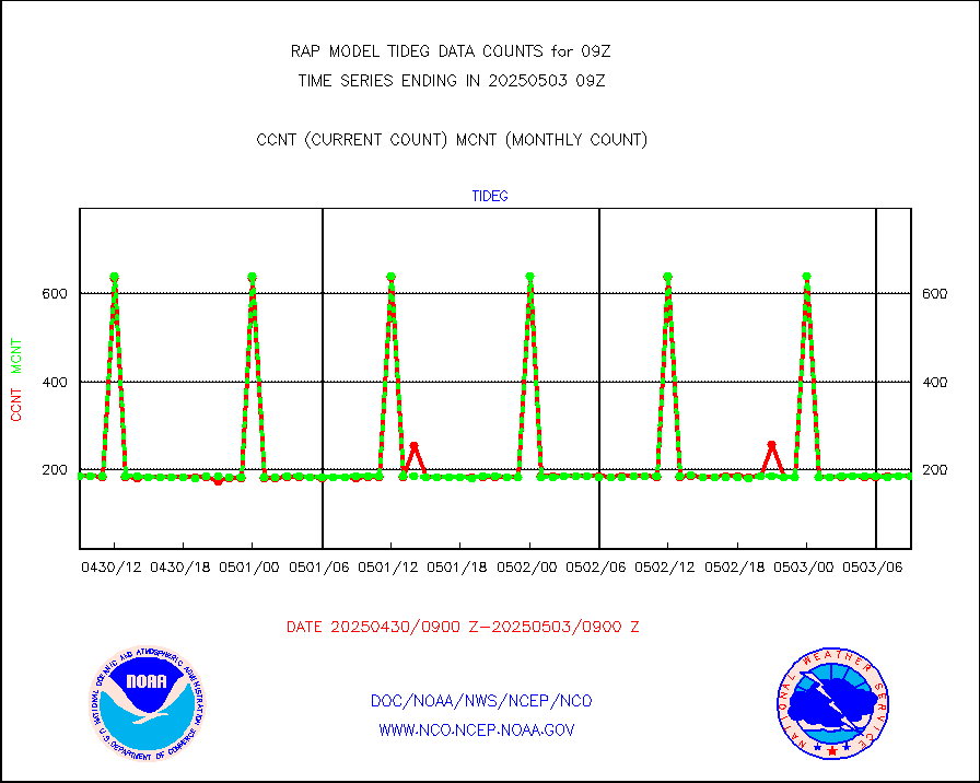
tideg |
Tide gauge reports decoded from CREX format |
181 |
179 |
101.1 % |
0808.50-0809.50 |
| Data Types of Opportunity with Normal Counts |
|---|
| Type | Description | Hourly Count | Monthly Average | Percent (%) of Monthly Mean | UTC Time Window |
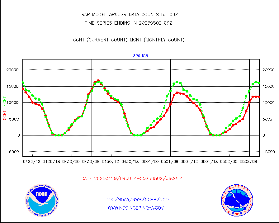
3p9usr |
GOES-16&up/NESDIS ir short-wv derived cld motion |
11571 |
14940 |
77.4 % |
0808.00-0808.99 |
acarsa |
MDCRS ACARS acft data (ARINC via AFWA)(AIREP fmt) |
0 |
0 |
n/a |
0805.75-0812.25 |
airep |
Manual AIREP aircraft data (dcded from AIREP fmt) |
3534 |
3457 |
102.2 % |
0805.75-0812.25 |
airsev |
AQUA AIRS/AMSU-A/HSB brightness temps- every FOV |
0 |
0 |
n/a |
0806.00-0811.99 |
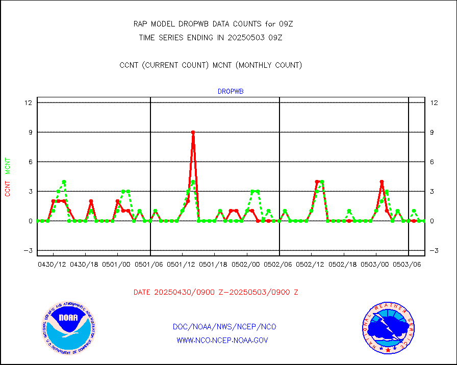
amdar |
AMDAR aircraft data (decoded from AMDAR format) |
2560 |
1888 |
135.6 % |
0805.75-0812.25 |
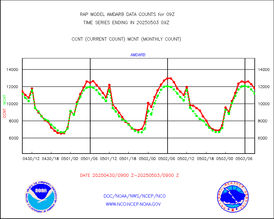
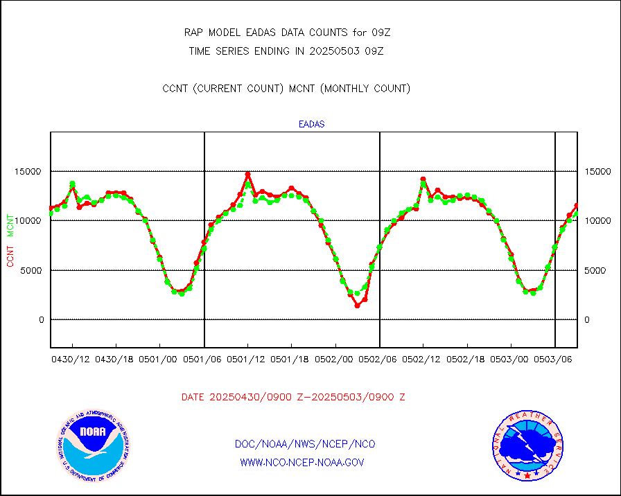
amdarb |
AMDAR aircraft data (decoded from BUFR) |
5493 |
6079 |
90.4 % |
0805.75-0812.25 |
amsr2 |
GCOM-W AMSR2 1B brightness temperatures |
1059535 |
624090 |
169.8 % |
0806.00-0806.99 |
ascat |
METOP 1-2 ASCAT products |
11439 |
21214 |
53.9 % |
0807.00-0811.00 |
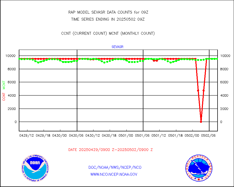
atms |
NPP/NOAA-20 ATMS brightness temperatures |
168024 |
143270 |
117.3 % |
0807.00-0810.99 |
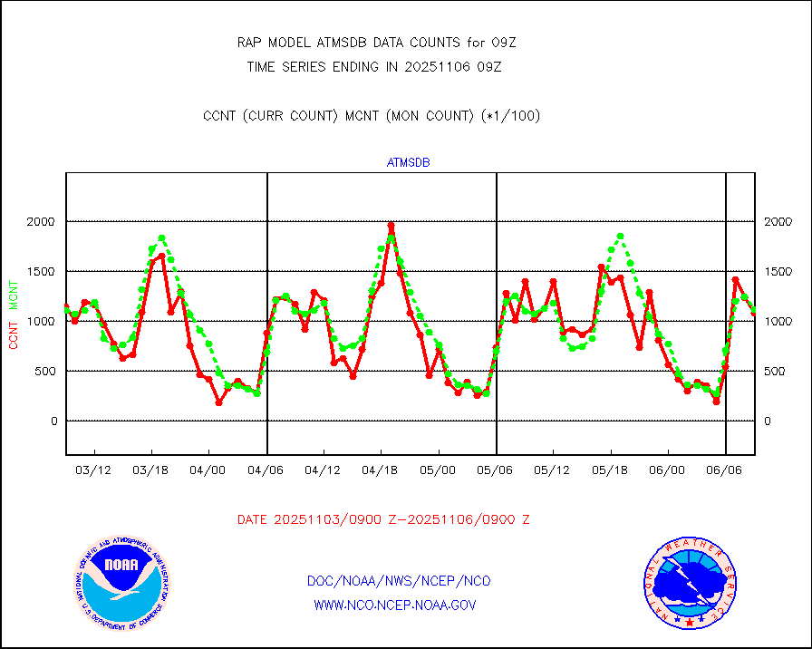
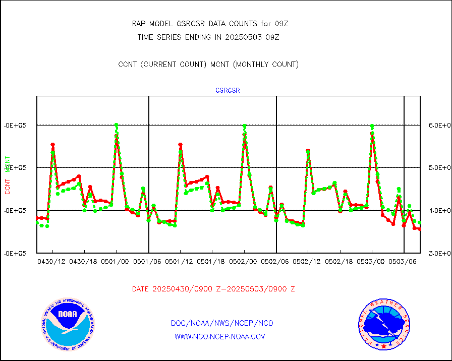
atmsdb |
NPP/NOAA-20 ATMS bright. temps-direct b-cast SSEC |
115434 |
116389 |
99.2 % |
0807.00-0810.99 |
coopmd |
Coop/MADIS NEPP & HCN-Modernization NOAA COOP Obs |
27 |
25 |
108.0 % |
0808.50-0809.50 |
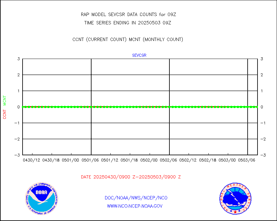
crisf4 |
NPP/NOAA-20 CrIS full spctrl radn (431 ch subset) |
102751 |
85321 |
120.4 % |
0807.00-0810.99 |
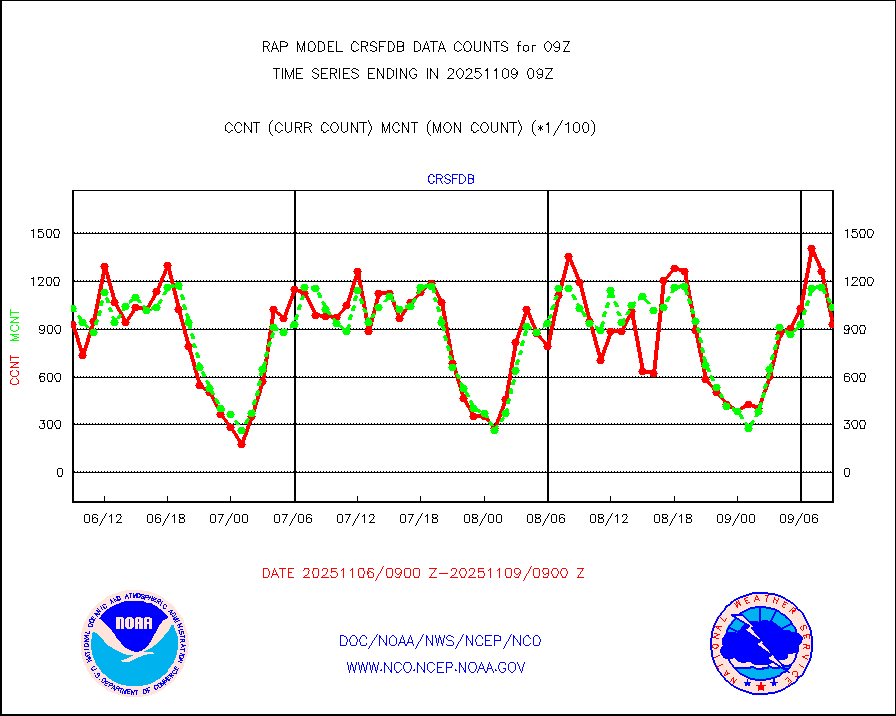
crsfdb |
NPP/NOAA-20 CrIS full spctrl radn dir brdcst SSEC |
126491 |
122251 |
103.5 % |
0807.00-0810.99 |
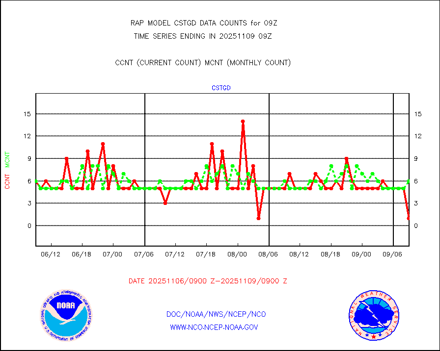
cstgd |
Coast Guard |
3 |
4 |
75.0 % |
0808.50-0809.50 |
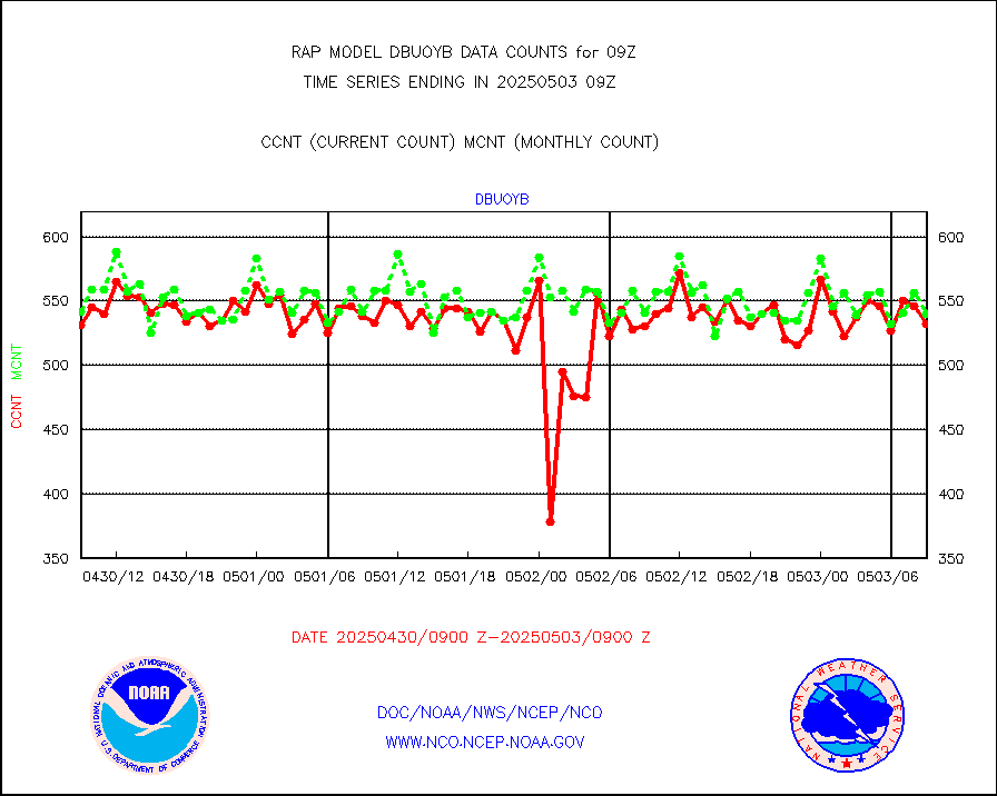
dbuoyb |
Drifting buoys (decoded from BUFR) |
516 |
552 |
93.5 % |
0808.50-0809.50 |
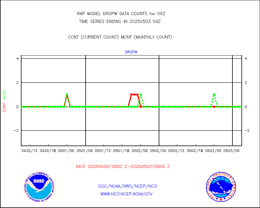
dropw |
Dropwinsonde (from TEMP DROP) |
0 |
0 |
n/a |
0808.00-0810.00 |
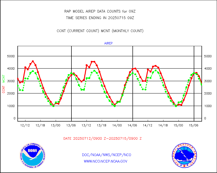
eadas |
E-AMDAR (European AMDAR acft decoded from BUFR) |
7063 |
8500 |
83.1 % |
0805.75-0812.25 |
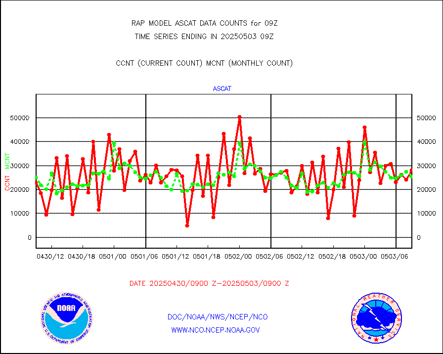
esamua |
NOAA 15-19 & METOP 1-2 AMSU-A proc btmps frm RARS |
10905 |
8666 |
125.8 % |
0808.00-0810.00 |
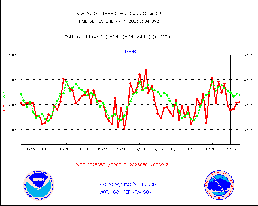
esatms |
NPP Adv. Tech. MW Sndr (ATMS) br. temps from RARS |
71156 |
97910 |
72.7 % |
0807.00-0810.99 |
eshrs3 |
NOAA 15-19 & METOP 1-2 HIRS-3/4 pr btmps frm RARS |
25448 |
21613 |
117.7 % |
0808.00-0810.00 |
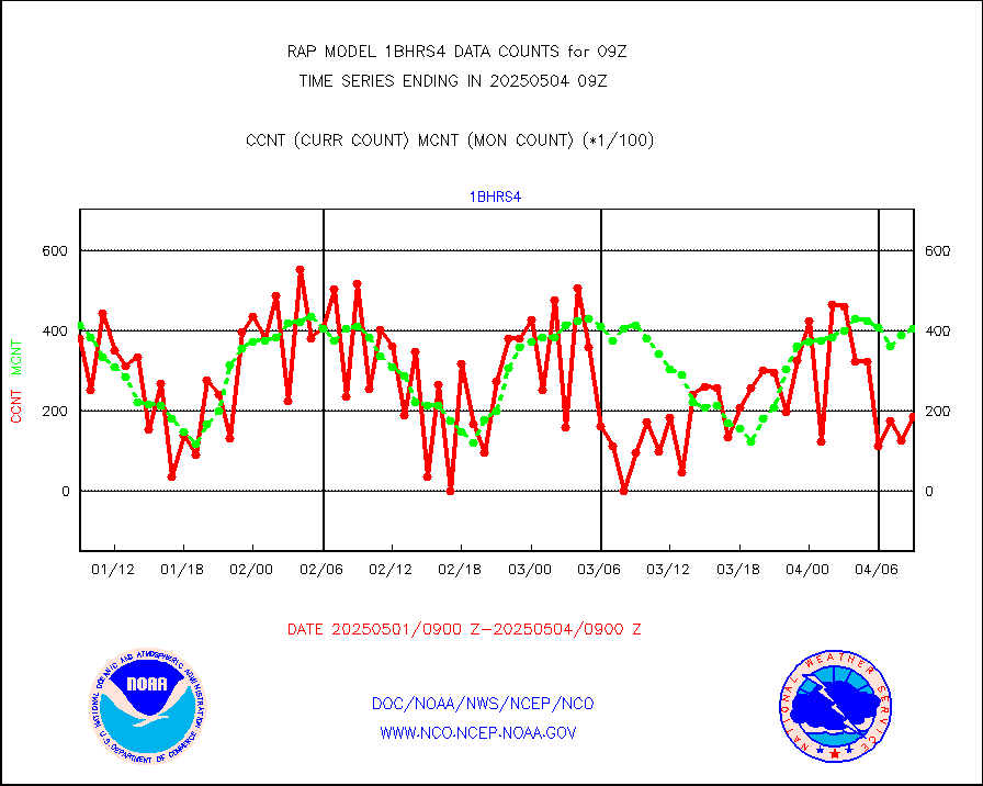
esiasi |
METOP 1-2 IASI 1C radiance data vbl chn from RARS |
9876 |
14625 |
67.5 % |
0807.00-0810.99 |
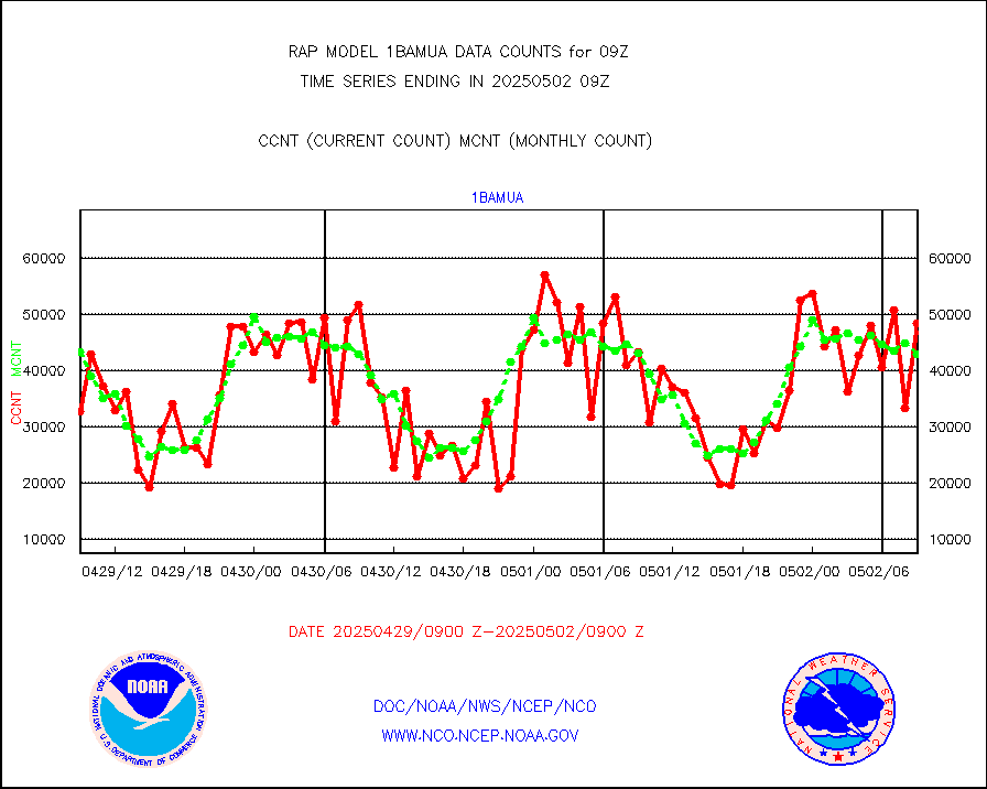
esmhs |
NOAA 18-19 & METOP 1-2 MHS proc. btemps from RARS |
59733 |
59003 |
101.2 % |
0808.00-0810.00 |
gmi1cr |
GPM GMI Level 1C-R brightness temperatures |
282694 |
806197 |
35.1 % |
0806.00-0811.99 |
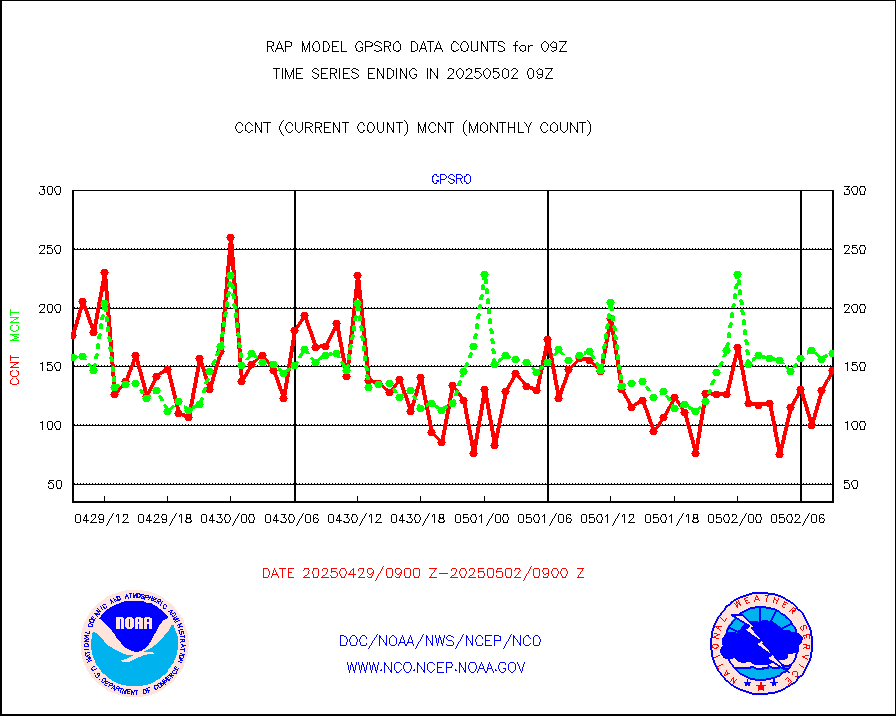
gpsro |
GPS radio occultation data |
86 |
124 |
69.4 % |
0807.00-0810.99 |
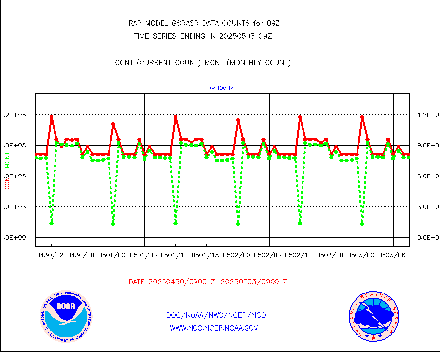
gsrasr |
GOES-16/17 All Sky Radiances (proc.) |
812097 |
810764 |
100.2 % |
0807.00-0810.99 |
gsrcsr |
GOES-16/17 Clear Sky Radiances (proc.) |
340950 |
361578 |
94.3 % |
0807.00-0810.99 |
h20ja |
MTSAT/JMA water vapor imager derived cloud motion |
3412 |
3047 |
112.0 % |
0806.50-0811.50 |
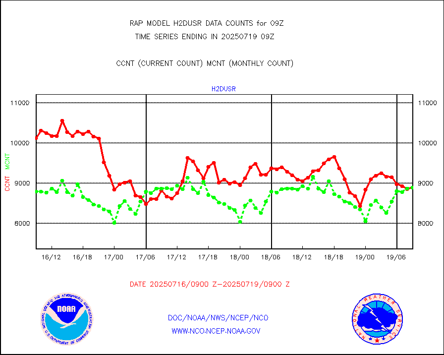
h2dusr |
GOES-16&up/NESDIS wv imgr/deep-lyr derivd cld mtn |
6179 |
6539 |
94.5 % |
0808.00-0808.99 |
h2eunb |
METEOSAT/EUMETSAT wvpr imgr drv cld motion NBseq |
2715 |
4919 |
55.2 % |
0807.50-0810.49 |
h2tusr |
GOES-16&up/NESDIS wv imgr/cld-top derived cld mtn |
13355 |
10569 |
126.4 % |
0808.00-0808.99 |
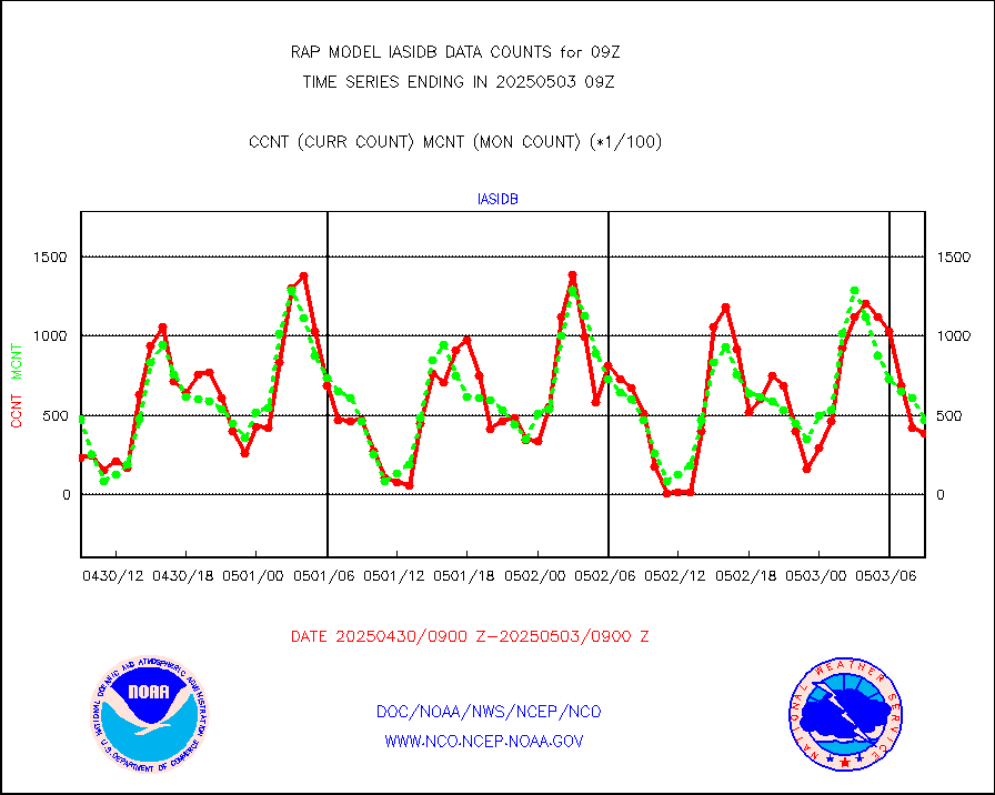
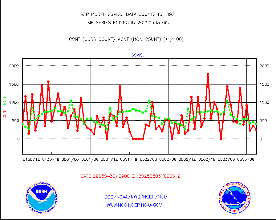
iasidb |
METOP 1-2 IASI 1C radiances-direct broadcast SSEC |
41206 |
37211 |
110.7 % |
0807.00-0810.99 |
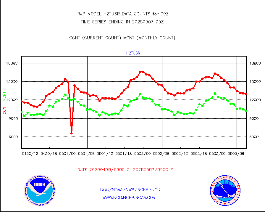
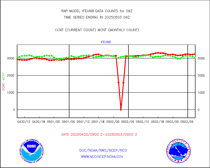
ifeunb |
METEOSAT/EUMETSAT ir lg-wave drv cld motion NBseq |
1606 |
3211 |
50.0 % |
0807.50-0810.49 |
ifvrnb |
VIIRS (NPP/NOAA-20) ir lg-wv drv cloud motion(NB) |
0 |
0 |
n/a |
0806.50-0811.50 |
infav |
AVHRR (NOAA/METOP) ir lg-wave derived cld motion |
0 |
0 |
n/a |
0806.50-0811.50 |
infav1 |
AVHRR (METOP) ir lg-wave derived cld motion |
0 |
0 |
n/a |
0807.50-0810.49 |
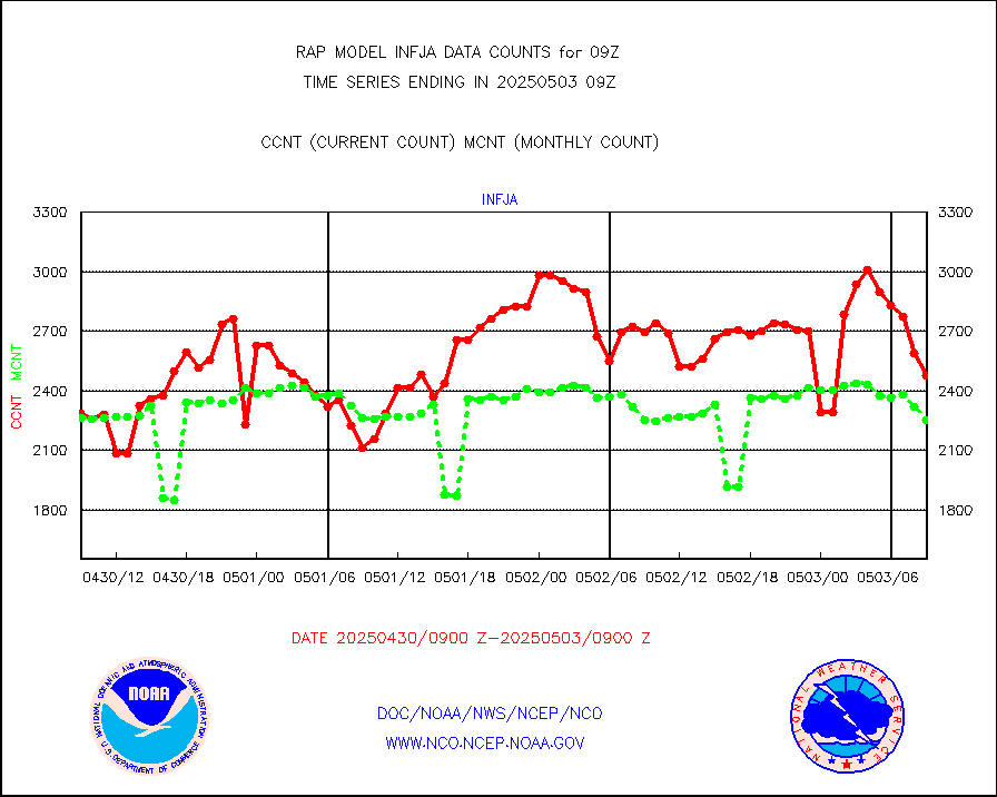
infja |
MTSAT/JMA infrared long-wave derived cloud motion |
2928 |
2502 |
117.0 % |
0806.50-0811.50 |
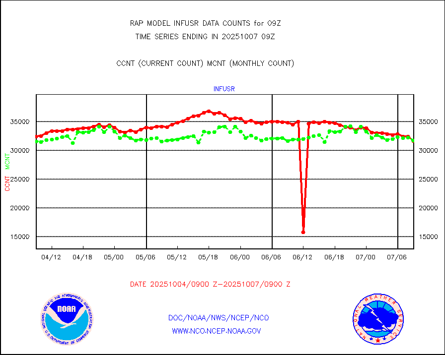
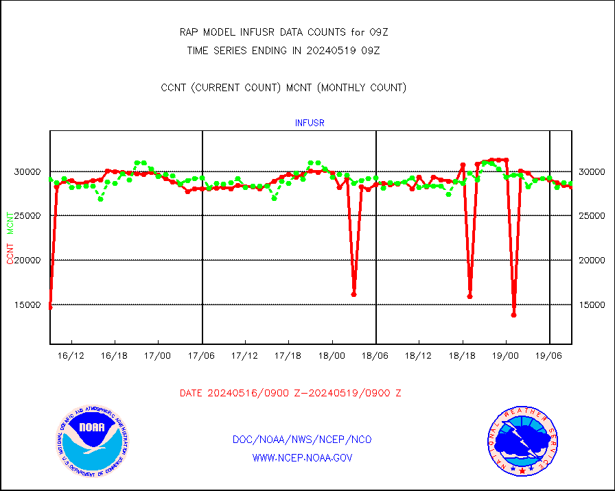
infusr |
GOES-16&up/NESDIS ir long-wave derived cld motion |
29903 |
30087 |
99.4 % |
0808.00-0808.99 |
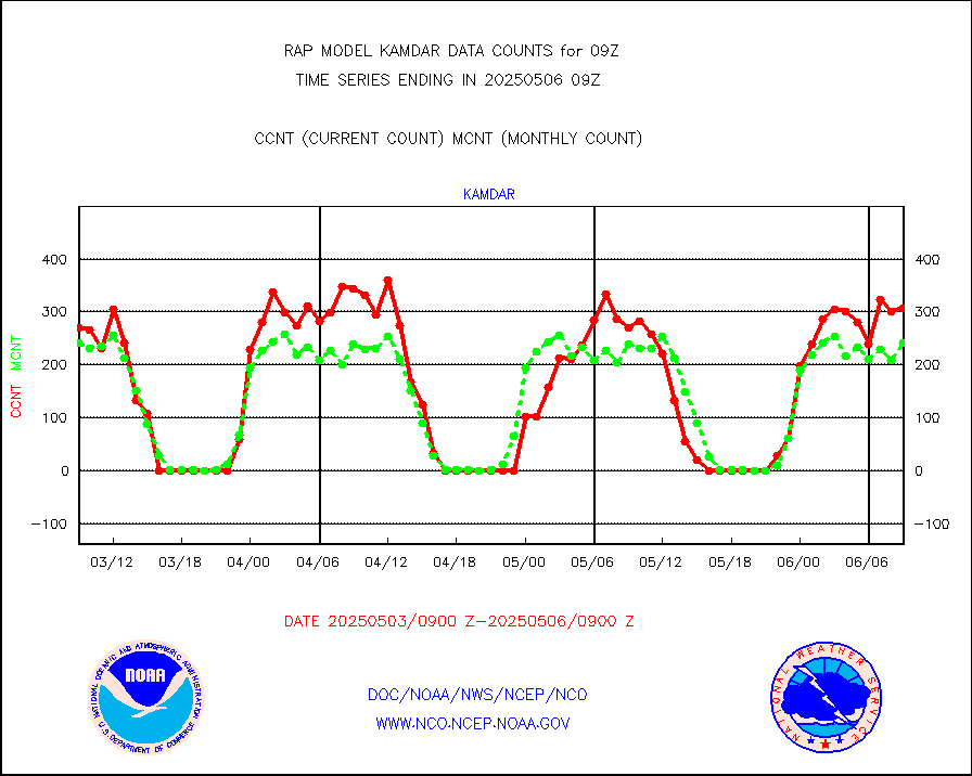
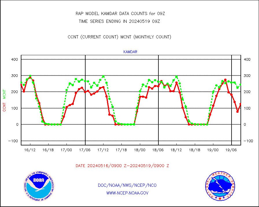
kamdar |
Korean AMDAR aircraft data (decoded from BUFR) |
218 |
278 |
78.4 % |
0805.75-0812.25 |
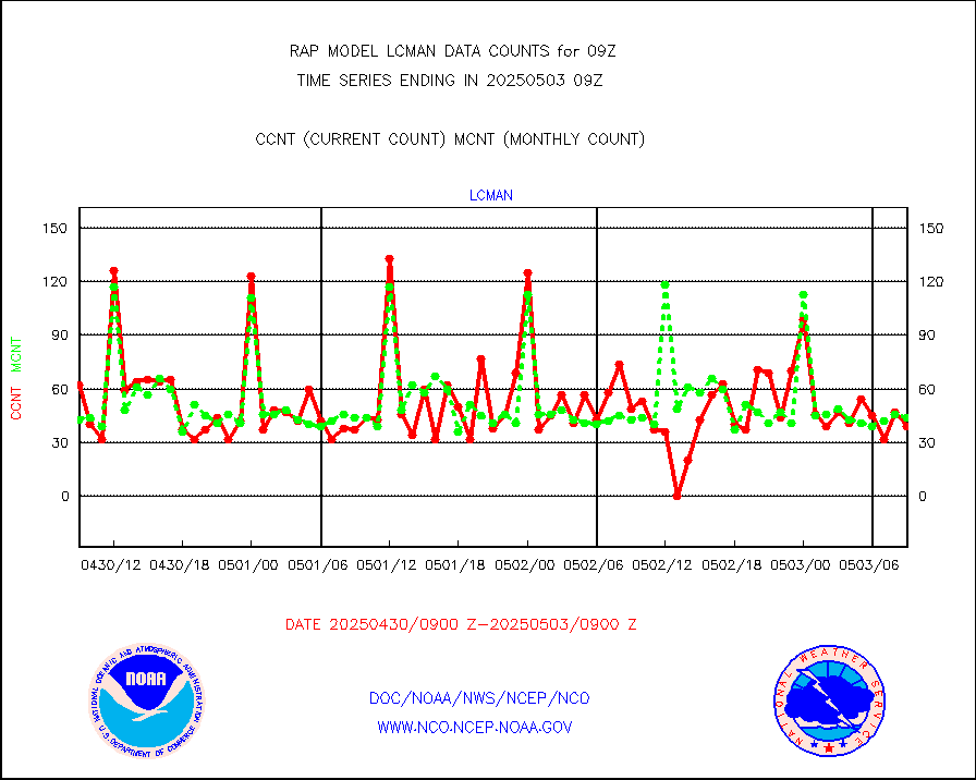
lcman |
Land-based CMAN stations decoded from CMAN format |
75 |
73 |
102.7 % |
0808.50-0809.50 |
ltnglr |
LLDN Long-rng lightning from Vaisala via NOAAPORT |
94961 |
63536 |
149.5 % |
0808.00-0809.50 |
ltngsr |
NLDN Shrt-rng lightning from Vaisala via NOAAPORT |
3960 |
3623 |
109.3 % |
0808.00-0809.50 |
mbuoyb |
Moored buoys (decoded from BUFR) |
530 |
508 |
104.3 % |
0808.50-0809.50 |
mso470 |
Mesonet/MADIS Colorado E-470 (Interstate 470) |
21 |
17 |
123.5 % |
0808.50-0809.50 |
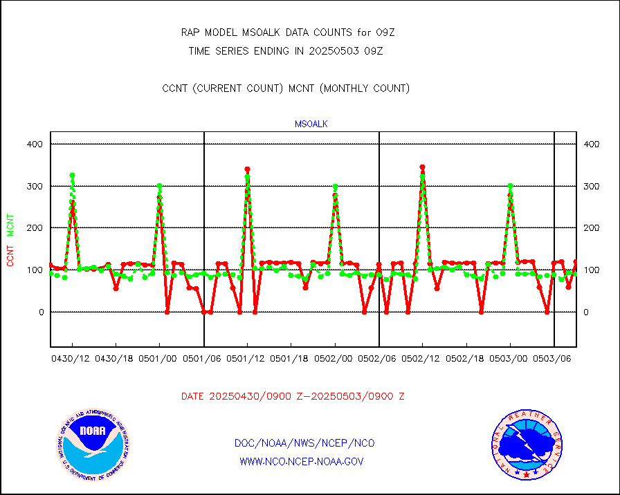
msoalk |
Mesonet/MADIS Alaska Department of Transportation |
109 |
99 |
110.1 % |
0808.50-0809.50 |
msoapg |
Mesonet/MADIS U.S. Army Aberdeen Proving Grounds |
0 |
0 |
n/a |
0808.50-0809.50 |
msoapr |
Mesonet/MADIS Citizen Weather Observers Program |
46282 |
43426 |
106.6 % |
0808.50-0809.50 |
msoaws |
Mesonet/MADIS AWS Convergence Technologies, Inc. |
25888 |
25016 |
103.5 % |
0808.50-0809.50 |
msoawx |
Mesonet/MADIS "Anything Weather" |
0 |
0 |
n/a |
0808.50-0809.50 |
msocol |
Mesonet/MADIS Colorado Dept. of Transportation |
0 |
0 |
n/a |
0808.50-0809.50 |
msodcn |
Mesonet/MADIS DC Net |
0 |
0 |
n/a |
0808.50-0809.50 |
msoden |
Mesonet/MADIS Denver Urban Drainage & Flood Cntrl |
225 |
205 |
109.8 % |
0808.50-0809.50 |
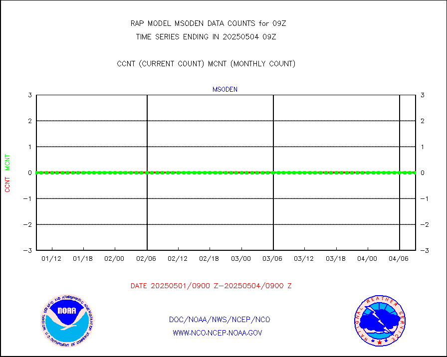
msofla |
Mesonet/MADIS Florida (FAWN & USF) |
3 |
3 |
100.0 % |
0808.50-0809.50 |
msoflt |
Mesonet/MADIS Florida Dept. of Transportation |
0 |
0 |
n/a |
0808.50-0809.50 |
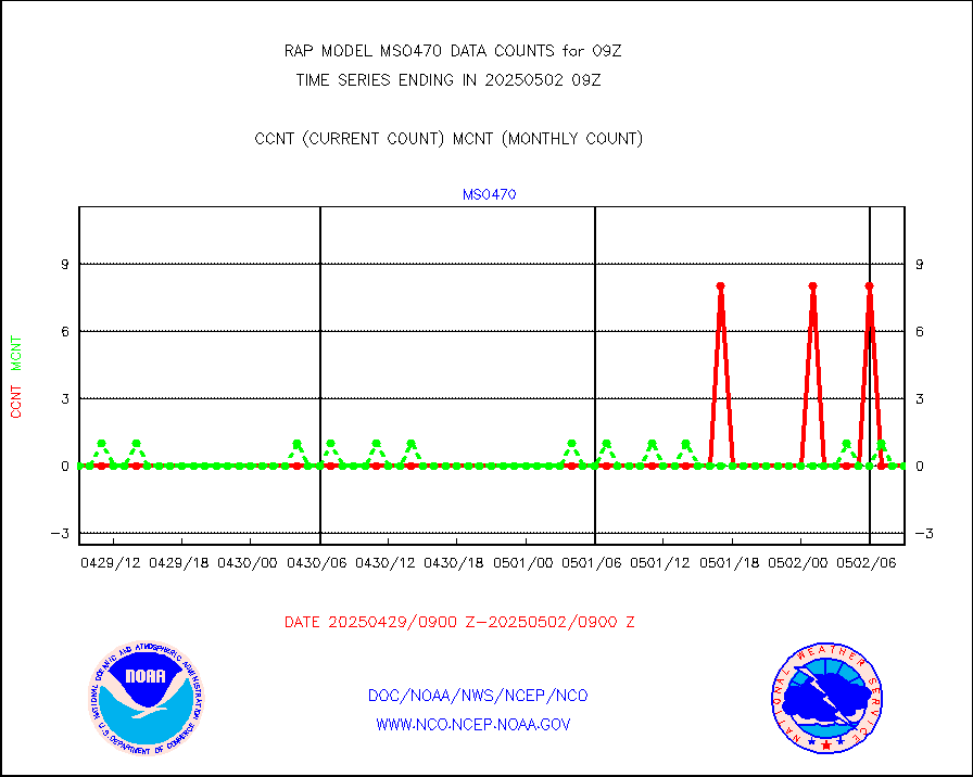
msogeo |
Mesonet/MADIS Georgia Dept. of Transportation |
0 |
0 |
n/a |
0808.50-0809.50 |
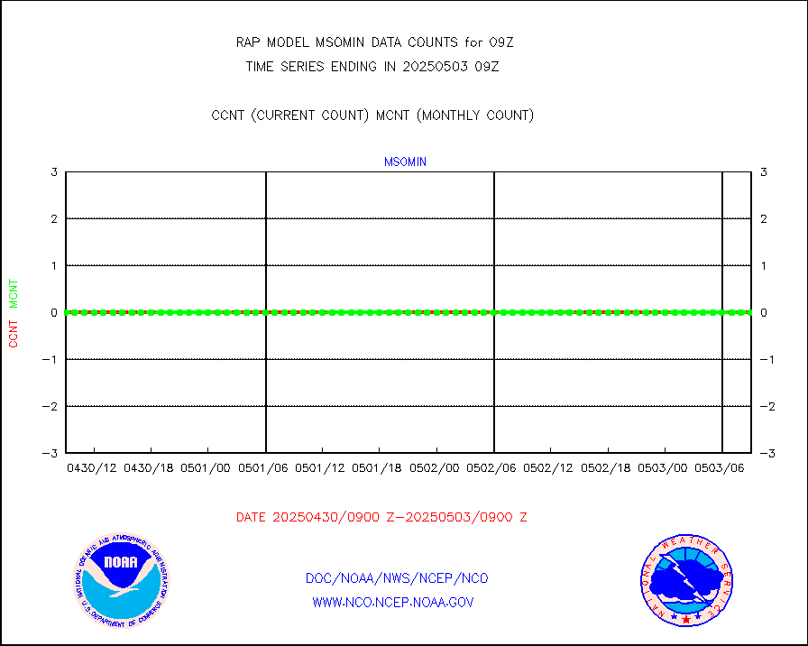
msohad |
Mesonet/MADIS NWS Hydromet Auto Data System(HADS) |
5511 |
5377 |
102.5 % |
0808.50-0809.50 |
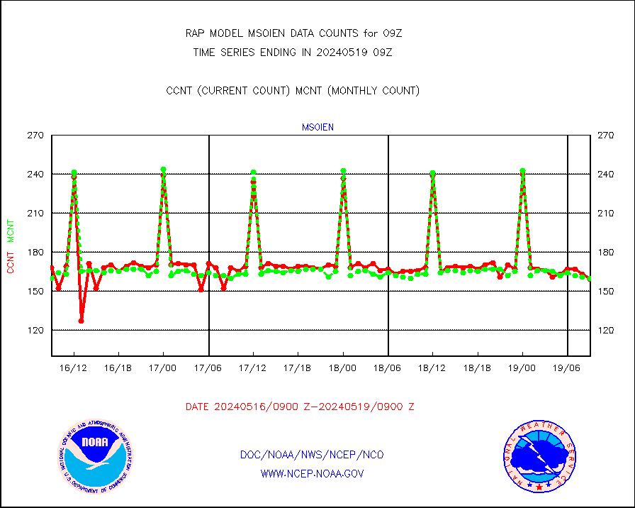
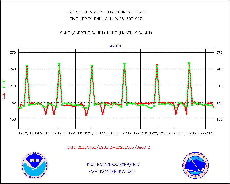
msoien |
Mesonet/MADIS Iowa Environmental |
147 |
161 |
91.3 % |
0808.50-0809.50 |
msoind |
Mesonet/MADIS Indiana Dept. of Transportation |
0 |
0 |
n/a |
0808.50-0809.50 |
msoiow |
Mesonet/MADIS Iowa Department of Transportation |
0 |
0 |
n/a |
0808.50-0809.50 |
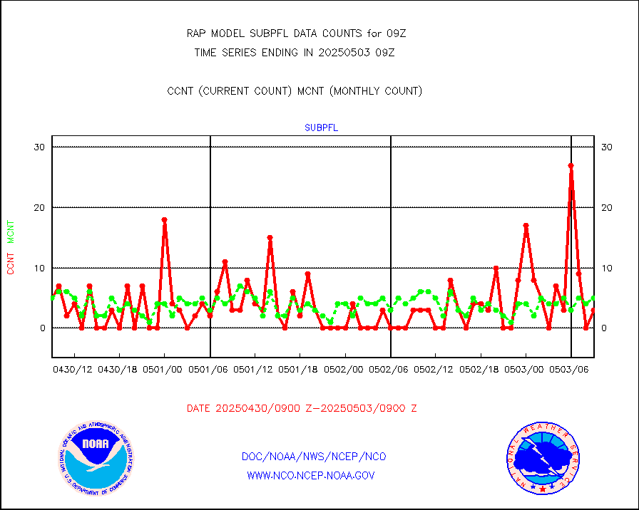
msokan |
Mesonet/MADIS Kansas Department of Transportation |
276 |
293 |
94.2 % |
0808.50-0809.50 |
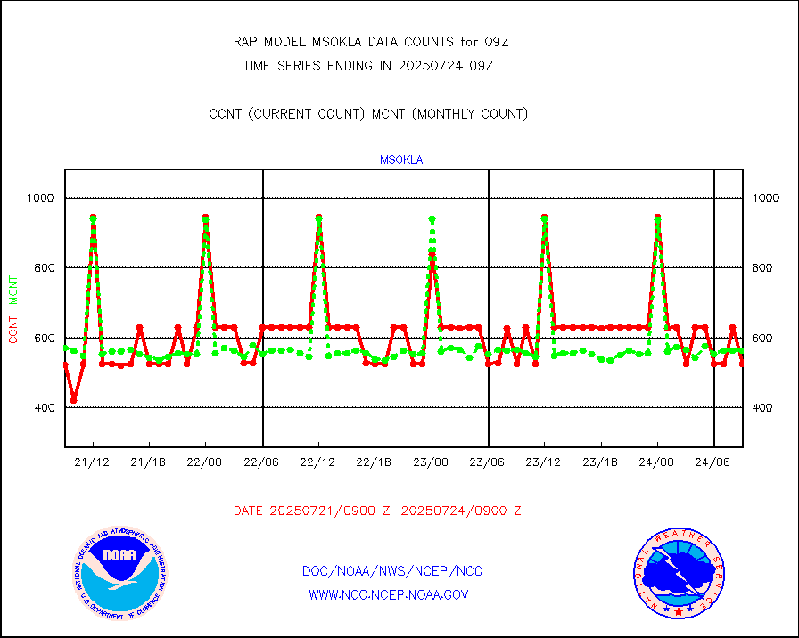
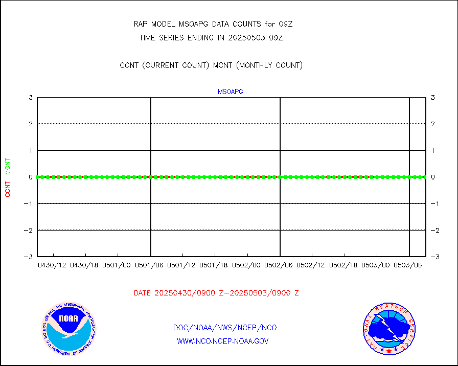
msokla |
Mesonet/MADIS Oklahoma Mesonet |
318 |
325 |
97.8 % |
0808.50-0809.50 |
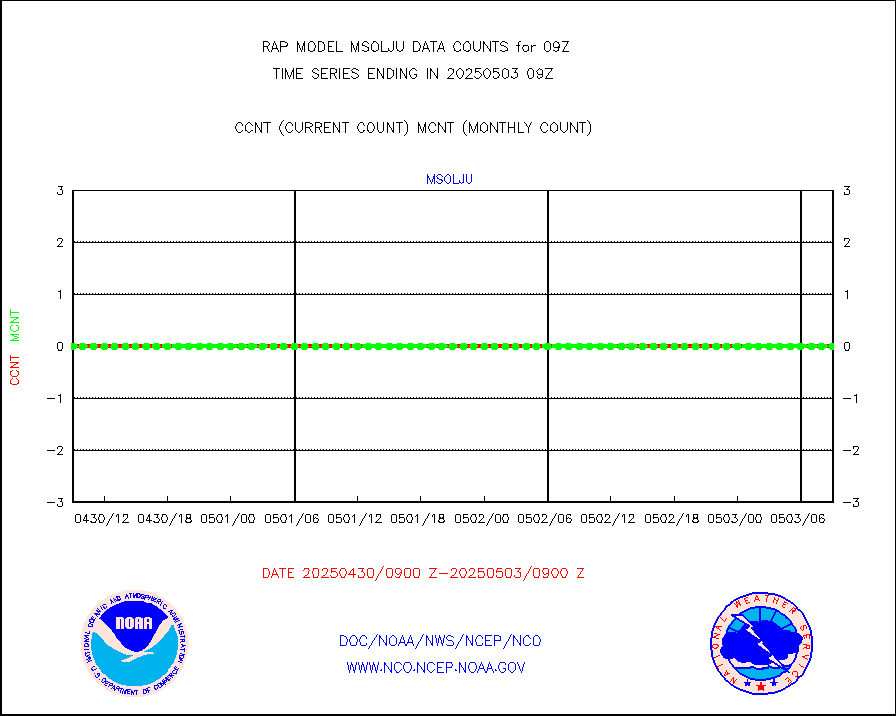
msolju |
Mesonet/MADIS Louisiana State/Jackson State Univ. |
0 |
0 |
n/a |
0808.50-0809.50 |
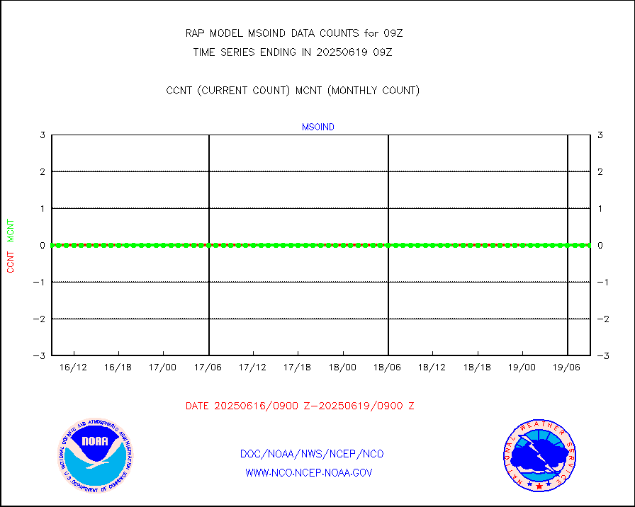
msomca |
Mesonet/MADIS Missouri Commercial Agricult Wx Net |
249 |
253 |
98.4 % |
0808.50-0809.50 |
msomin |
Mesonet/MADIS Minnesota Dept. of Transportation |
0 |
0 |
n/a |
0808.50-0809.50 |
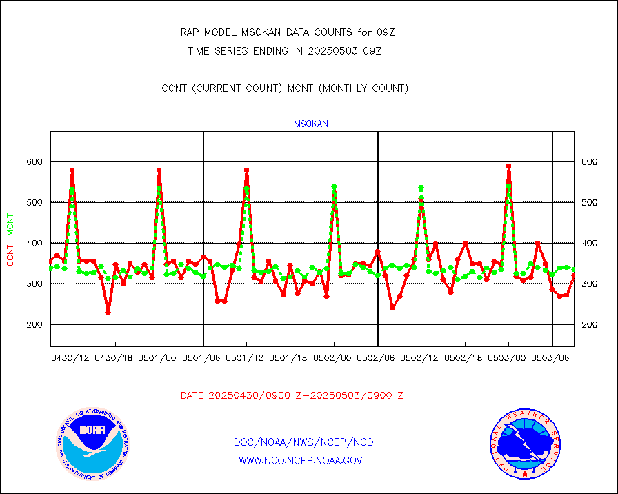
msonos |
Mesonet/MADIS NOS-Phys Oceanographic Realtime Sys |
292 |
272 |
107.4 % |
0808.50-0809.50 |
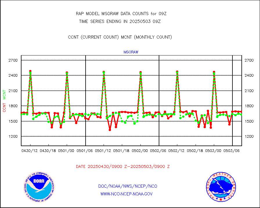
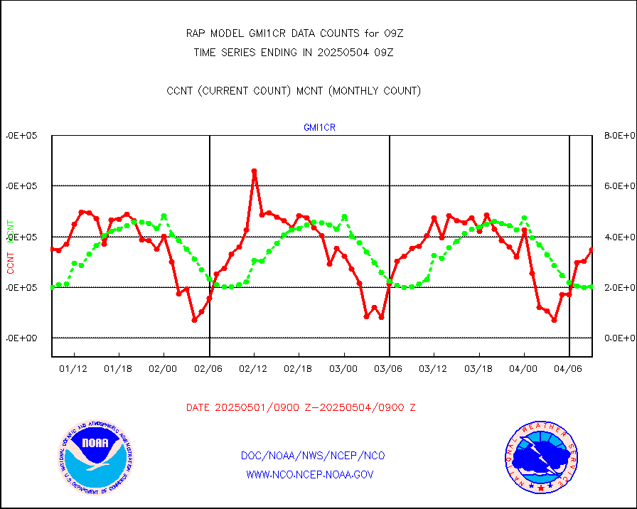
msoraw |
Mesonet/MADIS NFIC Remote Automated Wx Stns(RAWS) |
1630 |
1554 |
104.9 % |
0808.50-0809.50 |
msourb |
Mesonet/MADIS UrbaNet |
3981 |
3920 |
101.6 % |
0808.50-0809.50 |
msovir |
Mesonet/MADIS Virginia Dept. of Transportation |
227 |
227 |
100.0 % |
0808.50-0809.50 |
msowfy |
Mesonet/MADIS "Weather for You" |
0 |
0 |
n/a |
0808.50-0809.50 |
msowis |
Mesonet/MADIS Wisconsin Dept. of Transportation |
0 |
0 |
n/a |
0808.50-0809.50 |
msowst |
Mesonet/MADIS MesoWest (many subproviders) |
40265 |
38632 |
104.2 % |
0808.50-0809.50 |
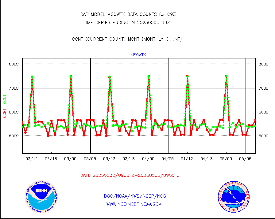
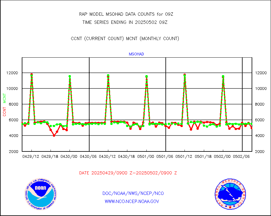
msowtx |
Mesonet/MADIS West Texas |
4597 |
4721 |
97.4 % |
0808.50-0809.50 |
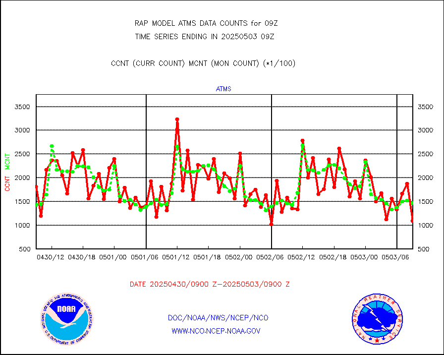
mtiasi |
METOP 1-2 IASI 1C radiance data (varbl. channels) |
41392 |
35294 |
117.3 % |
0807.00-0810.99 |
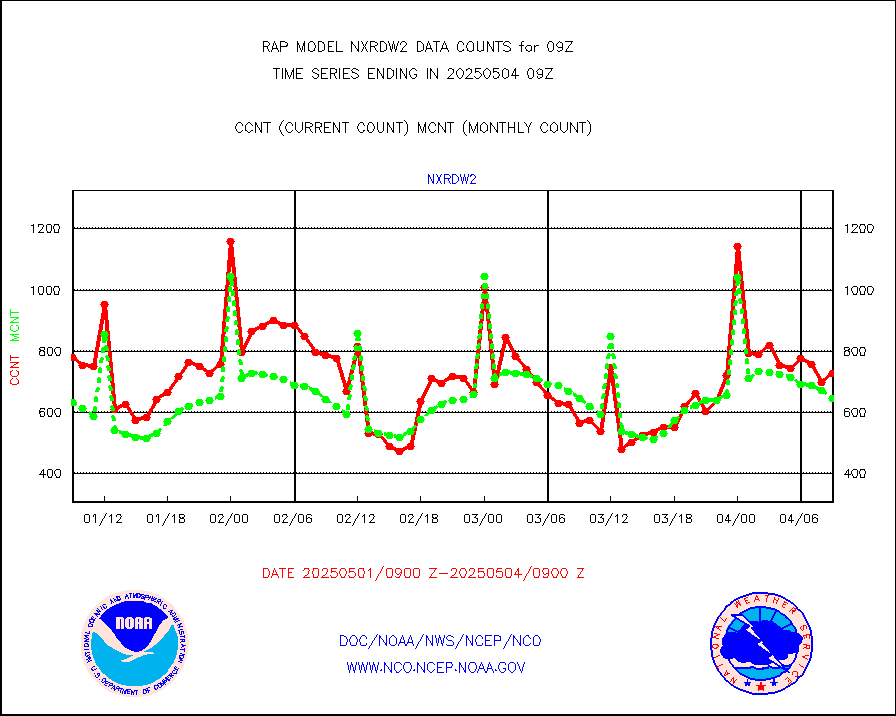
nxrdw2 |
NEXRAD Vel Azm Dsp(VAD) winds via Level 2 decoder |
798 |
743 |
107.4 % |
0808.00-0810.00 |
osbuv8 |
NOAA 16-19 Solar Backscatter UV-2 rad frm V8 BUFR |
0 |
0 |
n/a |
0807.00-0809.99 |
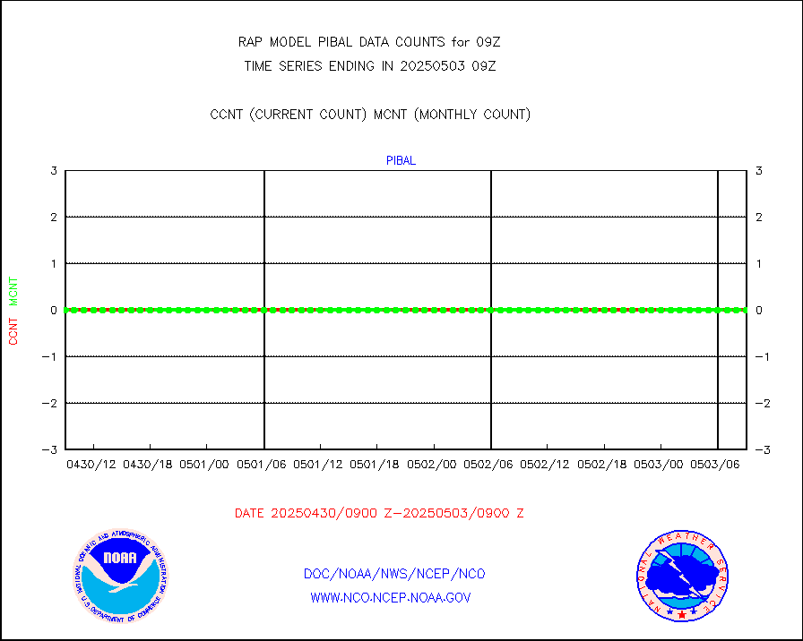
pibal |
PIBAL (from PILOT, PILOT SHIP, PILOT MOBIL) |
0 |
0 |
n/a |
0808.00-0810.00 |
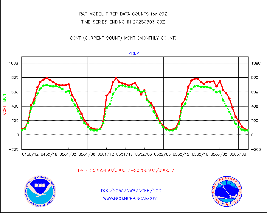
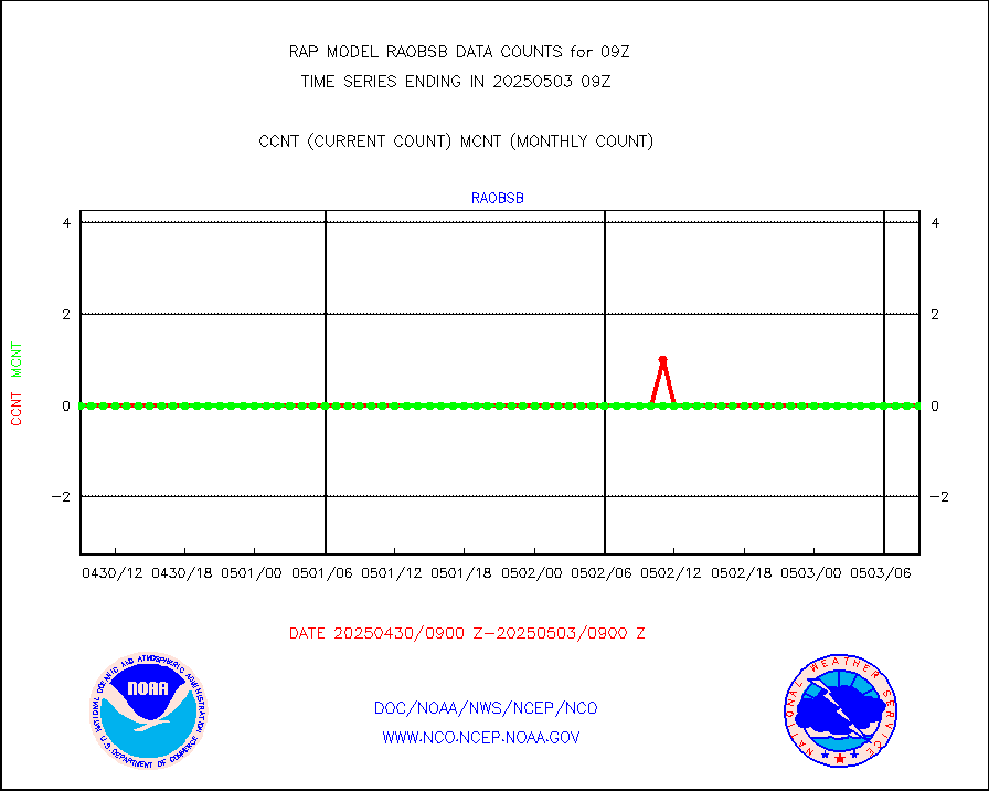
pirep |
Manual PIREP aircraft data (dcded from AIREP fmt) |
53 |
51 |
103.9 % |
0805.75-0812.25 |
prflrp |
Profilr winds from PIBAL (PILOT,PILOT SHIP/MOBIL) |
0 |
0 |
n/a |
0807.50-0810.50 |
raobm |
Rawinsonde - mobile land (from TEMP/PILOT MOBIL) |
0 |
0 |
n/a |
0808.00-0810.00 |
raobs |
Rawinsonde - ship (from TEMP SHIP, PILOT SHIP) |
0 |
0 |
n/a |
0808.00-0810.00 |
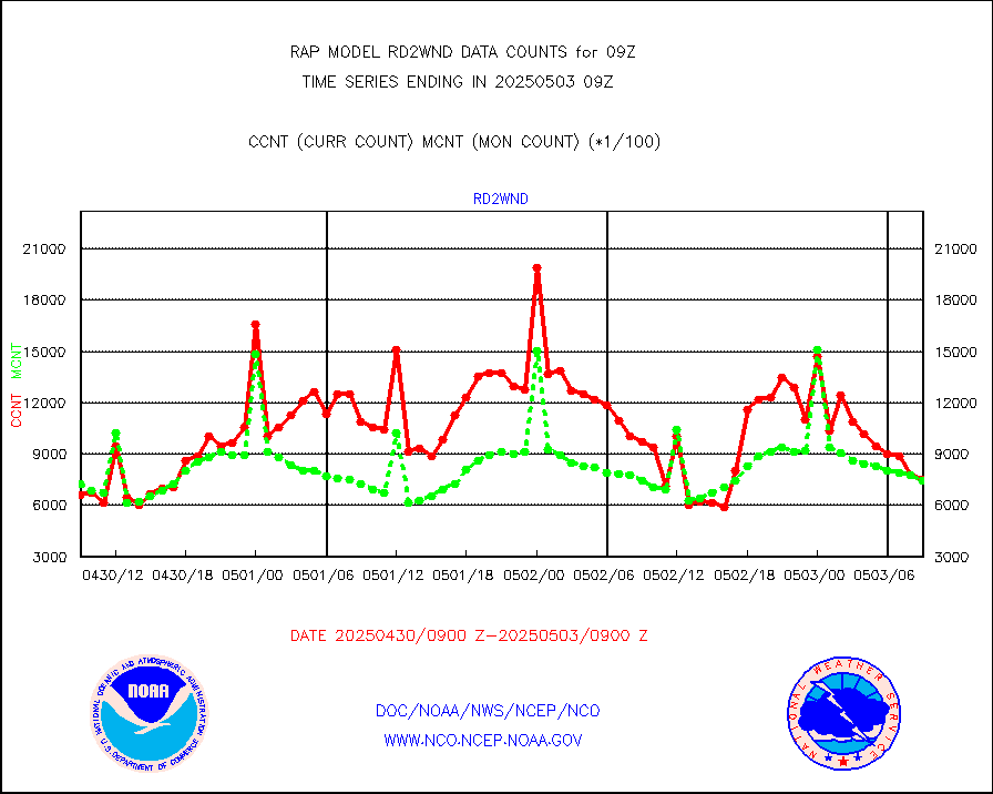
rd2wnd |
NEXRAD radial wind (Level 2 - GTS) |
1005967 |
866726 |
116.1 % |
0808.50-0809.49 |
recco |
Flight level reconnaissance aircraft data |
0 |
0 |
n/a |
0808.00-0810.00 |
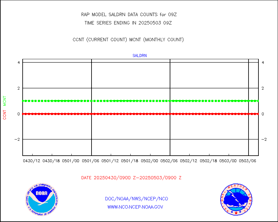
saldrn |
Surface Marine Saildrone (decoded from BUFR) |
2 |
2 |
100.0 % |
0807.00-0810.99 |
saphir |
Megha-Tropiques SAPHIR L1A2 brightness temps |
0 |
0 |
n/a |
0806.00-0811.99 |
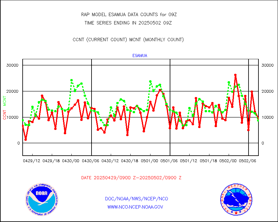
sevasr |
METEOSAT-10 2nd Gen SEVIRI All Sky Radiance(proc) |
4756 |
9488 |
50.1 % |
0807.00-0810.99 |
sevcsr |
METEOSAT-10 2nd Gen SEVIRI Clr Sky Radiance(proc) |
0 |
0 |
n/a |
0807.00-0810.99 |
ships |
Ship - manual and automatic, restricted |
0 |
4 |
0.0 % |
0808.50-0809.50 |
snocvr |
NOW COVER, DEPTH/DENSITY AND WATER EQUIVALENT |
1627 |
6465 |
25.2 % |
0807.00-0811.00 |
ssmisu |
DMSP SSM/IS 1C radiance data (Unified Pre-Proc.) |
114241 |
39631 |
288.3 % |
0807.00-0810.99 |
subpfl |
Sub-surface float and glider profile (BUFR) |
24 |
15 |
160.0 % |
0807.00-0810.99 |
synopr |
Synoptic - restricted (WMO Res 40) manual & auto. |
22 |
0 |
n/a |
0808.50-0809.50 |
synpbr |
Synoptic - restricted (WMO Res 40)(decoded BUFR) |
15 |
307 |
4.9 % |
0808.50-0809.50 |
synpmb |
Synoptic - mobile manual & auto (decoded fr BUFR) |
0 |
0 |
n/a |
0808.50-0809.50 |
tmdara |
TAMDAR aircft data-all types(from Panasonic,BUFR) |
1479 |
1499 |
98.7 % |
0805.75-0812.25 |
visja |
MTSAT/JMA visible derived cloud motion |
739 |
545 |
135.6 % |
0806.50-0811.50 |
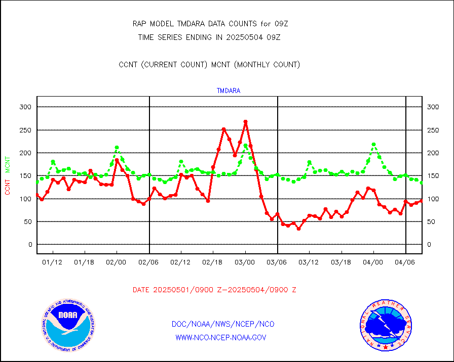
visusr |
GOES-16&up/NESDIS visible derived cloud motion |
1822 |
702 |
259.5 % |
0808.00-0808.99 |
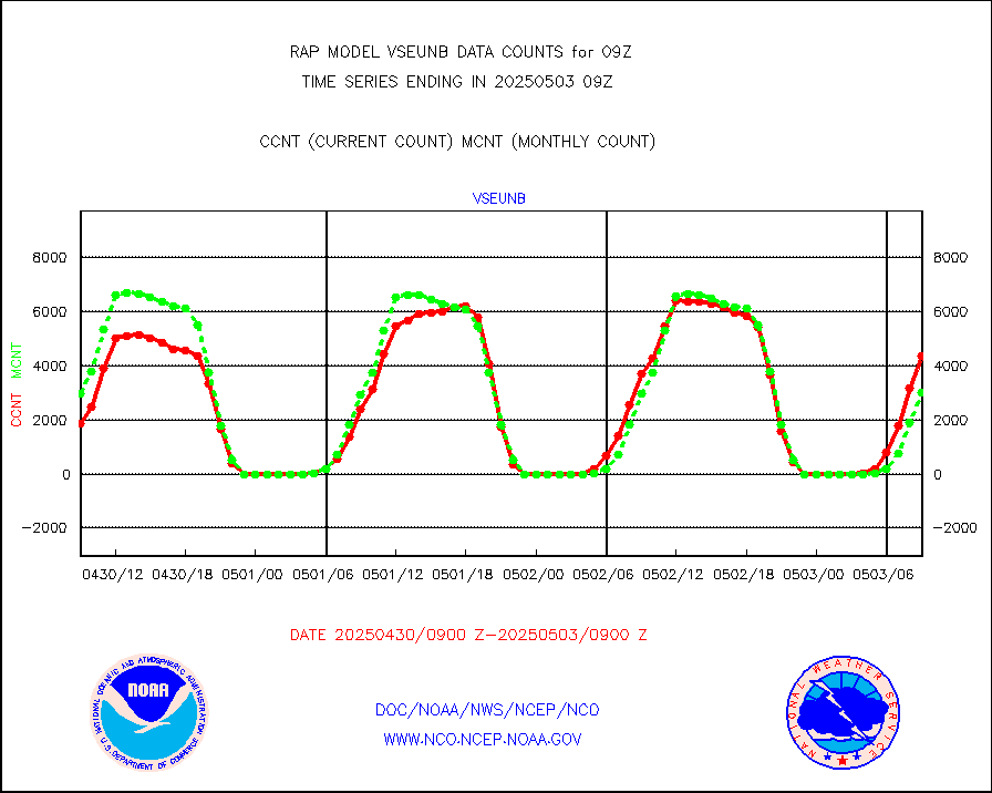
vseunb |
METEOSAT/EUMETSAT visible drv cld motion NBseq |
1127 |
3801 |
29.7 % |
0807.50-0810.49 |


