| Critical Data with Normal Counts |
|---|
| Type | Description | Hourly Count | Monthly Average | Percent (%) of Monthly Mean | UTC Time Window |
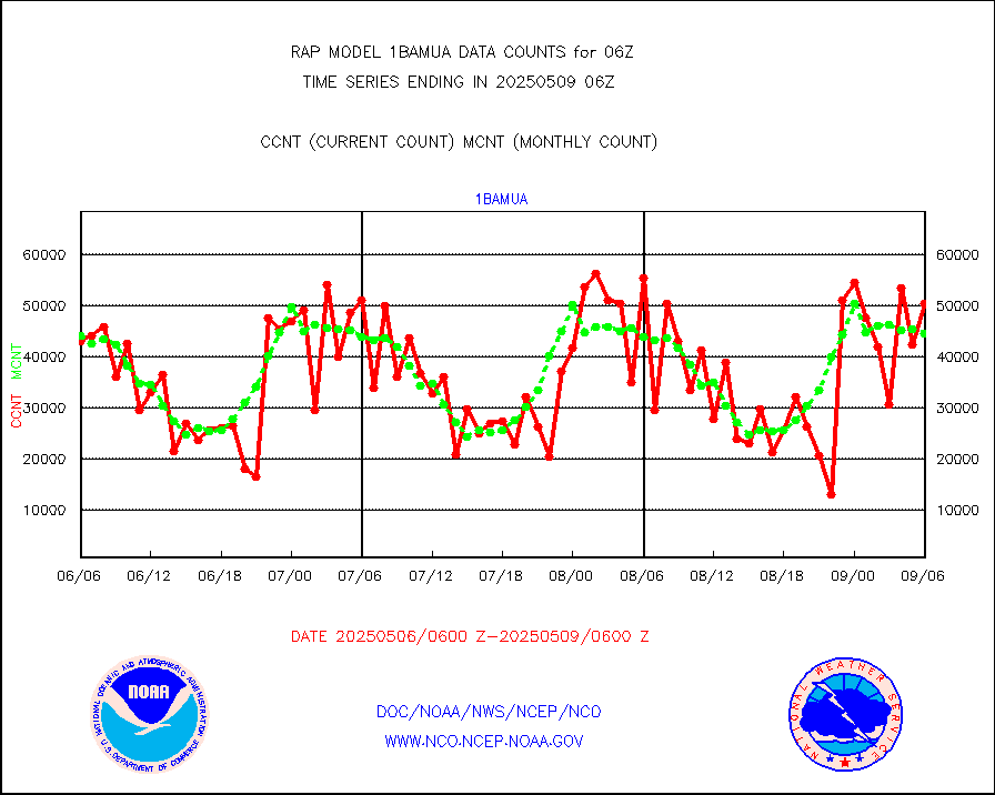
1bamua |
NOAA 15-19 & METOP 1-2 AMSU-A NCEP-proc. br.temps |
42708 |
44296 |
96.4 % |
2003.00-2008.99 |
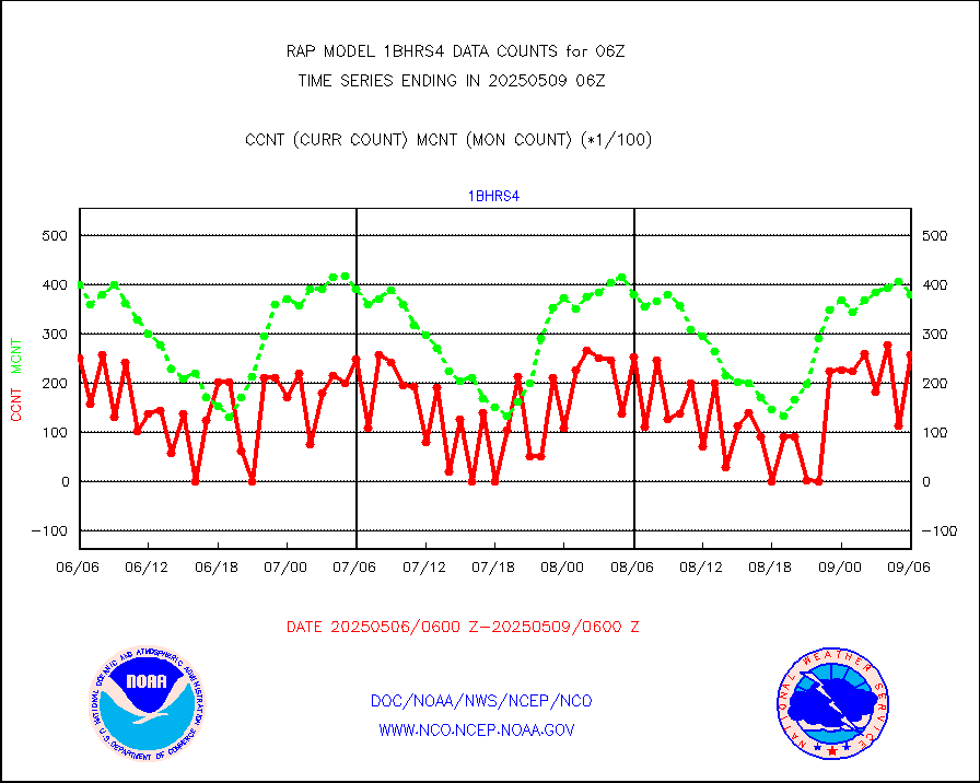
1bhrs4 |
NOAA 18-19 & METOP 1-2 HIRS-4 NCEP-proc. br.temps |
32575 |
41679 |
78.2 % |
2003.00-2008.99 |
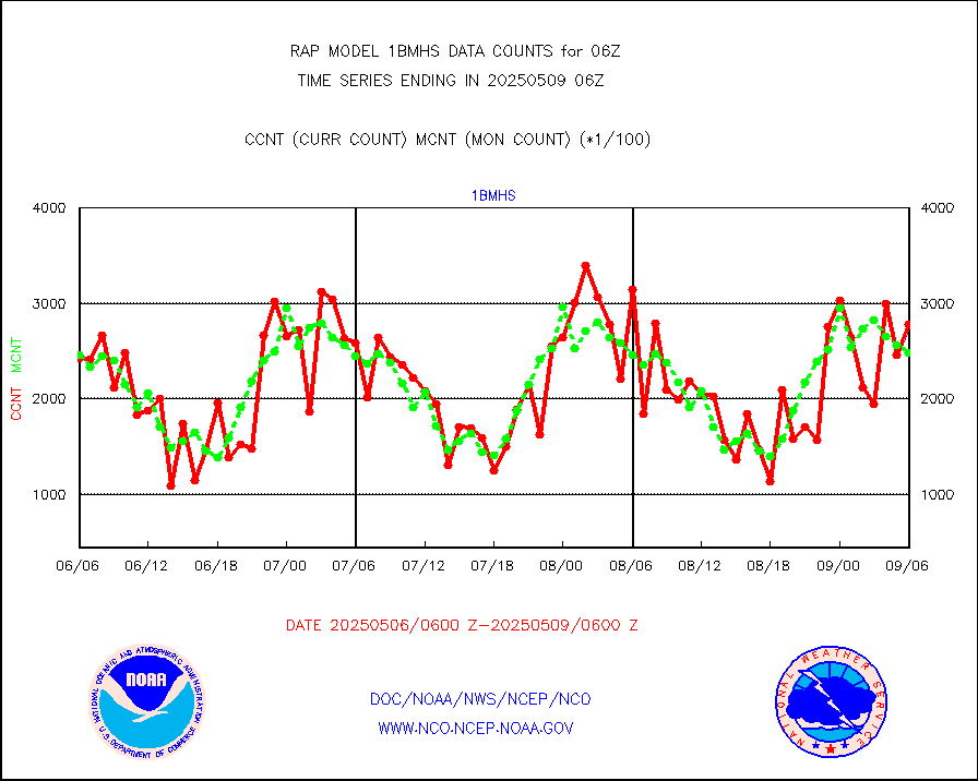
1bmhs |
NOAA 18-19 & METOP 1-2 MHS NCEP-proces. br. temps |
296939 |
248223 |
119.6 % |
2003.00-2008.99 |
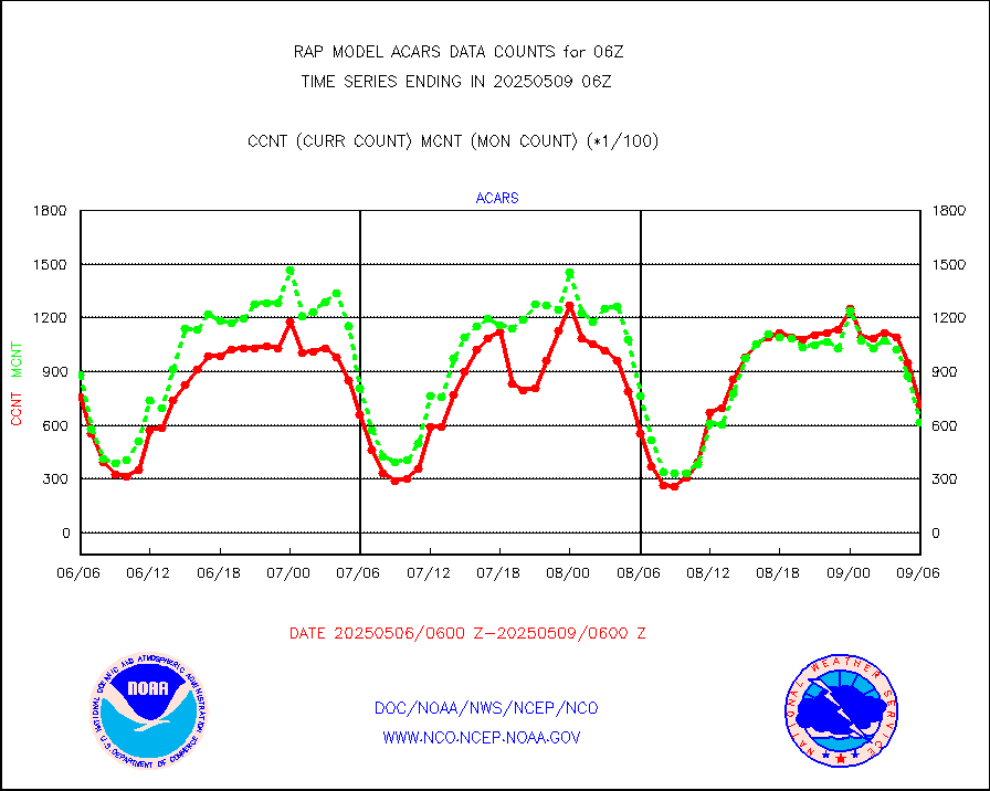
acars |
MDCRS ACARS acft data from ARINC(dcded from BUFR) |
53491 |
21151 |
252.9 % |
2002.75-2009.25 |
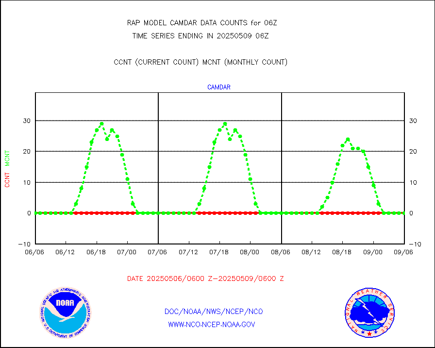
camdar |
Canadian AMDAR aircraft data (decoded from BUFR) |
0 |
3 |
0.0 % |
2002.75-2009.25 |
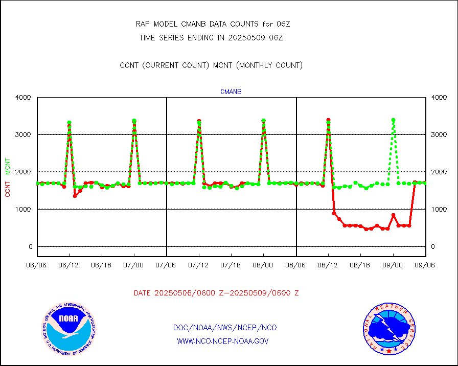
cmanb |
Surface Marine CMAN rpts decoded from BUFR format |
1713 |
1673 |
102.4 % |
2005.50-2006.50 |
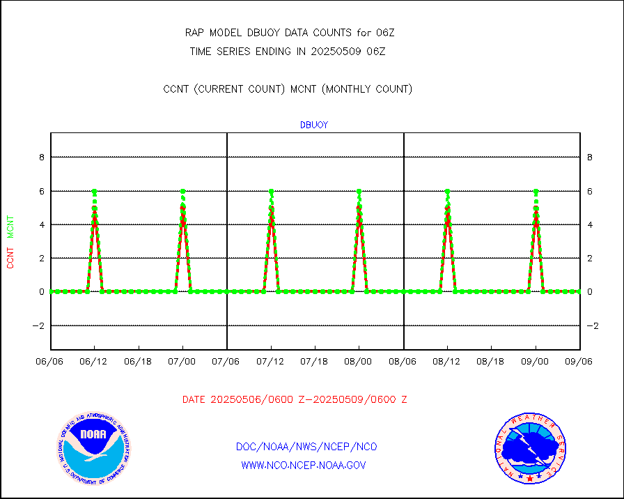
dbuoy |
Buoys decoded from FM-18 fmt (moored or drifting) |
0 |
0 |
n/a |
2005.50-2006.50 |
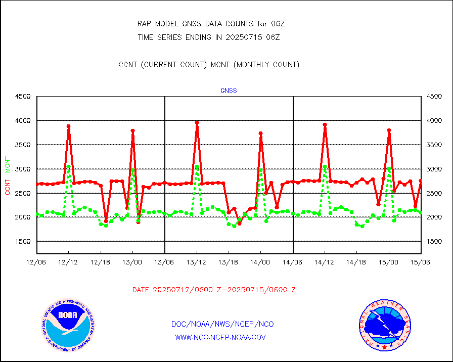
gnss |
Grnd-based Gbl Navigation Sat System (GNSS) data |
2657 |
2551 |
104.2 % |
2004.95-2005.05 |
h20mo |
MODIS (AQUA/TERRA) wvpr imager derived cld motion |
0 |
0 |
n/a |
2003.50-2008.50 |
infmo |
MODIS (AQUA/TERRA) ir l-wave derived cloud motion |
0 |
0 |
n/a |
2003.50-2008.50 |
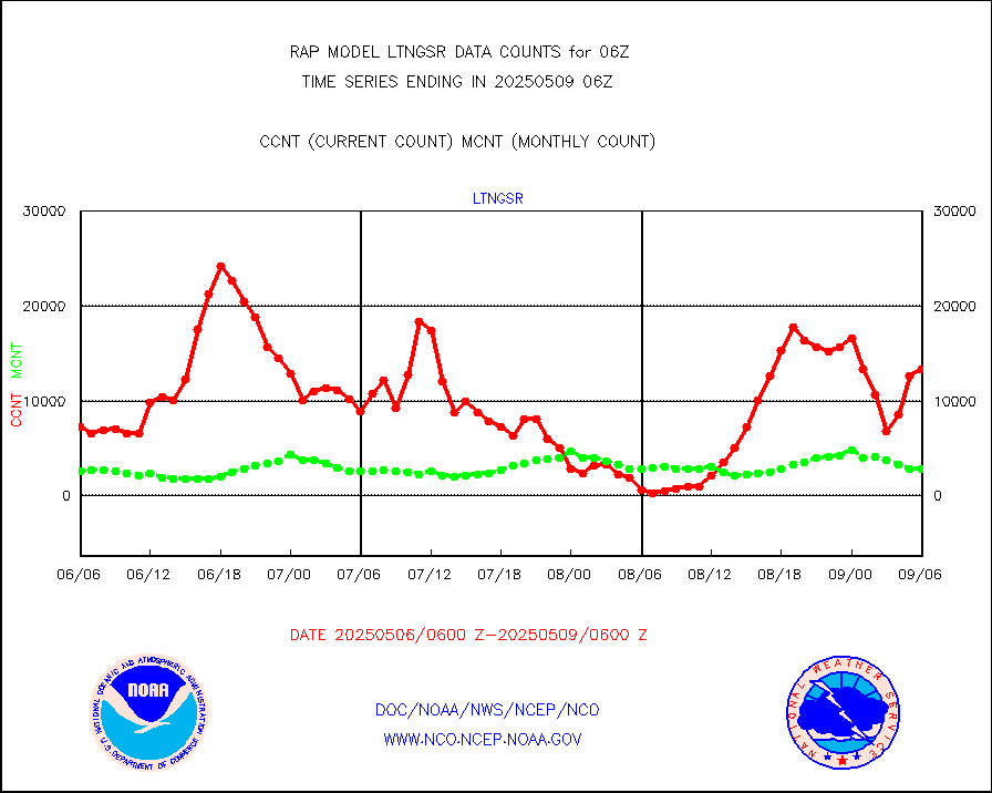
lgycld |
GOES/NASA(Langley) hi-res. (1x1 f-o-v) cloud data |
3737995 |
3179059 |
117.6 % |
2005.50-2006.50 |
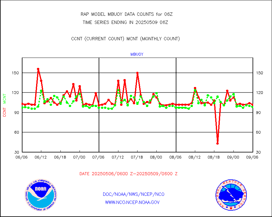
mbuoy |
Buoys decoded from FM-13 format (moored) |
80 |
61 |
131.1 % |
2005.50-2006.50 |
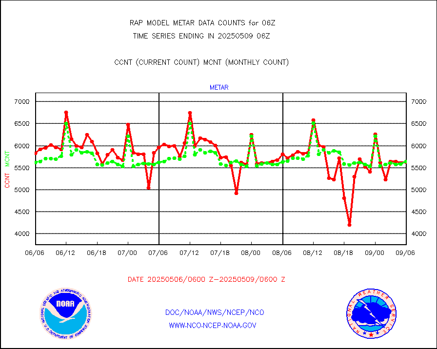
metar |
Aviation - METAR |
5700 |
5817 |
98.0 % |
2005.50-2006.50 |
nxrdw |
NEXRAD Vel Azm Dsp(VAD) winds via radar coded msg |
0 |
0 |
n/a |
2005.00-2007.00 |
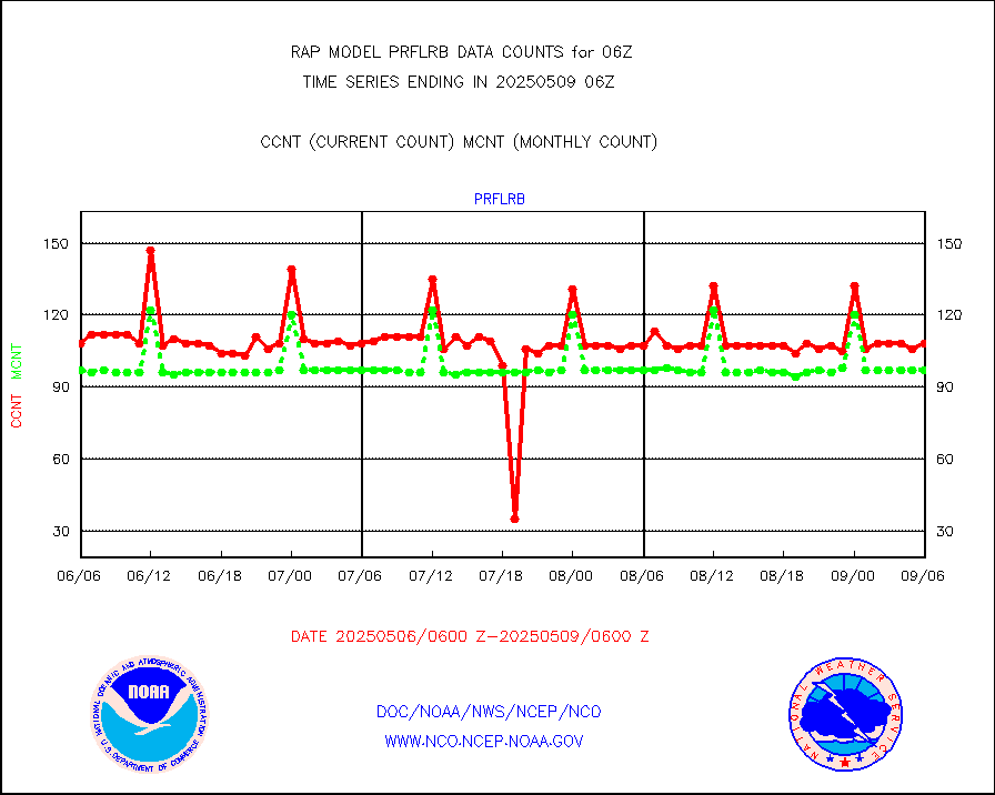
prflrb |
Multi-Agency Profiler (MAP) and SODAR winds |
70 |
84 |
83.3 % |
2004.50-2007.50 |
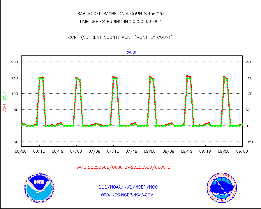
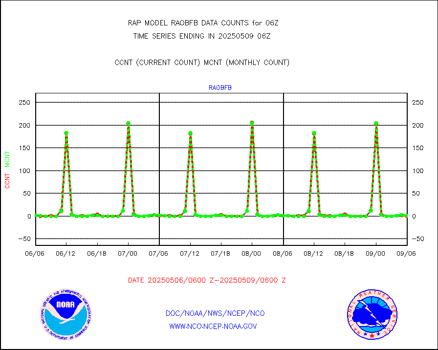
raobf |
Rawinsonde - fixed land (from TEMP or PILOT) |
2 |
3 |
66.7 % |
2005.00-2007.00 |
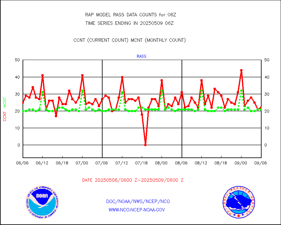
rass |
RASS temperatures (NOAA and Multi-Agency) |
14 |
21 |
66.7 % |
2005.50-2006.50 |
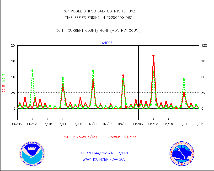
shipsb |
Ship - manual and automatic, restricted (BUFR) |
0 |
0 |
n/a |
2005.50-2006.50 |
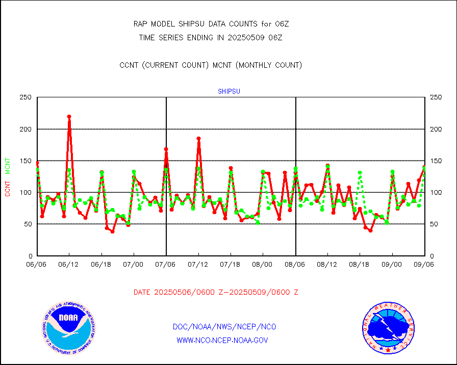
shipsu |
Ship - manual and automatic, unrestricted |
95 |
70 |
135.7 % |
2005.50-2006.50 |
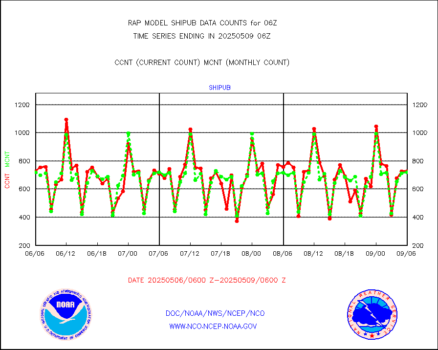
shipub |
Ship - manual and automatic, unrestricted (BUFR) |
582 |
637 |
91.4 % |
2005.50-2006.50 |
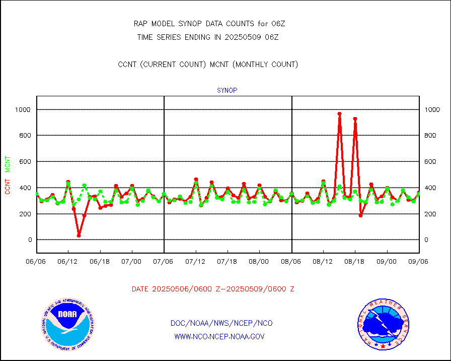
synop |
Synoptic - fixed manual and automatic |
453 |
463 |
97.8 % |
2005.50-2006.50 |
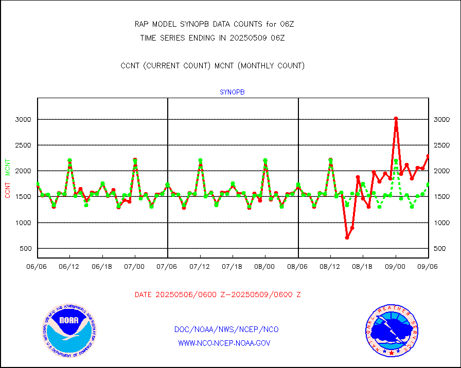
synopb |
Synoptic - fixed manual & auto (decoded fr BUFR) |
1813 |
1811 |
100.1 % |
2005.50-2006.50 |
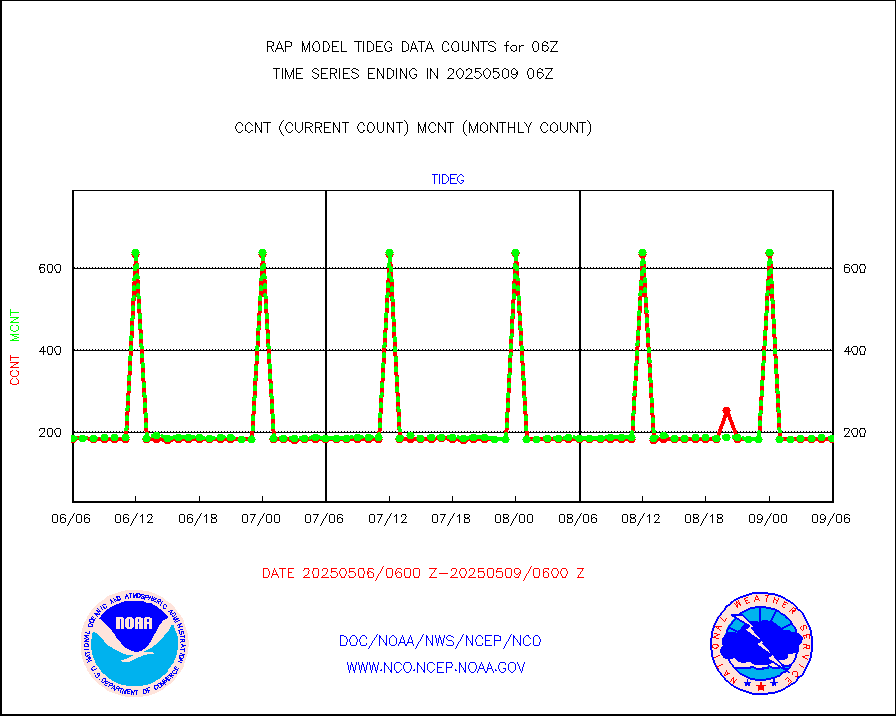
tideg |
Tide gauge reports decoded from CREX format |
183 |
181 |
101.1 % |
2005.50-2006.50 |
| Data Types of Opportunity with Normal Counts |
|---|
| Type | Description | Hourly Count | Monthly Average | Percent (%) of Monthly Mean | UTC Time Window |
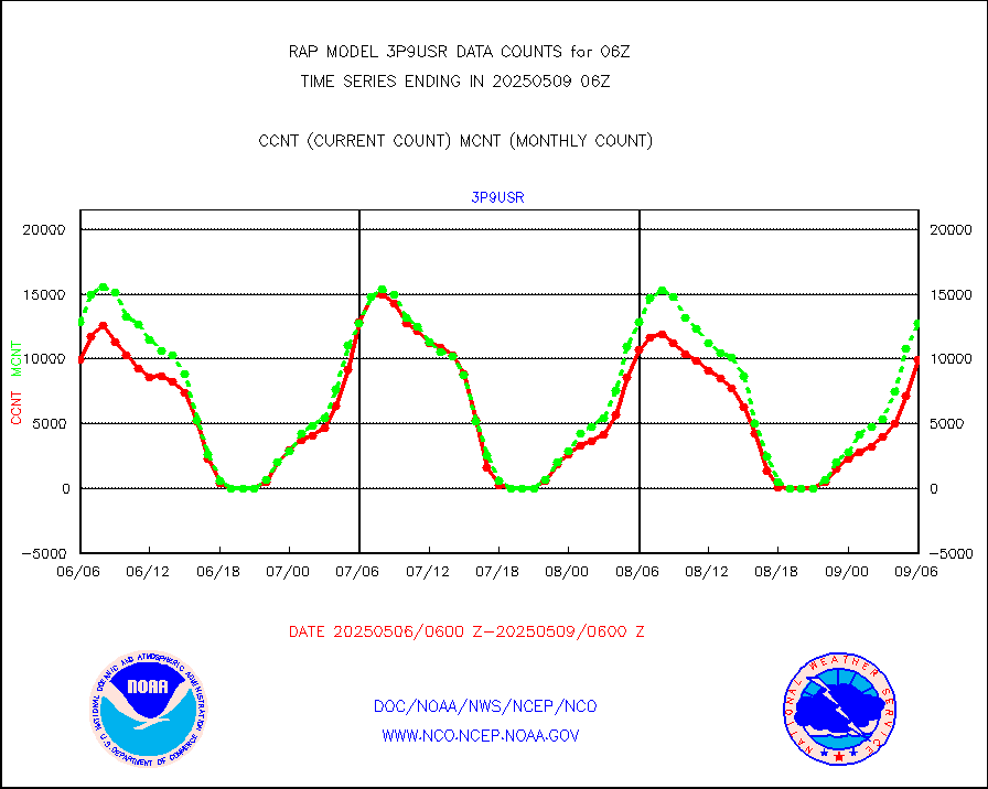
3p9usr |
GOES-16&up/NESDIS ir short-wv derived cld motion |
7401 |
11685 |
63.3 % |
2005.00-2005.99 |
acarsa |
MDCRS ACARS acft data (ARINC via AFWA)(AIREP fmt) |
0 |
0 |
n/a |
2002.75-2009.25 |
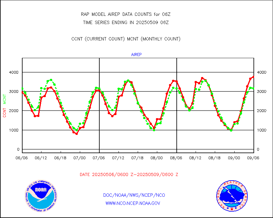
airep |
Manual AIREP aircraft data (dcded from AIREP fmt) |
5352 |
4831 |
110.8 % |
2002.75-2009.25 |
airsev |
AQUA AIRS/AMSU-A/HSB brightness temps- every FOV |
0 |
0 |
n/a |
2003.00-2008.99 |
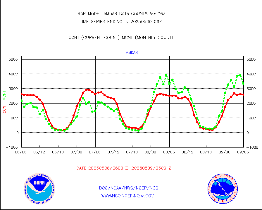
amdar |
AMDAR aircraft data (decoded from AMDAR format) |
2754 |
2682 |
102.7 % |
2002.75-2009.25 |
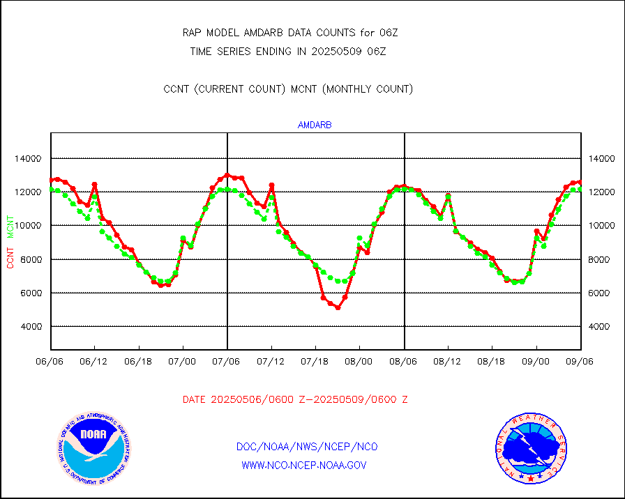
amdarb |
AMDAR aircraft data (decoded from BUFR) |
6221 |
6324 |
98.4 % |
2002.75-2009.25 |
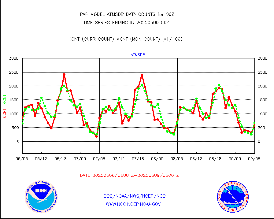
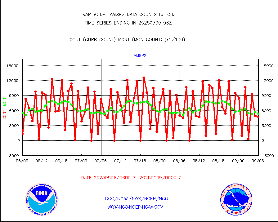
amsr2 |
GCOM-W AMSR2 1B brightness temperatures |
825577 |
546235 |
151.1 % |
2003.00-2003.99 |
ascat |
METOP 1-2 ASCAT products |
21756 |
20674 |
105.2 % |
2004.00-2008.00 |
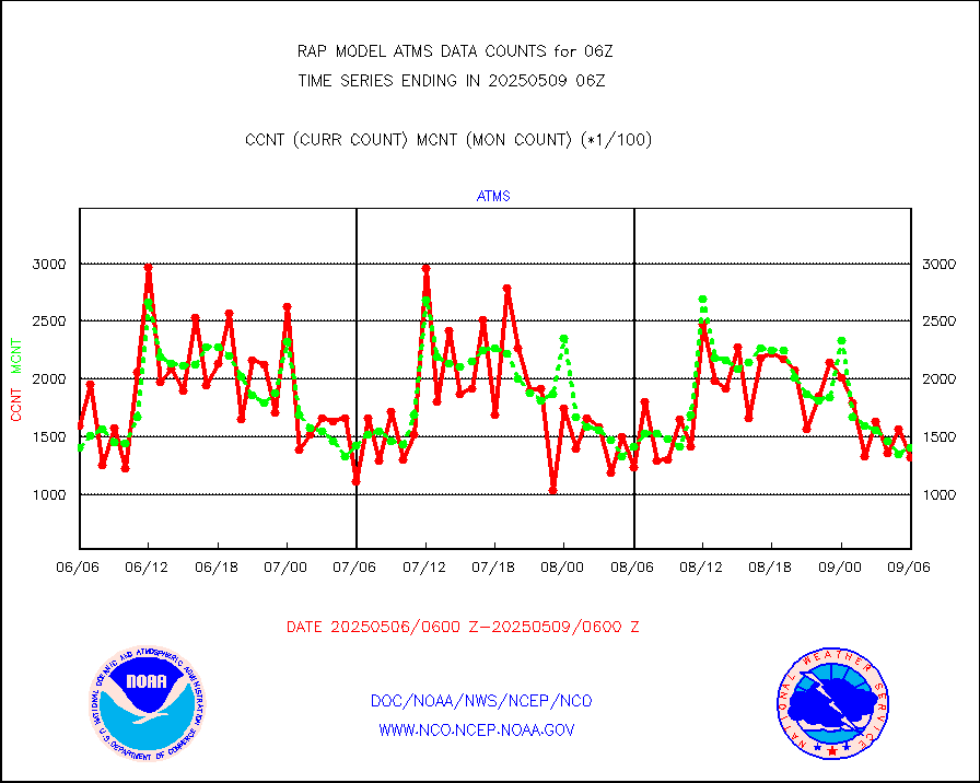
atms |
NPP/NOAA-20 ATMS brightness temperatures |
115828 |
140735 |
82.3 % |
2004.00-2007.99 |
atmsdb |
NPP/NOAA-20 ATMS bright. temps-direct b-cast SSEC |
86233 |
61555 |
140.1 % |
2004.00-2007.99 |
coopmd |
Coop/MADIS NEPP & HCN-Modernization NOAA COOP Obs |
27 |
27 |
100.0 % |
2005.50-2006.50 |
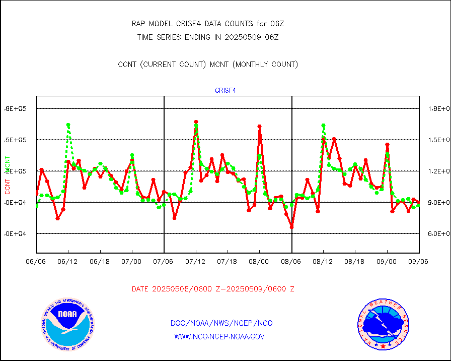
crisf4 |
NPP/NOAA-20 CrIS full spctrl radn (431 ch subset) |
105069 |
84347 |
124.6 % |
2004.00-2007.99 |
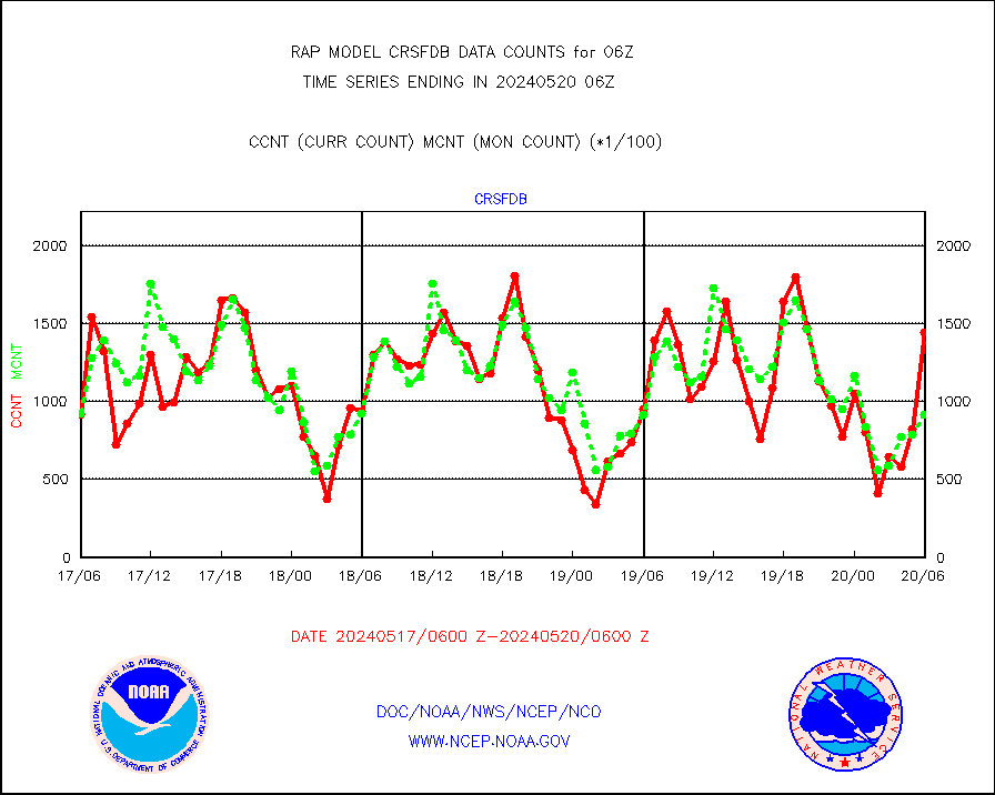
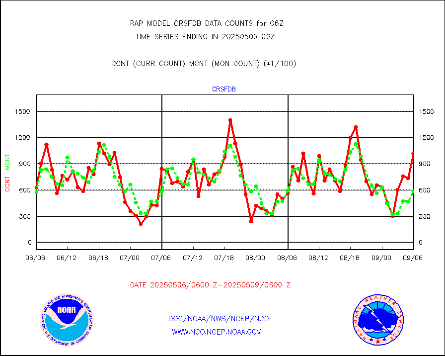
crsfdb |
NPP/NOAA-20 CrIS full spctrl radn dir brdcst SSEC |
143904 |
91349 |
157.5 % |
2004.00-2007.99 |
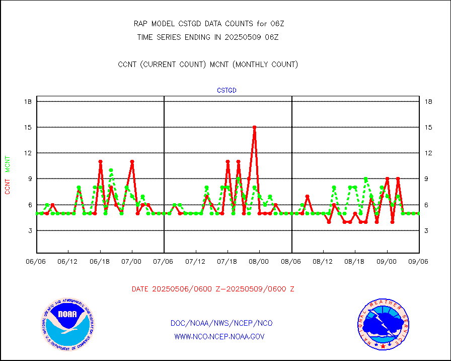
cstgd |
Coast Guard |
3 |
3 |
100.0 % |
2005.50-2006.50 |
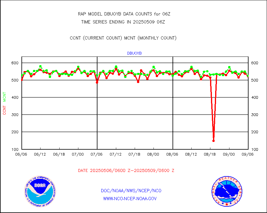
dbuoyb |
Drifting buoys (decoded from BUFR) |
578 |
582 |
99.3 % |
2005.50-2006.50 |
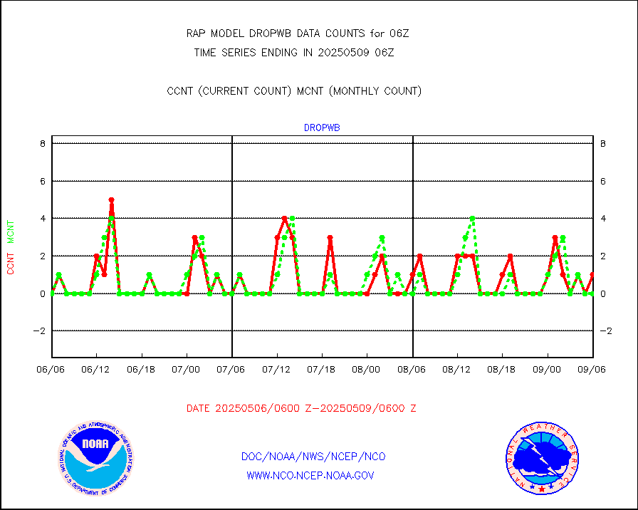
dropw |
Dropwinsonde (from TEMP DROP) |
0 |
0 |
n/a |
2005.00-2007.00 |
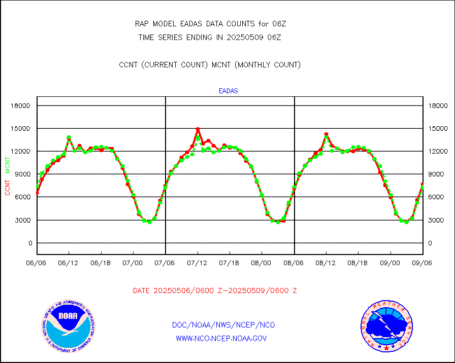
eadas |
E-AMDAR (European AMDAR acft decoded from BUFR) |
5872 |
5562 |
105.6 % |
2002.75-2009.25 |
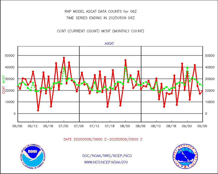
esamua |
NOAA 15-19 & METOP 1-2 AMSU-A proc btmps frm RARS |
13323 |
15913 |
83.7 % |
2005.00-2007.00 |
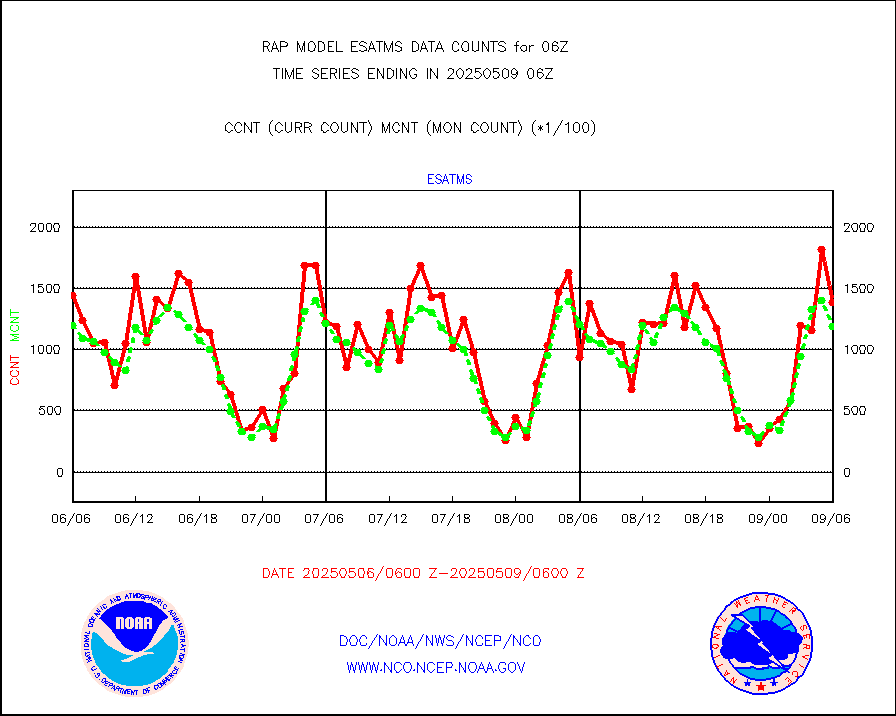
esatms |
NPP Adv. Tech. MW Sndr (ATMS) br. temps from RARS |
129295 |
124766 |
103.6 % |
2004.00-2007.99 |
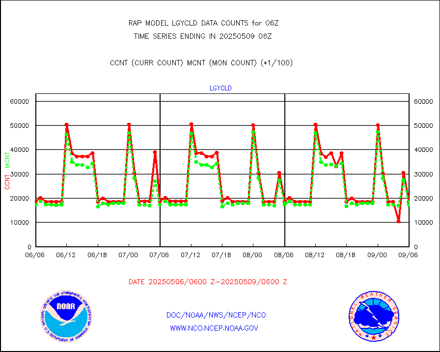
eshrs3 |
NOAA 15-19 & METOP 1-2 HIRS-3/4 pr btmps frm RARS |
27242 |
37194 |
73.2 % |
2005.00-2007.00 |
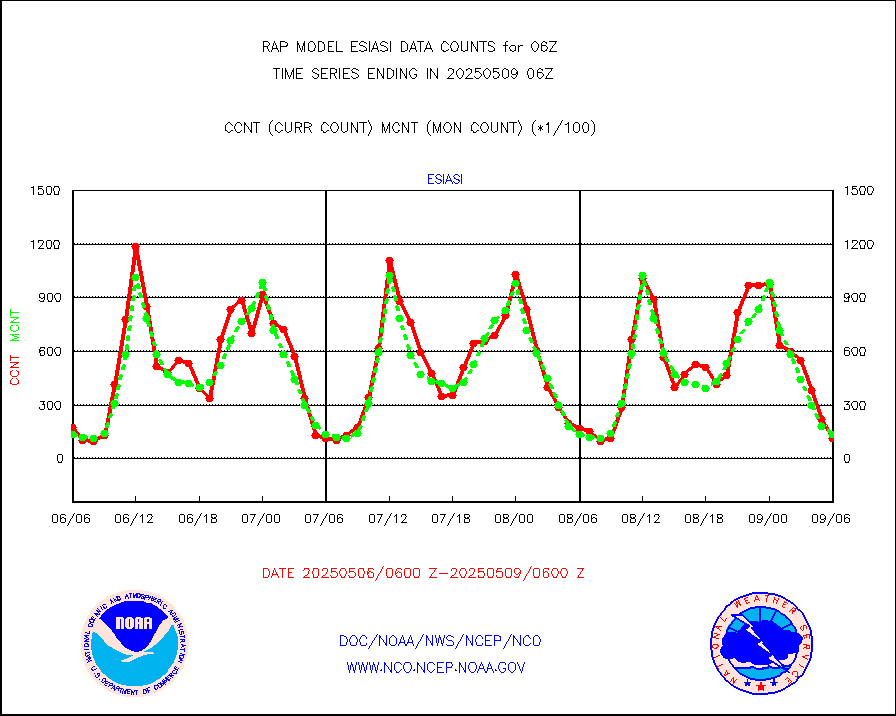
esiasi |
METOP 1-2 IASI 1C radiance data vbl chn from RARS |
40429 |
23482 |
172.2 % |
2004.00-2007.99 |
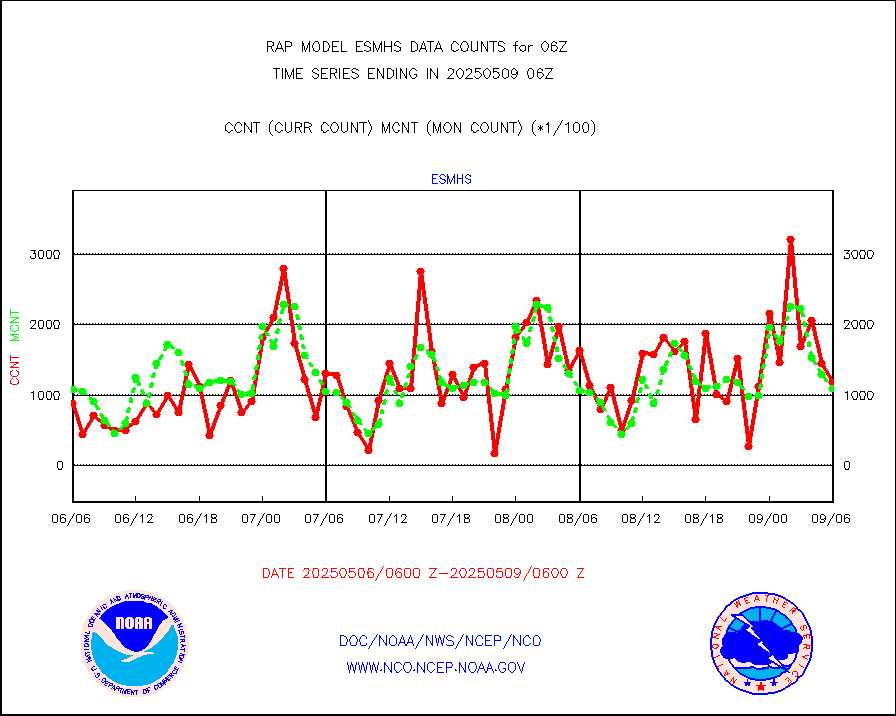
esmhs |
NOAA 18-19 & METOP 1-2 MHS proc. btemps from RARS |
68987 |
102476 |
67.3 % |
2005.00-2007.00 |
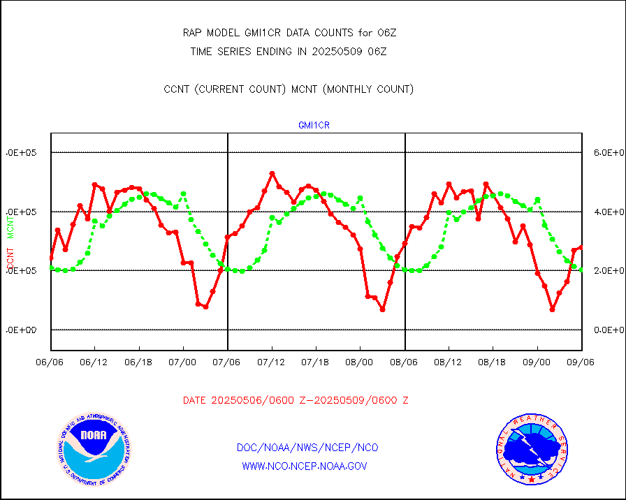
gmi1cr |
GPM GMI Level 1C-R brightness temperatures |
222142 |
788826 |
28.2 % |
2003.00-2008.99 |
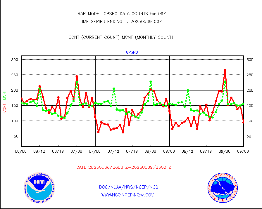
gpsro |
GPS radio occultation data |
132 |
134 |
98.5 % |
2004.00-2007.99 |
gsrasr |
GOES-16/17 All Sky Radiances (proc.) |
812097 |
808406 |
100.5 % |
2004.00-2007.99 |
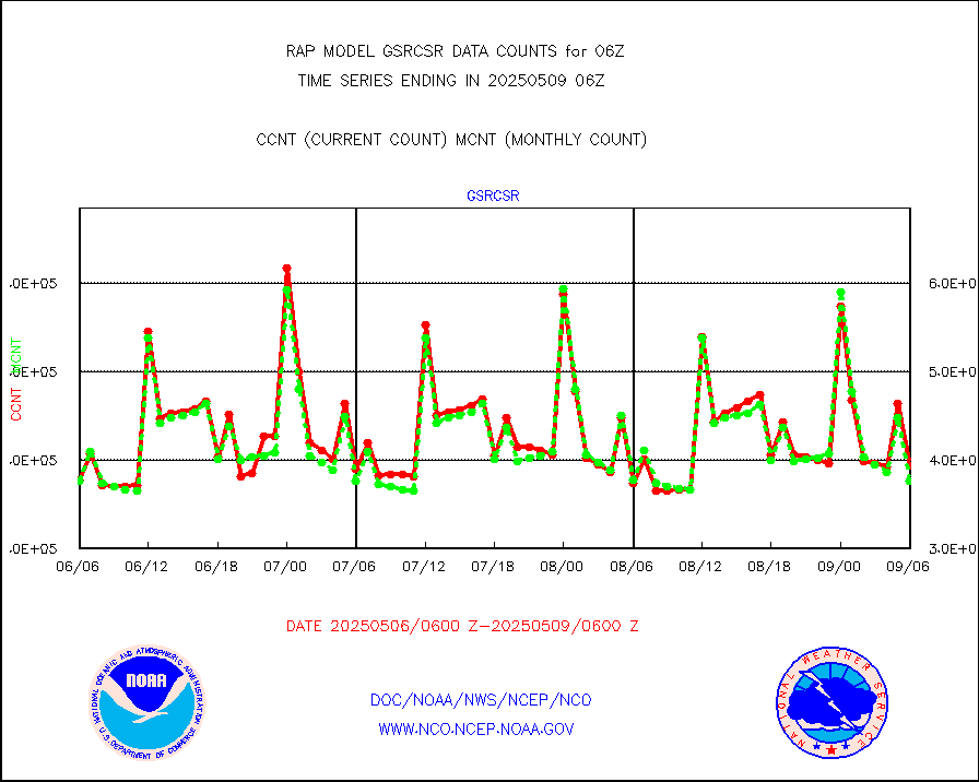
gsrcsr |
GOES-16/17 Clear Sky Radiances (proc.) |
324248 |
368261 |
88.0 % |
2004.00-2007.99 |
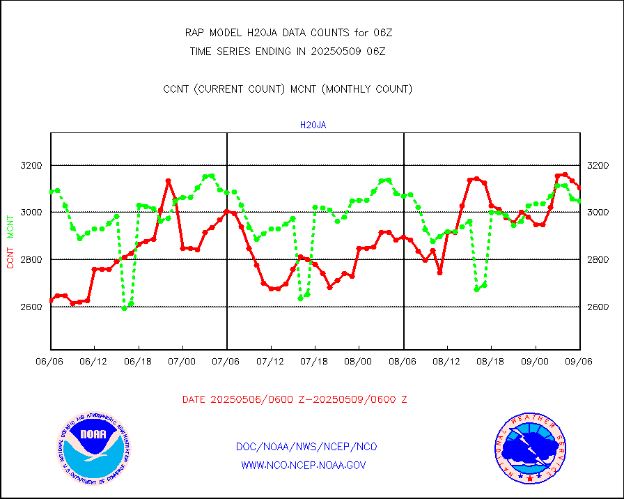
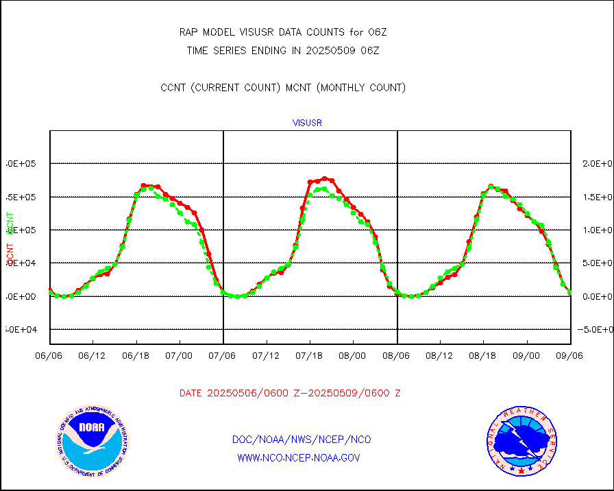
h20ja |
MTSAT/JMA water vapor imager derived cloud motion |
3000 |
3189 |
94.1 % |
2003.50-2008.50 |
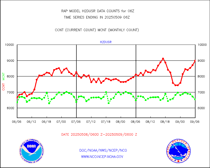
h2dusr |
GOES-16&up/NESDIS wv imgr/deep-lyr derivd cld mtn |
6318 |
7028 |
89.9 % |
2005.00-2005.99 |
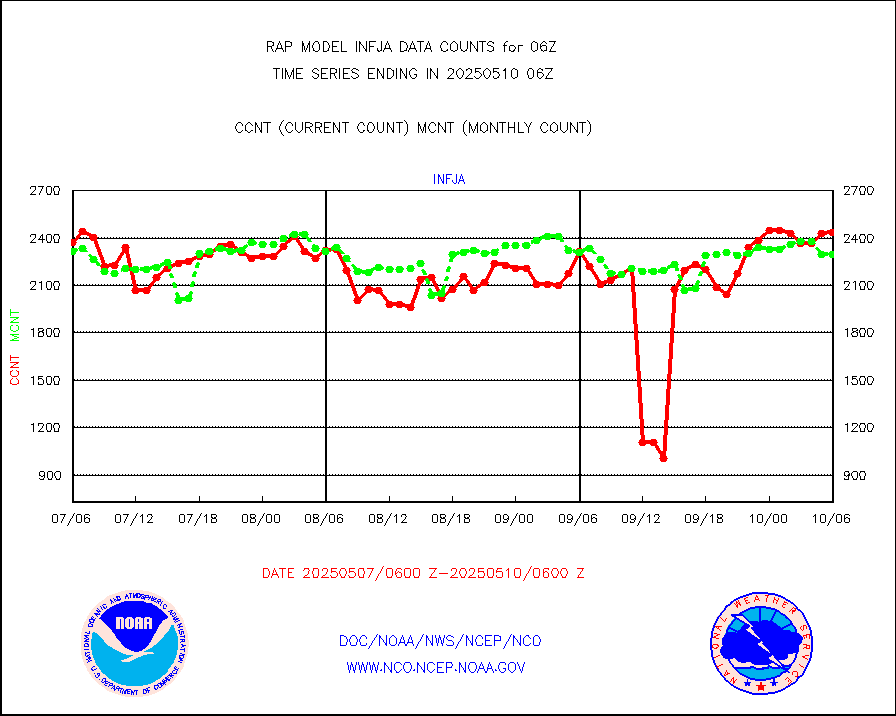
h2eunb |
METEOSAT/EUMETSAT wvpr imgr drv cld motion NBseq |
5306 |
5182 |
102.4 % |
2004.50-2007.49 |
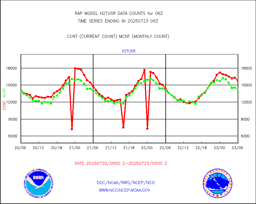
h2tusr |
GOES-16&up/NESDIS wv imgr/cld-top derived cld mtn |
15091 |
12129 |
124.4 % |
2005.00-2005.99 |
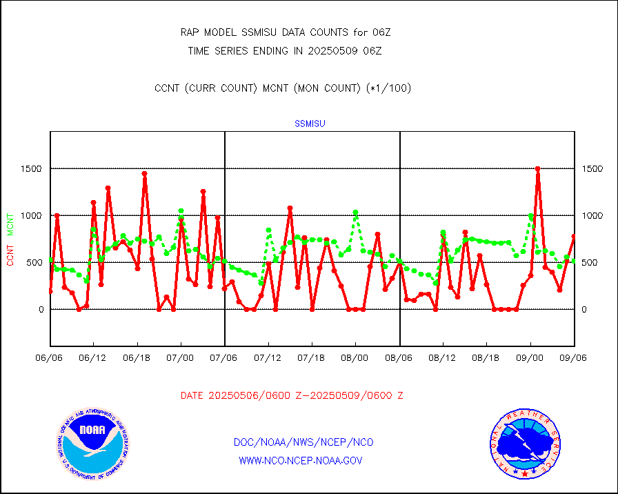
iasidb |
METOP 1-2 IASI 1C radiances-direct broadcast SSEC |
65412 |
57797 |
113.2 % |
2004.00-2007.99 |
ifeunb |
METEOSAT/EUMETSAT ir lg-wave drv cld motion NBseq |
3335 |
3241 |
102.9 % |
2004.50-2007.49 |
ifvrnb |
VIIRS (NPP/NOAA-20) ir lg-wv drv cloud motion(NB) |
0 |
0 |
n/a |
2003.50-2008.50 |
infav |
AVHRR (NOAA/METOP) ir lg-wave derived cld motion |
0 |
0 |
n/a |
2003.50-2008.50 |
infav1 |
AVHRR (METOP) ir lg-wave derived cld motion |
0 |
0 |
n/a |
2004.50-2007.49 |
infja |
MTSAT/JMA infrared long-wave derived cloud motion |
2174 |
2560 |
84.9 % |
2003.50-2008.50 |
infusr |
GOES-16&up/NESDIS ir long-wave derived cld motion |
28086 |
29290 |
95.9 % |
2005.00-2005.99 |
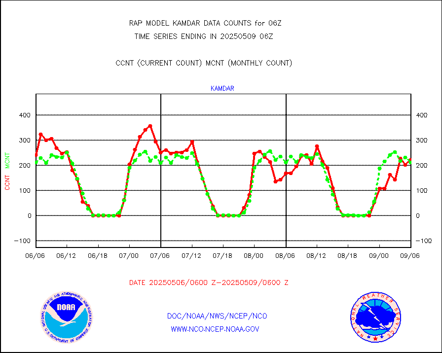
kamdar |
Korean AMDAR aircraft data (decoded from BUFR) |
159 |
252 |
63.1 % |
2002.75-2009.25 |
lcman |
Land-based CMAN stations decoded from CMAN format |
71 |
77 |
92.2 % |
2005.50-2006.50 |
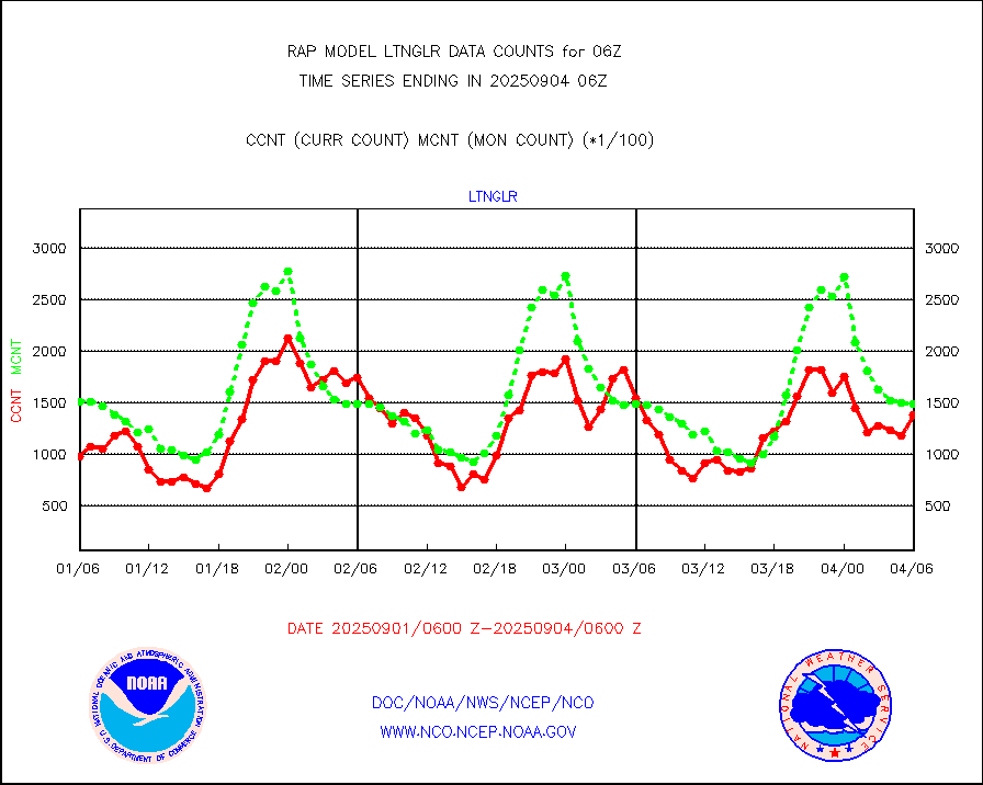
ltnglr |
LLDN Long-rng lightning from Vaisala via NOAAPORT |
143149 |
104077 |
137.5 % |
2005.00-2006.50 |
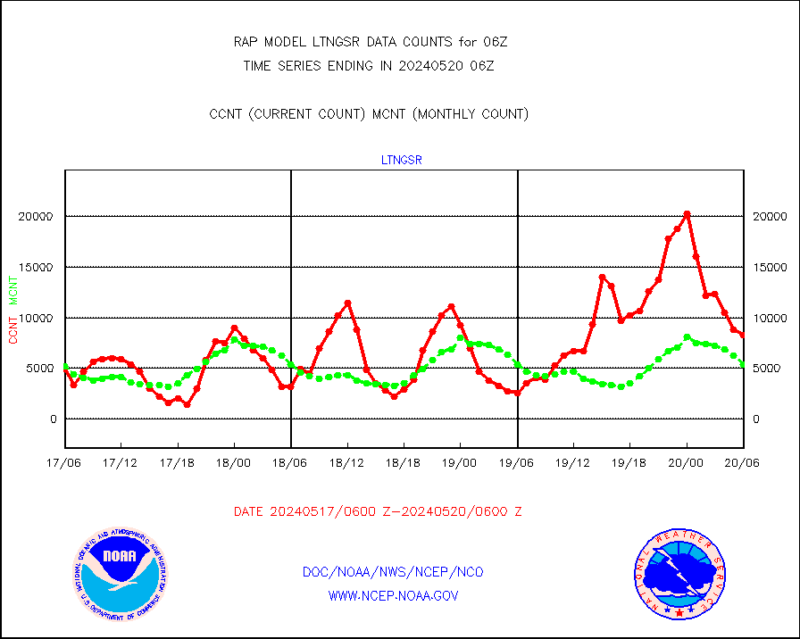
ltngsr |
NLDN Shrt-rng lightning from Vaisala via NOAAPORT |
8328 |
5345 |
155.8 % |
2005.00-2006.50 |
mbuoyb |
Moored buoys (decoded from BUFR) |
616 |
567 |
108.6 % |
2005.50-2006.50 |
mso470 |
Mesonet/MADIS Colorado E-470 (Interstate 470) |
7 |
19 |
36.8 % |
2005.50-2006.50 |
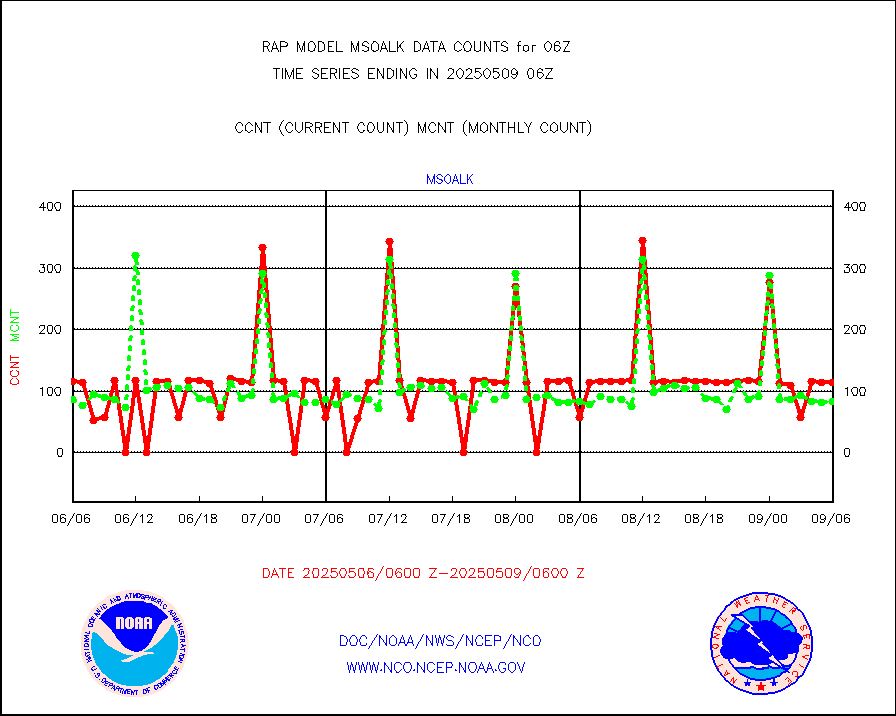
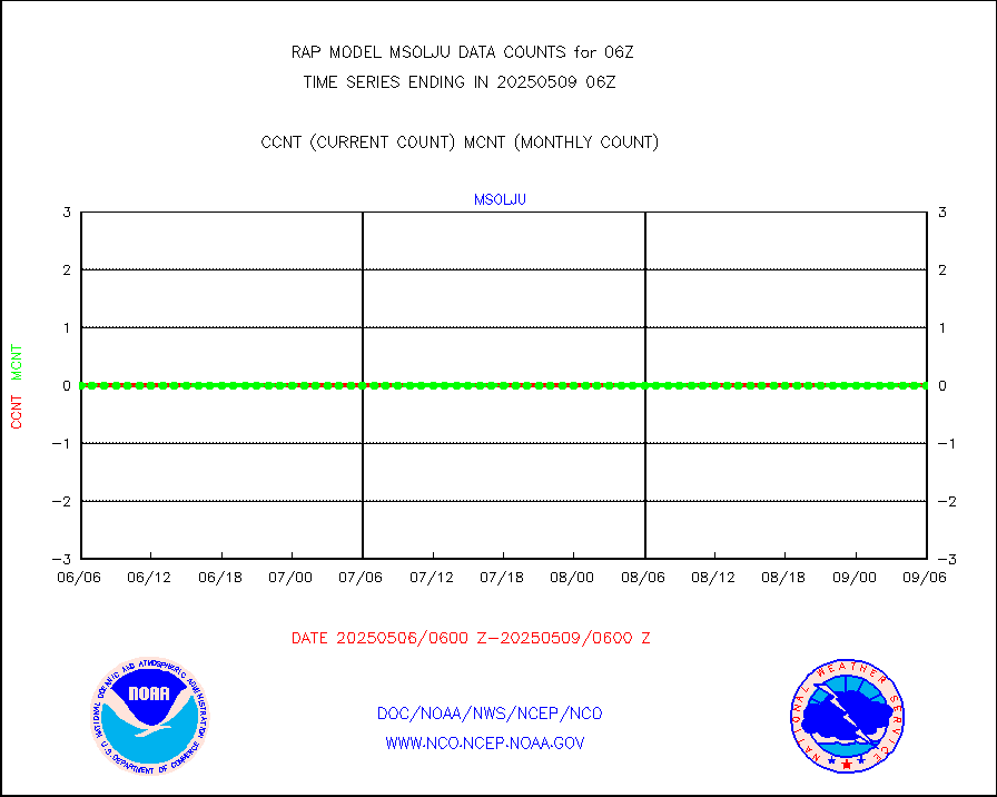
msoalk |
Mesonet/MADIS Alaska Department of Transportation |
108 |
107 |
100.9 % |
2005.50-2006.50 |
msoapg |
Mesonet/MADIS U.S. Army Aberdeen Proving Grounds |
0 |
0 |
n/a |
2005.50-2006.50 |
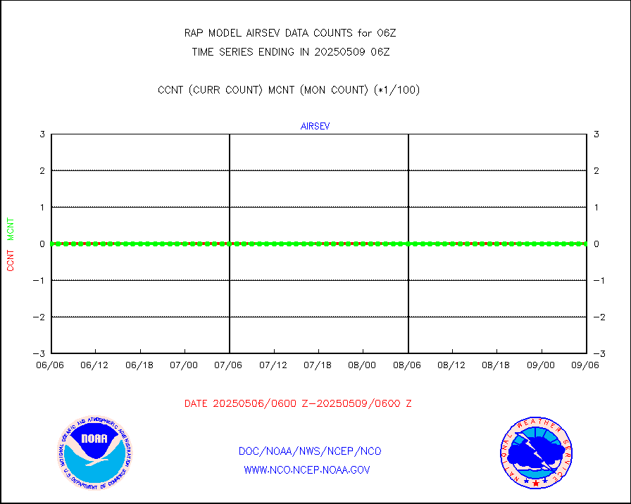
msoapr |
Mesonet/MADIS Citizen Weather Observers Program |
46260 |
45914 |
100.8 % |
2005.50-2006.50 |
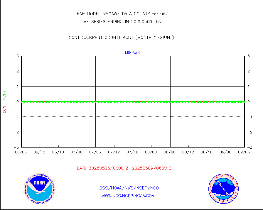
msoaws |
Mesonet/MADIS AWS Convergence Technologies, Inc. |
24773 |
25719 |
96.3 % |
2005.50-2006.50 |
msoawx |
Mesonet/MADIS "Anything Weather" |
0 |
0 |
n/a |
2005.50-2006.50 |
msocol |
Mesonet/MADIS Colorado Dept. of Transportation |
0 |
0 |
n/a |
2005.50-2006.50 |
msodcn |
Mesonet/MADIS DC Net |
0 |
0 |
n/a |
2005.50-2006.50 |
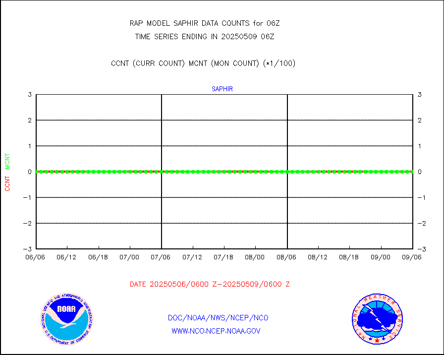
msoden |
Mesonet/MADIS Denver Urban Drainage & Flood Cntrl |
225 |
219 |
102.7 % |
2005.50-2006.50 |
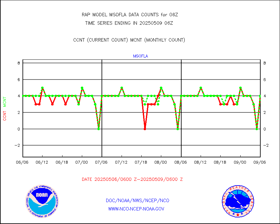
msofla |
Mesonet/MADIS Florida (FAWN & USF) |
3 |
3 |
100.0 % |
2005.50-2006.50 |
msoflt |
Mesonet/MADIS Florida Dept. of Transportation |
0 |
0 |
n/a |
2005.50-2006.50 |
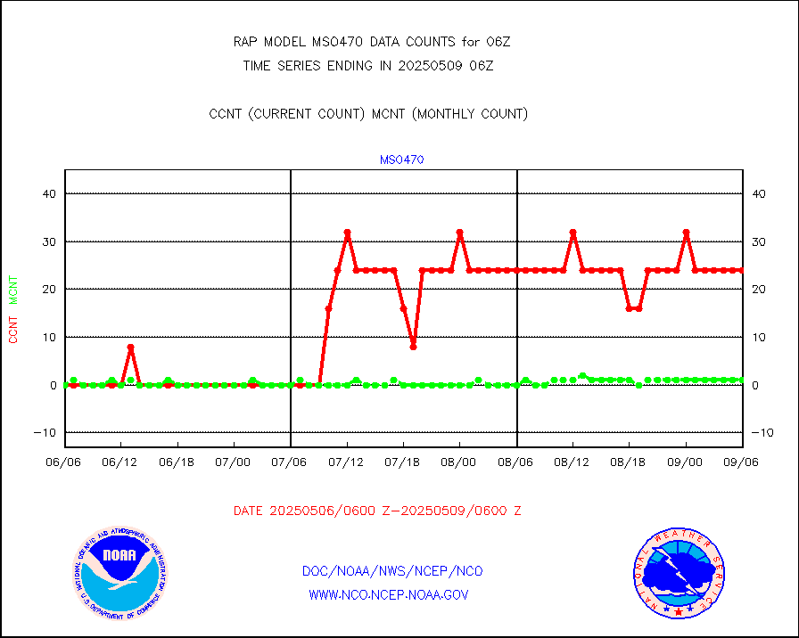
msogeo |
Mesonet/MADIS Georgia Dept. of Transportation |
0 |
0 |
n/a |
2005.50-2006.50 |
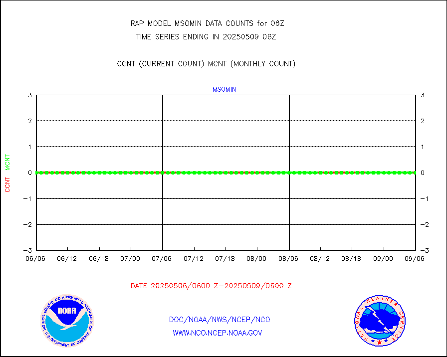
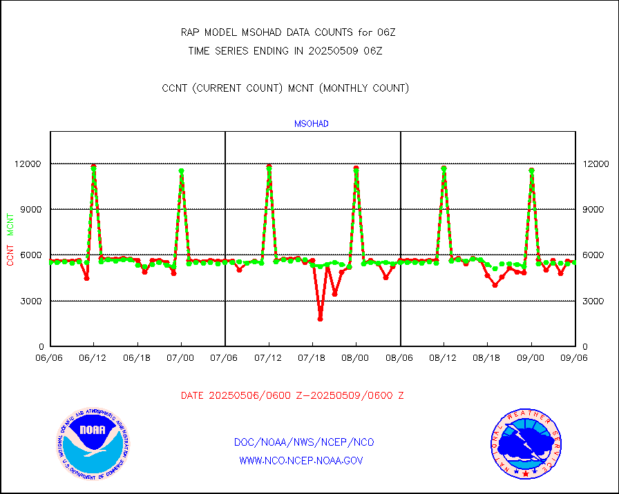
msohad |
Mesonet/MADIS NWS Hydromet Auto Data System(HADS) |
5723 |
5563 |
102.9 % |
2005.50-2006.50 |
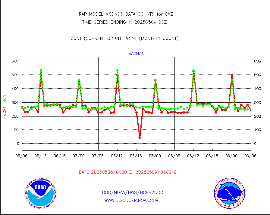
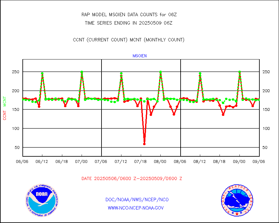
msoien |
Mesonet/MADIS Iowa Environmental |
167 |
164 |
101.8 % |
2005.50-2006.50 |
msoind |
Mesonet/MADIS Indiana Dept. of Transportation |
0 |
0 |
n/a |
2005.50-2006.50 |
msoiow |
Mesonet/MADIS Iowa Department of Transportation |
0 |
0 |
n/a |
2005.50-2006.50 |
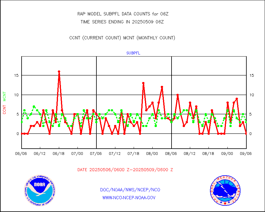
msokan |
Mesonet/MADIS Kansas Department of Transportation |
286 |
320 |
89.4 % |
2005.50-2006.50 |
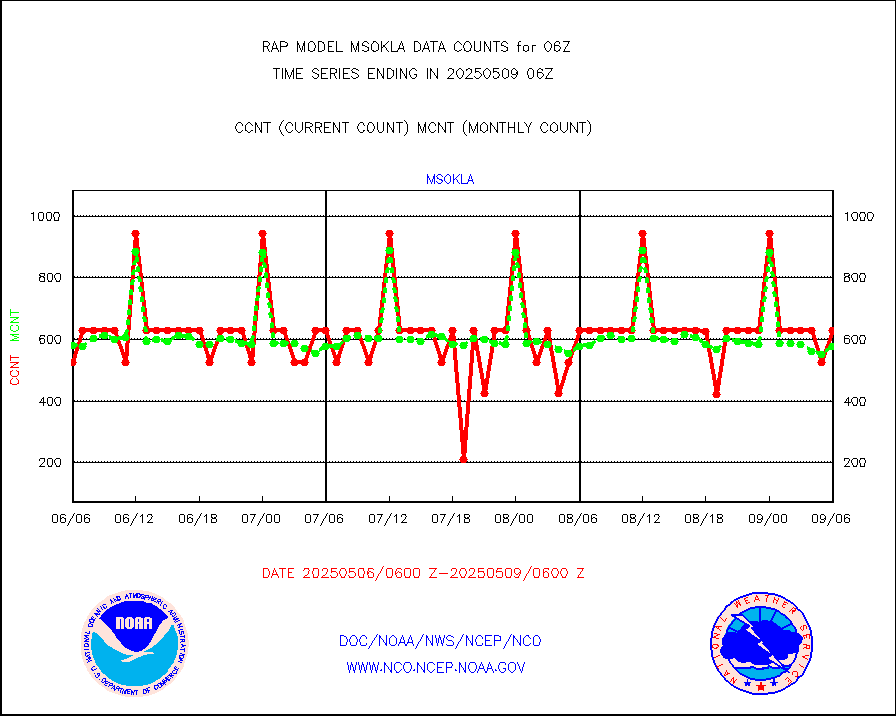
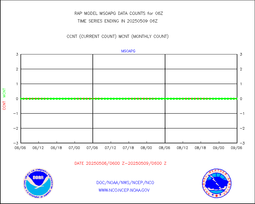
msokla |
Mesonet/MADIS Oklahoma Mesonet |
318 |
322 |
98.8 % |
2005.50-2006.50 |
msolju |
Mesonet/MADIS Louisiana State/Jackson State Univ. |
0 |
0 |
n/a |
2005.50-2006.50 |
msomca |
Mesonet/MADIS Missouri Commercial Agricult Wx Net |
253 |
241 |
105.0 % |
2005.50-2006.50 |
msomin |
Mesonet/MADIS Minnesota Dept. of Transportation |
0 |
0 |
n/a |
2005.50-2006.50 |
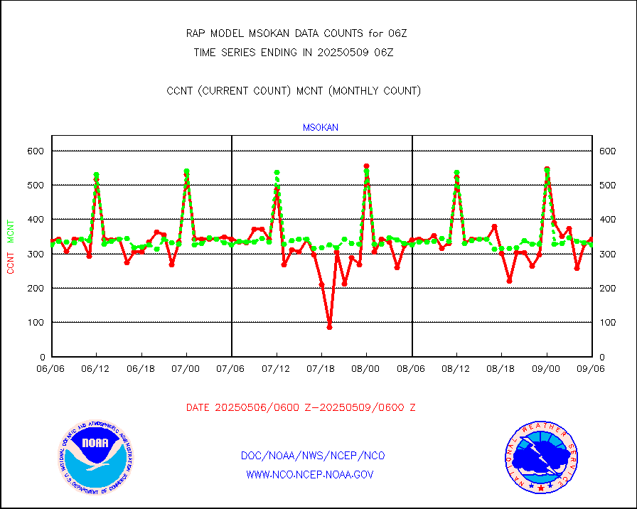
msonos |
Mesonet/MADIS NOS-Phys Oceanographic Realtime Sys |
292 |
288 |
101.4 % |
2005.50-2006.50 |
msoraw |
Mesonet/MADIS NFIC Remote Automated Wx Stns(RAWS) |
1631 |
1593 |
102.4 % |
2005.50-2006.50 |
msourb |
Mesonet/MADIS UrbaNet |
3947 |
3962 |
99.6 % |
2005.50-2006.50 |
msovir |
Mesonet/MADIS Virginia Dept. of Transportation |
74 |
226 |
32.7 % |
2005.50-2006.50 |
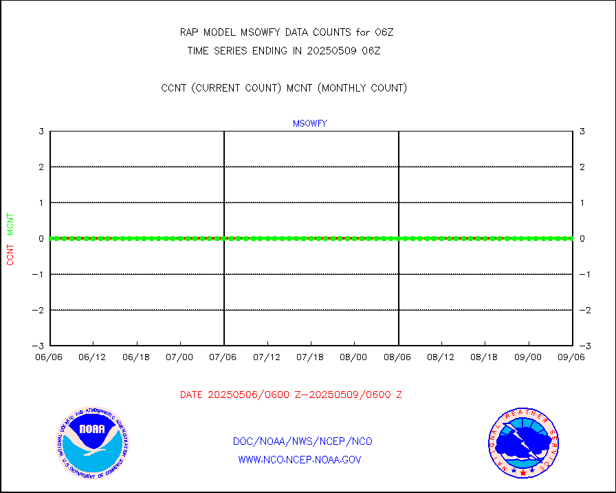
msowfy |
Mesonet/MADIS "Weather for You" |
0 |
0 |
n/a |
2005.50-2006.50 |
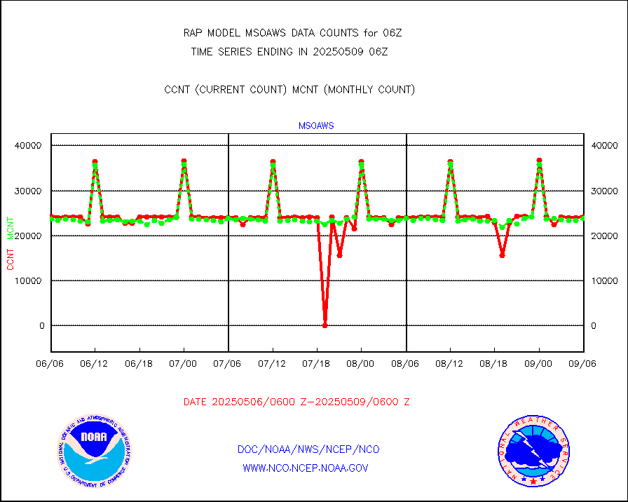
msowis |
Mesonet/MADIS Wisconsin Dept. of Transportation |
0 |
0 |
n/a |
2005.50-2006.50 |
msowst |
Mesonet/MADIS MesoWest (many subproviders) |
41080 |
39837 |
103.1 % |
2005.50-2006.50 |
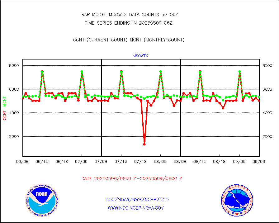
msowtx |
Mesonet/MADIS West Texas |
5043 |
4846 |
104.1 % |
2005.50-2006.50 |
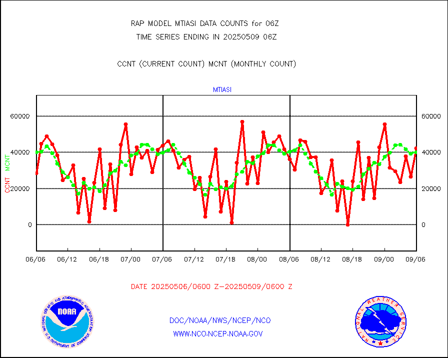
mtiasi |
METOP 1-2 IASI 1C radiance data (varbl. channels) |
37129 |
34697 |
107.0 % |
2004.00-2007.99 |
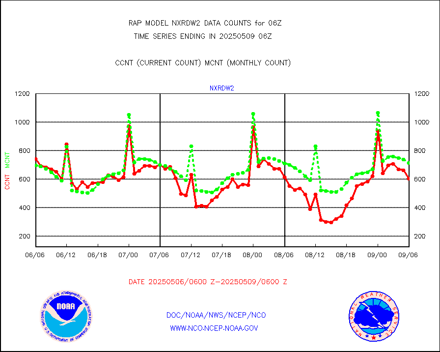
nxrdw2 |
NEXRAD Vel Azm Dsp(VAD) winds via Level 2 decoder |
918 |
848 |
108.3 % |
2005.00-2007.00 |
osbuv8 |
NOAA 16-19 Solar Backscatter UV-2 rad frm V8 BUFR |
0 |
0 |
n/a |
2004.00-2006.99 |
pibal |
PIBAL (from PILOT, PILOT SHIP, PILOT MOBIL) |
0 |
0 |
n/a |
2005.00-2007.00 |
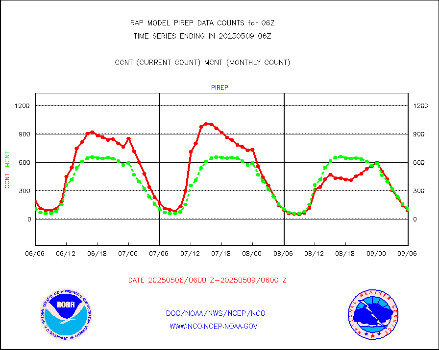
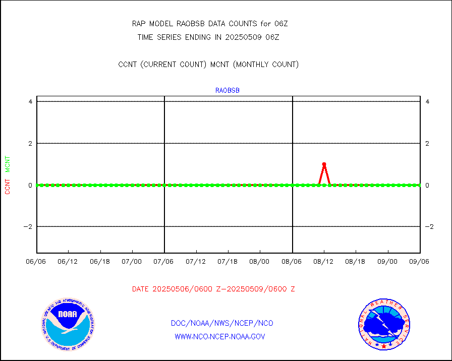
pirep |
Manual PIREP aircraft data (dcded from AIREP fmt) |
82 |
96 |
85.4 % |
2002.75-2009.25 |
prflrp |
Profilr winds from PIBAL (PILOT,PILOT SHIP/MOBIL) |
0 |
0 |
n/a |
2004.50-2007.50 |
raobm |
Rawinsonde - mobile land (from TEMP/PILOT MOBIL) |
0 |
0 |
n/a |
2005.00-2007.00 |
raobs |
Rawinsonde - ship (from TEMP SHIP, PILOT SHIP) |
0 |
0 |
n/a |
2005.00-2007.00 |
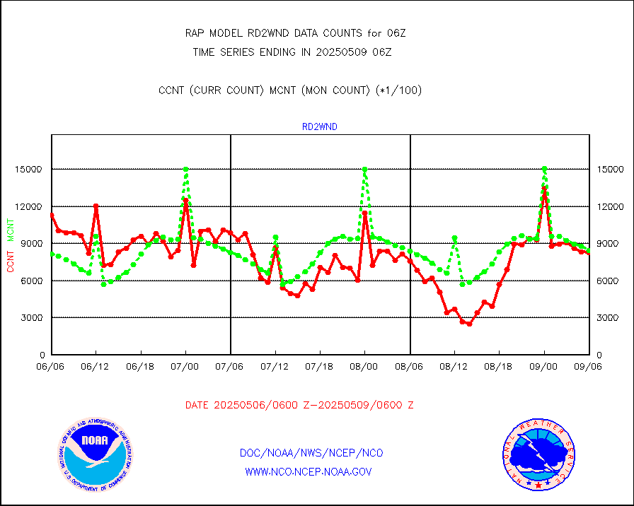
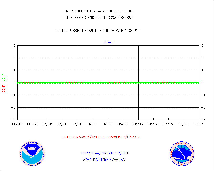
rd2wnd |
NEXRAD radial wind (Level 2 - GTS) |
1108151 |
1021955 |
108.4 % |
2005.50-2006.49 |
recco |
Flight level reconnaissance aircraft data |
0 |
0 |
n/a |
2005.00-2007.00 |
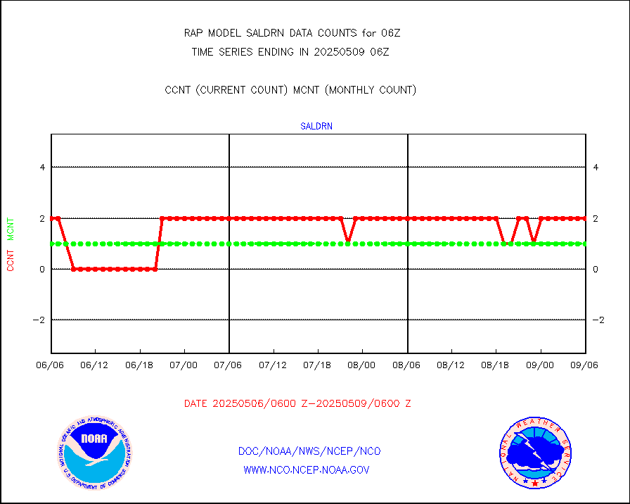
saldrn |
Surface Marine Saildrone (decoded from BUFR) |
2 |
2 |
100.0 % |
2004.00-2007.99 |
saphir |
Megha-Tropiques SAPHIR L1A2 brightness temps |
0 |
0 |
n/a |
2003.00-2008.99 |
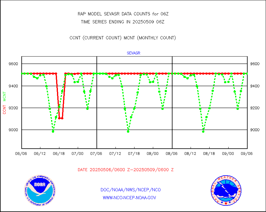
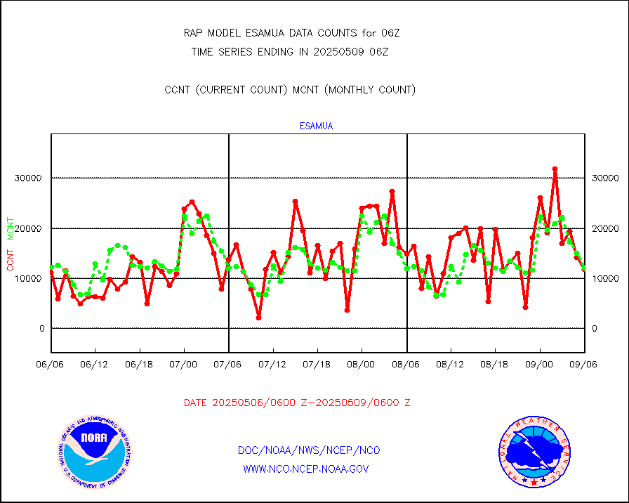
sevasr |
METEOSAT-10 2nd Gen SEVIRI All Sky Radiance(proc) |
9512 |
9353 |
101.7 % |
2004.00-2007.99 |
sevcsr |
METEOSAT-10 2nd Gen SEVIRI Clr Sky Radiance(proc) |
0 |
0 |
n/a |
2004.00-2007.99 |
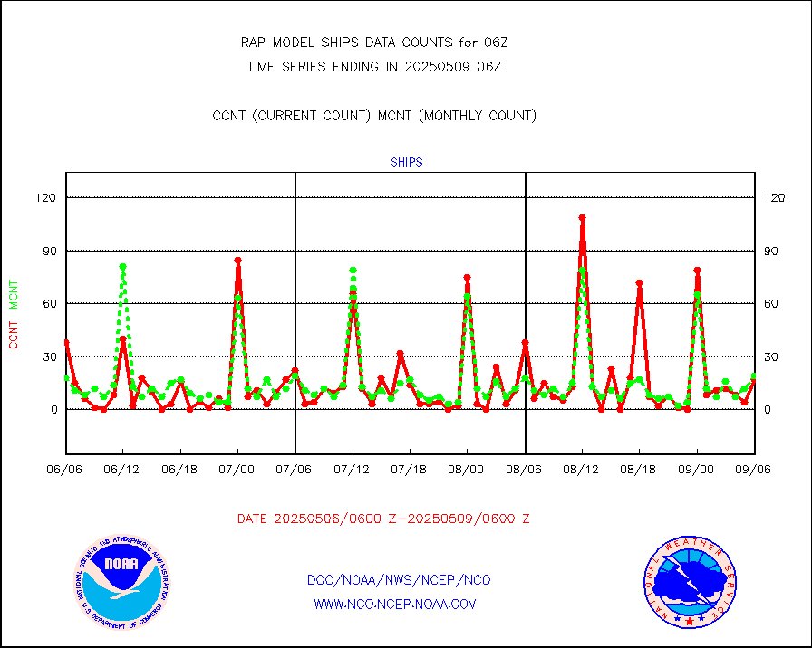
ships |
Ship - manual and automatic, restricted |
4 |
5 |
80.0 % |
2005.50-2006.50 |
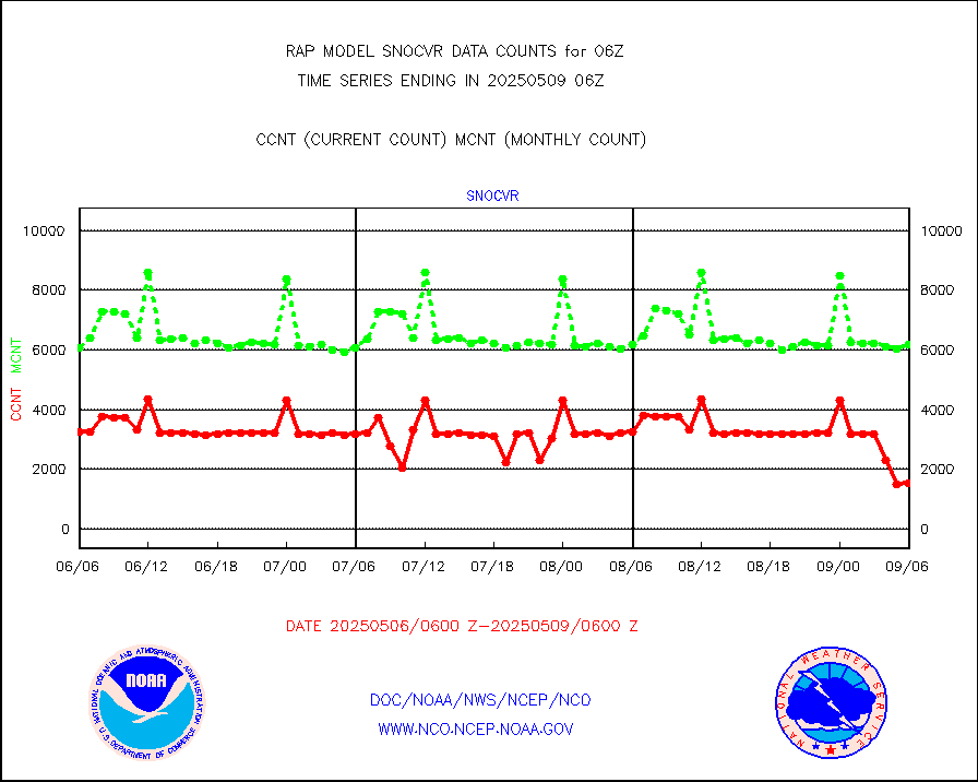
snocvr |
NOW COVER, DEPTH/DENSITY AND WATER EQUIVALENT |
2980 |
5902 |
50.5 % |
2004.00-2008.00 |
ssmisu |
DMSP SSM/IS 1C radiance data (Unified Pre-Proc.) |
77486 |
52662 |
147.1 % |
2004.00-2007.99 |
subpfl |
Sub-surface float and glider profile (BUFR) |
13 |
5 |
260.0 % |
2004.00-2007.99 |
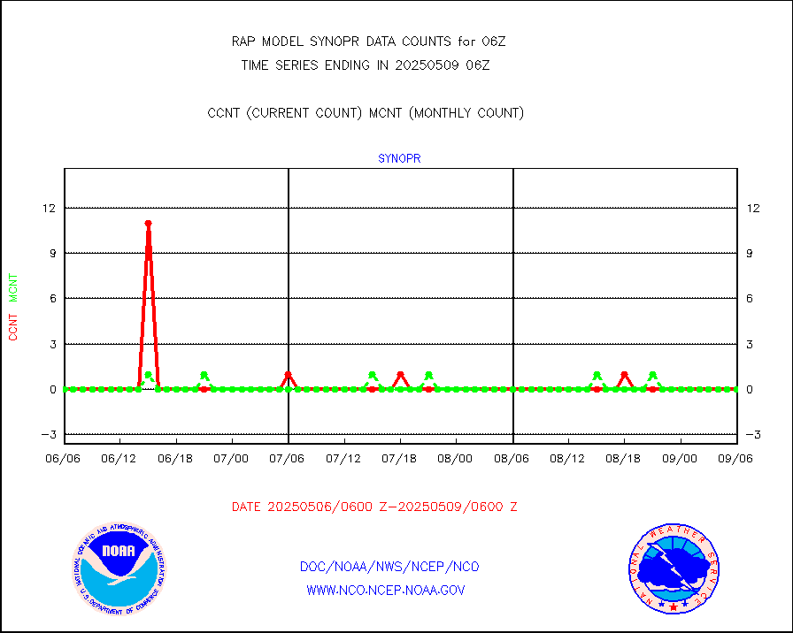
synopr |
Synoptic - restricted (WMO Res 40) manual & auto. |
0 |
0 |
n/a |
2005.50-2006.50 |
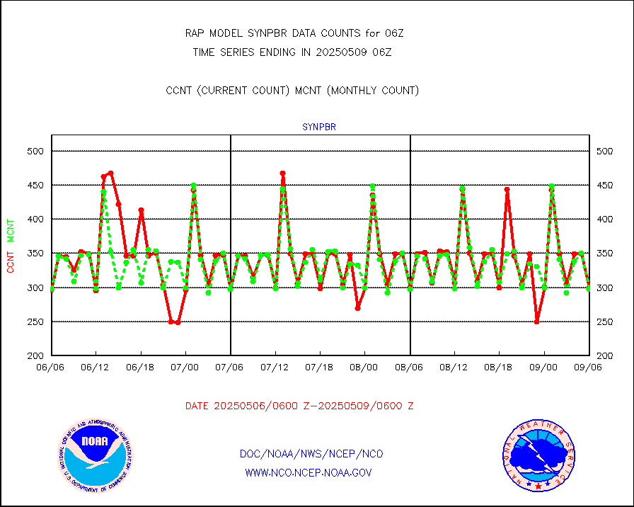
synpbr |
Synoptic - restricted (WMO Res 40)(decoded BUFR) |
299 |
298 |
100.3 % |
2005.50-2006.50 |
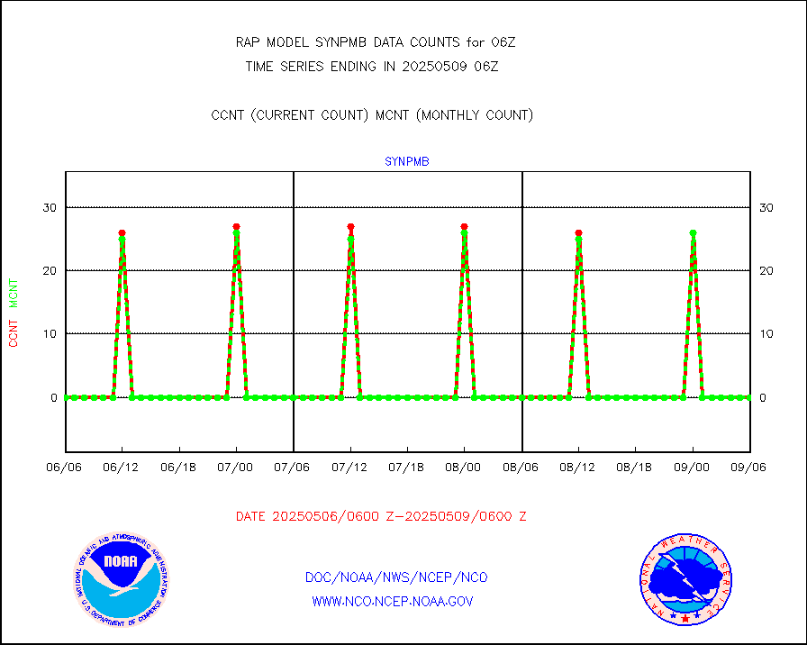
synpmb |
Synoptic - mobile manual & auto (decoded fr BUFR) |
0 |
0 |
n/a |
2005.50-2006.50 |
tmdara |
TAMDAR aircft data-all types(from Panasonic,BUFR) |
1306 |
1455 |
89.8 % |
2002.75-2009.25 |
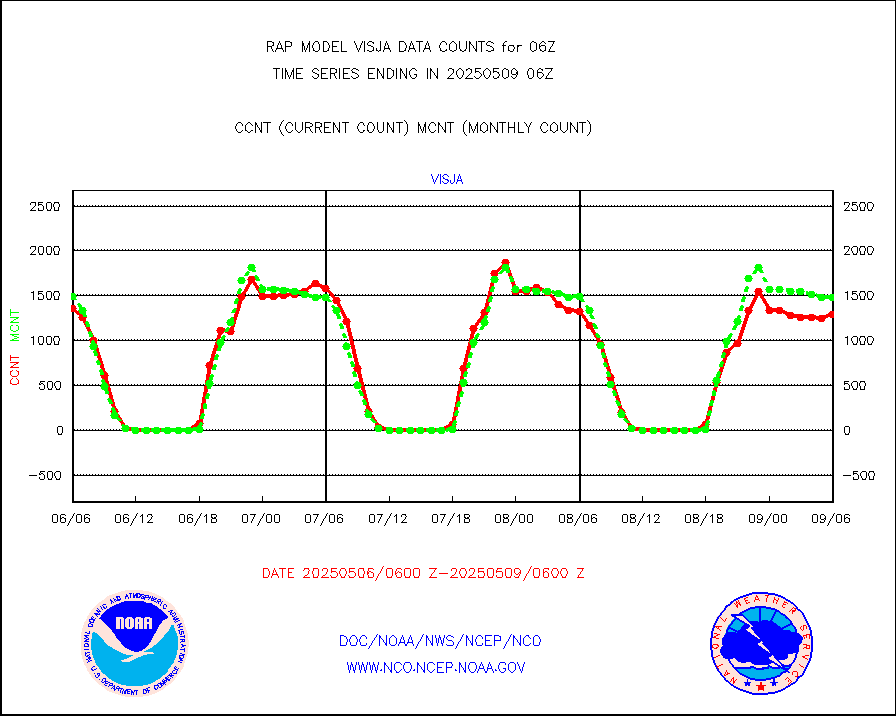
visja |
MTSAT/JMA visible derived cloud motion |
1501 |
1645 |
91.2 % |
2003.50-2008.50 |
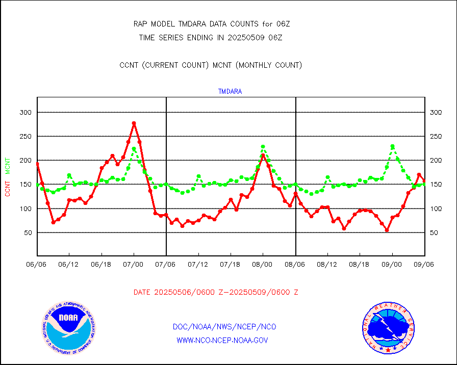
visusr |
GOES-16&up/NESDIS visible derived cloud motion |
11482 |
8063 |
142.4 % |
2005.00-2005.99 |
vseunb |
METEOSAT/EUMETSAT visible drv cld motion NBseq |
1066 |
638 |
167.1 % |
2004.50-2007.49 |


