| Critical Data with Normal Counts |
|---|
| Type | Description | Hourly Count | Monthly Average | Percent (%) of Monthly Mean | UTC Time Window |
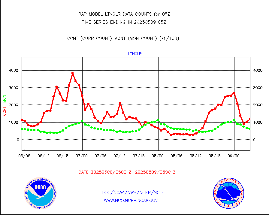
1bamua |
NOAA 15-19 & METOP 1-2 AMSU-A NCEP-proc. br.temps |
43660 |
45347 |
96.3 % |
2002.00-2007.99 |
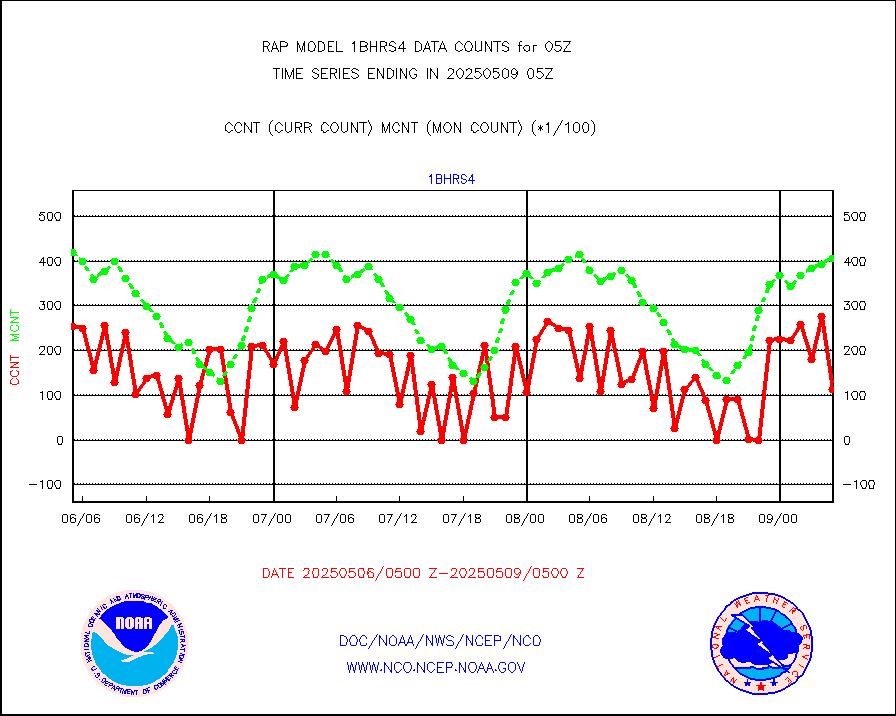
1bhrs4 |
NOAA 18-19 & METOP 1-2 HIRS-4 NCEP-proc. br.temps |
38335 |
40793 |
94.0 % |
2002.00-2007.99 |
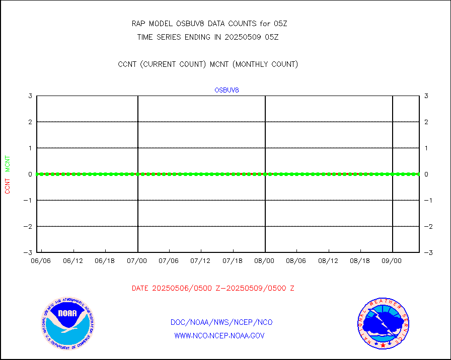
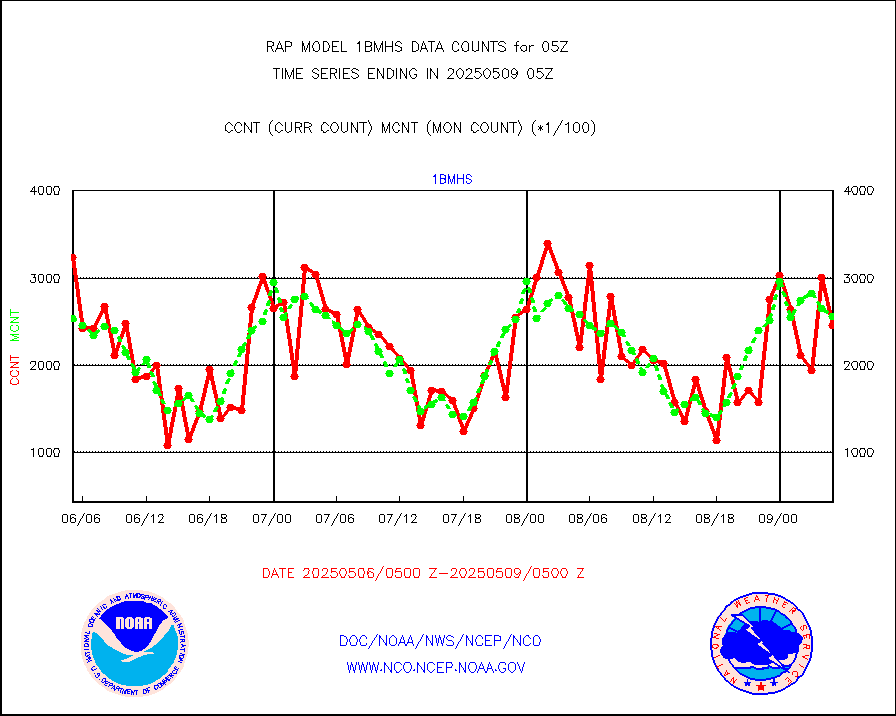
1bmhs |
NOAA 18-19 & METOP 1-2 MHS NCEP-proces. br. temps |
213296 |
262557 |
81.2 % |
2002.00-2007.99 |
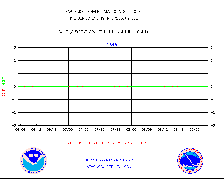
acars |
MDCRS ACARS acft data from ARINC(dcded from BUFR) |
68306 |
22340 |
305.8 % |
2001.75-2008.25 |
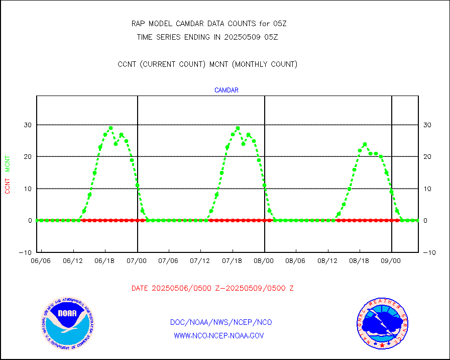
camdar |
Canadian AMDAR aircraft data (decoded from BUFR) |
23 |
17 |
135.3 % |
2001.75-2008.25 |
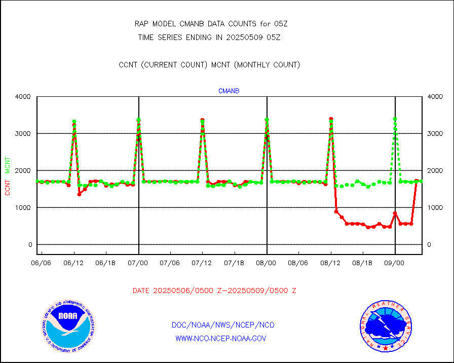
cmanb |
Surface Marine CMAN rpts decoded from BUFR format |
1707 |
1697 |
100.6 % |
2004.50-2005.50 |
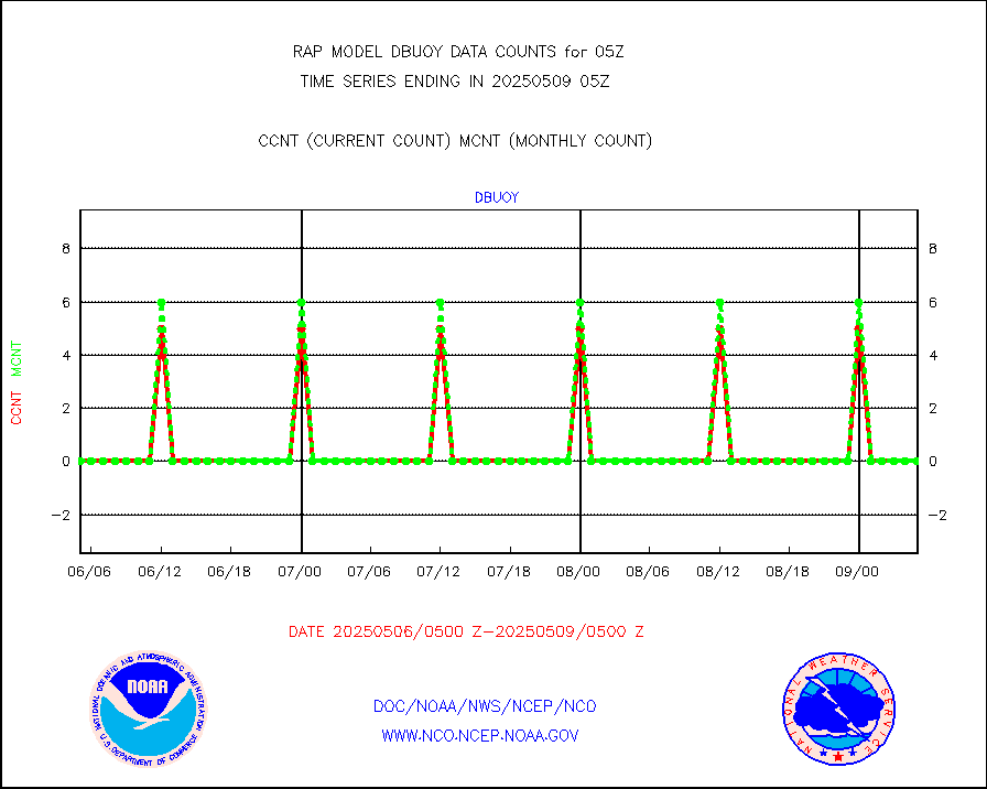
dbuoy |
Buoys decoded from FM-18 fmt (moored or drifting) |
0 |
0 |
n/a |
2004.50-2005.50 |
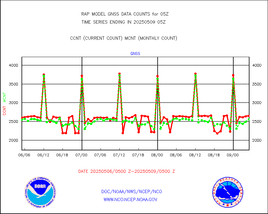
gnss |
Grnd-based Gbl Navigation Sat System (GNSS) data |
2646 |
2543 |
104.1 % |
2003.95-2004.05 |
h20mo |
MODIS (AQUA/TERRA) wvpr imager derived cld motion |
0 |
0 |
n/a |
2002.50-2007.50 |
infmo |
MODIS (AQUA/TERRA) ir l-wave derived cloud motion |
0 |
0 |
n/a |
2002.50-2007.50 |
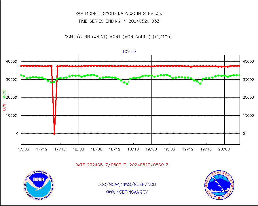
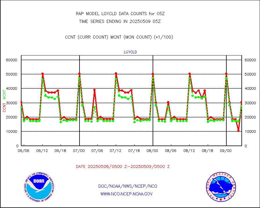
lgycld |
GOES/NASA(Langley) hi-res. (1x1 f-o-v) cloud data |
3741729 |
3245395 |
115.3 % |
2004.50-2005.50 |
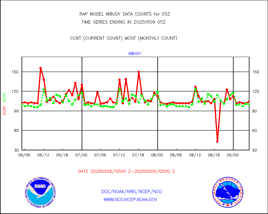
mbuoy |
Buoys decoded from FM-13 format (moored) |
66 |
61 |
108.2 % |
2004.50-2005.50 |
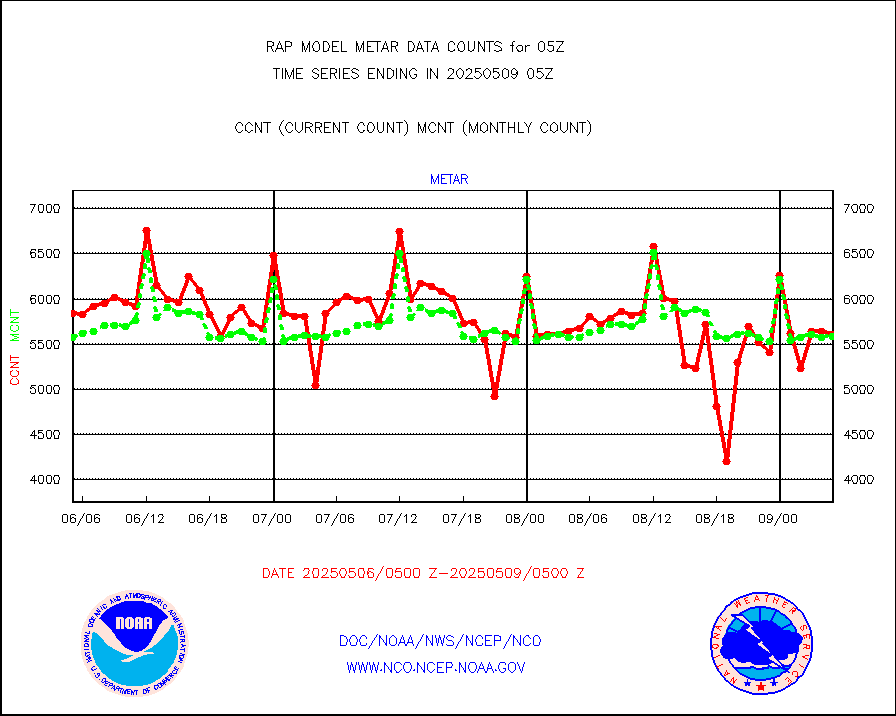
metar |
Aviation - METAR |
5589 |
5638 |
99.1 % |
2004.50-2005.50 |
nxrdw |
NEXRAD Vel Azm Dsp(VAD) winds via radar coded msg |
0 |
0 |
n/a |
2004.00-2006.00 |
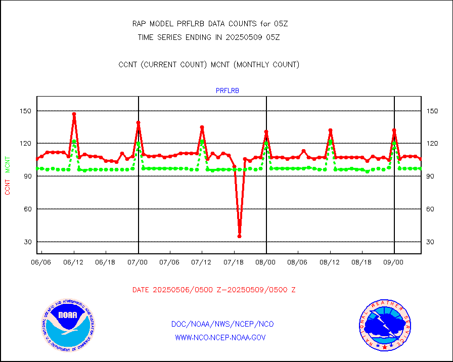
prflrb |
Multi-Agency Profiler (MAP) and SODAR winds |
72 |
84 |
85.7 % |
2003.50-2006.50 |
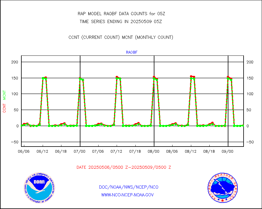
raobf |
Rawinsonde - fixed land (from TEMP or PILOT) |
0 |
1 |
0.0 % |
2004.00-2006.00 |
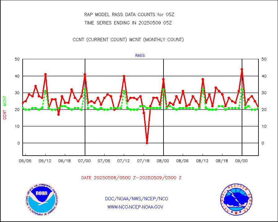
rass |
RASS temperatures (NOAA and Multi-Agency) |
15 |
21 |
71.4 % |
2004.50-2005.50 |
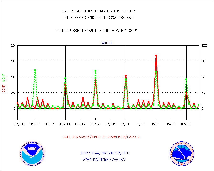
shipsb |
Ship - manual and automatic, restricted (BUFR) |
2 |
0 |
n/a |
2004.50-2005.50 |
shipsu |
Ship - manual and automatic, unrestricted |
44 |
53 |
83.0 % |
2004.50-2005.50 |
shipub |
Ship - manual and automatic, unrestricted (BUFR) |
693 |
620 |
111.8 % |
2004.50-2005.50 |
synop |
Synoptic - fixed manual and automatic |
318 |
308 |
103.2 % |
2004.50-2005.50 |
synopb |
Synoptic - fixed manual & auto (decoded fr BUFR) |
1691 |
1697 |
99.6 % |
2004.50-2005.50 |
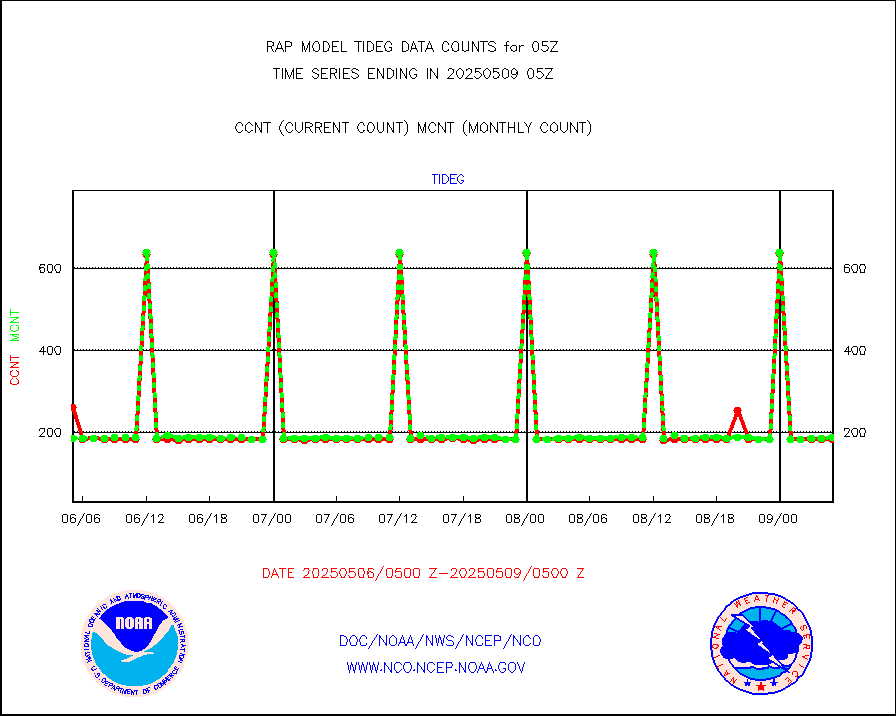
tideg |
Tide gauge reports decoded from CREX format |
183 |
181 |
101.1 % |
2004.50-2005.50 |
| Data Types of Opportunity with Normal Counts |
|---|
| Type | Description | Hourly Count | Monthly Average | Percent (%) of Monthly Mean | UTC Time Window |
3p9usr |
GOES-16&up/NESDIS ir short-wv derived cld motion |
6506 |
9493 |
68.5 % |
2004.00-2004.99 |
acarsa |
MDCRS ACARS acft data (ARINC via AFWA)(AIREP fmt) |
0 |
0 |
n/a |
2001.75-2008.25 |
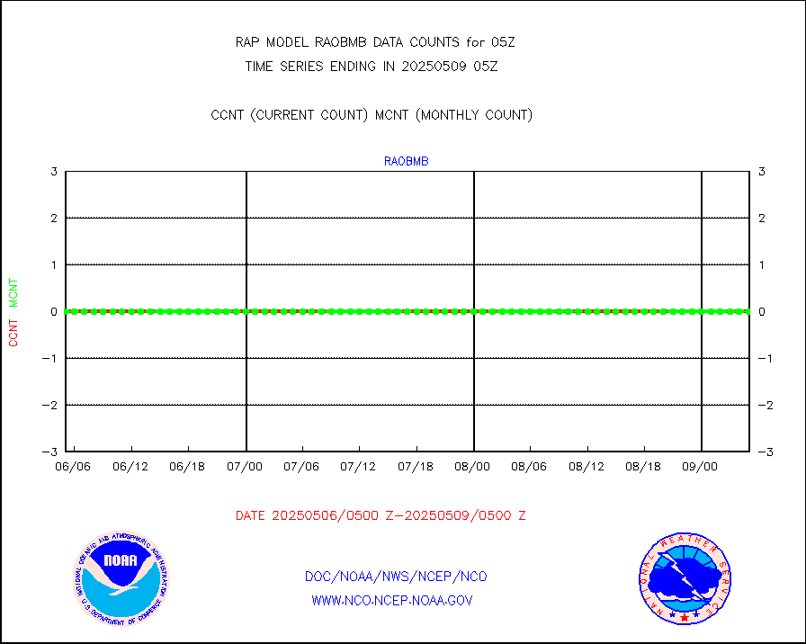
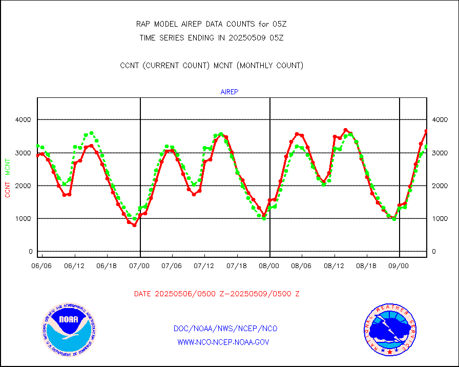
airep |
Manual AIREP aircraft data (dcded from AIREP fmt) |
5274 |
4850 |
108.7 % |
2001.75-2008.25 |
airsev |
AQUA AIRS/AMSU-A/HSB brightness temps- every FOV |
0 |
0 |
n/a |
2002.00-2007.99 |
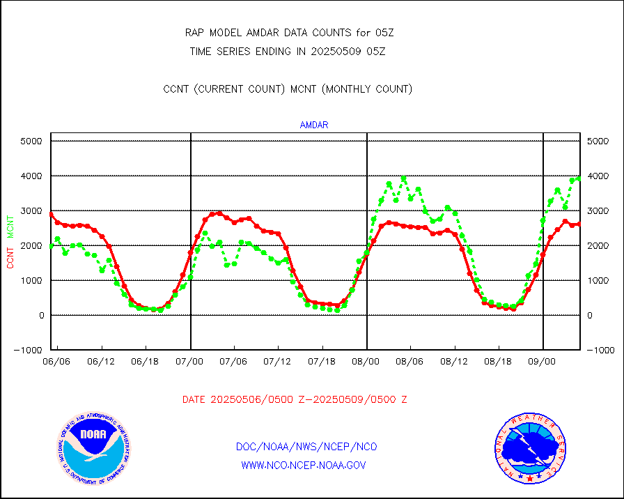
amdar |
AMDAR aircraft data (decoded from AMDAR format) |
2837 |
2365 |
120.0 % |
2001.75-2008.25 |
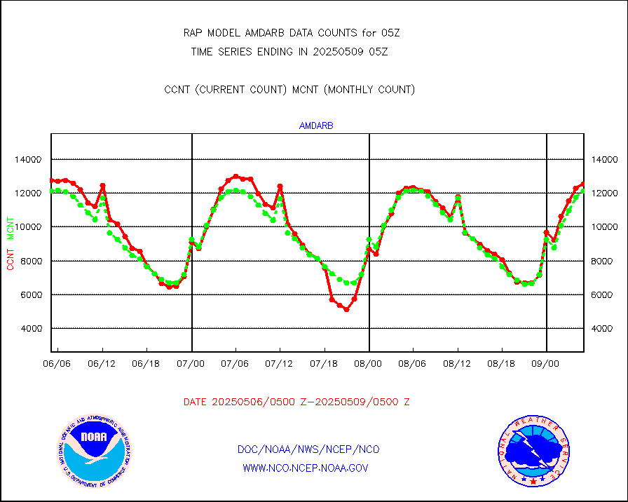
amdarb |
AMDAR aircraft data (decoded from BUFR) |
6390 |
6290 |
101.6 % |
2001.75-2008.25 |
amsr2 |
GCOM-W AMSR2 1B brightness temperatures |
144996 |
569684 |
25.5 % |
2002.00-2002.99 |
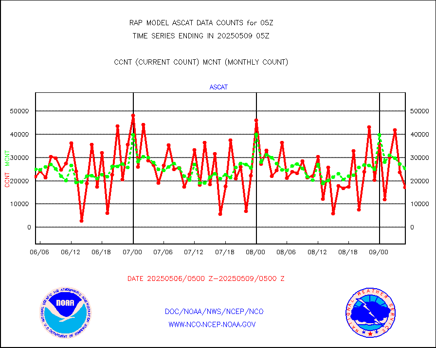
ascat |
METOP 1-2 ASCAT products |
31739 |
21168 |
149.9 % |
2003.00-2007.00 |
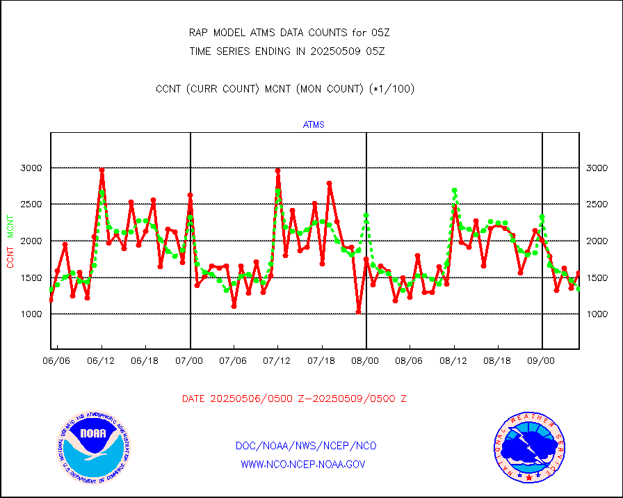
atms |
NPP/NOAA-20 ATMS brightness temperatures |
168251 |
135494 |
124.2 % |
2003.00-2006.99 |
atmsdb |
NPP/NOAA-20 ATMS bright. temps-direct b-cast SSEC |
28793 |
24789 |
116.2 % |
2003.00-2006.99 |
coopmd |
Coop/MADIS NEPP & HCN-Modernization NOAA COOP Obs |
27 |
27 |
100.0 % |
2004.50-2005.50 |
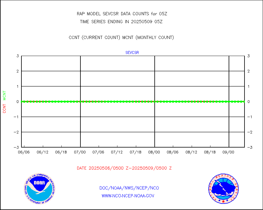
crisf4 |
NPP/NOAA-20 CrIS full spctrl radn (431 ch subset) |
85157 |
83837 |
101.6 % |
2003.00-2006.99 |
crsfdb |
NPP/NOAA-20 CrIS full spctrl radn dir brdcst SSEC |
82647 |
78753 |
104.9 % |
2003.00-2006.99 |
cstgd |
Coast Guard |
4 |
4 |
100.0 % |
2004.50-2005.50 |
dbuoyb |
Drifting buoys (decoded from BUFR) |
606 |
587 |
103.2 % |
2004.50-2005.50 |
dropw |
Dropwinsonde (from TEMP DROP) |
0 |
0 |
n/a |
2004.00-2006.00 |
eadas |
E-AMDAR (European AMDAR acft decoded from BUFR) |
4232 |
3899 |
108.5 % |
2001.75-2008.25 |
esamua |
NOAA 15-19 & METOP 1-2 AMSU-A proc btmps frm RARS |
27655 |
17259 |
160.2 % |
2004.00-2006.00 |
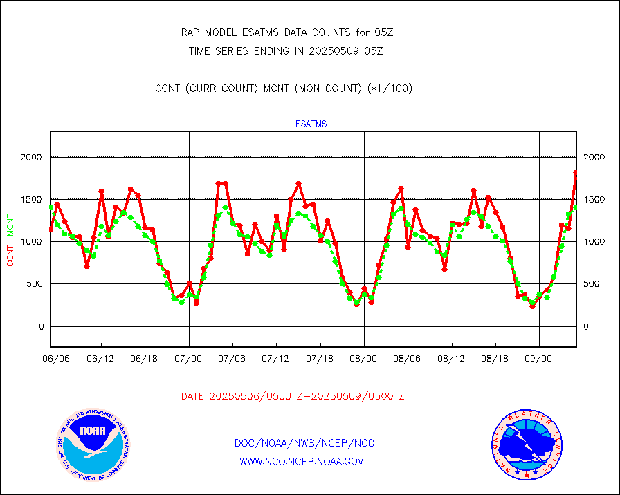
esatms |
NPP Adv. Tech. MW Sndr (ATMS) br. temps from RARS |
165411 |
142625 |
116.0 % |
2003.00-2006.99 |
eshrs3 |
NOAA 15-19 & METOP 1-2 HIRS-3/4 pr btmps frm RARS |
56211 |
39210 |
143.4 % |
2004.00-2006.00 |
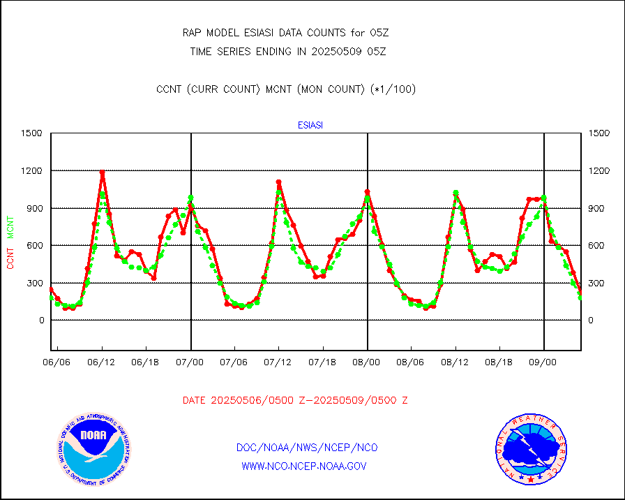
esiasi |
METOP 1-2 IASI 1C radiance data vbl chn from RARS |
32548 |
28178 |
115.5 % |
2003.00-2006.99 |
esmhs |
NOAA 18-19 & METOP 1-2 MHS proc. btemps from RARS |
182683 |
116178 |
157.2 % |
2004.00-2006.00 |
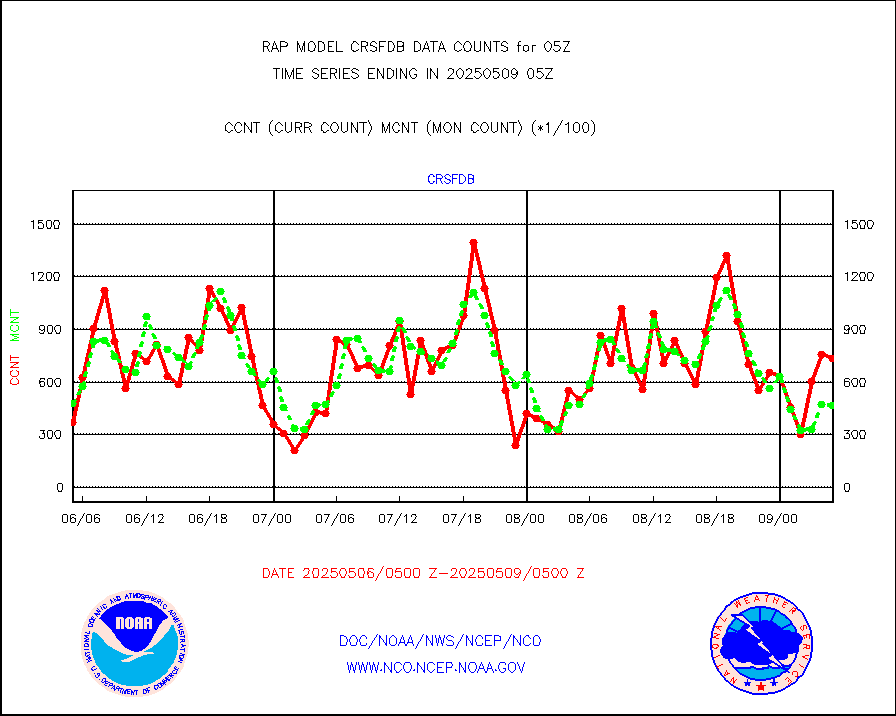
gmi1cr |
GPM GMI Level 1C-R brightness temperatures |
295203 |
833863 |
35.4 % |
2002.00-2007.99 |
gpsro |
GPS radio occultation data |
149 |
126 |
118.3 % |
2003.00-2006.99 |
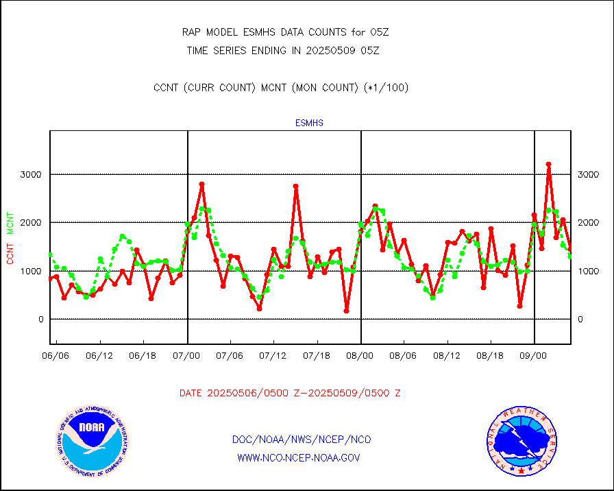
gsrasr |
GOES-16/17 All Sky Radiances (proc.) |
922578 |
957290 |
96.4 % |
2003.00-2006.99 |
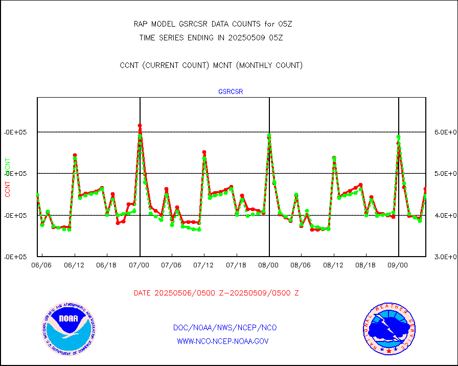
gsrcsr |
GOES-16/17 Clear Sky Radiances (proc.) |
370012 |
439815 |
84.1 % |
2003.00-2006.99 |
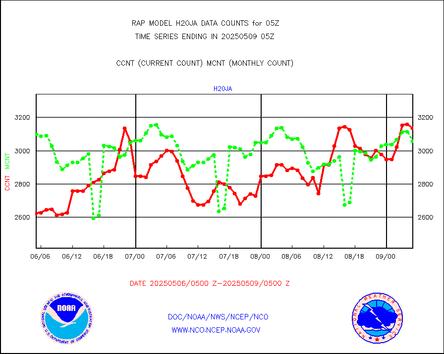
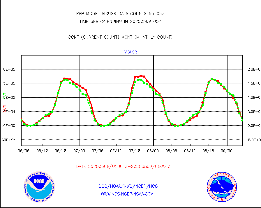
h20ja |
MTSAT/JMA water vapor imager derived cloud motion |
2915 |
3191 |
91.4 % |
2002.50-2007.50 |
h2dusr |
GOES-16&up/NESDIS wv imgr/deep-lyr derivd cld mtn |
6519 |
7145 |
91.2 % |
2004.00-2004.99 |
h2eunb |
METEOSAT/EUMETSAT wvpr imgr drv cld motion NBseq |
5274 |
4897 |
107.7 % |
2003.50-2006.49 |
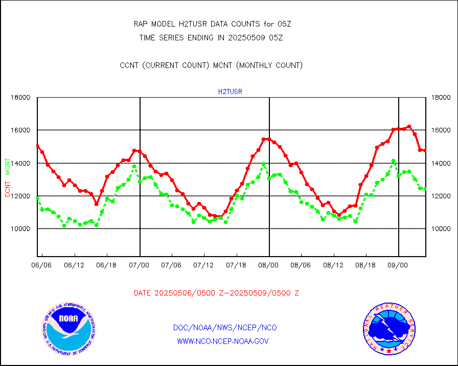
h2tusr |
GOES-16&up/NESDIS wv imgr/cld-top derived cld mtn |
15440 |
12412 |
124.4 % |
2004.00-2004.99 |
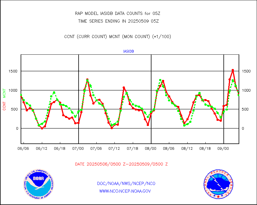
iasidb |
METOP 1-2 IASI 1C radiances-direct broadcast SSEC |
91668 |
68941 |
133.0 % |
2003.00-2006.99 |
ifeunb |
METEOSAT/EUMETSAT ir lg-wave drv cld motion NBseq |
3321 |
3016 |
110.1 % |
2003.50-2006.49 |
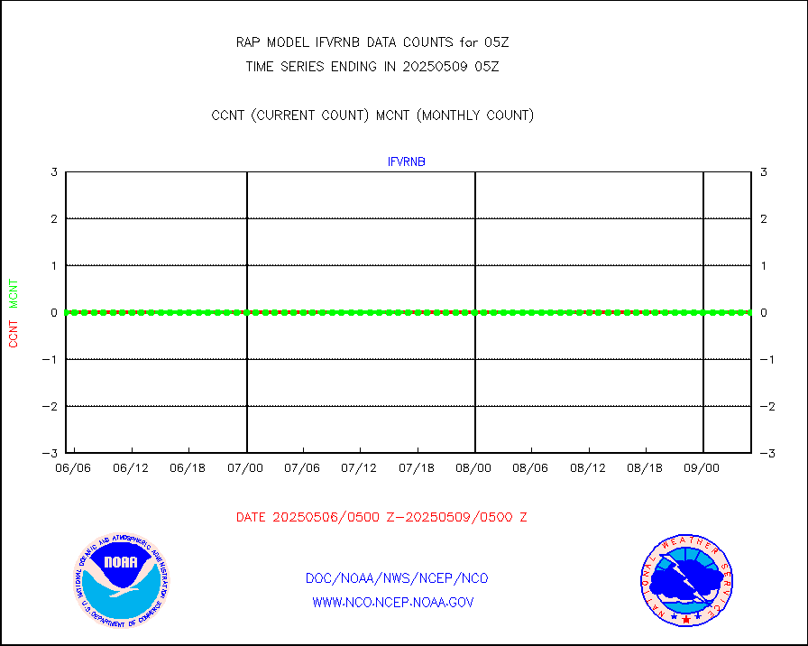
ifvrnb |
VIIRS (NPP/NOAA-20) ir lg-wv drv cloud motion(NB) |
0 |
0 |
n/a |
2002.50-2007.50 |
infav |
AVHRR (NOAA/METOP) ir lg-wave derived cld motion |
0 |
0 |
n/a |
2002.50-2007.50 |
infav1 |
AVHRR (METOP) ir lg-wave derived cld motion |
0 |
0 |
n/a |
2003.50-2006.49 |
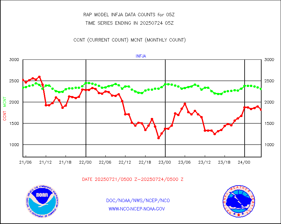
infja |
MTSAT/JMA infrared long-wave derived cloud motion |
2176 |
2576 |
84.5 % |
2002.50-2007.50 |
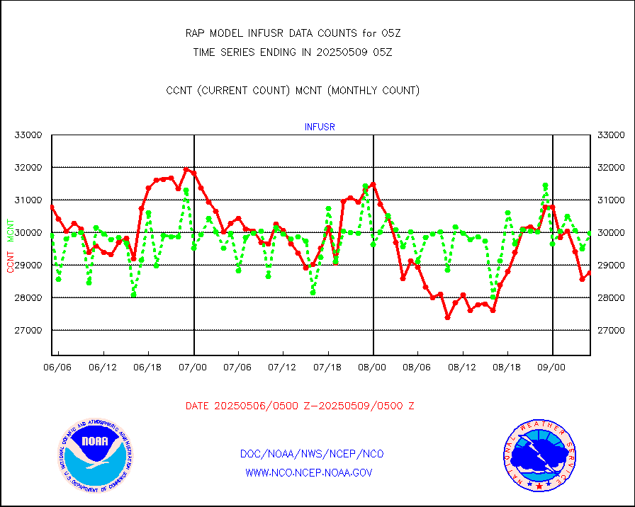
infusr |
GOES-16&up/NESDIS ir long-wave derived cld motion |
28664 |
29241 |
98.0 % |
2004.00-2004.99 |
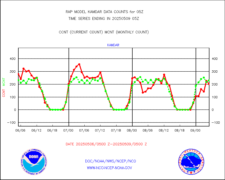
kamdar |
Korean AMDAR aircraft data (decoded from BUFR) |
247 |
259 |
95.4 % |
2001.75-2008.25 |
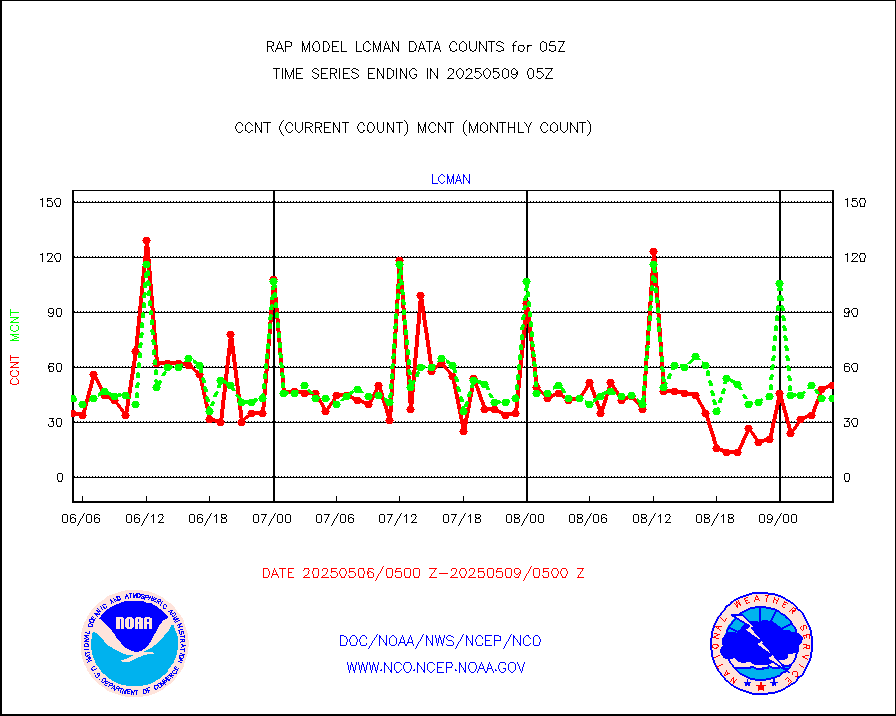
lcman |
Land-based CMAN stations decoded from CMAN format |
70 |
75 |
93.3 % |
2004.50-2005.50 |
ltnglr |
LLDN Long-rng lightning from Vaisala via NOAAPORT |
153401 |
113891 |
134.7 % |
2004.00-2005.50 |
ltngsr |
NLDN Shrt-rng lightning from Vaisala via NOAAPORT |
8839 |
6295 |
140.4 % |
2004.00-2005.50 |
mbuoyb |
Moored buoys (decoded from BUFR) |
618 |
560 |
110.4 % |
2004.50-2005.50 |
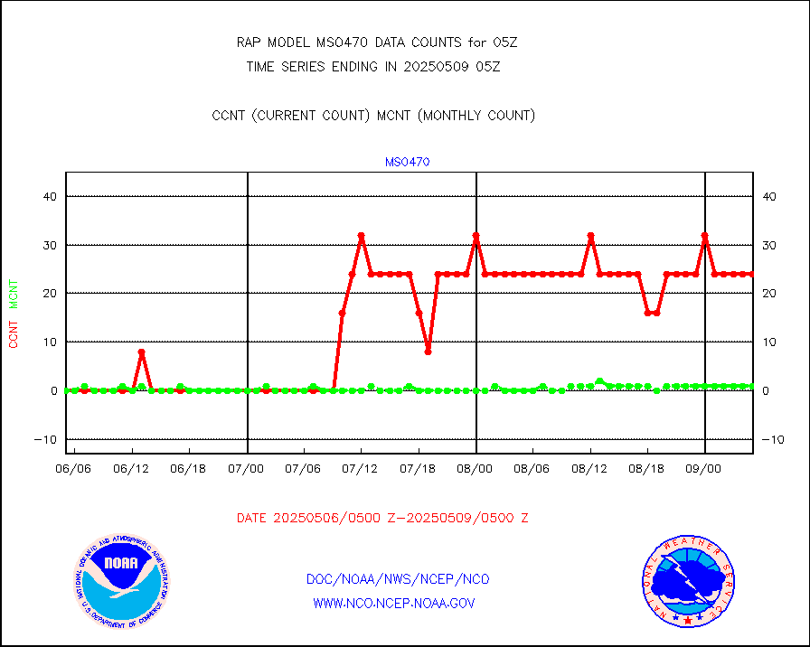
mso470 |
Mesonet/MADIS Colorado E-470 (Interstate 470) |
21 |
19 |
110.5 % |
2004.50-2005.50 |
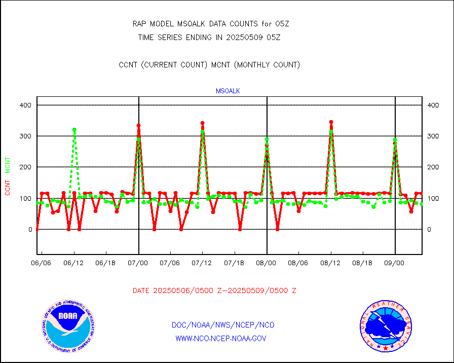
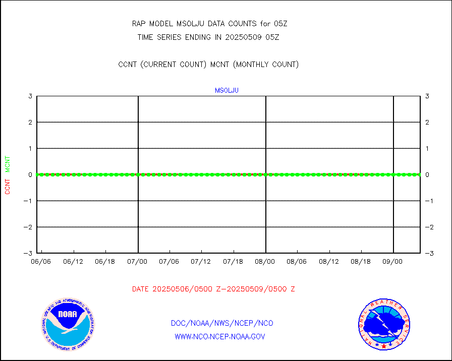
msoalk |
Mesonet/MADIS Alaska Department of Transportation |
107 |
101 |
105.9 % |
2004.50-2005.50 |
msoapg |
Mesonet/MADIS U.S. Army Aberdeen Proving Grounds |
0 |
0 |
n/a |
2004.50-2005.50 |
msoapr |
Mesonet/MADIS Citizen Weather Observers Program |
44659 |
46016 |
97.1 % |
2004.50-2005.50 |
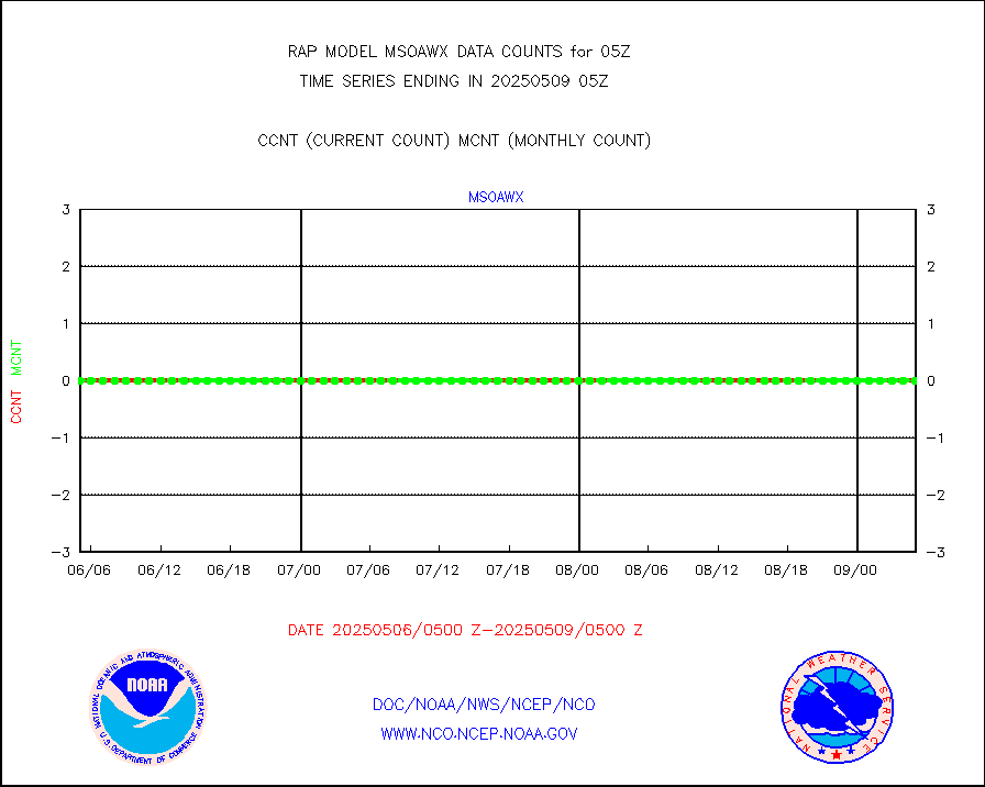
msoaws |
Mesonet/MADIS AWS Convergence Technologies, Inc. |
24958 |
25693 |
97.1 % |
2004.50-2005.50 |
msoawx |
Mesonet/MADIS "Anything Weather" |
0 |
0 |
n/a |
2004.50-2005.50 |
msocol |
Mesonet/MADIS Colorado Dept. of Transportation |
0 |
0 |
n/a |
2004.50-2005.50 |
msodcn |
Mesonet/MADIS DC Net |
0 |
0 |
n/a |
2004.50-2005.50 |
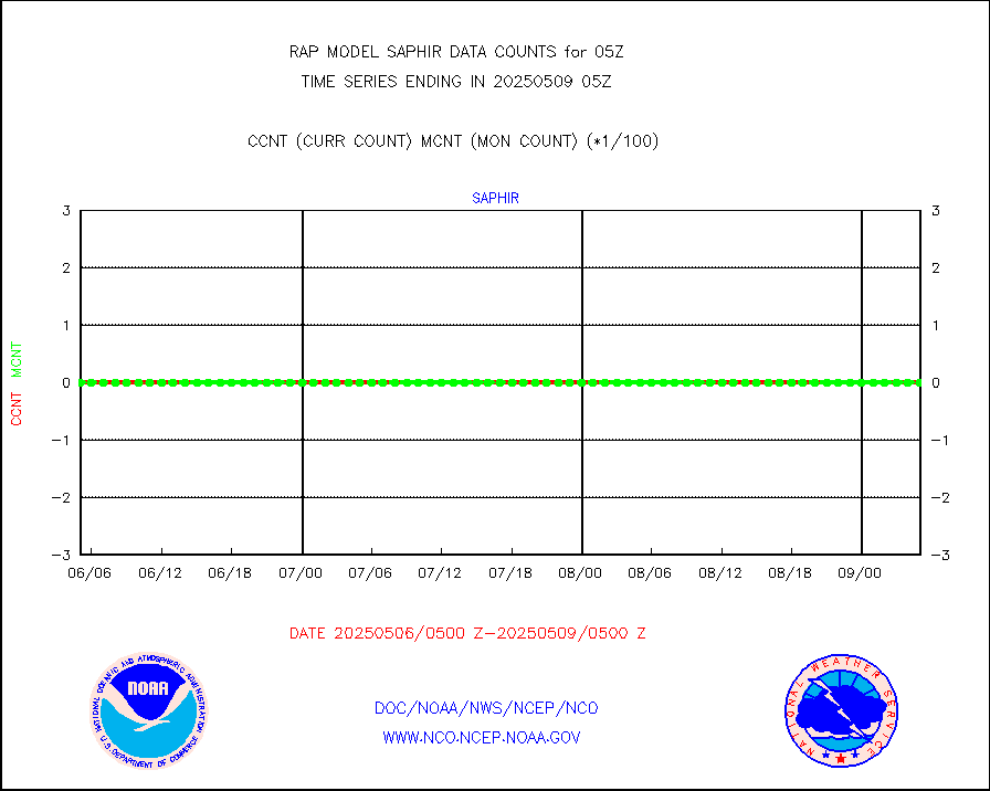
msoden |
Mesonet/MADIS Denver Urban Drainage & Flood Cntrl |
225 |
217 |
103.7 % |
2004.50-2005.50 |
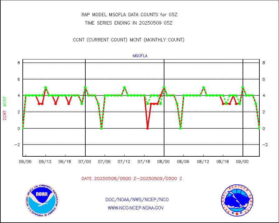
msofla |
Mesonet/MADIS Florida (FAWN & USF) |
0 |
0 |
n/a |
2004.50-2005.50 |
msoflt |
Mesonet/MADIS Florida Dept. of Transportation |
0 |
0 |
n/a |
2004.50-2005.50 |
msogeo |
Mesonet/MADIS Georgia Dept. of Transportation |
0 |
0 |
n/a |
2004.50-2005.50 |
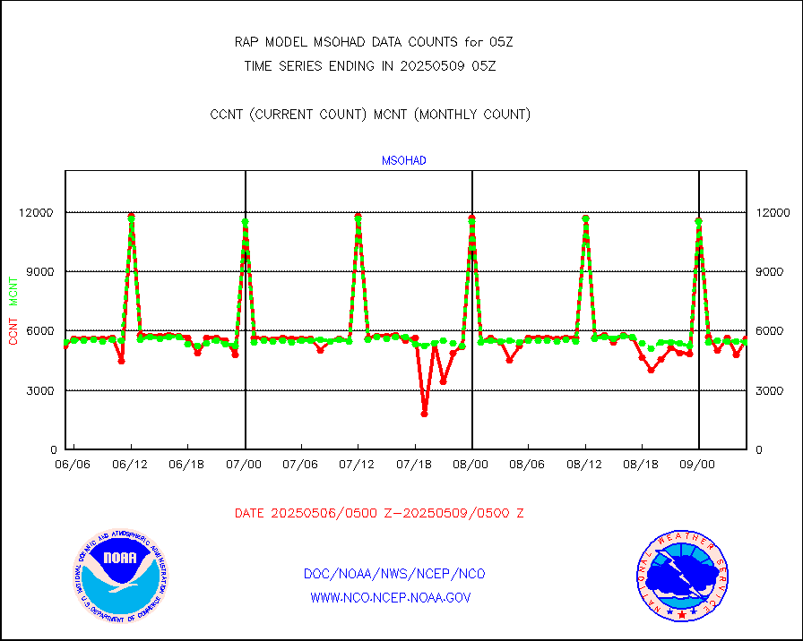
msohad |
Mesonet/MADIS NWS Hydromet Auto Data System(HADS) |
5728 |
5521 |
103.7 % |
2004.50-2005.50 |
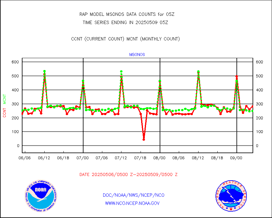
msoien |
Mesonet/MADIS Iowa Environmental |
164 |
162 |
101.2 % |
2004.50-2005.50 |
msoind |
Mesonet/MADIS Indiana Dept. of Transportation |
0 |
0 |
n/a |
2004.50-2005.50 |
msoiow |
Mesonet/MADIS Iowa Department of Transportation |
0 |
0 |
n/a |
2004.50-2005.50 |
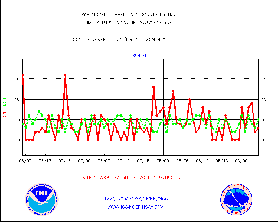
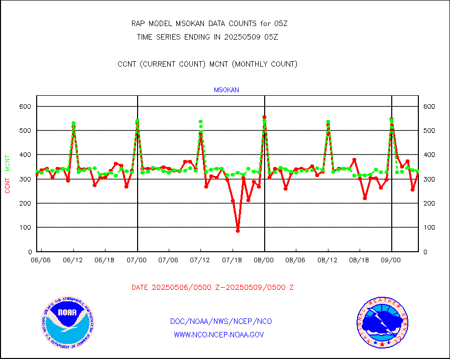
msokan |
Mesonet/MADIS Kansas Department of Transportation |
321 |
327 |
98.2 % |
2004.50-2005.50 |
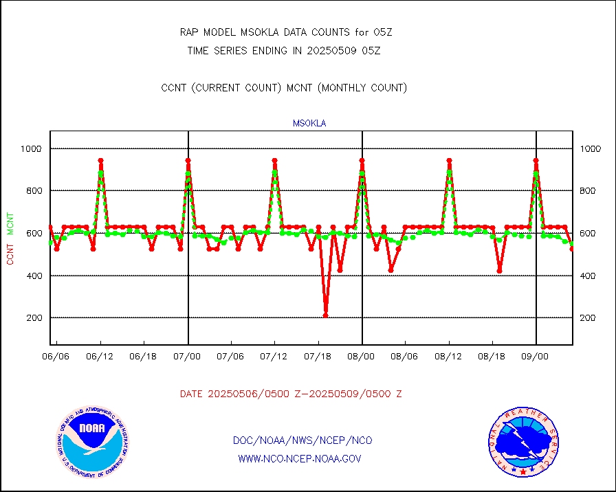
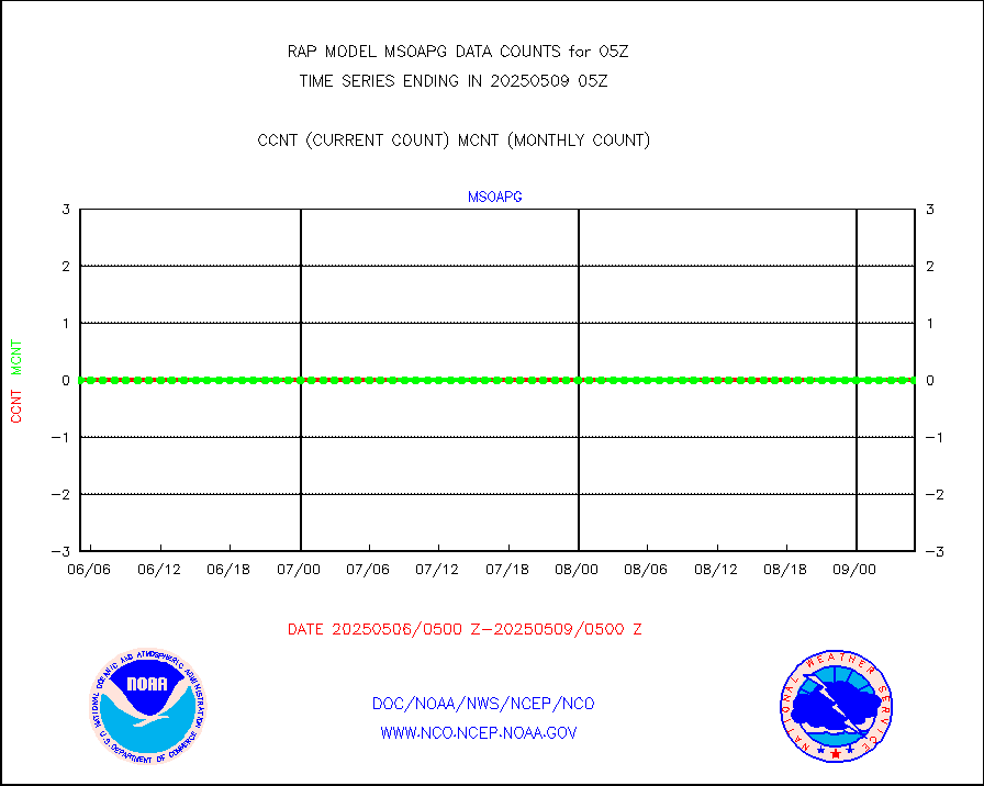
msokla |
Mesonet/MADIS Oklahoma Mesonet |
318 |
322 |
98.8 % |
2004.50-2005.50 |
msolju |
Mesonet/MADIS Louisiana State/Jackson State Univ. |
0 |
0 |
n/a |
2004.50-2005.50 |
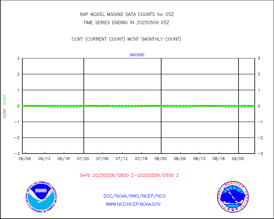
msomca |
Mesonet/MADIS Missouri Commercial Agricult Wx Net |
269 |
258 |
104.3 % |
2004.50-2005.50 |
msomin |
Mesonet/MADIS Minnesota Dept. of Transportation |
0 |
0 |
n/a |
2004.50-2005.50 |
msonos |
Mesonet/MADIS NOS-Phys Oceanographic Realtime Sys |
288 |
286 |
100.7 % |
2004.50-2005.50 |
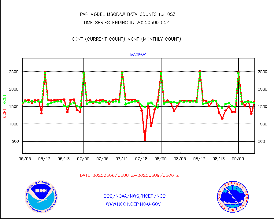
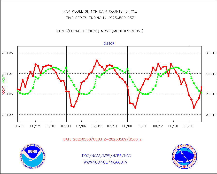
msoraw |
Mesonet/MADIS NFIC Remote Automated Wx Stns(RAWS) |
1690 |
1582 |
106.8 % |
2004.50-2005.50 |
msourb |
Mesonet/MADIS UrbaNet |
3958 |
3911 |
101.2 % |
2004.50-2005.50 |
msovir |
Mesonet/MADIS Virginia Dept. of Transportation |
206 |
227 |
90.7 % |
2004.50-2005.50 |
msowfy |
Mesonet/MADIS "Weather for You" |
0 |
0 |
n/a |
2004.50-2005.50 |
msowis |
Mesonet/MADIS Wisconsin Dept. of Transportation |
0 |
0 |
n/a |
2004.50-2005.50 |
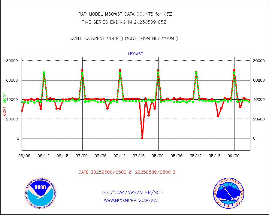
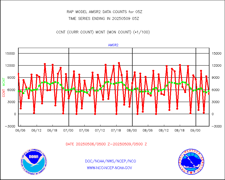
msowst |
Mesonet/MADIS MesoWest (many subproviders) |
41427 |
39944 |
103.7 % |
2004.50-2005.50 |
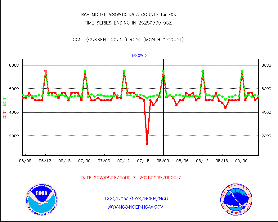
msowtx |
Mesonet/MADIS West Texas |
5043 |
4812 |
104.8 % |
2004.50-2005.50 |
mtiasi |
METOP 1-2 IASI 1C radiance data (varbl. channels) |
42274 |
34351 |
123.1 % |
2003.00-2006.99 |
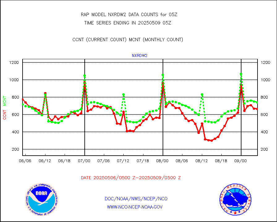
nxrdw2 |
NEXRAD Vel Azm Dsp(VAD) winds via Level 2 decoder |
888 |
862 |
103.0 % |
2004.00-2006.00 |
osbuv8 |
NOAA 16-19 Solar Backscatter UV-2 rad frm V8 BUFR |
0 |
0 |
n/a |
2003.00-2005.99 |
pibal |
PIBAL (from PILOT, PILOT SHIP, PILOT MOBIL) |
0 |
0 |
n/a |
2004.00-2006.00 |
pirep |
Manual PIREP aircraft data (dcded from AIREP fmt) |
101 |
139 |
72.7 % |
2001.75-2008.25 |
prflrp |
Profilr winds from PIBAL (PILOT,PILOT SHIP/MOBIL) |
0 |
0 |
n/a |
2003.50-2006.50 |
raobm |
Rawinsonde - mobile land (from TEMP/PILOT MOBIL) |
0 |
0 |
n/a |
2004.00-2006.00 |
raobs |
Rawinsonde - ship (from TEMP SHIP, PILOT SHIP) |
0 |
0 |
n/a |
2004.00-2006.00 |
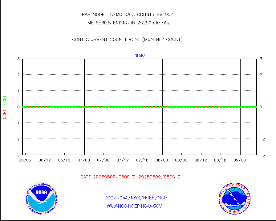
rd2wnd |
NEXRAD radial wind (Level 2 - GTS) |
1101658 |
1050606 |
104.9 % |
2004.50-2005.49 |
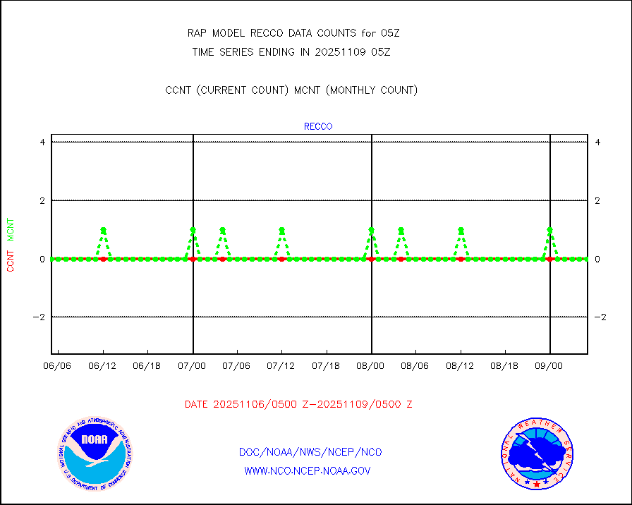
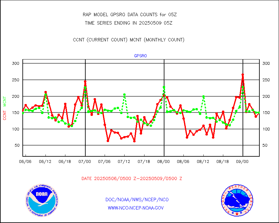
recco |
Flight level reconnaissance aircraft data |
0 |
0 |
n/a |
2004.00-2006.00 |
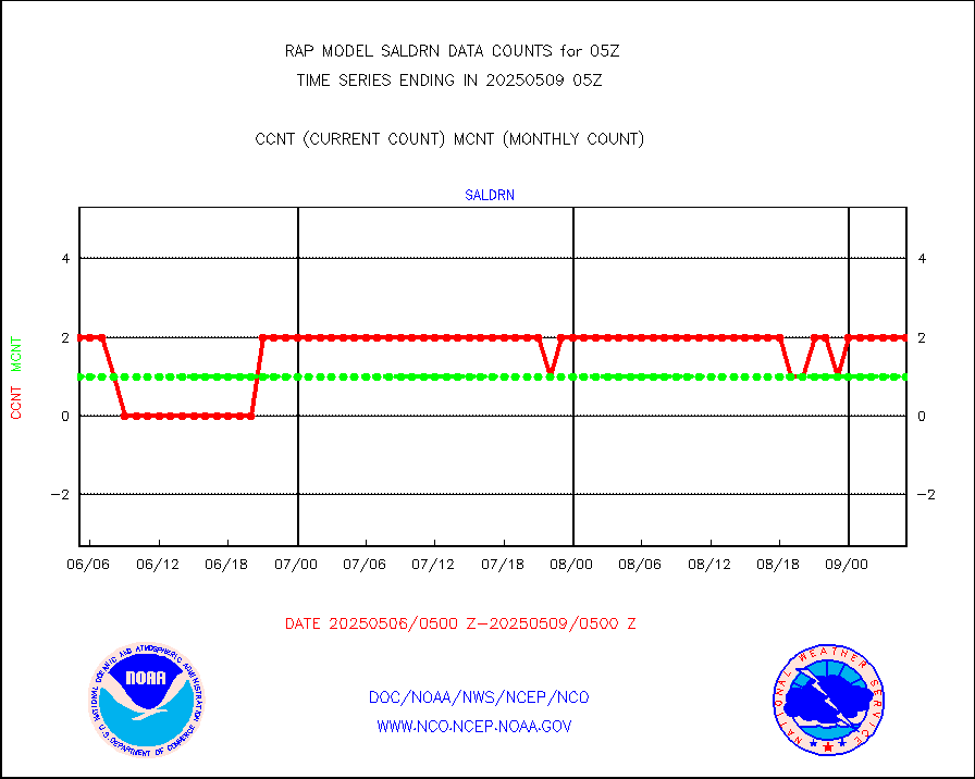
saldrn |
Surface Marine Saildrone (decoded from BUFR) |
2 |
2 |
100.0 % |
2003.00-2006.99 |
saphir |
Megha-Tropiques SAPHIR L1A2 brightness temps |
0 |
0 |
n/a |
2002.00-2007.99 |
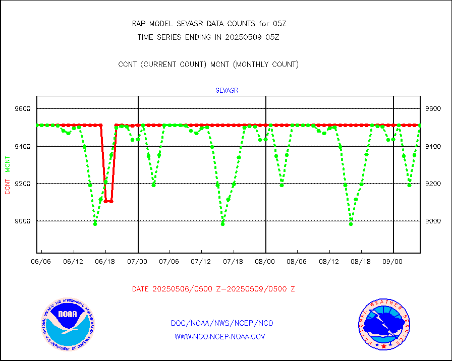
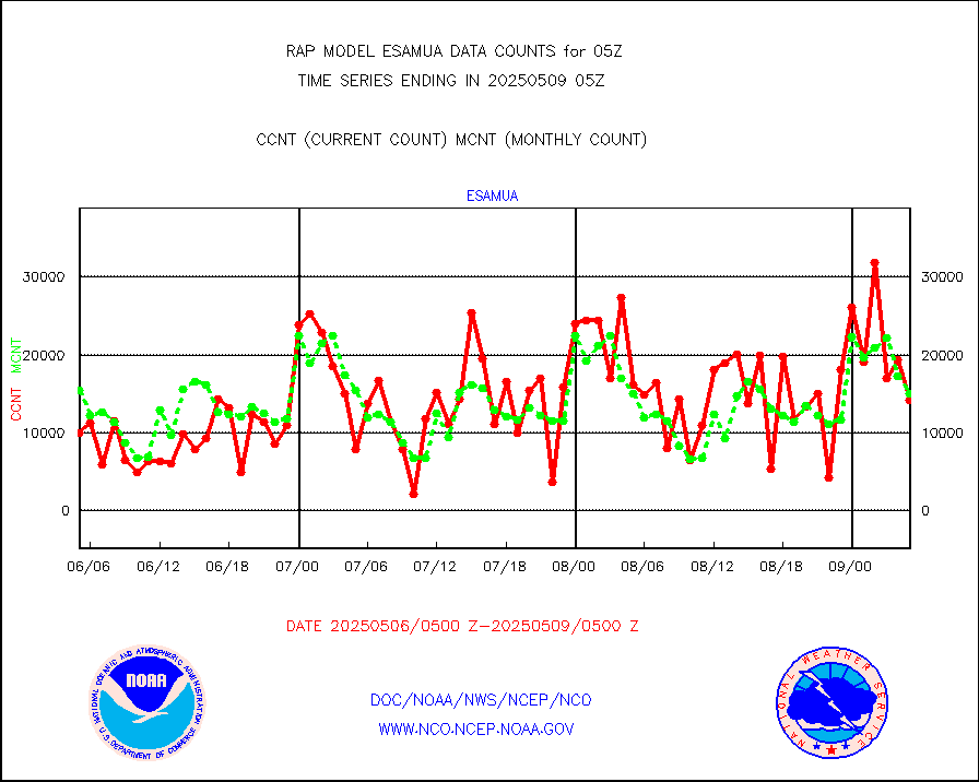
sevasr |
METEOSAT-10 2nd Gen SEVIRI All Sky Radiance(proc) |
9512 |
8878 |
107.1 % |
2003.00-2006.99 |
sevcsr |
METEOSAT-10 2nd Gen SEVIRI Clr Sky Radiance(proc) |
0 |
0 |
n/a |
2003.00-2006.99 |
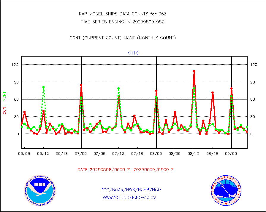
ships |
Ship - manual and automatic, restricted |
3 |
3 |
100.0 % |
2004.50-2005.50 |
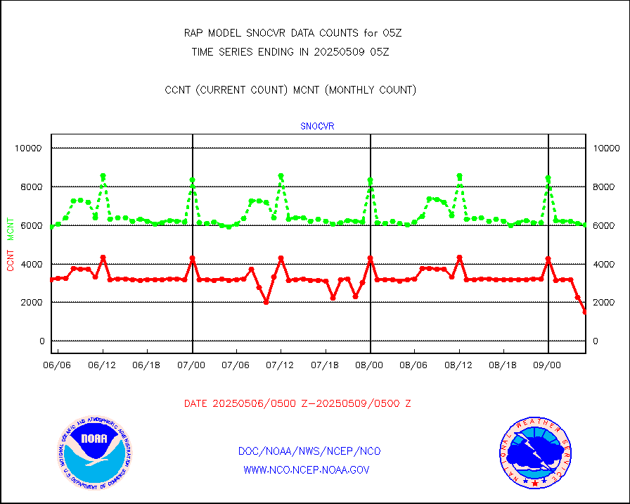
snocvr |
NOW COVER, DEPTH/DENSITY AND WATER EQUIVALENT |
3039 |
5673 |
53.6 % |
2003.00-2007.00 |
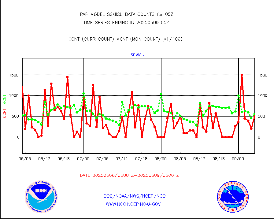
ssmisu |
DMSP SSM/IS 1C radiance data (Unified Pre-Proc.) |
52541 |
41027 |
128.1 % |
2003.00-2006.99 |
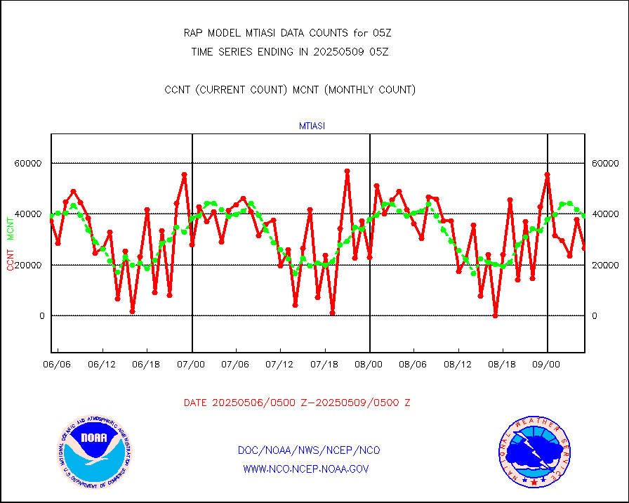
subpfl |
Sub-surface float and glider profile (BUFR) |
6 |
11 |
54.5 % |
2003.00-2006.99 |
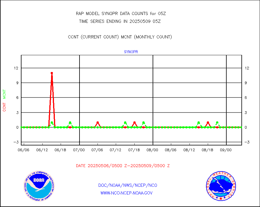
synopr |
Synoptic - restricted (WMO Res 40) manual & auto. |
0 |
0 |
n/a |
2004.50-2005.50 |
synpbr |
Synoptic - restricted (WMO Res 40)(decoded BUFR) |
343 |
347 |
98.8 % |
2004.50-2005.50 |
synpmb |
Synoptic - mobile manual & auto (decoded fr BUFR) |
0 |
0 |
n/a |
2004.50-2005.50 |
tmdara |
TAMDAR aircft data-all types(from Panasonic,BUFR) |
1313 |
1456 |
90.2 % |
2001.75-2008.25 |
visja |
MTSAT/JMA visible derived cloud motion |
1446 |
1634 |
88.5 % |
2002.50-2007.50 |
visusr |
GOES-16&up/NESDIS visible derived cloud motion |
18474 |
20326 |
90.9 % |
2004.00-2004.99 |
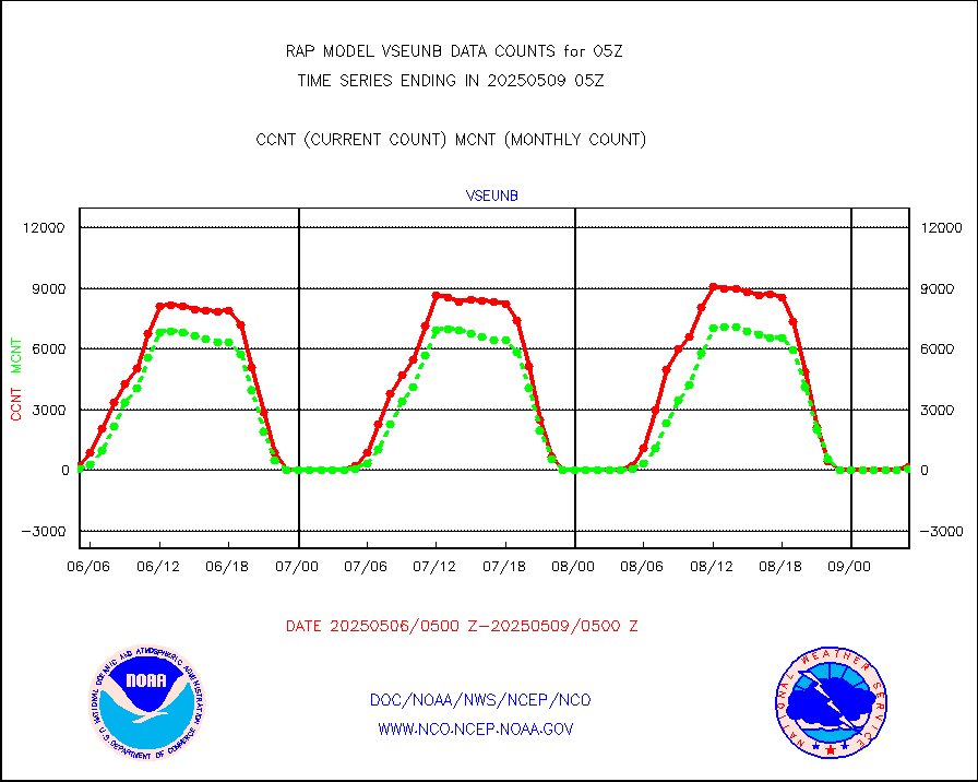
vseunb |
METEOSAT/EUMETSAT visible drv cld motion NBseq |
300 |
158 |
189.9 % |
2003.50-2006.49 |


