| Critical Data with Normal Counts |
|---|
| Type | Description | Hourly Count | Monthly Average | Percent (%) of Monthly Mean | UTC Time Window |
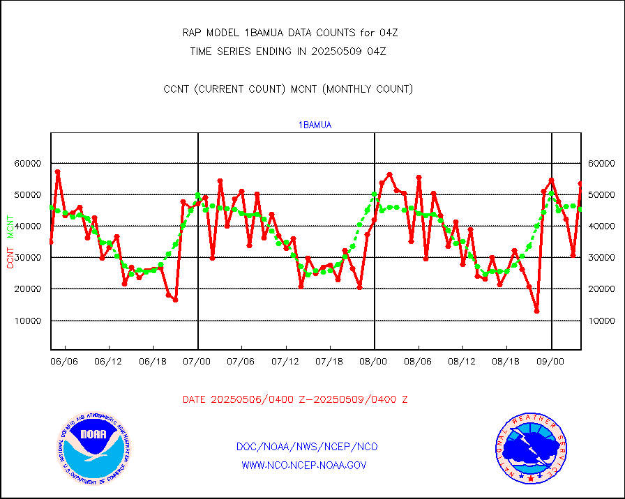
1bamua |
NOAA 15-19 & METOP 1-2 AMSU-A NCEP-proc. br.temps |
46454 |
47009 |
98.8 % |
1901.00-1906.99 |
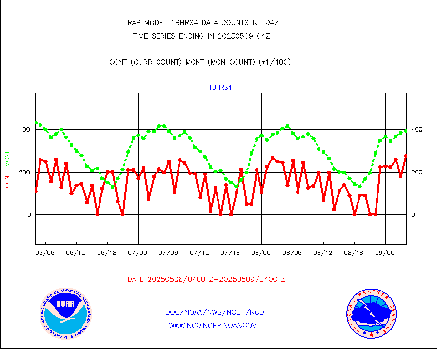
1bhrs4 |
NOAA 18-19 & METOP 1-2 HIRS-4 NCEP-proc. br.temps |
27268 |
43981 |
62.0 % |
1901.00-1906.99 |
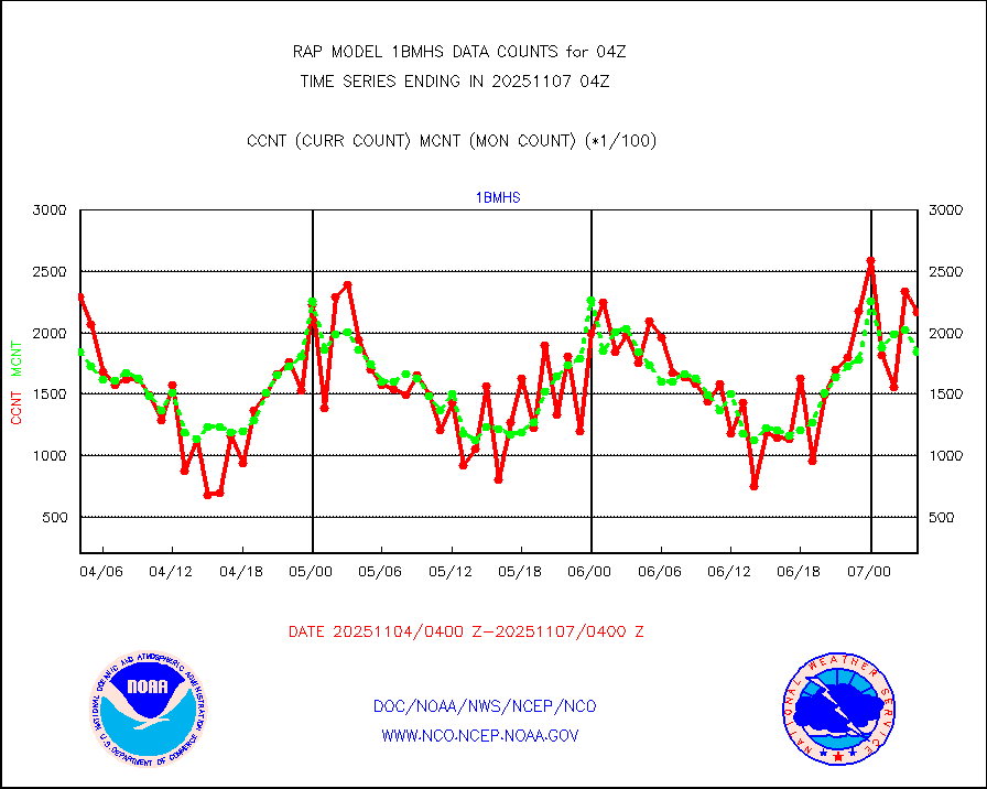
1bmhs |
NOAA 18-19 & METOP 1-2 MHS NCEP-proces. br. temps |
222399 |
281236 |
79.1 % |
1901.00-1906.99 |
acars |
MDCRS ACARS acft data from ARINC(dcded from BUFR) |
61287 |
34358 |
178.4 % |
1900.75-1907.25 |
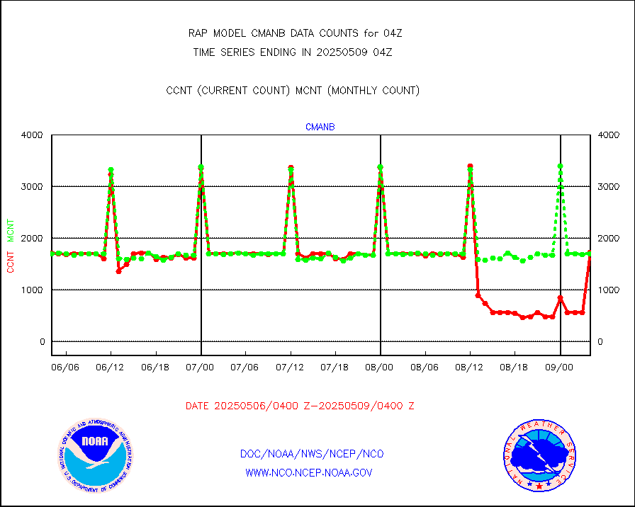
cmanb |
Surface Marine CMAN rpts decoded from BUFR format |
1721 |
1665 |
103.4 % |
1903.50-1904.50 |
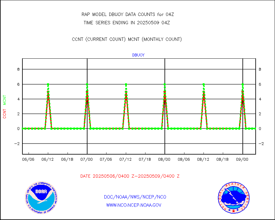
dbuoy |
Buoys decoded from FM-18 fmt (moored or drifting) |
0 |
0 |
n/a |
1903.50-1904.50 |
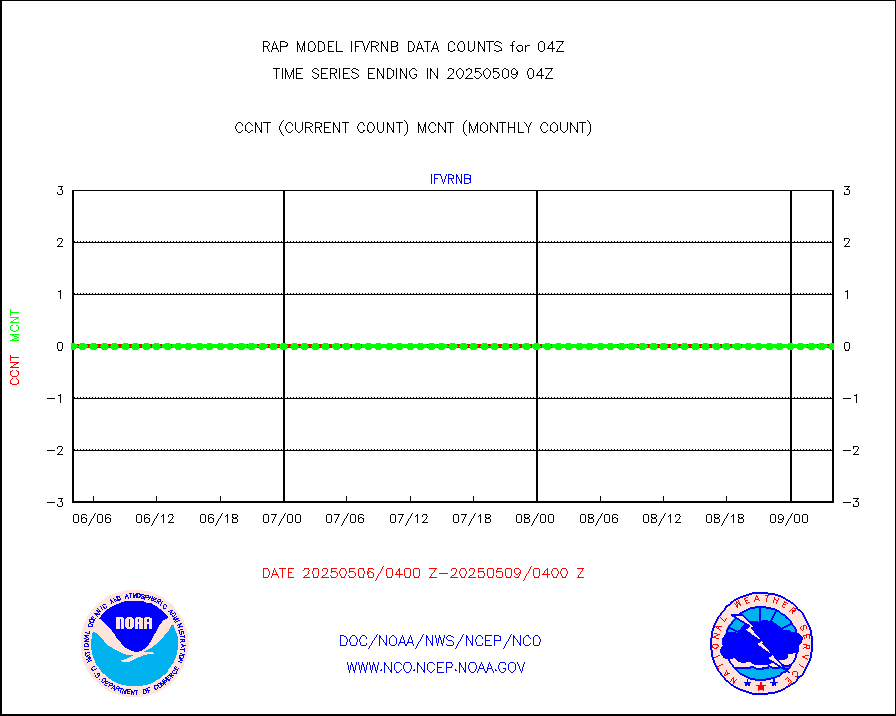
gnss |
Grnd-based Gbl Navigation Sat System (GNSS) data |
2489 |
2527 |
98.5 % |
1902.95-1903.05 |
h20mo |
MODIS (AQUA/TERRA) wvpr imager derived cld motion |
0 |
0 |
n/a |
1901.50-1906.50 |
infmo |
MODIS (AQUA/TERRA) ir l-wave derived cloud motion |
0 |
0 |
n/a |
1901.50-1906.50 |
lgycld |
GOES/NASA(Langley) hi-res. (1x1 f-o-v) cloud data |
3747401 |
3237701 |
115.7 % |
1903.50-1904.50 |
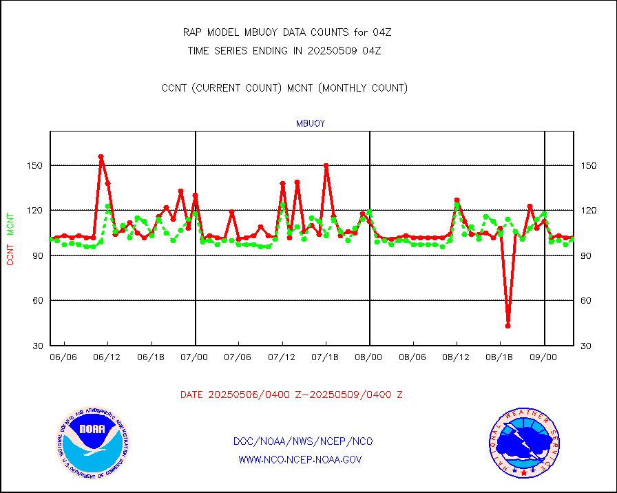
mbuoy |
Buoys decoded from FM-13 format (moored) |
72 |
61 |
118.0 % |
1903.50-1904.50 |
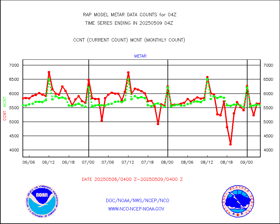
metar |
Aviation - METAR |
5622 |
5702 |
98.6 % |
1903.50-1904.50 |
nxrdw |
NEXRAD Vel Azm Dsp(VAD) winds via radar coded msg |
0 |
0 |
n/a |
1903.00-1905.00 |
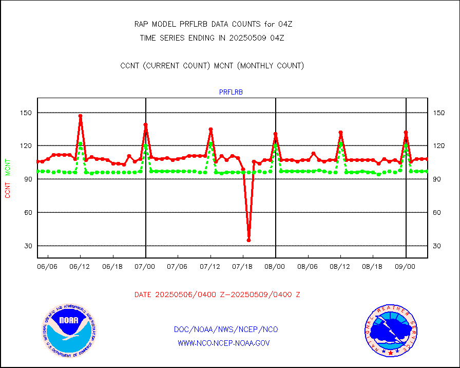
prflrb |
Multi-Agency Profiler (MAP) and SODAR winds |
72 |
86 |
83.7 % |
1902.50-1905.50 |
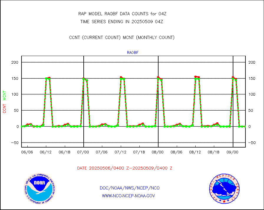
raobf |
Rawinsonde - fixed land (from TEMP or PILOT) |
0 |
0 |
n/a |
1903.00-1905.00 |
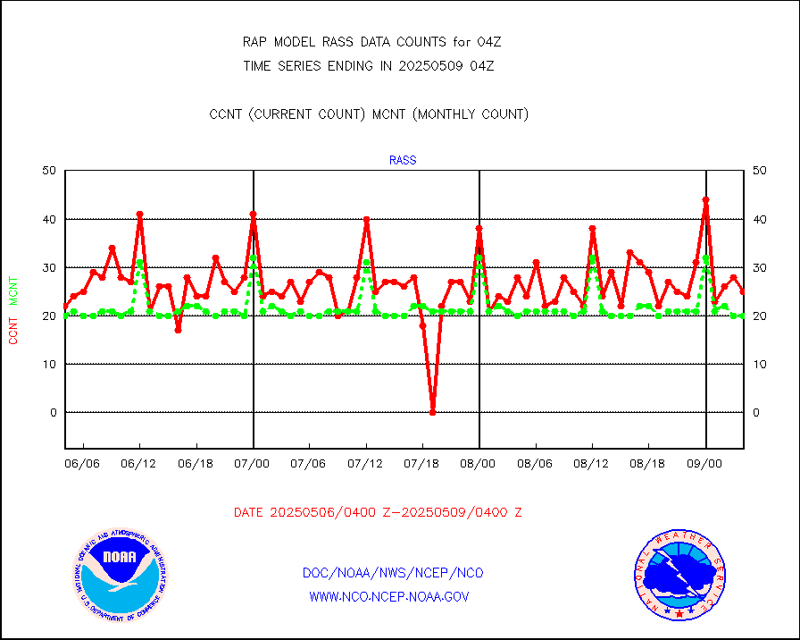
rass |
RASS temperatures (NOAA and Multi-Agency) |
18 |
22 |
81.8 % |
1903.50-1904.50 |
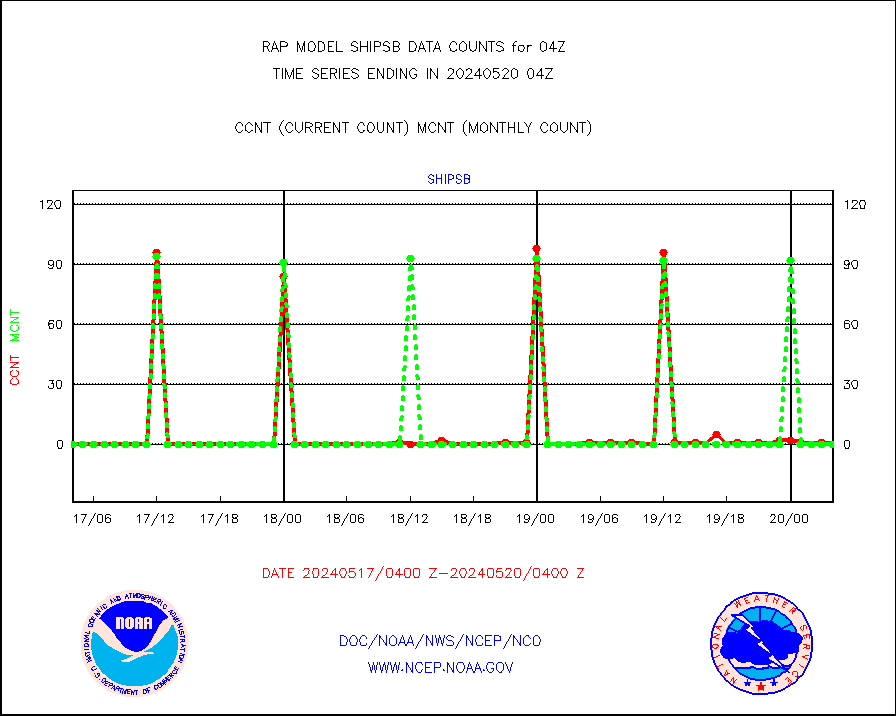
shipsb |
Ship - manual and automatic, restricted (BUFR) |
0 |
0 |
n/a |
1903.50-1904.50 |
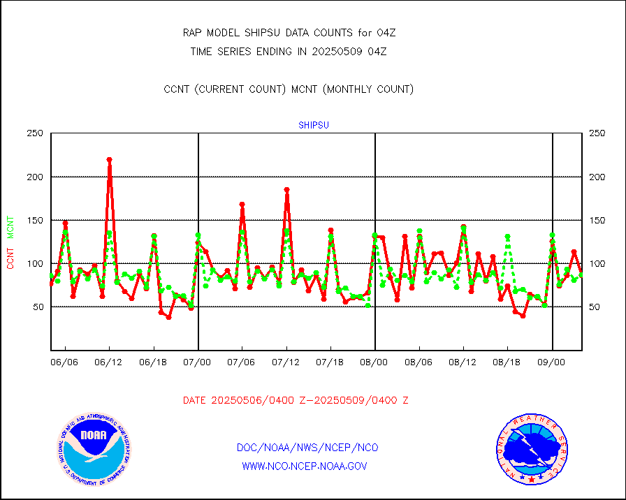
shipsu |
Ship - manual and automatic, unrestricted |
61 |
56 |
108.9 % |
1903.50-1904.50 |
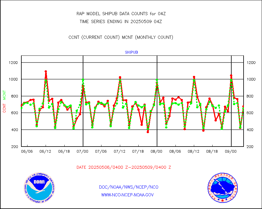
shipub |
Ship - manual and automatic, unrestricted (BUFR) |
505 |
546 |
92.5 % |
1903.50-1904.50 |
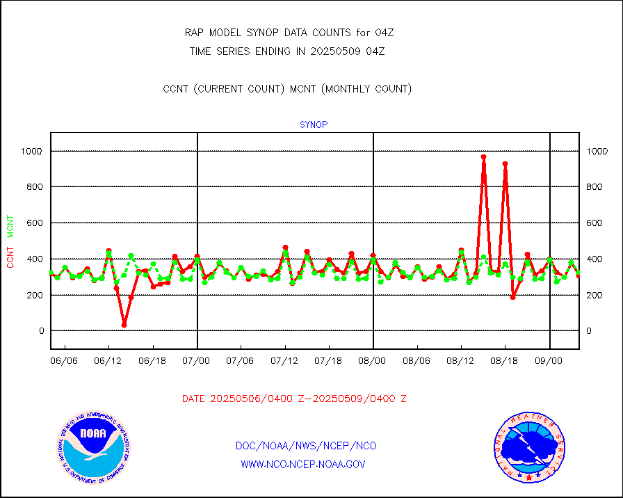
synop |
Synoptic - fixed manual and automatic |
311 |
323 |
96.3 % |
1903.50-1904.50 |
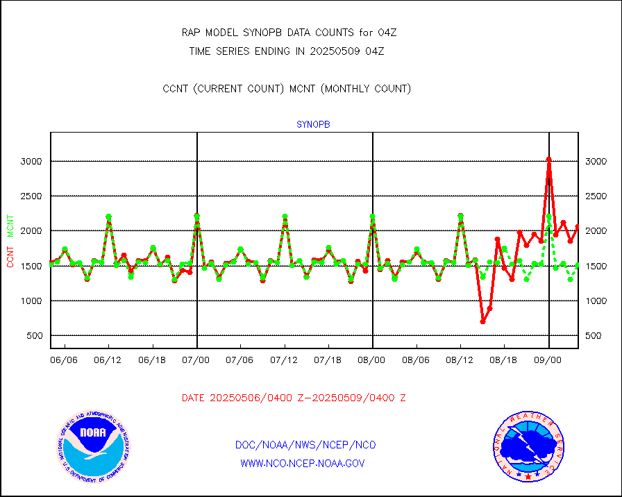
synopb |
Synoptic - fixed manual & auto (decoded fr BUFR) |
1675 |
1672 |
100.2 % |
1903.50-1904.50 |
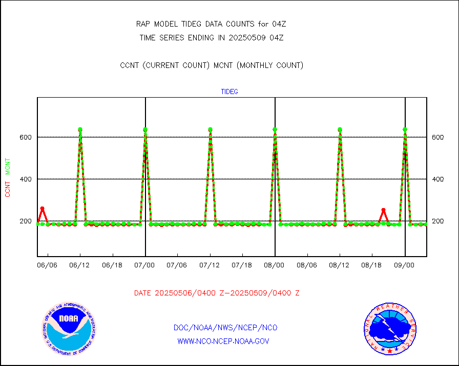
tideg |
Tide gauge reports decoded from CREX format |
182 |
181 |
100.6 % |
1903.50-1904.50 |
| Data Types of Opportunity with Normal Counts |
|---|
| Type | Description | Hourly Count | Monthly Average | Percent (%) of Monthly Mean | UTC Time Window |
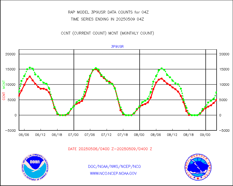
3p9usr |
GOES-16&up/NESDIS ir short-wv derived cld motion |
4968 |
6390 |
77.7 % |
1903.00-1903.99 |
acarsa |
MDCRS ACARS acft data (ARINC via AFWA)(AIREP fmt) |
0 |
0 |
n/a |
1900.75-1907.25 |
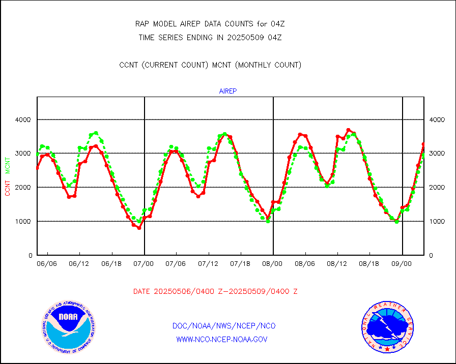
airep |
Manual AIREP aircraft data (dcded from AIREP fmt) |
4994 |
4567 |
109.3 % |
1900.75-1907.25 |
airsev |
AQUA AIRS/AMSU-A/HSB brightness temps- every FOV |
0 |
0 |
n/a |
1901.00-1906.99 |
amdar |
AMDAR aircraft data (decoded from AMDAR format) |
3050 |
1701 |
179.3 % |
1900.75-1907.25 |
amdarb |
AMDAR aircraft data (decoded from BUFR) |
6524 |
6109 |
106.8 % |
1900.75-1907.25 |
amsr2 |
GCOM-W AMSR2 1B brightness temperatures |
9474 |
551818 |
1.7 % |
1901.00-1901.99 |
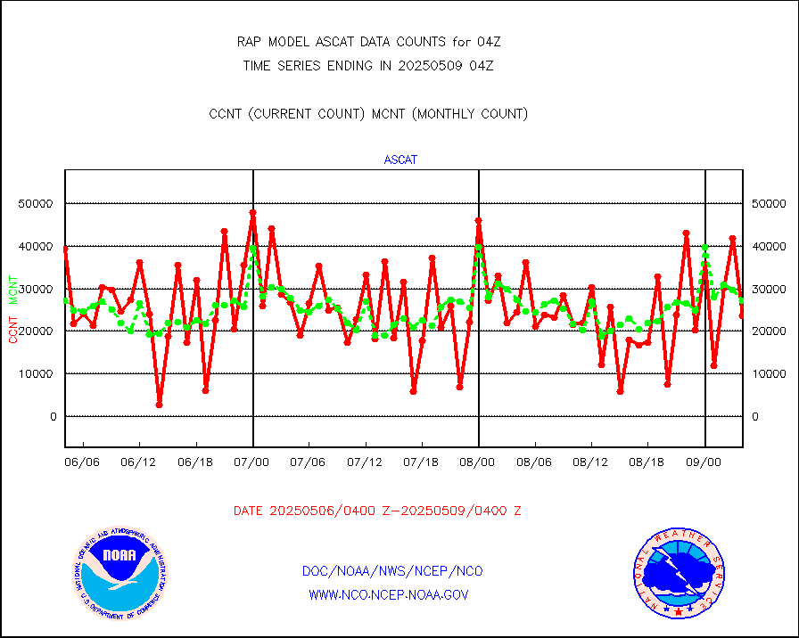
ascat |
METOP 1-2 ASCAT products |
28977 |
23630 |
122.6 % |
1902.00-1906.00 |
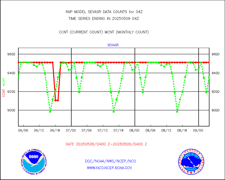
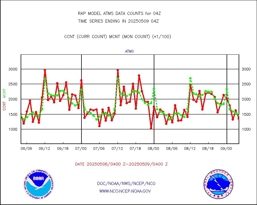
atms |
NPP/NOAA-20 ATMS brightness temperatures |
145709 |
144070 |
101.1 % |
1902.00-1905.99 |
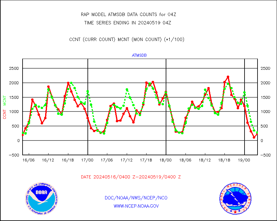
atmsdb |
NPP/NOAA-20 ATMS bright. temps-direct b-cast SSEC |
24630 |
28023 |
87.9 % |
1902.00-1905.99 |
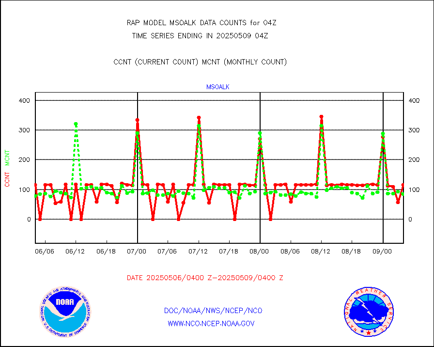
coopmd |
Coop/MADIS NEPP & HCN-Modernization NOAA COOP Obs |
27 |
27 |
100.0 % |
1903.50-1904.50 |
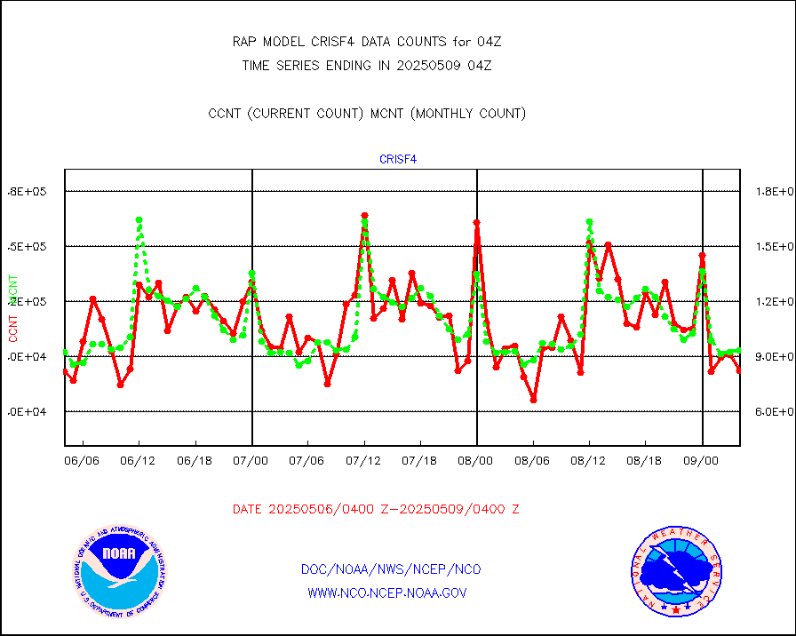
crisf4 |
NPP/NOAA-20 CrIS full spctrl radn (431 ch subset) |
81264 |
89594 |
90.7 % |
1902.00-1905.99 |
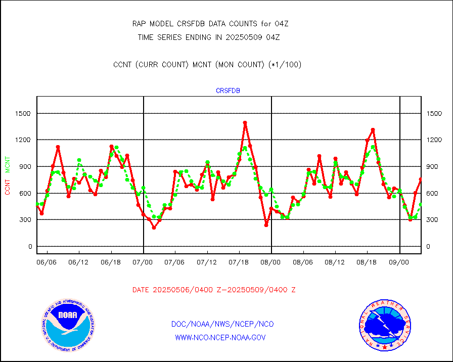
crsfdb |
NPP/NOAA-20 CrIS full spctrl radn dir brdcst SSEC |
66708 |
78105 |
85.4 % |
1902.00-1905.99 |
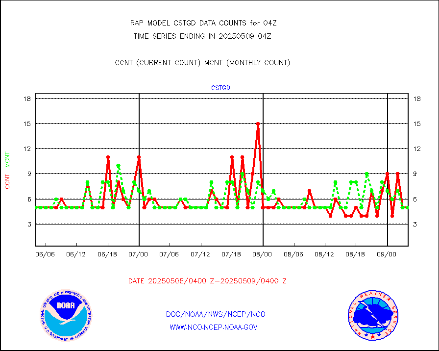
cstgd |
Coast Guard |
3 |
3 |
100.0 % |
1903.50-1904.50 |
dbuoyb |
Drifting buoys (decoded from BUFR) |
590 |
584 |
101.0 % |
1903.50-1904.50 |
dropw |
Dropwinsonde (from TEMP DROP) |
0 |
0 |
n/a |
1903.00-1905.00 |
eadas |
E-AMDAR (European AMDAR acft decoded from BUFR) |
3059 |
2375 |
128.8 % |
1900.75-1907.25 |
esamua |
NOAA 15-19 & METOP 1-2 AMSU-A proc btmps frm RARS |
18547 |
21847 |
84.9 % |
1903.00-1905.00 |
esatms |
NPP Adv. Tech. MW Sndr (ATMS) br. temps from RARS |
145369 |
137188 |
106.0 % |
1902.00-1905.99 |
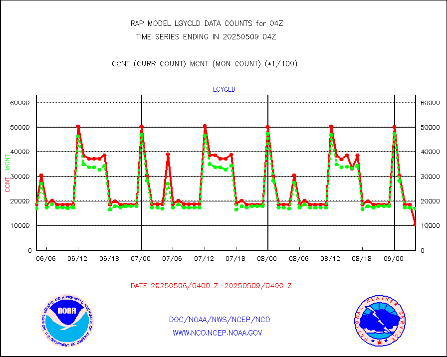
eshrs3 |
NOAA 15-19 & METOP 1-2 HIRS-3/4 pr btmps frm RARS |
31046 |
46090 |
67.4 % |
1903.00-1905.00 |
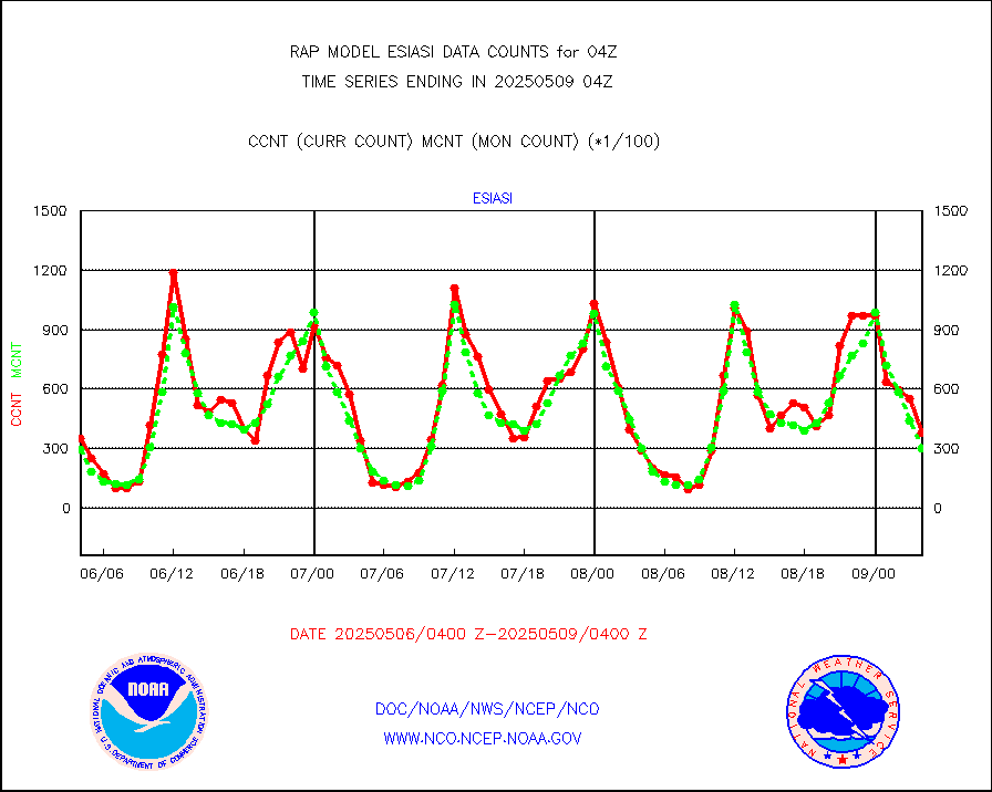
esiasi |
METOP 1-2 IASI 1C radiance data vbl chn from RARS |
47797 |
43418 |
110.1 % |
1902.00-1905.99 |
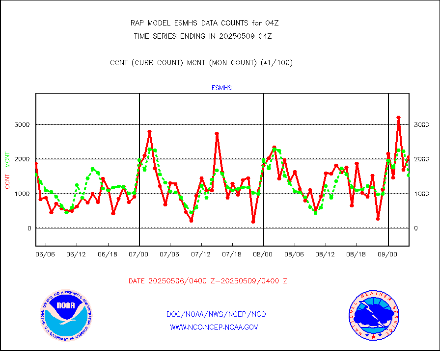
esmhs |
NOAA 18-19 & METOP 1-2 MHS proc. btemps from RARS |
177149 |
150344 |
117.8 % |
1903.00-1905.00 |
gmi1cr |
GPM GMI Level 1C-R brightness temperatures |
349543 |
866861 |
40.3 % |
1901.00-1906.99 |
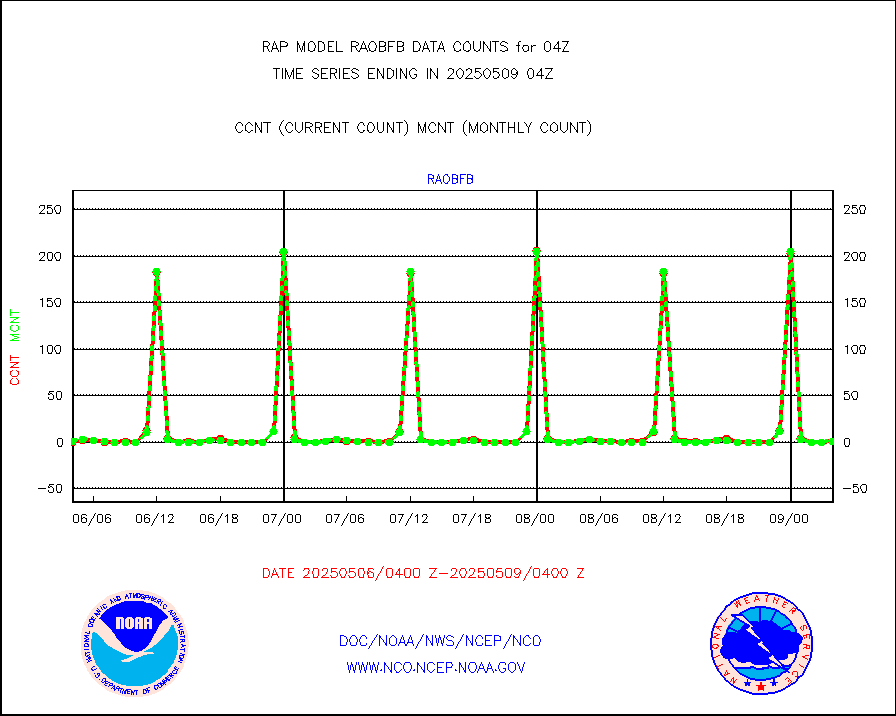
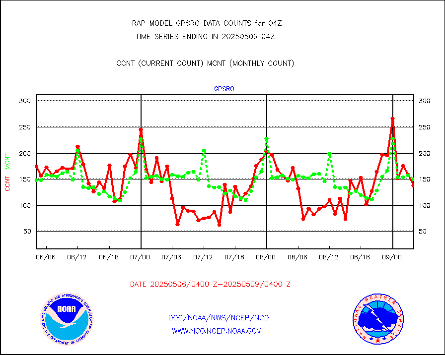
gpsro |
GPS radio occultation data |
75 |
127 |
59.1 % |
1902.00-1905.99 |
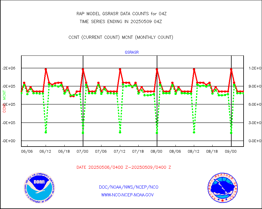
gsrasr |
GOES-16/17 All Sky Radiances (proc.) |
812097 |
810674 |
100.2 % |
1902.00-1905.99 |
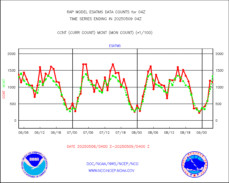
gsrcsr |
GOES-16/17 Clear Sky Radiances (proc.) |
355593 |
381853 |
93.1 % |
1902.00-1905.99 |
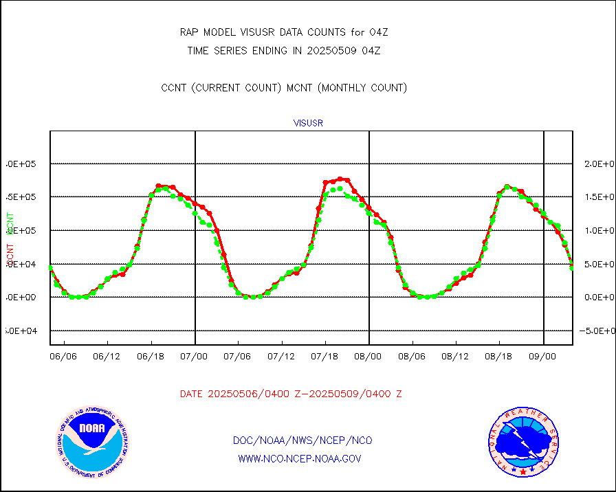
h20ja |
MTSAT/JMA water vapor imager derived cloud motion |
2961 |
3288 |
90.1 % |
1901.50-1906.50 |
h2dusr |
GOES-16&up/NESDIS wv imgr/deep-lyr derivd cld mtn |
7266 |
7249 |
100.2 % |
1903.00-1903.99 |
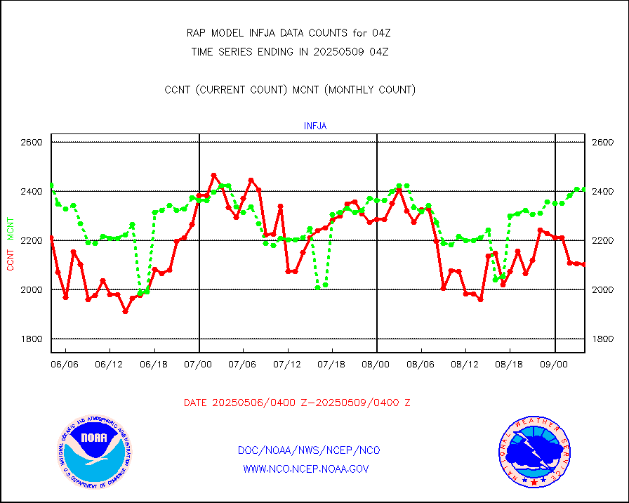
h2eunb |
METEOSAT/EUMETSAT wvpr imgr drv cld motion NBseq |
5446 |
5061 |
107.6 % |
1902.50-1905.49 |
h2tusr |
GOES-16&up/NESDIS wv imgr/cld-top derived cld mtn |
13589 |
12264 |
110.8 % |
1903.00-1903.99 |
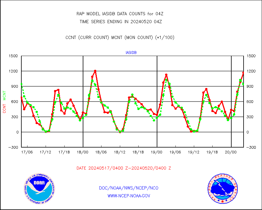
iasidb |
METOP 1-2 IASI 1C radiances-direct broadcast SSEC |
88595 |
95316 |
92.9 % |
1902.00-1905.99 |
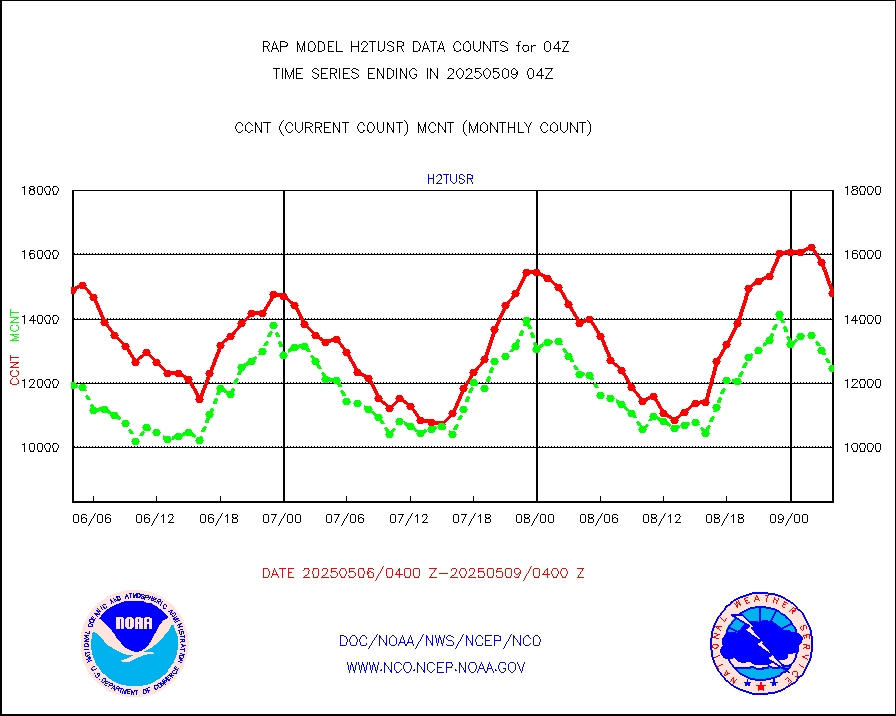
ifeunb |
METEOSAT/EUMETSAT ir lg-wave drv cld motion NBseq |
3250 |
3118 |
104.2 % |
1902.50-1905.49 |
ifvrnb |
VIIRS (NPP/NOAA-20) ir lg-wv drv cloud motion(NB) |
0 |
0 |
n/a |
1901.50-1906.50 |
infav |
AVHRR (NOAA/METOP) ir lg-wave derived cld motion |
0 |
0 |
n/a |
1901.50-1906.50 |
infav1 |
AVHRR (METOP) ir lg-wave derived cld motion |
0 |
0 |
n/a |
1902.50-1905.49 |
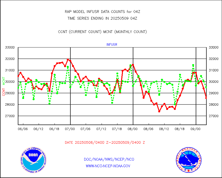
infja |
MTSAT/JMA infrared long-wave derived cloud motion |
2469 |
2637 |
93.6 % |
1901.50-1906.50 |
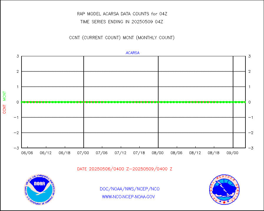
infusr |
GOES-16&up/NESDIS ir long-wave derived cld motion |
29032 |
28943 |
100.3 % |
1903.00-1903.99 |
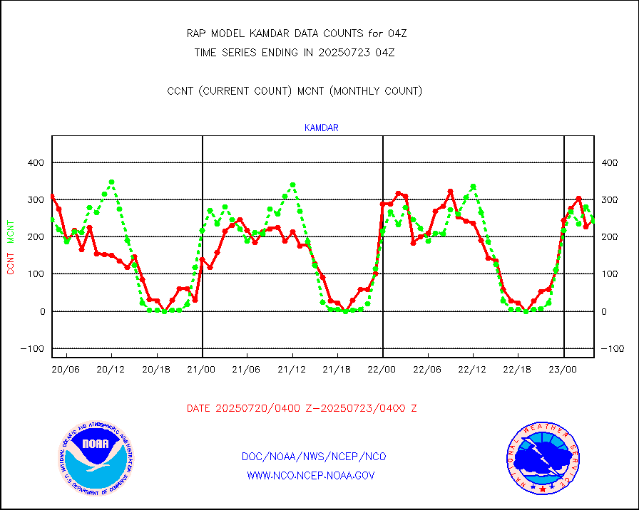
kamdar |
Korean AMDAR aircraft data (decoded from BUFR) |
275 |
254 |
108.3 % |
1900.75-1907.25 |
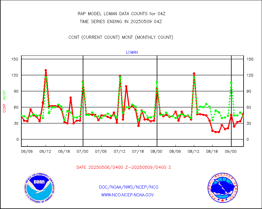
lcman |
Land-based CMAN stations decoded from CMAN format |
73 |
78 |
93.6 % |
1903.50-1904.50 |
ltnglr |
LLDN Long-rng lightning from Vaisala via NOAAPORT |
122691 |
117708 |
104.2 % |
1903.00-1904.50 |
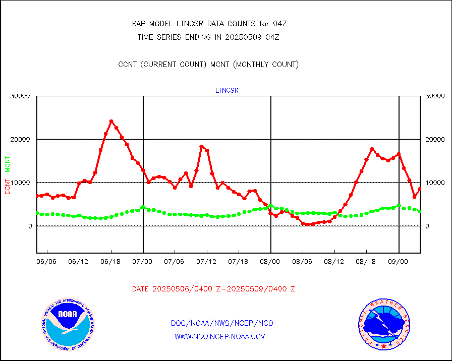
ltngsr |
NLDN Shrt-rng lightning from Vaisala via NOAAPORT |
3277 |
6924 |
47.3 % |
1903.00-1904.50 |
mbuoyb |
Moored buoys (decoded from BUFR) |
622 |
551 |
112.9 % |
1903.50-1904.50 |
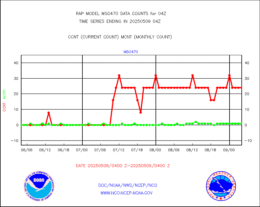
mso470 |
Mesonet/MADIS Colorado E-470 (Interstate 470) |
21 |
18 |
116.7 % |
1903.50-1904.50 |
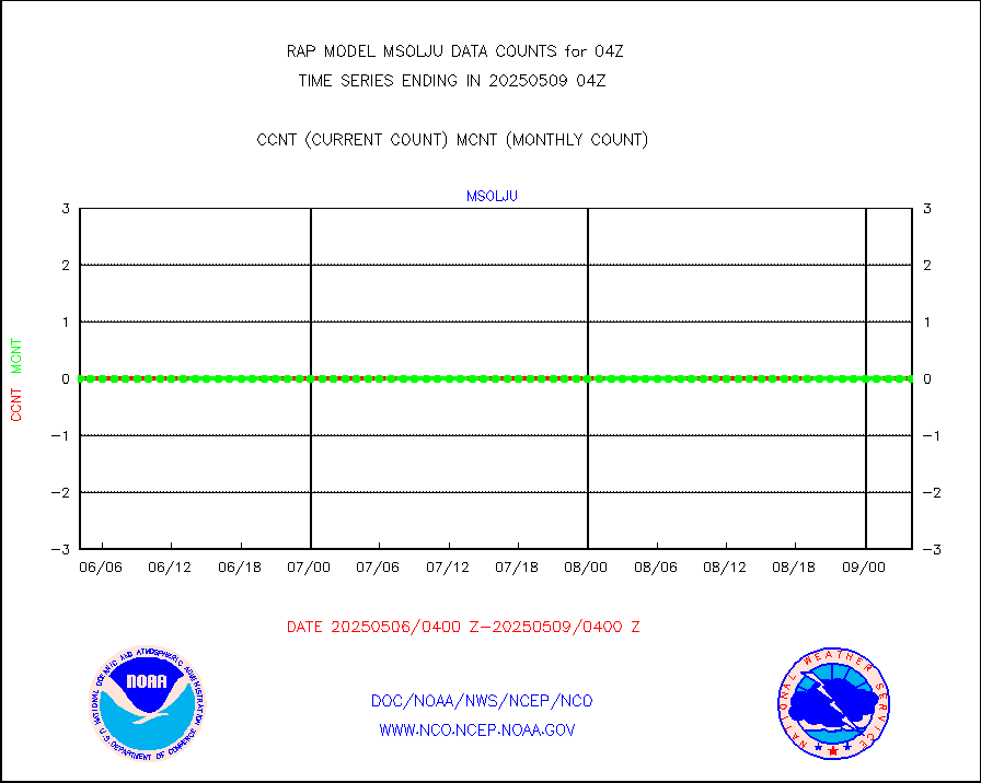
msoalk |
Mesonet/MADIS Alaska Department of Transportation |
107 |
97 |
110.3 % |
1903.50-1904.50 |
msoapg |
Mesonet/MADIS U.S. Army Aberdeen Proving Grounds |
0 |
0 |
n/a |
1903.50-1904.50 |
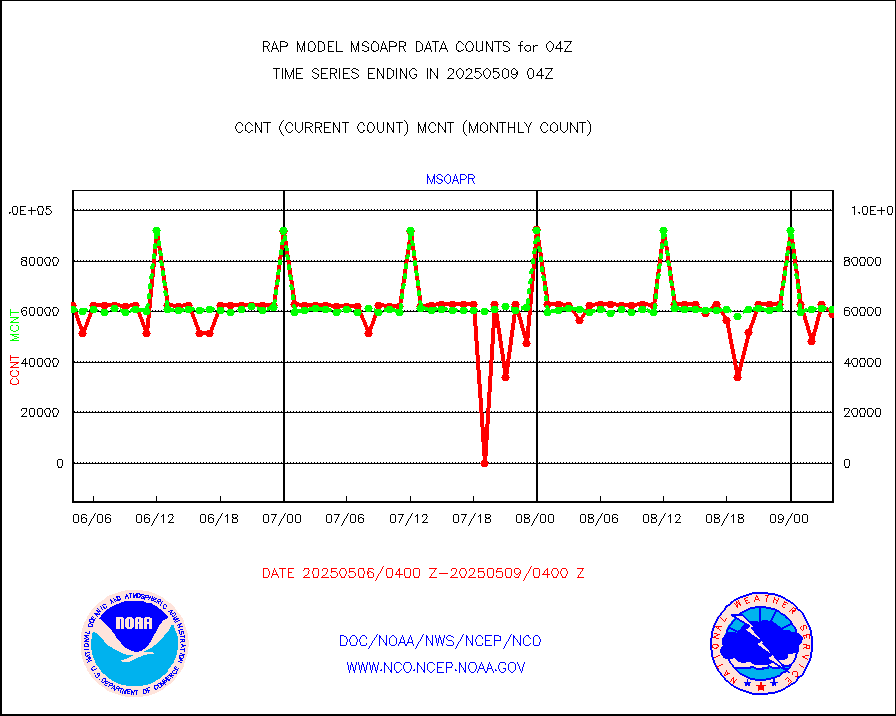
msoapr |
Mesonet/MADIS Citizen Weather Observers Program |
46131 |
45191 |
102.1 % |
1903.50-1904.50 |
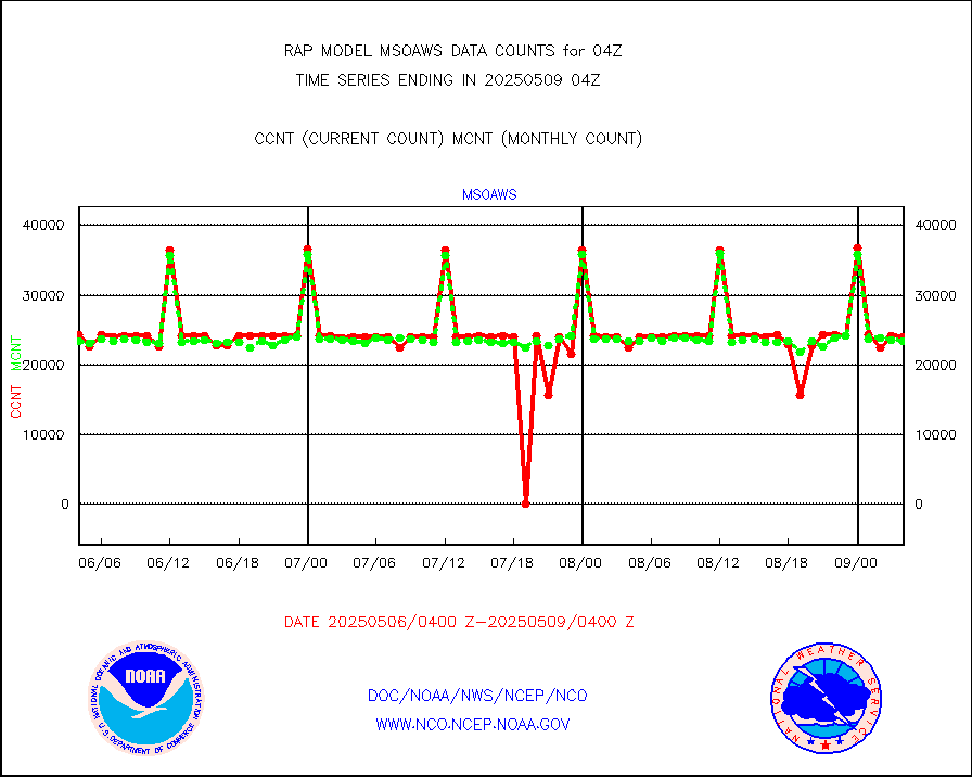
msoaws |
Mesonet/MADIS AWS Convergence Technologies, Inc. |
25594 |
25379 |
100.8 % |
1903.50-1904.50 |
msoawx |
Mesonet/MADIS "Anything Weather" |
0 |
0 |
n/a |
1903.50-1904.50 |
msocol |
Mesonet/MADIS Colorado Dept. of Transportation |
0 |
0 |
n/a |
1903.50-1904.50 |
msodcn |
Mesonet/MADIS DC Net |
0 |
0 |
n/a |
1903.50-1904.50 |
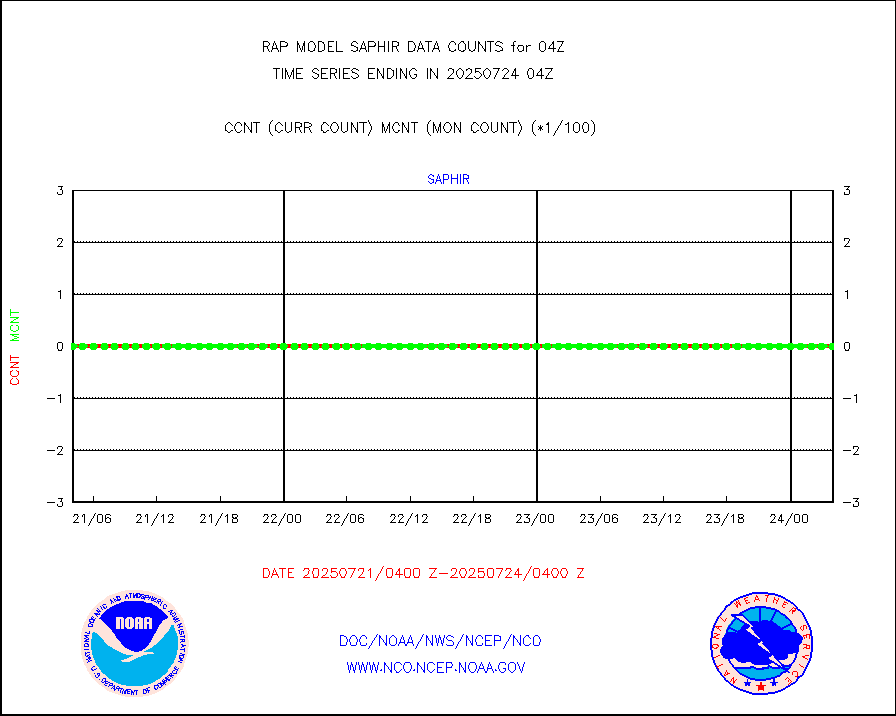
msoden |
Mesonet/MADIS Denver Urban Drainage & Flood Cntrl |
225 |
216 |
104.2 % |
1903.50-1904.50 |
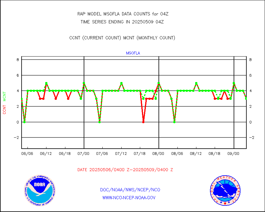
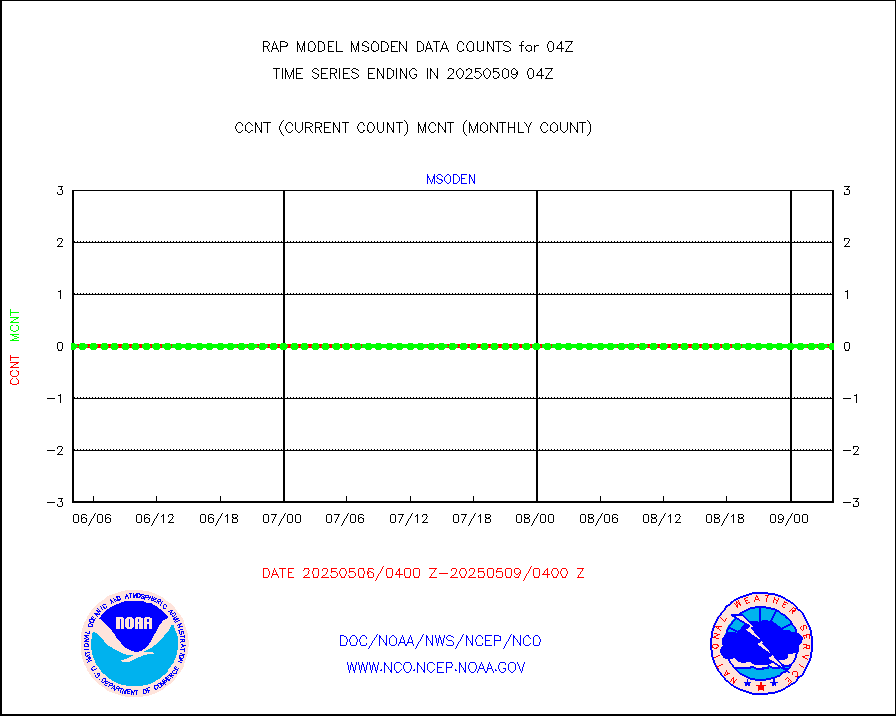
msofla |
Mesonet/MADIS Florida (FAWN & USF) |
3 |
3 |
100.0 % |
1903.50-1904.50 |
msoflt |
Mesonet/MADIS Florida Dept. of Transportation |
0 |
0 |
n/a |
1903.50-1904.50 |
msogeo |
Mesonet/MADIS Georgia Dept. of Transportation |
0 |
0 |
n/a |
1903.50-1904.50 |
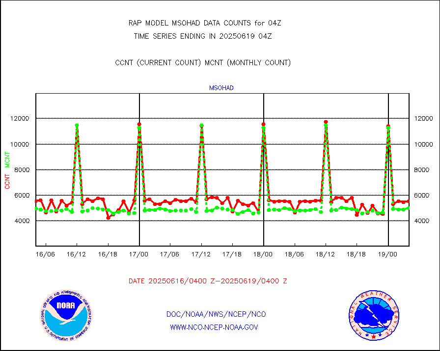
msohad |
Mesonet/MADIS NWS Hydromet Auto Data System(HADS) |
5752 |
5581 |
103.1 % |
1903.50-1904.50 |
msoien |
Mesonet/MADIS Iowa Environmental |
161 |
165 |
97.6 % |
1903.50-1904.50 |
msoind |
Mesonet/MADIS Indiana Dept. of Transportation |
0 |
0 |
n/a |
1903.50-1904.50 |
msoiow |
Mesonet/MADIS Iowa Department of Transportation |
0 |
0 |
n/a |
1903.50-1904.50 |
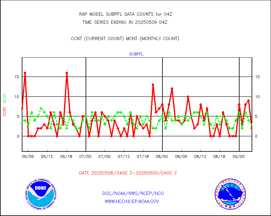
msokan |
Mesonet/MADIS Kansas Department of Transportation |
348 |
330 |
105.5 % |
1903.50-1904.50 |
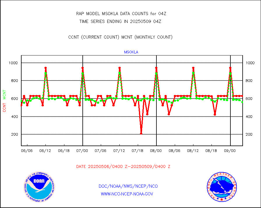
msokla |
Mesonet/MADIS Oklahoma Mesonet |
318 |
346 |
91.9 % |
1903.50-1904.50 |
msolju |
Mesonet/MADIS Louisiana State/Jackson State Univ. |
0 |
0 |
n/a |
1903.50-1904.50 |
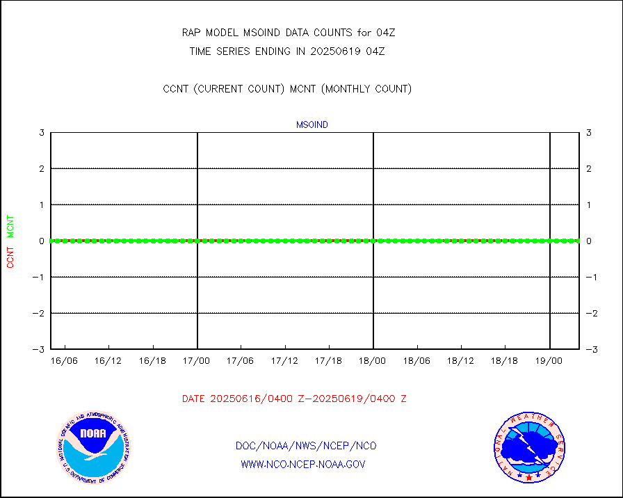
msomca |
Mesonet/MADIS Missouri Commercial Agricult Wx Net |
269 |
259 |
103.9 % |
1903.50-1904.50 |
msomin |
Mesonet/MADIS Minnesota Dept. of Transportation |
0 |
0 |
n/a |
1903.50-1904.50 |
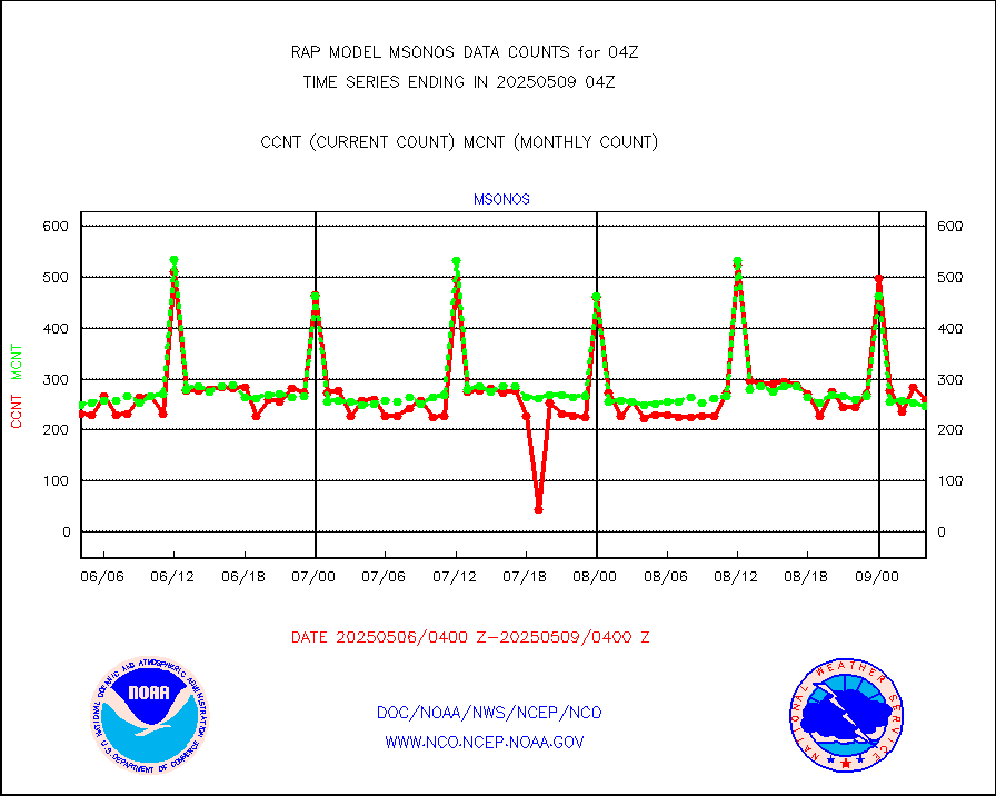
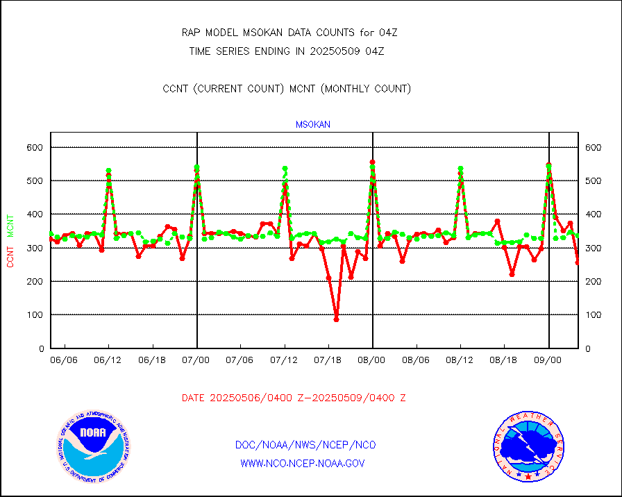
msonos |
Mesonet/MADIS NOS-Phys Oceanographic Realtime Sys |
292 |
283 |
103.2 % |
1903.50-1904.50 |
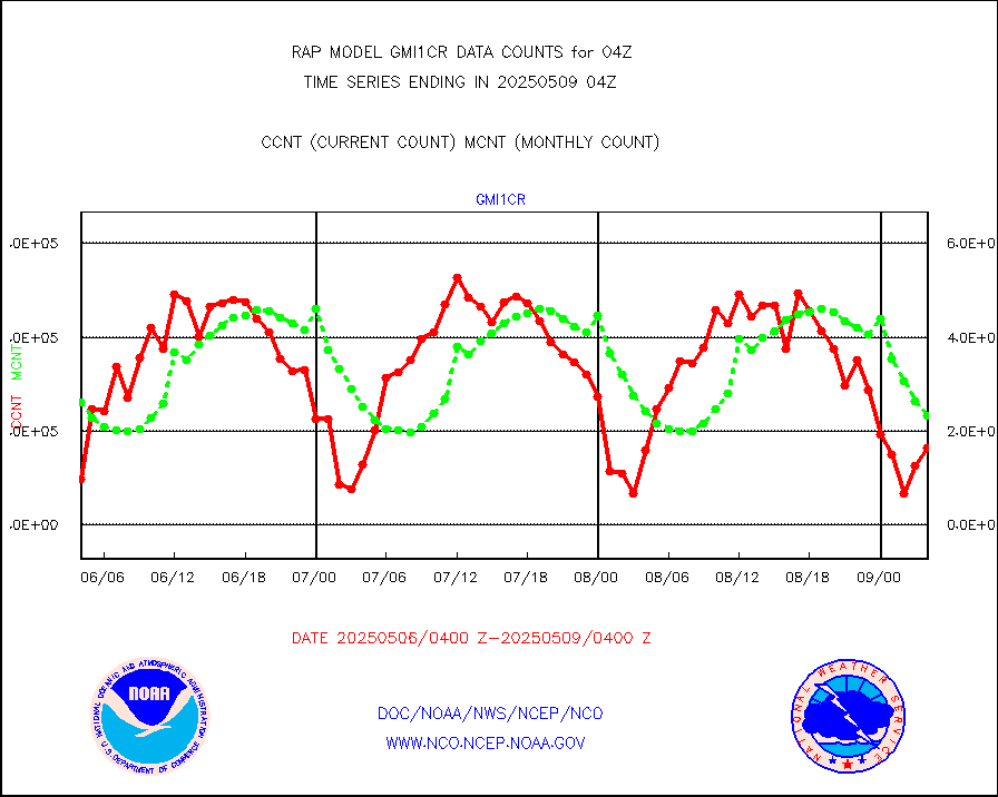
msoraw |
Mesonet/MADIS NFIC Remote Automated Wx Stns(RAWS) |
1691 |
1566 |
108.0 % |
1903.50-1904.50 |
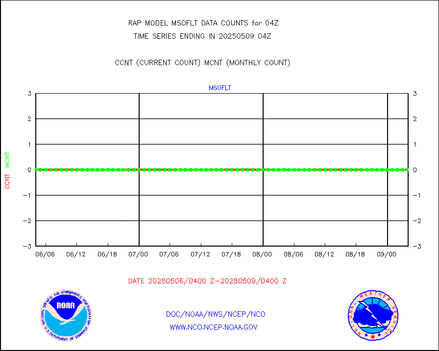
msourb |
Mesonet/MADIS UrbaNet |
3931 |
3911 |
100.5 % |
1903.50-1904.50 |
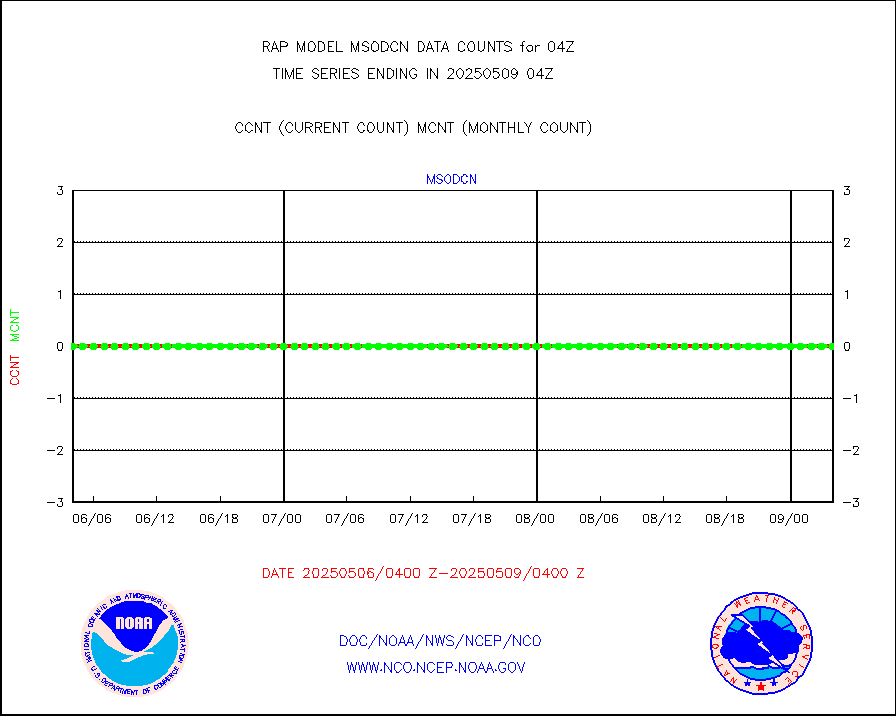
msovir |
Mesonet/MADIS Virginia Dept. of Transportation |
209 |
228 |
91.7 % |
1903.50-1904.50 |
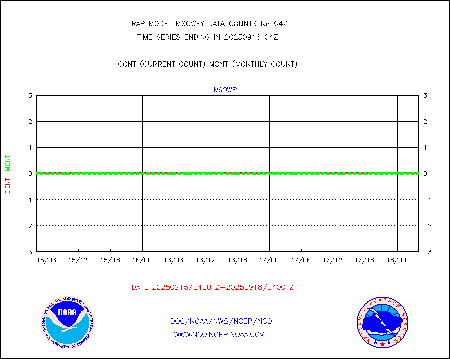
msowfy |
Mesonet/MADIS "Weather for You" |
0 |
0 |
n/a |
1903.50-1904.50 |
msowis |
Mesonet/MADIS Wisconsin Dept. of Transportation |
0 |
0 |
n/a |
1903.50-1904.50 |
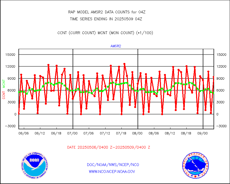
msowst |
Mesonet/MADIS MesoWest (many subproviders) |
41708 |
39474 |
105.7 % |
1903.50-1904.50 |
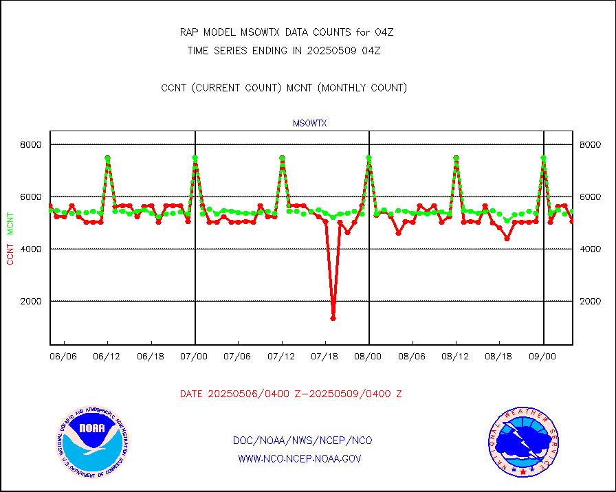
msowtx |
Mesonet/MADIS West Texas |
5043 |
4802 |
105.0 % |
1903.50-1904.50 |
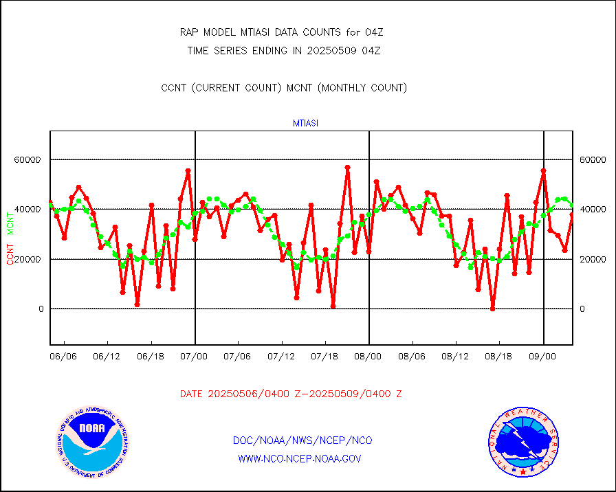
mtiasi |
METOP 1-2 IASI 1C radiance data (varbl. channels) |
32505 |
37674 |
86.3 % |
1902.00-1905.99 |
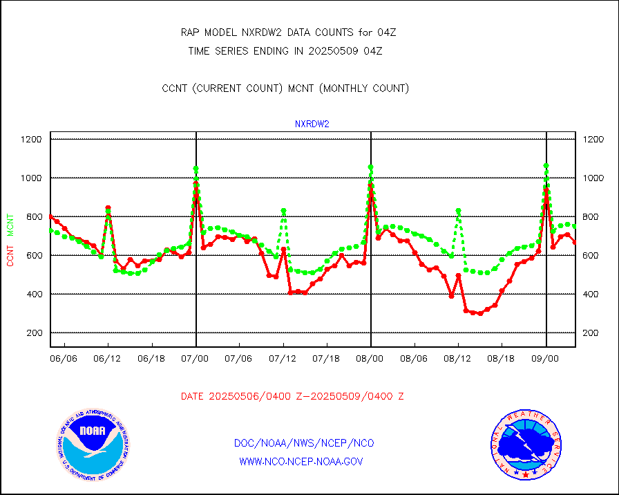
nxrdw2 |
NEXRAD Vel Azm Dsp(VAD) winds via Level 2 decoder |
954 |
869 |
109.8 % |
1903.00-1905.00 |
osbuv8 |
NOAA 16-19 Solar Backscatter UV-2 rad frm V8 BUFR |
0 |
0 |
n/a |
1902.00-1904.99 |
pibal |
PIBAL (from PILOT, PILOT SHIP, PILOT MOBIL) |
0 |
0 |
n/a |
1903.00-1905.00 |
pirep |
Manual PIREP aircraft data (dcded from AIREP fmt) |
164 |
203 |
80.8 % |
1900.75-1907.25 |
prflrp |
Profilr winds from PIBAL (PILOT,PILOT SHIP/MOBIL) |
0 |
0 |
n/a |
1902.50-1905.50 |
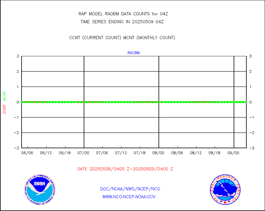
raobm |
Rawinsonde - mobile land (from TEMP/PILOT MOBIL) |
0 |
0 |
n/a |
1903.00-1905.00 |
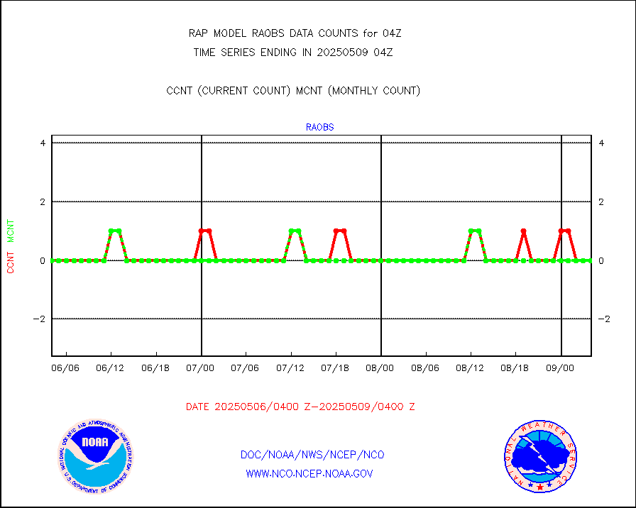
raobs |
Rawinsonde - ship (from TEMP SHIP, PILOT SHIP) |
0 |
0 |
n/a |
1903.00-1905.00 |
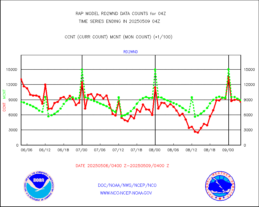
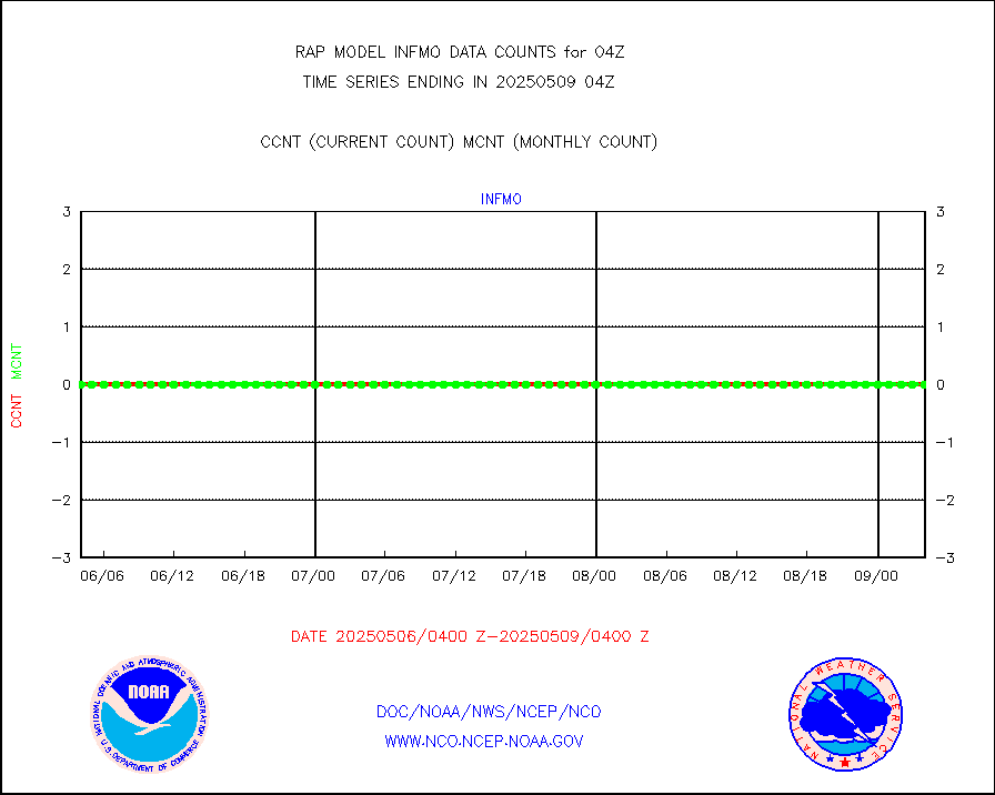
rd2wnd |
NEXRAD radial wind (Level 2 - GTS) |
1191663 |
1069449 |
111.4 % |
1903.50-1904.49 |
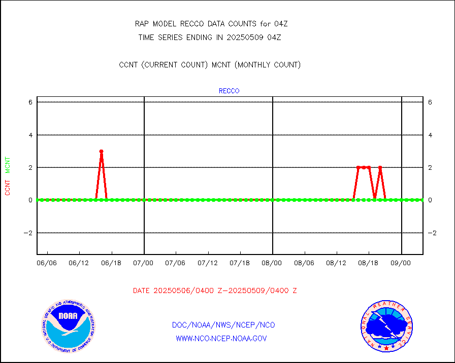
recco |
Flight level reconnaissance aircraft data |
0 |
0 |
n/a |
1903.00-1905.00 |
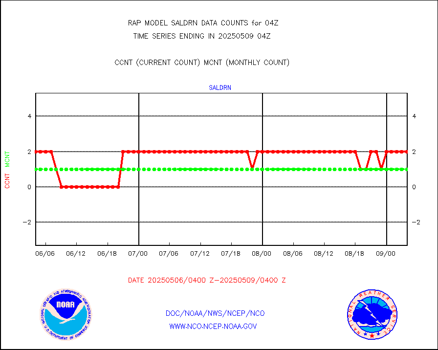
saldrn |
Surface Marine Saildrone (decoded from BUFR) |
2 |
2 |
100.0 % |
1902.00-1905.99 |
saphir |
Megha-Tropiques SAPHIR L1A2 brightness temps |
0 |
0 |
n/a |
1901.00-1906.99 |
sevasr |
METEOSAT-10 2nd Gen SEVIRI All Sky Radiance(proc) |
9512 |
9051 |
105.1 % |
1902.00-1905.99 |
sevcsr |
METEOSAT-10 2nd Gen SEVIRI Clr Sky Radiance(proc) |
0 |
0 |
n/a |
1902.00-1905.99 |
ships |
Ship - manual and automatic, restricted |
2 |
3 |
66.7 % |
1903.50-1904.50 |
snocvr |
NOW COVER, DEPTH/DENSITY AND WATER EQUIVALENT |
2733 |
6062 |
45.1 % |
1902.00-1906.00 |
ssmisu |
DMSP SSM/IS 1C radiance data (Unified Pre-Proc.) |
22787 |
40377 |
56.4 % |
1902.00-1905.99 |
subpfl |
Sub-surface float and glider profile (BUFR) |
0 |
8 |
0.0 % |
1902.00-1905.99 |
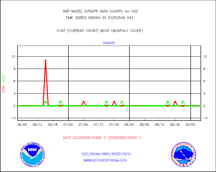
synopr |
Synoptic - restricted (WMO Res 40) manual & auto. |
0 |
0 |
n/a |
1903.50-1904.50 |
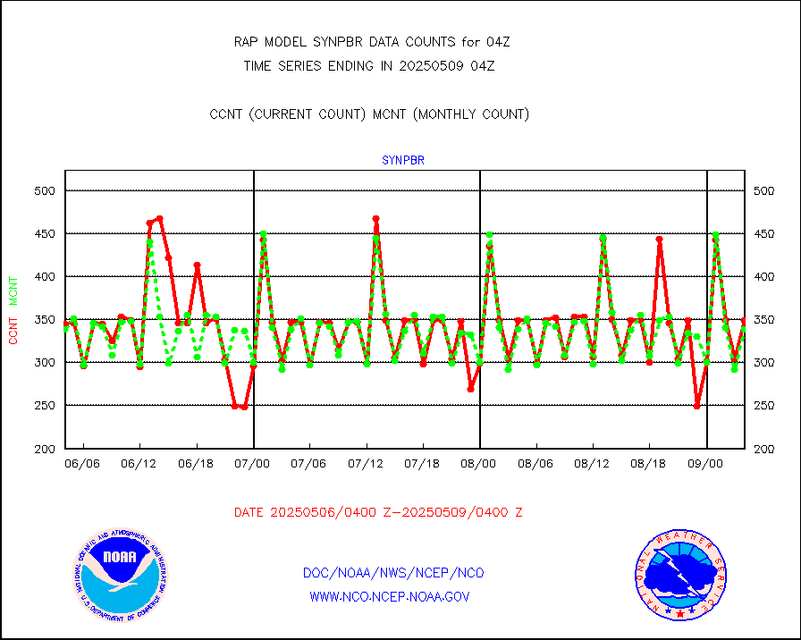
synpbr |
Synoptic - restricted (WMO Res 40)(decoded BUFR) |
344 |
344 |
100.0 % |
1903.50-1904.50 |
synpmb |
Synoptic - mobile manual & auto (decoded fr BUFR) |
0 |
0 |
n/a |
1903.50-1904.50 |
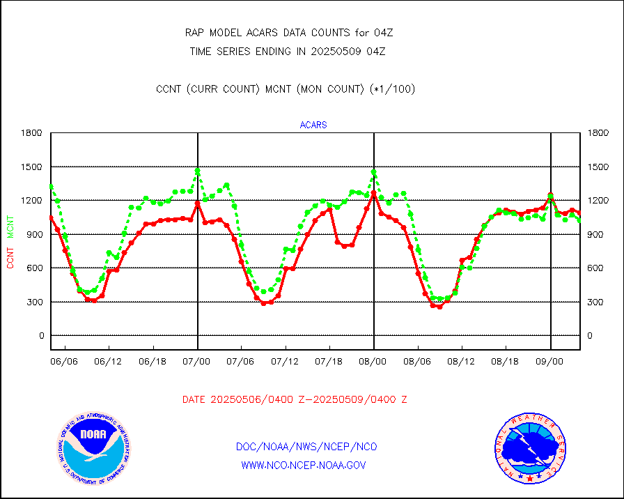
tmdara |
TAMDAR aircft data-all types(from Panasonic,BUFR) |
1424 |
1409 |
101.1 % |
1900.75-1907.25 |
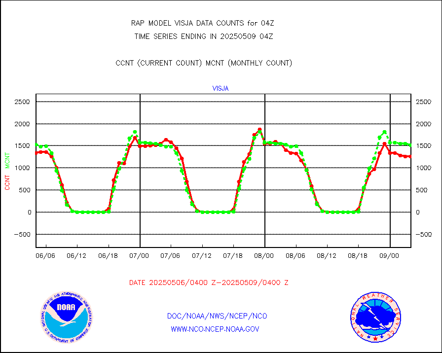
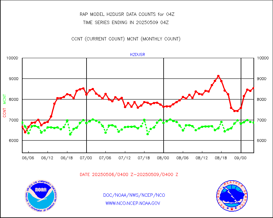
visja |
MTSAT/JMA visible derived cloud motion |
1787 |
1627 |
109.8 % |
1901.50-1906.50 |
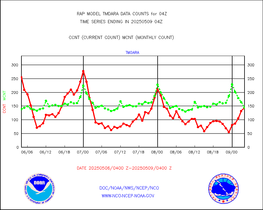
visusr |
GOES-16&up/NESDIS visible derived cloud motion |
49330 |
47422 |
104.0 % |
1903.00-1903.99 |
vseunb |
METEOSAT/EUMETSAT visible drv cld motion NBseq |
58 |
14 |
414.3 % |
1902.50-1905.49 |


