| Critical Data with Normal Counts |
|---|
| Type | Description | Hourly Count | Monthly Average | Percent (%) of Monthly Mean | UTC Time Window |
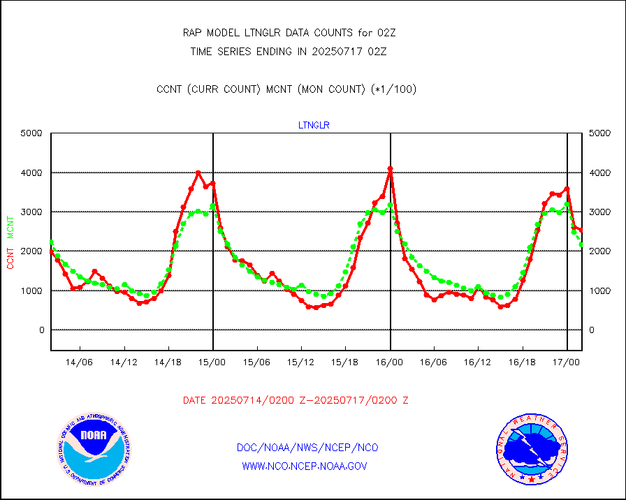
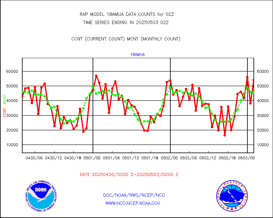
1bamua |
NOAA 15-19 & METOP 1-2 AMSU-A NCEP-proc. br.temps |
52347 |
43858 |
119.4 % |
1923.00-2004.99 |
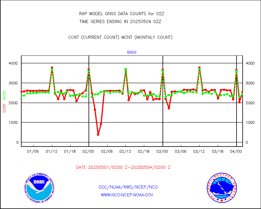
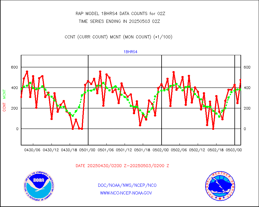
1bhrs4 |
NOAA 18-19 & METOP 1-2 HIRS-4 NCEP-proc. br.temps |
49366 |
37025 |
133.3 % |
1923.00-2004.99 |
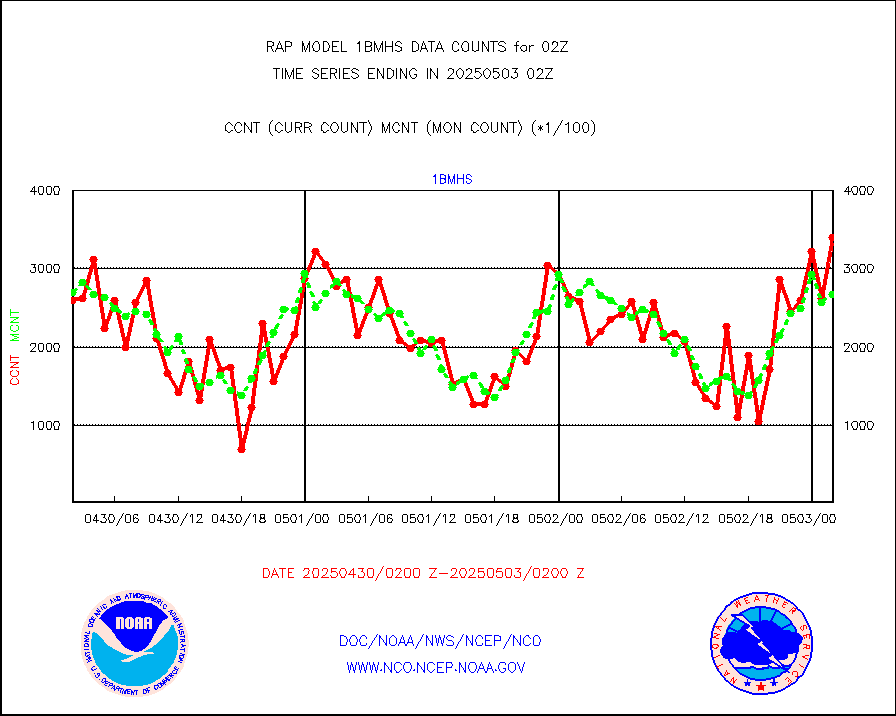
1bmhs |
NOAA 18-19 & METOP 1-2 MHS NCEP-proces. br. temps |
340922 |
267721 |
127.3 % |
1923.00-2004.99 |
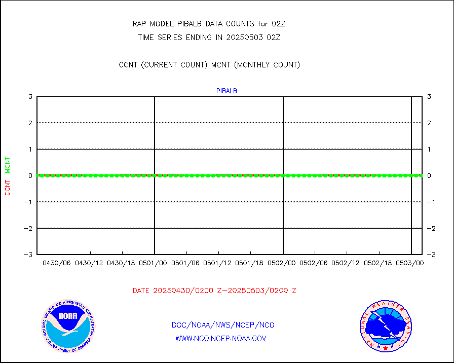
acars |
MDCRS ACARS acft data from ARINC(dcded from BUFR) |
84020 |
79814 |
105.3 % |
1922.75-2005.25 |
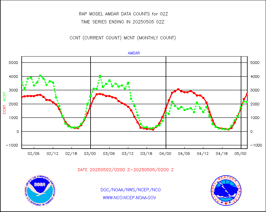
camdar |
Canadian AMDAR aircraft data (decoded from BUFR) |
69 |
38 |
181.6 % |
1922.75-2005.25 |
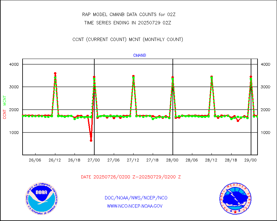
cmanb |
Surface Marine CMAN rpts decoded from BUFR format |
1709 |
1688 |
101.2 % |
2001.50-2002.50 |
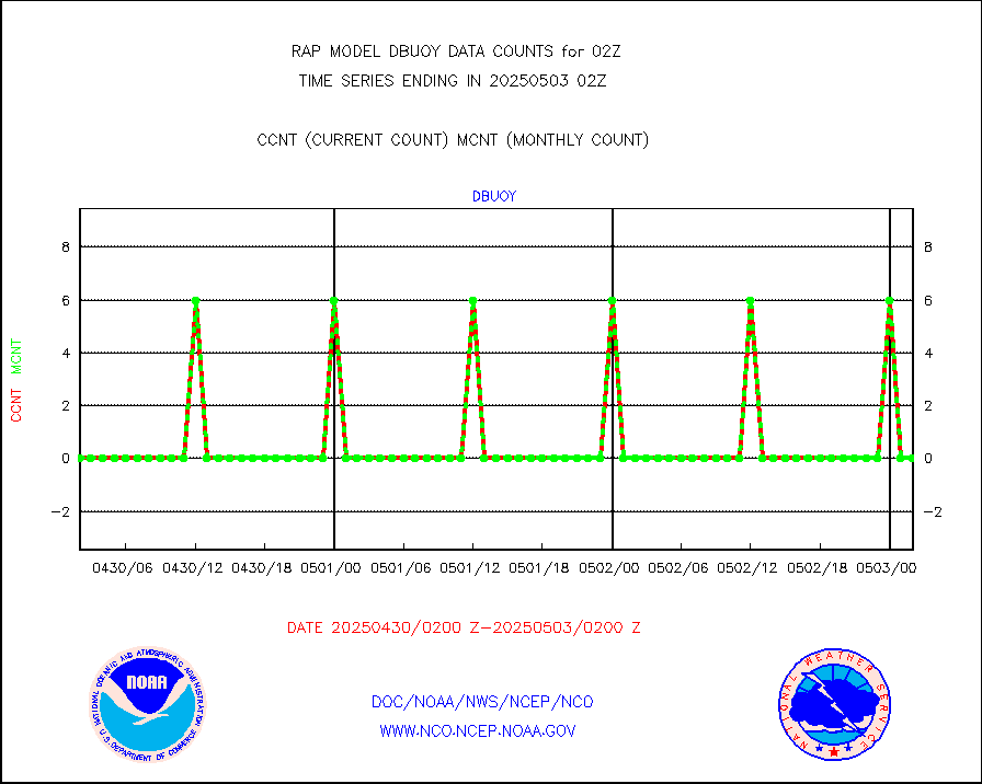
dbuoy |
Buoys decoded from FM-18 fmt (moored or drifting) |
0 |
1 |
0.0 % |
2001.50-2002.50 |
gnss |
Grnd-based Gbl Navigation Sat System (GNSS) data |
2351 |
2375 |
99.0 % |
2000.95-2001.05 |
h20mo |
MODIS (AQUA/TERRA) wvpr imager derived cld motion |
0 |
0 |
n/a |
1923.50-2004.50 |
infmo |
MODIS (AQUA/TERRA) ir l-wave derived cloud motion |
0 |
0 |
n/a |
1923.50-2004.50 |
lgycld |
GOES/NASA(Langley) hi-res. (1x1 f-o-v) cloud data |
3737031 |
3197865 |
116.9 % |
2001.50-2002.50 |
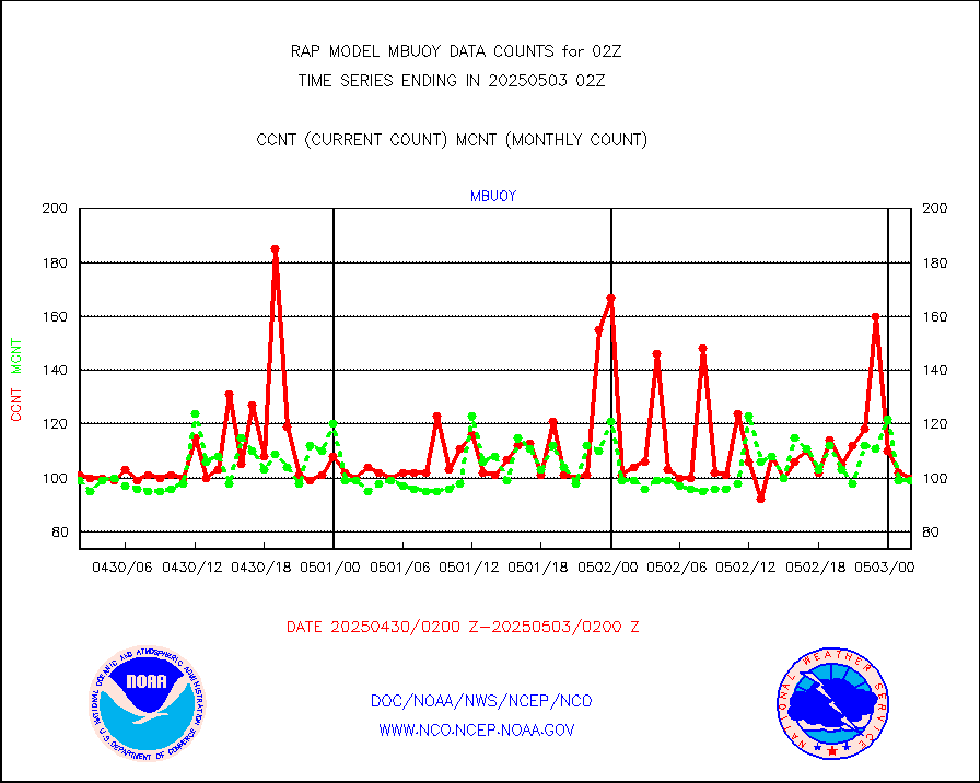
mbuoy |
Buoys decoded from FM-13 format (moored) |
69 |
62 |
111.3 % |
2001.50-2002.50 |
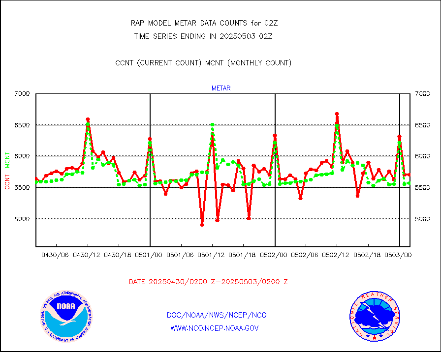
metar |
Aviation - METAR |
5416 |
5722 |
94.7 % |
2001.50-2002.50 |
nxrdw |
NEXRAD Vel Azm Dsp(VAD) winds via radar coded msg |
0 |
0 |
n/a |
2001.00-2003.00 |
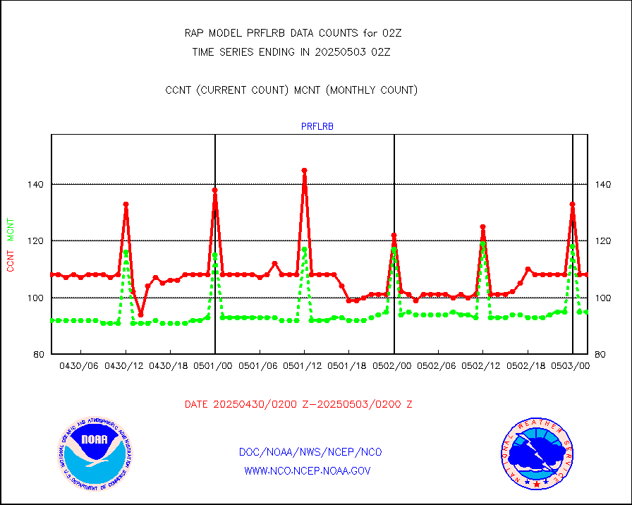
prflrb |
Multi-Agency Profiler (MAP) and SODAR winds |
70 |
84 |
83.3 % |
2000.50-2003.50 |
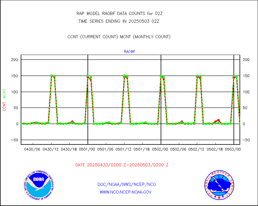
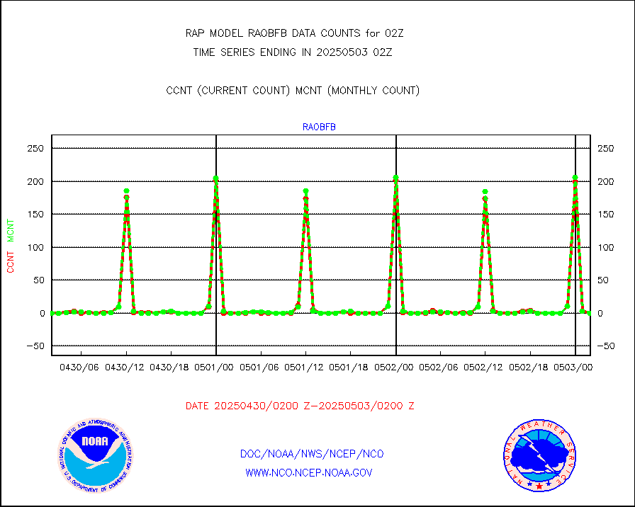
raobf |
Rawinsonde - fixed land (from TEMP or PILOT) |
0 |
0 |
n/a |
2001.00-2003.00 |
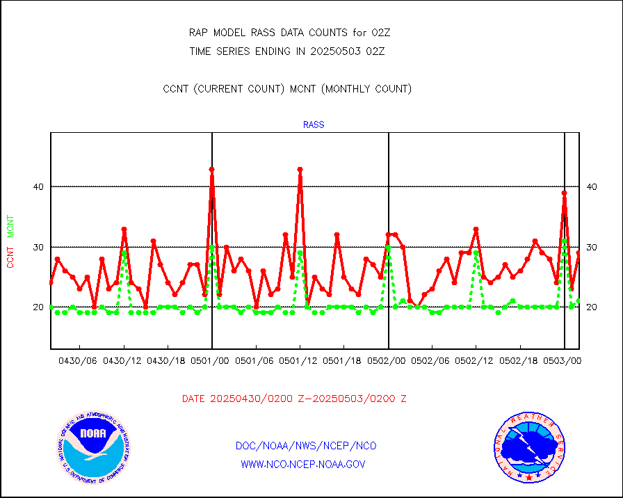
rass |
RASS temperatures (NOAA and Multi-Agency) |
20 |
21 |
95.2 % |
2001.50-2002.50 |
shipsb |
Ship - manual and automatic, restricted (BUFR) |
0 |
0 |
n/a |
2001.50-2002.50 |
shipsu |
Ship - manual and automatic, unrestricted |
64 |
57 |
112.3 % |
2001.50-2002.50 |
shipub |
Ship - manual and automatic, unrestricted (BUFR) |
653 |
619 |
105.5 % |
2001.50-2002.50 |
synop |
Synoptic - fixed manual and automatic |
314 |
308 |
101.9 % |
2001.50-2002.50 |
synopb |
Synoptic - fixed manual & auto (decoded fr BUFR) |
1701 |
1706 |
99.7 % |
2001.50-2002.50 |
tideg |
Tide gauge reports decoded from CREX format |
180 |
180 |
100.0 % |
2001.50-2002.50 |
| Data Types of Opportunity with Normal Counts |
|---|
| Type | Description | Hourly Count | Monthly Average | Percent (%) of Monthly Mean | UTC Time Window |
3p9usr |
GOES-16&up/NESDIS ir short-wv derived cld motion |
2408 |
3912 |
61.6 % |
2001.00-2001.99 |
acarsa |
MDCRS ACARS acft data (ARINC via AFWA)(AIREP fmt) |
0 |
0 |
n/a |
1922.75-2005.25 |
airep |
Manual AIREP aircraft data (dcded from AIREP fmt) |
3540 |
3192 |
110.9 % |
1922.75-2005.25 |
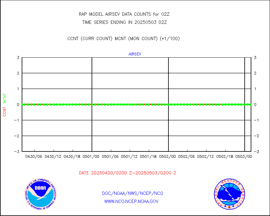
airsev |
AQUA AIRS/AMSU-A/HSB brightness temps- every FOV |
0 |
0 |
n/a |
1923.00-2004.99 |
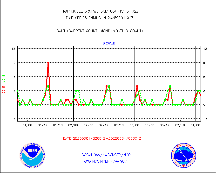
amdar |
AMDAR aircraft data (decoded from AMDAR format) |
2623 |
2156 |
121.7 % |
1922.75-2005.25 |
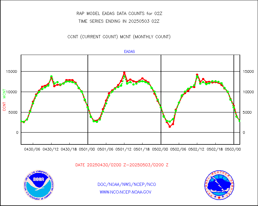
amdarb |
AMDAR aircraft data (decoded from BUFR) |
5317 |
5337 |
99.6 % |
1922.75-2005.25 |
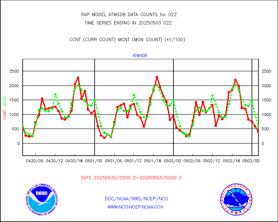
amsr2 |
GCOM-W AMSR2 1B brightness temperatures |
1060455 |
635710 |
166.8 % |
1923.00-1923.99 |
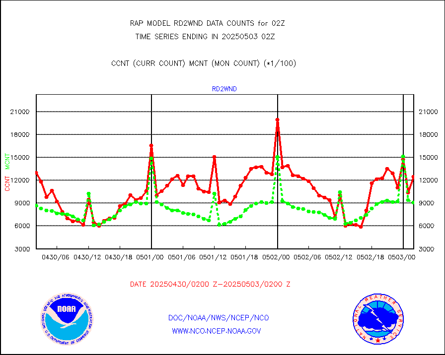
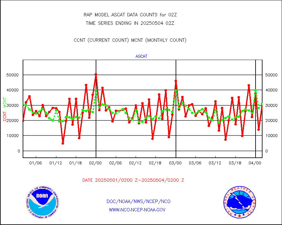
ascat |
METOP 1-2 ASCAT products |
34576 |
26192 |
132.0 % |
2000.00-2004.00 |
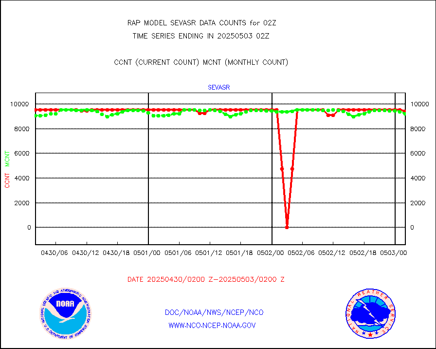
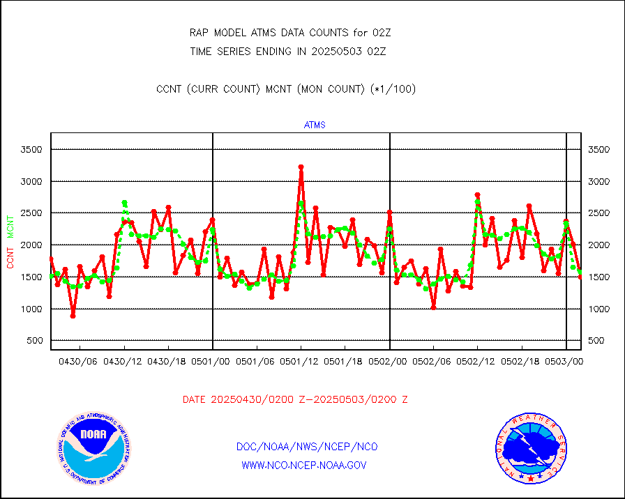
atms |
NPP/NOAA-20 ATMS brightness temperatures |
153343 |
153694 |
99.8 % |
2000.00-2003.99 |
atmsdb |
NPP/NOAA-20 ATMS bright. temps-direct b-cast SSEC |
61395 |
64546 |
95.1 % |
2000.00-2003.99 |
coopmd |
Coop/MADIS NEPP & HCN-Modernization NOAA COOP Obs |
27 |
27 |
100.0 % |
2001.50-2002.50 |
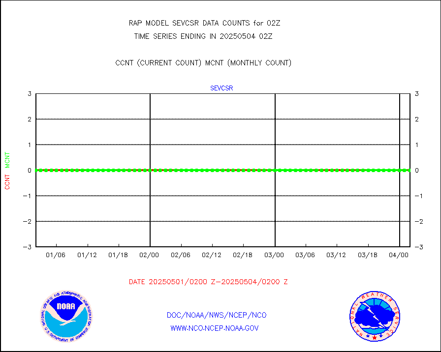
crisf4 |
NPP/NOAA-20 CrIS full spctrl radn (431 ch subset) |
94396 |
90801 |
104.0 % |
2000.00-2003.99 |
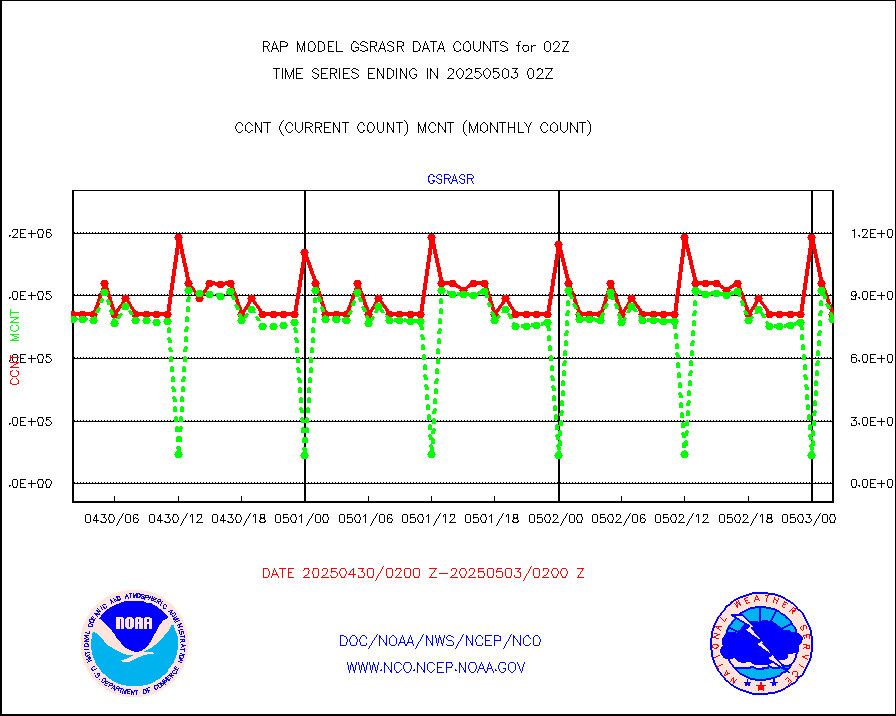
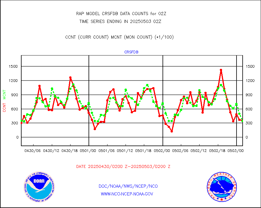
crsfdb |
NPP/NOAA-20 CrIS full spctrl radn dir brdcst SSEC |
41086 |
55959 |
73.4 % |
2000.00-2003.99 |
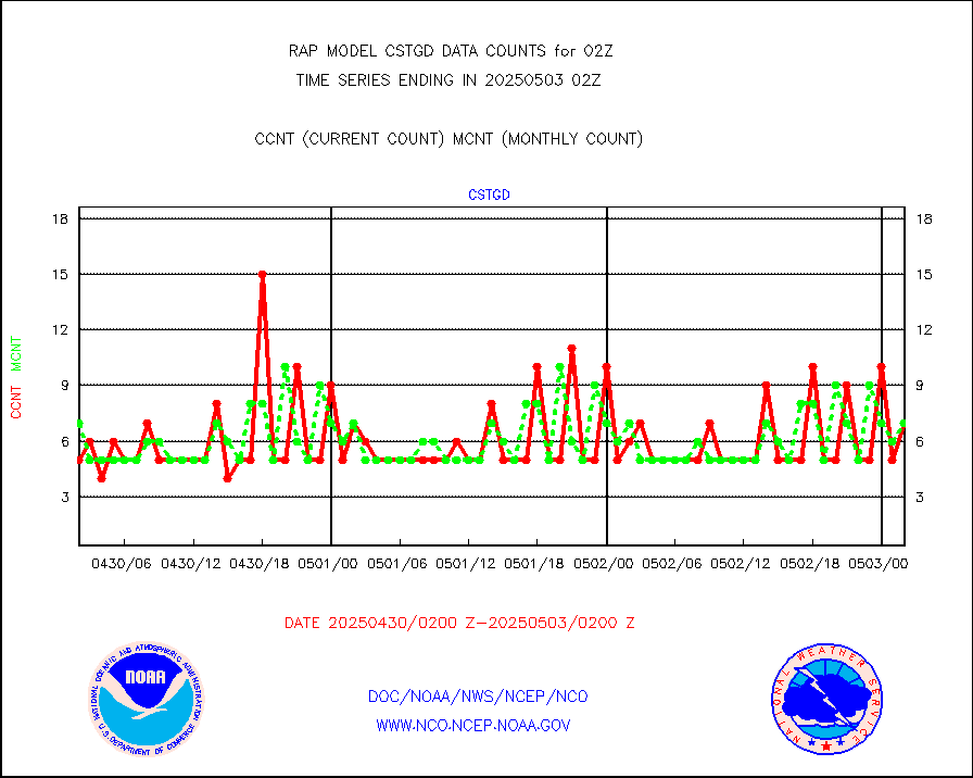
cstgd |
Coast Guard |
6 |
5 |
120.0 % |
2001.50-2002.50 |
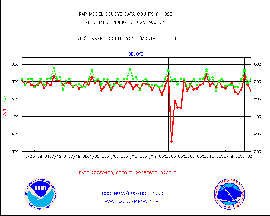
dbuoyb |
Drifting buoys (decoded from BUFR) |
581 |
575 |
101.0 % |
2001.50-2002.50 |
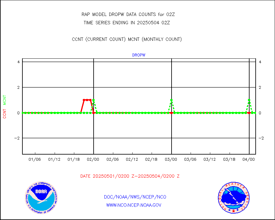
dropw |
Dropwinsonde (from TEMP DROP) |
0 |
0 |
n/a |
2001.00-2003.00 |
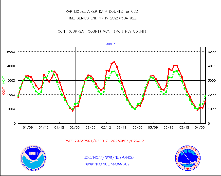
eadas |
E-AMDAR (European AMDAR acft decoded from BUFR) |
2702 |
2181 |
123.9 % |
1922.75-2005.25 |
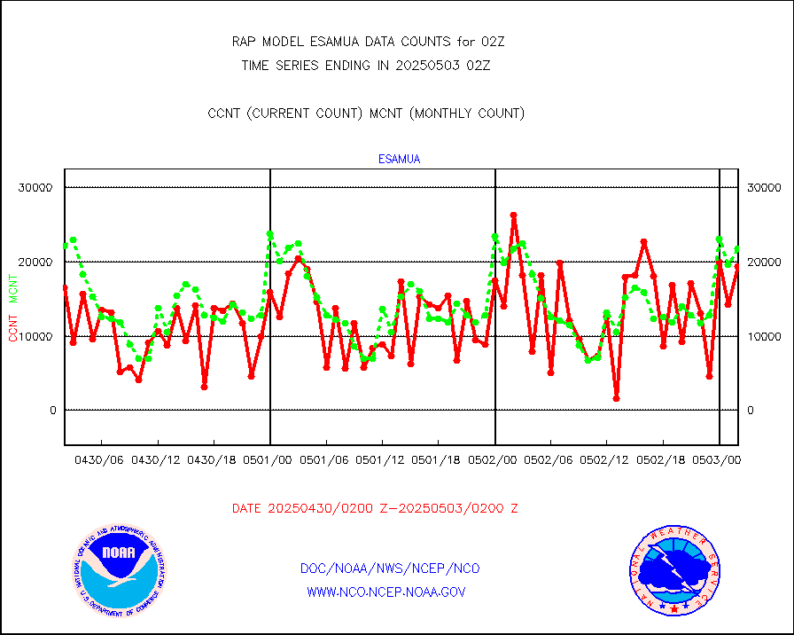
esamua |
NOAA 15-19 & METOP 1-2 AMSU-A proc btmps frm RARS |
23987 |
25017 |
95.9 % |
2001.00-2003.00 |
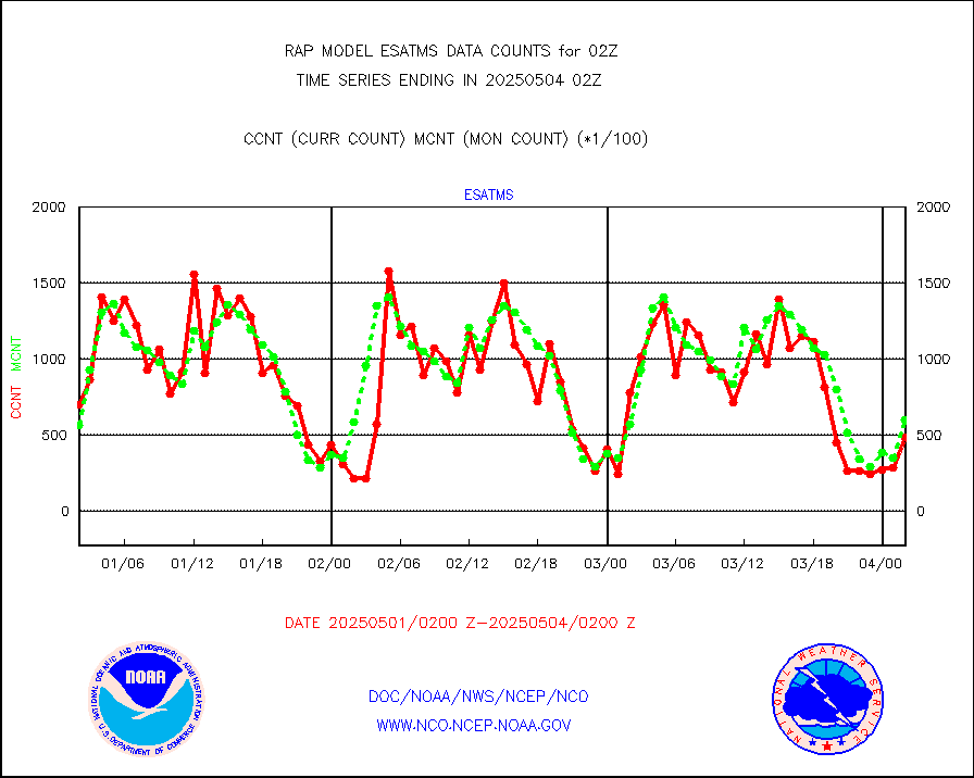
esatms |
NPP Adv. Tech. MW Sndr (ATMS) br. temps from RARS |
64796 |
58698 |
110.4 % |
2000.00-2003.99 |
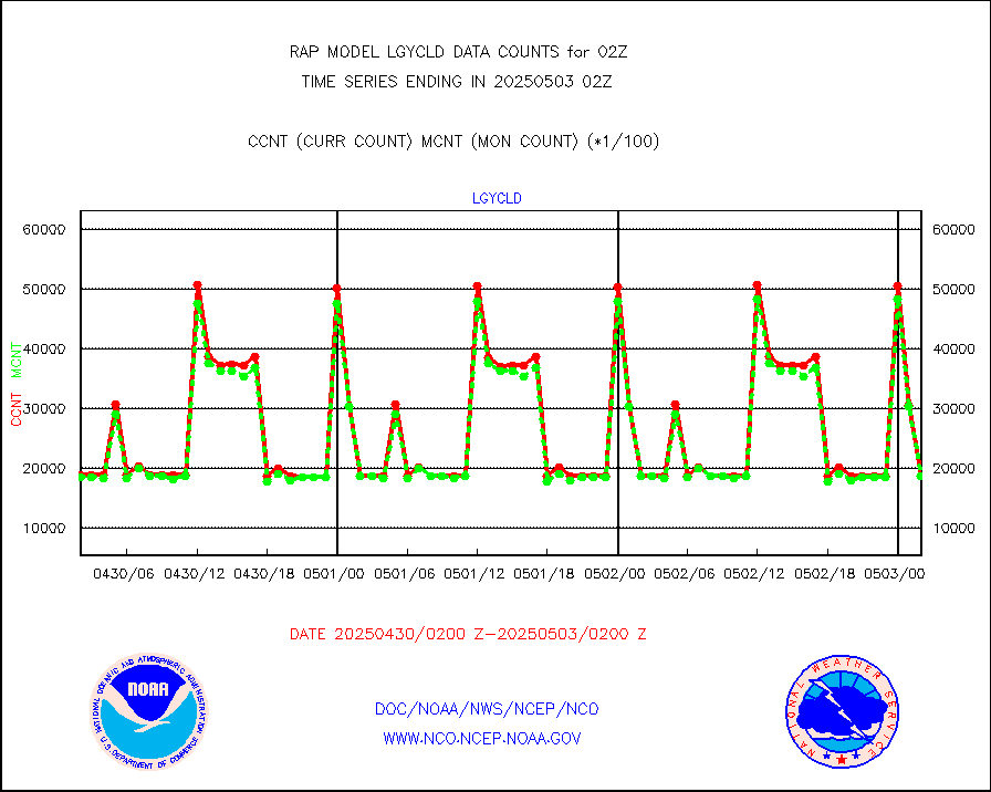
eshrs3 |
NOAA 15-19 & METOP 1-2 HIRS-3/4 pr btmps frm RARS |
51736 |
50604 |
102.2 % |
2001.00-2003.00 |
esiasi |
METOP 1-2 IASI 1C radiance data vbl chn from RARS |
83225 |
76329 |
109.0 % |
2000.00-2003.99 |
esmhs |
NOAA 18-19 & METOP 1-2 MHS proc. btemps from RARS |
270184 |
221237 |
122.1 % |
2001.00-2003.00 |
gmi1cr |
GPM GMI Level 1C-R brightness temperatures |
381684 |
925411 |
41.2 % |
1923.00-2004.99 |
gpsro |
GPS radio occultation data |
119 |
121 |
98.3 % |
2000.00-2003.99 |
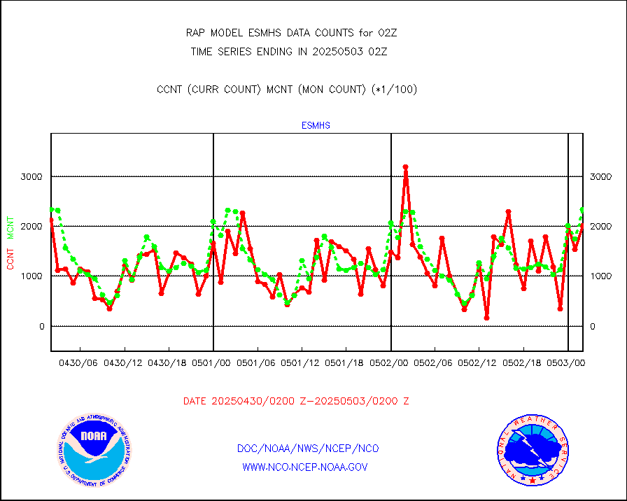
gsrasr |
GOES-16/17 All Sky Radiances (proc.) |
812097 |
794841 |
102.2 % |
2000.00-2003.99 |
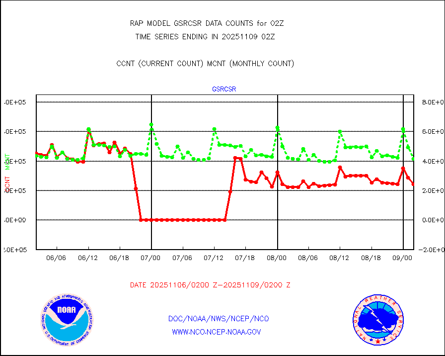
gsrcsr |
GOES-16/17 Clear Sky Radiances (proc.) |
341157 |
383182 |
89.0 % |
2000.00-2003.99 |
h20ja |
MTSAT/JMA water vapor imager derived cloud motion |
2804 |
3213 |
87.3 % |
1923.50-2004.50 |
h2dusr |
GOES-16&up/NESDIS wv imgr/deep-lyr derivd cld mtn |
6657 |
7364 |
90.4 % |
2001.00-2001.99 |
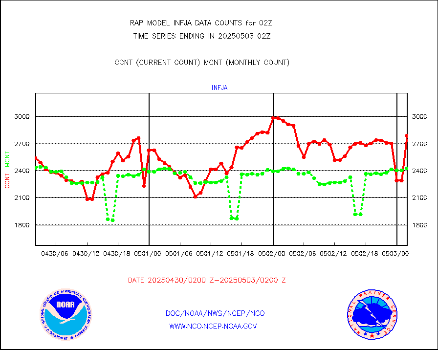
h2eunb |
METEOSAT/EUMETSAT wvpr imgr drv cld motion NBseq |
5435 |
5239 |
103.7 % |
2000.50-2003.49 |
h2tusr |
GOES-16&up/NESDIS wv imgr/cld-top derived cld mtn |
16330 |
12964 |
126.0 % |
2001.00-2001.99 |
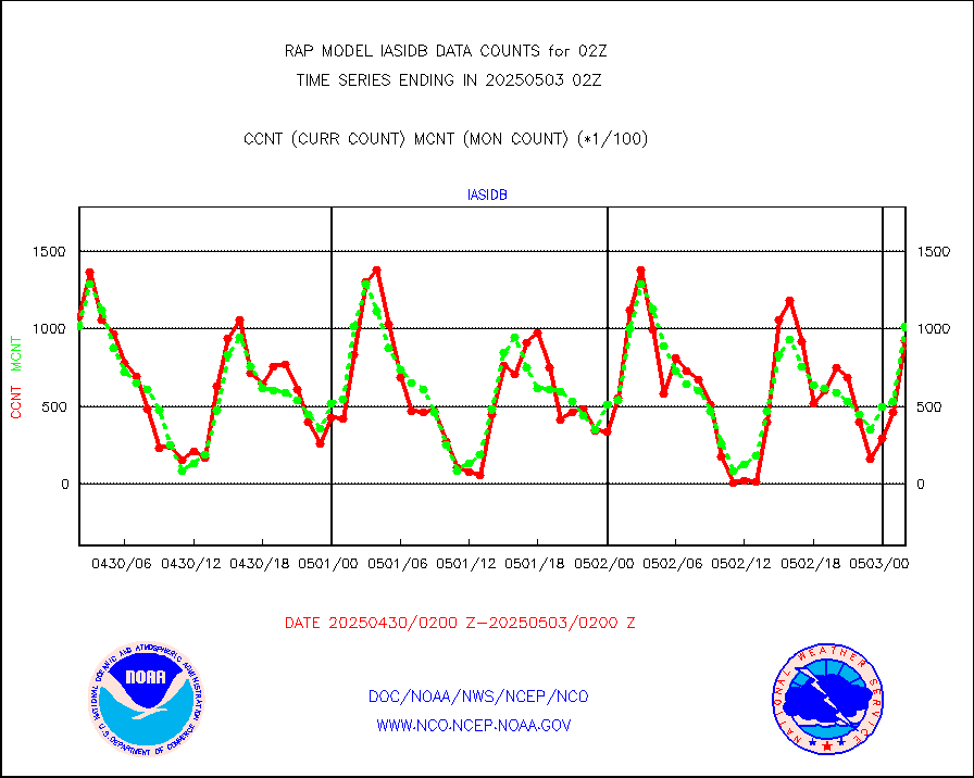
iasidb |
METOP 1-2 IASI 1C radiances-direct broadcast SSEC |
79960 |
73870 |
108.2 % |
2000.00-2003.99 |
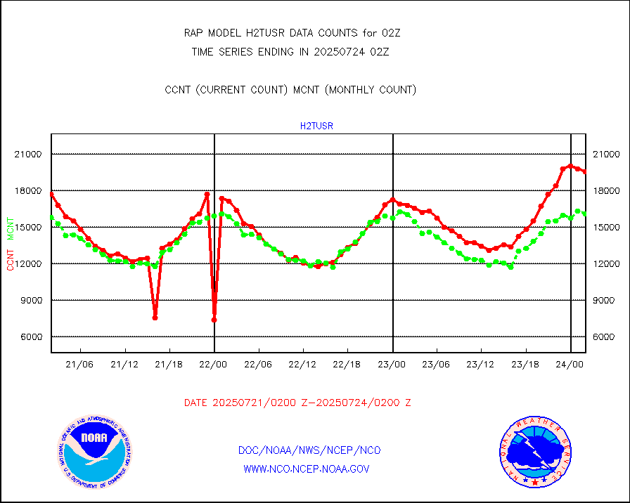
ifeunb |
METEOSAT/EUMETSAT ir lg-wave drv cld motion NBseq |
3309 |
3215 |
102.9 % |
2000.50-2003.49 |
ifvrnb |
VIIRS (NPP/NOAA-20) ir lg-wv drv cloud motion(NB) |
0 |
0 |
n/a |
1923.50-2004.50 |
infav |
AVHRR (NOAA/METOP) ir lg-wave derived cld motion |
0 |
0 |
n/a |
1923.50-2004.50 |
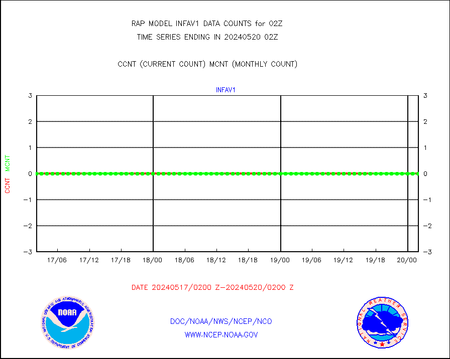
infav1 |
AVHRR (METOP) ir lg-wave derived cld motion |
0 |
0 |
n/a |
2000.50-2003.49 |
infja |
MTSAT/JMA infrared long-wave derived cloud motion |
2273 |
2622 |
86.7 % |
1923.50-2004.50 |
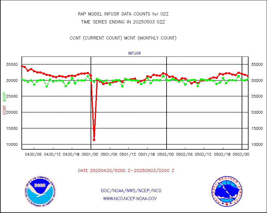
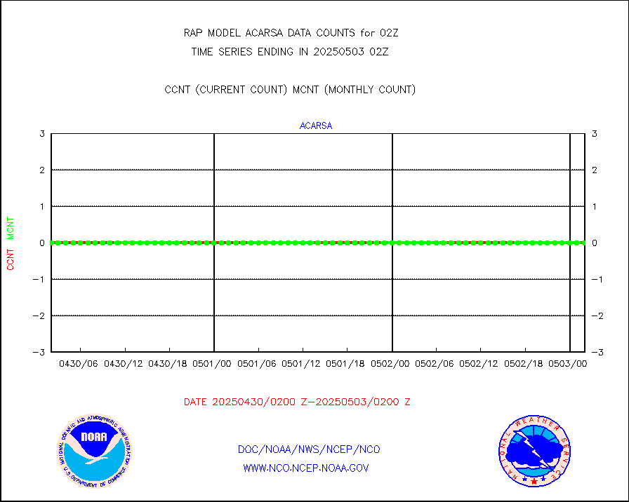
infusr |
GOES-16&up/NESDIS ir long-wave derived cld motion |
29858 |
29545 |
101.1 % |
2001.00-2001.99 |
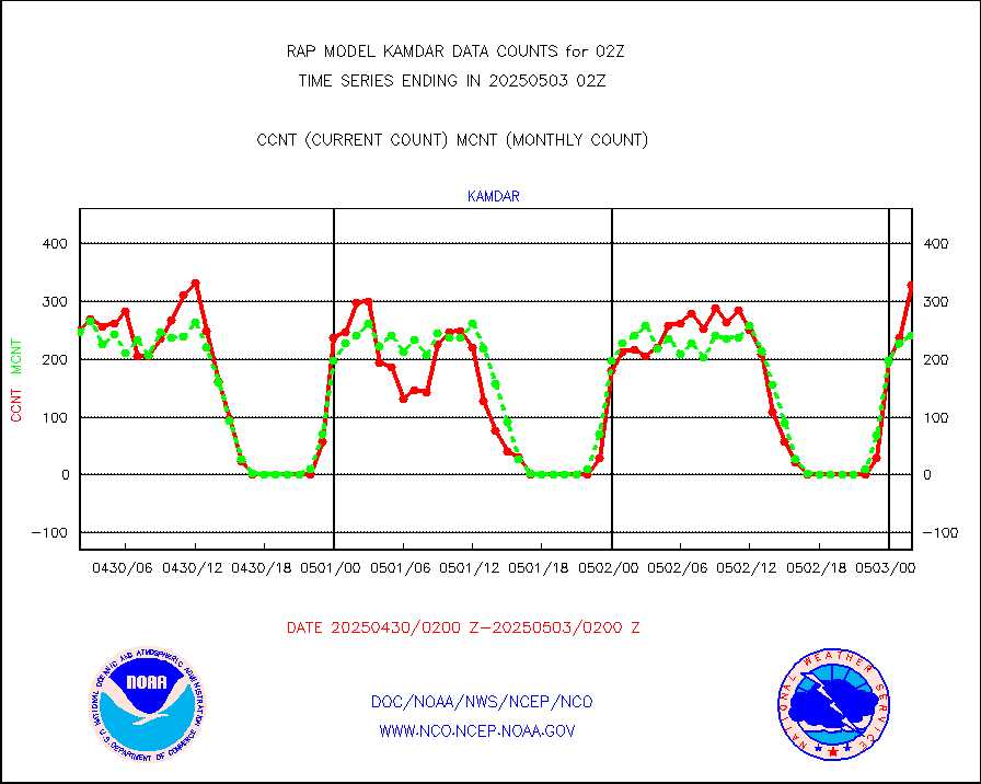
kamdar |
Korean AMDAR aircraft data (decoded from BUFR) |
173 |
224 |
77.2 % |
1922.75-2005.25 |
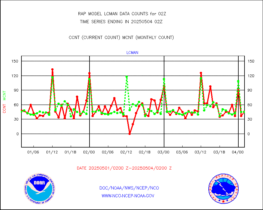
lcman |
Land-based CMAN stations decoded from CMAN format |
69 |
71 |
97.2 % |
2001.50-2002.50 |
ltnglr |
LLDN Long-rng lightning from Vaisala via NOAAPORT |
170679 |
149486 |
114.2 % |
2001.00-2002.50 |
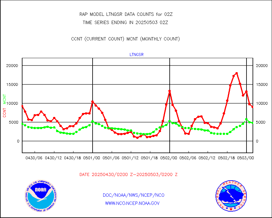
ltngsr |
NLDN Shrt-rng lightning from Vaisala via NOAAPORT |
12156 |
7365 |
165.1 % |
2001.00-2002.50 |
mbuoyb |
Moored buoys (decoded from BUFR) |
623 |
563 |
110.7 % |
2001.50-2002.50 |
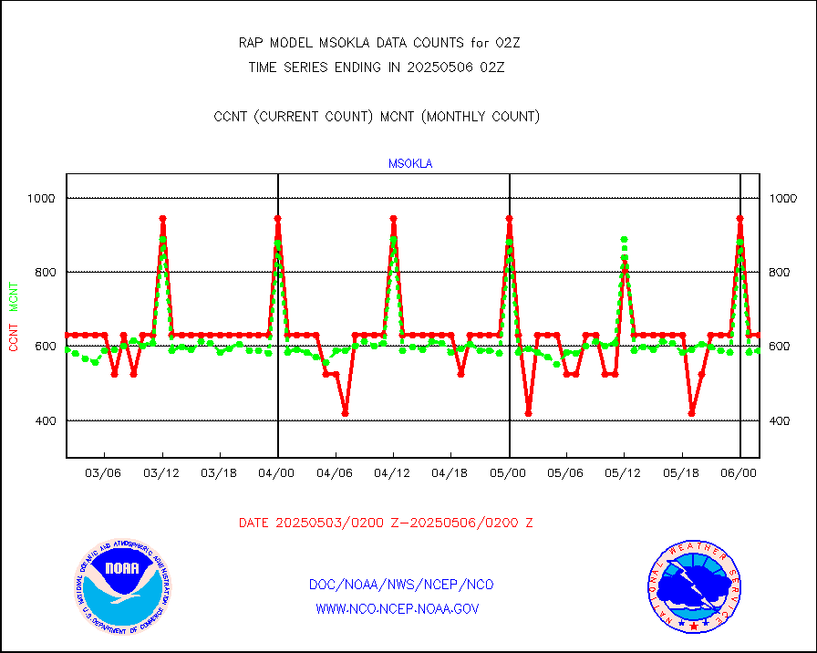
mso470 |
Mesonet/MADIS Colorado E-470 (Interstate 470) |
21 |
17 |
123.5 % |
2001.50-2002.50 |
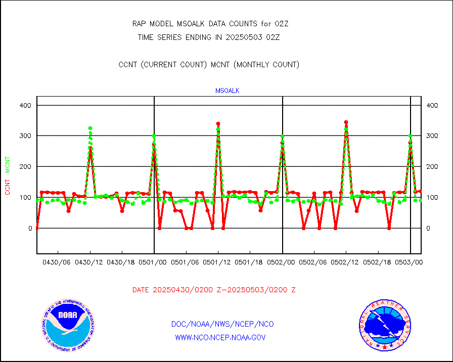
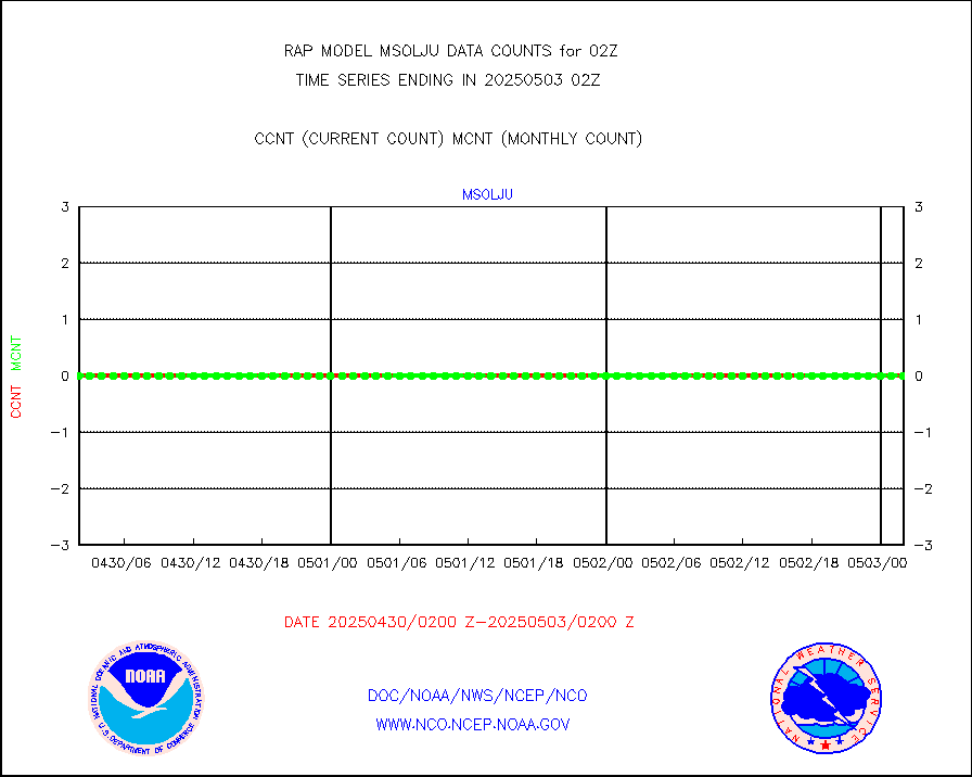
msoalk |
Mesonet/MADIS Alaska Department of Transportation |
107 |
95 |
112.6 % |
2001.50-2002.50 |
msoapg |
Mesonet/MADIS U.S. Army Aberdeen Proving Grounds |
0 |
0 |
n/a |
2001.50-2002.50 |
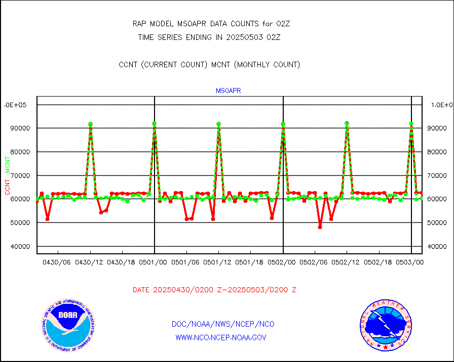
msoapr |
Mesonet/MADIS Citizen Weather Observers Program |
46114 |
45132 |
102.2 % |
2001.50-2002.50 |
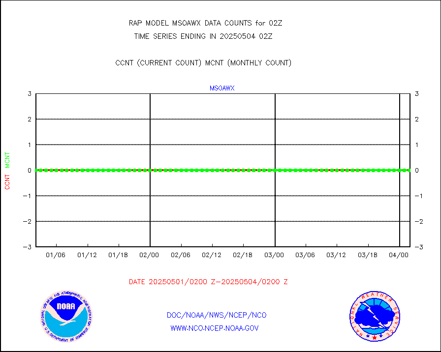
msoaws |
Mesonet/MADIS AWS Convergence Technologies, Inc. |
25724 |
25424 |
101.2 % |
2001.50-2002.50 |
msoawx |
Mesonet/MADIS "Anything Weather" |
0 |
0 |
n/a |
2001.50-2002.50 |
msocol |
Mesonet/MADIS Colorado Dept. of Transportation |
0 |
0 |
n/a |
2001.50-2002.50 |
msodcn |
Mesonet/MADIS DC Net |
0 |
0 |
n/a |
2001.50-2002.50 |
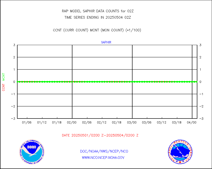
msoden |
Mesonet/MADIS Denver Urban Drainage & Flood Cntrl |
225 |
211 |
106.6 % |
2001.50-2002.50 |
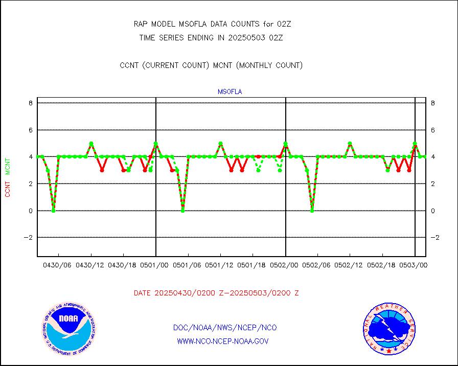
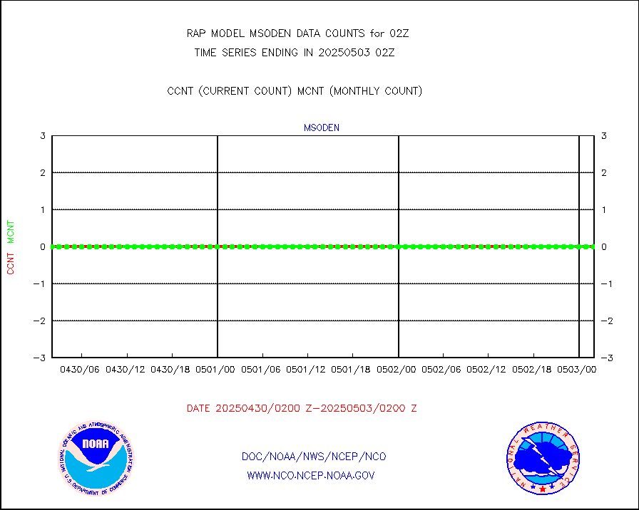
msofla |
Mesonet/MADIS Florida (FAWN & USF) |
4 |
3 |
133.3 % |
2001.50-2002.50 |
msoflt |
Mesonet/MADIS Florida Dept. of Transportation |
0 |
0 |
n/a |
2001.50-2002.50 |
msogeo |
Mesonet/MADIS Georgia Dept. of Transportation |
0 |
0 |
n/a |
2001.50-2002.50 |
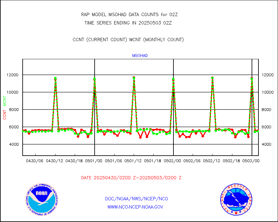
msohad |
Mesonet/MADIS NWS Hydromet Auto Data System(HADS) |
5562 |
5489 |
101.3 % |
2001.50-2002.50 |
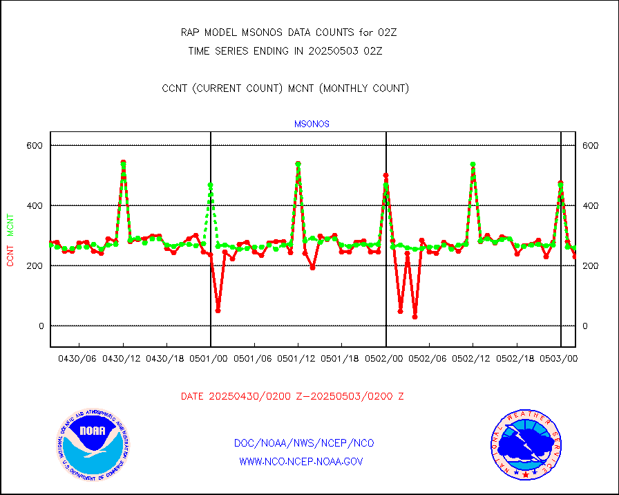
msoien |
Mesonet/MADIS Iowa Environmental |
164 |
166 |
98.8 % |
2001.50-2002.50 |
msoind |
Mesonet/MADIS Indiana Dept. of Transportation |
0 |
0 |
n/a |
2001.50-2002.50 |
msoiow |
Mesonet/MADIS Iowa Department of Transportation |
0 |
0 |
n/a |
2001.50-2002.50 |
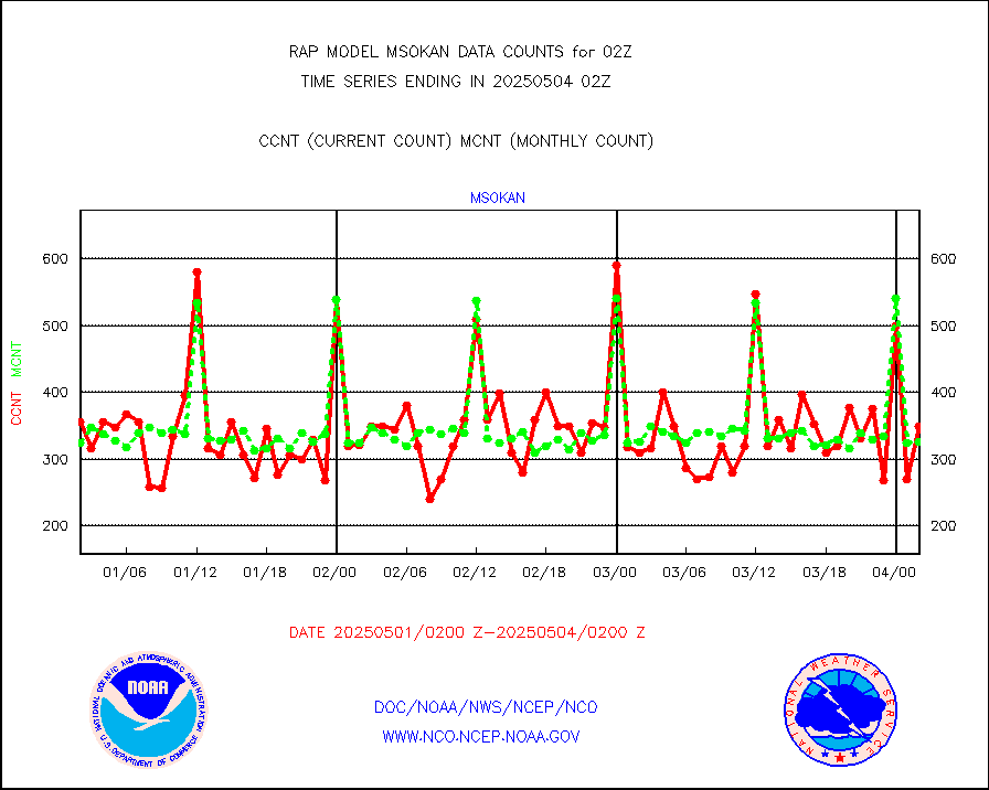
msokan |
Mesonet/MADIS Kansas Department of Transportation |
361 |
307 |
117.6 % |
2001.50-2002.50 |
msokla |
Mesonet/MADIS Oklahoma Mesonet |
318 |
314 |
101.3 % |
2001.50-2002.50 |
msolju |
Mesonet/MADIS Louisiana State/Jackson State Univ. |
0 |
0 |
n/a |
2001.50-2002.50 |
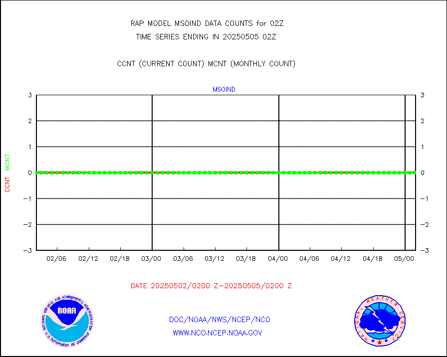
msomca |
Mesonet/MADIS Missouri Commercial Agricult Wx Net |
274 |
262 |
104.6 % |
2001.50-2002.50 |
msomin |
Mesonet/MADIS Minnesota Dept. of Transportation |
0 |
0 |
n/a |
2001.50-2002.50 |
msonos |
Mesonet/MADIS NOS-Phys Oceanographic Realtime Sys |
291 |
281 |
103.6 % |
2001.50-2002.50 |
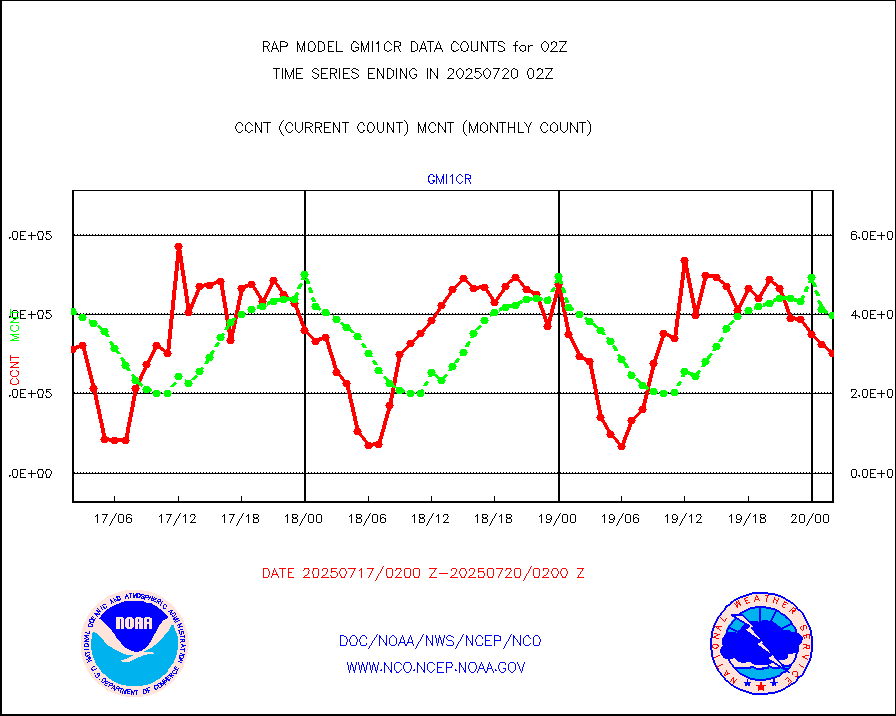
msoraw |
Mesonet/MADIS NFIC Remote Automated Wx Stns(RAWS) |
1551 |
1488 |
104.2 % |
2001.50-2002.50 |
msourb |
Mesonet/MADIS UrbaNet |
3951 |
3935 |
100.4 % |
2001.50-2002.50 |
msovir |
Mesonet/MADIS Virginia Dept. of Transportation |
206 |
227 |
90.7 % |
2001.50-2002.50 |
msowfy |
Mesonet/MADIS "Weather for You" |
0 |
0 |
n/a |
2001.50-2002.50 |
msowis |
Mesonet/MADIS Wisconsin Dept. of Transportation |
0 |
0 |
n/a |
2001.50-2002.50 |
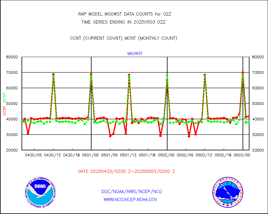
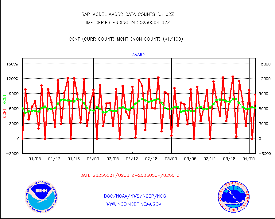
msowst |
Mesonet/MADIS MesoWest (many subproviders) |
39951 |
38432 |
104.0 % |
2001.50-2002.50 |
msowtx |
Mesonet/MADIS West Texas |
5043 |
4792 |
105.2 % |
2001.50-2002.50 |
mtiasi |
METOP 1-2 IASI 1C radiance data (varbl. channels) |
32181 |
35478 |
90.7 % |
2000.00-2003.99 |
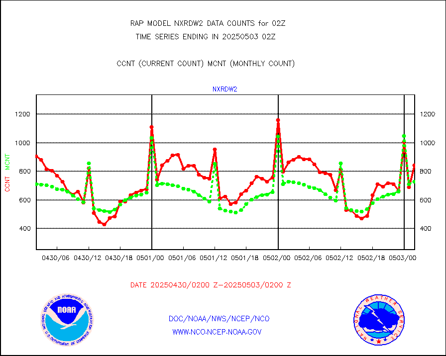
nxrdw2 |
NEXRAD Vel Azm Dsp(VAD) winds via Level 2 decoder |
873 |
849 |
102.8 % |
2001.00-2003.00 |
osbuv8 |
NOAA 16-19 Solar Backscatter UV-2 rad frm V8 BUFR |
0 |
0 |
n/a |
2000.00-2002.99 |
pibal |
PIBAL (from PILOT, PILOT SHIP, PILOT MOBIL) |
0 |
0 |
n/a |
2001.00-2003.00 |
pirep |
Manual PIREP aircraft data (dcded from AIREP fmt) |
235 |
354 |
66.4 % |
1922.75-2005.25 |
prflrp |
Profilr winds from PIBAL (PILOT,PILOT SHIP/MOBIL) |
0 |
0 |
n/a |
2000.50-2003.50 |
raobm |
Rawinsonde - mobile land (from TEMP/PILOT MOBIL) |
0 |
0 |
n/a |
2001.00-2003.00 |
raobs |
Rawinsonde - ship (from TEMP SHIP, PILOT SHIP) |
0 |
0 |
n/a |
2001.00-2003.00 |
rd2wnd |
NEXRAD radial wind (Level 2 - GTS) |
1169538 |
1115848 |
104.8 % |
2001.50-2002.49 |
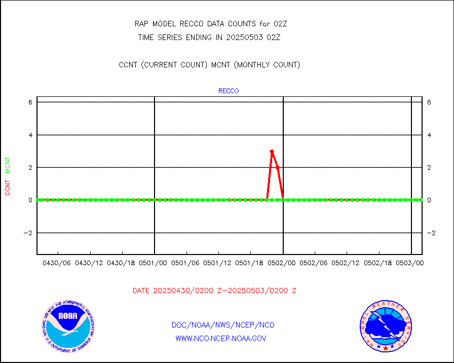
recco |
Flight level reconnaissance aircraft data |
0 |
0 |
n/a |
2001.00-2003.00 |
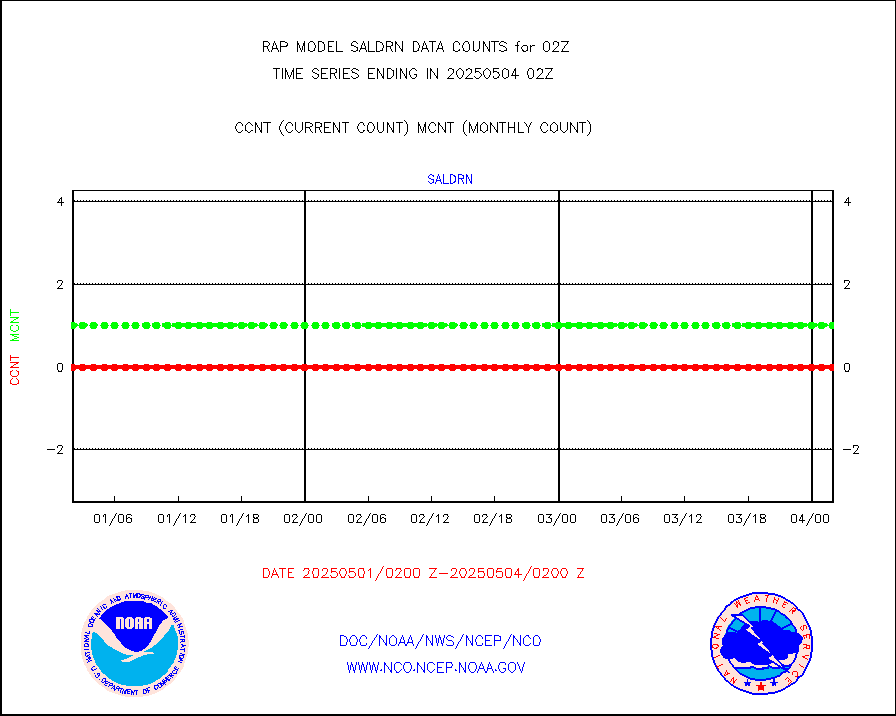
saldrn |
Surface Marine Saildrone (decoded from BUFR) |
2 |
2 |
100.0 % |
2000.00-2003.99 |
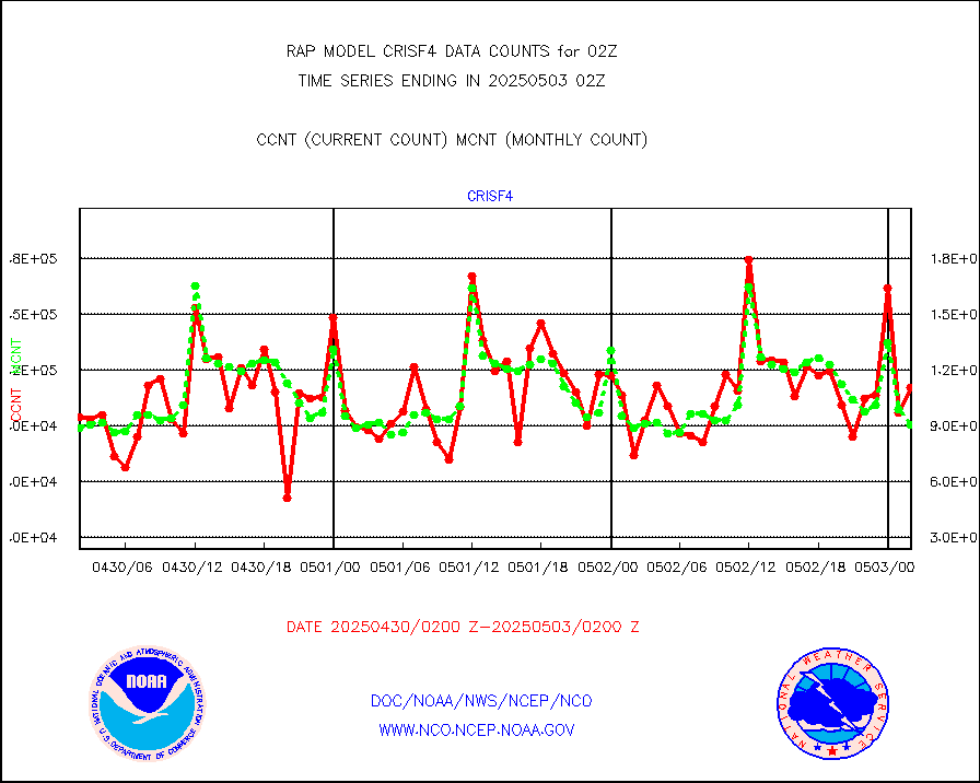
saphir |
Megha-Tropiques SAPHIR L1A2 brightness temps |
0 |
0 |
n/a |
1923.00-2004.99 |
sevasr |
METEOSAT-10 2nd Gen SEVIRI All Sky Radiance(proc) |
9512 |
9486 |
100.3 % |
2000.00-2003.99 |
sevcsr |
METEOSAT-10 2nd Gen SEVIRI Clr Sky Radiance(proc) |
0 |
0 |
n/a |
2000.00-2003.99 |
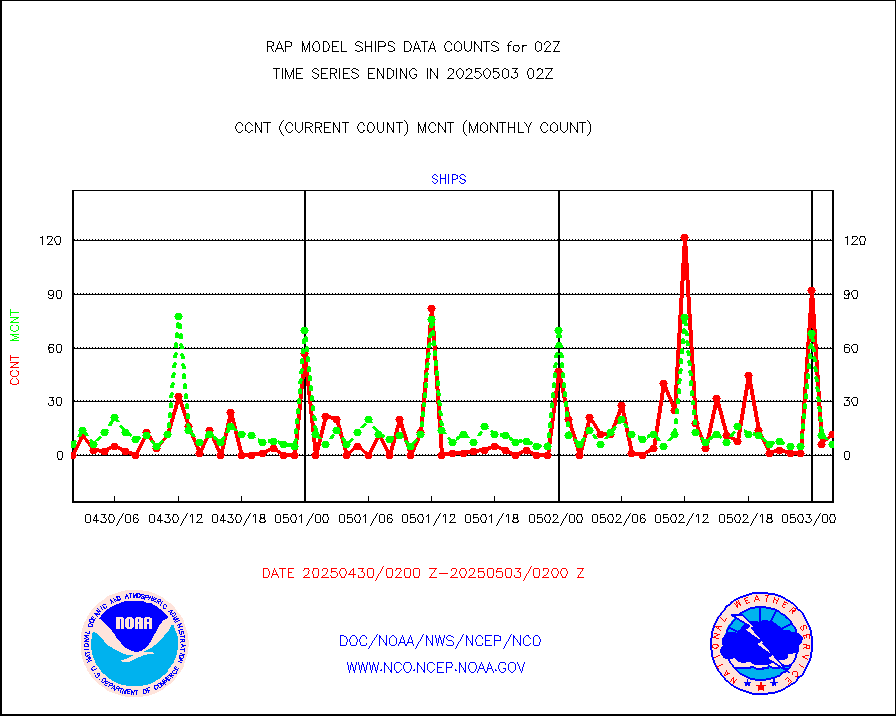
ships |
Ship - manual and automatic, restricted |
9 |
4 |
225.0 % |
2001.50-2002.50 |
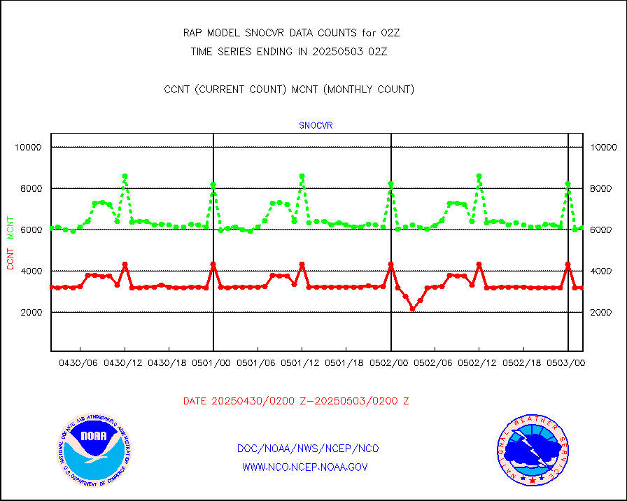
snocvr |
NOW COVER, DEPTH/DENSITY AND WATER EQUIVALENT |
3109 |
6093 |
51.0 % |
2000.00-2004.00 |
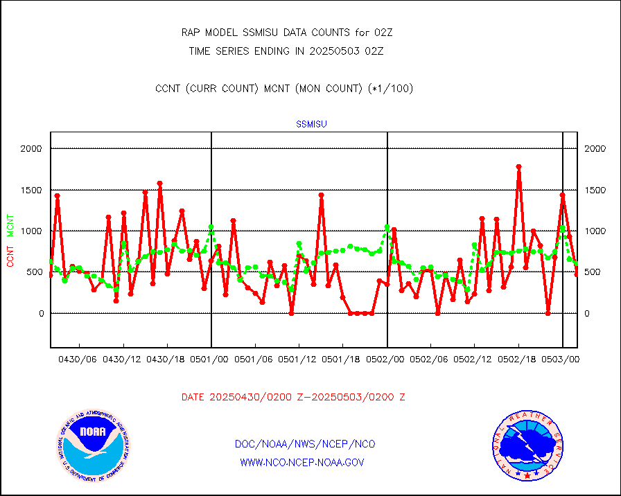
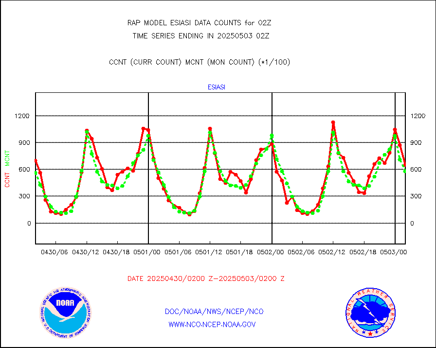
ssmisu |
DMSP SSM/IS 1C radiance data (Unified Pre-Proc.) |
37004 |
60128 |
61.5 % |
2000.00-2003.99 |
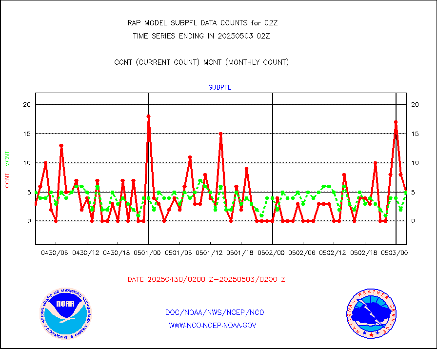
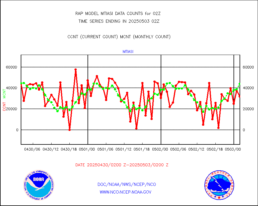
subpfl |
Sub-surface float and glider profile (BUFR) |
11 |
9 |
122.2 % |
2000.00-2003.99 |
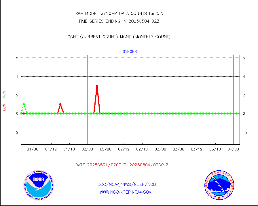
synopr |
Synoptic - restricted (WMO Res 40) manual & auto. |
0 |
0 |
n/a |
2001.50-2002.50 |
synpbr |
Synoptic - restricted (WMO Res 40)(decoded BUFR) |
343 |
344 |
99.7 % |
2001.50-2002.50 |
synpmb |
Synoptic - mobile manual & auto (decoded fr BUFR) |
0 |
0 |
n/a |
2001.50-2002.50 |
tmdara |
TAMDAR aircft data-all types(from Panasonic,BUFR) |
1149 |
1304 |
88.1 % |
1922.75-2005.25 |
visja |
MTSAT/JMA visible derived cloud motion |
1386 |
1661 |
83.4 % |
1923.50-2004.50 |
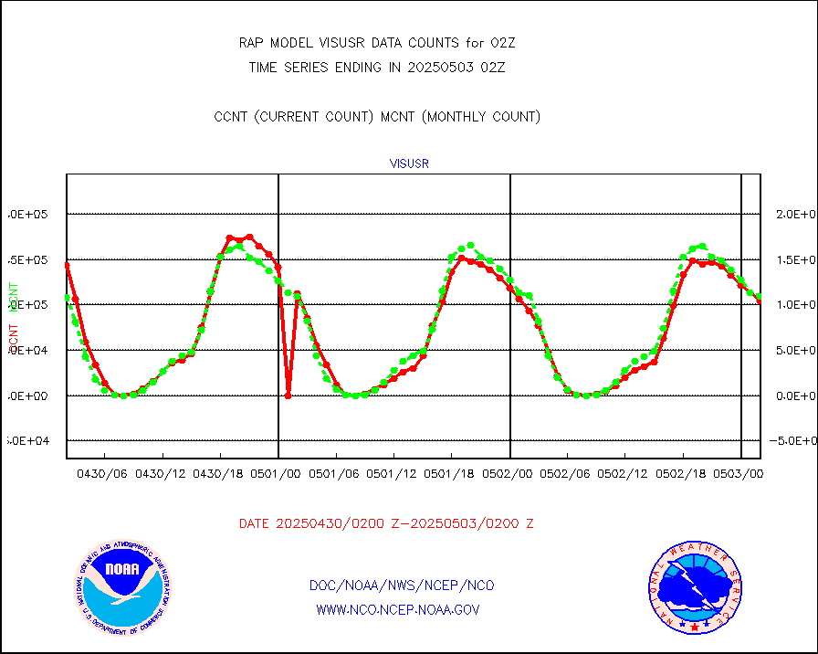
visusr |
GOES-16&up/NESDIS visible derived cloud motion |
100472 |
114820 |
87.5 % |
2001.00-2001.99 |
vseunb |
METEOSAT/EUMETSAT visible drv cld motion NBseq |
0 |
0 |
n/a |
2000.50-2003.49 |


