| Critical Data with Normal Counts |
|---|
| Type | Description | Hourly Count | Monthly Average | Percent (%) of Monthly Mean |
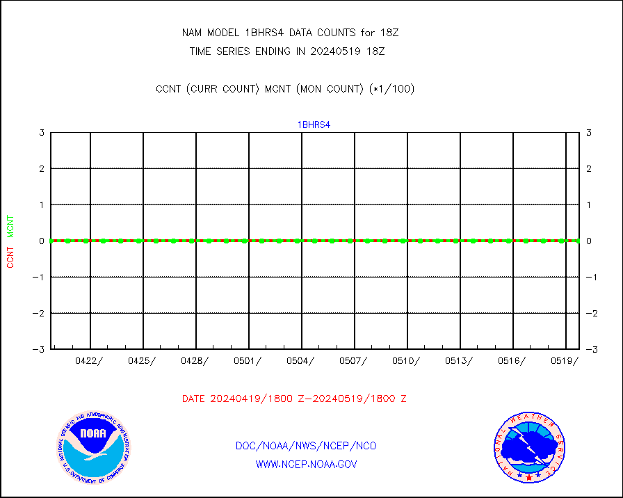
1bhrs4 |
NOAA 18-19 & METOP 1-2 HIRS-4 NCEP-proc. br.temps |
0 |
4 |
0.0 % |
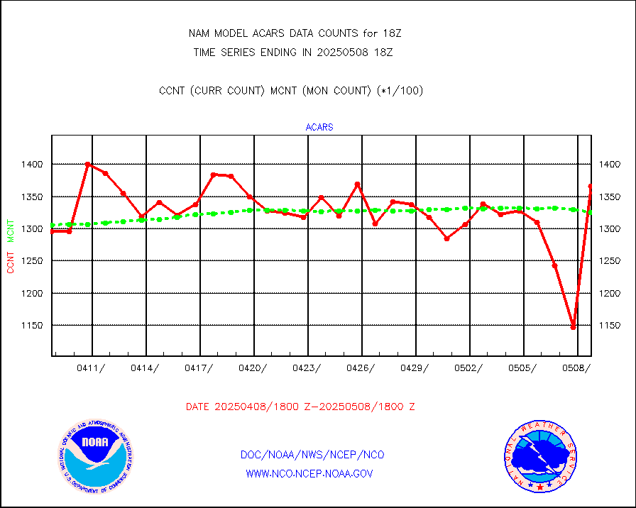
acars |
MDCRS ACARS acft data from ARINC(dcded from BUFR) |
103073 |
109000 |
94.6 % |
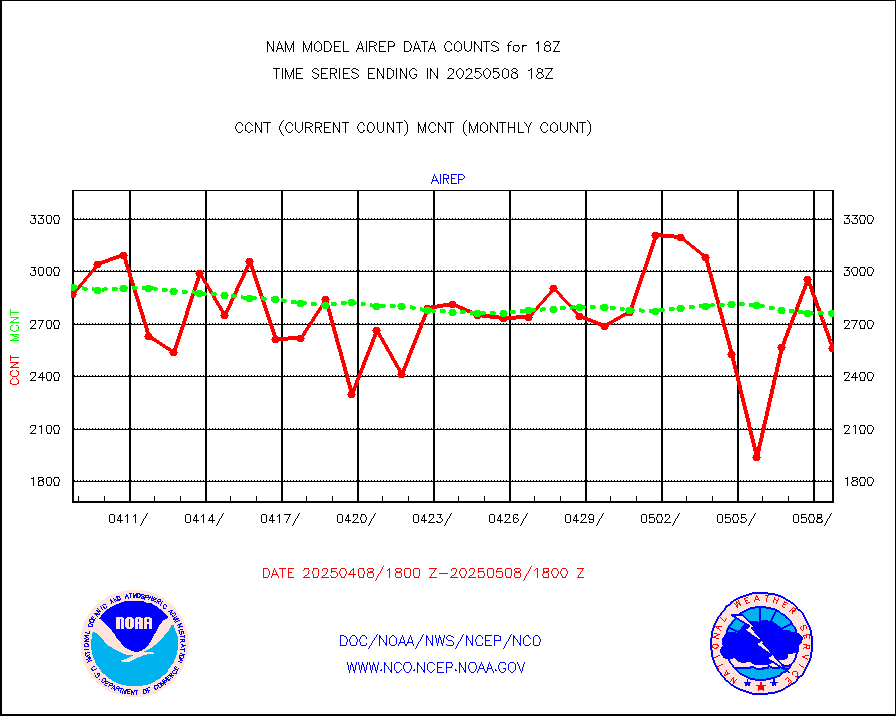
airep |
Manual AIREP aircraft data (dcded from AIREP fmt) |
5348 |
4863 |
110.0 % |
airsev |
AQUA AIRS/AMSU-A/HSB brightness temps- every FOV |
0 |
0 |
n/a |
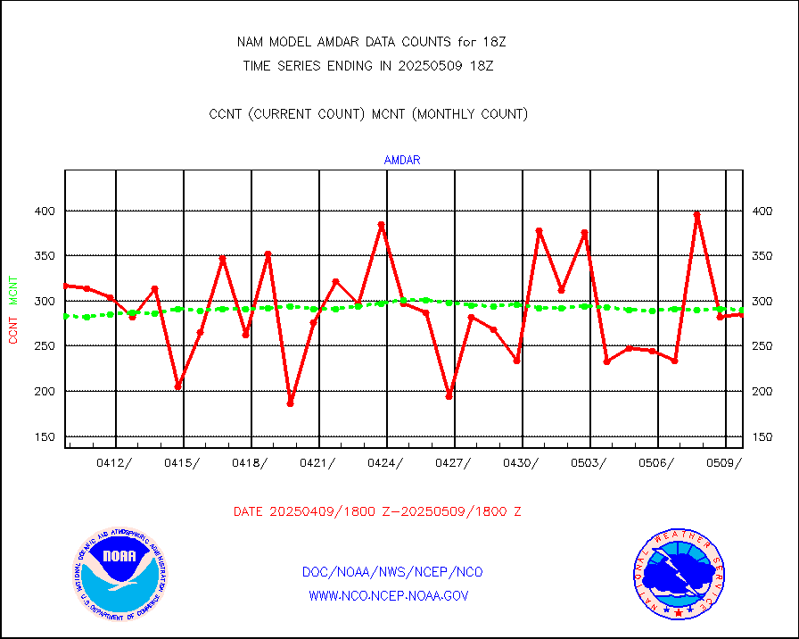
amdar |
AMDAR aircraft data (decoded from AMDAR format) |
300 |
322 |
93.2 % |
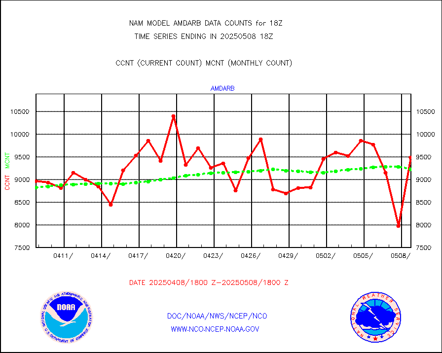
amdarb |
AMDAR aircraft data (decoded from BUFR) |
1414 |
1454 |
97.2 % |
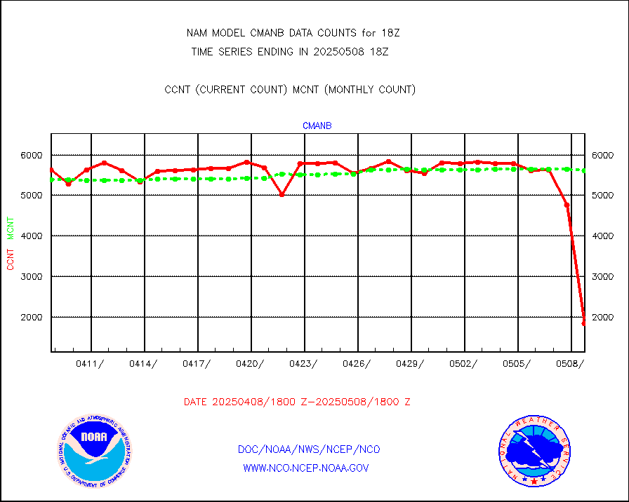
cmanb |
Surface Marine CMAN rpts decoded from BUFR format |
5667 |
5518 |
102.7 % |
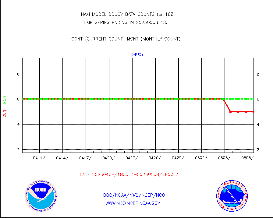
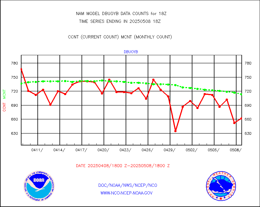
dbuoy |
Buoys decoded from FM-18 fmt (moored or drifting) |
4 |
4 |
100.0 % |
dropw |
Dropwinsonde (from TEMP DROP) |
0 |
0 |
n/a |
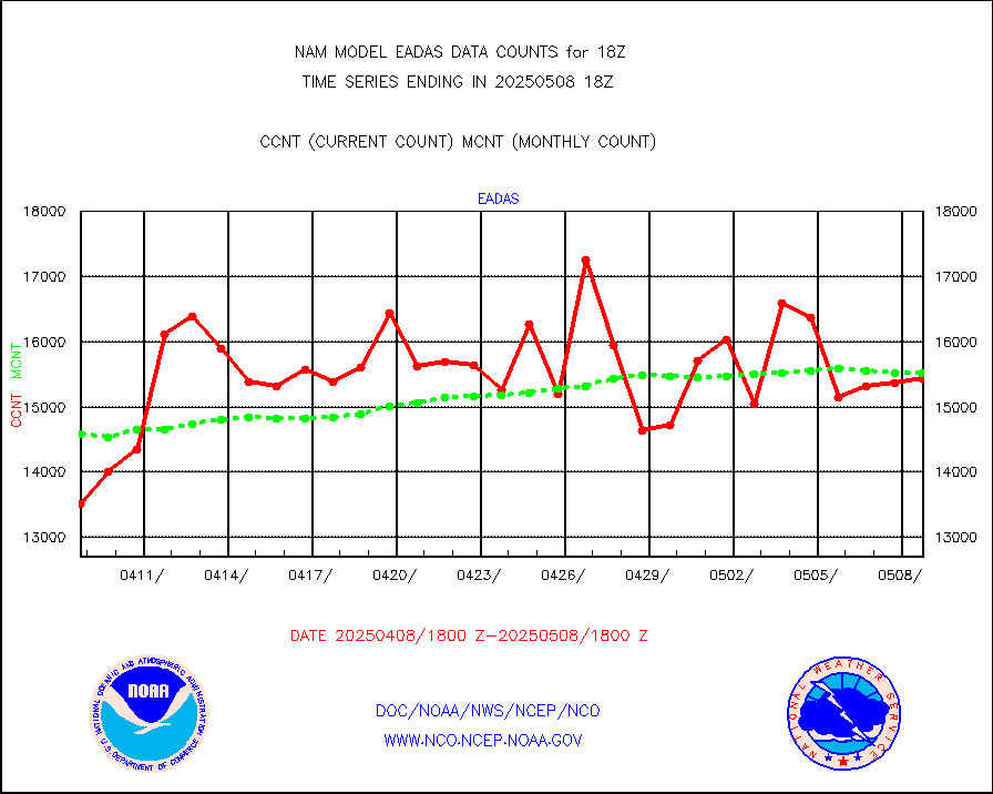
eadas |
E-AMDAR (European AMDAR acft decoded from BUFR) |
12648 |
11881 |
106.5 % |
geost1 |
GOES/NESDIS hi-resol. (1x1 f-o-v) sndgs/radiances |
0 |
0 |
n/a |
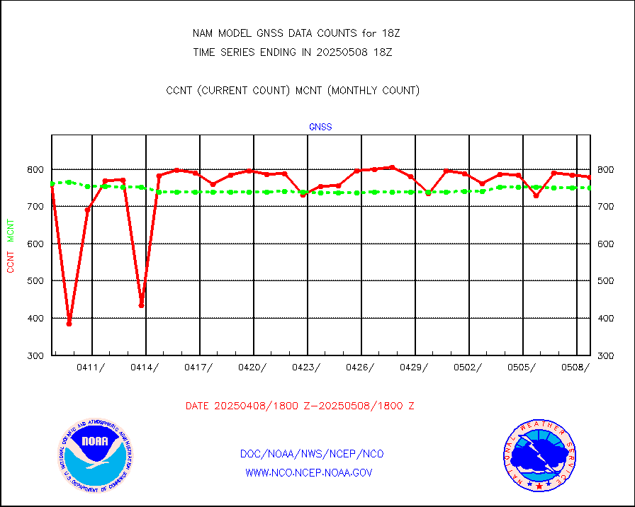
gnss |
Grnd-based Gbl Navigation Sat System (GNSS) data |
610 |
949 |
64.3 % |
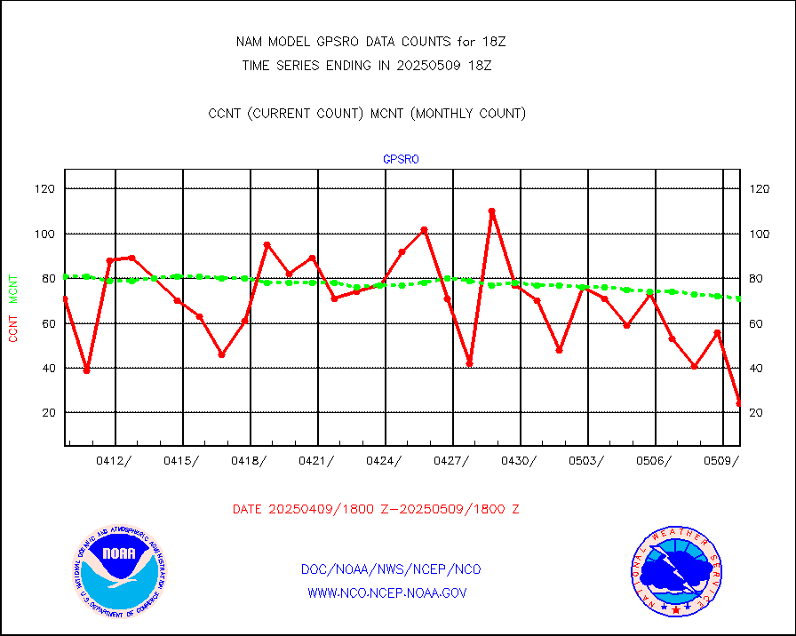
gpsro |
GPS radio occultation data |
64 |
71 |
90.1 % |
h20mo |
MODIS (AQUA/TERRA) wvpr imager derived cld motion |
0 |
0 |
n/a |
infmo |
MODIS (AQUA/TERRA) ir l-wave derived cloud motion |
0 |
0 |
n/a |
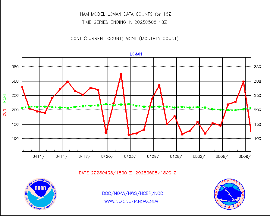
lcman |
Land-based CMAN stations decoded from CMAN format |
250 |
202 |
123.8 % |
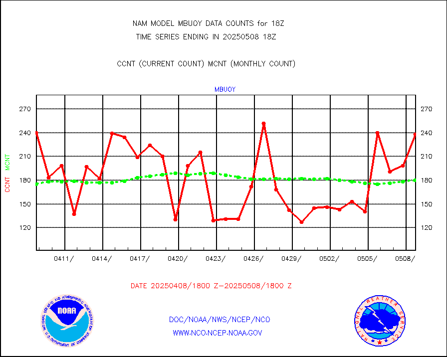
mbuoy |
Buoys decoded from FM-13 format (moored) |
244 |
195 |
125.1 % |
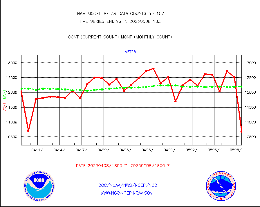
metar |
Aviation - METAR |
11813 |
12176 |
97.0 % |
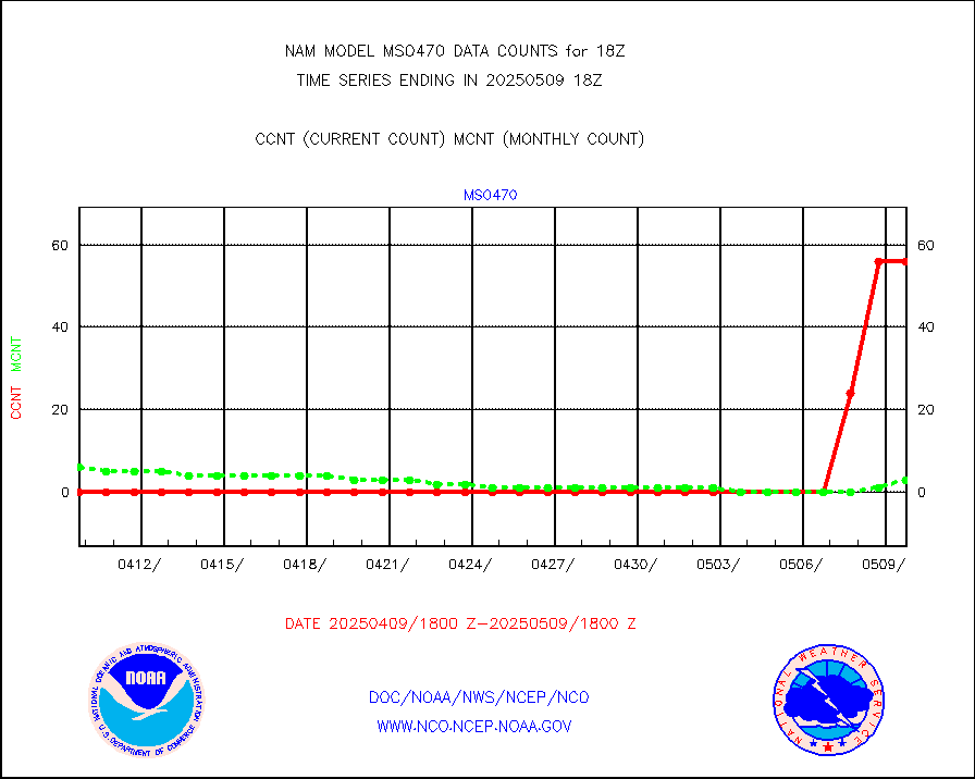
mso470 |
Mesonet/MADIS Colorado E-470 (Interstate 470) |
42 |
45 |
93.3 % |
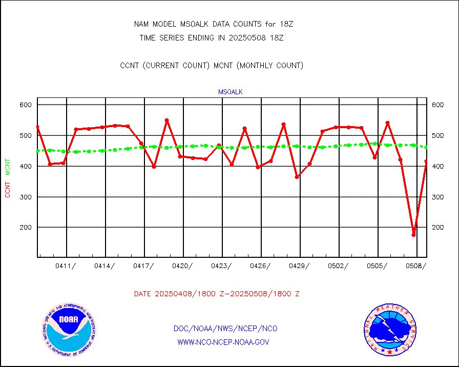
msoalk |
Mesonet/MADIS Alaska Department of Transportation |
394 |
446 |
88.3 % |
msoapg |
Mesonet/MADIS U.S. Army Aberdeen Proving Grounds |
0 |
0 |
n/a |
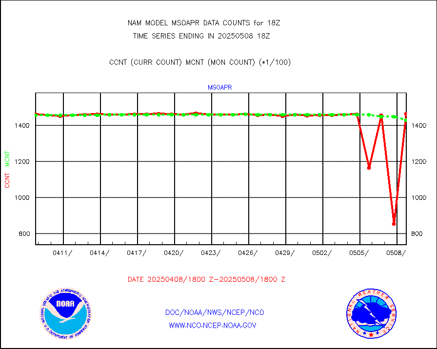
msoapr |
Mesonet/MADIS Citizen Weather Observers Program |
109174 |
109616 |
99.6 % |
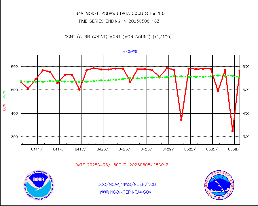
msoaws |
Mesonet/MADIS AWS Convergence Technologies, Inc. |
61160 |
62914 |
97.2 % |
msoawx |
Mesonet/MADIS "Anything Weather" |
0 |
0 |
n/a |
msocol |
Mesonet/MADIS Colorado Dept. of Transportation |
0 |
0 |
n/a |
msodcn |
Mesonet/MADIS DC Net |
0 |
0 |
n/a |
msoden |
Mesonet/MADIS Denver Urban Drainage & Flood Cntrl |
500 |
508 |
98.4 % |
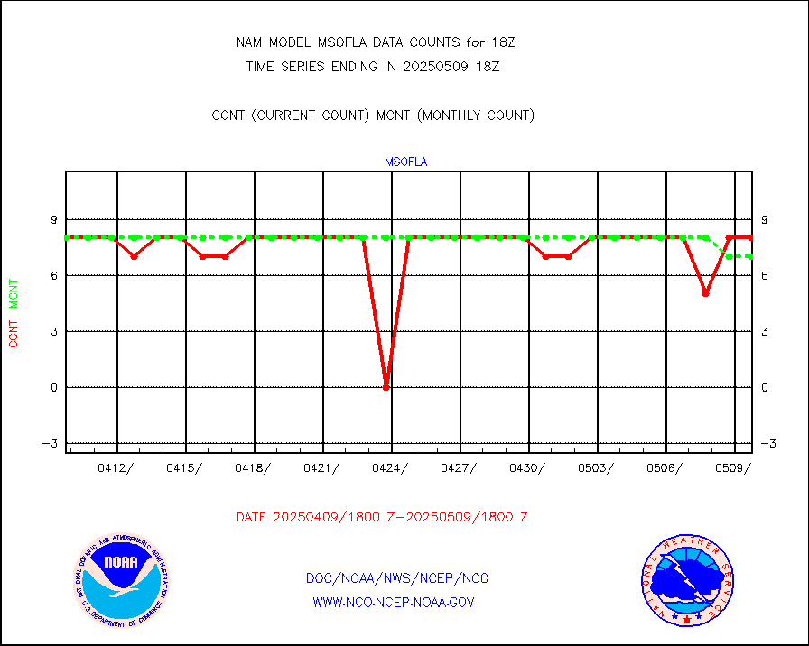
msofla |
Mesonet/MADIS Florida (FAWN & USF) |
8 |
8 |
100.0 % |
msoflt |
Mesonet/MADIS Florida Dept. of Transportation |
0 |
0 |
n/a |
msogeo |
Mesonet/MADIS Georgia Dept. of Transportation |
0 |
0 |
n/a |
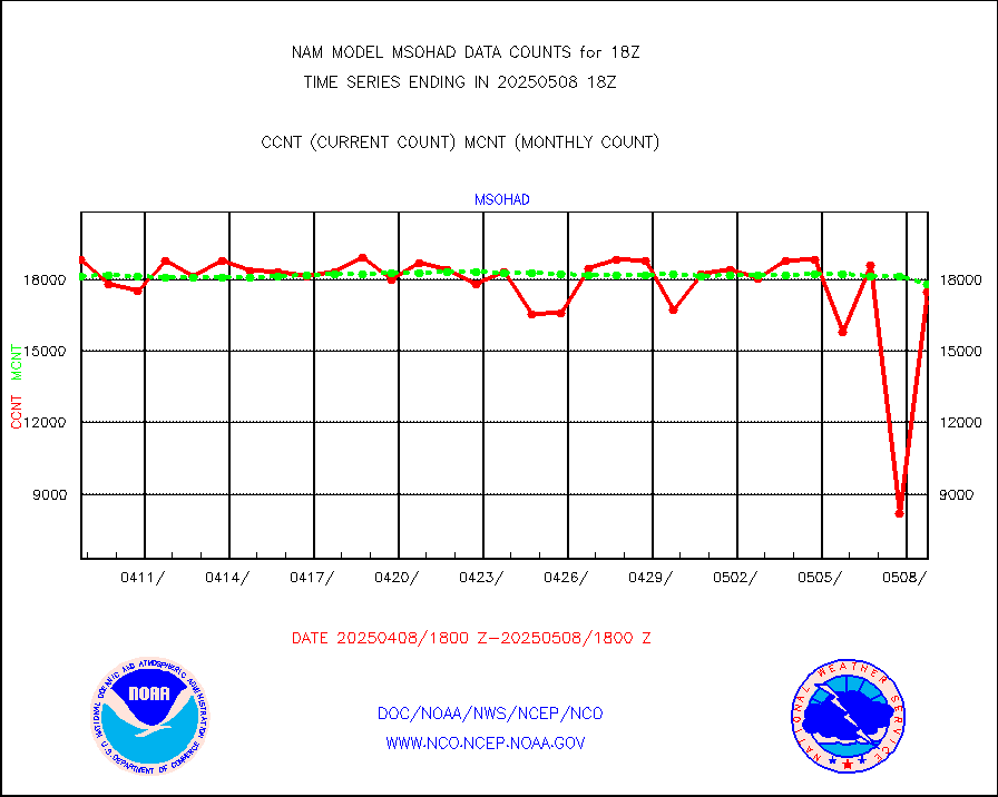
msohad |
Mesonet/MADIS NWS Hydromet Auto Data System(HADS) |
18323 |
18471 |
99.2 % |
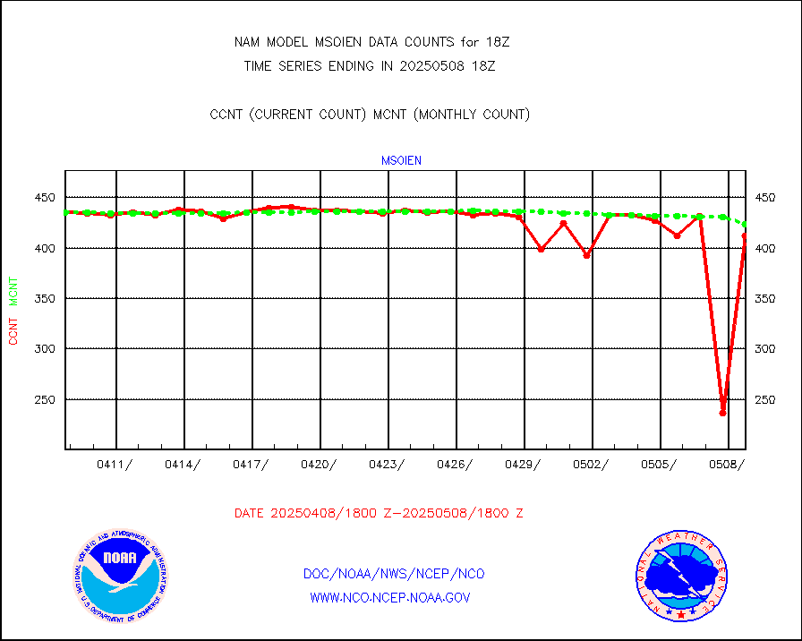
msoien |
Mesonet/MADIS Iowa Environmental |
410 |
418 |
98.1 % |
msoind |
Mesonet/MADIS Indiana Dept. of Transportation |
0 |
0 |
n/a |
msoiow |
Mesonet/MADIS Iowa Department of Transportation |
0 |
0 |
n/a |
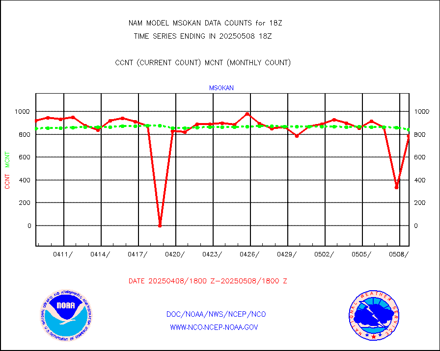
msokan |
Mesonet/MADIS Kansas Department of Transportation |
908 |
854 |
106.3 % |
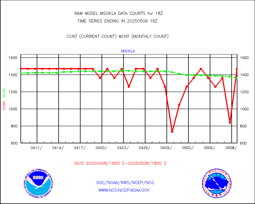
msokla |
Mesonet/MADIS Oklahoma Mesonet |
742 |
749 |
99.1 % |
msolju |
Mesonet/MADIS Louisiana State/Jackson State Univ. |
0 |
0 |
n/a |
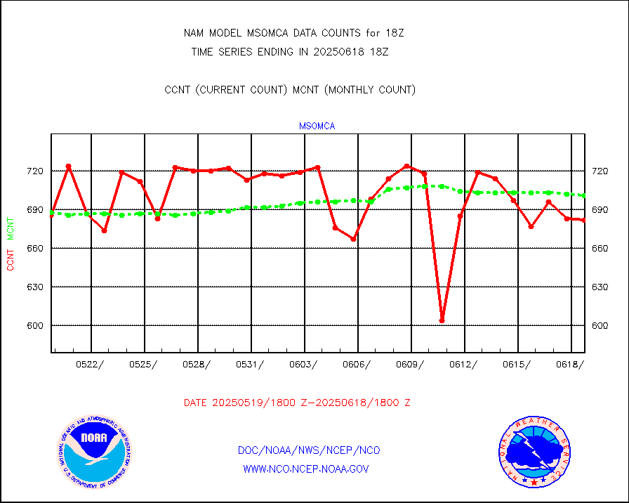
msomca |
Mesonet/MADIS Missouri Commercial Agricult Wx Net |
638 |
629 |
101.4 % |
msomin |
Mesonet/MADIS Minnesota Dept. of Transportation |
0 |
0 |
n/a |
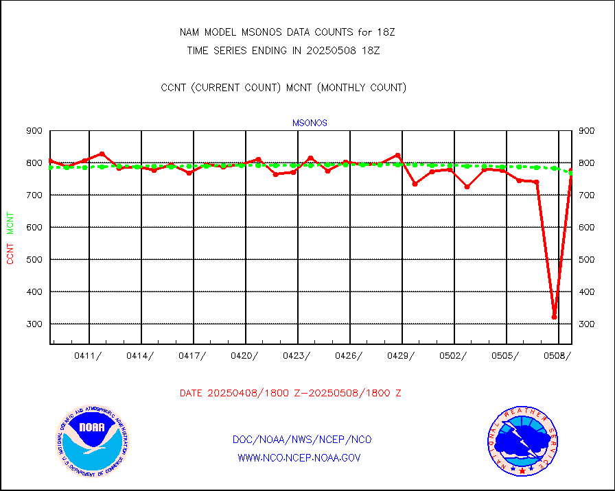
msonos |
Mesonet/MADIS NOS-Phys Oceanographic Realtime Sys |
838 |
773 |
108.4 % |
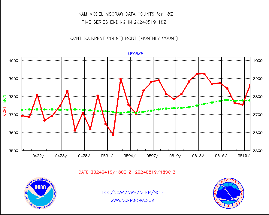
msoraw |
Mesonet/MADIS NFIC Remote Automated Wx Stns(RAWS) |
3867 |
3779 |
102.3 % |
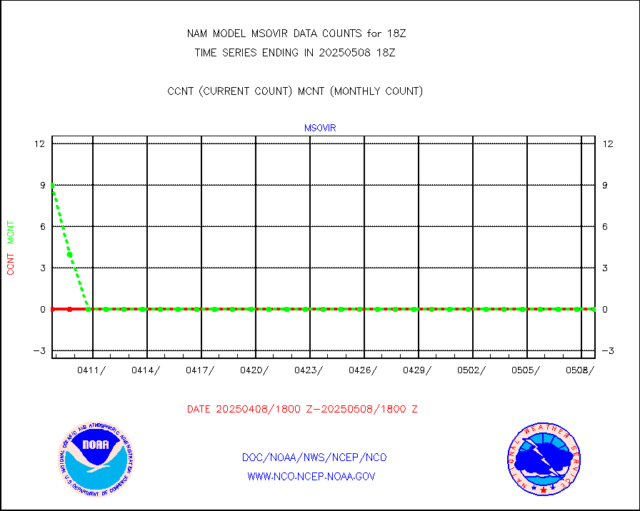
msovir |
Mesonet/MADIS Virginia Dept. of Transportation |
494 |
546 |
90.5 % |
msowfy |
Mesonet/MADIS "Weather for You" |
0 |
0 |
n/a |
msowis |
Mesonet/MADIS Wisconsin Dept. of Transportation |
0 |
0 |
n/a |
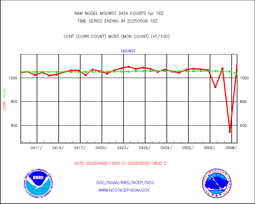
msowst |
Mesonet/MADIS MesoWest (many subproviders) |
103646 |
102962 |
100.7 % |
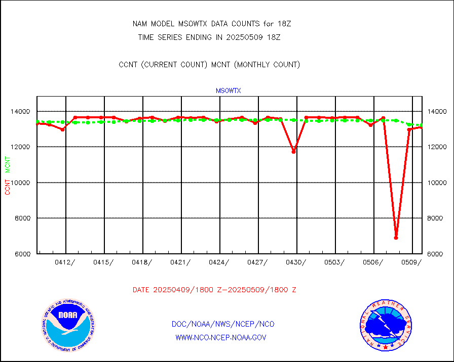
msowtx |
Mesonet/MADIS West Texas |
13068 |
13171 |
99.2 % |
nxrdw |
NEXRAD Vel Azm Dsp(VAD) winds via radar coded msg |
0 |
0 |
n/a |
pibal |
PIBAL (from PILOT, PILOT SHIP, PILOT MOBIL) |
0 |
0 |
n/a |
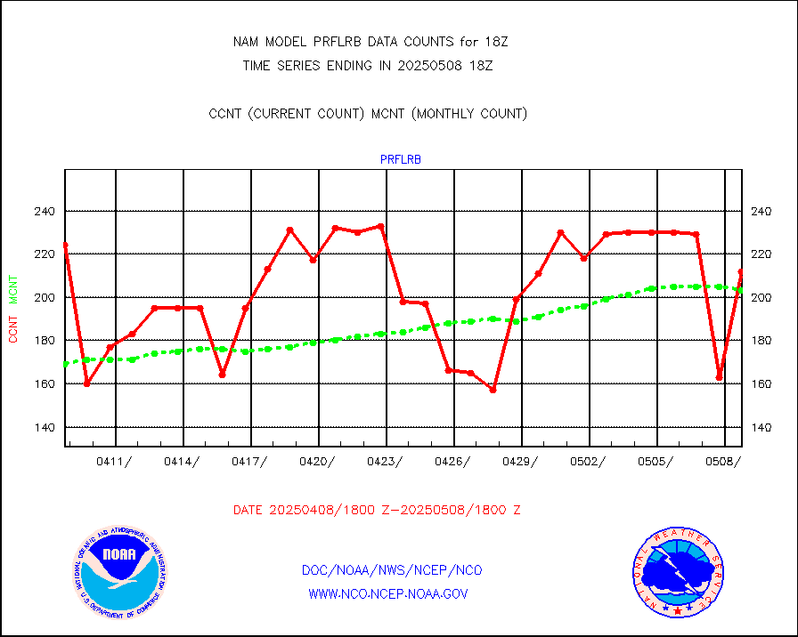
prflrb |
Multi-Agency Profiler (MAP) and SODAR winds |
150 |
180 |
83.3 % |
prflrp |
Profilr winds from PIBAL (PILOT,PILOT SHIP/MOBIL) |
0 |
0 |
n/a |
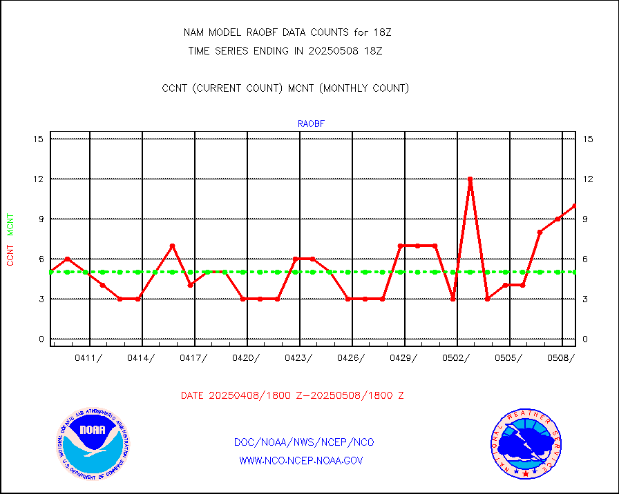
raobf |
Rawinsonde - fixed land (from TEMP or PILOT) |
3 |
5 |
60.0 % |
raobm |
Rawinsonde - mobile land (from TEMP/PILOT MOBIL) |
0 |
0 |
n/a |
raobs |
Rawinsonde - ship (from TEMP SHIP, PILOT SHIP) |
0 |
0 |
n/a |
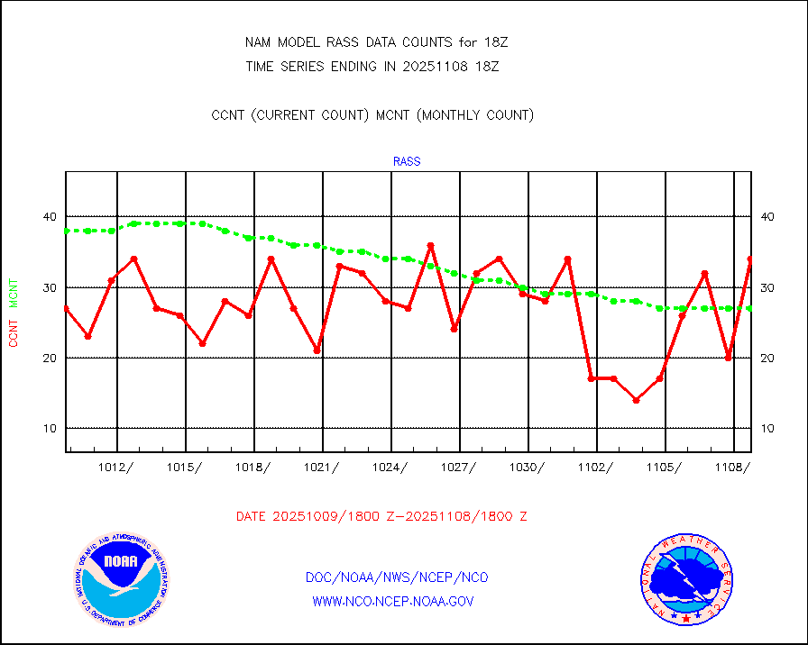
rass |
RASS temperatures (NOAA and Multi-Agency) |
49 |
58 |
84.5 % |
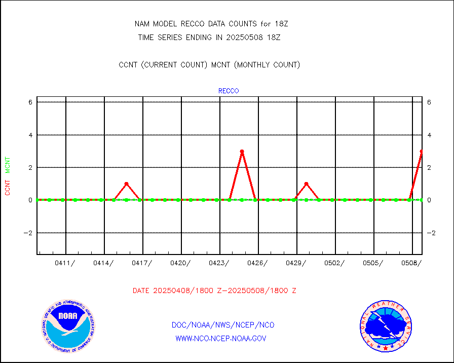
recco |
Flight level reconnaissance aircraft data |
0 |
0 |
n/a |
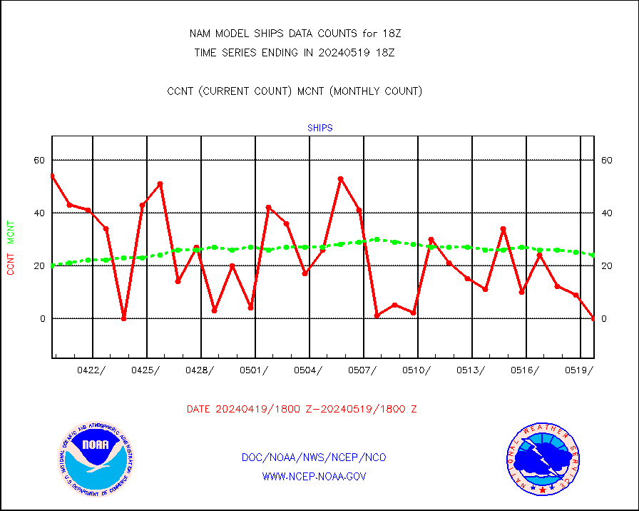
ships |
Ship - manual and automatic, restricted |
0 |
24 |
0.0 % |
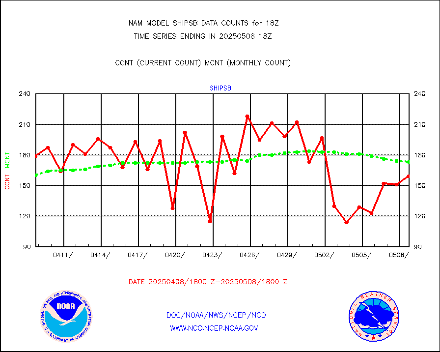
shipsb |
Ship - manual and automatic, restricted (BUFR) |
151 |
112 |
134.8 % |
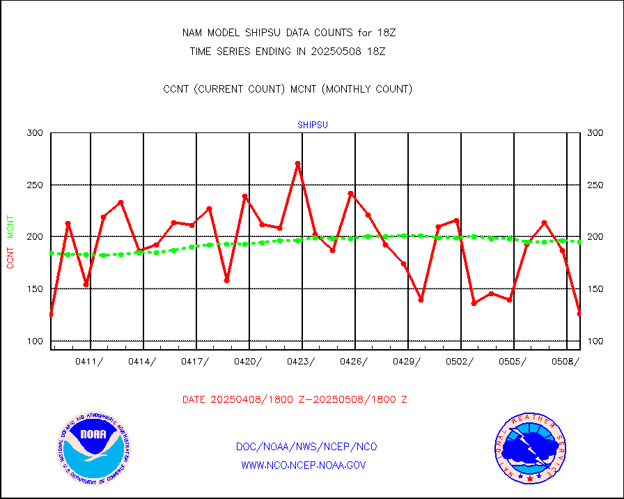
shipsu |
Ship - manual and automatic, unrestricted |
166 |
158 |
105.1 % |
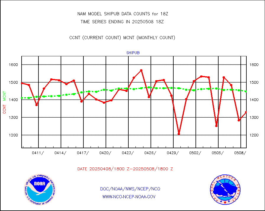
shipub |
Ship - manual and automatic, unrestricted (BUFR) |
1490 |
1492 |
99.9 % |
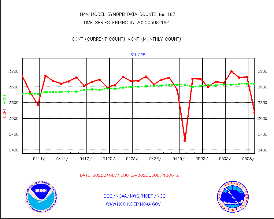
synopb |
Synoptic - fixed manual & auto (decoded fr BUFR) |
3643 |
3566 |
102.2 % |
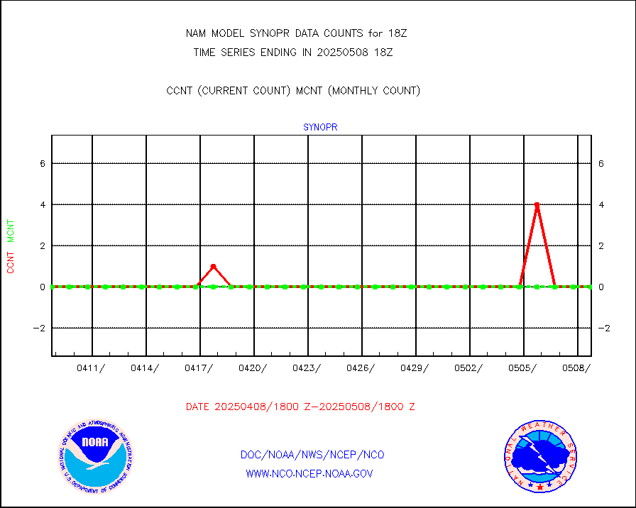
synopr |
Synoptic - restricted (WMO Res 40) manual & auto. |
0 |
0 |
n/a |
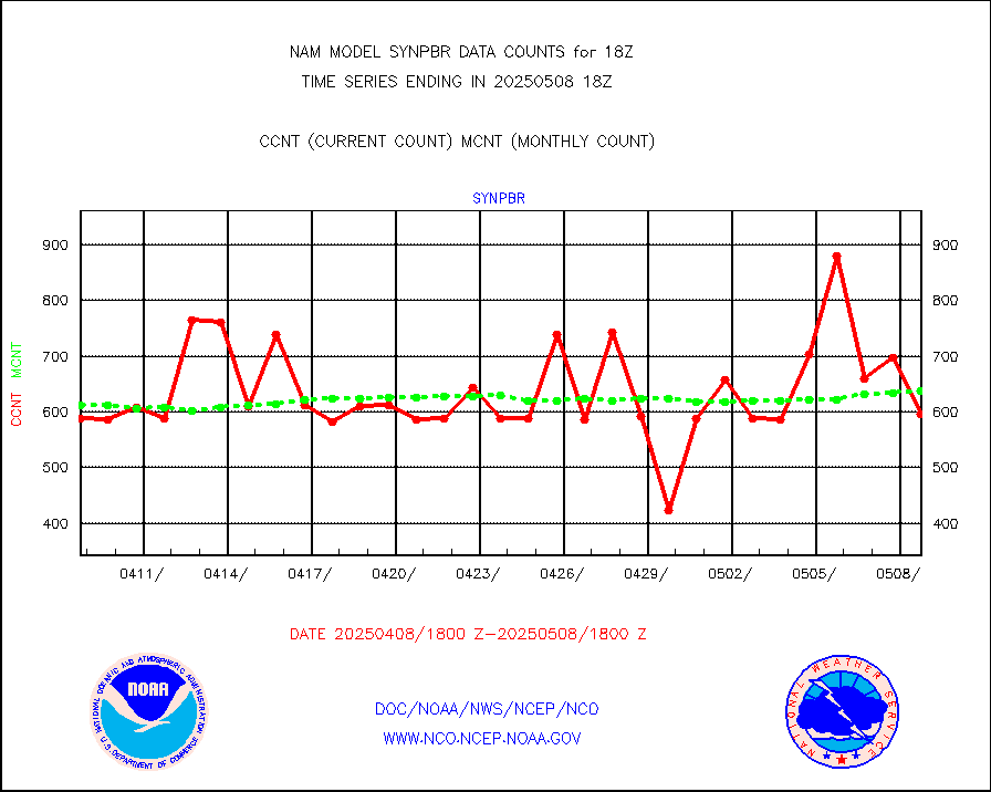
synpbr |
Synoptic - restricted (WMO Res 40)(decoded BUFR) |
587 |
634 |
92.6 % |
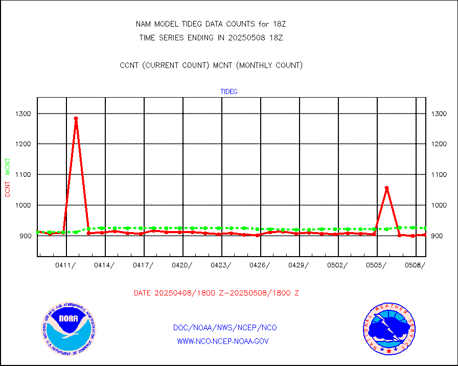
tideg |
Tide gauge reports decoded from CREX format |
898 |
895 |
100.3 % |
| Data Types of Opportunity with Normal Counts |
|---|
| Type | Description | Hourly Count | Monthly Average | Percent (%) of Monthly Mean |
acarsa |
MDCRS ACARS acft data (ARINC via AFWA)(AIREP fmt) |
0 |
0 |
n/a |
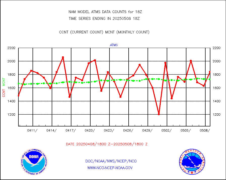
atms |
NPP/NOAA-20 ATMS brightness temperatures |
154744 |
170268 |
90.9 % |
cris |
NPP CrIS apodized radiances (399 channel) |
0 |
0 |
n/a |
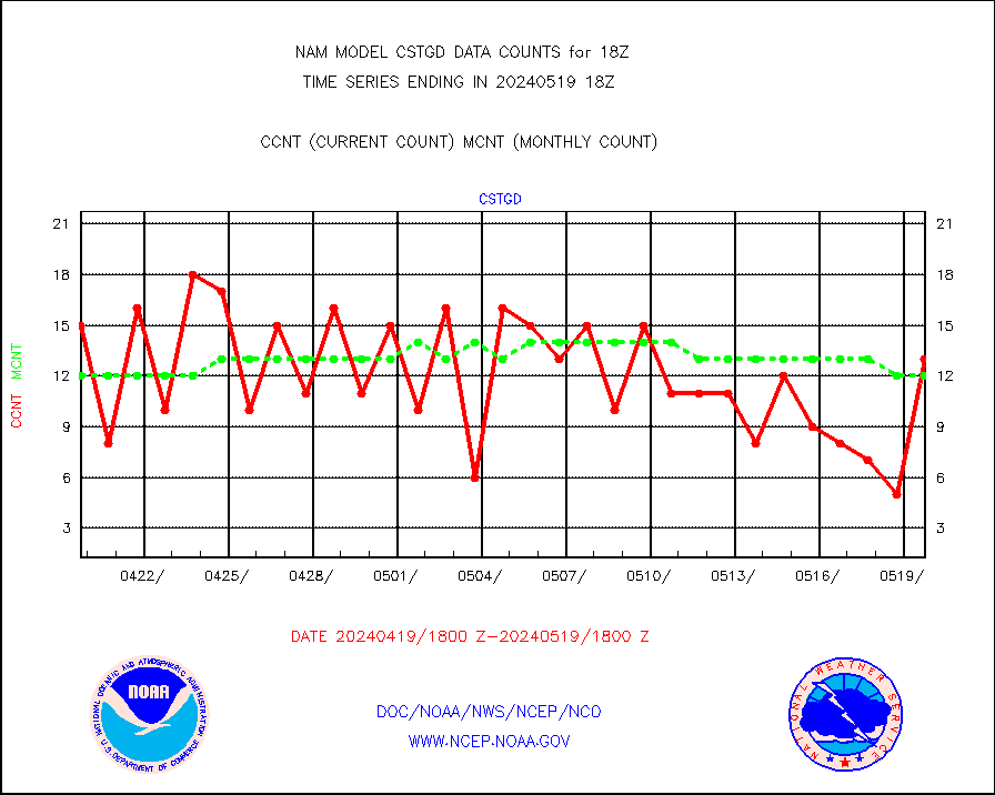
cstgd |
Coast Guard |
13 |
12 |
108.3 % |
dbuoyb |
Drifting buoys (decoded from BUFR) |
812 |
772 |
105.2 % |
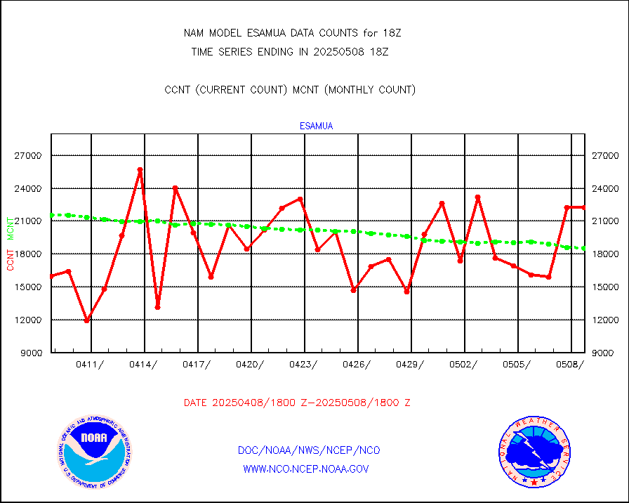
esamua |
NOAA 15-19 & METOP 1-2 AMSU-A proc btmps frm RARS |
24918 |
22224 |
112.1 % |
eshrs3 |
NOAA 15-19 & METOP 1-2 HIRS-3/4 pr btmps frm RARS |
52164 |
46432 |
112.3 % |
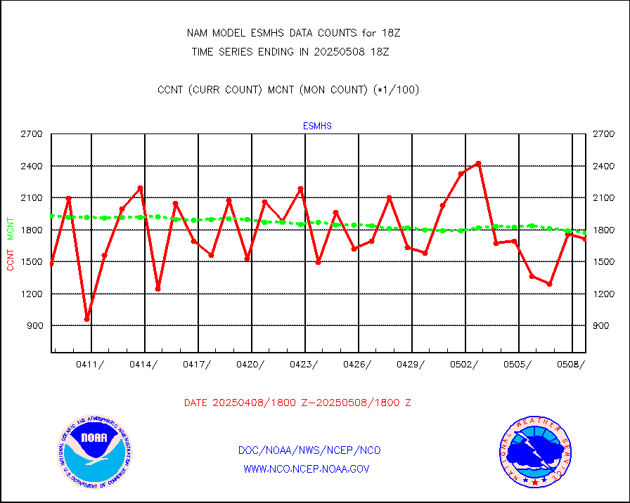
esmhs |
NOAA 18-19 & METOP 1-2 MHS proc. btemps from RARS |
201956 |
175183 |
115.3 % |
geosth |
GOES/NESDIS hi-resol. (1x1 f-o-v) cloud data |
0 |
0 |
n/a |
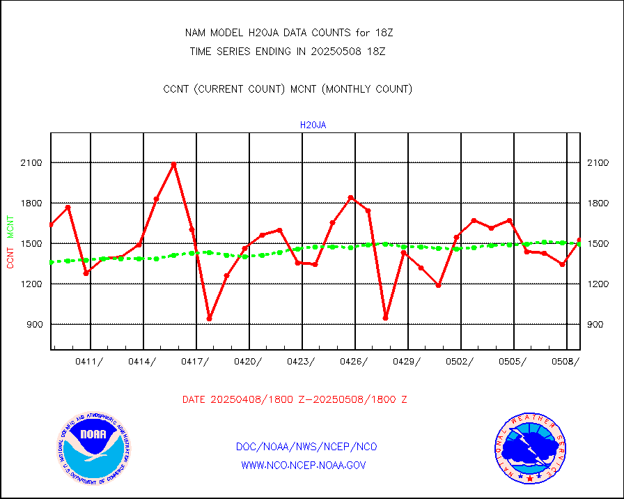
h20ja |
MTSAT/JMA water vapor imager derived cloud motion |
1441 |
1518 |
94.9 % |
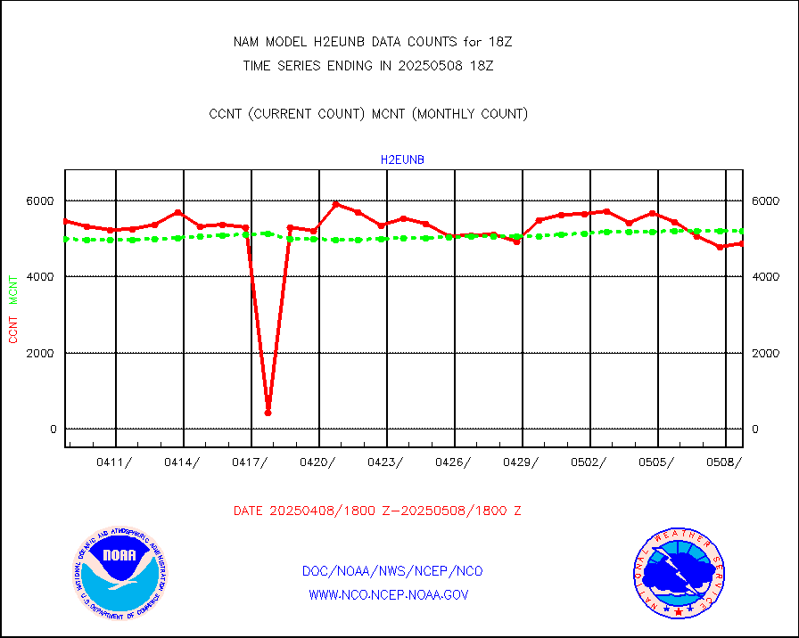
h2eunb |
METEOSAT/EUMETSAT wvpr imgr drv cld motion NBseq |
6008 |
5429 |
110.7 % |
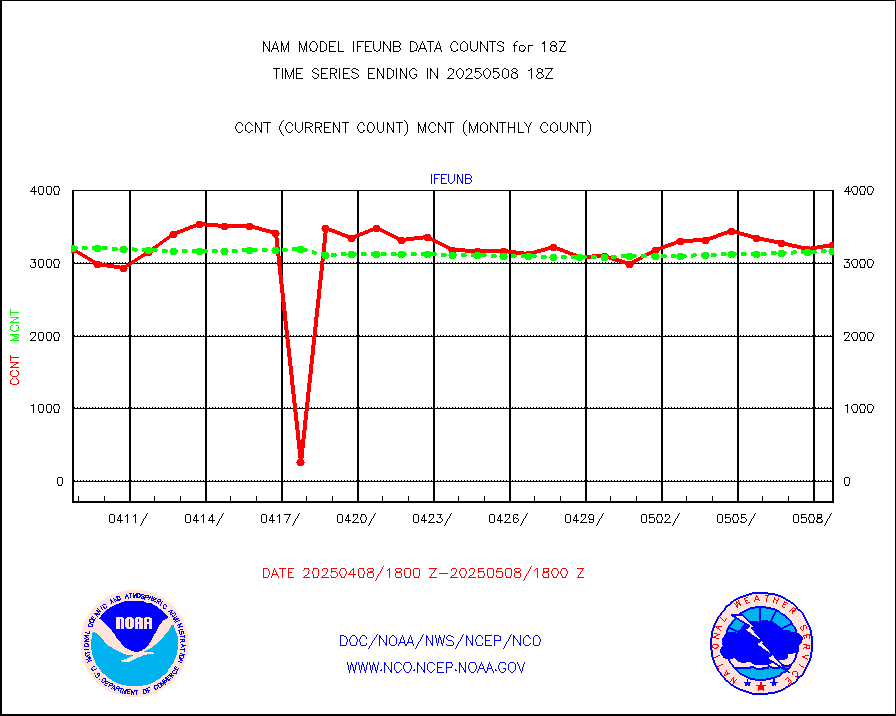
ifeunb |
METEOSAT/EUMETSAT ir lg-wave drv cld motion NBseq |
3398 |
3295 |
103.1 % |
ifvrnb |
VIIRS (NPP/NOAA-20) ir lg-wv drv cloud motion(NB) |
0 |
0 |
n/a |
infav |
AVHRR (NOAA/METOP) ir lg-wave derived cld motion |
0 |
0 |
n/a |
infav1 |
AVHRR (METOP) ir lg-wave derived cld motion |
0 |
0 |
n/a |
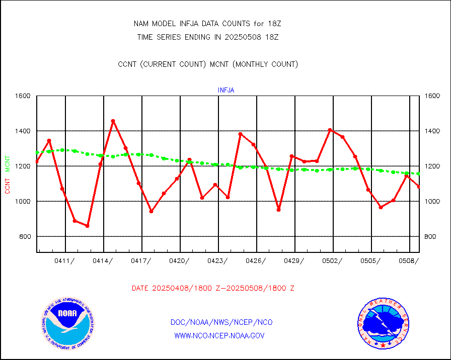
infja |
MTSAT/JMA infrared long-wave derived cloud motion |
1170 |
1272 |
92.0 % |
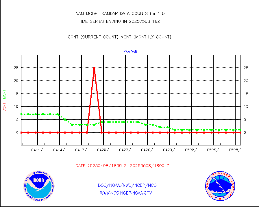
kamdar |
Korean AMDAR aircraft data (decoded from BUFR) |
0 |
2 |
0.0 % |
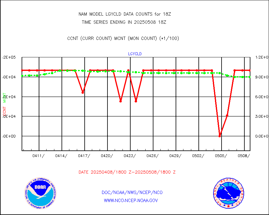
lgycld |
GOES/NASA(Langley) hi-res. (1x1 f-o-v) cloud data |
4204695 |
3469909 |
121.2 % |
mbuoyb |
Moored buoys (decoded from BUFR) |
1439 |
1353 |
106.4 % |
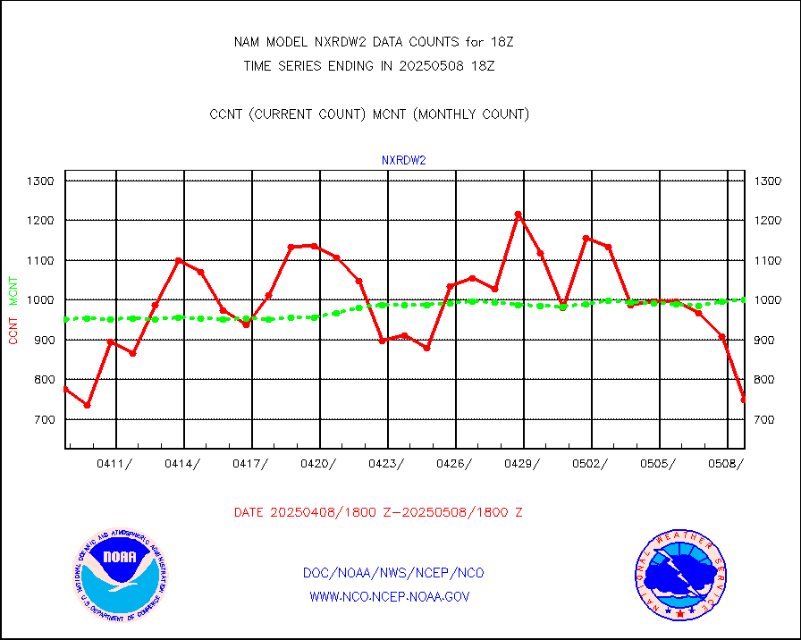
nxrdw2 |
NEXRAD Vel Azm Dsp(VAD) winds via Level 2 decoder |
1124 |
1067 |
105.3 % |
osbuv8 |
NOAA 16-19 Solar Backscatter UV-2 rad frm V8 BUFR |
0 |
0 |
n/a |
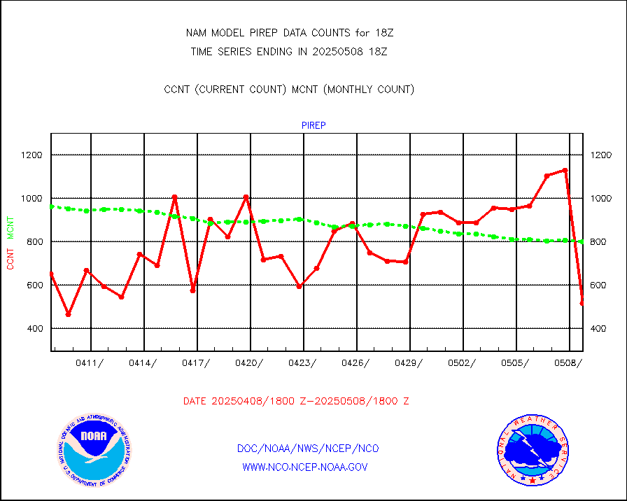
pirep |
Manual PIREP aircraft data (dcded from AIREP fmt) |
632 |
759 |
83.3 % |
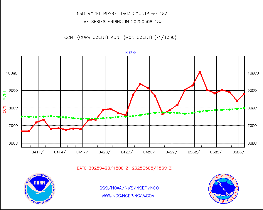
rd2rft |
NEXRAD reflectivity (Lvl 2 - GTS) |
8423856 |
8330306 |
101.1 % |
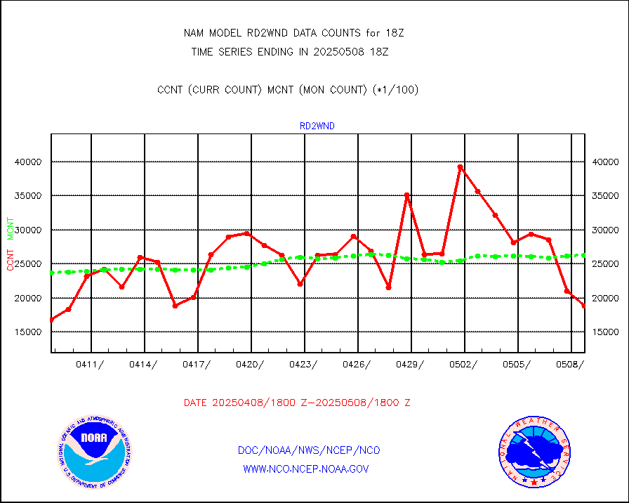
rd2wnd |
NEXRAD radial wind (Level 2 - GTS) |
3299776 |
3056802 |
107.9 % |
sevcsr |
METEOSAT-10 2nd Gen SEVIRI Clr Sky Radiance(proc) |
0 |
0 |
n/a |
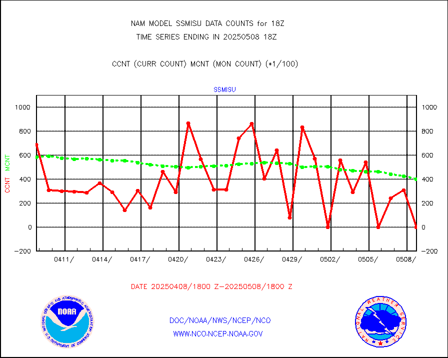
ssmisu |
DMSP SSM/IS 1C radiance data (Unified Pre-Proc.) |
42990 |
35788 |
120.1 % |
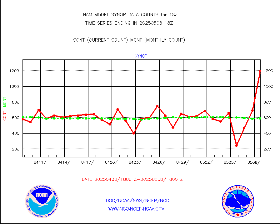
synop |
Synoptic - fixed manual and automatic |
715 |
760 |
94.1 % |
synpmb |
Synoptic - mobile manual & auto (decoded fr BUFR) |
0 |
0 |
n/a |
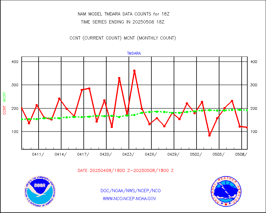
tmdara |
TAMDAR aircft data-all types(from Panasonic,BUFR) |
996 |
975 |
102.2 % |
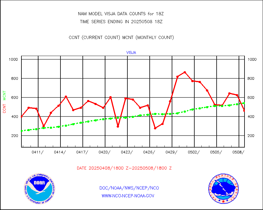
visja |
MTSAT/JMA visible derived cloud motion |
756 |
637 |
118.7 % |
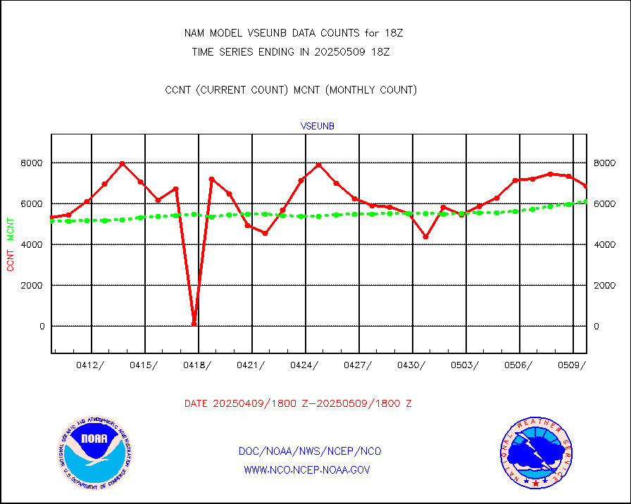
vseunb |
METEOSAT/EUMETSAT visible drv cld motion NBseq |
8164 |
7660 |
106.6 % |


