| Critical Data with Normal Counts |
|---|
| Type | Description | Hourly Count | Monthly Average | Percent (%) of Monthly Mean |
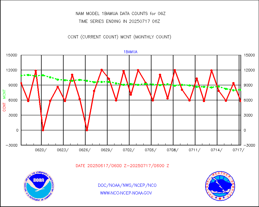
1bamua |
NOAA 15-19 & METOP 1-2 AMSU-A NCEP-proc. br.temps |
15176 |
12618 |
120.3 % |
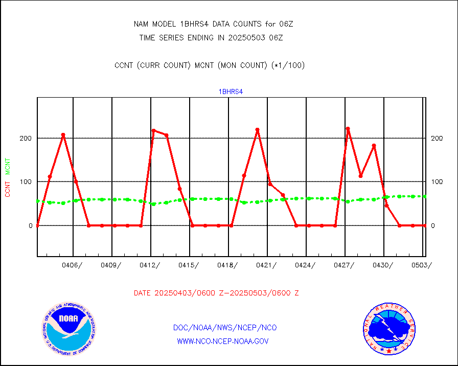
1bhrs4 |
NOAA 18-19 & METOP 1-2 HIRS-4 NCEP-proc. br.temps |
8951 |
7776 |
115.1 % |
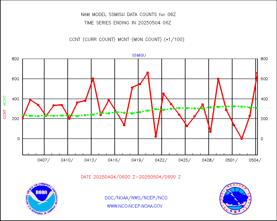
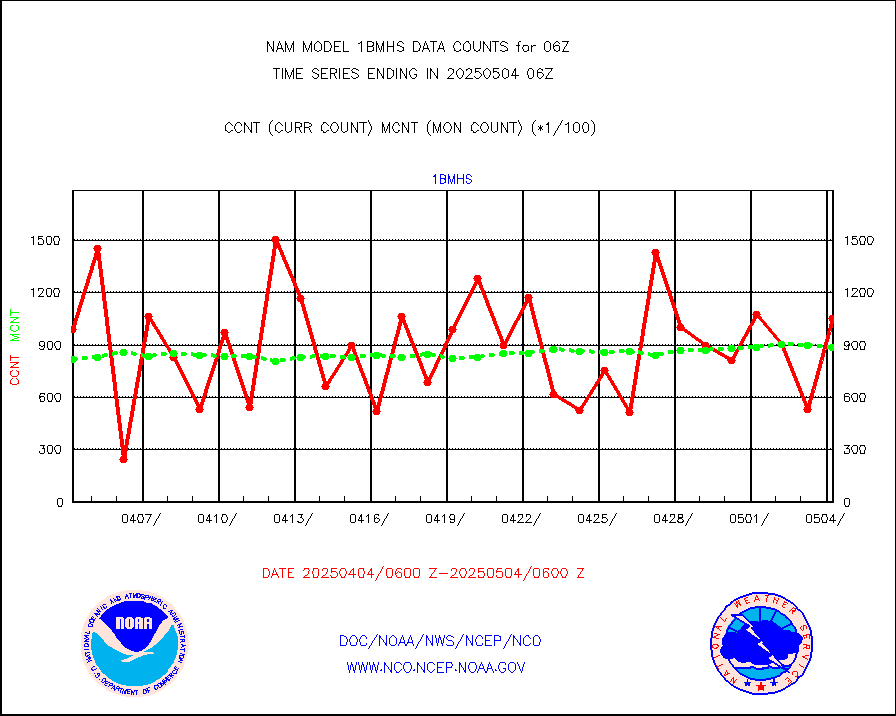
1bmhs |
NOAA 18-19 & METOP 1-2 MHS NCEP-proces. br. temps |
136812 |
92468 |
148.0 % |
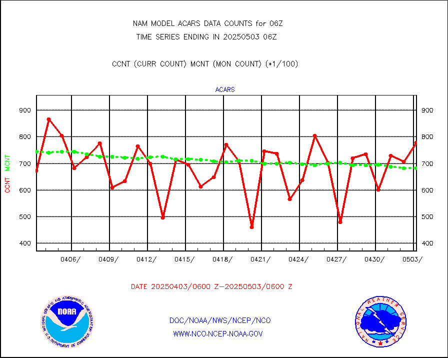
acars |
MDCRS ACARS acft data from ARINC(dcded from BUFR) |
53299 |
52309 |
101.9 % |
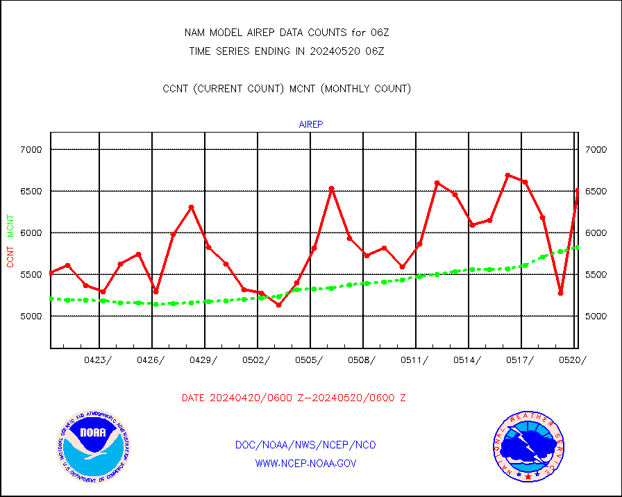
airep |
Manual AIREP aircraft data (dcded from AIREP fmt) |
5815 |
5404 |
107.6 % |
airsev |
AQUA AIRS/AMSU-A/HSB brightness temps- every FOV |
0 |
0 |
n/a |
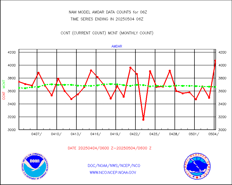
amdar |
AMDAR aircraft data (decoded from AMDAR format) |
3933 |
3824 |
102.9 % |
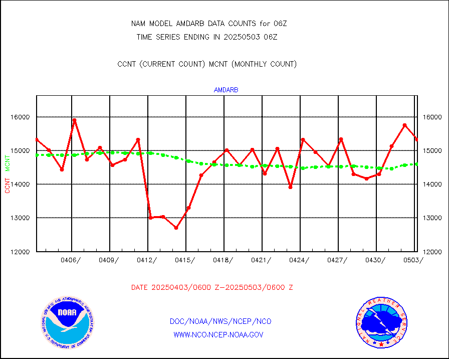
amdarb |
AMDAR aircraft data (decoded from BUFR) |
7189 |
7674 |
93.7 % |
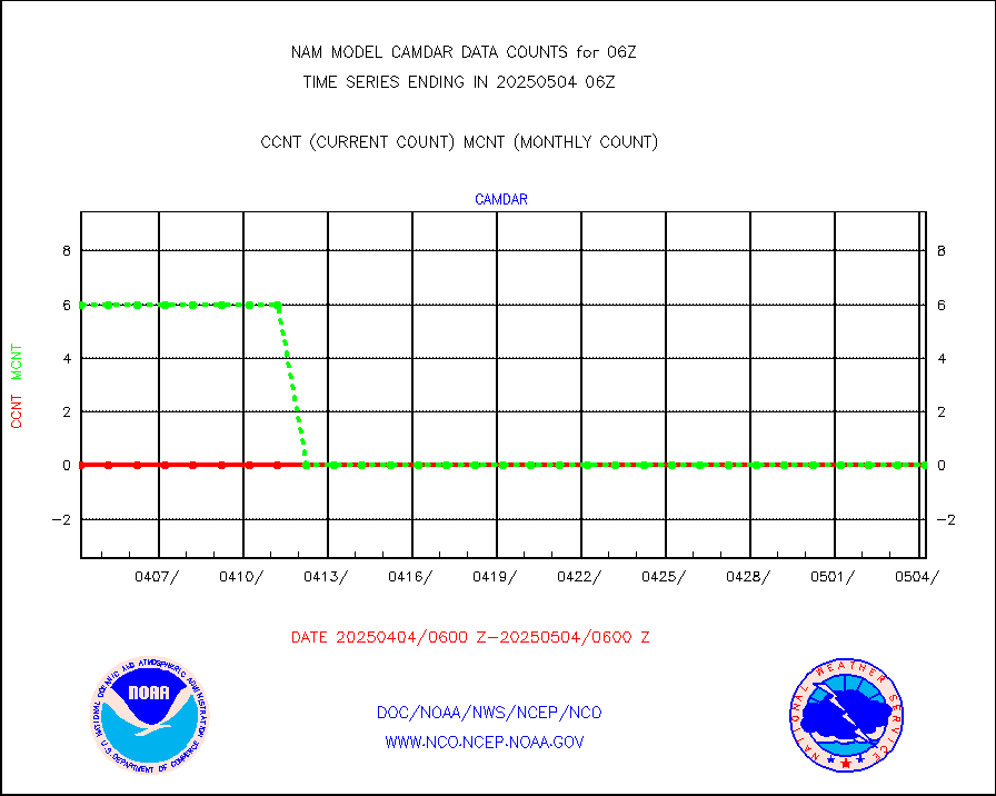
camdar |
Canadian AMDAR aircraft data (decoded from BUFR) |
0 |
3 |
0.0 % |
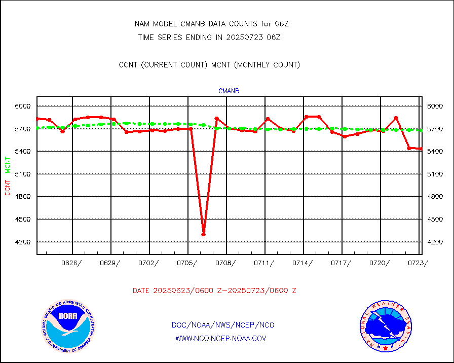
cmanb |
Surface Marine CMAN rpts decoded from BUFR format |
5622 |
5423 |
103.7 % |
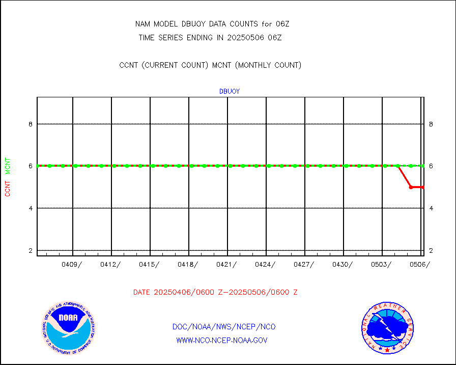
dbuoy |
Buoys decoded from FM-18 fmt (moored or drifting) |
4 |
4 |
100.0 % |
dropw |
Dropwinsonde (from TEMP DROP) |
0 |
0 |
n/a |
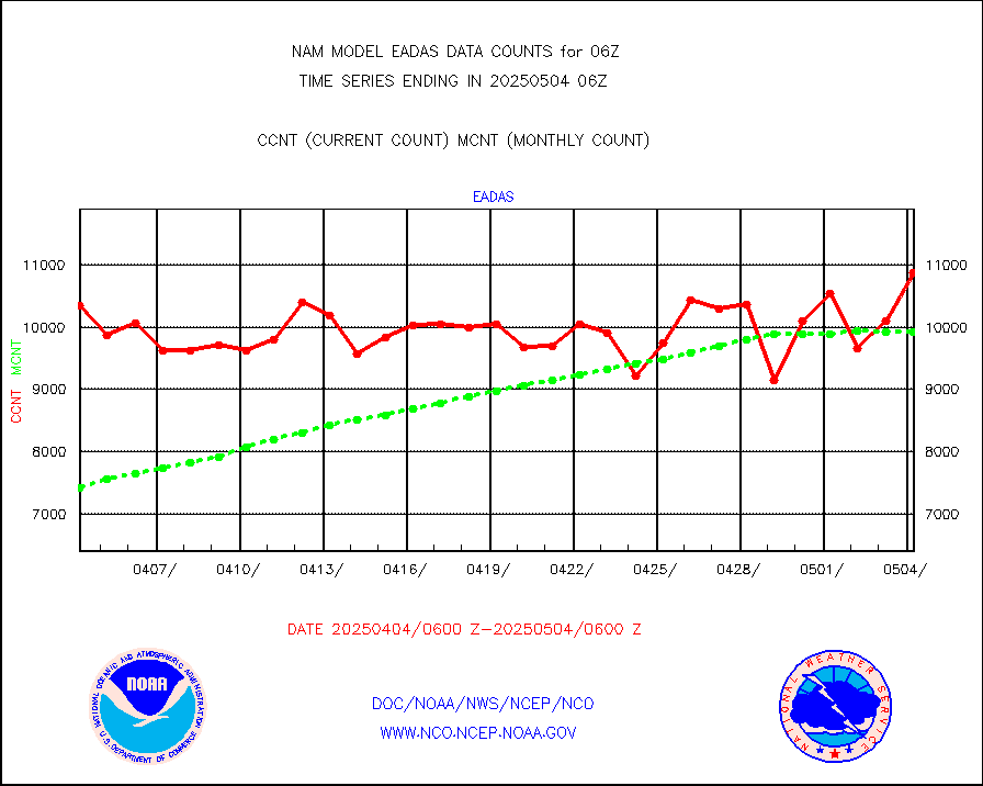
eadas |
E-AMDAR (European AMDAR acft decoded from BUFR) |
7680 |
7539 |
101.9 % |
geost1 |
GOES/NESDIS hi-resol. (1x1 f-o-v) sndgs/radiances |
0 |
0 |
n/a |
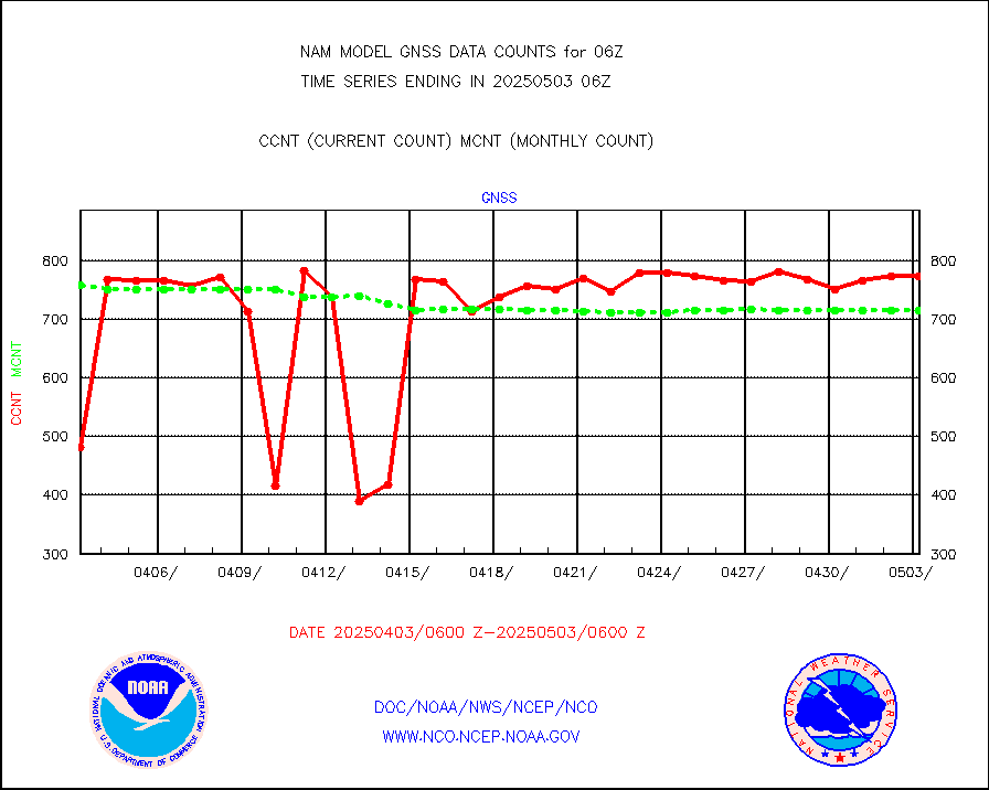
gnss |
Grnd-based Gbl Navigation Sat System (GNSS) data |
902 |
950 |
94.9 % |
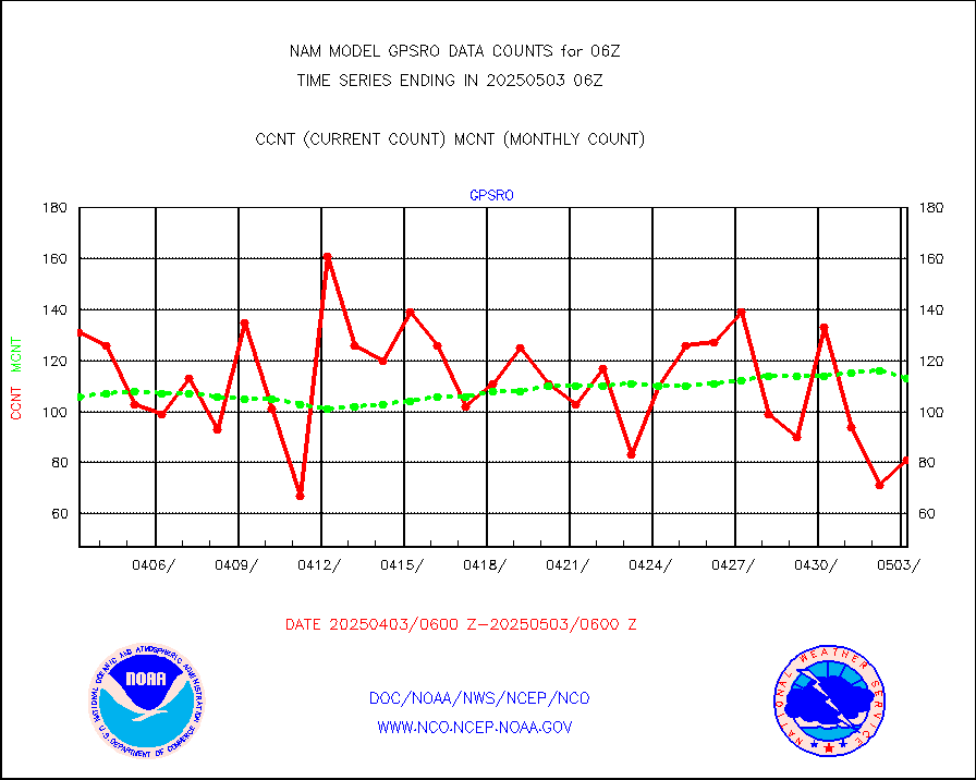
gpsro |
GPS radio occultation data |
103 |
81 |
127.2 % |
h20mo |
MODIS (AQUA/TERRA) wvpr imager derived cld motion |
0 |
0 |
n/a |
infmo |
MODIS (AQUA/TERRA) ir l-wave derived cloud motion |
0 |
0 |
n/a |
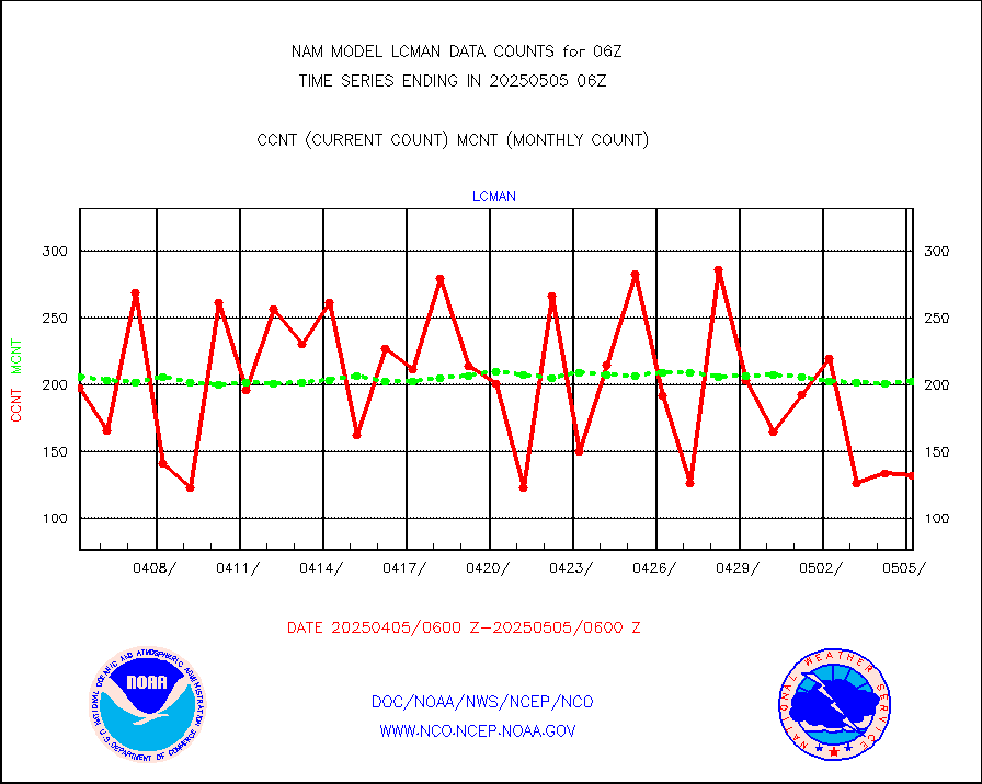
lcman |
Land-based CMAN stations decoded from CMAN format |
244 |
225 |
108.4 % |
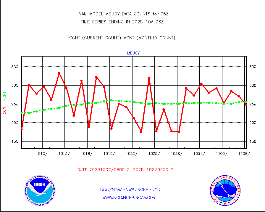
mbuoy |
Buoys decoded from FM-13 format (moored) |
241 |
203 |
118.7 % |
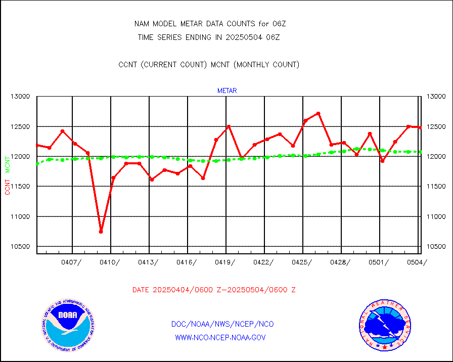
metar |
Aviation - METAR |
12375 |
12040 |
102.8 % |
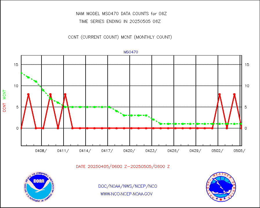
mso470 |
Mesonet/MADIS Colorado E-470 (Interstate 470) |
49 |
43 |
114.0 % |
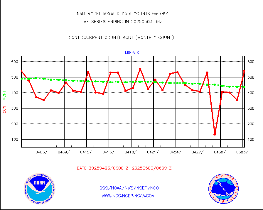
msoalk |
Mesonet/MADIS Alaska Department of Transportation |
490 |
433 |
113.2 % |
msoapg |
Mesonet/MADIS U.S. Army Aberdeen Proving Grounds |
0 |
0 |
n/a |
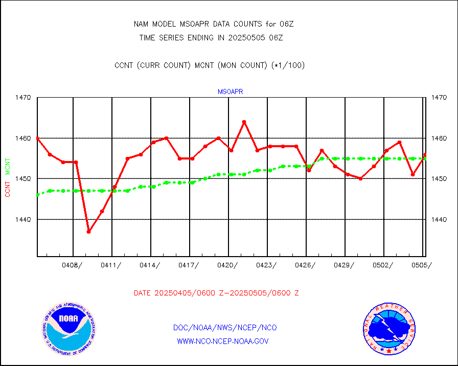
msoapr |
Mesonet/MADIS Citizen Weather Observers Program |
109175 |
104467 |
104.5 % |
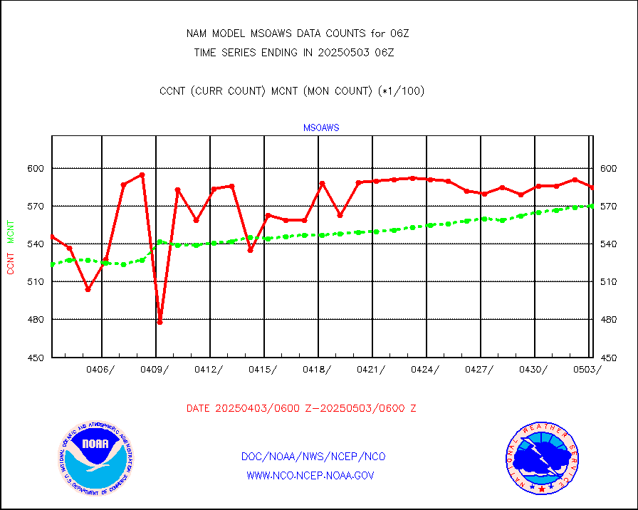
msoaws |
Mesonet/MADIS AWS Convergence Technologies, Inc. |
63373 |
62156 |
102.0 % |
msoawx |
Mesonet/MADIS "Anything Weather" |
0 |
0 |
n/a |
msocol |
Mesonet/MADIS Colorado Dept. of Transportation |
0 |
0 |
n/a |
msodcn |
Mesonet/MADIS DC Net |
0 |
0 |
n/a |
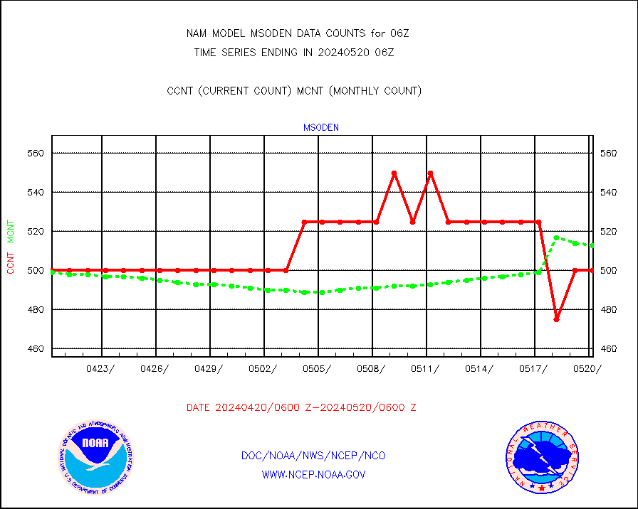
msoden |
Mesonet/MADIS Denver Urban Drainage & Flood Cntrl |
550 |
492 |
111.8 % |
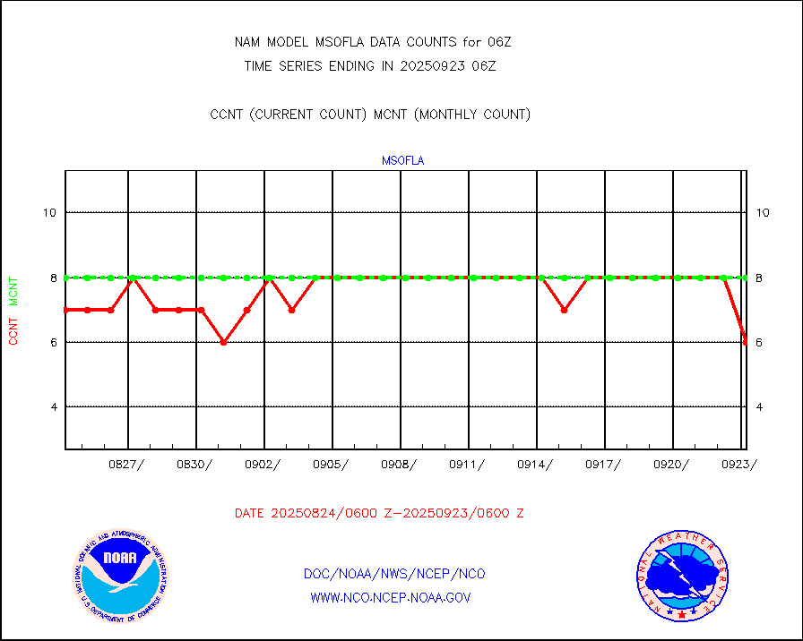
msofla |
Mesonet/MADIS Florida (FAWN & USF) |
8 |
7 |
114.3 % |
msoflt |
Mesonet/MADIS Florida Dept. of Transportation |
0 |
0 |
n/a |
msogeo |
Mesonet/MADIS Georgia Dept. of Transportation |
0 |
0 |
n/a |
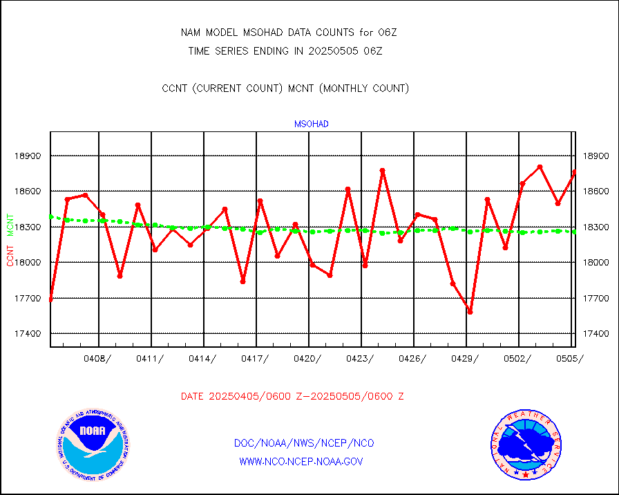
msohad |
Mesonet/MADIS NWS Hydromet Auto Data System(HADS) |
18938 |
17951 |
105.5 % |
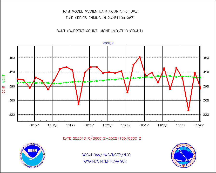
msoien |
Mesonet/MADIS Iowa Environmental |
408 |
411 |
99.3 % |
msoind |
Mesonet/MADIS Indiana Dept. of Transportation |
0 |
0 |
n/a |
msoiow |
Mesonet/MADIS Iowa Department of Transportation |
0 |
0 |
n/a |
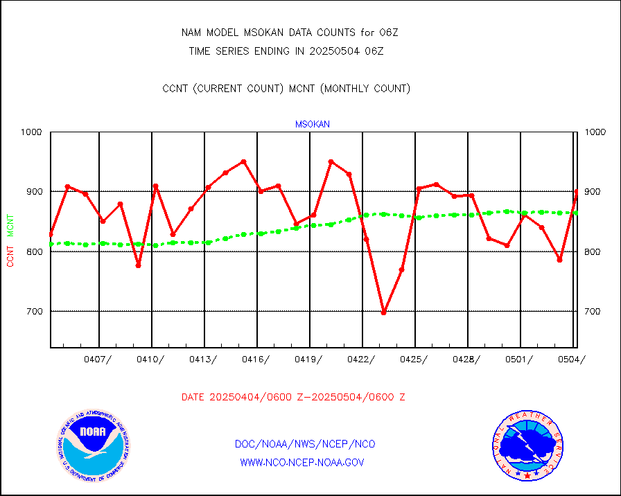
msokan |
Mesonet/MADIS Kansas Department of Transportation |
847 |
789 |
107.4 % |
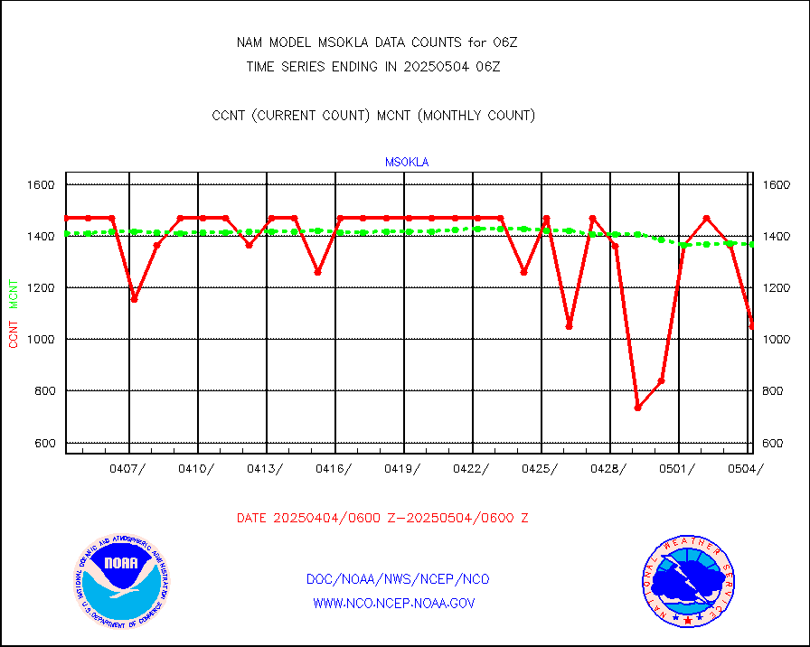
msokla |
Mesonet/MADIS Oklahoma Mesonet |
742 |
767 |
96.7 % |
msolju |
Mesonet/MADIS Louisiana State/Jackson State Univ. |
0 |
0 |
n/a |
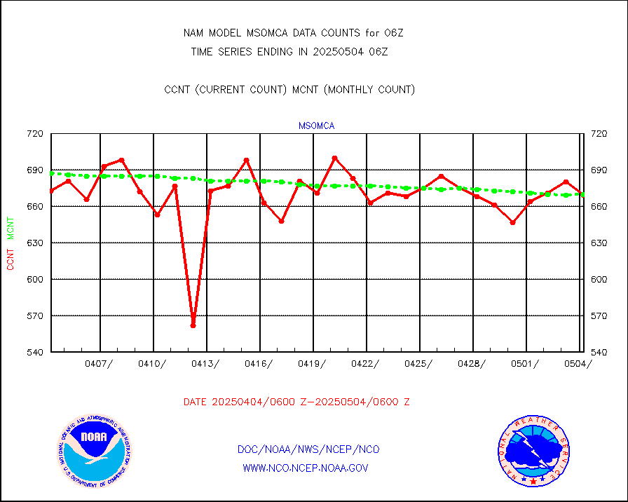
msomca |
Mesonet/MADIS Missouri Commercial Agricult Wx Net |
568 |
593 |
95.8 % |
msomin |
Mesonet/MADIS Minnesota Dept. of Transportation |
0 |
0 |
n/a |
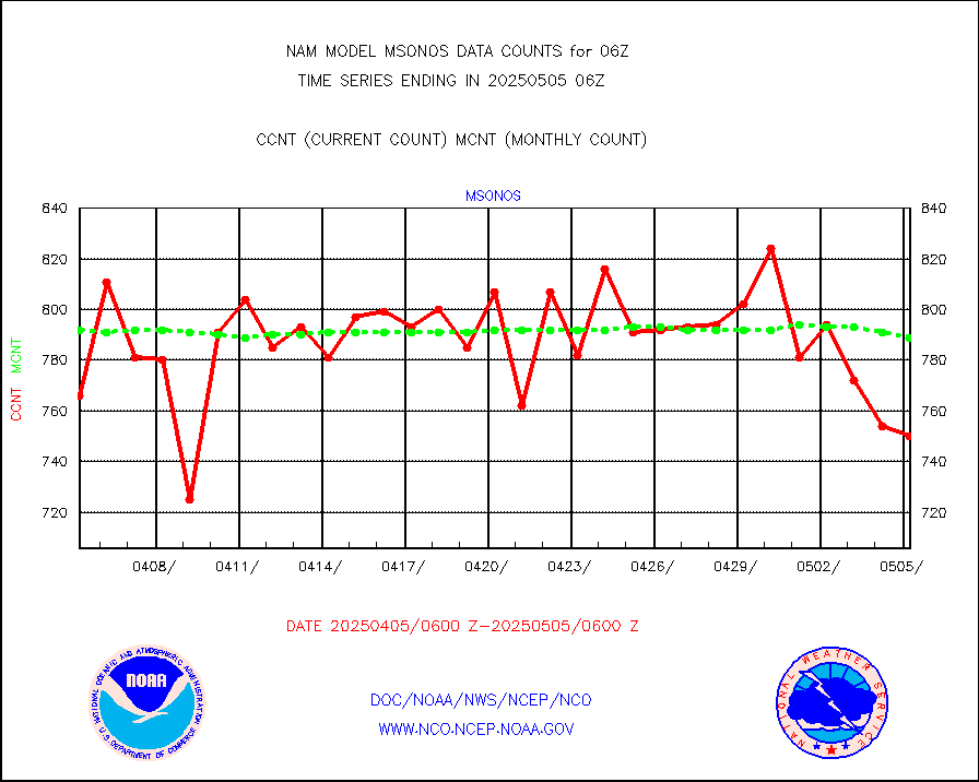
msonos |
Mesonet/MADIS NOS-Phys Oceanographic Realtime Sys |
784 |
745 |
105.2 % |
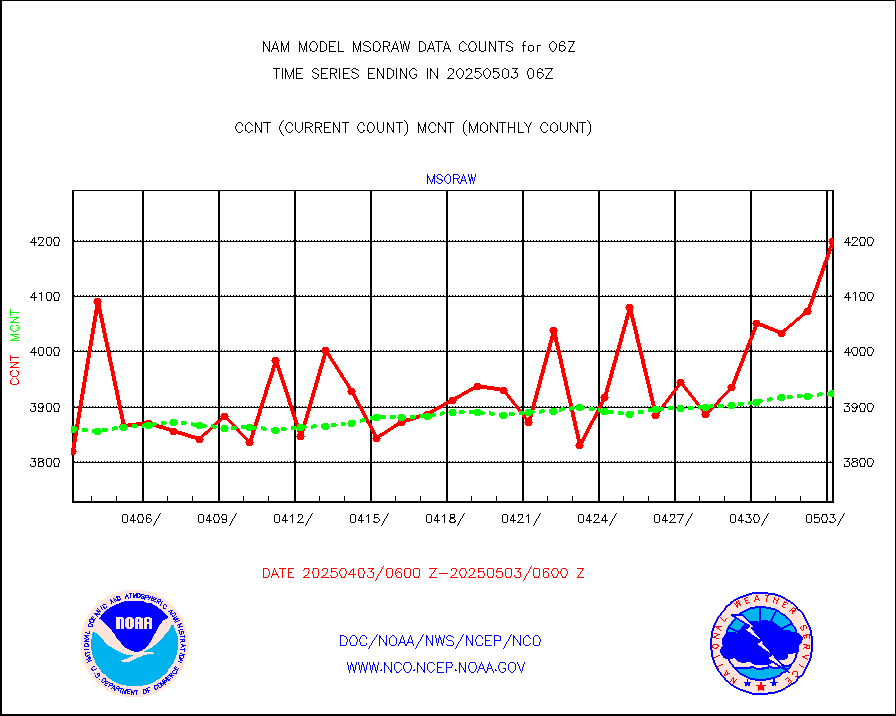
msoraw |
Mesonet/MADIS NFIC Remote Automated Wx Stns(RAWS) |
4129 |
3638 |
113.5 % |
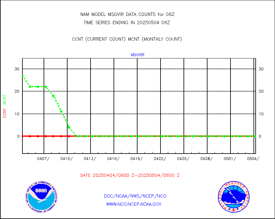
msovir |
Mesonet/MADIS Virginia Dept. of Transportation |
542 |
554 |
97.8 % |
msowfy |
Mesonet/MADIS "Weather for You" |
0 |
0 |
n/a |
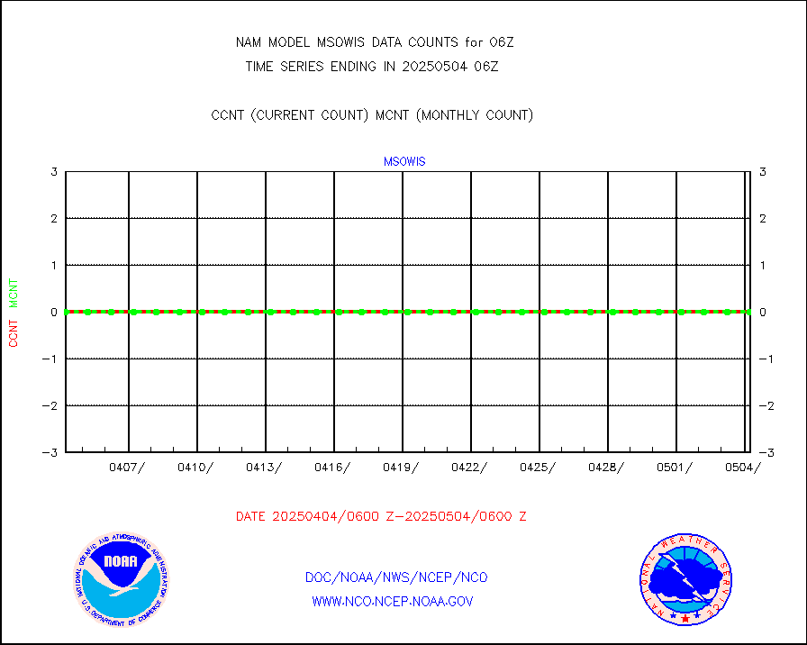
msowis |
Mesonet/MADIS Wisconsin Dept. of Transportation |
0 |
0 |
n/a |
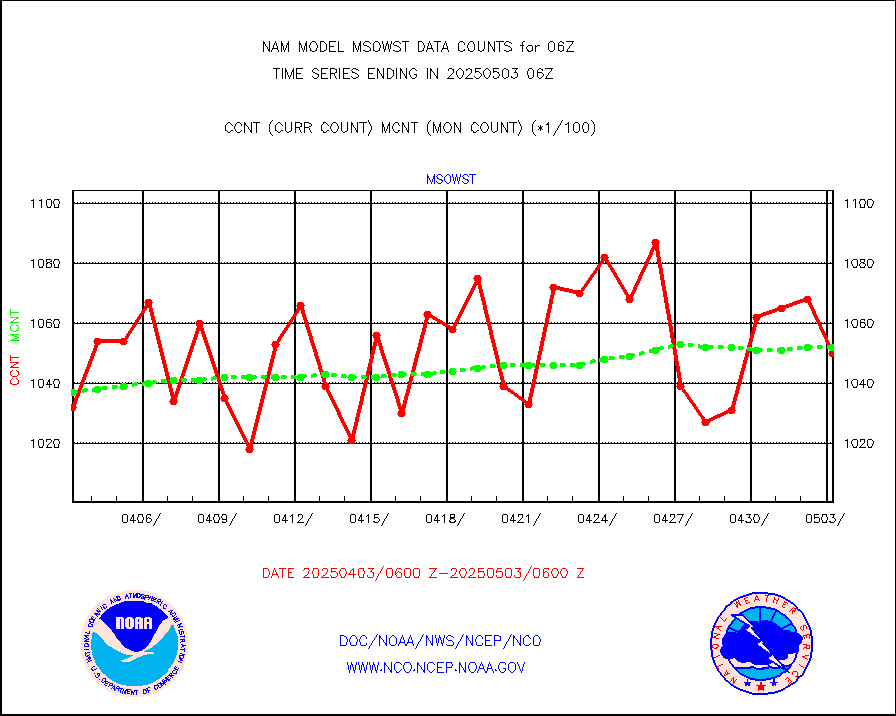
msowst |
Mesonet/MADIS MesoWest (many subproviders) |
108151 |
101026 |
107.1 % |
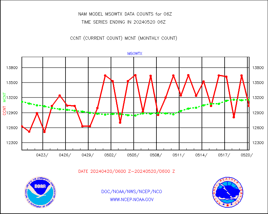
msowtx |
Mesonet/MADIS West Texas |
13203 |
12886 |
102.5 % |
nxrdw |
NEXRAD Vel Azm Dsp(VAD) winds via radar coded msg |
0 |
0 |
n/a |
pibal |
PIBAL (from PILOT, PILOT SHIP, PILOT MOBIL) |
0 |
0 |
n/a |
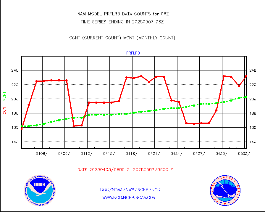
prflrb |
Multi-Agency Profiler (MAP) and SODAR winds |
204 |
173 |
117.9 % |
prflrp |
Profilr winds from PIBAL (PILOT,PILOT SHIP/MOBIL) |
0 |
0 |
n/a |
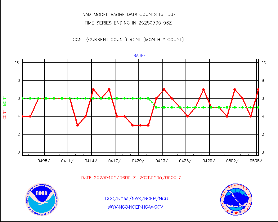
raobf |
Rawinsonde - fixed land (from TEMP or PILOT) |
5 |
5 |
100.0 % |
raobm |
Rawinsonde - mobile land (from TEMP/PILOT MOBIL) |
0 |
0 |
n/a |
raobs |
Rawinsonde - ship (from TEMP SHIP, PILOT SHIP) |
0 |
0 |
n/a |
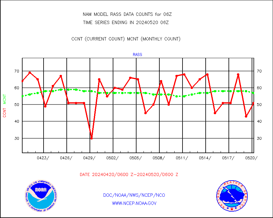
rass |
RASS temperatures (NOAA and Multi-Agency) |
50 |
56 |
89.3 % |
recco |
Flight level reconnaissance aircraft data |
0 |
0 |
n/a |
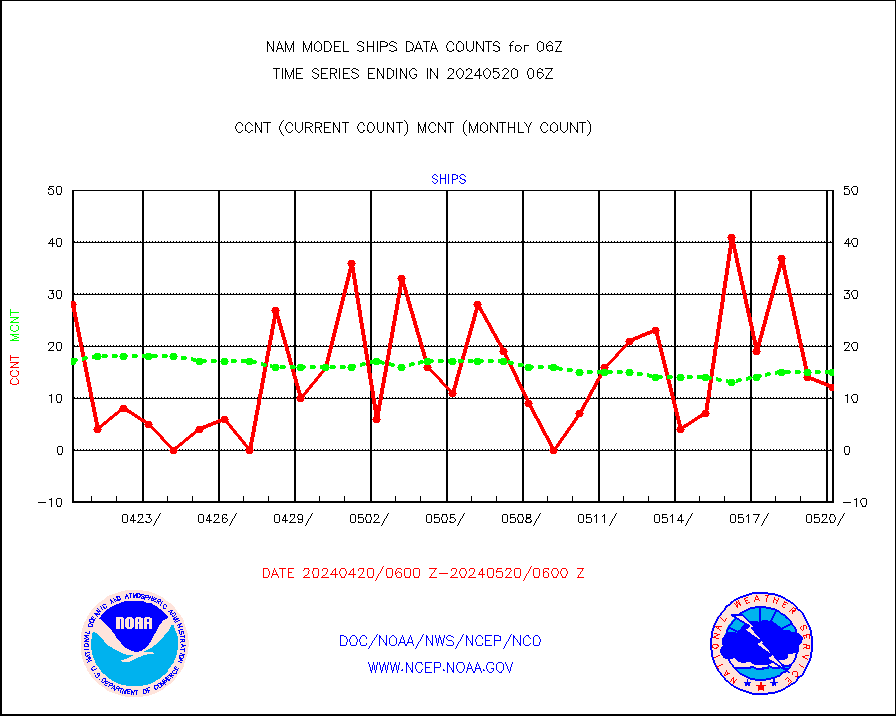
ships |
Ship - manual and automatic, restricted |
0 |
16 |
0.0 % |
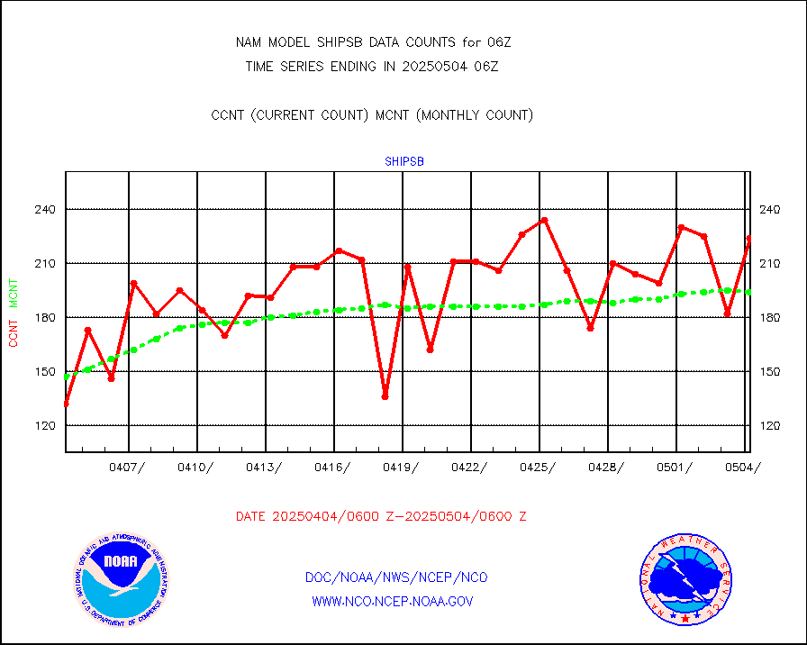
shipsb |
Ship - manual and automatic, restricted (BUFR) |
146 |
133 |
109.8 % |
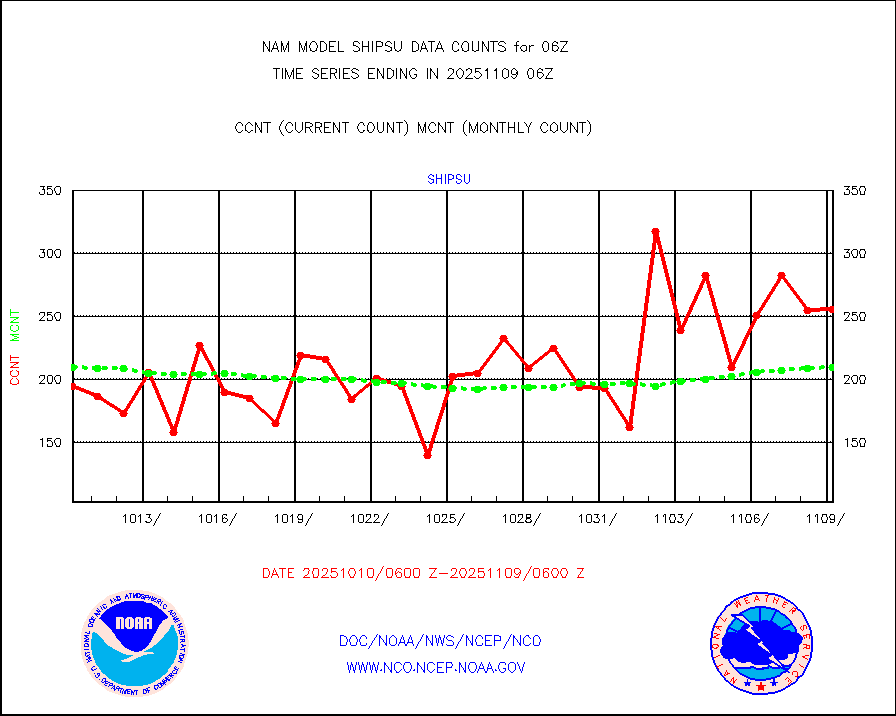
shipsu |
Ship - manual and automatic, unrestricted |
166 |
145 |
114.5 % |
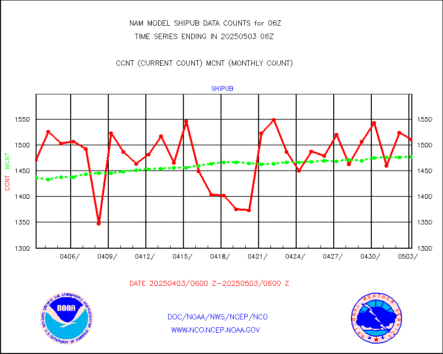
shipub |
Ship - manual and automatic, unrestricted (BUFR) |
1469 |
1467 |
100.1 % |
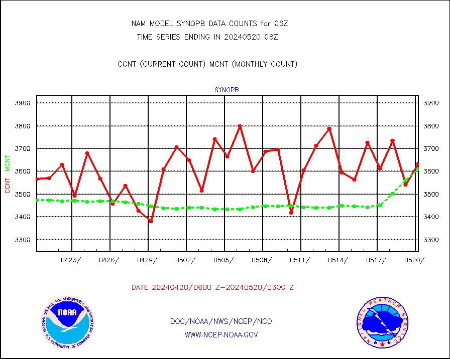
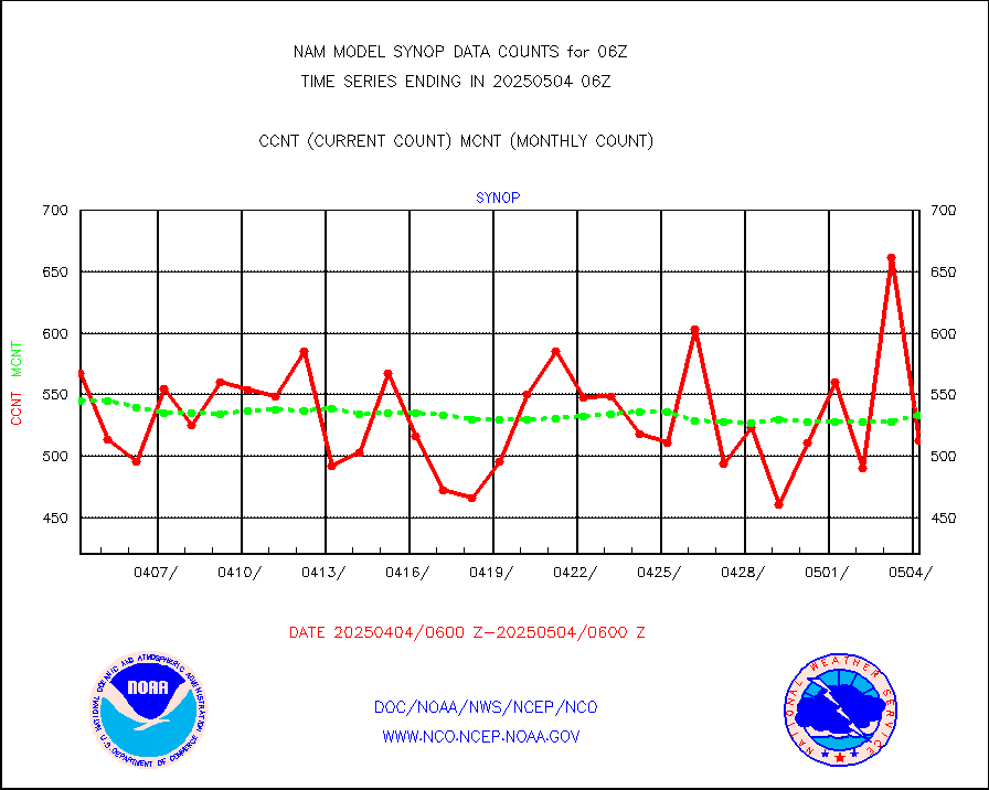
synopb |
Synoptic - fixed manual & auto (decoded fr BUFR) |
3696 |
3446 |
107.3 % |
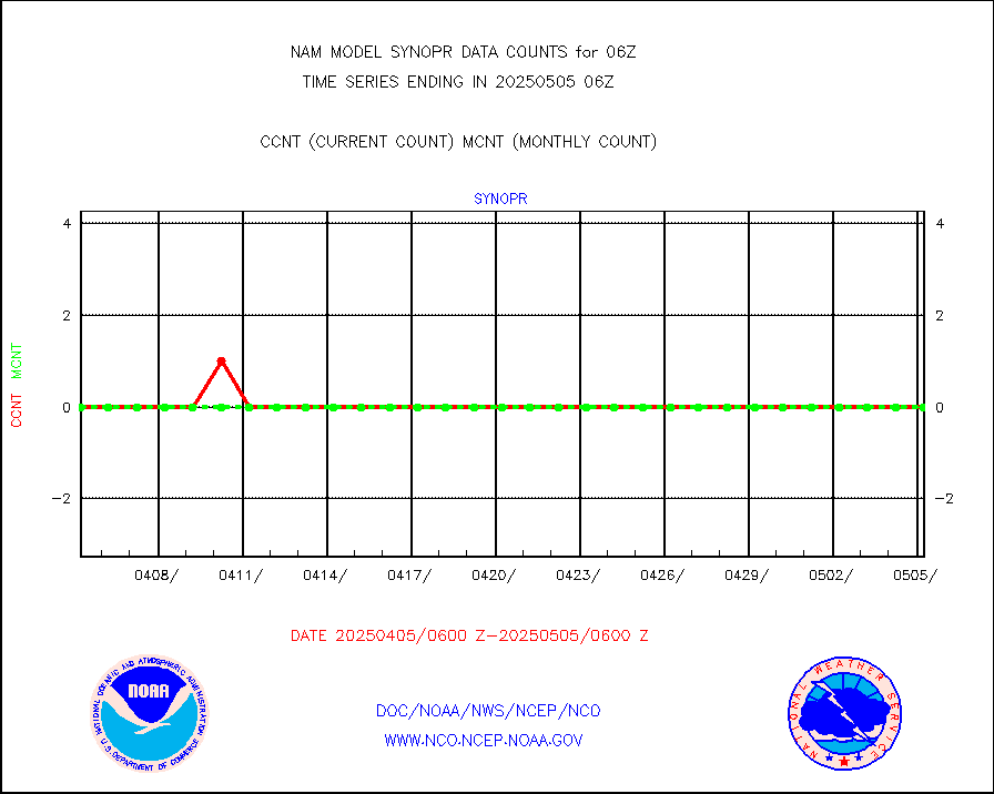
synopr |
Synoptic - restricted (WMO Res 40) manual & auto. |
0 |
0 |
n/a |
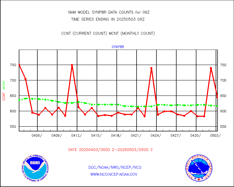
synpbr |
Synoptic - restricted (WMO Res 40)(decoded BUFR) |
739 |
593 |
124.6 % |
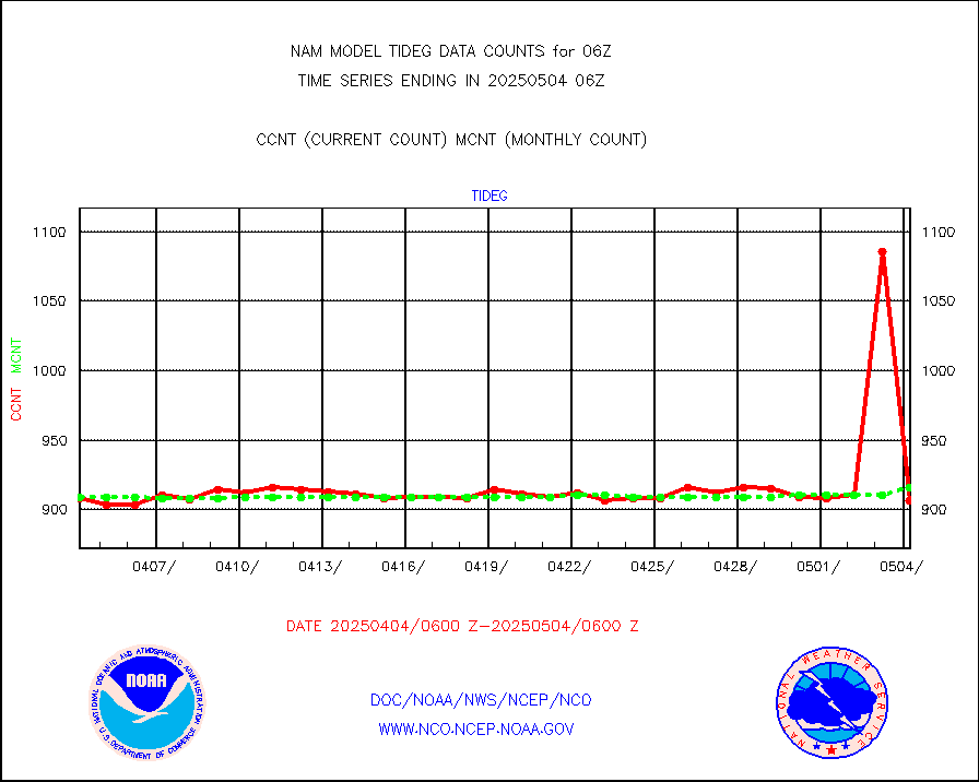
tideg |
Tide gauge reports decoded from CREX format |
896 |
896 |
100.0 % |
| Data Types of Opportunity with Normal Counts |
|---|
| Type | Description | Hourly Count | Monthly Average | Percent (%) of Monthly Mean |
acarsa |
MDCRS ACARS acft data (ARINC via AFWA)(AIREP fmt) |
0 |
0 |
n/a |
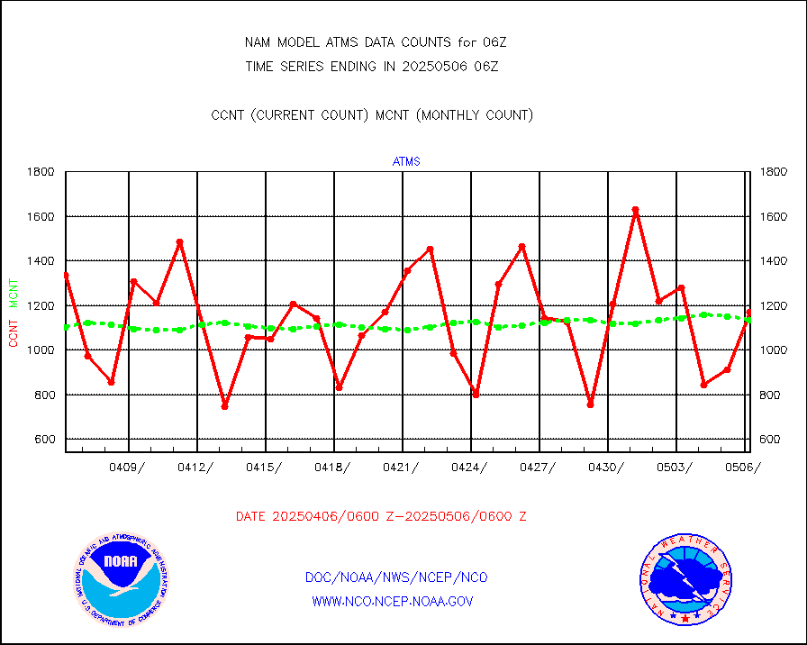
atms |
NPP/NOAA-20 ATMS brightness temperatures |
145809 |
109691 |
132.9 % |
cris |
NPP CrIS apodized radiances (399 channel) |
0 |
0 |
n/a |
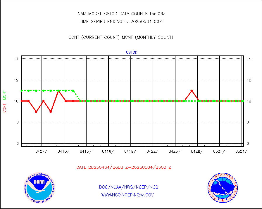
cstgd |
Coast Guard |
6 |
7 |
85.7 % |
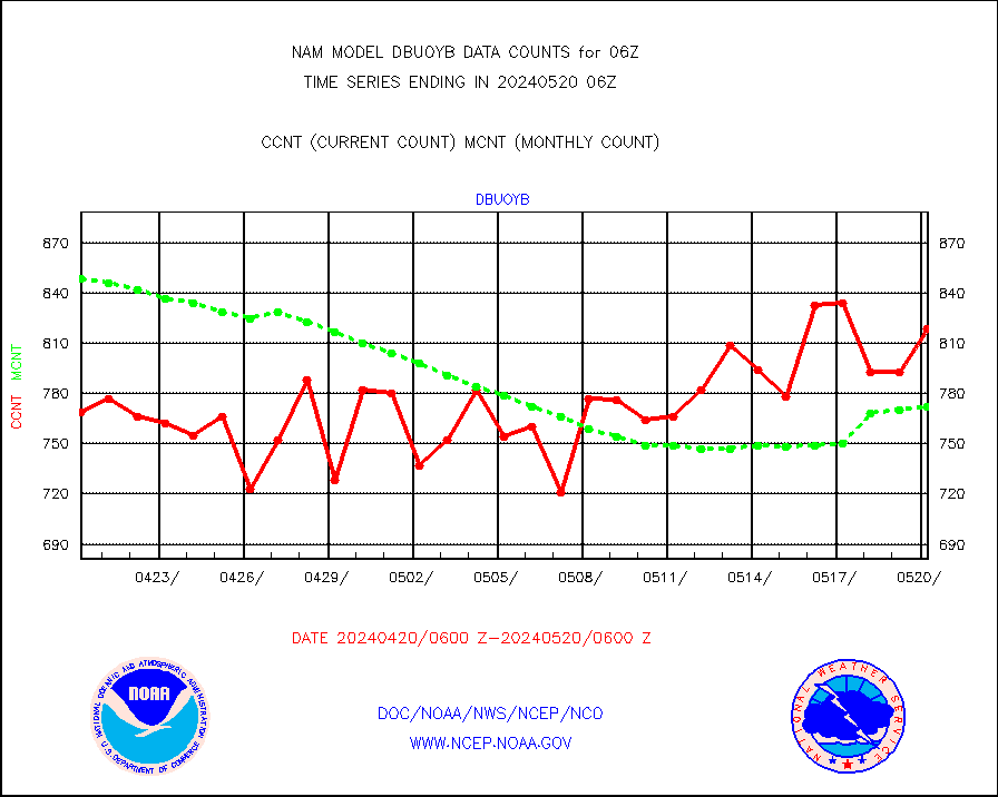
dbuoyb |
Drifting buoys (decoded from BUFR) |
776 |
754 |
102.9 % |
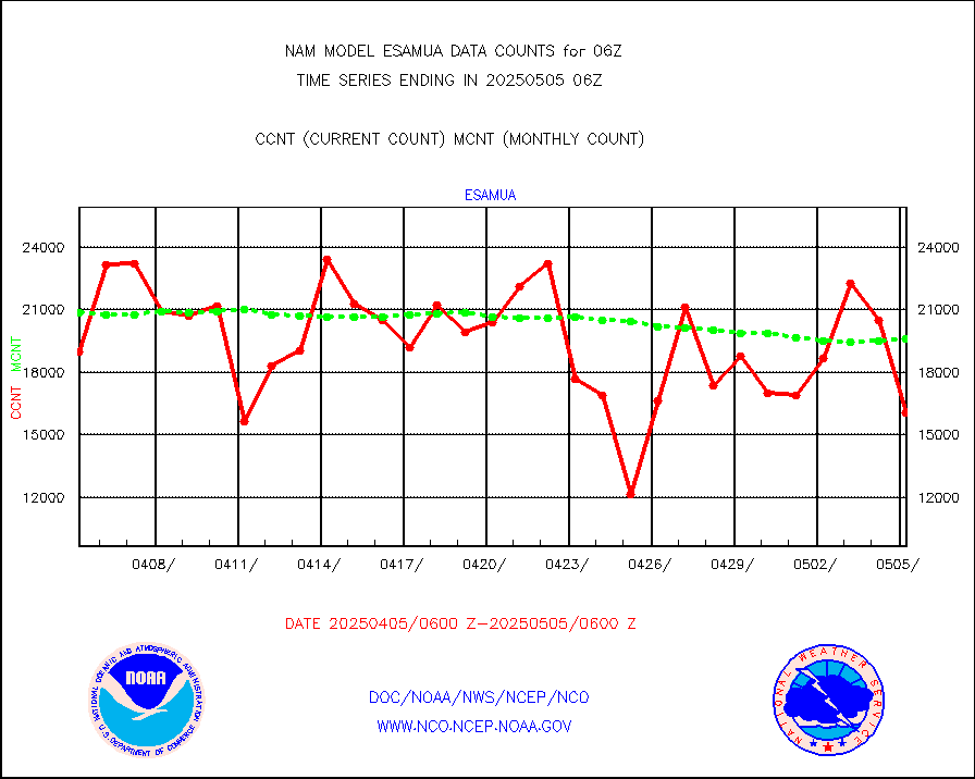
esamua |
NOAA 15-19 & METOP 1-2 AMSU-A proc btmps frm RARS |
23162 |
23139 |
100.1 % |
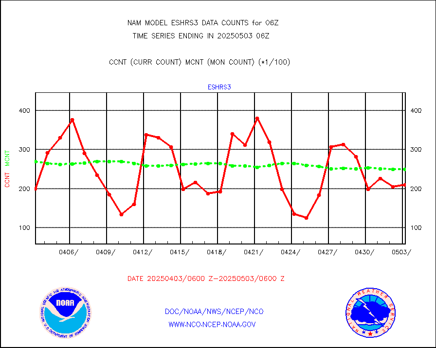
eshrs3 |
NOAA 15-19 & METOP 1-2 HIRS-3/4 pr btmps frm RARS |
53572 |
50213 |
106.7 % |
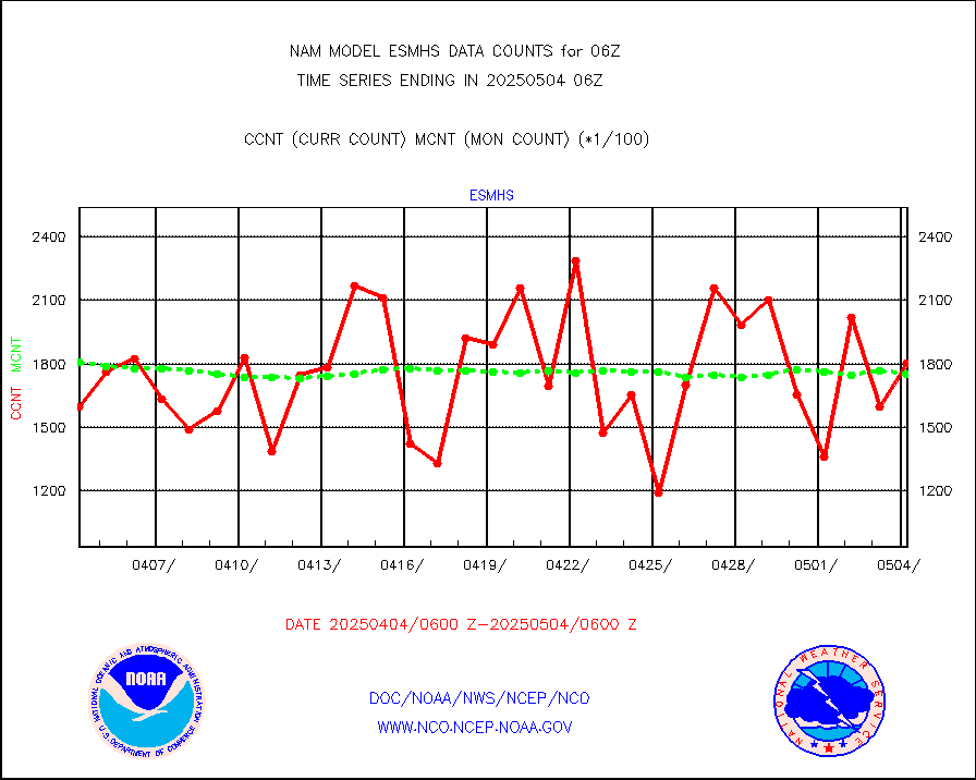
esmhs |
NOAA 18-19 & METOP 1-2 MHS proc. btemps from RARS |
141537 |
152109 |
93.0 % |
geosth |
GOES/NESDIS hi-resol. (1x1 f-o-v) cloud data |
0 |
0 |
n/a |
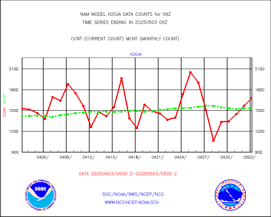
h20ja |
MTSAT/JMA water vapor imager derived cloud motion |
1725 |
1555 |
110.9 % |
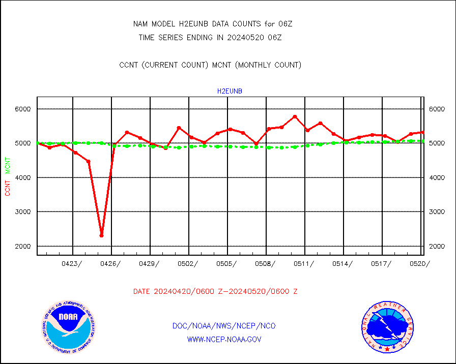
h2eunb |
METEOSAT/EUMETSAT wvpr imgr drv cld motion NBseq |
5459 |
4875 |
112.0 % |
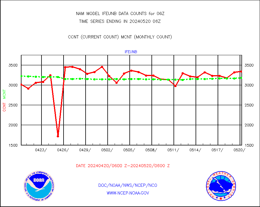
ifeunb |
METEOSAT/EUMETSAT ir lg-wave drv cld motion NBseq |
3146 |
3142 |
100.1 % |
ifvrnb |
VIIRS (NPP/NOAA-20) ir lg-wv drv cloud motion(NB) |
0 |
0 |
n/a |
infav |
AVHRR (NOAA/METOP) ir lg-wave derived cld motion |
0 |
0 |
n/a |
infav1 |
AVHRR (METOP) ir lg-wave derived cld motion |
0 |
0 |
n/a |
infja |
MTSAT/JMA infrared long-wave derived cloud motion |
1436 |
1287 |
111.6 % |
kamdar |
Korean AMDAR aircraft data (decoded from BUFR) |
272 |
343 |
79.3 % |
lgycld |
GOES/NASA(Langley) hi-res. (1x1 f-o-v) cloud data |
4197986 |
3541723 |
118.5 % |
mbuoyb |
Moored buoys (decoded from BUFR) |
1360 |
1235 |
110.1 % |
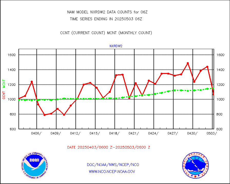
nxrdw2 |
NEXRAD Vel Azm Dsp(VAD) winds via Level 2 decoder |
1295 |
1324 |
97.8 % |
osbuv8 |
NOAA 16-19 Solar Backscatter UV-2 rad frm V8 BUFR |
0 |
0 |
n/a |
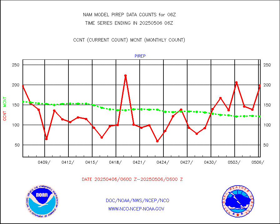
pirep |
Manual PIREP aircraft data (dcded from AIREP fmt) |
134 |
97 |
138.1 % |
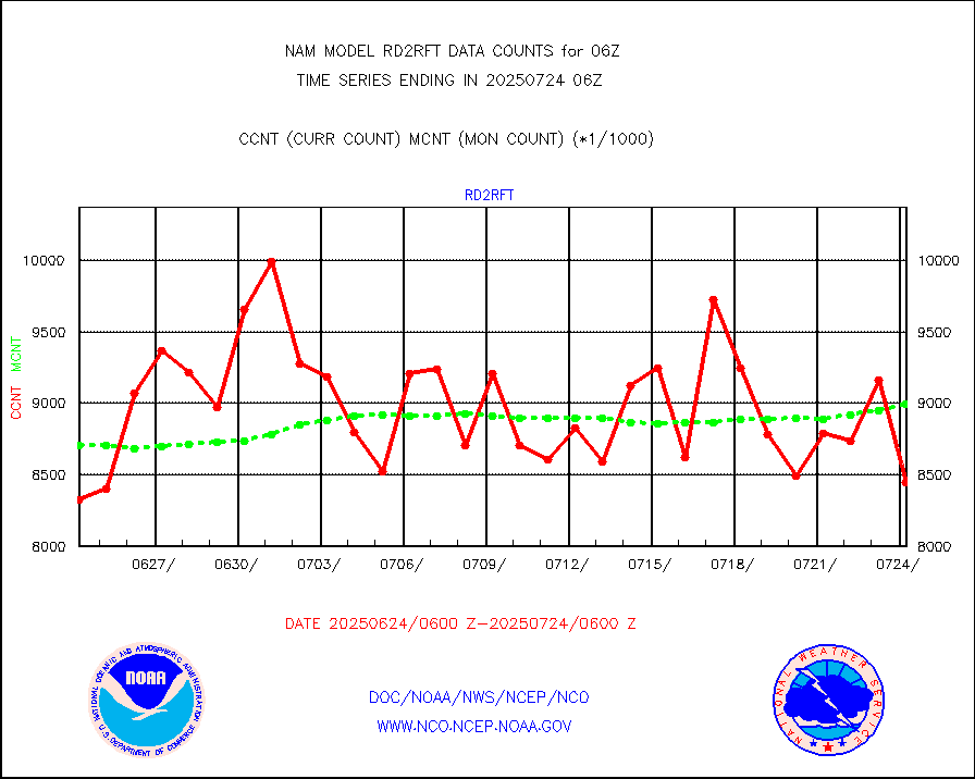
rd2rft |
NEXRAD reflectivity (Lvl 2 - GTS) |
7664552 |
8125717 |
94.3 % |
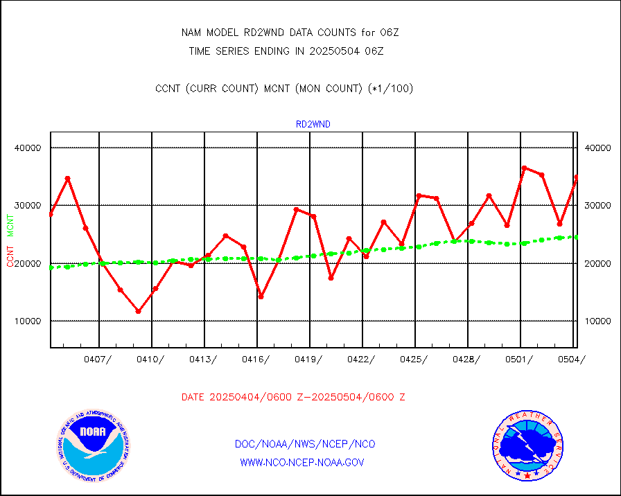
rd2wnd |
NEXRAD radial wind (Level 2 - GTS) |
3041872 |
2868034 |
106.1 % |
sevcsr |
METEOSAT-10 2nd Gen SEVIRI Clr Sky Radiance(proc) |
0 |
0 |
n/a |
synop |
Synoptic - fixed manual and automatic |
647 |
637 |
101.6 % |
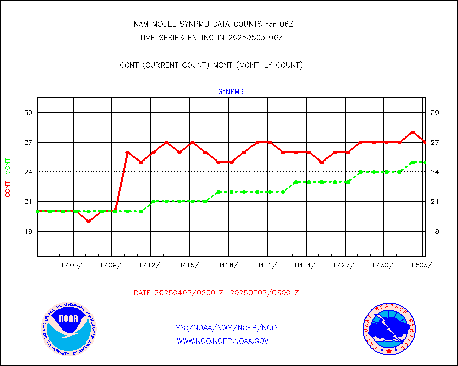
synpmb |
Synoptic - mobile manual & auto (decoded fr BUFR) |
0 |
0 |
n/a |
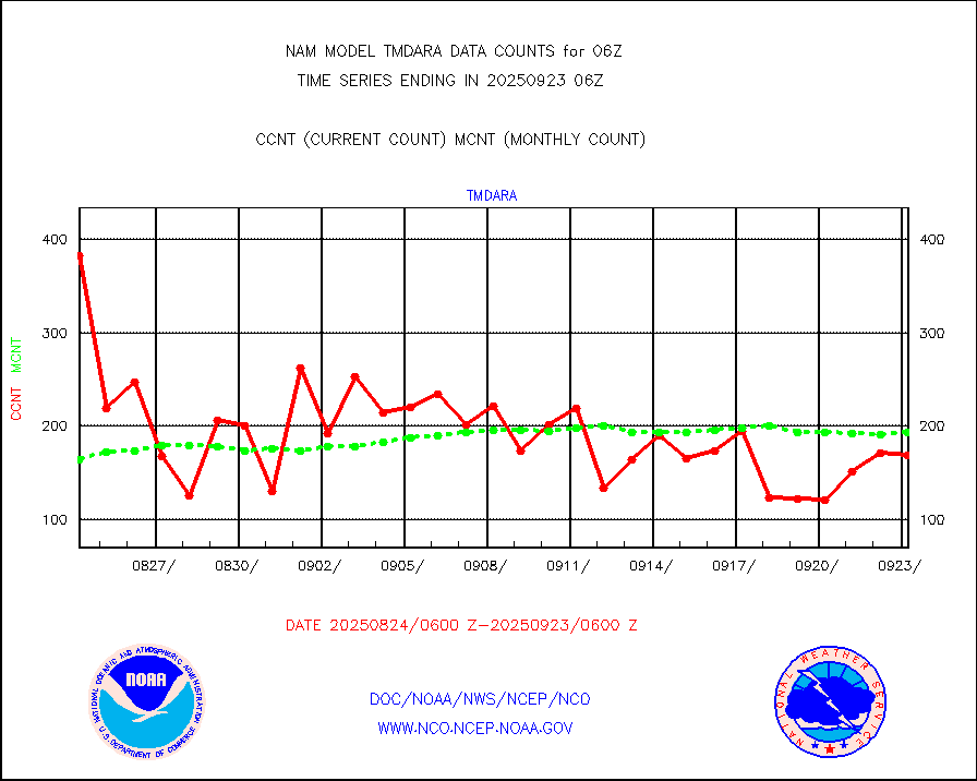
tmdara |
TAMDAR aircft data-all types(from Panasonic,BUFR) |
1779 |
1853 |
96.0 % |
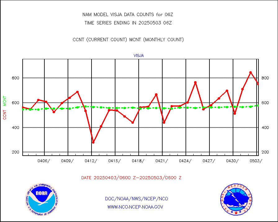
visja |
MTSAT/JMA visible derived cloud motion |
719 |
638 |
112.7 % |
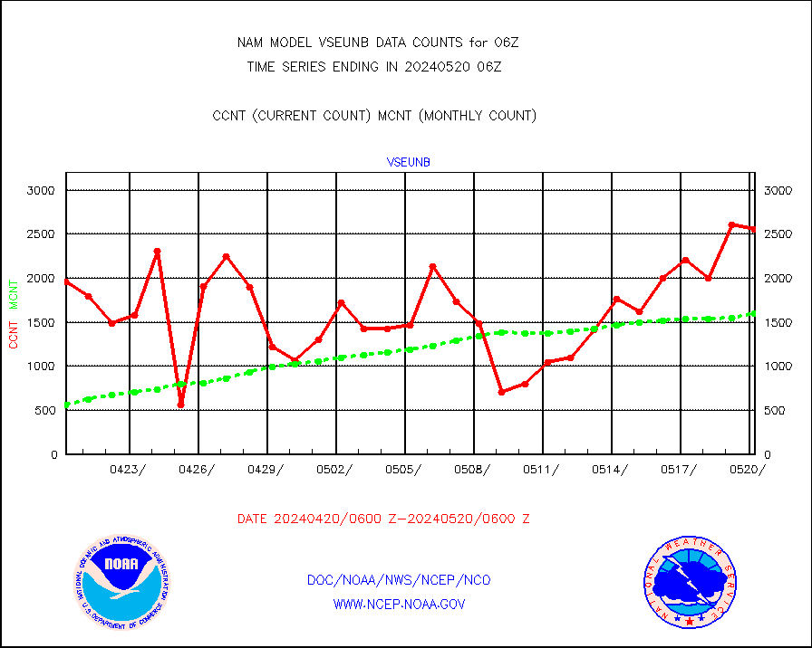
vseunb |
METEOSAT/EUMETSAT visible drv cld motion NBseq |
706 |
1380 |
51.2 % |


