| Critical Data with Normal Counts |
|---|
| Type | Description | Hourly Count | Monthly Average | Percent (%) of Monthly Mean | UTC Time Window |
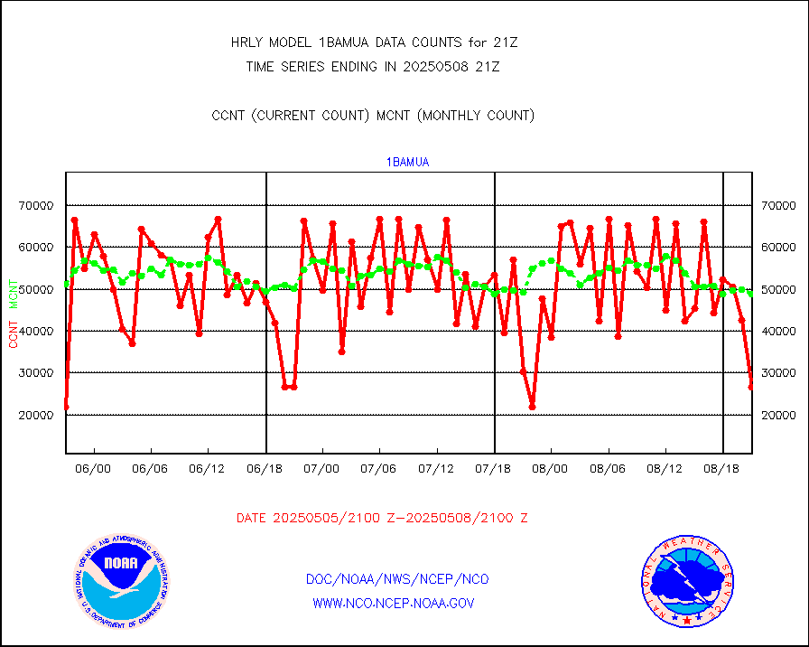
1bamua |
NOAA 15-19 & METOP 1-2 AMSU-A NCEP-proc. br.temps |
65960 |
55999 |
117.8 % |
1919.00-1919.99 |
1bhrs4 |
NOAA 18-19 & METOP 1-2 HIRS-4 NCEP-proc. br.temps |
57621 |
48243 |
119.4 % |
1919.00-1919.99 |
1bmhs |
NOAA 18-19 & METOP 1-2 MHS NCEP-proces. br. temps |
357020 |
304258 |
117.3 % |
1919.00-1919.99 |
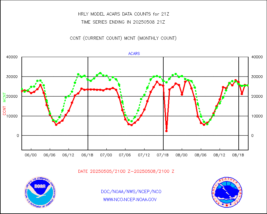
acars |
MDCRS ACARS acft data from ARINC(dcded from BUFR) |
20900 |
19533 |
107.0 % |
1920.50-1921.49 |
airep |
Manual AIREP aircraft data (dcded from AIREP fmt) |
493 |
427 |
115.5 % |
1920.50-1921.49 |
airsev |
AQUA AIRS/AMSU-A/HSB brightness temps- every FOV |
0 |
0 |
n/a |
1918.50-1919.49 |
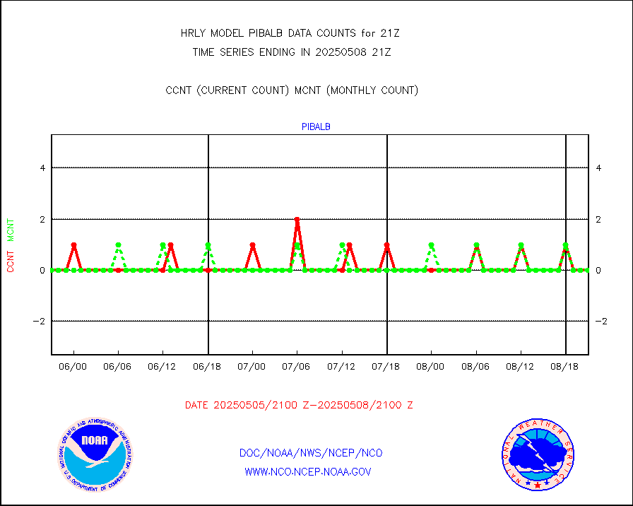
amdar |
AMDAR aircraft data (decoded from AMDAR format) |
136 |
122 |
111.5 % |
1920.50-1921.49 |
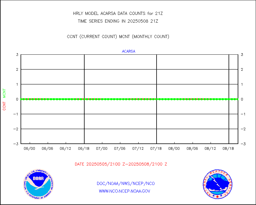
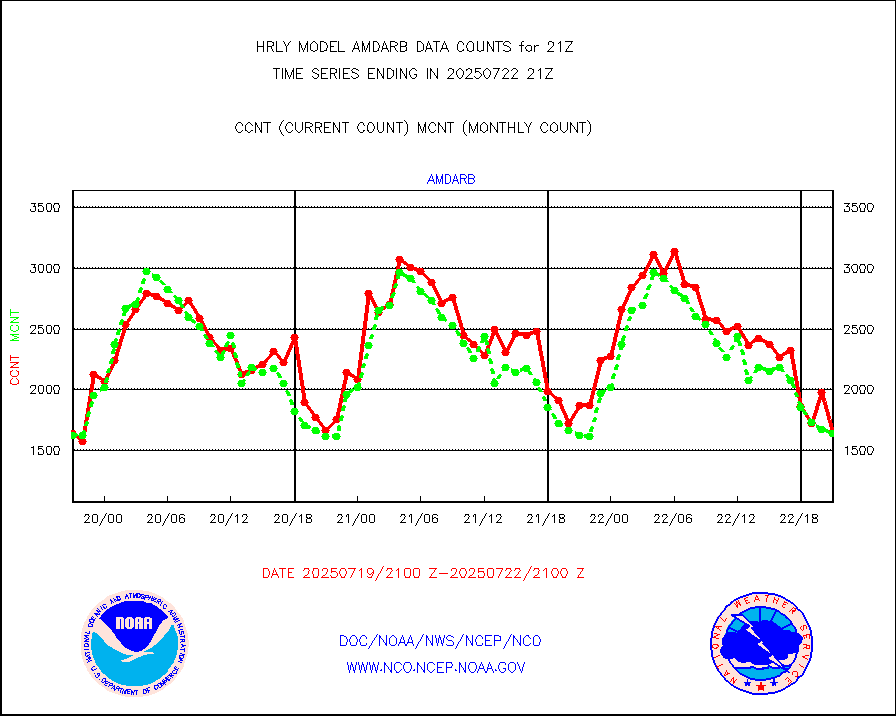
amdarb |
AMDAR aircraft data (decoded from BUFR) |
470 |
325 |
144.6 % |
1920.50-1921.49 |
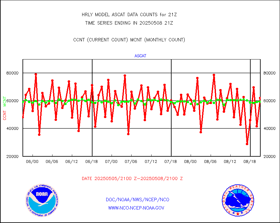
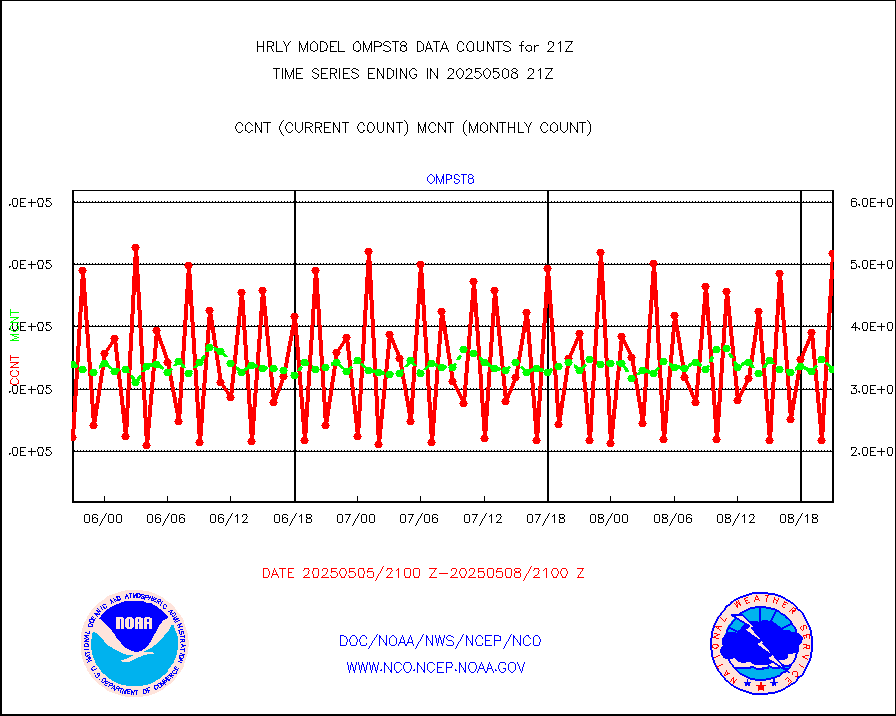
ascat |
METOP 1-2 ASCAT products |
74340 |
47117 |
157.8 % |
1919.50-1920.49 |
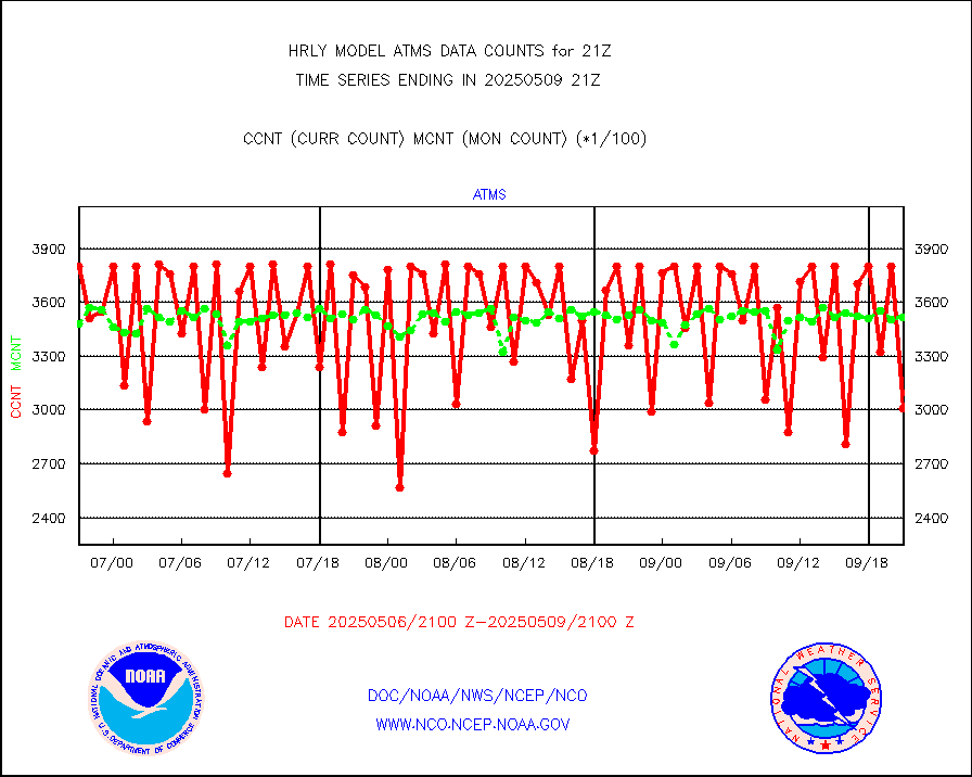
atms |
NPP/NOAA-20 ATMS brightness temperatures |
381504 |
334531 |
114.0 % |
1919.50-1920.49 |
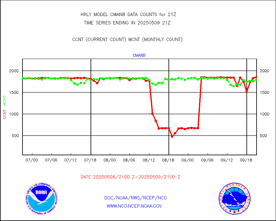
cmanb |
Surface Marine CMAN rpts decoded from BUFR format |
1849 |
1820 |
101.6 % |
1920.50-1921.50 |
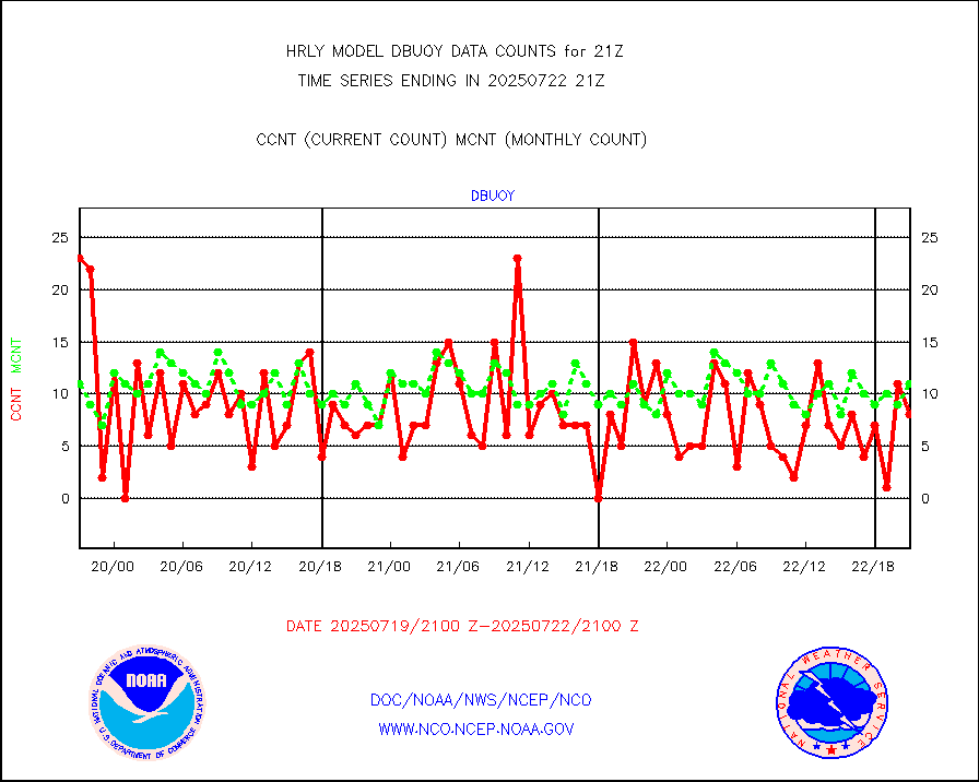
dbuoy |
Buoys decoded from FM-18 fmt (moored or drifting) |
40 |
36 |
111.1 % |
1920.50-1921.49 |
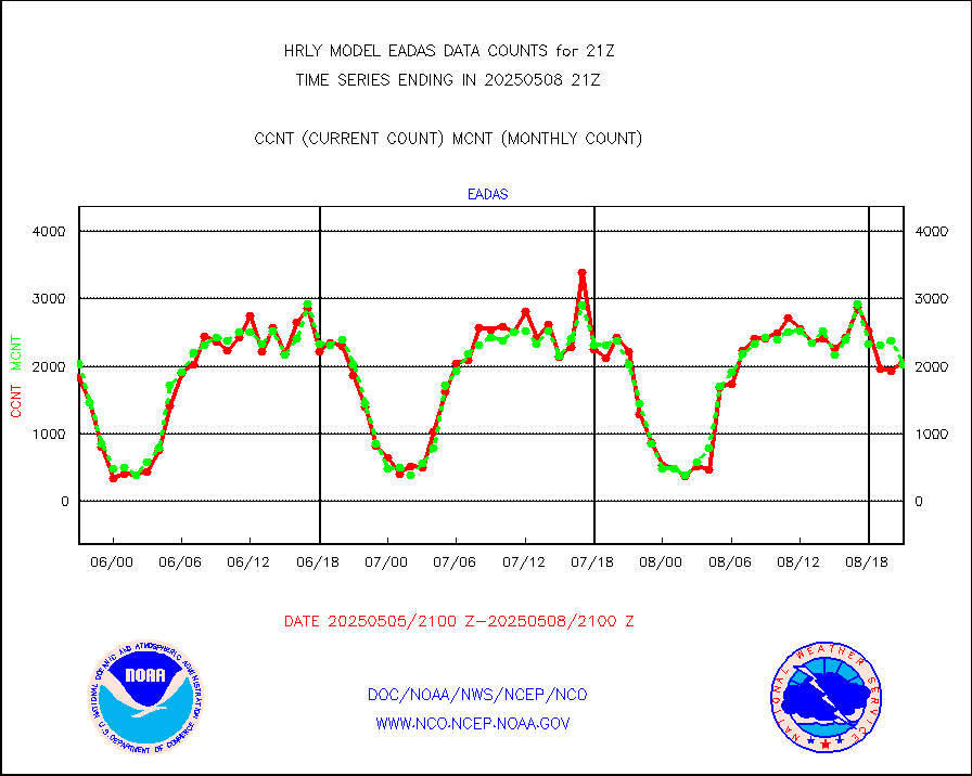
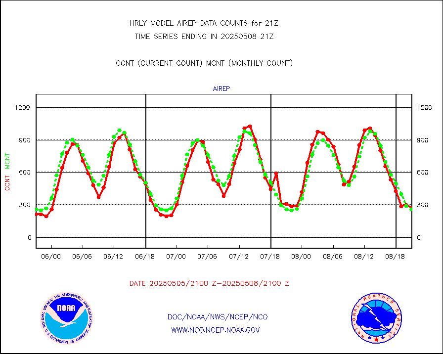
eadas |
E-AMDAR (European AMDAR acft decoded from BUFR) |
1623 |
1366 |
118.8 % |
1920.50-1921.49 |
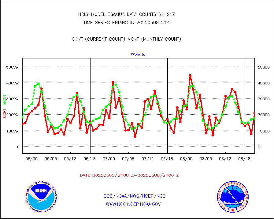
esamua |
NOAA 15-19 & METOP 1-2 AMSU-A proc btmps frm RARS |
32245 |
28704 |
112.3 % |
1920.50-1921.49 |
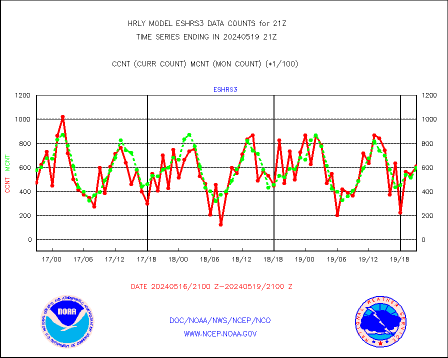
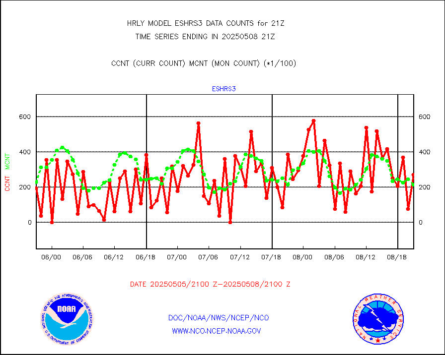
eshrs3 |
NOAA 15-19 & METOP 1-2 HIRS-3/4 pr btmps frm RARS |
61119 |
59791 |
102.2 % |
1920.50-1921.49 |
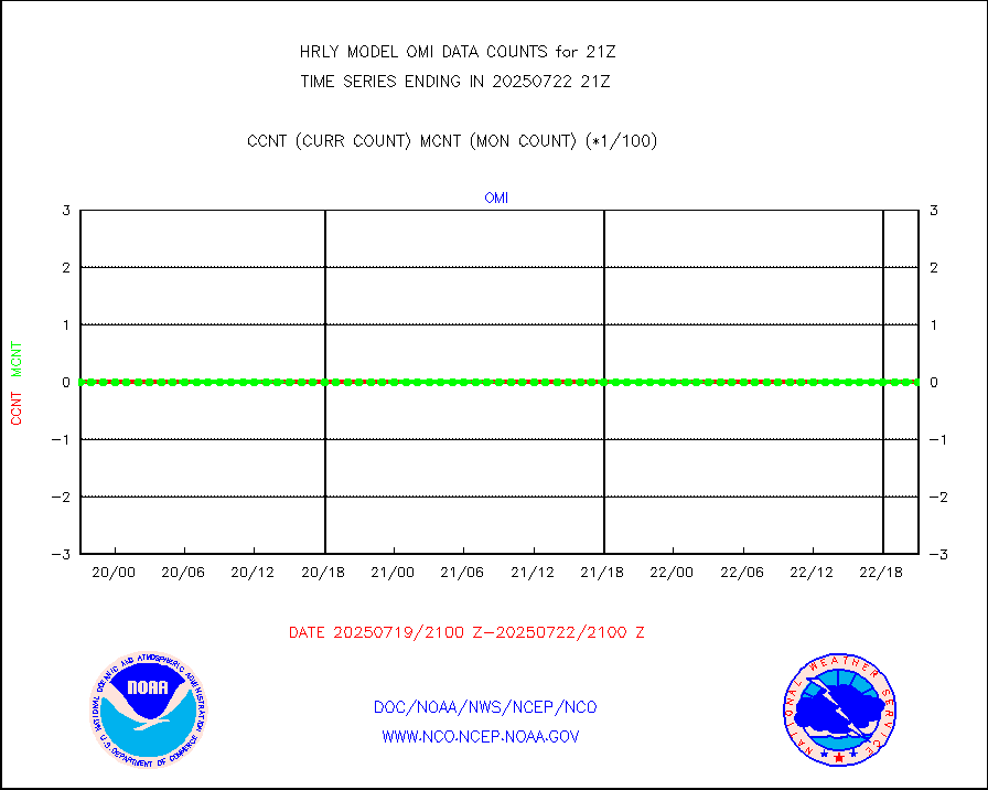
gnss |
Grnd-based Gbl Navigation Sat System (GNSS) data |
8165 |
9236 |
88.4 % |
1920.00-1920.99 |
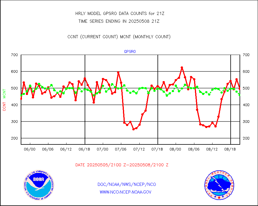
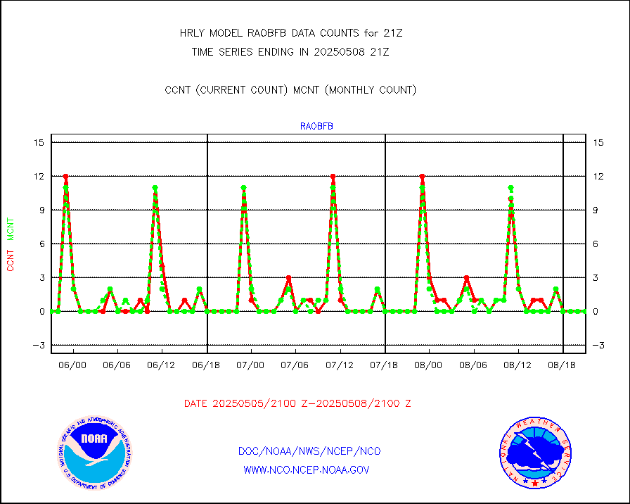
gpsro |
GPS radio occultation data |
423 |
439 |
96.4 % |
1918.50-1919.49 |
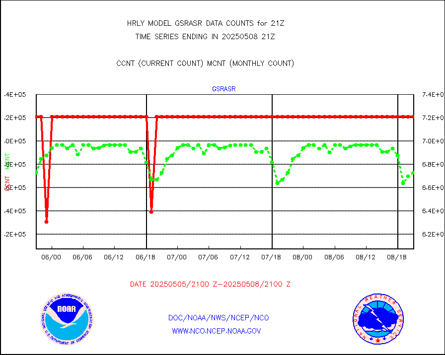
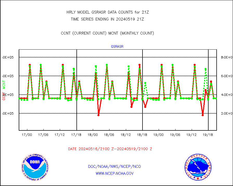
gsrasr |
GOES-16/17 All Sky Radiances (proc.) |
360476 |
357440 |
100.8 % |
1920.50-1921.49 |
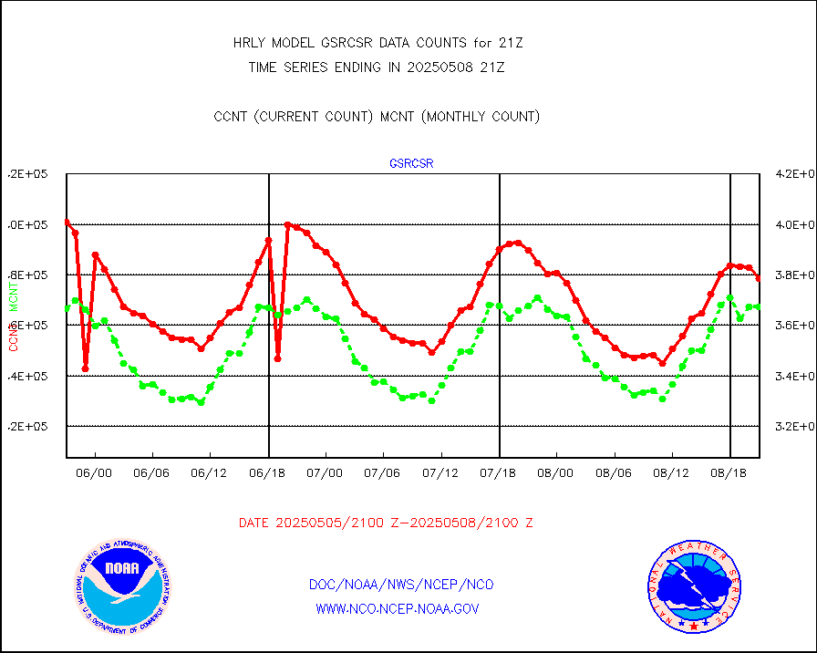
gsrcsr |
GOES-16/17 Clear Sky Radiances (proc.) |
176702 |
186342 |
94.8 % |
1920.50-1921.49 |
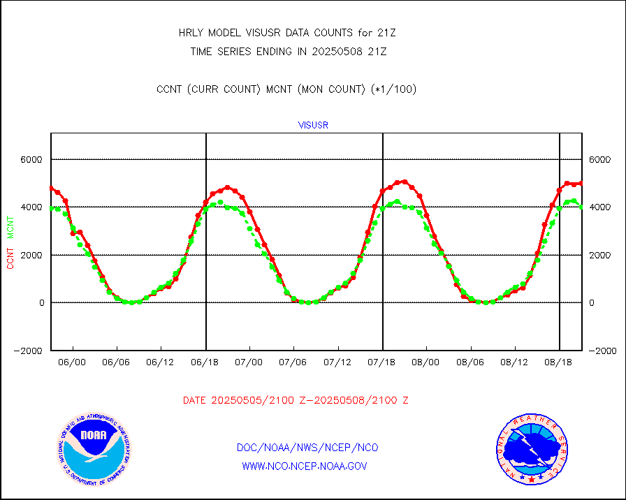
h20ja |
MTSAT/JMA water vapor imager derived cloud motion |
19002 |
18336 |
103.6 % |
1918.50-1919.49 |
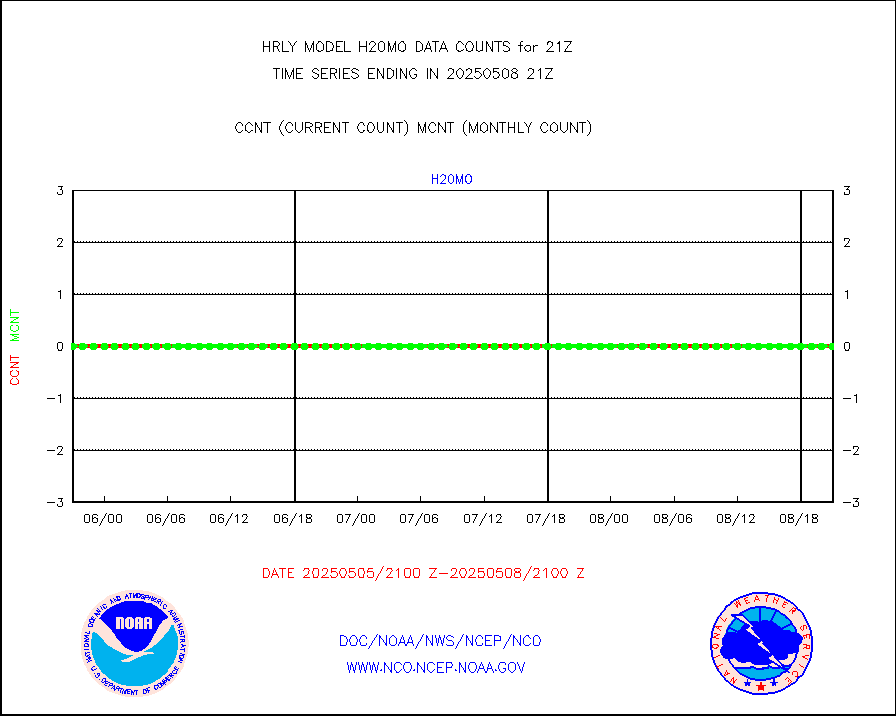
h20mo |
MODIS (AQUA/TERRA) wvpr imager derived cld motion |
0 |
0 |
n/a |
1917.00-1917.99 |
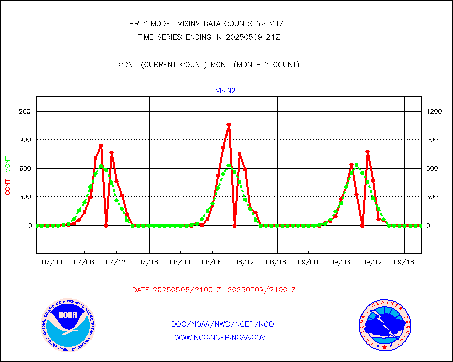
h2tusr |
GOES-16&up/NESDIS wv imgr/cld-top derived cld mtn |
28552 |
29016 |
98.4 % |
1920.00-1920.99 |
ifeunb |
METEOSAT/EUMETSAT ir lg-wave drv cld motion NBseq |
21561 |
21455 |
100.5 % |
1919.50-1920.49 |
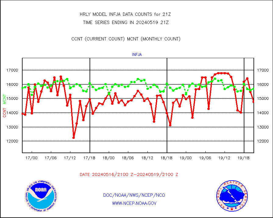
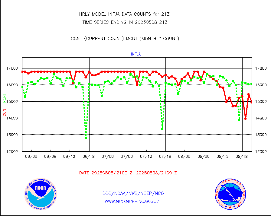
infja |
MTSAT/JMA infrared long-wave derived cloud motion |
14773 |
15706 |
94.1 % |
1918.50-1919.49 |
infmo |
MODIS (AQUA/TERRA) ir l-wave derived cloud motion |
0 |
0 |
n/a |
1917.00-1917.99 |
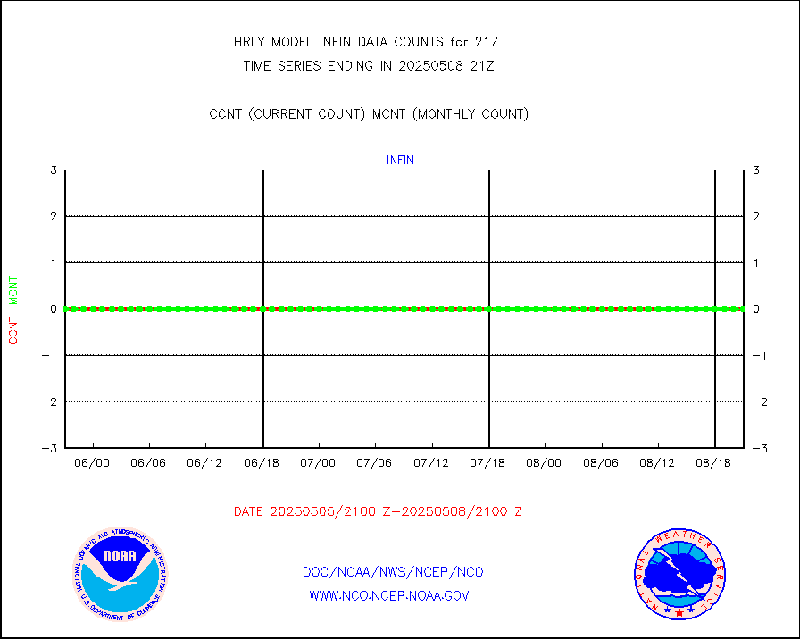
infusr |
GOES-16&up/NESDIS ir long-wave derived cld motion |
80366 |
82838 |
97.0 % |
1920.00-1920.99 |
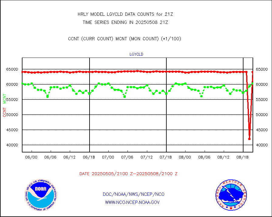
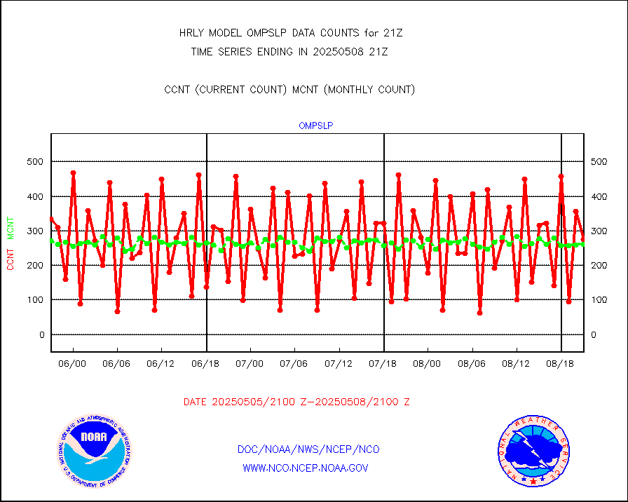
lgycld |
GOES/NASA(Langley) hi-res. (1x1 f-o-v) cloud data |
4198681 |
3573020 |
117.5 % |
1920.50-1921.49 |
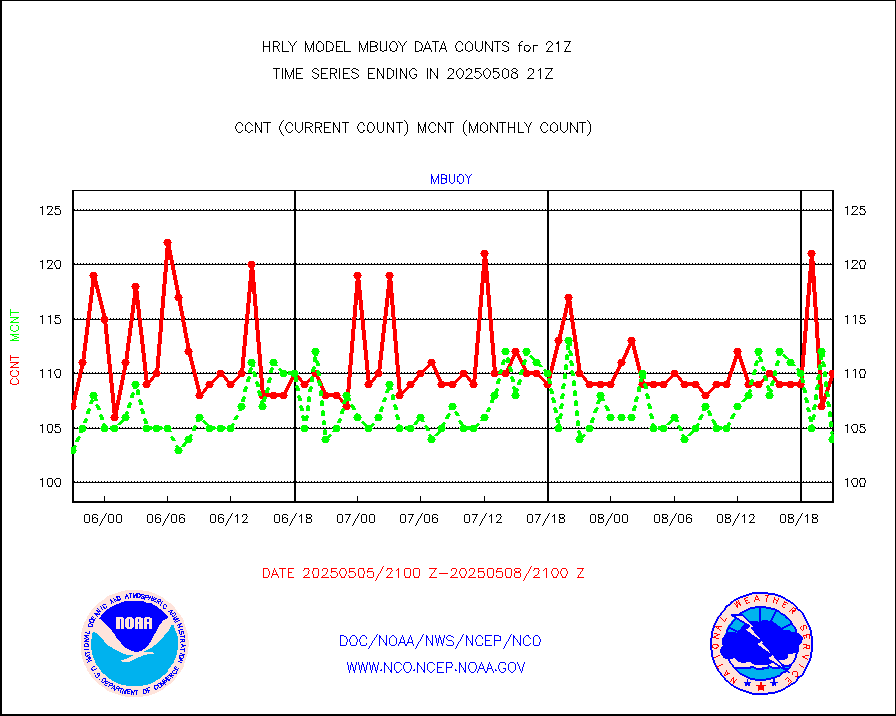
mbuoy |
Buoys decoded from FM-13 format (moored) |
117 |
110 |
106.4 % |
1920.50-1921.49 |
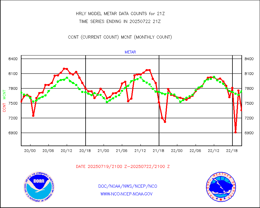
metar |
Aviation - METAR |
7441 |
7688 |
96.8 % |
1920.50-1921.49 |
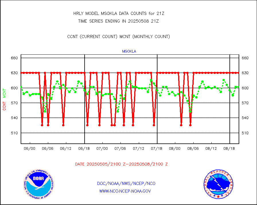
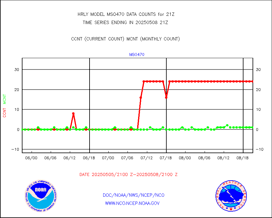
mso470 |
Mesonet/MADIS Colorado E-470 (Interstate 470) |
21 |
20 |
105.0 % |
1920.50-1921.49 |
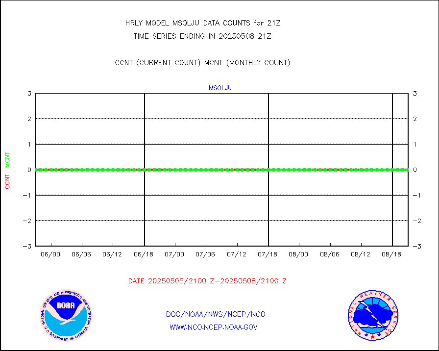
msoalk |
Mesonet/MADIS Alaska Department of Transportation |
109 |
108 |
100.9 % |
1920.50-1921.49 |
msoapg |
Mesonet/MADIS U.S. Army Aberdeen Proving Grounds |
0 |
0 |
n/a |
1920.50-1921.49 |
msoapr |
Mesonet/MADIS Citizen Weather Observers Program |
50094 |
49430 |
101.3 % |
1920.50-1921.49 |
msoaws |
Mesonet/MADIS AWS Convergence Technologies, Inc. |
25703 |
25846 |
99.4 % |
1920.50-1921.49 |
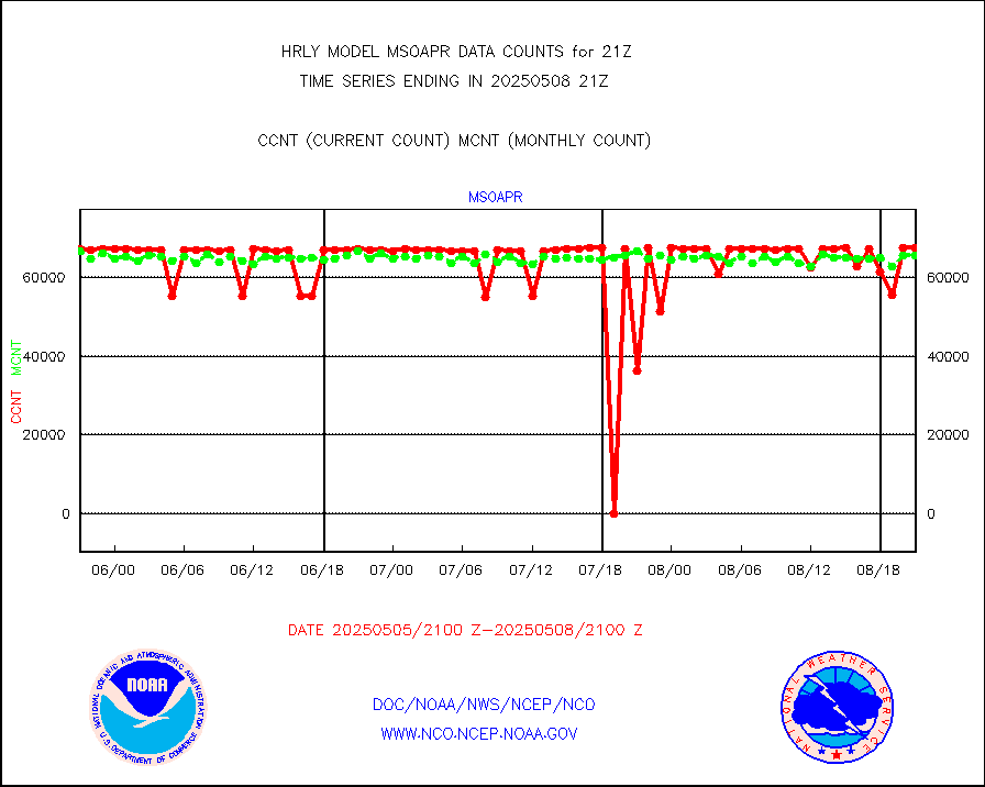
msoawx |
Mesonet/MADIS "Anything Weather" |
0 |
0 |
n/a |
1920.50-1921.49 |
msocol |
Mesonet/MADIS Colorado Dept. of Transportation |
0 |
0 |
n/a |
1920.50-1921.49 |
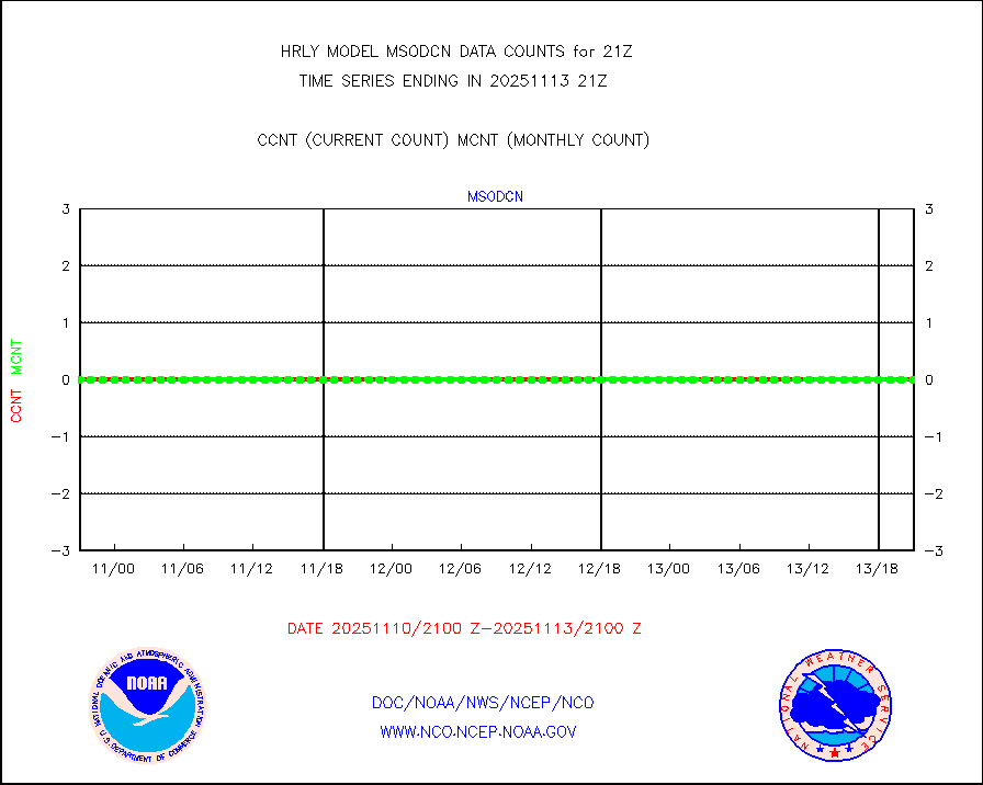
msodcn |
Mesonet/MADIS DC Net |
0 |
0 |
n/a |
1920.50-1921.49 |
msoden |
Mesonet/MADIS Denver Urban Drainage & Flood Cntrl |
250 |
248 |
100.8 % |
1920.50-1921.49 |
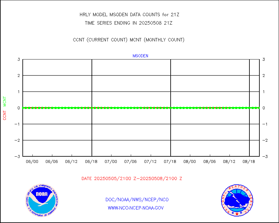
msofla |
Mesonet/MADIS Florida (FAWN & USF) |
4 |
4 |
100.0 % |
1920.50-1921.49 |
msoflt |
Mesonet/MADIS Florida Dept. of Transportation |
0 |
0 |
n/a |
1920.50-1921.49 |
msogeo |
Mesonet/MADIS Georgia Dept. of Transportation |
0 |
0 |
n/a |
1920.50-1921.49 |
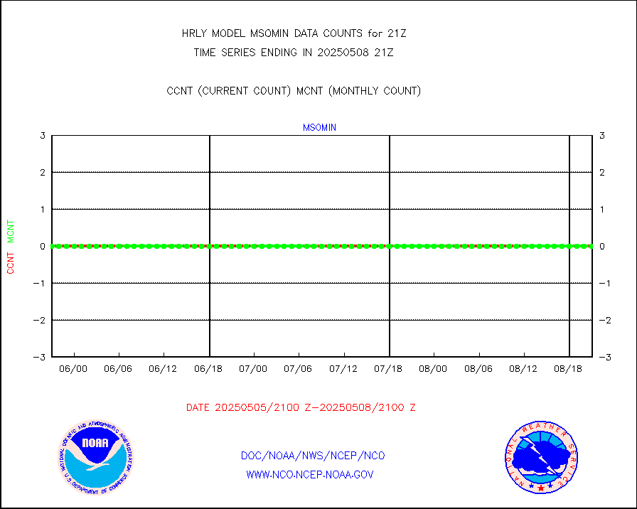
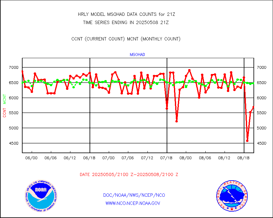
msohad |
Mesonet/MADIS NWS Hydromet Auto Data System(HADS) |
6851 |
6673 |
102.7 % |
1920.50-1921.49 |
msoien |
Mesonet/MADIS Iowa Environmental |
185 |
187 |
98.9 % |
1920.50-1921.49 |
msoind |
Mesonet/MADIS Indiana Dept. of Transportation |
0 |
0 |
n/a |
1920.50-1921.49 |
msoiow |
Mesonet/MADIS Iowa Department of Transportation |
0 |
0 |
n/a |
1920.50-1921.49 |
msokan |
Mesonet/MADIS Kansas Department of Transportation |
348 |
364 |
95.6 % |
1920.50-1921.49 |
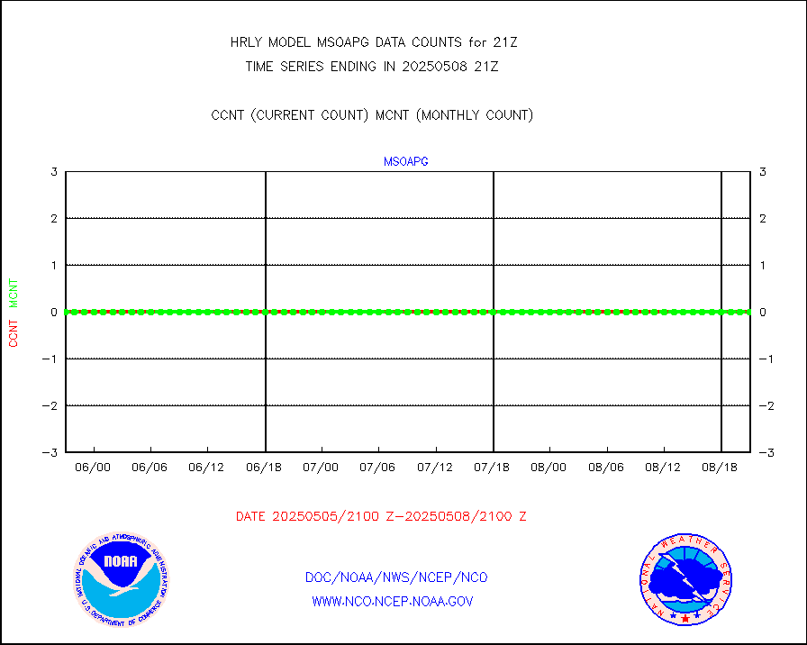
msokla |
Mesonet/MADIS Oklahoma Mesonet |
318 |
322 |
98.8 % |
1920.50-1921.49 |
msolju |
Mesonet/MADIS Louisiana State/Jackson State Univ. |
0 |
0 |
n/a |
1920.50-1921.49 |
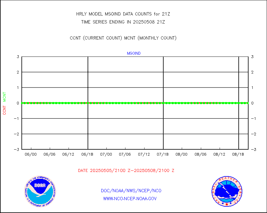
msomca |
Mesonet/MADIS Missouri Commercial Agricult Wx Net |
299 |
296 |
101.0 % |
1920.50-1921.49 |
msomin |
Mesonet/MADIS Minnesota Dept. of Transportation |
0 |
0 |
n/a |
1920.50-1921.49 |
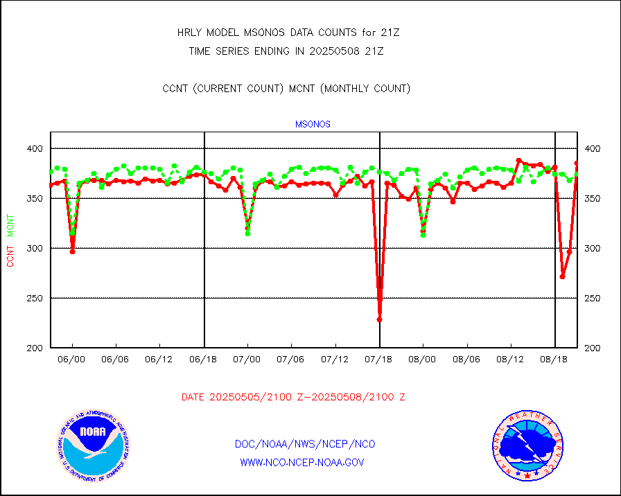
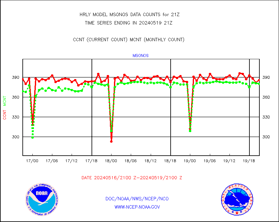
msonos |
Mesonet/MADIS NOS-Phys Oceanographic Realtime Sys |
386 |
380 |
101.6 % |
1920.50-1921.49 |
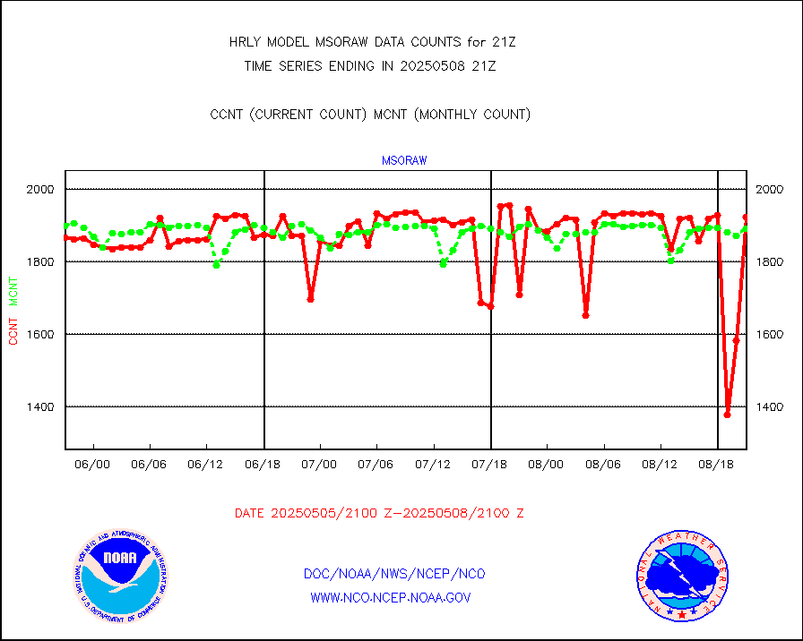
msoraw |
Mesonet/MADIS NFIC Remote Automated Wx Stns(RAWS) |
1866 |
1910 |
97.7 % |
1920.50-1921.49 |
msovir |
Mesonet/MADIS Virginia Dept. of Transportation |
207 |
229 |
90.4 % |
1920.50-1921.49 |
msowfy |
Mesonet/MADIS "Weather for You" |
0 |
0 |
n/a |
1920.50-1921.49 |
msowis |
Mesonet/MADIS Wisconsin Dept. of Transportation |
0 |
0 |
n/a |
1920.50-1921.49 |
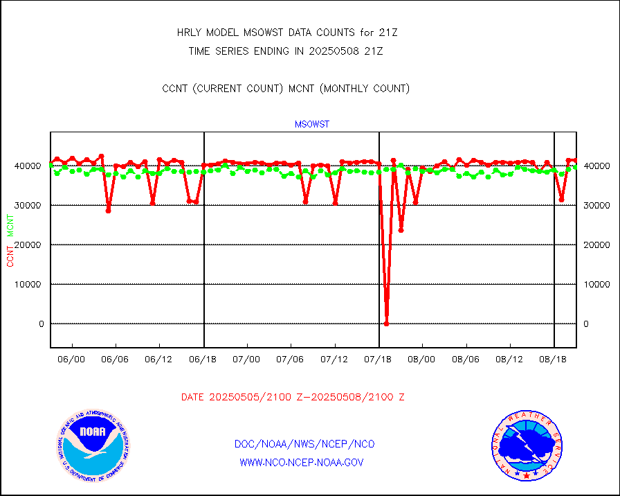
msowst |
Mesonet/MADIS MesoWest (many subproviders) |
46874 |
46314 |
101.2 % |
1920.50-1921.49 |
msowtx |
Mesonet/MADIS West Texas |
5643 |
5597 |
100.8 % |
1920.50-1921.49 |
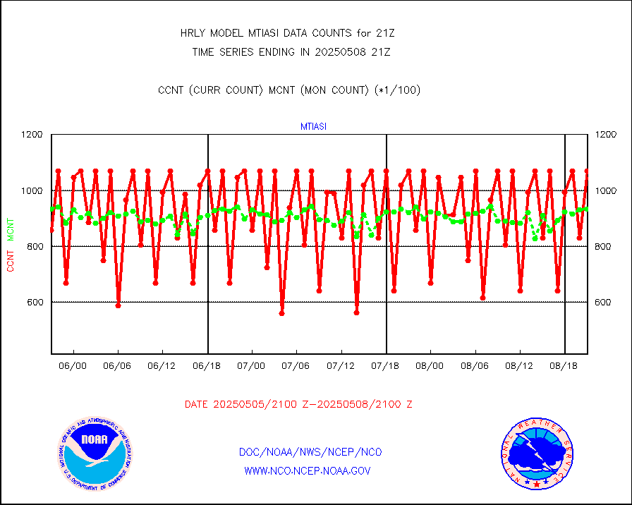
mtiasi |
METOP 1-2 IASI 1C radiance data (varbl. channels) |
102016 |
80366 |
126.9 % |
1919.00-1919.99 |
nxrdw |
NEXRAD Vel Azm Dsp(VAD) winds via radar coded msg |
0 |
0 |
n/a |
1920.50-1921.49 |
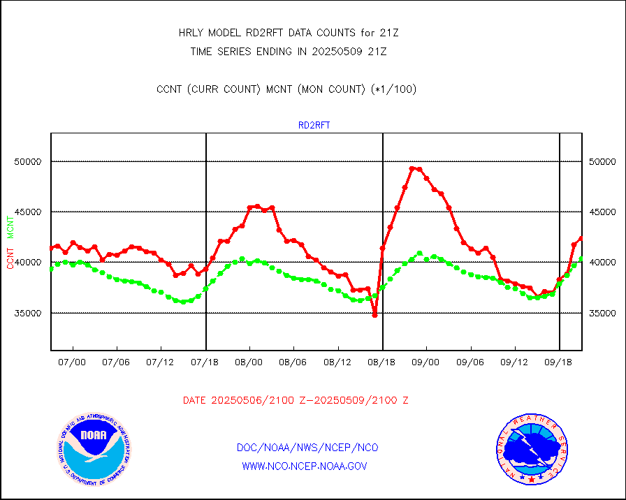
omi |
Aura Ozone Monitoring Instrument (OMI) data |
0 |
29722 |
0.0 % |
1918.50-1919.49 |
osbuv8 |
NOAA 16-19 Solar Backscatter UV-2 rad frm V8 BUFR |
0 |
0 |
n/a |
1919.00-1919.99 |
pibal |
PIBAL (from PILOT, PILOT SHIP, PILOT MOBIL) |
0 |
0 |
n/a |
1920.50-1921.49 |
prflrb |
Multi-Agency Profiler (MAP) and SODAR winds |
35 |
42 |
83.3 % |
1920.50-1921.49 |
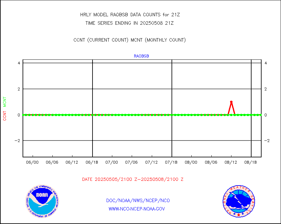
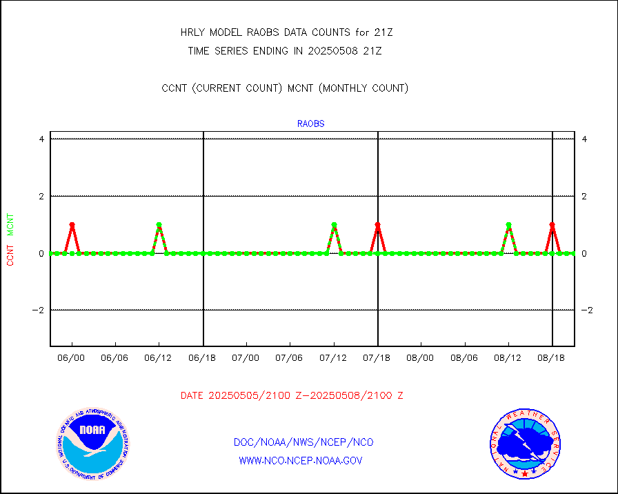
raobf |
Rawinsonde - fixed land (from TEMP or PILOT) |
0 |
0 |
n/a |
1920.50-1921.49 |
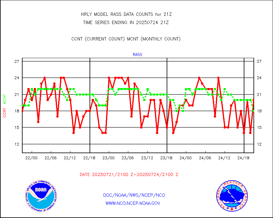
rass |
RASS temperatures (NOAA and Multi-Agency) |
19 |
26 |
73.1 % |
1920.50-1921.49 |
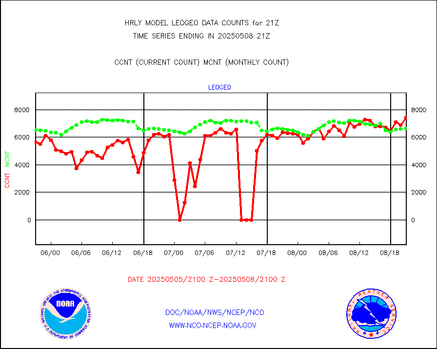
rd2rft |
NEXRAD reflectivity (Lvl 2 - GTS) |
4368451 |
4145672 |
105.4 % |
1920.50-1921.49 |
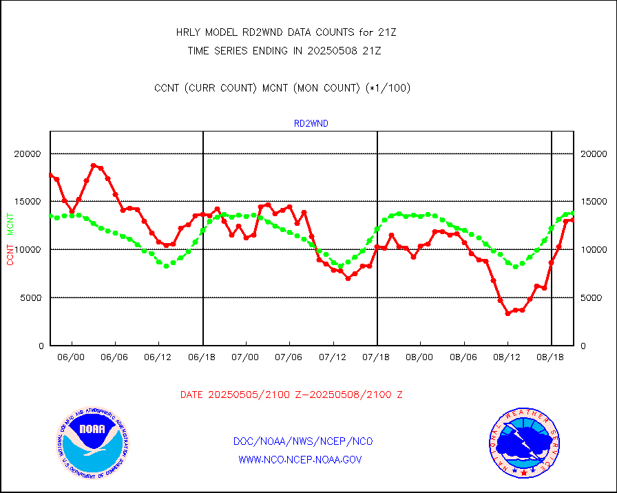
rd2wnd |
NEXRAD radial wind (Level 2 - GTS) |
1863248 |
1601266 |
116.4 % |
1920.50-1921.49 |
sevcsr |
METEOSAT-10 2nd Gen SEVIRI Clr Sky Radiance(proc) |
0 |
0 |
n/a |
1920.50-1921.49 |
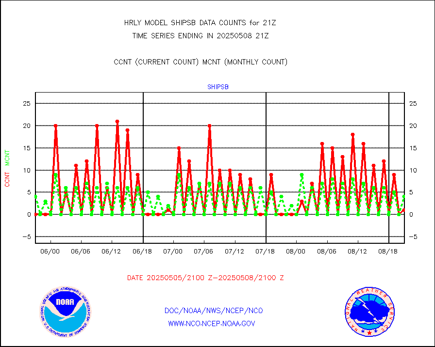
shipsb |
Ship - manual and automatic, restricted (BUFR) |
1 |
0 |
n/a |
1920.50-1921.50 |
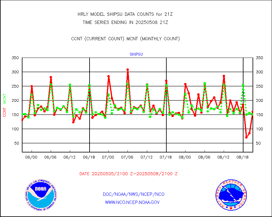
shipsu |
Ship - manual and automatic, unrestricted |
137 |
128 |
107.0 % |
1920.50-1921.50 |
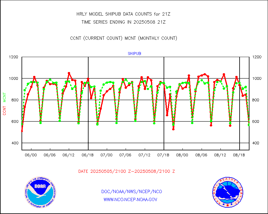
shipub |
Ship - manual and automatic, unrestricted (BUFR) |
329 |
420 |
78.3 % |
1920.50-1921.50 |
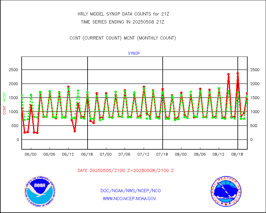
synop |
Synoptic - fixed manual and automatic |
1752 |
1923 |
91.1 % |
1920.50-1921.49 |
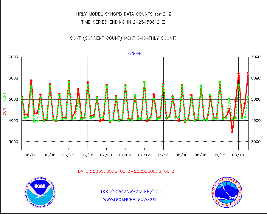
synopb |
Synoptic - fixed manual & auto (decoded fr BUFR) |
5231 |
5151 |
101.6 % |
1920.50-1921.49 |
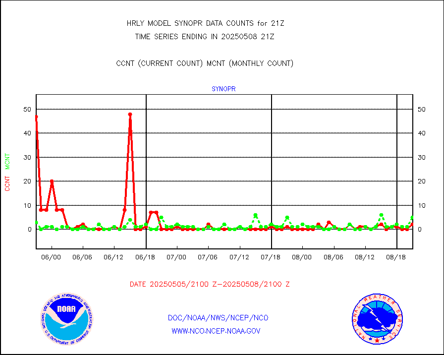
synopr |
Synoptic - restricted (WMO Res 40) manual & auto. |
0 |
2 |
0.0 % |
1920.50-1921.49 |
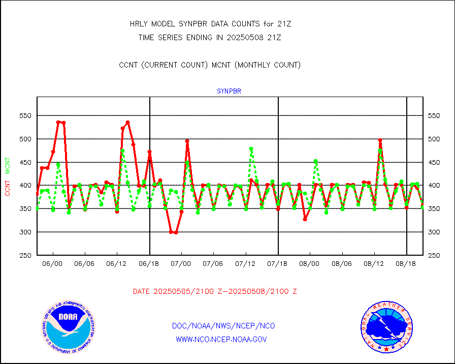
synpbr |
Synoptic - restricted (WMO Res 40)(decoded BUFR) |
355 |
358 |
99.2 % |
1920.50-1921.49 |
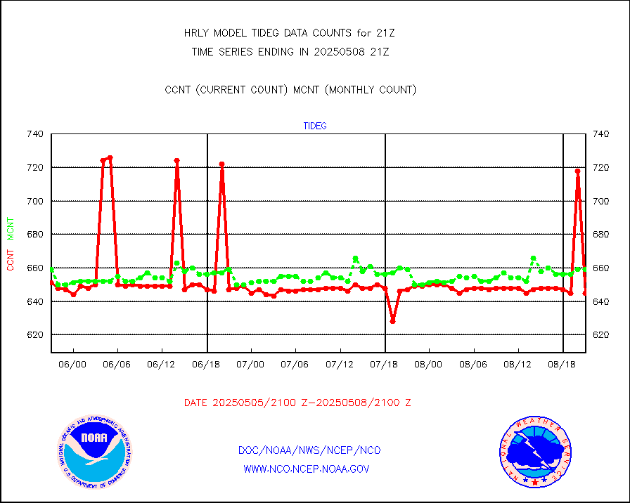
tideg |
Tide gauge reports decoded from CREX format |
641 |
639 |
100.3 % |
1920.00-1920.99 |
| Data Types of Opportunity with Normal Counts |
|---|
| Type | Description | Hourly Count | Monthly Average | Percent (%) of Monthly Mean | UTC Time Window |
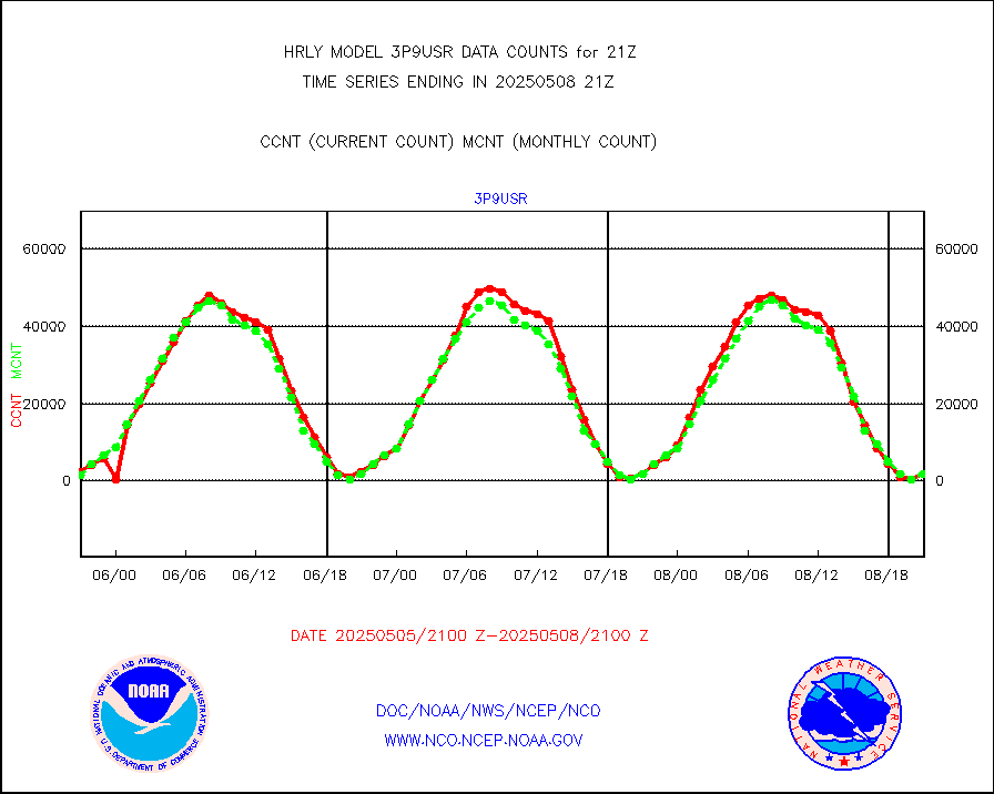
3p9usr |
GOES-16&up/NESDIS ir short-wv derived cld motion |
3320 |
2140 |
155.1 % |
1920.00-1920.99 |
acarsa |
MDCRS ACARS acft data (ARINC via AFWA)(AIREP fmt) |
0 |
0 |
n/a |
1920.50-1921.49 |
ahicsr |
Himawari Clear Sky Radiance |
0 |
0 |
n/a |
1920.00-1920.99 |
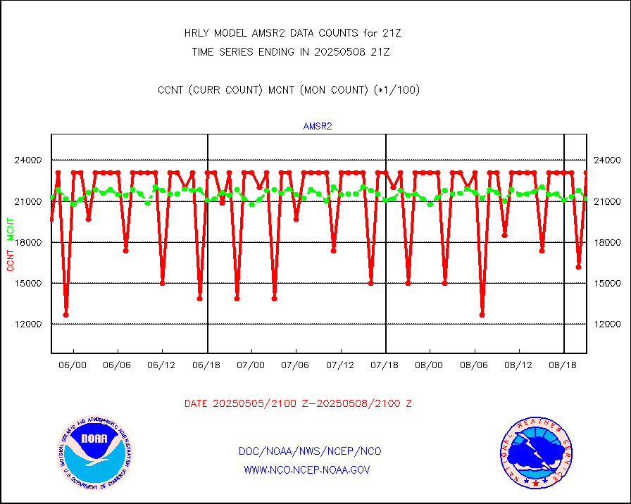
amsr2 |
GCOM-W AMSR2 1B brightness temperatures |
2309472 |
2016738 |
114.5 % |
1919.00-1919.99 |
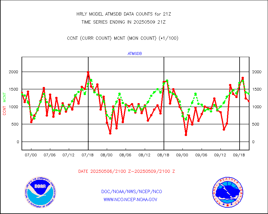
atmsdb |
NPP/NOAA-20 ATMS bright. temps-direct b-cast SSEC |
119786 |
119907 |
99.9 % |
1919.50-1920.49 |
atovs |
POES/NESDIS - processed ATOVS soundings/radiances |
0 |
0 |
n/a |
1919.00-1919.99 |
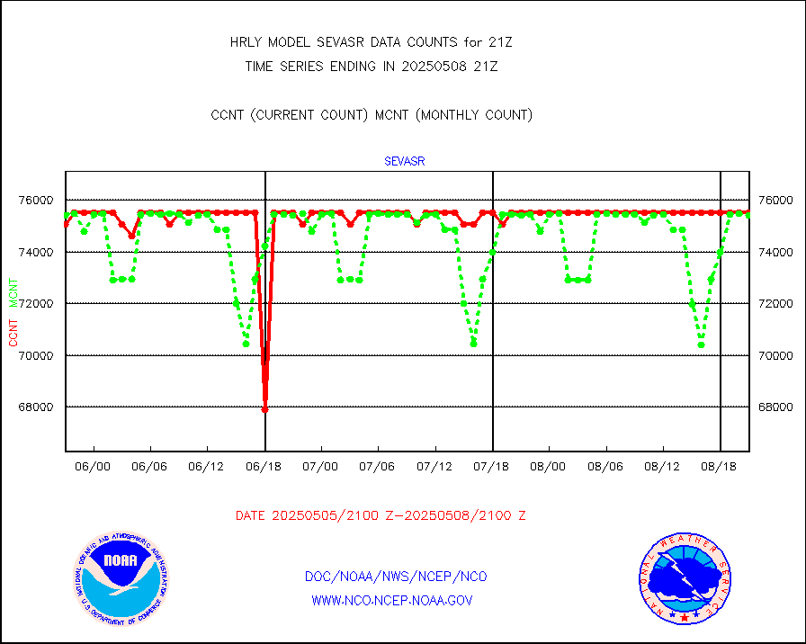
avcsam |
A.M.(N17,M2,M3) AVHRR GAC NCEP-proc clr&sea btmps |
1188282 |
1178426 |
100.8 % |
1918.50-1919.49 |
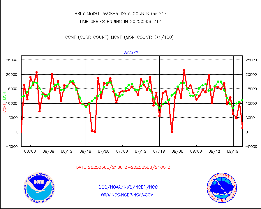
avcspm |
P.M.(N18-19) AVHRR GAC NCEP-proc clr & sea btemps |
1451854 |
1332580 |
109.0 % |
1918.50-1919.49 |
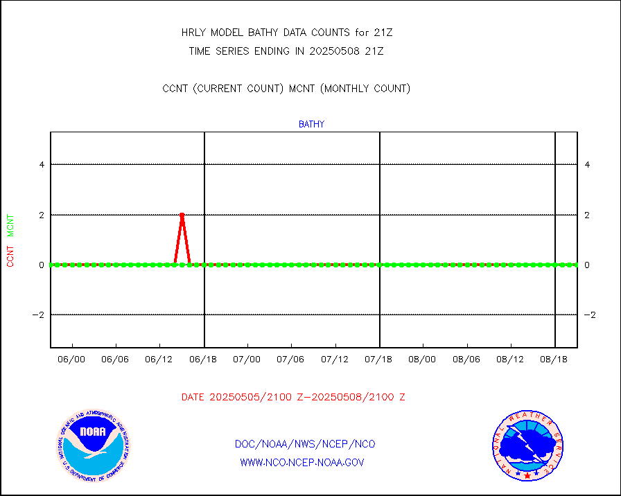
bathy |
eXpendable BathyThermograph, mooring (BATHY fmt) |
0 |
0 |
n/a |
1914.00-1914.99 |
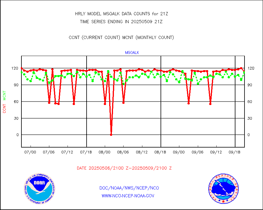
coopmd |
Coop/MADIS NEPP & HCN-Modernization NOAA COOP Obs |
27 |
27 |
100.0 % |
1920.50-1921.49 |
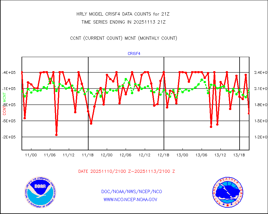
crisf4 |
NPP/NOAA-20 CrIS full spctrl radn (431 ch subset) |
218196 |
216474 |
100.8 % |
1919.50-1920.49 |
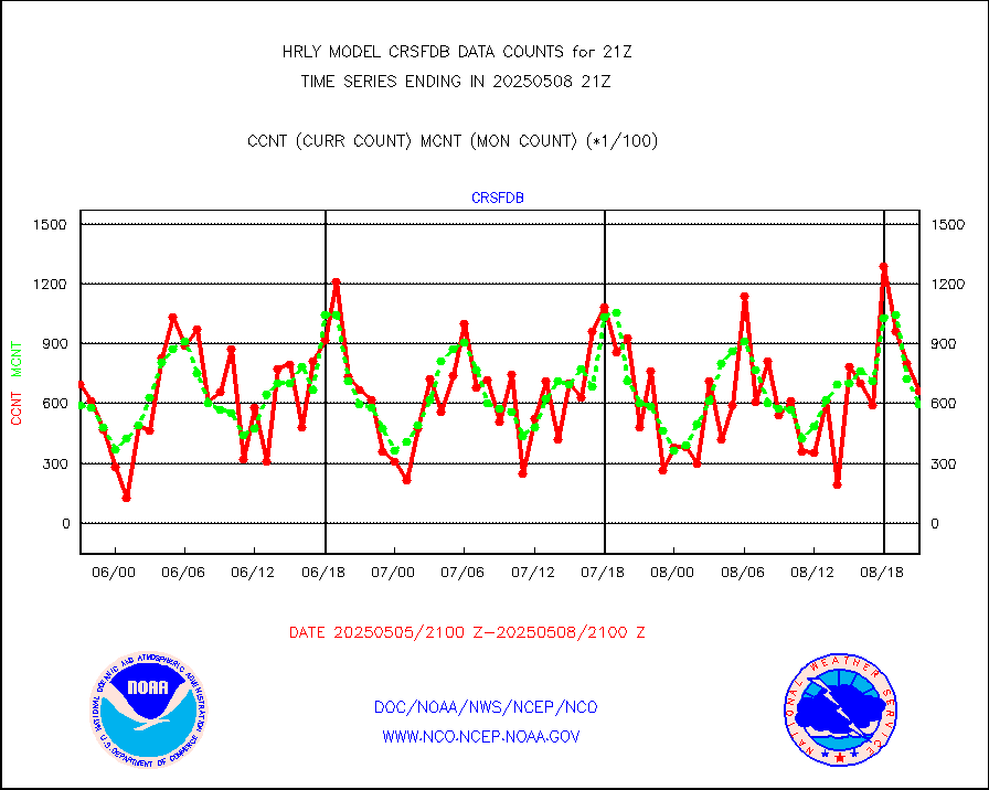
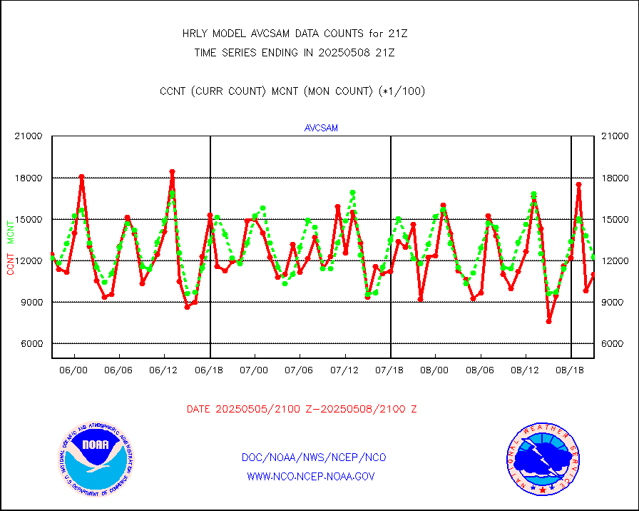
crsfdb |
NPP/NOAA-20 CrIS full spctrl radn dir brdcst SSEC |
58800 |
81882 |
71.8 % |
1919.50-1920.49 |
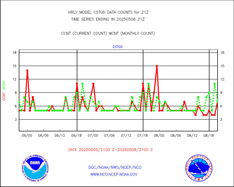
cstgd |
Coast Guard |
7 |
6 |
116.7 % |
1920.50-1921.50 |
dbuoyb |
Drifting buoys (decoded from BUFR) |
1397 |
1390 |
100.5 % |
1920.50-1921.50 |
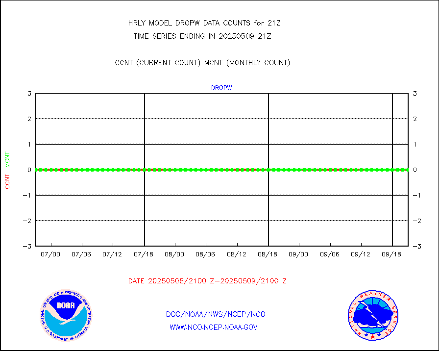
dropw |
Dropwinsonde (from TEMP DROP) |
0 |
0 |
n/a |
1920.50-1921.49 |
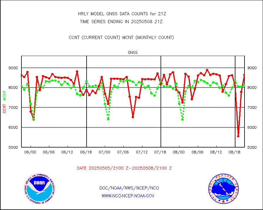
efclam |
GOES imager effective cloud amount data (U.Wisc.) |
8298871 |
8146463 |
101.9 % |
1920.50-1921.49 |
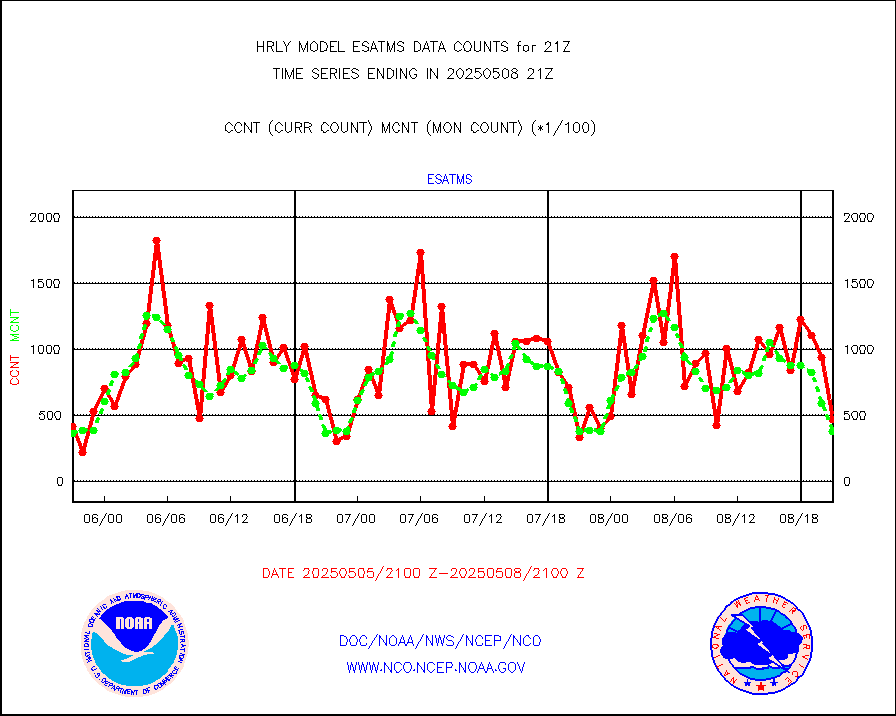
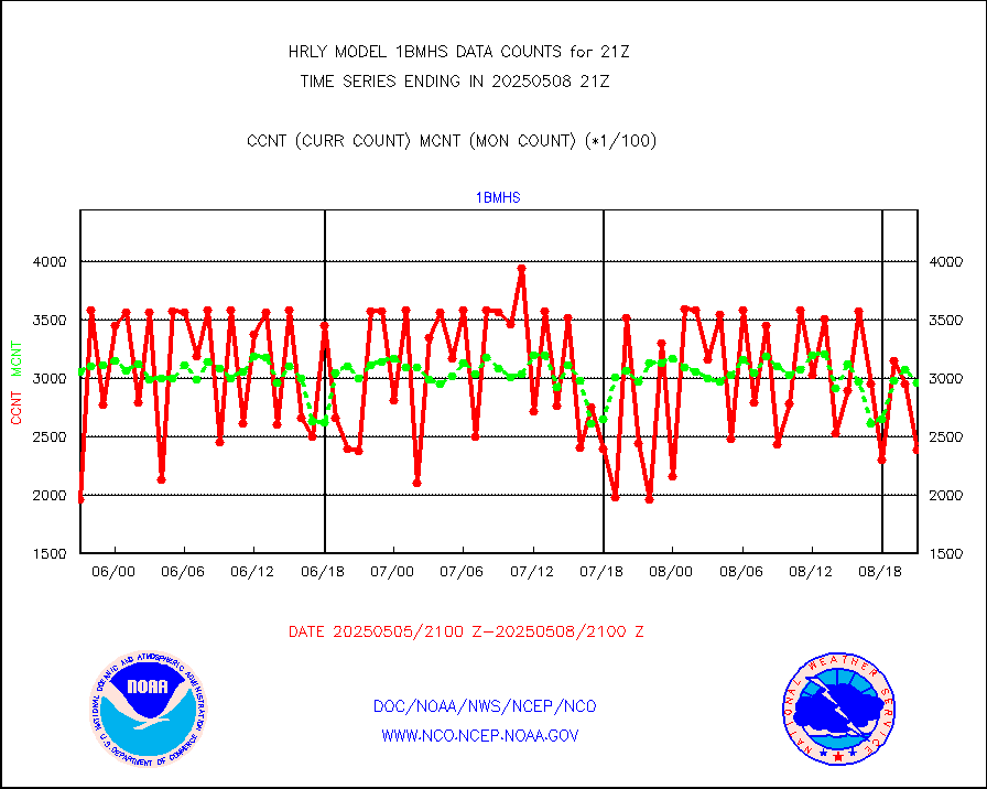
esatms |
NPP Adv. Tech. MW Sndr (ATMS) br. temps from RARS |
41550 |
51867 |
80.1 % |
1919.50-1920.49 |
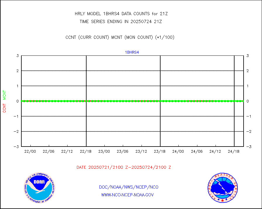
esiasi |
METOP 1-2 IASI 1C radiance data vbl chn from RARS |
64579 |
62066 |
104.0 % |
1920.00-1920.99 |
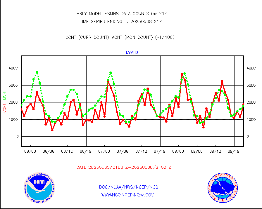
esmhs |
NOAA 18-19 & METOP 1-2 MHS proc. btemps from RARS |
230926 |
215840 |
107.0 % |
1920.50-1921.49 |
geoimr |
GOES/NESDIS (11x17 f-o-v) imager clear radiances |
0 |
0 |
n/a |
1920.00-1920.99 |
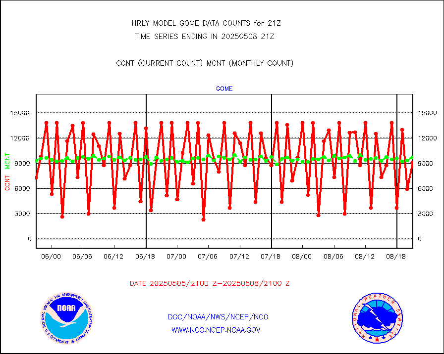
gome |
METOP 1-2 Global Ozone Monitoring Exp.-2 (GOME-2) |
13978 |
6827 |
204.7 % |
1919.50-1920.49 |
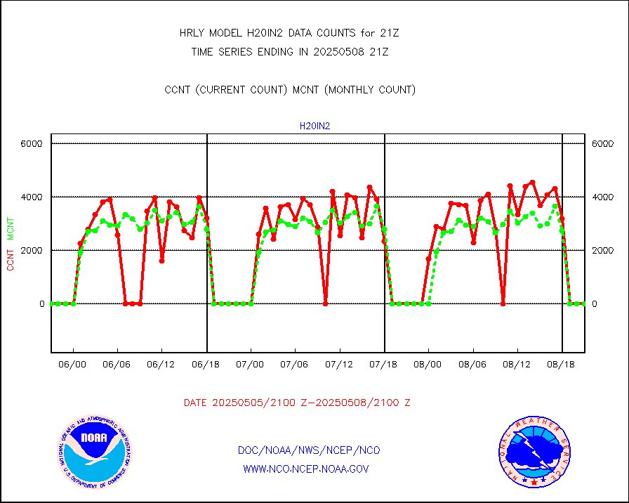
h20in2 |
INDIA SATWIND, INSAT WV channel |
9094 |
245 |
n/a |
1920.00-1920.99 |
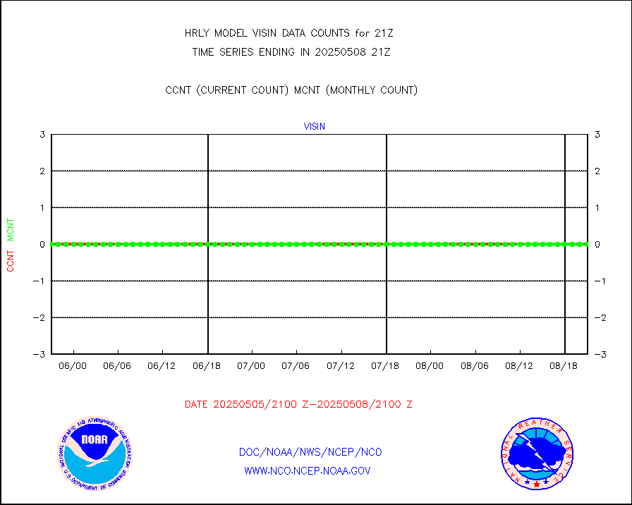
h2dusr |
GOES-16&up/NESDIS wv imgr/deep-lyr derivd cld mtn |
16613 |
17859 |
93.0 % |
1920.00-1920.99 |
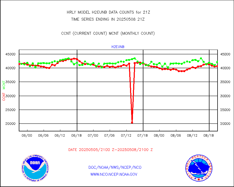
h2eunb |
METEOSAT/EUMETSAT wvpr imgr drv cld motion NBseq |
39682 |
41375 |
95.9 % |
1919.50-1920.49 |
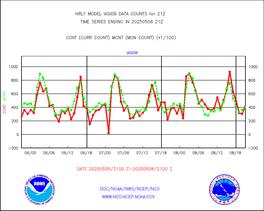
iasidb |
METOP 1-2 IASI 1C radiances-direct broadcast SSEC |
36348 |
31384 |
115.8 % |
1919.50-1920.49 |
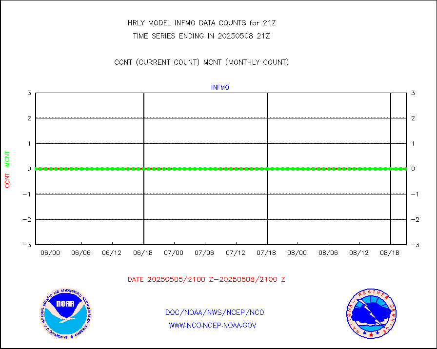
ifvrnb |
VIIRS (NPP/NOAA-20) ir lg-wv drv cloud motion(NB) |
13791 |
14235 |
96.9 % |
1917.00-1917.99 |
infav |
AVHRR (NOAA/METOP) ir lg-wave derived cld motion |
0 |
0 |
n/a |
1917.00-1917.99 |
infav1 |
AVHRR (METOP) ir lg-wave derived cld motion |
0 |
0 |
n/a |
1920.50-1921.50 |
infin |
INSAT/KALPANA India ir lg-wave derived cld motion |
0 |
0 |
n/a |
1918.50-1919.49 |
infin2 |
INDIA SATWIND, INSAT IR channel |
10995 |
268 |
n/a |
1920.00-1920.99 |
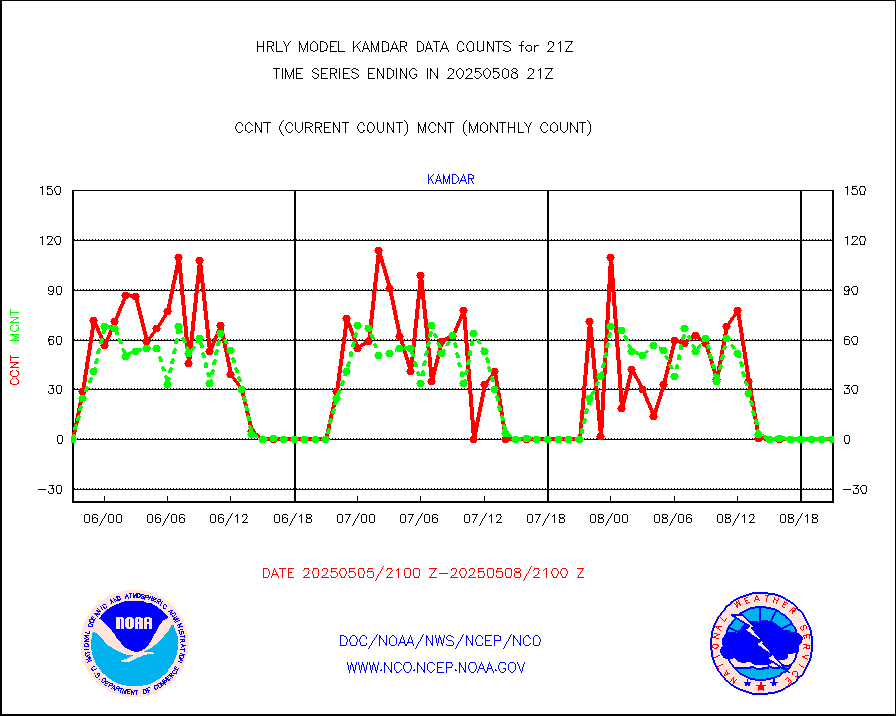
kamdar |
Korean AMDAR aircraft data (decoded from BUFR) |
0 |
0 |
n/a |
1920.50-1921.49 |
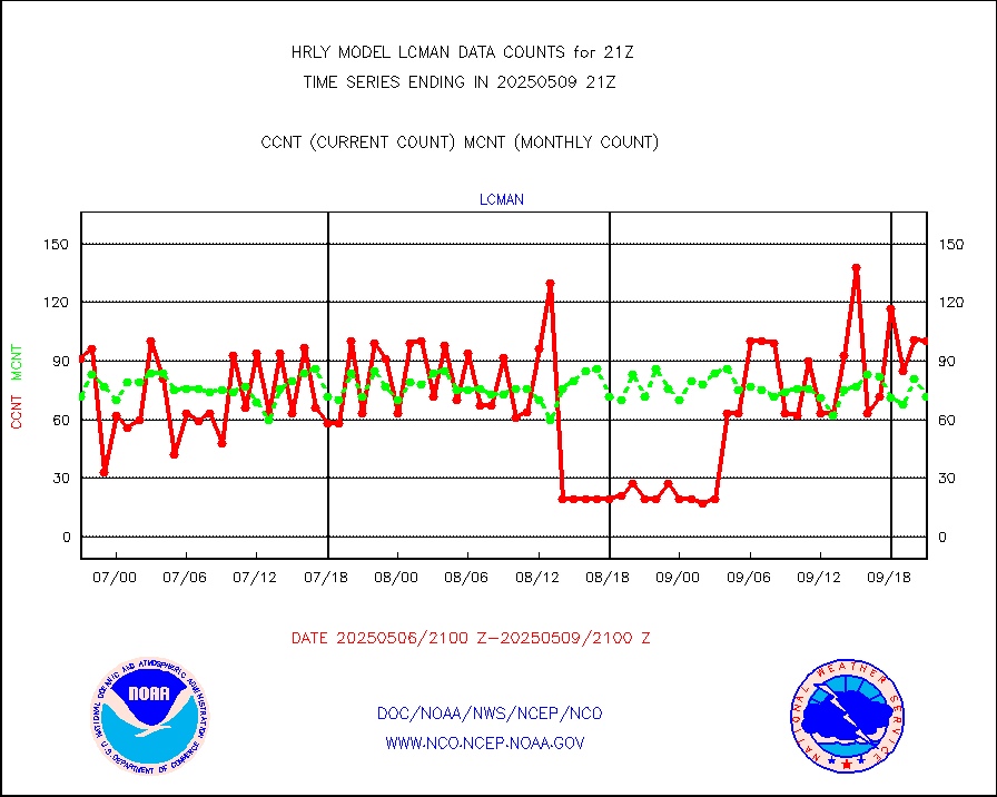
lcman |
Land-based CMAN stations decoded from CMAN format |
44 |
78 |
56.4 % |
1920.50-1921.49 |
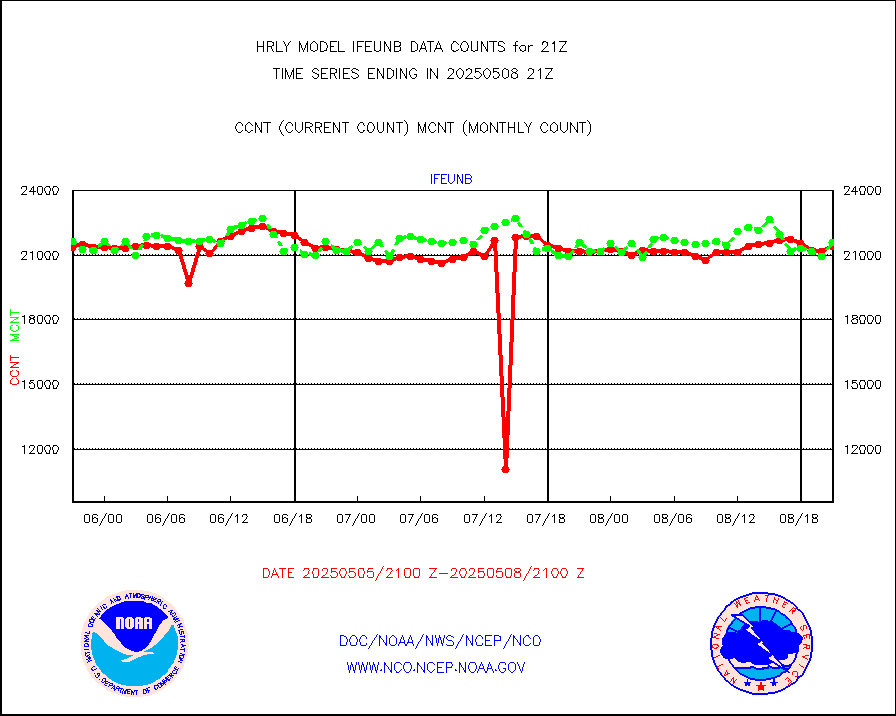
leogeo |
LEO-GEO satellite AMVs from UWisc. |
6314 |
5066 |
124.6 % |
1917.00-1917.99 |
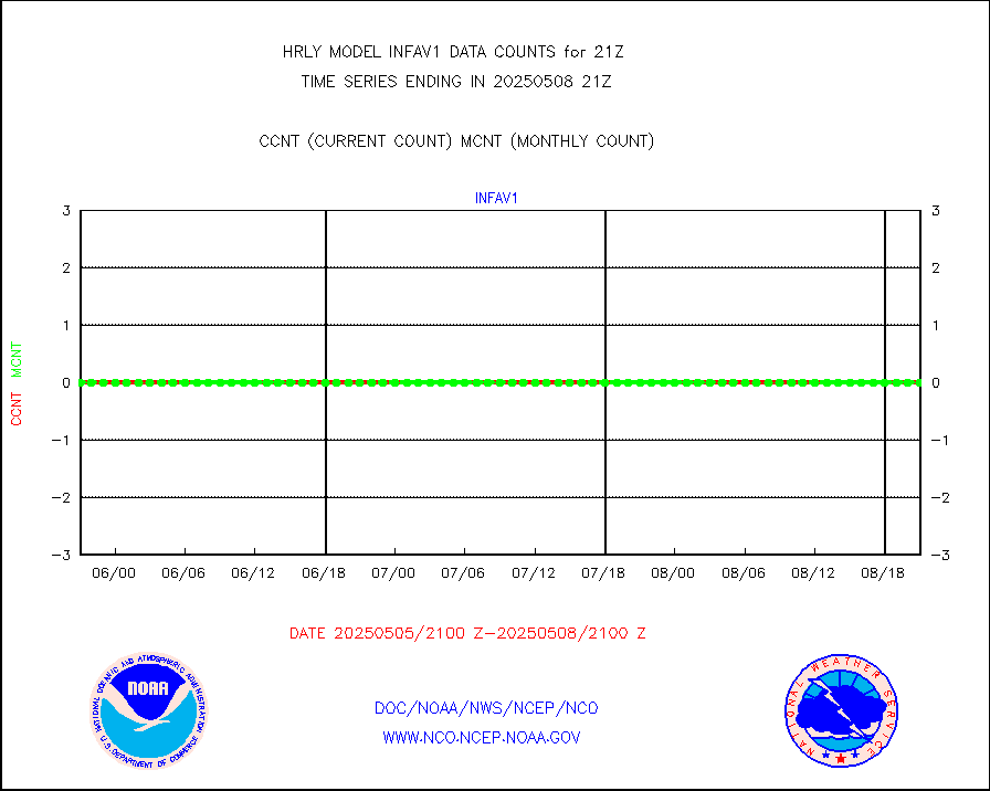
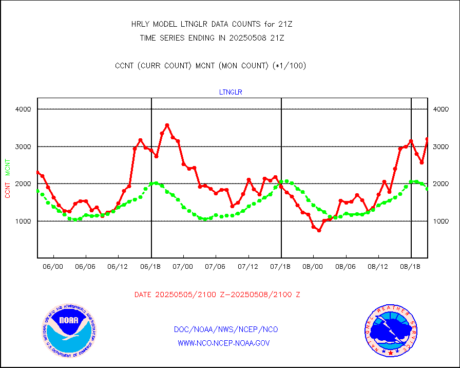
ltnglr |
LLDN Long-rng lightning from Vaisala via NOAAPORT |
203988 |
184100 |
110.8 % |
1920.50-1921.49 |
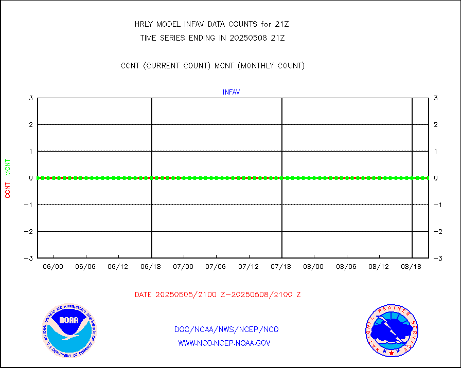
ltngsr |
NLDN Shrt-rng lightning from Vaisala via NOAAPORT |
9963 |
4195 |
237.5 % |
1920.50-1921.49 |
mbuoyb |
Moored buoys (decoded from BUFR) |
816 |
756 |
107.9 % |
1920.50-1921.50 |
mls |
Aura Microwave Limb Sounder (MLS) ozone data |
0 |
0 |
n/a |
1919.00-1919.99 |
msourb |
Mesonet/MADIS UrbaNet |
4352 |
4388 |
99.2 % |
1920.50-1921.49 |
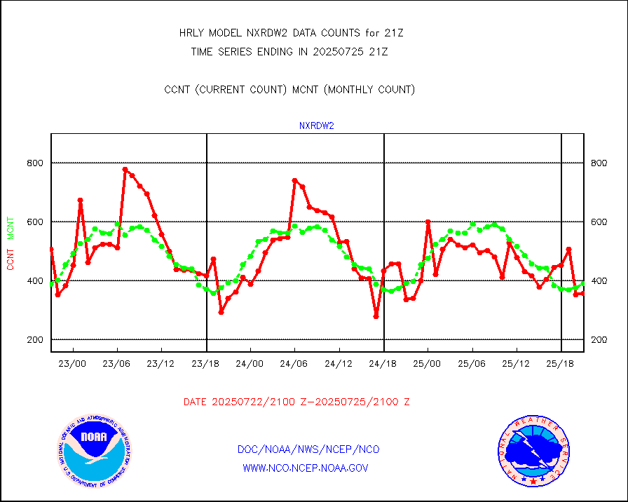
nxrdw2 |
NEXRAD Vel Azm Dsp(VAD) winds via Level 2 decoder |
597 |
528 |
113.1 % |
1920.50-1921.49 |
ompslp |
OMPS Limb Profiler ozone data (NPP) |
36 |
264 |
13.6 % |
1914.00-1914.99 |
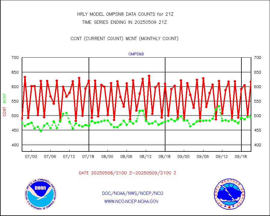
ompsn8 |
OMPS nadir profile ozone (Version 8 BUFR) |
521 |
554 |
94.0 % |
1919.00-1919.99 |
ompst8 |
OMPS total column ozone (Version 8 BUFR) |
246283 |
340306 |
72.4 % |
1919.00-1919.99 |
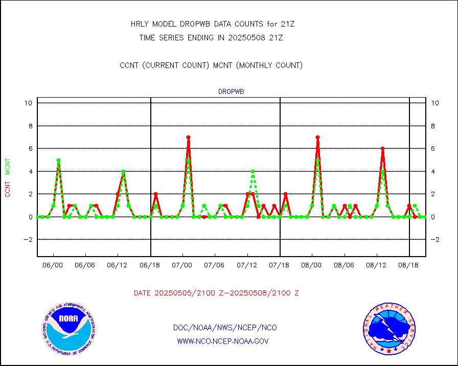
pirep |
Manual PIREP aircraft data (dcded from AIREP fmt) |
107 |
133 |
80.5 % |
1920.50-1921.49 |
prflrp |
Profilr winds from PIBAL (PILOT,PILOT SHIP/MOBIL) |
0 |
0 |
n/a |
1920.50-1921.49 |
raobm |
Rawinsonde - mobile land (from TEMP/PILOT MOBIL) |
0 |
0 |
n/a |
1920.50-1921.49 |
raobs |
Rawinsonde - ship (from TEMP SHIP, PILOT SHIP) |
0 |
0 |
n/a |
1920.50-1921.49 |
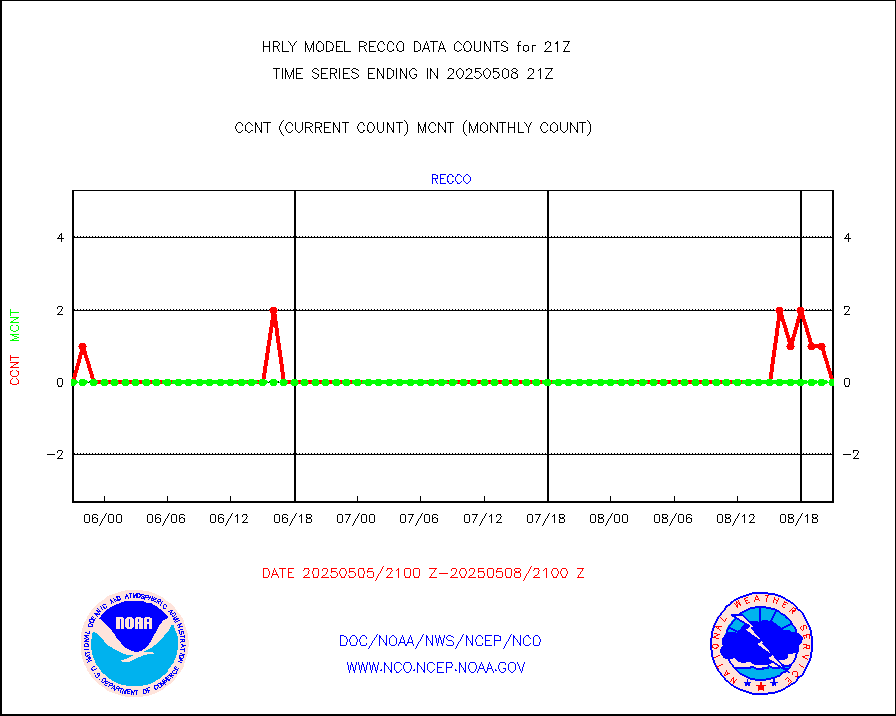
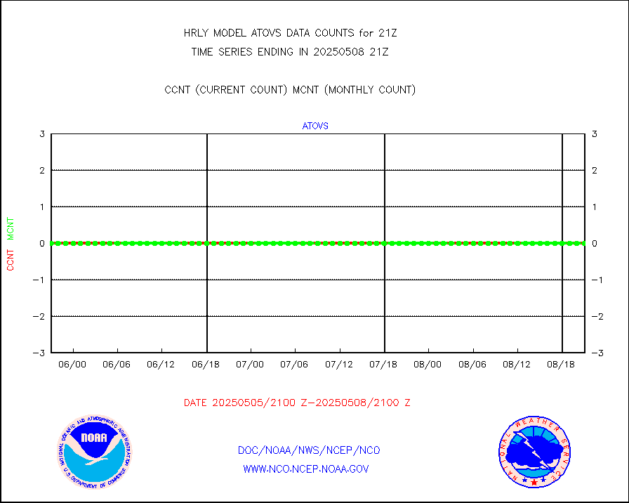
recco |
Flight level reconnaissance aircraft data |
0 |
0 |
n/a |
1920.50-1921.49 |
saphir |
Megha-Tropiques SAPHIR L1A2 brightness temps |
0 |
0 |
n/a |
1918.50-1919.49 |
sevasr |
METEOSAT-10 2nd Gen SEVIRI All Sky Radiance(proc) |
75073 |
75452 |
99.5 % |
1920.50-1921.49 |
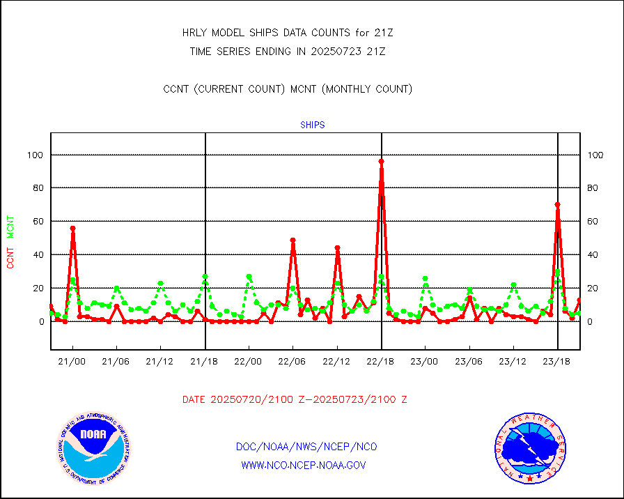
ships |
Ship - manual and automatic, restricted |
0 |
5 |
0.0 % |
1920.50-1921.49 |
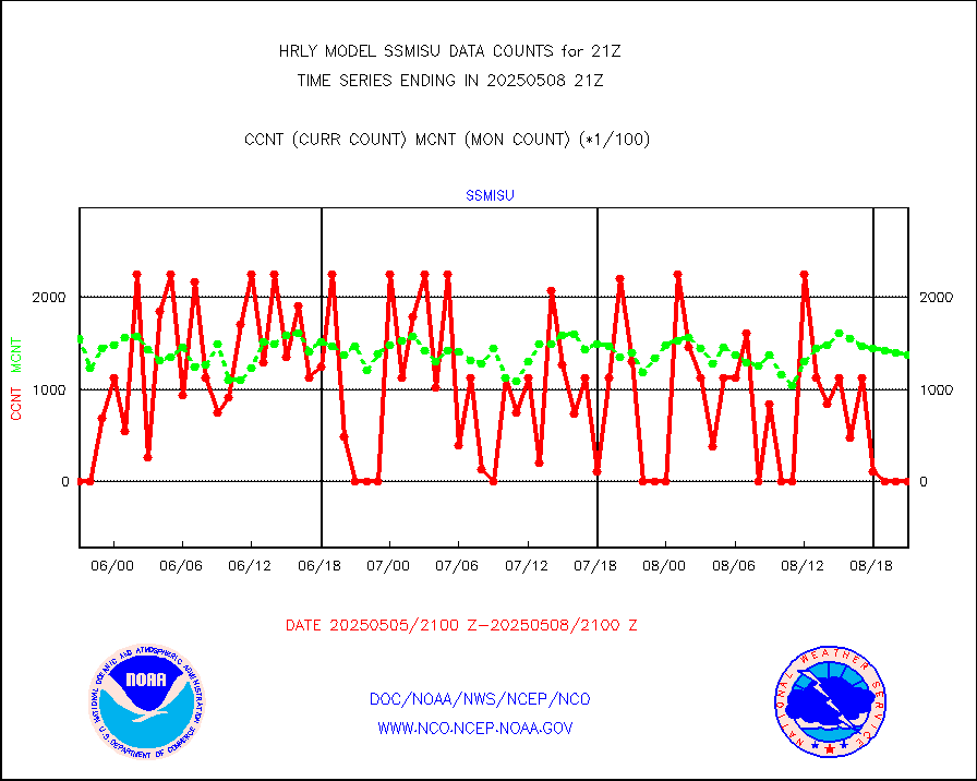
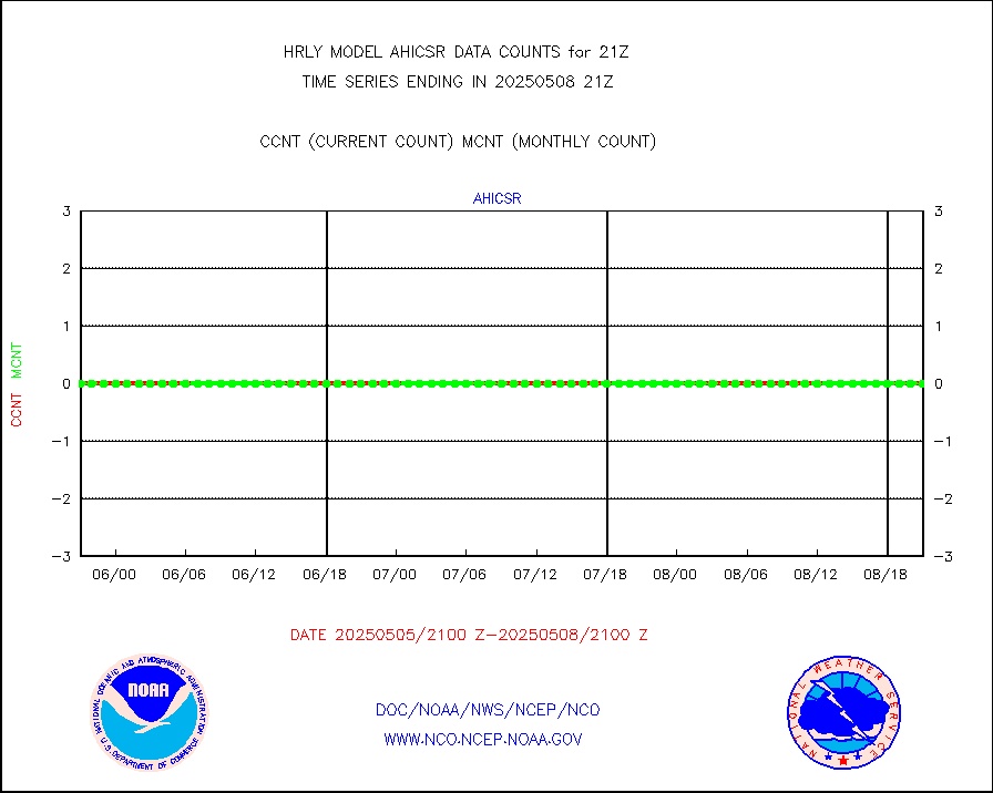
ssmisu |
DMSP SSM/IS 1C radiance data (Unified Pre-Proc.) |
79980 |
122872 |
65.1 % |
1919.50-1920.49 |
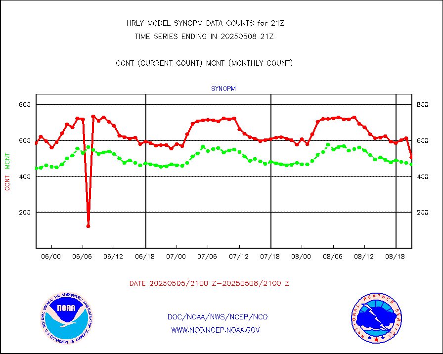
synopm |
Synoptic - mobile manual and automatic |
566 |
602 |
94.0 % |
1920.50-1921.49 |
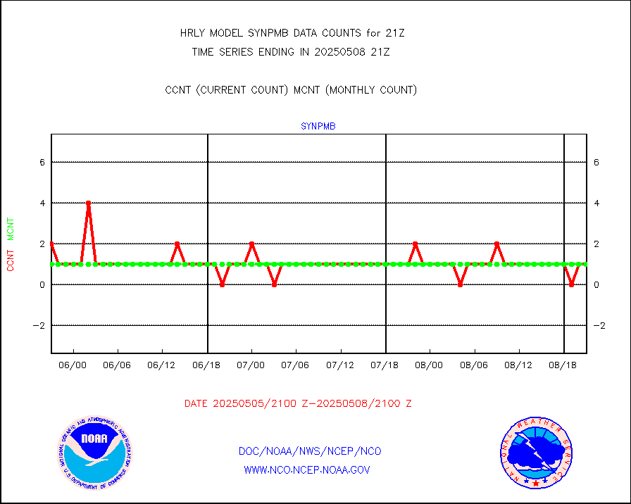
synpmb |
Synoptic - mobile manual & auto (decoded fr BUFR) |
0 |
1 |
0.0 % |
1920.50-1921.49 |
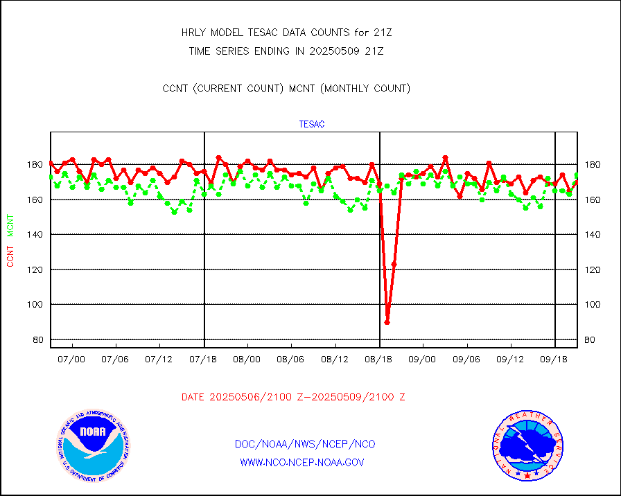
tesac |
CTD probe, Argo prflng float, mooring (TESAC fmt) |
207 |
201 |
103.0 % |
1920.50-1921.49 |
tmdara |
TAMDAR aircft data-all types(from Panasonic,BUFR) |
161 |
132 |
122.0 % |
1920.50-1921.49 |
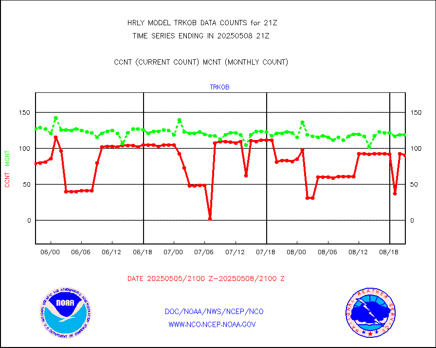
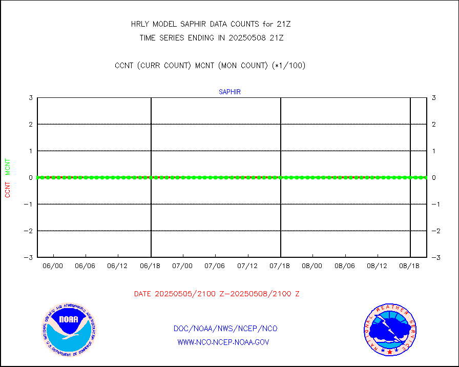
trkob |
ThermoSalinoGraph (TSG) TRACKOB format) |
90 |
45 |
200.0 % |
1919.50-1920.49 |
visin |
INSAT/KALPANA India visible derived cloud motion |
0 |
0 |
n/a |
1918.50-1919.49 |
visin2 |
INDIA SATWIND, INSAT VIS channel |
0 |
0 |
n/a |
1920.00-1920.99 |
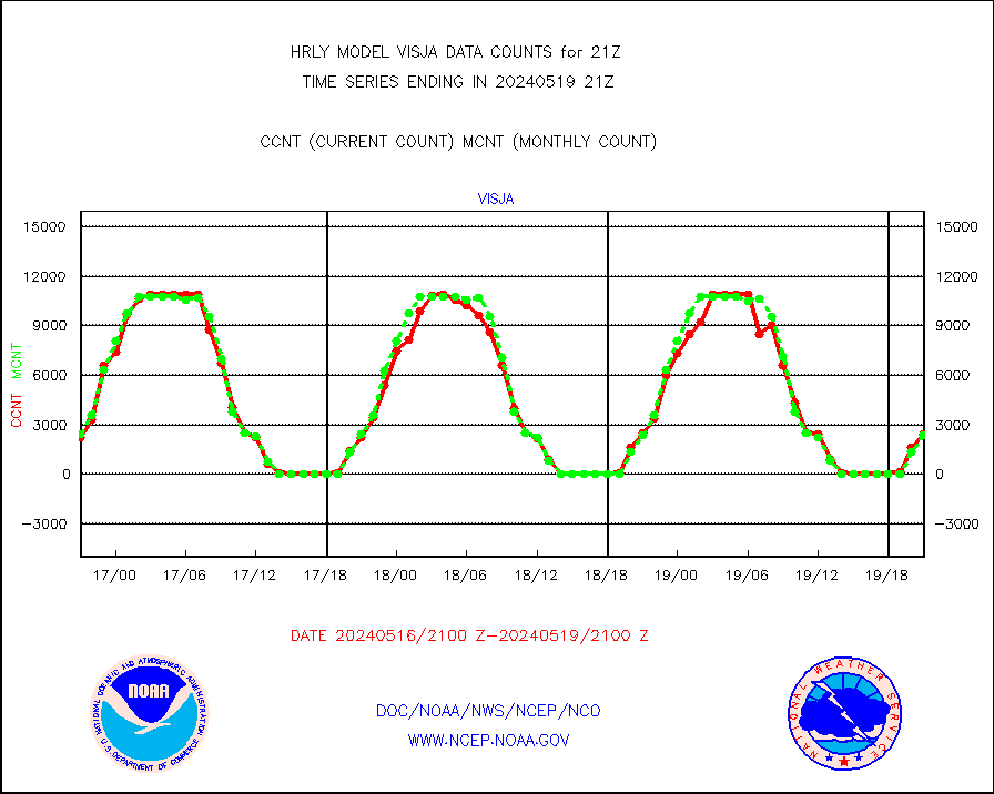
visja |
MTSAT/JMA visible derived cloud motion |
2407 |
2394 |
100.5 % |
1918.50-1919.49 |
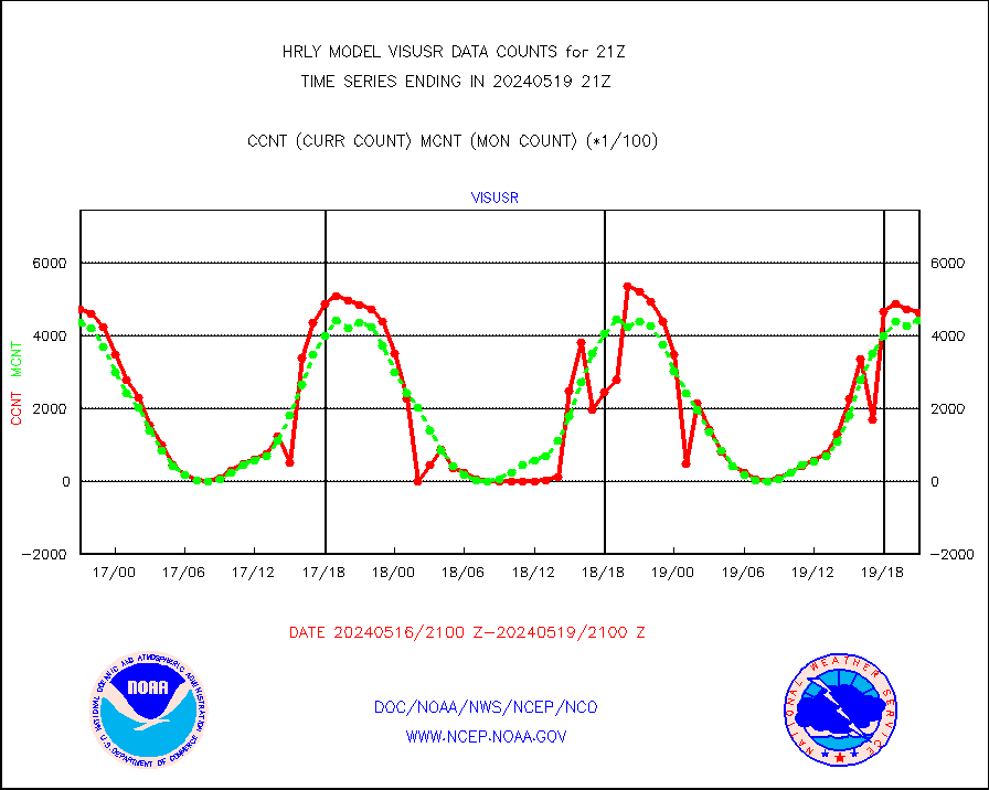
visusr |
GOES-16&up/NESDIS visible derived cloud motion |
465104 |
443207 |
104.9 % |
1920.00-1920.99 |
vseunb |
METEOSAT/EUMETSAT visible drv cld motion NBseq |
5276 |
5106 |
103.3 % |
1919.50-1920.49 |


