| Critical Data with Normal Counts |
|---|
| Type | Description | Hourly Count | Monthly Average | Percent (%) of Monthly Mean | UTC Time Window |
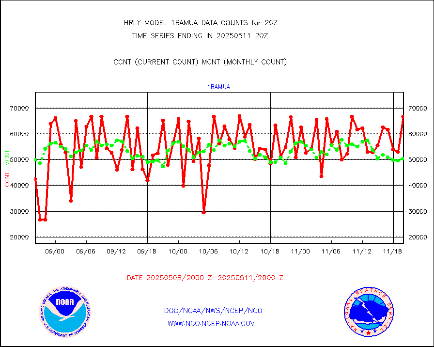
1bamua |
NOAA 15-19 & METOP 1-2 AMSU-A NCEP-proc. br.temps |
46416 |
55418 |
83.8 % |
1918.00-1918.99 |
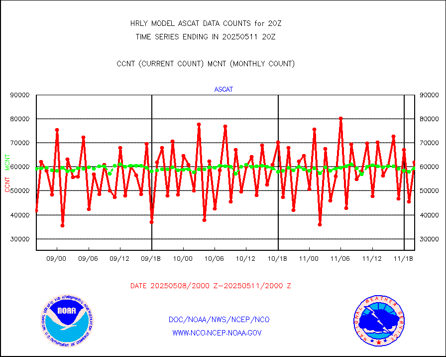
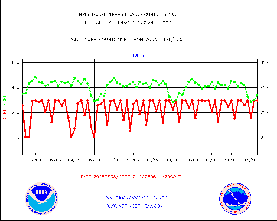
1bhrs4 |
NOAA 18-19 & METOP 1-2 HIRS-4 NCEP-proc. br.temps |
27404 |
49817 |
55.0 % |
1918.00-1918.99 |
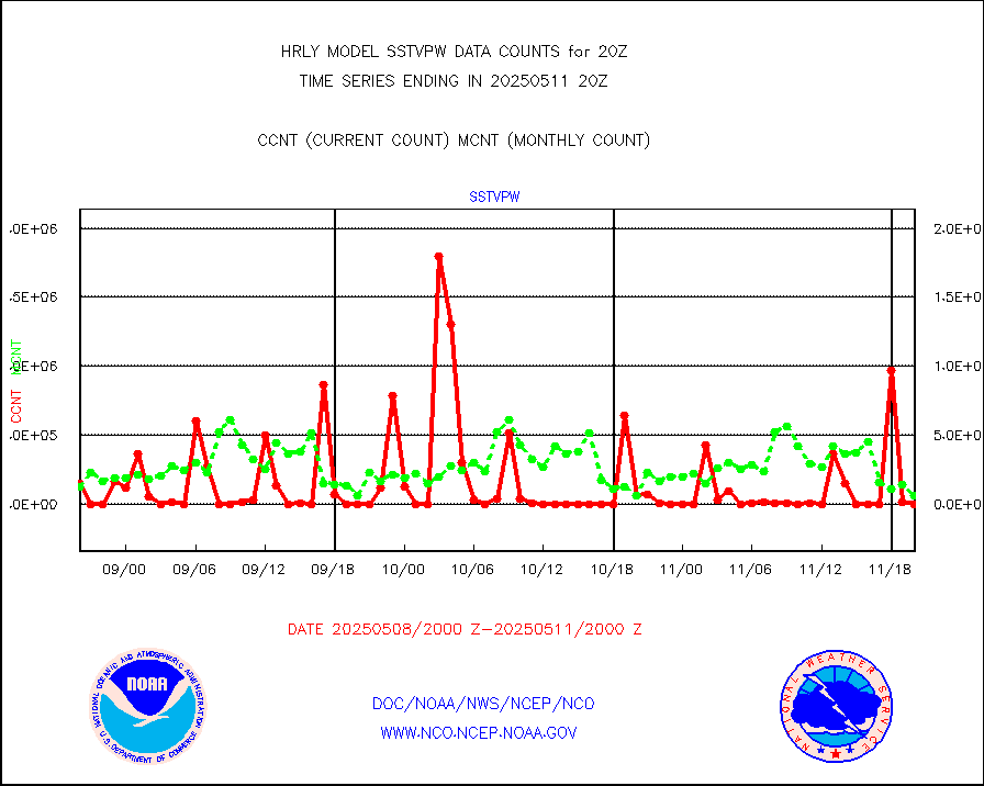
1bmhs |
NOAA 18-19 & METOP 1-2 MHS NCEP-proces. br. temps |
316717 |
313059 |
101.2 % |
1918.00-1918.99 |
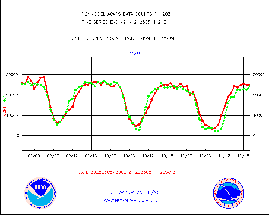
acars |
MDCRS ACARS acft data from ARINC(dcded from BUFR) |
20498 |
20483 |
100.1 % |
1919.50-1920.49 |
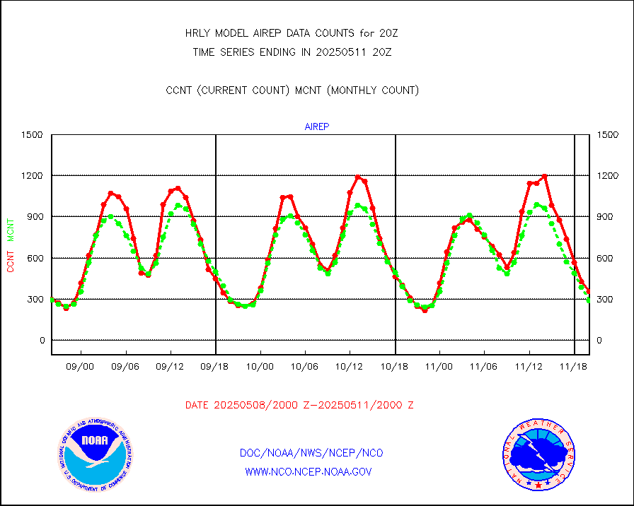
airep |
Manual AIREP aircraft data (dcded from AIREP fmt) |
733 |
577 |
127.0 % |
1919.50-1920.49 |
airsev |
AQUA AIRS/AMSU-A/HSB brightness temps- every FOV |
0 |
0 |
n/a |
1917.50-1918.49 |
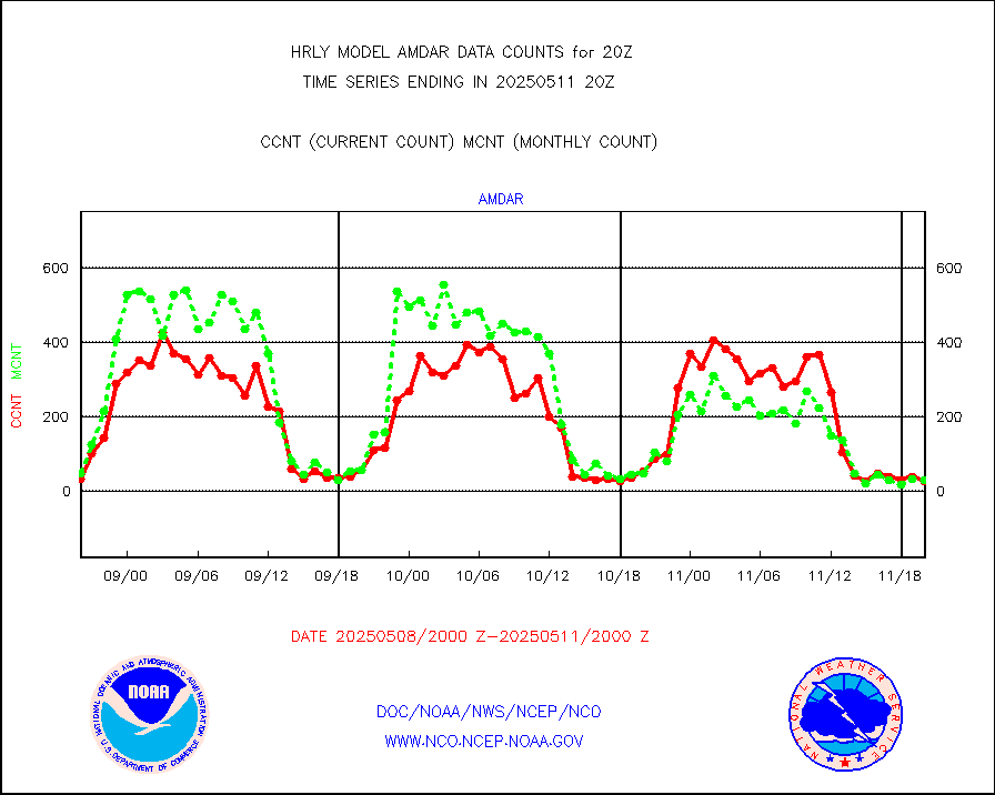
amdar |
AMDAR aircraft data (decoded from AMDAR format) |
53 |
35 |
151.4 % |
1919.50-1920.49 |
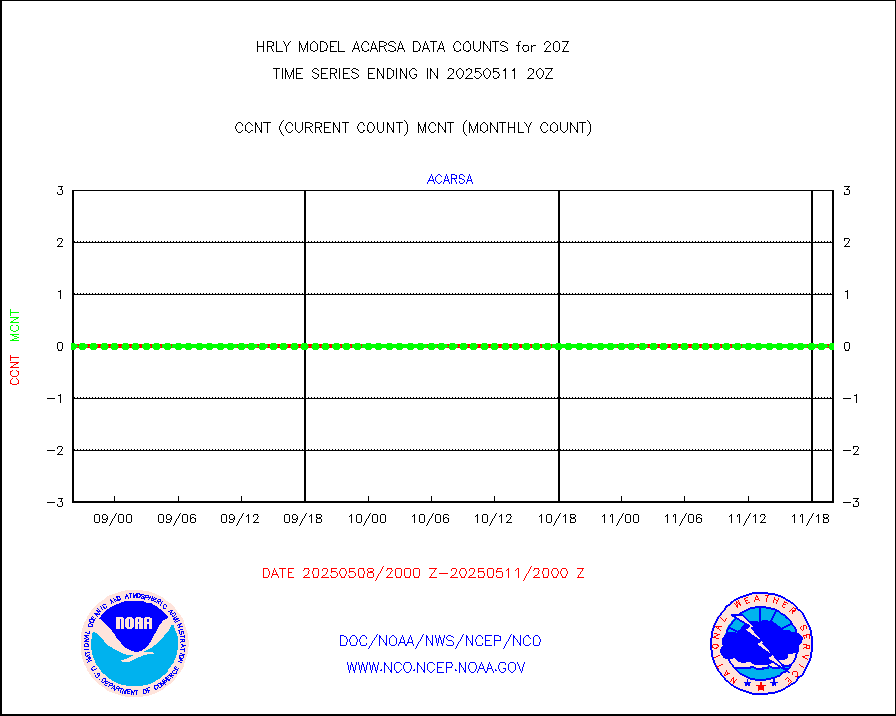
amdarb |
AMDAR aircraft data (decoded from BUFR) |
351 |
268 |
131.0 % |
1919.50-1920.49 |
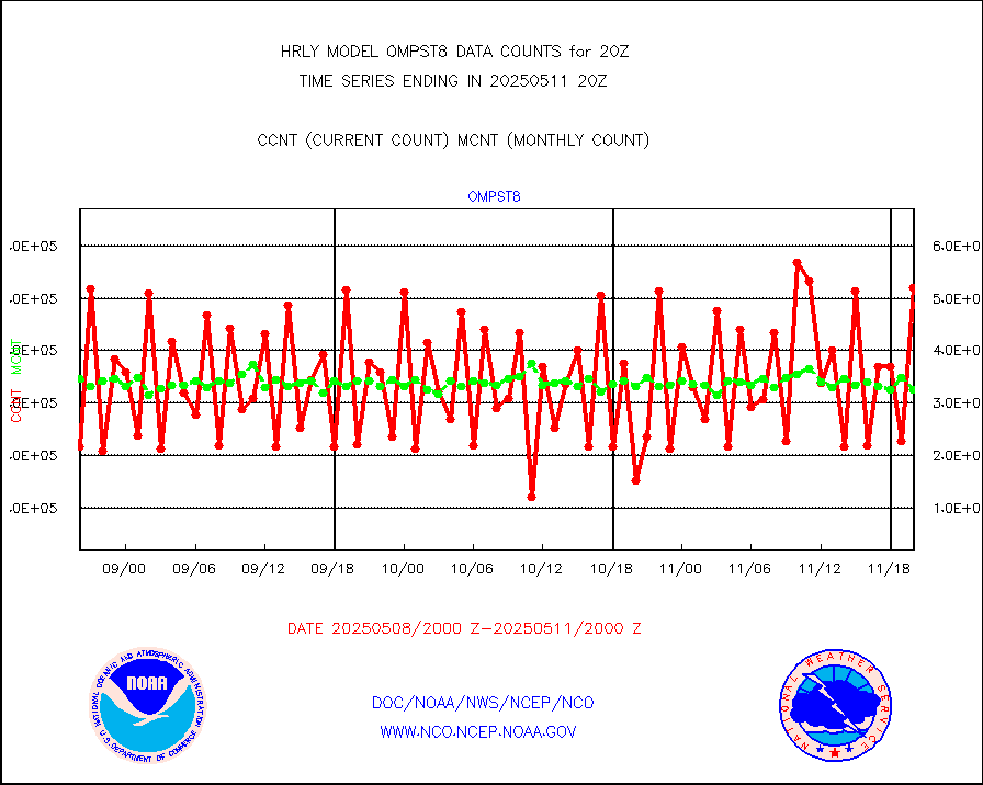
ascat |
METOP 1-2 ASCAT products |
43890 |
45373 |
96.7 % |
1918.50-1919.49 |
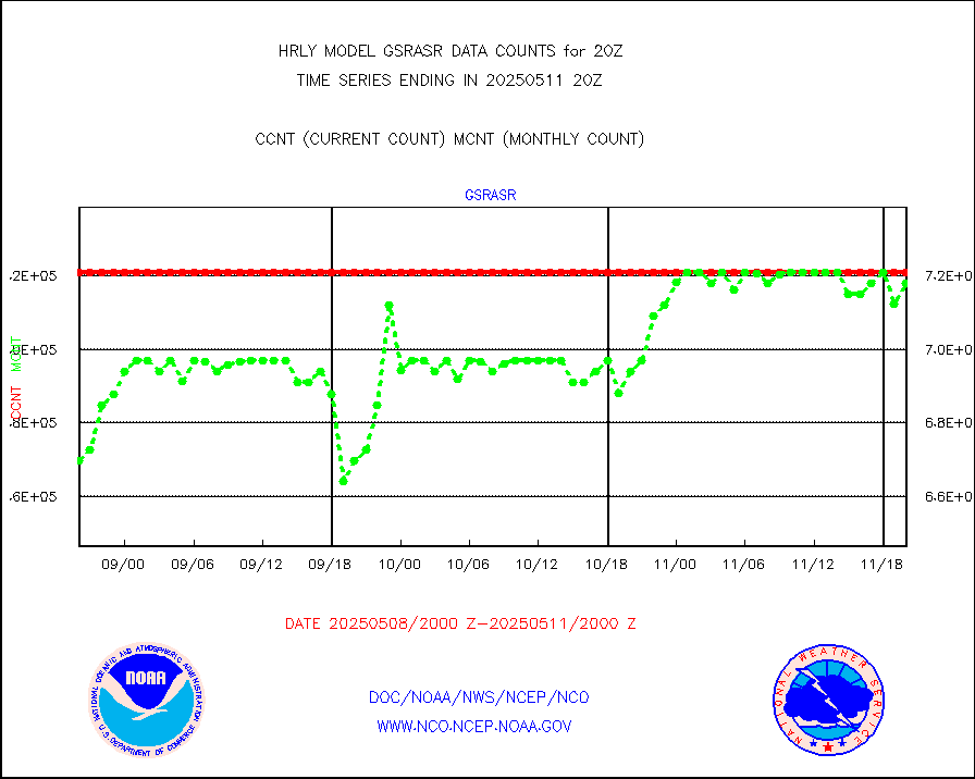
atms |
NPP/NOAA-20 ATMS brightness temperatures |
318912 |
349629 |
91.2 % |
1918.50-1919.49 |
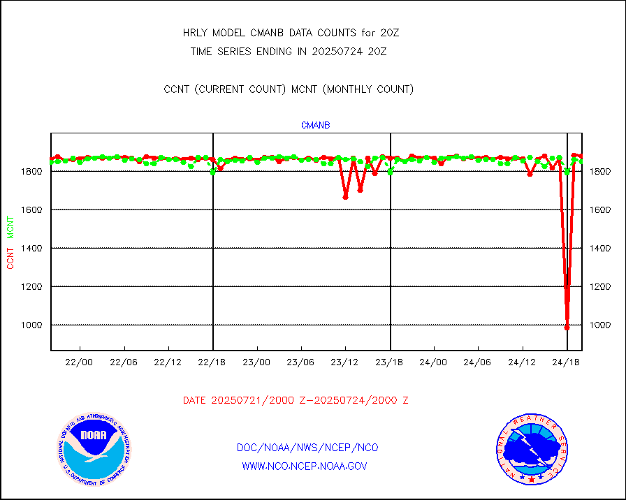
cmanb |
Surface Marine CMAN rpts decoded from BUFR format |
1817 |
1811 |
100.3 % |
1919.50-1920.50 |
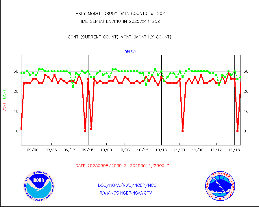
dbuoy |
Buoys decoded from FM-18 fmt (moored or drifting) |
39 |
36 |
108.3 % |
1919.50-1920.49 |
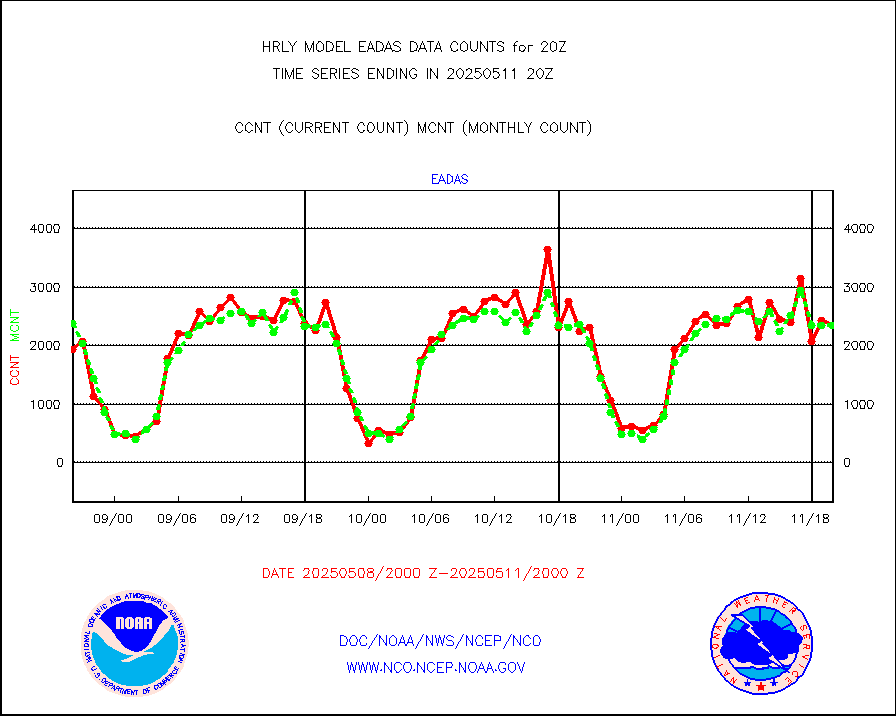
eadas |
E-AMDAR (European AMDAR acft decoded from BUFR) |
2035 |
1876 |
108.5 % |
1919.50-1920.49 |
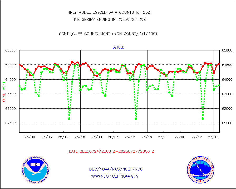
esamua |
NOAA 15-19 & METOP 1-2 AMSU-A proc btmps frm RARS |
29761 |
25250 |
117.9 % |
1919.50-1920.49 |
eshrs3 |
NOAA 15-19 & METOP 1-2 HIRS-3/4 pr btmps frm RARS |
54667 |
51757 |
105.6 % |
1919.50-1920.49 |
gnss |
Grnd-based Gbl Navigation Sat System (GNSS) data |
8821 |
9233 |
95.5 % |
1919.00-1919.99 |
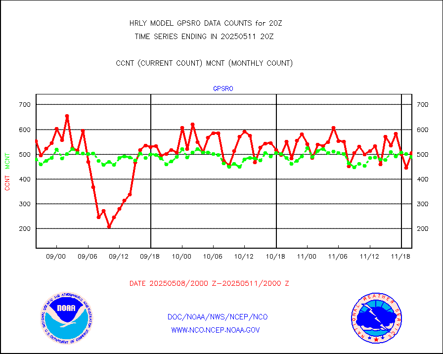
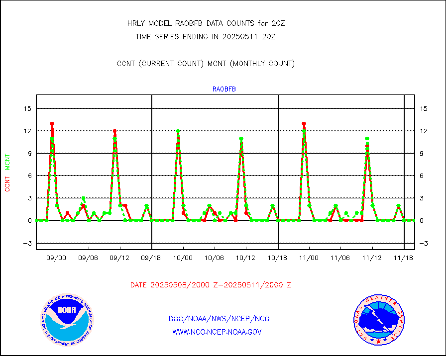
gpsro |
GPS radio occultation data |
416 |
444 |
93.7 % |
1917.50-1918.49 |
gsrasr |
GOES-16/17 All Sky Radiances (proc.) |
360476 |
360476 |
100.0 % |
1919.50-1920.49 |
gsrcsr |
GOES-16/17 Clear Sky Radiances (proc.) |
177791 |
189688 |
93.7 % |
1919.50-1920.49 |
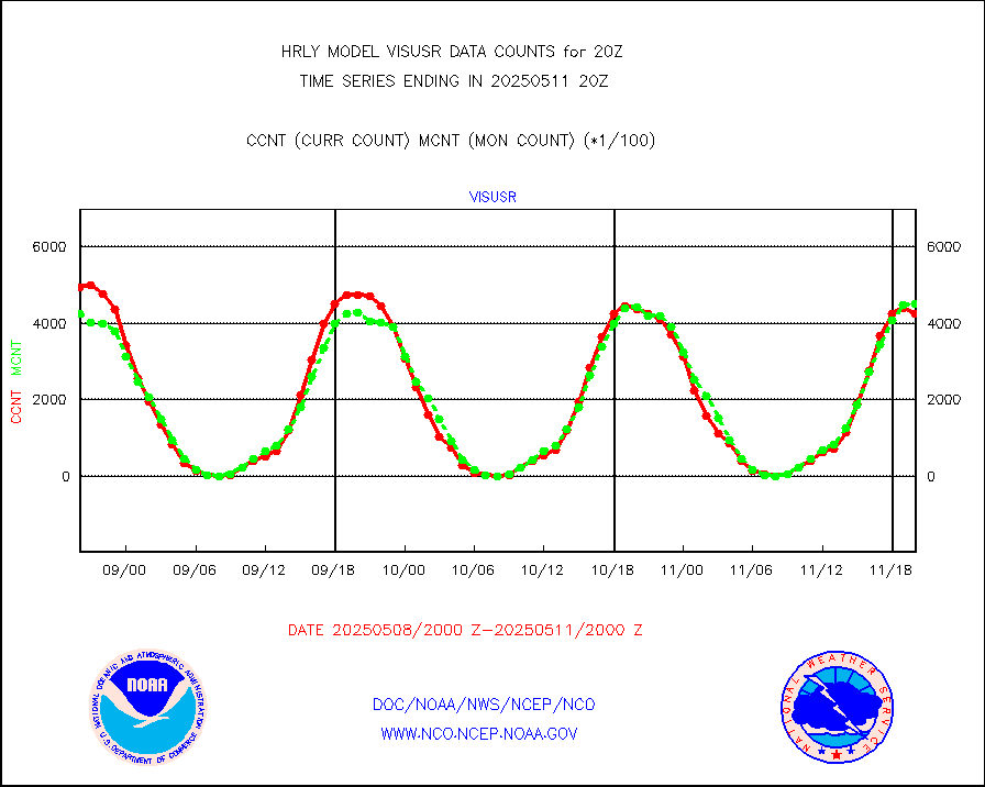
h20ja |
MTSAT/JMA water vapor imager derived cloud motion |
19407 |
18227 |
106.5 % |
1917.50-1918.49 |
h20mo |
MODIS (AQUA/TERRA) wvpr imager derived cld motion |
0 |
0 |
n/a |
1916.00-1916.99 |
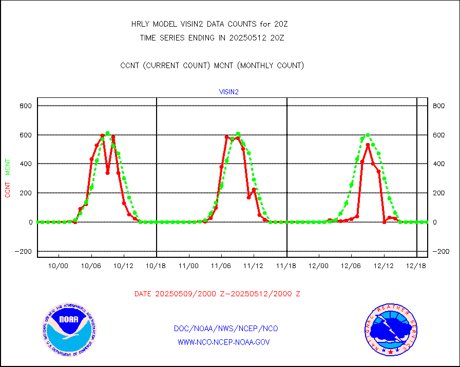
h2tusr |
GOES-16&up/NESDIS wv imgr/cld-top derived cld mtn |
27296 |
26187 |
104.2 % |
1919.00-1919.99 |
ifeunb |
METEOSAT/EUMETSAT ir lg-wave drv cld motion NBseq |
21788 |
21553 |
101.1 % |
1918.50-1919.49 |
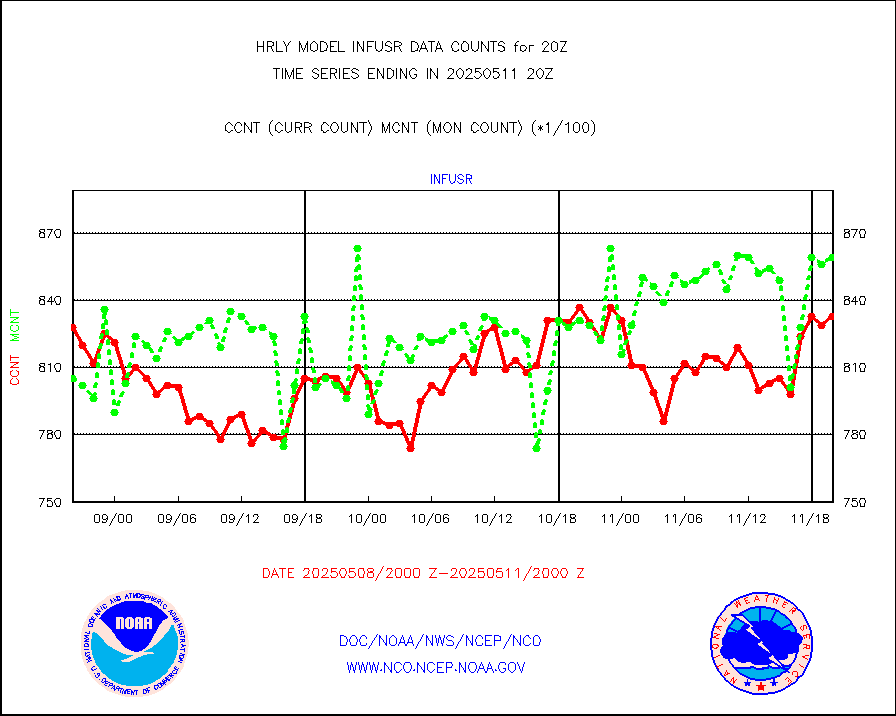
infja |
MTSAT/JMA infrared long-wave derived cloud motion |
15478 |
15588 |
99.3 % |
1917.50-1918.49 |
infmo |
MODIS (AQUA/TERRA) ir l-wave derived cloud motion |
0 |
0 |
n/a |
1916.00-1916.99 |
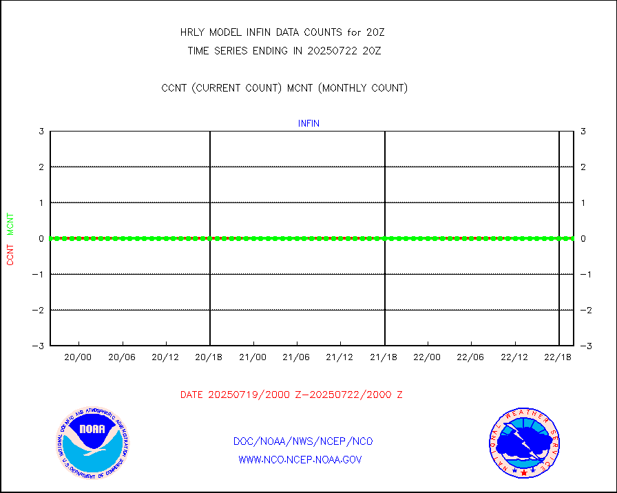
infusr |
GOES-16&up/NESDIS ir long-wave derived cld motion |
80539 |
78740 |
102.3 % |
1919.00-1919.99 |
lgycld |
GOES/NASA(Langley) hi-res. (1x1 f-o-v) cloud data |
4201975 |
3501494 |
120.0 % |
1919.50-1920.49 |
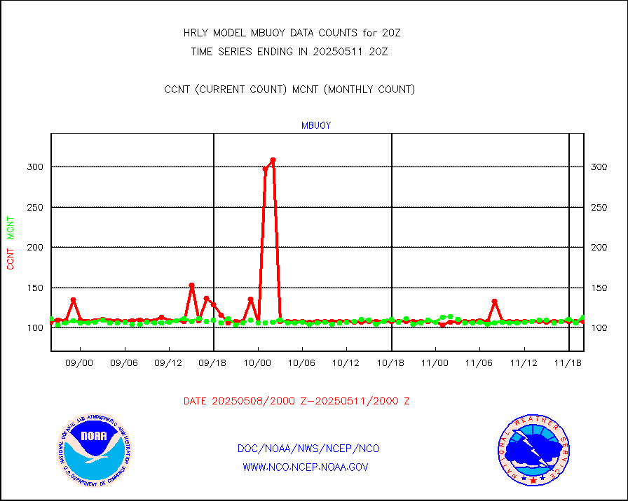
mbuoy |
Buoys decoded from FM-13 format (moored) |
118 |
111 |
106.3 % |
1919.50-1920.49 |
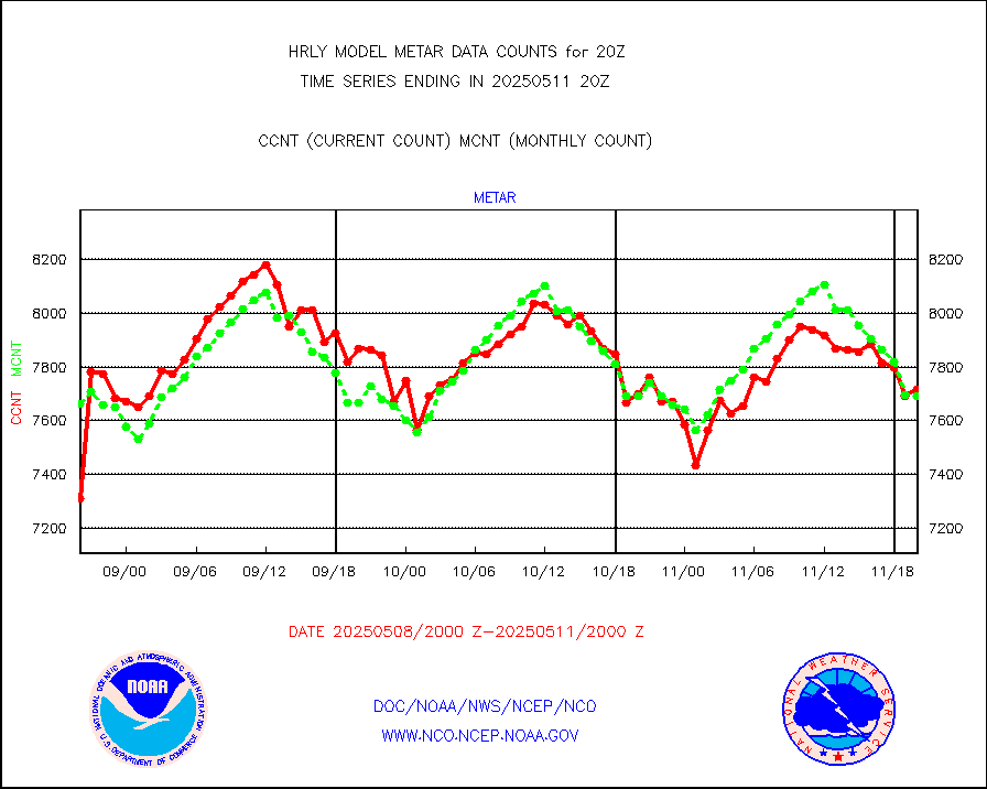
metar |
Aviation - METAR |
7328 |
7685 |
95.4 % |
1919.50-1920.49 |
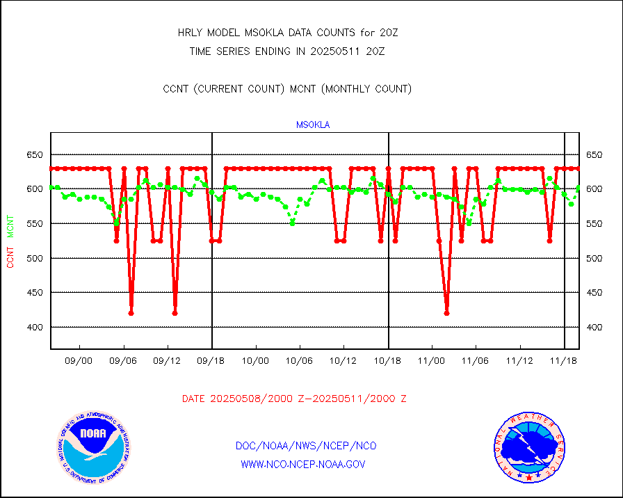
mso470 |
Mesonet/MADIS Colorado E-470 (Interstate 470) |
21 |
20 |
105.0 % |
1919.50-1920.49 |
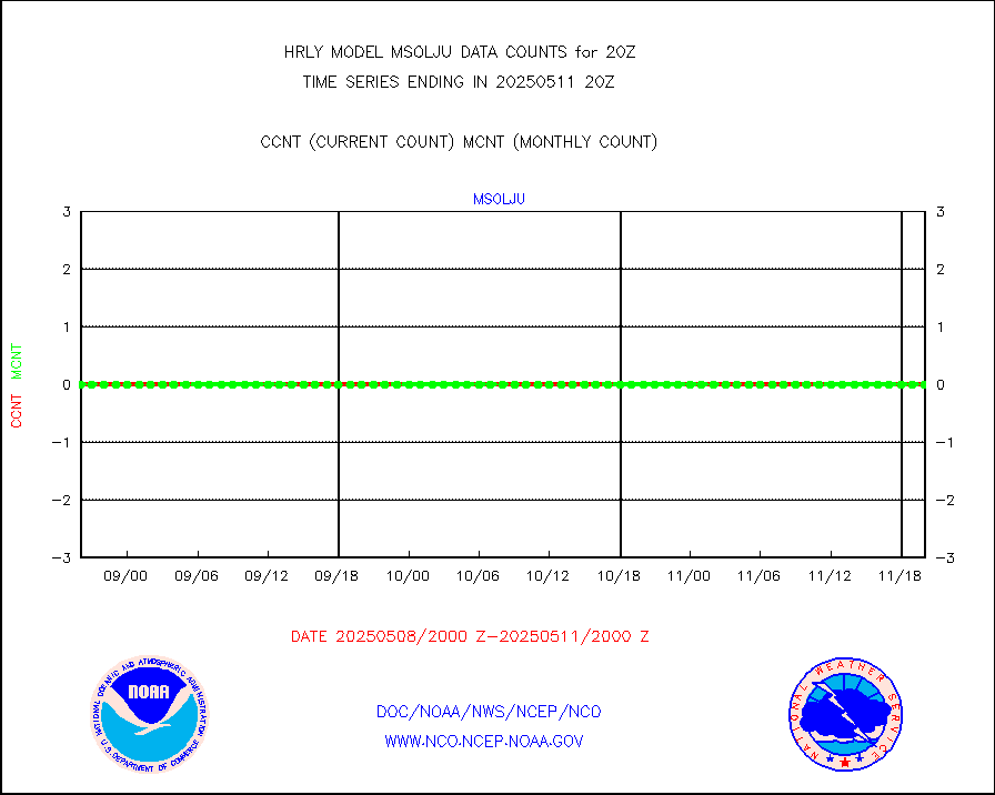
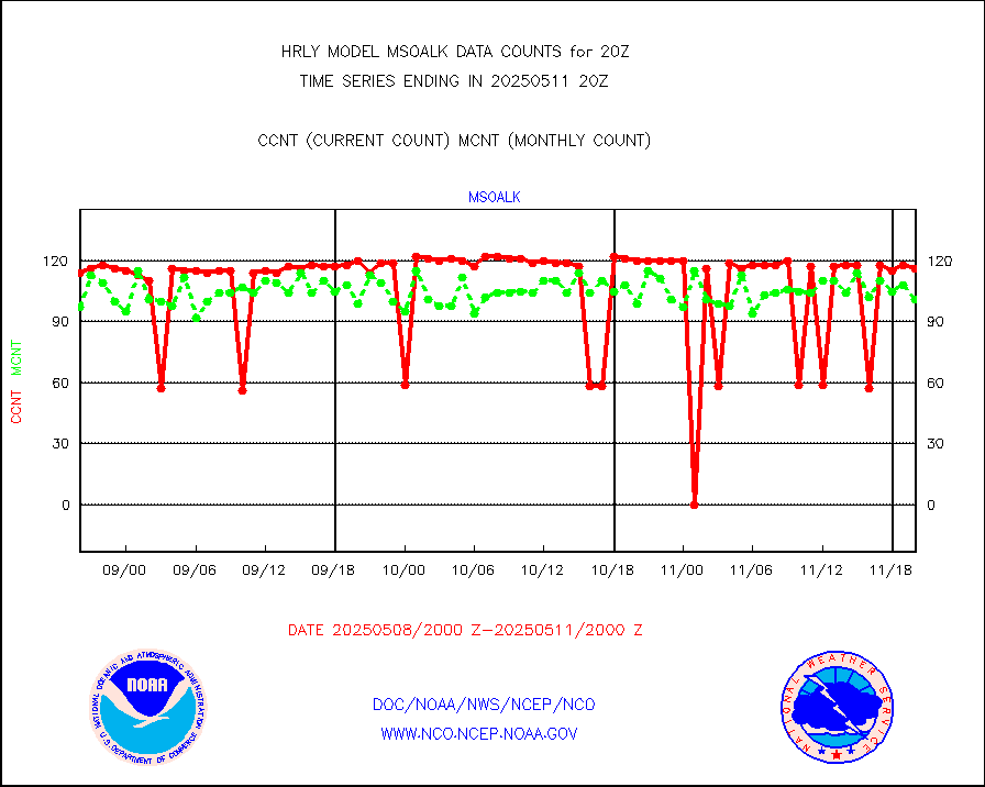
msoalk |
Mesonet/MADIS Alaska Department of Transportation |
105 |
108 |
97.2 % |
1919.50-1920.49 |
msoapg |
Mesonet/MADIS U.S. Army Aberdeen Proving Grounds |
0 |
0 |
n/a |
1919.50-1920.49 |
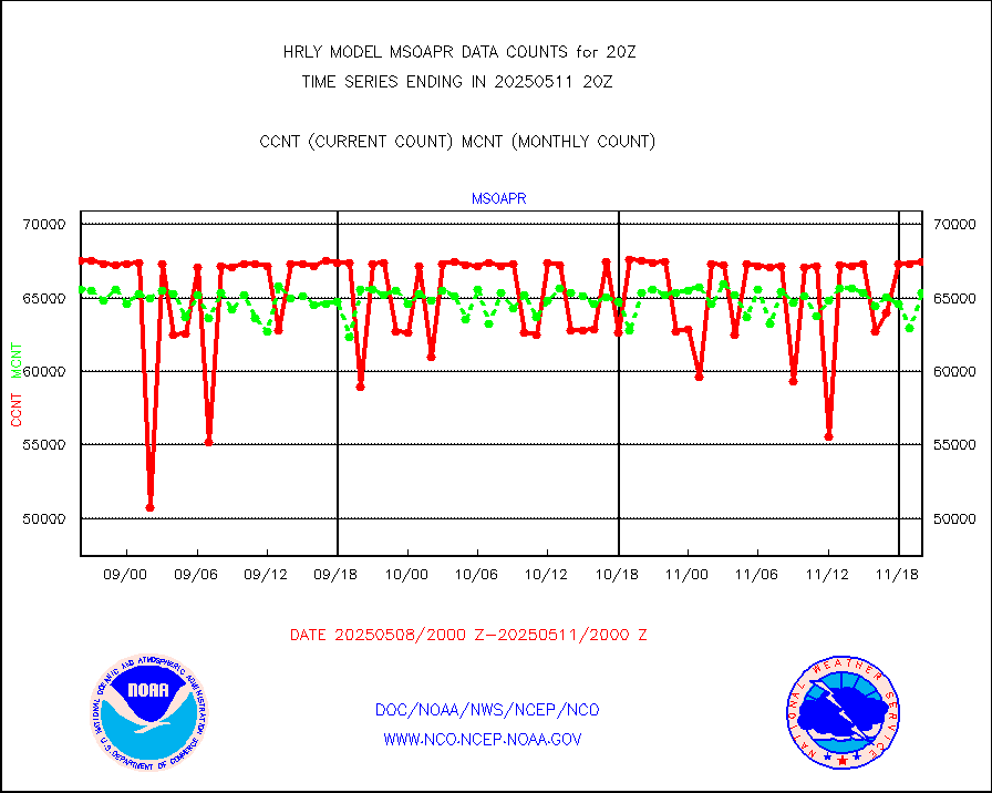
msoapr |
Mesonet/MADIS Citizen Weather Observers Program |
46427 |
47750 |
97.2 % |
1919.50-1920.49 |
msoaws |
Mesonet/MADIS AWS Convergence Technologies, Inc. |
25432 |
25454 |
99.9 % |
1919.50-1920.49 |
msoawx |
Mesonet/MADIS "Anything Weather" |
0 |
0 |
n/a |
1919.50-1920.49 |
msocol |
Mesonet/MADIS Colorado Dept. of Transportation |
0 |
0 |
n/a |
1919.50-1920.49 |
msodcn |
Mesonet/MADIS DC Net |
0 |
0 |
n/a |
1919.50-1920.49 |
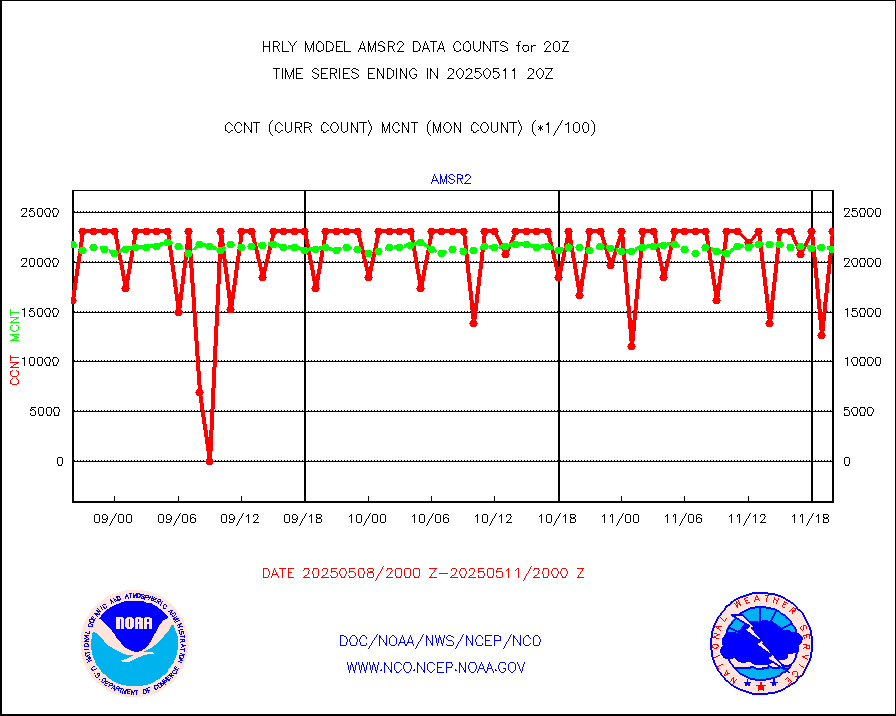
msoden |
Mesonet/MADIS Denver Urban Drainage & Flood Cntrl |
250 |
250 |
100.0 % |
1919.50-1920.49 |
msofla |
Mesonet/MADIS Florida (FAWN & USF) |
4 |
4 |
100.0 % |
1919.50-1920.49 |
msoflt |
Mesonet/MADIS Florida Dept. of Transportation |
0 |
0 |
n/a |
1919.50-1920.49 |
msogeo |
Mesonet/MADIS Georgia Dept. of Transportation |
0 |
0 |
n/a |
1919.50-1920.49 |
msohad |
Mesonet/MADIS NWS Hydromet Auto Data System(HADS) |
6686 |
6764 |
98.8 % |
1919.50-1920.49 |
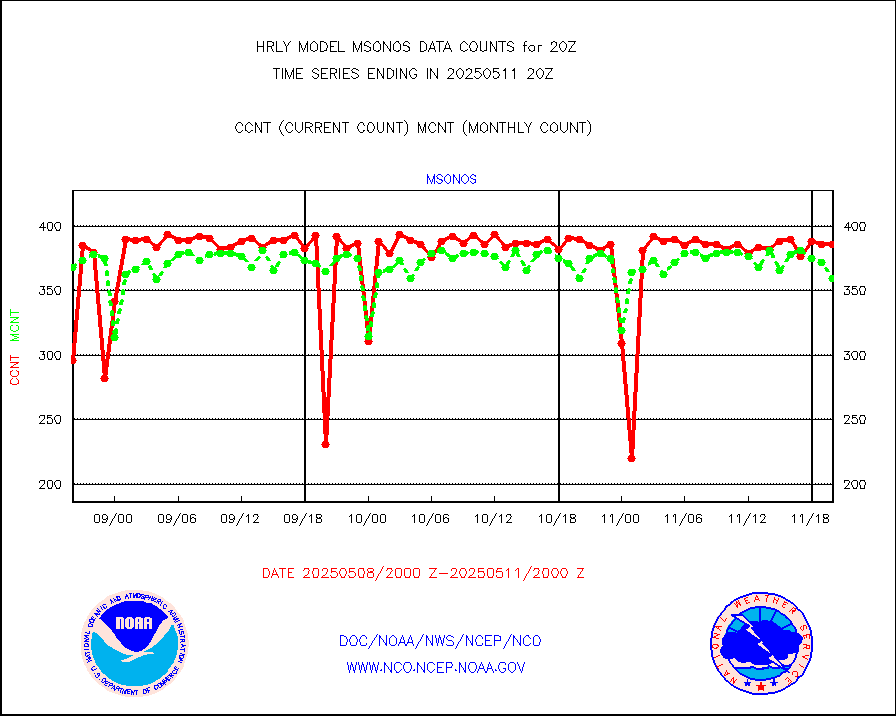
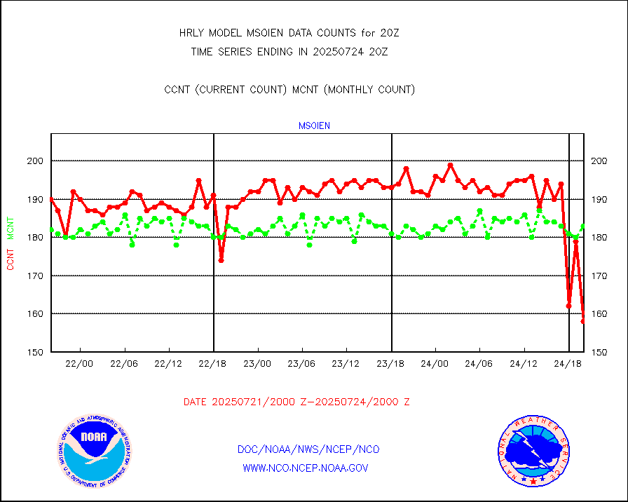
msoien |
Mesonet/MADIS Iowa Environmental |
187 |
189 |
98.9 % |
1919.50-1920.49 |
msoind |
Mesonet/MADIS Indiana Dept. of Transportation |
0 |
0 |
n/a |
1919.50-1920.49 |
msoiow |
Mesonet/MADIS Iowa Department of Transportation |
0 |
0 |
n/a |
1919.50-1920.49 |
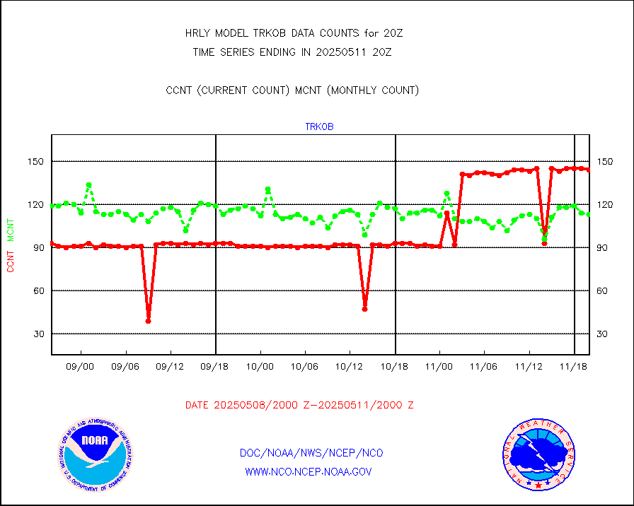
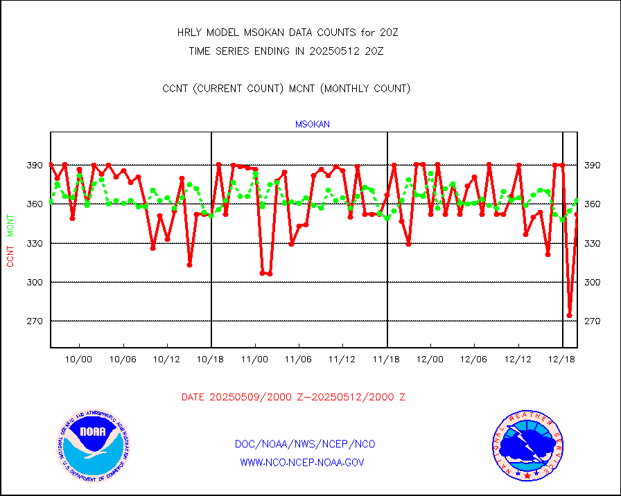
msokan |
Mesonet/MADIS Kansas Department of Transportation |
387 |
361 |
107.2 % |
1919.50-1920.49 |
msokla |
Mesonet/MADIS Oklahoma Mesonet |
318 |
325 |
97.8 % |
1919.50-1920.49 |
msolju |
Mesonet/MADIS Louisiana State/Jackson State Univ. |
0 |
0 |
n/a |
1919.50-1920.49 |
msomca |
Mesonet/MADIS Missouri Commercial Agricult Wx Net |
300 |
297 |
101.0 % |
1919.50-1920.49 |
msomin |
Mesonet/MADIS Minnesota Dept. of Transportation |
0 |
0 |
n/a |
1919.50-1920.49 |
msonos |
Mesonet/MADIS NOS-Phys Oceanographic Realtime Sys |
382 |
381 |
100.3 % |
1919.50-1920.49 |
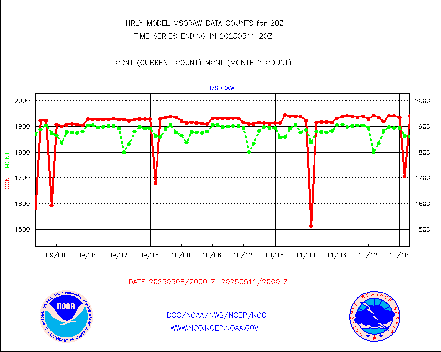
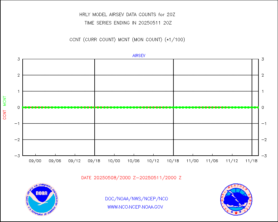
msoraw |
Mesonet/MADIS NFIC Remote Automated Wx Stns(RAWS) |
1948 |
1862 |
104.6 % |
1919.50-1920.49 |
msovir |
Mesonet/MADIS Virginia Dept. of Transportation |
204 |
229 |
89.1 % |
1919.50-1920.49 |
msowfy |
Mesonet/MADIS "Weather for You" |
0 |
0 |
n/a |
1919.50-1920.49 |
msowis |
Mesonet/MADIS Wisconsin Dept. of Transportation |
0 |
0 |
n/a |
1919.50-1920.49 |
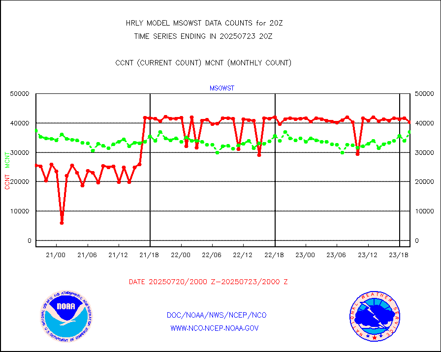
msowst |
Mesonet/MADIS MesoWest (many subproviders) |
46850 |
46203 |
101.4 % |
1919.50-1920.49 |
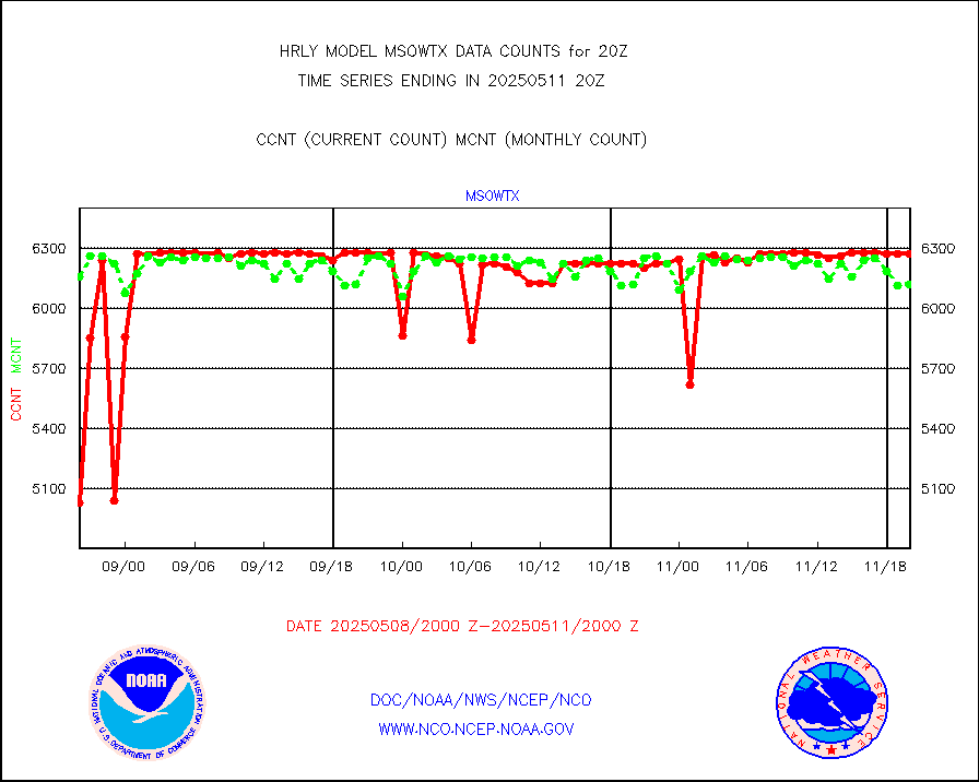
msowtx |
Mesonet/MADIS West Texas |
5648 |
5641 |
100.1 % |
1919.50-1920.49 |
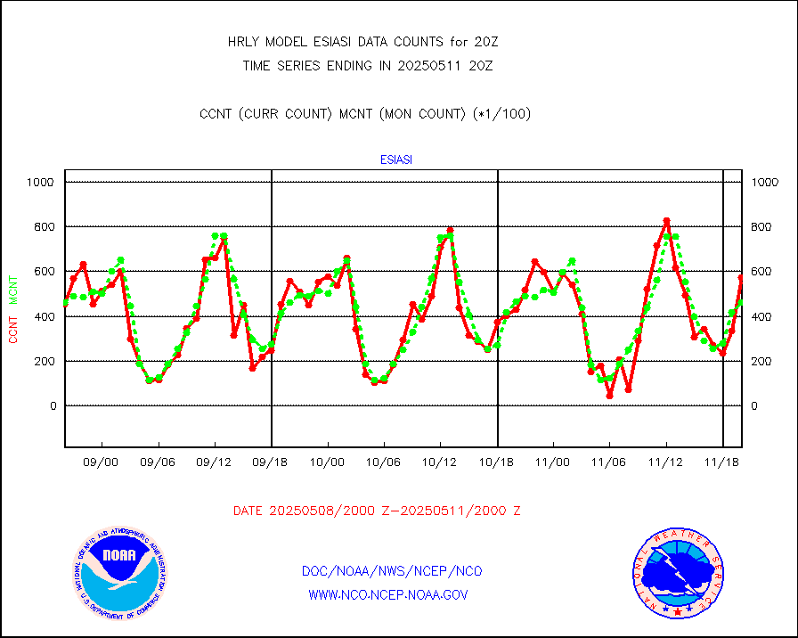
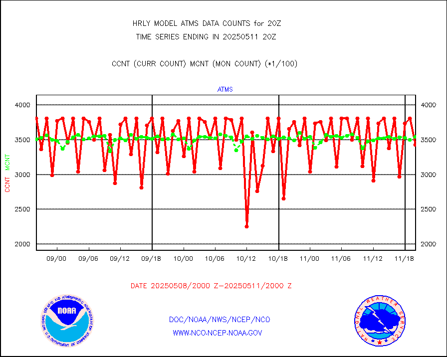
mtiasi |
METOP 1-2 IASI 1C radiance data (varbl. channels) |
96616 |
82890 |
116.6 % |
1918.00-1918.99 |
nxrdw |
NEXRAD Vel Azm Dsp(VAD) winds via radar coded msg |
0 |
0 |
n/a |
1919.50-1920.49 |
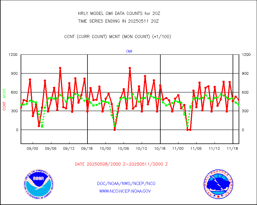
omi |
Aura Ozone Monitoring Instrument (OMI) data |
47160 |
28666 |
164.5 % |
1917.50-1918.49 |
osbuv8 |
NOAA 16-19 Solar Backscatter UV-2 rad frm V8 BUFR |
0 |
0 |
n/a |
1918.00-1918.99 |
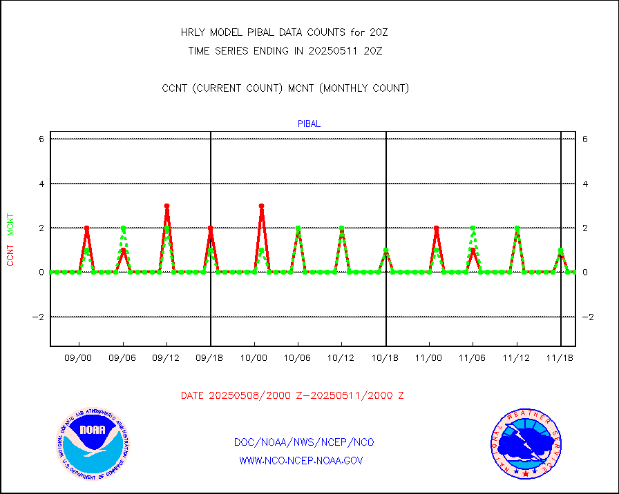
pibal |
PIBAL (from PILOT, PILOT SHIP, PILOT MOBIL) |
0 |
0 |
n/a |
1919.50-1920.49 |
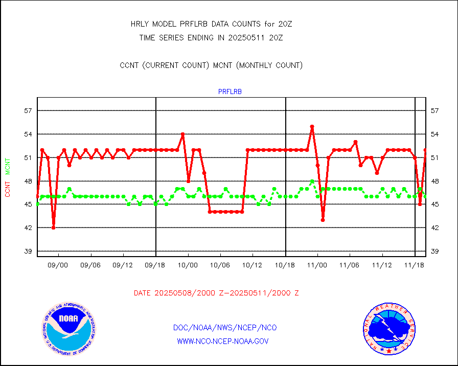
prflrb |
Multi-Agency Profiler (MAP) and SODAR winds |
34 |
42 |
81.0 % |
1919.50-1920.49 |
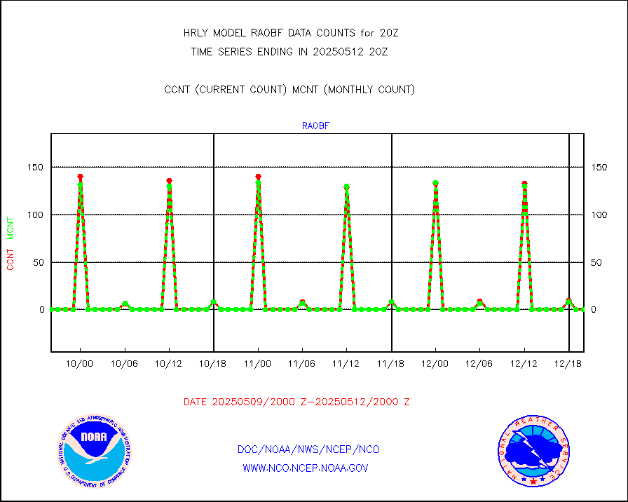
raobf |
Rawinsonde - fixed land (from TEMP or PILOT) |
0 |
0 |
n/a |
1919.50-1920.49 |
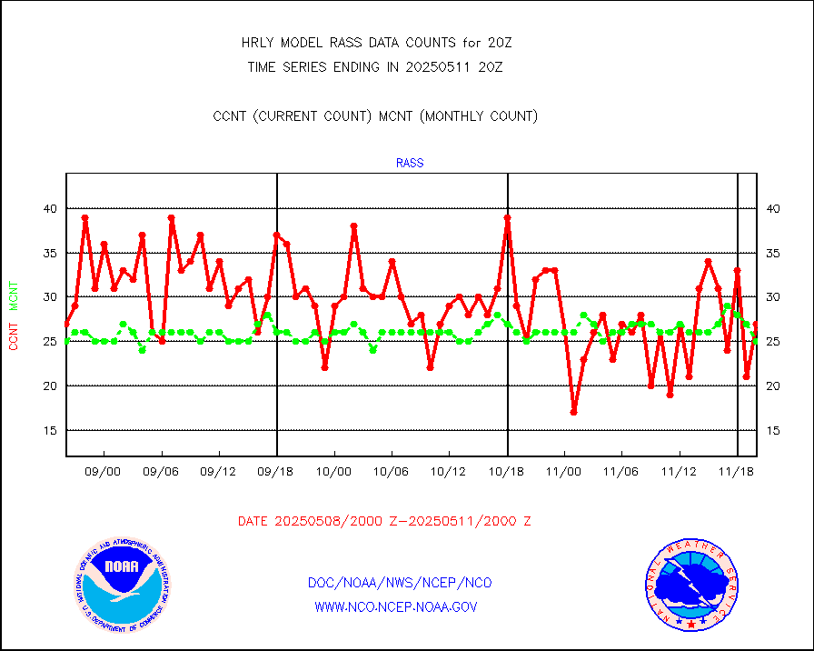
rass |
RASS temperatures (NOAA and Multi-Agency) |
21 |
26 |
80.8 % |
1919.50-1920.49 |
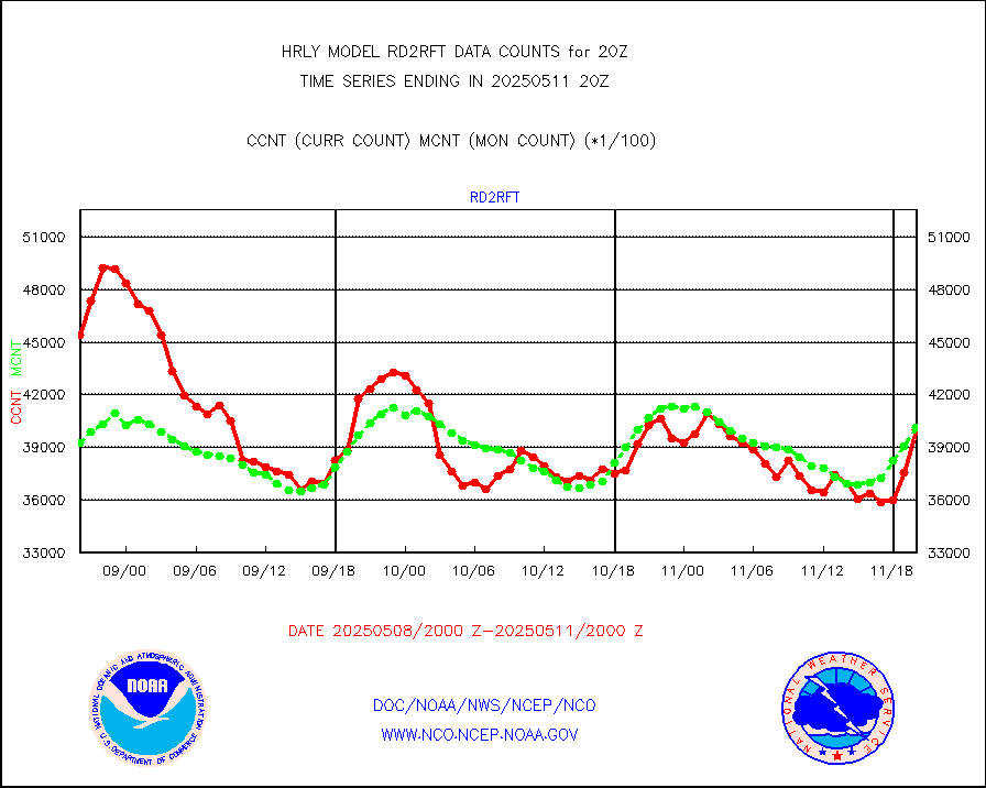
rd2rft |
NEXRAD reflectivity (Lvl 2 - GTS) |
4218651 |
4067353 |
103.7 % |
1919.50-1920.49 |
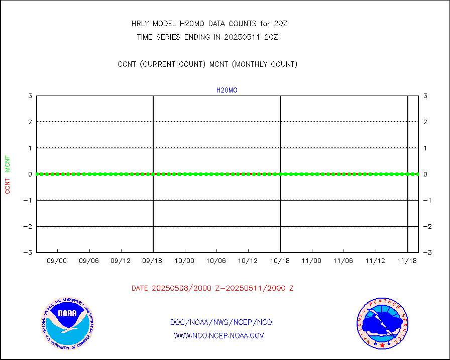
rd2wnd |
NEXRAD radial wind (Level 2 - GTS) |
1662940 |
1543319 |
107.8 % |
1919.50-1920.49 |
sevcsr |
METEOSAT-10 2nd Gen SEVIRI Clr Sky Radiance(proc) |
0 |
0 |
n/a |
1919.50-1920.49 |
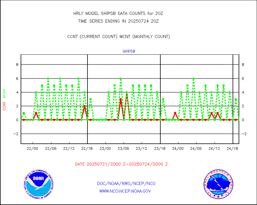
shipsb |
Ship - manual and automatic, restricted (BUFR) |
0 |
0 |
n/a |
1919.50-1920.50 |
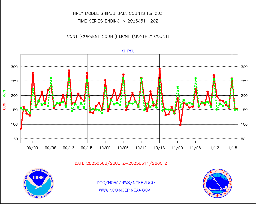
shipsu |
Ship - manual and automatic, unrestricted |
121 |
117 |
103.4 % |
1919.50-1920.50 |
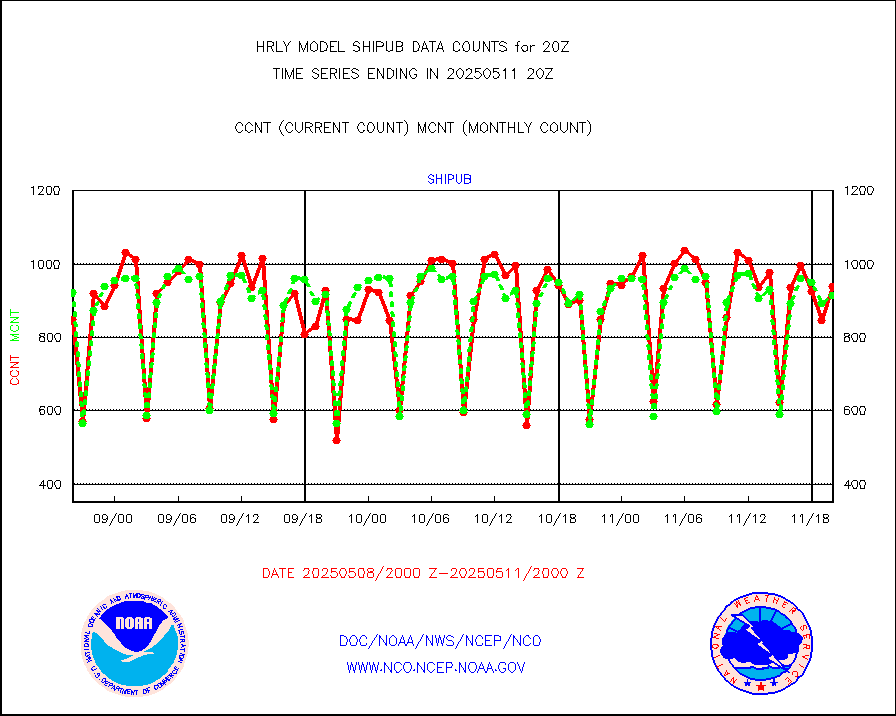
shipub |
Ship - manual and automatic, unrestricted (BUFR) |
786 |
841 |
93.5 % |
1919.50-1920.50 |
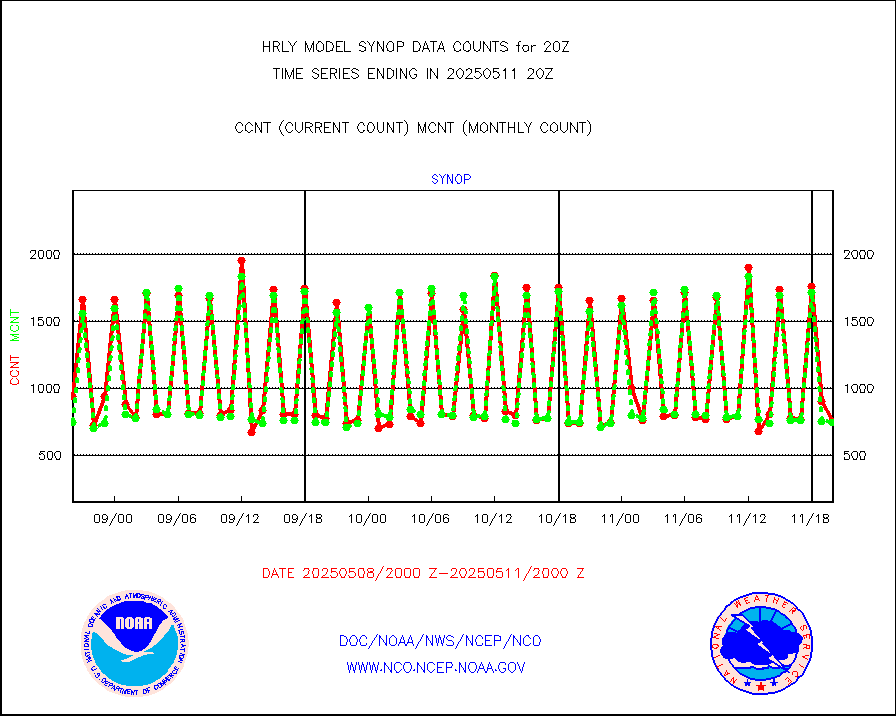
synop |
Synoptic - fixed manual and automatic |
917 |
864 |
106.1 % |
1919.50-1920.49 |
synopb |
Synoptic - fixed manual & auto (decoded fr BUFR) |
4170 |
4190 |
99.5 % |
1919.50-1920.49 |
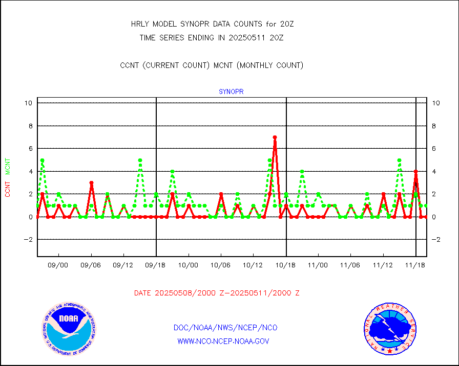
synopr |
Synoptic - restricted (WMO Res 40) manual & auto. |
4 |
2 |
200.0 % |
1919.50-1920.49 |
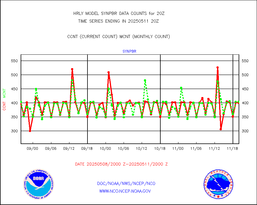
synpbr |
Synoptic - restricted (WMO Res 40)(decoded BUFR) |
397 |
403 |
98.5 % |
1919.50-1920.49 |
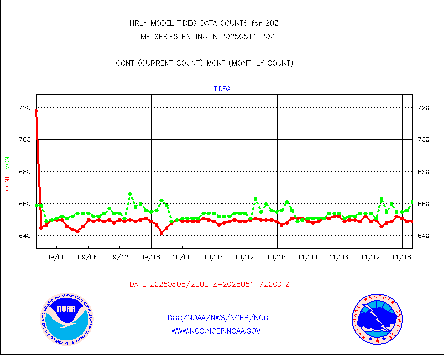
tideg |
Tide gauge reports decoded from CREX format |
642 |
640 |
100.3 % |
1919.00-1919.99 |
| Data Types of Opportunity with Normal Counts |
|---|
| Type | Description | Hourly Count | Monthly Average | Percent (%) of Monthly Mean | UTC Time Window |
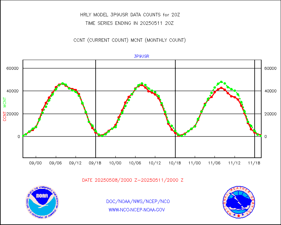
3p9usr |
GOES-16&up/NESDIS ir short-wv derived cld motion |
1120 |
827 |
135.4 % |
1919.00-1919.99 |
acarsa |
MDCRS ACARS acft data (ARINC via AFWA)(AIREP fmt) |
0 |
0 |
n/a |
1919.50-1920.49 |
ahicsr |
Himawari Clear Sky Radiance |
0 |
0 |
n/a |
1919.00-1919.99 |
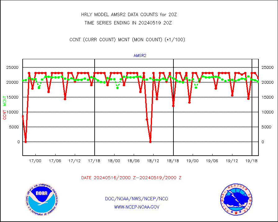
amsr2 |
GCOM-W AMSR2 1B brightness temperatures |
2143260 |
2019881 |
106.1 % |
1918.00-1918.99 |
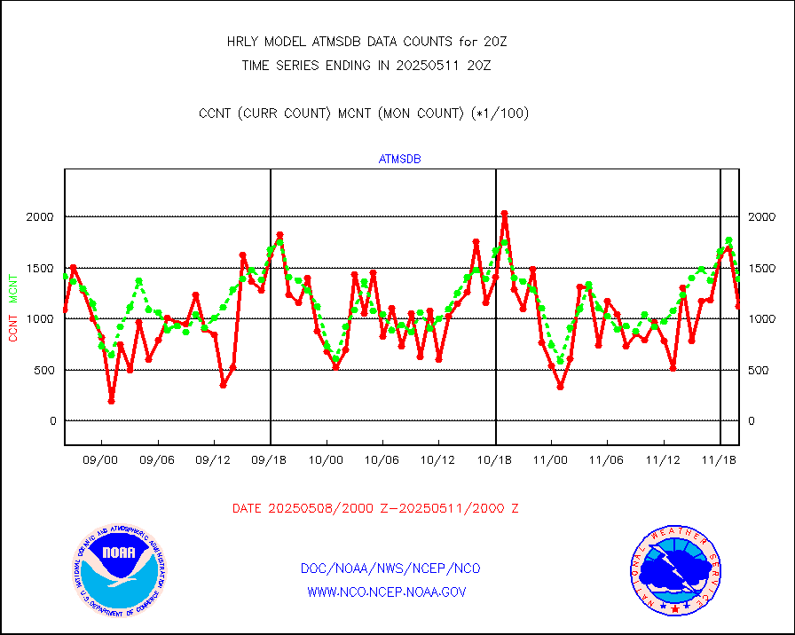
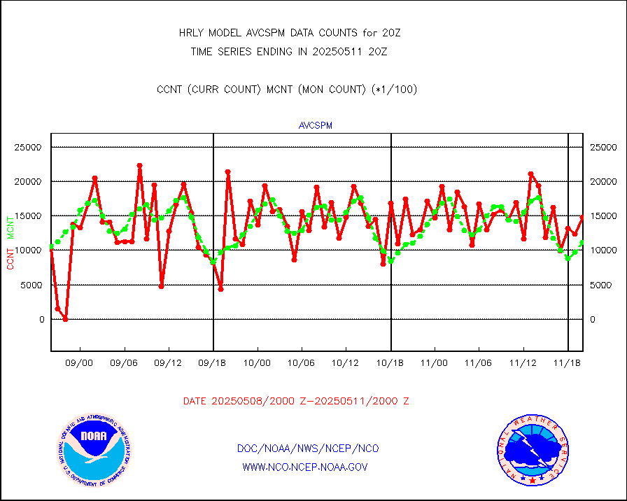
atmsdb |
NPP/NOAA-20 ATMS bright. temps-direct b-cast SSEC |
166423 |
140642 |
118.3 % |
1918.50-1919.49 |
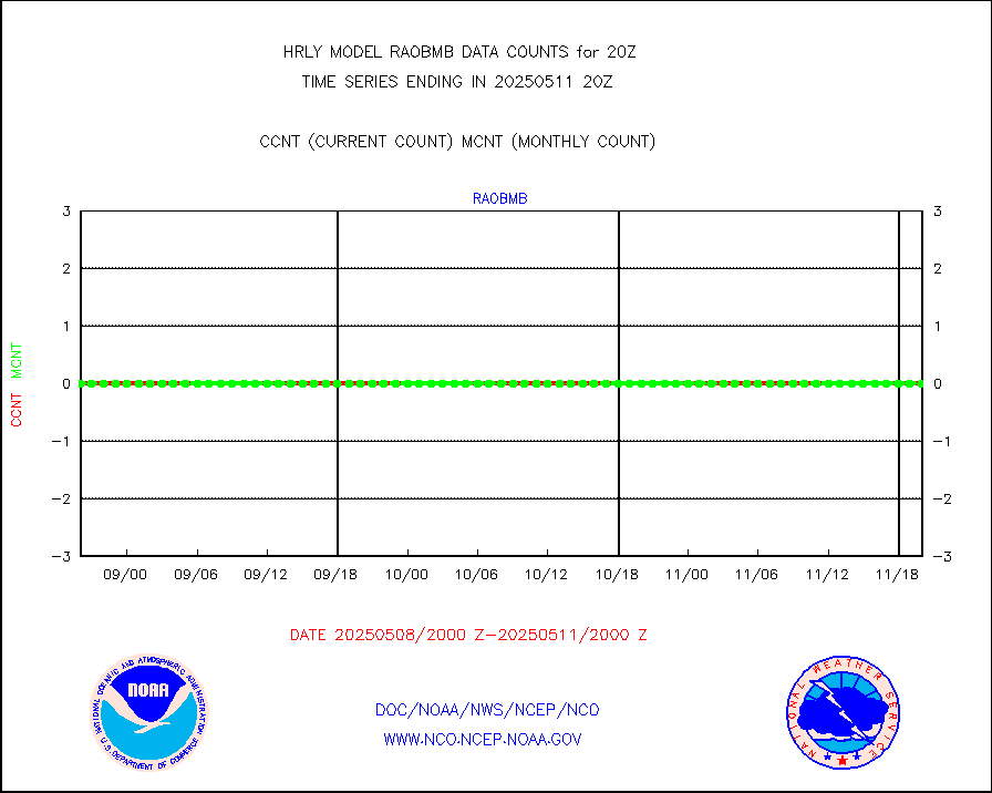
atovs |
POES/NESDIS - processed ATOVS soundings/radiances |
0 |
0 |
n/a |
1918.00-1918.99 |
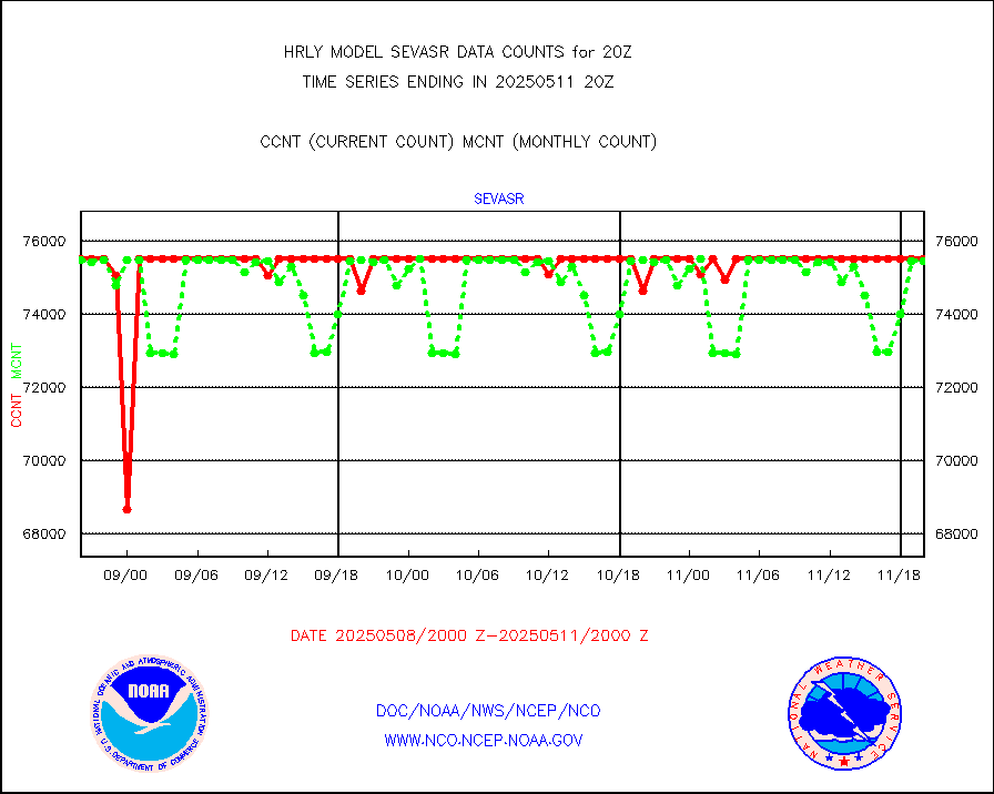
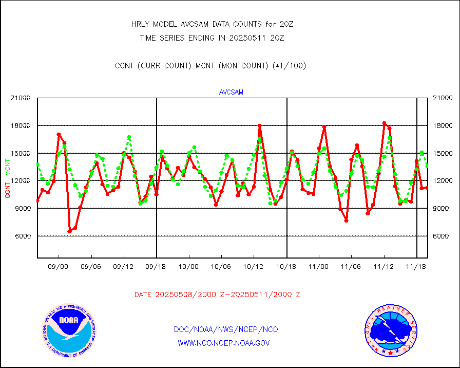
avcsam |
A.M.(N17,M2,M3) AVHRR GAC NCEP-proc clr&sea btmps |
1229392 |
1251881 |
98.2 % |
1917.50-1918.49 |
avcspm |
P.M.(N18-19) AVHRR GAC NCEP-proc clr & sea btemps |
1333353 |
1473505 |
90.5 % |
1917.50-1918.49 |
bathy |
eXpendable BathyThermograph, mooring (BATHY fmt) |
0 |
0 |
n/a |
1913.00-1913.99 |
coopmd |
Coop/MADIS NEPP & HCN-Modernization NOAA COOP Obs |
27 |
27 |
100.0 % |
1919.50-1920.49 |
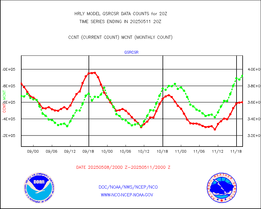
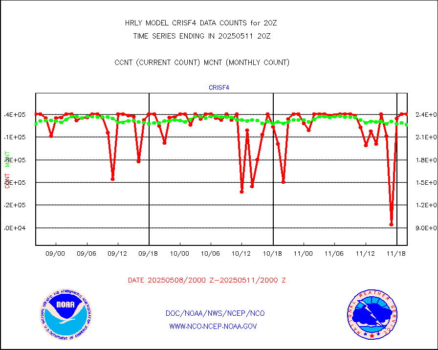
crisf4 |
NPP/NOAA-20 CrIS full spctrl radn (431 ch subset) |
240534 |
220645 |
109.0 % |
1918.50-1919.49 |
crsfdb |
NPP/NOAA-20 CrIS full spctrl radn dir brdcst SSEC |
139011 |
121010 |
114.9 % |
1918.50-1919.49 |
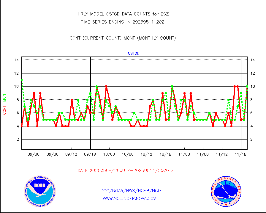
cstgd |
Coast Guard |
8 |
8 |
100.0 % |
1919.50-1920.50 |
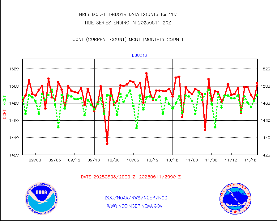
dbuoyb |
Drifting buoys (decoded from BUFR) |
1395 |
1399 |
99.7 % |
1919.50-1920.50 |
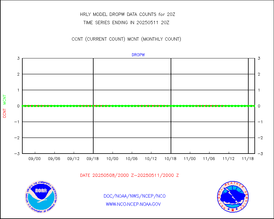
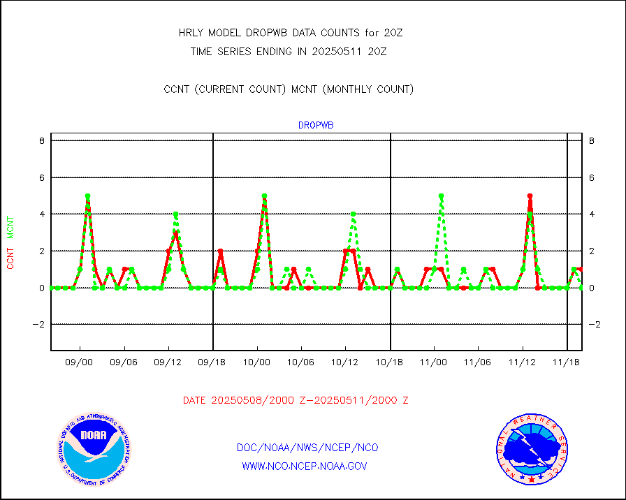
dropw |
Dropwinsonde (from TEMP DROP) |
0 |
0 |
n/a |
1919.50-1920.49 |
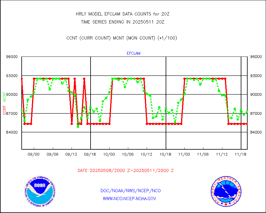
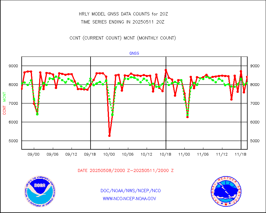
efclam |
GOES imager effective cloud amount data (U.Wisc.) |
8299008 |
8291857 |
100.1 % |
1919.50-1920.49 |
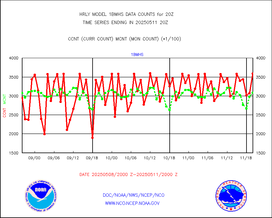
esatms |
NPP Adv. Tech. MW Sndr (ATMS) br. temps from RARS |
46460 |
71457 |
65.0 % |
1918.50-1919.49 |
esiasi |
METOP 1-2 IASI 1C radiance data vbl chn from RARS |
81377 |
65827 |
123.6 % |
1919.00-1919.99 |
esmhs |
NOAA 18-19 & METOP 1-2 MHS proc. btemps from RARS |
189254 |
189790 |
99.7 % |
1919.50-1920.49 |
geoimr |
GOES/NESDIS (11x17 f-o-v) imager clear radiances |
0 |
0 |
n/a |
1919.00-1919.99 |
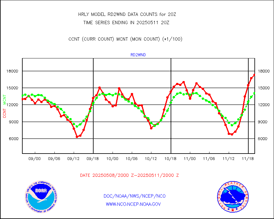
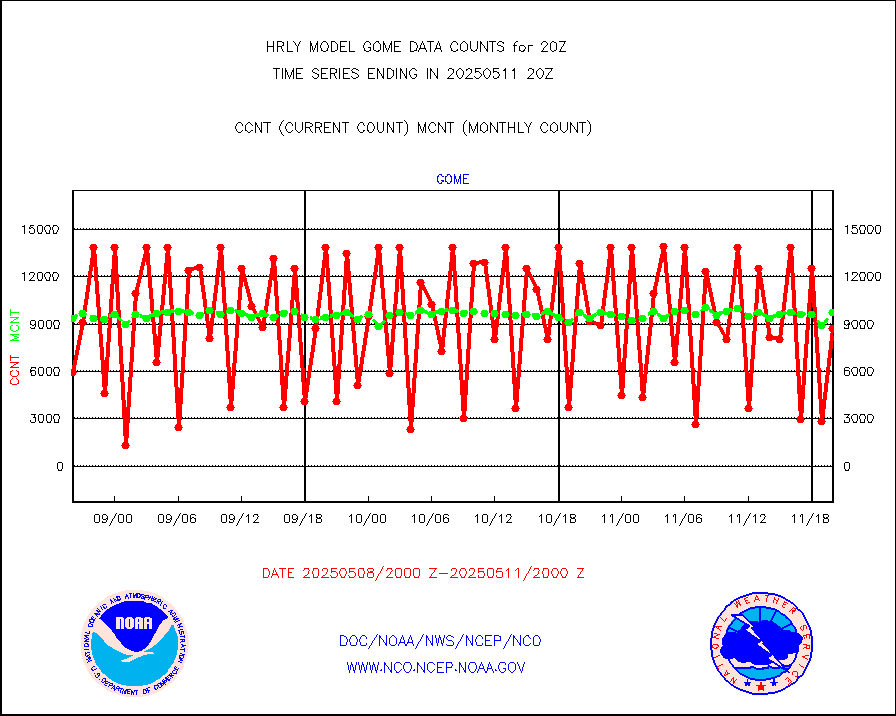
gome |
METOP 1-2 Global Ozone Monitoring Exp.-2 (GOME-2) |
4190 |
6638 |
63.1 % |
1918.50-1919.49 |
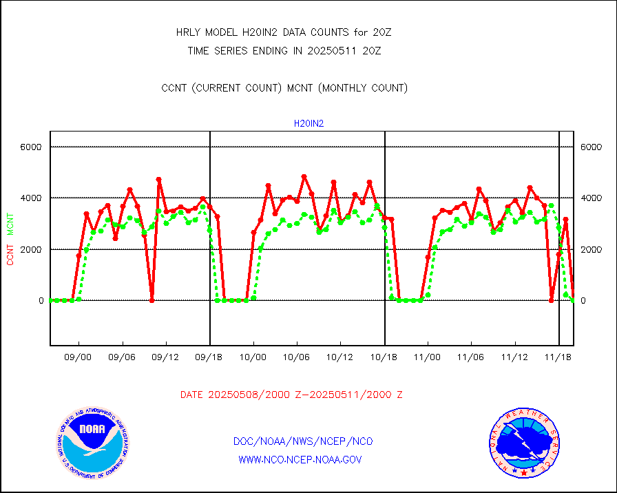
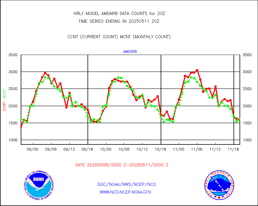
h20in2 |
INDIA SATWIND, INSAT WV channel |
9034 |
216 |
n/a |
1919.00-1919.99 |
h2dusr |
GOES-16&up/NESDIS wv imgr/deep-lyr derivd cld mtn |
16856 |
16756 |
100.6 % |
1919.00-1919.99 |
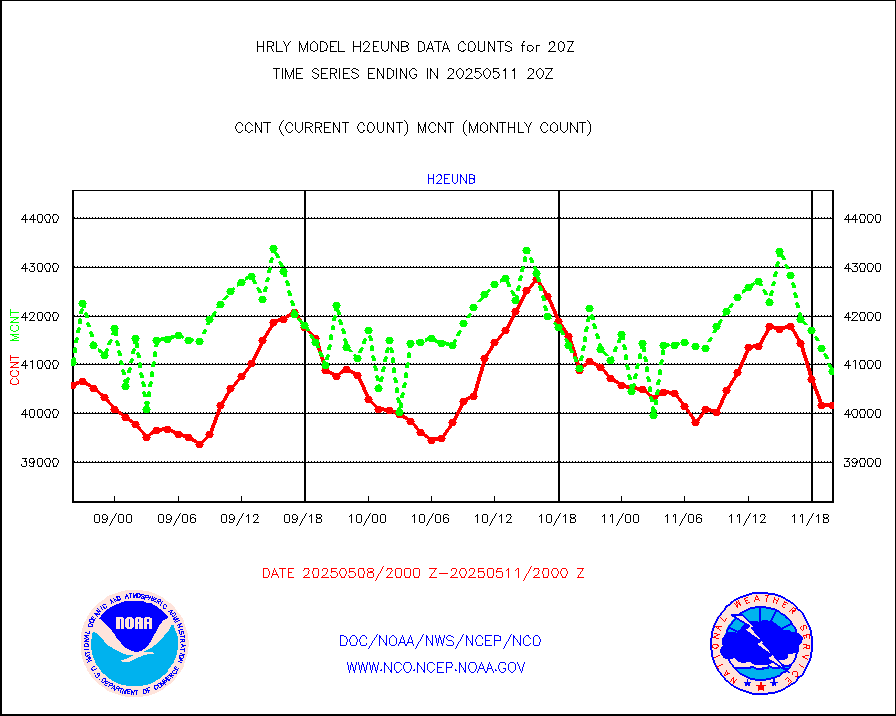
h2eunb |
METEOSAT/EUMETSAT wvpr imgr drv cld motion NBseq |
40125 |
41559 |
96.5 % |
1918.50-1919.49 |
iasidb |
METOP 1-2 IASI 1C radiances-direct broadcast SSEC |
27874 |
28667 |
97.2 % |
1918.50-1919.49 |
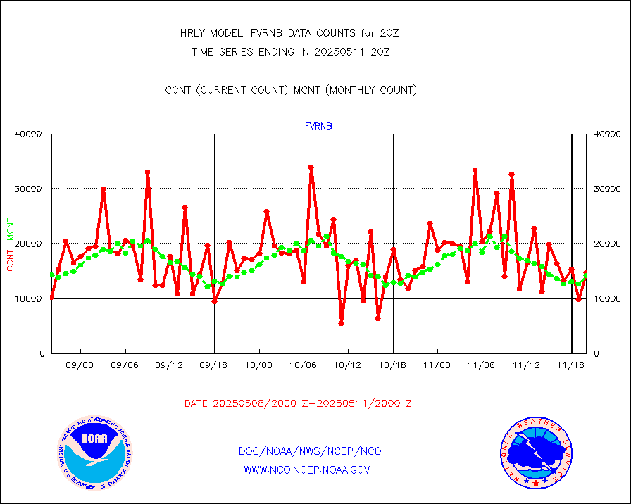
ifvrnb |
VIIRS (NPP/NOAA-20) ir lg-wv drv cloud motion(NB) |
19139 |
14442 |
132.5 % |
1916.00-1916.99 |
infav |
AVHRR (NOAA/METOP) ir lg-wave derived cld motion |
0 |
0 |
n/a |
1916.00-1916.99 |
infav1 |
AVHRR (METOP) ir lg-wave derived cld motion |
0 |
0 |
n/a |
1919.50-1920.50 |
infin |
INSAT/KALPANA India ir lg-wave derived cld motion |
0 |
0 |
n/a |
1917.50-1918.49 |
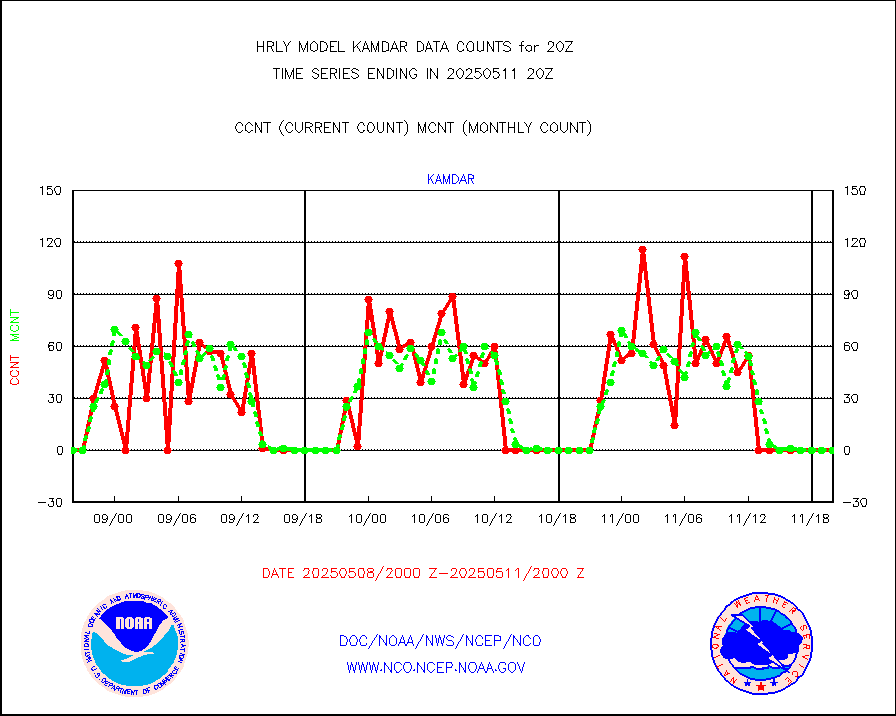
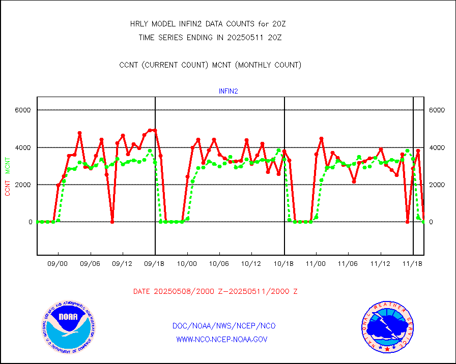
infin2 |
INDIA SATWIND, INSAT IR channel |
13361 |
209 |
n/a |
1919.00-1919.99 |
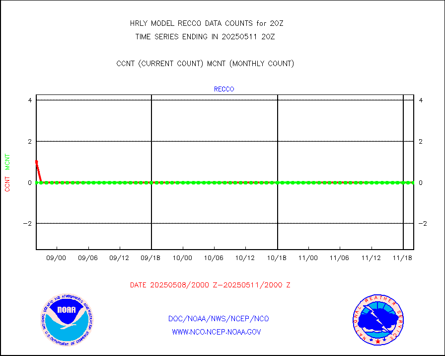
kamdar |
Korean AMDAR aircraft data (decoded from BUFR) |
0 |
0 |
n/a |
1919.50-1920.49 |
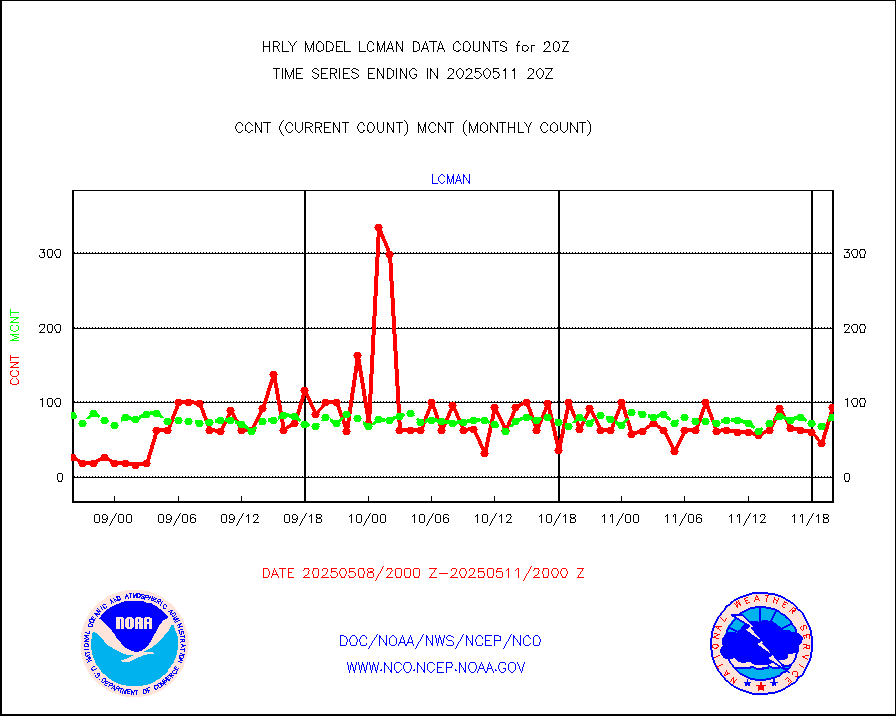
lcman |
Land-based CMAN stations decoded from CMAN format |
102 |
83 |
122.9 % |
1919.50-1920.49 |
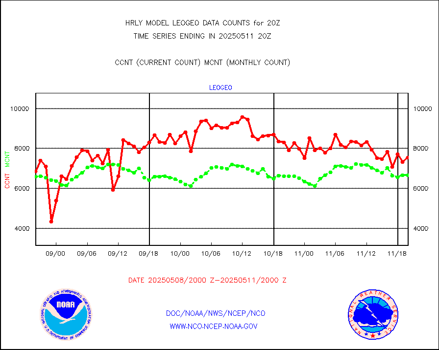
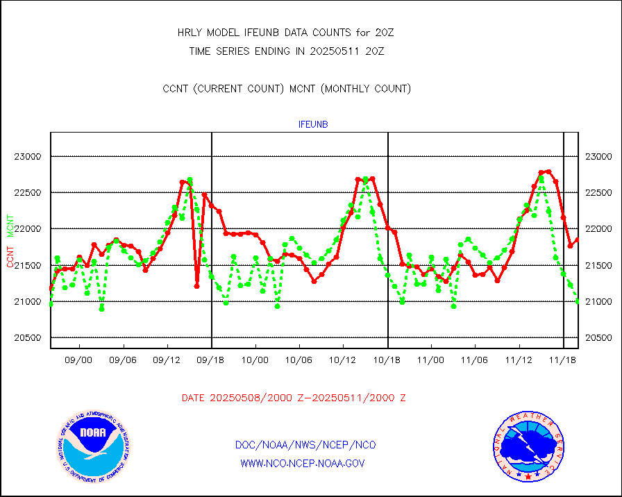
leogeo |
LEO-GEO satellite AMVs from UWisc. |
5850 |
4850 |
120.6 % |
1916.00-1916.99 |
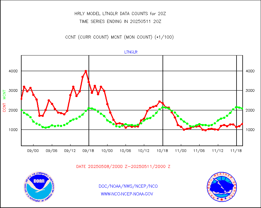
ltnglr |
LLDN Long-rng lightning from Vaisala via NOAAPORT |
201121 |
184775 |
108.8 % |
1919.50-1920.49 |
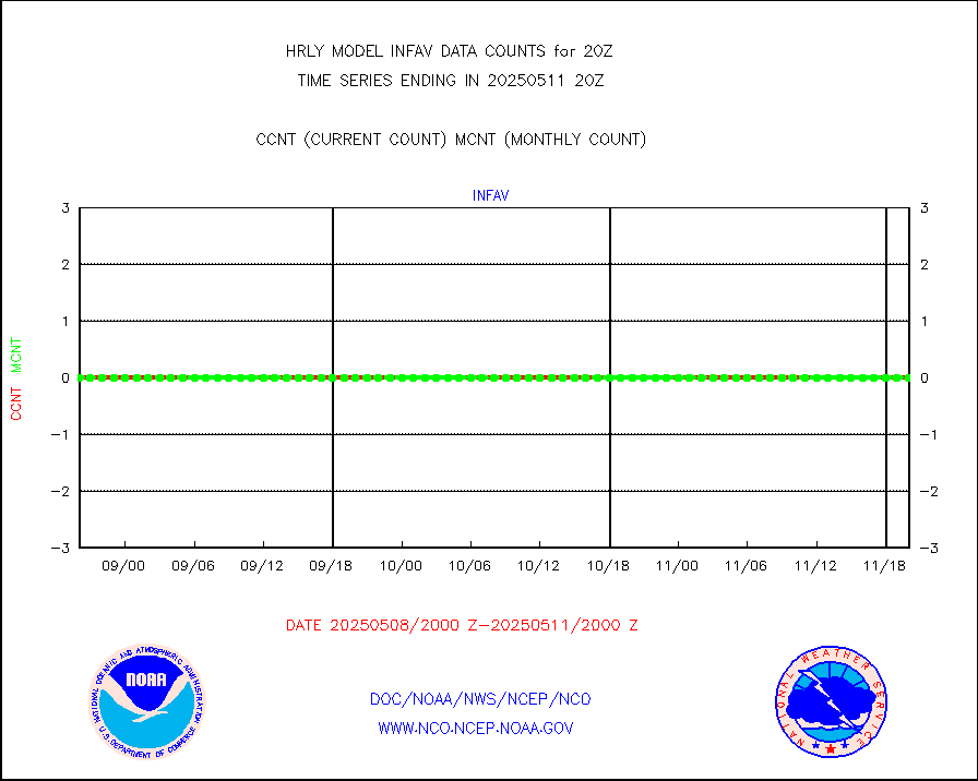
ltngsr |
NLDN Shrt-rng lightning from Vaisala via NOAAPORT |
9077 |
3603 |
251.9 % |
1919.50-1920.49 |
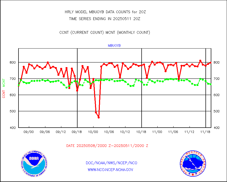
mbuoyb |
Moored buoys (decoded from BUFR) |
813 |
746 |
109.0 % |
1919.50-1920.50 |
mls |
Aura Microwave Limb Sounder (MLS) ozone data |
0 |
0 |
n/a |
1918.00-1918.99 |
msourb |
Mesonet/MADIS UrbaNet |
4357 |
4339 |
100.4 % |
1919.50-1920.49 |
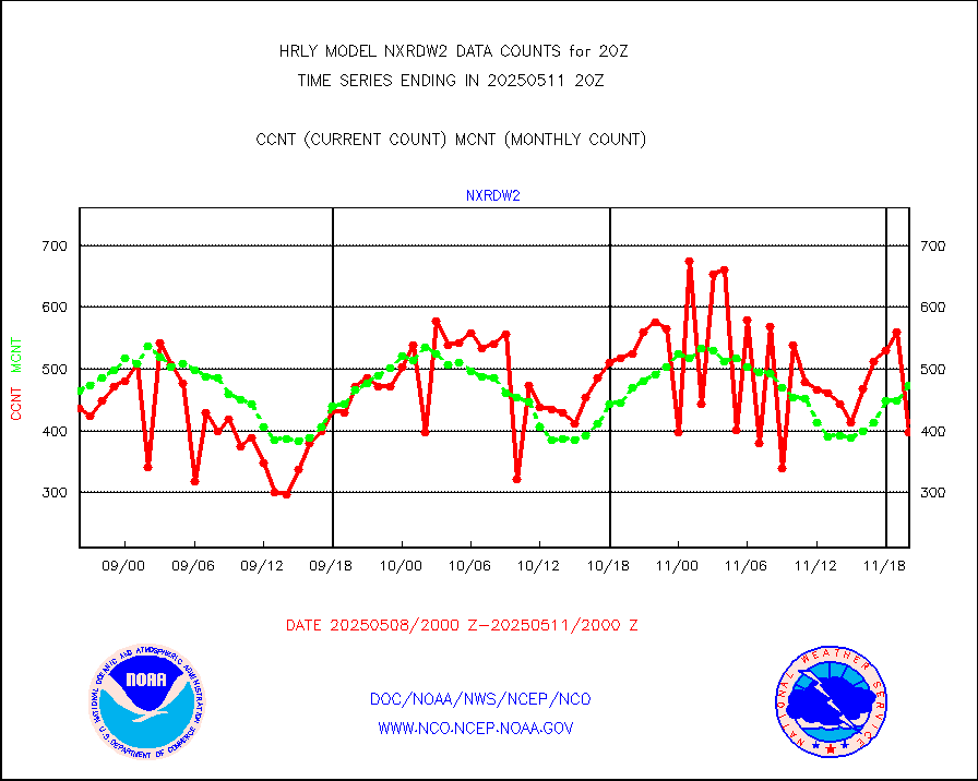
nxrdw2 |
NEXRAD Vel Azm Dsp(VAD) winds via Level 2 decoder |
550 |
505 |
108.9 % |
1919.50-1920.49 |
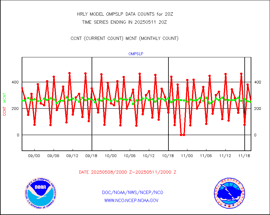
ompslp |
OMPS Limb Profiler ozone data (NPP) |
292 |
219 |
133.3 % |
1913.00-1913.99 |
ompsn8 |
OMPS nadir profile ozone (Version 8 BUFR) |
582 |
557 |
104.5 % |
1918.00-1918.99 |
ompst8 |
OMPS total column ozone (Version 8 BUFR) |
485602 |
334101 |
145.3 % |
1918.00-1918.99 |
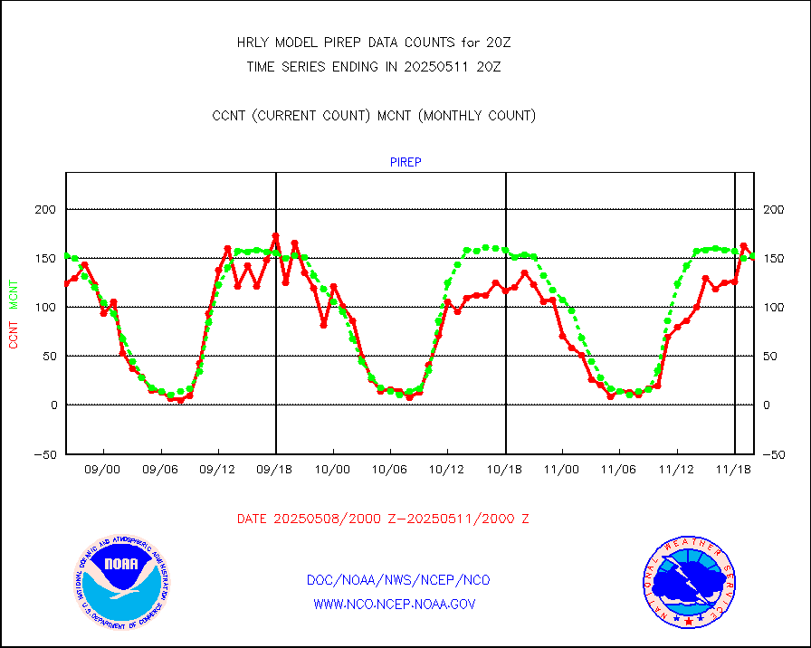
pirep |
Manual PIREP aircraft data (dcded from AIREP fmt) |
114 |
143 |
79.7 % |
1919.50-1920.49 |
prflrp |
Profilr winds from PIBAL (PILOT,PILOT SHIP/MOBIL) |
0 |
0 |
n/a |
1919.50-1920.49 |
raobm |
Rawinsonde - mobile land (from TEMP/PILOT MOBIL) |
0 |
0 |
n/a |
1919.50-1920.49 |
raobs |
Rawinsonde - ship (from TEMP SHIP, PILOT SHIP) |
0 |
0 |
n/a |
1919.50-1920.49 |
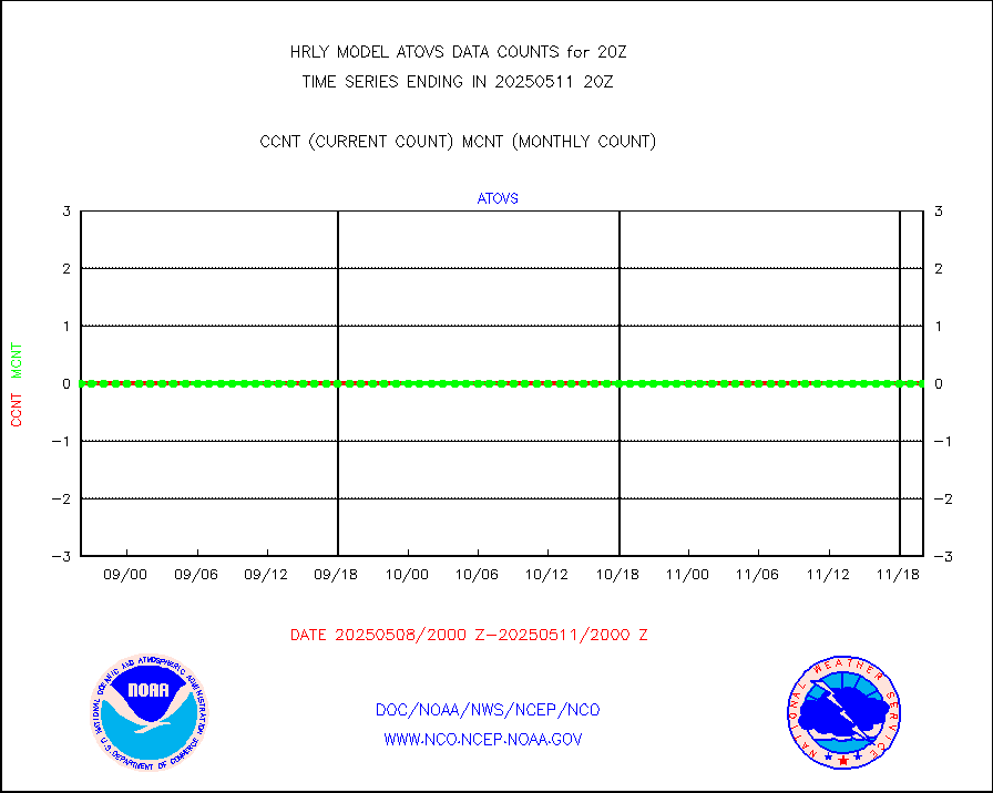
recco |
Flight level reconnaissance aircraft data |
0 |
0 |
n/a |
1919.50-1920.49 |
saphir |
Megha-Tropiques SAPHIR L1A2 brightness temps |
0 |
0 |
n/a |
1917.50-1918.49 |
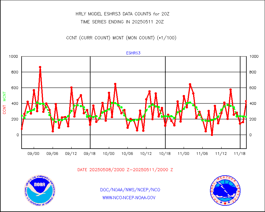
sevasr |
METEOSAT-10 2nd Gen SEVIRI All Sky Radiance(proc) |
75512 |
75446 |
100.1 % |
1919.50-1920.49 |
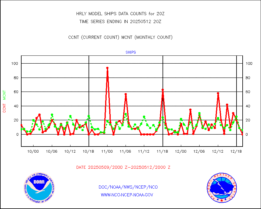
ships |
Ship - manual and automatic, restricted |
1 |
4 |
25.0 % |
1919.50-1920.49 |
ssmisu |
DMSP SSM/IS 1C radiance data (Unified Pre-Proc.) |
219720 |
126662 |
173.5 % |
1918.50-1919.49 |
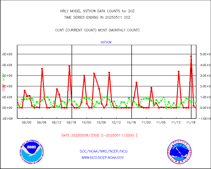
sstvcw |
NPP/NOAA-20 VIIRS SST - CLEAR & OVER WATER |
0 |
18909 |
0.0 % |
1919.50-1920.49 |
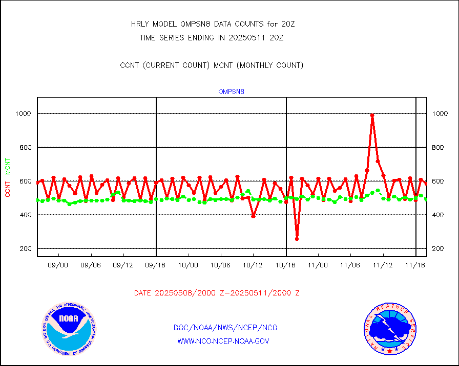
sstvpw |
NPP/NOAA-20 VIIRS SST - PROBABLY CLR & OVER WATER |
0 |
4449 |
0.0 % |
1919.50-1920.49 |
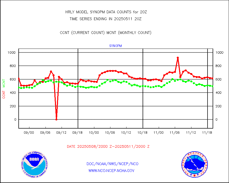
synopm |
Synoptic - mobile manual and automatic |
713 |
721 |
98.9 % |
1919.50-1920.49 |
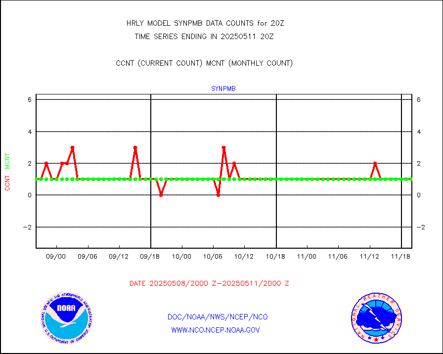
synpmb |
Synoptic - mobile manual & auto (decoded fr BUFR) |
0 |
1 |
0.0 % |
1919.50-1920.49 |
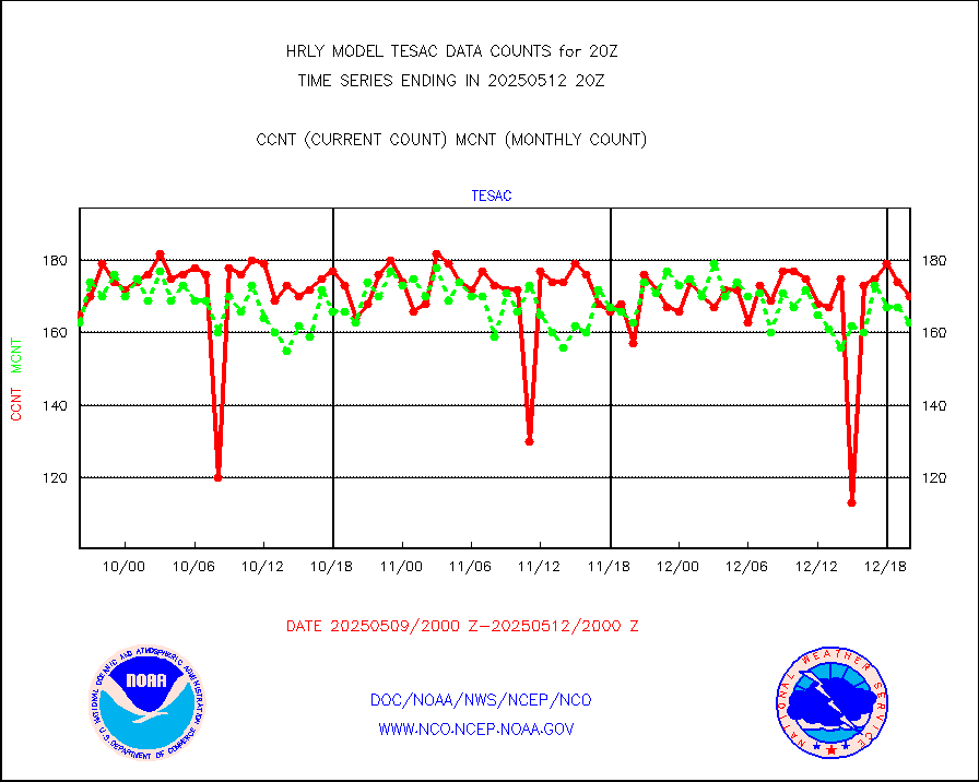
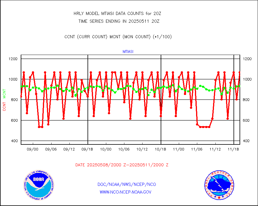
tesac |
CTD probe, Argo prflng float, mooring (TESAC fmt) |
191 |
191 |
100.0 % |
1919.50-1920.49 |
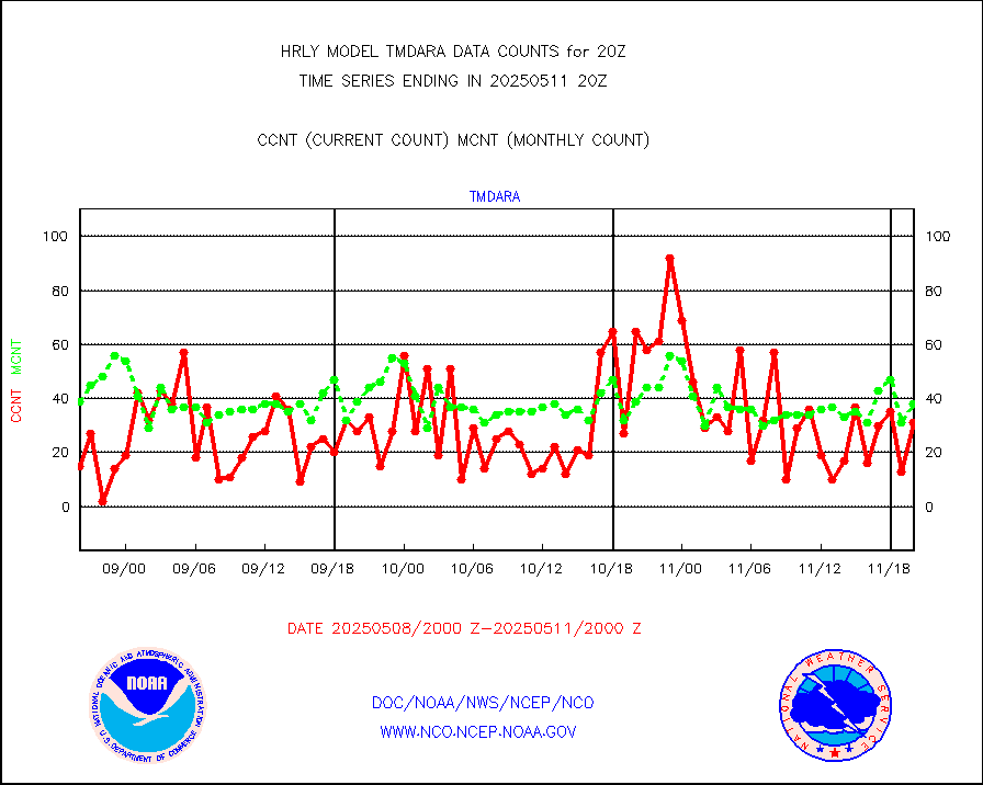
tmdara |
TAMDAR aircft data-all types(from Panasonic,BUFR) |
177 |
125 |
141.6 % |
1919.50-1920.49 |
trkob |
ThermoSalinoGraph (TSG) TRACKOB format) |
90 |
45 |
200.0 % |
1918.50-1919.49 |
visin |
INSAT/KALPANA India visible derived cloud motion |
0 |
0 |
n/a |
1917.50-1918.49 |
visin2 |
INDIA SATWIND, INSAT VIS channel |
0 |
0 |
n/a |
1919.00-1919.99 |
visja |
MTSAT/JMA visible derived cloud motion |
1653 |
1359 |
121.6 % |
1917.50-1918.49 |
visusr |
GOES-16&up/NESDIS visible derived cloud motion |
472728 |
428750 |
110.3 % |
1919.00-1919.99 |
vseunb |
METEOSAT/EUMETSAT visible drv cld motion NBseq |
13569 |
11494 |
118.1 % |
1918.50-1919.49 |


