| Critical Data with Normal Counts |
|---|
| Type | Description | Hourly Count | Monthly Average | Percent (%) of Monthly Mean | UTC Time Window |
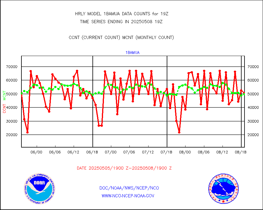
1bamua |
NOAA 15-19 & METOP 1-2 AMSU-A NCEP-proc. br.temps |
57194 |
54886 |
104.2 % |
1917.00-1917.99 |
1bhrs4 |
NOAA 18-19 & METOP 1-2 HIRS-4 NCEP-proc. br.temps |
59189 |
47644 |
124.2 % |
1917.00-1917.99 |
1bmhs |
NOAA 18-19 & METOP 1-2 MHS NCEP-proces. br. temps |
273588 |
302305 |
90.5 % |
1917.00-1917.99 |
acars |
MDCRS ACARS acft data from ARINC(dcded from BUFR) |
20809 |
20632 |
100.9 % |
1918.50-1919.49 |
airep |
Manual AIREP aircraft data (dcded from AIREP fmt) |
908 |
745 |
121.9 % |
1918.50-1919.49 |
airsev |
AQUA AIRS/AMSU-A/HSB brightness temps- every FOV |
0 |
0 |
n/a |
1916.50-1917.49 |
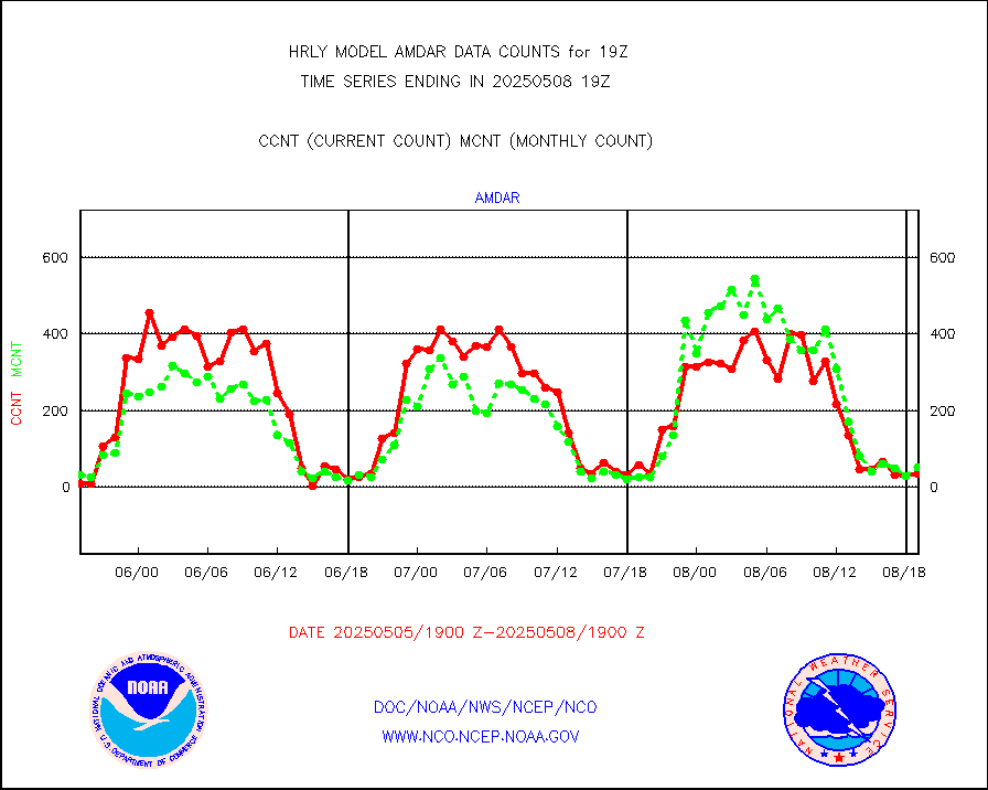
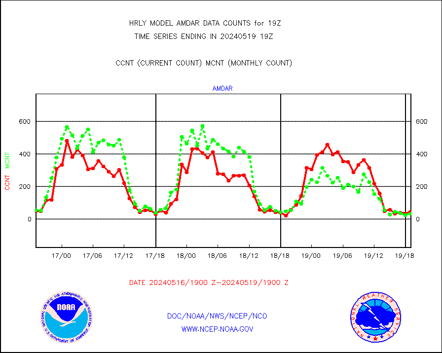
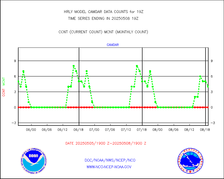
amdar |
AMDAR aircraft data (decoded from AMDAR format) |
45 |
35 |
128.6 % |
1918.50-1919.49 |
amdarb |
AMDAR aircraft data (decoded from BUFR) |
176 |
224 |
78.6 % |
1918.50-1919.49 |
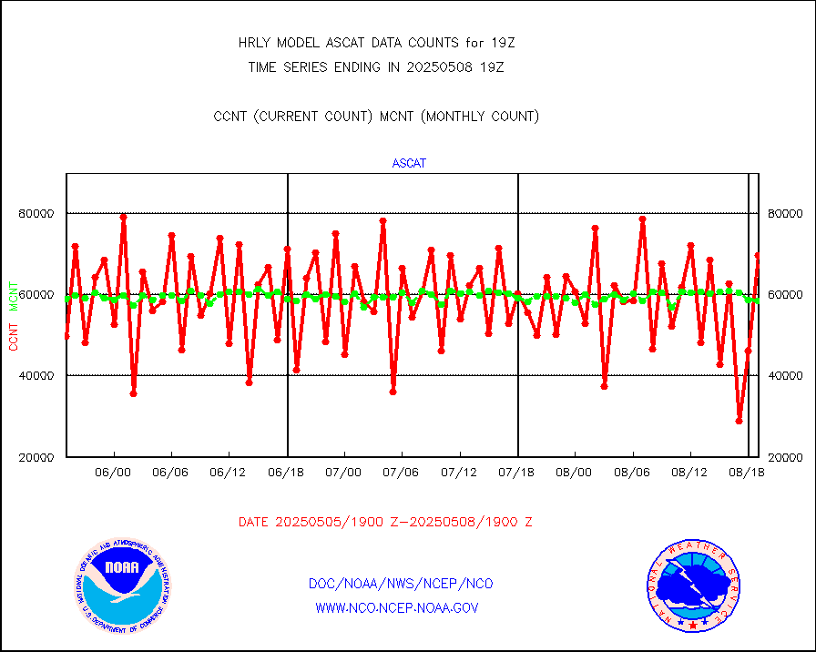
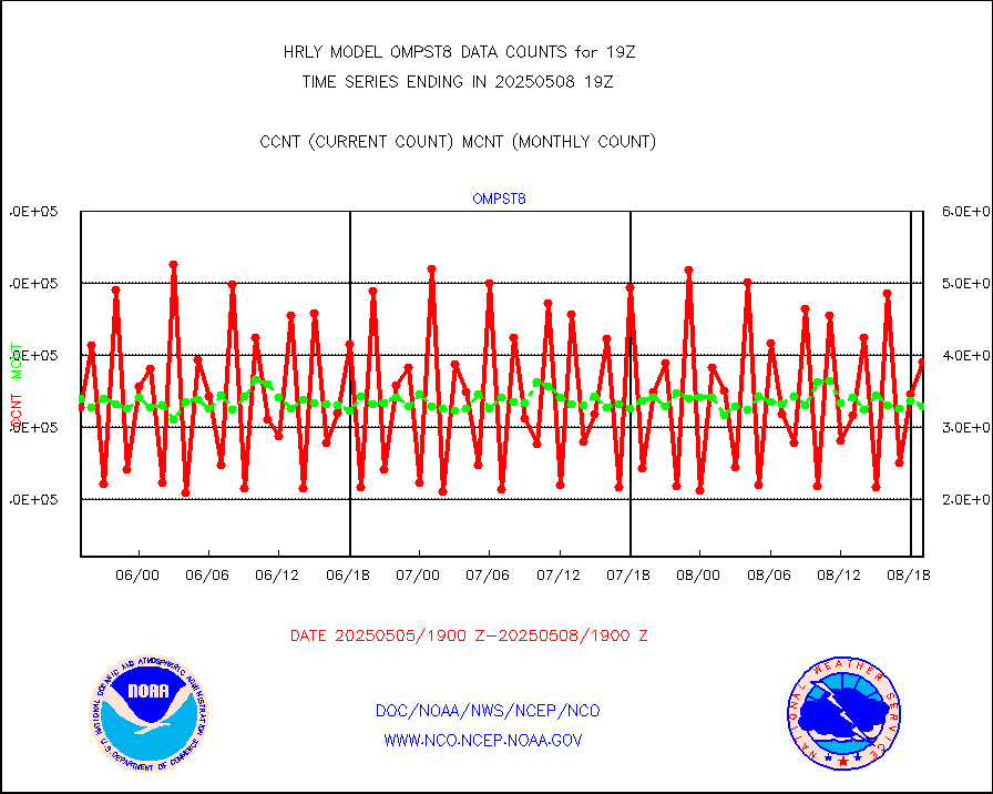
ascat |
METOP 1-2 ASCAT products |
53802 |
43516 |
123.6 % |
1917.50-1918.49 |
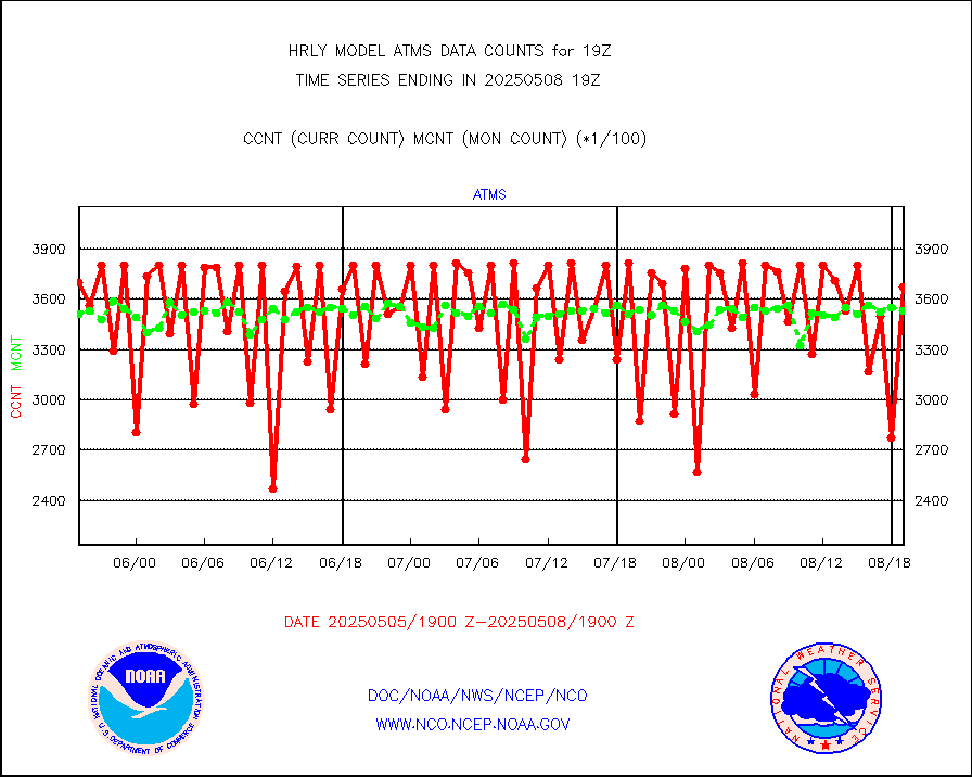
atms |
NPP/NOAA-20 ATMS brightness temperatures |
380352 |
345616 |
110.1 % |
1917.50-1918.49 |
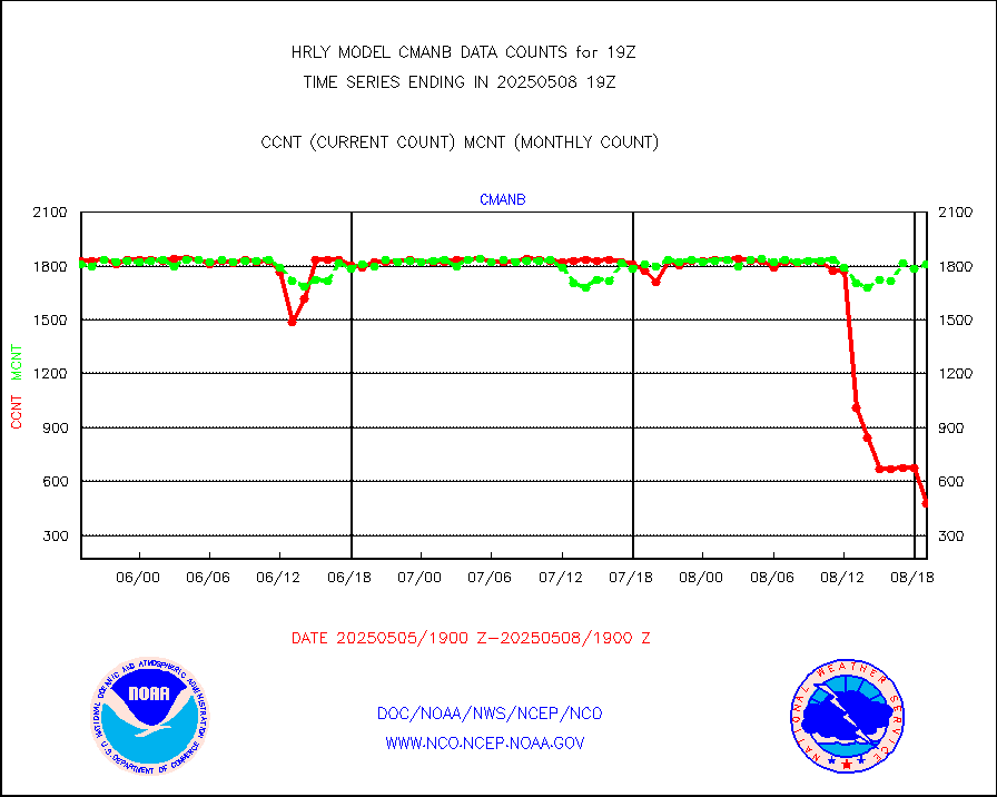
cmanb |
Surface Marine CMAN rpts decoded from BUFR format |
1741 |
1749 |
99.5 % |
1918.50-1919.50 |
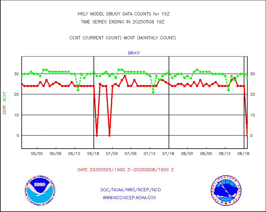
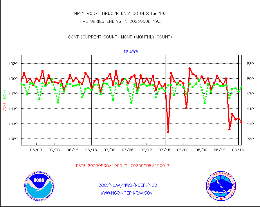
dbuoy |
Buoys decoded from FM-18 fmt (moored or drifting) |
39 |
36 |
108.3 % |
1918.50-1919.49 |
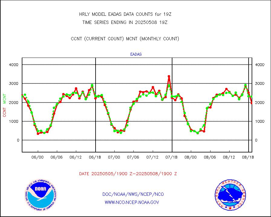
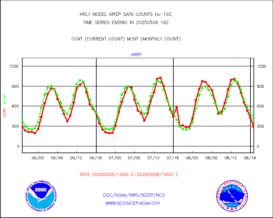
eadas |
E-AMDAR (European AMDAR acft decoded from BUFR) |
2108 |
2022 |
104.3 % |
1918.50-1919.49 |
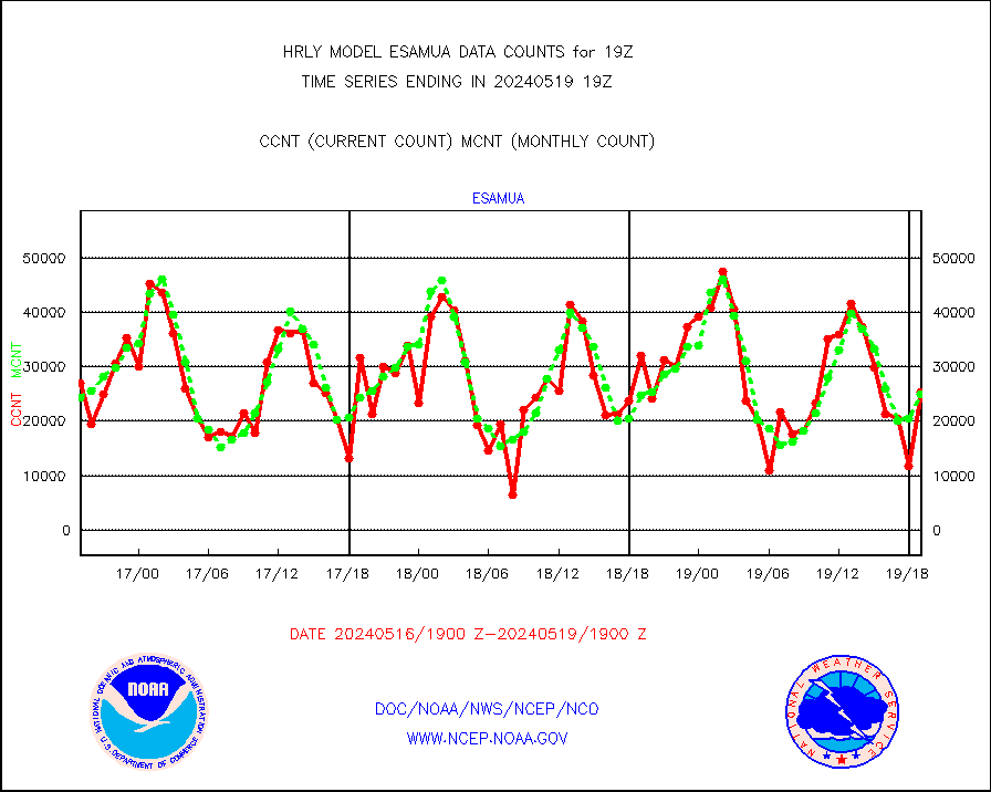
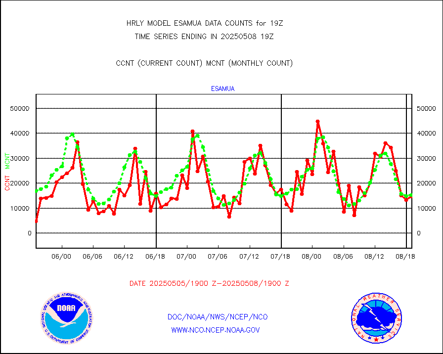
esamua |
NOAA 15-19 & METOP 1-2 AMSU-A proc btmps frm RARS |
25355 |
24888 |
101.9 % |
1918.50-1919.49 |
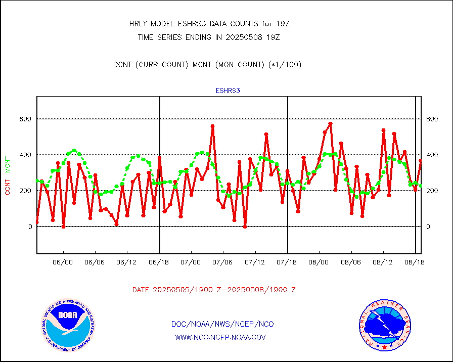
eshrs3 |
NOAA 15-19 & METOP 1-2 HIRS-3/4 pr btmps frm RARS |
56445 |
53969 |
104.6 % |
1918.50-1919.49 |
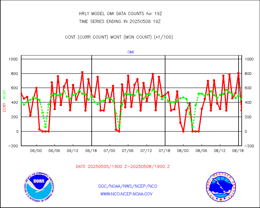
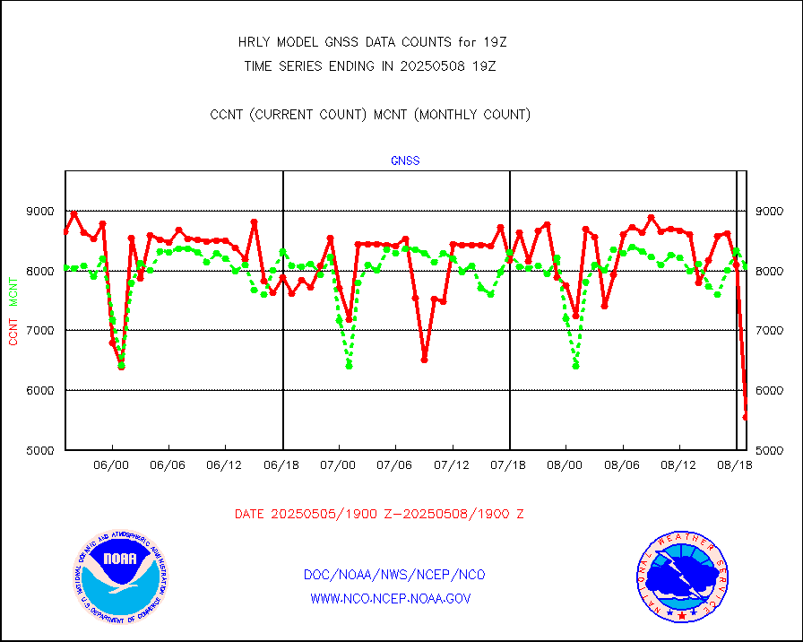
gnss |
Grnd-based Gbl Navigation Sat System (GNSS) data |
8175 |
9219 |
88.7 % |
1918.00-1918.99 |
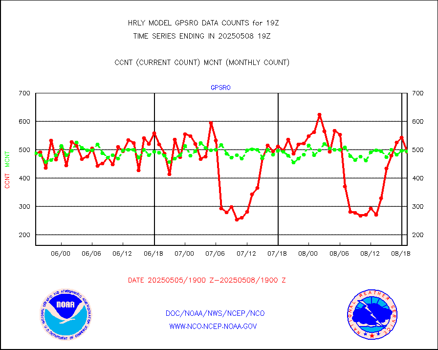
gpsro |
GPS radio occultation data |
380 |
439 |
86.6 % |
1916.50-1917.49 |
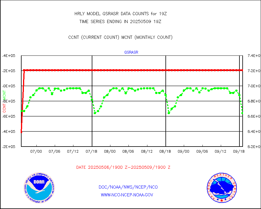
gsrasr |
GOES-16/17 All Sky Radiances (proc.) |
540714 |
516672 |
104.7 % |
1918.50-1919.49 |
gsrcsr |
GOES-16/17 Clear Sky Radiances (proc.) |
263162 |
269462 |
97.7 % |
1918.50-1919.49 |
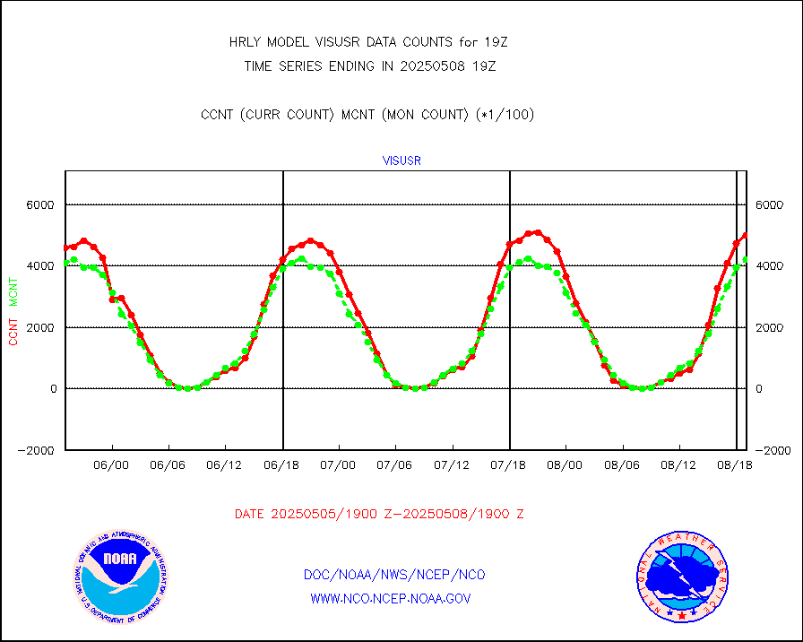
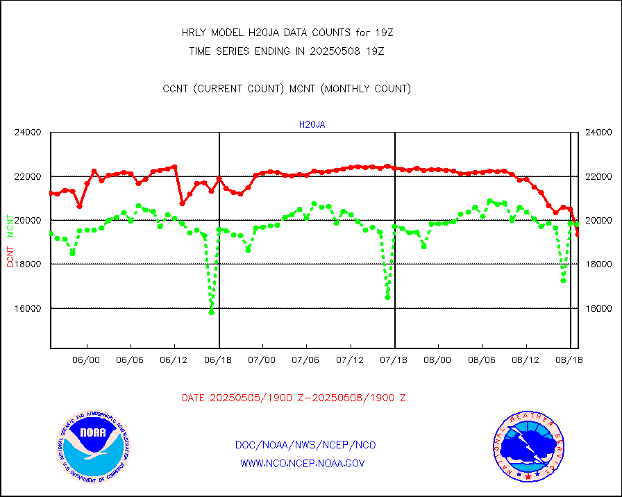
h20ja |
MTSAT/JMA water vapor imager derived cloud motion |
20164 |
18374 |
109.7 % |
1916.50-1917.49 |
h20mo |
MODIS (AQUA/TERRA) wvpr imager derived cld motion |
0 |
0 |
n/a |
1915.00-1915.99 |
h2tusr |
GOES-16&up/NESDIS wv imgr/cld-top derived cld mtn |
26001 |
26296 |
98.9 % |
1918.00-1918.99 |
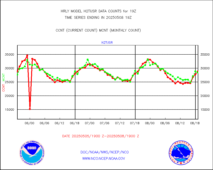
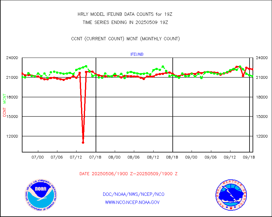
ifeunb |
METEOSAT/EUMETSAT ir lg-wave drv cld motion NBseq |
21861 |
21659 |
100.9 % |
1917.50-1918.49 |
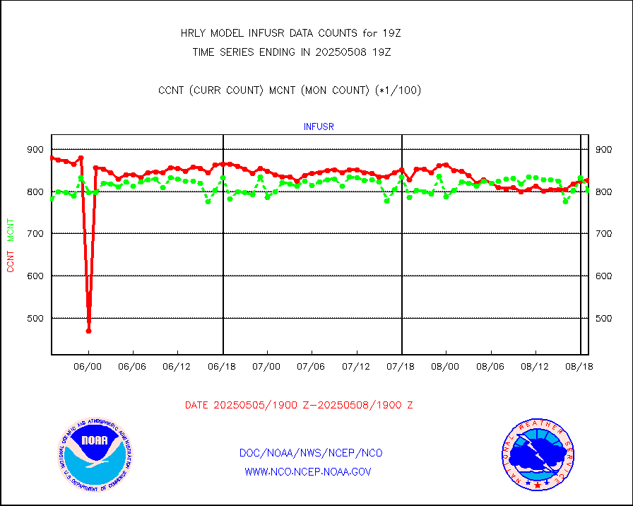
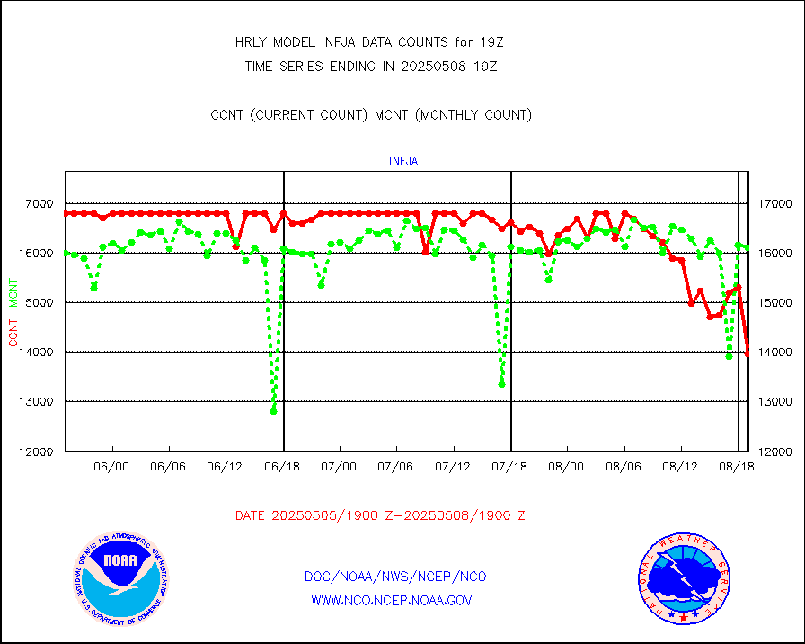
infja |
MTSAT/JMA infrared long-wave derived cloud motion |
16416 |
15680 |
104.7 % |
1916.50-1917.49 |
infmo |
MODIS (AQUA/TERRA) ir l-wave derived cloud motion |
0 |
0 |
n/a |
1915.00-1915.99 |
infusr |
GOES-16&up/NESDIS ir long-wave derived cld motion |
80143 |
80154 |
100.0 % |
1918.00-1918.99 |
lgycld |
GOES/NASA(Langley) hi-res. (1x1 f-o-v) cloud data |
4203892 |
3502125 |
120.0 % |
1918.50-1919.49 |
mbuoy |
Buoys decoded from FM-13 format (moored) |
118 |
115 |
102.6 % |
1918.50-1919.49 |
metar |
Aviation - METAR |
7439 |
7706 |
96.5 % |
1918.50-1919.49 |
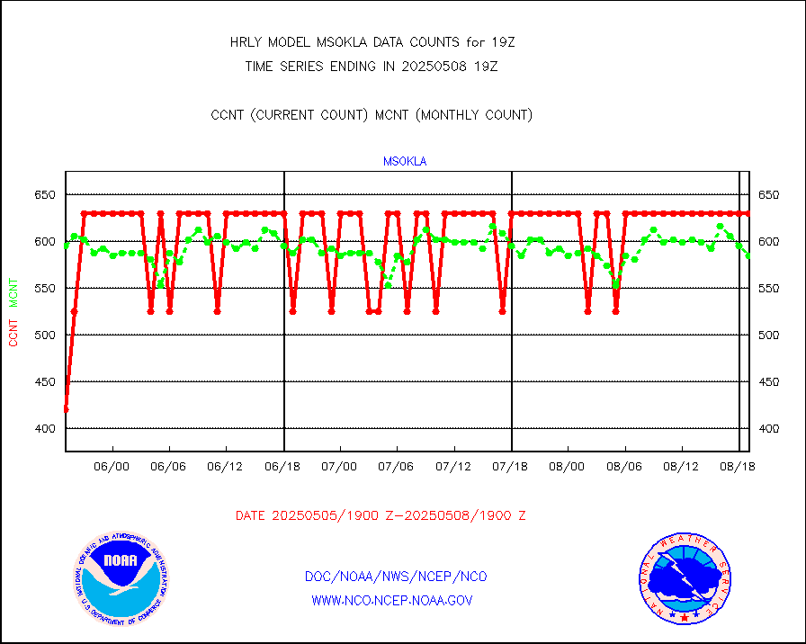
mso470 |
Mesonet/MADIS Colorado E-470 (Interstate 470) |
21 |
20 |
105.0 % |
1918.50-1919.49 |
msoalk |
Mesonet/MADIS Alaska Department of Transportation |
110 |
109 |
100.9 % |
1918.50-1919.49 |
msoapg |
Mesonet/MADIS U.S. Army Aberdeen Proving Grounds |
0 |
0 |
n/a |
1918.50-1919.49 |
msoapr |
Mesonet/MADIS Citizen Weather Observers Program |
49973 |
49458 |
101.0 % |
1918.50-1919.49 |
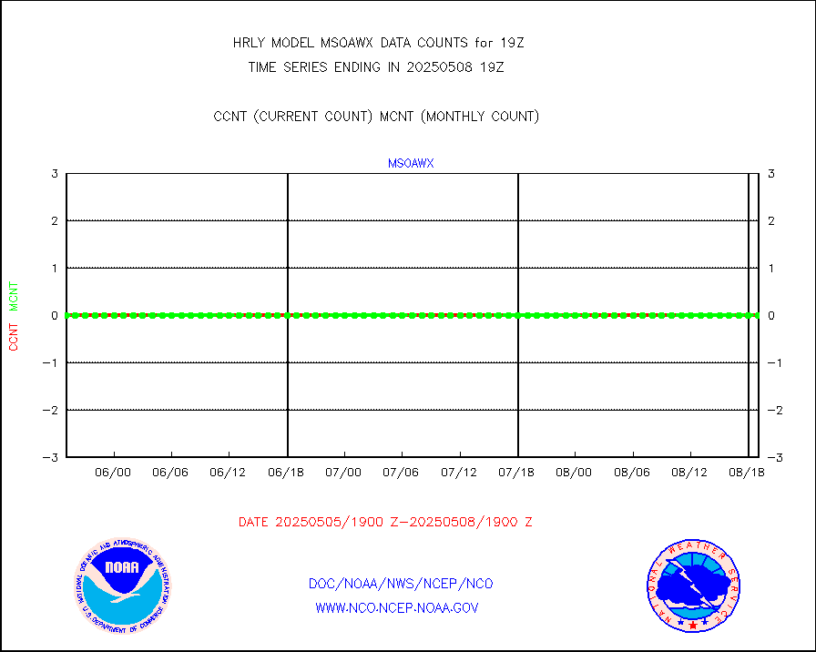
msoaws |
Mesonet/MADIS AWS Convergence Technologies, Inc. |
24826 |
25740 |
96.4 % |
1918.50-1919.49 |
msoawx |
Mesonet/MADIS "Anything Weather" |
0 |
0 |
n/a |
1918.50-1919.49 |
msocol |
Mesonet/MADIS Colorado Dept. of Transportation |
0 |
0 |
n/a |
1918.50-1919.49 |
msodcn |
Mesonet/MADIS DC Net |
0 |
0 |
n/a |
1918.50-1919.49 |
msoden |
Mesonet/MADIS Denver Urban Drainage & Flood Cntrl |
250 |
247 |
101.2 % |
1918.50-1919.49 |
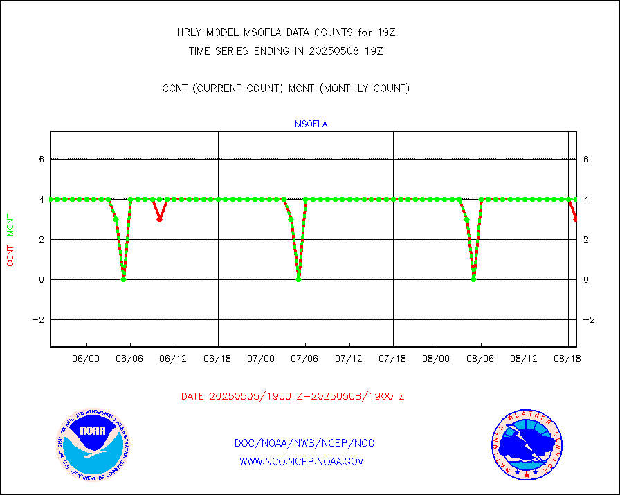
msofla |
Mesonet/MADIS Florida (FAWN & USF) |
4 |
4 |
100.0 % |
1918.50-1919.49 |
msoflt |
Mesonet/MADIS Florida Dept. of Transportation |
0 |
0 |
n/a |
1918.50-1919.49 |
msogeo |
Mesonet/MADIS Georgia Dept. of Transportation |
0 |
0 |
n/a |
1918.50-1919.49 |
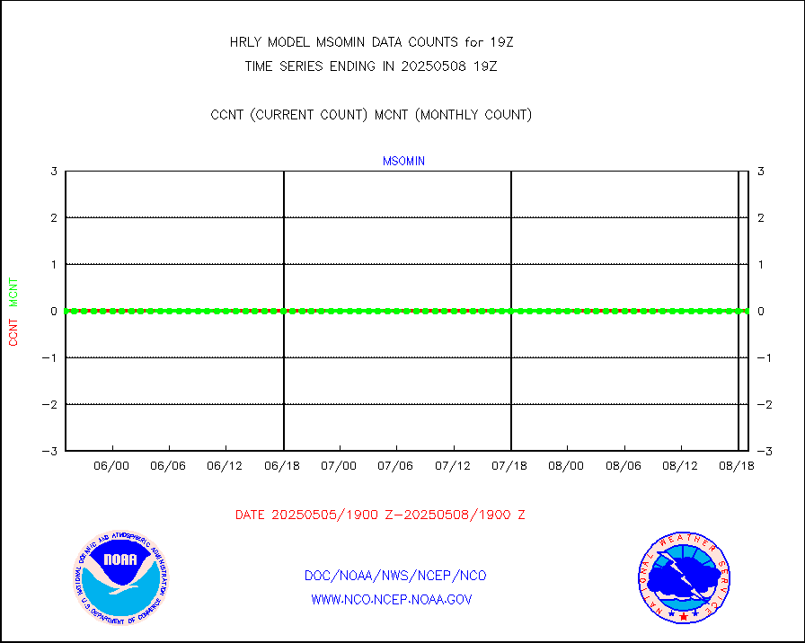
msohad |
Mesonet/MADIS NWS Hydromet Auto Data System(HADS) |
6325 |
6784 |
93.2 % |
1918.50-1919.49 |
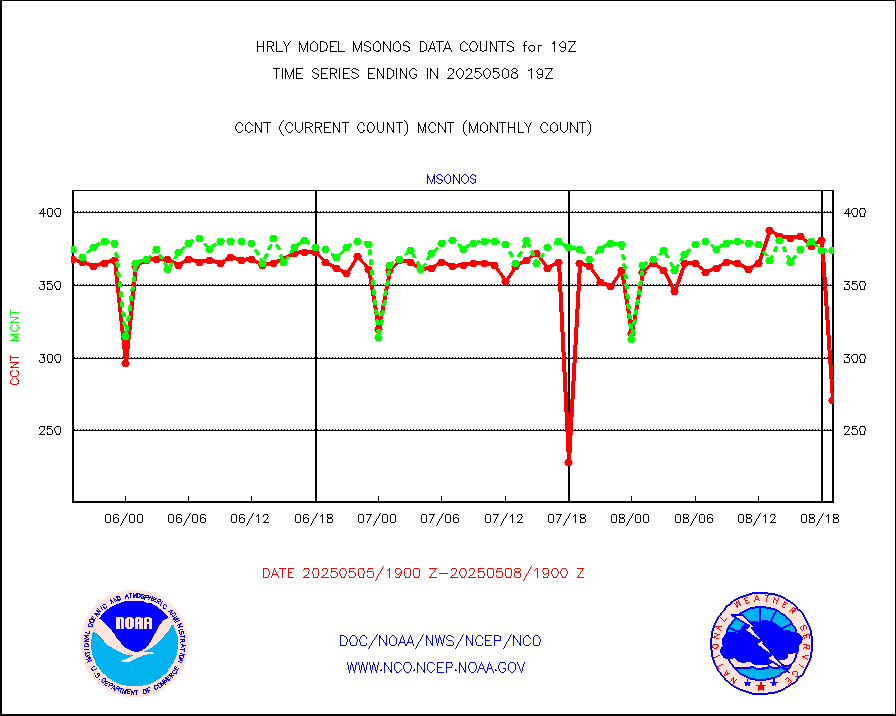
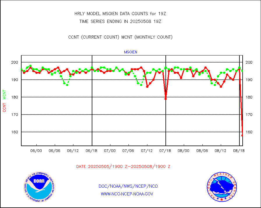
msoien |
Mesonet/MADIS Iowa Environmental |
185 |
188 |
98.4 % |
1918.50-1919.49 |
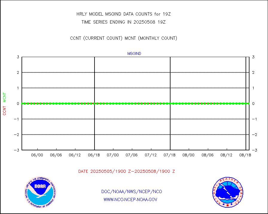
msoind |
Mesonet/MADIS Indiana Dept. of Transportation |
0 |
0 |
n/a |
1918.50-1919.49 |
msoiow |
Mesonet/MADIS Iowa Department of Transportation |
0 |
0 |
n/a |
1918.50-1919.49 |
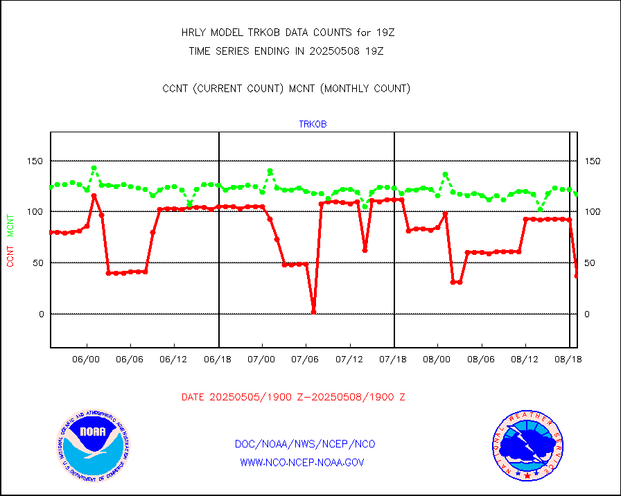
msokan |
Mesonet/MADIS Kansas Department of Transportation |
387 |
359 |
107.8 % |
1918.50-1919.49 |
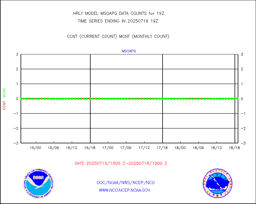
msokla |
Mesonet/MADIS Oklahoma Mesonet |
318 |
318 |
100.0 % |
1918.50-1919.49 |
msolju |
Mesonet/MADIS Louisiana State/Jackson State Univ. |
0 |
0 |
n/a |
1918.50-1919.49 |
msomca |
Mesonet/MADIS Missouri Commercial Agricult Wx Net |
302 |
297 |
101.7 % |
1918.50-1919.49 |
msomin |
Mesonet/MADIS Minnesota Dept. of Transportation |
0 |
0 |
n/a |
1918.50-1919.49 |
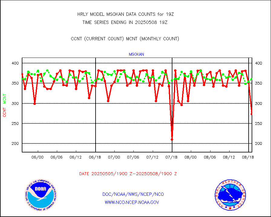
msonos |
Mesonet/MADIS NOS-Phys Oceanographic Realtime Sys |
388 |
382 |
101.6 % |
1918.50-1919.49 |
msoraw |
Mesonet/MADIS NFIC Remote Automated Wx Stns(RAWS) |
1953 |
1903 |
102.6 % |
1918.50-1919.49 |
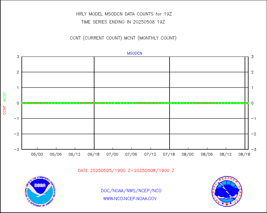
msovir |
Mesonet/MADIS Virginia Dept. of Transportation |
207 |
225 |
92.0 % |
1918.50-1919.49 |
msowfy |
Mesonet/MADIS "Weather for You" |
0 |
0 |
n/a |
1918.50-1919.49 |
msowis |
Mesonet/MADIS Wisconsin Dept. of Transportation |
0 |
0 |
n/a |
1918.50-1919.49 |
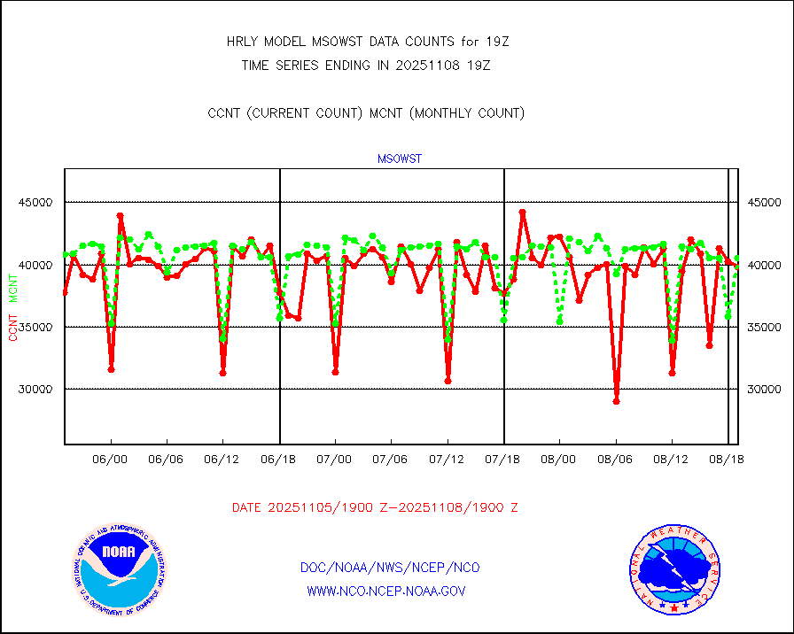
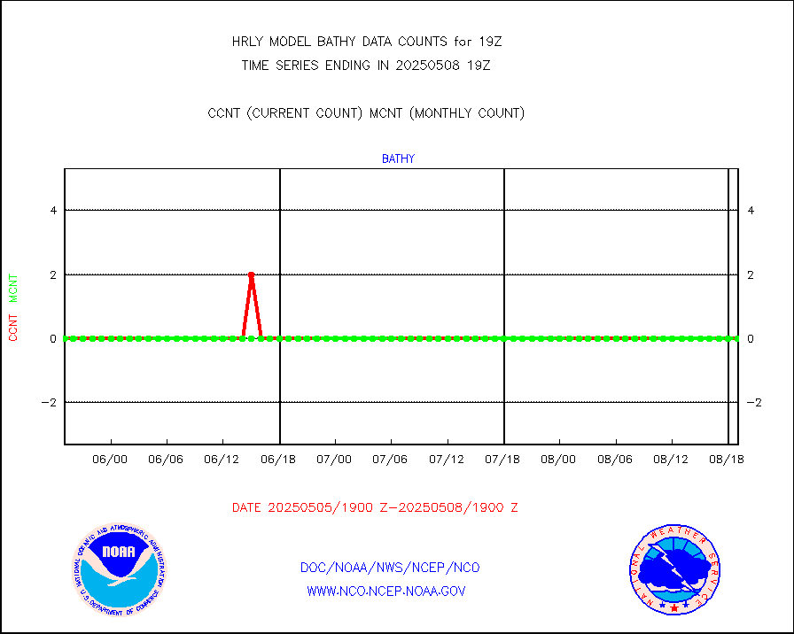
msowst |
Mesonet/MADIS MesoWest (many subproviders) |
46994 |
46601 |
100.8 % |
1918.50-1919.49 |
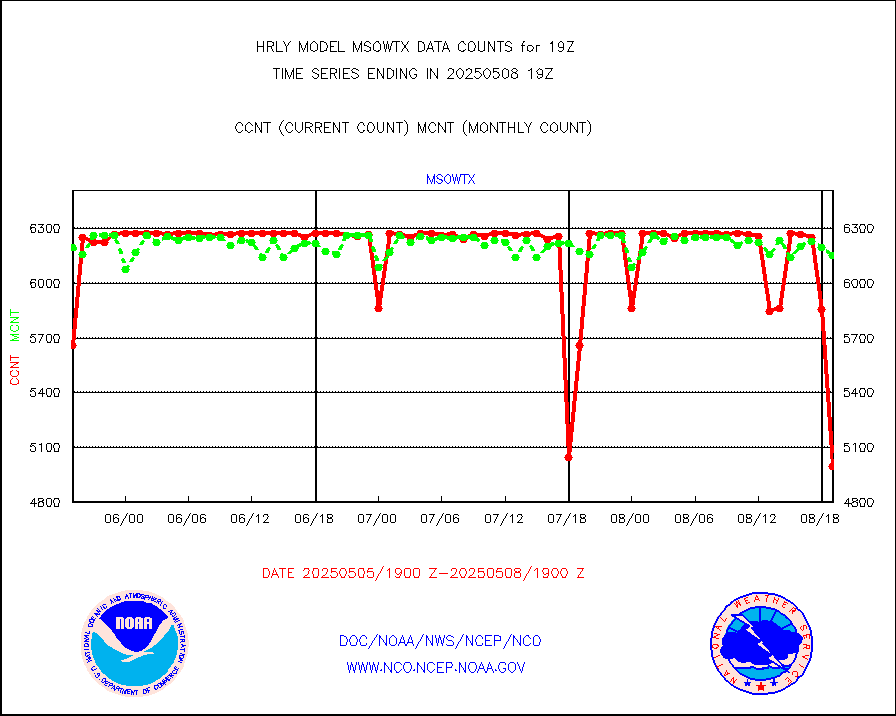
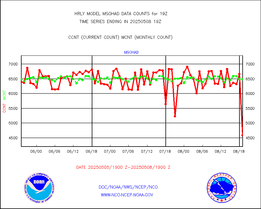
msowtx |
Mesonet/MADIS West Texas |
5653 |
5625 |
100.5 % |
1918.50-1919.49 |
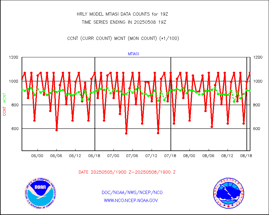
mtiasi |
METOP 1-2 IASI 1C radiance data (varbl. channels) |
66856 |
78595 |
85.1 % |
1917.00-1917.99 |
nxrdw |
NEXRAD Vel Azm Dsp(VAD) winds via radar coded msg |
0 |
0 |
n/a |
1918.50-1919.49 |
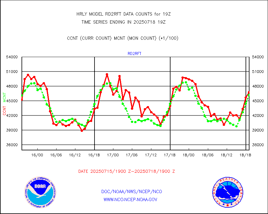
omi |
Aura Ozone Monitoring Instrument (OMI) data |
40140 |
29196 |
137.5 % |
1916.50-1917.49 |
osbuv8 |
NOAA 16-19 Solar Backscatter UV-2 rad frm V8 BUFR |
0 |
0 |
n/a |
1917.00-1917.99 |
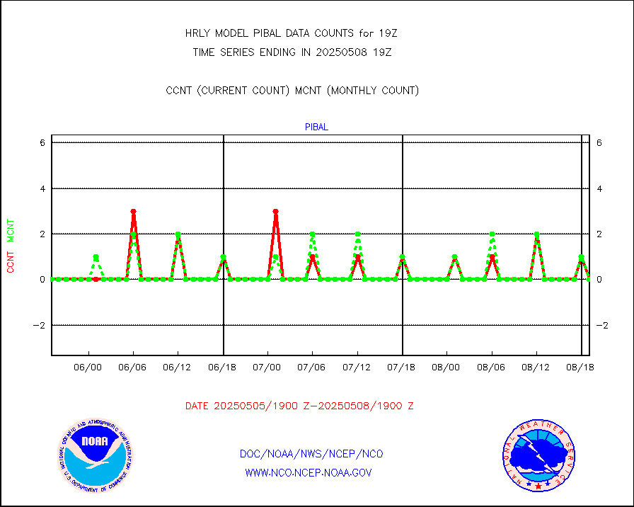
pibal |
PIBAL (from PILOT, PILOT SHIP, PILOT MOBIL) |
0 |
0 |
n/a |
1918.50-1919.49 |
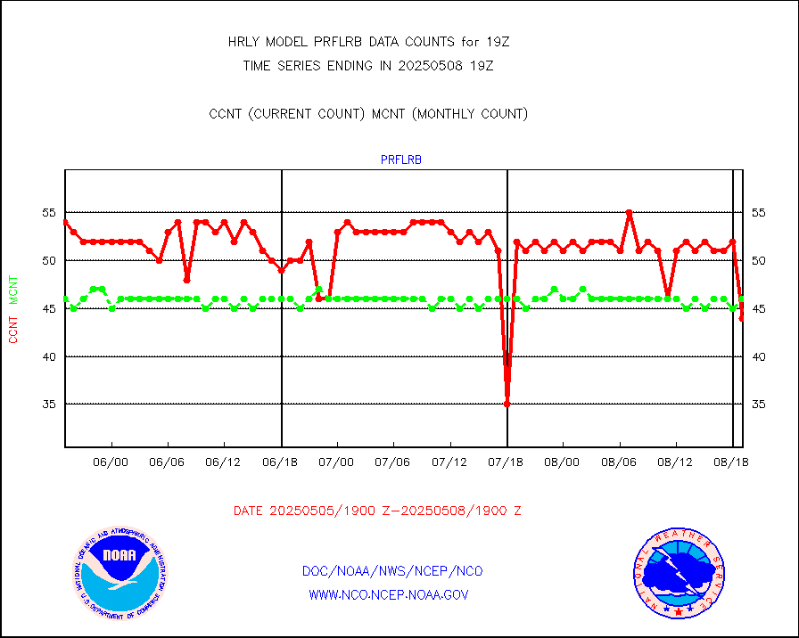
prflrb |
Multi-Agency Profiler (MAP) and SODAR winds |
35 |
42 |
83.3 % |
1918.50-1919.49 |
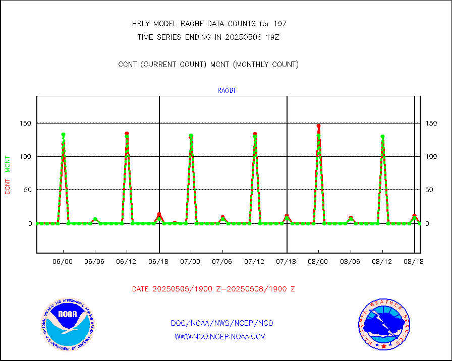
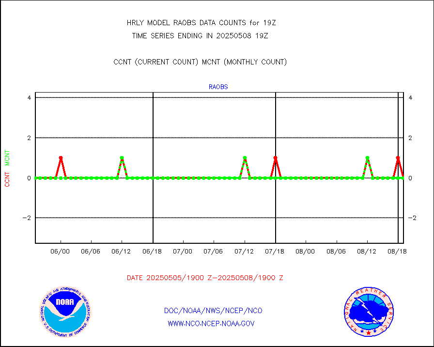
raobf |
Rawinsonde - fixed land (from TEMP or PILOT) |
0 |
0 |
n/a |
1918.50-1919.49 |
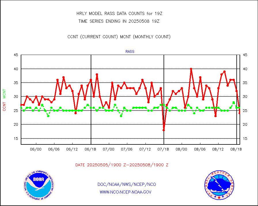
rass |
RASS temperatures (NOAA and Multi-Agency) |
24 |
25 |
96.0 % |
1918.50-1919.49 |
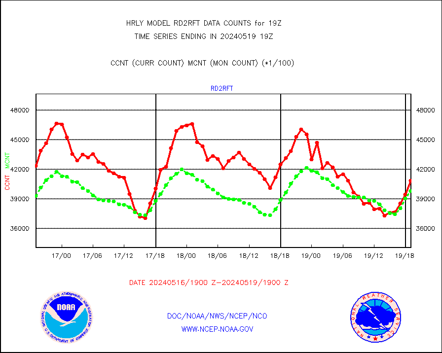
rd2rft |
NEXRAD reflectivity (Lvl 2 - GTS) |
4085810 |
3979341 |
102.7 % |
1918.50-1919.49 |
rd2wnd |
NEXRAD radial wind (Level 2 - GTS) |
1662459 |
1475209 |
112.7 % |
1918.50-1919.49 |
sevcsr |
METEOSAT-10 2nd Gen SEVIRI Clr Sky Radiance(proc) |
0 |
0 |
n/a |
1918.50-1919.49 |
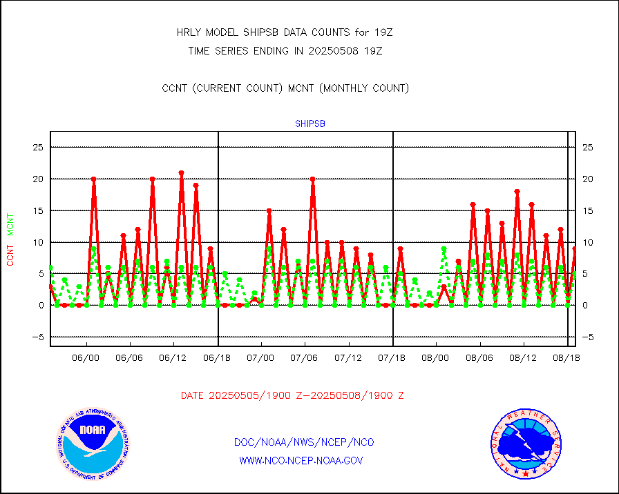
shipsb |
Ship - manual and automatic, restricted (BUFR) |
1 |
0 |
n/a |
1918.50-1919.50 |
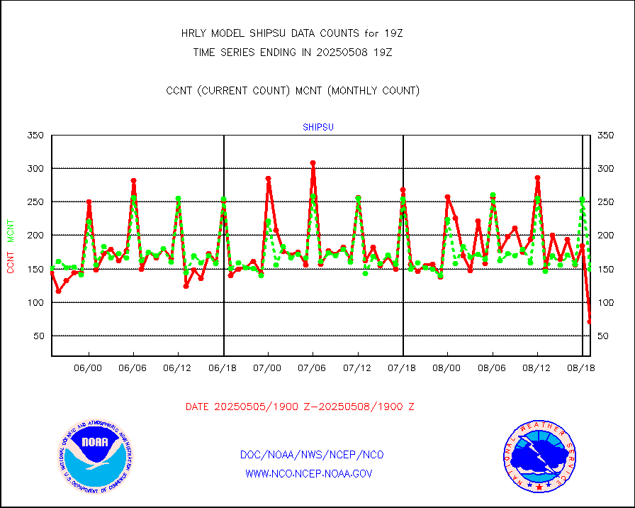
shipsu |
Ship - manual and automatic, unrestricted |
116 |
122 |
95.1 % |
1918.50-1919.50 |
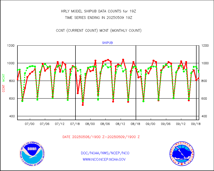
shipub |
Ship - manual and automatic, unrestricted (BUFR) |
783 |
817 |
95.8 % |
1918.50-1919.50 |
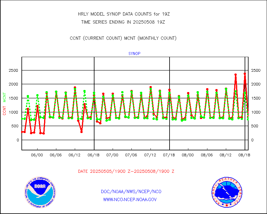
synop |
Synoptic - fixed manual and automatic |
924 |
891 |
103.7 % |
1918.50-1919.49 |
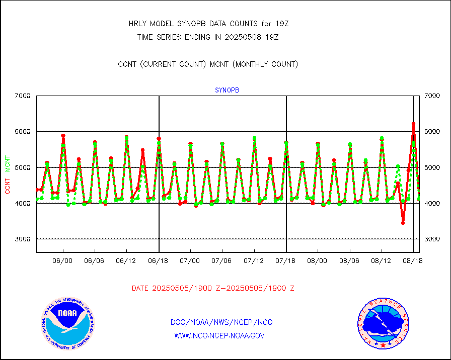
synopb |
Synoptic - fixed manual & auto (decoded fr BUFR) |
4138 |
4129 |
100.2 % |
1918.50-1919.49 |
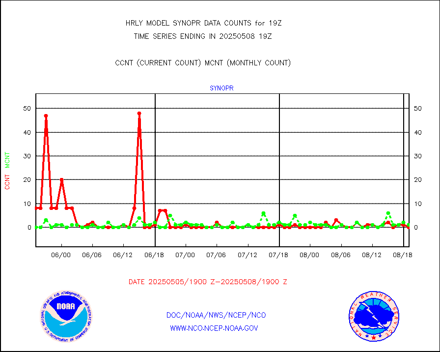
synopr |
Synoptic - restricted (WMO Res 40) manual & auto. |
1 |
0 |
n/a |
1918.50-1919.49 |
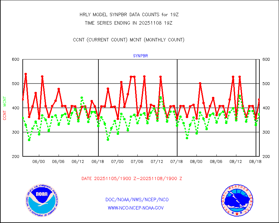
synpbr |
Synoptic - restricted (WMO Res 40)(decoded BUFR) |
397 |
402 |
98.8 % |
1918.50-1919.49 |
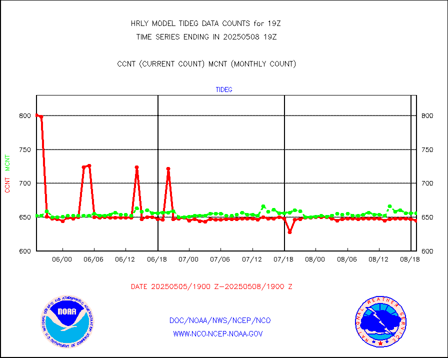
tideg |
Tide gauge reports decoded from CREX format |
642 |
640 |
100.3 % |
1918.00-1918.99 |
| Data Types of Opportunity with Normal Counts |
|---|
| Type | Description | Hourly Count | Monthly Average | Percent (%) of Monthly Mean | UTC Time Window |
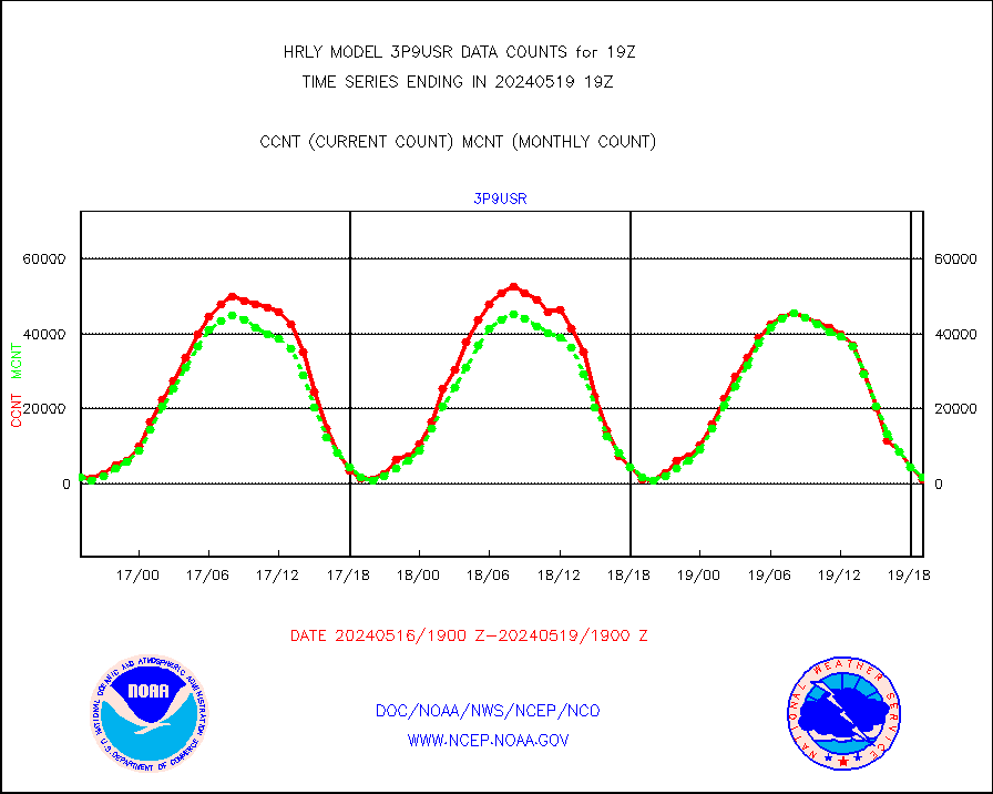
3p9usr |
GOES-16&up/NESDIS ir short-wv derived cld motion |
1251 |
1832 |
68.3 % |
1918.00-1918.99 |
acarsa |
MDCRS ACARS acft data (ARINC via AFWA)(AIREP fmt) |
0 |
0 |
n/a |
1918.50-1919.49 |
ahicsr |
Himawari Clear Sky Radiance |
0 |
0 |
n/a |
1918.00-1918.99 |
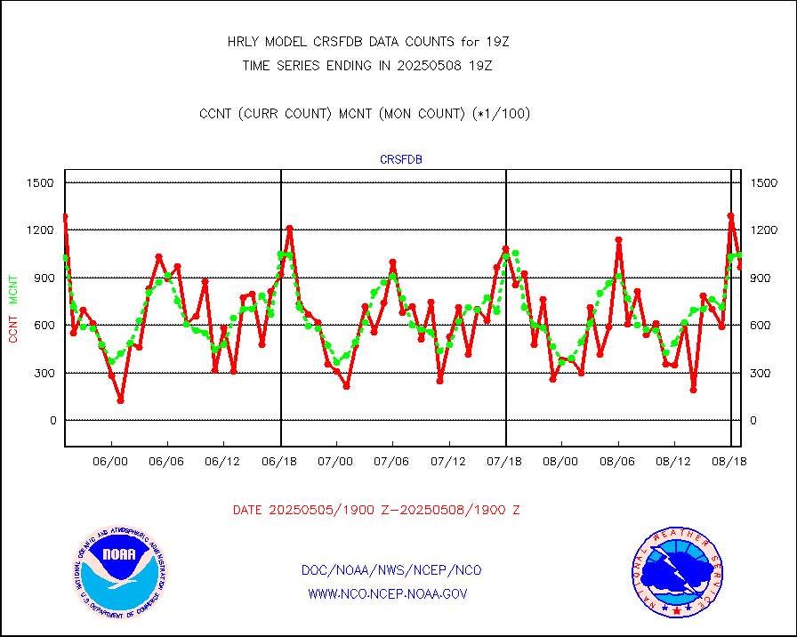
amsr2 |
GCOM-W AMSR2 1B brightness temperatures |
2309472 |
2069906 |
111.6 % |
1917.00-1917.99 |
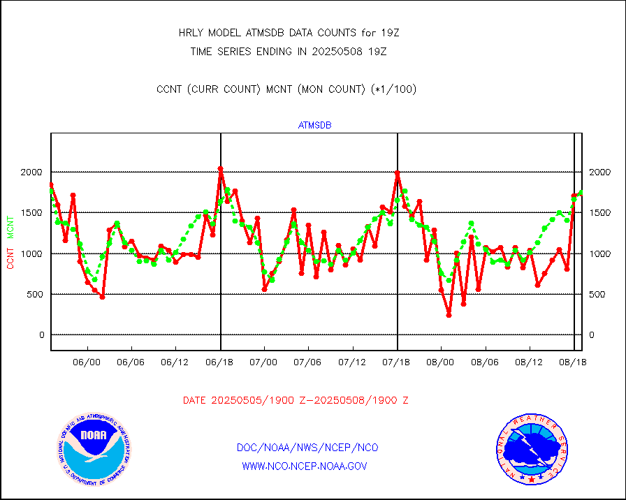
atmsdb |
NPP/NOAA-20 ATMS bright. temps-direct b-cast SSEC |
155216 |
161791 |
95.9 % |
1917.50-1918.49 |
atovs |
POES/NESDIS - processed ATOVS soundings/radiances |
0 |
0 |
n/a |
1917.00-1917.99 |
avcsam |
A.M.(N17,M2,M3) AVHRR GAC NCEP-proc clr&sea btmps |
1187797 |
1366987 |
86.9 % |
1916.50-1917.49 |
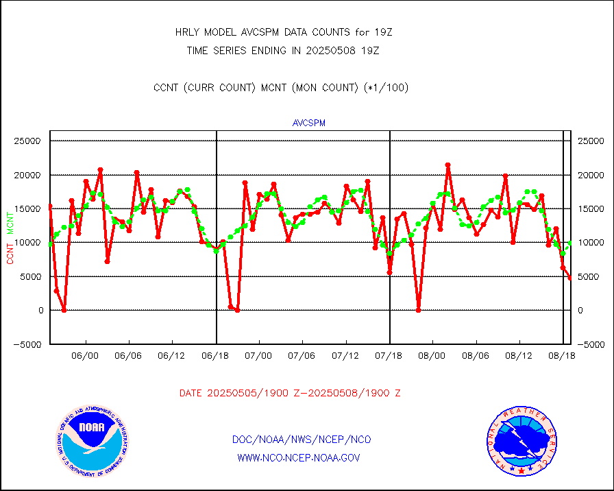
avcspm |
P.M.(N18-19) AVHRR GAC NCEP-proc clr & sea btemps |
1195456 |
1410697 |
84.7 % |
1916.50-1917.49 |
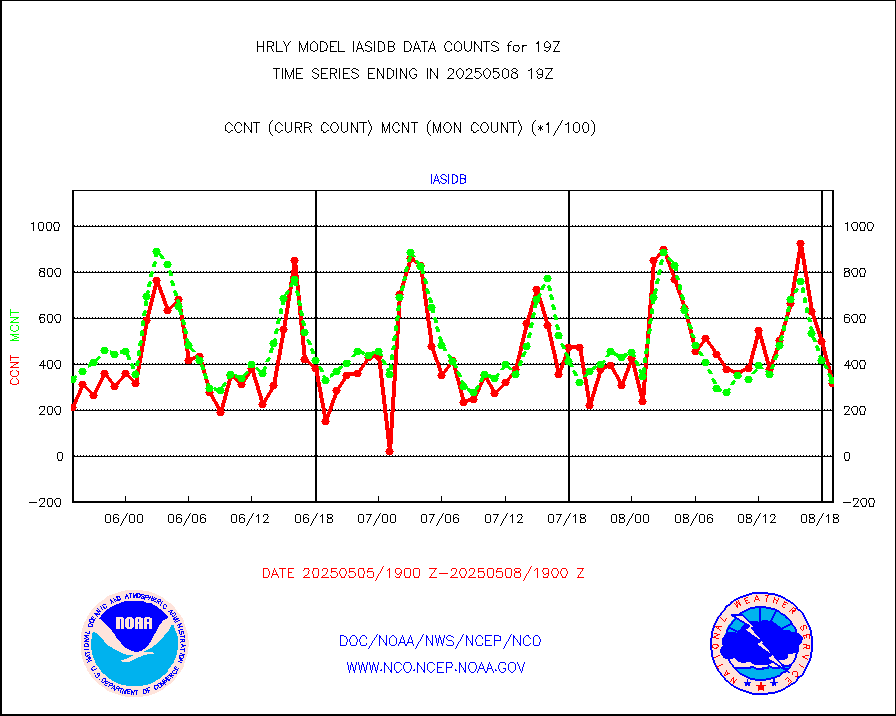
bathy |
eXpendable BathyThermograph, mooring (BATHY fmt) |
0 |
0 |
n/a |
1912.00-1912.99 |
coopmd |
Coop/MADIS NEPP & HCN-Modernization NOAA COOP Obs |
27 |
27 |
100.0 % |
1918.50-1919.49 |
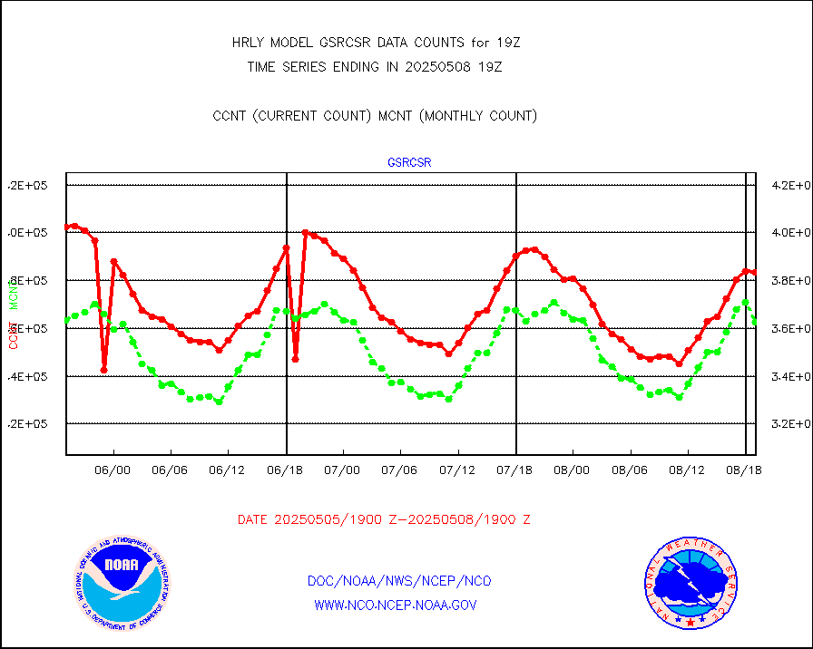
crisf4 |
NPP/NOAA-20 CrIS full spctrl radn (431 ch subset) |
240534 |
218425 |
110.1 % |
1917.50-1918.49 |
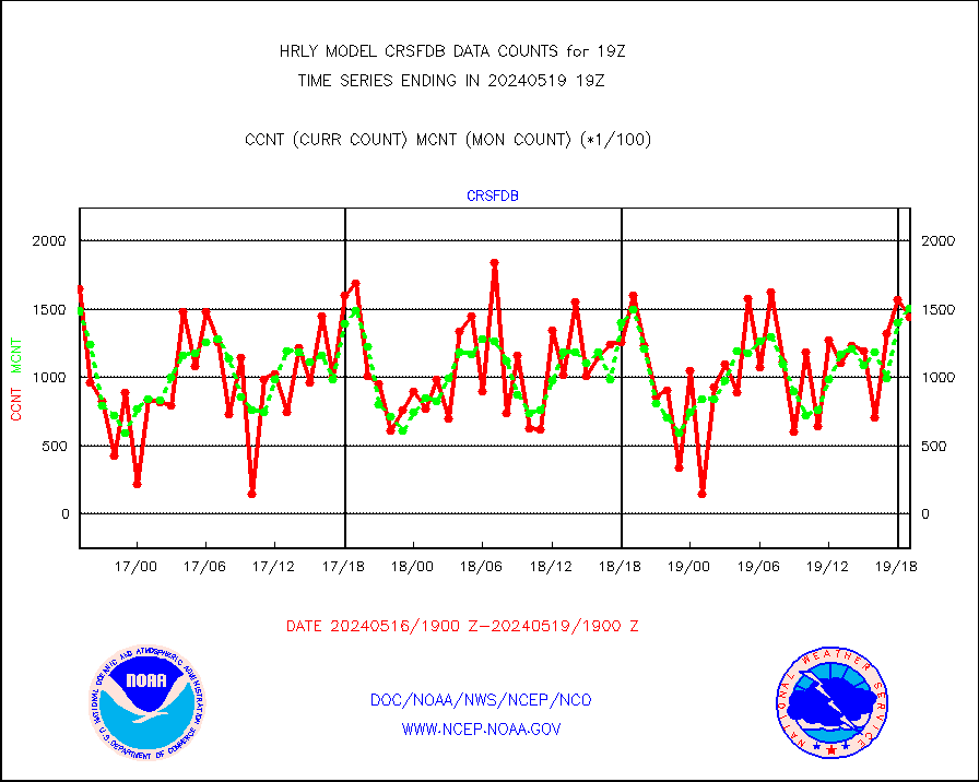
crsfdb |
NPP/NOAA-20 CrIS full spctrl radn dir brdcst SSEC |
144011 |
151099 |
95.3 % |
1917.50-1918.49 |
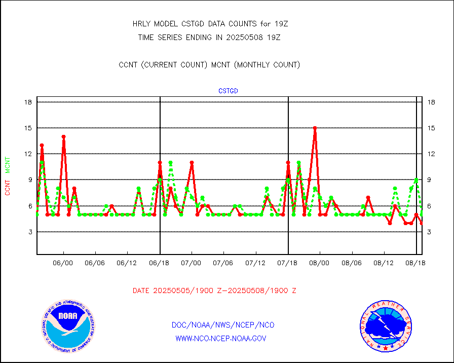
cstgd |
Coast Guard |
3 |
4 |
75.0 % |
1918.50-1919.50 |
dbuoyb |
Drifting buoys (decoded from BUFR) |
1440 |
1392 |
103.4 % |
1918.50-1919.50 |
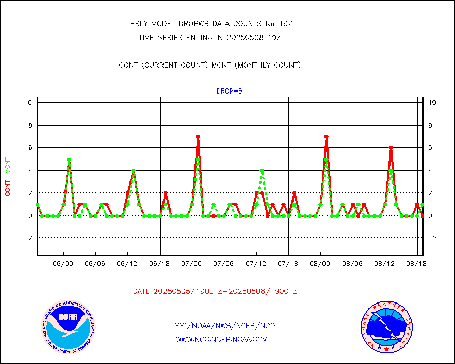
dropw |
Dropwinsonde (from TEMP DROP) |
0 |
0 |
n/a |
1918.50-1919.49 |
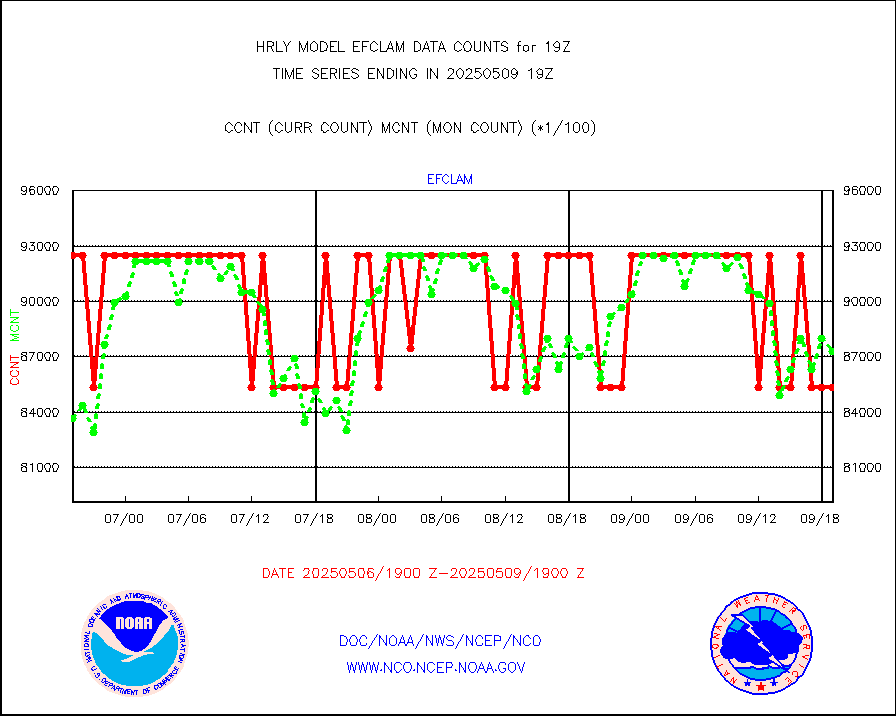
efclam |
GOES imager effective cloud amount data (U.Wisc.) |
8298720 |
8287209 |
100.1 % |
1918.50-1919.49 |
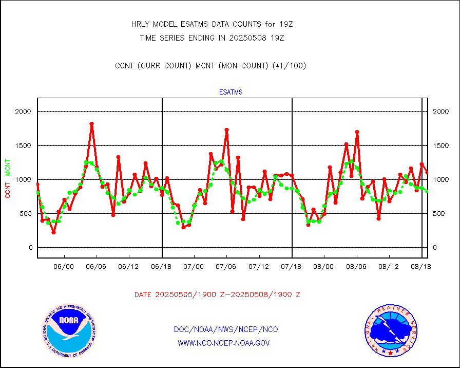
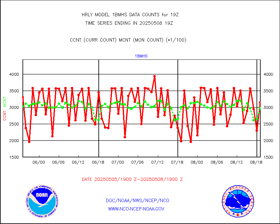
esatms |
NPP Adv. Tech. MW Sndr (ATMS) br. temps from RARS |
108192 |
99406 |
108.8 % |
1917.50-1918.49 |
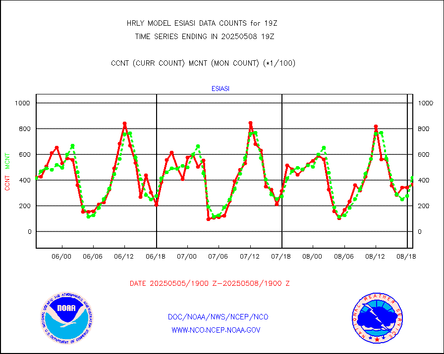
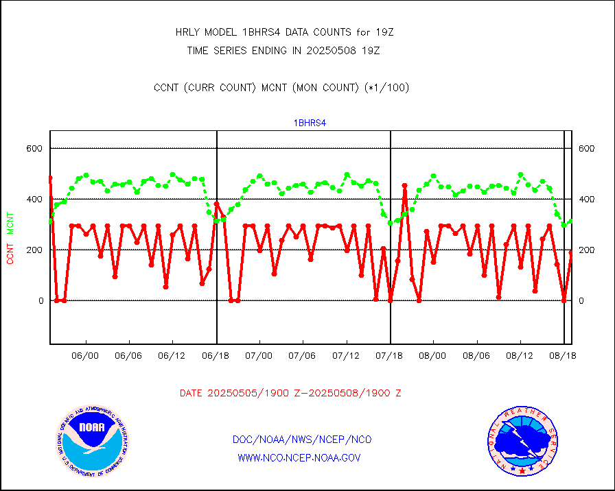
esiasi |
METOP 1-2 IASI 1C radiance data vbl chn from RARS |
81359 |
58462 |
139.2 % |
1918.00-1918.99 |
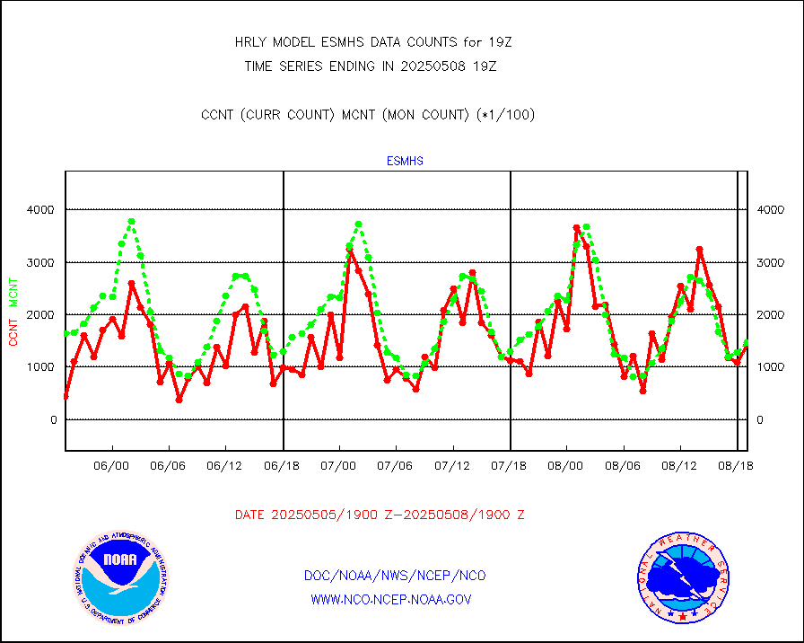
esmhs |
NOAA 18-19 & METOP 1-2 MHS proc. btemps from RARS |
215492 |
194734 |
110.7 % |
1918.50-1919.49 |
geoimr |
GOES/NESDIS (11x17 f-o-v) imager clear radiances |
0 |
0 |
n/a |
1918.00-1918.99 |
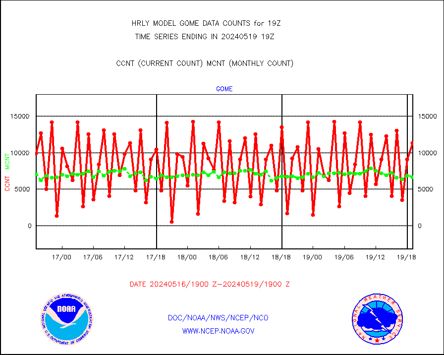
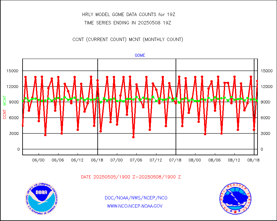
gome |
METOP 1-2 Global Ozone Monitoring Exp.-2 (GOME-2) |
11348 |
6624 |
171.3 % |
1917.50-1918.49 |
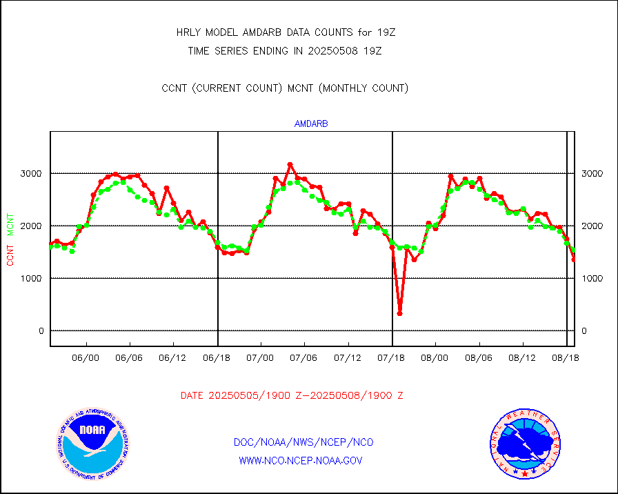
h20in2 |
INDIA SATWIND, INSAT WV channel |
2526 |
1679 |
150.4 % |
1918.00-1918.99 |
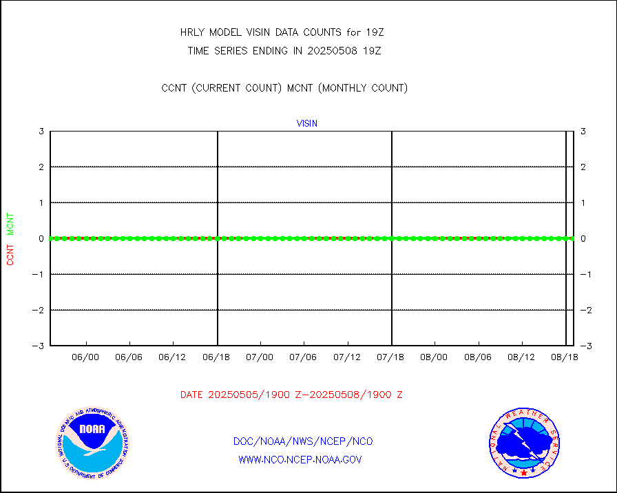
h2dusr |
GOES-16&up/NESDIS wv imgr/deep-lyr derivd cld mtn |
16889 |
17133 |
98.6 % |
1918.00-1918.99 |
h2eunb |
METEOSAT/EUMETSAT wvpr imgr drv cld motion NBseq |
40543 |
41947 |
96.7 % |
1917.50-1918.49 |
iasidb |
METOP 1-2 IASI 1C radiances-direct broadcast SSEC |
28787 |
21869 |
131.6 % |
1917.50-1918.49 |
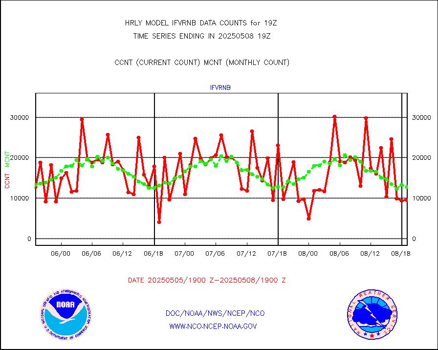
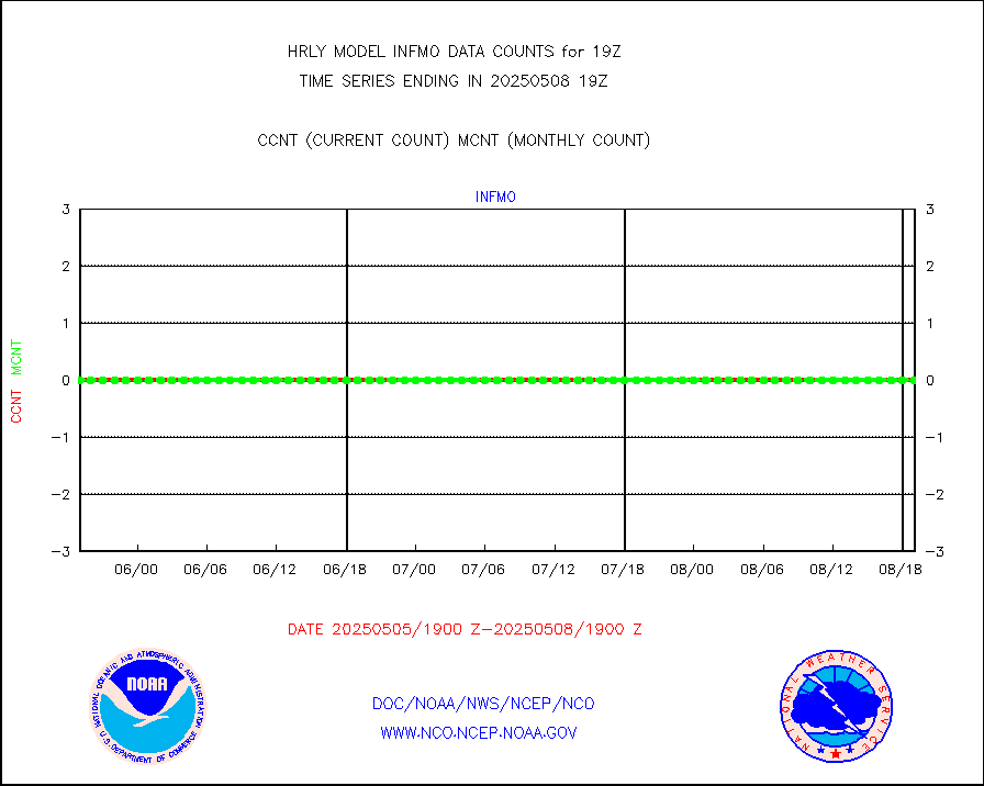
ifvrnb |
VIIRS (NPP/NOAA-20) ir lg-wv drv cloud motion(NB) |
8349 |
13656 |
61.1 % |
1915.00-1915.99 |
infav |
AVHRR (NOAA/METOP) ir lg-wave derived cld motion |
0 |
0 |
n/a |
1915.00-1915.99 |
infav1 |
AVHRR (METOP) ir lg-wave derived cld motion |
0 |
0 |
n/a |
1918.50-1919.50 |
infin |
INSAT/KALPANA India ir lg-wave derived cld motion |
0 |
0 |
n/a |
1916.50-1917.49 |
infin2 |
INDIA SATWIND, INSAT IR channel |
3710 |
1666 |
222.7 % |
1918.00-1918.99 |
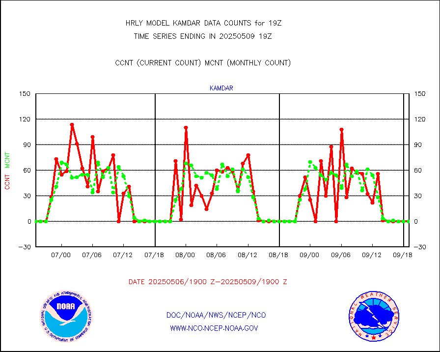
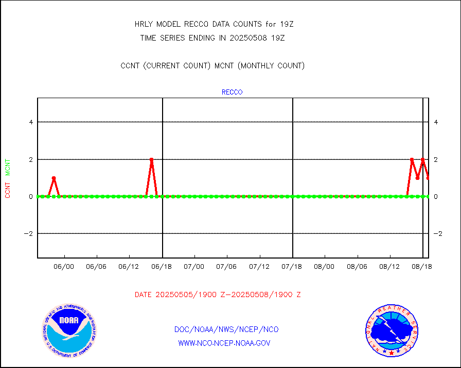
kamdar |
Korean AMDAR aircraft data (decoded from BUFR) |
0 |
0 |
n/a |
1918.50-1919.49 |
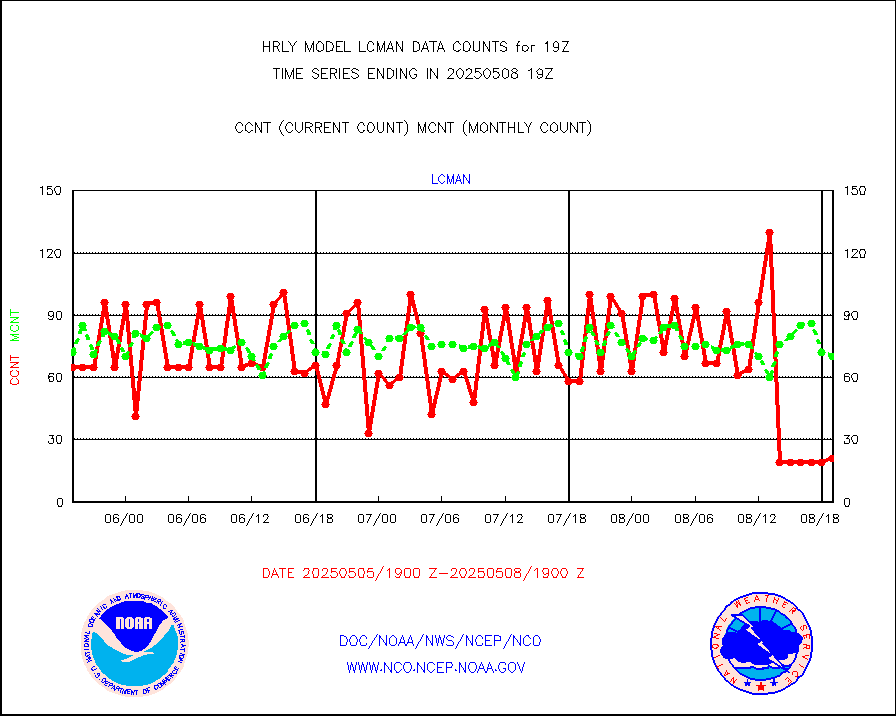
lcman |
Land-based CMAN stations decoded from CMAN format |
75 |
87 |
86.2 % |
1918.50-1919.49 |
leogeo |
LEO-GEO satellite AMVs from UWisc. |
6072 |
4677 |
129.8 % |
1915.00-1915.99 |
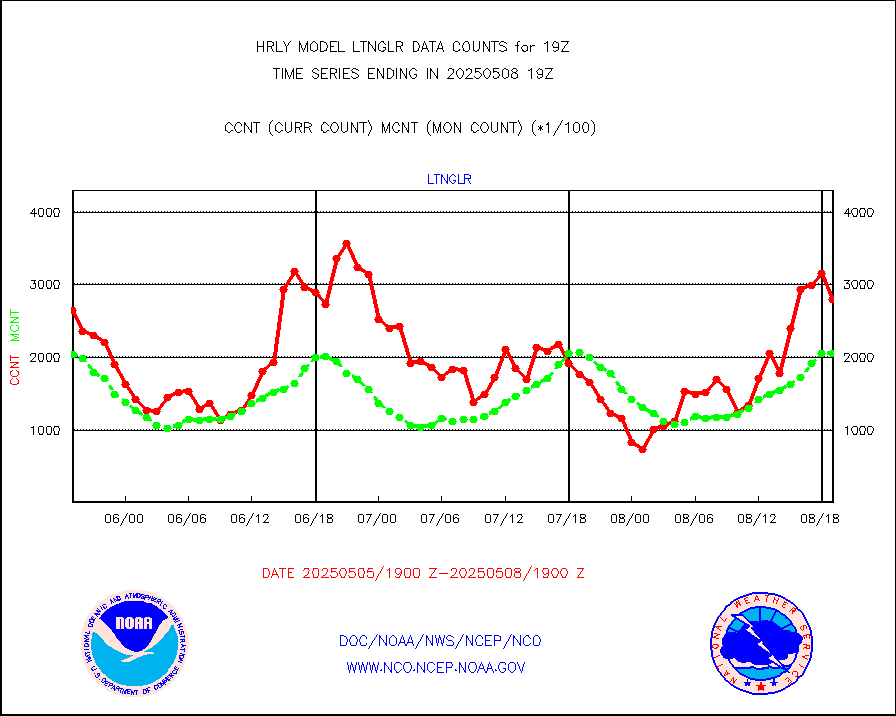
ltnglr |
LLDN Long-rng lightning from Vaisala via NOAAPORT |
227776 |
181387 |
125.6 % |
1918.50-1919.49 |
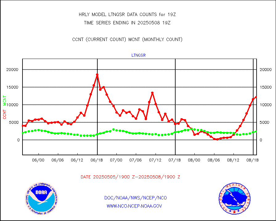
ltngsr |
NLDN Shrt-rng lightning from Vaisala via NOAAPORT |
7825 |
3132 |
249.8 % |
1918.50-1919.49 |
mbuoyb |
Moored buoys (decoded from BUFR) |
831 |
752 |
110.5 % |
1918.50-1919.50 |
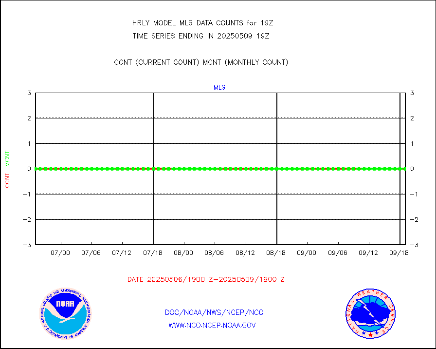
mls |
Aura Microwave Limb Sounder (MLS) ozone data |
0 |
0 |
n/a |
1917.00-1917.99 |
msourb |
Mesonet/MADIS UrbaNet |
4344 |
4377 |
99.2 % |
1918.50-1919.49 |
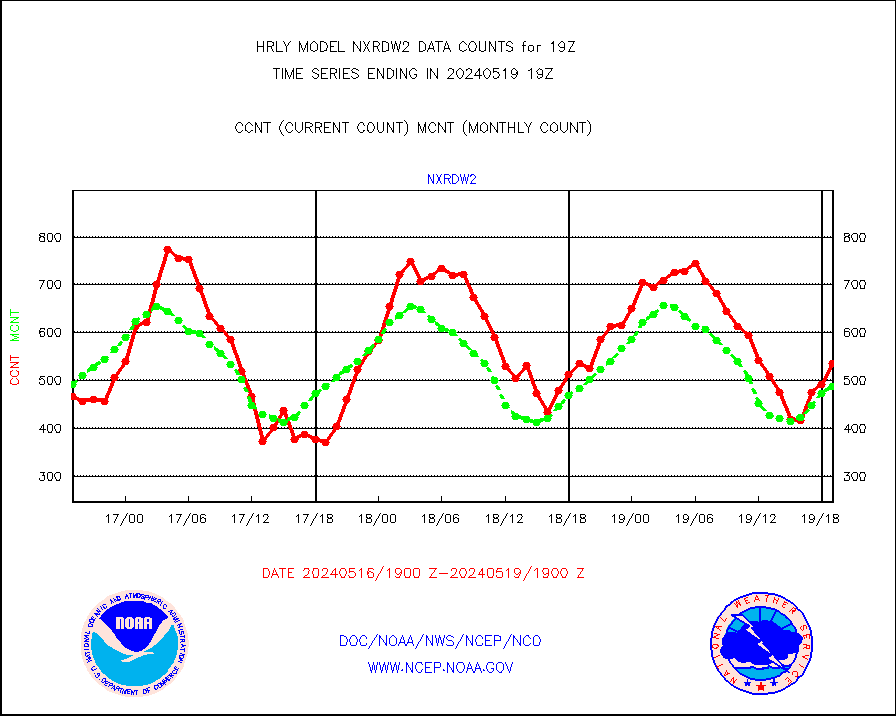
nxrdw2 |
NEXRAD Vel Azm Dsp(VAD) winds via Level 2 decoder |
536 |
488 |
109.8 % |
1918.50-1919.49 |
ompslp |
OMPS Limb Profiler ozone data (NPP) |
192 |
224 |
85.7 % |
1912.00-1912.99 |
ompsn8 |
OMPS nadir profile ozone (Version 8 BUFR) |
586 |
550 |
106.5 % |
1917.00-1917.99 |
ompst8 |
OMPS total column ozone (Version 8 BUFR) |
216243 |
336043 |
64.3 % |
1917.00-1917.99 |
pirep |
Manual PIREP aircraft data (dcded from AIREP fmt) |
102 |
144 |
70.8 % |
1918.50-1919.49 |
prflrp |
Profilr winds from PIBAL (PILOT,PILOT SHIP/MOBIL) |
0 |
0 |
n/a |
1918.50-1919.49 |
raobm |
Rawinsonde - mobile land (from TEMP/PILOT MOBIL) |
0 |
0 |
n/a |
1918.50-1919.49 |
raobs |
Rawinsonde - ship (from TEMP SHIP, PILOT SHIP) |
0 |
0 |
n/a |
1918.50-1919.49 |
recco |
Flight level reconnaissance aircraft data |
0 |
0 |
n/a |
1918.50-1919.49 |
saphir |
Megha-Tropiques SAPHIR L1A2 brightness temps |
0 |
0 |
n/a |
1916.50-1917.49 |
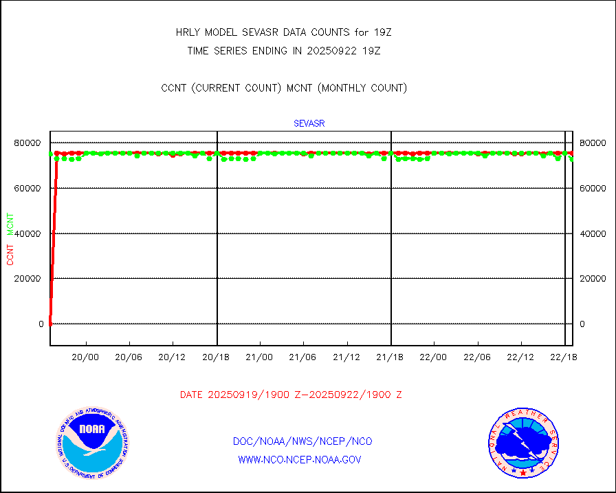
sevasr |
METEOSAT-10 2nd Gen SEVIRI All Sky Radiance(proc) |
75077 |
75451 |
99.5 % |
1918.50-1919.49 |
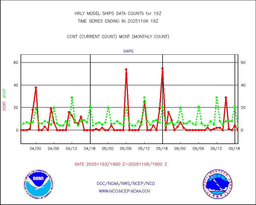
ships |
Ship - manual and automatic, restricted |
0 |
5 |
0.0 % |
1918.50-1919.49 |
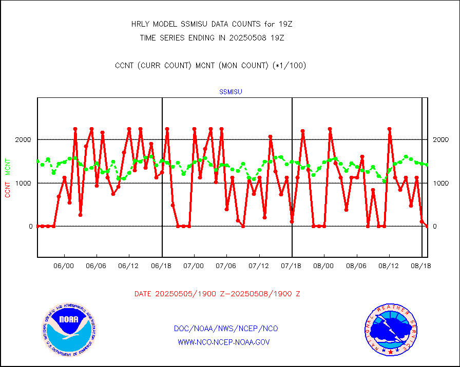
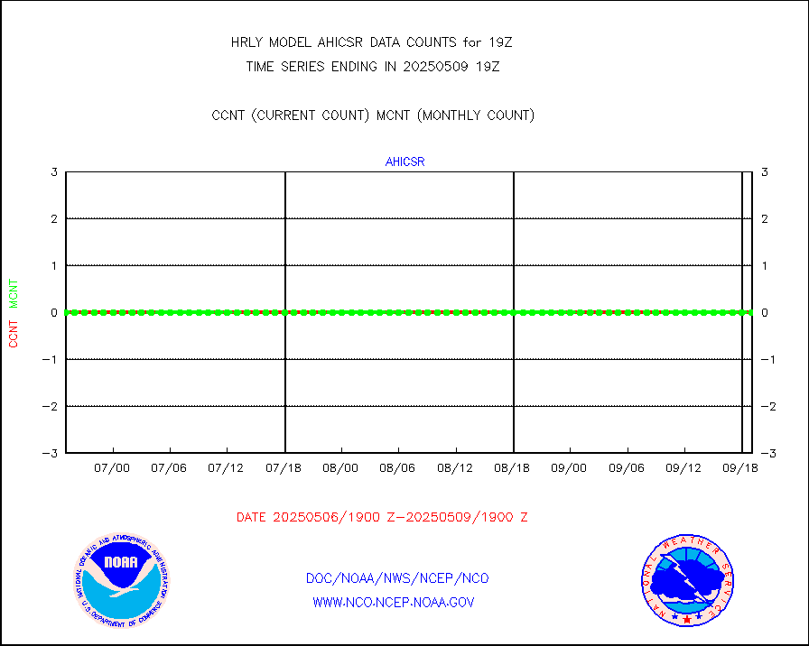
ssmisu |
DMSP SSM/IS 1C radiance data (Unified Pre-Proc.) |
183000 |
127236 |
143.8 % |
1917.50-1918.49 |
sstvcw |
NPP/NOAA-20 VIIRS SST - CLEAR & OVER WATER |
319807 |
345551 |
92.5 % |
1918.50-1919.49 |
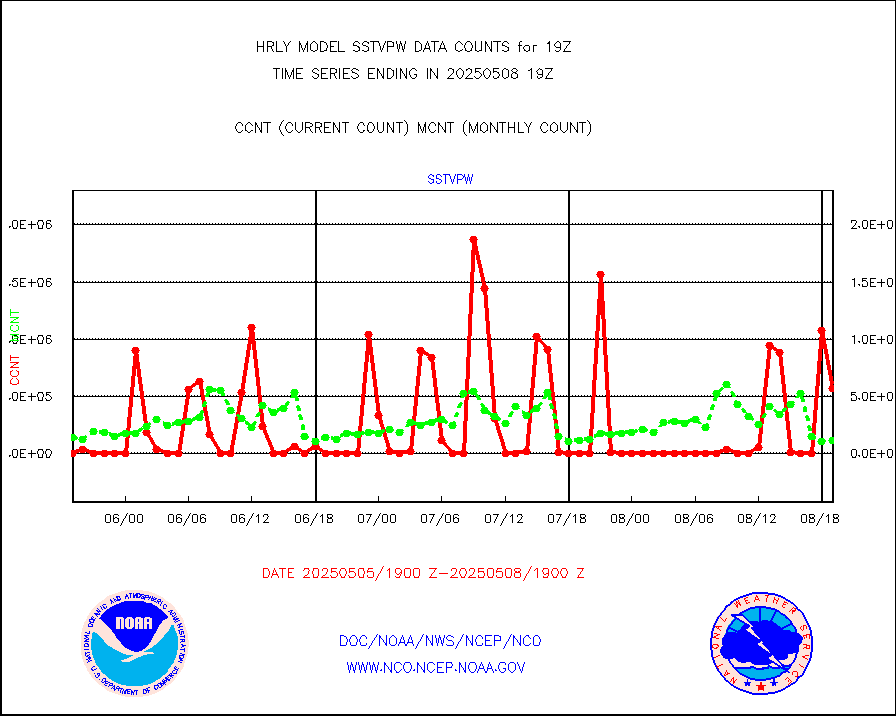
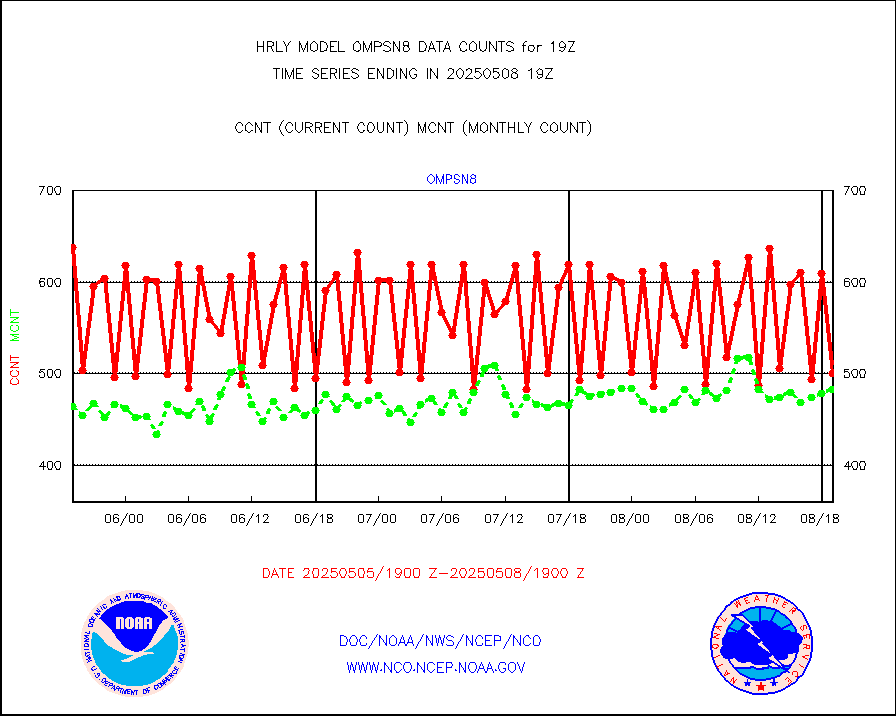
sstvpw |
NPP/NOAA-20 VIIRS SST - PROBABLY CLR & OVER WATER |
90317 |
66934 |
134.9 % |
1918.50-1919.49 |
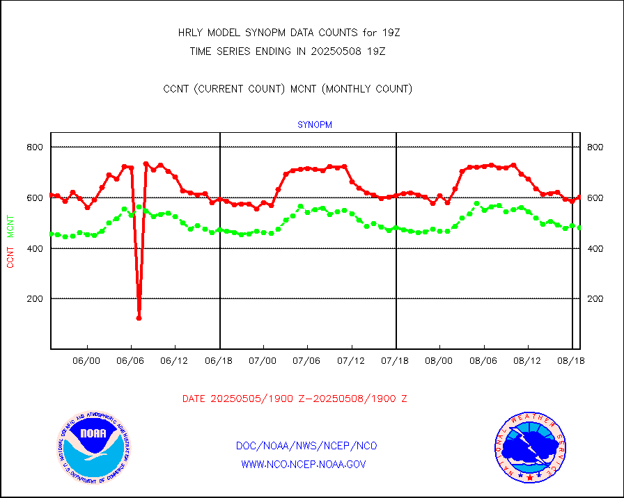
synopm |
Synoptic - mobile manual and automatic |
617 |
665 |
92.8 % |
1918.50-1919.49 |
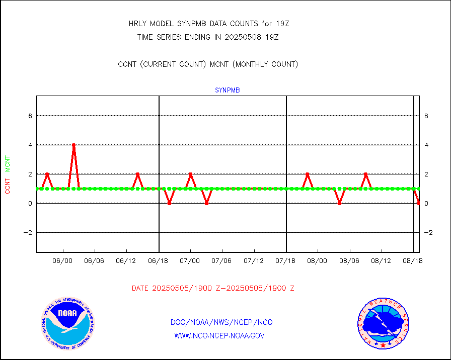
synpmb |
Synoptic - mobile manual & auto (decoded fr BUFR) |
0 |
1 |
0.0 % |
1918.50-1919.49 |
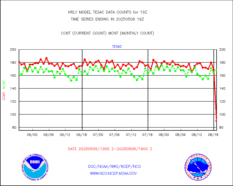
tesac |
CTD probe, Argo prflng float, mooring (TESAC fmt) |
198 |
192 |
103.1 % |
1918.50-1919.49 |
tmdara |
TAMDAR aircft data-all types(from Panasonic,BUFR) |
155 |
132 |
117.4 % |
1918.50-1919.49 |
trkob |
ThermoSalinoGraph (TSG) TRACKOB format) |
90 |
45 |
200.0 % |
1917.50-1918.49 |
visin |
INSAT/KALPANA India visible derived cloud motion |
0 |
0 |
n/a |
1916.50-1917.49 |
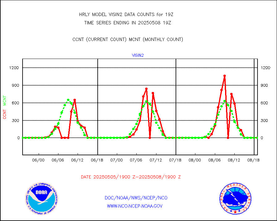
visin2 |
INDIA SATWIND, INSAT VIS channel |
0 |
0 |
n/a |
1918.00-1918.99 |
visja |
MTSAT/JMA visible derived cloud motion |
143 |
36 |
397.2 % |
1916.50-1917.49 |
visusr |
GOES-16&up/NESDIS visible derived cloud motion |
487260 |
441129 |
110.5 % |
1918.00-1918.99 |
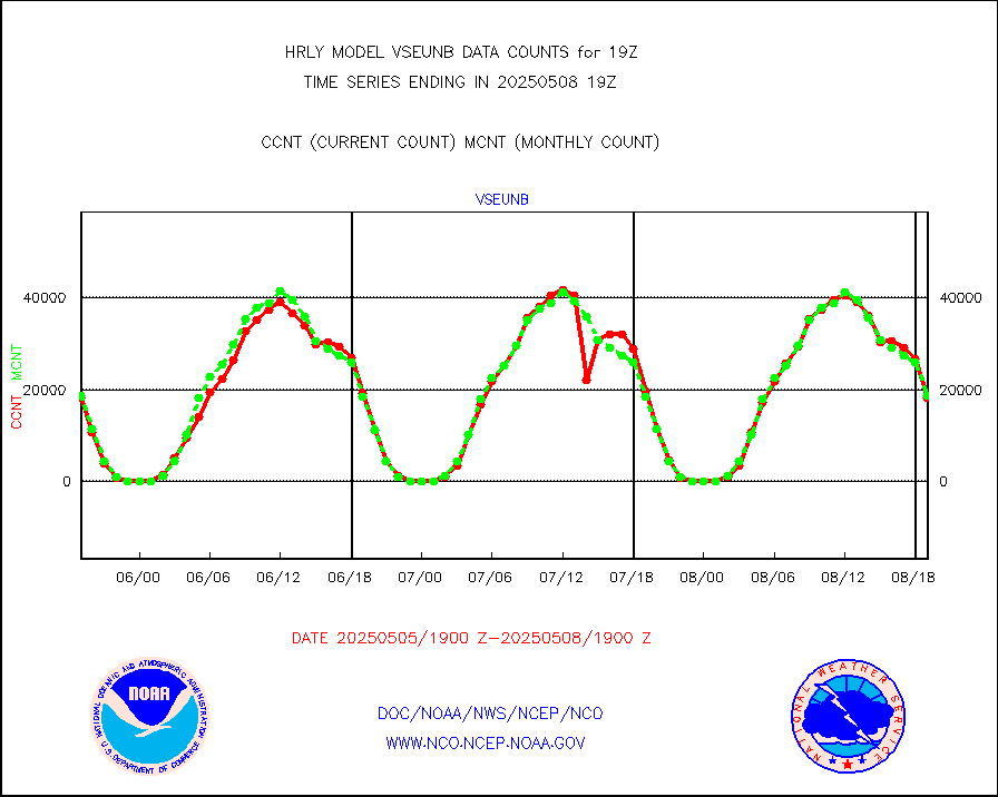
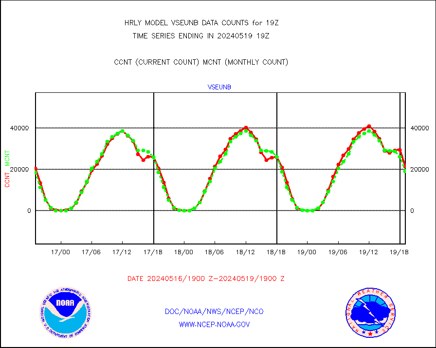
vseunb |
METEOSAT/EUMETSAT visible drv cld motion NBseq |
21361 |
18905 |
113.0 % |
1917.50-1918.49 |


