| Critical Data with Normal Counts |
|---|
| Type | Description | Hourly Count | Monthly Average | Percent (%) of Monthly Mean | UTC Time Window |
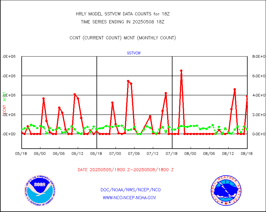
1bamua |
NOAA 15-19 & METOP 1-2 AMSU-A NCEP-proc. br.temps |
59735 |
52433 |
113.9 % |
1916.00-1916.99 |
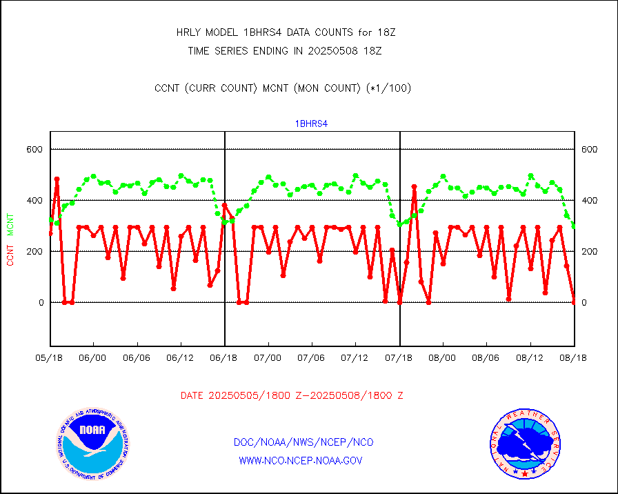
1bhrs4 |
NOAA 18-19 & METOP 1-2 HIRS-4 NCEP-proc. br.temps |
46612 |
42108 |
110.7 % |
1916.00-1916.99 |
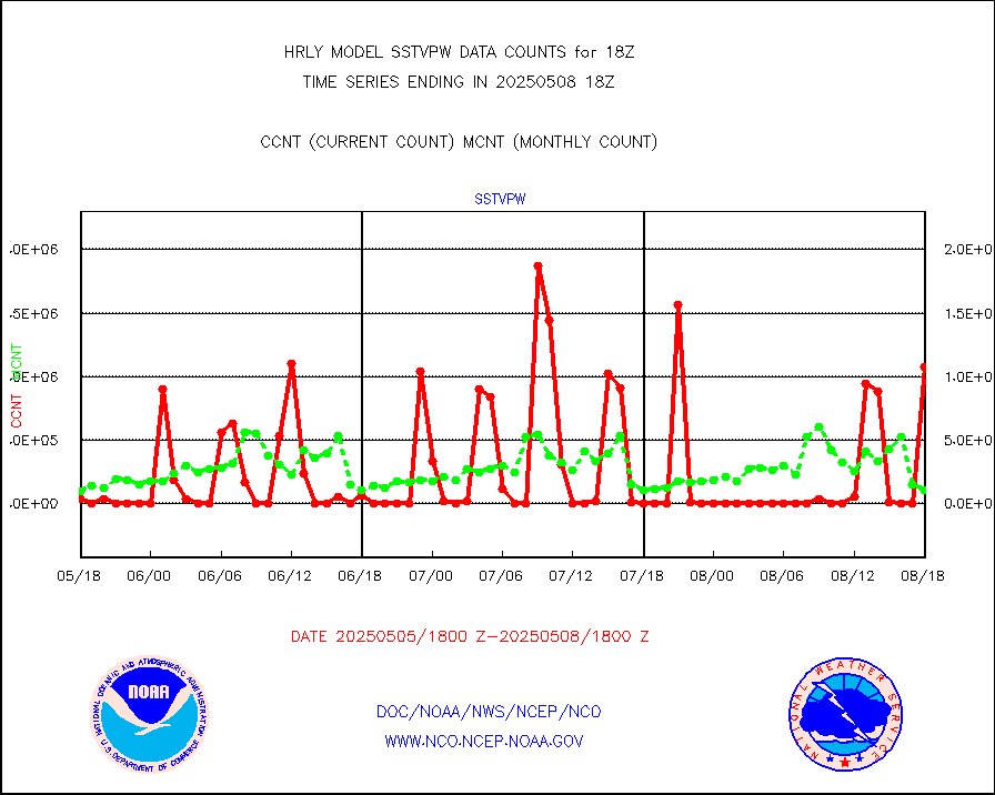
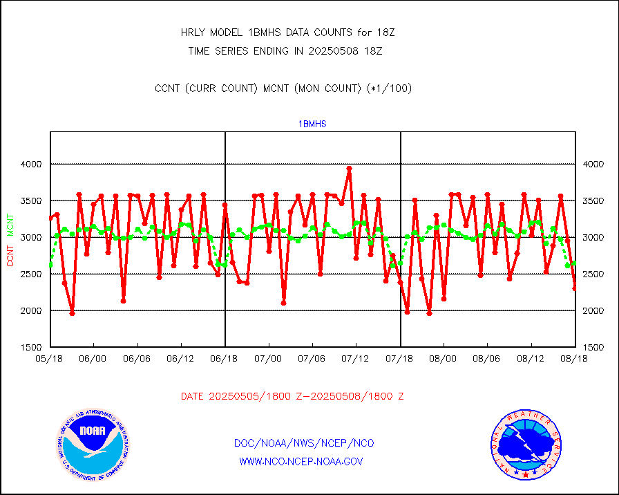
1bmhs |
NOAA 18-19 & METOP 1-2 MHS NCEP-proces. br. temps |
356885 |
285117 |
125.2 % |
1916.00-1916.99 |
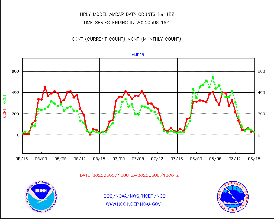
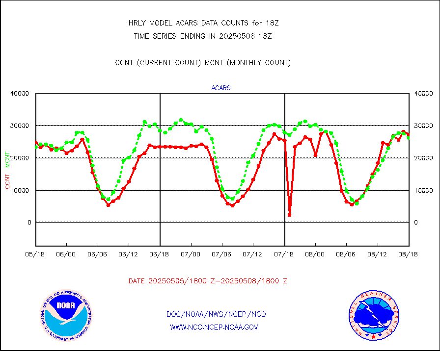
acars |
MDCRS ACARS acft data from ARINC(dcded from BUFR) |
20693 |
20181 |
102.5 % |
1917.50-1918.49 |
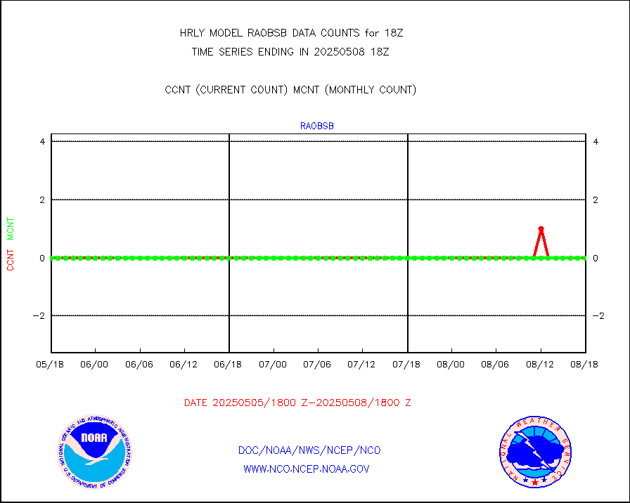
airep |
Manual AIREP aircraft data (dcded from AIREP fmt) |
1039 |
861 |
120.7 % |
1917.50-1918.49 |
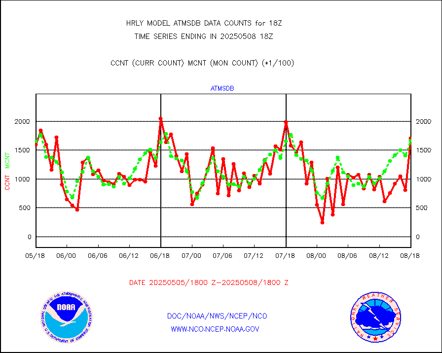
airsev |
AQUA AIRS/AMSU-A/HSB brightness temps- every FOV |
0 |
0 |
n/a |
1915.50-1916.49 |
amdar |
AMDAR aircraft data (decoded from AMDAR format) |
34 |
25 |
136.0 % |
1917.50-1918.49 |
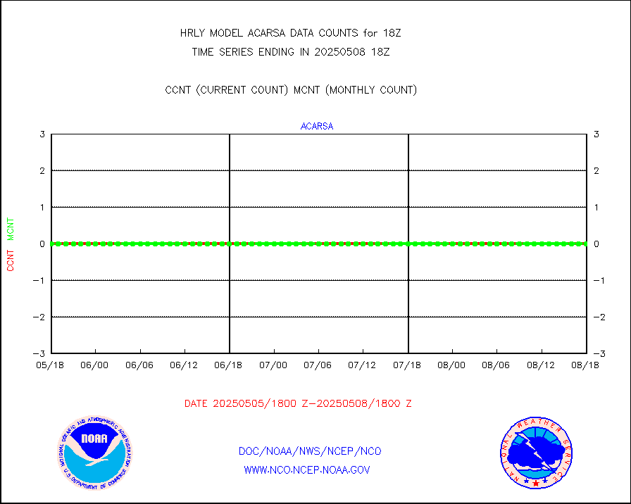
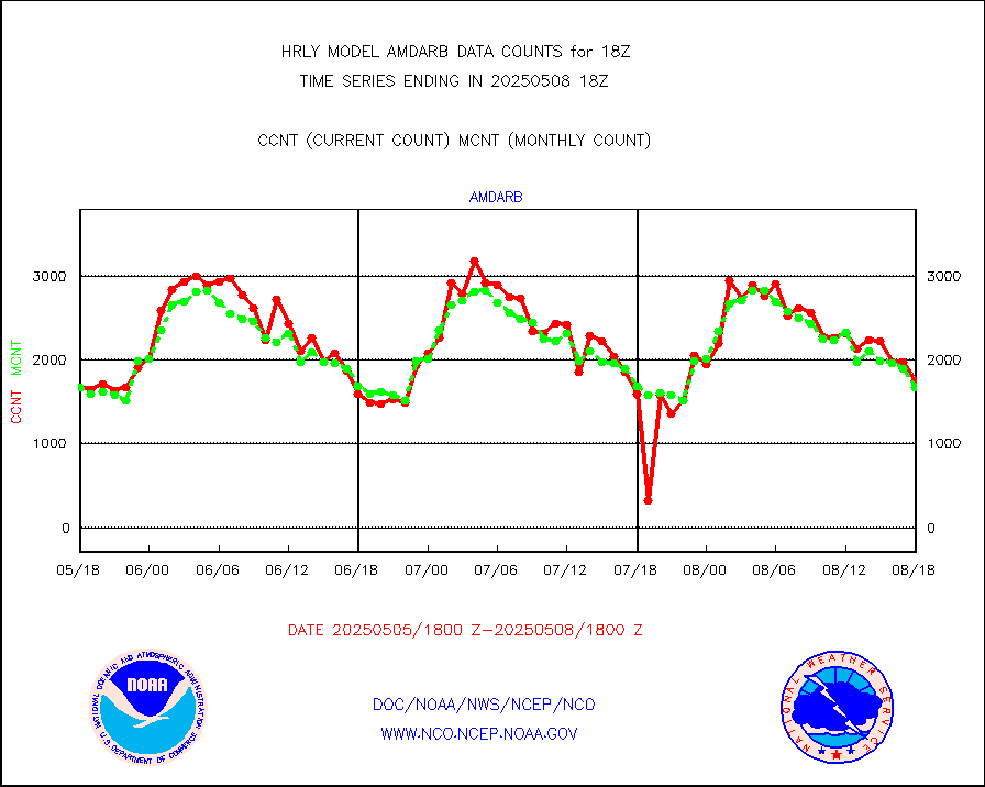
amdarb |
AMDAR aircraft data (decoded from BUFR) |
132 |
181 |
72.9 % |
1917.50-1918.49 |
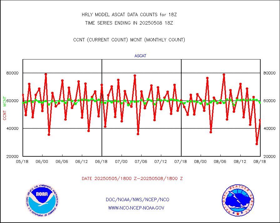
ascat |
METOP 1-2 ASCAT products |
62286 |
43301 |
143.8 % |
1916.50-1917.49 |
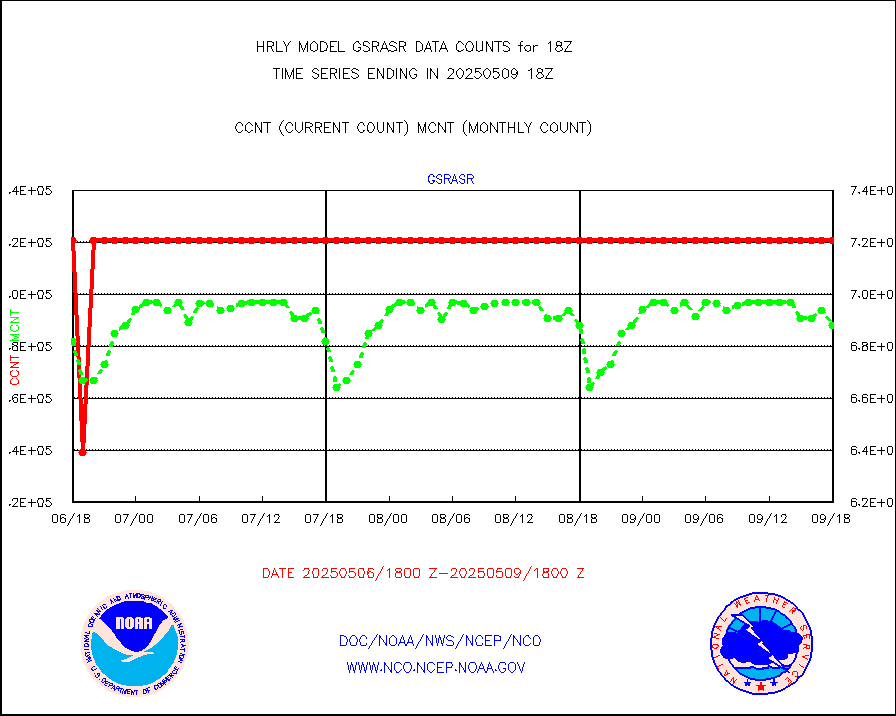
atms |
NPP/NOAA-20 ATMS brightness temperatures |
364992 |
345050 |
105.8 % |
1916.50-1917.49 |
cmanb |
Surface Marine CMAN rpts decoded from BUFR format |
1849 |
1742 |
106.1 % |
1917.50-1918.50 |
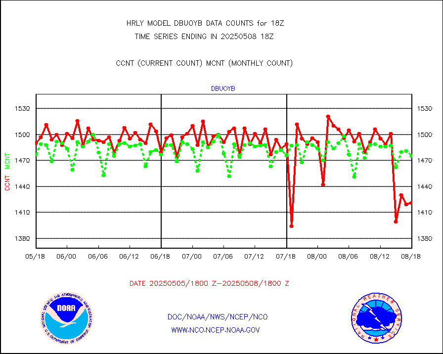
dbuoy |
Buoys decoded from FM-18 fmt (moored or drifting) |
39 |
37 |
105.4 % |
1917.50-1918.49 |
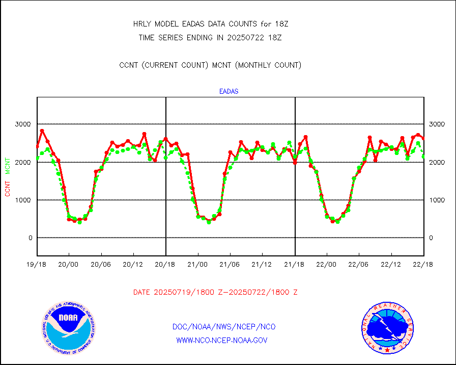
eadas |
E-AMDAR (European AMDAR acft decoded from BUFR) |
1962 |
1862 |
105.4 % |
1917.50-1918.49 |
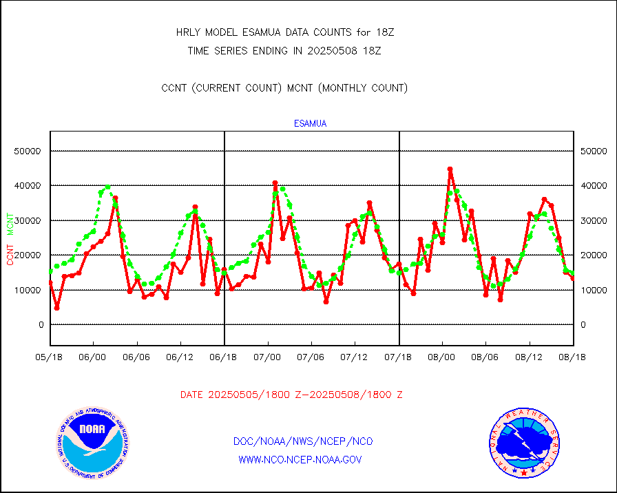
esamua |
NOAA 15-19 & METOP 1-2 AMSU-A proc btmps frm RARS |
11671 |
20578 |
56.7 % |
1917.50-1918.49 |
eshrs3 |
NOAA 15-19 & METOP 1-2 HIRS-3/4 pr btmps frm RARS |
22614 |
45565 |
49.6 % |
1917.50-1918.49 |
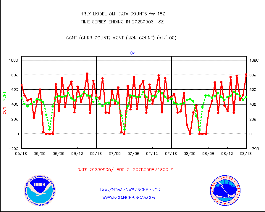
gnss |
Grnd-based Gbl Navigation Sat System (GNSS) data |
8870 |
9065 |
97.8 % |
1917.00-1917.99 |
gpsro |
GPS radio occultation data |
365 |
430 |
84.9 % |
1915.50-1916.49 |
gsrasr |
GOES-16/17 All Sky Radiances (proc.) |
360476 |
348460 |
103.4 % |
1917.50-1918.49 |
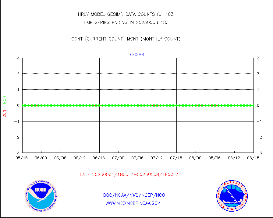
gsrcsr |
GOES-16/17 Clear Sky Radiances (proc.) |
173831 |
184054 |
94.4 % |
1917.50-1918.49 |
h20ja |
MTSAT/JMA water vapor imager derived cloud motion |
20241 |
18655 |
108.5 % |
1915.50-1916.49 |
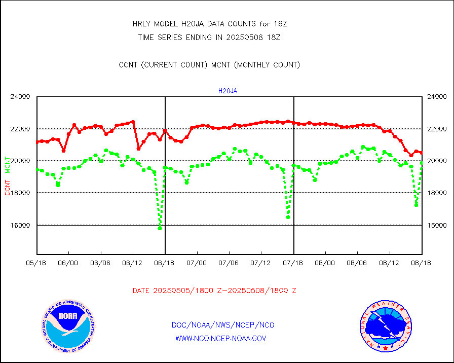
h20mo |
MODIS (AQUA/TERRA) wvpr imager derived cld motion |
0 |
0 |
n/a |
1914.00-1914.99 |
h2tusr |
GOES-16&up/NESDIS wv imgr/cld-top derived cld mtn |
25566 |
24544 |
104.2 % |
1917.00-1917.99 |
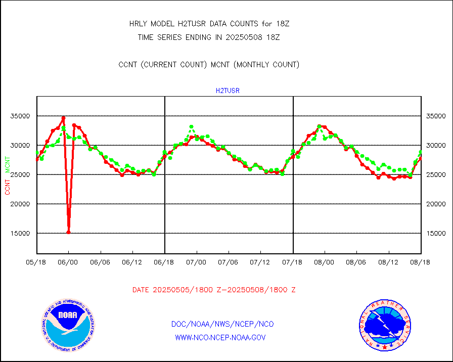
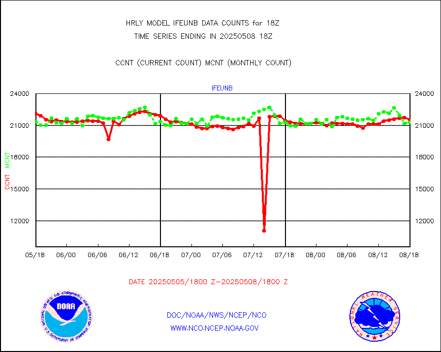
ifeunb |
METEOSAT/EUMETSAT ir lg-wave drv cld motion NBseq |
22078 |
21816 |
101.2 % |
1916.50-1917.49 |
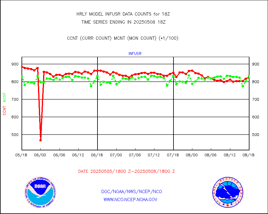
infja |
MTSAT/JMA infrared long-wave derived cloud motion |
16186 |
16039 |
100.9 % |
1915.50-1916.49 |
infmo |
MODIS (AQUA/TERRA) ir l-wave derived cloud motion |
0 |
0 |
n/a |
1914.00-1914.99 |
infusr |
GOES-16&up/NESDIS ir long-wave derived cld motion |
80487 |
79262 |
101.5 % |
1917.00-1917.99 |
lgycld |
GOES/NASA(Langley) hi-res. (1x1 f-o-v) cloud data |
4204695 |
3469909 |
121.2 % |
1917.50-1918.49 |
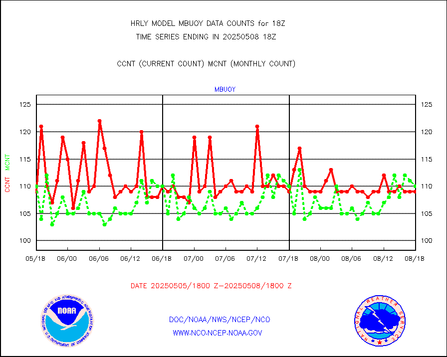
mbuoy |
Buoys decoded from FM-13 format (moored) |
116 |
121 |
95.9 % |
1917.50-1918.49 |
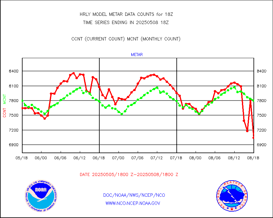
metar |
Aviation - METAR |
7546 |
7765 |
97.2 % |
1917.50-1918.49 |
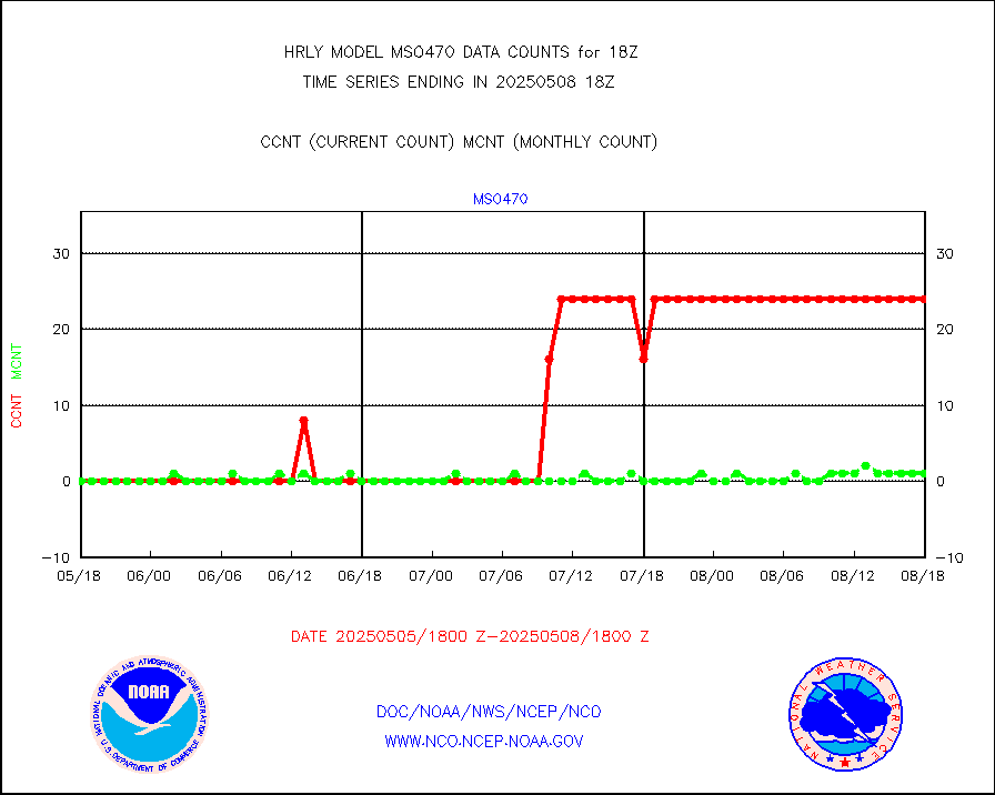
mso470 |
Mesonet/MADIS Colorado E-470 (Interstate 470) |
21 |
20 |
105.0 % |
1917.50-1918.49 |
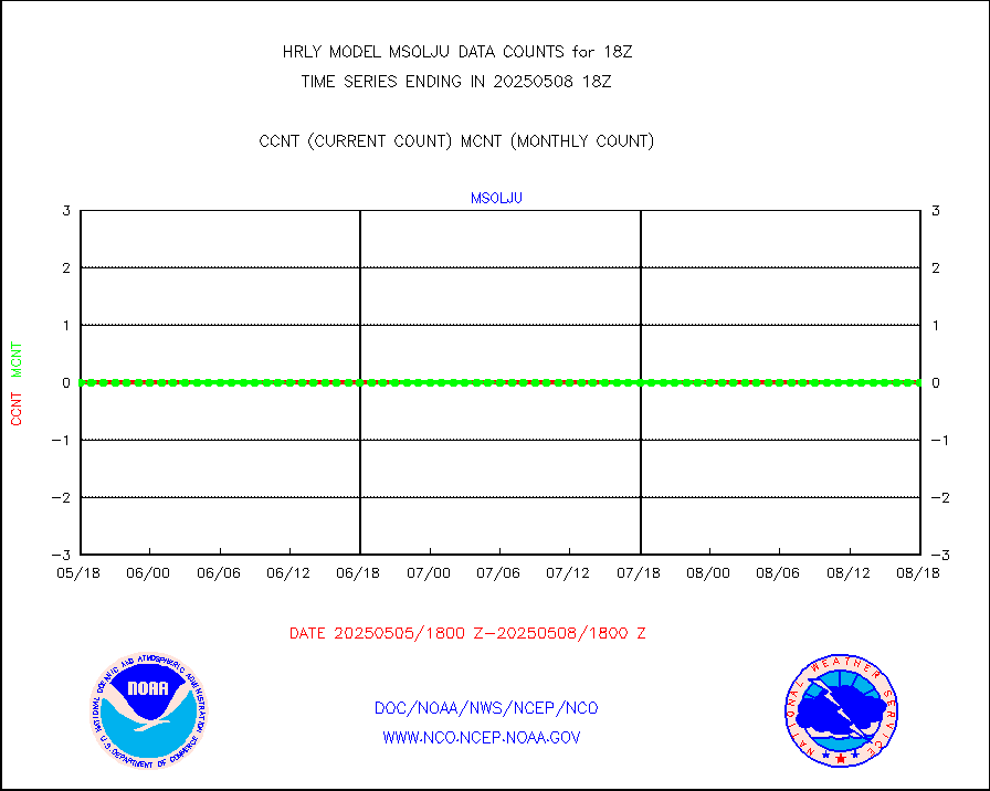
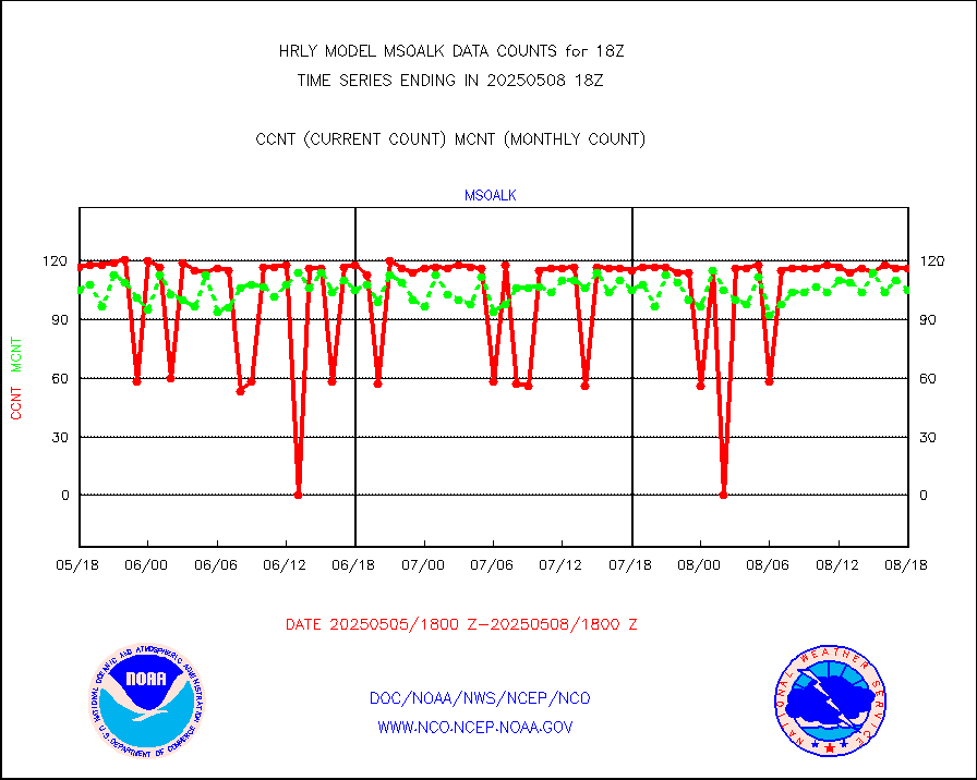
msoalk |
Mesonet/MADIS Alaska Department of Transportation |
109 |
107 |
101.9 % |
1917.50-1918.49 |
msoapg |
Mesonet/MADIS U.S. Army Aberdeen Proving Grounds |
0 |
0 |
n/a |
1917.50-1918.49 |
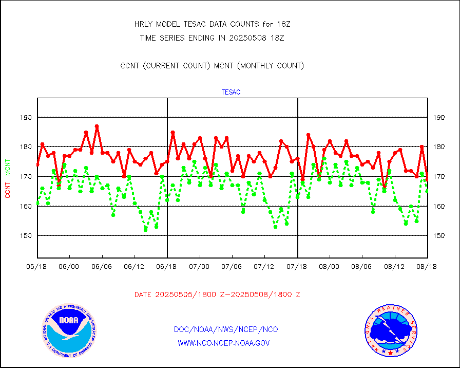
msoapr |
Mesonet/MADIS Citizen Weather Observers Program |
50062 |
48760 |
102.7 % |
1917.50-1918.49 |
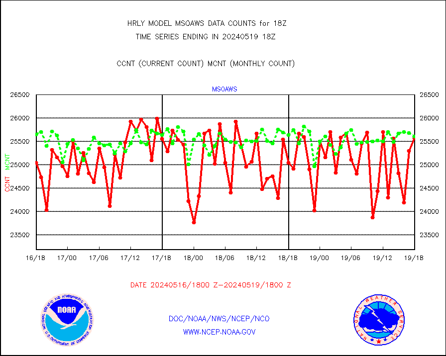
msoaws |
Mesonet/MADIS AWS Convergence Technologies, Inc. |
25581 |
25611 |
99.9 % |
1917.50-1918.49 |
msoawx |
Mesonet/MADIS "Anything Weather" |
0 |
0 |
n/a |
1917.50-1918.49 |
msocol |
Mesonet/MADIS Colorado Dept. of Transportation |
0 |
0 |
n/a |
1917.50-1918.49 |
msodcn |
Mesonet/MADIS DC Net |
0 |
0 |
n/a |
1917.50-1918.49 |
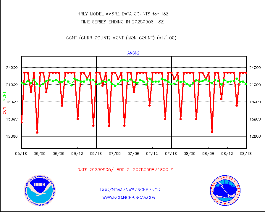
msoden |
Mesonet/MADIS Denver Urban Drainage & Flood Cntrl |
250 |
249 |
100.4 % |
1917.50-1918.49 |
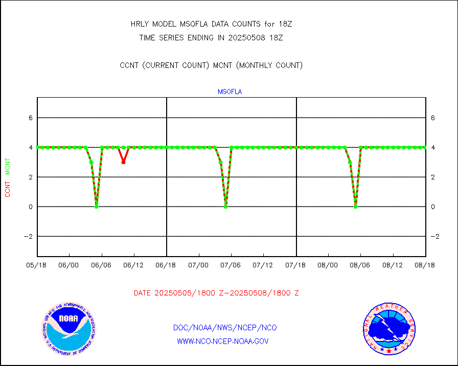
msofla |
Mesonet/MADIS Florida (FAWN & USF) |
4 |
4 |
100.0 % |
1917.50-1918.49 |
msoflt |
Mesonet/MADIS Florida Dept. of Transportation |
0 |
0 |
n/a |
1917.50-1918.49 |
msogeo |
Mesonet/MADIS Georgia Dept. of Transportation |
0 |
0 |
n/a |
1917.50-1918.49 |
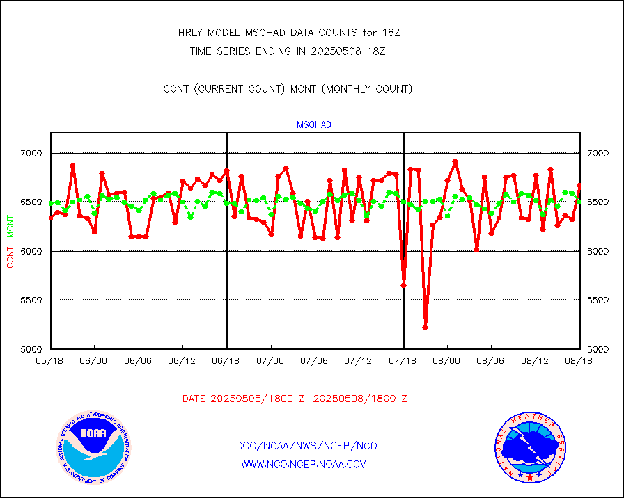
msohad |
Mesonet/MADIS NWS Hydromet Auto Data System(HADS) |
6679 |
6665 |
100.2 % |
1917.50-1918.49 |
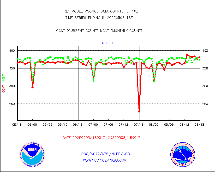
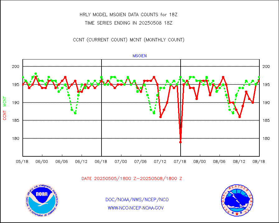
msoien |
Mesonet/MADIS Iowa Environmental |
186 |
187 |
99.5 % |
1917.50-1918.49 |
msoind |
Mesonet/MADIS Indiana Dept. of Transportation |
0 |
0 |
n/a |
1917.50-1918.49 |
msoiow |
Mesonet/MADIS Iowa Department of Transportation |
0 |
0 |
n/a |
1917.50-1918.49 |
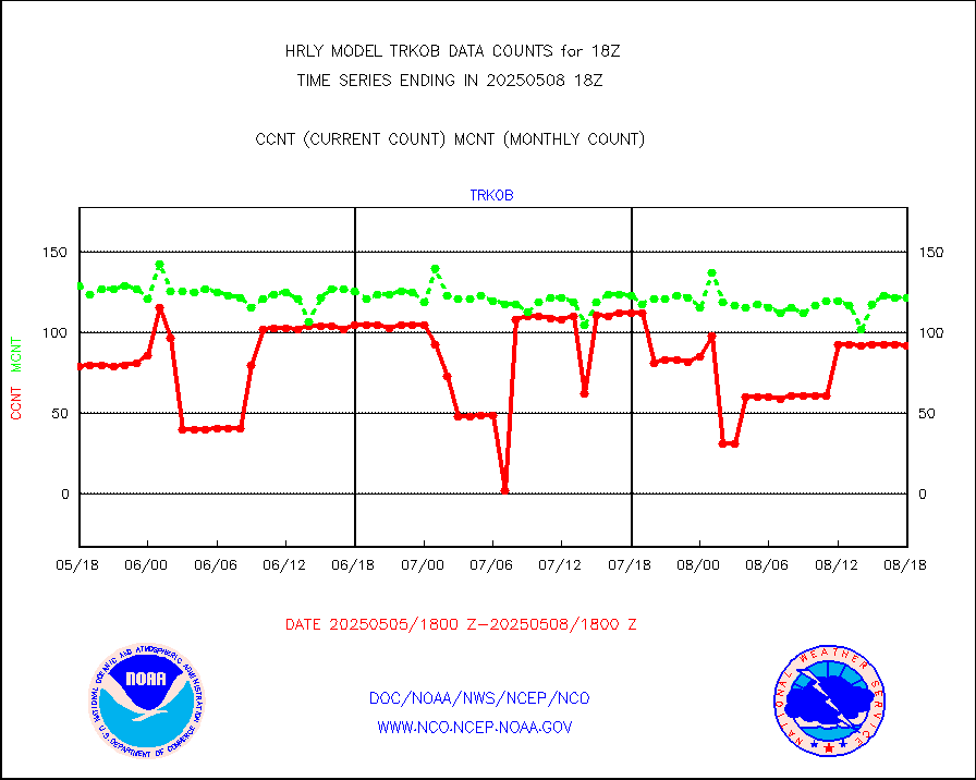
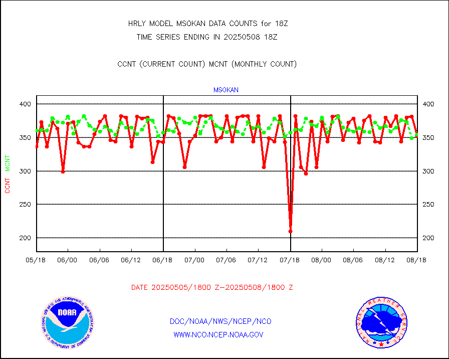
msokan |
Mesonet/MADIS Kansas Department of Transportation |
387 |
368 |
105.2 % |
1917.50-1918.49 |
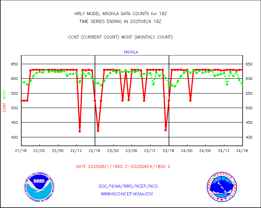
msokla |
Mesonet/MADIS Oklahoma Mesonet |
318 |
322 |
98.8 % |
1917.50-1918.49 |
msolju |
Mesonet/MADIS Louisiana State/Jackson State Univ. |
0 |
0 |
n/a |
1917.50-1918.49 |
msomca |
Mesonet/MADIS Missouri Commercial Agricult Wx Net |
302 |
297 |
101.7 % |
1917.50-1918.49 |
msomin |
Mesonet/MADIS Minnesota Dept. of Transportation |
0 |
0 |
n/a |
1917.50-1918.49 |
msonos |
Mesonet/MADIS NOS-Phys Oceanographic Realtime Sys |
393 |
375 |
104.8 % |
1917.50-1918.49 |
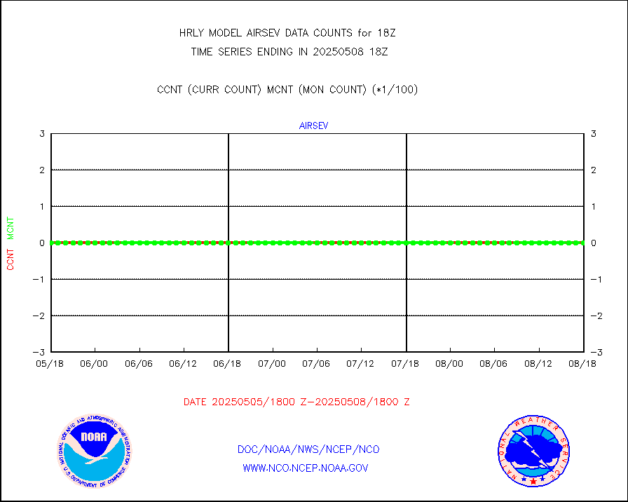
msoraw |
Mesonet/MADIS NFIC Remote Automated Wx Stns(RAWS) |
1868 |
1878 |
99.5 % |
1917.50-1918.49 |
msovir |
Mesonet/MADIS Virginia Dept. of Transportation |
207 |
229 |
90.4 % |
1917.50-1918.49 |
msowfy |
Mesonet/MADIS "Weather for You" |
0 |
0 |
n/a |
1917.50-1918.49 |
msowis |
Mesonet/MADIS Wisconsin Dept. of Transportation |
0 |
0 |
n/a |
1917.50-1918.49 |
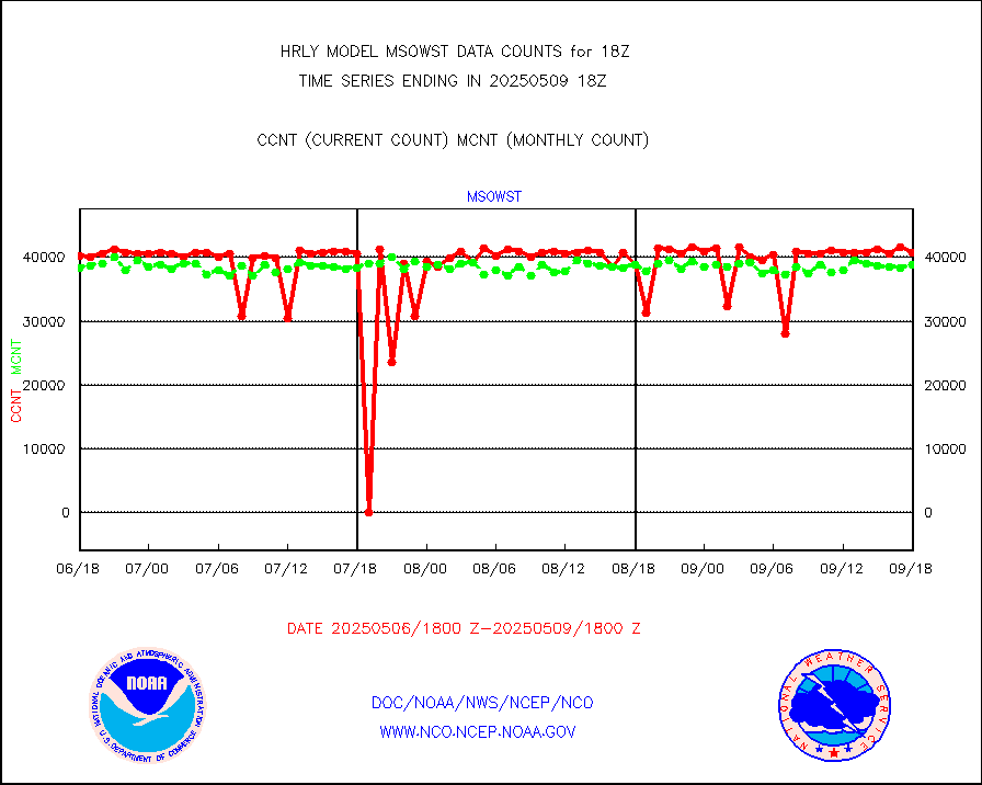
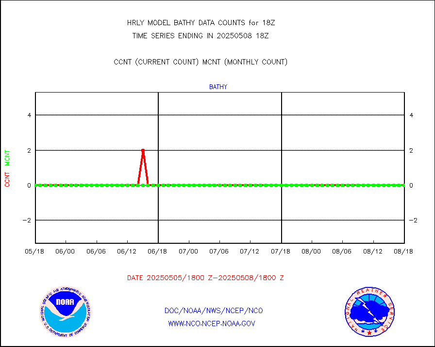
msowst |
Mesonet/MADIS MesoWest (many subproviders) |
46801 |
45286 |
103.3 % |
1917.50-1918.49 |
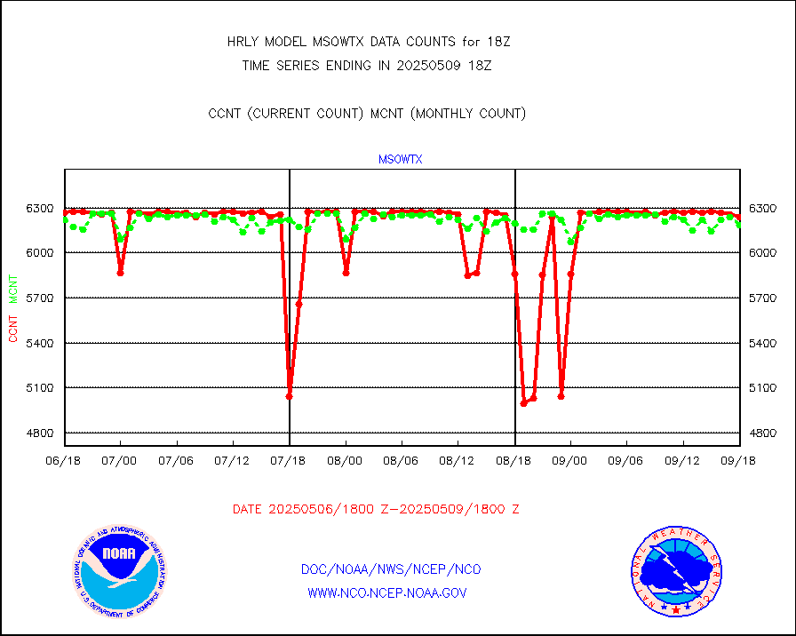
msowtx |
Mesonet/MADIS West Texas |
5658 |
5619 |
100.7 % |
1917.50-1918.49 |
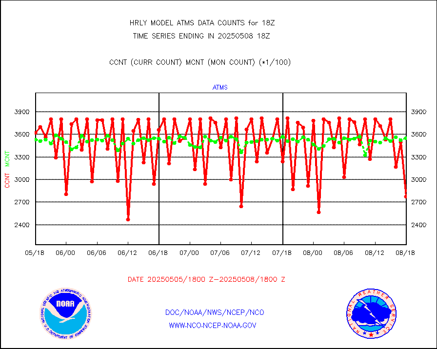
mtiasi |
METOP 1-2 IASI 1C radiance data (varbl. channels) |
106936 |
78441 |
136.3 % |
1916.00-1916.99 |
nxrdw |
NEXRAD Vel Azm Dsp(VAD) winds via radar coded msg |
0 |
0 |
n/a |
1917.50-1918.49 |
omi |
Aura Ozone Monitoring Instrument (OMI) data |
28800 |
36236 |
79.5 % |
1915.50-1916.49 |
osbuv8 |
NOAA 16-19 Solar Backscatter UV-2 rad frm V8 BUFR |
0 |
0 |
n/a |
1916.00-1916.99 |
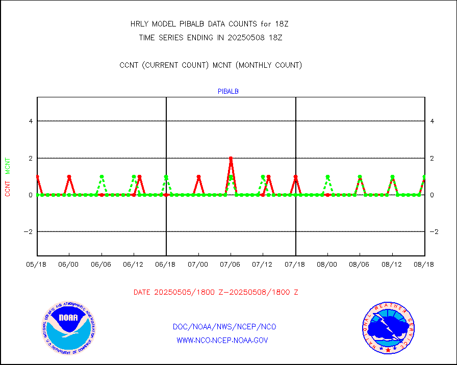
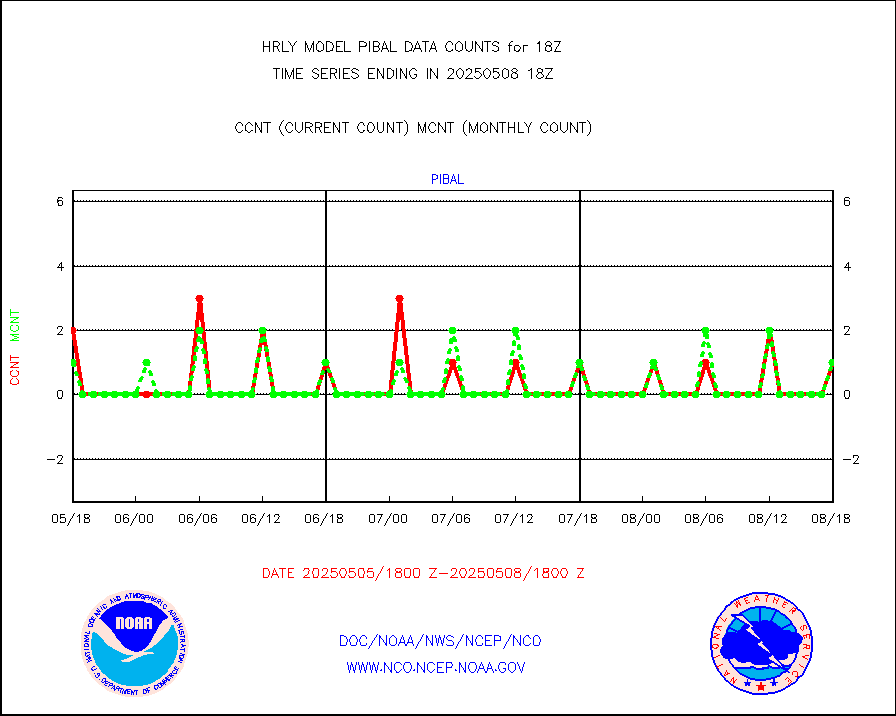
pibal |
PIBAL (from PILOT, PILOT SHIP, PILOT MOBIL) |
12 |
11 |
109.1 % |
1917.50-1918.49 |
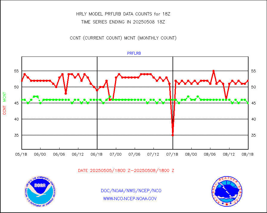
prflrb |
Multi-Agency Profiler (MAP) and SODAR winds |
35 |
42 |
83.3 % |
1917.50-1918.49 |
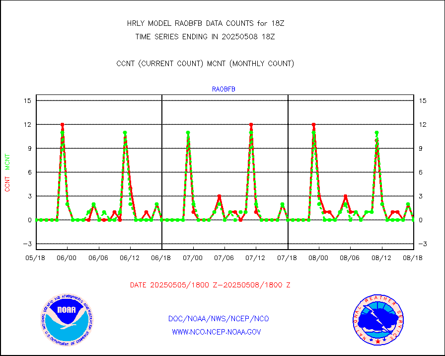
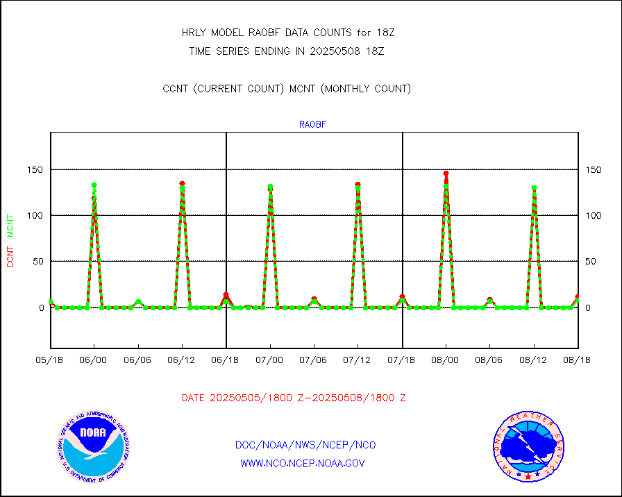
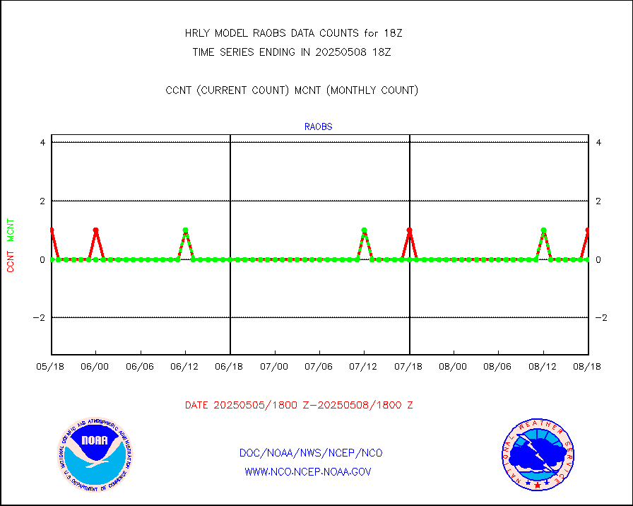
raobf |
Rawinsonde - fixed land (from TEMP or PILOT) |
14 |
10 |
140.0 % |
1917.50-1918.49 |
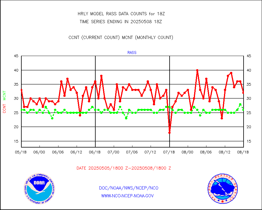
rass |
RASS temperatures (NOAA and Multi-Agency) |
23 |
26 |
88.5 % |
1917.50-1918.49 |
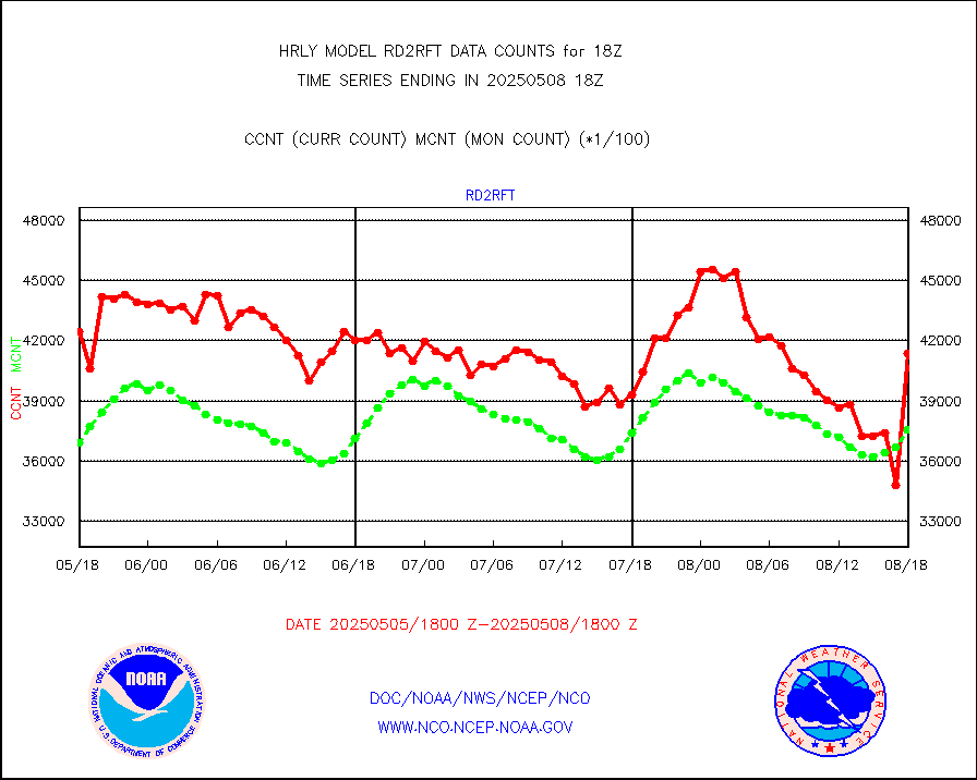
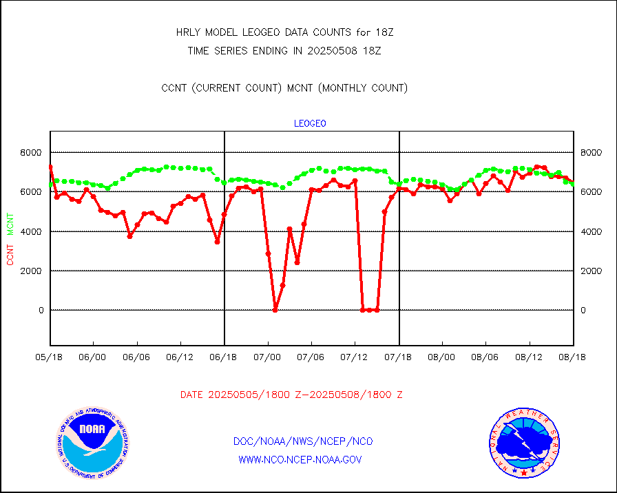
rd2rft |
NEXRAD reflectivity (Lvl 2 - GTS) |
3944607 |
3905287 |
101.0 % |
1917.50-1918.49 |
rd2wnd |
NEXRAD radial wind (Level 2 - GTS) |
1518148 |
1422247 |
106.7 % |
1917.50-1918.49 |
sevcsr |
METEOSAT-10 2nd Gen SEVIRI Clr Sky Radiance(proc) |
0 |
0 |
n/a |
1917.50-1918.49 |
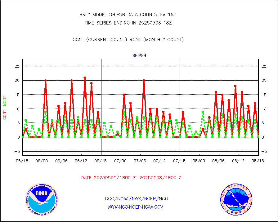
shipsb |
Ship - manual and automatic, restricted (BUFR) |
0 |
0 |
n/a |
1917.50-1918.50 |
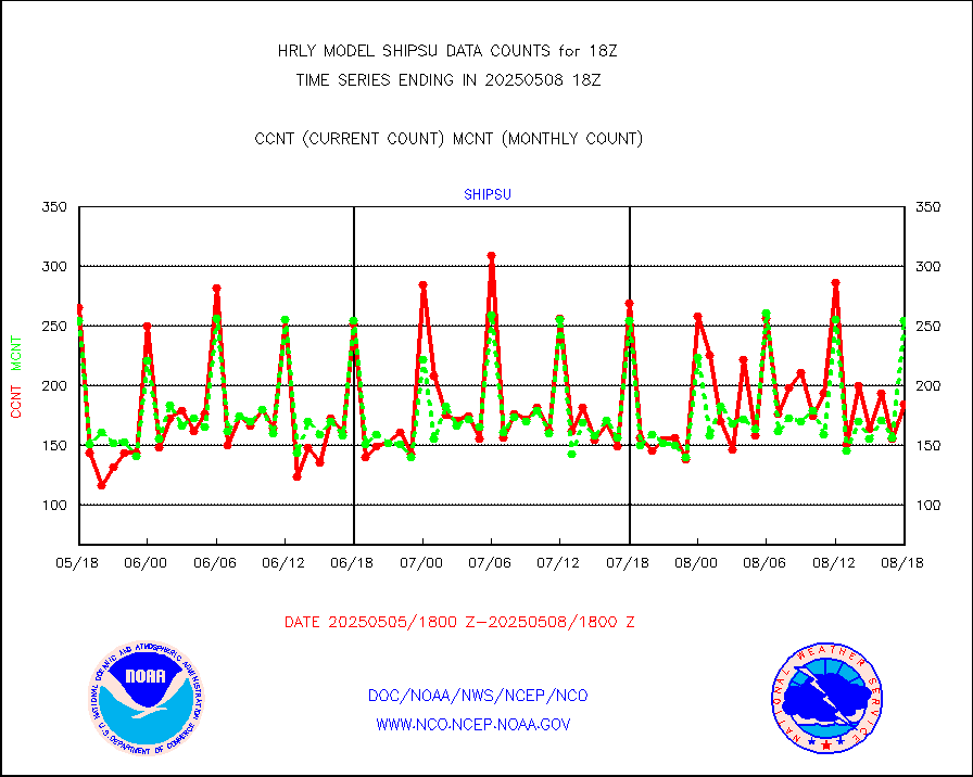
shipsu |
Ship - manual and automatic, unrestricted |
171 |
167 |
102.4 % |
1917.50-1918.50 |
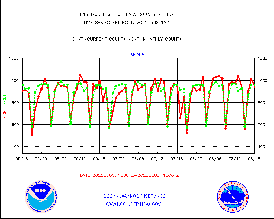
shipub |
Ship - manual and automatic, unrestricted (BUFR) |
841 |
859 |
97.9 % |
1917.50-1918.50 |
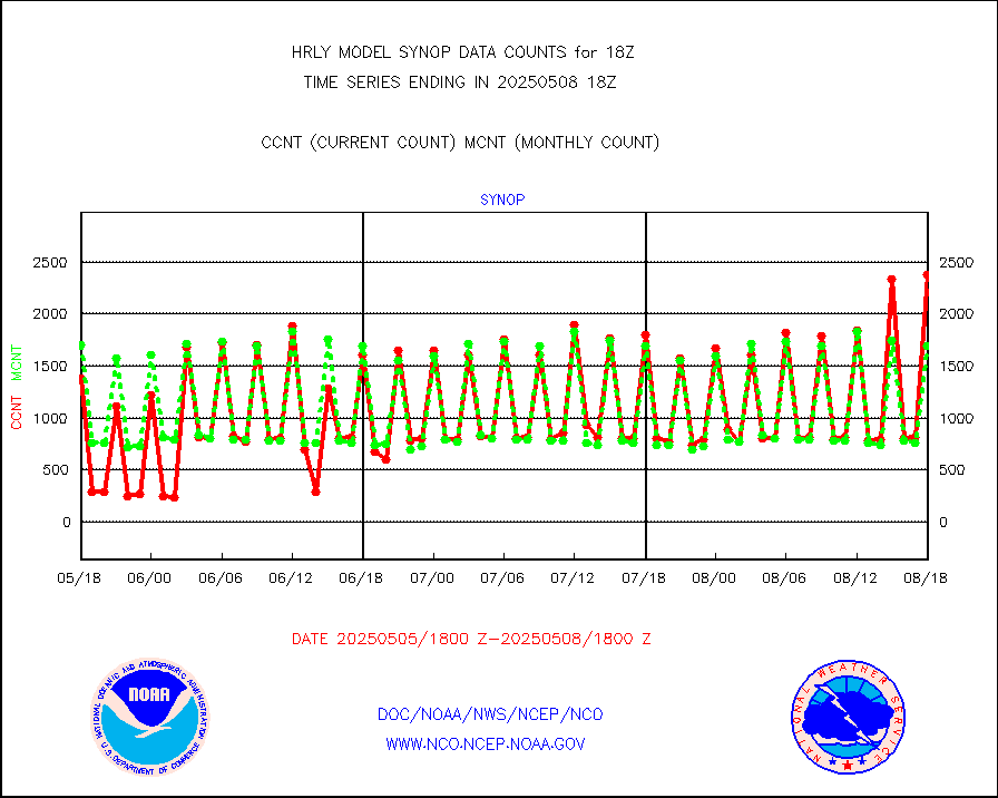
synop |
Synoptic - fixed manual and automatic |
1900 |
2087 |
91.0 % |
1917.50-1918.49 |
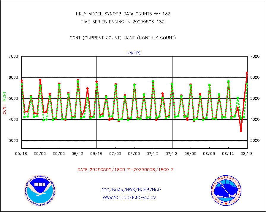
synopb |
Synoptic - fixed manual & auto (decoded fr BUFR) |
5800 |
5779 |
100.4 % |
1917.50-1918.49 |
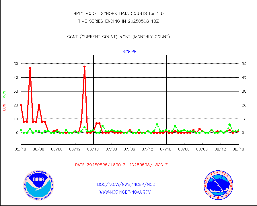
synopr |
Synoptic - restricted (WMO Res 40) manual & auto. |
1 |
1 |
100.0 % |
1917.50-1918.49 |
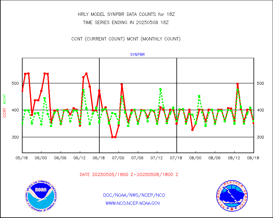
synpbr |
Synoptic - restricted (WMO Res 40)(decoded BUFR) |
347 |
350 |
99.1 % |
1917.50-1918.49 |
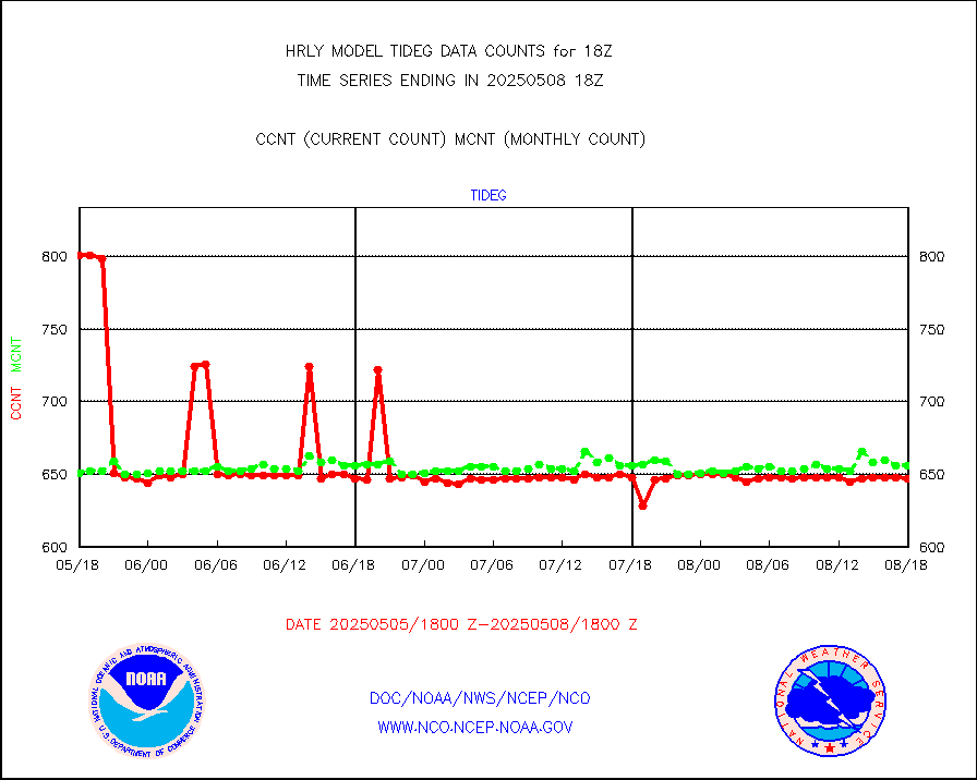
tideg |
Tide gauge reports decoded from CREX format |
645 |
641 |
100.6 % |
1917.00-1917.99 |
| Data Types of Opportunity with Normal Counts |
|---|
| Type | Description | Hourly Count | Monthly Average | Percent (%) of Monthly Mean | UTC Time Window |
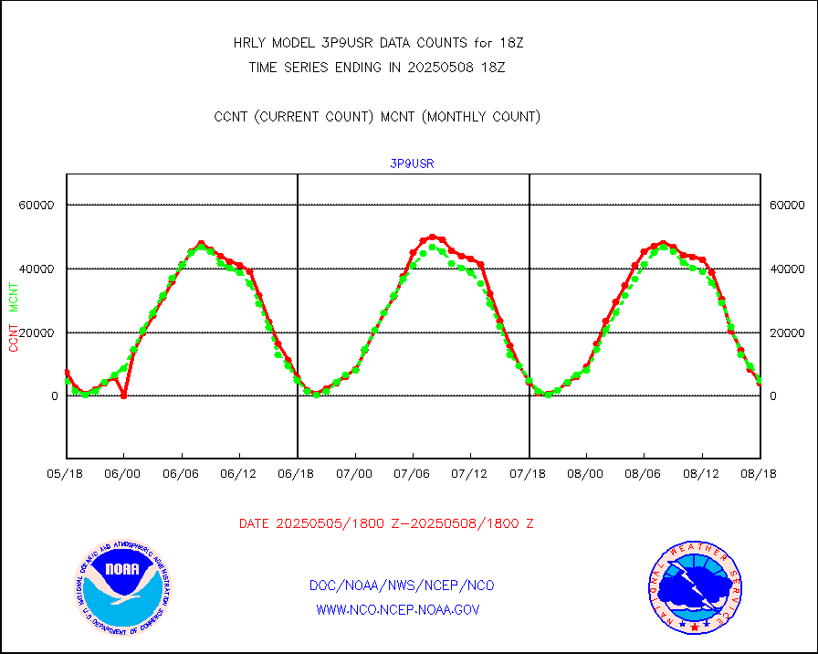
3p9usr |
GOES-16&up/NESDIS ir short-wv derived cld motion |
4263 |
4335 |
98.3 % |
1917.00-1917.99 |
acarsa |
MDCRS ACARS acft data (ARINC via AFWA)(AIREP fmt) |
0 |
0 |
n/a |
1917.50-1918.49 |
ahicsr |
Himawari Clear Sky Radiance |
0 |
0 |
n/a |
1917.00-1917.99 |
amsr2 |
GCOM-W AMSR2 1B brightness temperatures |
2309472 |
2097155 |
110.1 % |
1916.00-1916.99 |
atmsdb |
NPP/NOAA-20 ATMS bright. temps-direct b-cast SSEC |
185894 |
153148 |
121.4 % |
1916.50-1917.49 |
atovs |
POES/NESDIS - processed ATOVS soundings/radiances |
0 |
0 |
n/a |
1916.00-1916.99 |
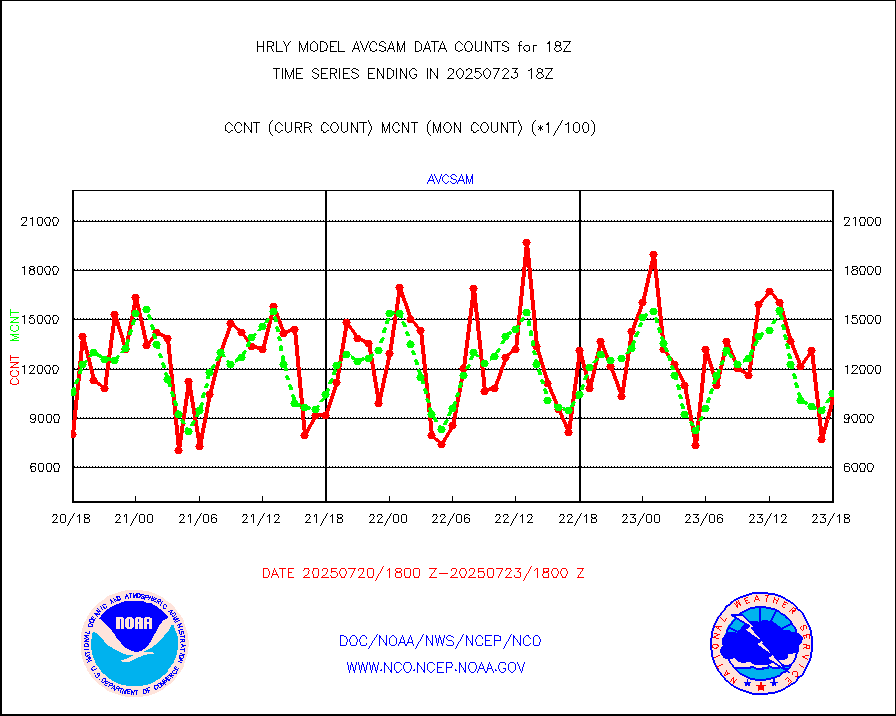
avcsam |
A.M.(N17,M2,M3) AVHRR GAC NCEP-proc clr&sea btmps |
981066 |
1228877 |
79.8 % |
1915.50-1916.49 |
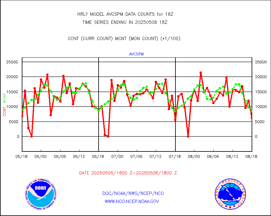
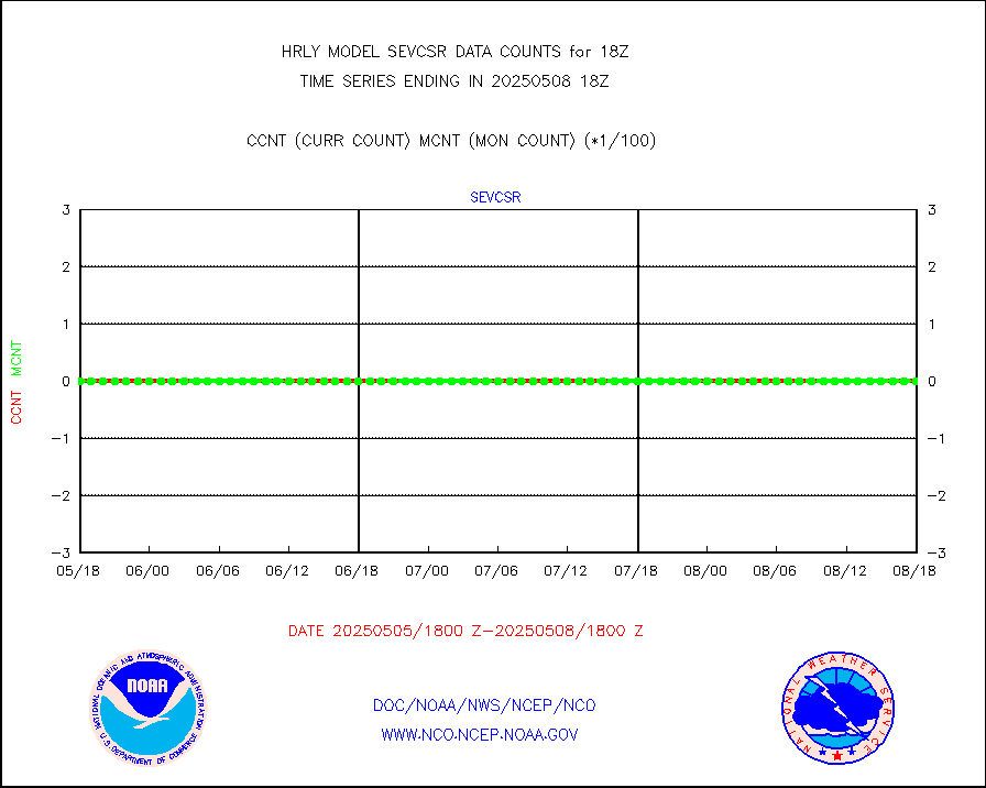
avcspm |
P.M.(N18-19) AVHRR GAC NCEP-proc clr & sea btemps |
1360933 |
1272090 |
107.0 % |
1915.50-1916.49 |
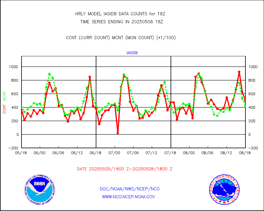
bathy |
eXpendable BathyThermograph, mooring (BATHY fmt) |
0 |
0 |
n/a |
1911.00-1911.99 |
coopmd |
Coop/MADIS NEPP & HCN-Modernization NOAA COOP Obs |
27 |
27 |
100.0 % |
1917.50-1918.49 |
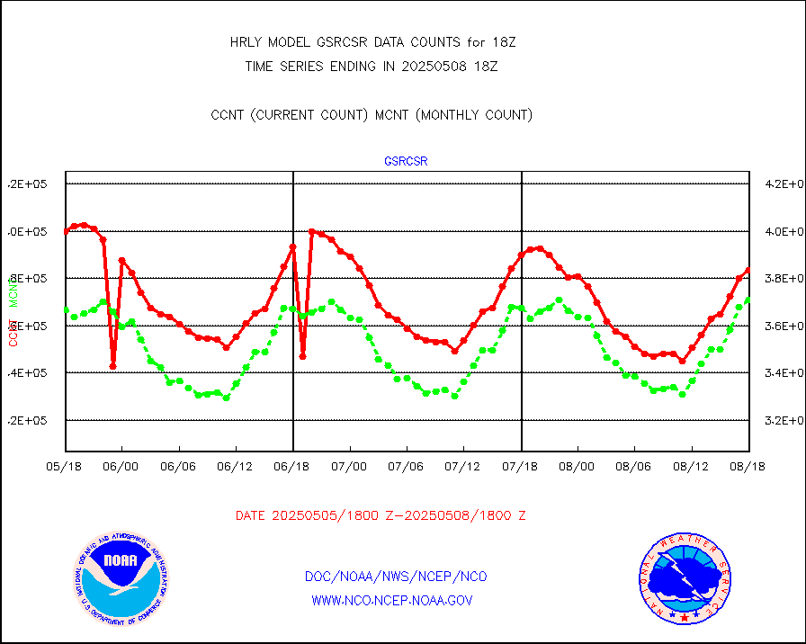
crisf4 |
NPP/NOAA-20 CrIS full spctrl radn (431 ch subset) |
240534 |
224181 |
107.3 % |
1916.50-1917.49 |
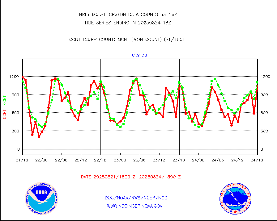
crsfdb |
NPP/NOAA-20 CrIS full spctrl radn dir brdcst SSEC |
156969 |
140265 |
111.9 % |
1916.50-1917.49 |
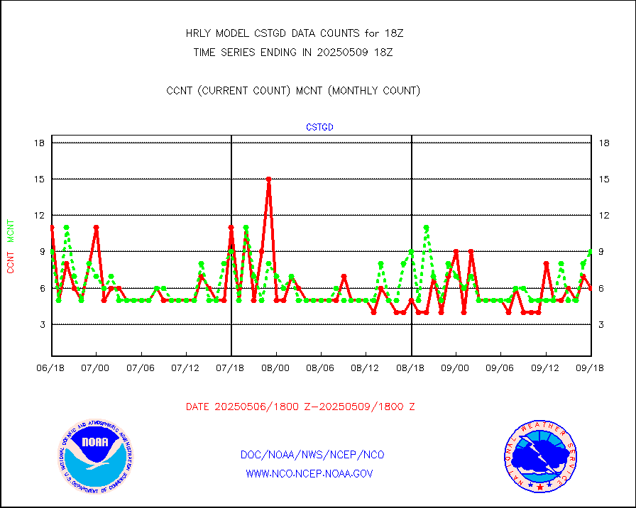
cstgd |
Coast Guard |
8 |
7 |
114.3 % |
1917.50-1918.50 |
dbuoyb |
Drifting buoys (decoded from BUFR) |
1432 |
1388 |
103.2 % |
1917.50-1918.50 |
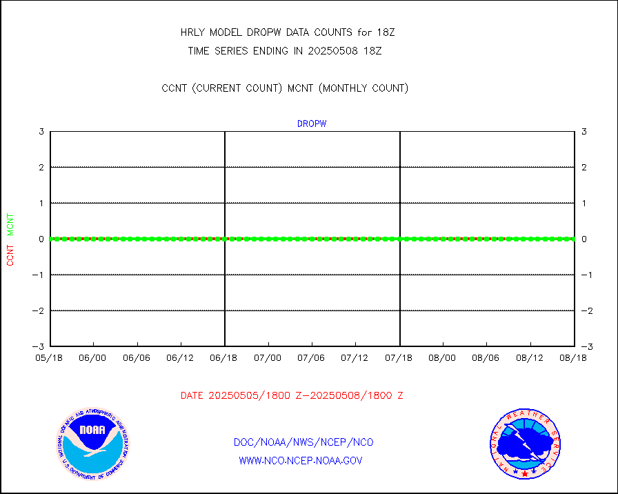
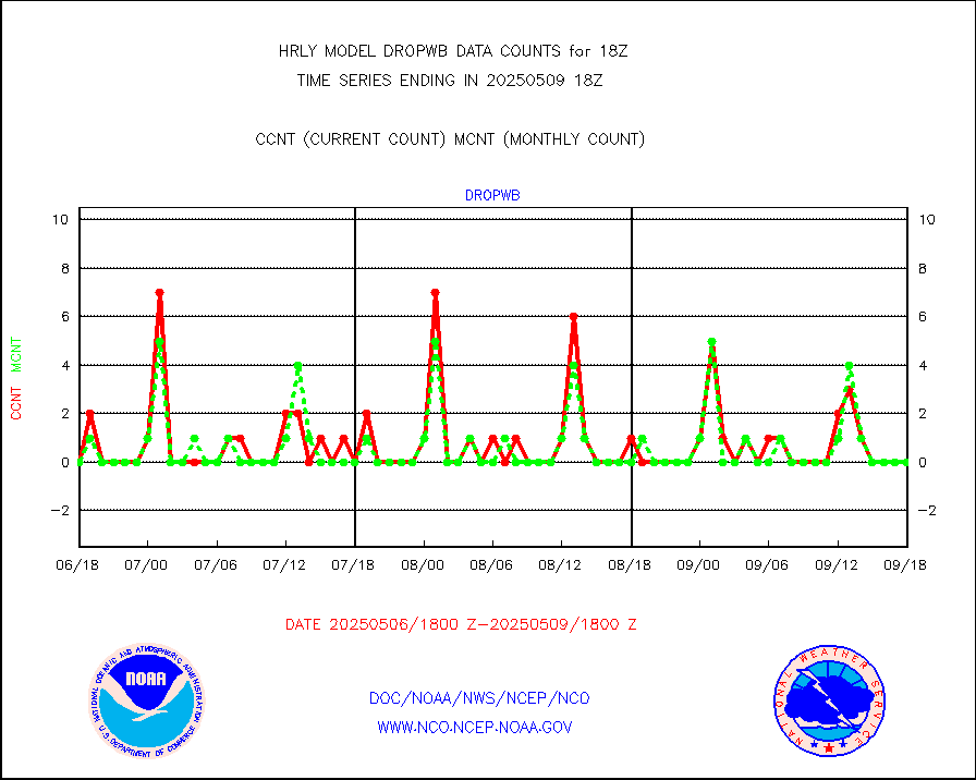
dropw |
Dropwinsonde (from TEMP DROP) |
0 |
0 |
n/a |
1917.50-1918.49 |
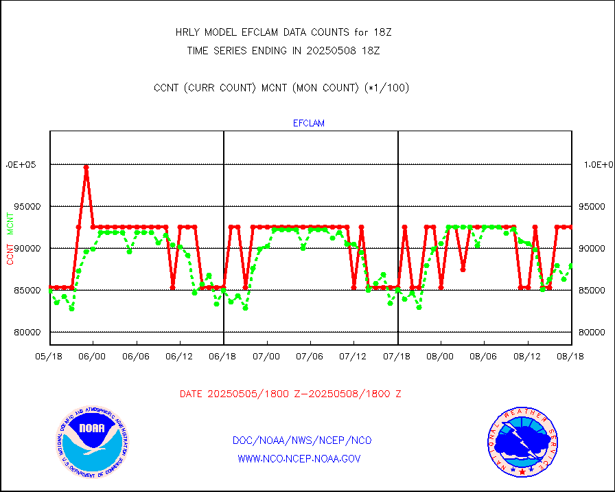
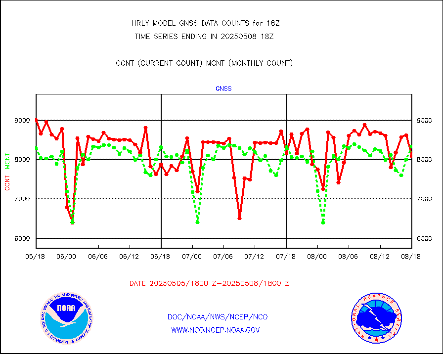
efclam |
GOES imager effective cloud amount data (U.Wisc.) |
8295243 |
8218453 |
100.9 % |
1917.50-1918.49 |
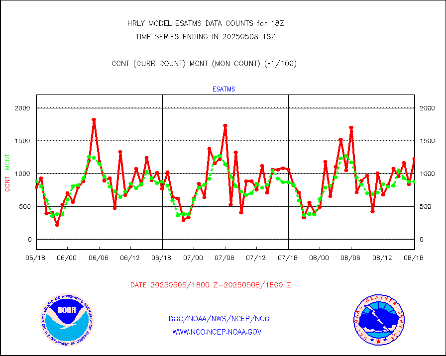
esatms |
NPP Adv. Tech. MW Sndr (ATMS) br. temps from RARS |
51840 |
104140 |
49.8 % |
1916.50-1917.49 |
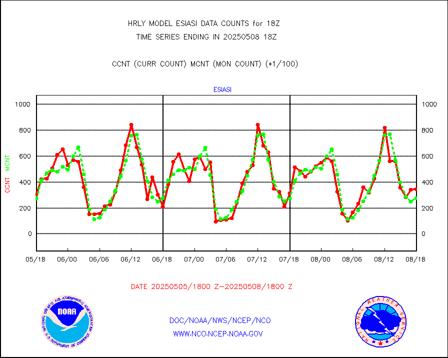
esiasi |
METOP 1-2 IASI 1C radiance data vbl chn from RARS |
44173 |
41532 |
106.4 % |
1917.00-1917.99 |
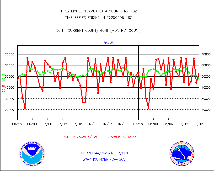
esmhs |
NOAA 18-19 & METOP 1-2 MHS proc. btemps from RARS |
128948 |
157959 |
81.6 % |
1917.50-1918.49 |
geoimr |
GOES/NESDIS (11x17 f-o-v) imager clear radiances |
0 |
0 |
n/a |
1917.00-1917.99 |
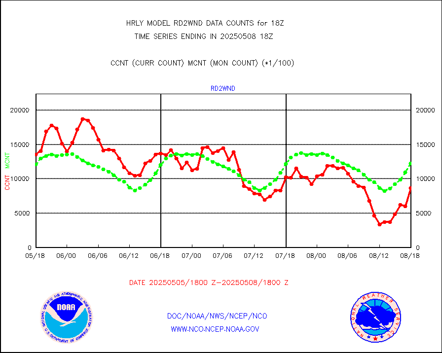
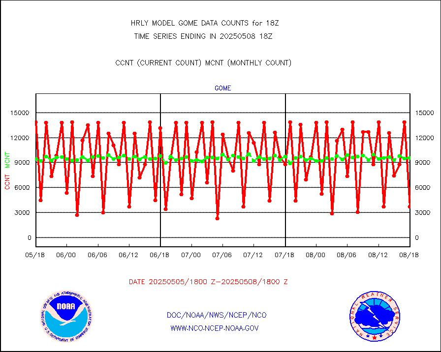
gome |
METOP 1-2 Global Ozone Monitoring Exp.-2 (GOME-2) |
9087 |
6826 |
133.1 % |
1916.50-1917.49 |
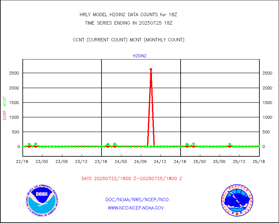
h20in2 |
INDIA SATWIND, INSAT WV channel |
7218 |
4390 |
164.4 % |
1917.00-1917.99 |
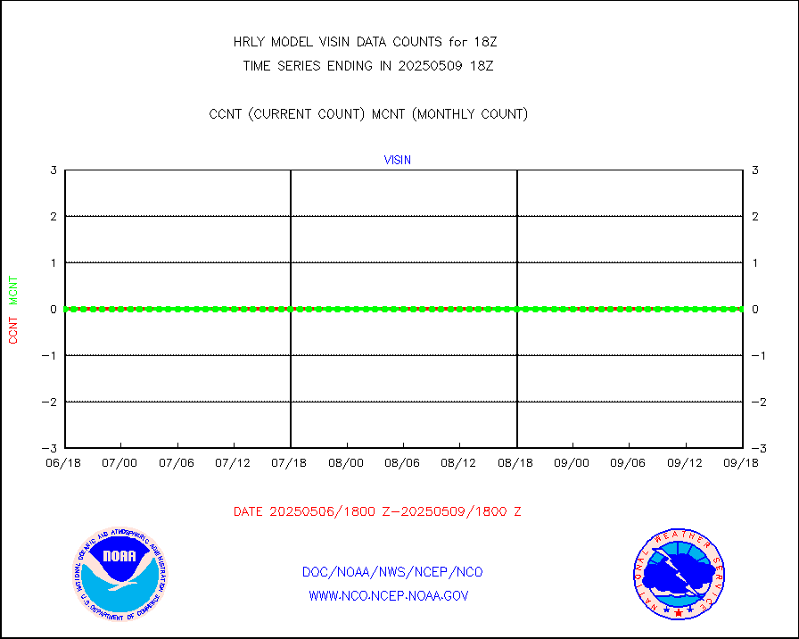
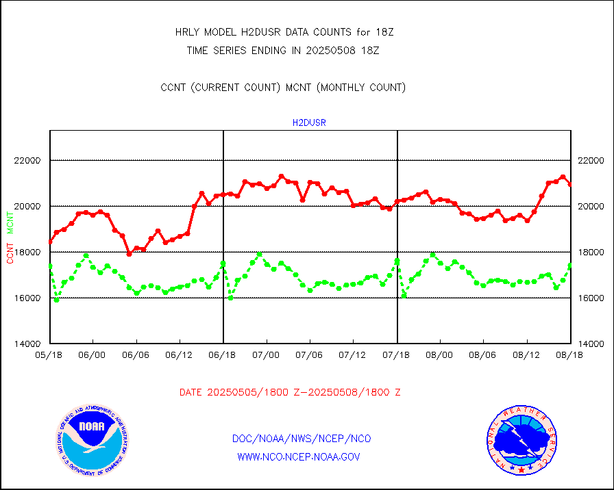
h2dusr |
GOES-16&up/NESDIS wv imgr/deep-lyr derivd cld mtn |
17028 |
17023 |
100.0 % |
1917.00-1917.99 |
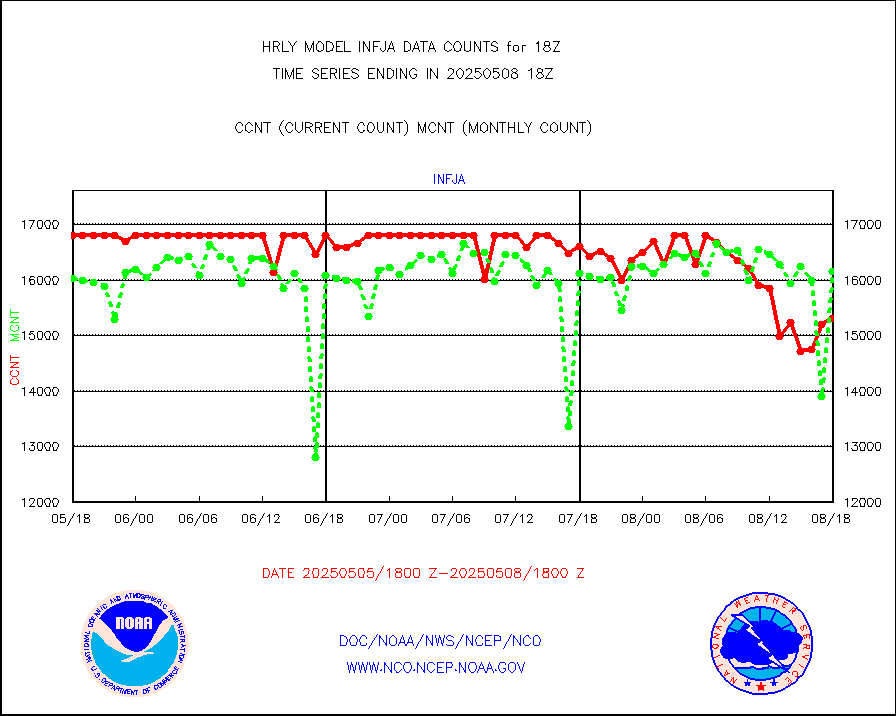
h2eunb |
METEOSAT/EUMETSAT wvpr imgr drv cld motion NBseq |
41138 |
42289 |
97.3 % |
1916.50-1917.49 |
iasidb |
METOP 1-2 IASI 1C radiances-direct broadcast SSEC |
29537 |
21312 |
138.6 % |
1916.50-1917.49 |
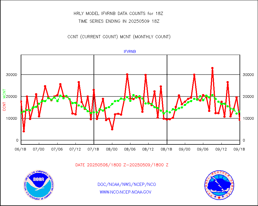
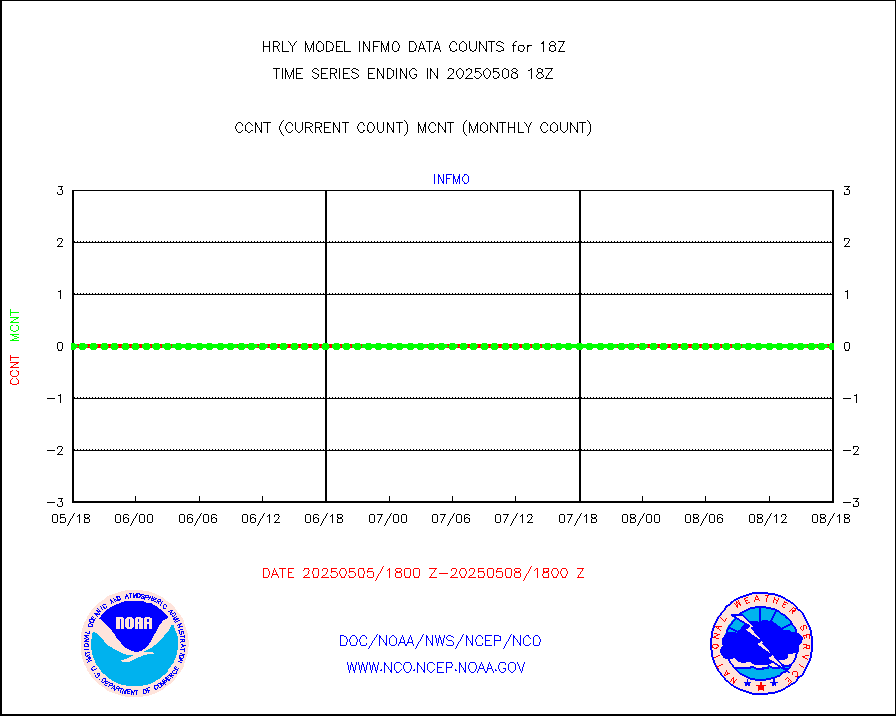
ifvrnb |
VIIRS (NPP/NOAA-20) ir lg-wv drv cloud motion(NB) |
17578 |
13536 |
129.9 % |
1914.00-1914.99 |
infav |
AVHRR (NOAA/METOP) ir lg-wave derived cld motion |
0 |
0 |
n/a |
1914.00-1914.99 |
infav1 |
AVHRR (METOP) ir lg-wave derived cld motion |
0 |
0 |
n/a |
1917.50-1918.50 |
infin |
INSAT/KALPANA India ir lg-wave derived cld motion |
0 |
0 |
n/a |
1915.50-1916.49 |
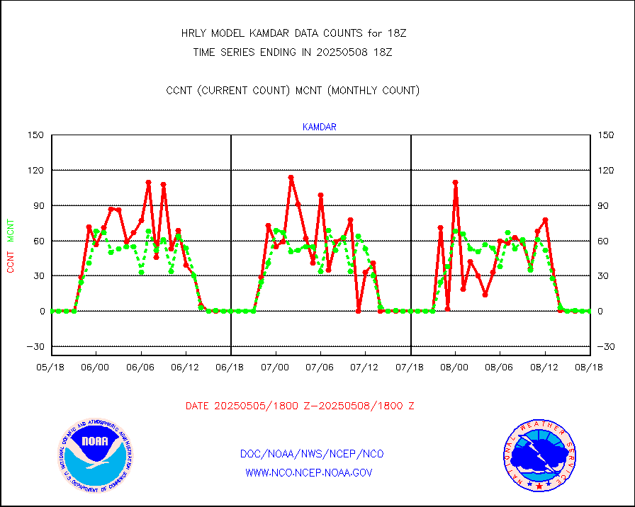
infin2 |
INDIA SATWIND, INSAT IR channel |
10544 |
4900 |
215.2 % |
1917.00-1917.99 |
kamdar |
Korean AMDAR aircraft data (decoded from BUFR) |
0 |
0 |
n/a |
1917.50-1918.49 |
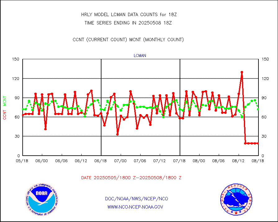
lcman |
Land-based CMAN stations decoded from CMAN format |
96 |
90 |
106.7 % |
1917.50-1918.49 |
leogeo |
LEO-GEO satellite AMVs from UWisc. |
6040 |
4779 |
126.4 % |
1914.00-1914.99 |
ltnglr |
LLDN Long-rng lightning from Vaisala via NOAAPORT |
271158 |
182989 |
148.2 % |
1917.50-1918.49 |
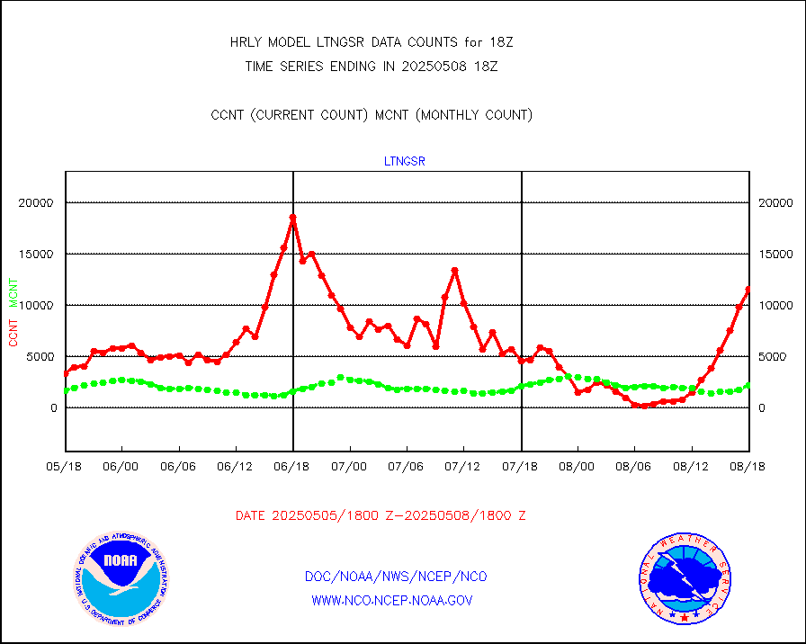
ltngsr |
NLDN Shrt-rng lightning from Vaisala via NOAAPORT |
7124 |
2501 |
284.8 % |
1917.50-1918.49 |
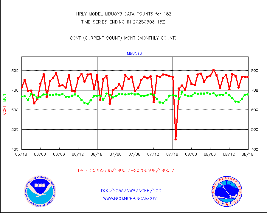
mbuoyb |
Moored buoys (decoded from BUFR) |
820 |
734 |
111.7 % |
1917.50-1918.50 |
mls |
Aura Microwave Limb Sounder (MLS) ozone data |
0 |
0 |
n/a |
1916.00-1916.99 |
msourb |
Mesonet/MADIS UrbaNet |
4359 |
4376 |
99.6 % |
1917.50-1918.49 |
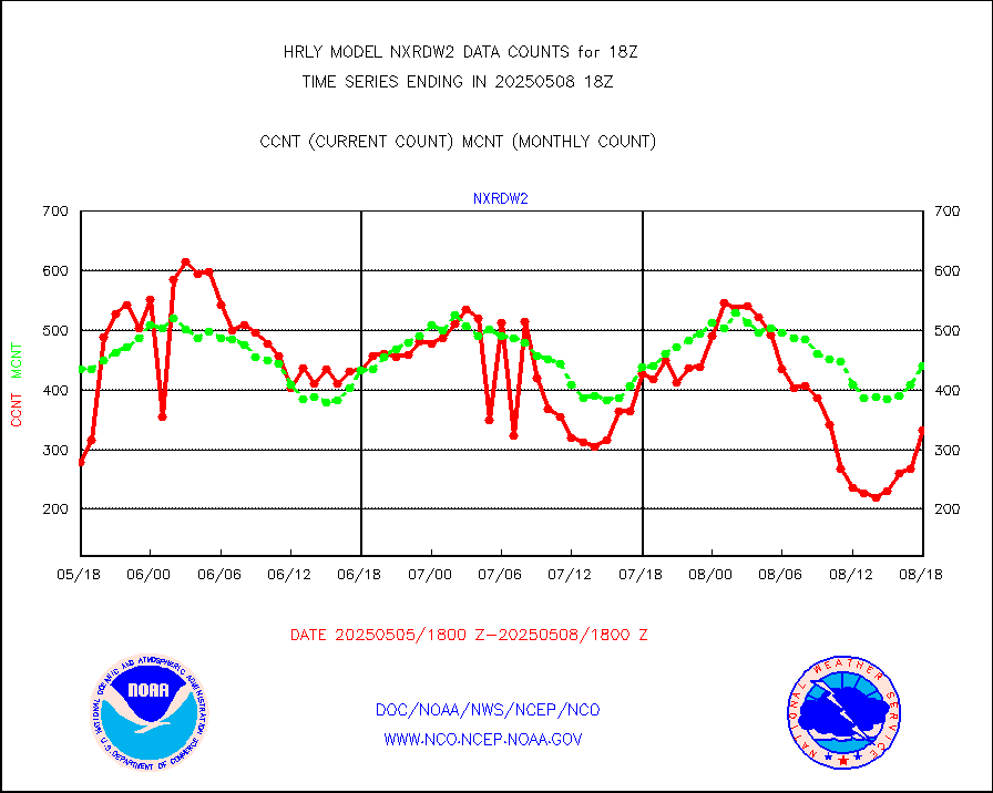
nxrdw2 |
NEXRAD Vel Azm Dsp(VAD) winds via Level 2 decoder |
493 |
474 |
104.0 % |
1917.50-1918.49 |
ompslp |
OMPS Limb Profiler ozone data (NPP) |
133 |
267 |
49.8 % |
1911.00-1911.99 |
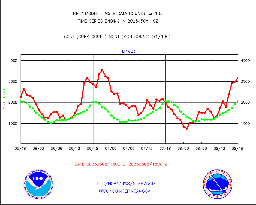
ompsn8 |
OMPS nadir profile ozone (Version 8 BUFR) |
529 |
544 |
97.2 % |
1916.00-1916.99 |
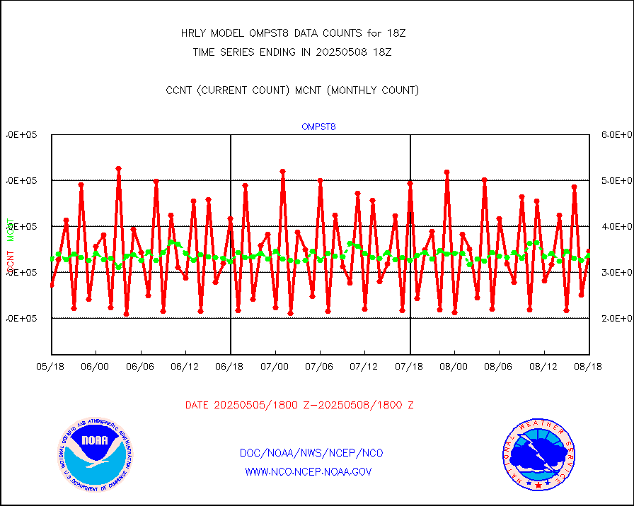
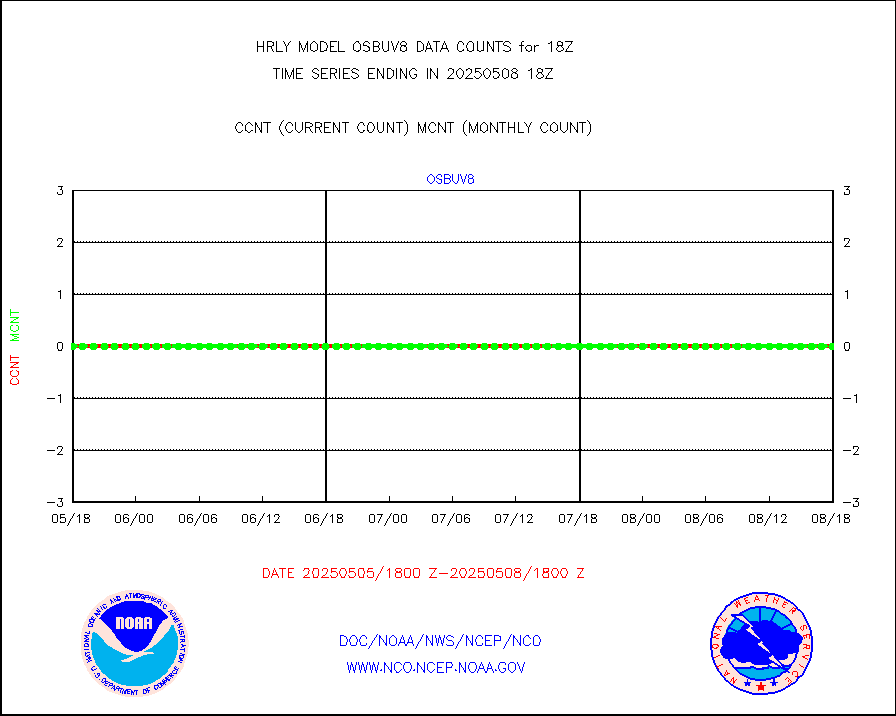
ompst8 |
OMPS total column ozone (Version 8 BUFR) |
420163 |
313619 |
134.0 % |
1916.00-1916.99 |
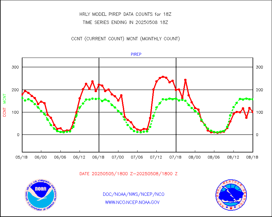
pirep |
Manual PIREP aircraft data (dcded from AIREP fmt) |
115 |
149 |
77.2 % |
1917.50-1918.49 |
prflrp |
Profilr winds from PIBAL (PILOT,PILOT SHIP/MOBIL) |
0 |
0 |
n/a |
1917.50-1918.49 |
raobm |
Rawinsonde - mobile land (from TEMP/PILOT MOBIL) |
0 |
0 |
n/a |
1917.50-1918.49 |
raobs |
Rawinsonde - ship (from TEMP SHIP, PILOT SHIP) |
0 |
0 |
n/a |
1917.50-1918.49 |
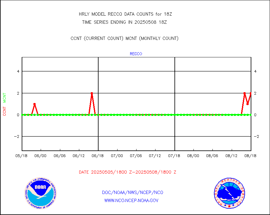
recco |
Flight level reconnaissance aircraft data |
0 |
0 |
n/a |
1917.50-1918.49 |
saphir |
Megha-Tropiques SAPHIR L1A2 brightness temps |
0 |
0 |
n/a |
1915.50-1916.49 |
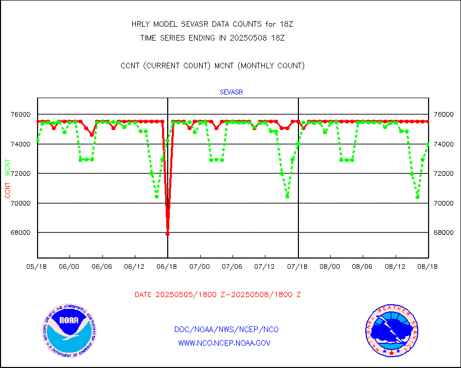
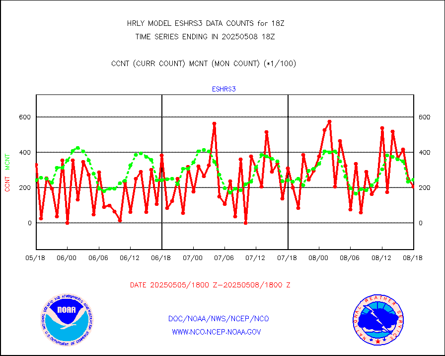
sevasr |
METEOSAT-10 2nd Gen SEVIRI All Sky Radiance(proc) |
75512 |
75483 |
100.0 % |
1917.50-1918.49 |
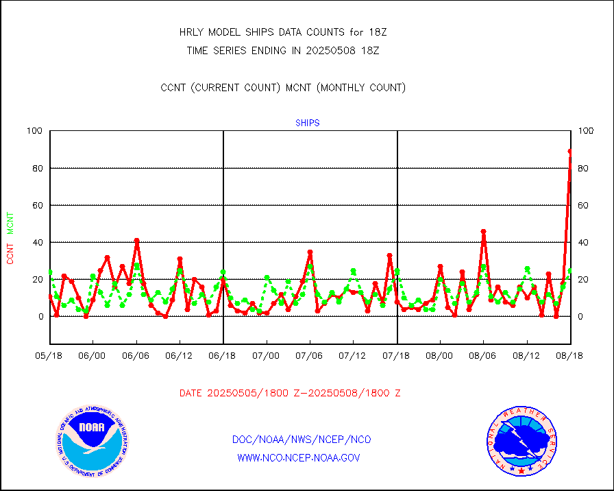
ships |
Ship - manual and automatic, restricted |
6 |
10 |
60.0 % |
1917.50-1918.49 |
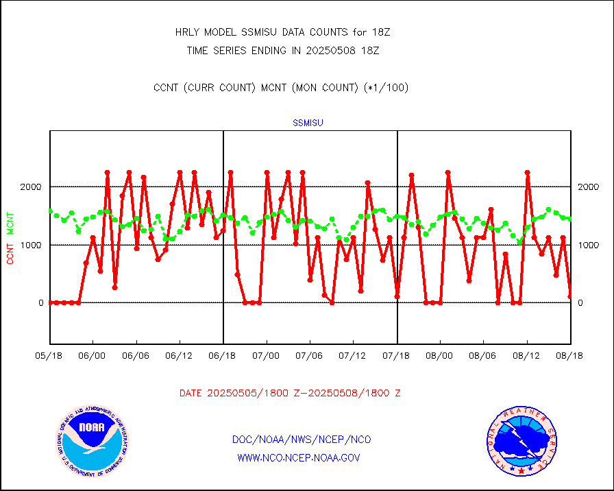
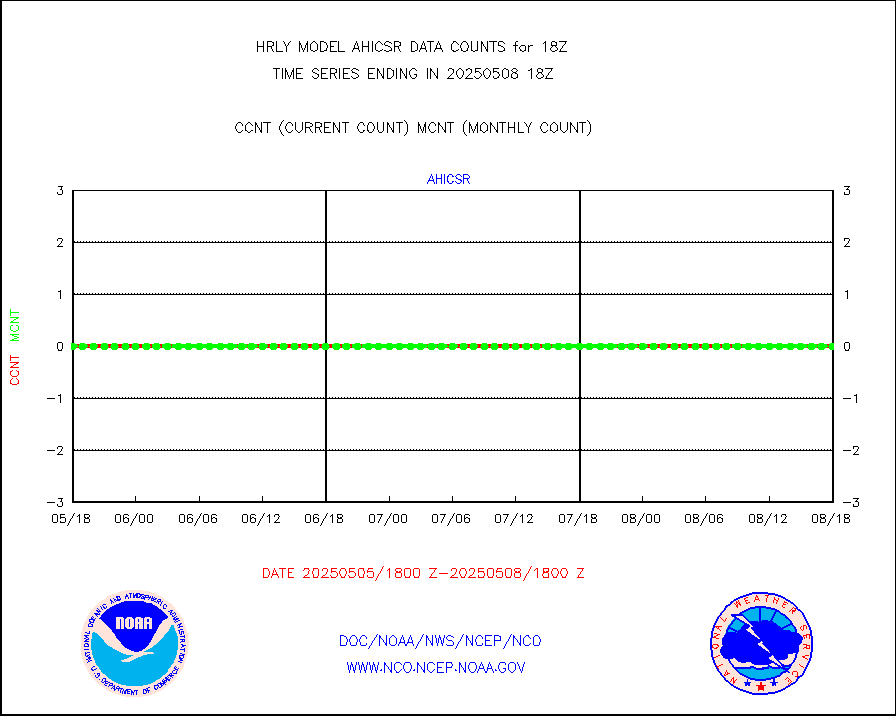
ssmisu |
DMSP SSM/IS 1C radiance data (Unified Pre-Proc.) |
23640 |
119846 |
19.7 % |
1916.50-1917.49 |
sstvcw |
NPP/NOAA-20 VIIRS SST - CLEAR & OVER WATER |
3070579 |
314695 |
975.7 % |
1917.50-1918.49 |
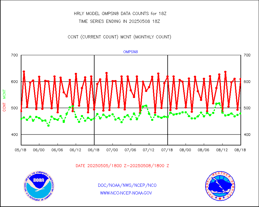
sstvpw |
NPP/NOAA-20 VIIRS SST - PROBABLY CLR & OVER WATER |
551873 |
81399 |
678.0 % |
1917.50-1918.49 |
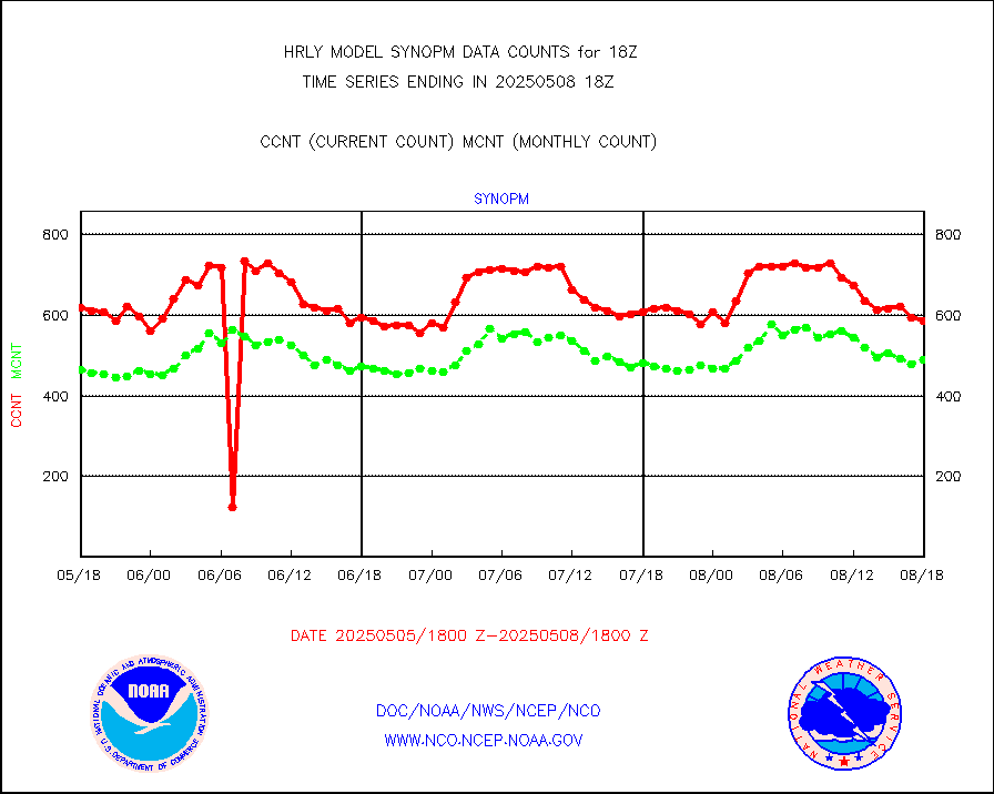
synopm |
Synoptic - mobile manual and automatic |
606 |
637 |
95.1 % |
1917.50-1918.49 |
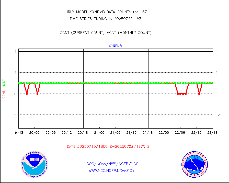
synpmb |
Synoptic - mobile manual & auto (decoded fr BUFR) |
0 |
1 |
0.0 % |
1917.50-1918.49 |
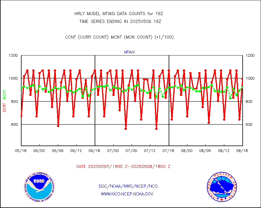
tesac |
CTD probe, Argo prflng float, mooring (TESAC fmt) |
182 |
190 |
95.8 % |
1917.50-1918.49 |
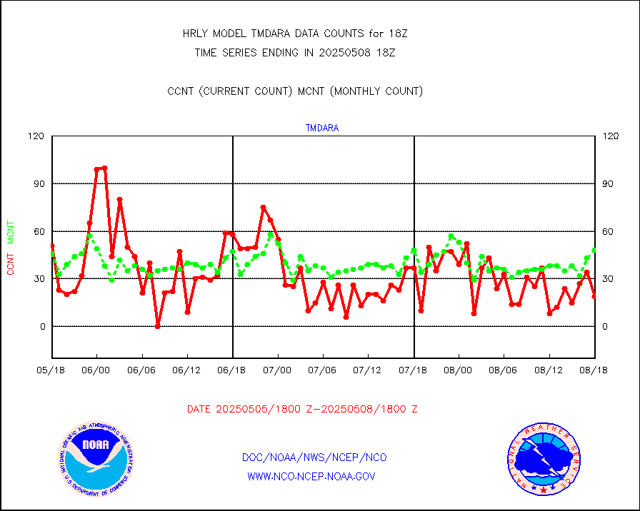
tmdara |
TAMDAR aircft data-all types(from Panasonic,BUFR) |
187 |
170 |
110.0 % |
1917.50-1918.49 |
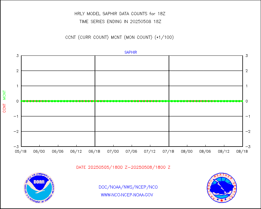
trkob |
ThermoSalinoGraph (TSG) TRACKOB format) |
90 |
44 |
204.5 % |
1916.50-1917.49 |
visin |
INSAT/KALPANA India visible derived cloud motion |
0 |
0 |
n/a |
1915.50-1916.49 |
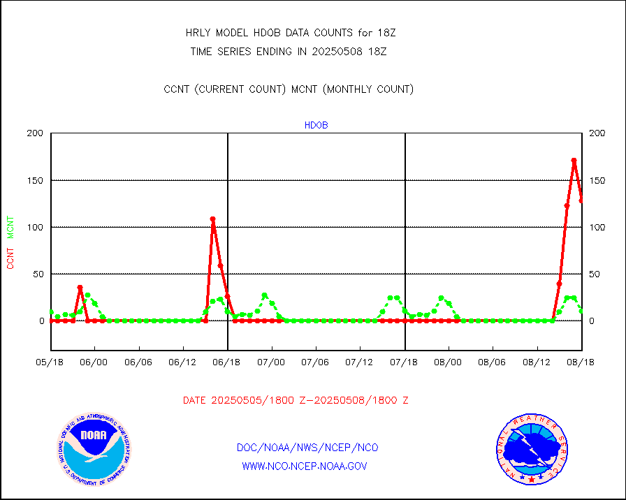
visin2 |
INDIA SATWIND, INSAT VIS channel |
0 |
0 |
n/a |
1917.00-1917.99 |
visja |
MTSAT/JMA visible derived cloud motion |
0 |
0 |
n/a |
1915.50-1916.49 |
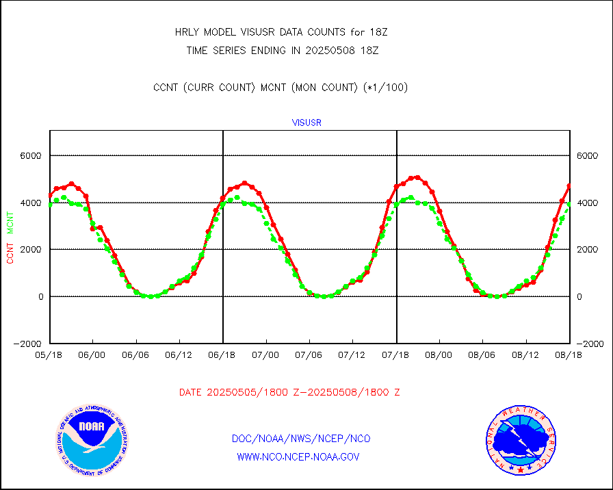
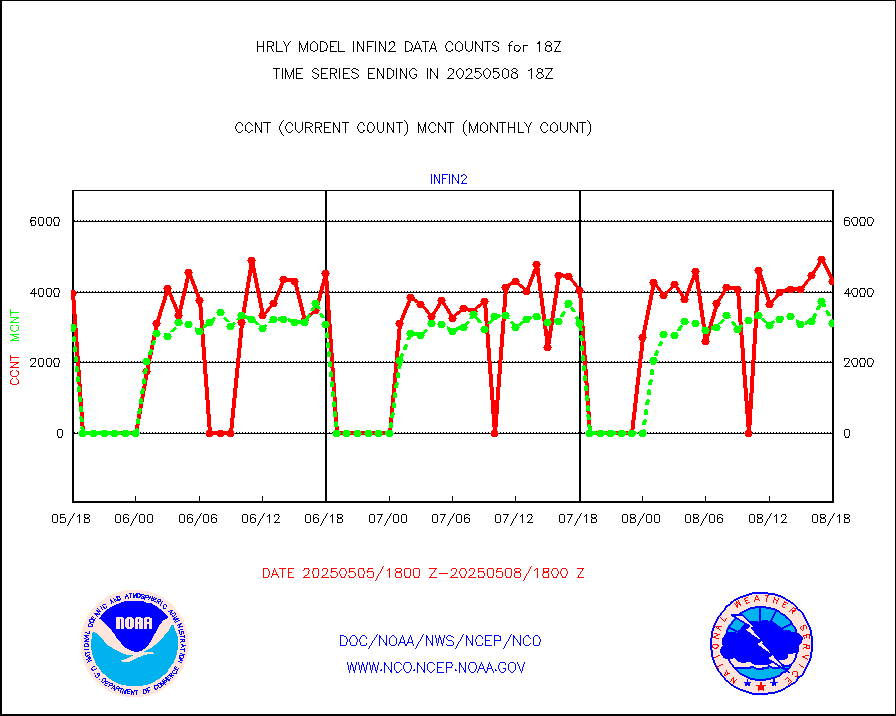
visusr |
GOES-16&up/NESDIS visible derived cloud motion |
467453 |
401016 |
116.6 % |
1917.00-1917.99 |
vseunb |
METEOSAT/EUMETSAT visible drv cld motion NBseq |
29271 |
26134 |
112.0 % |
1916.50-1917.49 |


