| Critical Data with Normal Counts |
|---|
| Type | Description | Hourly Count | Monthly Average | Percent (%) of Monthly Mean | UTC Time Window |
1bamua |
NOAA 15-19 & METOP 1-2 AMSU-A NCEP-proc. br.temps |
65598 |
56089 |
117.0 % |
1914.00-1914.99 |
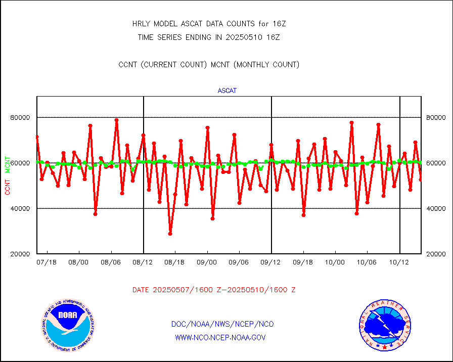
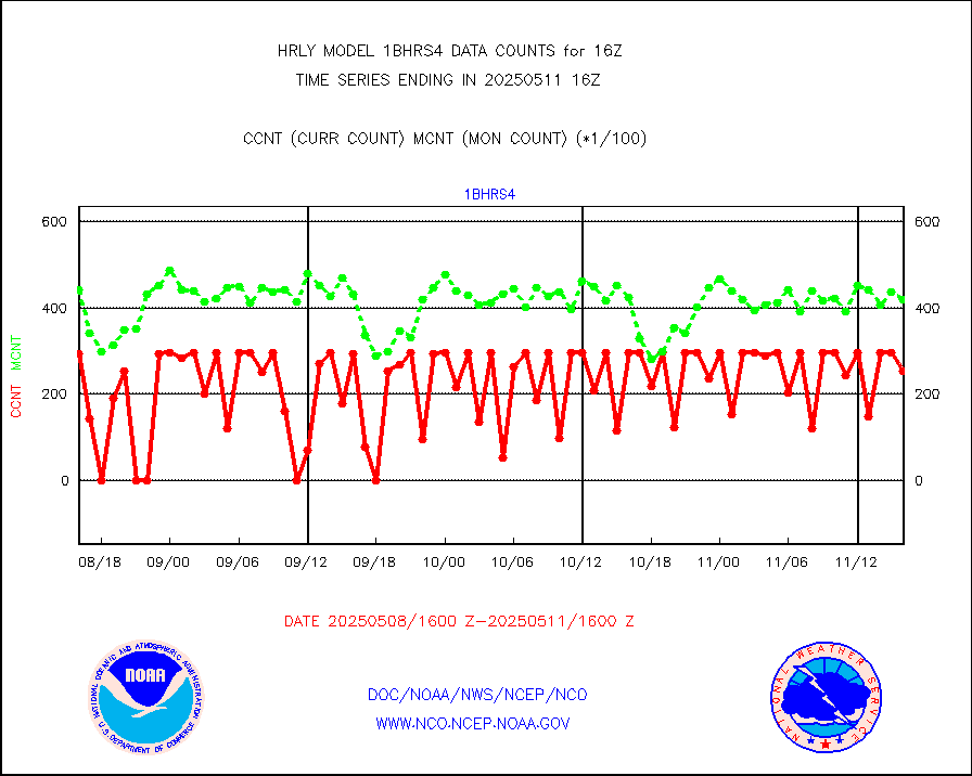
1bhrs4 |
NOAA 18-19 & METOP 1-2 HIRS-4 NCEP-proc. br.temps |
56583 |
47237 |
119.8 % |
1914.00-1914.99 |
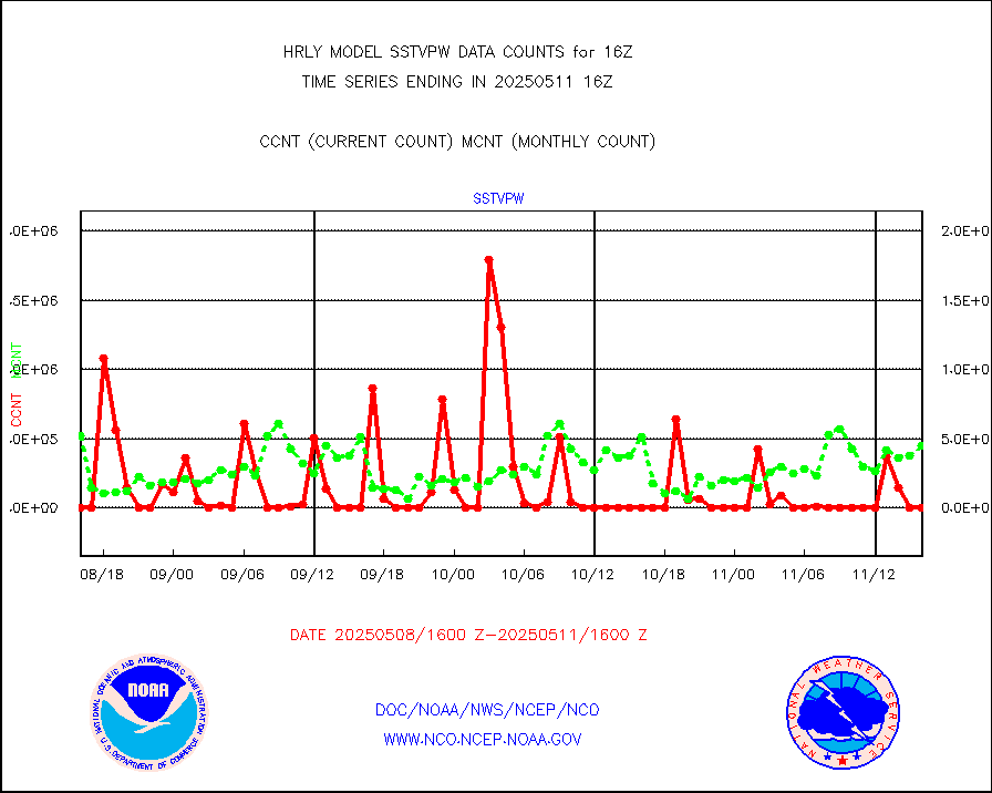
1bmhs |
NOAA 18-19 & METOP 1-2 MHS NCEP-proces. br. temps |
356390 |
304047 |
117.2 % |
1914.00-1914.99 |
acars |
MDCRS ACARS acft data from ARINC(dcded from BUFR) |
20633 |
19718 |
104.6 % |
1915.50-1916.49 |
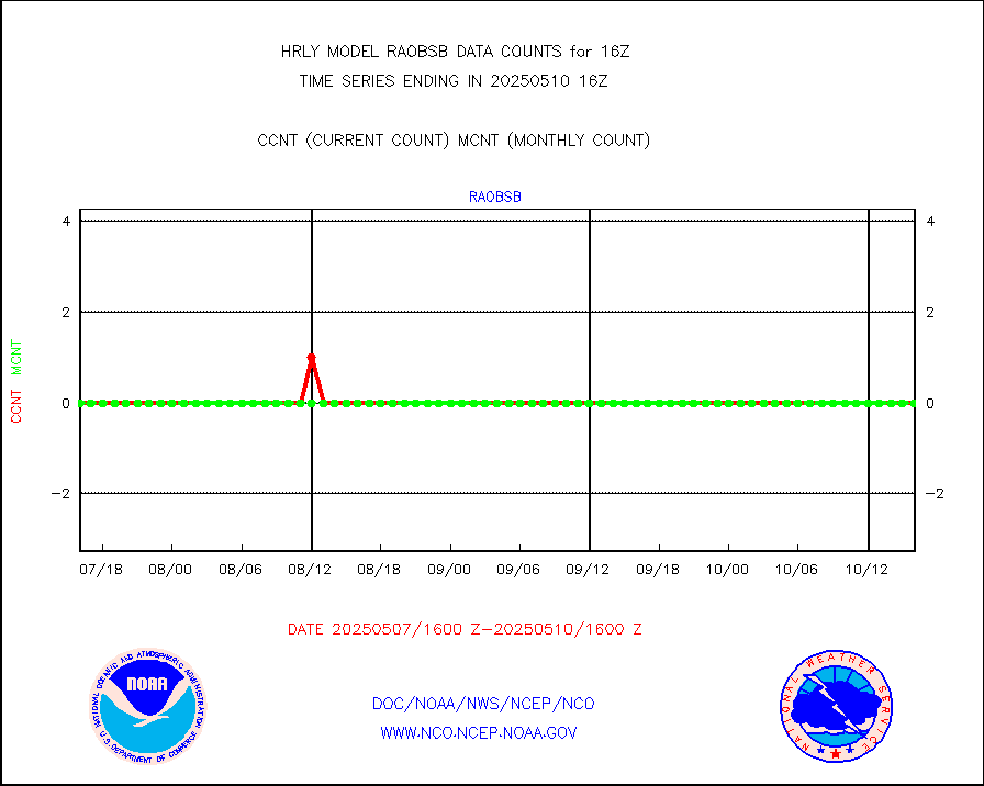
airep |
Manual AIREP aircraft data (dcded from AIREP fmt) |
1240 |
1206 |
102.8 % |
1915.50-1916.49 |
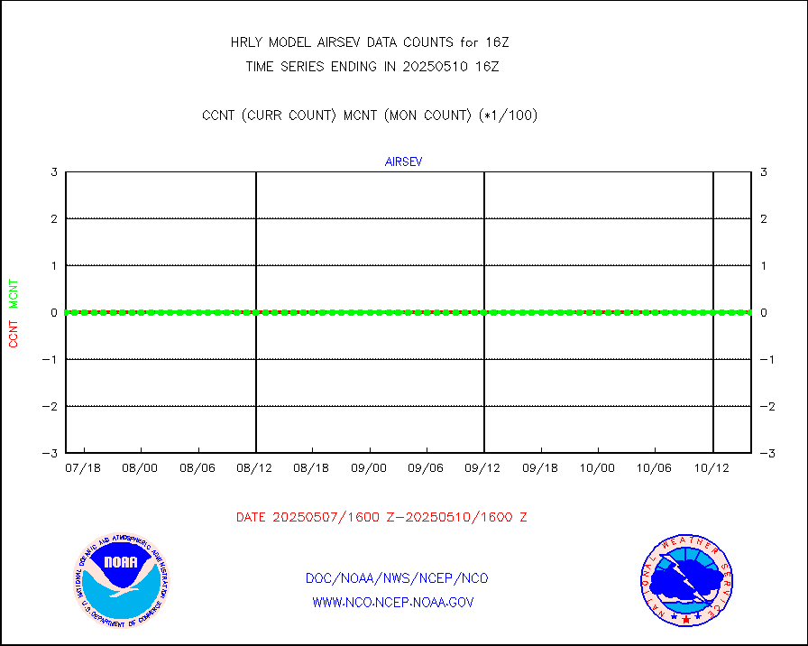
airsev |
AQUA AIRS/AMSU-A/HSB brightness temps- every FOV |
0 |
0 |
n/a |
1913.50-1914.49 |
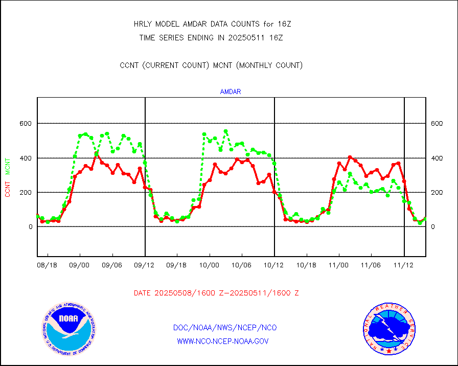
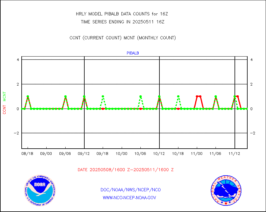
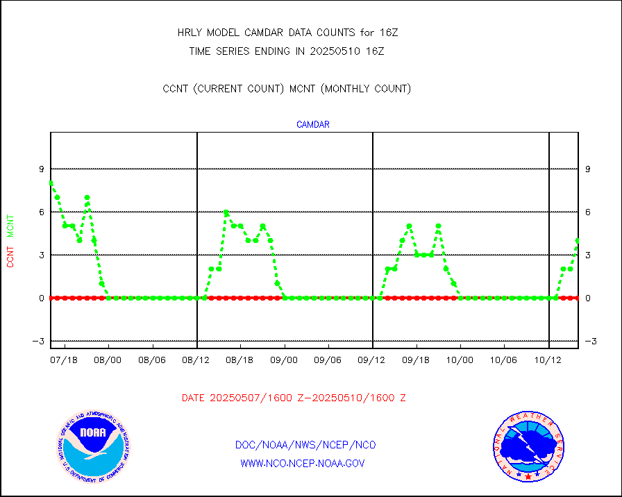
amdar |
AMDAR aircraft data (decoded from AMDAR format) |
33 |
47 |
70.2 % |
1915.50-1916.49 |
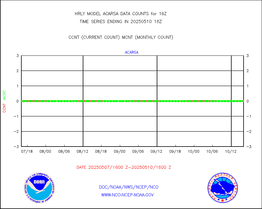
amdarb |
AMDAR aircraft data (decoded from BUFR) |
462 |
307 |
150.5 % |
1915.50-1916.49 |
ascat |
METOP 1-2 ASCAT products |
55272 |
46292 |
119.4 % |
1914.50-1915.49 |
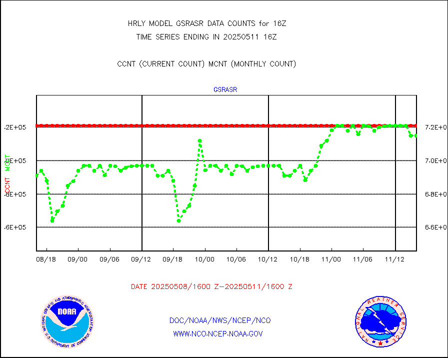
atms |
NPP/NOAA-20 ATMS brightness temperatures |
381504 |
346634 |
110.1 % |
1914.50-1915.49 |
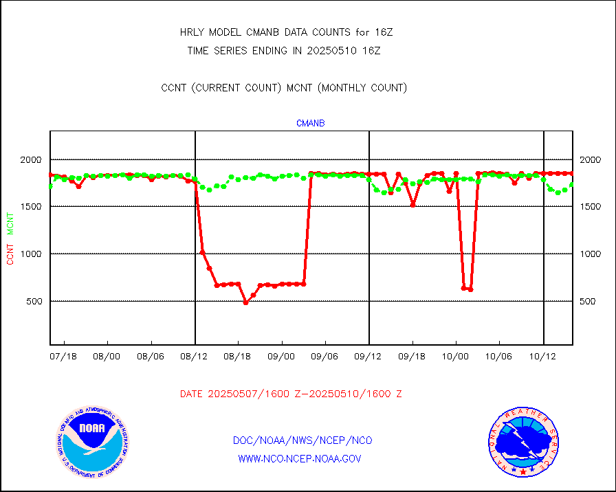
cmanb |
Surface Marine CMAN rpts decoded from BUFR format |
1846 |
1772 |
104.2 % |
1915.50-1916.50 |
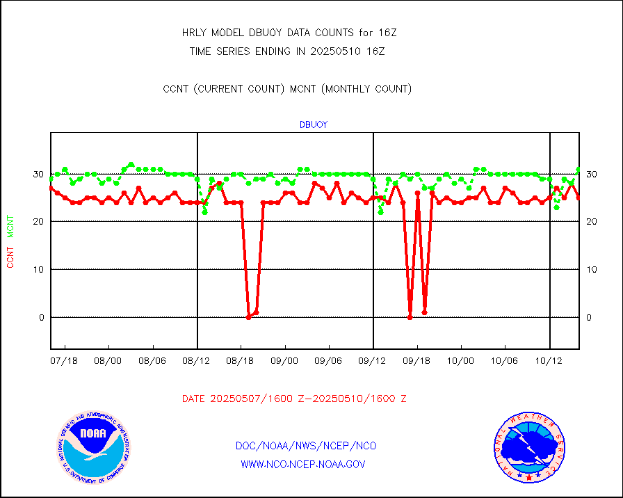
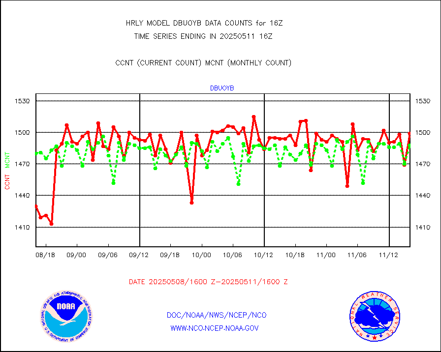
dbuoy |
Buoys decoded from FM-18 fmt (moored or drifting) |
39 |
37 |
105.4 % |
1915.50-1916.49 |
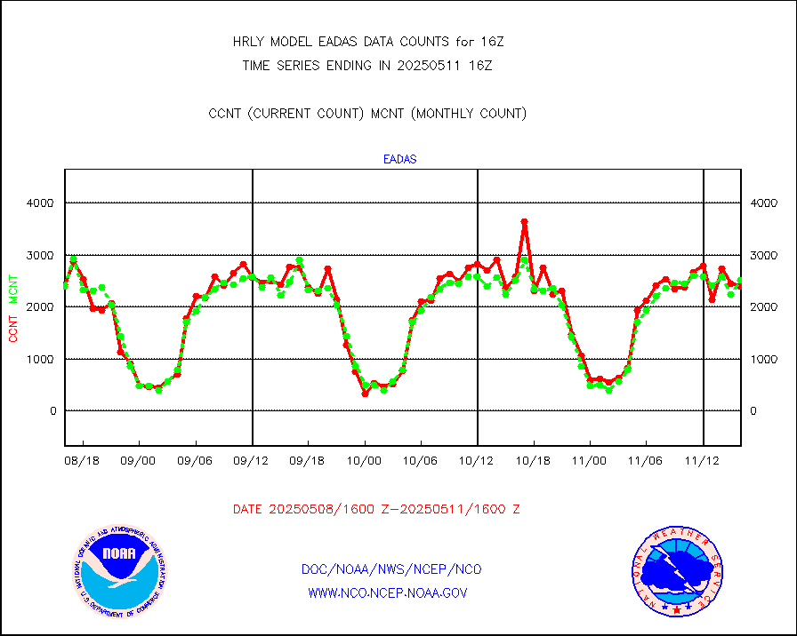
eadas |
E-AMDAR (European AMDAR acft decoded from BUFR) |
1882 |
1906 |
98.7 % |
1915.50-1916.49 |
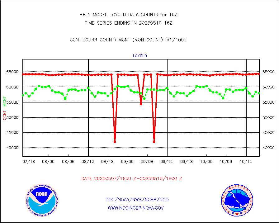
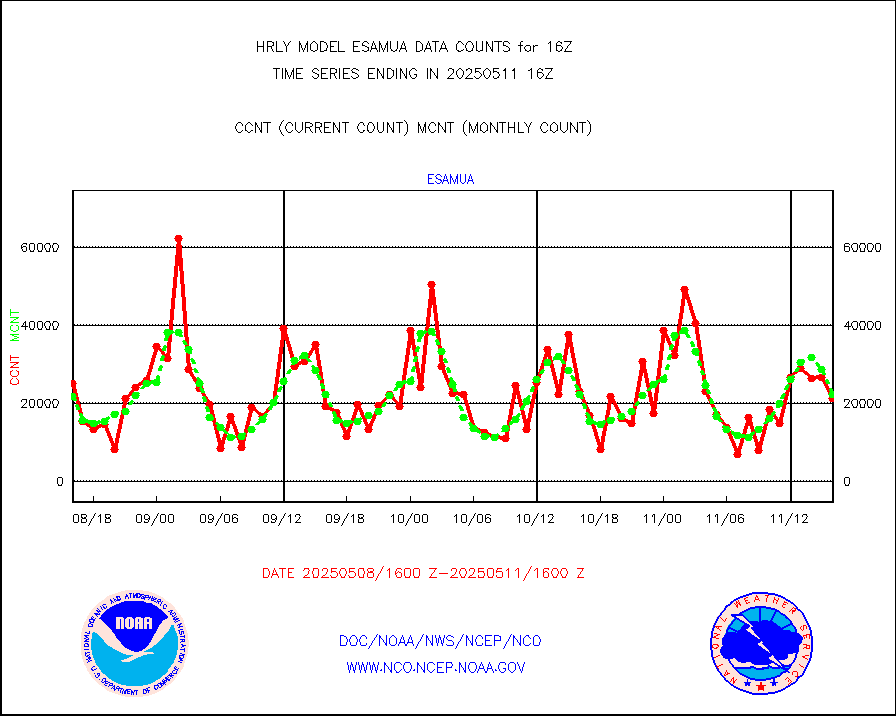
esamua |
NOAA 15-19 & METOP 1-2 AMSU-A proc btmps frm RARS |
21312 |
26020 |
81.9 % |
1915.50-1916.49 |
eshrs3 |
NOAA 15-19 & METOP 1-2 HIRS-3/4 pr btmps frm RARS |
37457 |
58246 |
64.3 % |
1915.50-1916.49 |
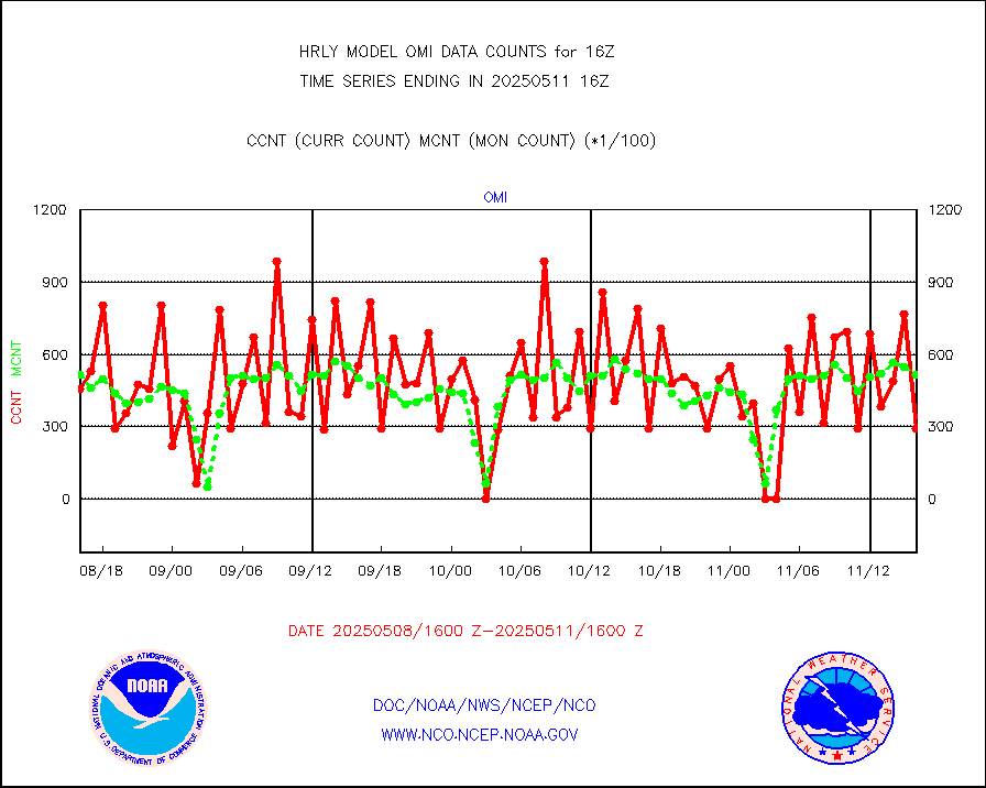
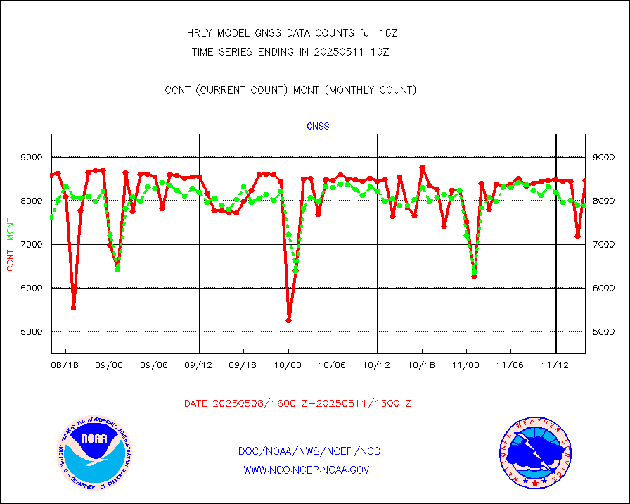
gnss |
Grnd-based Gbl Navigation Sat System (GNSS) data |
8719 |
9301 |
93.7 % |
1915.00-1915.99 |
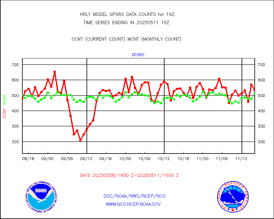
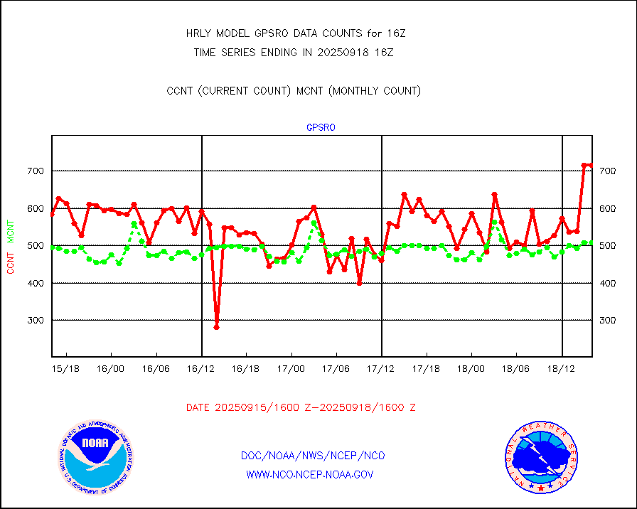
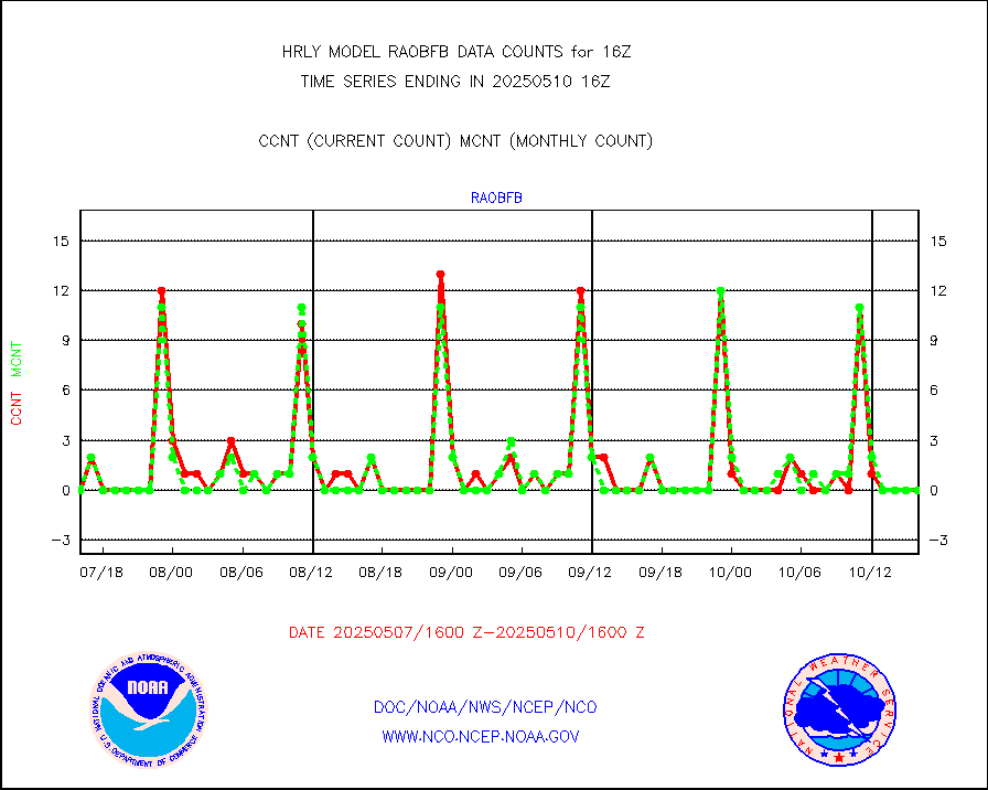
gpsro |
GPS radio occultation data |
397 |
422 |
94.1 % |
1913.50-1914.49 |
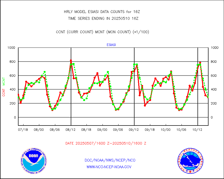
gsrasr |
GOES-16/17 All Sky Radiances (proc.) |
180244 |
351464 |
51.3 % |
1915.50-1916.49 |
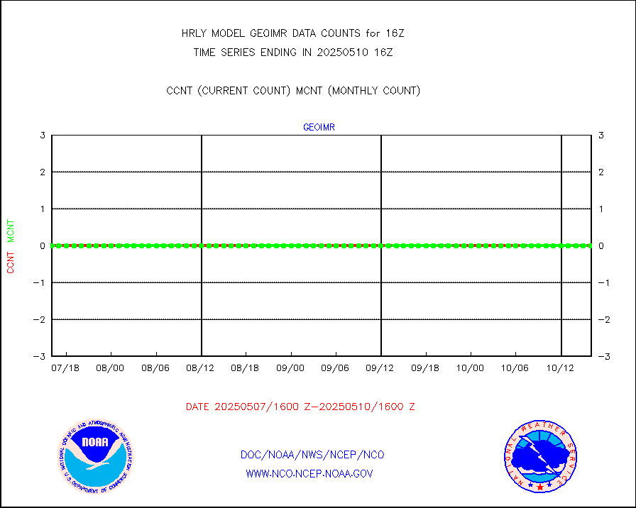
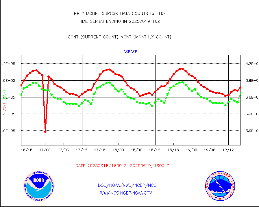
gsrcsr |
GOES-16/17 Clear Sky Radiances (proc.) |
73067 |
174064 |
42.0 % |
1915.50-1916.49 |
h20ja |
MTSAT/JMA water vapor imager derived cloud motion |
18722 |
18301 |
102.3 % |
1913.50-1914.49 |
h20mo |
MODIS (AQUA/TERRA) wvpr imager derived cld motion |
0 |
0 |
n/a |
1912.00-1912.99 |
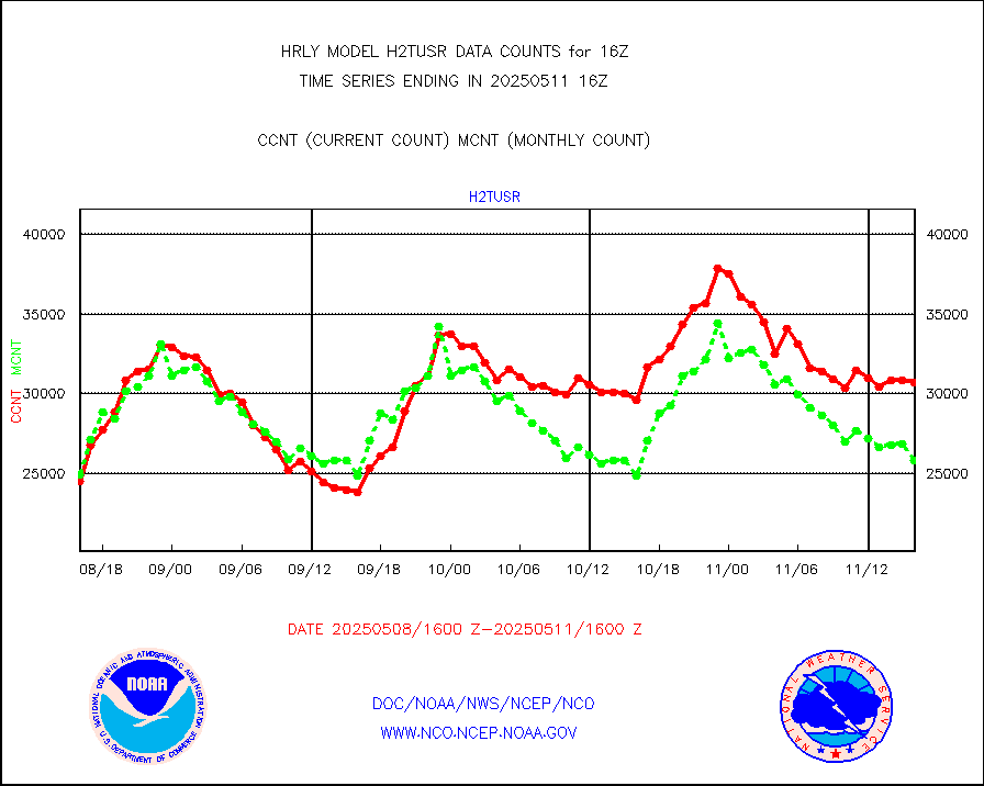
h2tusr |
GOES-16&up/NESDIS wv imgr/cld-top derived cld mtn |
22980 |
23870 |
96.3 % |
1915.00-1915.99 |
ifeunb |
METEOSAT/EUMETSAT ir lg-wave drv cld motion NBseq |
22452 |
22242 |
100.9 % |
1914.50-1915.49 |
infja |
MTSAT/JMA infrared long-wave derived cloud motion |
14181 |
15498 |
91.5 % |
1913.50-1914.49 |
infmo |
MODIS (AQUA/TERRA) ir l-wave derived cloud motion |
0 |
0 |
n/a |
1912.00-1912.99 |
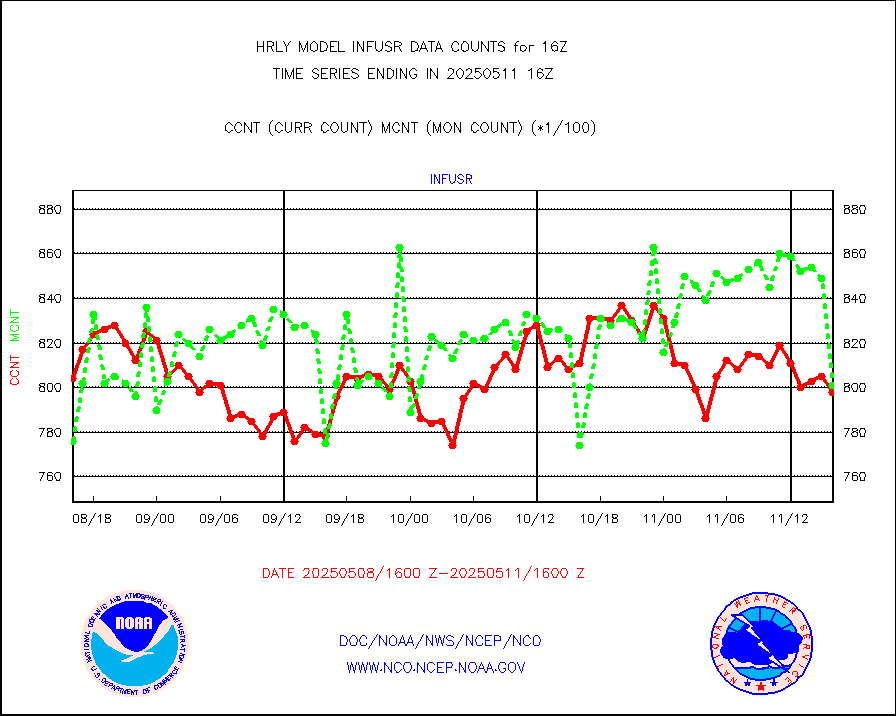
infusr |
GOES-16&up/NESDIS ir long-wave derived cld motion |
78807 |
78864 |
99.9 % |
1915.00-1915.99 |
lgycld |
GOES/NASA(Langley) hi-res. (1x1 f-o-v) cloud data |
4207020 |
3135350 |
134.2 % |
1915.50-1916.49 |
mbuoy |
Buoys decoded from FM-13 format (moored) |
119 |
124 |
96.0 % |
1915.50-1916.49 |
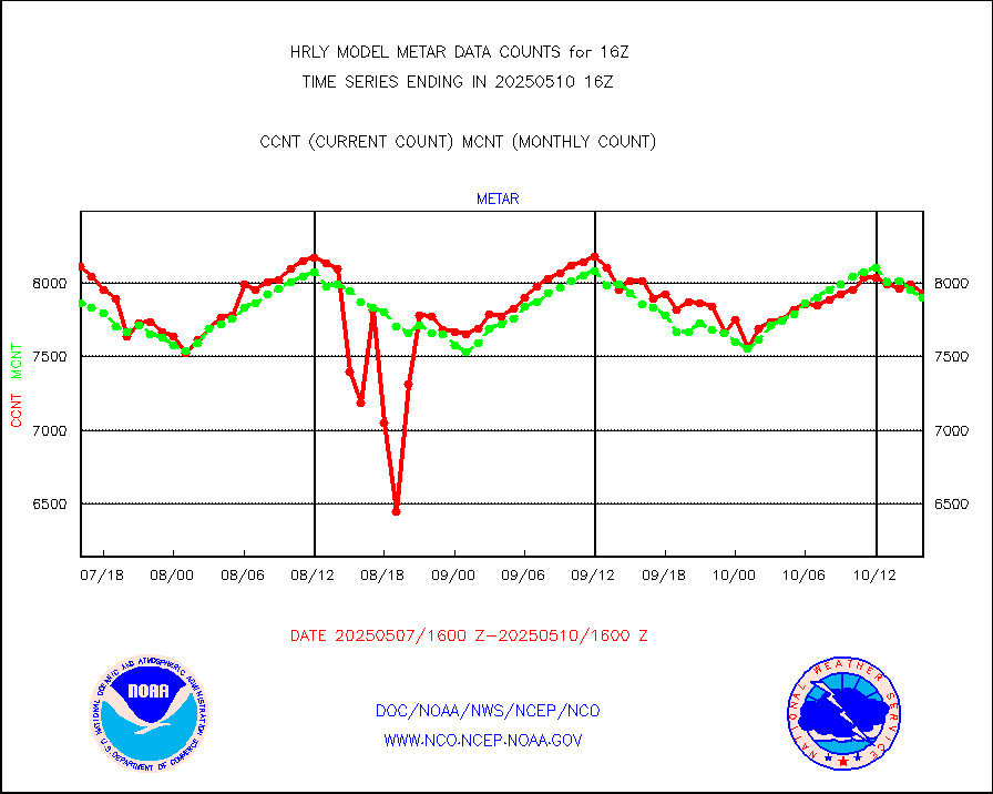
metar |
Aviation - METAR |
7567 |
7918 |
95.6 % |
1915.50-1916.49 |
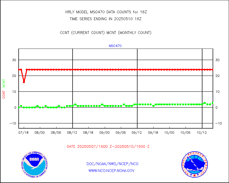
mso470 |
Mesonet/MADIS Colorado E-470 (Interstate 470) |
21 |
20 |
105.0 % |
1915.50-1916.49 |
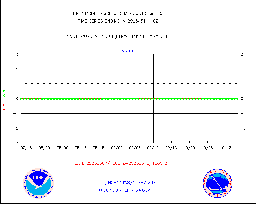
msoalk |
Mesonet/MADIS Alaska Department of Transportation |
104 |
107 |
97.2 % |
1915.50-1916.49 |
msoapg |
Mesonet/MADIS U.S. Army Aberdeen Proving Grounds |
0 |
0 |
n/a |
1915.50-1916.49 |
msoapr |
Mesonet/MADIS Citizen Weather Observers Program |
48411 |
48899 |
99.0 % |
1915.50-1916.49 |
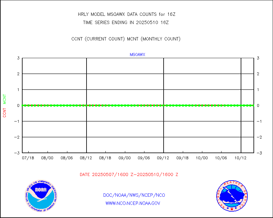
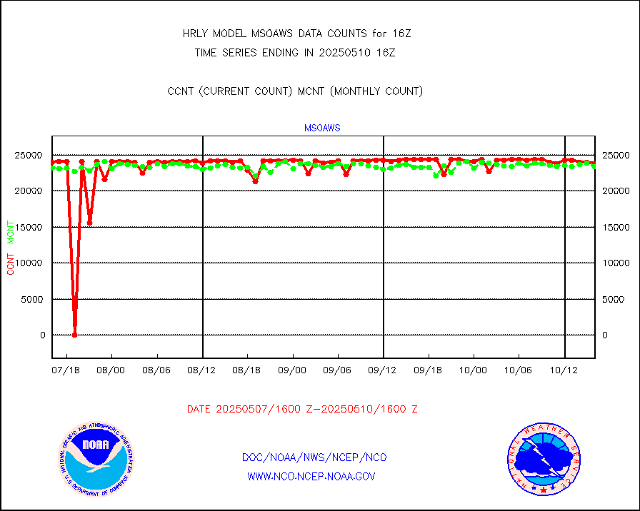
msoaws |
Mesonet/MADIS AWS Convergence Technologies, Inc. |
24192 |
25701 |
94.1 % |
1915.50-1916.49 |
msoawx |
Mesonet/MADIS "Anything Weather" |
0 |
0 |
n/a |
1915.50-1916.49 |
msocol |
Mesonet/MADIS Colorado Dept. of Transportation |
0 |
0 |
n/a |
1915.50-1916.49 |
msodcn |
Mesonet/MADIS DC Net |
0 |
0 |
n/a |
1915.50-1916.49 |
msoden |
Mesonet/MADIS Denver Urban Drainage & Flood Cntrl |
250 |
248 |
100.8 % |
1915.50-1916.49 |
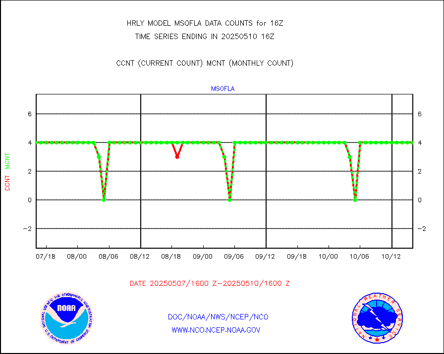
msofla |
Mesonet/MADIS Florida (FAWN & USF) |
4 |
4 |
100.0 % |
1915.50-1916.49 |
msoflt |
Mesonet/MADIS Florida Dept. of Transportation |
0 |
0 |
n/a |
1915.50-1916.49 |
msogeo |
Mesonet/MADIS Georgia Dept. of Transportation |
0 |
0 |
n/a |
1915.50-1916.49 |
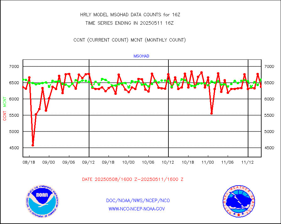
msohad |
Mesonet/MADIS NWS Hydromet Auto Data System(HADS) |
6897 |
6455 |
106.8 % |
1915.50-1916.49 |
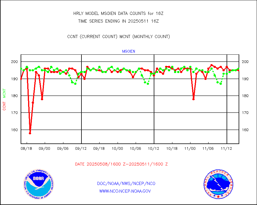
msoien |
Mesonet/MADIS Iowa Environmental |
184 |
186 |
98.9 % |
1915.50-1916.49 |
msoind |
Mesonet/MADIS Indiana Dept. of Transportation |
0 |
0 |
n/a |
1915.50-1916.49 |
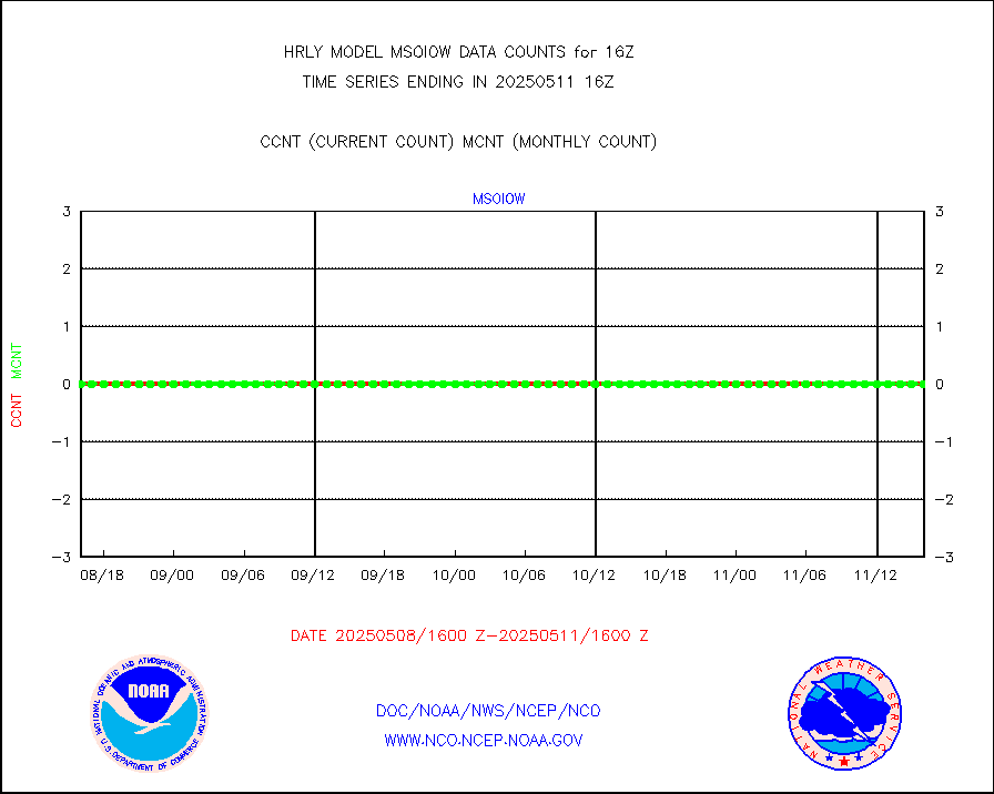
msoiow |
Mesonet/MADIS Iowa Department of Transportation |
0 |
0 |
n/a |
1915.50-1916.49 |
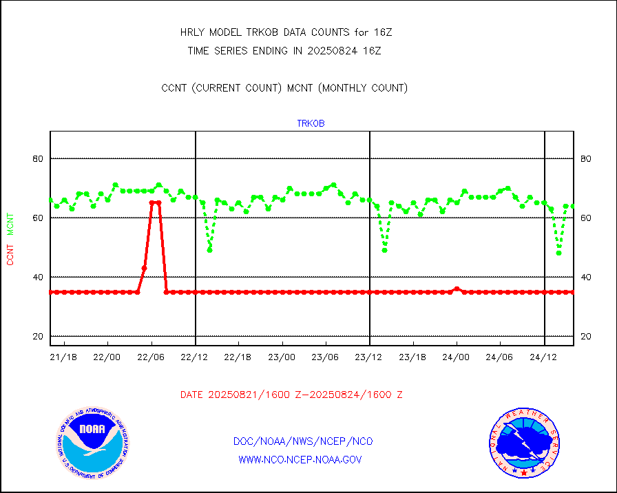
msokan |
Mesonet/MADIS Kansas Department of Transportation |
386 |
352 |
109.7 % |
1915.50-1916.49 |
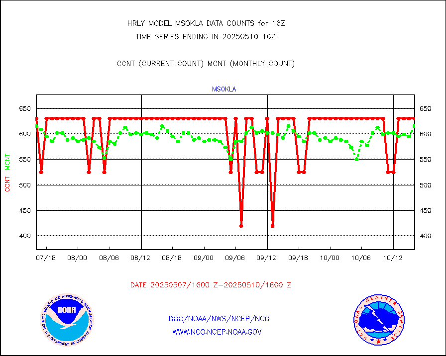
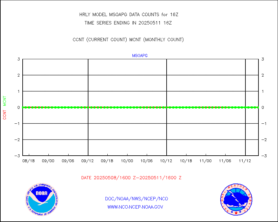
msokla |
Mesonet/MADIS Oklahoma Mesonet |
318 |
318 |
100.0 % |
1915.50-1916.49 |
msolju |
Mesonet/MADIS Louisiana State/Jackson State Univ. |
0 |
0 |
n/a |
1915.50-1916.49 |
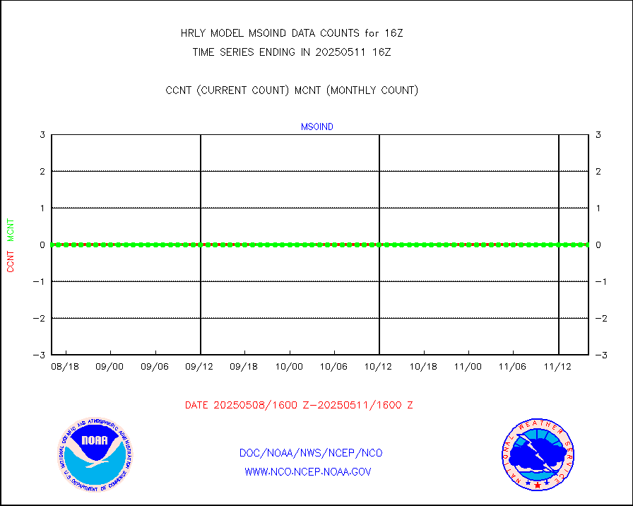
msomca |
Mesonet/MADIS Missouri Commercial Agricult Wx Net |
300 |
295 |
101.7 % |
1915.50-1916.49 |
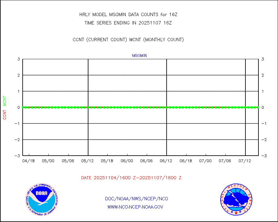
msomin |
Mesonet/MADIS Minnesota Dept. of Transportation |
0 |
0 |
n/a |
1915.50-1916.49 |
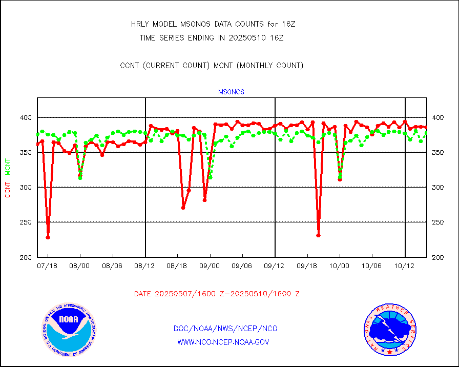
msonos |
Mesonet/MADIS NOS-Phys Oceanographic Realtime Sys |
395 |
381 |
103.7 % |
1915.50-1916.49 |
msoraw |
Mesonet/MADIS NFIC Remote Automated Wx Stns(RAWS) |
1941 |
1704 |
113.9 % |
1915.50-1916.49 |
msovir |
Mesonet/MADIS Virginia Dept. of Transportation |
208 |
229 |
90.8 % |
1915.50-1916.49 |
msowfy |
Mesonet/MADIS "Weather for You" |
0 |
0 |
n/a |
1915.50-1916.49 |
msowis |
Mesonet/MADIS Wisconsin Dept. of Transportation |
0 |
0 |
n/a |
1915.50-1916.49 |
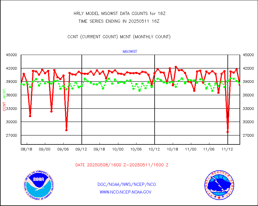
msowst |
Mesonet/MADIS MesoWest (many subproviders) |
47032 |
44673 |
105.3 % |
1915.50-1916.49 |
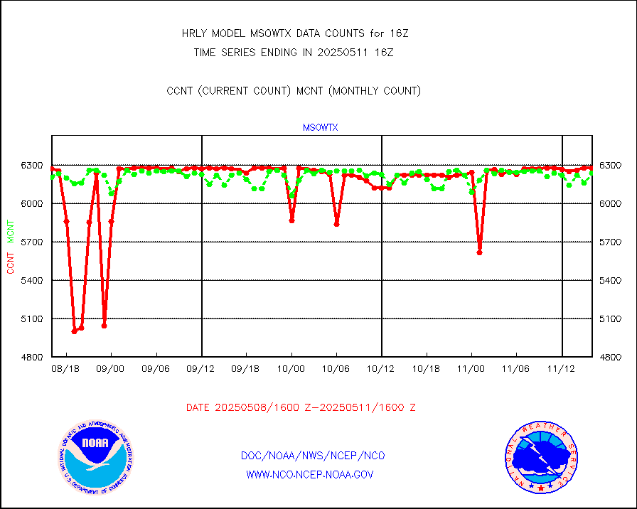
msowtx |
Mesonet/MADIS West Texas |
5658 |
5578 |
101.4 % |
1915.50-1916.49 |
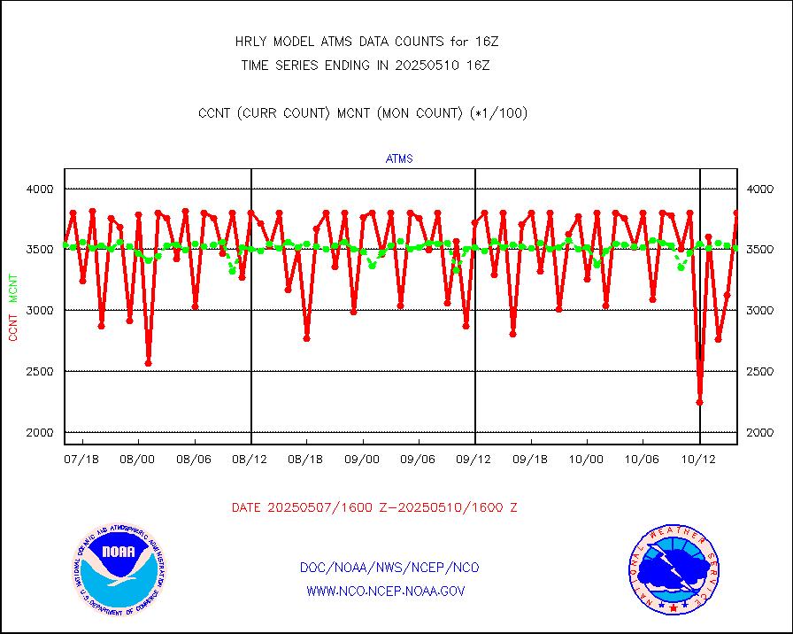
mtiasi |
METOP 1-2 IASI 1C radiance data (varbl. channels) |
106936 |
84073 |
127.2 % |
1914.00-1914.99 |
nxrdw |
NEXRAD Vel Azm Dsp(VAD) winds via radar coded msg |
0 |
0 |
n/a |
1915.50-1916.49 |
omi |
Aura Ozone Monitoring Instrument (OMI) data |
39300 |
38950 |
100.9 % |
1913.50-1914.49 |
osbuv8 |
NOAA 16-19 Solar Backscatter UV-2 rad frm V8 BUFR |
0 |
0 |
n/a |
1914.00-1914.99 |
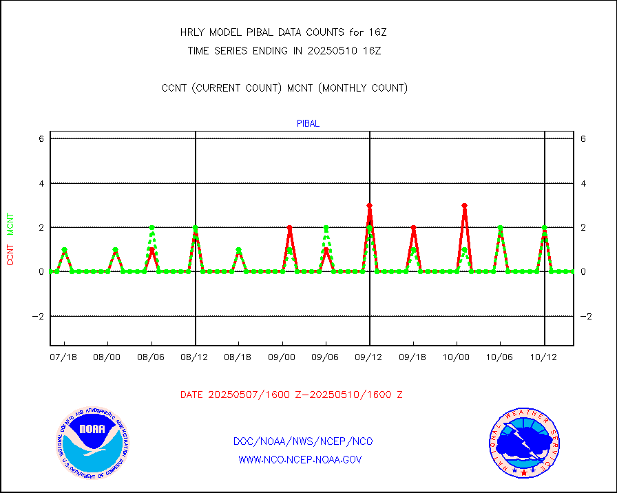
pibal |
PIBAL (from PILOT, PILOT SHIP, PILOT MOBIL) |
0 |
0 |
n/a |
1915.50-1916.49 |
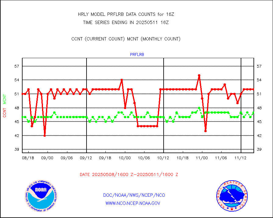
prflrb |
Multi-Agency Profiler (MAP) and SODAR winds |
35 |
41 |
85.4 % |
1915.50-1916.49 |
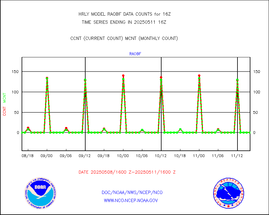
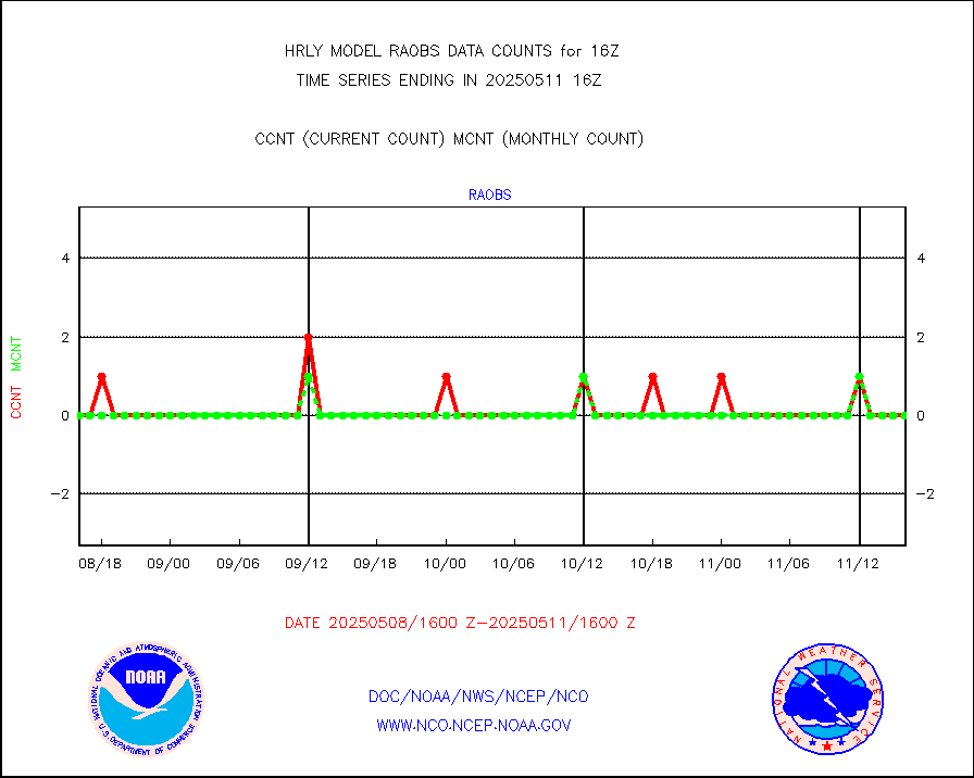
raobf |
Rawinsonde - fixed land (from TEMP or PILOT) |
0 |
0 |
n/a |
1915.50-1916.49 |
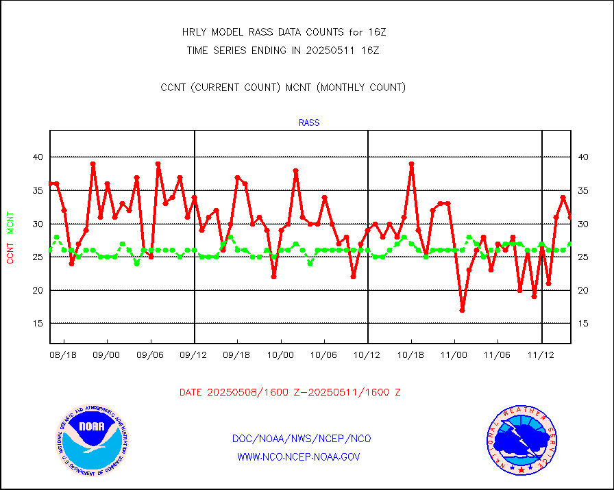
rass |
RASS temperatures (NOAA and Multi-Agency) |
24 |
26 |
92.3 % |
1915.50-1916.49 |
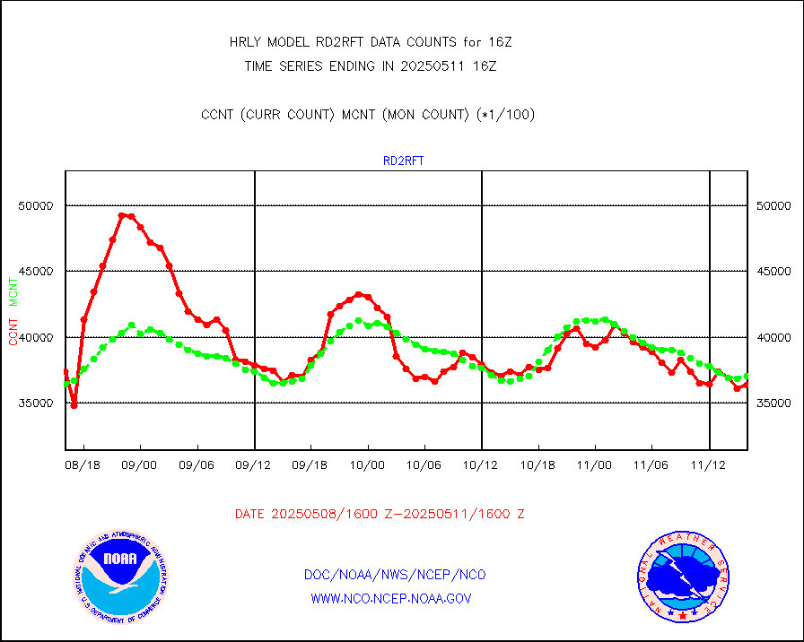
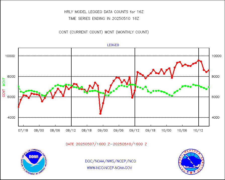
rd2rft |
NEXRAD reflectivity (Lvl 2 - GTS) |
3764455 |
3745405 |
100.5 % |
1915.50-1916.49 |
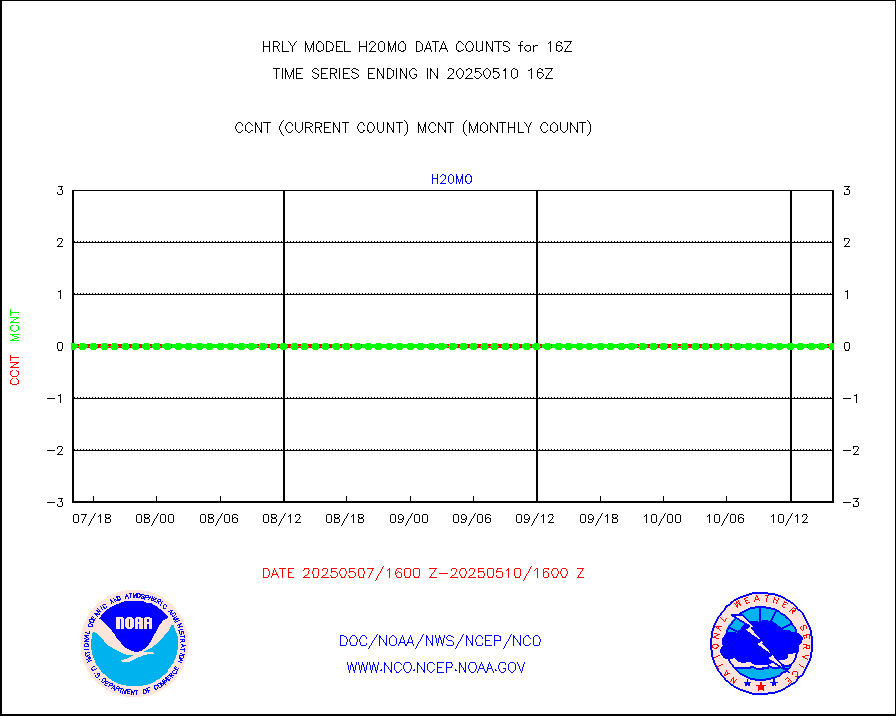
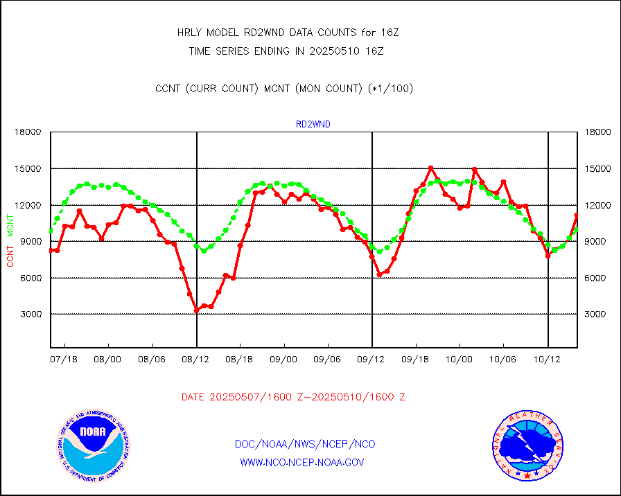
rd2wnd |
NEXRAD radial wind (Level 2 - GTS) |
1149803 |
1182314 |
97.3 % |
1915.50-1916.49 |
sevcsr |
METEOSAT-10 2nd Gen SEVIRI Clr Sky Radiance(proc) |
0 |
0 |
n/a |
1915.50-1916.49 |
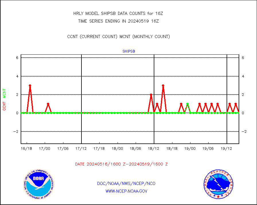
shipsb |
Ship - manual and automatic, restricted (BUFR) |
0 |
0 |
n/a |
1915.50-1916.50 |
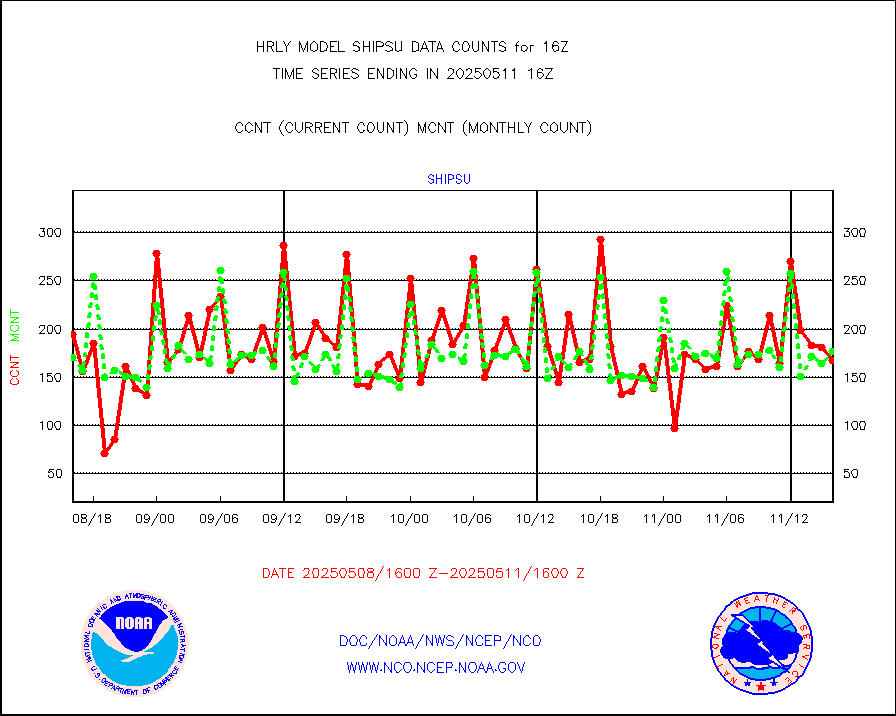
shipsu |
Ship - manual and automatic, unrestricted |
105 |
120 |
87.5 % |
1915.50-1916.50 |
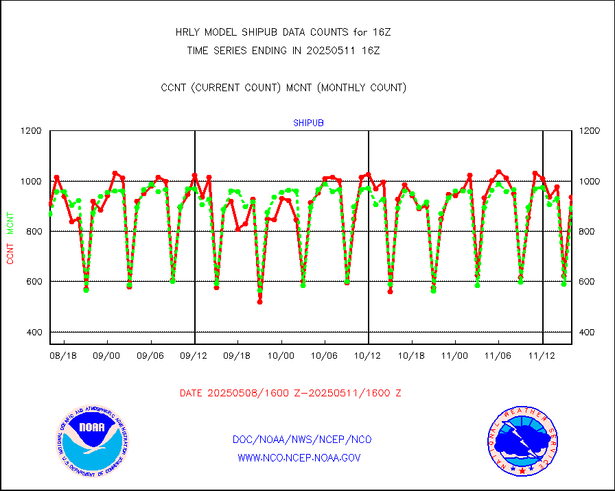
shipub |
Ship - manual and automatic, unrestricted (BUFR) |
776 |
736 |
105.4 % |
1915.50-1916.50 |
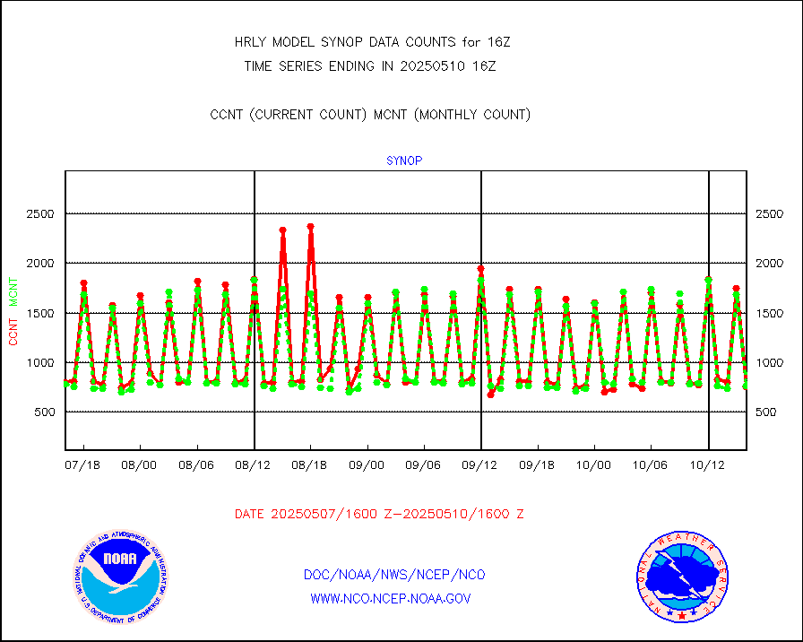
synop |
Synoptic - fixed manual and automatic |
943 |
896 |
105.2 % |
1915.50-1916.49 |
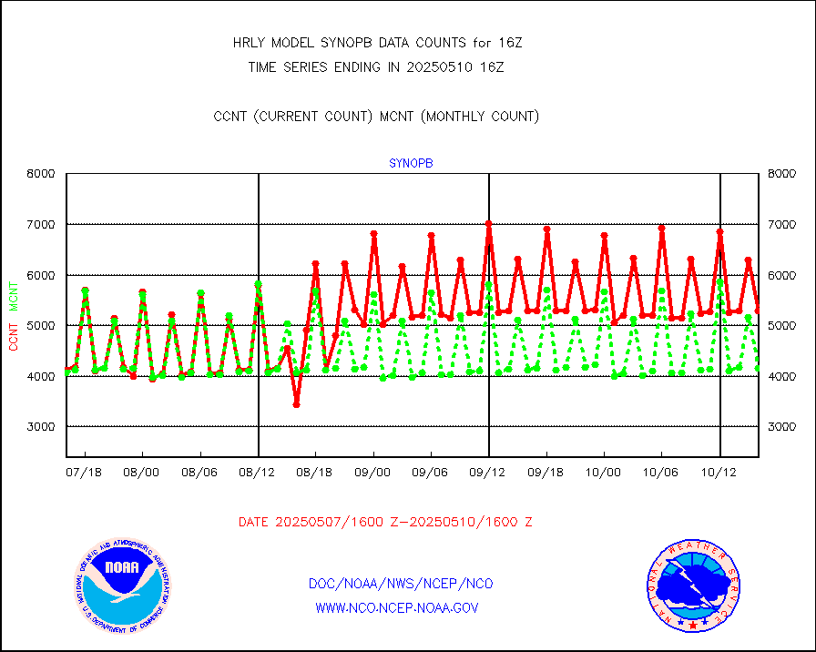
synopb |
Synoptic - fixed manual & auto (decoded fr BUFR) |
4181 |
4220 |
99.1 % |
1915.50-1916.49 |
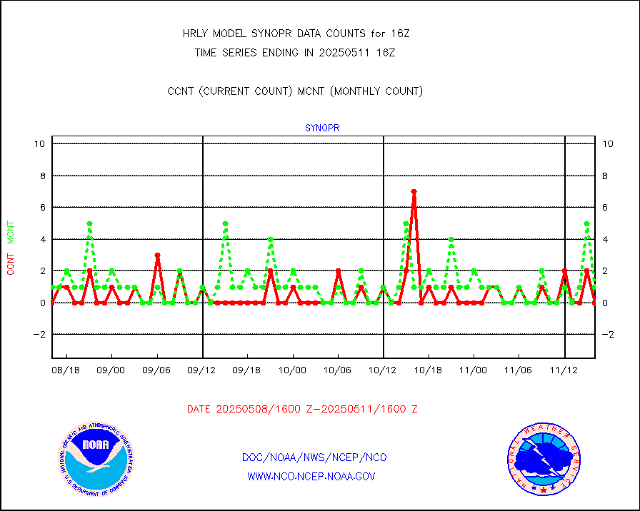
synopr |
Synoptic - restricted (WMO Res 40) manual & auto. |
0 |
1 |
0.0 % |
1915.50-1916.49 |
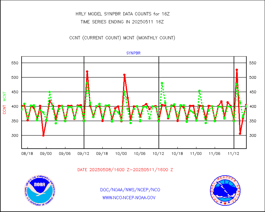
synpbr |
Synoptic - restricted (WMO Res 40)(decoded BUFR) |
397 |
397 |
100.0 % |
1915.50-1916.49 |
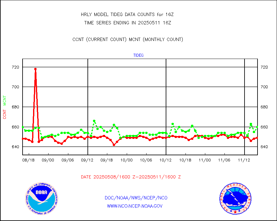
tideg |
Tide gauge reports decoded from CREX format |
645 |
642 |
100.5 % |
1915.00-1915.99 |
| Data Types of Opportunity with Normal Counts |
|---|
| Type | Description | Hourly Count | Monthly Average | Percent (%) of Monthly Mean | UTC Time Window |
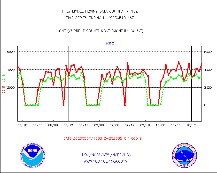
3p9usr |
GOES-16&up/NESDIS ir short-wv derived cld motion |
11551 |
13216 |
87.4 % |
1915.00-1915.99 |
acarsa |
MDCRS ACARS acft data (ARINC via AFWA)(AIREP fmt) |
0 |
0 |
n/a |
1915.50-1916.49 |
ahicsr |
Himawari Clear Sky Radiance |
0 |
0 |
n/a |
1915.00-1915.99 |
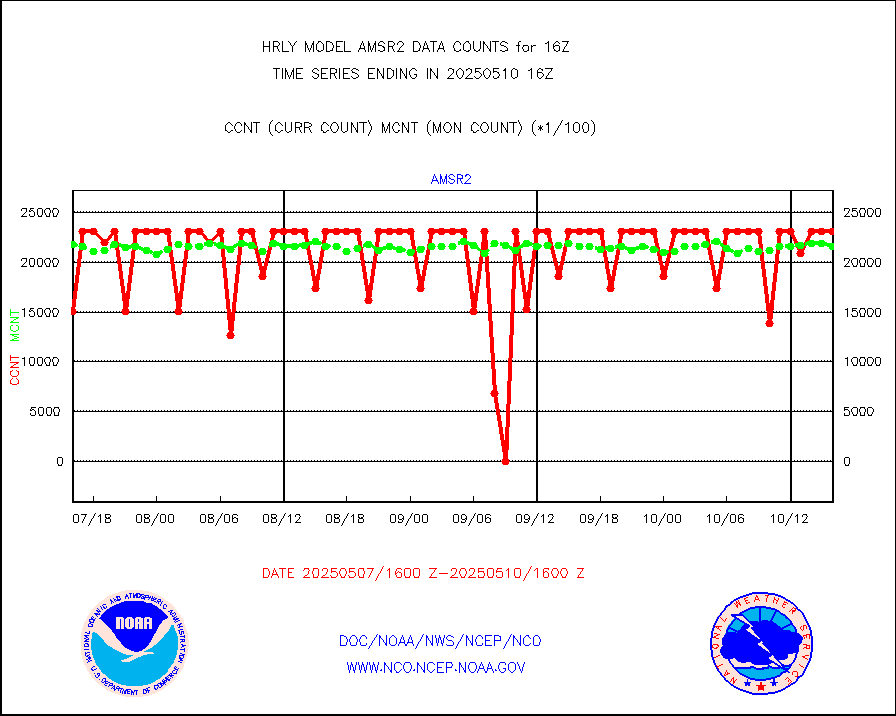
amsr2 |
GCOM-W AMSR2 1B brightness temperatures |
2310444 |
2101497 |
109.9 % |
1914.00-1914.99 |
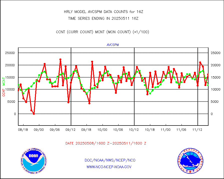
atmsdb |
NPP/NOAA-20 ATMS bright. temps-direct b-cast SSEC |
126079 |
134914 |
93.5 % |
1914.50-1915.49 |
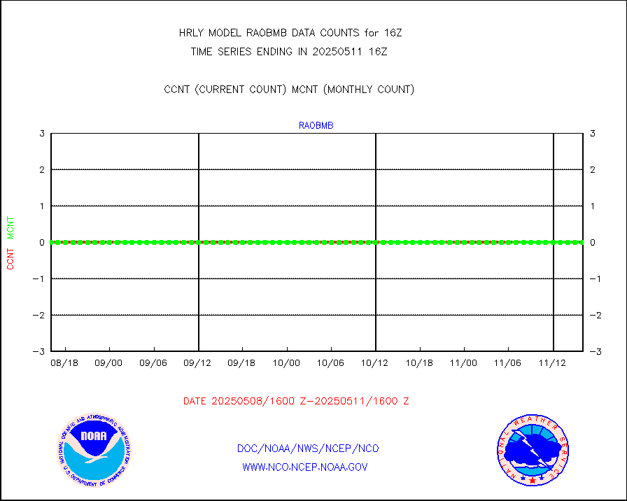
atovs |
POES/NESDIS - processed ATOVS soundings/radiances |
0 |
0 |
n/a |
1914.00-1914.99 |
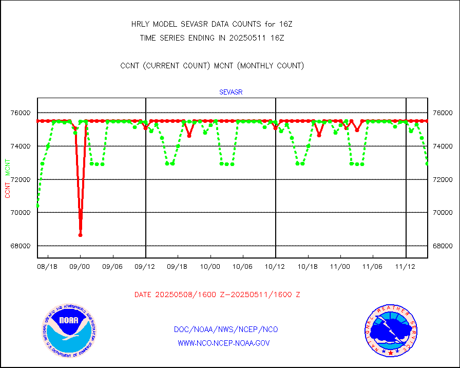
avcsam |
A.M.(N17,M2,M3) AVHRR GAC NCEP-proc clr&sea btmps |
863964 |
1054510 |
81.9 % |
1913.50-1914.49 |
avcspm |
P.M.(N18-19) AVHRR GAC NCEP-proc clr & sea btemps |
1202395 |
1225236 |
98.1 % |
1913.50-1914.49 |
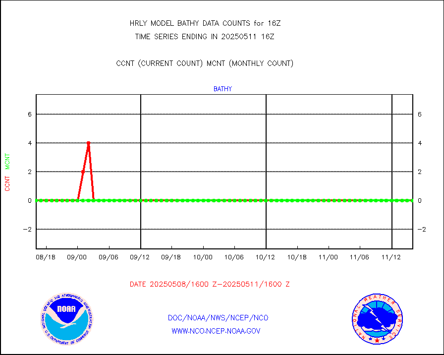
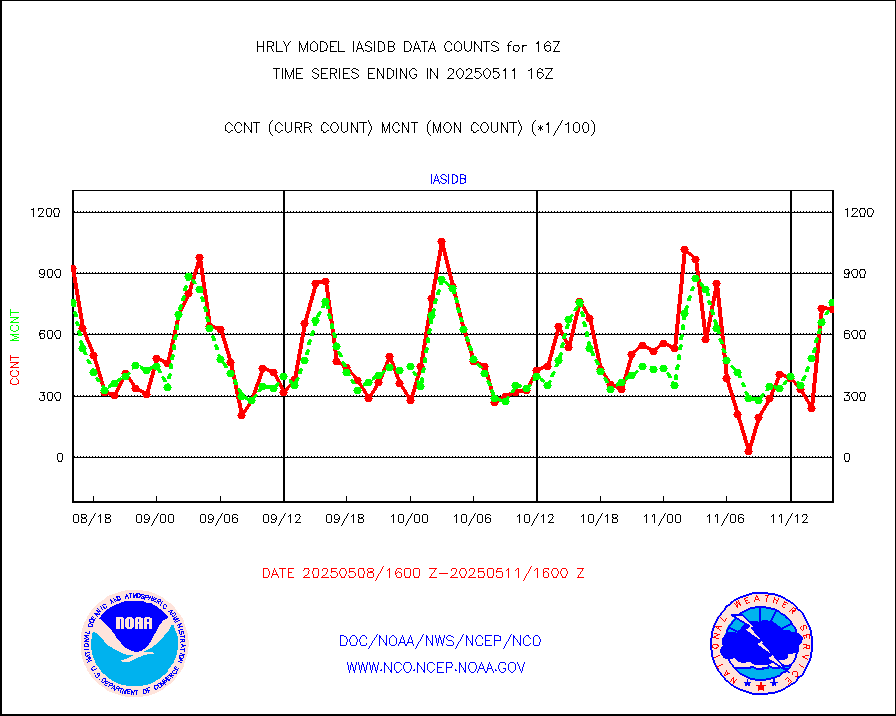
bathy |
eXpendable BathyThermograph, mooring (BATHY fmt) |
0 |
0 |
n/a |
1909.00-1909.99 |
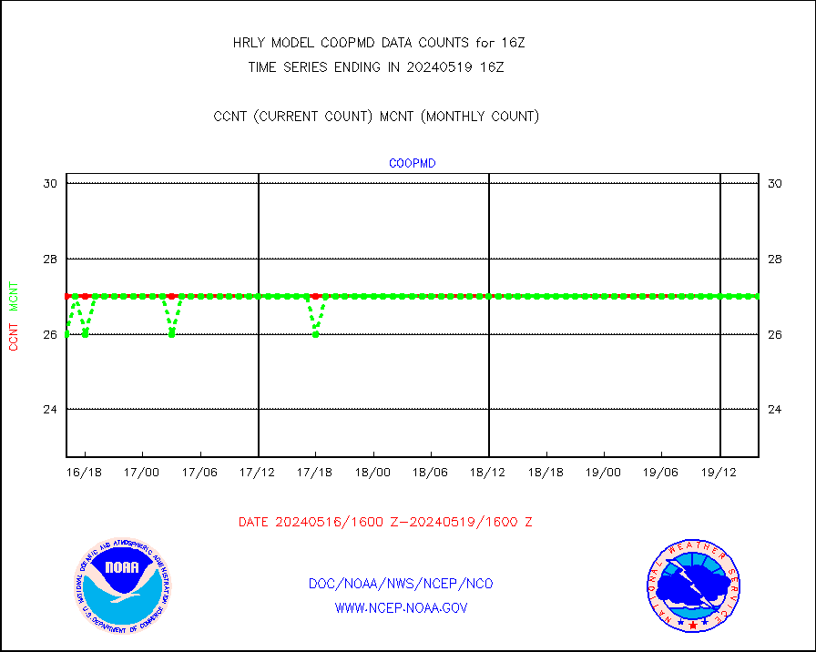
coopmd |
Coop/MADIS NEPP & HCN-Modernization NOAA COOP Obs |
27 |
27 |
100.0 % |
1915.50-1916.49 |
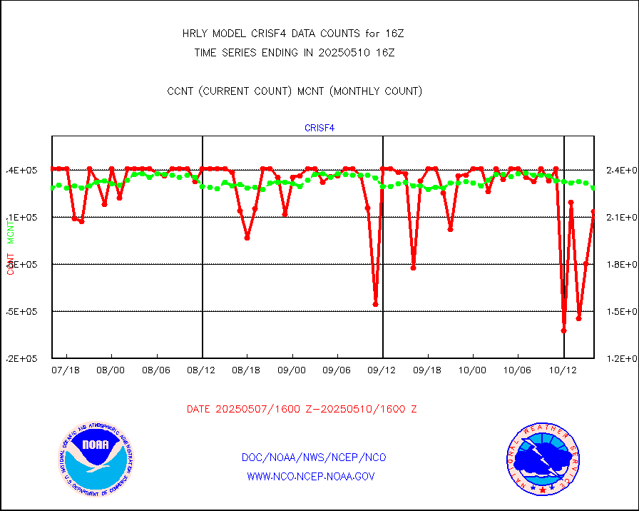
crisf4 |
NPP/NOAA-20 CrIS full spctrl radn (431 ch subset) |
201330 |
229179 |
87.8 % |
1914.50-1915.49 |
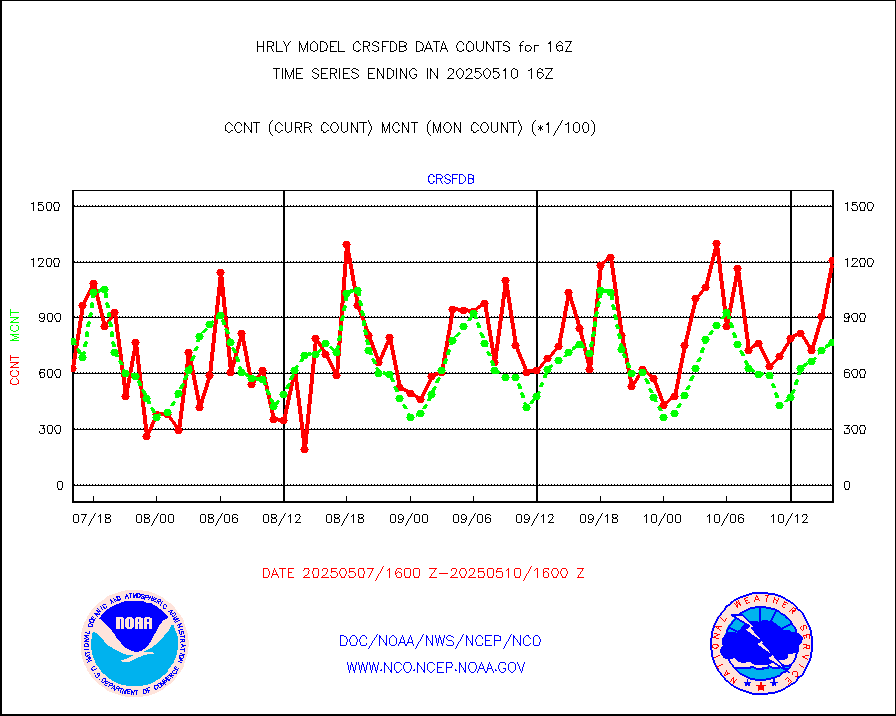
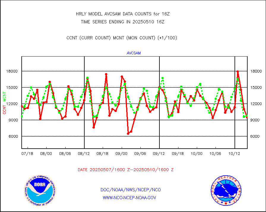
crsfdb |
NPP/NOAA-20 CrIS full spctrl radn dir brdcst SSEC |
71050 |
119017 |
59.7 % |
1914.50-1915.49 |
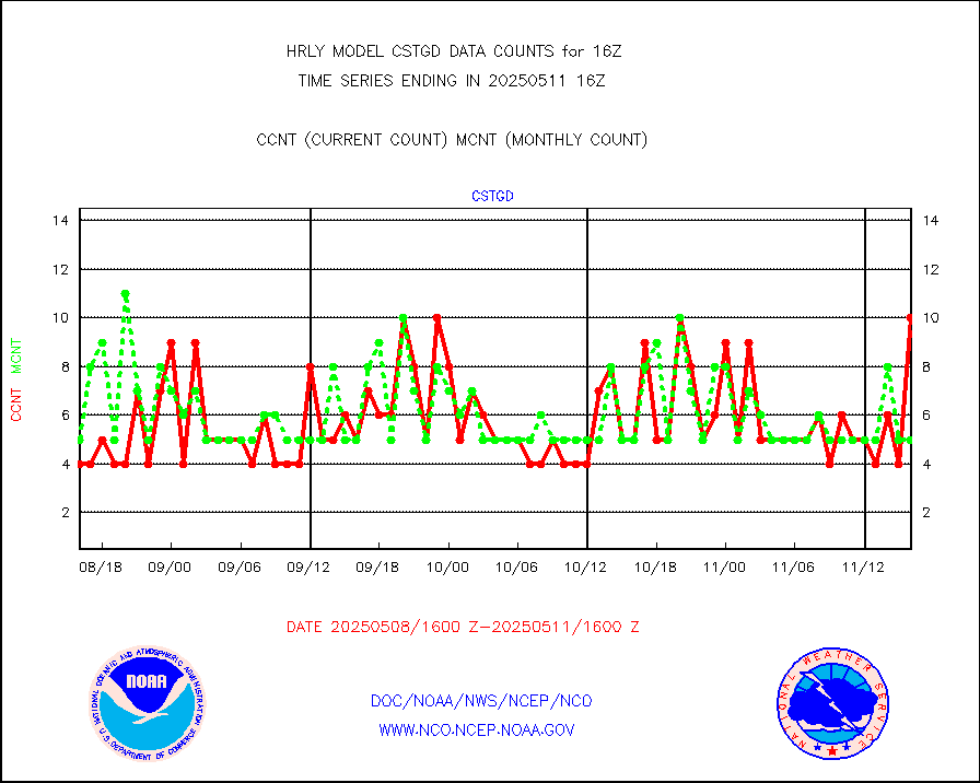
cstgd |
Coast Guard |
3 |
3 |
100.0 % |
1915.50-1916.50 |
dbuoyb |
Drifting buoys (decoded from BUFR) |
1423 |
1399 |
101.7 % |
1915.50-1916.50 |
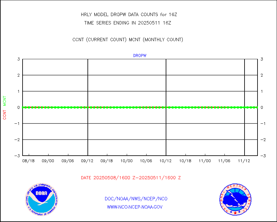
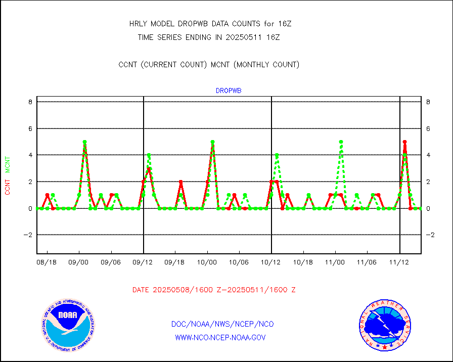
dropw |
Dropwinsonde (from TEMP DROP) |
0 |
0 |
n/a |
1915.50-1916.49 |
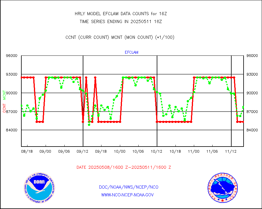
efclam |
GOES imager effective cloud amount data (U.Wisc.) |
8285485 |
8230222 |
100.7 % |
1915.50-1916.49 |
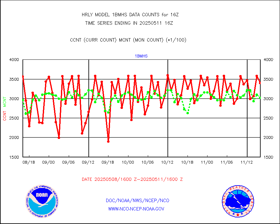
esatms |
NPP Adv. Tech. MW Sndr (ATMS) br. temps from RARS |
86876 |
113150 |
76.8 % |
1914.50-1915.49 |
esiasi |
METOP 1-2 IASI 1C radiance data vbl chn from RARS |
46275 |
49406 |
93.7 % |
1915.00-1915.99 |
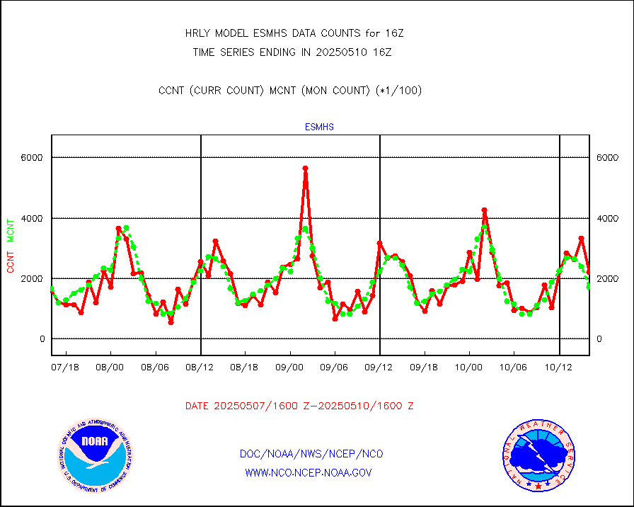
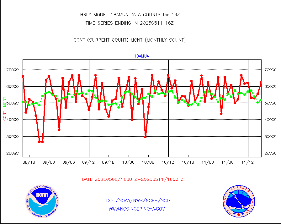
esmhs |
NOAA 18-19 & METOP 1-2 MHS proc. btemps from RARS |
141542 |
182814 |
77.4 % |
1915.50-1916.49 |
geoimr |
GOES/NESDIS (11x17 f-o-v) imager clear radiances |
0 |
0 |
n/a |
1915.00-1915.99 |
gome |
METOP 1-2 Global Ozone Monitoring Exp.-2 (GOME-2) |
13018 |
6547 |
198.8 % |
1914.50-1915.49 |
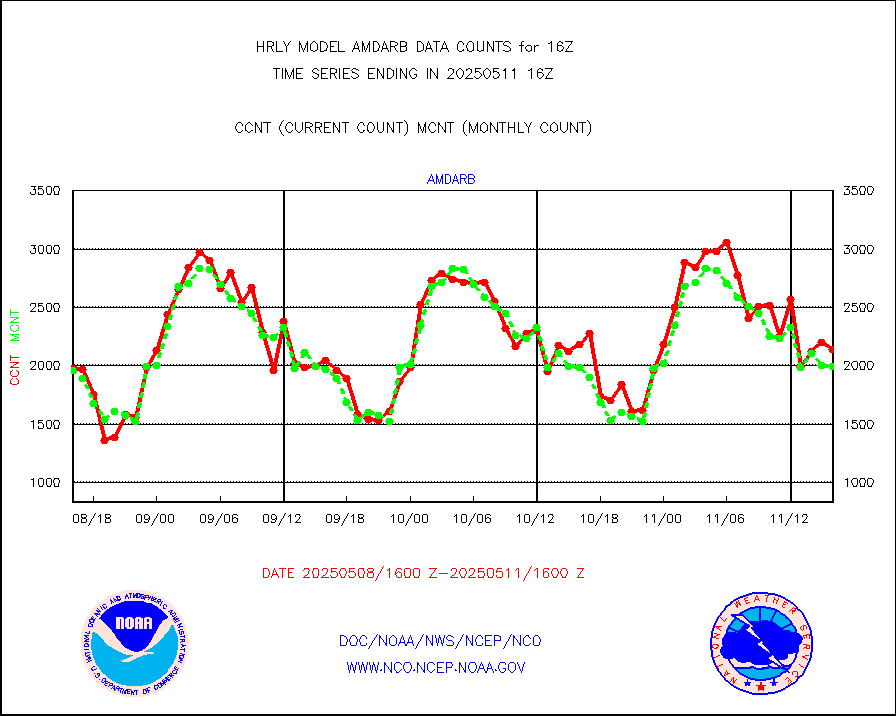
h20in2 |
INDIA SATWIND, INSAT WV channel |
2504 |
5505 |
45.5 % |
1915.00-1915.99 |
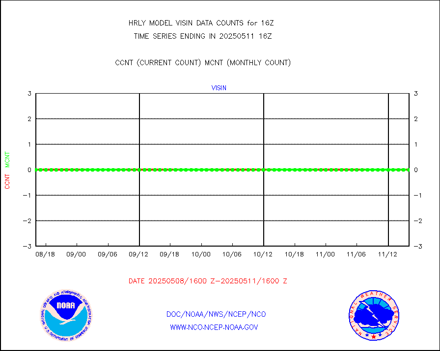
h2dusr |
GOES-16&up/NESDIS wv imgr/deep-lyr derivd cld mtn |
5977 |
16371 |
36.5 % |
1915.00-1915.99 |
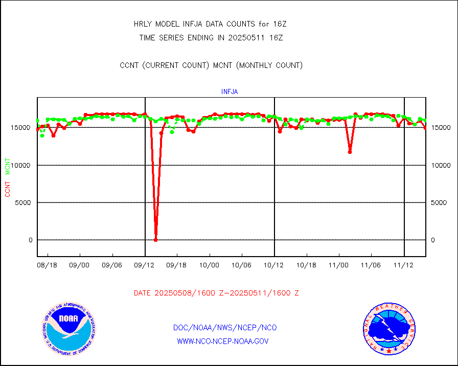
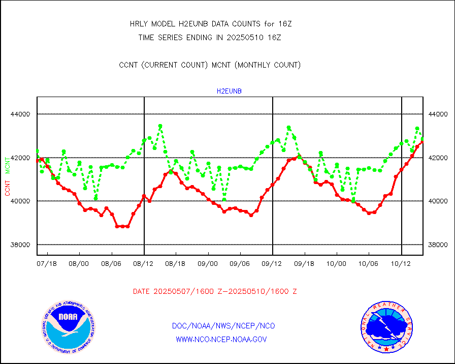
h2eunb |
METEOSAT/EUMETSAT wvpr imgr drv cld motion NBseq |
41704 |
42802 |
97.4 % |
1914.50-1915.49 |
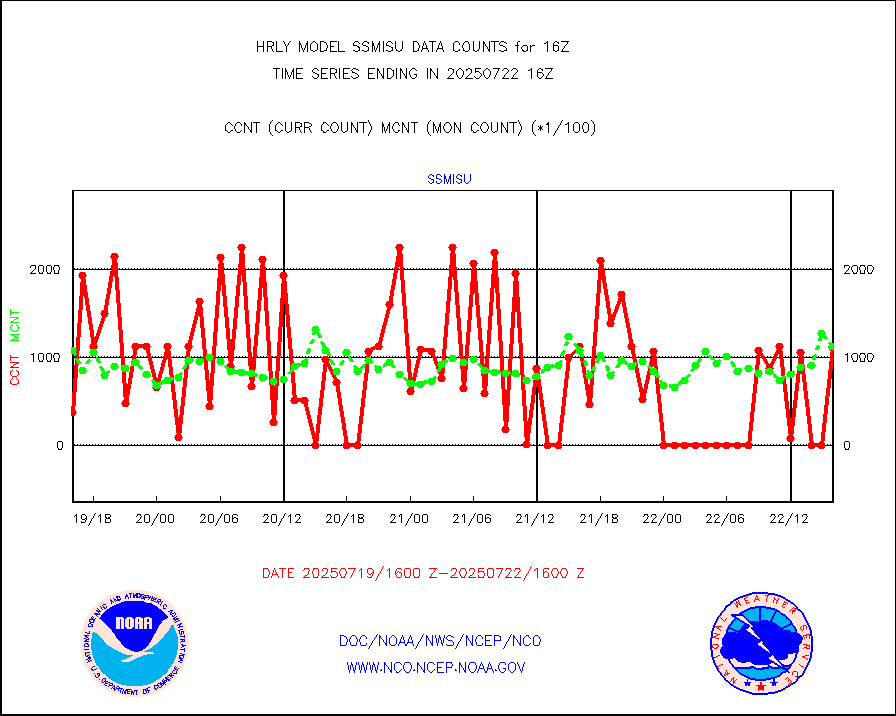
iasidb |
METOP 1-2 IASI 1C radiances-direct broadcast SSEC |
41016 |
62042 |
66.1 % |
1914.50-1915.49 |
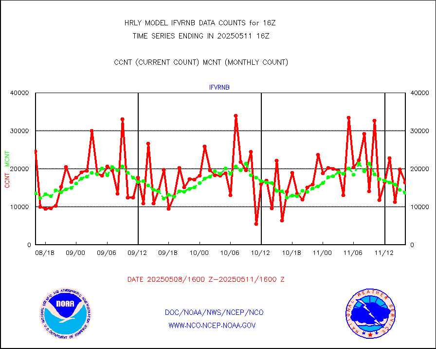
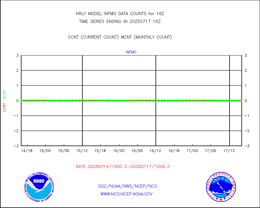
ifvrnb |
VIIRS (NPP/NOAA-20) ir lg-wv drv cloud motion(NB) |
15993 |
14291 |
111.9 % |
1912.00-1912.99 |
infav |
AVHRR (NOAA/METOP) ir lg-wave derived cld motion |
0 |
0 |
n/a |
1912.00-1912.99 |
infav1 |
AVHRR (METOP) ir lg-wave derived cld motion |
0 |
0 |
n/a |
1915.50-1916.50 |
infin |
INSAT/KALPANA India ir lg-wave derived cld motion |
0 |
0 |
n/a |
1913.50-1914.49 |
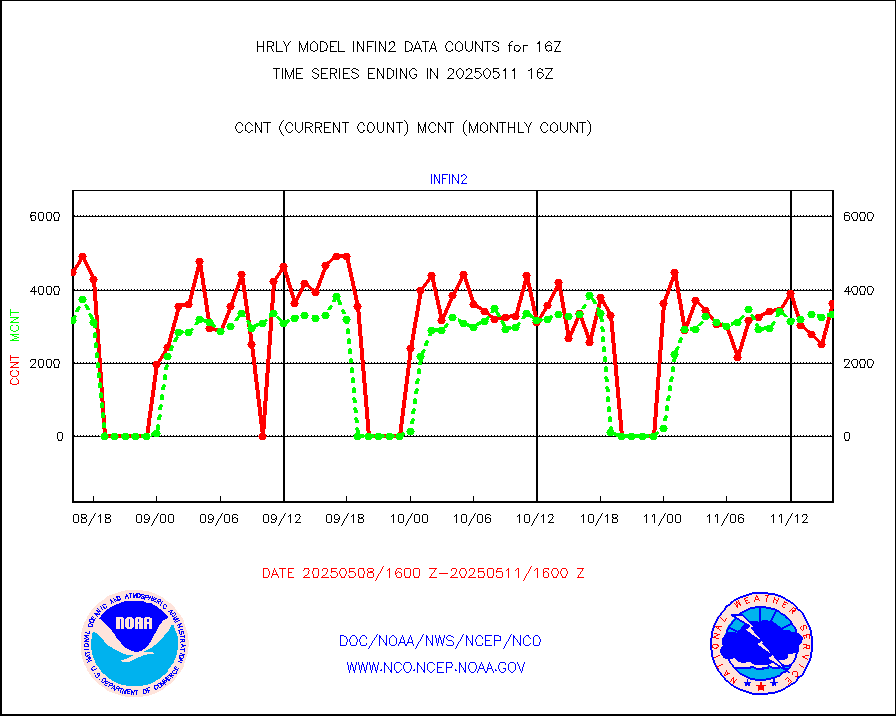
infin2 |
INDIA SATWIND, INSAT IR channel |
2953 |
5457 |
54.1 % |
1915.00-1915.99 |
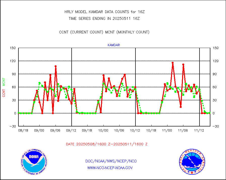
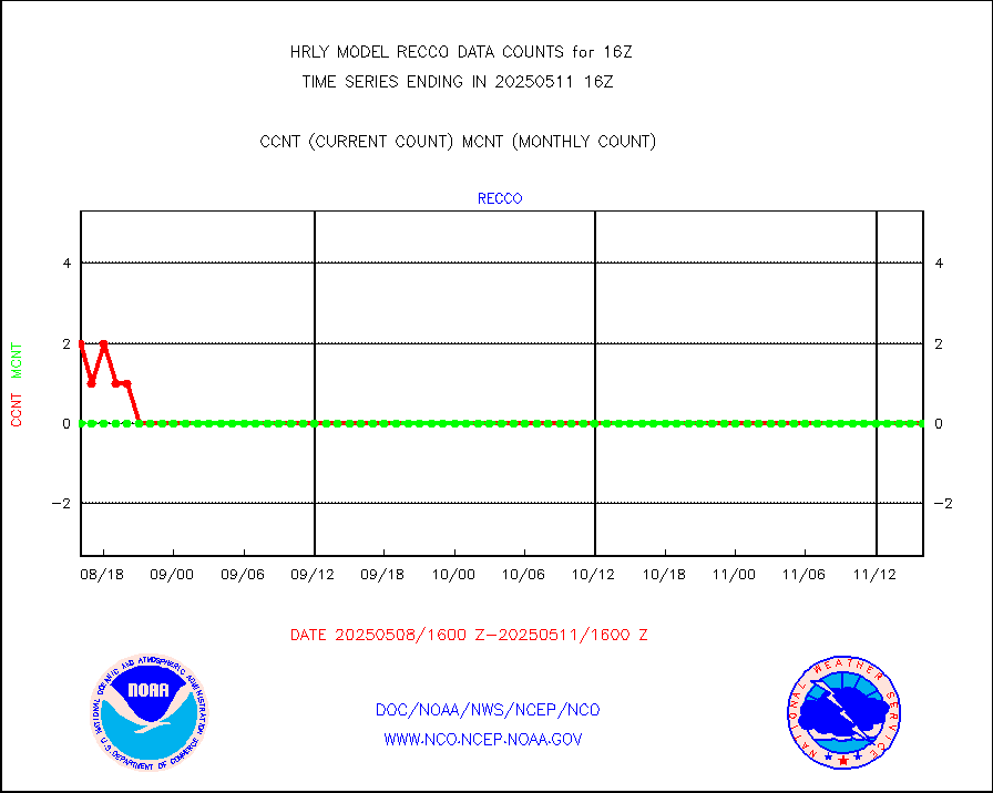
kamdar |
Korean AMDAR aircraft data (decoded from BUFR) |
0 |
0 |
n/a |
1915.50-1916.49 |
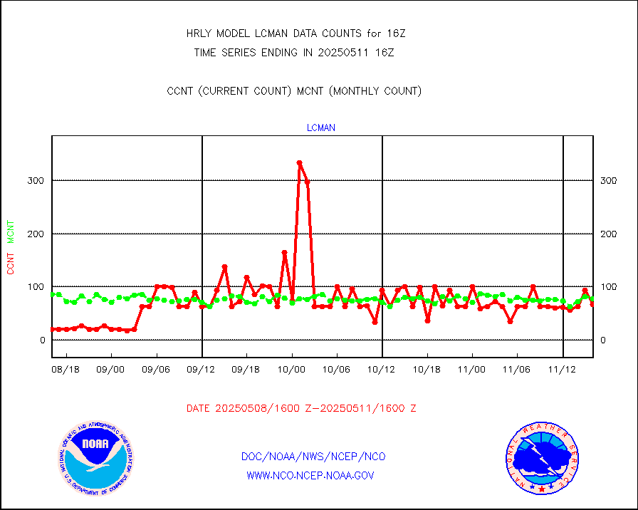
lcman |
Land-based CMAN stations decoded from CMAN format |
75 |
89 |
84.3 % |
1915.50-1916.49 |
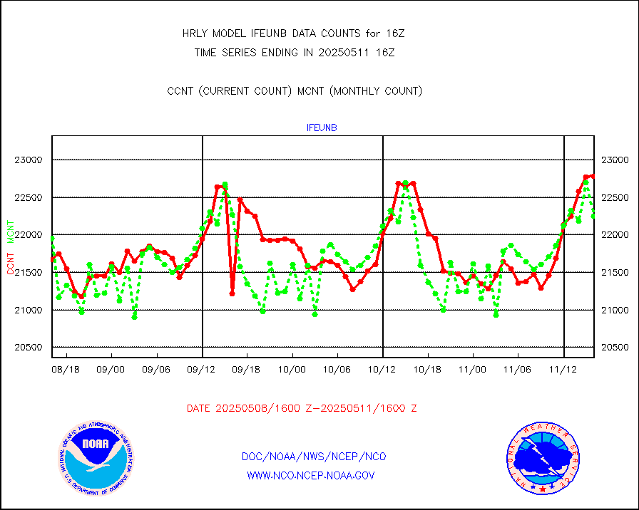
leogeo |
LEO-GEO satellite AMVs from UWisc. |
5399 |
4780 |
112.9 % |
1912.00-1912.99 |
ltnglr |
LLDN Long-rng lightning from Vaisala via NOAAPORT |
267340 |
170277 |
157.0 % |
1915.50-1916.49 |
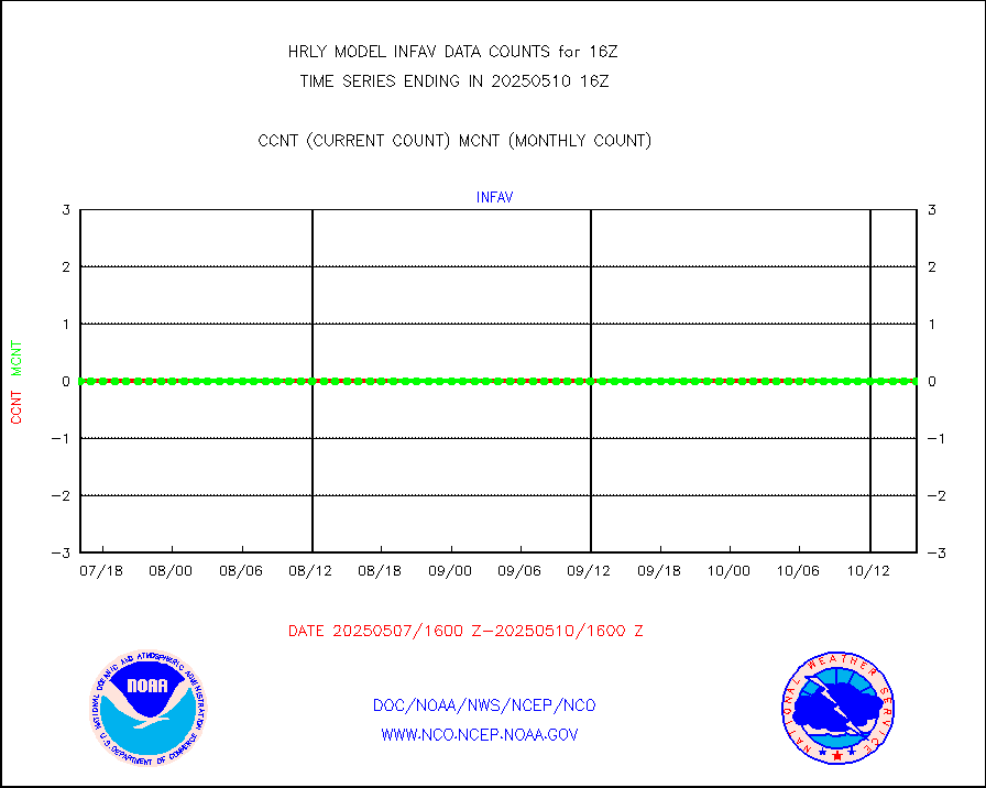
ltngsr |
NLDN Shrt-rng lightning from Vaisala via NOAAPORT |
8426 |
2261 |
372.7 % |
1915.50-1916.49 |
mbuoyb |
Moored buoys (decoded from BUFR) |
814 |
732 |
111.2 % |
1915.50-1916.50 |
mls |
Aura Microwave Limb Sounder (MLS) ozone data |
0 |
0 |
n/a |
1914.00-1914.99 |
msourb |
Mesonet/MADIS UrbaNet |
4324 |
4351 |
99.4 % |
1915.50-1916.49 |
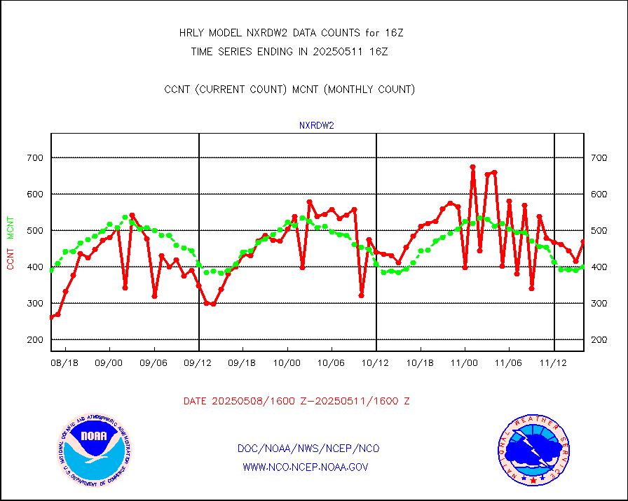
nxrdw2 |
NEXRAD Vel Azm Dsp(VAD) winds via Level 2 decoder |
417 |
424 |
98.3 % |
1915.50-1916.49 |
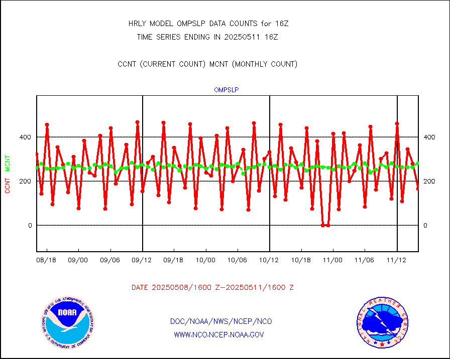
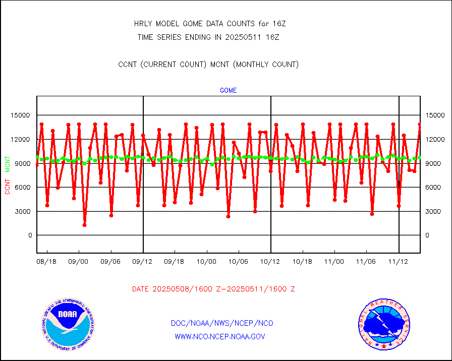
ompslp |
OMPS Limb Profiler ozone data (NPP) |
107 |
280 |
38.2 % |
1909.00-1909.99 |
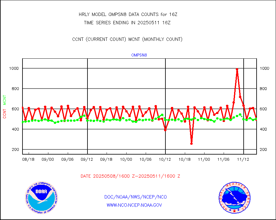
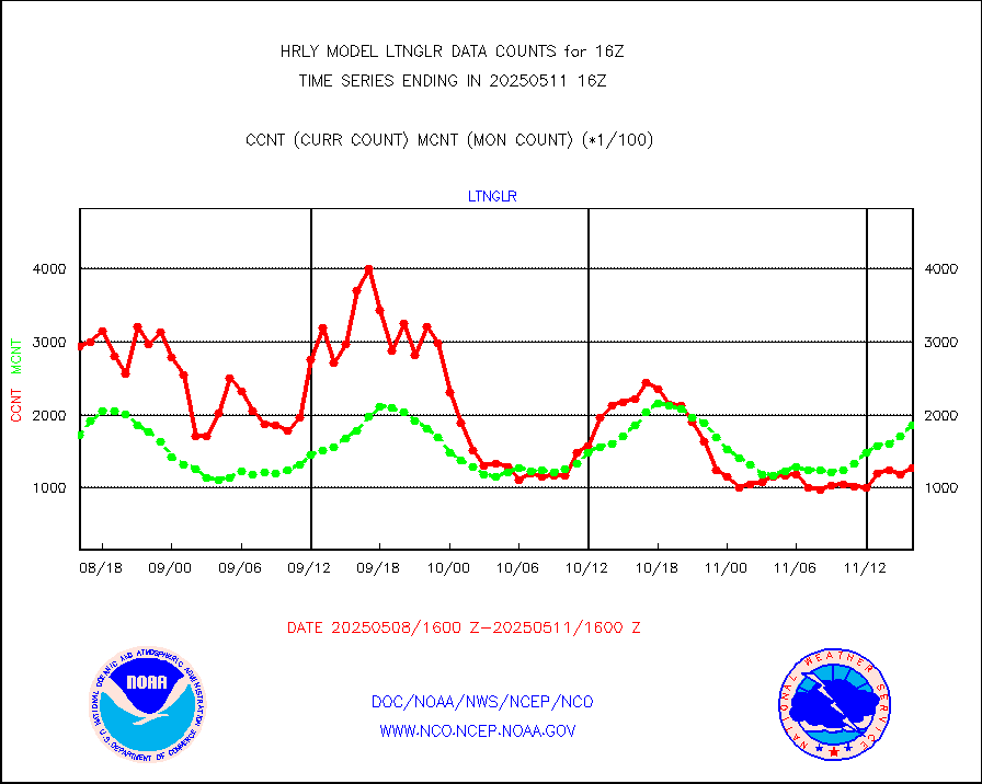
ompsn8 |
OMPS nadir profile ozone (Version 8 BUFR) |
508 |
566 |
89.8 % |
1914.00-1914.99 |
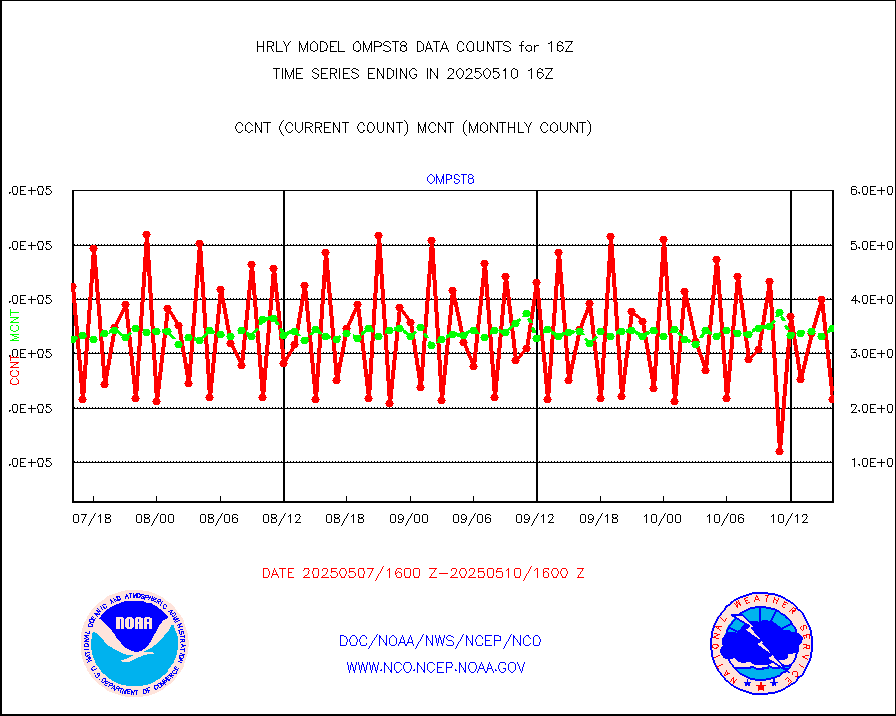
ompst8 |
OMPS total column ozone (Version 8 BUFR) |
276299 |
340288 |
81.2 % |
1914.00-1914.99 |
pirep |
Manual PIREP aircraft data (dcded from AIREP fmt) |
163 |
152 |
107.2 % |
1915.50-1916.49 |
prflrp |
Profilr winds from PIBAL (PILOT,PILOT SHIP/MOBIL) |
0 |
0 |
n/a |
1915.50-1916.49 |
raobm |
Rawinsonde - mobile land (from TEMP/PILOT MOBIL) |
0 |
0 |
n/a |
1915.50-1916.49 |
raobs |
Rawinsonde - ship (from TEMP SHIP, PILOT SHIP) |
0 |
0 |
n/a |
1915.50-1916.49 |
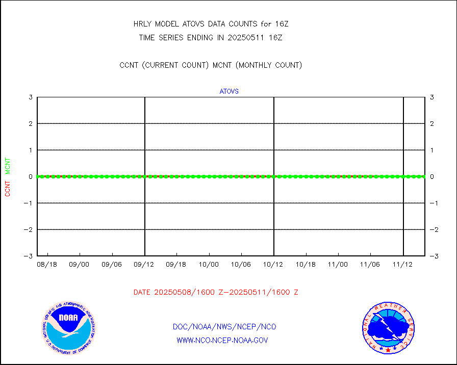
recco |
Flight level reconnaissance aircraft data |
0 |
0 |
n/a |
1915.50-1916.49 |
saphir |
Megha-Tropiques SAPHIR L1A2 brightness temps |
0 |
0 |
n/a |
1913.50-1914.49 |
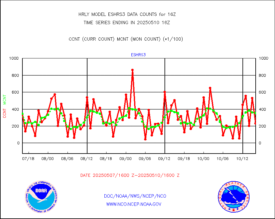
sevasr |
METEOSAT-10 2nd Gen SEVIRI All Sky Radiance(proc) |
75512 |
75482 |
100.0 % |
1915.50-1916.49 |
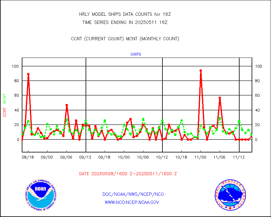
ships |
Ship - manual and automatic, restricted |
0 |
3 |
0.0 % |
1915.50-1916.49 |
ssmisu |
DMSP SSM/IS 1C radiance data (Unified Pre-Proc.) |
83580 |
118170 |
70.7 % |
1914.50-1915.49 |
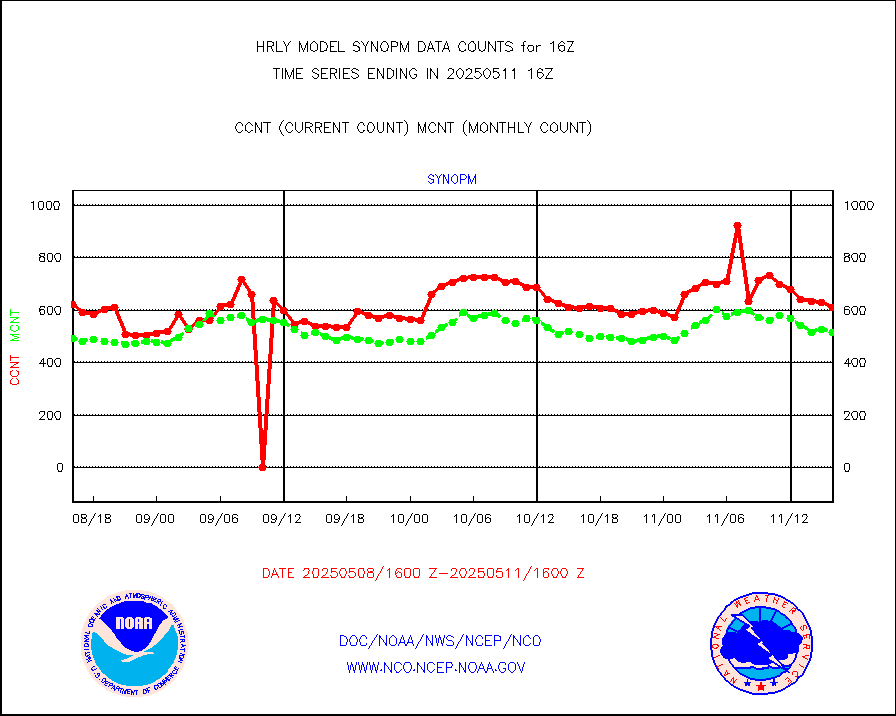
synopm |
Synoptic - mobile manual and automatic |
568 |
556 |
102.2 % |
1915.50-1916.49 |
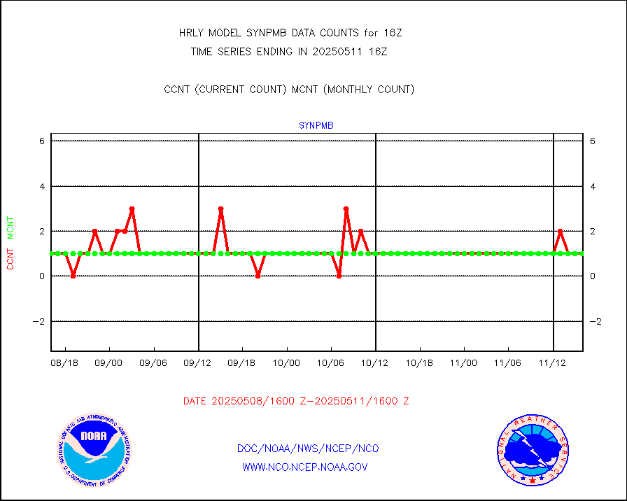
synpmb |
Synoptic - mobile manual & auto (decoded fr BUFR) |
0 |
1 |
0.0 % |
1915.50-1916.49 |
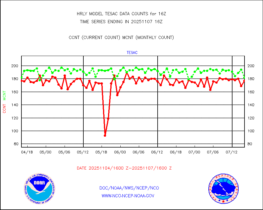
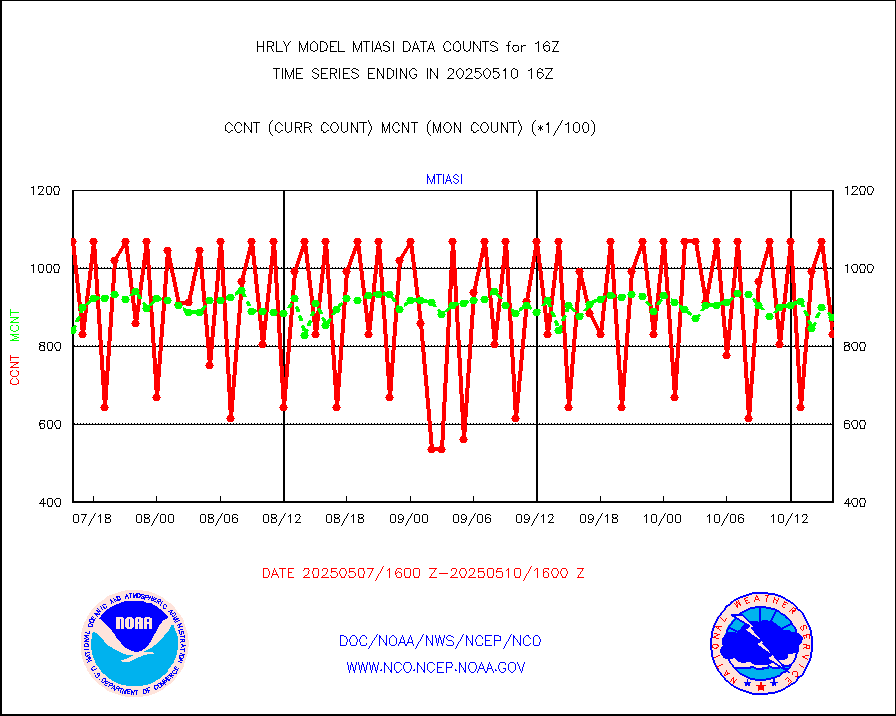
tesac |
CTD probe, Argo prflng float, mooring (TESAC fmt) |
190 |
189 |
100.5 % |
1915.50-1916.49 |
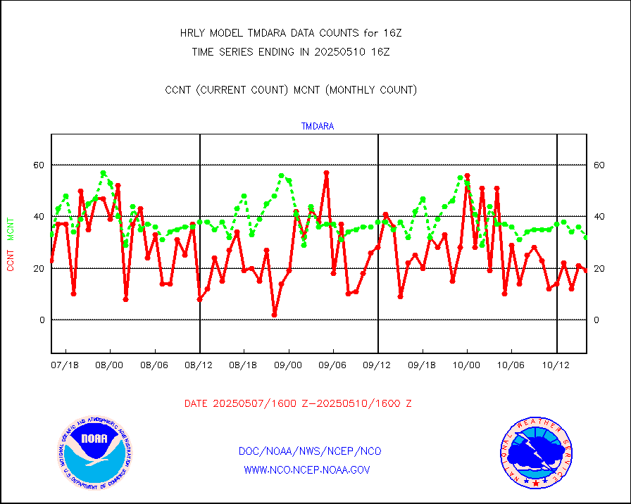
tmdara |
TAMDAR aircft data-all types(from Panasonic,BUFR) |
191 |
228 |
83.8 % |
1915.50-1916.49 |
trkob |
ThermoSalinoGraph (TSG) TRACKOB format) |
90 |
44 |
204.5 % |
1914.50-1915.49 |
visin |
INSAT/KALPANA India visible derived cloud motion |
0 |
0 |
n/a |
1913.50-1914.49 |
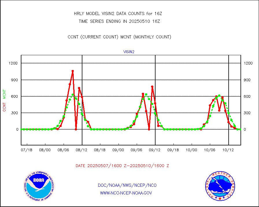
visin2 |
INDIA SATWIND, INSAT VIS channel |
0 |
0 |
n/a |
1915.00-1915.99 |
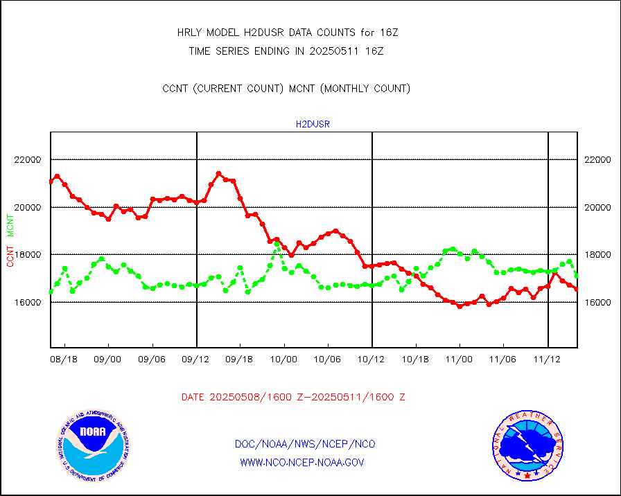
visja |
MTSAT/JMA visible derived cloud motion |
0 |
0 |
n/a |
1913.50-1914.49 |
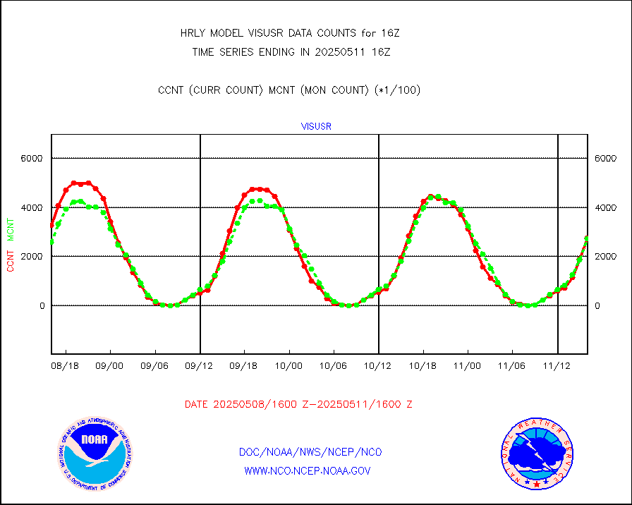
visusr |
GOES-16&up/NESDIS visible derived cloud motion |
336759 |
279328 |
120.6 % |
1915.00-1915.99 |
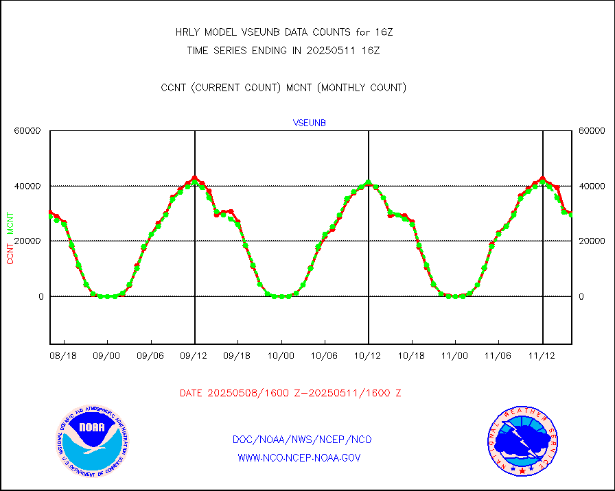
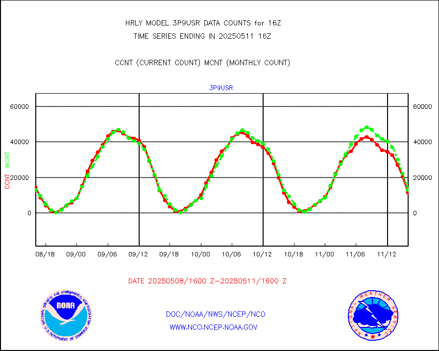
vseunb |
METEOSAT/EUMETSAT visible drv cld motion NBseq |
27875 |
28874 |
96.5 % |
1914.50-1915.49 |


