| Critical Data with Normal Counts |
|---|
| Type | Description | Hourly Count | Monthly Average | Percent (%) of Monthly Mean | UTC Time Window |
1bamua |
NOAA 15-19 & METOP 1-2 AMSU-A NCEP-proc. br.temps |
44740 |
58802 |
76.1 % |
1913.00-1913.99 |
1bhrs4 |
NOAA 18-19 & METOP 1-2 HIRS-4 NCEP-proc. br.temps |
53274 |
50588 |
105.3 % |
1913.00-1913.99 |
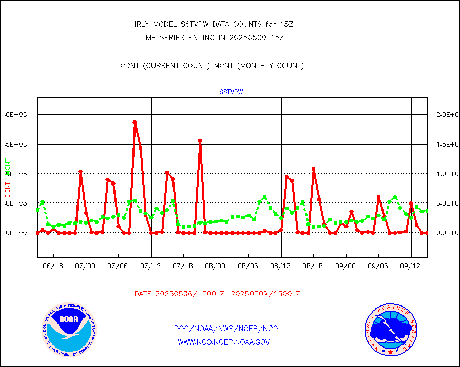
1bmhs |
NOAA 18-19 & METOP 1-2 MHS NCEP-proces. br. temps |
195618 |
314540 |
62.2 % |
1913.00-1913.99 |
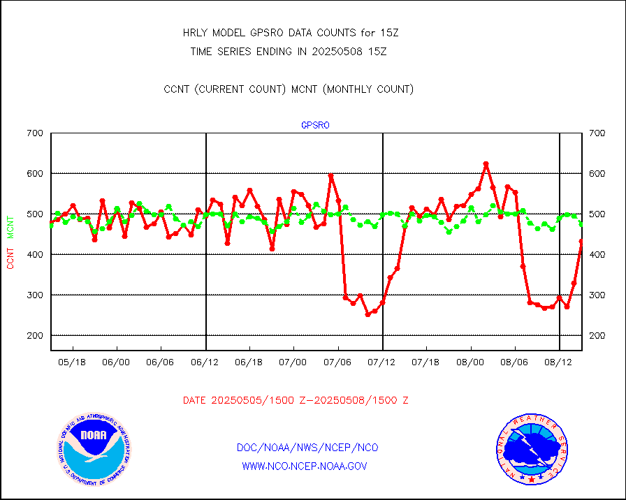
acars |
MDCRS ACARS acft data from ARINC(dcded from BUFR) |
20137 |
16649 |
121.0 % |
1914.50-1915.49 |
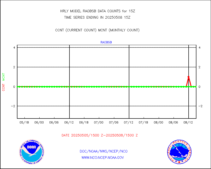
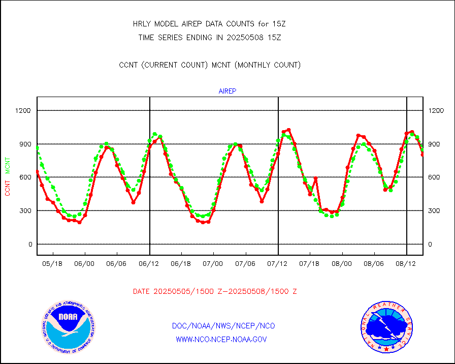
airep |
Manual AIREP aircraft data (dcded from AIREP fmt) |
1530 |
1428 |
107.1 % |
1914.50-1915.49 |
airsev |
AQUA AIRS/AMSU-A/HSB brightness temps- every FOV |
0 |
0 |
n/a |
1912.50-1913.49 |
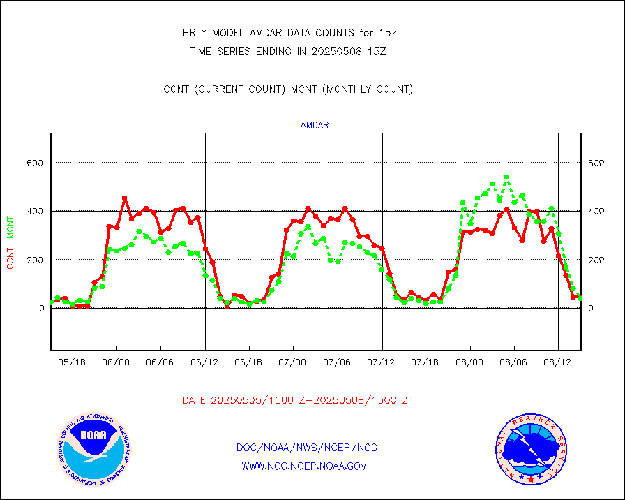
amdar |
AMDAR aircraft data (decoded from AMDAR format) |
58 |
26 |
223.1 % |
1914.50-1915.49 |
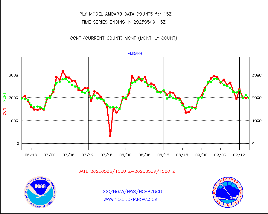
amdarb |
AMDAR aircraft data (decoded from BUFR) |
353 |
327 |
108.0 % |
1914.50-1915.49 |
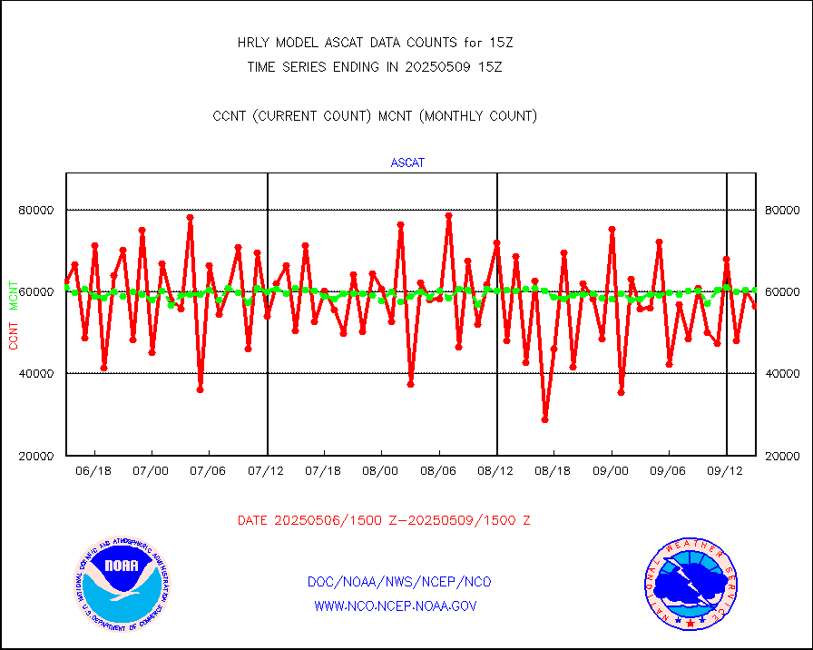
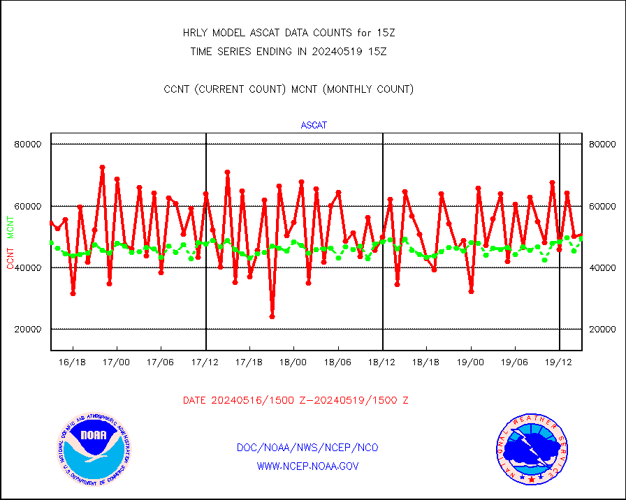
ascat |
METOP 1-2 ASCAT products |
50484 |
49389 |
102.2 % |
1913.50-1914.49 |
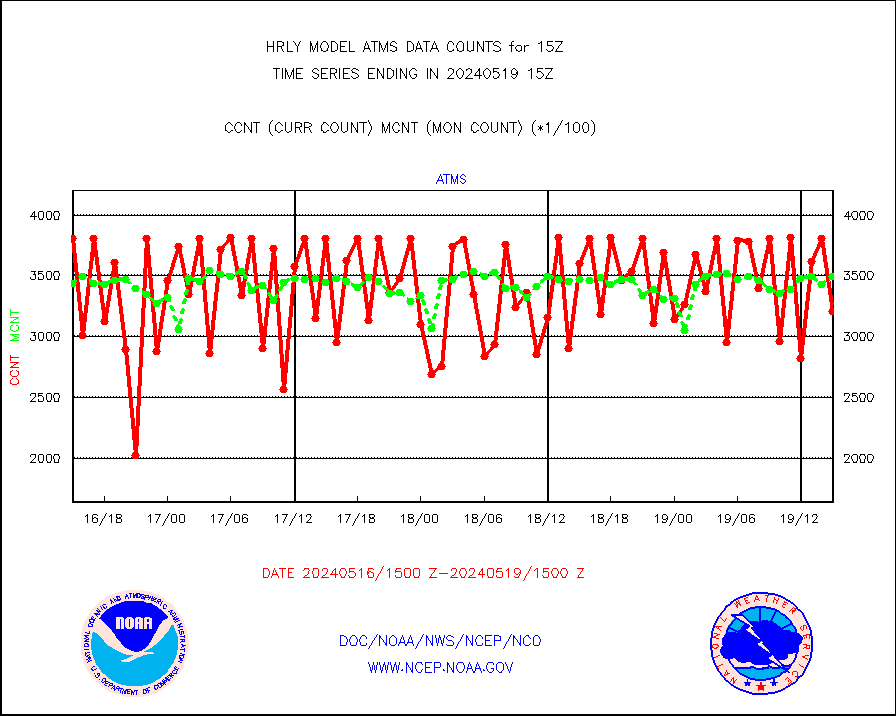
atms |
NPP/NOAA-20 ATMS brightness temperatures |
320640 |
349533 |
91.7 % |
1913.50-1914.49 |
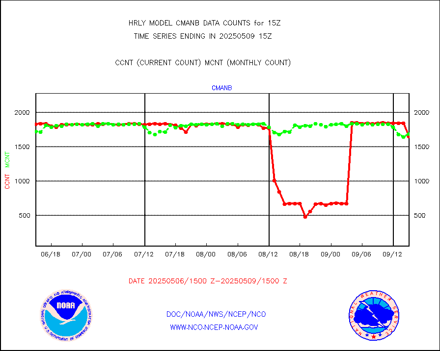
cmanb |
Surface Marine CMAN rpts decoded from BUFR format |
1785 |
1807 |
98.8 % |
1914.50-1915.50 |
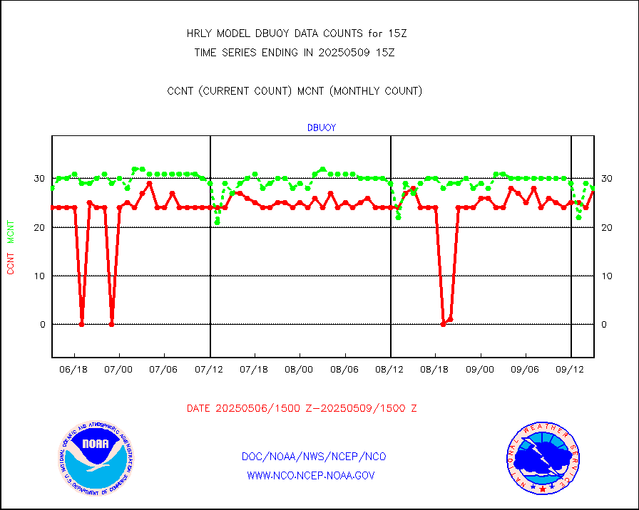
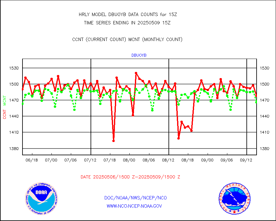
dbuoy |
Buoys decoded from FM-18 fmt (moored or drifting) |
39 |
34 |
114.7 % |
1914.50-1915.49 |
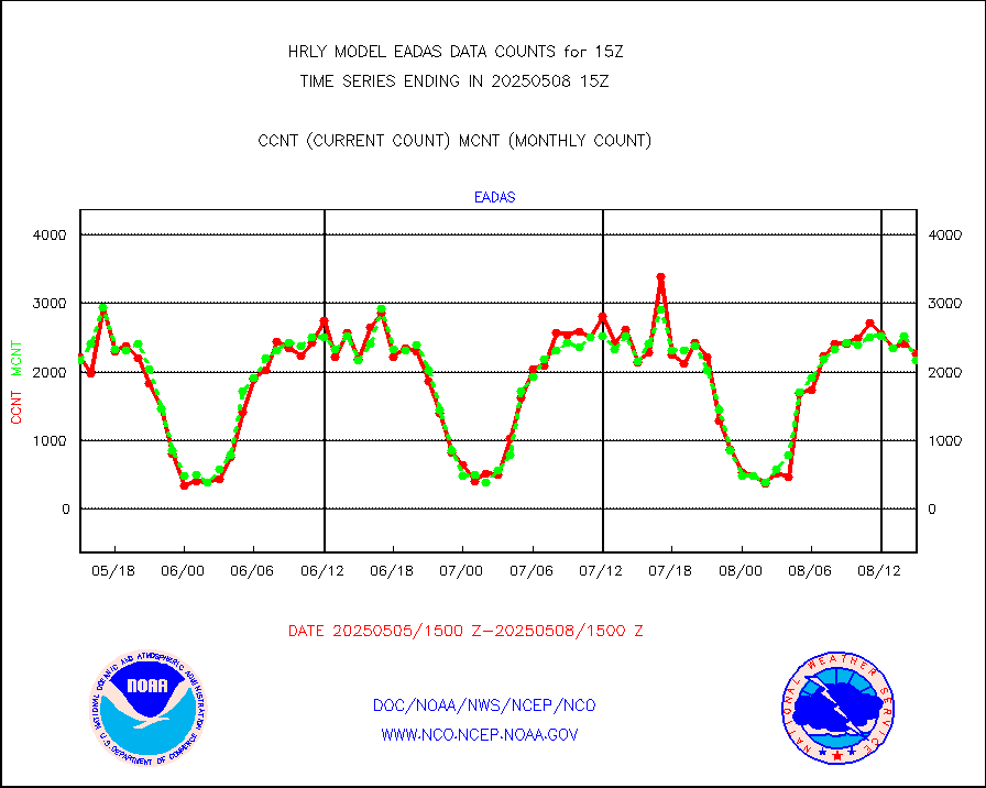
eadas |
E-AMDAR (European AMDAR acft decoded from BUFR) |
1945 |
1830 |
106.3 % |
1914.50-1915.49 |
esamua |
NOAA 15-19 & METOP 1-2 AMSU-A proc btmps frm RARS |
29930 |
33228 |
90.1 % |
1914.50-1915.49 |
eshrs3 |
NOAA 15-19 & METOP 1-2 HIRS-3/4 pr btmps frm RARS |
74493 |
69963 |
106.5 % |
1914.50-1915.49 |
gnss |
Grnd-based Gbl Navigation Sat System (GNSS) data |
8249 |
9177 |
89.9 % |
1914.00-1914.99 |
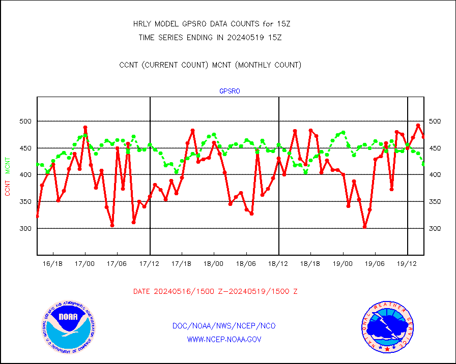
gpsro |
GPS radio occultation data |
470 |
419 |
112.2 % |
1912.50-1913.49 |
gsrasr |
GOES-16/17 All Sky Radiances (proc.) |
360476 |
345456 |
104.3 % |
1914.50-1915.49 |
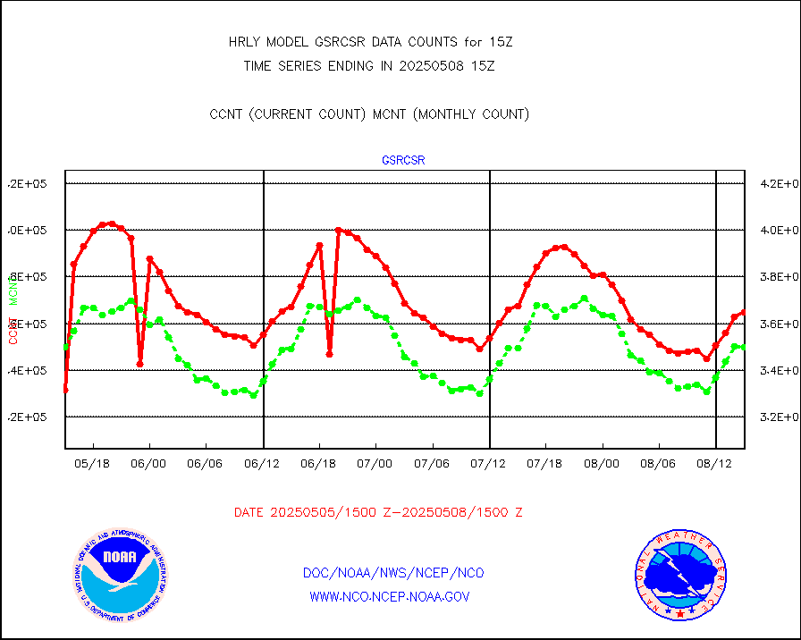
gsrcsr |
GOES-16/17 Clear Sky Radiances (proc.) |
162867 |
166663 |
97.7 % |
1914.50-1915.49 |
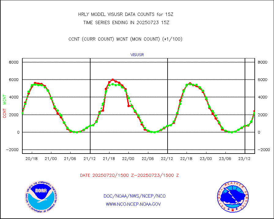
h20ja |
MTSAT/JMA water vapor imager derived cloud motion |
19330 |
18510 |
104.4 % |
1912.50-1913.49 |
h20mo |
MODIS (AQUA/TERRA) wvpr imager derived cld motion |
0 |
0 |
n/a |
1911.00-1911.99 |
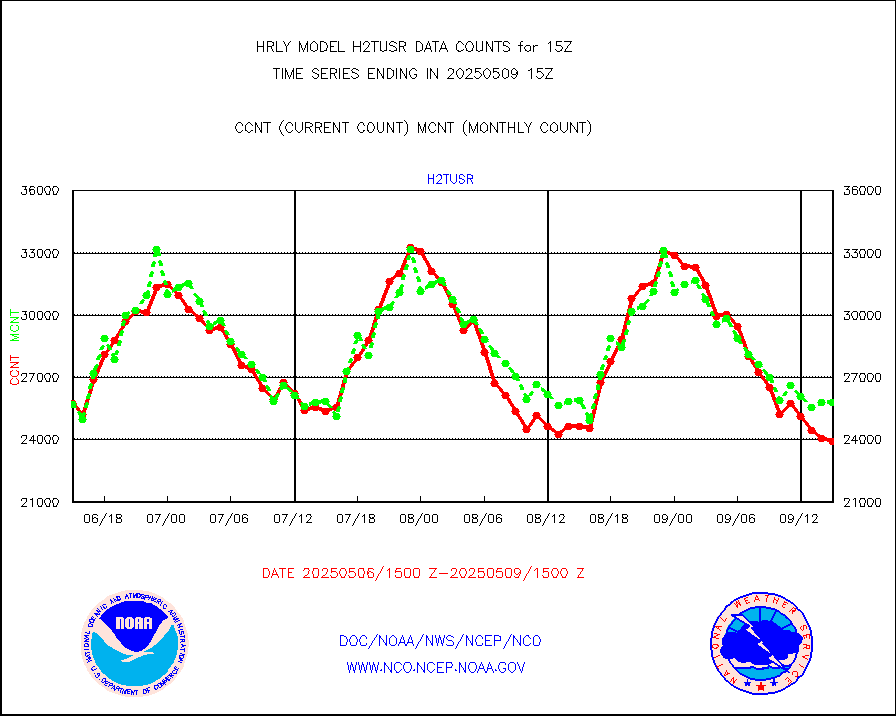
h2tusr |
GOES-16&up/NESDIS wv imgr/cld-top derived cld mtn |
23207 |
24231 |
95.8 % |
1914.00-1914.99 |
ifeunb |
METEOSAT/EUMETSAT ir lg-wave drv cld motion NBseq |
22587 |
22274 |
101.4 % |
1913.50-1914.49 |
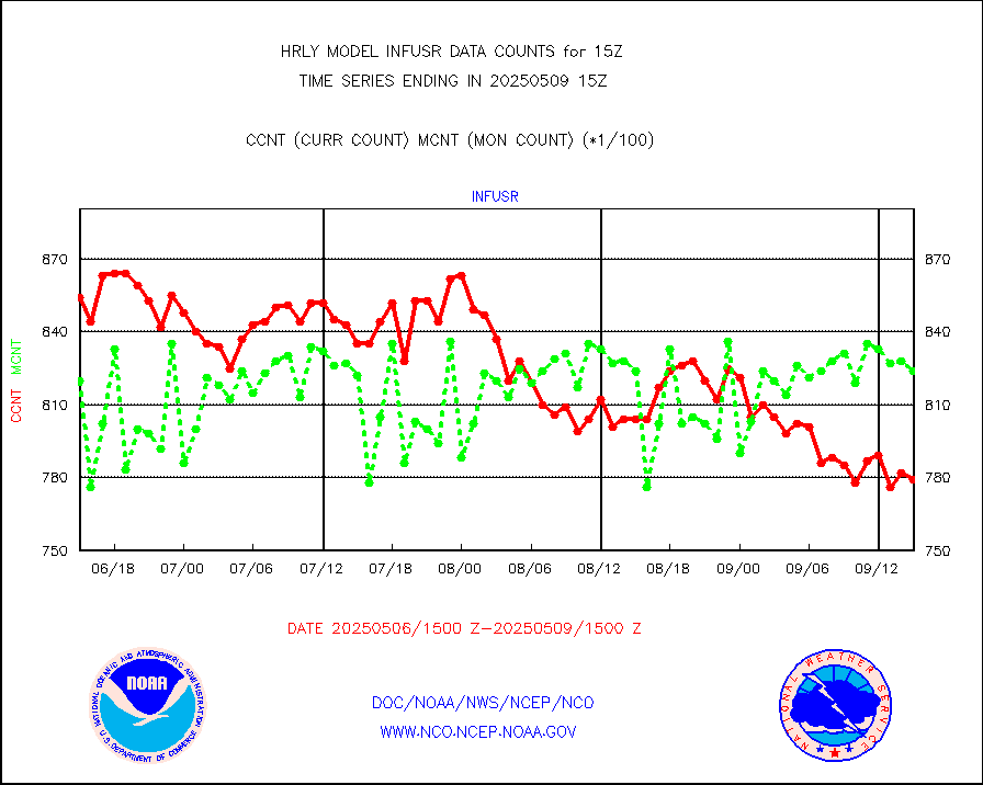
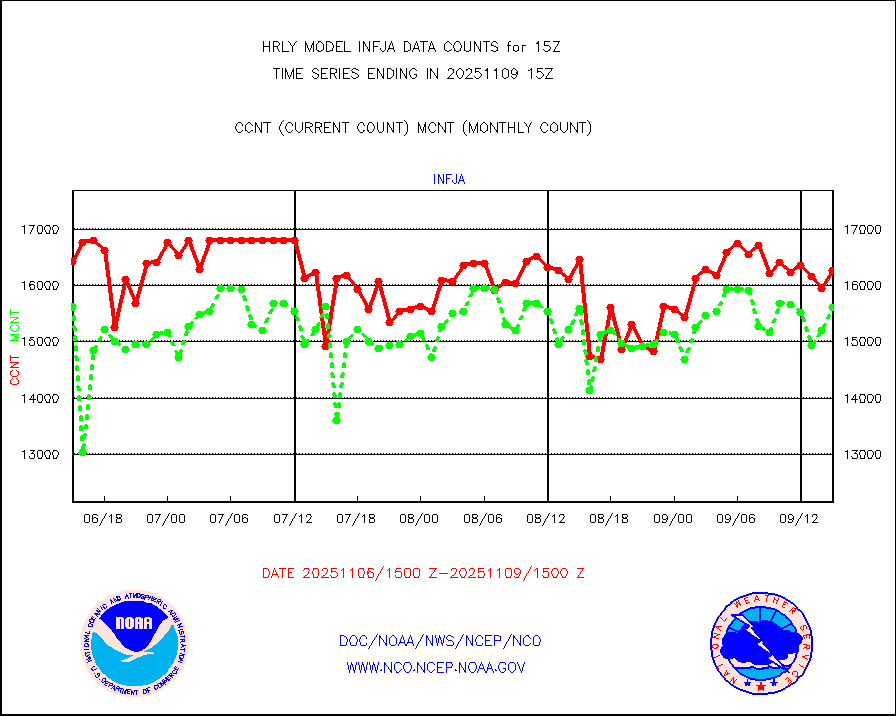
infja |
MTSAT/JMA infrared long-wave derived cloud motion |
15624 |
15843 |
98.6 % |
1912.50-1913.49 |
infmo |
MODIS (AQUA/TERRA) ir l-wave derived cloud motion |
0 |
0 |
n/a |
1911.00-1911.99 |
infusr |
GOES-16&up/NESDIS ir long-wave derived cld motion |
78449 |
79877 |
98.2 % |
1914.00-1914.99 |
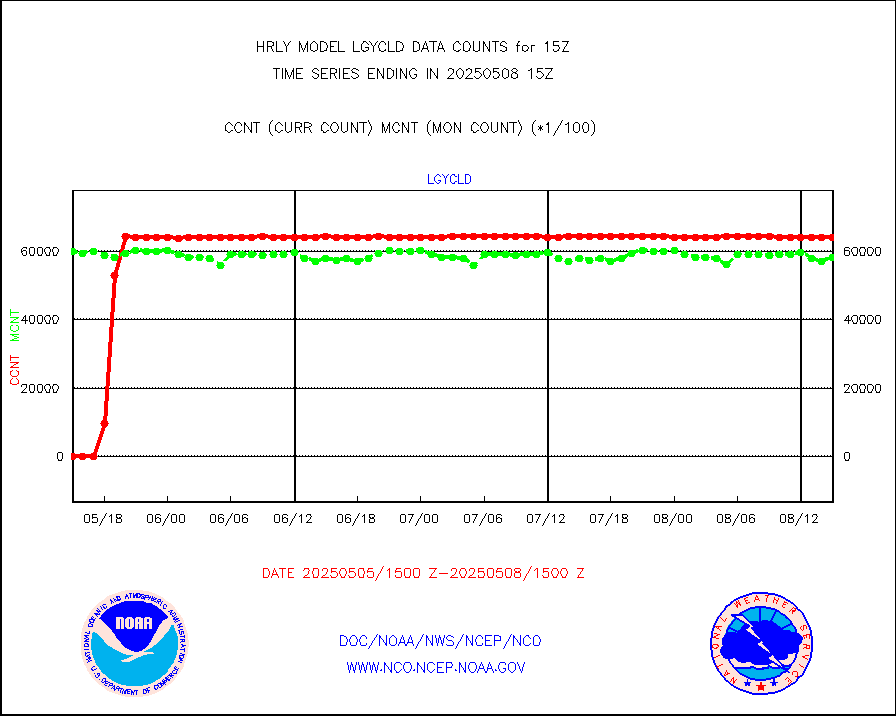
lgycld |
GOES/NASA(Langley) hi-res. (1x1 f-o-v) cloud data |
4211820 |
3265740 |
129.0 % |
1914.50-1915.49 |
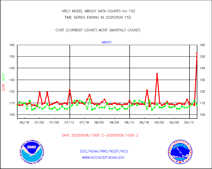
mbuoy |
Buoys decoded from FM-13 format (moored) |
126 |
119 |
105.9 % |
1914.50-1915.49 |
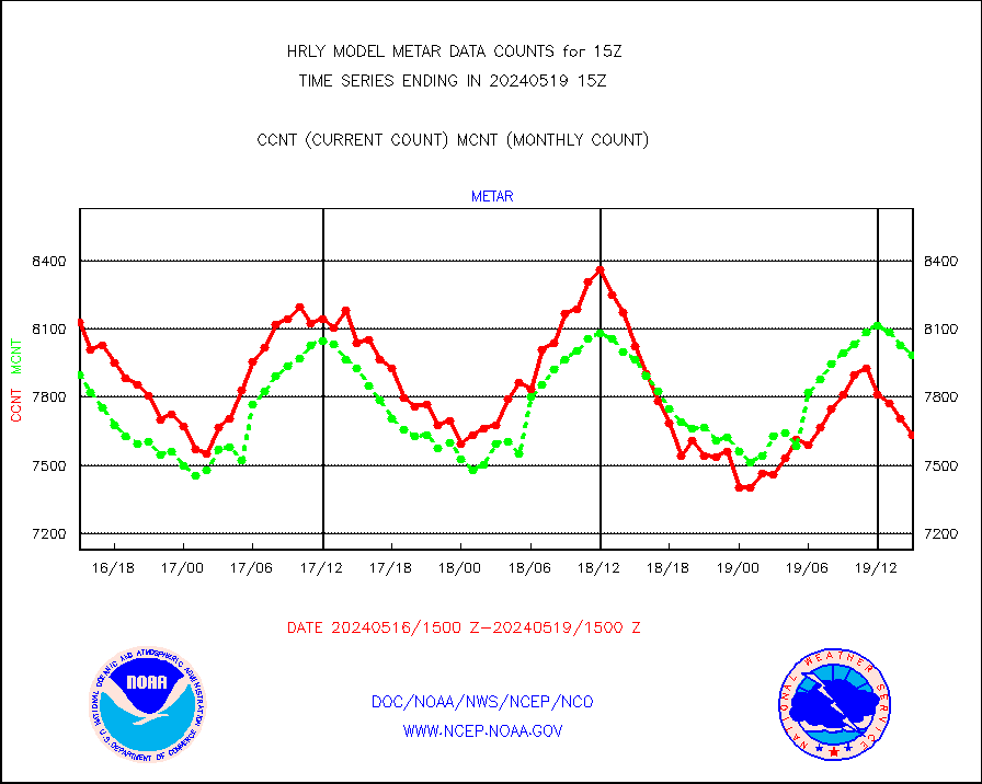
metar |
Aviation - METAR |
7633 |
7987 |
95.6 % |
1914.50-1915.49 |
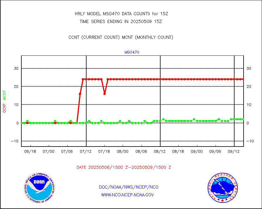
mso470 |
Mesonet/MADIS Colorado E-470 (Interstate 470) |
21 |
20 |
105.0 % |
1914.50-1915.49 |
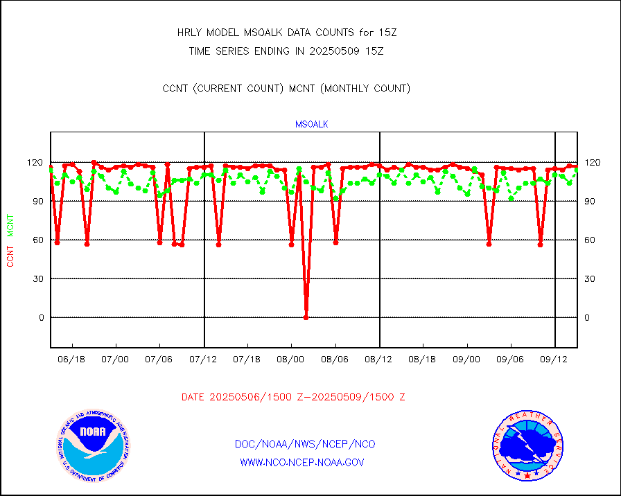
msoalk |
Mesonet/MADIS Alaska Department of Transportation |
106 |
109 |
97.2 % |
1914.50-1915.49 |
msoapg |
Mesonet/MADIS U.S. Army Aberdeen Proving Grounds |
0 |
0 |
n/a |
1914.50-1915.49 |
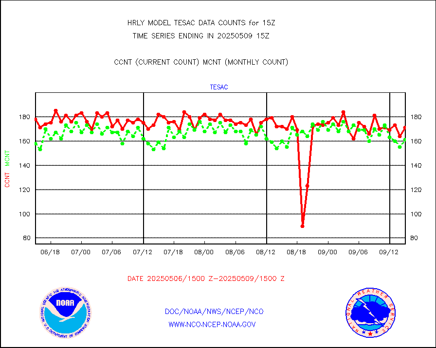
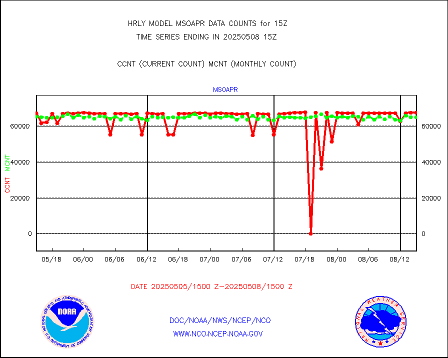
msoapr |
Mesonet/MADIS Citizen Weather Observers Program |
43388 |
48296 |
89.8 % |
1914.50-1915.49 |
msoaws |
Mesonet/MADIS AWS Convergence Technologies, Inc. |
24827 |
25672 |
96.7 % |
1914.50-1915.49 |
msoawx |
Mesonet/MADIS "Anything Weather" |
0 |
0 |
n/a |
1914.50-1915.49 |
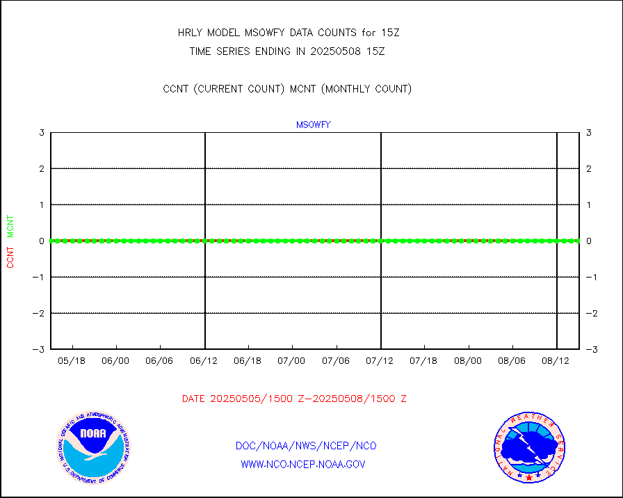
msocol |
Mesonet/MADIS Colorado Dept. of Transportation |
0 |
0 |
n/a |
1914.50-1915.49 |
msodcn |
Mesonet/MADIS DC Net |
0 |
0 |
n/a |
1914.50-1915.49 |
msoden |
Mesonet/MADIS Denver Urban Drainage & Flood Cntrl |
250 |
250 |
100.0 % |
1914.50-1915.49 |
msofla |
Mesonet/MADIS Florida (FAWN & USF) |
4 |
4 |
100.0 % |
1914.50-1915.49 |
msoflt |
Mesonet/MADIS Florida Dept. of Transportation |
0 |
0 |
n/a |
1914.50-1915.49 |
msogeo |
Mesonet/MADIS Georgia Dept. of Transportation |
0 |
0 |
n/a |
1914.50-1915.49 |
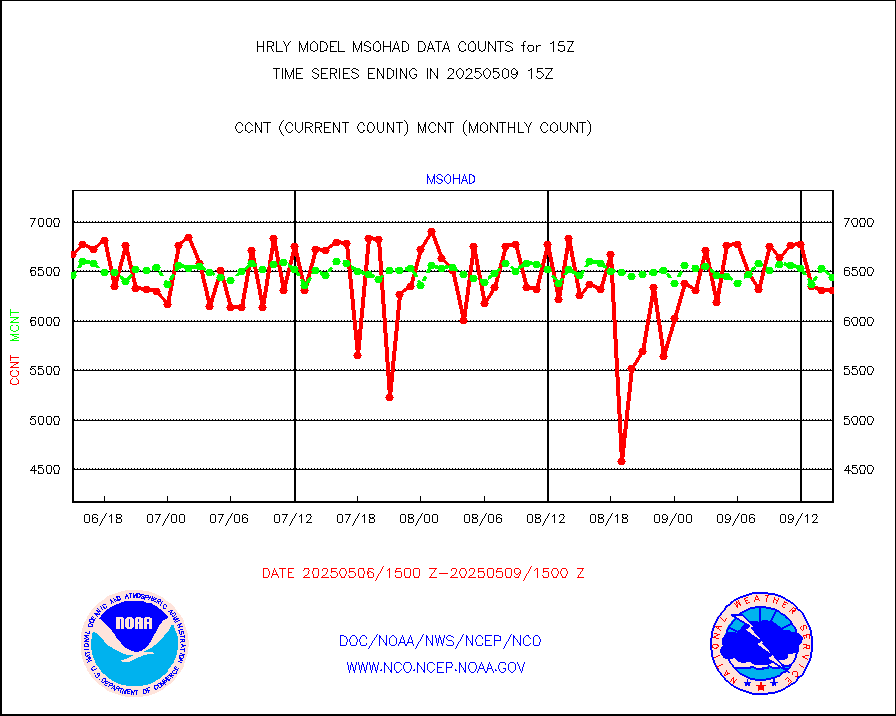
msohad |
Mesonet/MADIS NWS Hydromet Auto Data System(HADS) |
6836 |
6578 |
103.9 % |
1914.50-1915.49 |
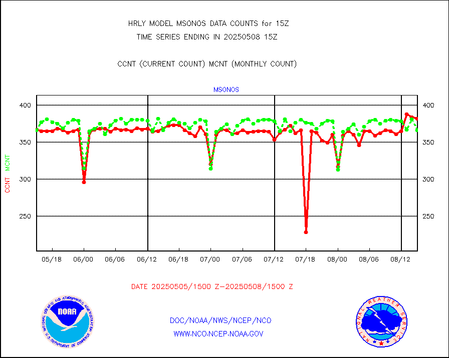
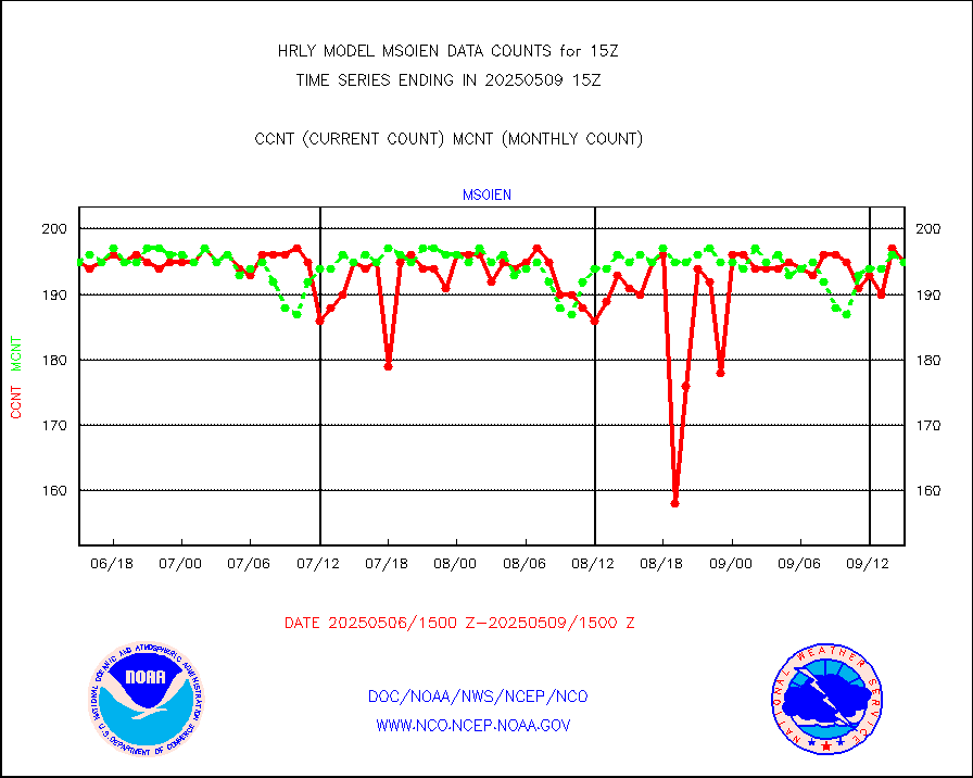
msoien |
Mesonet/MADIS Iowa Environmental |
187 |
188 |
99.5 % |
1914.50-1915.49 |
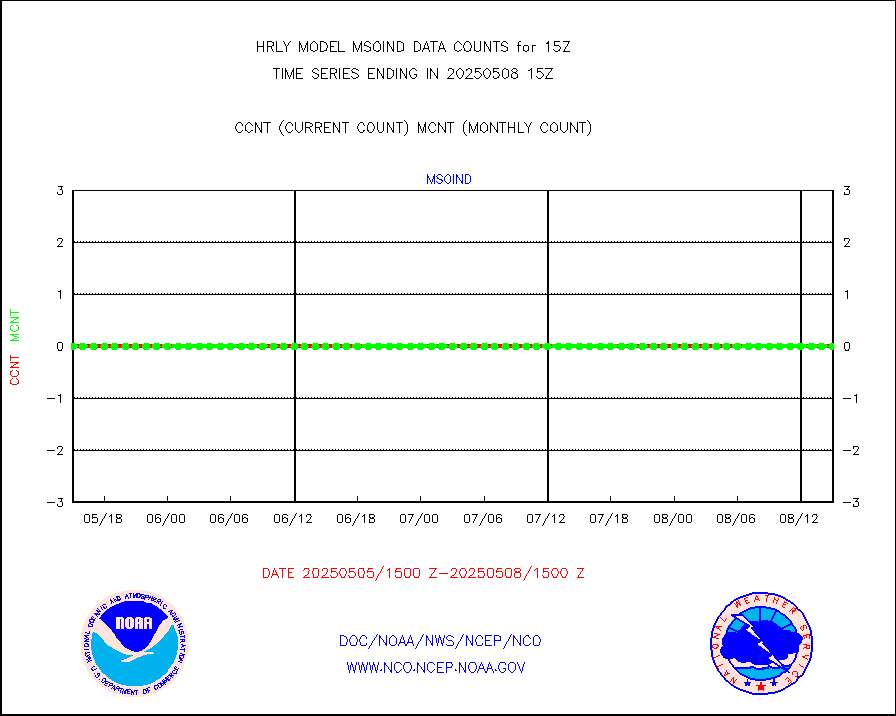
msoind |
Mesonet/MADIS Indiana Dept. of Transportation |
0 |
0 |
n/a |
1914.50-1915.49 |
msoiow |
Mesonet/MADIS Iowa Department of Transportation |
0 |
0 |
n/a |
1914.50-1915.49 |
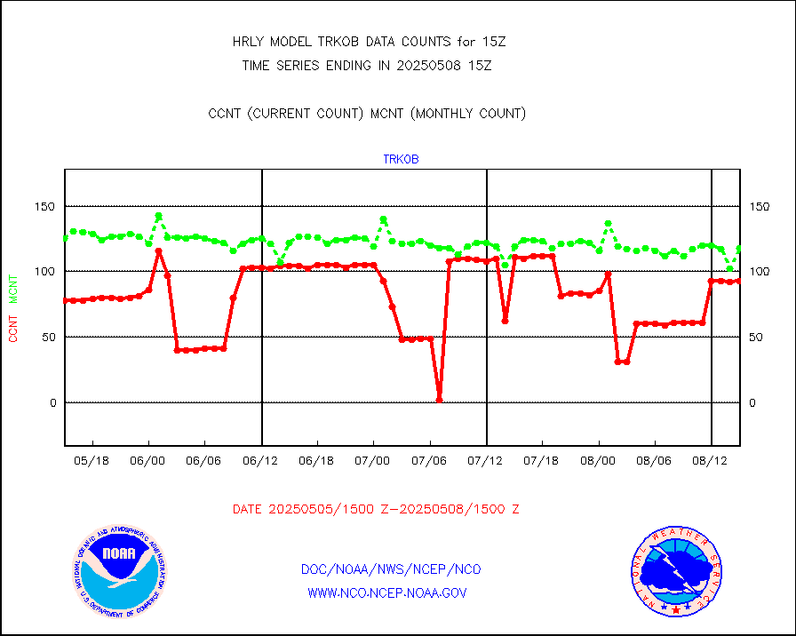
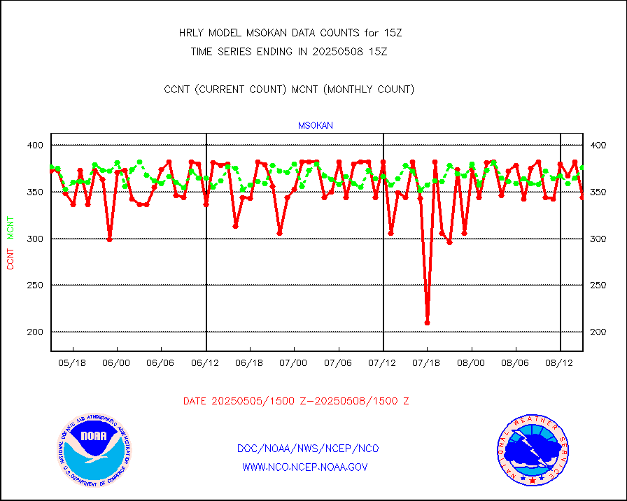
msokan |
Mesonet/MADIS Kansas Department of Transportation |
153 |
355 |
43.1 % |
1914.50-1915.49 |
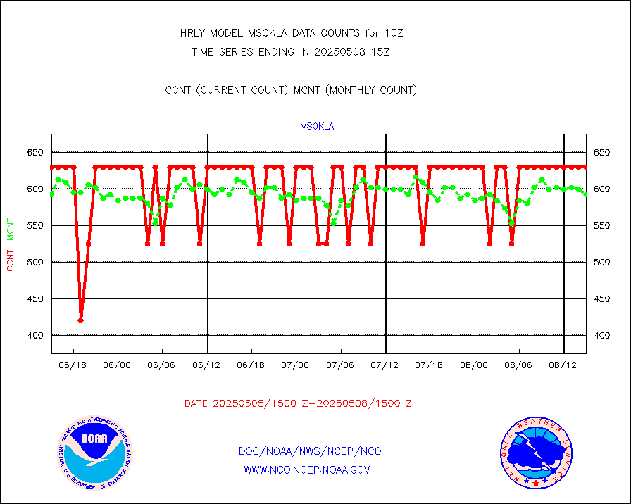
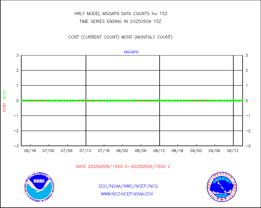
msokla |
Mesonet/MADIS Oklahoma Mesonet |
318 |
325 |
97.8 % |
1914.50-1915.49 |
msolju |
Mesonet/MADIS Louisiana State/Jackson State Univ. |
0 |
0 |
n/a |
1914.50-1915.49 |
msomca |
Mesonet/MADIS Missouri Commercial Agricult Wx Net |
299 |
297 |
100.7 % |
1914.50-1915.49 |
msomin |
Mesonet/MADIS Minnesota Dept. of Transportation |
0 |
0 |
n/a |
1914.50-1915.49 |
msonos |
Mesonet/MADIS NOS-Phys Oceanographic Realtime Sys |
396 |
383 |
103.4 % |
1914.50-1915.49 |
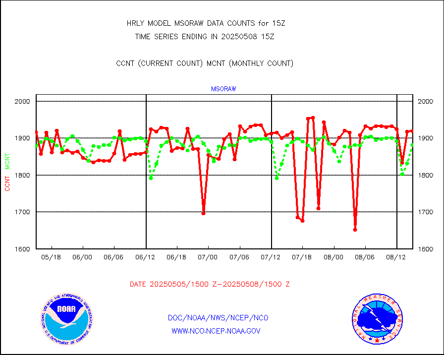
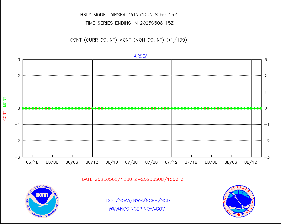
msoraw |
Mesonet/MADIS NFIC Remote Automated Wx Stns(RAWS) |
1933 |
1791 |
107.9 % |
1914.50-1915.49 |
msovir |
Mesonet/MADIS Virginia Dept. of Transportation |
205 |
228 |
89.9 % |
1914.50-1915.49 |
msowfy |
Mesonet/MADIS "Weather for You" |
0 |
0 |
n/a |
1914.50-1915.49 |
msowis |
Mesonet/MADIS Wisconsin Dept. of Transportation |
0 |
0 |
n/a |
1914.50-1915.49 |
msowst |
Mesonet/MADIS MesoWest (many subproviders) |
46745 |
45110 |
103.6 % |
1914.50-1915.49 |
msowtx |
Mesonet/MADIS West Texas |
5653 |
5632 |
100.4 % |
1914.50-1915.49 |
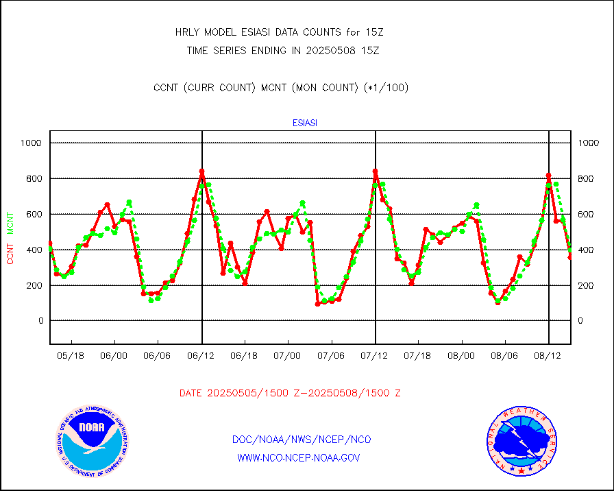
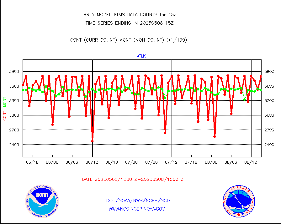
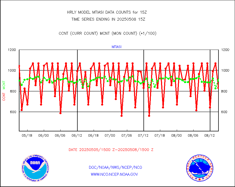
mtiasi |
METOP 1-2 IASI 1C radiance data (varbl. channels) |
53476 |
85306 |
62.7 % |
1913.00-1913.99 |
nxrdw |
NEXRAD Vel Azm Dsp(VAD) winds via radar coded msg |
0 |
0 |
n/a |
1914.50-1915.49 |
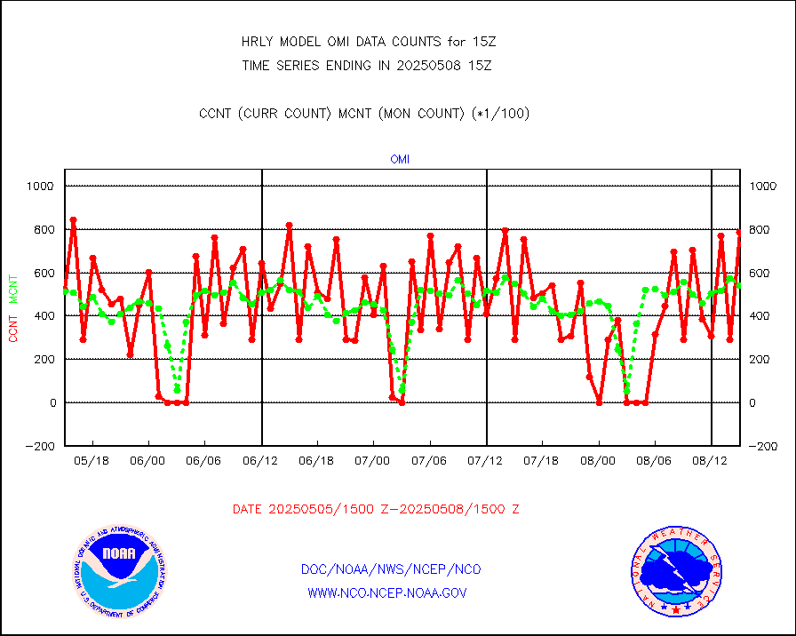
omi |
Aura Ozone Monitoring Instrument (OMI) data |
45540 |
38358 |
118.7 % |
1912.50-1913.49 |
osbuv8 |
NOAA 16-19 Solar Backscatter UV-2 rad frm V8 BUFR |
0 |
0 |
n/a |
1913.00-1913.99 |
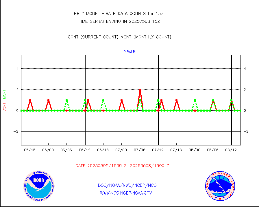
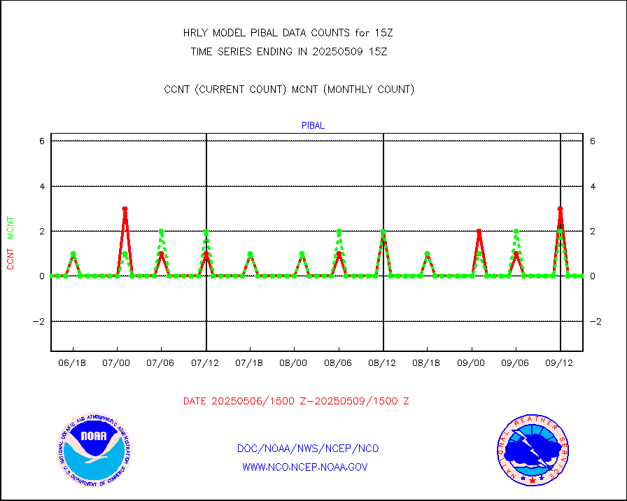
pibal |
PIBAL (from PILOT, PILOT SHIP, PILOT MOBIL) |
0 |
0 |
n/a |
1914.50-1915.49 |
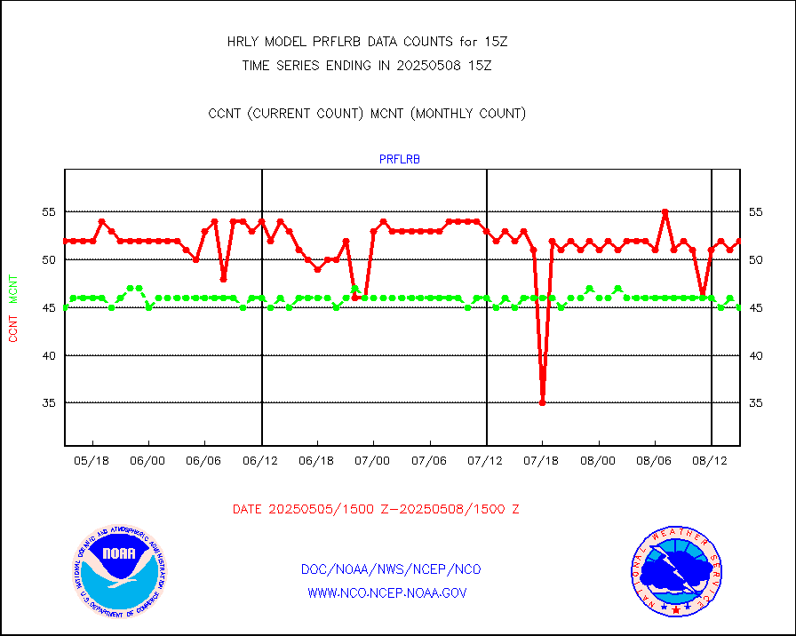
prflrb |
Multi-Agency Profiler (MAP) and SODAR winds |
35 |
41 |
85.4 % |
1914.50-1915.49 |
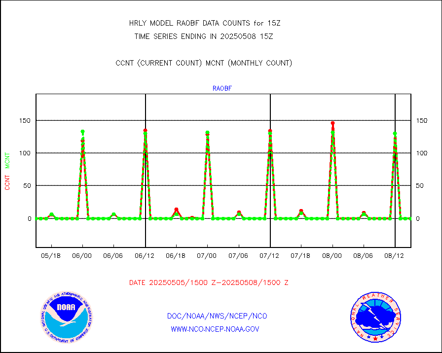
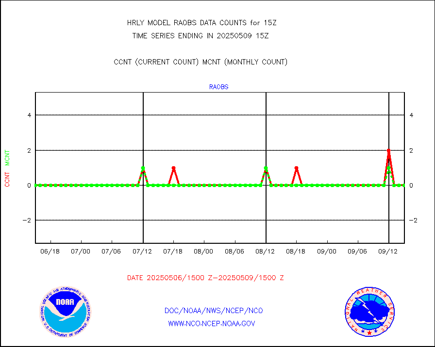
raobf |
Rawinsonde - fixed land (from TEMP or PILOT) |
0 |
0 |
n/a |
1914.50-1915.49 |
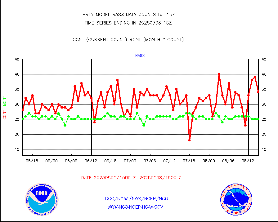
rass |
RASS temperatures (NOAA and Multi-Agency) |
22 |
26 |
84.6 % |
1914.50-1915.49 |
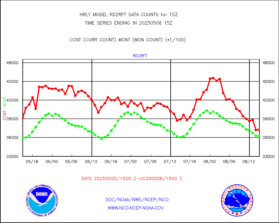
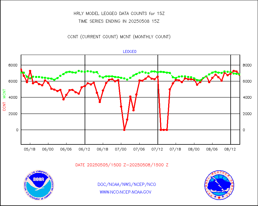
rd2rft |
NEXRAD reflectivity (Lvl 2 - GTS) |
3757049 |
3755972 |
100.0 % |
1914.50-1915.49 |
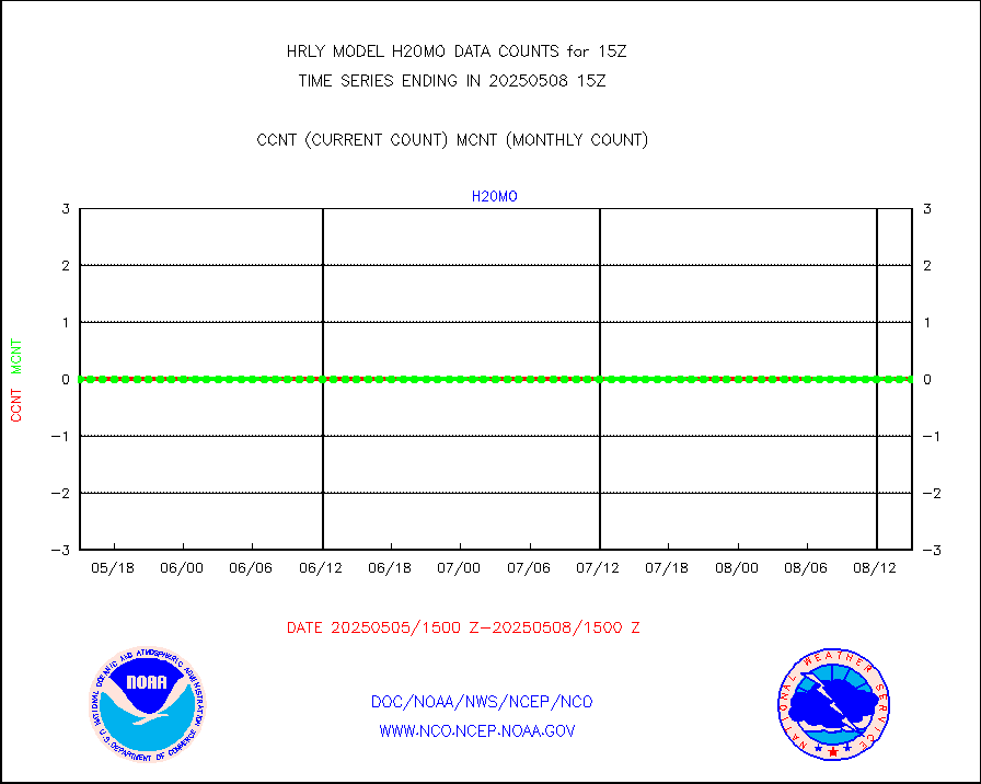
rd2wnd |
NEXRAD radial wind (Level 2 - GTS) |
1035591 |
1093752 |
94.7 % |
1914.50-1915.49 |
sevcsr |
METEOSAT-10 2nd Gen SEVIRI Clr Sky Radiance(proc) |
0 |
0 |
n/a |
1914.50-1915.49 |
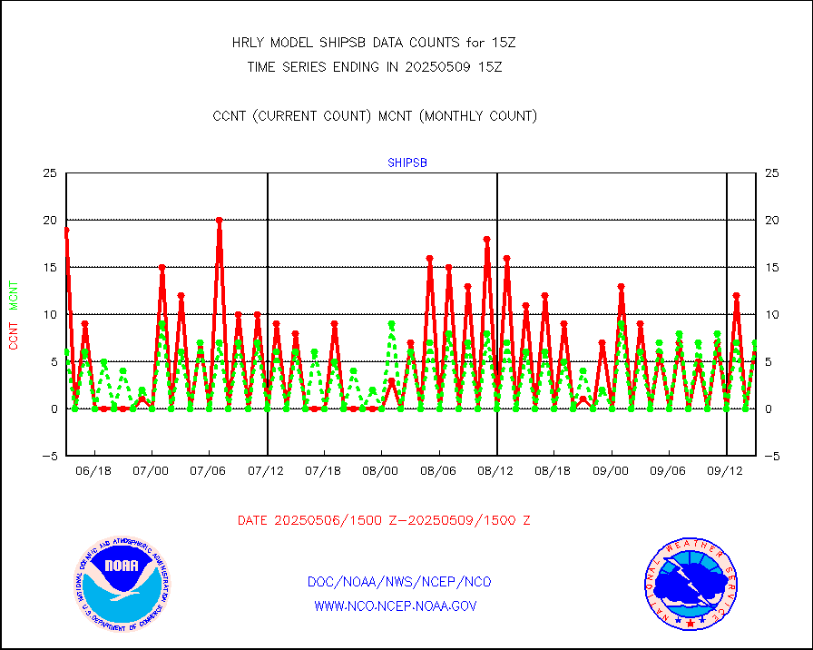
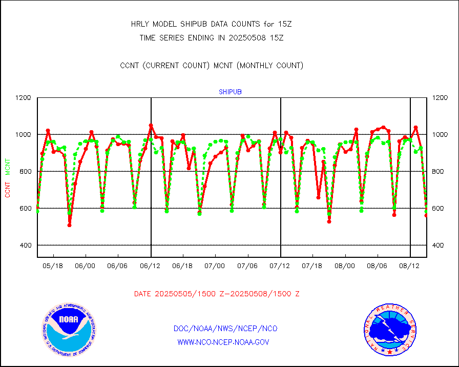
shipsb |
Ship - manual and automatic, restricted (BUFR) |
1 |
0 |
n/a |
1914.50-1915.50 |
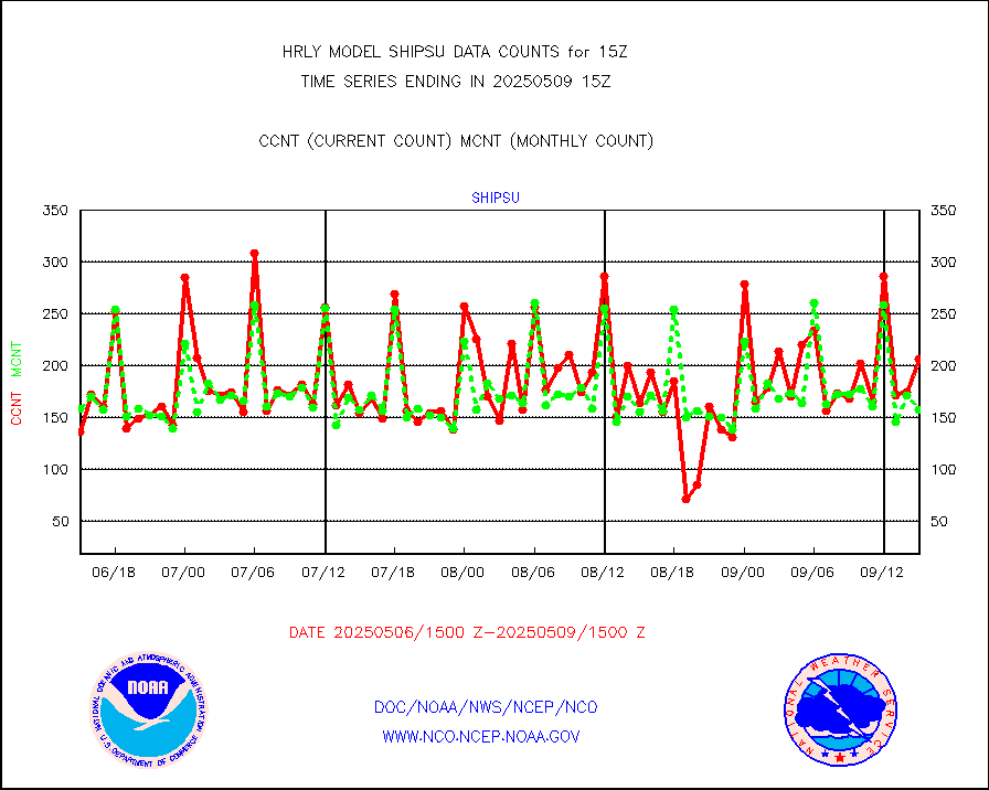
shipsu |
Ship - manual and automatic, unrestricted |
113 |
121 |
93.4 % |
1914.50-1915.50 |
shipub |
Ship - manual and automatic, unrestricted (BUFR) |
452 |
422 |
107.1 % |
1914.50-1915.50 |
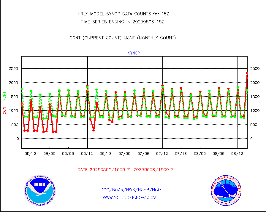
synop |
Synoptic - fixed manual and automatic |
1947 |
2056 |
94.7 % |
1914.50-1915.49 |
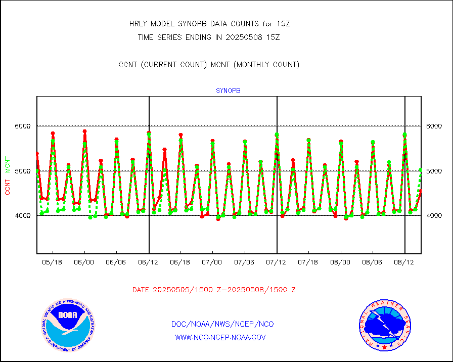
synopb |
Synoptic - fixed manual & auto (decoded fr BUFR) |
5355 |
5292 |
101.2 % |
1914.50-1915.49 |
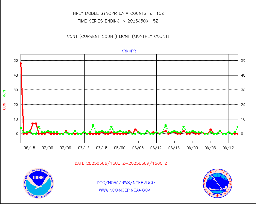
synopr |
Synoptic - restricted (WMO Res 40) manual & auto. |
2 |
3 |
66.7 % |
1914.50-1915.49 |
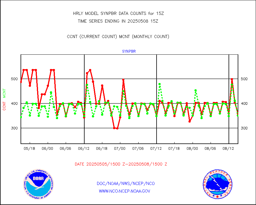
synpbr |
Synoptic - restricted (WMO Res 40)(decoded BUFR) |
356 |
357 |
99.7 % |
1914.50-1915.49 |
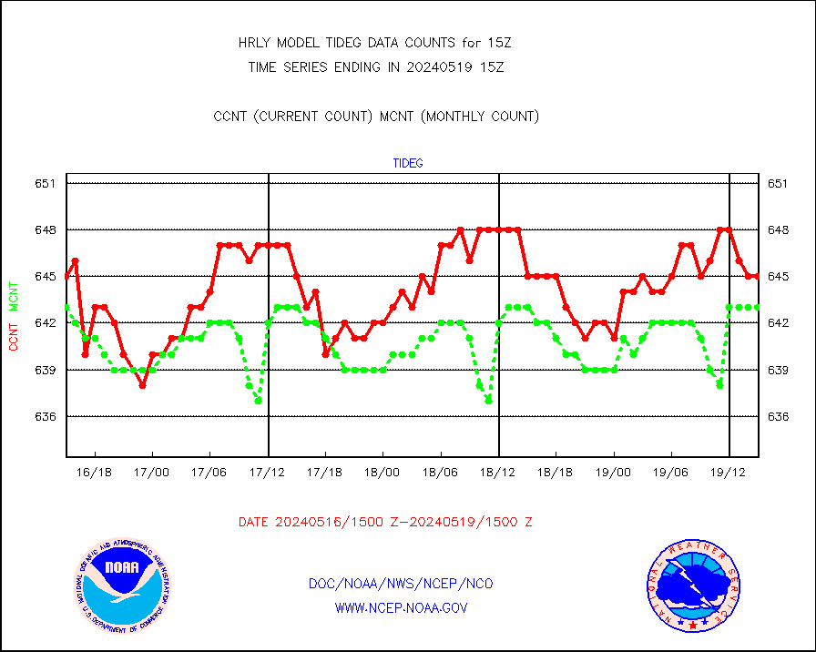
tideg |
Tide gauge reports decoded from CREX format |
645 |
643 |
100.3 % |
1914.00-1914.99 |
| Data Types of Opportunity with Normal Counts |
|---|
| Type | Description | Hourly Count | Monthly Average | Percent (%) of Monthly Mean | UTC Time Window |
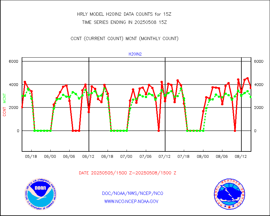
3p9usr |
GOES-16&up/NESDIS ir short-wv derived cld motion |
20270 |
20541 |
98.7 % |
1914.00-1914.99 |
acarsa |
MDCRS ACARS acft data (ARINC via AFWA)(AIREP fmt) |
0 |
0 |
n/a |
1914.50-1915.49 |
ahicsr |
Himawari Clear Sky Radiance |
0 |
0 |
n/a |
1914.00-1914.99 |
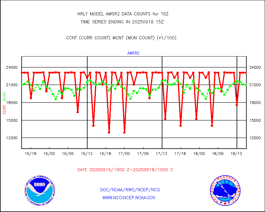
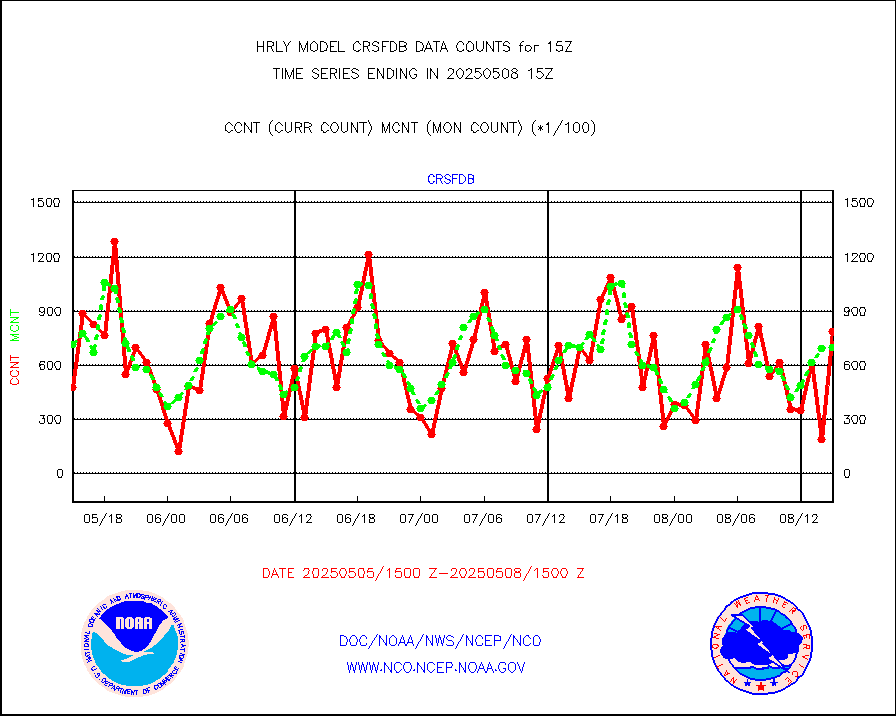
amsr2 |
GCOM-W AMSR2 1B brightness temperatures |
2259900 |
2122719 |
106.5 % |
1913.00-1913.99 |
atmsdb |
NPP/NOAA-20 ATMS bright. temps-direct b-cast SSEC |
70515 |
123898 |
56.9 % |
1913.50-1914.49 |
atovs |
POES/NESDIS - processed ATOVS soundings/radiances |
0 |
0 |
n/a |
1913.00-1913.99 |
avcsam |
A.M.(N17,M2,M3) AVHRR GAC NCEP-proc clr&sea btmps |
590966 |
1062760 |
55.6 % |
1912.50-1913.49 |
avcspm |
P.M.(N18-19) AVHRR GAC NCEP-proc clr & sea btemps |
1331112 |
1386692 |
96.0 % |
1912.50-1913.49 |
bathy |
eXpendable BathyThermograph, mooring (BATHY fmt) |
0 |
0 |
n/a |
1908.00-1908.99 |
coopmd |
Coop/MADIS NEPP & HCN-Modernization NOAA COOP Obs |
27 |
27 |
100.0 % |
1914.50-1915.49 |
crisf4 |
NPP/NOAA-20 CrIS full spctrl radn (431 ch subset) |
230346 |
231627 |
99.4 % |
1913.50-1914.49 |
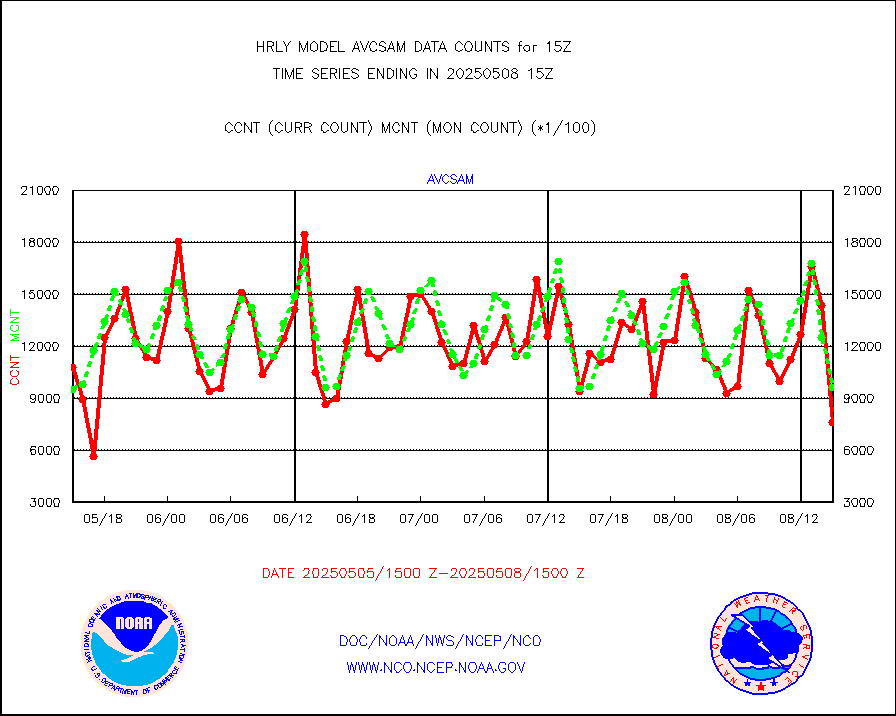
crsfdb |
NPP/NOAA-20 CrIS full spctrl radn dir brdcst SSEC |
119880 |
109211 |
109.8 % |
1913.50-1914.49 |
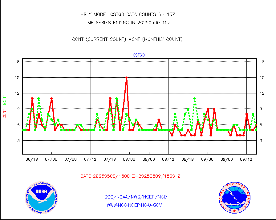
cstgd |
Coast Guard |
4 |
4 |
100.0 % |
1914.50-1915.50 |
dbuoyb |
Drifting buoys (decoded from BUFR) |
1436 |
1388 |
103.5 % |
1914.50-1915.50 |
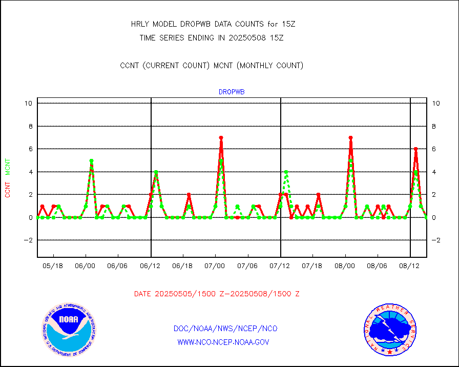
dropw |
Dropwinsonde (from TEMP DROP) |
0 |
0 |
n/a |
1914.50-1915.49 |
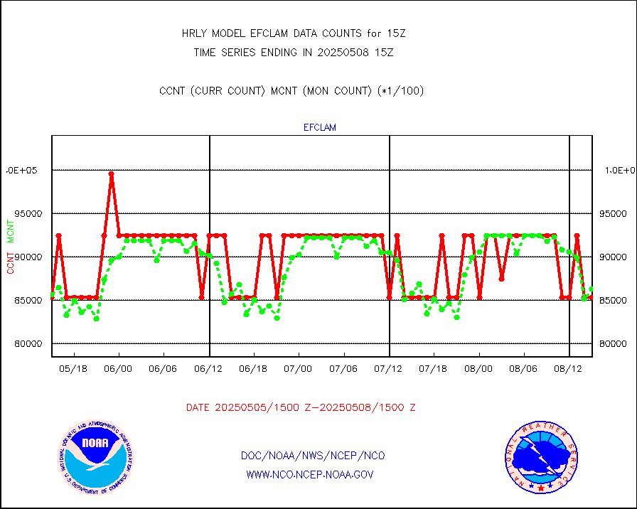
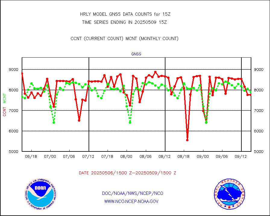
efclam |
GOES imager effective cloud amount data (U.Wisc.) |
8285510 |
8325477 |
99.5 % |
1914.50-1915.49 |
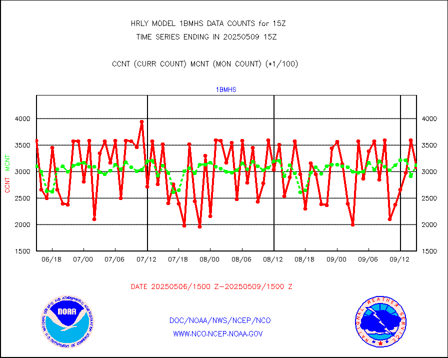
esatms |
NPP Adv. Tech. MW Sndr (ATMS) br. temps from RARS |
116372 |
110104 |
105.7 % |
1913.50-1914.49 |
esiasi |
METOP 1-2 IASI 1C radiance data vbl chn from RARS |
71886 |
61562 |
116.8 % |
1914.00-1914.99 |
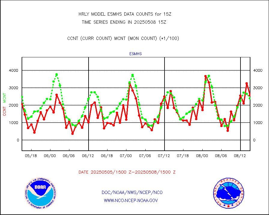
esmhs |
NOAA 18-19 & METOP 1-2 MHS proc. btemps from RARS |
206552 |
251776 |
82.0 % |
1914.50-1915.49 |
geoimr |
GOES/NESDIS (11x17 f-o-v) imager clear radiances |
0 |
0 |
n/a |
1914.00-1914.99 |
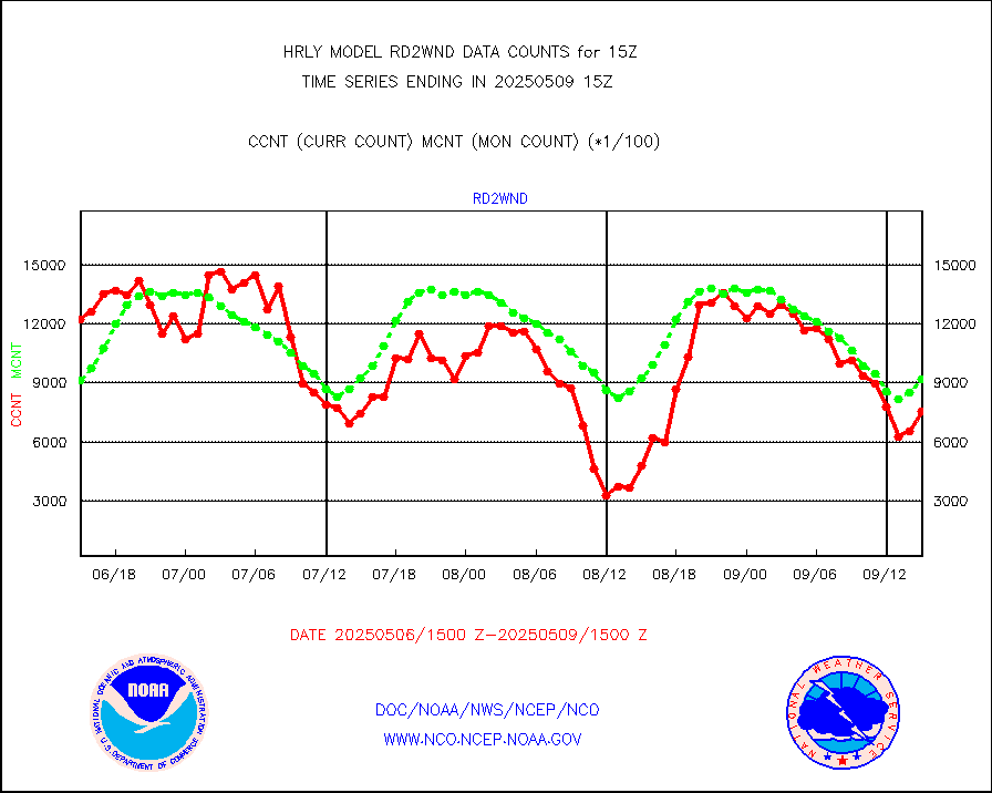
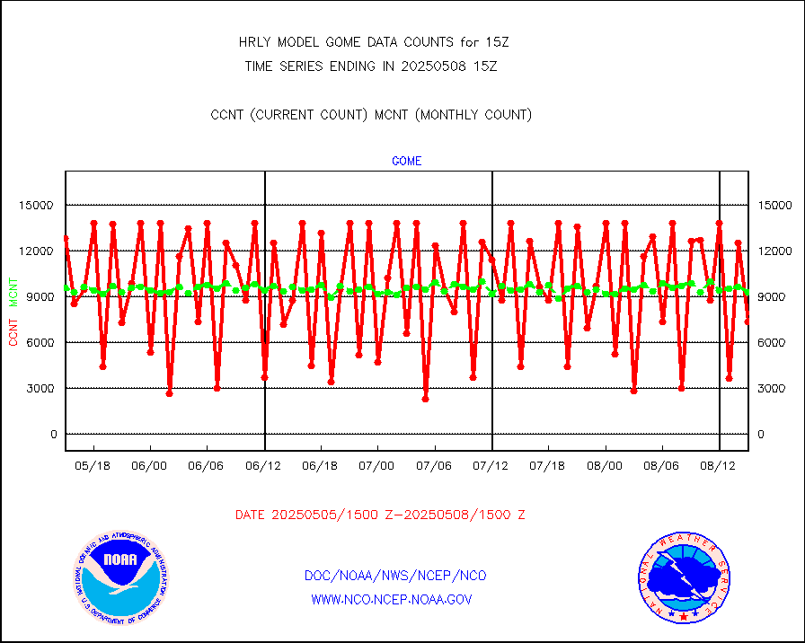
gome |
METOP 1-2 Global Ozone Monitoring Exp.-2 (GOME-2) |
4071 |
7287 |
55.9 % |
1913.50-1914.49 |
h20in2 |
INDIA SATWIND, INSAT WV channel |
2022 |
5986 |
33.8 % |
1914.00-1914.99 |
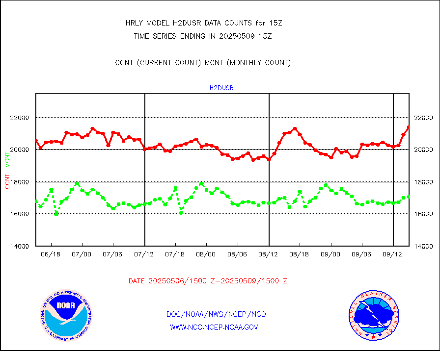
h2dusr |
GOES-16&up/NESDIS wv imgr/deep-lyr derivd cld mtn |
15352 |
16494 |
93.1 % |
1914.00-1914.99 |
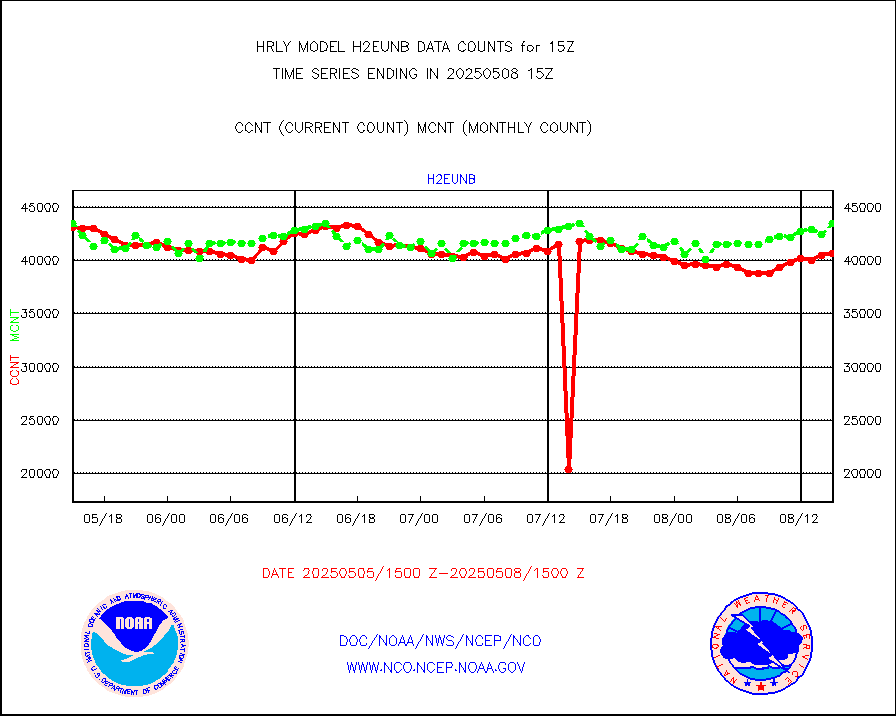
h2eunb |
METEOSAT/EUMETSAT wvpr imgr drv cld motion NBseq |
42055 |
42795 |
98.3 % |
1913.50-1914.49 |
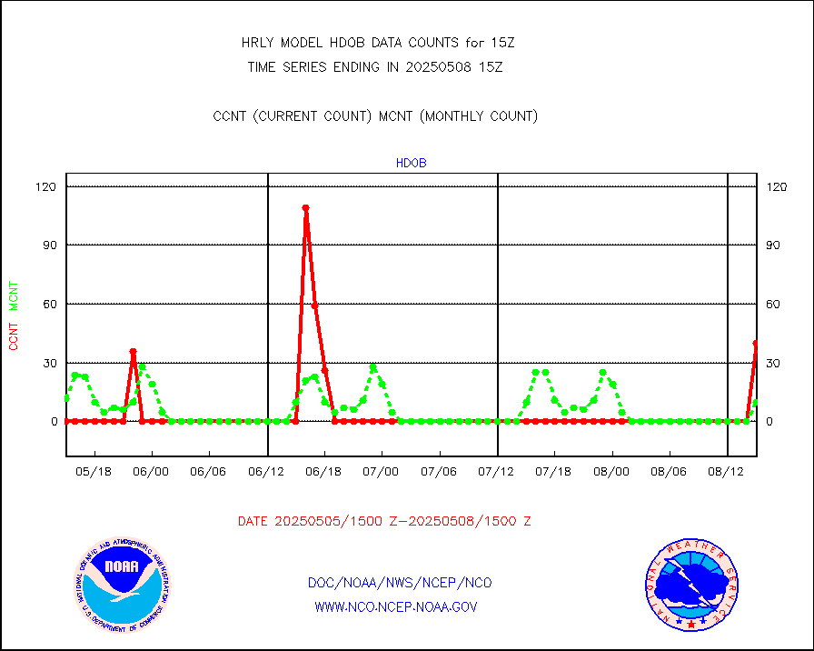
hdob |
High Density OBs from reconnaissance acft data |
0 |
6 |
0.0 % |
1914.50-1915.49 |
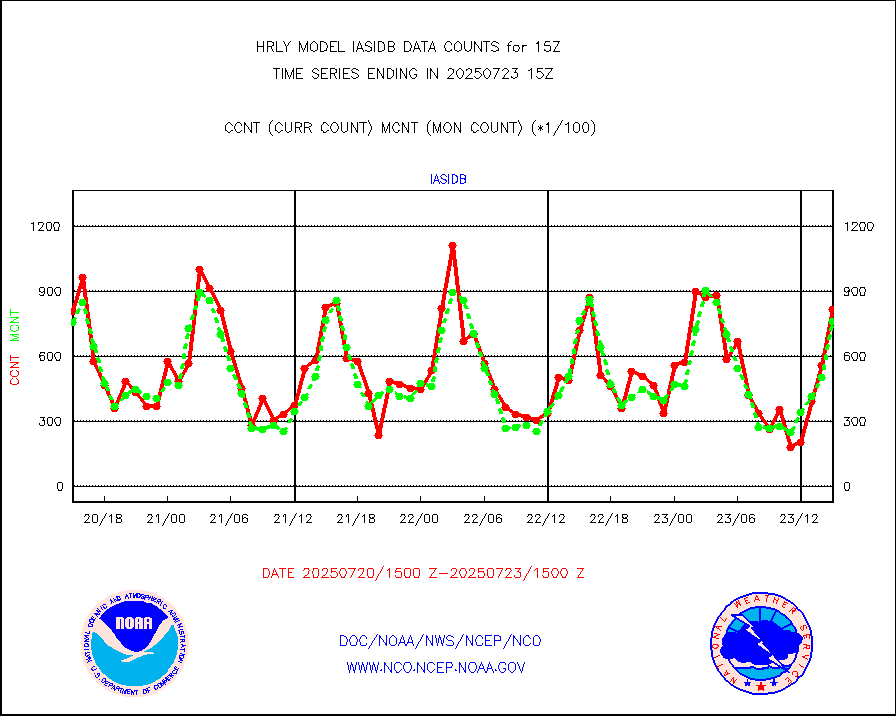
iasidb |
METOP 1-2 IASI 1C radiances-direct broadcast SSEC |
50901 |
54606 |
93.2 % |
1913.50-1914.49 |
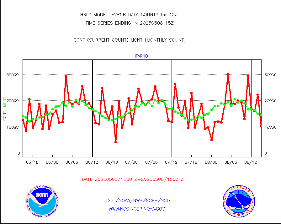
ifvrnb |
VIIRS (NPP/NOAA-20) ir lg-wv drv cloud motion(NB) |
22652 |
13200 |
171.6 % |
1911.00-1911.99 |
infav |
AVHRR (NOAA/METOP) ir lg-wave derived cld motion |
0 |
0 |
n/a |
1911.00-1911.99 |
infav1 |
AVHRR (METOP) ir lg-wave derived cld motion |
0 |
0 |
n/a |
1914.50-1915.50 |
infin |
INSAT/KALPANA India ir lg-wave derived cld motion |
0 |
0 |
n/a |
1912.50-1913.49 |
infin2 |
INDIA SATWIND, INSAT IR channel |
1895 |
5948 |
31.9 % |
1914.00-1914.99 |
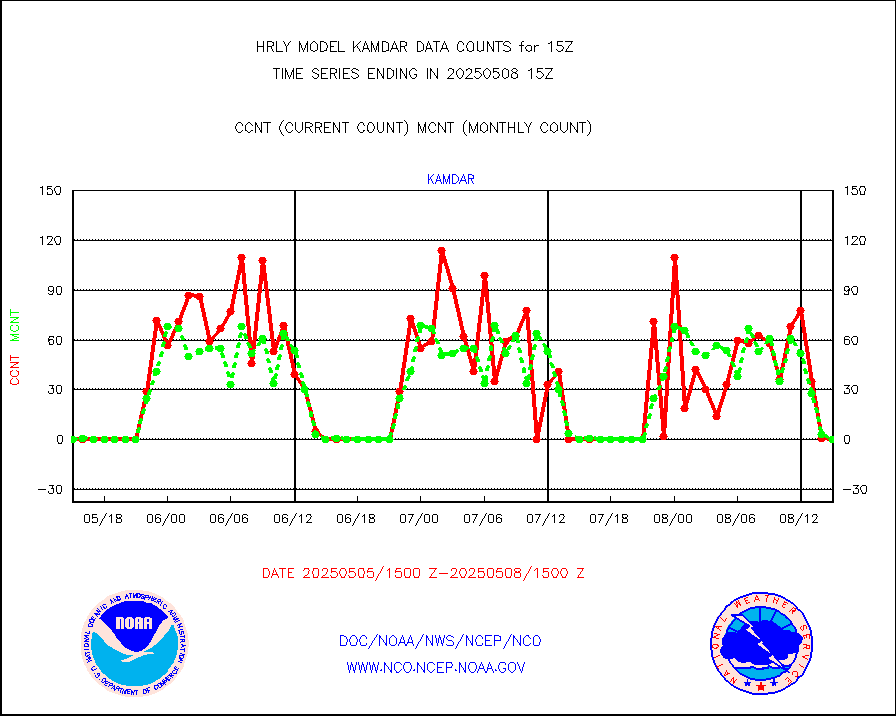
kamdar |
Korean AMDAR aircraft data (decoded from BUFR) |
0 |
1 |
0.0 % |
1914.50-1915.49 |
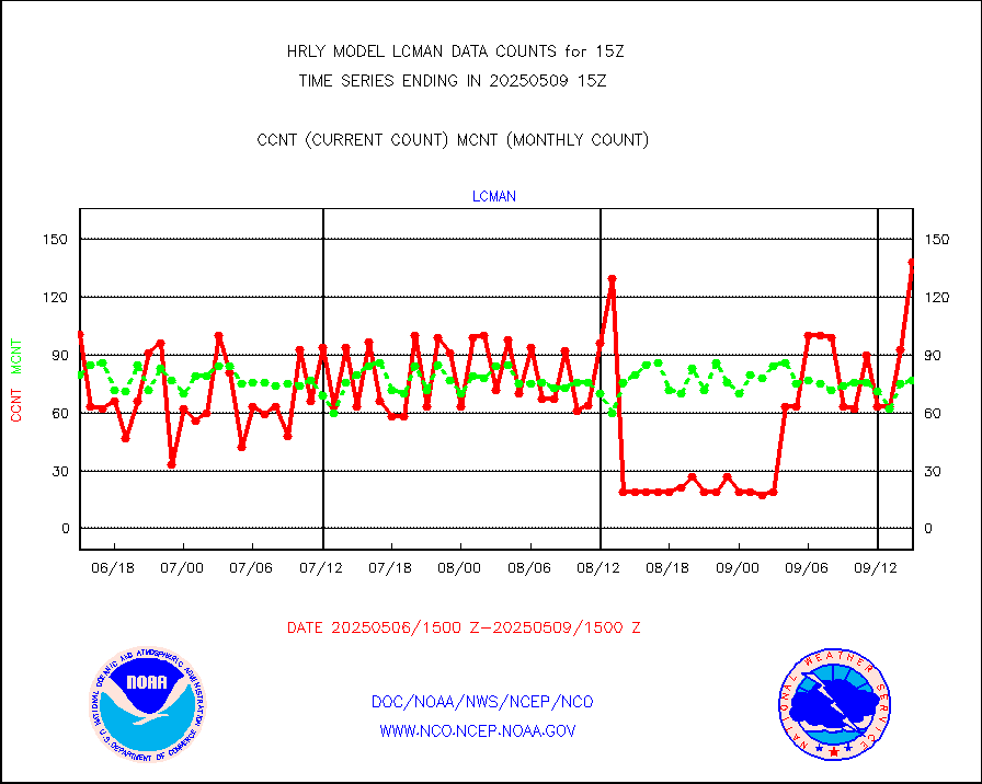
lcman |
Land-based CMAN stations decoded from CMAN format |
58 |
89 |
65.2 % |
1914.50-1915.49 |
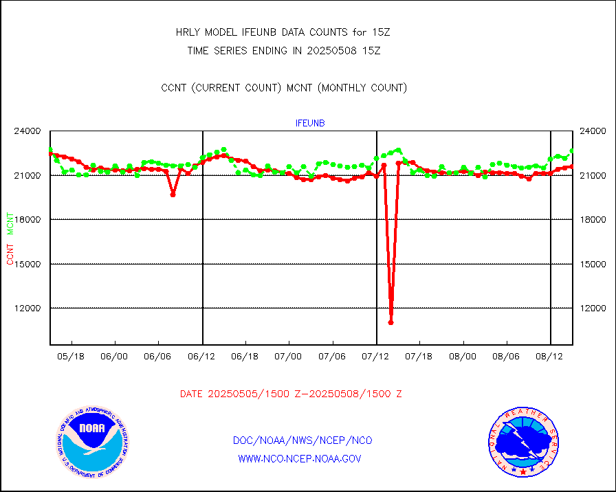
leogeo |
LEO-GEO satellite AMVs from UWisc. |
5877 |
4960 |
118.5 % |
1911.00-1911.99 |
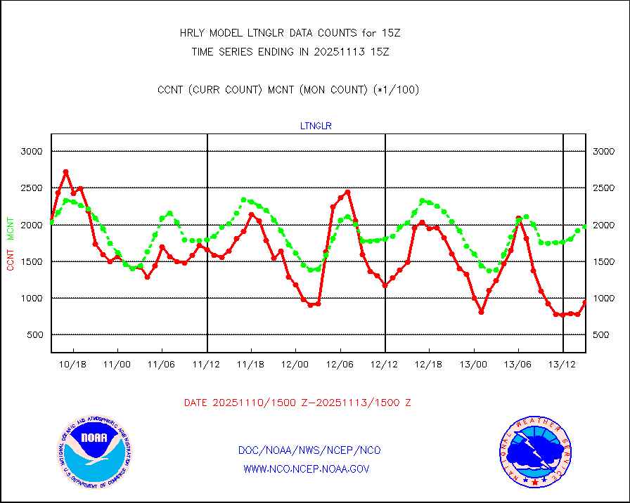
ltnglr |
LLDN Long-rng lightning from Vaisala via NOAAPORT |
258162 |
163899 |
157.5 % |
1914.50-1915.49 |
ltngsr |
NLDN Shrt-rng lightning from Vaisala via NOAAPORT |
10227 |
2341 |
436.9 % |
1914.50-1915.49 |
mbuoyb |
Moored buoys (decoded from BUFR) |
792 |
729 |
108.6 % |
1914.50-1915.50 |
mls |
Aura Microwave Limb Sounder (MLS) ozone data |
0 |
0 |
n/a |
1913.00-1913.99 |
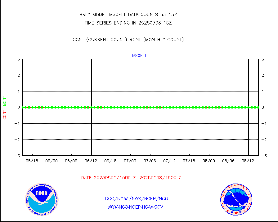
msourb |
Mesonet/MADIS UrbaNet |
4355 |
4367 |
99.7 % |
1914.50-1915.49 |
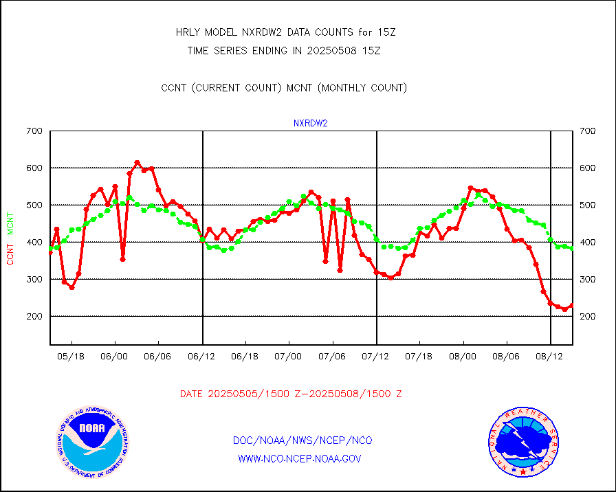
nxrdw2 |
NEXRAD Vel Azm Dsp(VAD) winds via Level 2 decoder |
418 |
415 |
100.7 % |
1914.50-1915.49 |
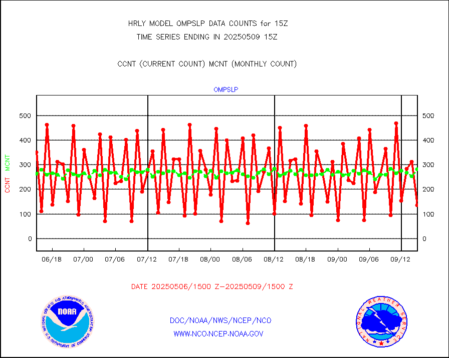
ompslp |
OMPS Limb Profiler ozone data (NPP) |
350 |
248 |
141.1 % |
1908.00-1908.99 |
ompsn8 |
OMPS nadir profile ozone (Version 8 BUFR) |
596 |
558 |
106.8 % |
1913.00-1913.99 |
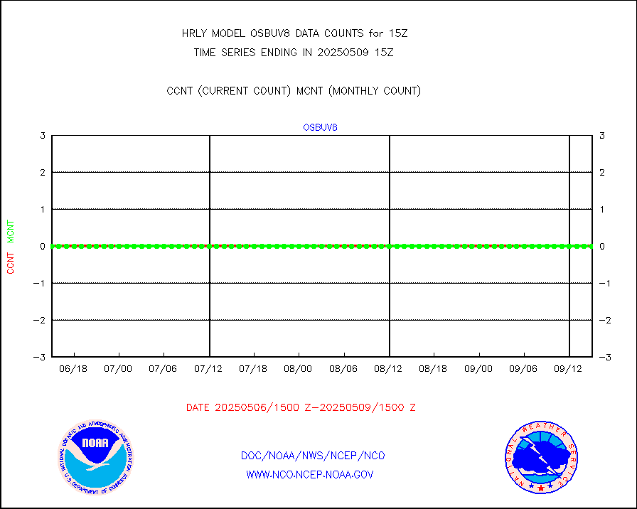
ompst8 |
OMPS total column ozone (Version 8 BUFR) |
459955 |
335153 |
137.2 % |
1913.00-1913.99 |
pirep |
Manual PIREP aircraft data (dcded from AIREP fmt) |
126 |
162 |
77.8 % |
1914.50-1915.49 |
prflrp |
Profilr winds from PIBAL (PILOT,PILOT SHIP/MOBIL) |
0 |
0 |
n/a |
1914.50-1915.49 |
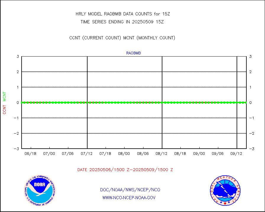
raobm |
Rawinsonde - mobile land (from TEMP/PILOT MOBIL) |
0 |
0 |
n/a |
1914.50-1915.49 |
raobs |
Rawinsonde - ship (from TEMP SHIP, PILOT SHIP) |
0 |
0 |
n/a |
1914.50-1915.49 |
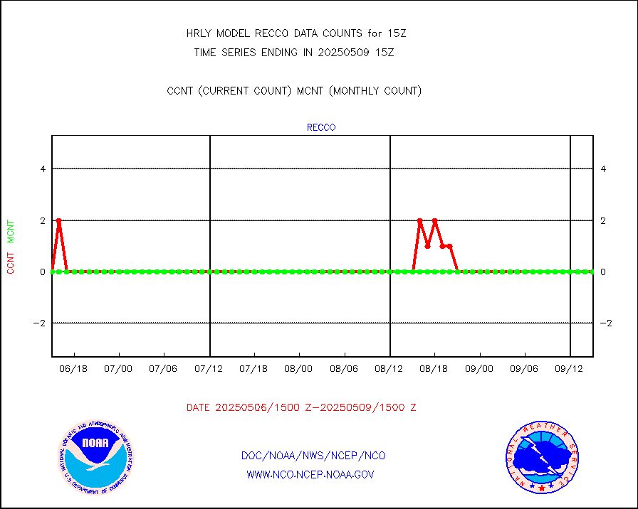
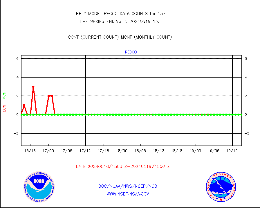
recco |
Flight level reconnaissance aircraft data |
0 |
0 |
n/a |
1914.50-1915.49 |
saphir |
Megha-Tropiques SAPHIR L1A2 brightness temps |
0 |
0 |
n/a |
1912.50-1913.49 |
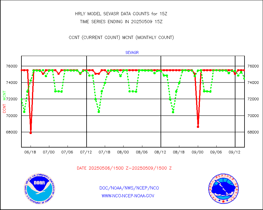
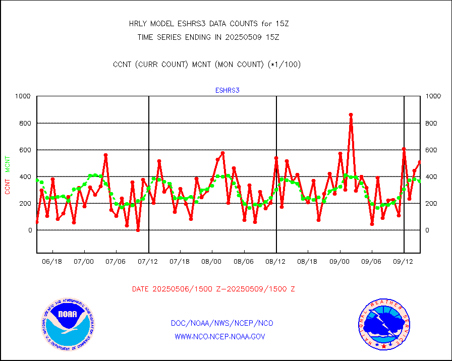
sevasr |
METEOSAT-10 2nd Gen SEVIRI All Sky Radiance(proc) |
75512 |
75453 |
100.1 % |
1914.50-1915.49 |
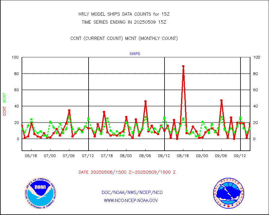
ships |
Ship - manual and automatic, restricted |
19 |
5 |
380.0 % |
1914.50-1915.49 |
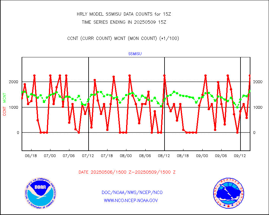
ssmisu |
DMSP SSM/IS 1C radiance data (Unified Pre-Proc.) |
224700 |
141749 |
158.5 % |
1913.50-1914.49 |
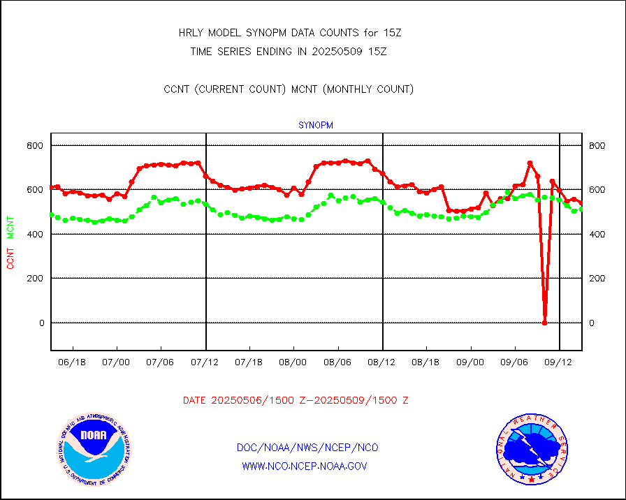
synopm |
Synoptic - mobile manual and automatic |
571 |
562 |
101.6 % |
1914.50-1915.49 |
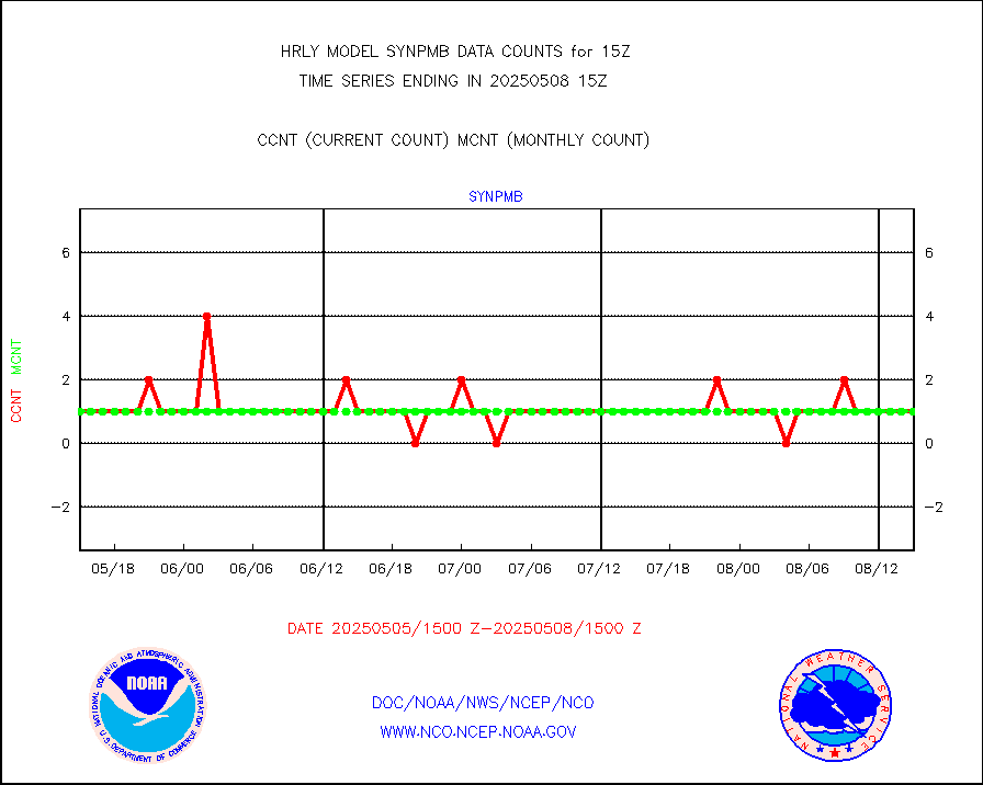
synpmb |
Synoptic - mobile manual & auto (decoded fr BUFR) |
0 |
1 |
0.0 % |
1914.50-1915.49 |
tesac |
CTD probe, Argo prflng float, mooring (TESAC fmt) |
187 |
195 |
95.9 % |
1914.50-1915.49 |
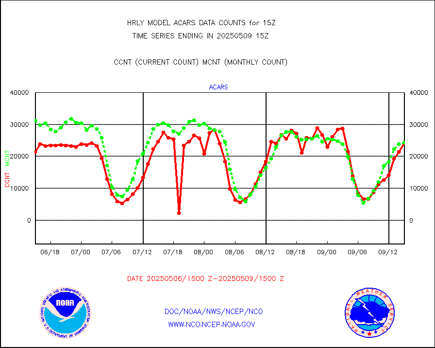
tmdara |
TAMDAR aircft data-all types(from Panasonic,BUFR) |
285 |
313 |
91.1 % |
1914.50-1915.49 |
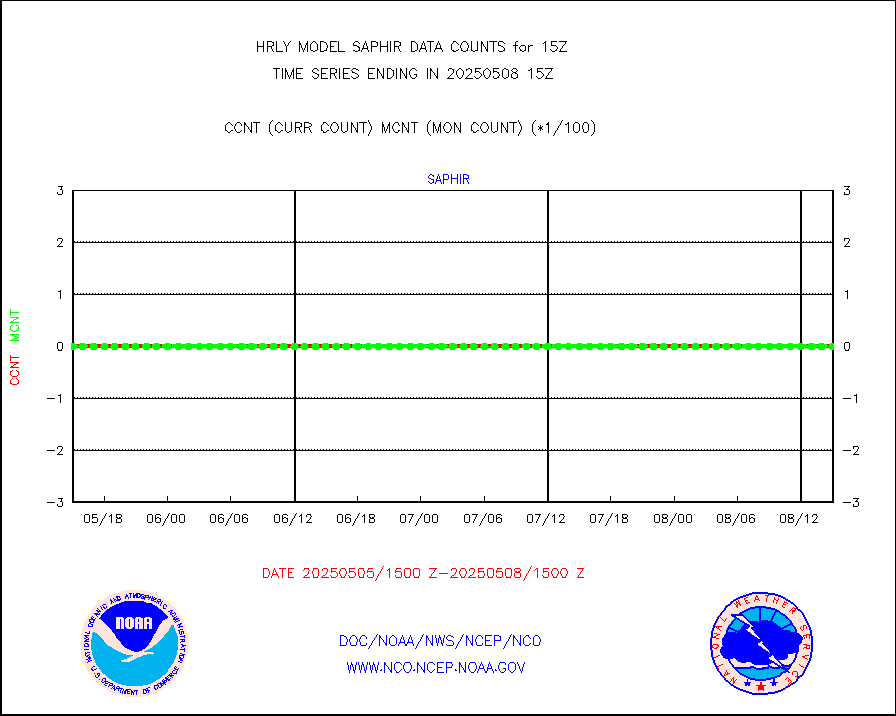
trkob |
ThermoSalinoGraph (TSG) TRACKOB format) |
90 |
45 |
200.0 % |
1913.50-1914.49 |
visin |
INSAT/KALPANA India visible derived cloud motion |
0 |
0 |
n/a |
1912.50-1913.49 |
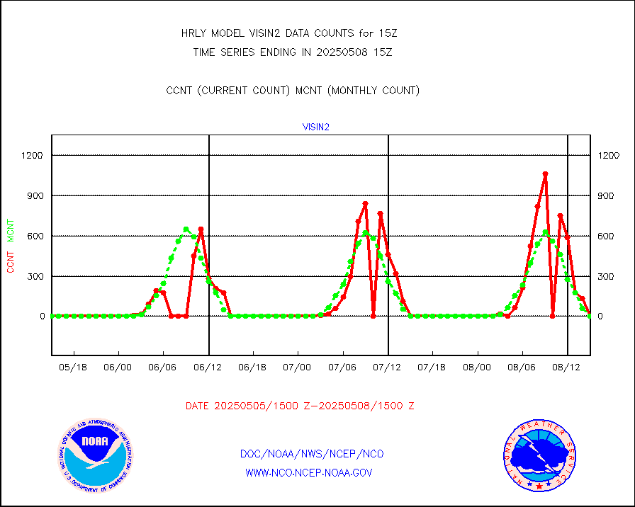
visin2 |
INDIA SATWIND, INSAT VIS channel |
0 |
0 |
n/a |
1914.00-1914.99 |
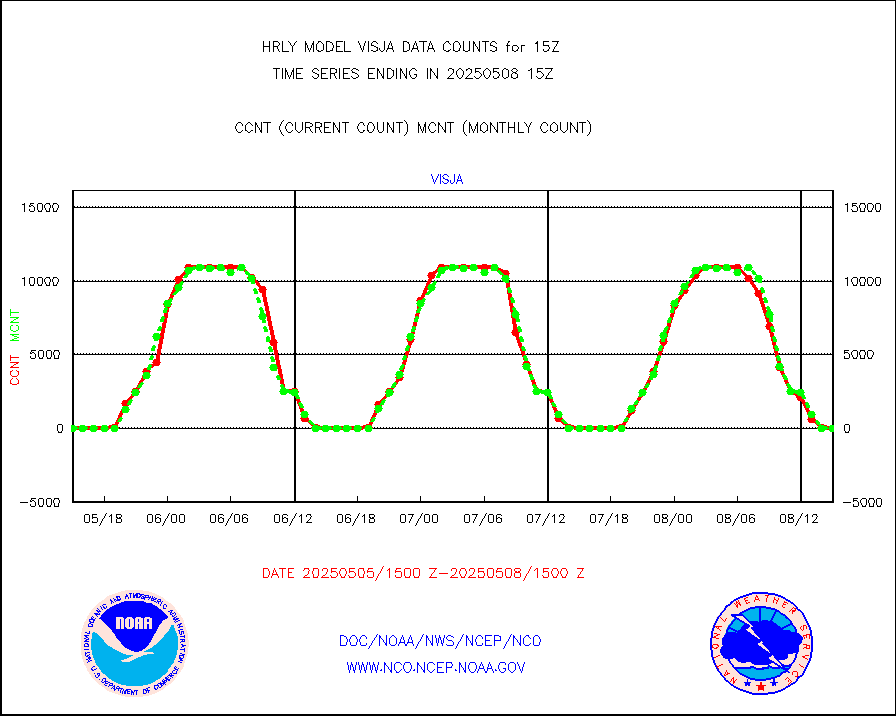
visja |
MTSAT/JMA visible derived cloud motion |
0 |
0 |
n/a |
1912.50-1913.49 |
visusr |
GOES-16&up/NESDIS visible derived cloud motion |
225756 |
180942 |
124.8 % |
1914.00-1914.99 |
vseunb |
METEOSAT/EUMETSAT visible drv cld motion NBseq |
28840 |
29059 |
99.2 % |
1913.50-1914.49 |


