| Critical Data with Normal Counts |
|---|
| Type | Description | Hourly Count | Monthly Average | Percent (%) of Monthly Mean | UTC Time Window |
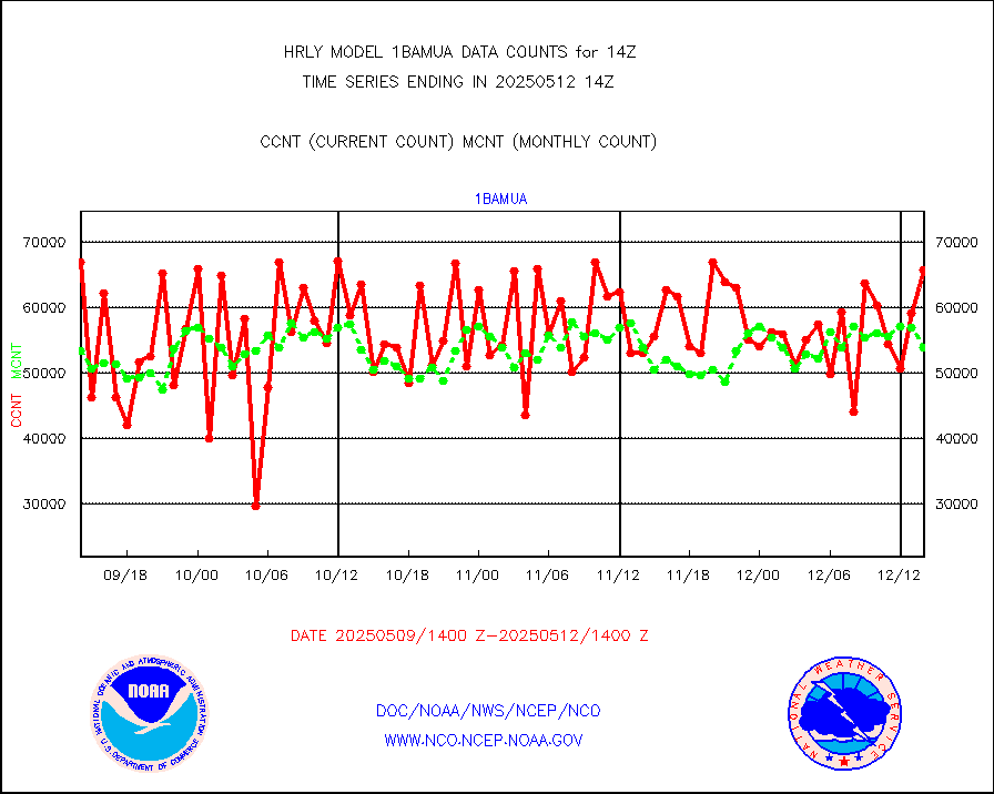
1bamua |
NOAA 15-19 & METOP 1-2 AMSU-A NCEP-proc. br.temps |
57670 |
55983 |
103.0 % |
1912.00-1912.99 |
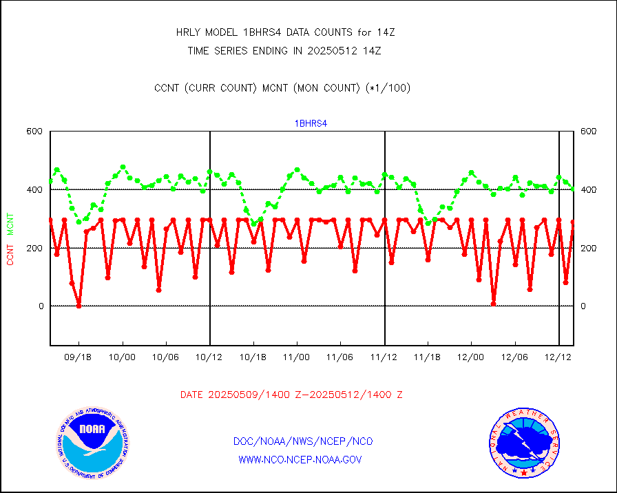
1bhrs4 |
NOAA 18-19 & METOP 1-2 HIRS-4 NCEP-proc. br.temps |
59242 |
47068 |
125.9 % |
1912.00-1912.99 |
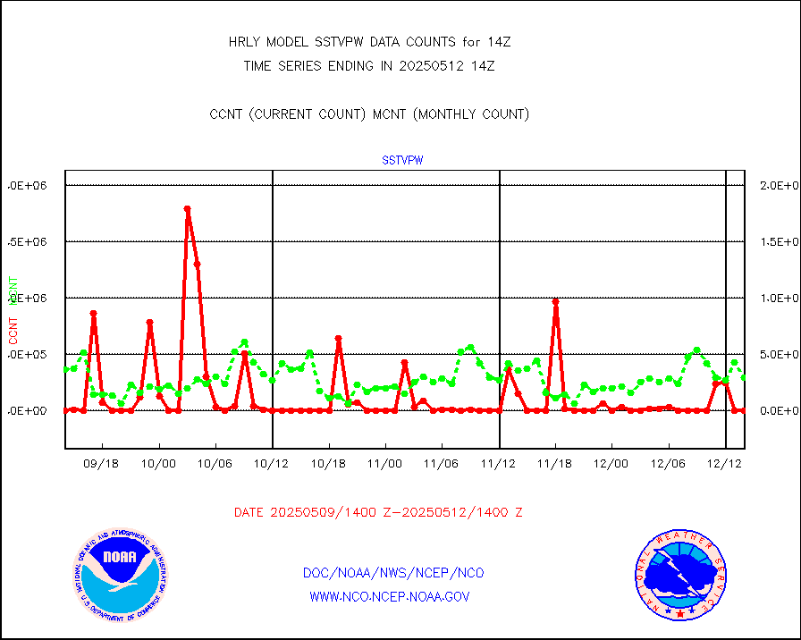
1bmhs |
NOAA 18-19 & METOP 1-2 MHS NCEP-proces. br. temps |
276470 |
310874 |
88.9 % |
1912.00-1912.99 |
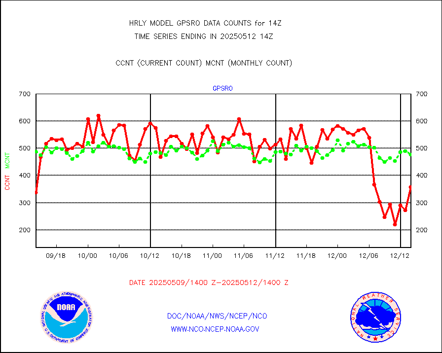
acars |
MDCRS ACARS acft data from ARINC(dcded from BUFR) |
18133 |
17058 |
106.3 % |
1913.50-1914.49 |
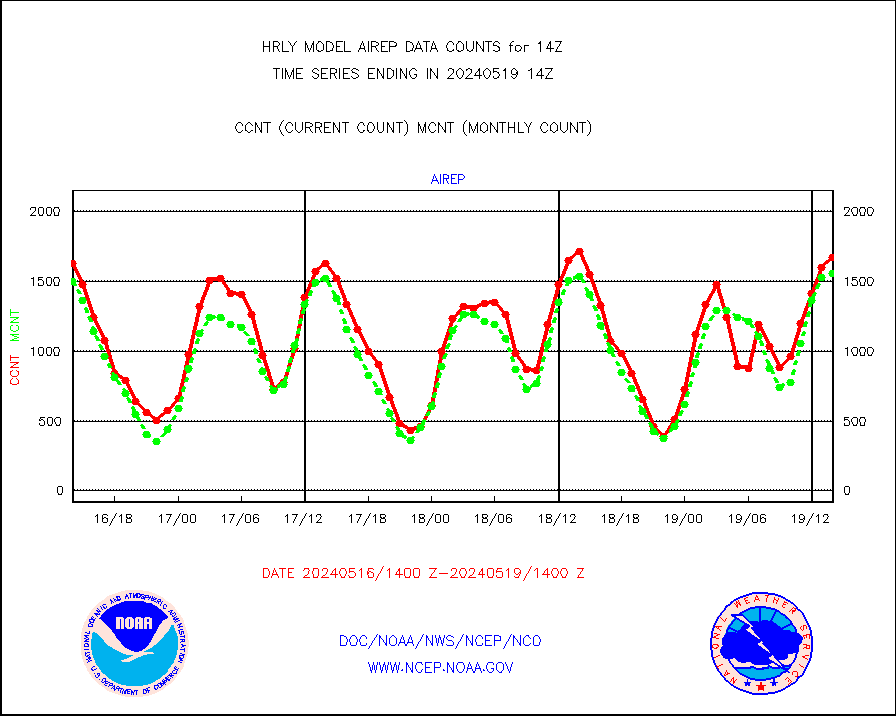
airep |
Manual AIREP aircraft data (dcded from AIREP fmt) |
1673 |
1559 |
107.3 % |
1913.50-1914.49 |
airsev |
AQUA AIRS/AMSU-A/HSB brightness temps- every FOV |
0 |
0 |
n/a |
1911.50-1912.49 |
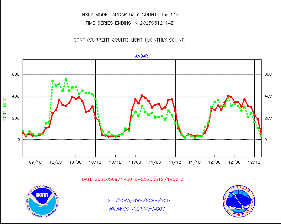
amdar |
AMDAR aircraft data (decoded from AMDAR format) |
49 |
55 |
89.1 % |
1913.50-1914.49 |
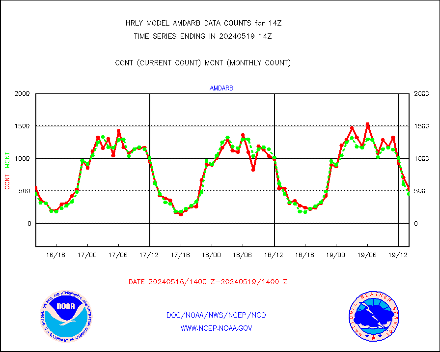
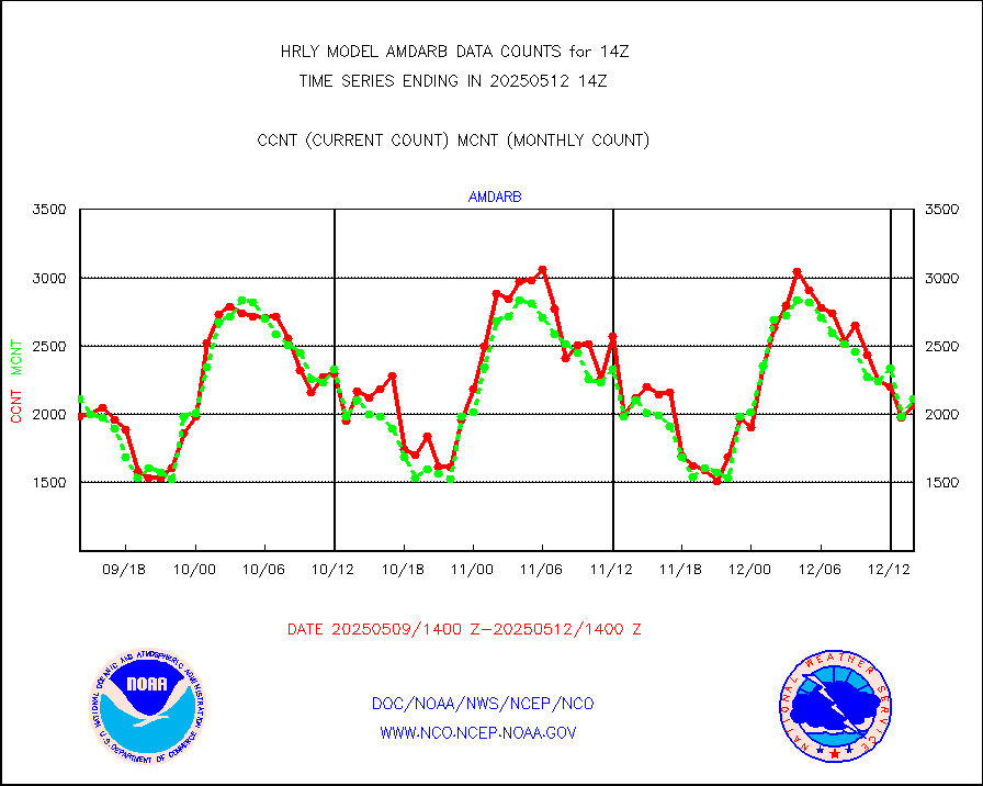
amdarb |
AMDAR aircraft data (decoded from BUFR) |
530 |
455 |
116.5 % |
1913.50-1914.49 |
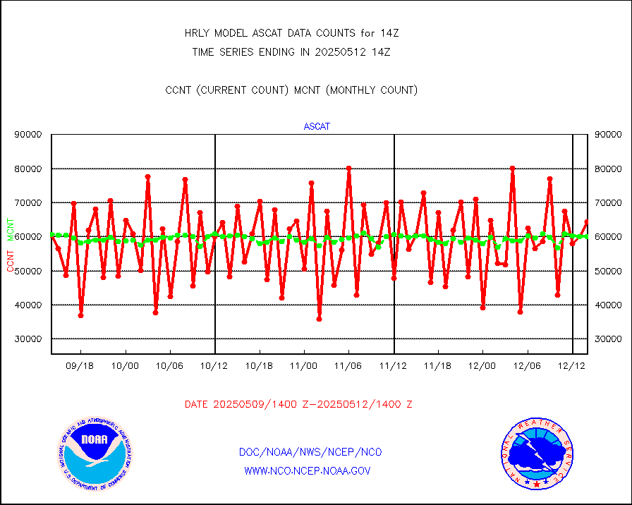
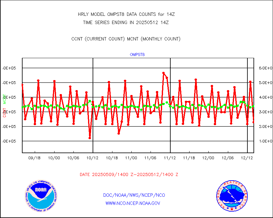
ascat |
METOP 1-2 ASCAT products |
50232 |
45483 |
110.4 % |
1912.50-1913.49 |
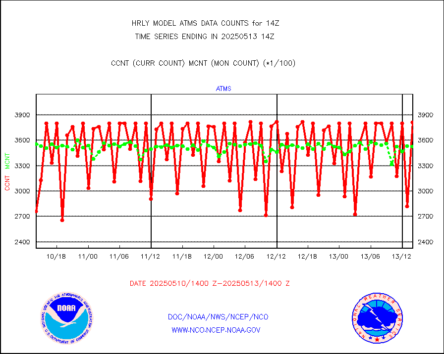
atms |
NPP/NOAA-20 ATMS brightness temperatures |
380352 |
342806 |
111.0 % |
1912.50-1913.49 |
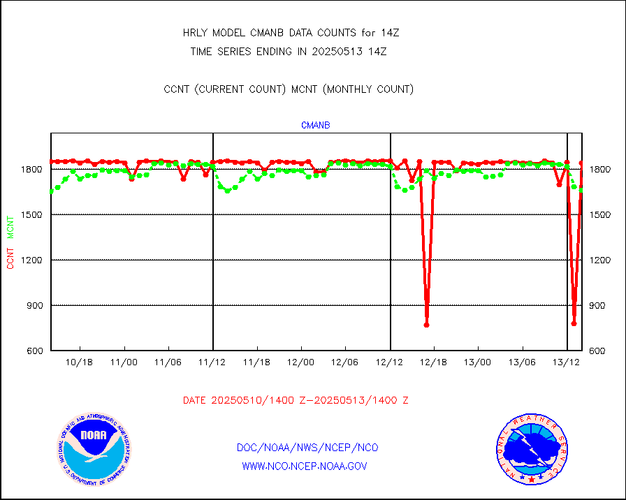
cmanb |
Surface Marine CMAN rpts decoded from BUFR format |
1691 |
1750 |
96.6 % |
1913.50-1914.50 |
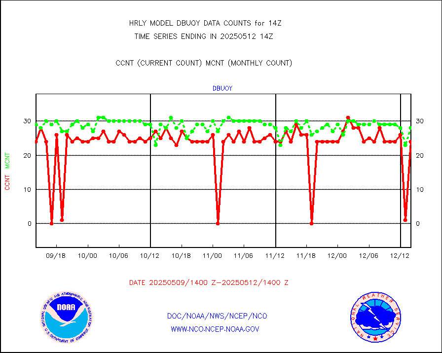
dbuoy |
Buoys decoded from FM-18 fmt (moored or drifting) |
39 |
29 |
134.5 % |
1913.50-1914.49 |
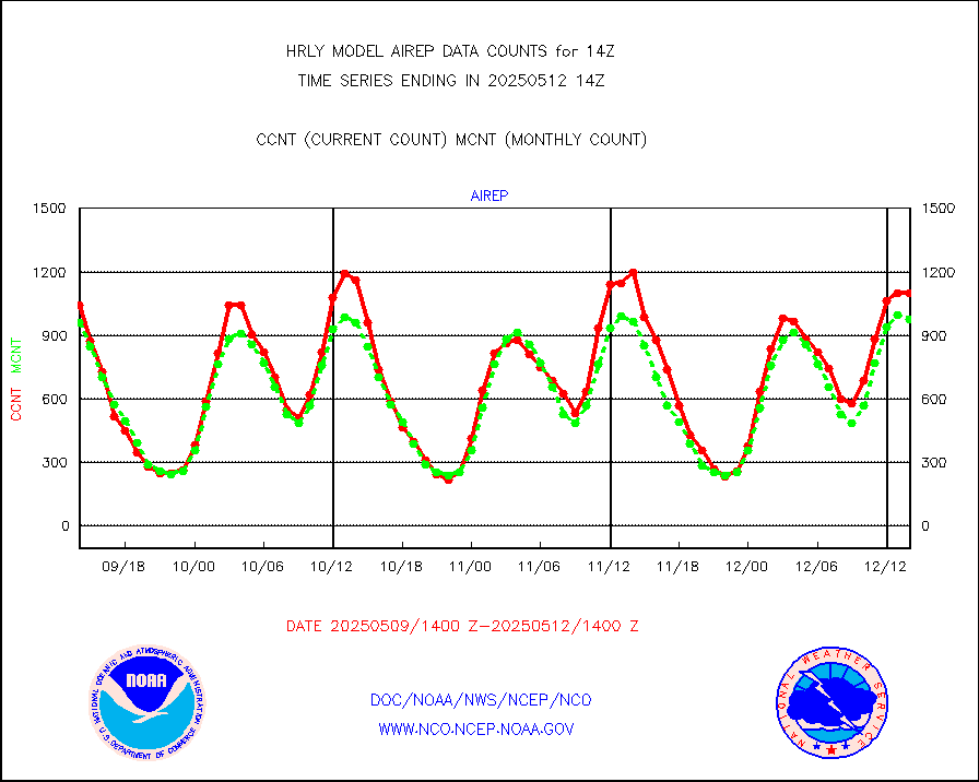
eadas |
E-AMDAR (European AMDAR acft decoded from BUFR) |
1896 |
1753 |
108.2 % |
1913.50-1914.49 |
esamua |
NOAA 15-19 & METOP 1-2 AMSU-A proc btmps frm RARS |
37262 |
37045 |
100.6 % |
1913.50-1914.49 |
eshrs3 |
NOAA 15-19 & METOP 1-2 HIRS-3/4 pr btmps frm RARS |
84374 |
74232 |
113.7 % |
1913.50-1914.49 |
gnss |
Grnd-based Gbl Navigation Sat System (GNSS) data |
8850 |
9174 |
96.5 % |
1913.00-1913.99 |
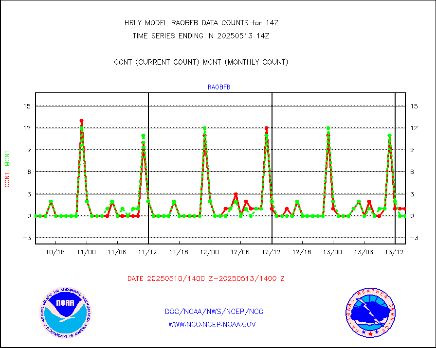
gpsro |
GPS radio occultation data |
492 |
440 |
111.8 % |
1911.50-1912.49 |
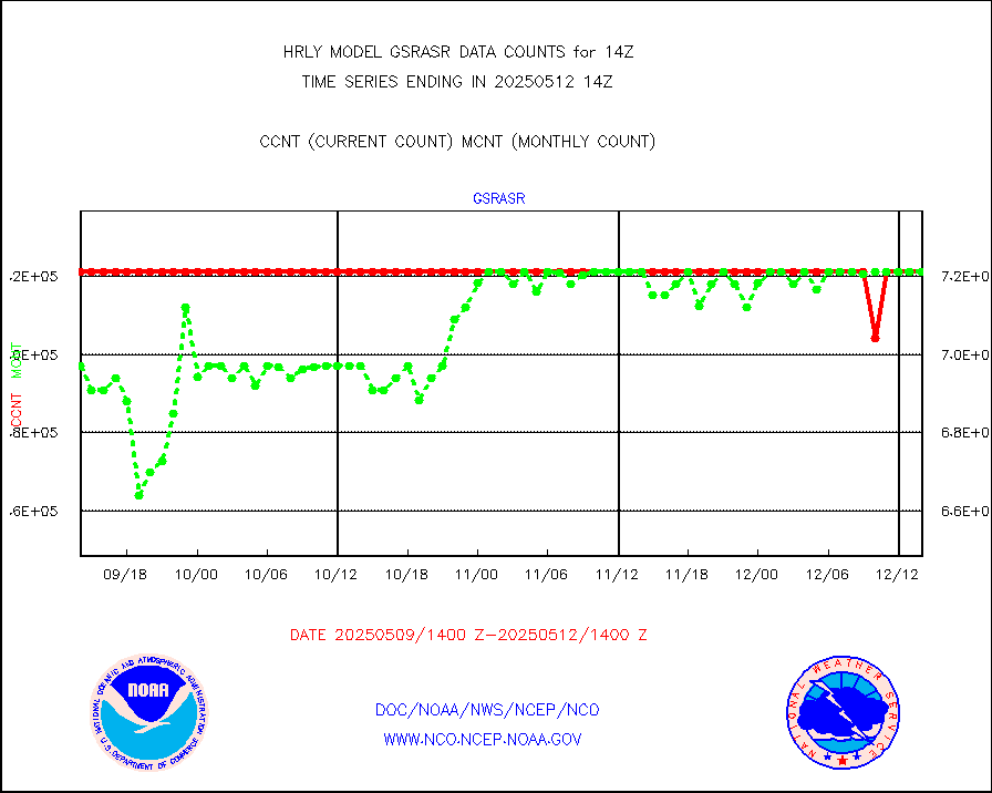
gsrasr |
GOES-16/17 All Sky Radiances (proc.) |
360476 |
354468 |
101.7 % |
1913.50-1914.49 |
gsrcsr |
GOES-16/17 Clear Sky Radiances (proc.) |
162928 |
166658 |
97.8 % |
1913.50-1914.49 |
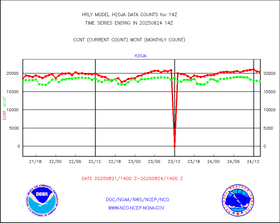
h20ja |
MTSAT/JMA water vapor imager derived cloud motion |
19646 |
18705 |
105.0 % |
1911.50-1912.49 |
h20mo |
MODIS (AQUA/TERRA) wvpr imager derived cld motion |
0 |
0 |
n/a |
1910.00-1910.99 |
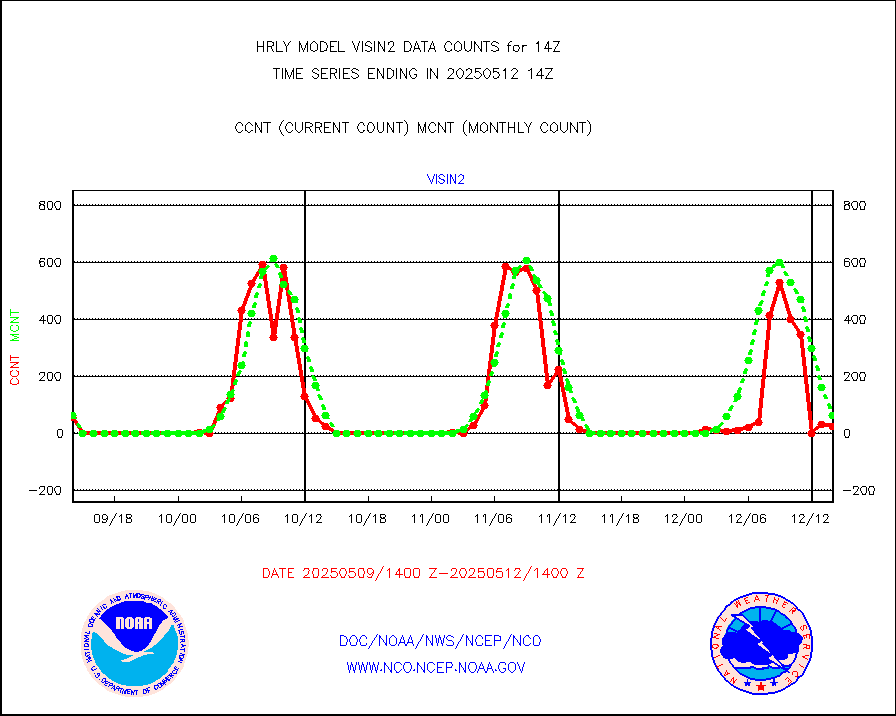
h2tusr |
GOES-16&up/NESDIS wv imgr/cld-top derived cld mtn |
23051 |
24374 |
94.6 % |
1913.00-1913.99 |
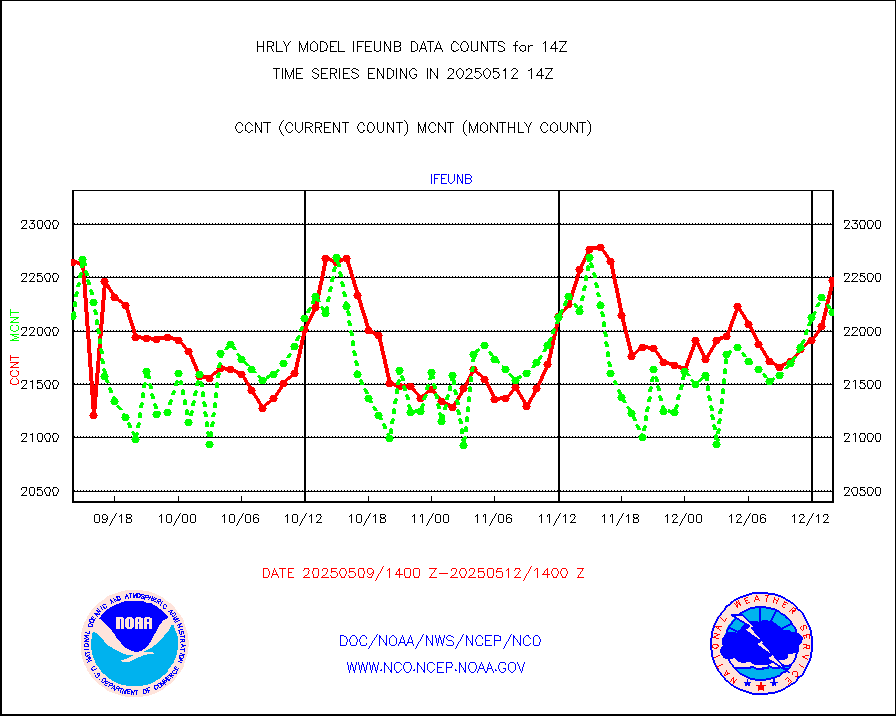
ifeunb |
METEOSAT/EUMETSAT ir lg-wave drv cld motion NBseq |
22470 |
22189 |
101.3 % |
1912.50-1913.49 |
infja |
MTSAT/JMA infrared long-wave derived cloud motion |
16542 |
15923 |
103.9 % |
1911.50-1912.49 |
infmo |
MODIS (AQUA/TERRA) ir l-wave derived cloud motion |
0 |
0 |
n/a |
1910.00-1910.99 |
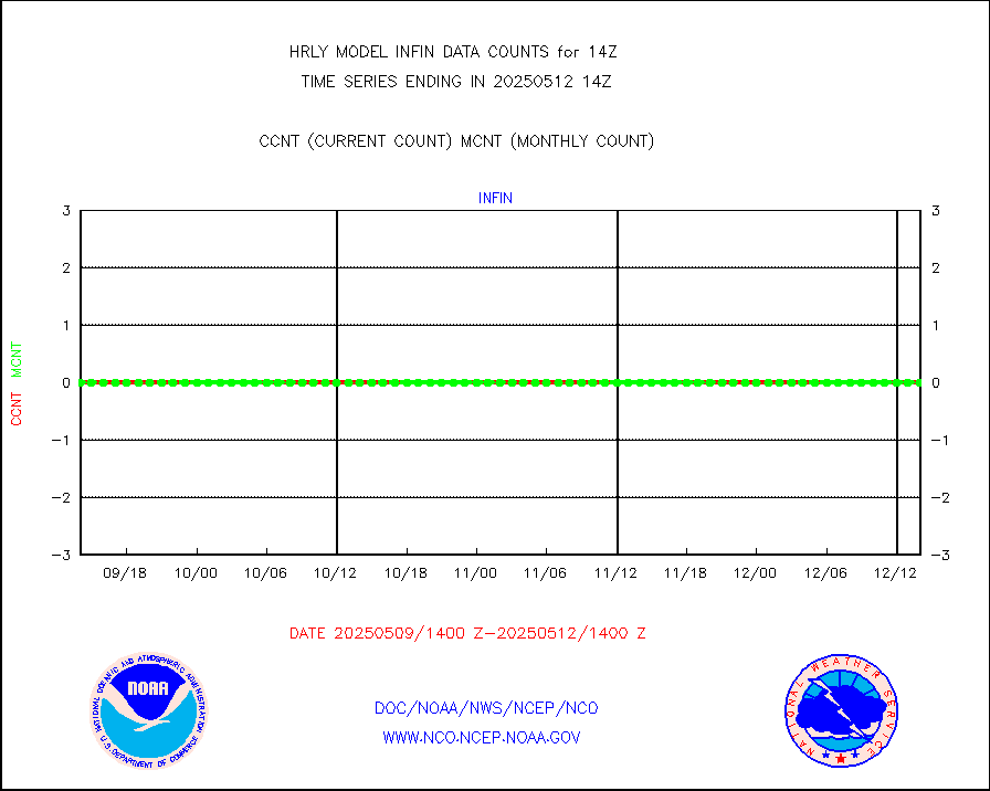
infusr |
GOES-16&up/NESDIS ir long-wave derived cld motion |
78918 |
80631 |
97.9 % |
1913.00-1913.99 |
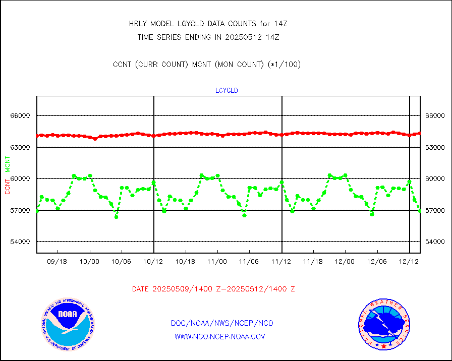
lgycld |
GOES/NASA(Langley) hi-res. (1x1 f-o-v) cloud data |
4205069 |
3320186 |
126.7 % |
1913.50-1914.49 |
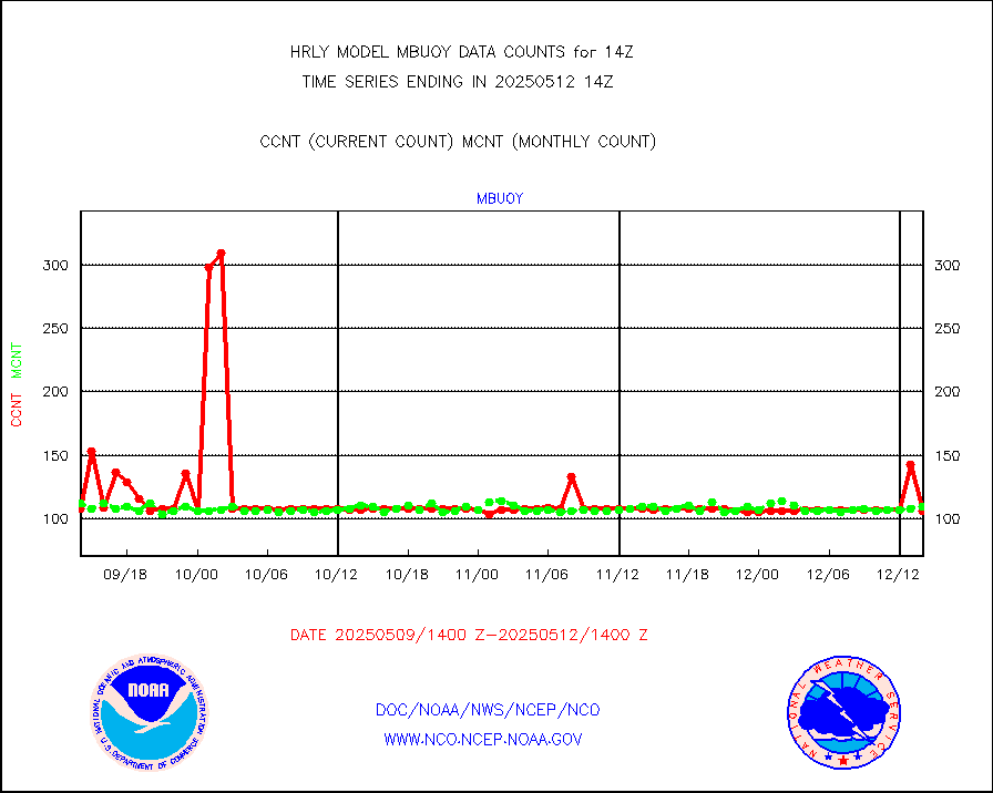
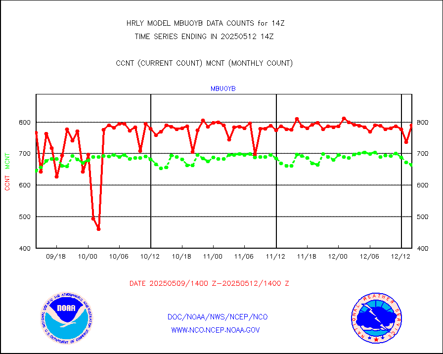
mbuoy |
Buoys decoded from FM-13 format (moored) |
117 |
129 |
90.7 % |
1913.50-1914.49 |
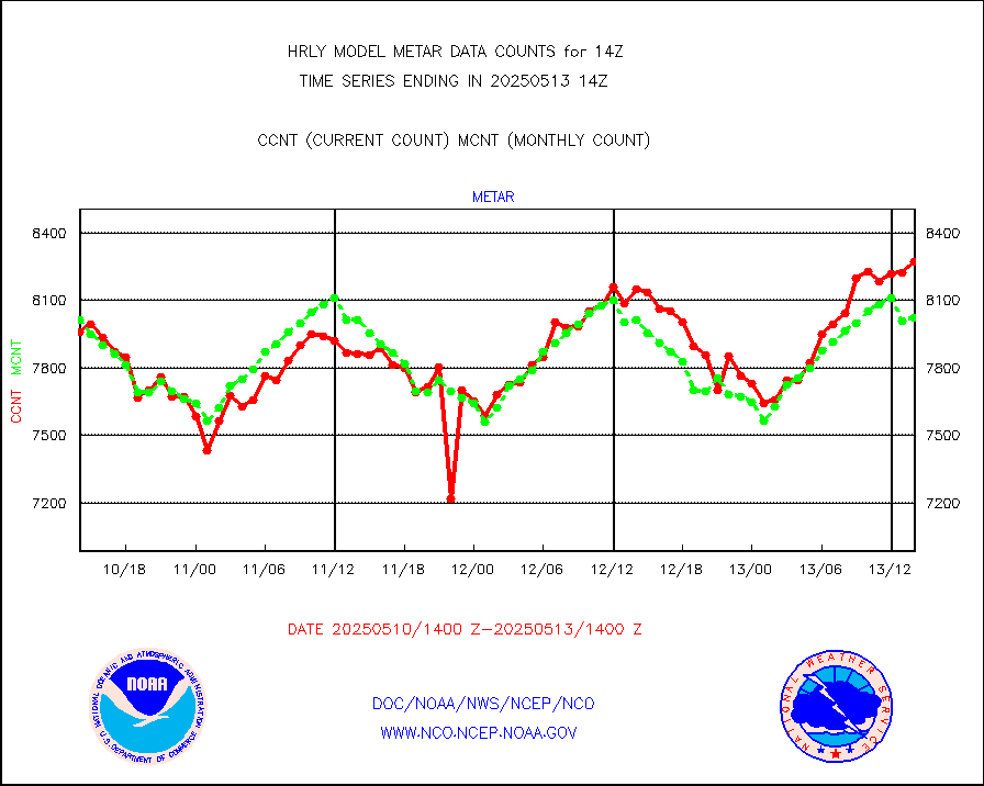
metar |
Aviation - METAR |
7708 |
8028 |
96.0 % |
1913.50-1914.49 |
mso470 |
Mesonet/MADIS Colorado E-470 (Interstate 470) |
21 |
20 |
105.0 % |
1913.50-1914.49 |
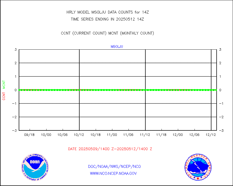
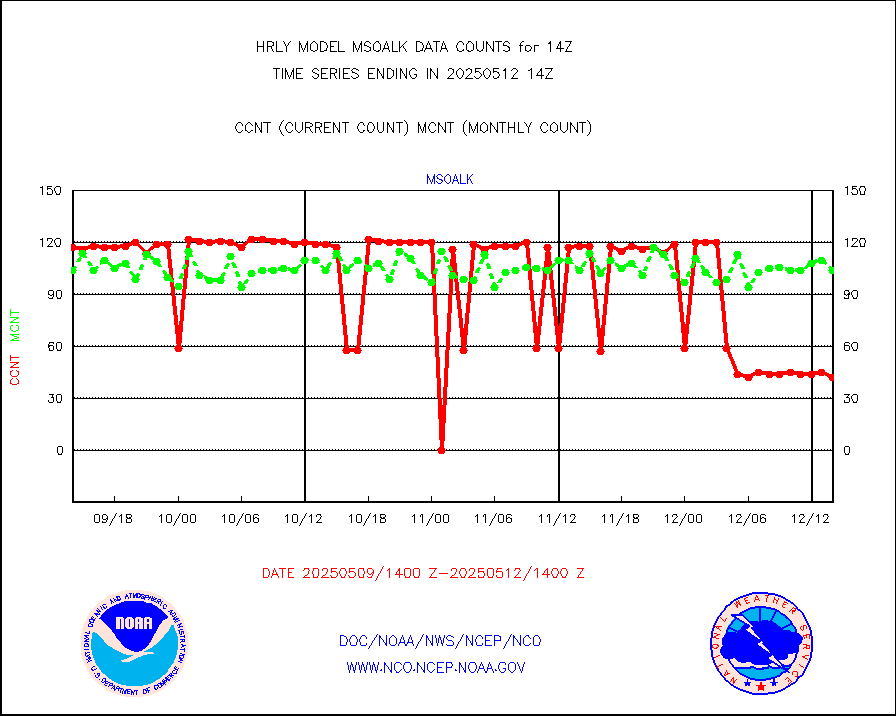
msoalk |
Mesonet/MADIS Alaska Department of Transportation |
110 |
109 |
100.9 % |
1913.50-1914.49 |
msoapg |
Mesonet/MADIS U.S. Army Aberdeen Proving Grounds |
0 |
0 |
n/a |
1913.50-1914.49 |
msoapr |
Mesonet/MADIS Citizen Weather Observers Program |
49945 |
48596 |
102.8 % |
1913.50-1914.49 |
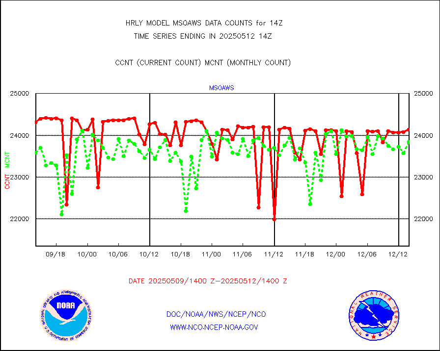
msoaws |
Mesonet/MADIS AWS Convergence Technologies, Inc. |
25569 |
25497 |
100.3 % |
1913.50-1914.49 |
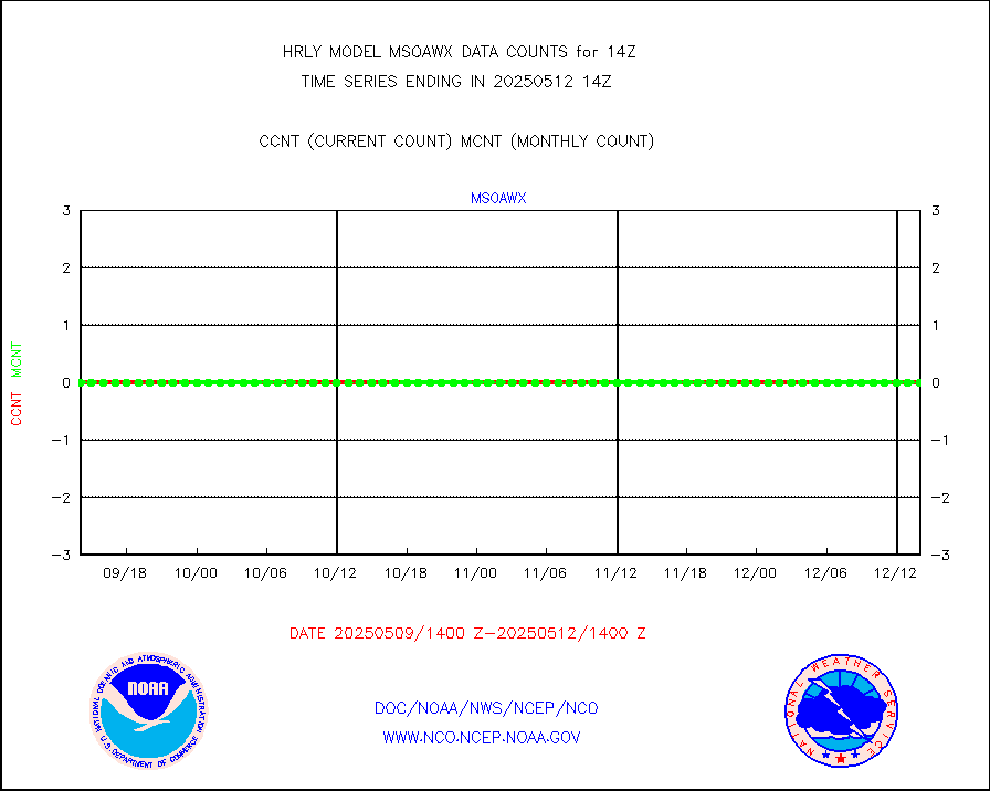
msoawx |
Mesonet/MADIS "Anything Weather" |
0 |
0 |
n/a |
1913.50-1914.49 |
msocol |
Mesonet/MADIS Colorado Dept. of Transportation |
0 |
0 |
n/a |
1913.50-1914.49 |
msodcn |
Mesonet/MADIS DC Net |
0 |
0 |
n/a |
1913.50-1914.49 |
msoden |
Mesonet/MADIS Denver Urban Drainage & Flood Cntrl |
250 |
250 |
100.0 % |
1913.50-1914.49 |
msofla |
Mesonet/MADIS Florida (FAWN & USF) |
4 |
4 |
100.0 % |
1913.50-1914.49 |
msoflt |
Mesonet/MADIS Florida Dept. of Transportation |
0 |
0 |
n/a |
1913.50-1914.49 |
msogeo |
Mesonet/MADIS Georgia Dept. of Transportation |
0 |
0 |
n/a |
1913.50-1914.49 |
msohad |
Mesonet/MADIS NWS Hydromet Auto Data System(HADS) |
6719 |
6654 |
101.0 % |
1913.50-1914.49 |
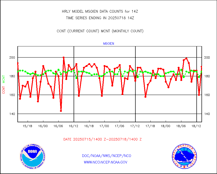
msoien |
Mesonet/MADIS Iowa Environmental |
187 |
186 |
100.5 % |
1913.50-1914.49 |
msoind |
Mesonet/MADIS Indiana Dept. of Transportation |
0 |
0 |
n/a |
1913.50-1914.49 |
msoiow |
Mesonet/MADIS Iowa Department of Transportation |
0 |
0 |
n/a |
1913.50-1914.49 |
msokan |
Mesonet/MADIS Kansas Department of Transportation |
387 |
359 |
107.8 % |
1913.50-1914.49 |
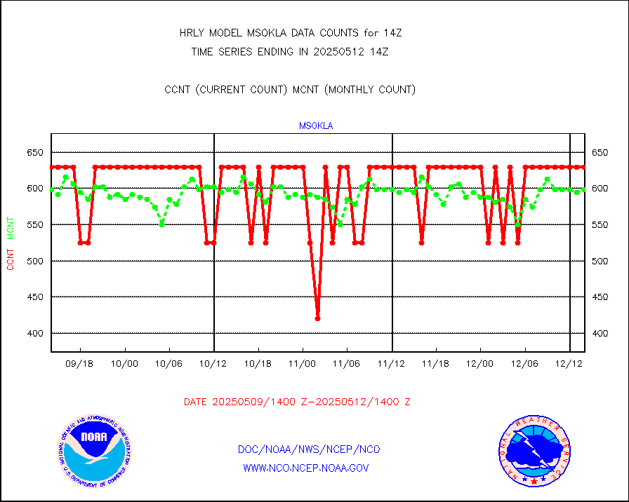
msokla |
Mesonet/MADIS Oklahoma Mesonet |
318 |
318 |
100.0 % |
1913.50-1914.49 |
msolju |
Mesonet/MADIS Louisiana State/Jackson State Univ. |
0 |
0 |
n/a |
1913.50-1914.49 |
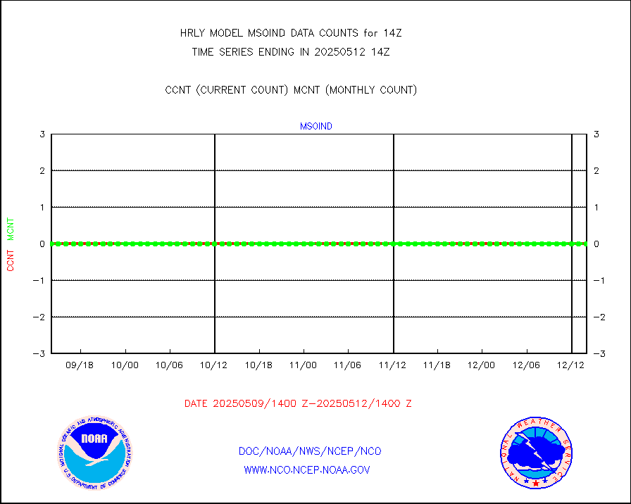
msomca |
Mesonet/MADIS Missouri Commercial Agricult Wx Net |
300 |
293 |
102.4 % |
1913.50-1914.49 |
msomin |
Mesonet/MADIS Minnesota Dept. of Transportation |
0 |
0 |
n/a |
1913.50-1914.49 |
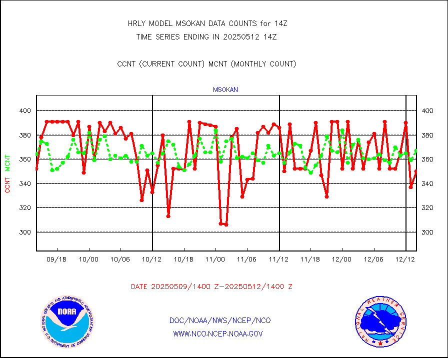
msonos |
Mesonet/MADIS NOS-Phys Oceanographic Realtime Sys |
387 |
382 |
101.3 % |
1913.50-1914.49 |
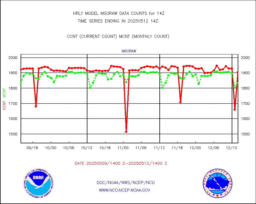
msoraw |
Mesonet/MADIS NFIC Remote Automated Wx Stns(RAWS) |
1871 |
1800 |
103.9 % |
1913.50-1914.49 |
msovir |
Mesonet/MADIS Virginia Dept. of Transportation |
207 |
227 |
91.2 % |
1913.50-1914.49 |
msowfy |
Mesonet/MADIS "Weather for You" |
0 |
0 |
n/a |
1913.50-1914.49 |
msowis |
Mesonet/MADIS Wisconsin Dept. of Transportation |
0 |
0 |
n/a |
1913.50-1914.49 |
msowst |
Mesonet/MADIS MesoWest (many subproviders) |
46971 |
45389 |
103.5 % |
1913.50-1914.49 |
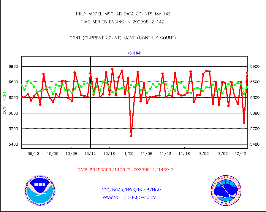
msowtx |
Mesonet/MADIS West Texas |
5638 |
5573 |
101.2 % |
1913.50-1914.49 |
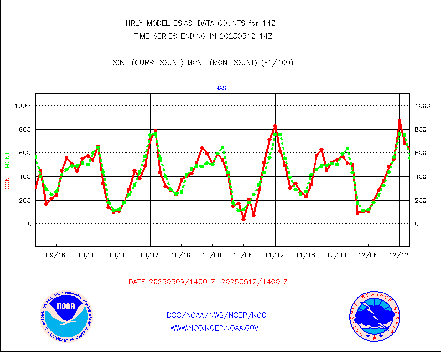
mtiasi |
METOP 1-2 IASI 1C radiance data (varbl. channels) |
66856 |
87239 |
76.6 % |
1912.00-1912.99 |
nxrdw |
NEXRAD Vel Azm Dsp(VAD) winds via radar coded msg |
0 |
0 |
n/a |
1913.50-1914.49 |
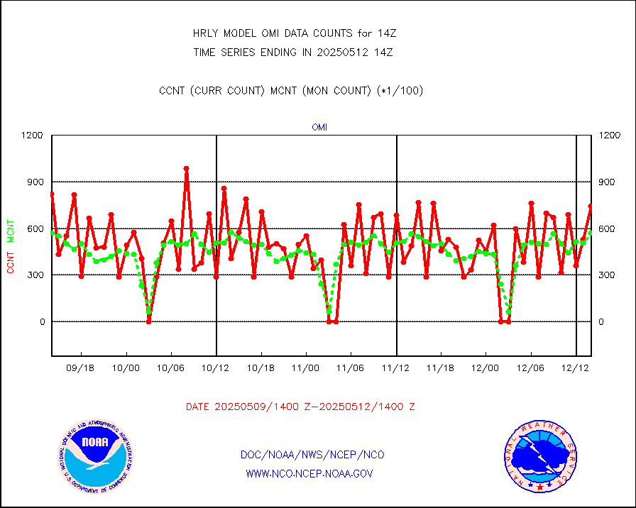
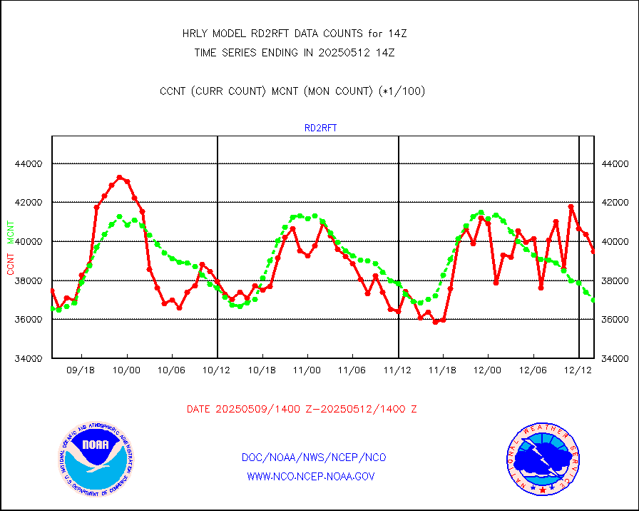
omi |
Aura Ozone Monitoring Instrument (OMI) data |
79140 |
39528 |
200.2 % |
1911.50-1912.49 |
osbuv8 |
NOAA 16-19 Solar Backscatter UV-2 rad frm V8 BUFR |
0 |
0 |
n/a |
1912.00-1912.99 |
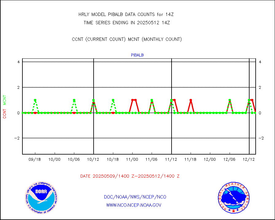
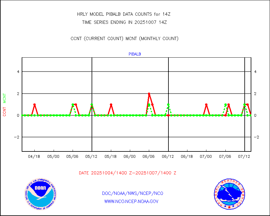
pibal |
PIBAL (from PILOT, PILOT SHIP, PILOT MOBIL) |
0 |
0 |
n/a |
1913.50-1914.49 |
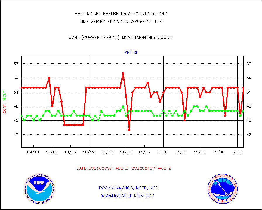
prflrb |
Multi-Agency Profiler (MAP) and SODAR winds |
35 |
42 |
83.3 % |
1913.50-1914.49 |
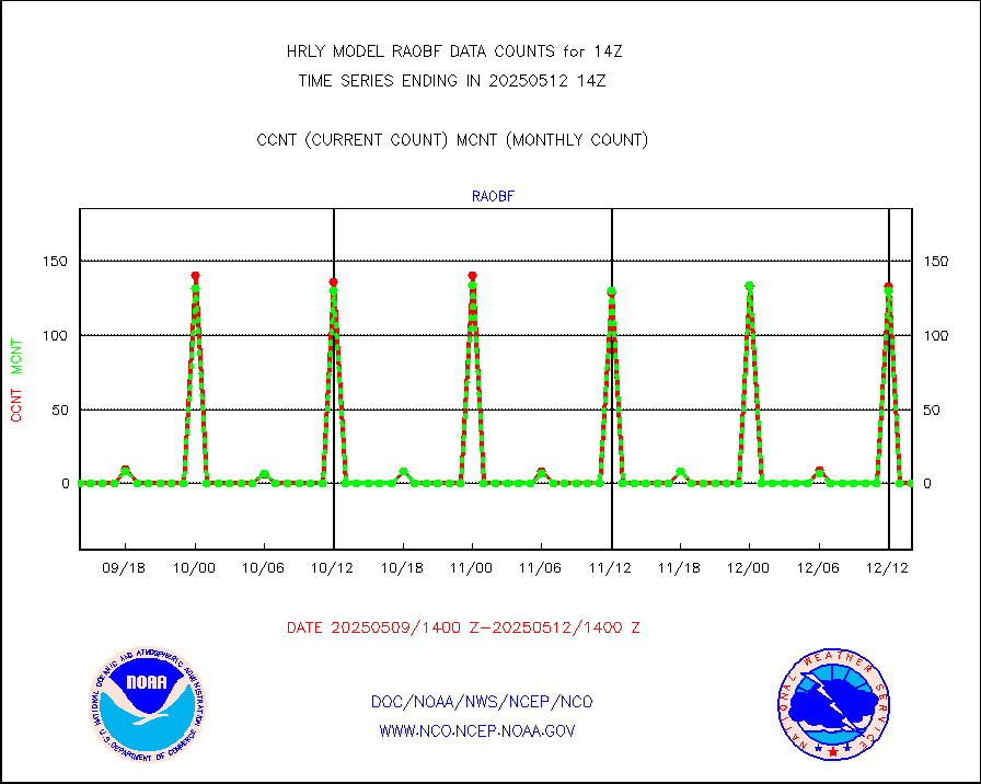
raobf |
Rawinsonde - fixed land (from TEMP or PILOT) |
0 |
0 |
n/a |
1913.50-1914.49 |
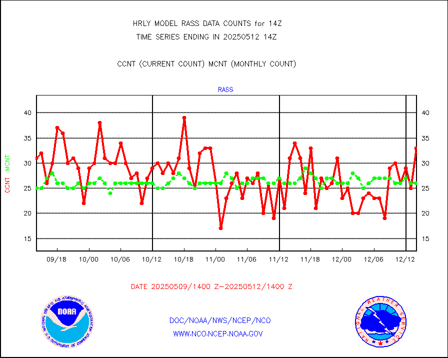
rass |
RASS temperatures (NOAA and Multi-Agency) |
24 |
27 |
88.9 % |
1913.50-1914.49 |
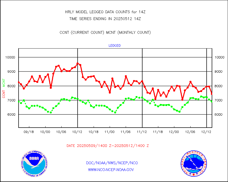
rd2rft |
NEXRAD reflectivity (Lvl 2 - GTS) |
3728179 |
3785294 |
98.5 % |
1913.50-1914.49 |
rd2wnd |
NEXRAD radial wind (Level 2 - GTS) |
1215497 |
1047895 |
116.0 % |
1913.50-1914.49 |
sevcsr |
METEOSAT-10 2nd Gen SEVIRI Clr Sky Radiance(proc) |
0 |
0 |
n/a |
1913.50-1914.49 |
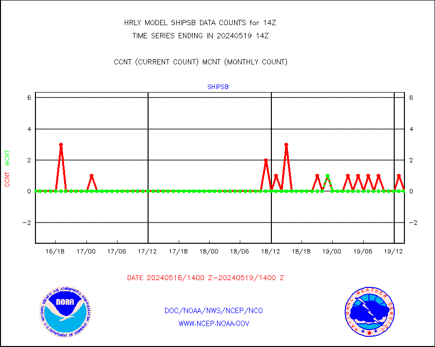
shipsb |
Ship - manual and automatic, restricted (BUFR) |
0 |
0 |
n/a |
1913.50-1914.50 |
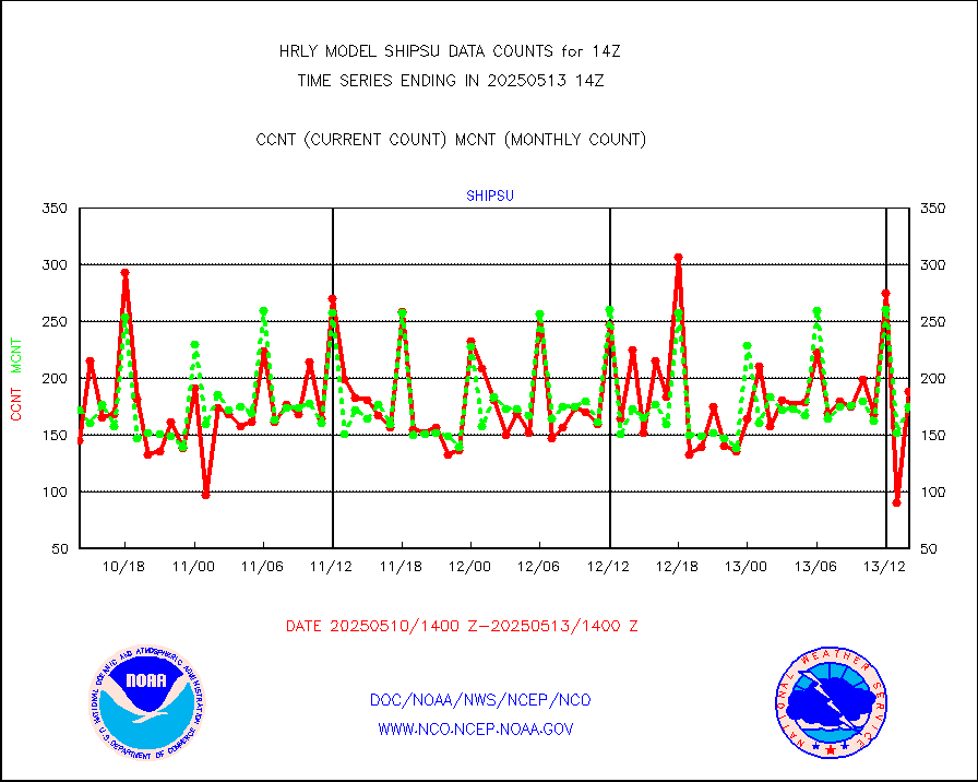
shipsu |
Ship - manual and automatic, unrestricted |
126 |
121 |
104.1 % |
1913.50-1914.50 |
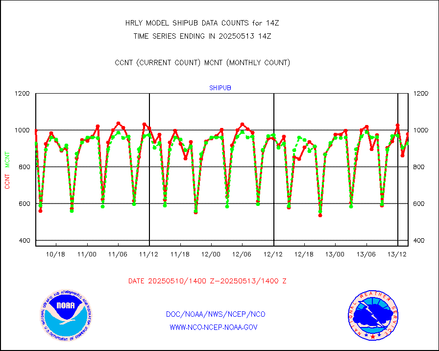
shipub |
Ship - manual and automatic, unrestricted (BUFR) |
859 |
807 |
106.4 % |
1913.50-1914.50 |
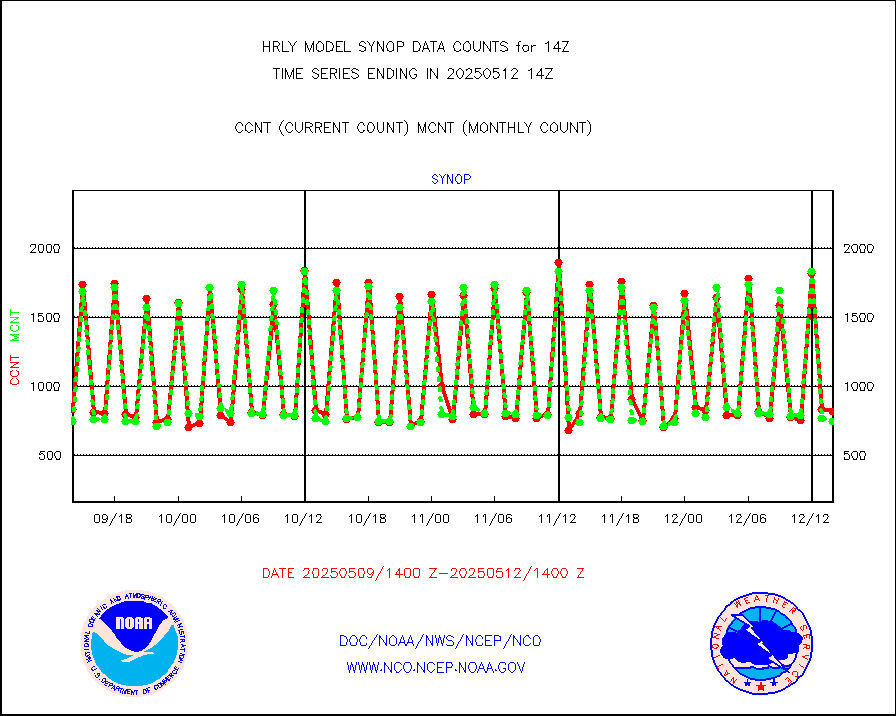
synop |
Synoptic - fixed manual and automatic |
954 |
930 |
102.6 % |
1913.50-1914.49 |
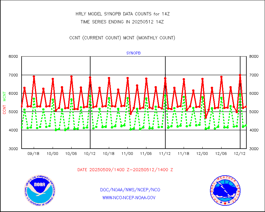
synopb |
Synoptic - fixed manual & auto (decoded fr BUFR) |
4205 |
4192 |
100.3 % |
1913.50-1914.49 |
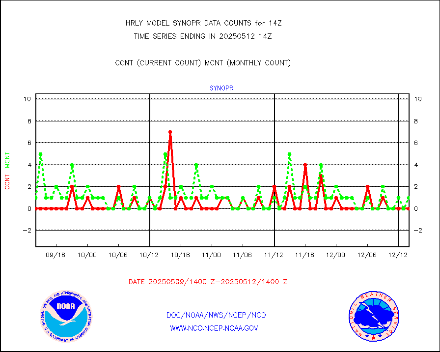
synopr |
Synoptic - restricted (WMO Res 40) manual & auto. |
0 |
1 |
0.0 % |
1913.50-1914.49 |
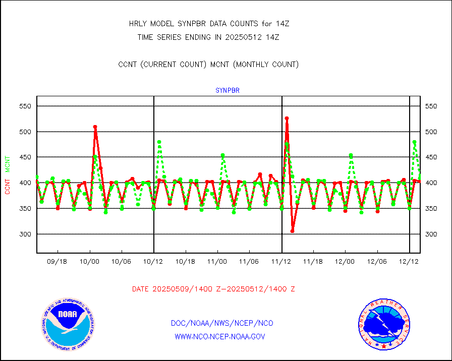
synpbr |
Synoptic - restricted (WMO Res 40)(decoded BUFR) |
395 |
398 |
99.2 % |
1913.50-1914.49 |
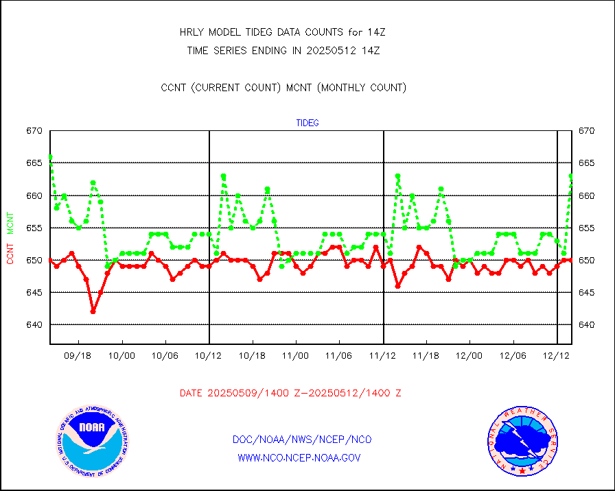
tideg |
Tide gauge reports decoded from CREX format |
645 |
643 |
100.3 % |
1913.00-1913.99 |
| Data Types of Opportunity with Normal Counts |
|---|
| Type | Description | Hourly Count | Monthly Average | Percent (%) of Monthly Mean | UTC Time Window |
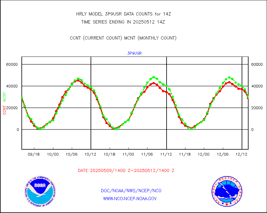
3p9usr |
GOES-16&up/NESDIS ir short-wv derived cld motion |
29626 |
29354 |
100.9 % |
1913.00-1913.99 |
acarsa |
MDCRS ACARS acft data (ARINC via AFWA)(AIREP fmt) |
0 |
0 |
n/a |
1913.50-1914.49 |
ahicsr |
Himawari Clear Sky Radiance |
0 |
0 |
n/a |
1913.00-1913.99 |
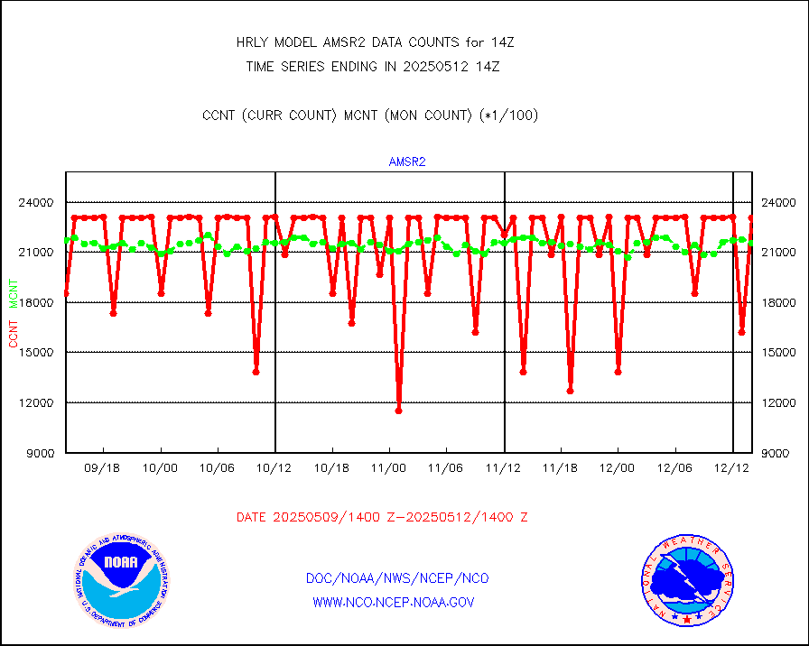
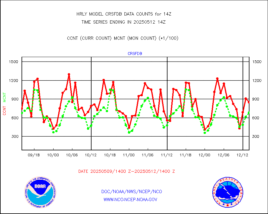
amsr2 |
GCOM-W AMSR2 1B brightness temperatures |
2309472 |
2085345 |
110.7 % |
1912.00-1912.99 |
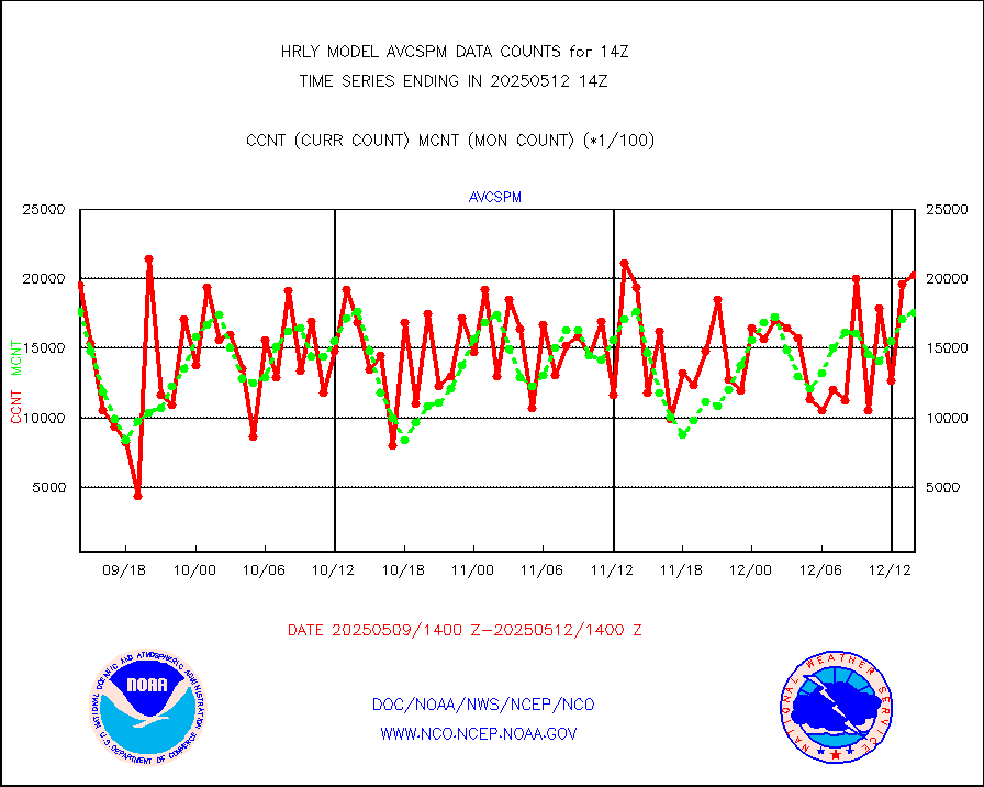
atmsdb |
NPP/NOAA-20 ATMS bright. temps-direct b-cast SSEC |
123607 |
133821 |
92.4 % |
1912.50-1913.49 |
atovs |
POES/NESDIS - processed ATOVS soundings/radiances |
0 |
0 |
n/a |
1912.00-1912.99 |
avcsam |
A.M.(N17,M2,M3) AVHRR GAC NCEP-proc clr&sea btmps |
1331229 |
1353802 |
98.3 % |
1911.50-1912.49 |
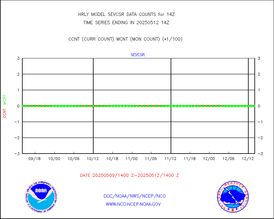
avcspm |
P.M.(N18-19) AVHRR GAC NCEP-proc clr & sea btemps |
1501765 |
1610911 |
93.2 % |
1911.50-1912.49 |
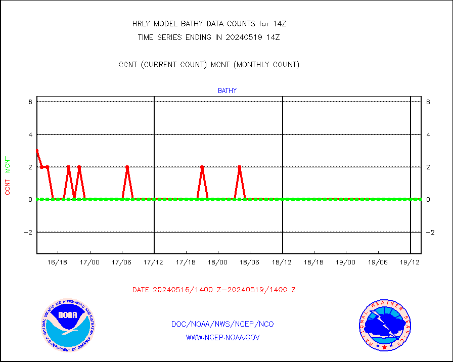
bathy |
eXpendable BathyThermograph, mooring (BATHY fmt) |
0 |
0 |
n/a |
1907.00-1907.99 |
coopmd |
Coop/MADIS NEPP & HCN-Modernization NOAA COOP Obs |
27 |
27 |
100.0 % |
1913.50-1914.49 |
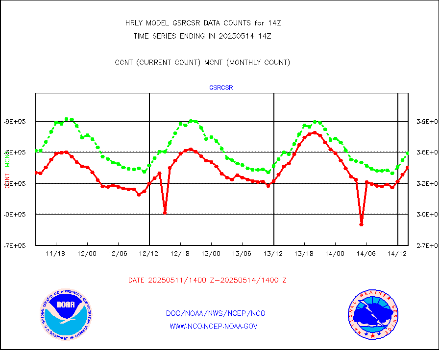
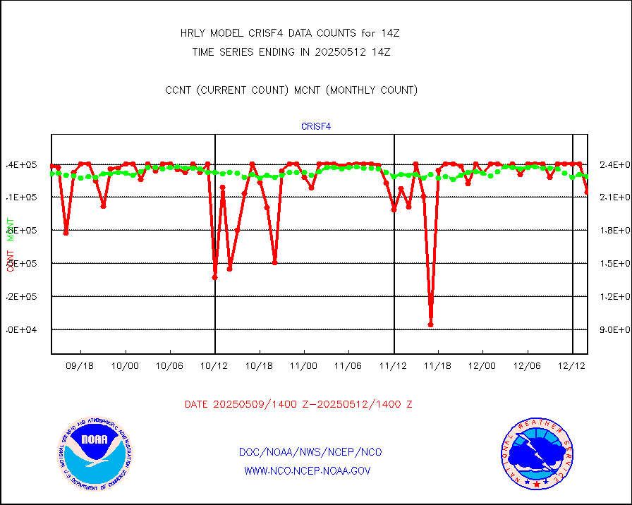
crisf4 |
NPP/NOAA-20 CrIS full spctrl radn (431 ch subset) |
240534 |
223049 |
107.8 % |
1912.50-1913.49 |
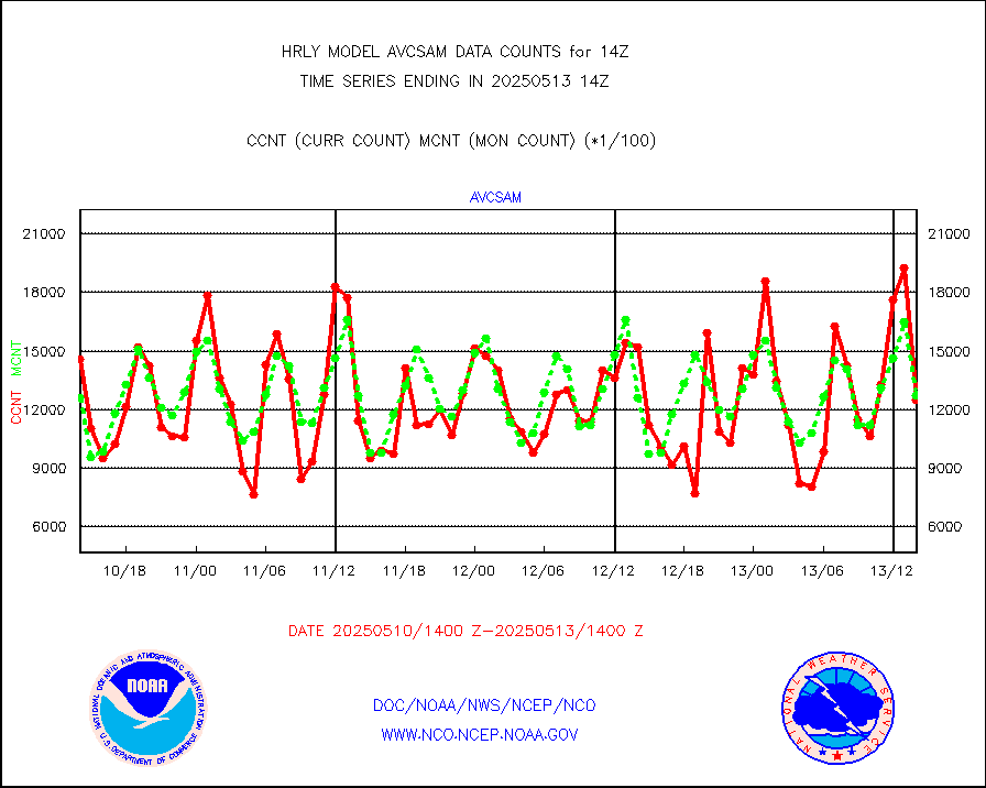
crsfdb |
NPP/NOAA-20 CrIS full spctrl radn dir brdcst SSEC |
123866 |
121162 |
102.2 % |
1912.50-1913.49 |
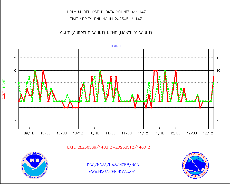
cstgd |
Coast Guard |
5 |
6 |
83.3 % |
1913.50-1914.50 |
dbuoyb |
Drifting buoys (decoded from BUFR) |
1431 |
1386 |
103.2 % |
1913.50-1914.50 |
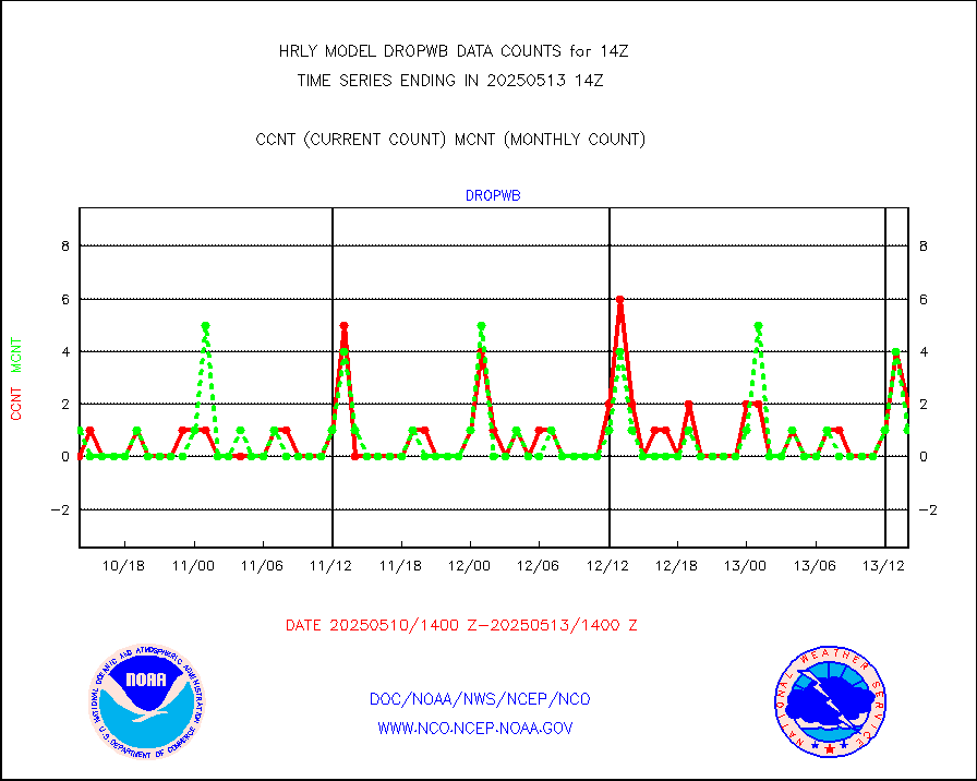
dropw |
Dropwinsonde (from TEMP DROP) |
0 |
0 |
n/a |
1913.50-1914.49 |
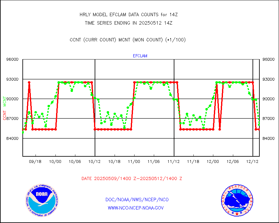
efclam |
GOES imager effective cloud amount data (U.Wisc.) |
8280418 |
8190888 |
101.1 % |
1913.50-1914.49 |
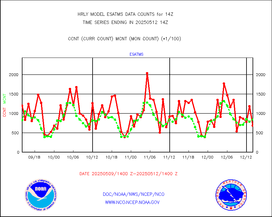
esatms |
NPP Adv. Tech. MW Sndr (ATMS) br. temps from RARS |
75723 |
85671 |
88.4 % |
1912.50-1913.49 |
esiasi |
METOP 1-2 IASI 1C radiance data vbl chn from RARS |
87933 |
78231 |
112.4 % |
1913.00-1913.99 |
esmhs |
NOAA 18-19 & METOP 1-2 MHS proc. btemps from RARS |
305658 |
271593 |
112.5 % |
1913.50-1914.49 |
geoimr |
GOES/NESDIS (11x17 f-o-v) imager clear radiances |
0 |
0 |
n/a |
1913.00-1913.99 |
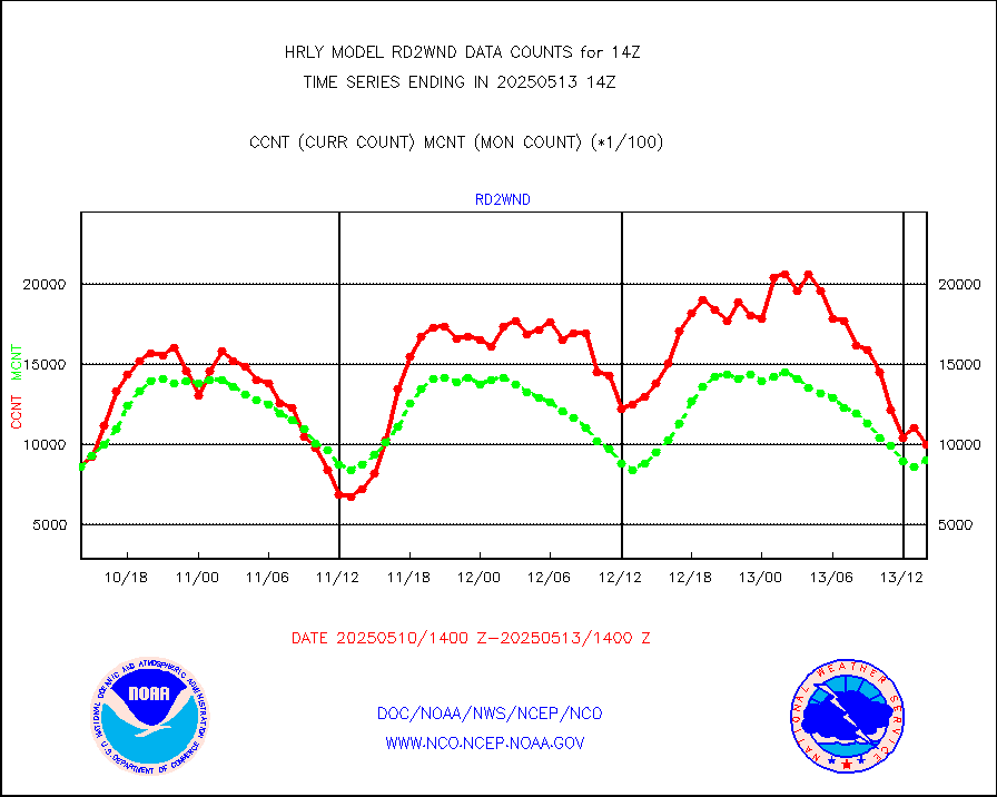
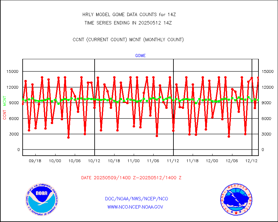
gome |
METOP 1-2 Global Ozone Monitoring Exp.-2 (GOME-2) |
12283 |
6944 |
176.9 % |
1912.50-1913.49 |
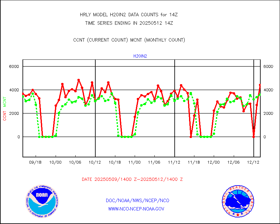
h20in2 |
INDIA SATWIND, INSAT WV channel |
7724 |
5310 |
145.5 % |
1913.00-1913.99 |
h2dusr |
GOES-16&up/NESDIS wv imgr/deep-lyr derivd cld mtn |
15460 |
16213 |
95.4 % |
1913.00-1913.99 |
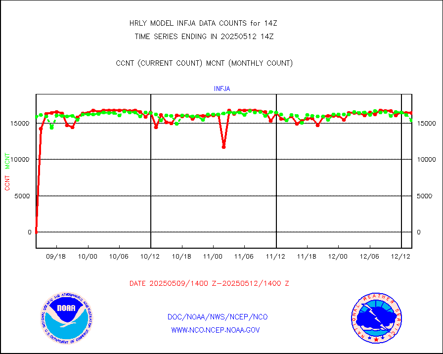
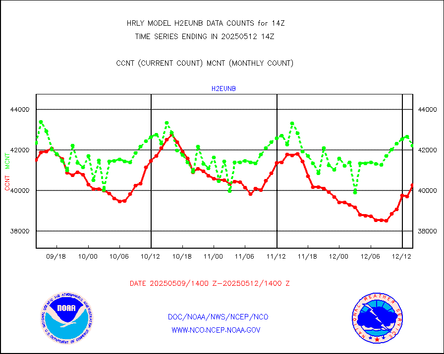
h2eunb |
METEOSAT/EUMETSAT wvpr imgr drv cld motion NBseq |
41760 |
42551 |
98.1 % |
1912.50-1913.49 |
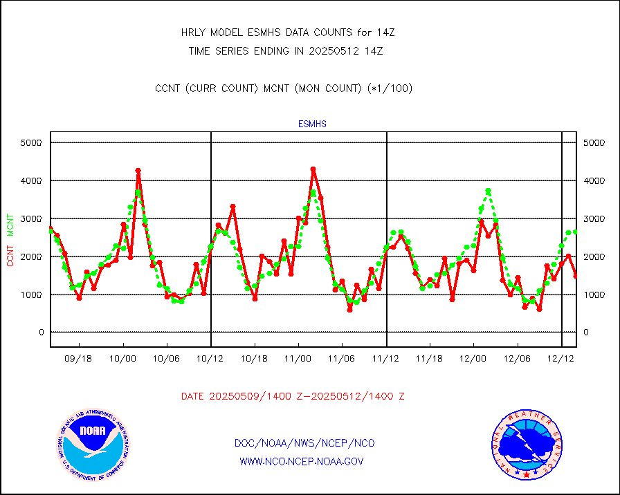
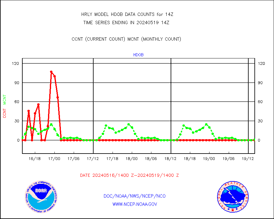
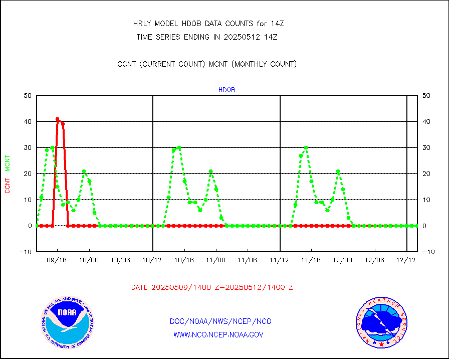
hdob |
High Density OBs from reconnaissance acft data |
0 |
1 |
0.0 % |
1913.50-1914.49 |
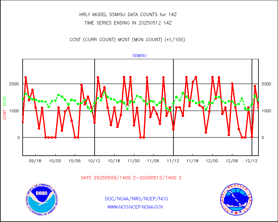
iasidb |
METOP 1-2 IASI 1C radiances-direct broadcast SSEC |
34077 |
27357 |
124.6 % |
1912.50-1913.49 |
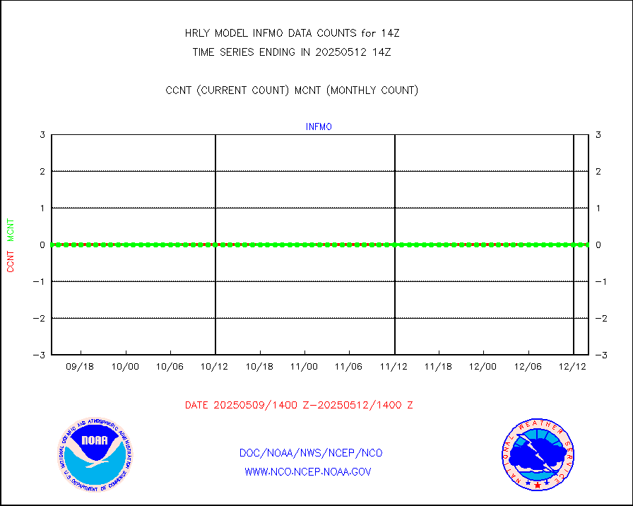
ifvrnb |
VIIRS (NPP/NOAA-20) ir lg-wv drv cloud motion(NB) |
10530 |
16147 |
65.2 % |
1910.00-1910.99 |
infav |
AVHRR (NOAA/METOP) ir lg-wave derived cld motion |
0 |
0 |
n/a |
1910.00-1910.99 |
infav1 |
AVHRR (METOP) ir lg-wave derived cld motion |
0 |
0 |
n/a |
1913.50-1914.50 |
infin |
INSAT/KALPANA India ir lg-wave derived cld motion |
0 |
0 |
n/a |
1911.50-1912.49 |
infin2 |
INDIA SATWIND, INSAT IR channel |
4219 |
4656 |
90.6 % |
1913.00-1913.99 |
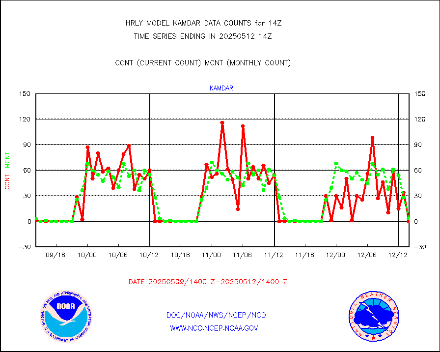
kamdar |
Korean AMDAR aircraft data (decoded from BUFR) |
6 |
3 |
200.0 % |
1913.50-1914.49 |
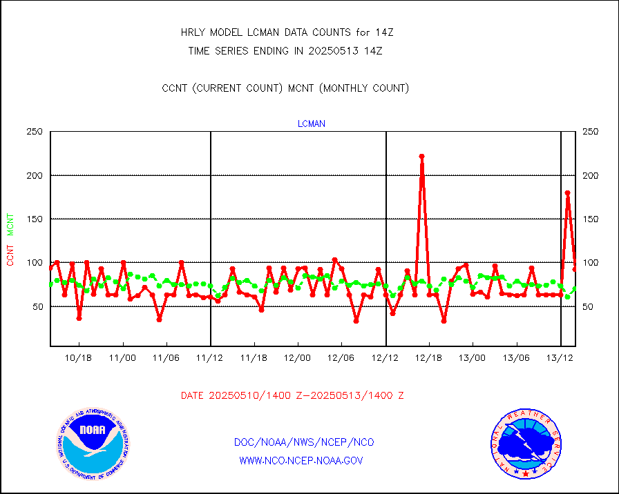
lcman |
Land-based CMAN stations decoded from CMAN format |
78 |
101 |
77.2 % |
1913.50-1914.49 |
leogeo |
LEO-GEO satellite AMVs from UWisc. |
6468 |
5052 |
128.0 % |
1910.00-1910.99 |
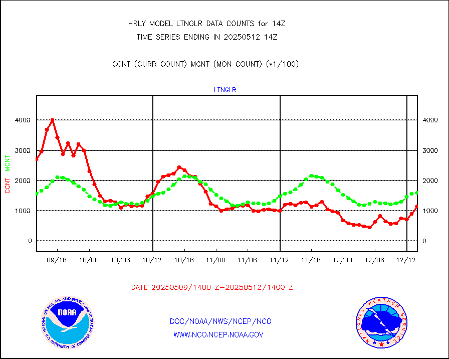
ltnglr |
LLDN Long-rng lightning from Vaisala via NOAAPORT |
230156 |
162970 |
141.2 % |
1913.50-1914.49 |
ltngsr |
NLDN Shrt-rng lightning from Vaisala via NOAAPORT |
7011 |
2478 |
282.9 % |
1913.50-1914.49 |
mbuoyb |
Moored buoys (decoded from BUFR) |
823 |
718 |
114.6 % |
1913.50-1914.50 |
mls |
Aura Microwave Limb Sounder (MLS) ozone data |
0 |
0 |
n/a |
1912.00-1912.99 |
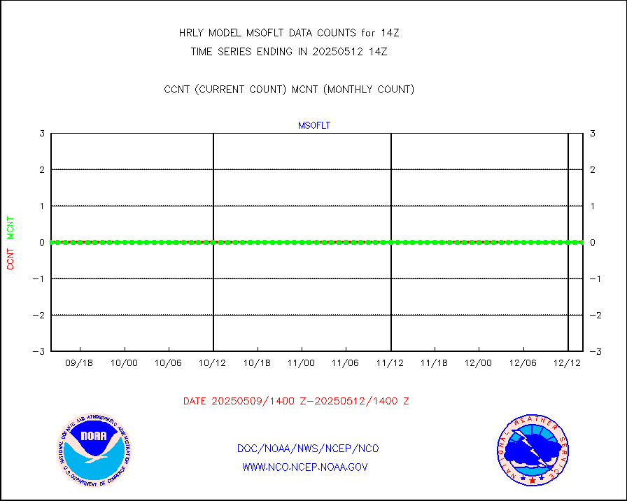
msourb |
Mesonet/MADIS UrbaNet |
4349 |
4382 |
99.2 % |
1913.50-1914.49 |
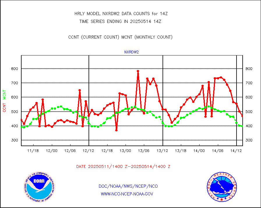
nxrdw2 |
NEXRAD Vel Azm Dsp(VAD) winds via Level 2 decoder |
475 |
422 |
112.6 % |
1913.50-1914.49 |
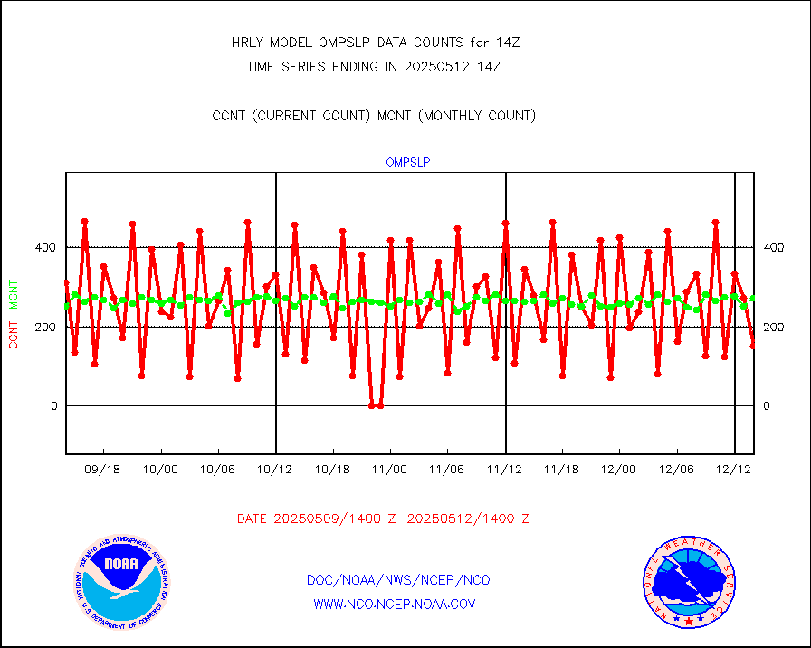
ompslp |
OMPS Limb Profiler ozone data (NPP) |
266 |
256 |
103.9 % |
1907.00-1907.99 |
ompsn8 |
OMPS nadir profile ozone (Version 8 BUFR) |
581 |
565 |
102.8 % |
1912.00-1912.99 |
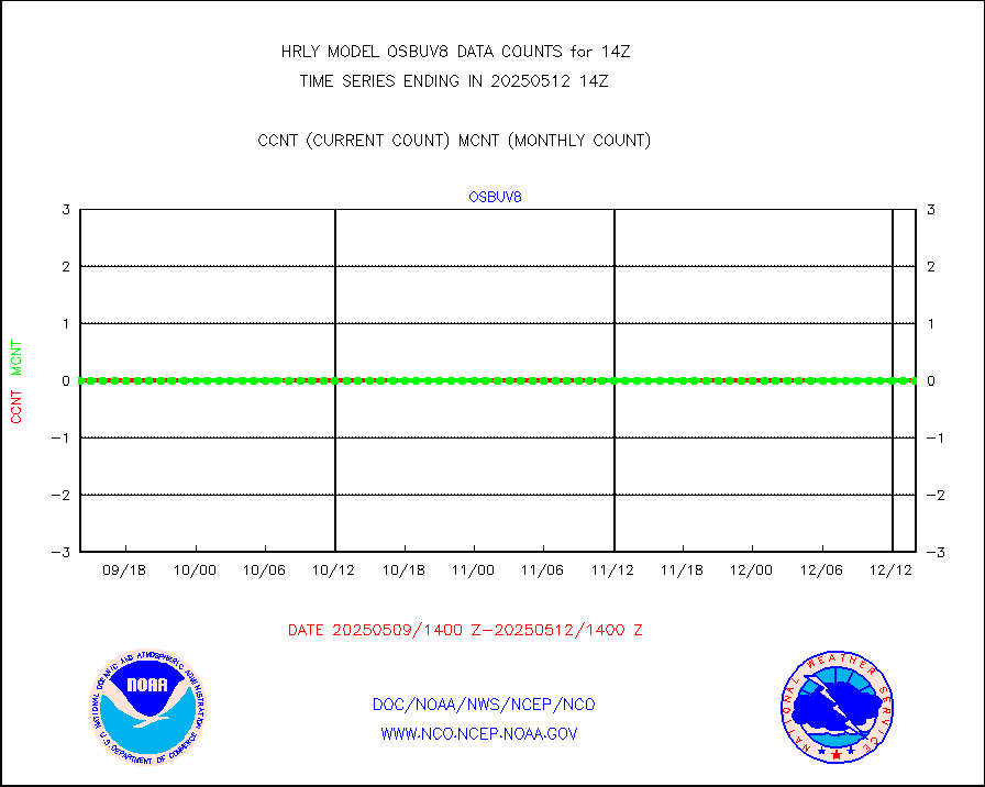
ompst8 |
OMPS total column ozone (Version 8 BUFR) |
214670 |
347960 |
61.7 % |
1912.00-1912.99 |
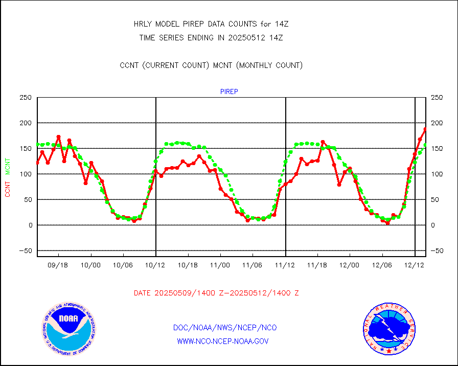
pirep |
Manual PIREP aircraft data (dcded from AIREP fmt) |
120 |
158 |
75.9 % |
1913.50-1914.49 |
prflrp |
Profilr winds from PIBAL (PILOT,PILOT SHIP/MOBIL) |
0 |
0 |
n/a |
1913.50-1914.49 |
raobm |
Rawinsonde - mobile land (from TEMP/PILOT MOBIL) |
0 |
0 |
n/a |
1913.50-1914.49 |
raobs |
Rawinsonde - ship (from TEMP SHIP, PILOT SHIP) |
0 |
0 |
n/a |
1913.50-1914.49 |
recco |
Flight level reconnaissance aircraft data |
0 |
0 |
n/a |
1913.50-1914.49 |
saphir |
Megha-Tropiques SAPHIR L1A2 brightness temps |
0 |
0 |
n/a |
1911.50-1912.49 |
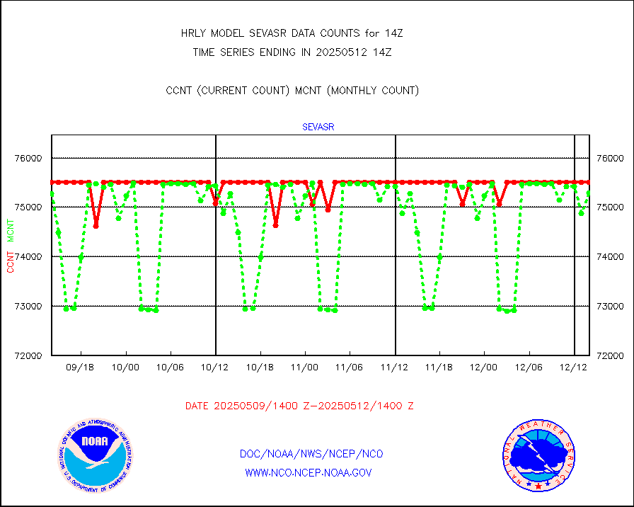
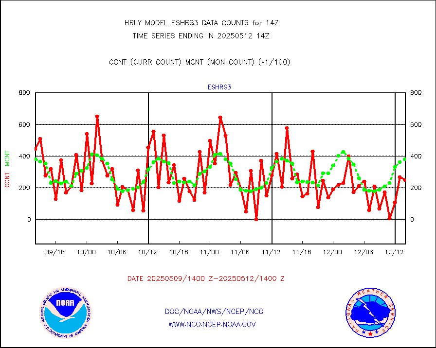
sevasr |
METEOSAT-10 2nd Gen SEVIRI All Sky Radiance(proc) |
75512 |
75483 |
100.0 % |
1913.50-1914.49 |
ships |
Ship - manual and automatic, restricted |
3 |
3 |
100.0 % |
1913.50-1914.49 |
ssmisu |
DMSP SSM/IS 1C radiance data (Unified Pre-Proc.) |
175380 |
139064 |
126.1 % |
1912.50-1913.49 |
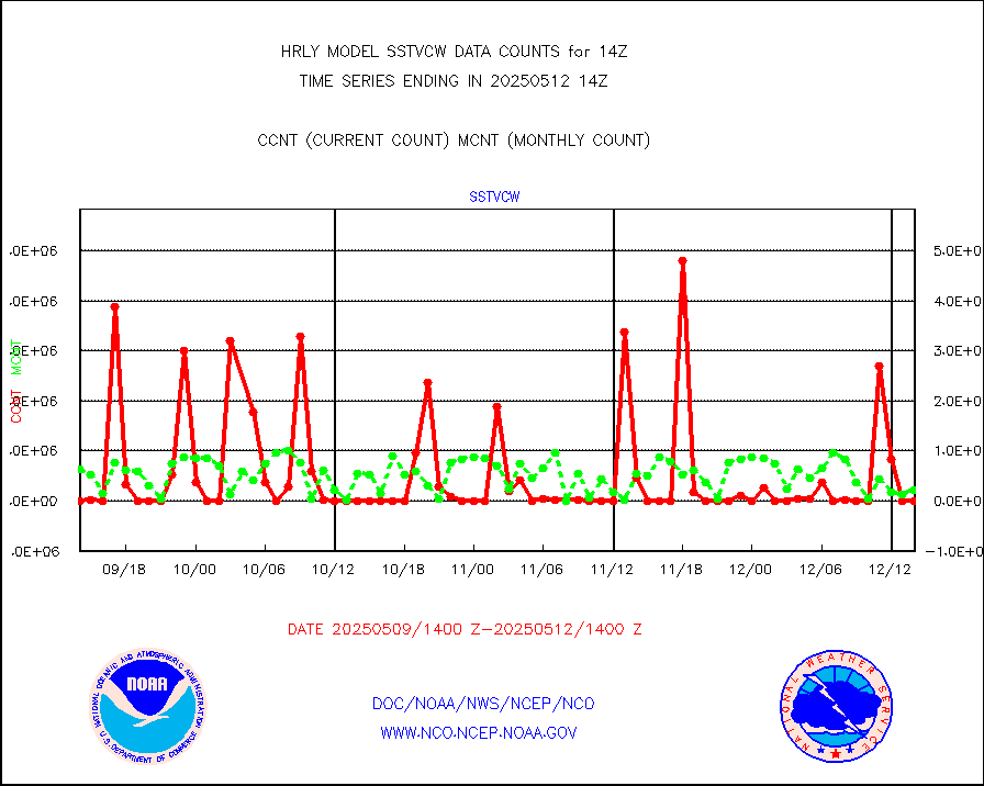
sstvcw |
NPP/NOAA-20 VIIRS SST - CLEAR & OVER WATER |
6603 |
675037 |
1.0 % |
1913.50-1914.49 |
sstvpw |
NPP/NOAA-20 VIIRS SST - PROBABLY CLR & OVER WATER |
3218 |
194452 |
1.7 % |
1913.50-1914.49 |
synopm |
Synoptic - mobile manual and automatic |
570 |
572 |
99.7 % |
1913.50-1914.49 |
synpmb |
Synoptic - mobile manual & auto (decoded fr BUFR) |
0 |
1 |
0.0 % |
1913.50-1914.49 |
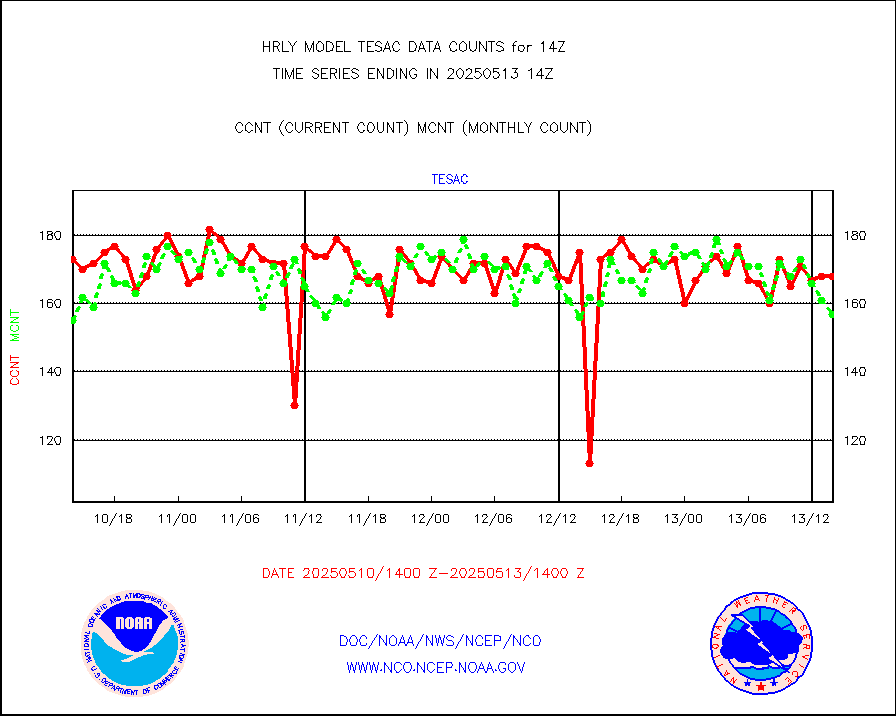
tesac |
CTD probe, Argo prflng float, mooring (TESAC fmt) |
154 |
190 |
81.1 % |
1913.50-1914.49 |
tmdara |
TAMDAR aircft data-all types(from Panasonic,BUFR) |
308 |
333 |
92.5 % |
1913.50-1914.49 |
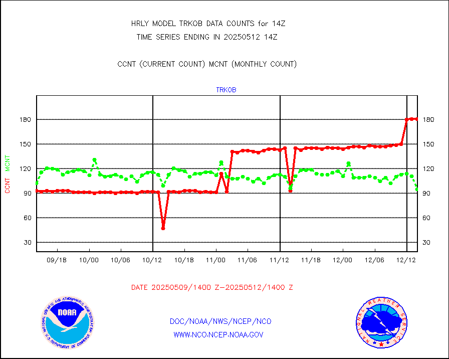
trkob |
ThermoSalinoGraph (TSG) TRACKOB format) |
90 |
44 |
204.5 % |
1912.50-1913.49 |
visin |
INSAT/KALPANA India visible derived cloud motion |
0 |
0 |
n/a |
1911.50-1912.49 |
visin2 |
INDIA SATWIND, INSAT VIS channel |
43 |
120 |
35.8 % |
1913.00-1913.99 |
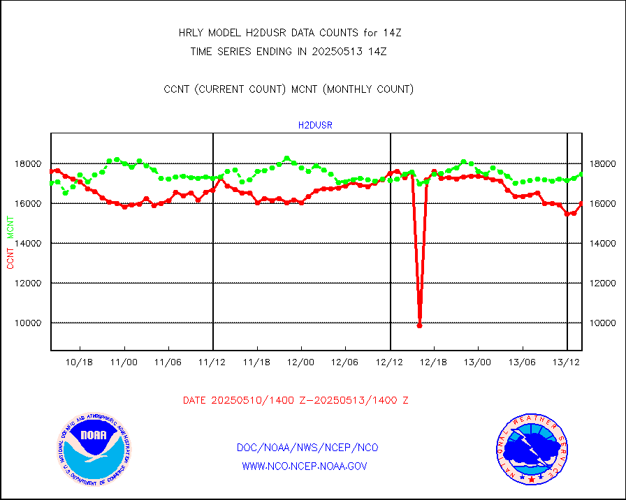
visja |
MTSAT/JMA visible derived cloud motion |
53 |
32 |
165.6 % |
1911.50-1912.49 |
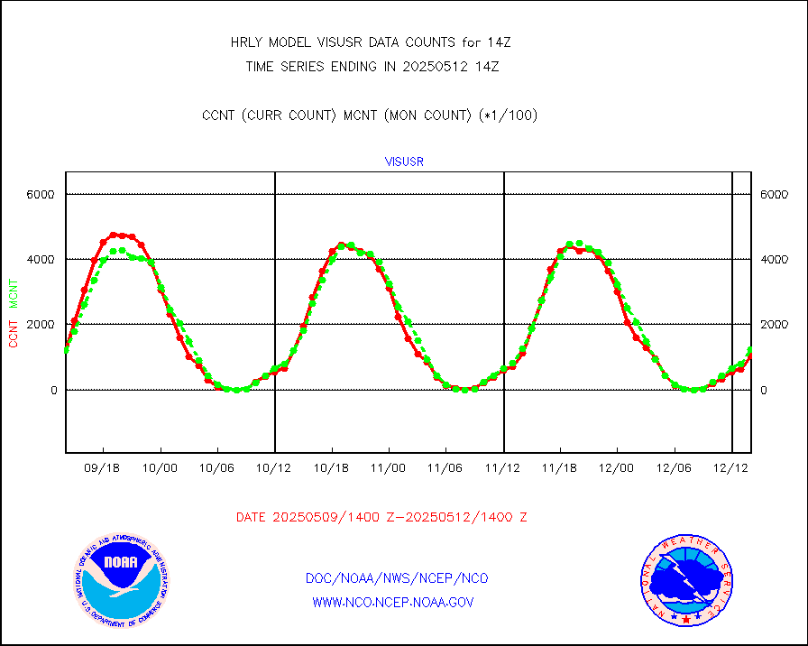
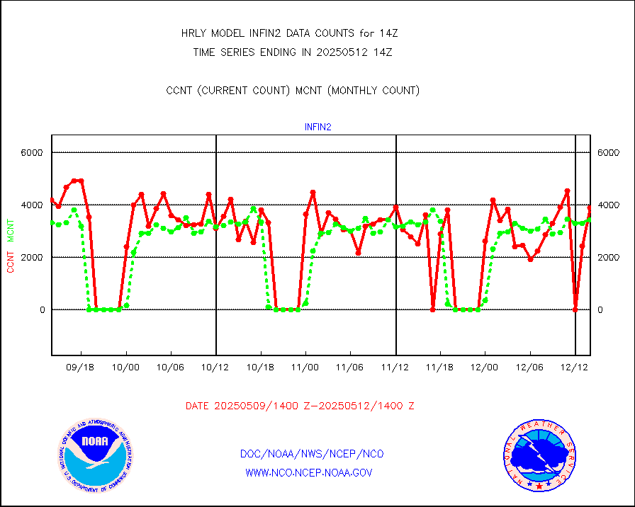
visusr |
GOES-16&up/NESDIS visible derived cloud motion |
129787 |
109973 |
118.0 % |
1913.00-1913.99 |
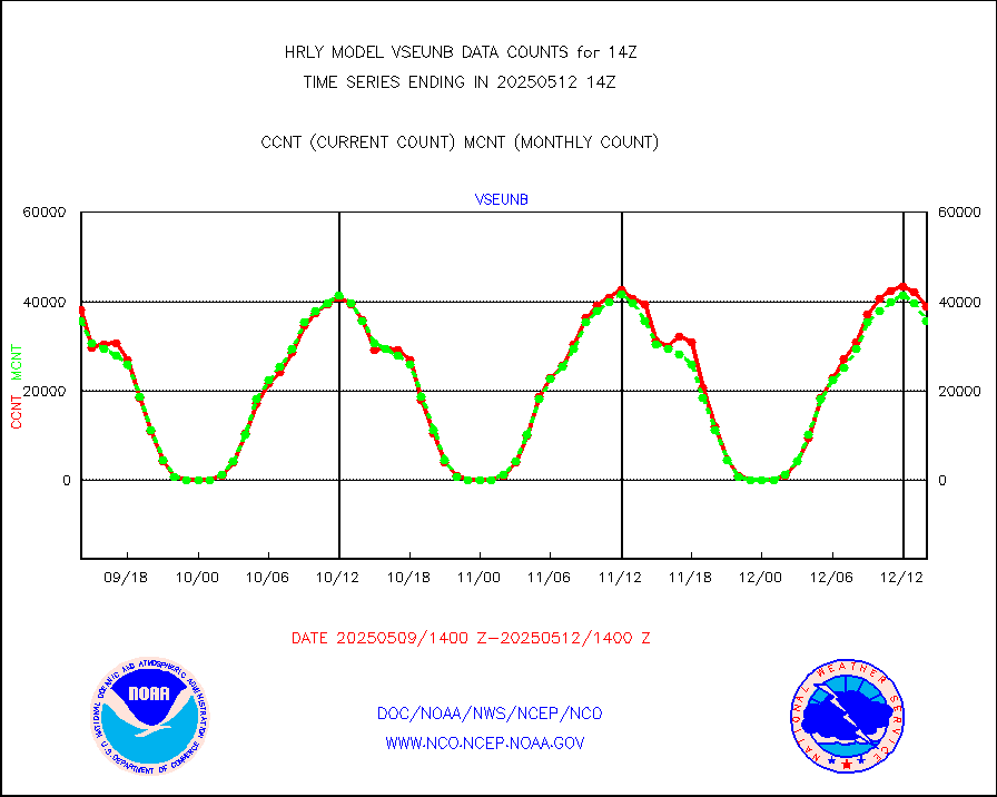
vseunb |
METEOSAT/EUMETSAT visible drv cld motion NBseq |
34837 |
33836 |
103.0 % |
1912.50-1913.49 |


