| Critical Data with Normal Counts |
|---|
| Type | Description | Hourly Count | Monthly Average | Percent (%) of Monthly Mean | UTC Time Window |
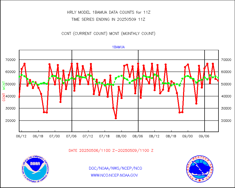
1bamua |
NOAA 15-19 & METOP 1-2 AMSU-A NCEP-proc. br.temps |
64992 |
55571 |
117.0 % |
1909.00-1909.99 |
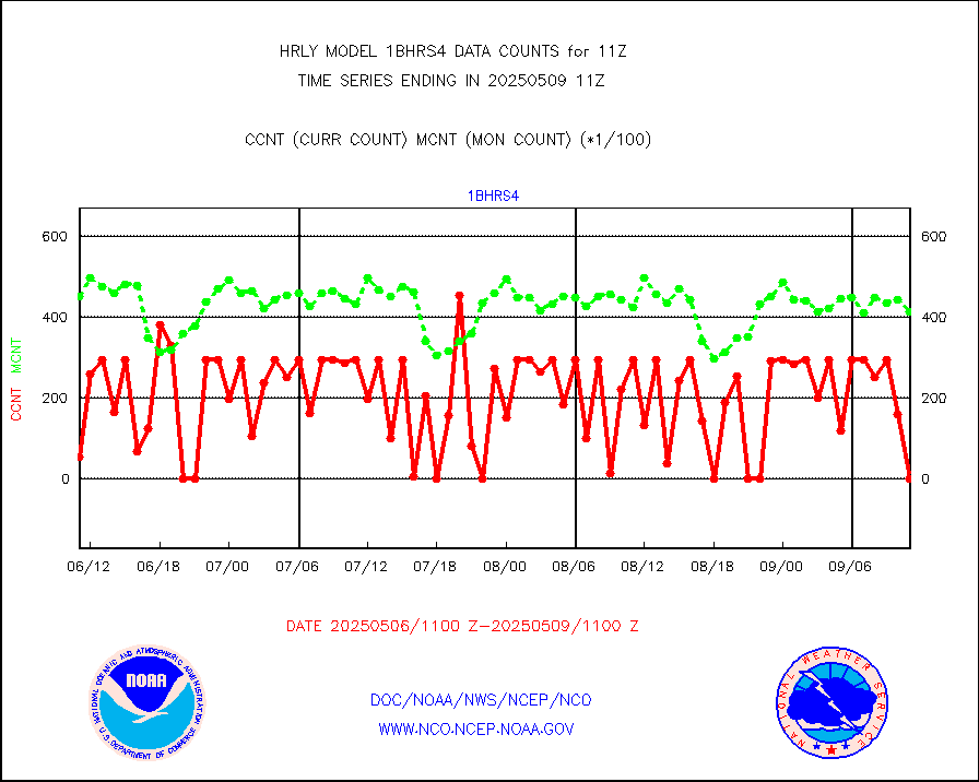
1bhrs4 |
NOAA 18-19 & METOP 1-2 HIRS-4 NCEP-proc. br.temps |
55010 |
47927 |
114.8 % |
1909.00-1909.99 |
1bmhs |
NOAA 18-19 & METOP 1-2 MHS NCEP-proces. br. temps |
357561 |
299693 |
119.3 % |
1909.00-1909.99 |
acars |
MDCRS ACARS acft data from ARINC(dcded from BUFR) |
7865 |
2838 |
277.1 % |
1910.50-1911.49 |
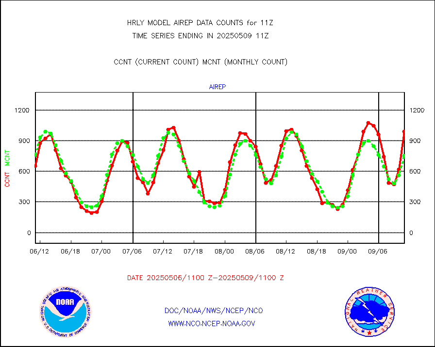
airep |
Manual AIREP aircraft data (dcded from AIREP fmt) |
1197 |
1060 |
112.9 % |
1910.50-1911.49 |
airsev |
AQUA AIRS/AMSU-A/HSB brightness temps- every FOV |
0 |
0 |
n/a |
1908.50-1909.49 |
amdar |
AMDAR aircraft data (decoded from AMDAR format) |
316 |
228 |
138.6 % |
1910.50-1911.49 |
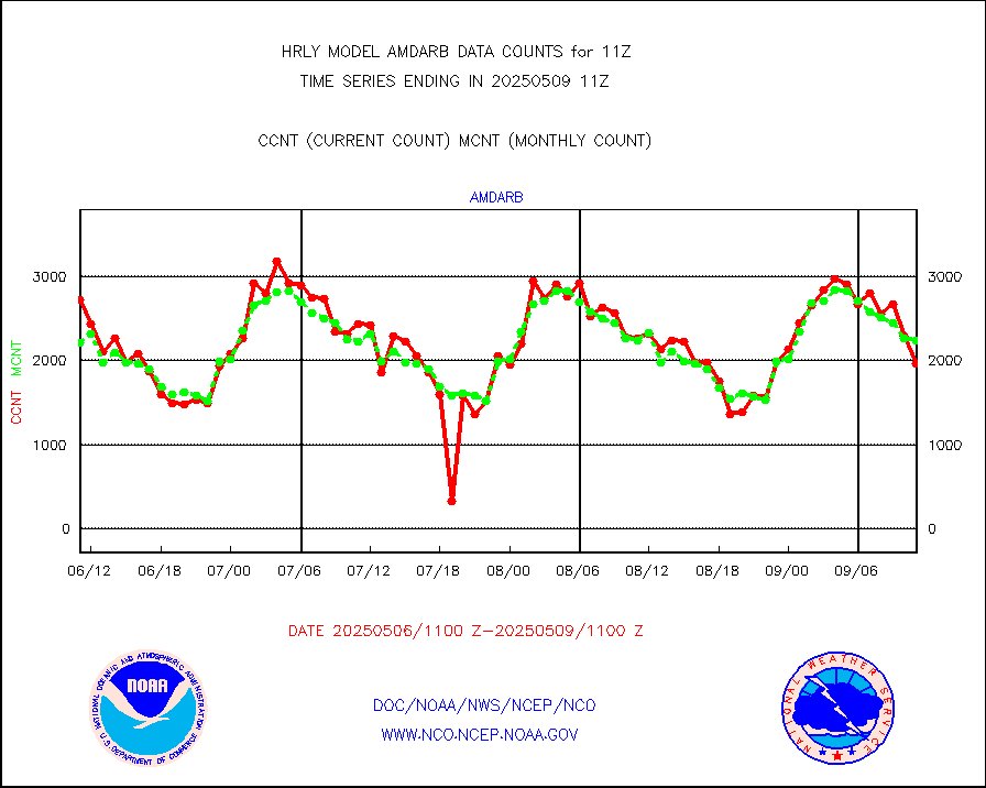
amdarb |
AMDAR aircraft data (decoded from BUFR) |
1326 |
1140 |
116.3 % |
1910.50-1911.49 |
ascat |
METOP 1-2 ASCAT products |
67620 |
47977 |
140.9 % |
1909.50-1910.49 |
atms |
NPP/NOAA-20 ATMS brightness temperatures |
381504 |
338867 |
112.6 % |
1909.50-1910.49 |
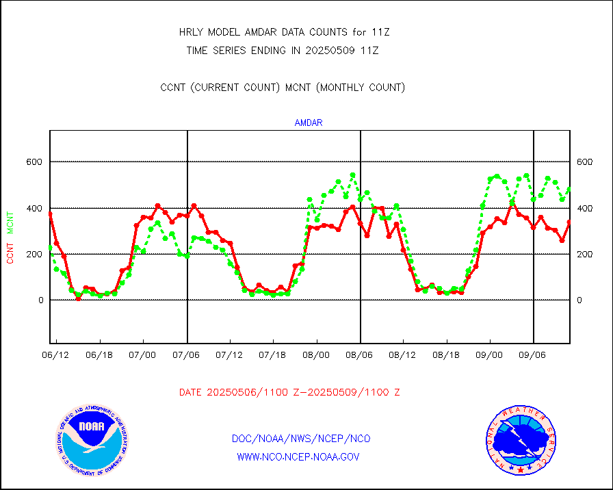
camdar |
Canadian AMDAR aircraft data (decoded from BUFR) |
0 |
2 |
0.0 % |
1910.50-1911.49 |
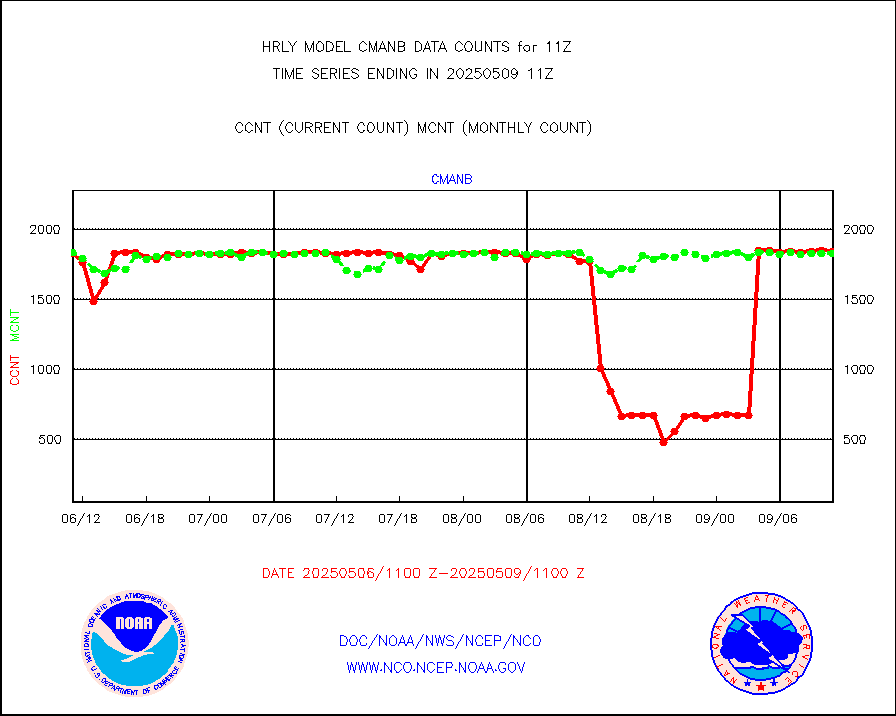
cmanb |
Surface Marine CMAN rpts decoded from BUFR format |
1842 |
1818 |
101.3 % |
1910.50-1911.50 |
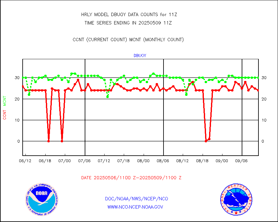
dbuoy |
Buoys decoded from FM-18 fmt (moored or drifting) |
42 |
40 |
105.0 % |
1910.50-1911.49 |
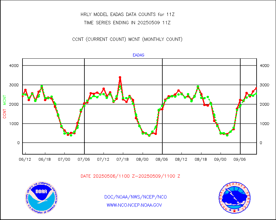
eadas |
E-AMDAR (European AMDAR acft decoded from BUFR) |
1982 |
1925 |
103.0 % |
1910.50-1911.49 |
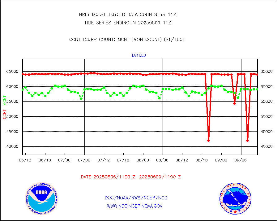
esamua |
NOAA 15-19 & METOP 1-2 AMSU-A proc btmps frm RARS |
35208 |
28018 |
125.7 % |
1910.50-1911.49 |
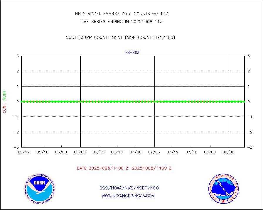
eshrs3 |
NOAA 15-19 & METOP 1-2 HIRS-3/4 pr btmps frm RARS |
71996 |
59407 |
121.2 % |
1910.50-1911.49 |
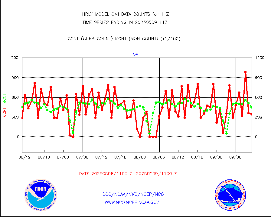
gnss |
Grnd-based Gbl Navigation Sat System (GNSS) data |
8916 |
9153 |
97.4 % |
1910.00-1910.99 |
gpsro |
GPS radio occultation data |
475 |
444 |
107.0 % |
1908.50-1909.49 |
gsrasr |
GOES-16/17 All Sky Radiances (proc.) |
360476 |
357472 |
100.8 % |
1910.50-1911.49 |
gsrcsr |
GOES-16/17 Clear Sky Radiances (proc.) |
158740 |
163807 |
96.9 % |
1910.50-1911.49 |
h20ja |
MTSAT/JMA water vapor imager derived cloud motion |
20848 |
19401 |
107.5 % |
1908.50-1909.49 |
h20mo |
MODIS (AQUA/TERRA) wvpr imager derived cld motion |
0 |
0 |
n/a |
1907.00-1907.99 |
h2tusr |
GOES-16&up/NESDIS wv imgr/cld-top derived cld mtn |
22717 |
25383 |
89.5 % |
1910.00-1910.99 |
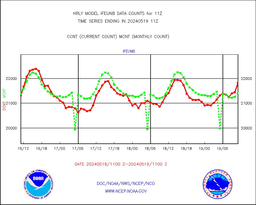
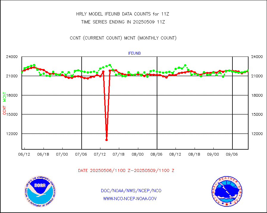
ifeunb |
METEOSAT/EUMETSAT ir lg-wave drv cld motion NBseq |
21821 |
21405 |
101.9 % |
1909.50-1910.49 |
infja |
MTSAT/JMA infrared long-wave derived cloud motion |
16800 |
16307 |
103.0 % |
1908.50-1909.49 |
infmo |
MODIS (AQUA/TERRA) ir l-wave derived cloud motion |
0 |
0 |
n/a |
1907.00-1907.99 |
infusr |
GOES-16&up/NESDIS ir long-wave derived cld motion |
80091 |
82385 |
97.2 % |
1910.00-1910.99 |
lgycld |
GOES/NASA(Langley) hi-res. (1x1 f-o-v) cloud data |
4209988 |
3509801 |
119.9 % |
1910.50-1911.49 |
mbuoy |
Buoys decoded from FM-13 format (moored) |
119 |
113 |
105.3 % |
1910.50-1911.49 |
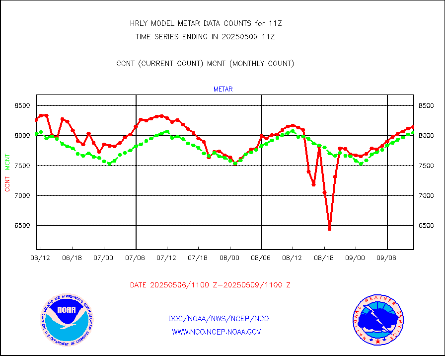
metar |
Aviation - METAR |
7927 |
8085 |
98.0 % |
1910.50-1911.49 |
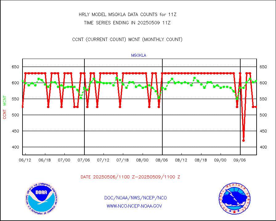
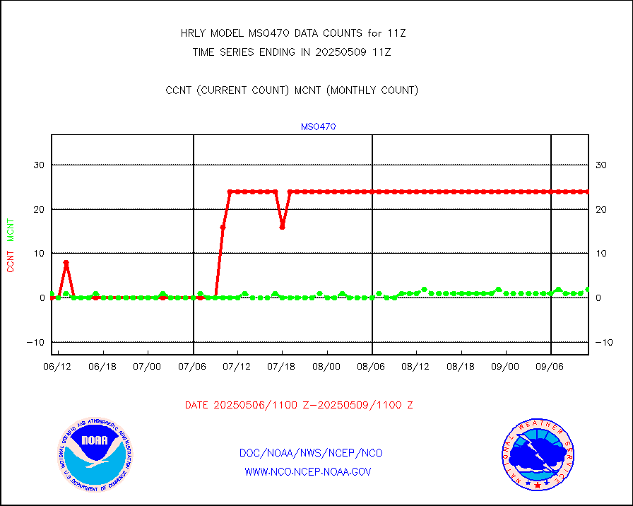
mso470 |
Mesonet/MADIS Colorado E-470 (Interstate 470) |
21 |
20 |
105.0 % |
1910.50-1911.49 |
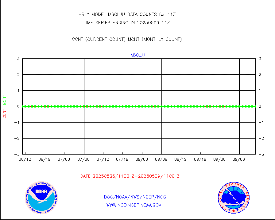
msoalk |
Mesonet/MADIS Alaska Department of Transportation |
108 |
107 |
100.9 % |
1910.50-1911.49 |
msoapg |
Mesonet/MADIS U.S. Army Aberdeen Proving Grounds |
0 |
0 |
n/a |
1910.50-1911.49 |
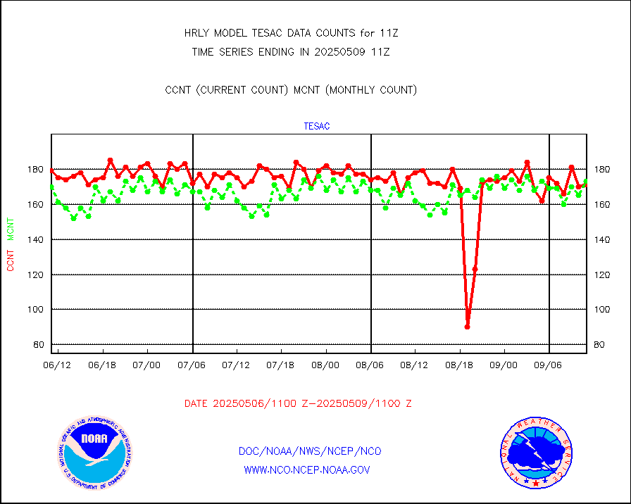
msoapr |
Mesonet/MADIS Citizen Weather Observers Program |
43047 |
48846 |
88.1 % |
1910.50-1911.49 |
msoaws |
Mesonet/MADIS AWS Convergence Technologies, Inc. |
24440 |
25526 |
95.7 % |
1910.50-1911.49 |
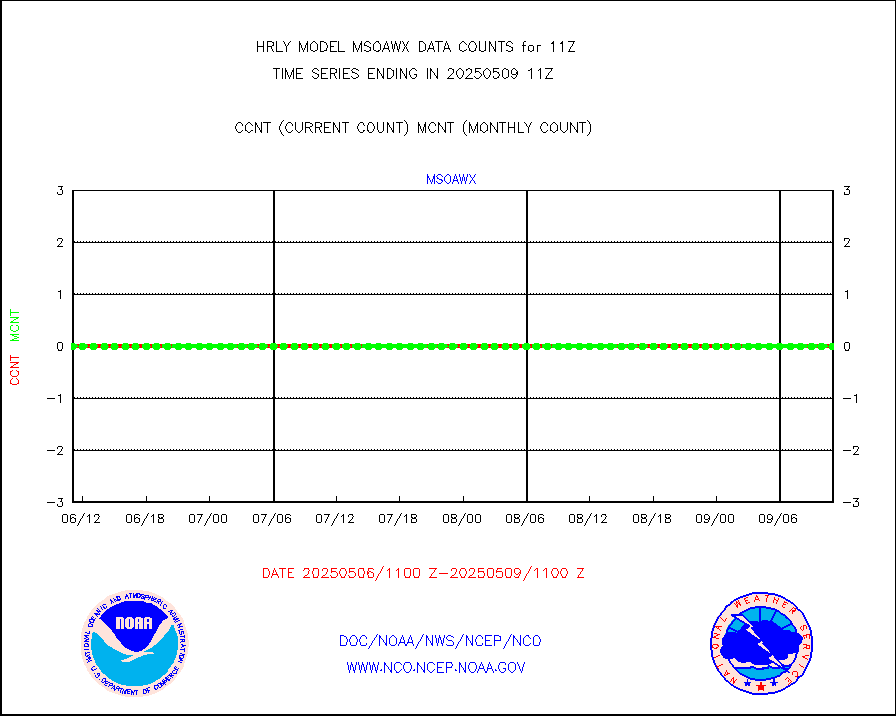
msoawx |
Mesonet/MADIS "Anything Weather" |
0 |
0 |
n/a |
1910.50-1911.49 |
msocol |
Mesonet/MADIS Colorado Dept. of Transportation |
0 |
0 |
n/a |
1910.50-1911.49 |
msodcn |
Mesonet/MADIS DC Net |
0 |
0 |
n/a |
1910.50-1911.49 |
msoden |
Mesonet/MADIS Denver Urban Drainage & Flood Cntrl |
250 |
250 |
100.0 % |
1910.50-1911.49 |
msofla |
Mesonet/MADIS Florida (FAWN & USF) |
4 |
4 |
100.0 % |
1910.50-1911.49 |
msoflt |
Mesonet/MADIS Florida Dept. of Transportation |
0 |
0 |
n/a |
1910.50-1911.49 |
msogeo |
Mesonet/MADIS Georgia Dept. of Transportation |
0 |
0 |
n/a |
1910.50-1911.49 |
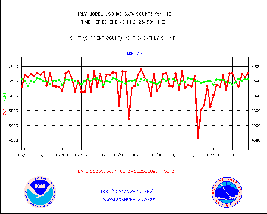
msohad |
Mesonet/MADIS NWS Hydromet Auto Data System(HADS) |
6676 |
6668 |
100.1 % |
1910.50-1911.49 |
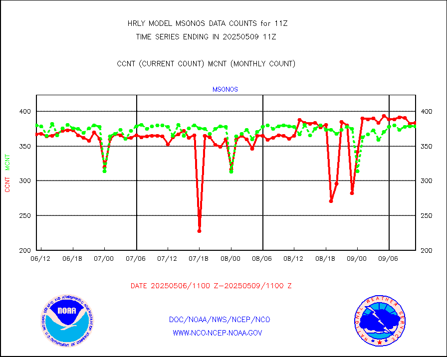
msoien |
Mesonet/MADIS Iowa Environmental |
184 |
184 |
100.0 % |
1910.50-1911.49 |
msoind |
Mesonet/MADIS Indiana Dept. of Transportation |
0 |
0 |
n/a |
1910.50-1911.49 |
msoiow |
Mesonet/MADIS Iowa Department of Transportation |
0 |
0 |
n/a |
1910.50-1911.49 |
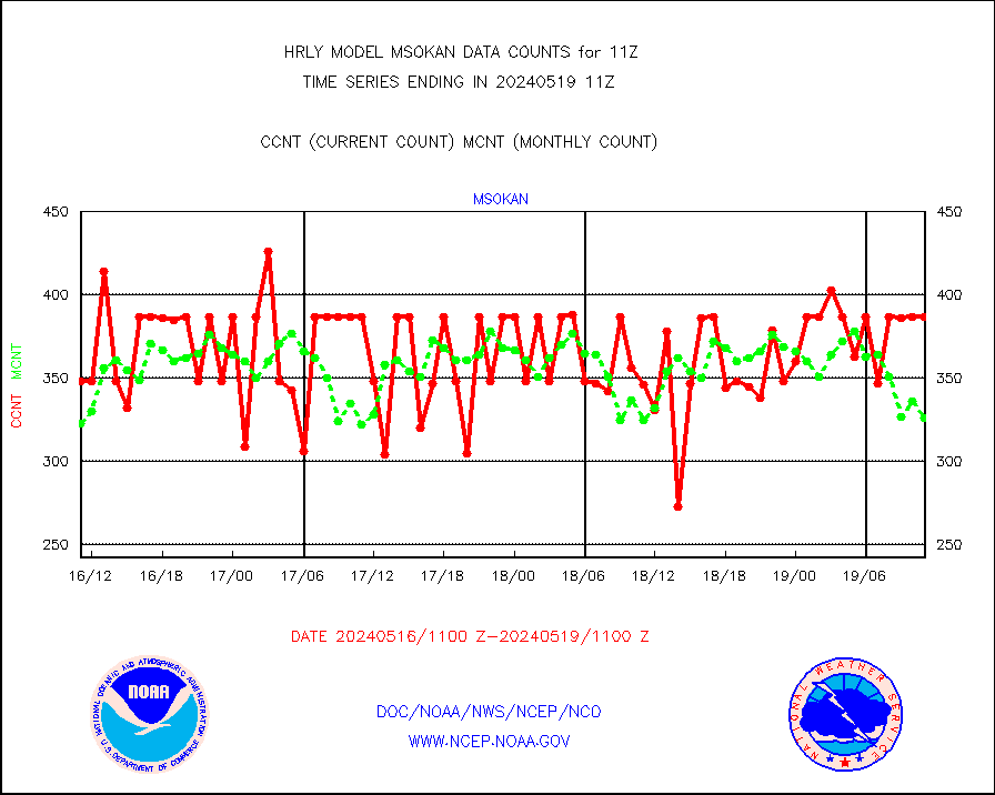
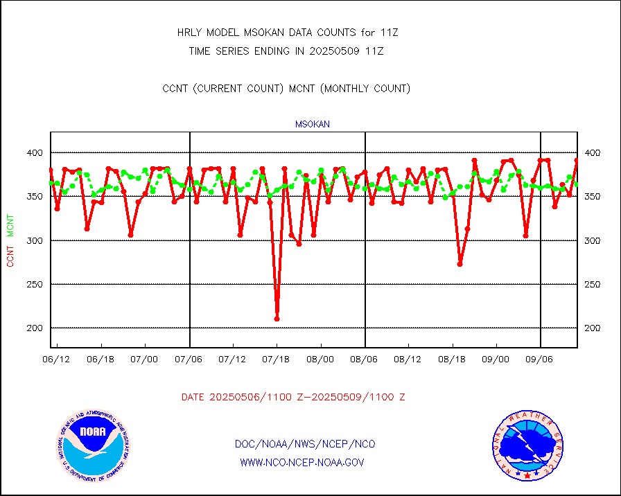
msokan |
Mesonet/MADIS Kansas Department of Transportation |
387 |
326 |
118.7 % |
1910.50-1911.49 |
msokla |
Mesonet/MADIS Oklahoma Mesonet |
318 |
318 |
100.0 % |
1910.50-1911.49 |
msolju |
Mesonet/MADIS Louisiana State/Jackson State Univ. |
0 |
0 |
n/a |
1910.50-1911.49 |
msomca |
Mesonet/MADIS Missouri Commercial Agricult Wx Net |
290 |
294 |
98.6 % |
1910.50-1911.49 |
msomin |
Mesonet/MADIS Minnesota Dept. of Transportation |
0 |
0 |
n/a |
1910.50-1911.49 |
msonos |
Mesonet/MADIS NOS-Phys Oceanographic Realtime Sys |
390 |
383 |
101.8 % |
1910.50-1911.49 |
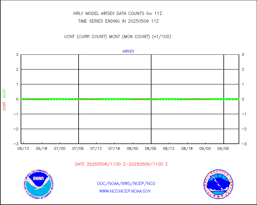
msoraw |
Mesonet/MADIS NFIC Remote Automated Wx Stns(RAWS) |
1948 |
1788 |
108.9 % |
1910.50-1911.49 |
msovir |
Mesonet/MADIS Virginia Dept. of Transportation |
208 |
224 |
92.9 % |
1910.50-1911.49 |
msowfy |
Mesonet/MADIS "Weather for You" |
0 |
0 |
n/a |
1910.50-1911.49 |
msowis |
Mesonet/MADIS Wisconsin Dept. of Transportation |
0 |
0 |
n/a |
1910.50-1911.49 |
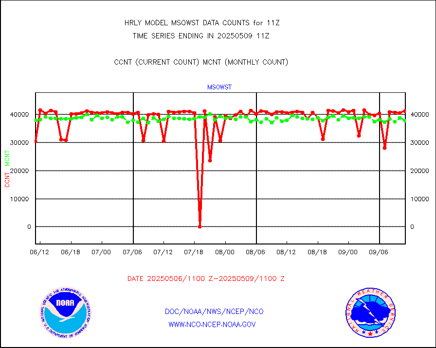
msowst |
Mesonet/MADIS MesoWest (many subproviders) |
46156 |
45051 |
102.5 % |
1910.50-1911.49 |
msowtx |
Mesonet/MADIS West Texas |
5566 |
5585 |
99.7 % |
1910.50-1911.49 |
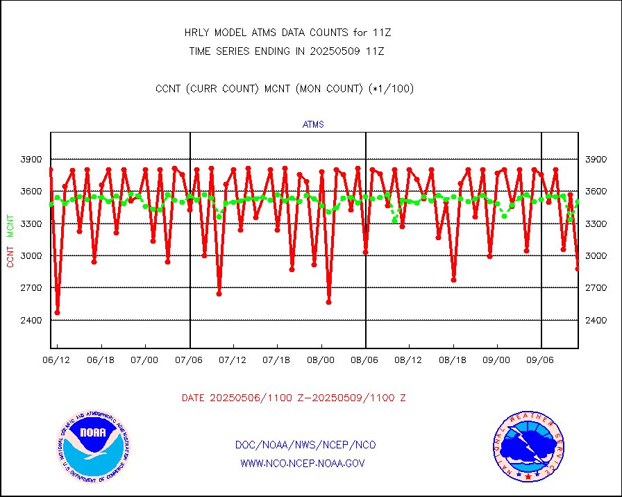
mtiasi |
METOP 1-2 IASI 1C radiance data (varbl. channels) |
106936 |
81883 |
130.6 % |
1909.00-1909.99 |
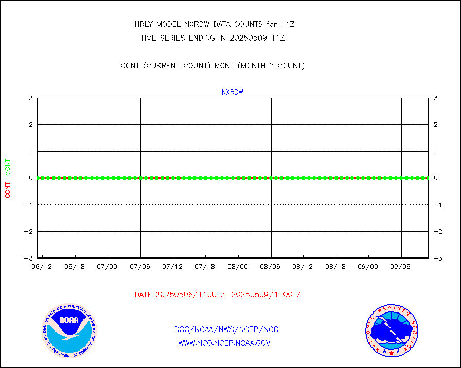
nxrdw |
NEXRAD Vel Azm Dsp(VAD) winds via radar coded msg |
0 |
0 |
n/a |
1910.50-1911.49 |
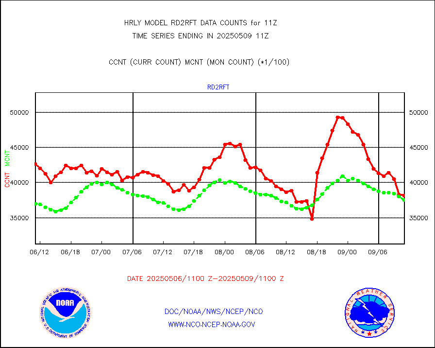
omi |
Aura Ozone Monitoring Instrument (OMI) data |
30600 |
36948 |
82.8 % |
1908.50-1909.49 |
osbuv8 |
NOAA 16-19 Solar Backscatter UV-2 rad frm V8 BUFR |
0 |
0 |
n/a |
1909.00-1909.99 |
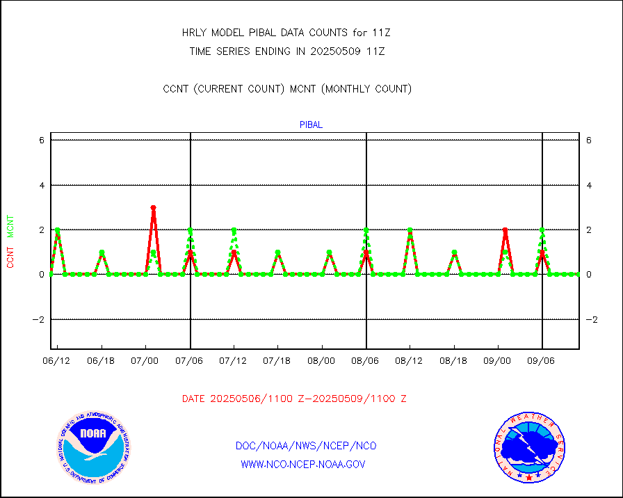
pibal |
PIBAL (from PILOT, PILOT SHIP, PILOT MOBIL) |
0 |
0 |
n/a |
1910.50-1911.49 |
prflrb |
Multi-Agency Profiler (MAP) and SODAR winds |
35 |
41 |
85.4 % |
1910.50-1911.49 |
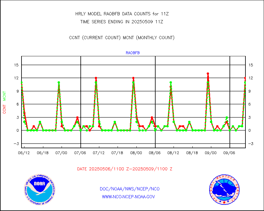
raobf |
Rawinsonde - fixed land (from TEMP or PILOT) |
0 |
0 |
n/a |
1910.50-1911.49 |
rass |
RASS temperatures (NOAA and Multi-Agency) |
24 |
25 |
96.0 % |
1910.50-1911.49 |
rd2rft |
NEXRAD reflectivity (Lvl 2 - GTS) |
3859810 |
3881326 |
99.4 % |
1910.50-1911.49 |
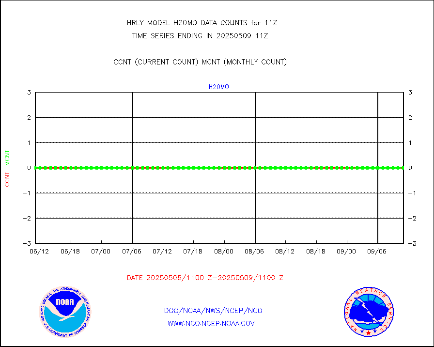
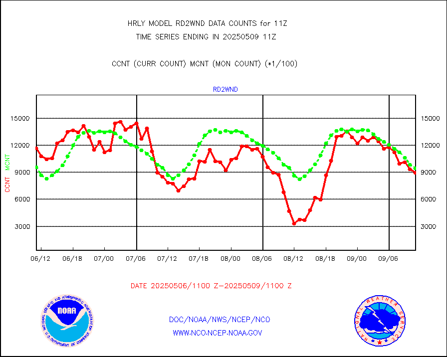
rd2wnd |
NEXRAD radial wind (Level 2 - GTS) |
1269025 |
1170039 |
108.5 % |
1910.50-1911.49 |
sevcsr |
METEOSAT-10 2nd Gen SEVIRI Clr Sky Radiance(proc) |
0 |
0 |
n/a |
1910.50-1911.49 |
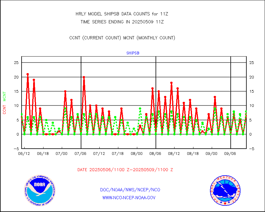
shipsb |
Ship - manual and automatic, restricted (BUFR) |
0 |
0 |
n/a |
1910.50-1911.50 |
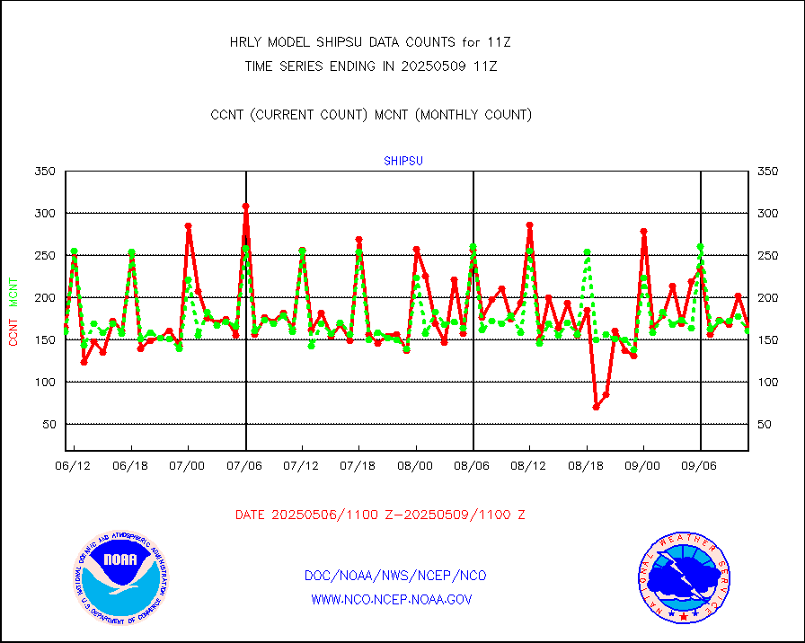
shipsu |
Ship - manual and automatic, unrestricted |
125 |
114 |
109.6 % |
1910.50-1911.50 |
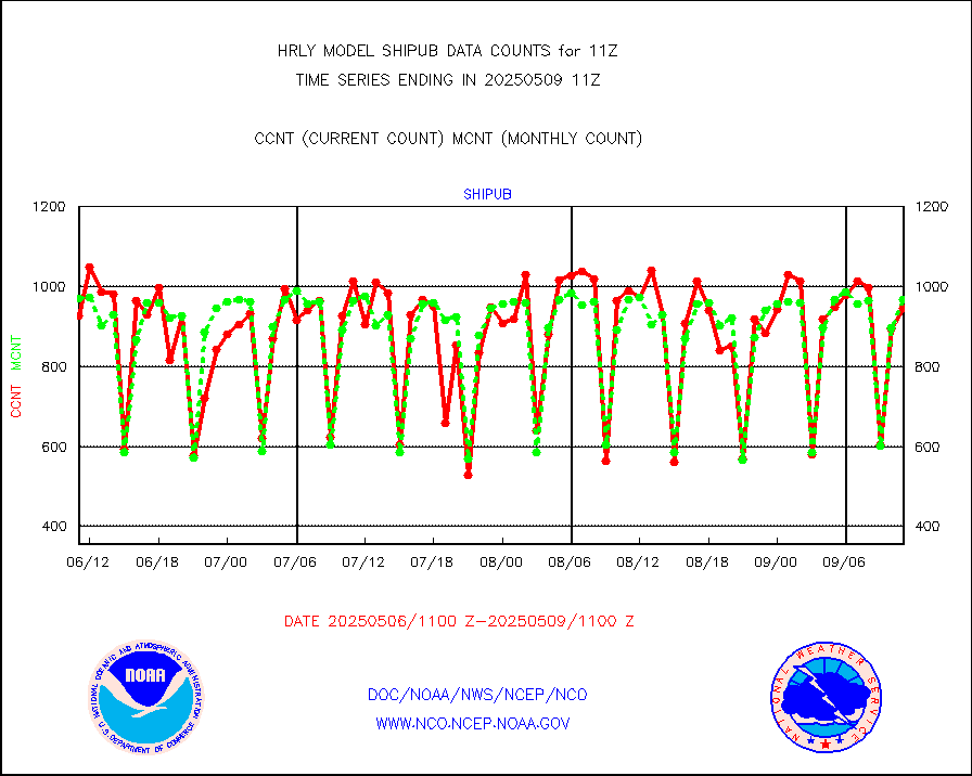
shipub |
Ship - manual and automatic, unrestricted (BUFR) |
817 |
835 |
97.8 % |
1910.50-1911.50 |
synop |
Synoptic - fixed manual and automatic |
944 |
890 |
106.1 % |
1910.50-1911.49 |
synopb |
Synoptic - fixed manual & auto (decoded fr BUFR) |
4112 |
4149 |
99.1 % |
1910.50-1911.49 |
synopr |
Synoptic - restricted (WMO Res 40) manual & auto. |
0 |
0 |
n/a |
1910.50-1911.49 |
synpbr |
Synoptic - restricted (WMO Res 40)(decoded BUFR) |
399 |
399 |
100.0 % |
1910.50-1911.49 |
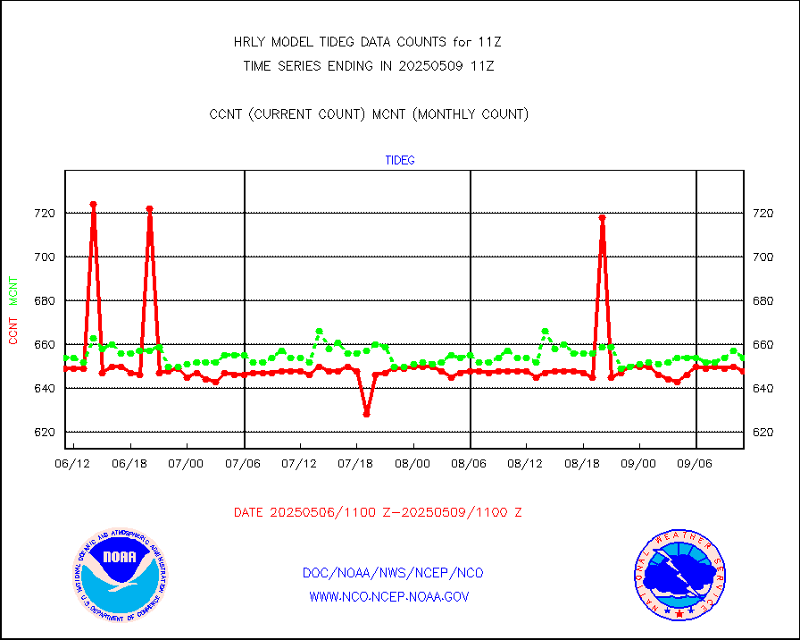
tideg |
Tide gauge reports decoded from CREX format |
648 |
638 |
101.6 % |
1910.00-1910.99 |
| Data Types of Opportunity with Normal Counts |
|---|
| Type | Description | Hourly Count | Monthly Average | Percent (%) of Monthly Mean | UTC Time Window |
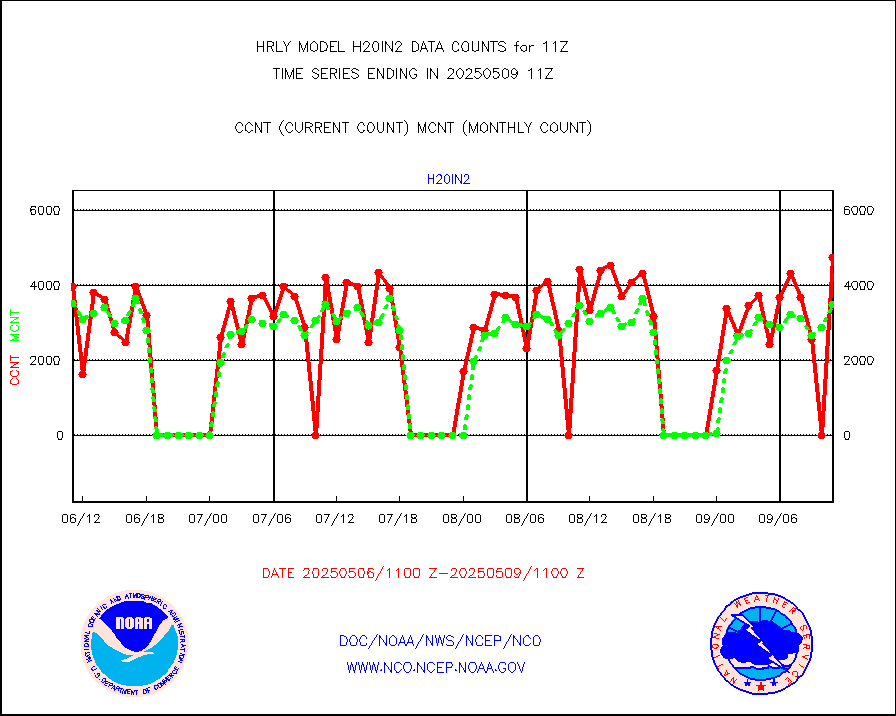
3p9usr |
GOES-16&up/NESDIS ir short-wv derived cld motion |
41709 |
40631 |
102.7 % |
1910.00-1910.99 |
acarsa |
MDCRS ACARS acft data (ARINC via AFWA)(AIREP fmt) |
0 |
0 |
n/a |
1910.50-1911.49 |
ahicsr |
Himawari Clear Sky Radiance |
0 |
0 |
n/a |
1910.00-1910.99 |
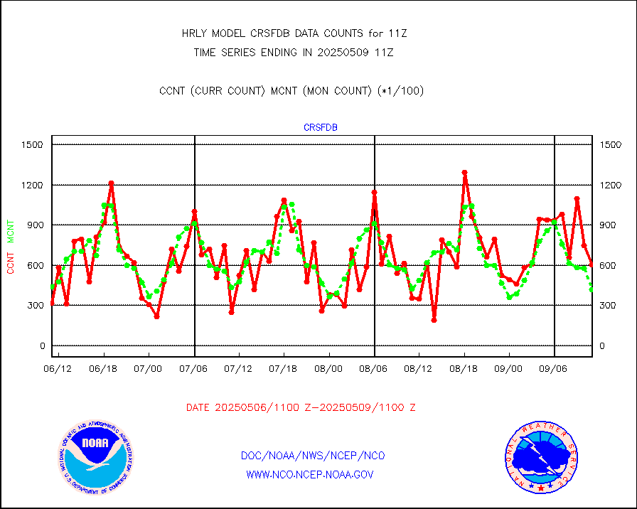
amsr2 |
GCOM-W AMSR2 1B brightness temperatures |
2309472 |
2076516 |
111.2 % |
1909.00-1909.99 |
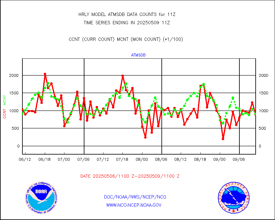
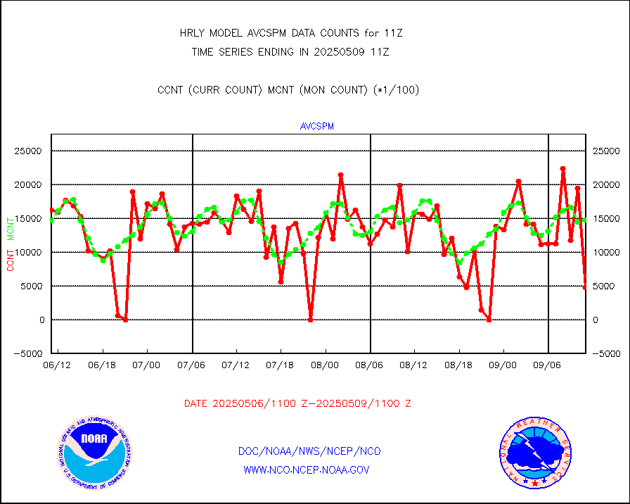
atmsdb |
NPP/NOAA-20 ATMS bright. temps-direct b-cast SSEC |
89472 |
75127 |
119.1 % |
1909.50-1910.49 |
atovs |
POES/NESDIS - processed ATOVS soundings/radiances |
0 |
0 |
n/a |
1909.00-1909.99 |
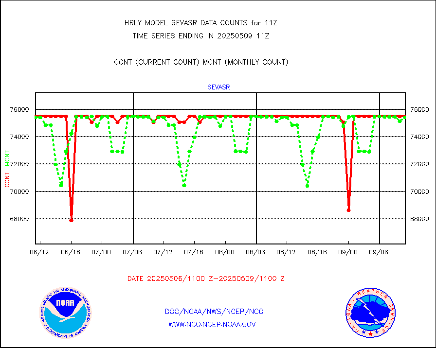
avcsam |
A.M.(N17,M2,M3) AVHRR GAC NCEP-proc clr&sea btmps |
1518721 |
1325584 |
114.6 % |
1908.50-1909.49 |
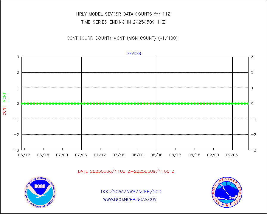
avcspm |
P.M.(N18-19) AVHRR GAC NCEP-proc clr & sea btemps |
1345776 |
1457026 |
92.4 % |
1908.50-1909.49 |
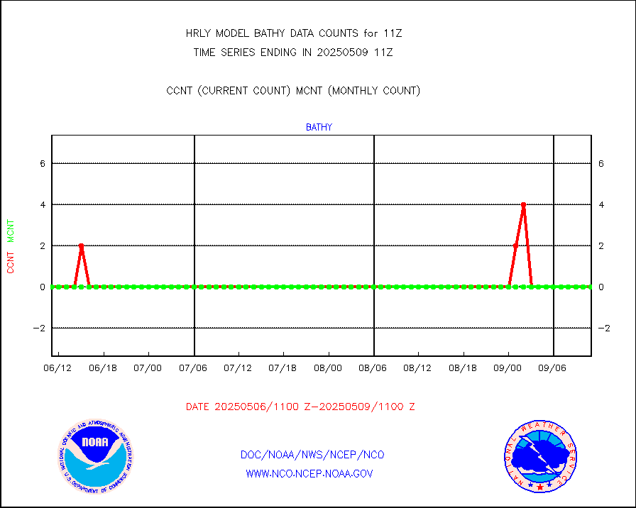
bathy |
eXpendable BathyThermograph, mooring (BATHY fmt) |
0 |
0 |
n/a |
1904.00-1904.99 |
coopmd |
Coop/MADIS NEPP & HCN-Modernization NOAA COOP Obs |
27 |
27 |
100.0 % |
1910.50-1911.49 |
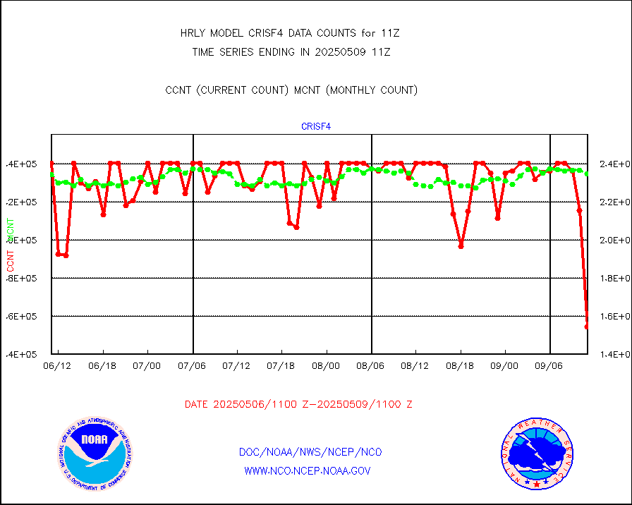
crisf4 |
NPP/NOAA-20 CrIS full spctrl radn (431 ch subset) |
213750 |
230086 |
92.9 % |
1909.50-1910.49 |
crsfdb |
NPP/NOAA-20 CrIS full spctrl radn dir brdcst SSEC |
64459 |
76571 |
84.2 % |
1909.50-1910.49 |
cstgd |
Coast Guard |
3 |
4 |
75.0 % |
1910.50-1911.50 |
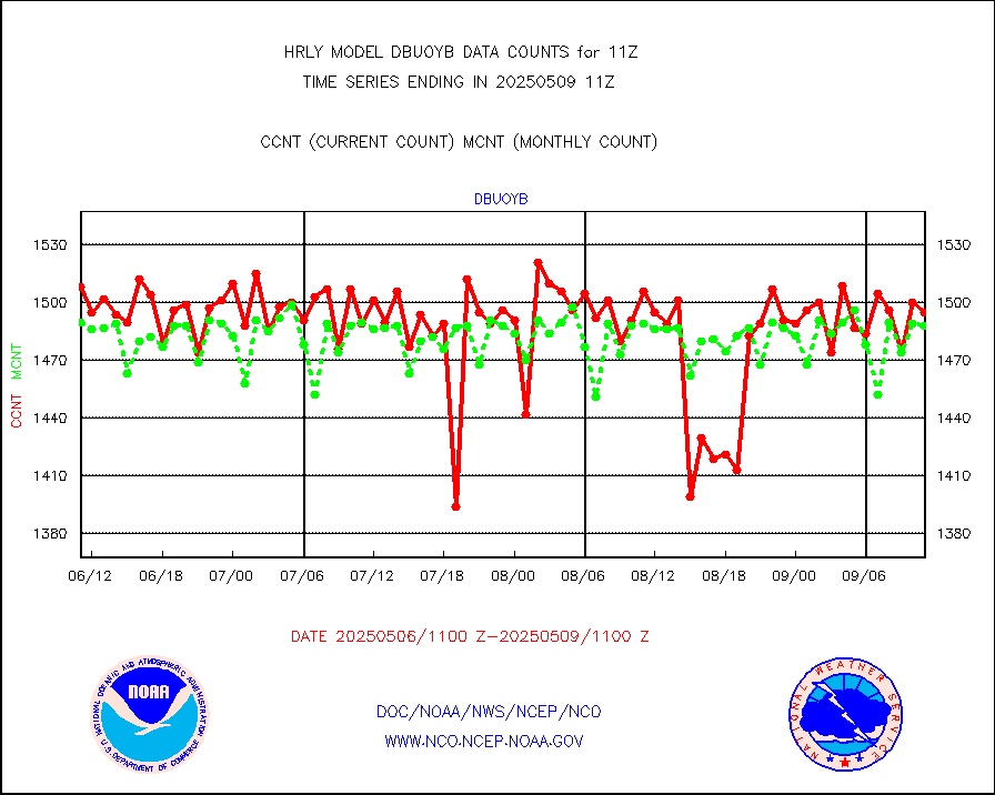
dbuoyb |
Drifting buoys (decoded from BUFR) |
1440 |
1397 |
103.1 % |
1910.50-1911.50 |
dropw |
Dropwinsonde (from TEMP DROP) |
0 |
0 |
n/a |
1910.50-1911.49 |
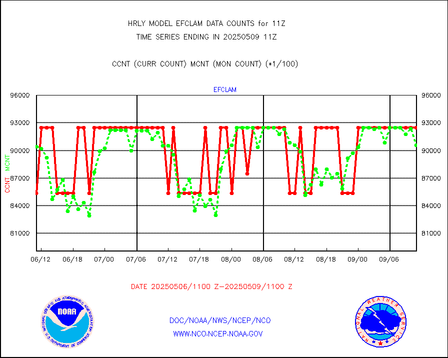
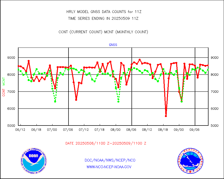
efclam |
GOES imager effective cloud amount data (U.Wisc.) |
8287240 |
8293345 |
99.9 % |
1910.50-1911.49 |
esatms |
NPP Adv. Tech. MW Sndr (ATMS) br. temps from RARS |
75356 |
80633 |
93.5 % |
1909.50-1910.49 |
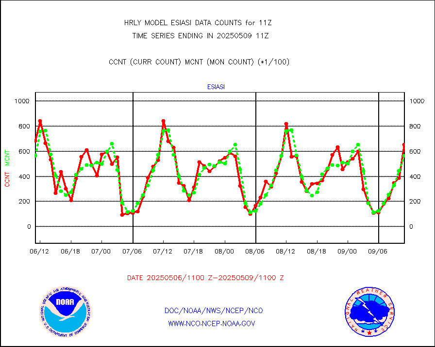
esiasi |
METOP 1-2 IASI 1C radiance data vbl chn from RARS |
56043 |
61892 |
90.5 % |
1910.00-1910.99 |
esmhs |
NOAA 18-19 & METOP 1-2 MHS proc. btemps from RARS |
231842 |
216334 |
107.2 % |
1910.50-1911.49 |
geoimr |
GOES/NESDIS (11x17 f-o-v) imager clear radiances |
0 |
0 |
n/a |
1910.00-1910.99 |
gome |
METOP 1-2 Global Ozone Monitoring Exp.-2 (GOME-2) |
12529 |
7854 |
159.5 % |
1909.50-1910.49 |
h20in2 |
INDIA SATWIND, INSAT WV channel |
2640 |
5466 |
48.3 % |
1910.00-1910.99 |
h2dusr |
GOES-16&up/NESDIS wv imgr/deep-lyr derivd cld mtn |
14476 |
15630 |
92.6 % |
1910.00-1910.99 |
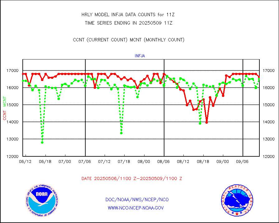
h2eunb |
METEOSAT/EUMETSAT wvpr imgr drv cld motion NBseq |
40562 |
41888 |
96.8 % |
1909.50-1910.49 |
hdob |
High Density OBs from reconnaissance acft data |
0 |
0 |
n/a |
1910.50-1911.49 |
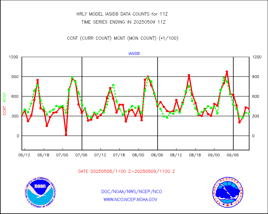
iasidb |
METOP 1-2 IASI 1C radiances-direct broadcast SSEC |
26217 |
29343 |
89.3 % |
1909.50-1910.49 |
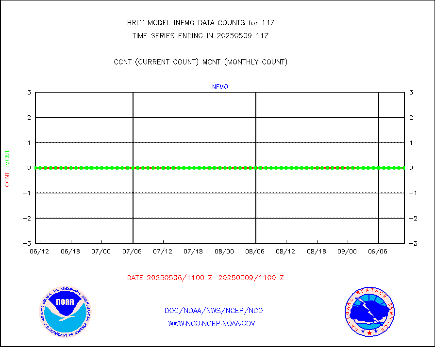
ifvrnb |
VIIRS (NPP/NOAA-20) ir lg-wv drv cloud motion(NB) |
11695 |
15281 |
76.5 % |
1907.00-1907.99 |
infav |
AVHRR (NOAA/METOP) ir lg-wave derived cld motion |
0 |
0 |
n/a |
1907.00-1907.99 |
infav1 |
AVHRR (METOP) ir lg-wave derived cld motion |
0 |
0 |
n/a |
1910.50-1911.50 |
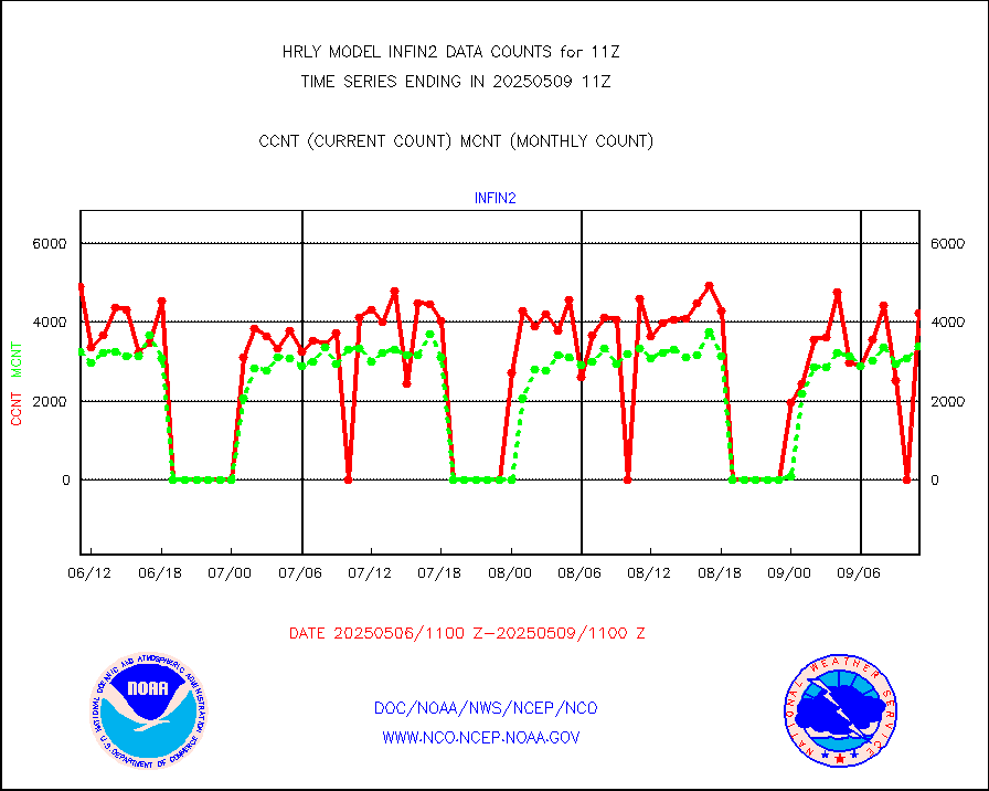
infin |
INSAT/KALPANA India ir lg-wave derived cld motion |
0 |
0 |
n/a |
1908.50-1909.49 |
infin2 |
INDIA SATWIND, INSAT IR channel |
3844 |
5332 |
72.1 % |
1910.00-1910.99 |
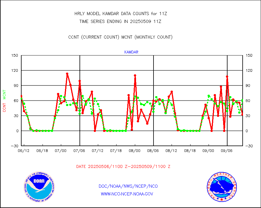
kamdar |
Korean AMDAR aircraft data (decoded from BUFR) |
82 |
44 |
186.4 % |
1910.50-1911.49 |
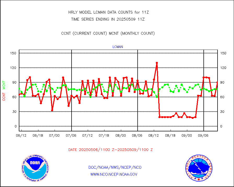
lcman |
Land-based CMAN stations decoded from CMAN format |
96 |
84 |
114.3 % |
1910.50-1911.49 |
leogeo |
LEO-GEO satellite AMVs from UWisc. |
6599 |
5305 |
124.4 % |
1907.00-1907.99 |
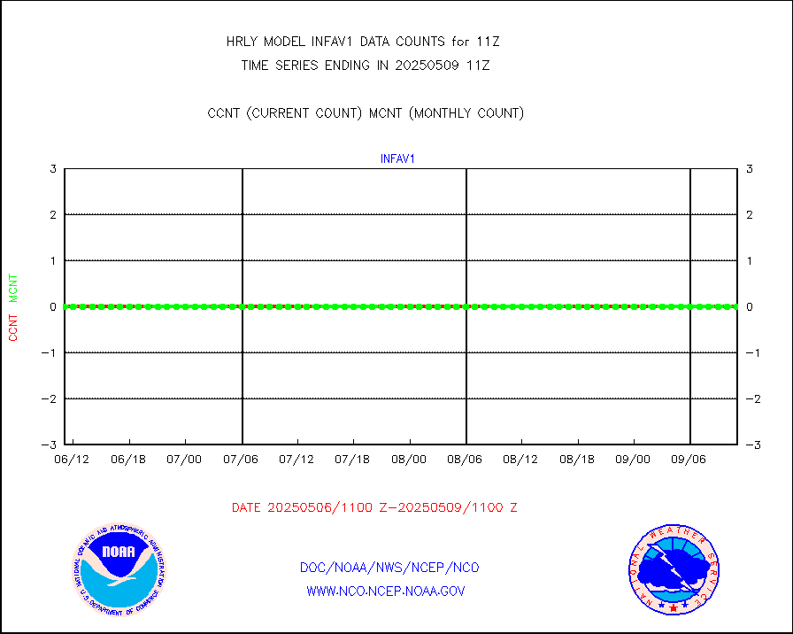
ltnglr |
LLDN Long-rng lightning from Vaisala via NOAAPORT |
149062 |
132810 |
112.2 % |
1910.50-1911.49 |
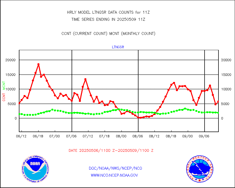
ltngsr |
NLDN Shrt-rng lightning from Vaisala via NOAAPORT |
4553 |
3154 |
144.4 % |
1910.50-1911.49 |
mbuoyb |
Moored buoys (decoded from BUFR) |
828 |
750 |
110.4 % |
1910.50-1911.50 |
mls |
Aura Microwave Limb Sounder (MLS) ozone data |
0 |
0 |
n/a |
1909.00-1909.99 |
msourb |
Mesonet/MADIS UrbaNet |
4355 |
4361 |
99.9 % |
1910.50-1911.49 |
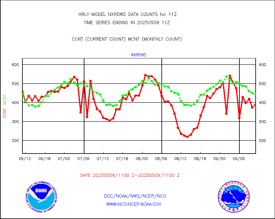
nxrdw2 |
NEXRAD Vel Azm Dsp(VAD) winds via Level 2 decoder |
595 |
504 |
118.1 % |
1910.50-1911.49 |
ompslp |
OMPS Limb Profiler ozone data (NPP) |
67 |
274 |
24.5 % |
1904.00-1904.99 |
ompsn8 |
OMPS nadir profile ozone (Version 8 BUFR) |
708 |
605 |
117.0 % |
1909.00-1909.99 |
ompst8 |
OMPS total column ozone (Version 8 BUFR) |
532205 |
363459 |
146.4 % |
1909.00-1909.99 |
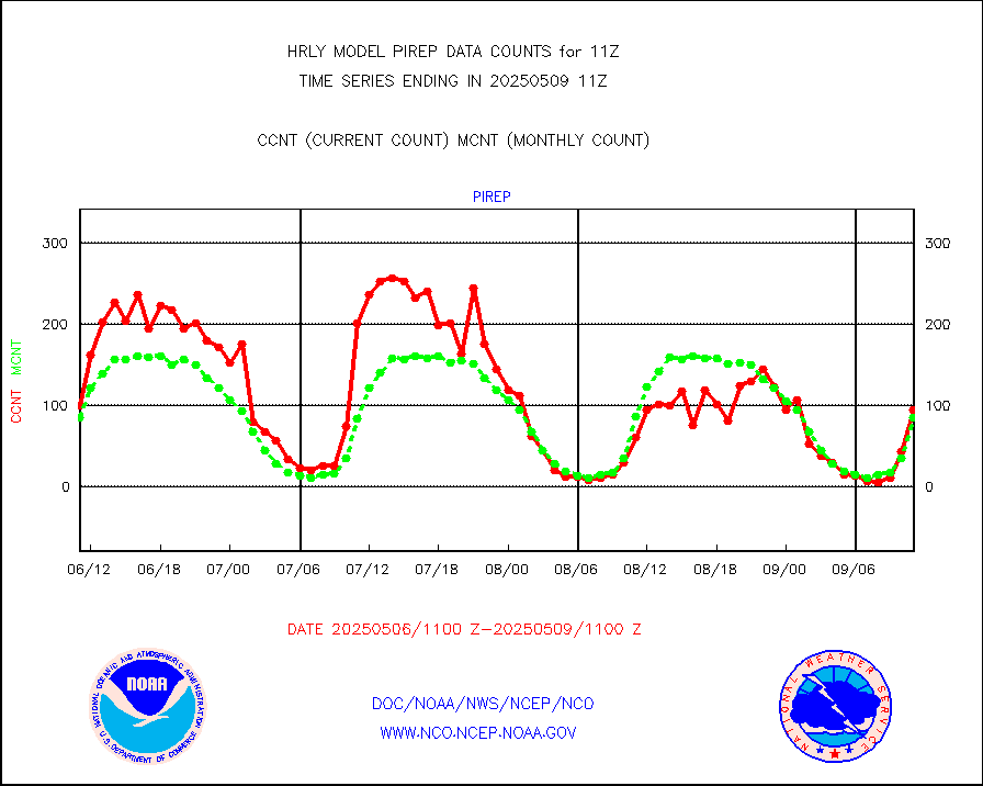
pirep |
Manual PIREP aircraft data (dcded from AIREP fmt) |
66 |
83 |
79.5 % |
1910.50-1911.49 |
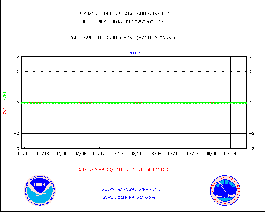
prflrp |
Profilr winds from PIBAL (PILOT,PILOT SHIP/MOBIL) |
0 |
0 |
n/a |
1910.50-1911.49 |
raobm |
Rawinsonde - mobile land (from TEMP/PILOT MOBIL) |
0 |
0 |
n/a |
1910.50-1911.49 |
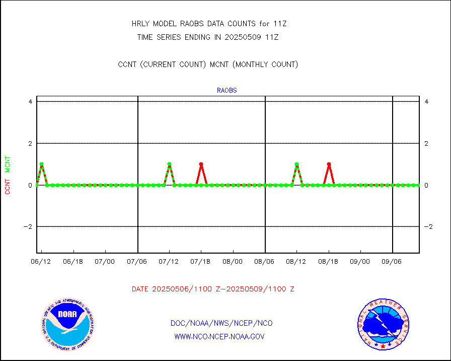
raobs |
Rawinsonde - ship (from TEMP SHIP, PILOT SHIP) |
0 |
0 |
n/a |
1910.50-1911.49 |
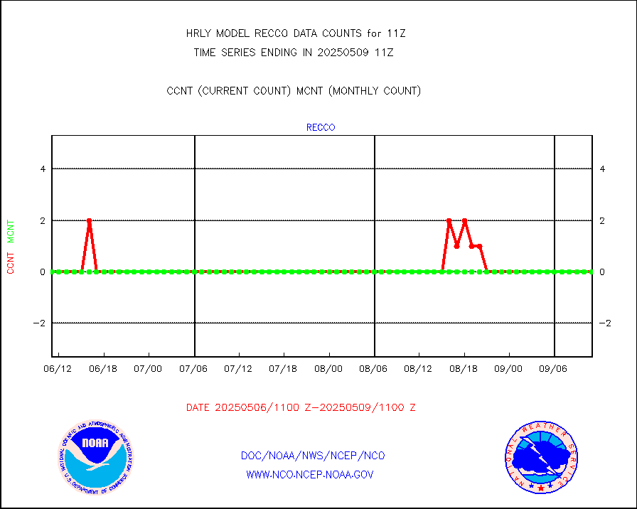
recco |
Flight level reconnaissance aircraft data |
0 |
0 |
n/a |
1910.50-1911.49 |
saphir |
Megha-Tropiques SAPHIR L1A2 brightness temps |
0 |
0 |
n/a |
1908.50-1909.49 |
sevasr |
METEOSAT-10 2nd Gen SEVIRI All Sky Radiance(proc) |
75512 |
75437 |
100.1 % |
1910.50-1911.49 |
ships |
Ship - manual and automatic, restricted |
0 |
6 |
0.0 % |
1910.50-1911.49 |
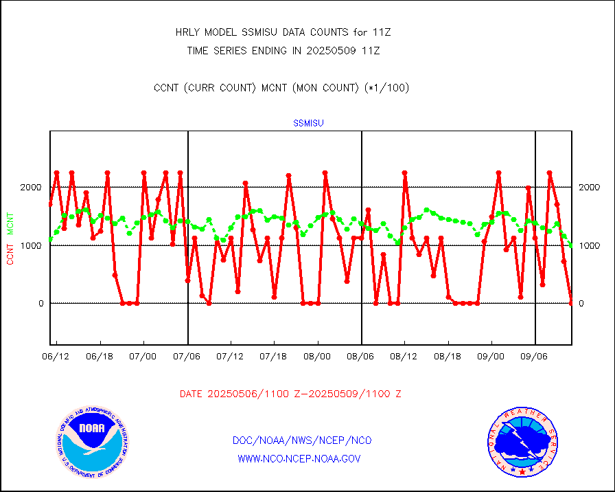
ssmisu |
DMSP SSM/IS 1C radiance data (Unified Pre-Proc.) |
34380 |
95890 |
35.9 % |
1909.50-1910.49 |
synopm |
Synoptic - mobile manual and automatic |
569 |
567 |
100.4 % |
1910.50-1911.49 |
synpmb |
Synoptic - mobile manual & auto (decoded fr BUFR) |
0 |
1 |
0.0 % |
1910.50-1911.49 |
tesac |
CTD probe, Argo prflng float, mooring (TESAC fmt) |
204 |
197 |
103.6 % |
1910.50-1911.49 |
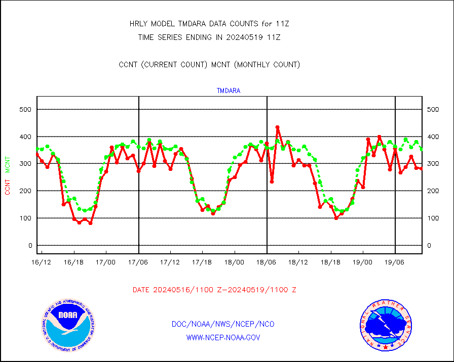
tmdara |
TAMDAR aircft data-all types(from Panasonic,BUFR) |
282 |
352 |
80.1 % |
1910.50-1911.49 |
trkob |
ThermoSalinoGraph (TSG) TRACKOB format) |
90 |
44 |
204.5 % |
1909.50-1910.49 |
visin |
INSAT/KALPANA India visible derived cloud motion |
0 |
0 |
n/a |
1908.50-1909.49 |
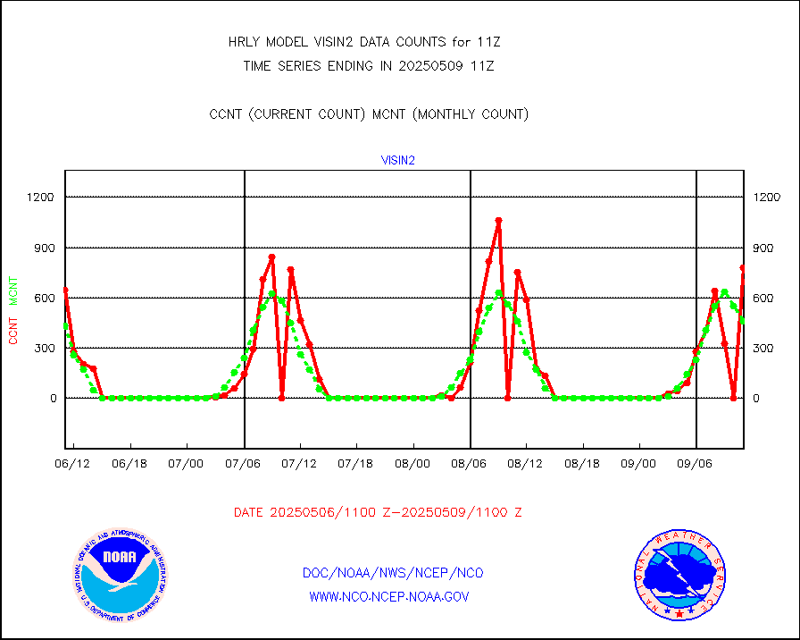
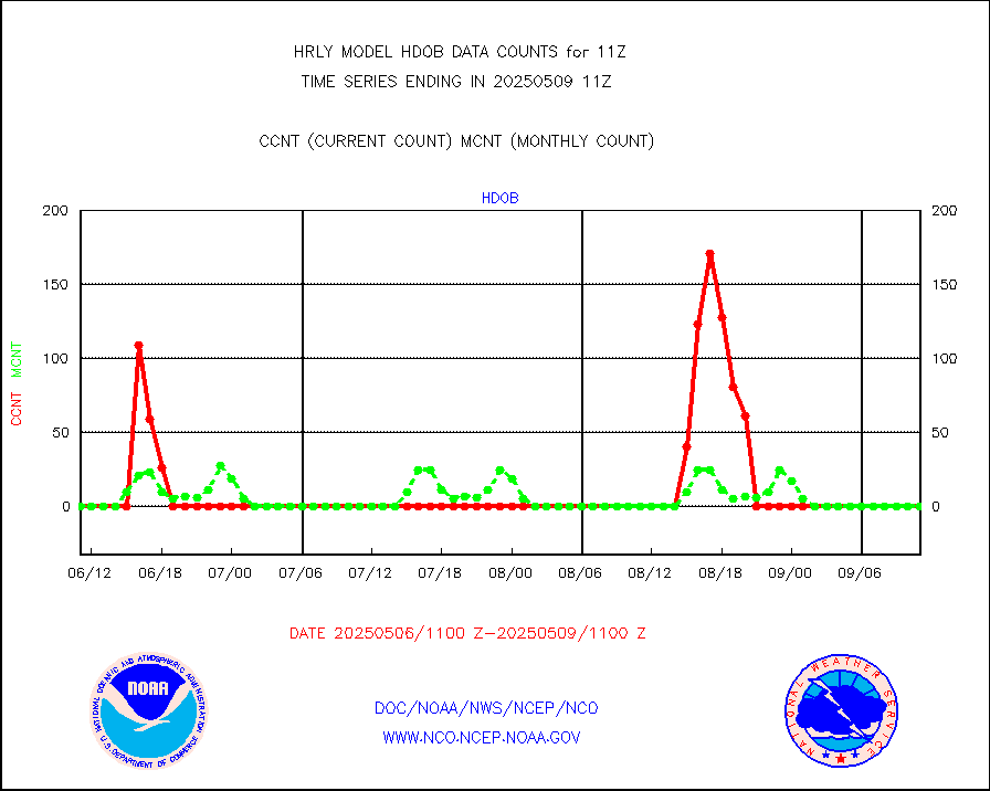
visin2 |
INDIA SATWIND, INSAT VIS channel |
420 |
821 |
51.2 % |
1910.00-1910.99 |
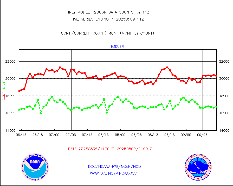
visja |
MTSAT/JMA visible derived cloud motion |
2520 |
2520 |
100.0 % |
1908.50-1909.49 |
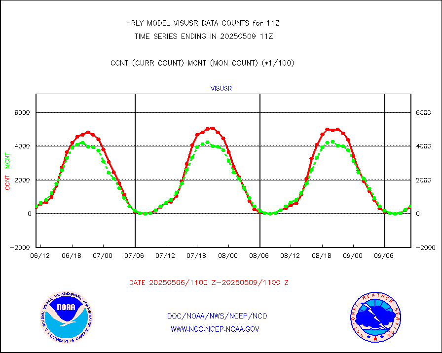
visusr |
GOES-16&up/NESDIS visible derived cloud motion |
41040 |
43471 |
94.4 % |
1910.00-1910.99 |
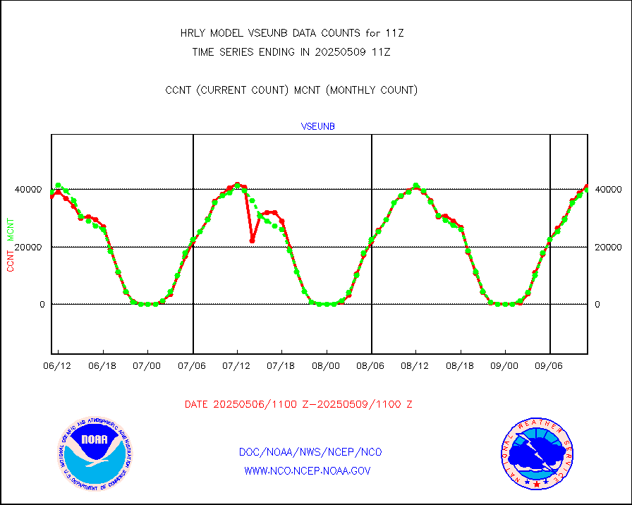
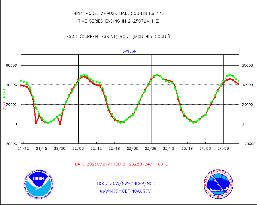
vseunb |
METEOSAT/EUMETSAT visible drv cld motion NBseq |
39444 |
37338 |
105.6 % |
1909.50-1910.49 |


