| Critical Data with Normal Counts |
|---|
| Type | Description | Hourly Count | Monthly Average | Percent (%) of Monthly Mean | UTC Time Window |
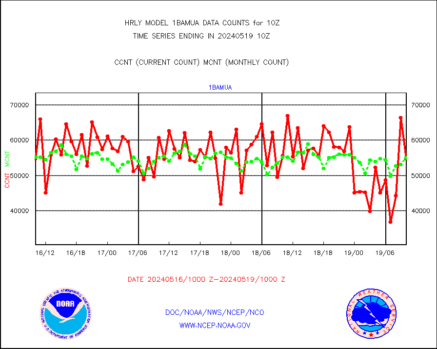
1bamua |
NOAA 15-19 & METOP 1-2 AMSU-A NCEP-proc. br.temps |
54750 |
55043 |
99.5 % |
1908.00-1908.99 |
1bhrs4 |
NOAA 18-19 & METOP 1-2 HIRS-4 NCEP-proc. br.temps |
46981 |
47403 |
99.1 % |
1908.00-1908.99 |
1bmhs |
NOAA 18-19 & METOP 1-2 MHS NCEP-proces. br. temps |
302616 |
318497 |
95.0 % |
1908.00-1908.99 |
acars |
MDCRS ACARS acft data from ARINC(dcded from BUFR) |
3388 |
1666 |
203.4 % |
1909.50-1910.49 |
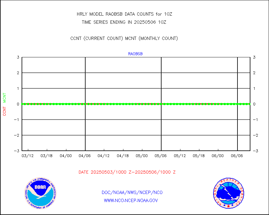
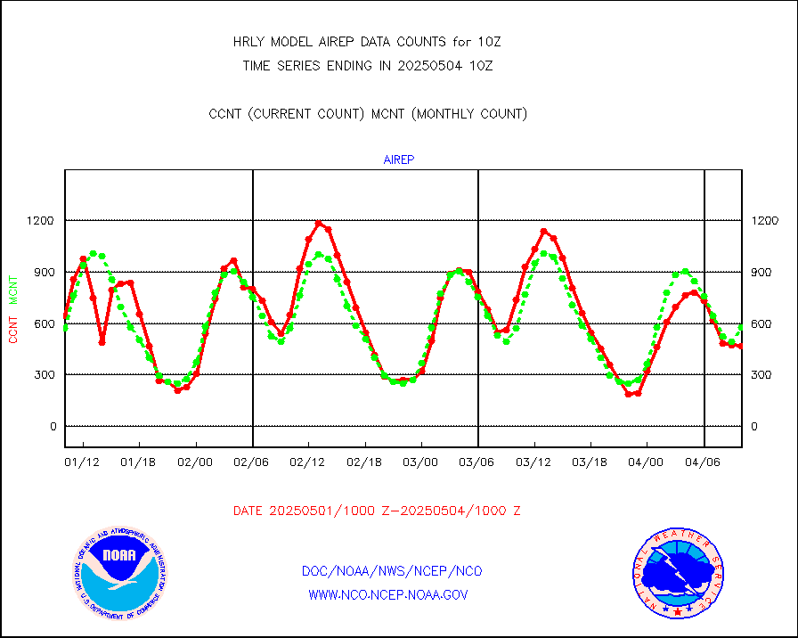
airep |
Manual AIREP aircraft data (dcded from AIREP fmt) |
963 |
779 |
123.6 % |
1909.50-1910.49 |
airsev |
AQUA AIRS/AMSU-A/HSB brightness temps- every FOV |
0 |
0 |
n/a |
1907.50-1908.49 |
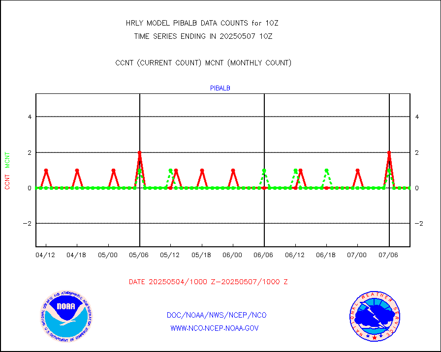
amdar |
AMDAR aircraft data (decoded from AMDAR format) |
364 |
276 |
131.9 % |
1909.50-1910.49 |
amdarb |
AMDAR aircraft data (decoded from BUFR) |
1188 |
1169 |
101.6 % |
1909.50-1910.49 |
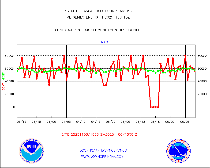
ascat |
METOP 1-2 ASCAT products |
48090 |
42405 |
113.4 % |
1908.50-1909.49 |
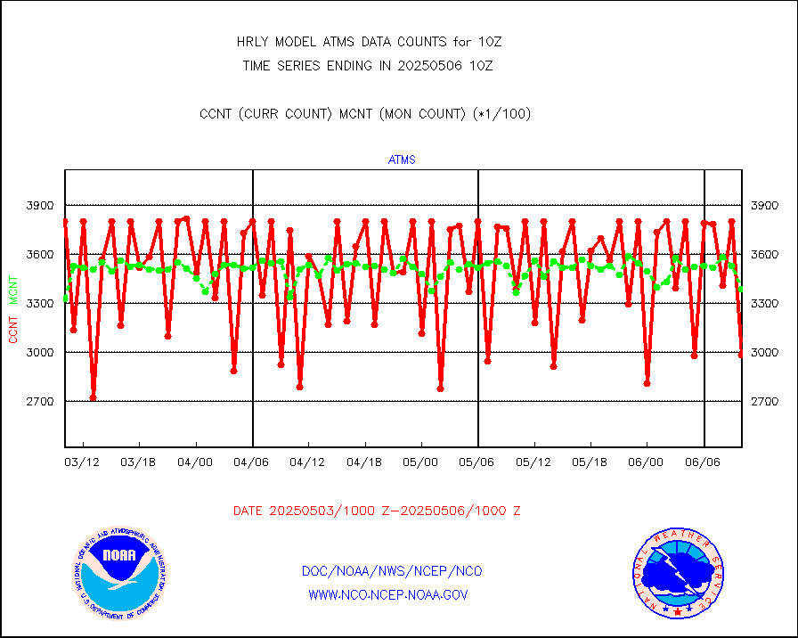
atms |
NPP/NOAA-20 ATMS brightness temperatures |
295960 |
335446 |
88.2 % |
1908.50-1909.49 |
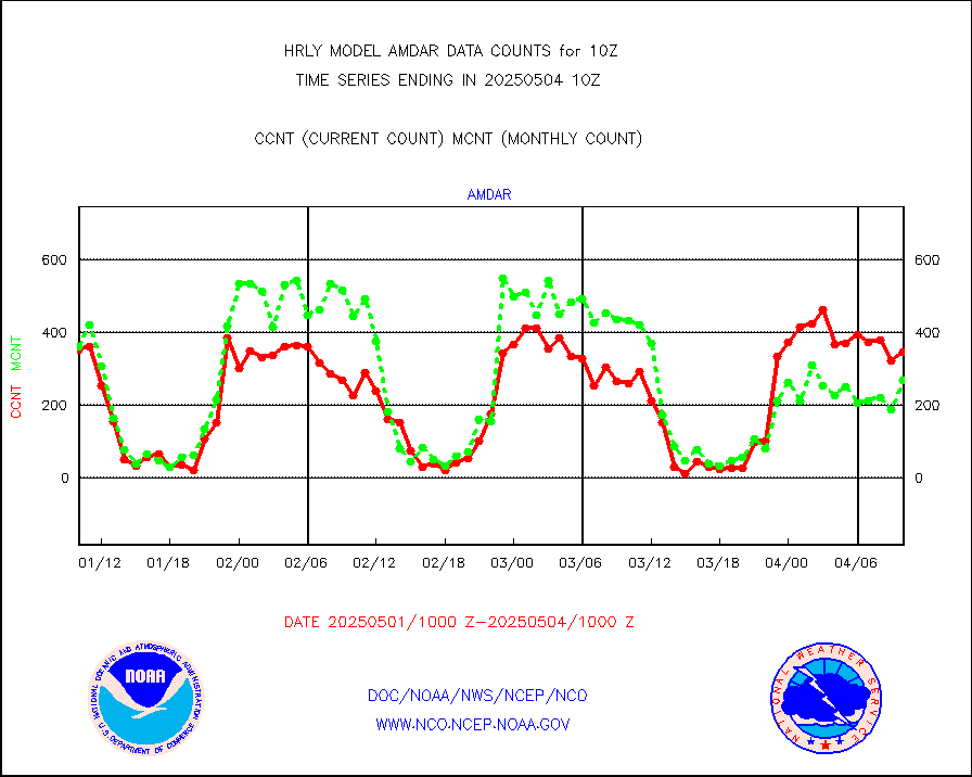
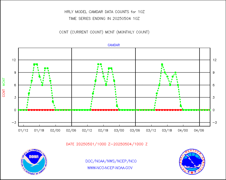
camdar |
Canadian AMDAR aircraft data (decoded from BUFR) |
0 |
1 |
0.0 % |
1909.50-1910.49 |
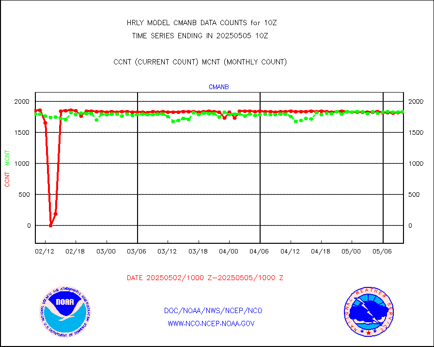
cmanb |
Surface Marine CMAN rpts decoded from BUFR format |
1725 |
1792 |
96.3 % |
1909.50-1910.50 |
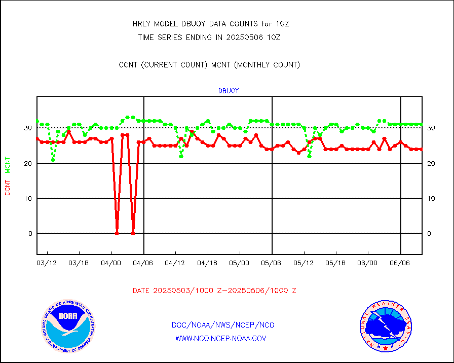
dbuoy |
Buoys decoded from FM-18 fmt (moored or drifting) |
41 |
35 |
117.1 % |
1909.50-1910.49 |
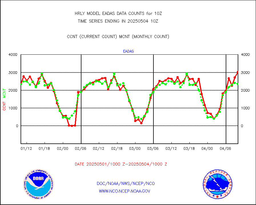
eadas |
E-AMDAR (European AMDAR acft decoded from BUFR) |
1823 |
1796 |
101.5 % |
1909.50-1910.49 |
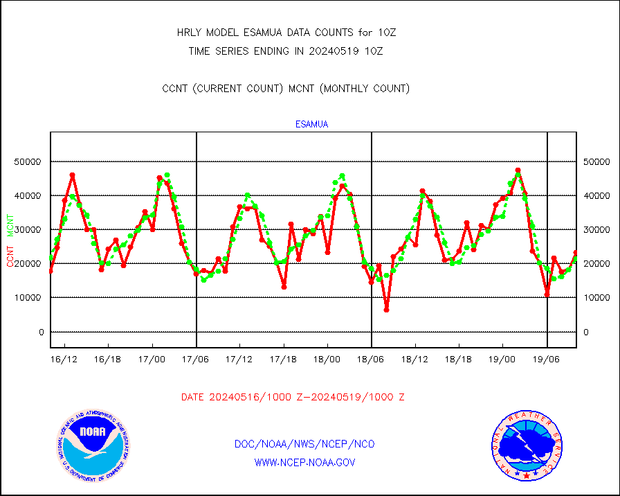
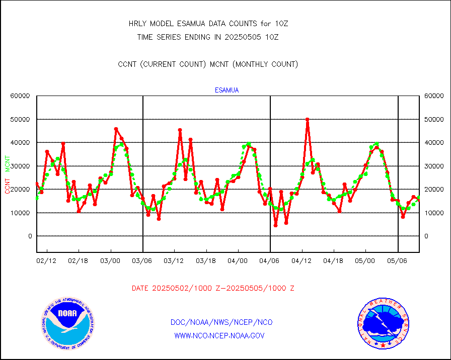
esamua |
NOAA 15-19 & METOP 1-2 AMSU-A proc btmps frm RARS |
23304 |
21424 |
108.8 % |
1909.50-1910.49 |
eshrs3 |
NOAA 15-19 & METOP 1-2 HIRS-3/4 pr btmps frm RARS |
48971 |
48817 |
100.3 % |
1909.50-1910.49 |
gnss |
Grnd-based Gbl Navigation Sat System (GNSS) data |
8885 |
9083 |
97.8 % |
1909.00-1909.99 |
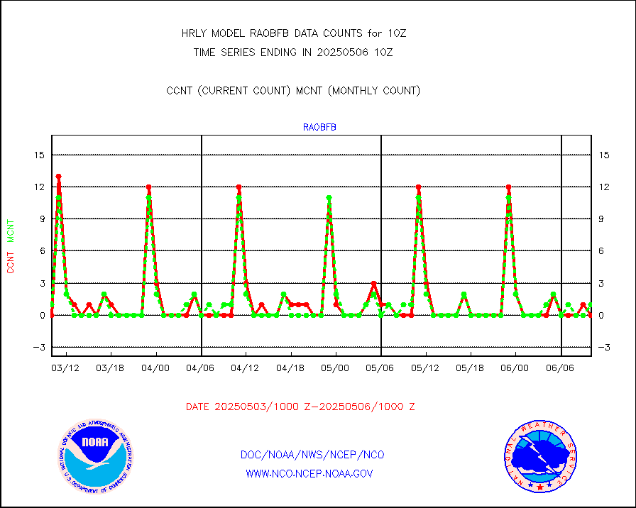
gpsro |
GPS radio occultation data |
480 |
444 |
108.1 % |
1907.50-1908.49 |
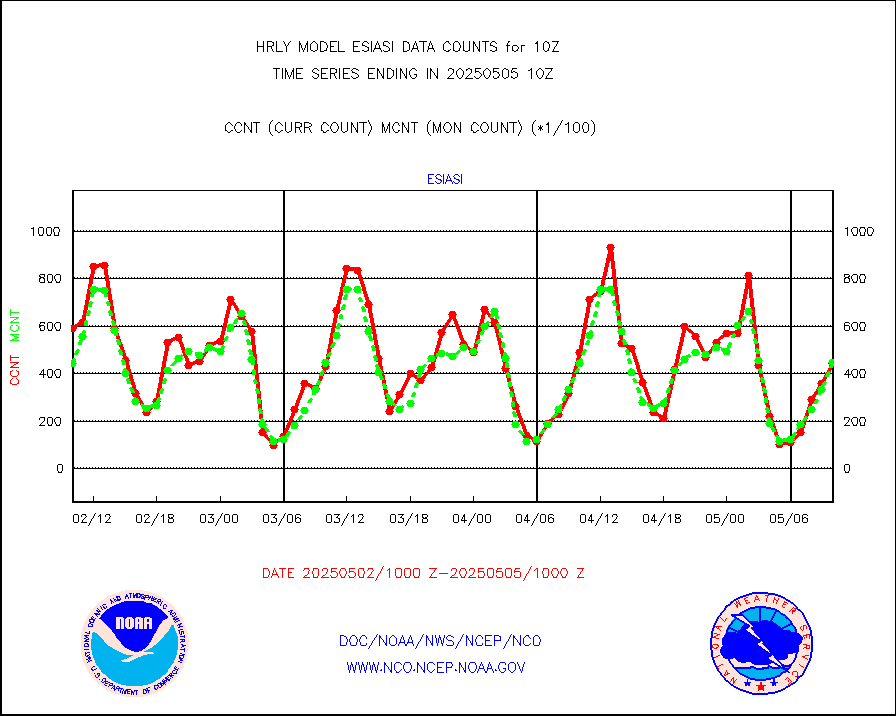
gsrasr |
GOES-16/17 All Sky Radiances (proc.) |
360476 |
360476 |
100.0 % |
1909.50-1910.49 |
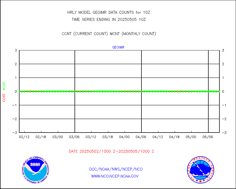
gsrcsr |
GOES-16/17 Clear Sky Radiances (proc.) |
157526 |
163039 |
96.6 % |
1909.50-1910.49 |
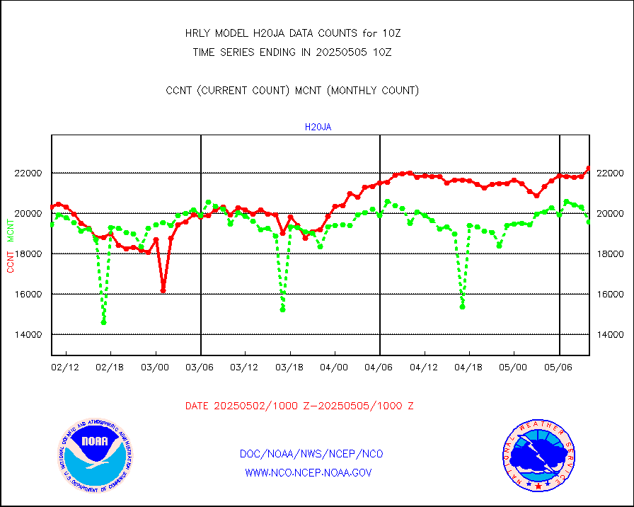
h20ja |
MTSAT/JMA water vapor imager derived cloud motion |
20932 |
19454 |
107.6 % |
1907.50-1908.49 |
h20mo |
MODIS (AQUA/TERRA) wvpr imager derived cld motion |
0 |
0 |
n/a |
1906.00-1906.99 |
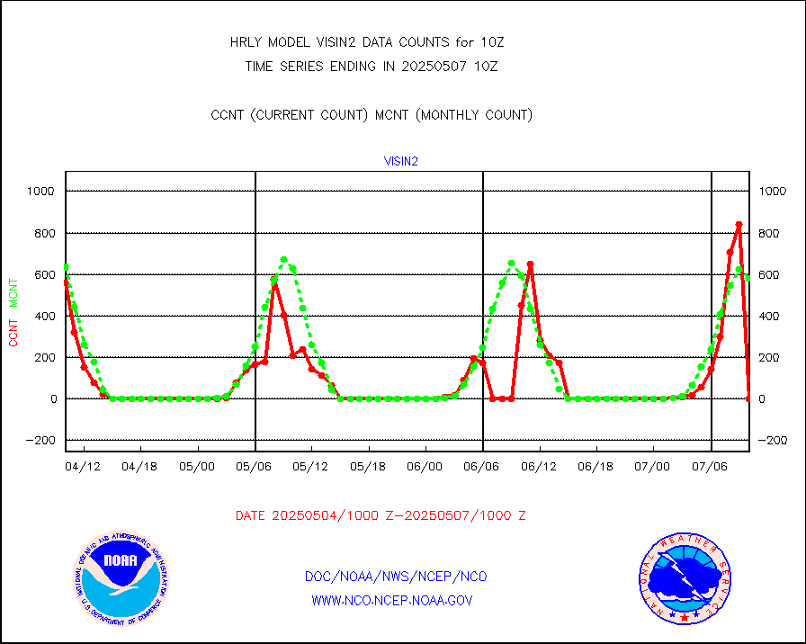
h2tusr |
GOES-16&up/NESDIS wv imgr/cld-top derived cld mtn |
21728 |
24917 |
87.2 % |
1909.00-1909.99 |
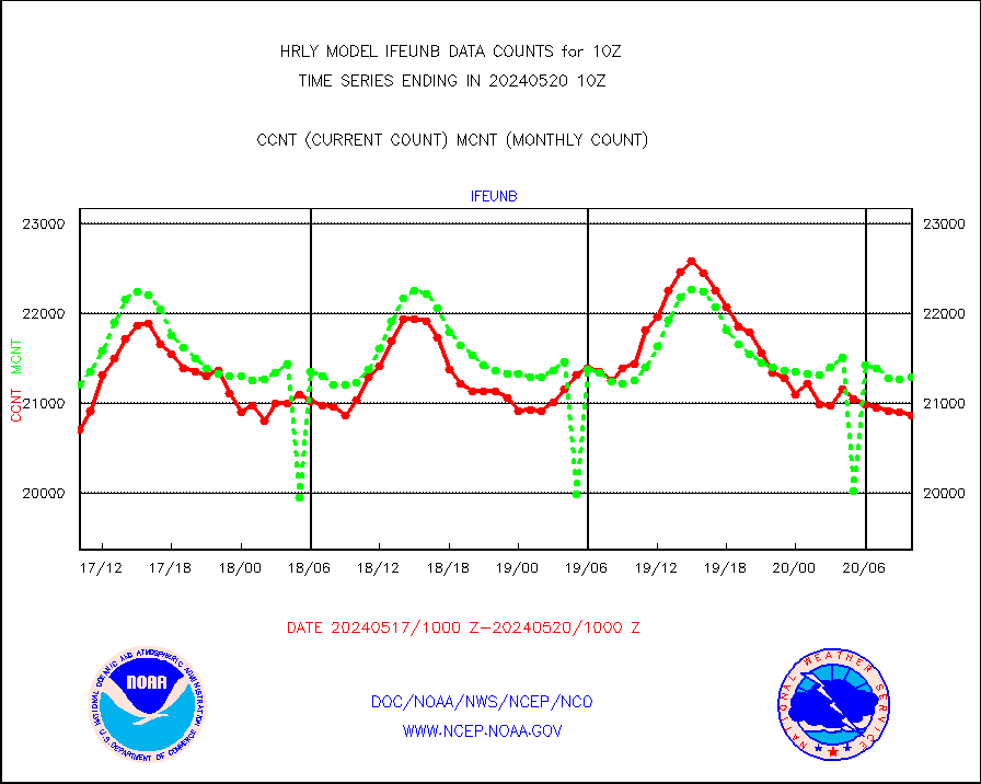
ifeunb |
METEOSAT/EUMETSAT ir lg-wave drv cld motion NBseq |
21441 |
21255 |
100.9 % |
1908.50-1909.49 |
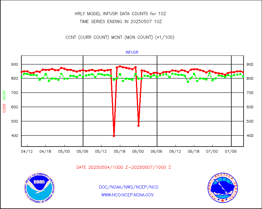
infja |
MTSAT/JMA infrared long-wave derived cloud motion |
16800 |
16256 |
103.3 % |
1907.50-1908.49 |
infmo |
MODIS (AQUA/TERRA) ir l-wave derived cloud motion |
0 |
0 |
n/a |
1906.00-1906.99 |
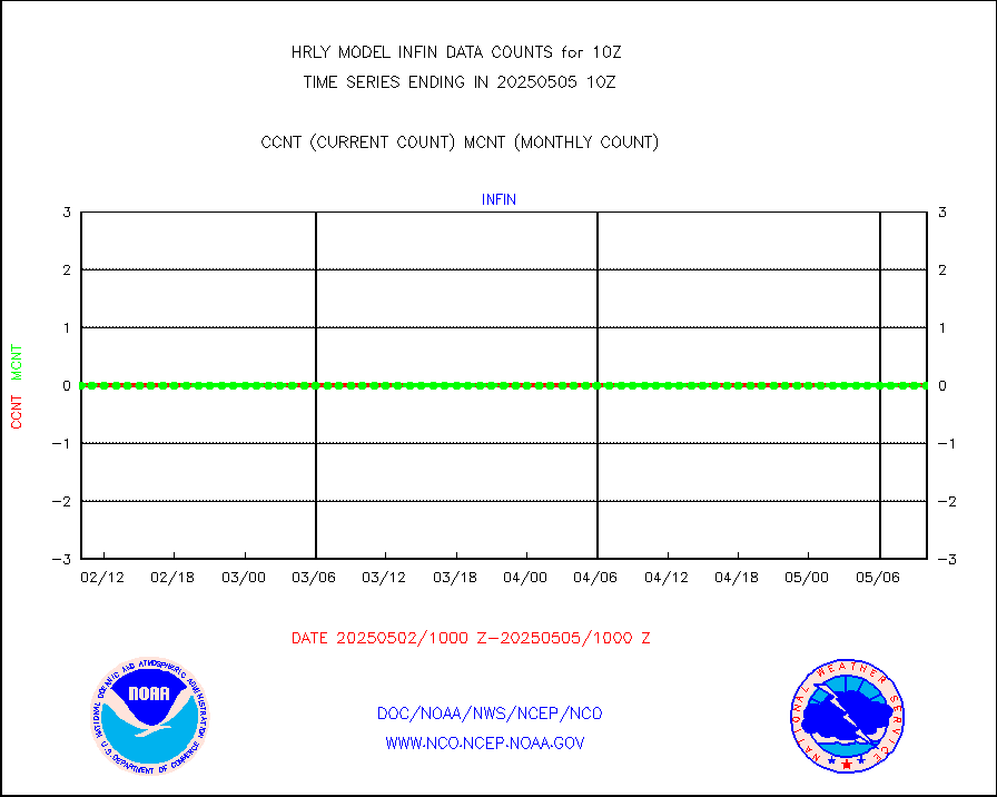
infusr |
GOES-16&up/NESDIS ir long-wave derived cld motion |
78987 |
81323 |
97.1 % |
1909.00-1909.99 |
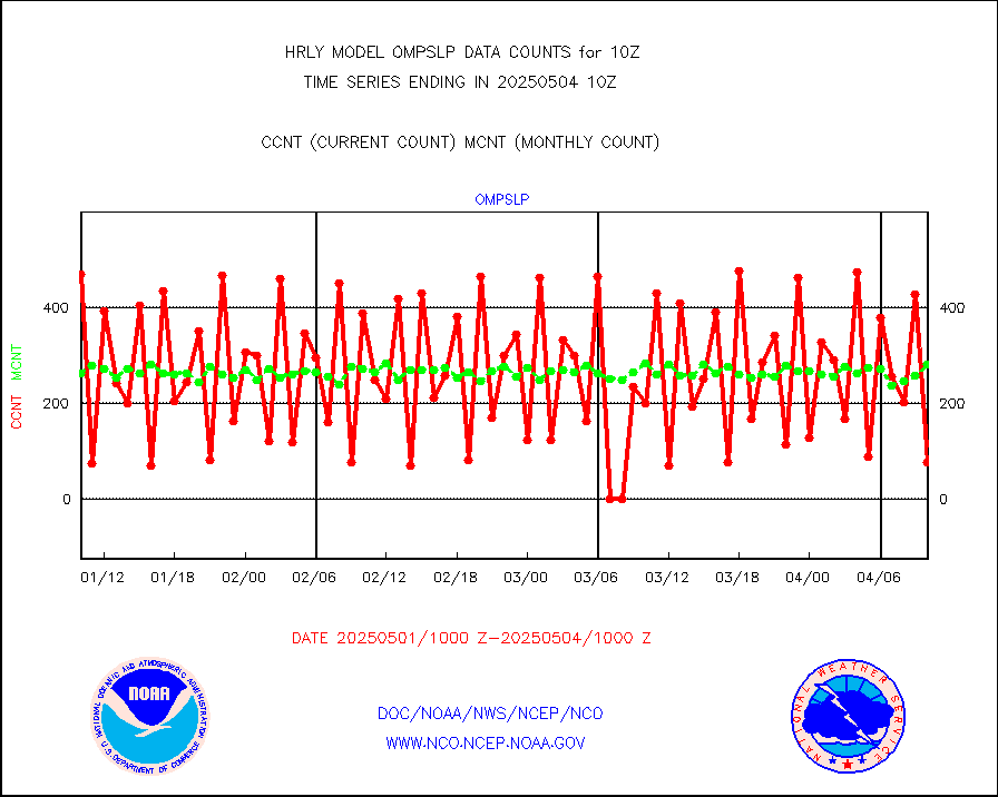
lgycld |
GOES/NASA(Langley) hi-res. (1x1 f-o-v) cloud data |
4216180 |
3512944 |
120.0 % |
1909.50-1910.49 |
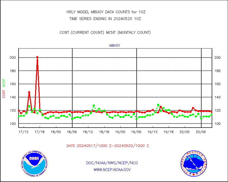
mbuoy |
Buoys decoded from FM-13 format (moored) |
119 |
113 |
105.3 % |
1909.50-1910.49 |
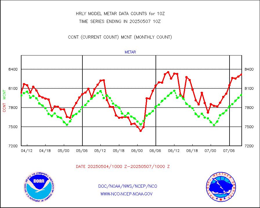
metar |
Aviation - METAR |
7898 |
8031 |
98.3 % |
1909.50-1910.49 |
mso470 |
Mesonet/MADIS Colorado E-470 (Interstate 470) |
21 |
20 |
105.0 % |
1909.50-1910.49 |
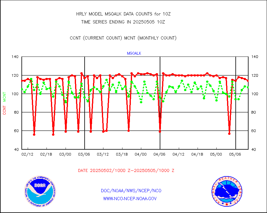
msoalk |
Mesonet/MADIS Alaska Department of Transportation |
107 |
107 |
100.0 % |
1909.50-1910.49 |
msoapg |
Mesonet/MADIS U.S. Army Aberdeen Proving Grounds |
0 |
0 |
n/a |
1909.50-1910.49 |
msoapr |
Mesonet/MADIS Citizen Weather Observers Program |
46802 |
48963 |
95.6 % |
1909.50-1910.49 |
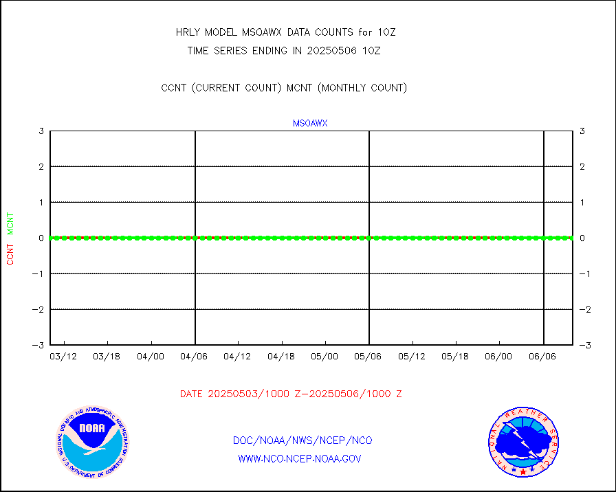
msoaws |
Mesonet/MADIS AWS Convergence Technologies, Inc. |
23880 |
25503 |
93.6 % |
1909.50-1910.49 |
msoawx |
Mesonet/MADIS "Anything Weather" |
0 |
0 |
n/a |
1909.50-1910.49 |
msocol |
Mesonet/MADIS Colorado Dept. of Transportation |
0 |
0 |
n/a |
1909.50-1910.49 |
msodcn |
Mesonet/MADIS DC Net |
0 |
0 |
n/a |
1909.50-1910.49 |
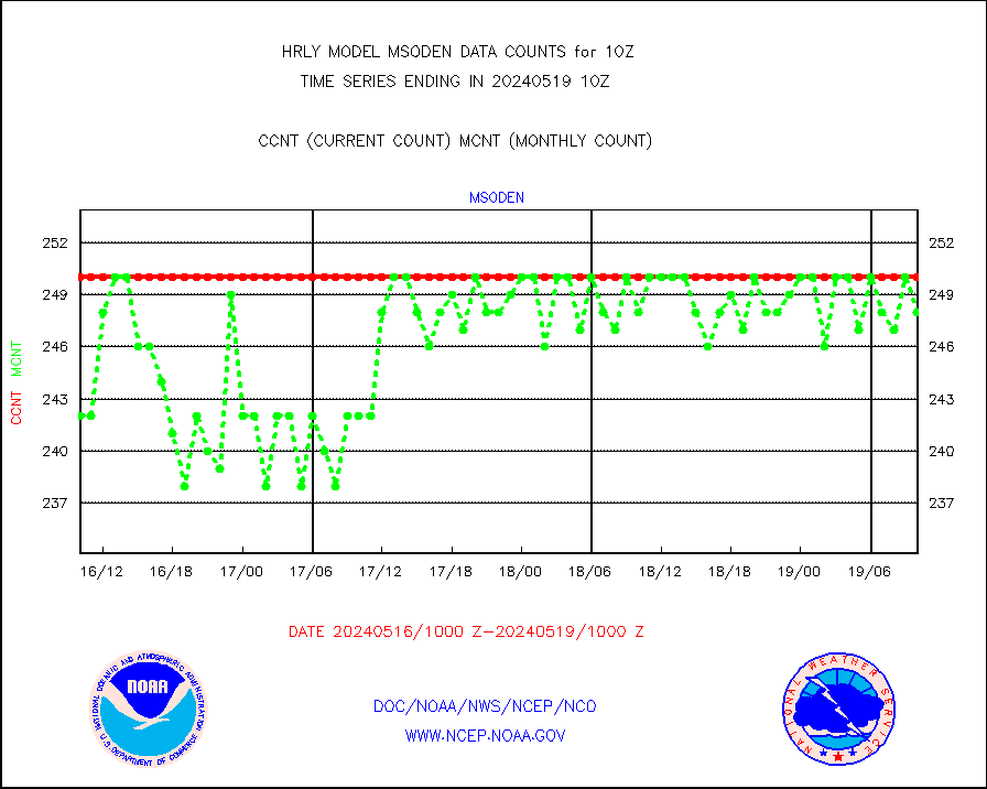
msoden |
Mesonet/MADIS Denver Urban Drainage & Flood Cntrl |
250 |
248 |
100.8 % |
1909.50-1910.49 |
msofla |
Mesonet/MADIS Florida (FAWN & USF) |
3 |
4 |
75.0 % |
1909.50-1910.49 |
msoflt |
Mesonet/MADIS Florida Dept. of Transportation |
0 |
0 |
n/a |
1909.50-1910.49 |
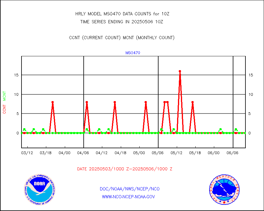
msogeo |
Mesonet/MADIS Georgia Dept. of Transportation |
0 |
0 |
n/a |
1909.50-1910.49 |
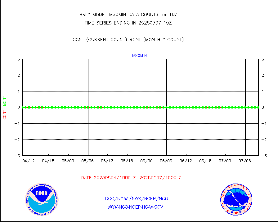
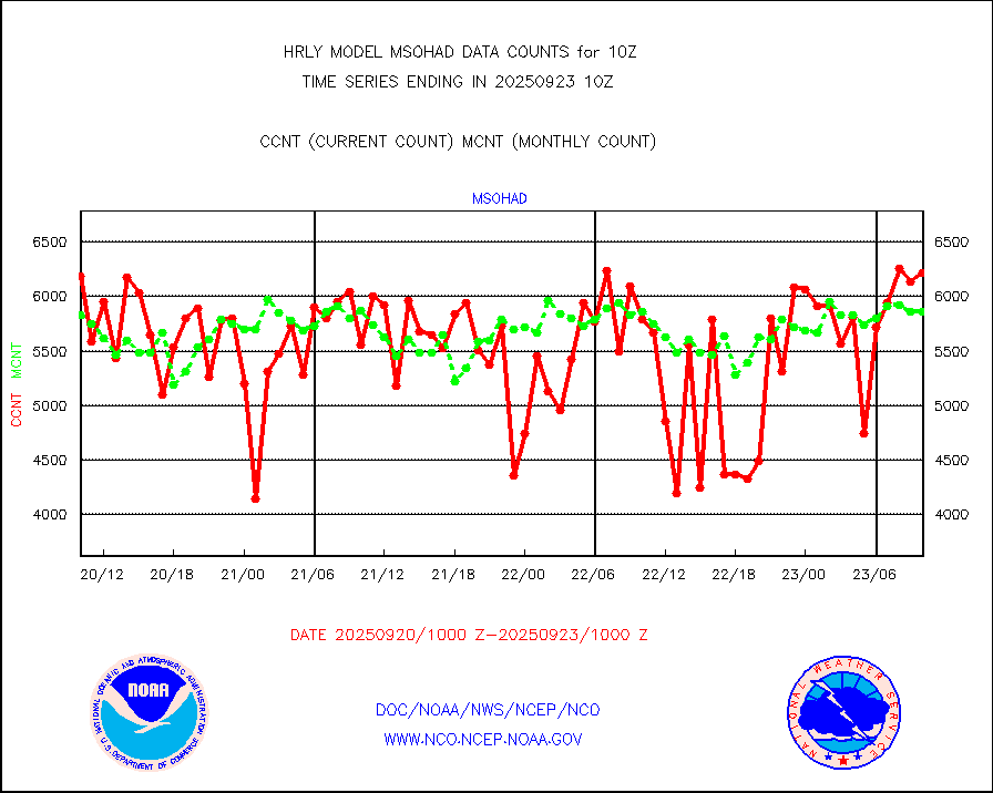
msohad |
Mesonet/MADIS NWS Hydromet Auto Data System(HADS) |
6740 |
6639 |
101.5 % |
1909.50-1910.49 |
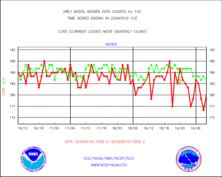
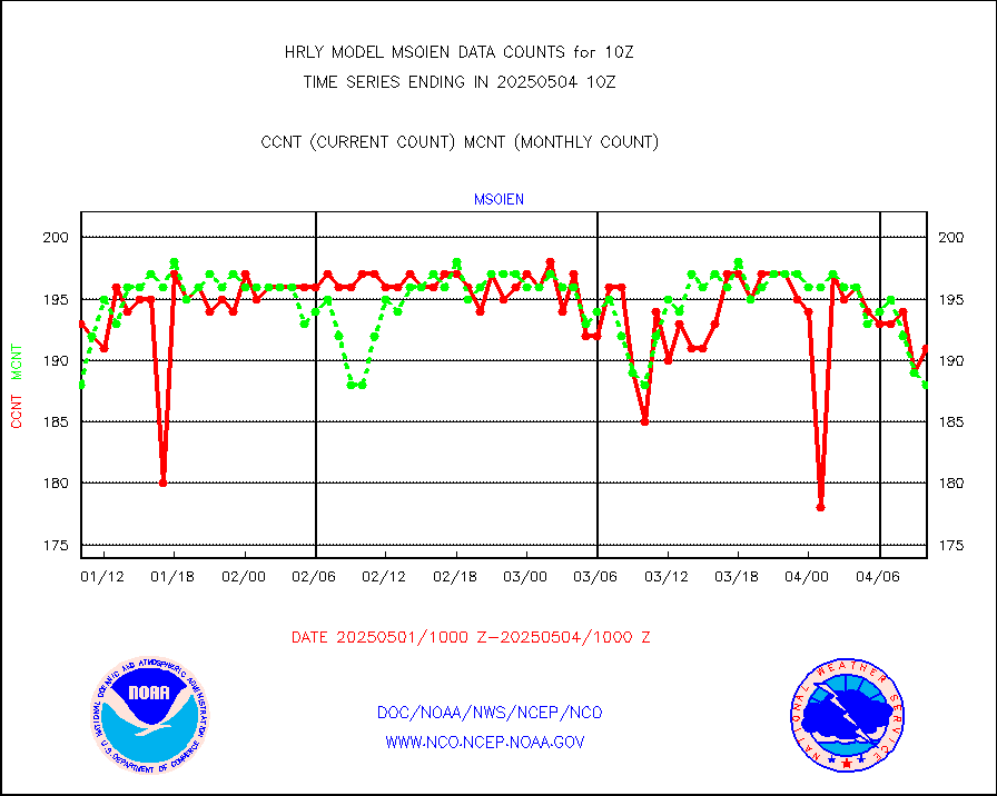
msoien |
Mesonet/MADIS Iowa Environmental |
180 |
184 |
97.8 % |
1909.50-1910.49 |
msoind |
Mesonet/MADIS Indiana Dept. of Transportation |
0 |
0 |
n/a |
1909.50-1910.49 |
msoiow |
Mesonet/MADIS Iowa Department of Transportation |
0 |
0 |
n/a |
1909.50-1910.49 |
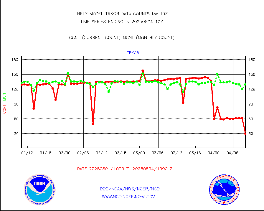
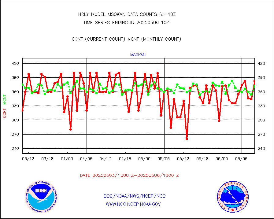
msokan |
Mesonet/MADIS Kansas Department of Transportation |
387 |
336 |
115.2 % |
1909.50-1910.49 |
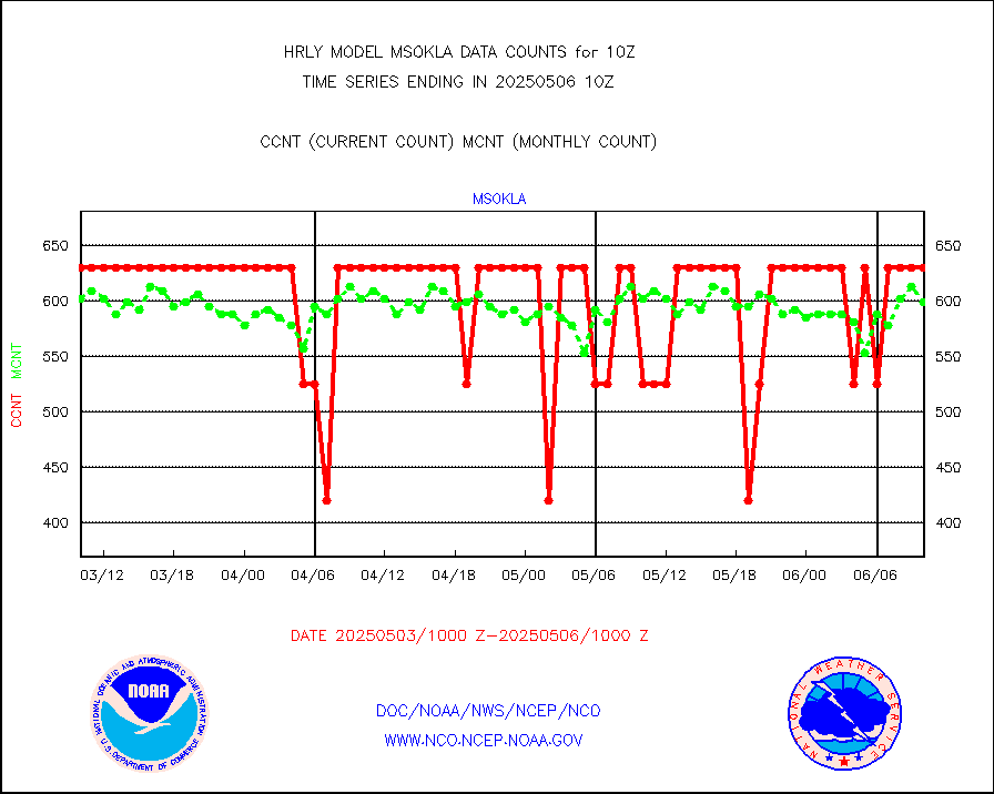
msokla |
Mesonet/MADIS Oklahoma Mesonet |
318 |
318 |
100.0 % |
1909.50-1910.49 |
msolju |
Mesonet/MADIS Louisiana State/Jackson State Univ. |
0 |
0 |
n/a |
1909.50-1910.49 |
msomca |
Mesonet/MADIS Missouri Commercial Agricult Wx Net |
290 |
294 |
98.6 % |
1909.50-1910.49 |
msomin |
Mesonet/MADIS Minnesota Dept. of Transportation |
0 |
0 |
n/a |
1909.50-1910.49 |
msonos |
Mesonet/MADIS NOS-Phys Oceanographic Realtime Sys |
387 |
382 |
101.3 % |
1909.50-1910.49 |
msoraw |
Mesonet/MADIS NFIC Remote Automated Wx Stns(RAWS) |
1941 |
1809 |
107.3 % |
1909.50-1910.49 |
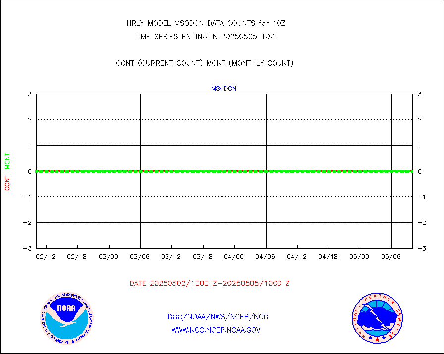
msovir |
Mesonet/MADIS Virginia Dept. of Transportation |
207 |
225 |
92.0 % |
1909.50-1910.49 |
msowfy |
Mesonet/MADIS "Weather for You" |
0 |
0 |
n/a |
1909.50-1910.49 |
msowis |
Mesonet/MADIS Wisconsin Dept. of Transportation |
0 |
0 |
n/a |
1909.50-1910.49 |
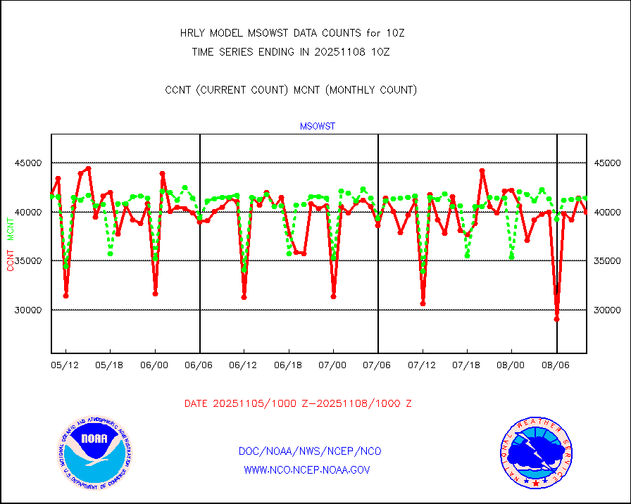
msowst |
Mesonet/MADIS MesoWest (many subproviders) |
46880 |
45998 |
101.9 % |
1909.50-1910.49 |
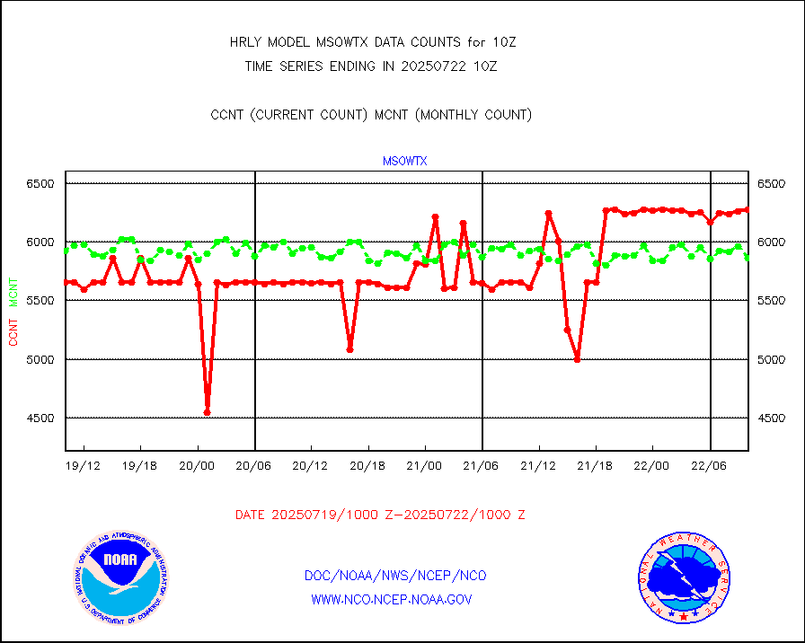
msowtx |
Mesonet/MADIS West Texas |
5567 |
5585 |
99.7 % |
1909.50-1910.49 |
mtiasi |
METOP 1-2 IASI 1C radiance data (varbl. channels) |
99376 |
83340 |
119.2 % |
1908.00-1908.99 |
nxrdw |
NEXRAD Vel Azm Dsp(VAD) winds via radar coded msg |
0 |
0 |
n/a |
1909.50-1910.49 |
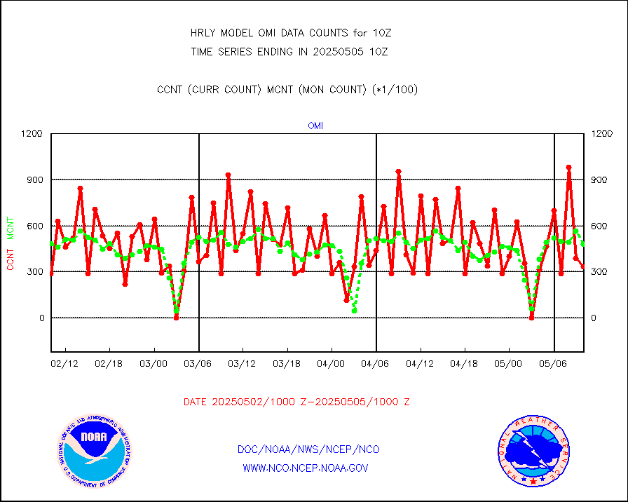
omi |
Aura Ozone Monitoring Instrument (OMI) data |
39000 |
34176 |
114.1 % |
1907.50-1908.49 |
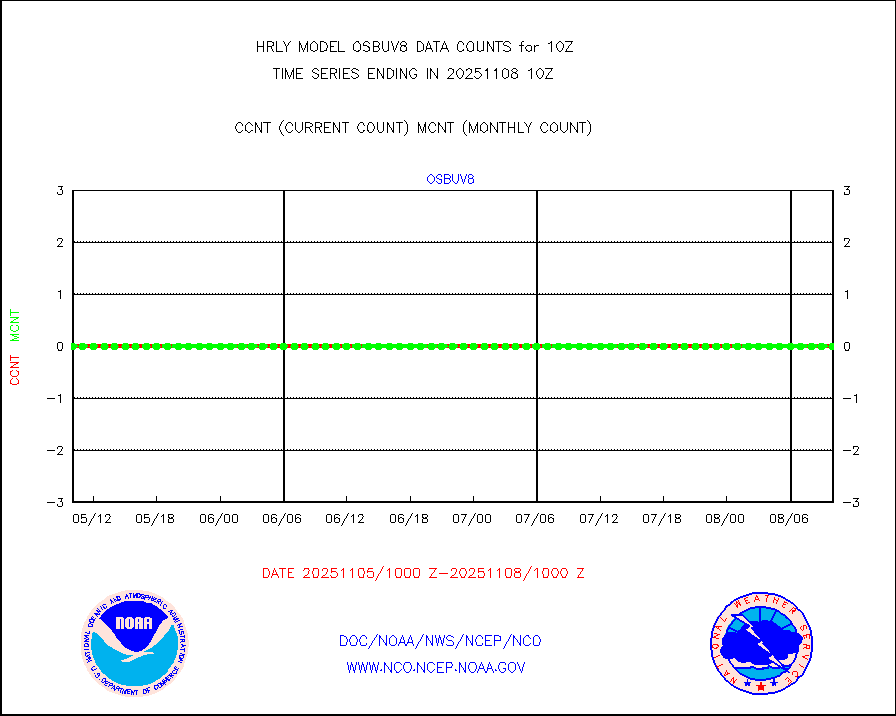
osbuv8 |
NOAA 16-19 Solar Backscatter UV-2 rad frm V8 BUFR |
0 |
0 |
n/a |
1908.00-1908.99 |
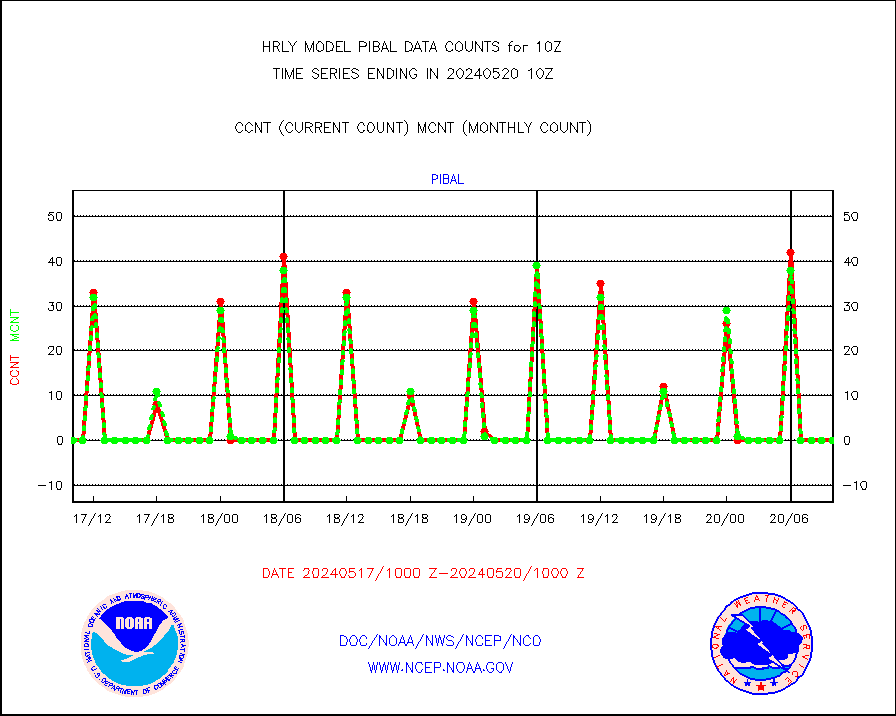
pibal |
PIBAL (from PILOT, PILOT SHIP, PILOT MOBIL) |
0 |
0 |
n/a |
1909.50-1910.49 |
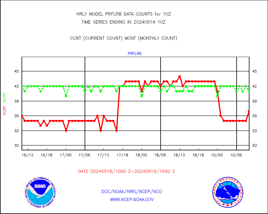
prflrb |
Multi-Agency Profiler (MAP) and SODAR winds |
37 |
41 |
90.2 % |
1909.50-1910.49 |
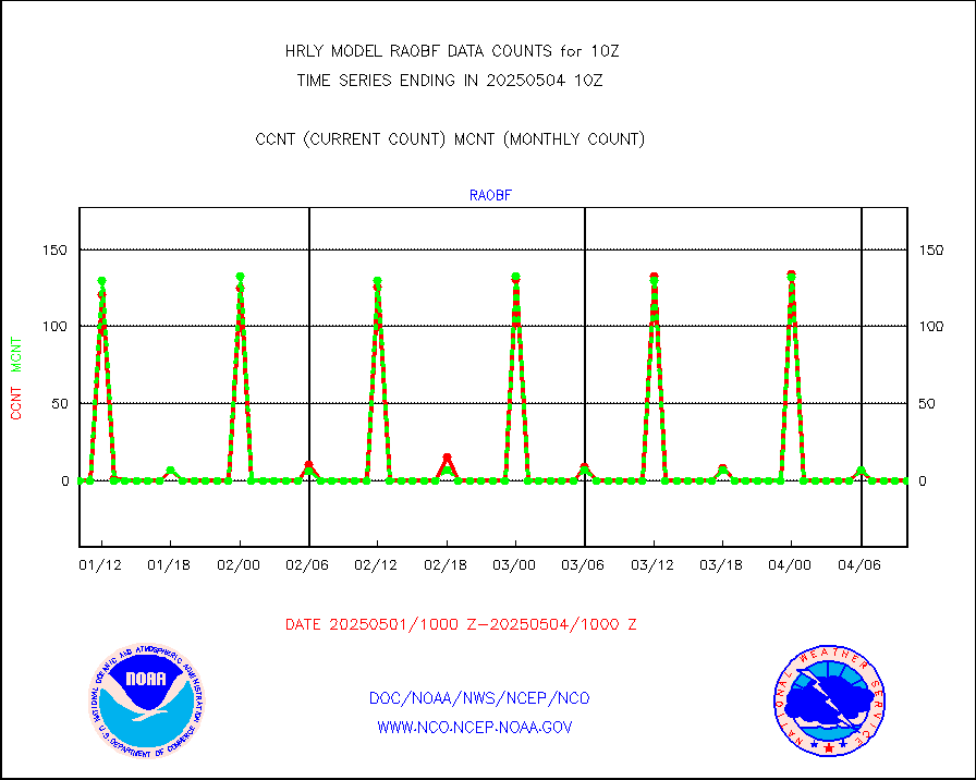
raobf |
Rawinsonde - fixed land (from TEMP or PILOT) |
0 |
0 |
n/a |
1909.50-1910.49 |
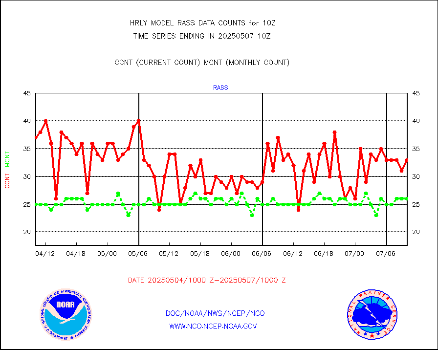
rass |
RASS temperatures (NOAA and Multi-Agency) |
16 |
25 |
64.0 % |
1909.50-1910.49 |
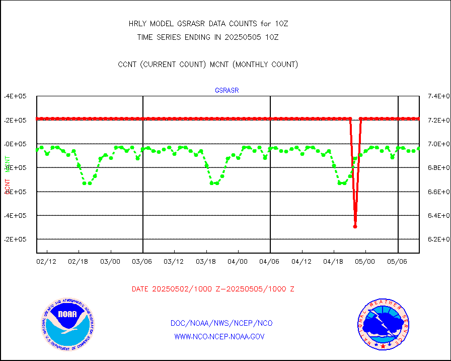
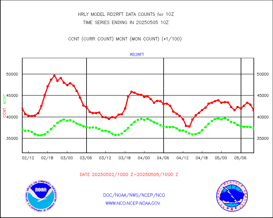
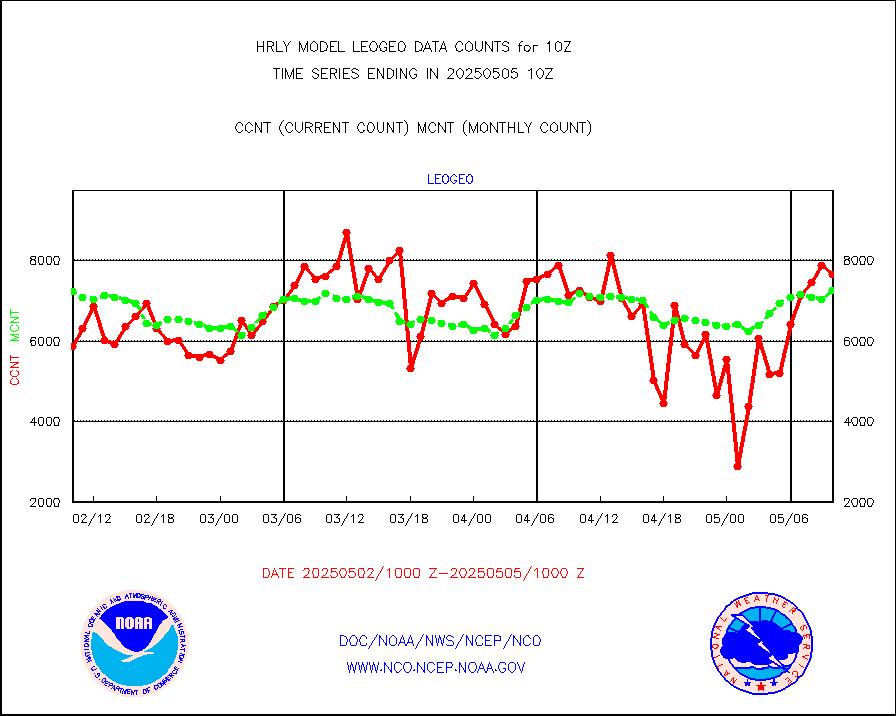
rd2rft |
NEXRAD reflectivity (Lvl 2 - GTS) |
3848943 |
3912603 |
98.4 % |
1909.50-1910.49 |
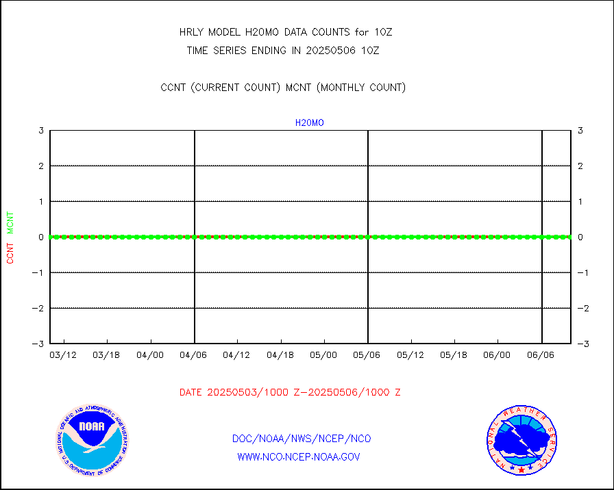
rd2wnd |
NEXRAD radial wind (Level 2 - GTS) |
1244996 |
1244641 |
100.0 % |
1909.50-1910.49 |
sevcsr |
METEOSAT-10 2nd Gen SEVIRI Clr Sky Radiance(proc) |
0 |
0 |
n/a |
1909.50-1910.49 |
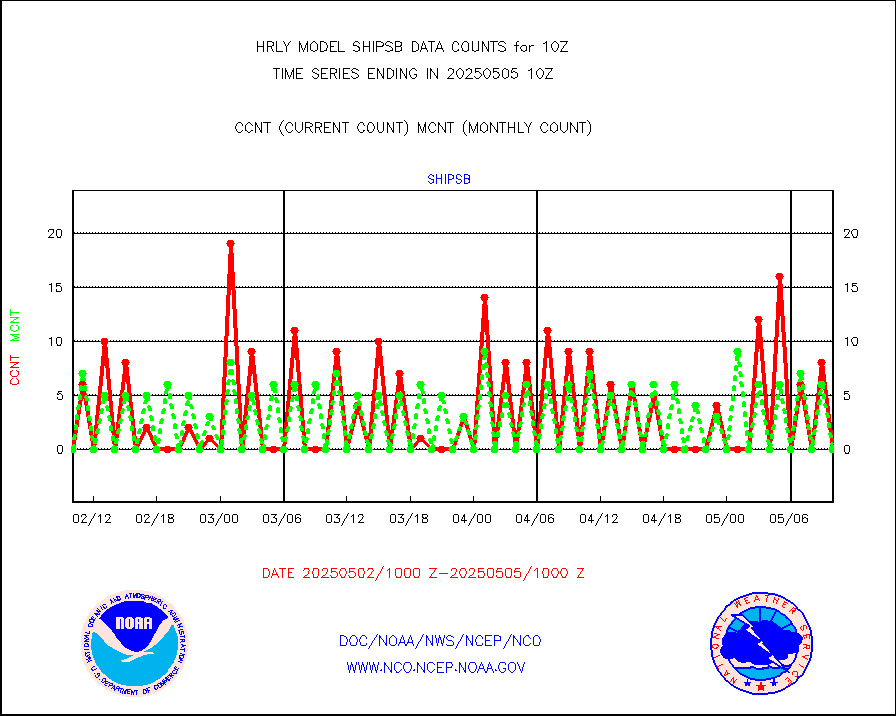
shipsb |
Ship - manual and automatic, restricted (BUFR) |
0 |
0 |
n/a |
1909.50-1910.50 |
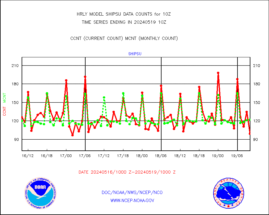
shipsu |
Ship - manual and automatic, unrestricted |
99 |
122 |
81.1 % |
1909.50-1910.50 |
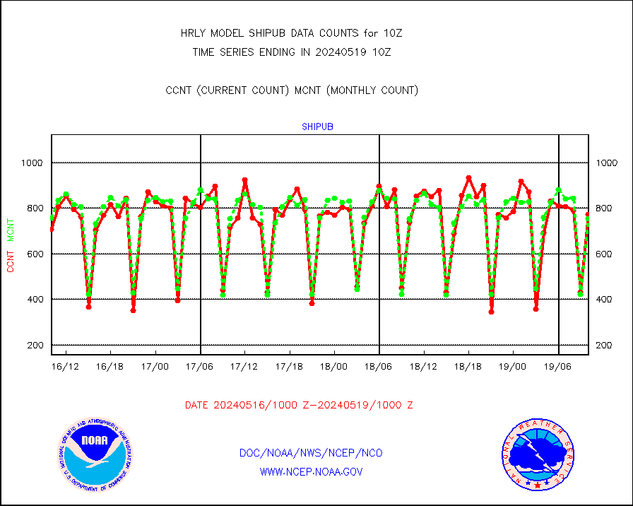
shipub |
Ship - manual and automatic, unrestricted (BUFR) |
773 |
753 |
102.7 % |
1909.50-1910.50 |
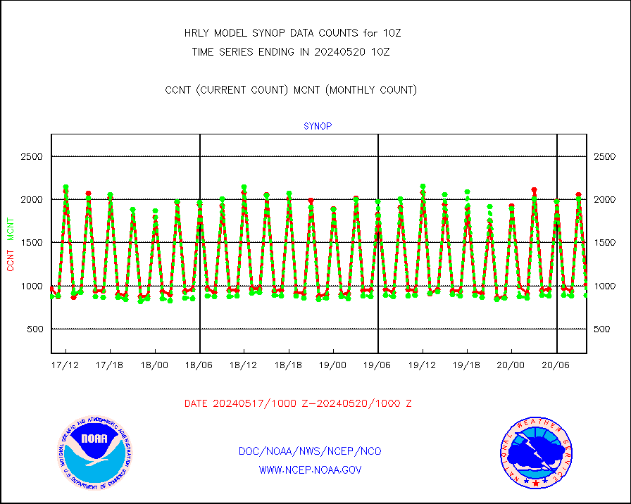
synop |
Synoptic - fixed manual and automatic |
954 |
885 |
107.8 % |
1909.50-1910.49 |
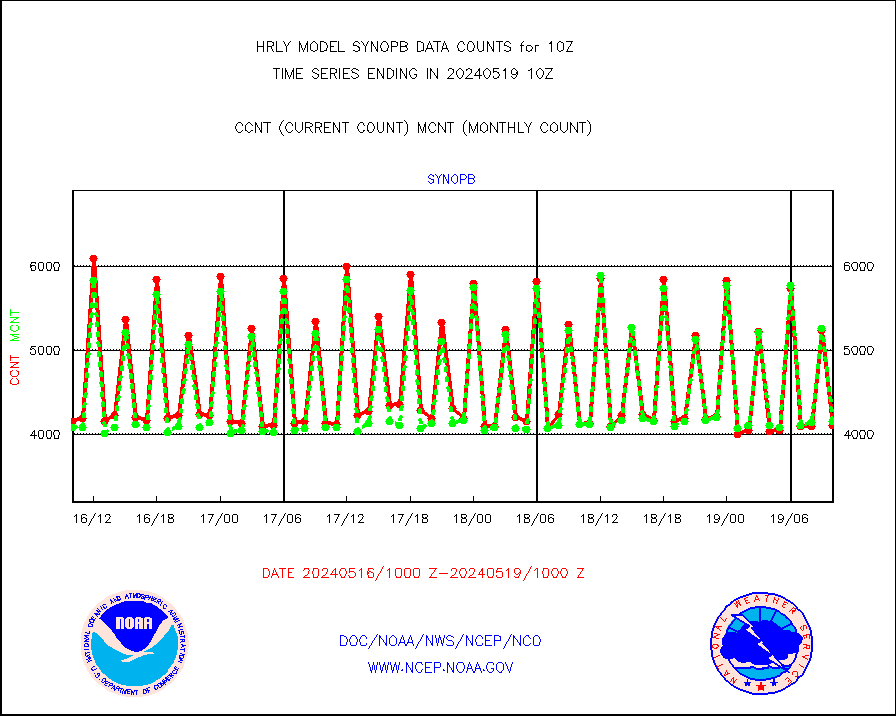
synopb |
Synoptic - fixed manual & auto (decoded fr BUFR) |
4099 |
4148 |
98.8 % |
1909.50-1910.49 |
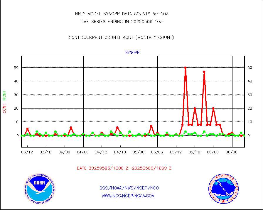
synopr |
Synoptic - restricted (WMO Res 40) manual & auto. |
0 |
0 |
n/a |
1909.50-1910.49 |
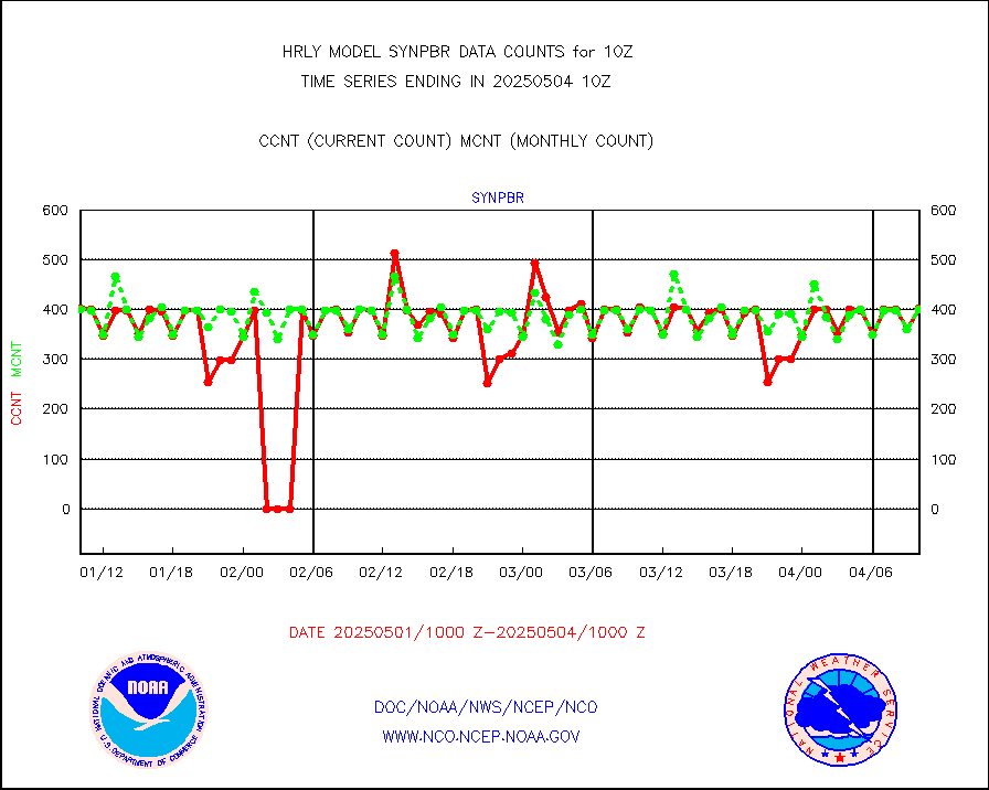
synpbr |
Synoptic - restricted (WMO Res 40)(decoded BUFR) |
397 |
397 |
100.0 % |
1909.50-1910.49 |
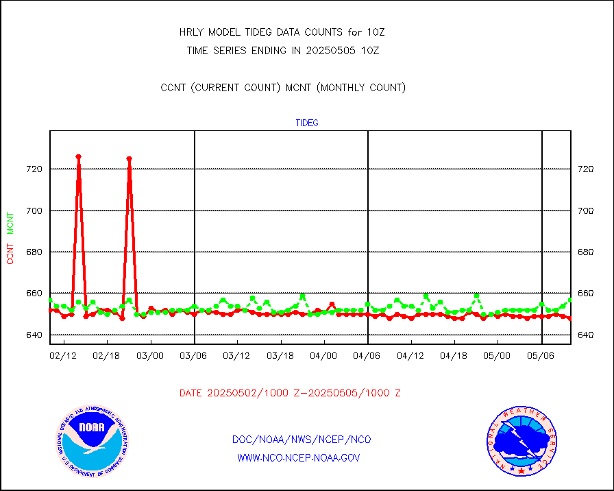
tideg |
Tide gauge reports decoded from CREX format |
646 |
639 |
101.1 % |
1909.00-1909.99 |
| Data Types of Opportunity with Normal Counts |
|---|
| Type | Description | Hourly Count | Monthly Average | Percent (%) of Monthly Mean | UTC Time Window |
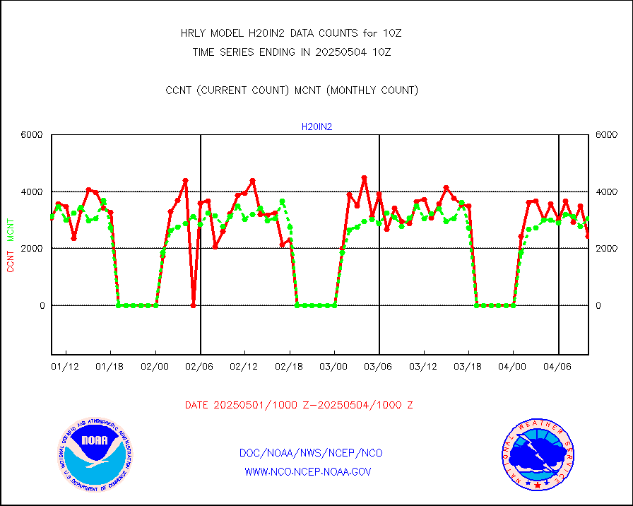
3p9usr |
GOES-16&up/NESDIS ir short-wv derived cld motion |
42818 |
42417 |
100.9 % |
1909.00-1909.99 |
acarsa |
MDCRS ACARS acft data (ARINC via AFWA)(AIREP fmt) |
0 |
0 |
n/a |
1909.50-1910.49 |
ahicsr |
Himawari Clear Sky Radiance |
0 |
0 |
n/a |
1909.00-1909.99 |
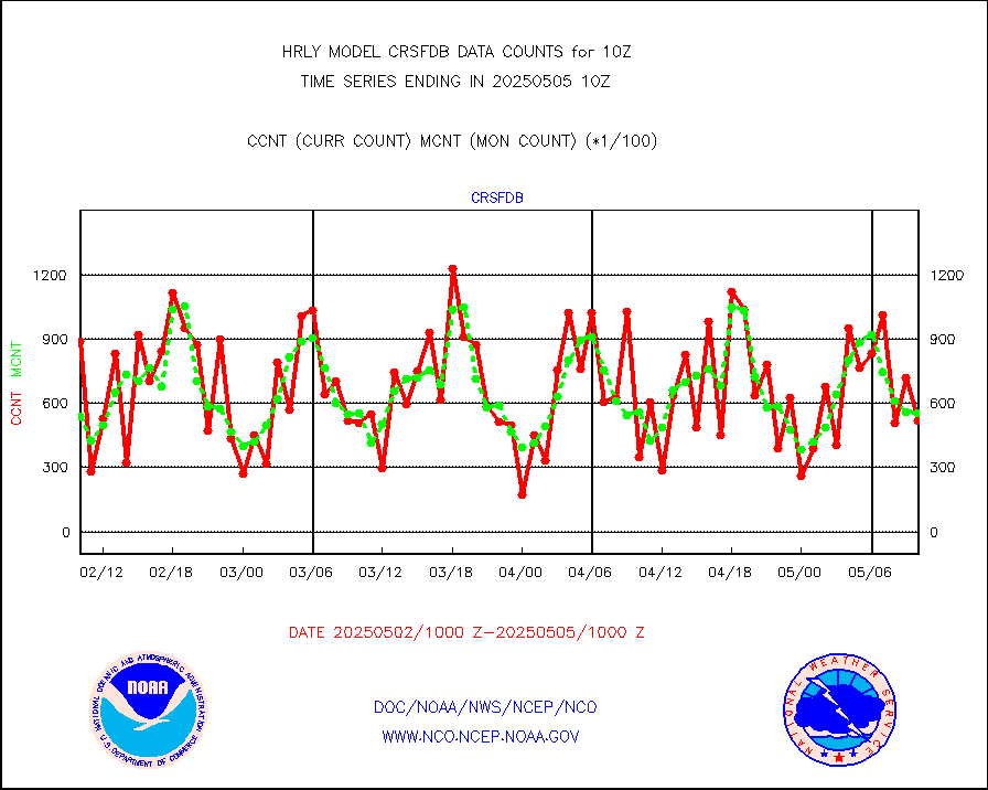
amsr2 |
GCOM-W AMSR2 1B brightness temperatures |
2309472 |
2041459 |
113.1 % |
1908.00-1908.99 |
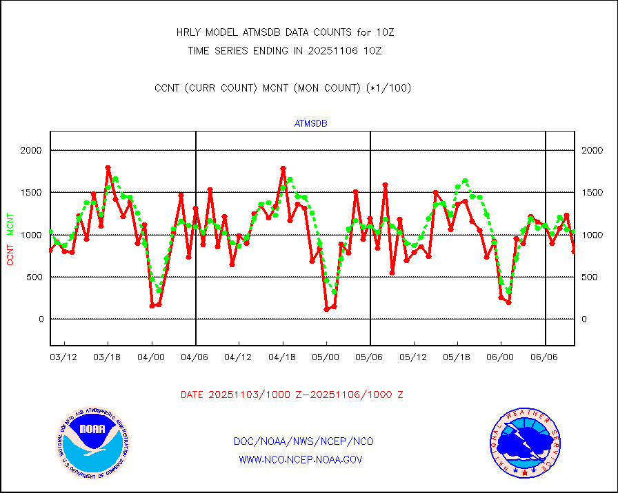
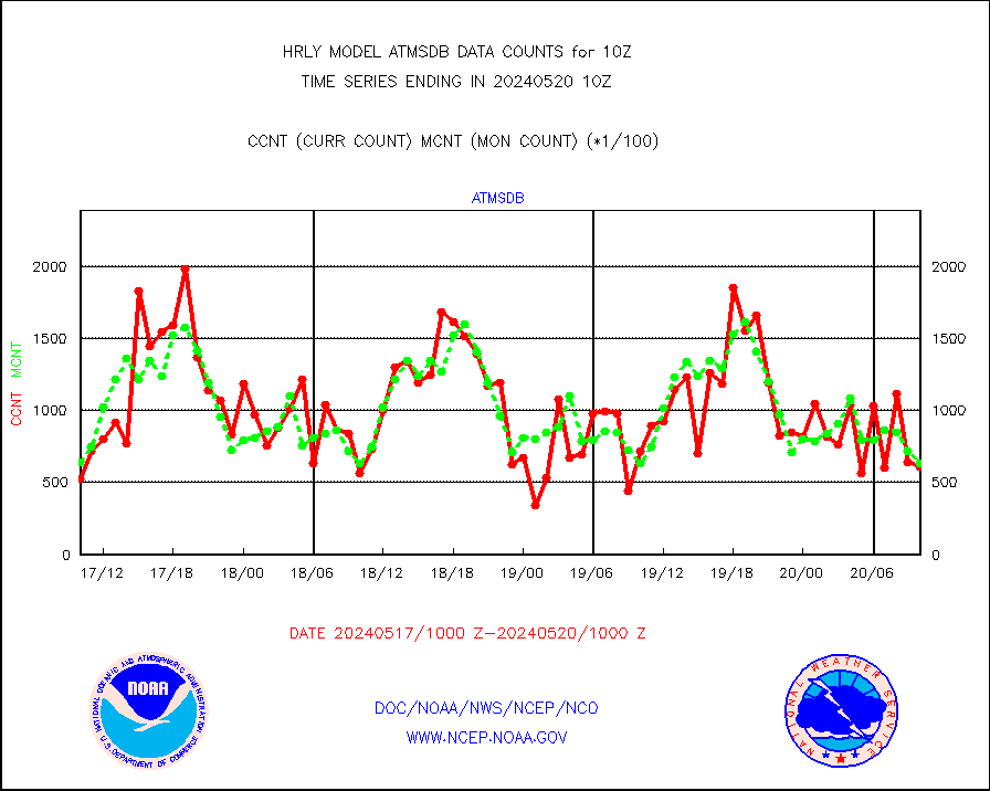
atmsdb |
NPP/NOAA-20 ATMS bright. temps-direct b-cast SSEC |
71671 |
63355 |
113.1 % |
1908.50-1909.49 |
atovs |
POES/NESDIS - processed ATOVS soundings/radiances |
0 |
0 |
n/a |
1908.00-1908.99 |
avcsam |
A.M.(N17,M2,M3) AVHRR GAC NCEP-proc clr&sea btmps |
1065456 |
1154968 |
92.2 % |
1907.50-1908.49 |
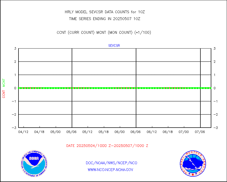
avcspm |
P.M.(N18-19) AVHRR GAC NCEP-proc clr & sea btemps |
1745733 |
1338716 |
130.4 % |
1907.50-1908.49 |
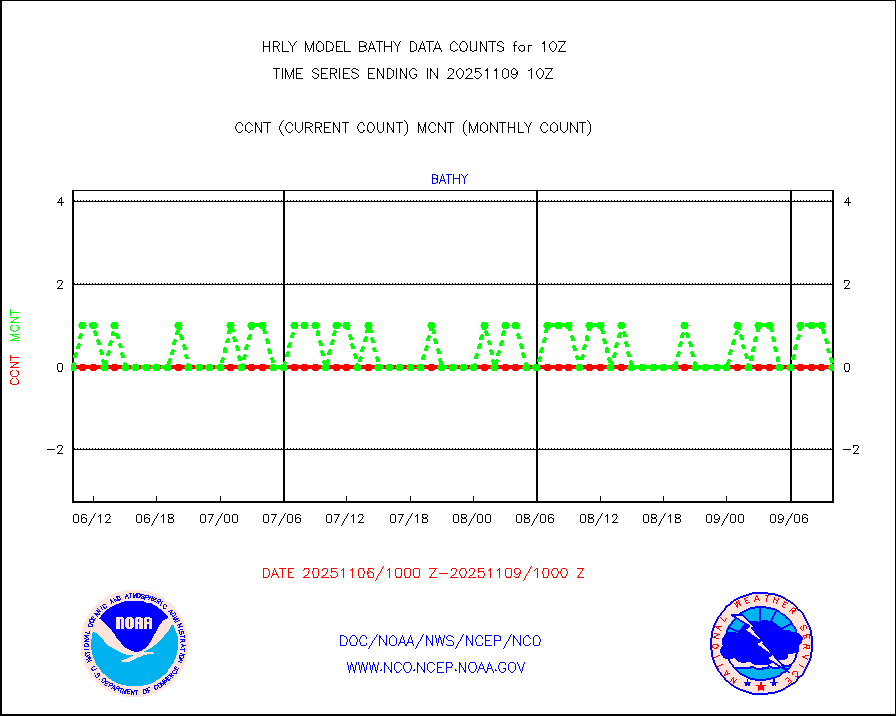
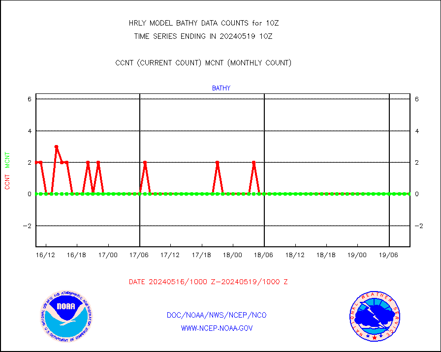
bathy |
eXpendable BathyThermograph, mooring (BATHY fmt) |
0 |
0 |
n/a |
1903.00-1903.99 |
coopmd |
Coop/MADIS NEPP & HCN-Modernization NOAA COOP Obs |
27 |
27 |
100.0 % |
1909.50-1910.49 |
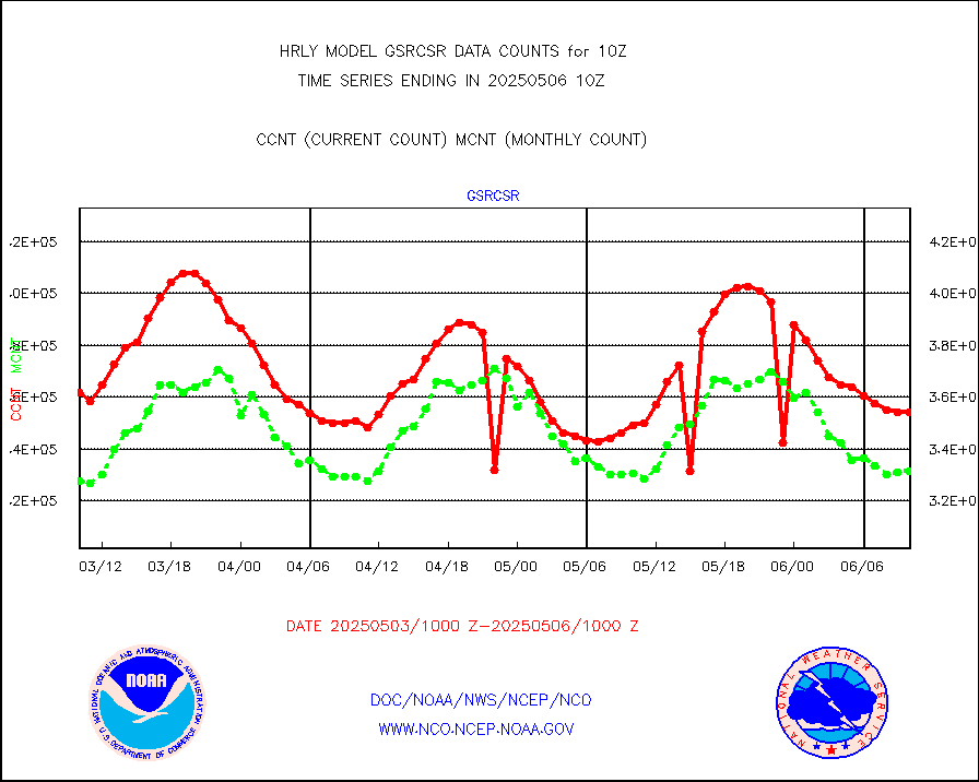
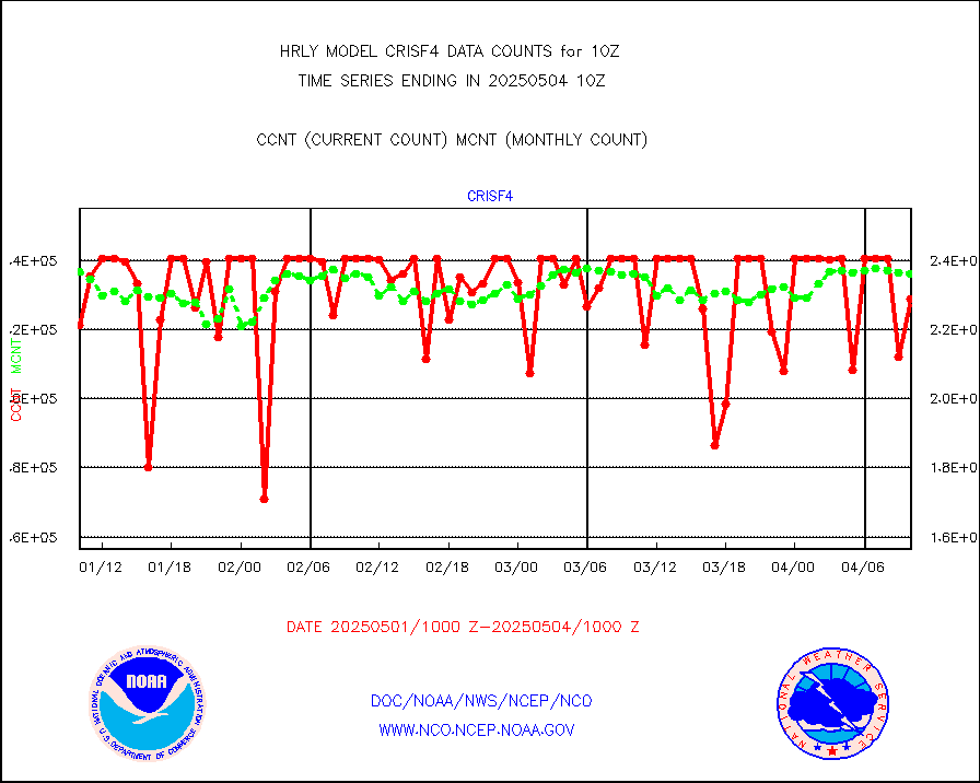
crisf4 |
NPP/NOAA-20 CrIS full spctrl radn (431 ch subset) |
227574 |
233172 |
97.6 % |
1908.50-1909.49 |
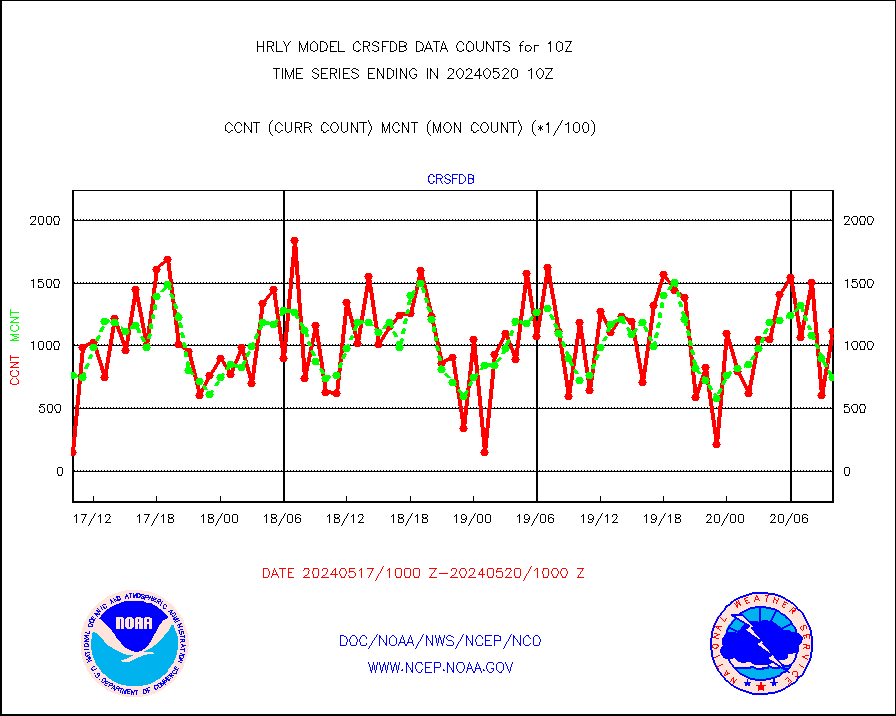
crsfdb |
NPP/NOAA-20 CrIS full spctrl radn dir brdcst SSEC |
119080 |
72715 |
163.8 % |
1908.50-1909.49 |
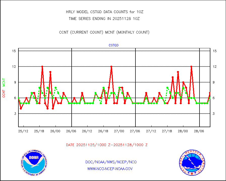
cstgd |
Coast Guard |
3 |
3 |
100.0 % |
1909.50-1910.50 |
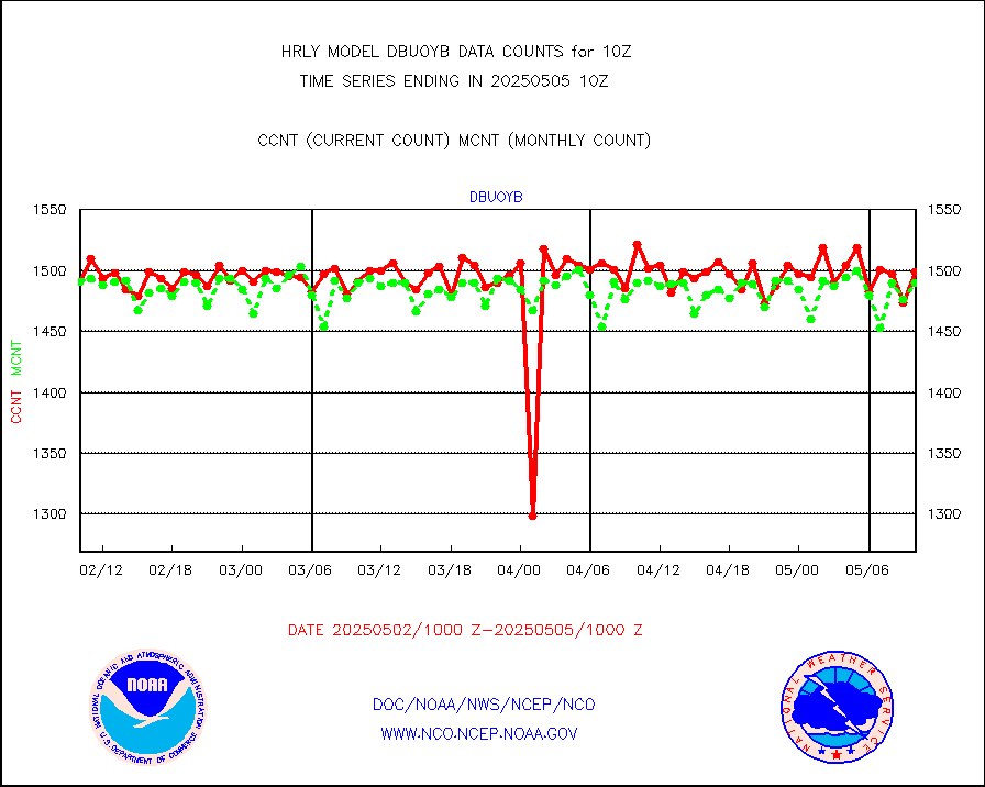
dbuoyb |
Drifting buoys (decoded from BUFR) |
1425 |
1397 |
102.0 % |
1909.50-1910.50 |
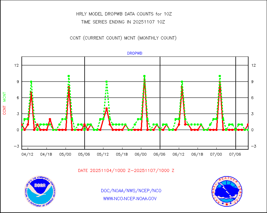
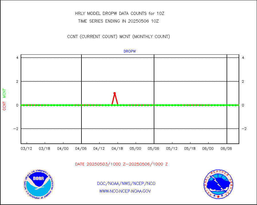
dropw |
Dropwinsonde (from TEMP DROP) |
0 |
0 |
n/a |
1909.50-1910.49 |
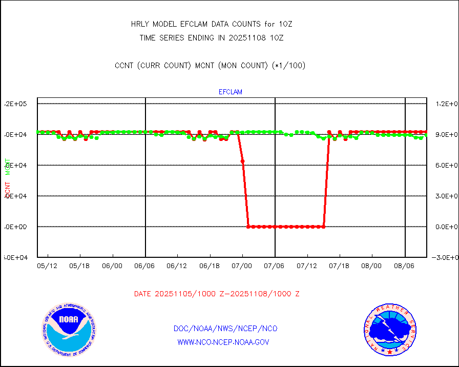
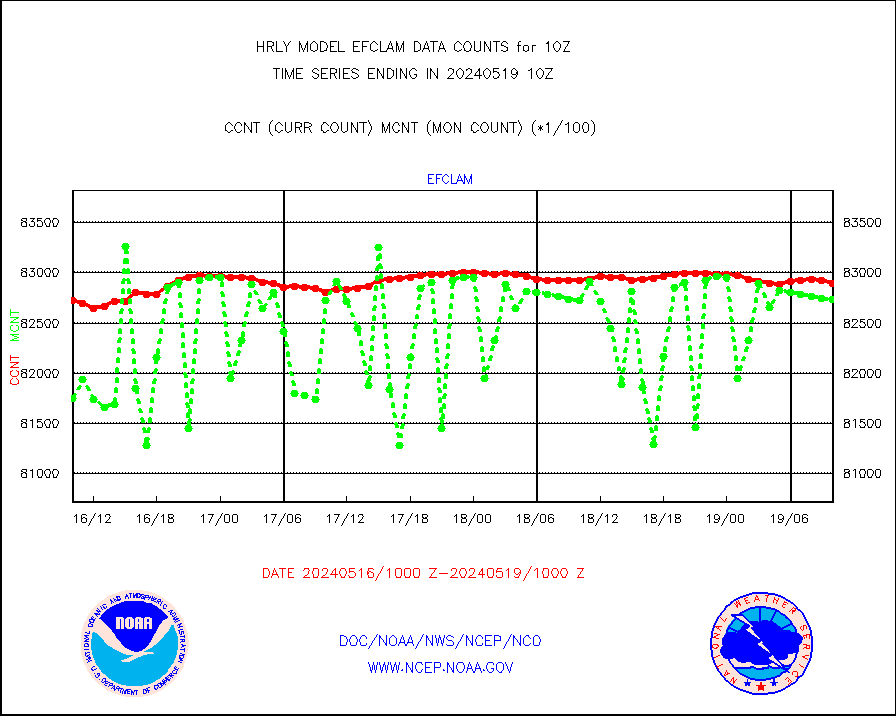
efclam |
GOES imager effective cloud amount data (U.Wisc.) |
8289914 |
8273541 |
100.2 % |
1909.50-1910.49 |
esatms |
NPP Adv. Tech. MW Sndr (ATMS) br. temps from RARS |
128311 |
75346 |
170.3 % |
1908.50-1909.49 |
esiasi |
METOP 1-2 IASI 1C radiance data vbl chn from RARS |
56209 |
47451 |
118.5 % |
1909.00-1909.99 |
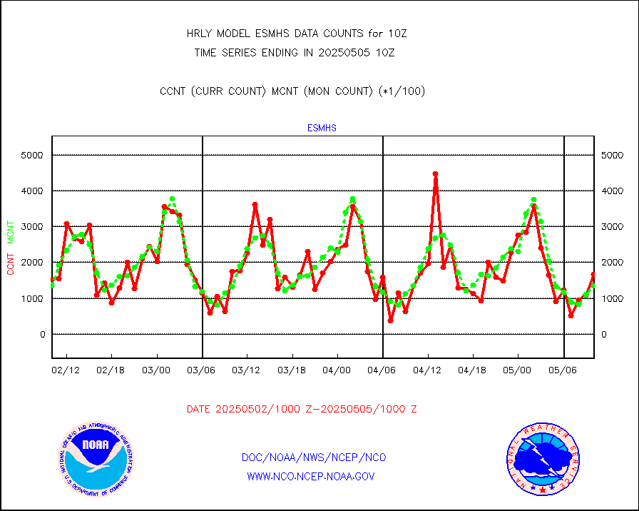
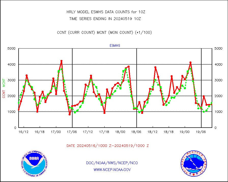
esmhs |
NOAA 18-19 & METOP 1-2 MHS proc. btemps from RARS |
147191 |
156847 |
93.8 % |
1909.50-1910.49 |
geoimr |
GOES/NESDIS (11x17 f-o-v) imager clear radiances |
0 |
0 |
n/a |
1909.00-1909.99 |
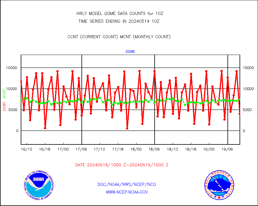
gome |
METOP 1-2 Global Ozone Monitoring Exp.-2 (GOME-2) |
4048 |
7432 |
54.5 % |
1908.50-1909.49 |
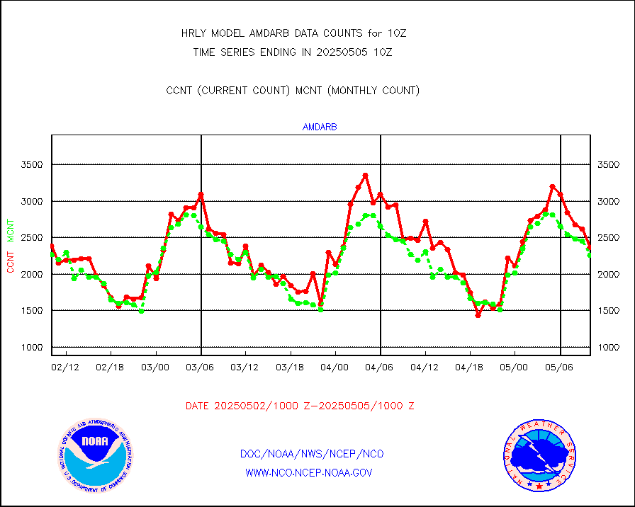
h20in2 |
INDIA SATWIND, INSAT WV channel |
3691 |
5180 |
71.3 % |
1909.00-1909.99 |
h2dusr |
GOES-16&up/NESDIS wv imgr/deep-lyr derivd cld mtn |
14691 |
15613 |
94.1 % |
1909.00-1909.99 |
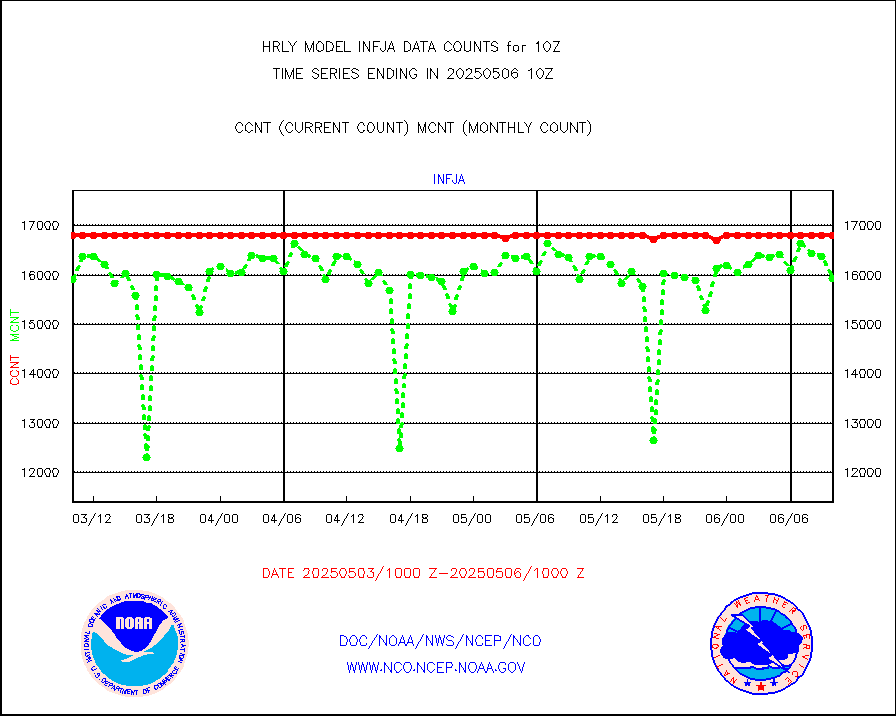
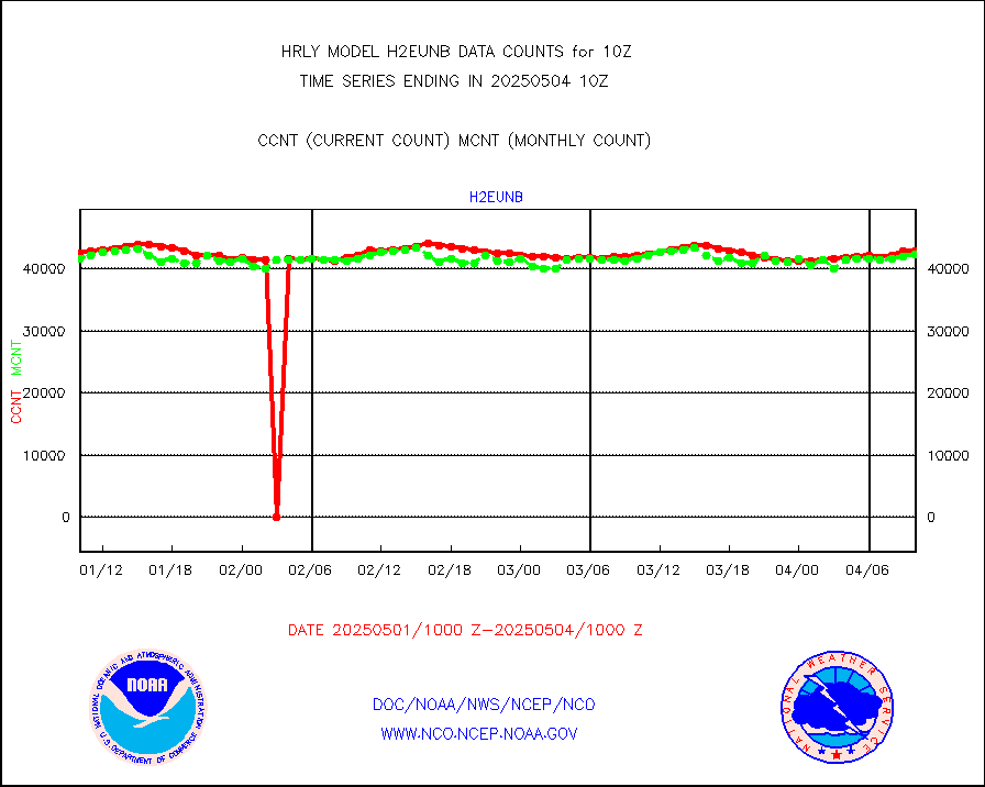
h2eunb |
METEOSAT/EUMETSAT wvpr imgr drv cld motion NBseq |
39670 |
41457 |
95.7 % |
1908.50-1909.49 |
hdob |
High Density OBs from reconnaissance acft data |
0 |
0 |
n/a |
1909.50-1910.49 |
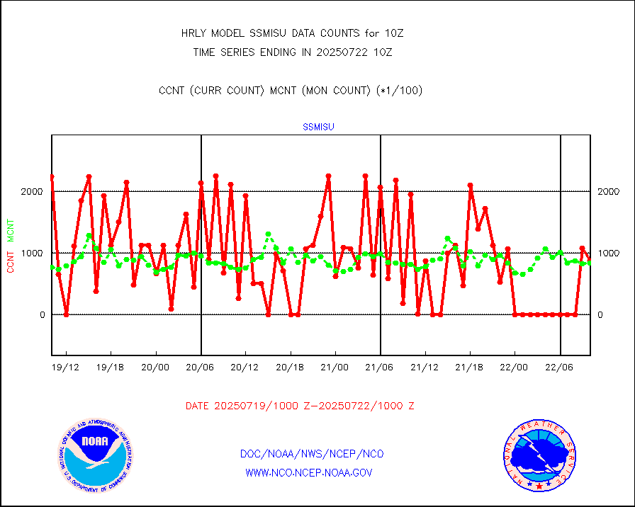
iasidb |
METOP 1-2 IASI 1C radiances-direct broadcast SSEC |
30640 |
29632 |
103.4 % |
1908.50-1909.49 |
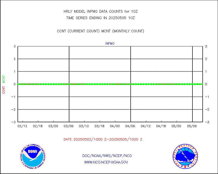
ifvrnb |
VIIRS (NPP/NOAA-20) ir lg-wv drv cloud motion(NB) |
24812 |
17391 |
142.7 % |
1906.00-1906.99 |
infav |
AVHRR (NOAA/METOP) ir lg-wave derived cld motion |
0 |
0 |
n/a |
1906.00-1906.99 |
infav1 |
AVHRR (METOP) ir lg-wave derived cld motion |
0 |
0 |
n/a |
1909.50-1910.50 |
infin |
INSAT/KALPANA India ir lg-wave derived cld motion |
0 |
0 |
n/a |
1907.50-1908.49 |
infin2 |
INDIA SATWIND, INSAT IR channel |
3952 |
5092 |
77.6 % |
1909.00-1909.99 |
kamdar |
Korean AMDAR aircraft data (decoded from BUFR) |
70 |
52 |
134.6 % |
1909.50-1910.49 |
lcman |
Land-based CMAN stations decoded from CMAN format |
95 |
77 |
123.4 % |
1909.50-1910.49 |
leogeo |
LEO-GEO satellite AMVs from UWisc. |
6884 |
5406 |
127.3 % |
1906.00-1906.99 |
ltnglr |
LLDN Long-rng lightning from Vaisala via NOAAPORT |
98874 |
129037 |
76.6 % |
1909.50-1910.49 |
ltngsr |
NLDN Shrt-rng lightning from Vaisala via NOAAPORT |
3952 |
3125 |
126.5 % |
1909.50-1910.49 |
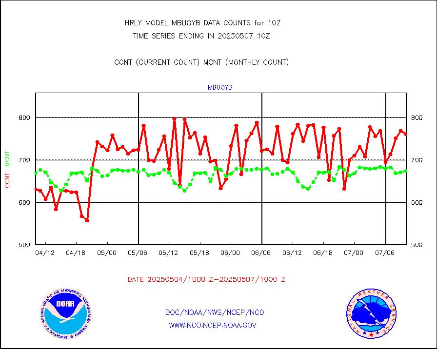
mbuoyb |
Moored buoys (decoded from BUFR) |
796 |
742 |
107.3 % |
1909.50-1910.50 |
mls |
Aura Microwave Limb Sounder (MLS) ozone data |
0 |
0 |
n/a |
1908.00-1908.99 |
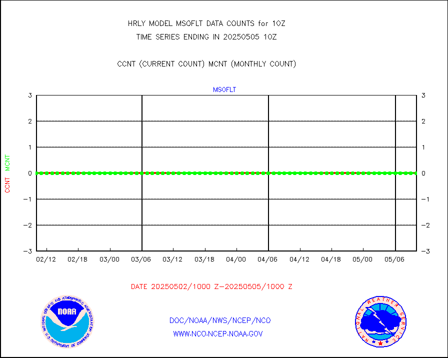
msourb |
Mesonet/MADIS UrbaNet |
4337 |
4354 |
99.6 % |
1909.50-1910.49 |
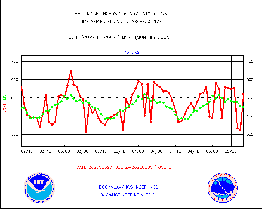
nxrdw2 |
NEXRAD Vel Azm Dsp(VAD) winds via Level 2 decoder |
613 |
541 |
113.3 % |
1909.50-1910.49 |
ompslp |
OMPS Limb Profiler ozone data (NPP) |
391 |
258 |
151.6 % |
1903.00-1903.99 |
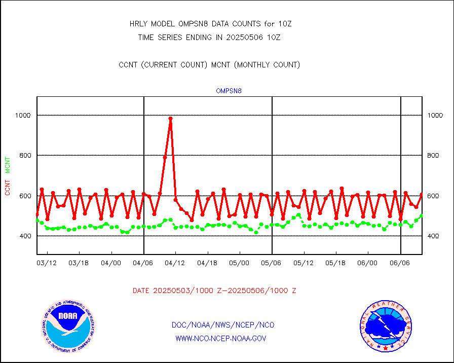
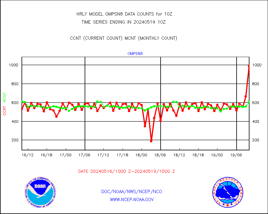
ompsn8 |
OMPS nadir profile ozone (Version 8 BUFR) |
991 |
608 |
163.0 % |
1908.00-1908.99 |
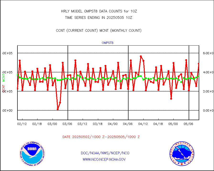
ompst8 |
OMPS total column ozone (Version 8 BUFR) |
568633 |
362285 |
157.0 % |
1908.00-1908.99 |
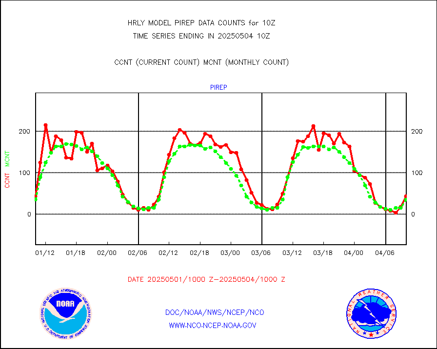
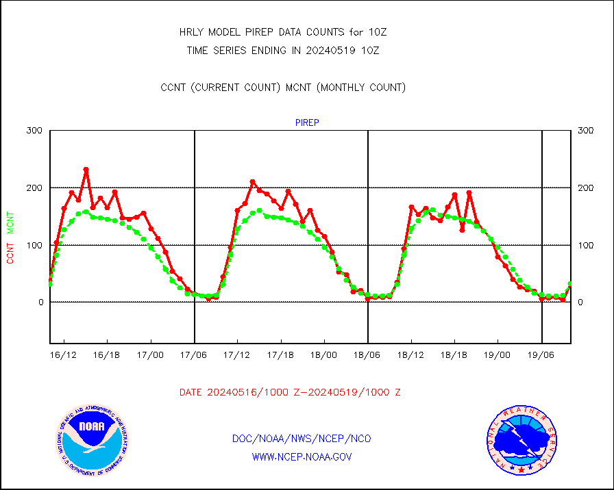
pirep |
Manual PIREP aircraft data (dcded from AIREP fmt) |
32 |
32 |
100.0 % |
1909.50-1910.49 |
prflrp |
Profilr winds from PIBAL (PILOT,PILOT SHIP/MOBIL) |
0 |
0 |
n/a |
1909.50-1910.49 |
raobm |
Rawinsonde - mobile land (from TEMP/PILOT MOBIL) |
0 |
0 |
n/a |
1909.50-1910.49 |
raobs |
Rawinsonde - ship (from TEMP SHIP, PILOT SHIP) |
0 |
0 |
n/a |
1909.50-1910.49 |
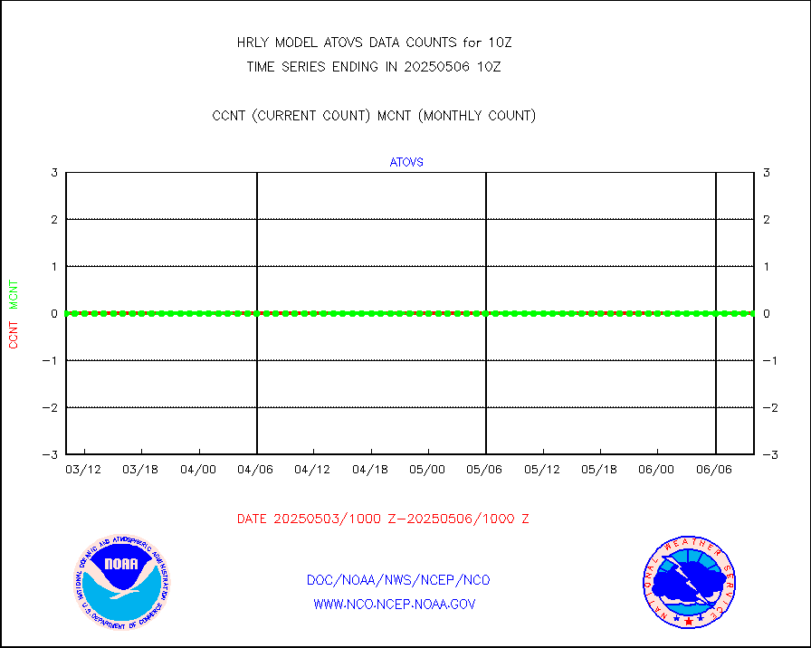
recco |
Flight level reconnaissance aircraft data |
0 |
0 |
n/a |
1909.50-1910.49 |
saphir |
Megha-Tropiques SAPHIR L1A2 brightness temps |
0 |
0 |
n/a |
1907.50-1908.49 |
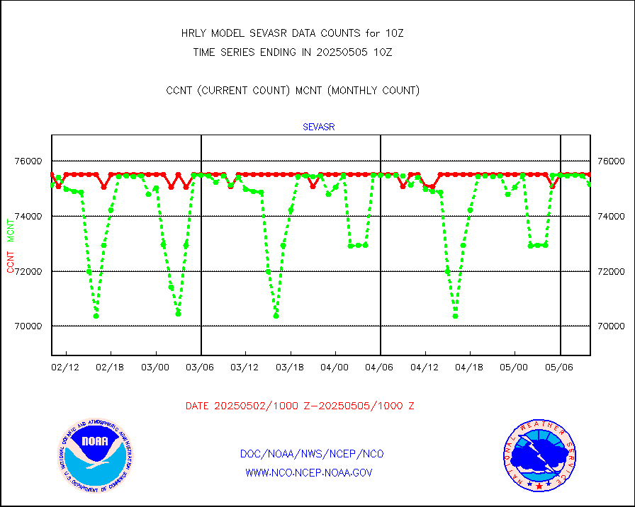
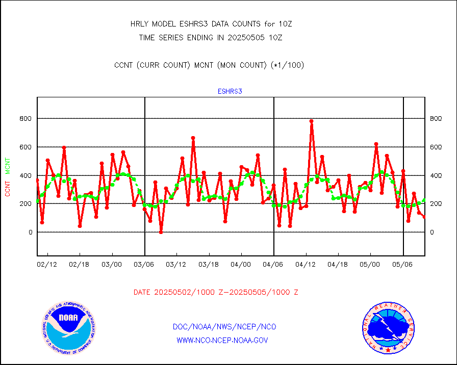
sevasr |
METEOSAT-10 2nd Gen SEVIRI All Sky Radiance(proc) |
75512 |
75467 |
100.1 % |
1909.50-1910.49 |
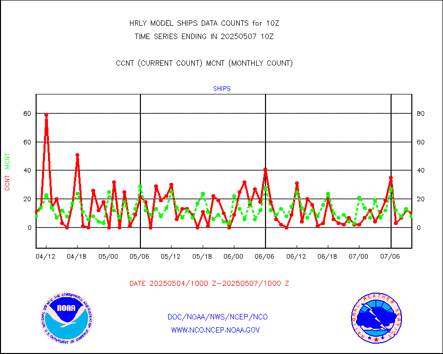
ships |
Ship - manual and automatic, restricted |
21 |
4 |
525.0 % |
1909.50-1910.49 |
ssmisu |
DMSP SSM/IS 1C radiance data (Unified Pre-Proc.) |
219420 |
106900 |
205.3 % |
1908.50-1909.49 |
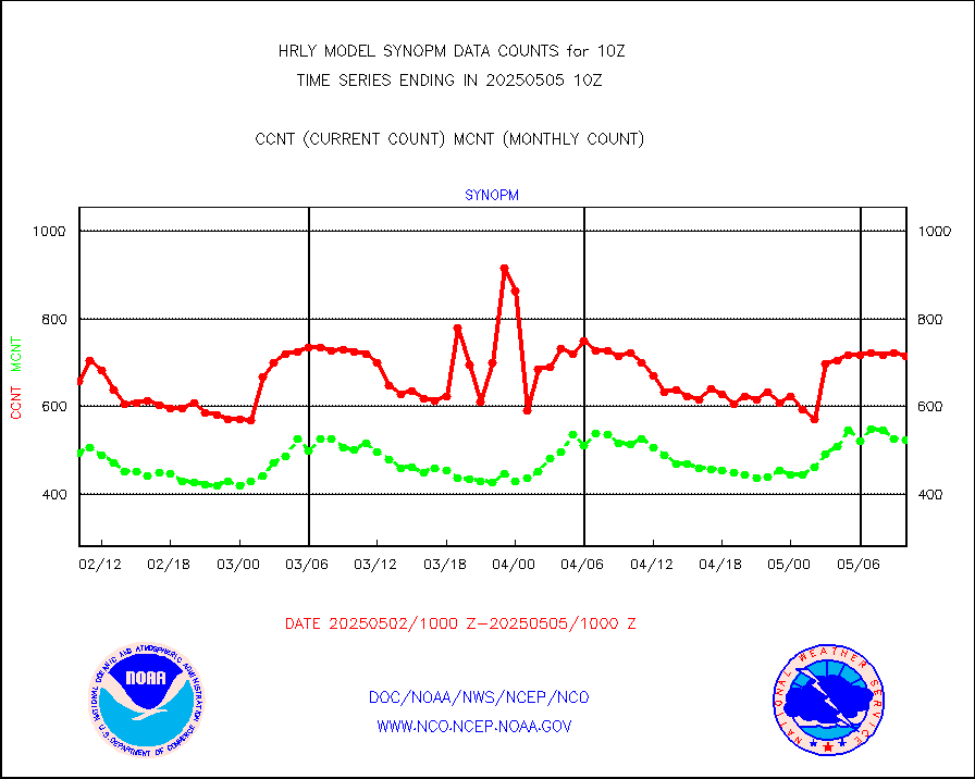
synopm |
Synoptic - mobile manual and automatic |
575 |
546 |
105.3 % |
1909.50-1910.49 |
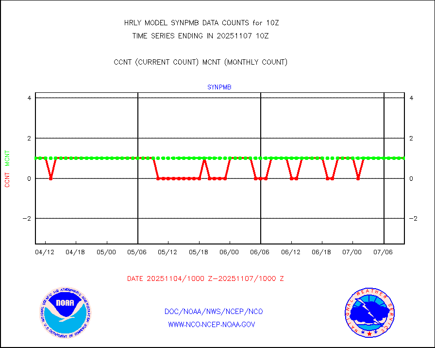
synpmb |
Synoptic - mobile manual & auto (decoded fr BUFR) |
0 |
1 |
0.0 % |
1909.50-1910.49 |
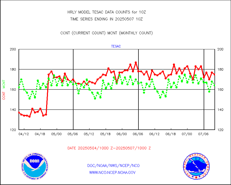
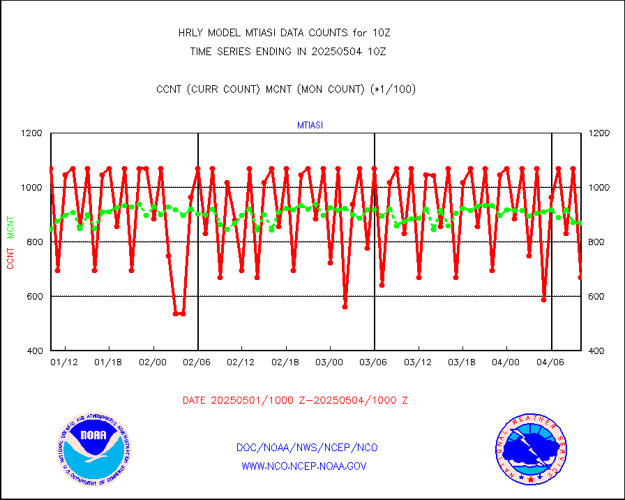
tesac |
CTD probe, Argo prflng float, mooring (TESAC fmt) |
151 |
186 |
81.2 % |
1909.50-1910.49 |
tmdara |
TAMDAR aircft data-all types(from Panasonic,BUFR) |
284 |
380 |
74.7 % |
1909.50-1910.49 |
trkob |
ThermoSalinoGraph (TSG) TRACKOB format) |
90 |
44 |
204.5 % |
1908.50-1909.49 |
visin |
INSAT/KALPANA India visible derived cloud motion |
0 |
0 |
n/a |
1907.50-1908.49 |
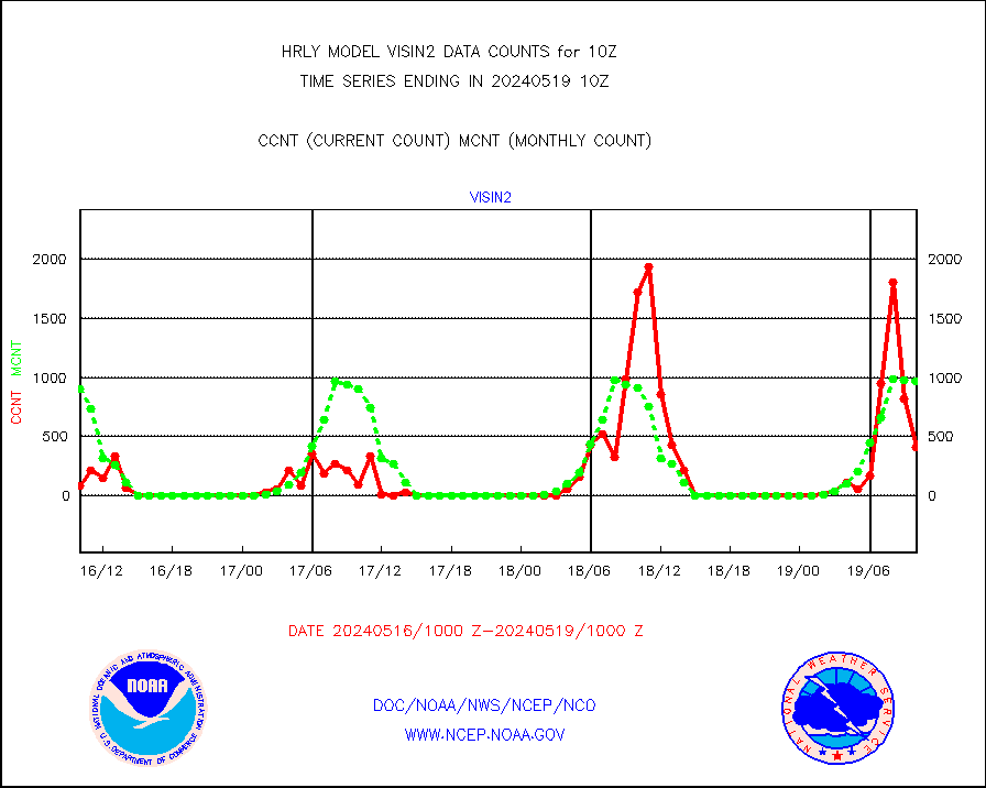
visin2 |
INDIA SATWIND, INSAT VIS channel |
411 |
969 |
42.4 % |
1909.00-1909.99 |
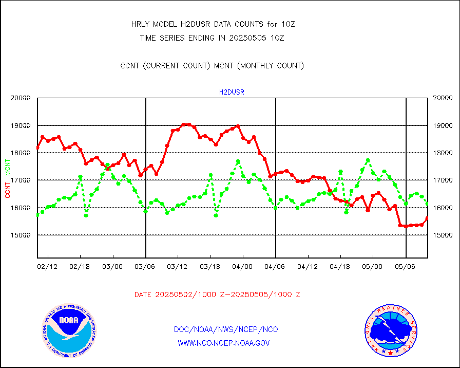
visja |
MTSAT/JMA visible derived cloud motion |
4307 |
3798 |
113.4 % |
1907.50-1908.49 |
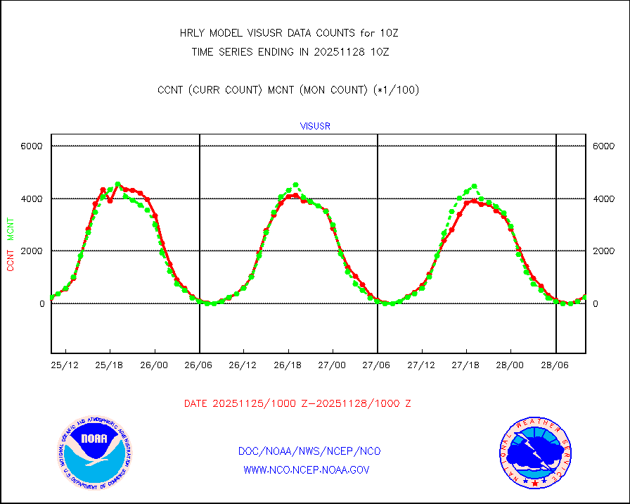
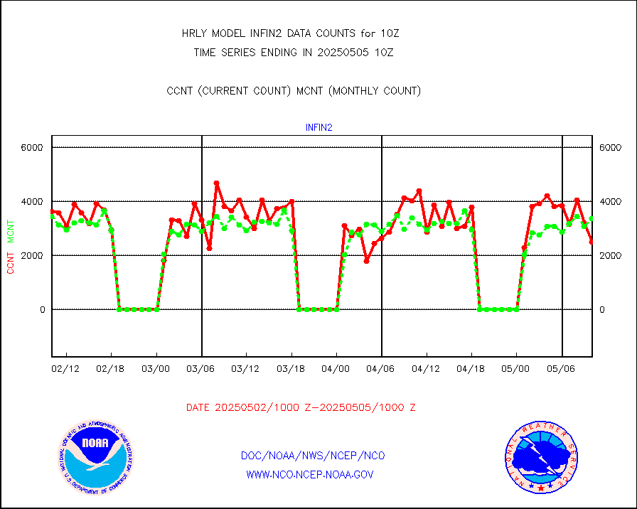
visusr |
GOES-16&up/NESDIS visible derived cloud motion |
24747 |
22657 |
109.2 % |
1909.00-1909.99 |
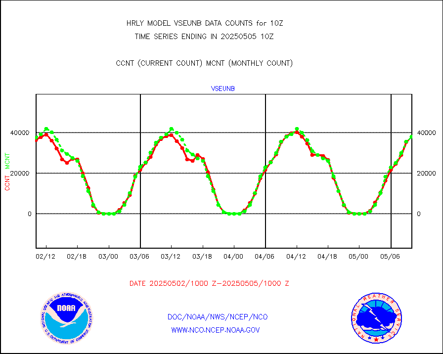
vseunb |
METEOSAT/EUMETSAT visible drv cld motion NBseq |
37539 |
35638 |
105.3 % |
1908.50-1909.49 |


