| Critical Data with Normal Counts |
|---|
| Type | Description | Hourly Count | Monthly Average | Percent (%) of Monthly Mean | UTC Time Window |
1bamua |
NOAA 15-19 & METOP 1-2 AMSU-A NCEP-proc. br.temps |
56248 |
54917 |
102.4 % |
0807.00-0807.99 |
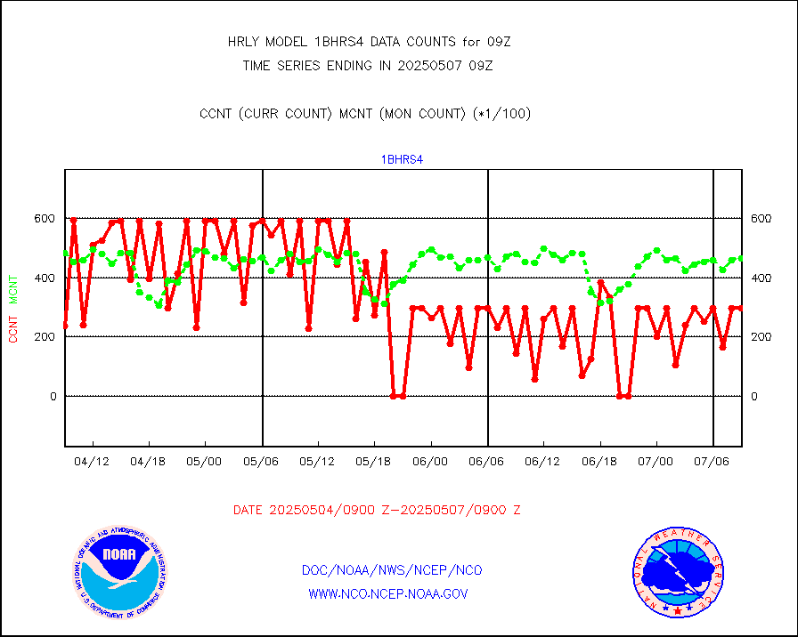
1bhrs4 |
NOAA 18-19 & METOP 1-2 HIRS-4 NCEP-proc. br.temps |
43586 |
46973 |
92.8 % |
0807.00-0807.99 |
1bmhs |
NOAA 18-19 & METOP 1-2 MHS NCEP-proces. br. temps |
262178 |
307767 |
85.2 % |
0807.00-0807.99 |
acars |
MDCRS ACARS acft data from ARINC(dcded from BUFR) |
3781 |
6497 |
58.2 % |
0808.50-0809.49 |
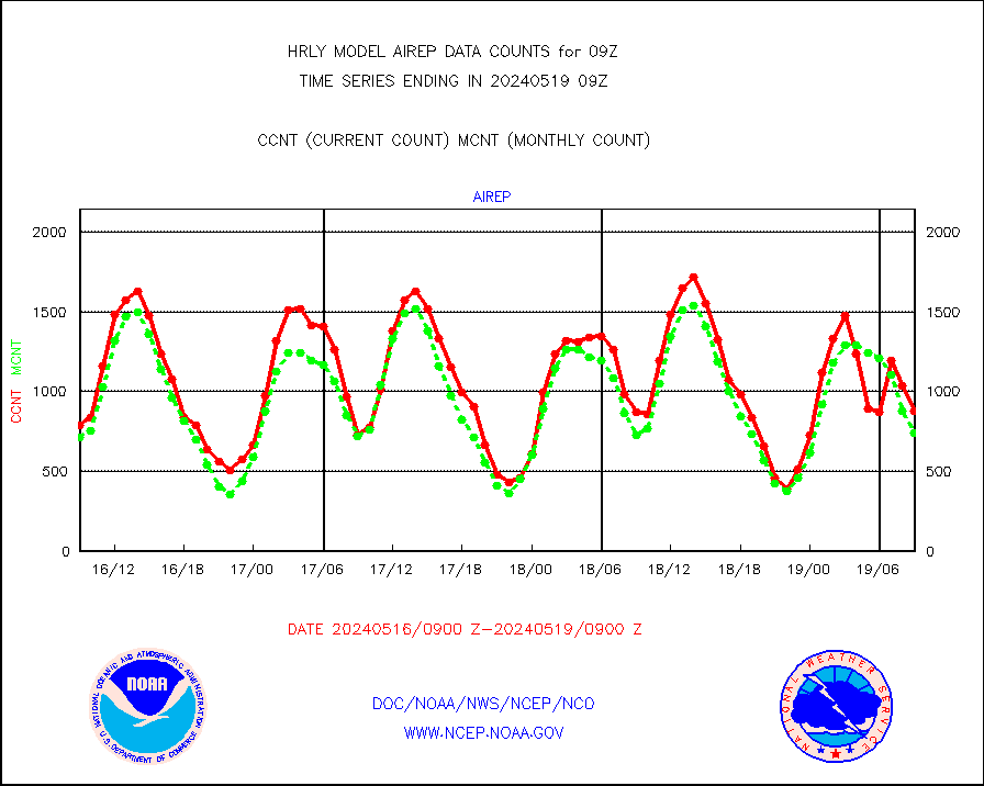
airep |
Manual AIREP aircraft data (dcded from AIREP fmt) |
668 |
693 |
96.4 % |
0808.50-0809.49 |
airsev |
AQUA AIRS/AMSU-A/HSB brightness temps- every FOV |
0 |
0 |
n/a |
0806.50-0807.49 |
amdar |
AMDAR aircraft data (decoded from AMDAR format) |
291 |
228 |
127.6 % |
0808.50-0809.49 |
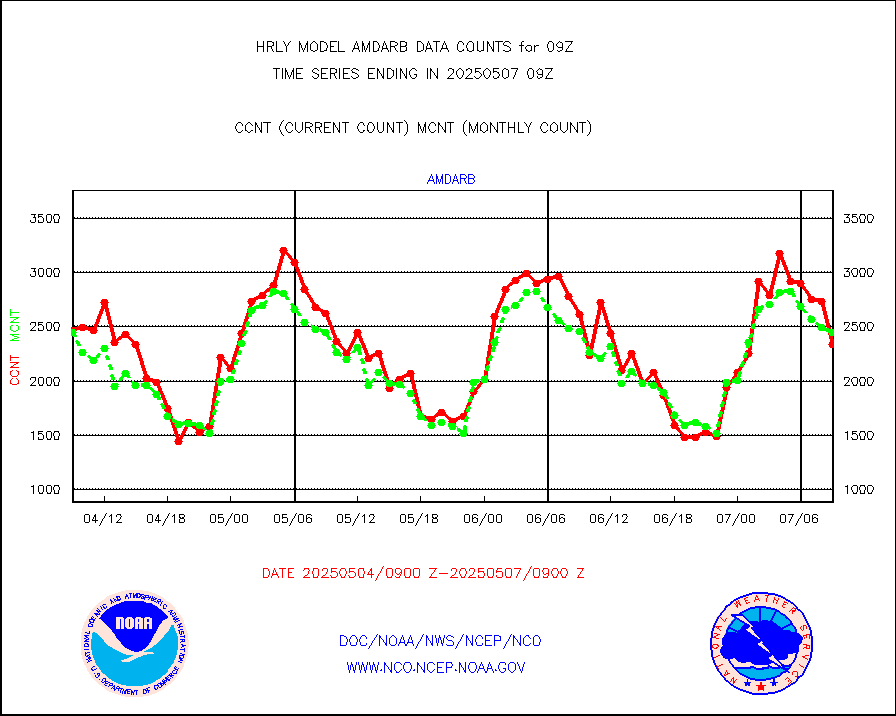
amdarb |
AMDAR aircraft data (decoded from BUFR) |
1019 |
1166 |
87.4 % |
0808.50-0809.49 |
ascat |
METOP 1-2 ASCAT products |
37464 |
45640 |
82.1 % |
0807.50-0808.49 |
atms |
NPP/NOAA-20 ATMS brightness temperatures |
380448 |
338102 |
112.5 % |
0807.50-0808.49 |
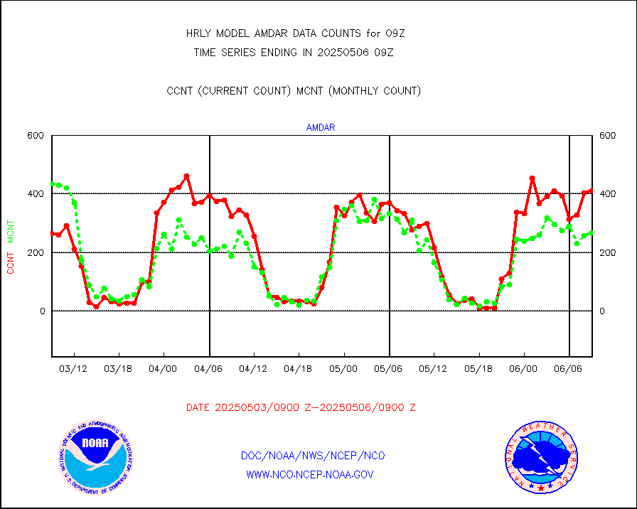
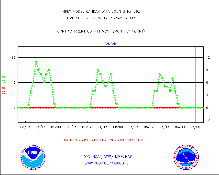
camdar |
Canadian AMDAR aircraft data (decoded from BUFR) |
0 |
0 |
n/a |
0808.50-0809.49 |
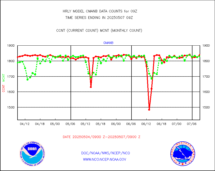
cmanb |
Surface Marine CMAN rpts decoded from BUFR format |
1855 |
1796 |
103.3 % |
0808.50-0809.50 |
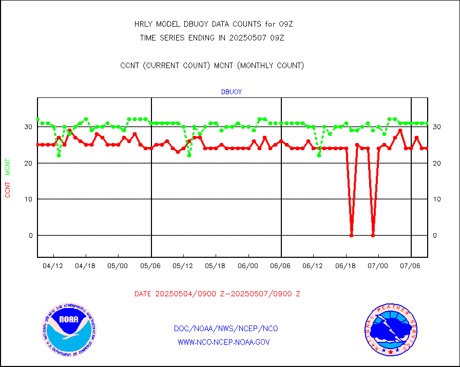
dbuoy |
Buoys decoded from FM-18 fmt (moored or drifting) |
39 |
33 |
118.2 % |
0808.50-0809.49 |
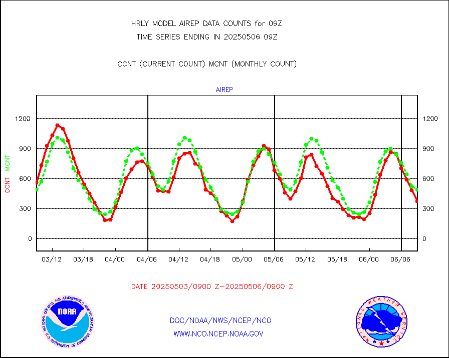
eadas |
E-AMDAR (European AMDAR acft decoded from BUFR) |
1424 |
1724 |
82.6 % |
0808.50-0809.49 |
esamua |
NOAA 15-19 & METOP 1-2 AMSU-A proc btmps frm RARS |
18060 |
17542 |
103.0 % |
0808.50-0809.49 |
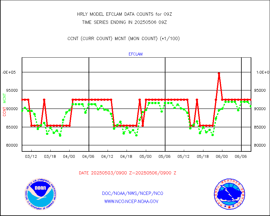
eshrs3 |
NOAA 15-19 & METOP 1-2 HIRS-3/4 pr btmps frm RARS |
30229 |
39658 |
76.2 % |
0808.50-0809.49 |
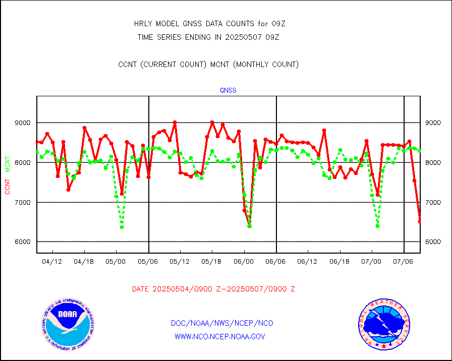
gnss |
Grnd-based Gbl Navigation Sat System (GNSS) data |
8892 |
8988 |
98.9 % |
0808.00-0808.99 |
gpsro |
GPS radio occultation data |
405 |
476 |
85.1 % |
0806.50-0807.49 |
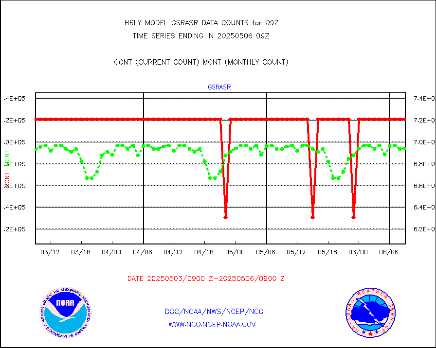
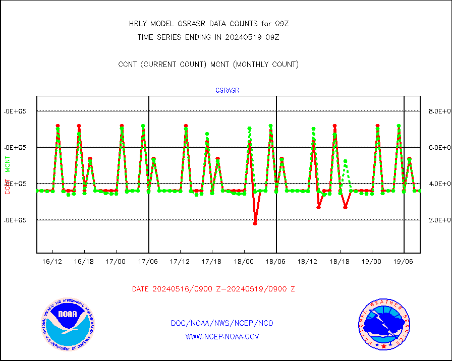
gsrasr |
GOES-16/17 All Sky Radiances (proc.) |
360476 |
357421 |
100.9 % |
0808.50-0809.49 |
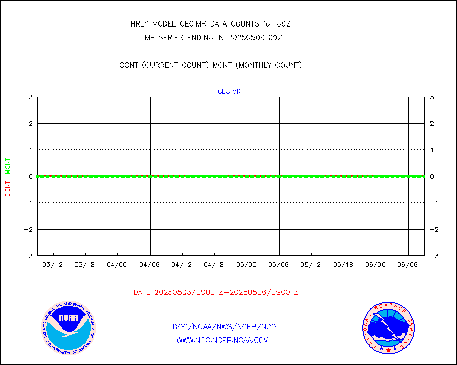
gsrcsr |
GOES-16/17 Clear Sky Radiances (proc.) |
155399 |
159575 |
97.4 % |
0808.50-0809.49 |
h20ja |
MTSAT/JMA water vapor imager derived cloud motion |
19551 |
19373 |
100.9 % |
0806.50-0807.49 |
h20mo |
MODIS (AQUA/TERRA) wvpr imager derived cld motion |
0 |
0 |
n/a |
0805.00-0805.99 |
h2tusr |
GOES-16&up/NESDIS wv imgr/cld-top derived cld mtn |
29027 |
26001 |
111.6 % |
0808.00-0808.99 |
ifeunb |
METEOSAT/EUMETSAT ir lg-wave drv cld motion NBseq |
21125 |
21344 |
99.0 % |
0807.50-0808.49 |
infja |
MTSAT/JMA infrared long-wave derived cloud motion |
16800 |
16147 |
104.0 % |
0806.50-0807.49 |
infmo |
MODIS (AQUA/TERRA) ir l-wave derived cloud motion |
0 |
0 |
n/a |
0805.00-0805.99 |
infusr |
GOES-16&up/NESDIS ir long-wave derived cld motion |
81921 |
83170 |
98.5 % |
0808.00-0808.99 |
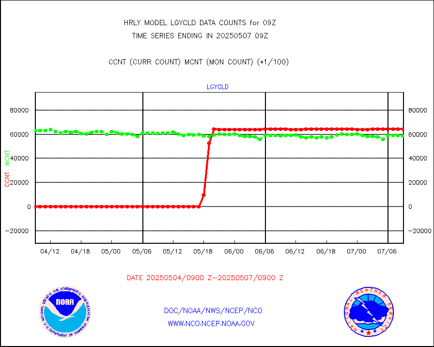
lgycld |
GOES/NASA(Langley) hi-res. (1x1 f-o-v) cloud data |
4212232 |
3475785 |
121.2 % |
0808.50-0809.49 |
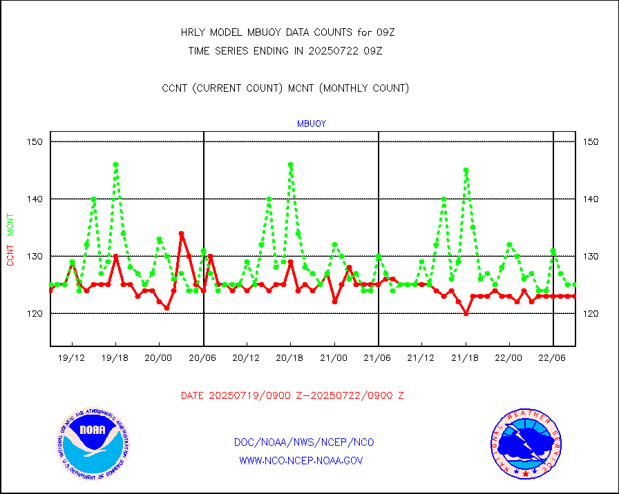
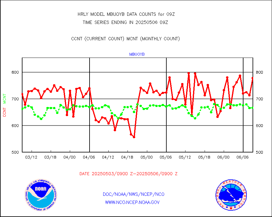
mbuoy |
Buoys decoded from FM-13 format (moored) |
112 |
107 |
104.7 % |
0808.50-0809.49 |
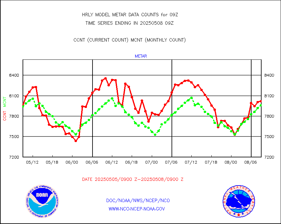
metar |
Aviation - METAR |
7937 |
7909 |
100.4 % |
0808.50-0809.49 |
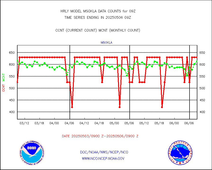
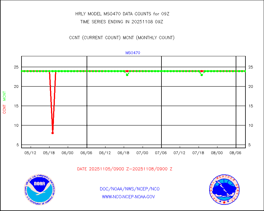
mso470 |
Mesonet/MADIS Colorado E-470 (Interstate 470) |
21 |
20 |
105.0 % |
0808.50-0809.49 |
msoalk |
Mesonet/MADIS Alaska Department of Transportation |
109 |
107 |
101.9 % |
0808.50-0809.49 |
msoapg |
Mesonet/MADIS U.S. Army Aberdeen Proving Grounds |
0 |
0 |
n/a |
0808.50-0809.49 |
msoapr |
Mesonet/MADIS Citizen Weather Observers Program |
49955 |
46559 |
107.3 % |
0808.50-0809.49 |
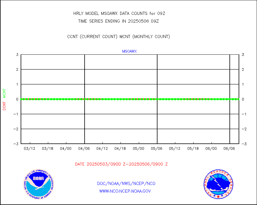
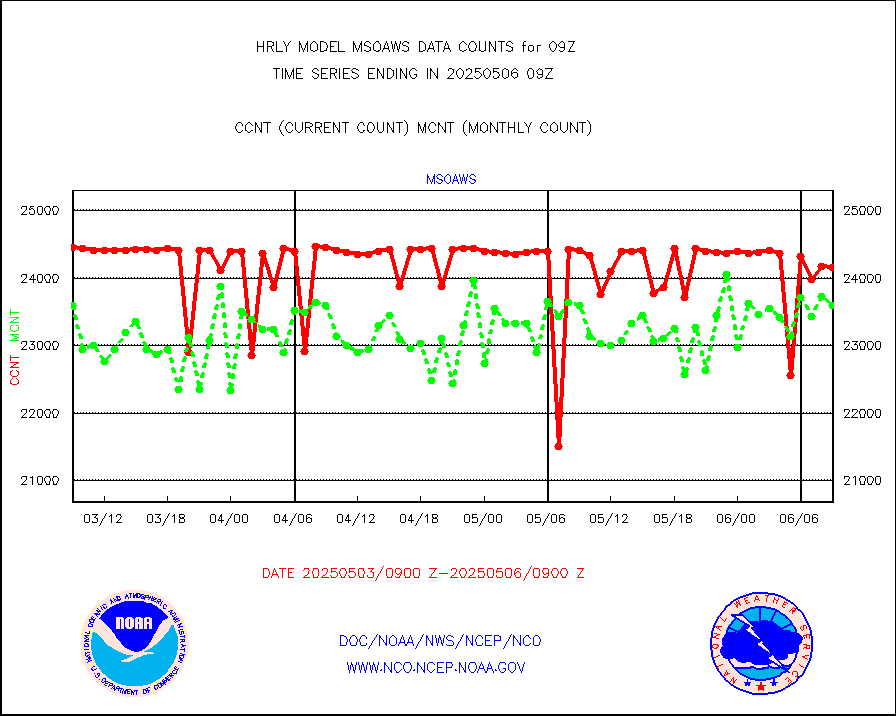
msoaws |
Mesonet/MADIS AWS Convergence Technologies, Inc. |
25888 |
25016 |
103.5 % |
0808.50-0809.49 |
msoawx |
Mesonet/MADIS "Anything Weather" |
0 |
0 |
n/a |
0808.50-0809.49 |
msocol |
Mesonet/MADIS Colorado Dept. of Transportation |
0 |
0 |
n/a |
0808.50-0809.49 |
msodcn |
Mesonet/MADIS DC Net |
0 |
0 |
n/a |
0808.50-0809.49 |
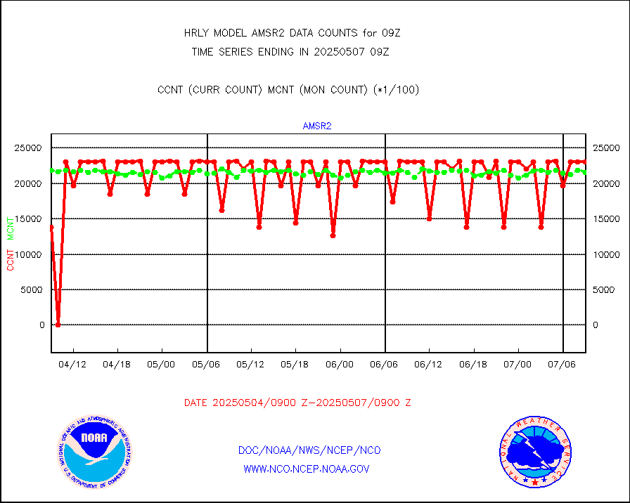
msoden |
Mesonet/MADIS Denver Urban Drainage & Flood Cntrl |
250 |
239 |
104.6 % |
0808.50-0809.49 |
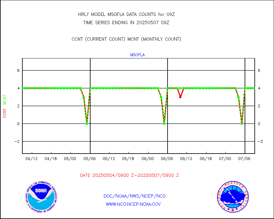
msofla |
Mesonet/MADIS Florida (FAWN & USF) |
4 |
4 |
100.0 % |
0808.50-0809.49 |
msoflt |
Mesonet/MADIS Florida Dept. of Transportation |
0 |
0 |
n/a |
0808.50-0809.49 |
msogeo |
Mesonet/MADIS Georgia Dept. of Transportation |
0 |
0 |
n/a |
0808.50-0809.49 |
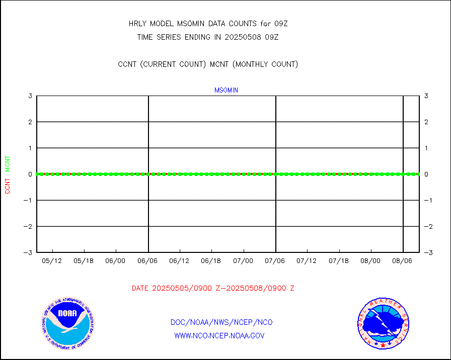
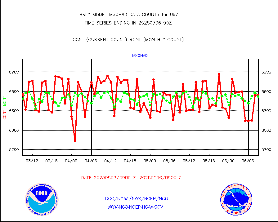
msohad |
Mesonet/MADIS NWS Hydromet Auto Data System(HADS) |
6336 |
6711 |
94.4 % |
0808.50-0809.49 |
msoien |
Mesonet/MADIS Iowa Environmental |
181 |
186 |
97.3 % |
0808.50-0809.49 |
msoind |
Mesonet/MADIS Indiana Dept. of Transportation |
0 |
0 |
n/a |
0808.50-0809.49 |
msoiow |
Mesonet/MADIS Iowa Department of Transportation |
0 |
0 |
n/a |
0808.50-0809.49 |
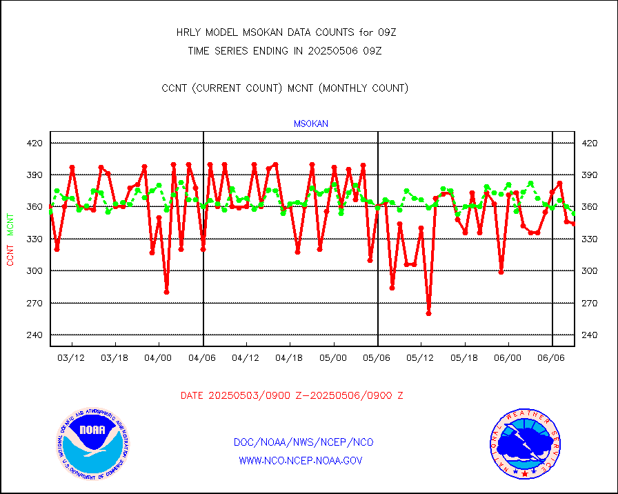
msokan |
Mesonet/MADIS Kansas Department of Transportation |
338 |
331 |
102.1 % |
0808.50-0809.49 |
msokla |
Mesonet/MADIS Oklahoma Mesonet |
318 |
329 |
96.7 % |
0808.50-0809.49 |
msolju |
Mesonet/MADIS Louisiana State/Jackson State Univ. |
0 |
0 |
n/a |
0808.50-0809.49 |
msomca |
Mesonet/MADIS Missouri Commercial Agricult Wx Net |
301 |
291 |
103.4 % |
0808.50-0809.49 |
msomin |
Mesonet/MADIS Minnesota Dept. of Transportation |
0 |
0 |
n/a |
0808.50-0809.49 |
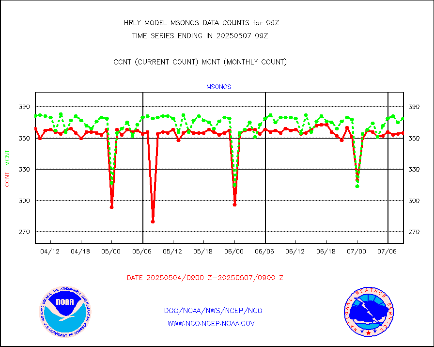
msonos |
Mesonet/MADIS NOS-Phys Oceanographic Realtime Sys |
388 |
366 |
106.0 % |
0808.50-0809.49 |
msoraw |
Mesonet/MADIS NFIC Remote Automated Wx Stns(RAWS) |
1924 |
1871 |
102.8 % |
0808.50-0809.49 |
msovir |
Mesonet/MADIS Virginia Dept. of Transportation |
227 |
227 |
100.0 % |
0808.50-0809.49 |
msowfy |
Mesonet/MADIS "Weather for You" |
0 |
0 |
n/a |
0808.50-0809.49 |
msowis |
Mesonet/MADIS Wisconsin Dept. of Transportation |
0 |
0 |
n/a |
0808.50-0809.49 |
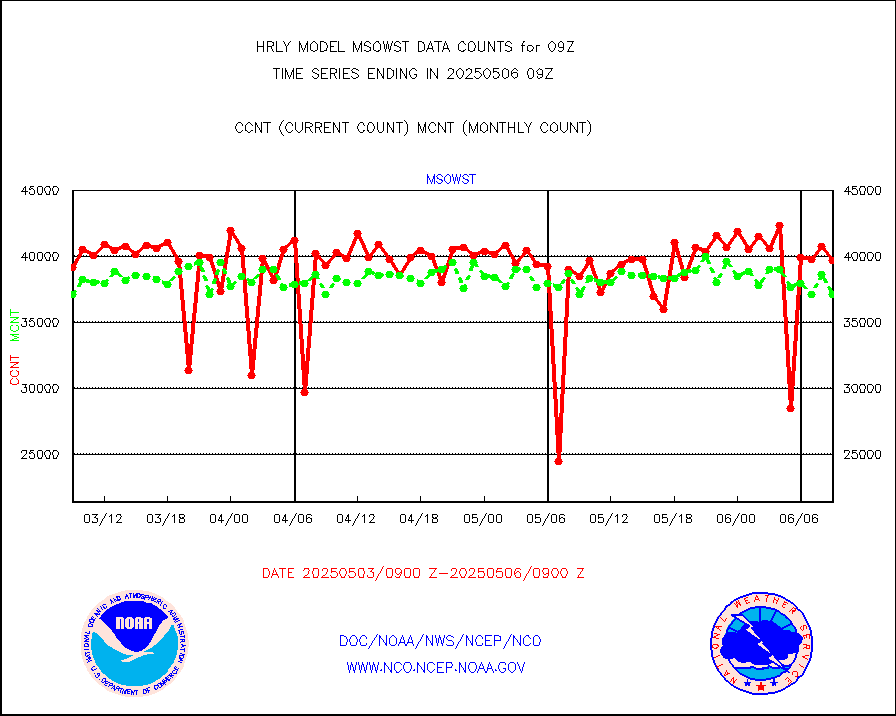
msowst |
Mesonet/MADIS MesoWest (many subproviders) |
45850 |
45412 |
101.0 % |
0808.50-0809.49 |
msowtx |
Mesonet/MADIS West Texas |
5607 |
5631 |
99.6 % |
0808.50-0809.49 |
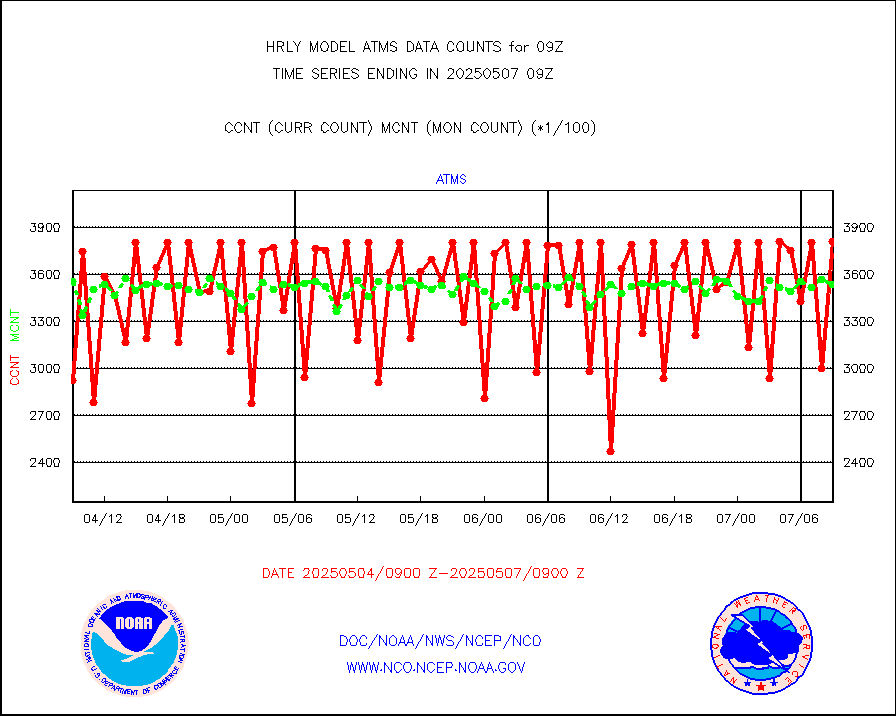
mtiasi |
METOP 1-2 IASI 1C radiance data (varbl. channels) |
88476 |
84163 |
105.1 % |
0807.00-0807.99 |
nxrdw |
NEXRAD Vel Azm Dsp(VAD) winds via radar coded msg |
0 |
0 |
n/a |
0808.50-0809.49 |
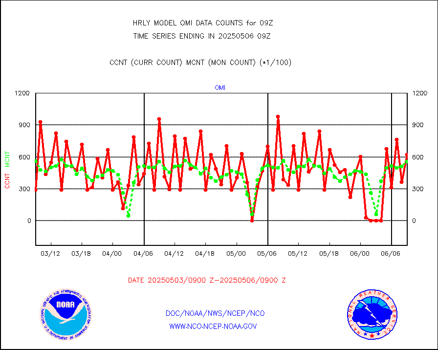
omi |
Aura Ozone Monitoring Instrument (OMI) data |
49080 |
45362 |
108.2 % |
0806.50-0807.49 |
osbuv8 |
NOAA 16-19 Solar Backscatter UV-2 rad frm V8 BUFR |
0 |
0 |
n/a |
0807.00-0807.99 |
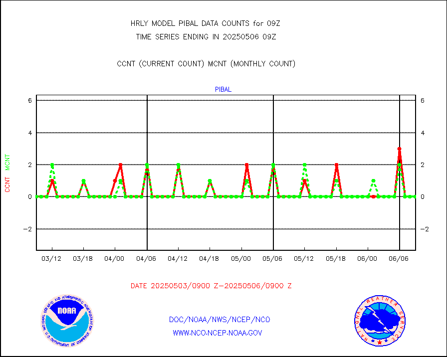
pibal |
PIBAL (from PILOT, PILOT SHIP, PILOT MOBIL) |
0 |
0 |
n/a |
0808.50-0809.49 |
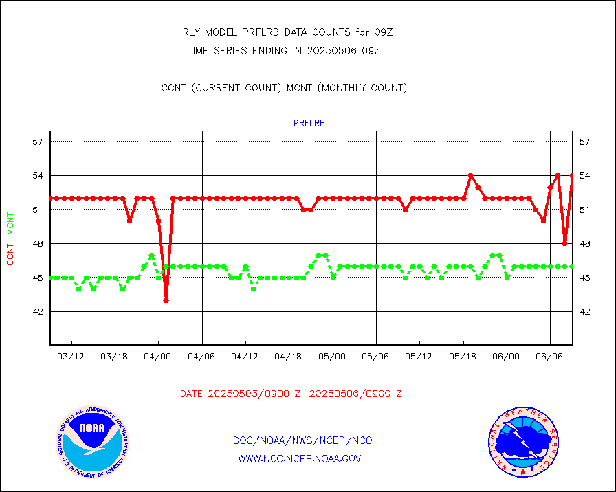
prflrb |
Multi-Agency Profiler (MAP) and SODAR winds |
49 |
40 |
122.5 % |
0808.50-0809.49 |
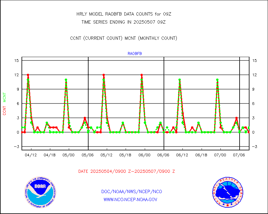
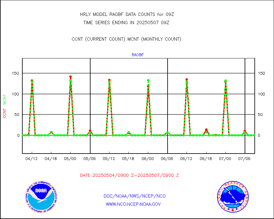
raobf |
Rawinsonde - fixed land (from TEMP or PILOT) |
0 |
0 |
n/a |
0808.50-0809.49 |
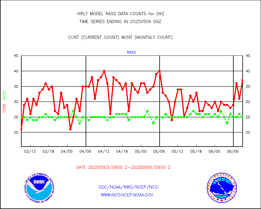
rass |
RASS temperatures (NOAA and Multi-Agency) |
24 |
24 |
100.0 % |
0808.50-0809.49 |
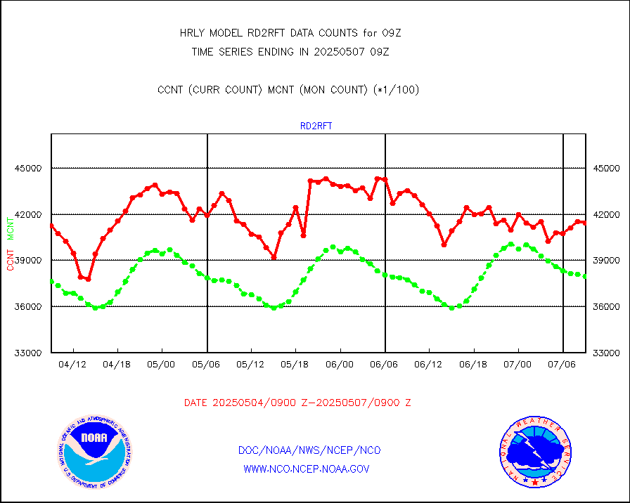
rd2rft |
NEXRAD reflectivity (Lvl 2 - GTS) |
3758920 |
3832685 |
98.1 % |
0808.50-0809.49 |
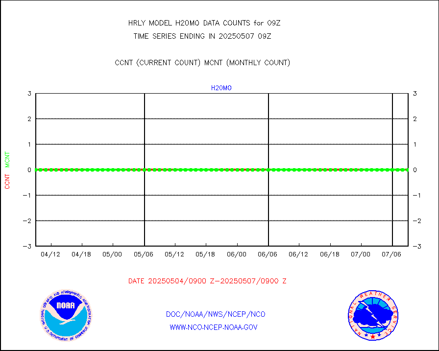
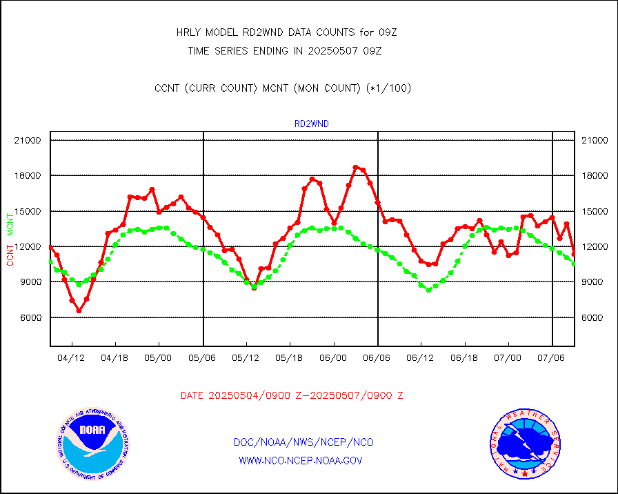
rd2wnd |
NEXRAD radial wind (Level 2 - GTS) |
1428546 |
1256302 |
113.7 % |
0808.50-0809.49 |
sevcsr |
METEOSAT-10 2nd Gen SEVIRI Clr Sky Radiance(proc) |
0 |
0 |
n/a |
0808.50-0809.49 |
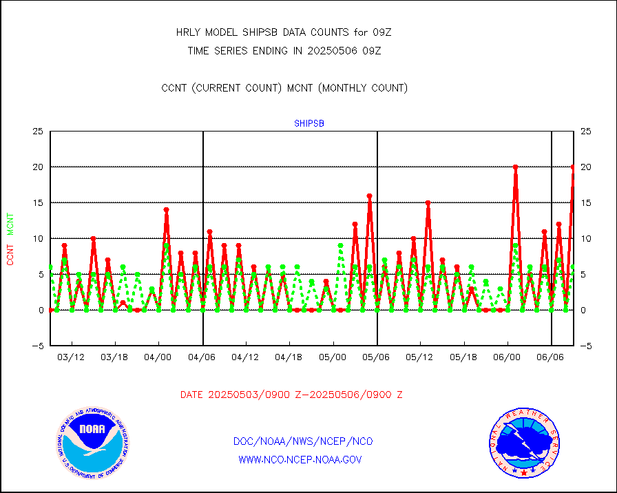
shipsb |
Ship - manual and automatic, restricted (BUFR) |
0 |
0 |
n/a |
0808.50-0809.50 |
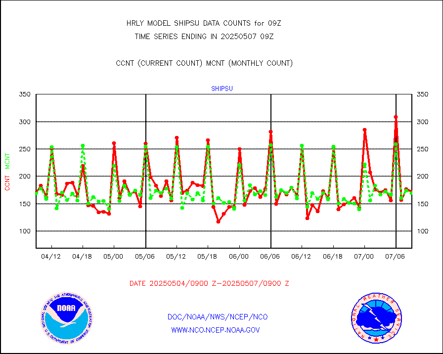
shipsu |
Ship - manual and automatic, unrestricted |
103 |
115 |
89.6 % |
0808.50-0809.50 |
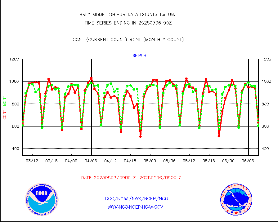
shipub |
Ship - manual and automatic, unrestricted (BUFR) |
233 |
431 |
54.1 % |
0808.50-0809.50 |
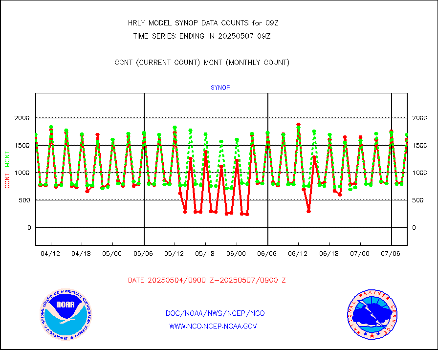
synop |
Synoptic - fixed manual and automatic |
1790 |
2002 |
89.4 % |
0808.50-0809.49 |
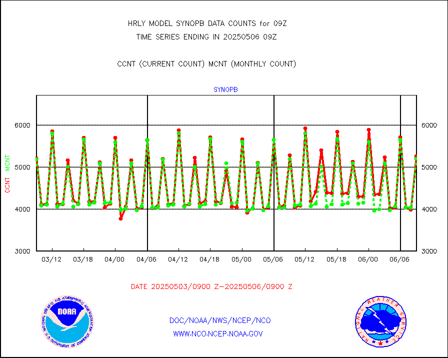
synopb |
Synoptic - fixed manual & auto (decoded fr BUFR) |
4244 |
5207 |
81.5 % |
0808.50-0809.49 |
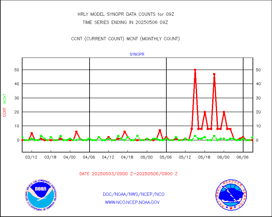
synopr |
Synoptic - restricted (WMO Res 40) manual & auto. |
59 |
1 |
n/a |
0808.50-0809.49 |
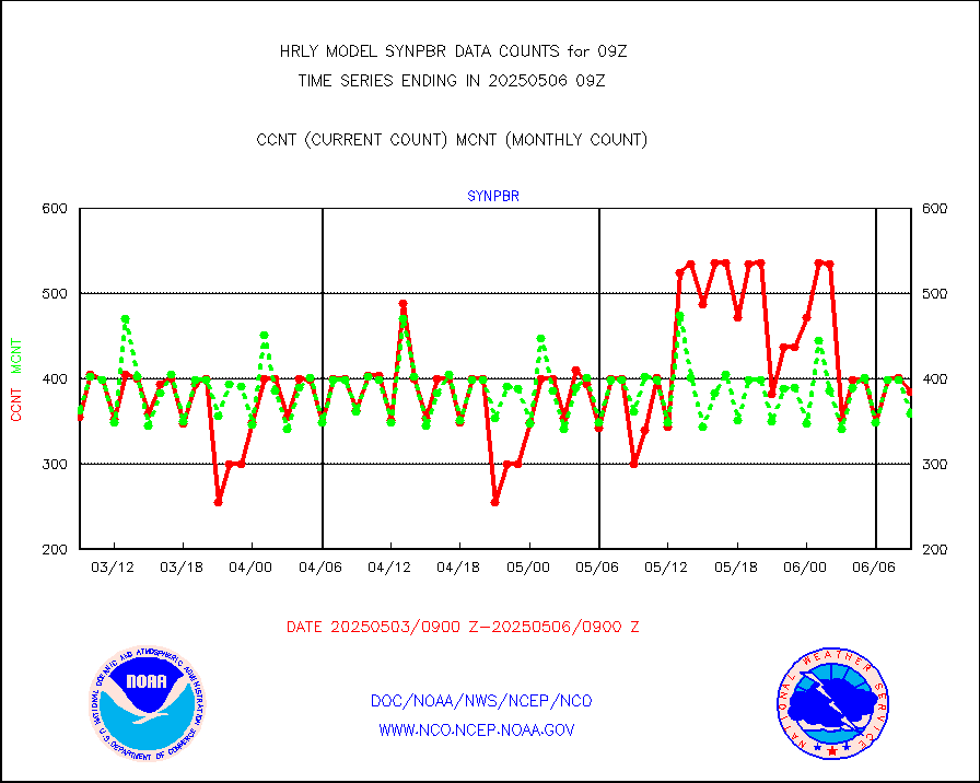
synpbr |
Synoptic - restricted (WMO Res 40)(decoded BUFR) |
130 |
357 |
36.4 % |
0808.50-0809.49 |
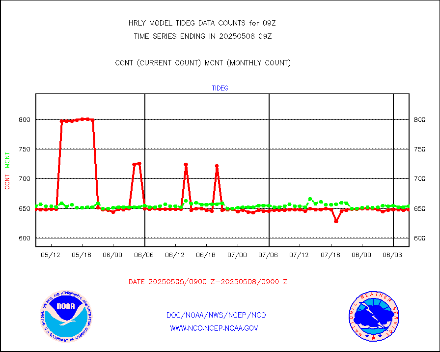
tideg |
Tide gauge reports decoded from CREX format |
640 |
639 |
100.2 % |
0808.00-0808.99 |
| Data Types of Opportunity with Normal Counts |
|---|
| Type | Description | Hourly Count | Monthly Average | Percent (%) of Monthly Mean | UTC Time Window |
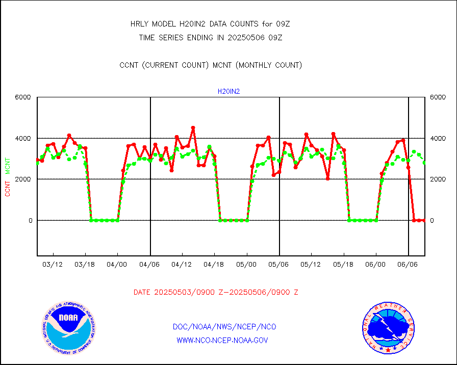
3p9usr |
GOES-16&up/NESDIS ir short-wv derived cld motion |
41347 |
46669 |
88.6 % |
0808.00-0808.99 |
acarsa |
MDCRS ACARS acft data (ARINC via AFWA)(AIREP fmt) |
0 |
0 |
n/a |
0808.50-0809.49 |
ahicsr |
Himawari Clear Sky Radiance |
0 |
0 |
n/a |
0808.00-0808.99 |
amsr2 |
GCOM-W AMSR2 1B brightness temperatures |
1673784 |
2191471 |
76.4 % |
0807.00-0807.99 |
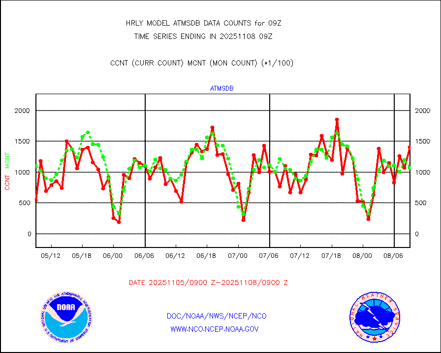
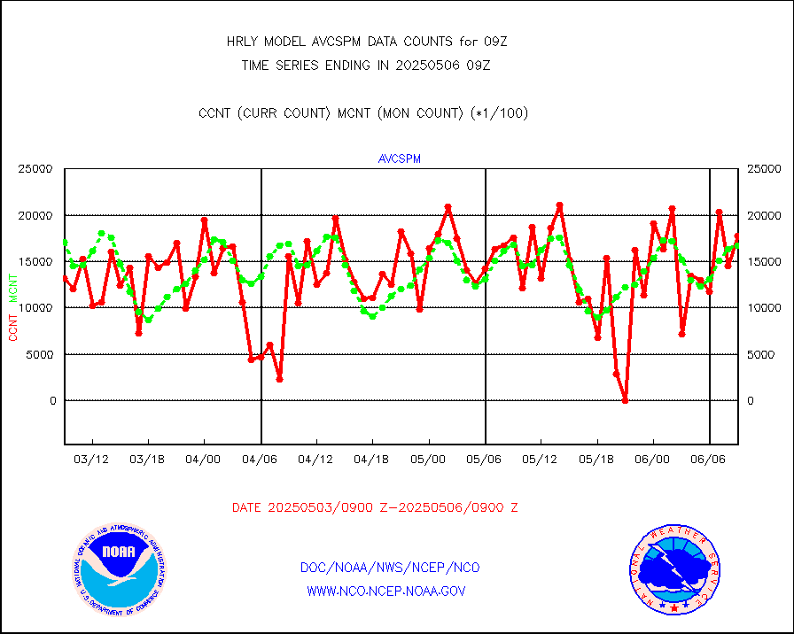
atmsdb |
NPP/NOAA-20 ATMS bright. temps-direct b-cast SSEC |
71904 |
72555 |
99.1 % |
0807.50-0808.49 |
atovs |
POES/NESDIS - processed ATOVS soundings/radiances |
0 |
0 |
n/a |
0807.00-0807.99 |
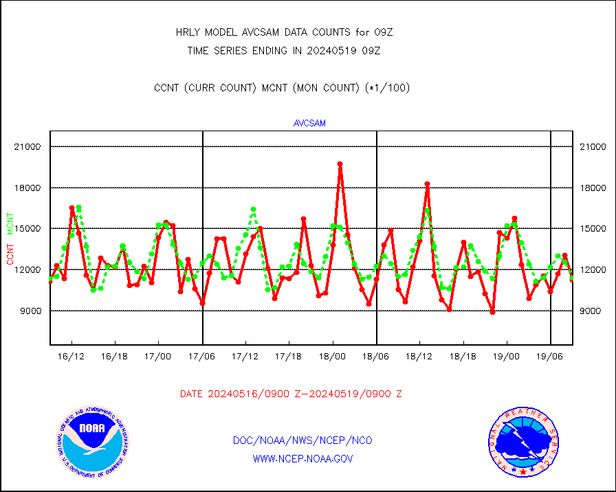
avcsam |
A.M.(N17,M2,M3) AVHRR GAC NCEP-proc clr&sea btmps |
1172660 |
1101710 |
106.4 % |
0806.50-0807.49 |
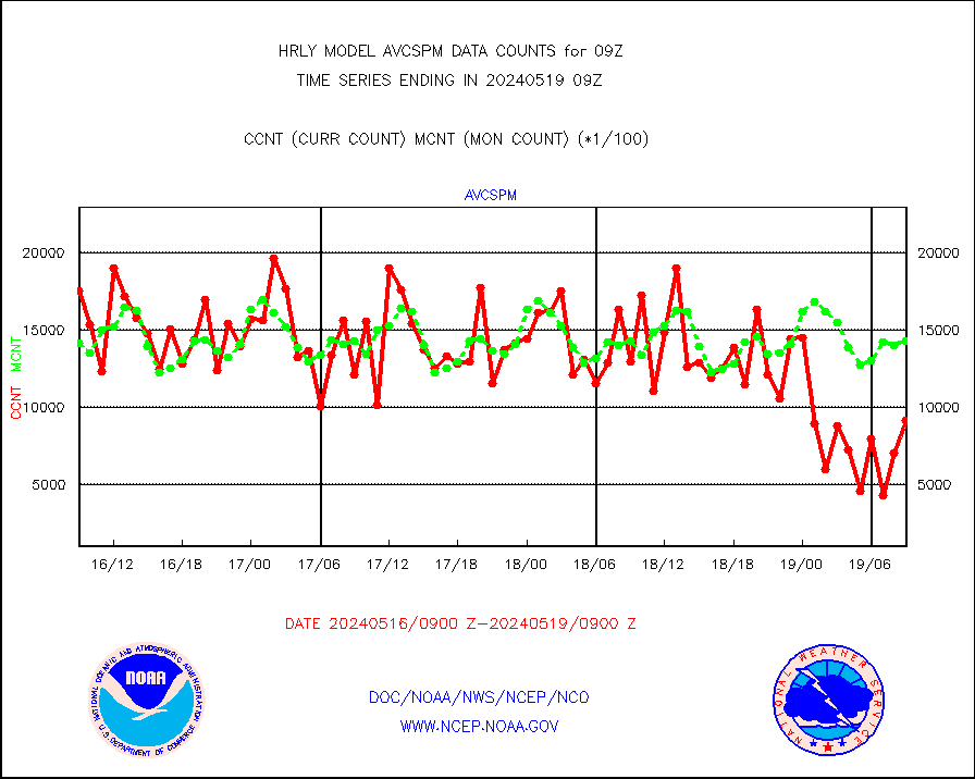
avcspm |
P.M.(N18-19) AVHRR GAC NCEP-proc clr & sea btemps |
1754157 |
1396982 |
125.6 % |
0806.50-0807.49 |
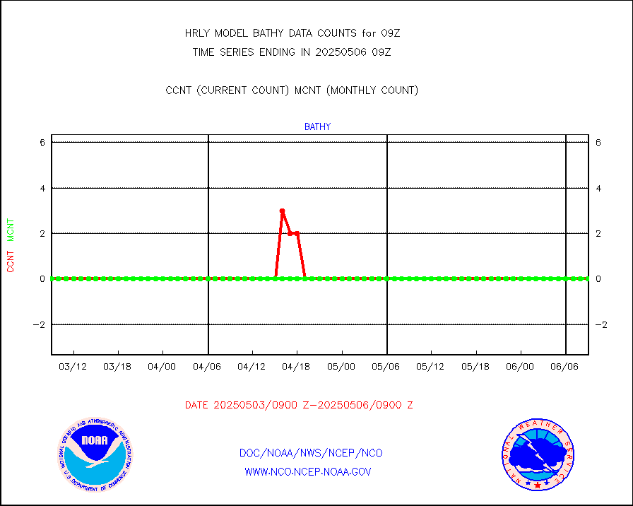
bathy |
eXpendable BathyThermograph, mooring (BATHY fmt) |
0 |
0 |
n/a |
0802.00-0802.99 |
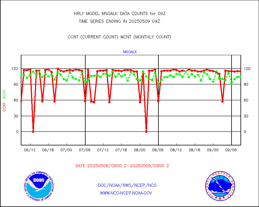
coopmd |
Coop/MADIS NEPP & HCN-Modernization NOAA COOP Obs |
27 |
25 |
108.0 % |
0808.50-0809.49 |
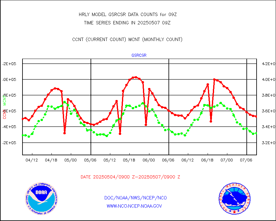
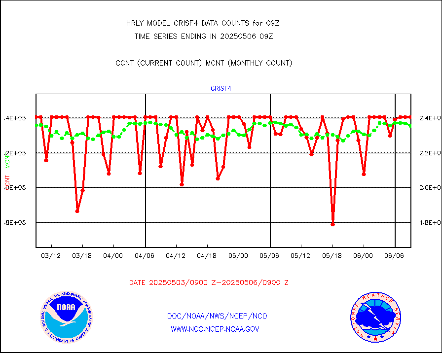
crisf4 |
NPP/NOAA-20 CrIS full spctrl radn (431 ch subset) |
240534 |
226070 |
106.4 % |
0807.50-0808.49 |
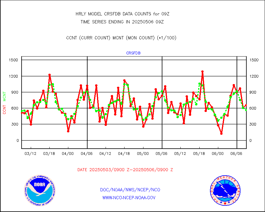
crsfdb |
NPP/NOAA-20 CrIS full spctrl radn dir brdcst SSEC |
83195 |
88862 |
93.6 % |
0807.50-0808.49 |
cstgd |
Coast Guard |
3 |
4 |
75.0 % |
0808.50-0809.50 |
dbuoyb |
Drifting buoys (decoded from BUFR) |
1329 |
1323 |
100.5 % |
0808.50-0809.50 |
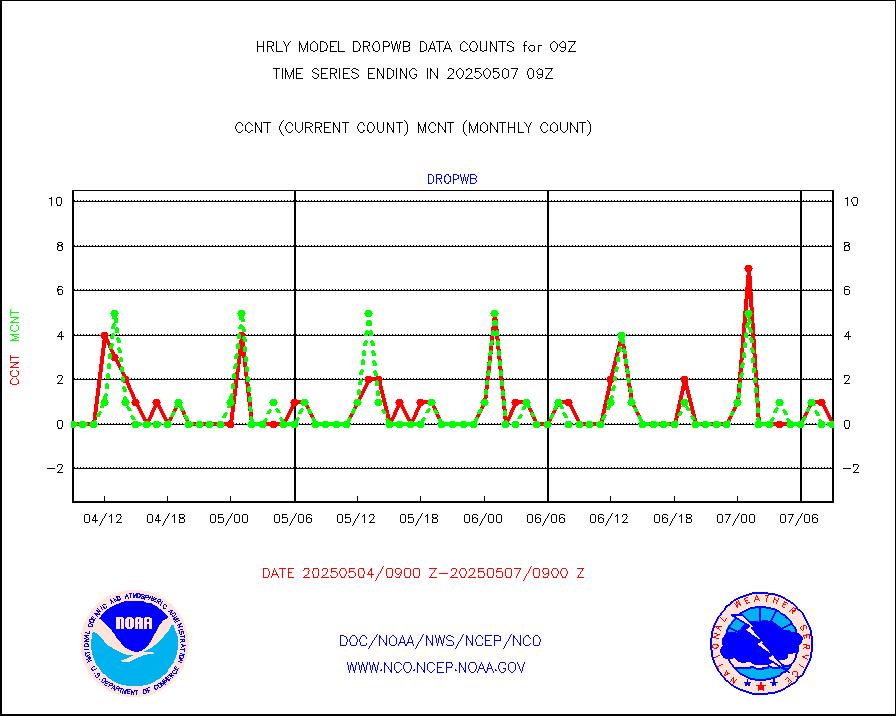
dropw |
Dropwinsonde (from TEMP DROP) |
0 |
0 |
n/a |
0808.50-0809.49 |
efclam |
GOES imager effective cloud amount data (U.Wisc.) |
8289953 |
7998429 |
103.6 % |
0808.50-0809.49 |
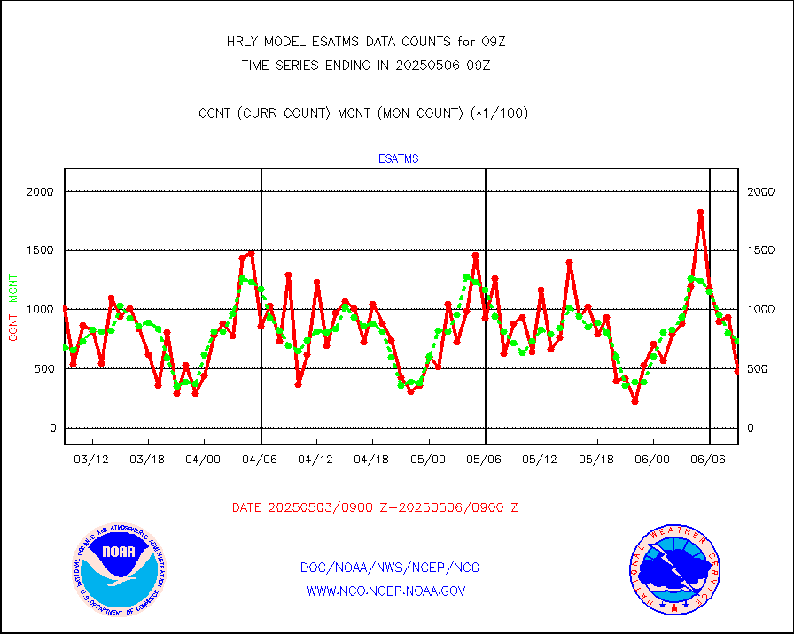
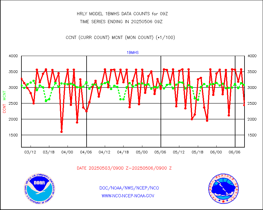
esatms |
NPP Adv. Tech. MW Sndr (ATMS) br. temps from RARS |
53956 |
86155 |
62.6 % |
0807.50-0808.49 |
esiasi |
METOP 1-2 IASI 1C radiance data vbl chn from RARS |
42591 |
36134 |
117.9 % |
0808.00-0808.99 |
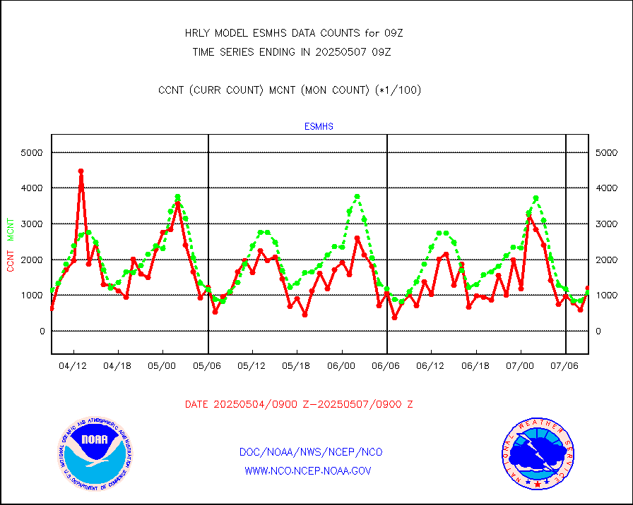
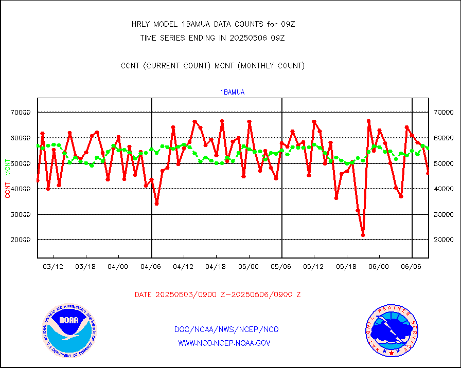
esmhs |
NOAA 18-19 & METOP 1-2 MHS proc. btemps from RARS |
113406 |
132137 |
85.8 % |
0808.50-0809.49 |
geoimr |
GOES/NESDIS (11x17 f-o-v) imager clear radiances |
0 |
0 |
n/a |
0808.00-0808.99 |
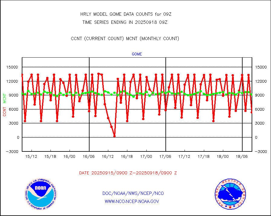
gome |
METOP 1-2 Global Ozone Monitoring Exp.-2 (GOME-2) |
3192 |
7716 |
41.4 % |
0807.50-0808.49 |
h20in2 |
INDIA SATWIND, INSAT WV channel |
9111 |
5166 |
176.4 % |
0808.00-0808.99 |
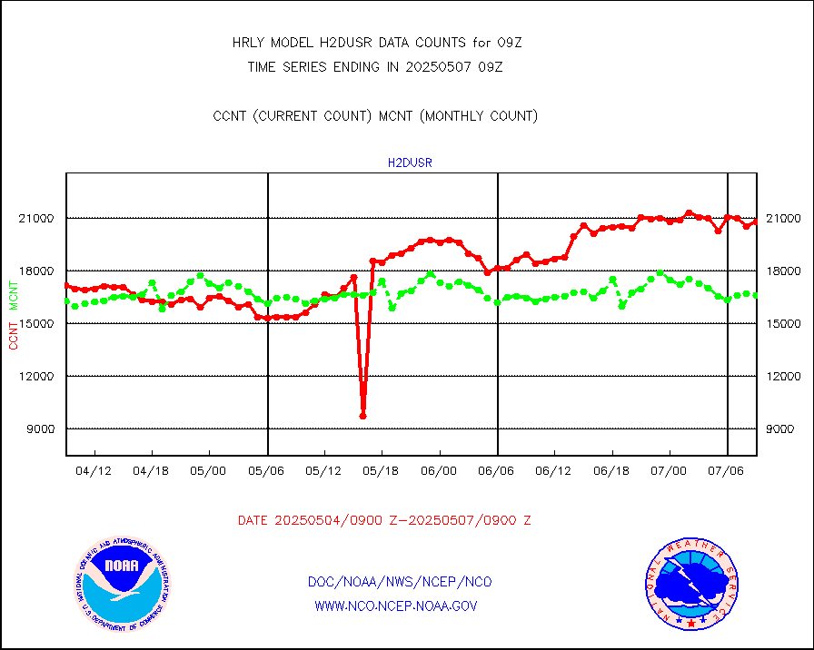
h2dusr |
GOES-16&up/NESDIS wv imgr/deep-lyr derivd cld mtn |
14005 |
15585 |
89.9 % |
0808.00-0808.99 |
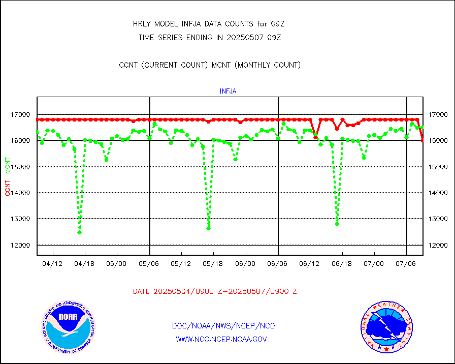
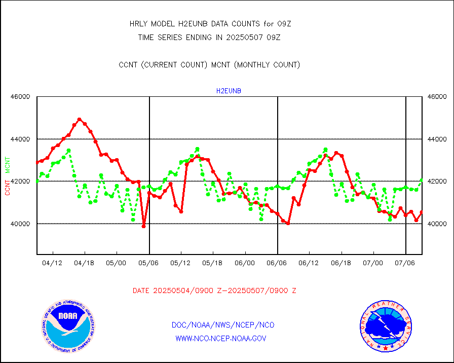
h2eunb |
METEOSAT/EUMETSAT wvpr imgr drv cld motion NBseq |
39830 |
41631 |
95.7 % |
0807.50-0808.49 |
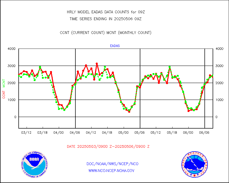
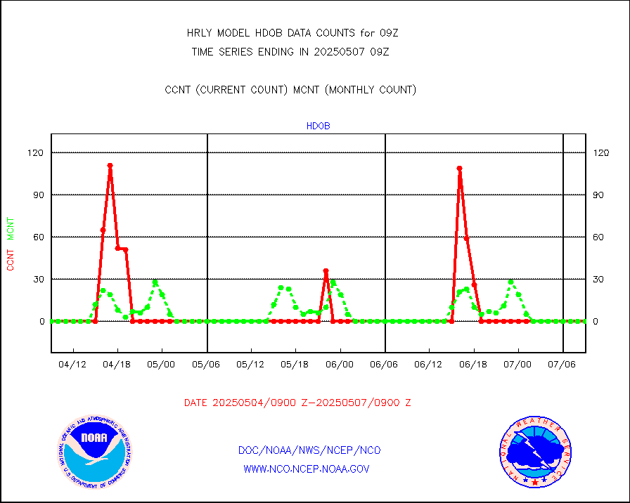
hdob |
High Density OBs from reconnaissance acft data |
0 |
0 |
n/a |
0808.50-0809.49 |
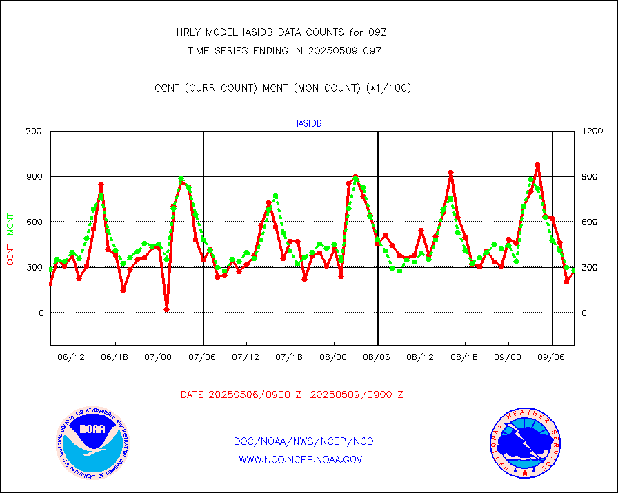
iasidb |
METOP 1-2 IASI 1C radiances-direct broadcast SSEC |
26364 |
20768 |
126.9 % |
0807.50-0808.49 |
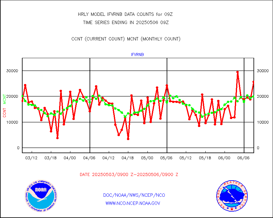
ifvrnb |
VIIRS (NPP/NOAA-20) ir lg-wv drv cloud motion(NB) |
12938 |
16939 |
76.4 % |
0805.00-0805.99 |
infav |
AVHRR (NOAA/METOP) ir lg-wave derived cld motion |
0 |
0 |
n/a |
0805.00-0805.99 |
infav1 |
AVHRR (METOP) ir lg-wave derived cld motion |
0 |
0 |
n/a |
0808.50-0809.50 |
infin |
INSAT/KALPANA India ir lg-wave derived cld motion |
0 |
0 |
n/a |
0806.50-0807.49 |
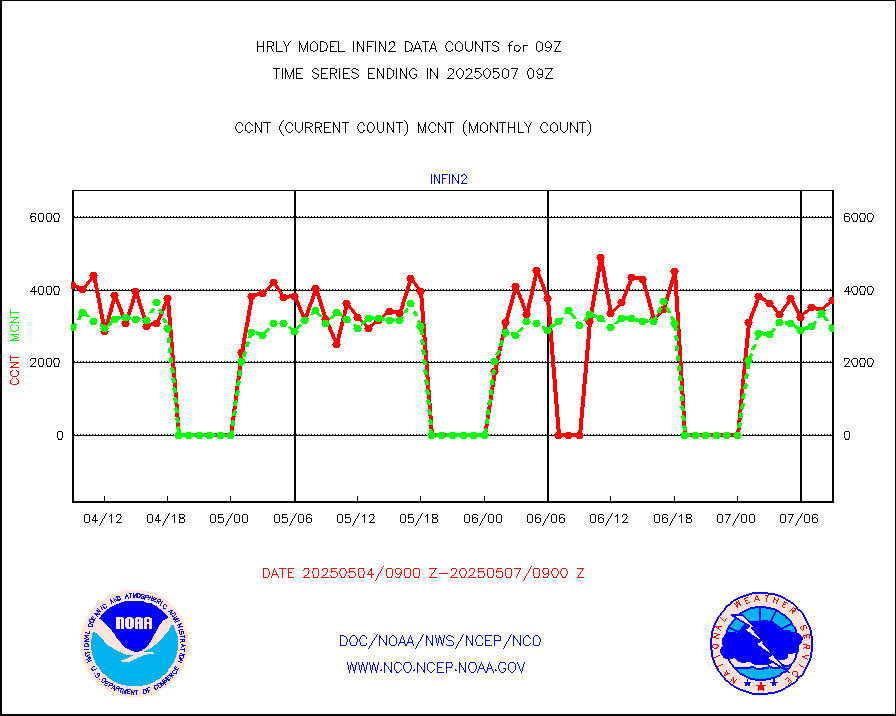
infin2 |
INDIA SATWIND, INSAT IR channel |
7493 |
5572 |
134.5 % |
0808.00-0808.99 |
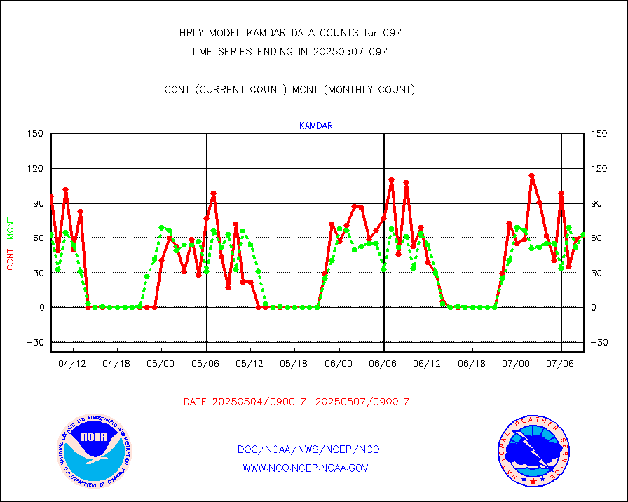
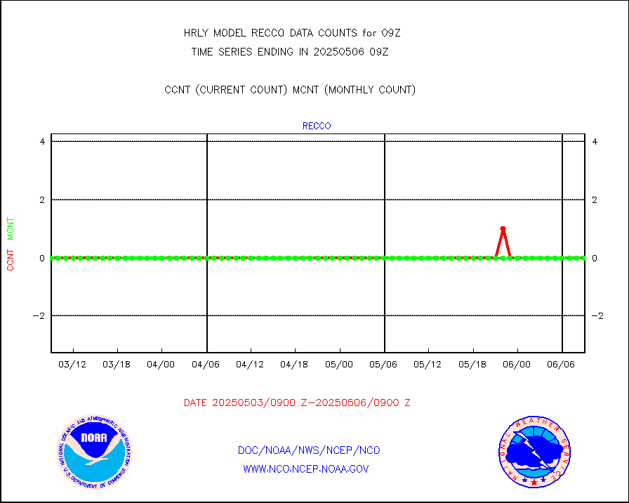
kamdar |
Korean AMDAR aircraft data (decoded from BUFR) |
40 |
82 |
48.8 % |
0808.50-0809.49 |
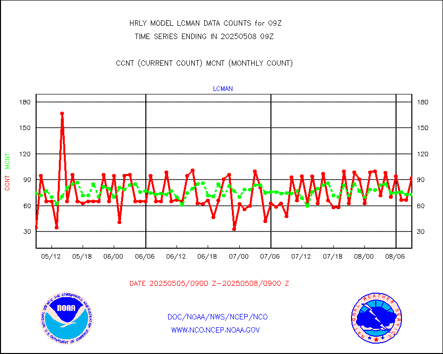
lcman |
Land-based CMAN stations decoded from CMAN format |
44 |
78 |
56.4 % |
0808.50-0809.49 |
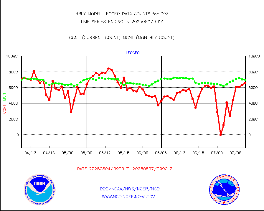
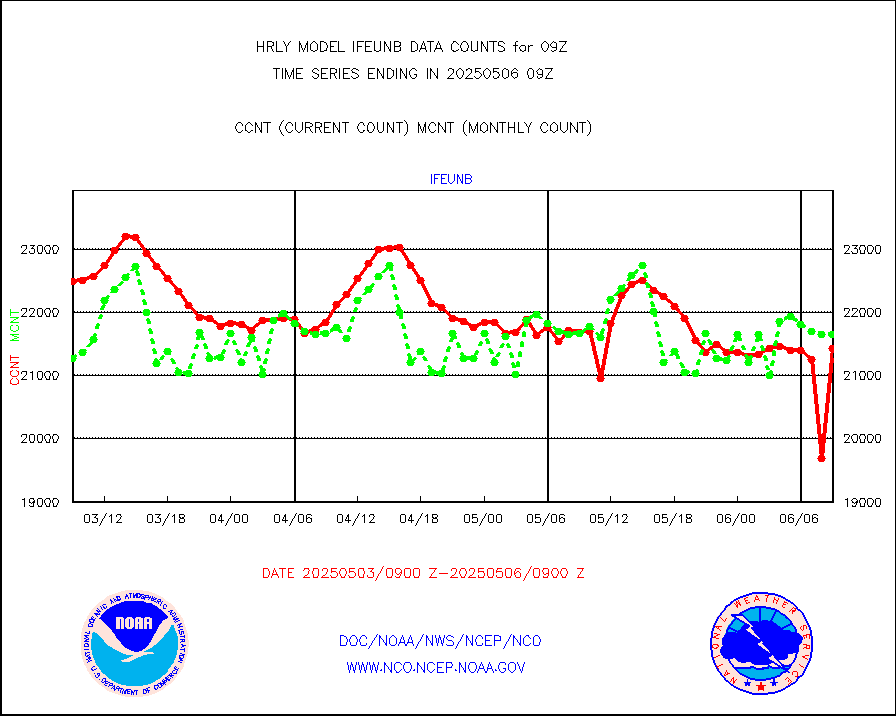
leogeo |
LEO-GEO satellite AMVs from UWisc. |
7058 |
2812 |
251.0 % |
0805.00-0805.99 |
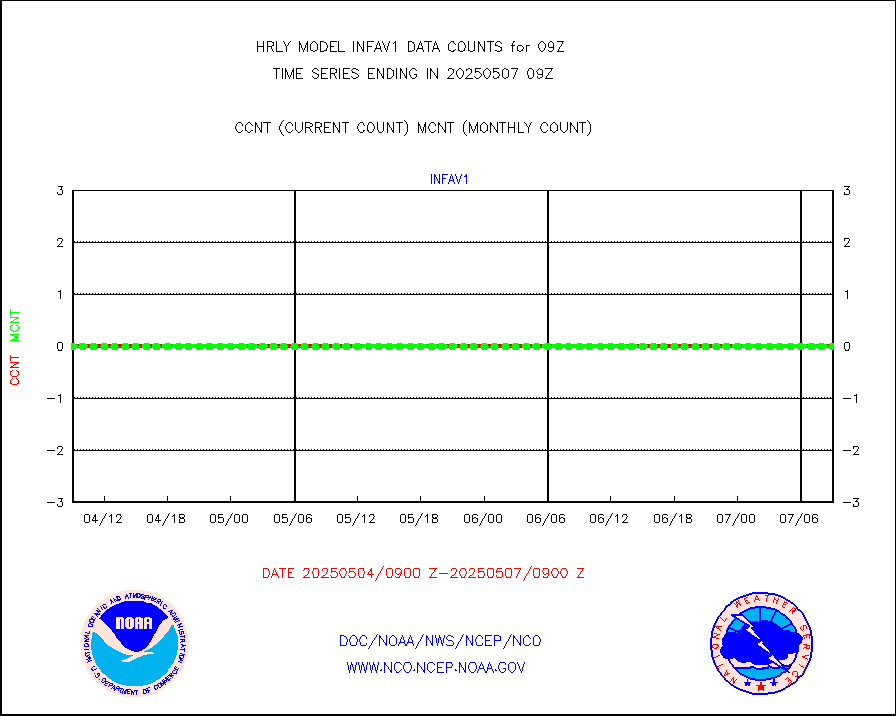
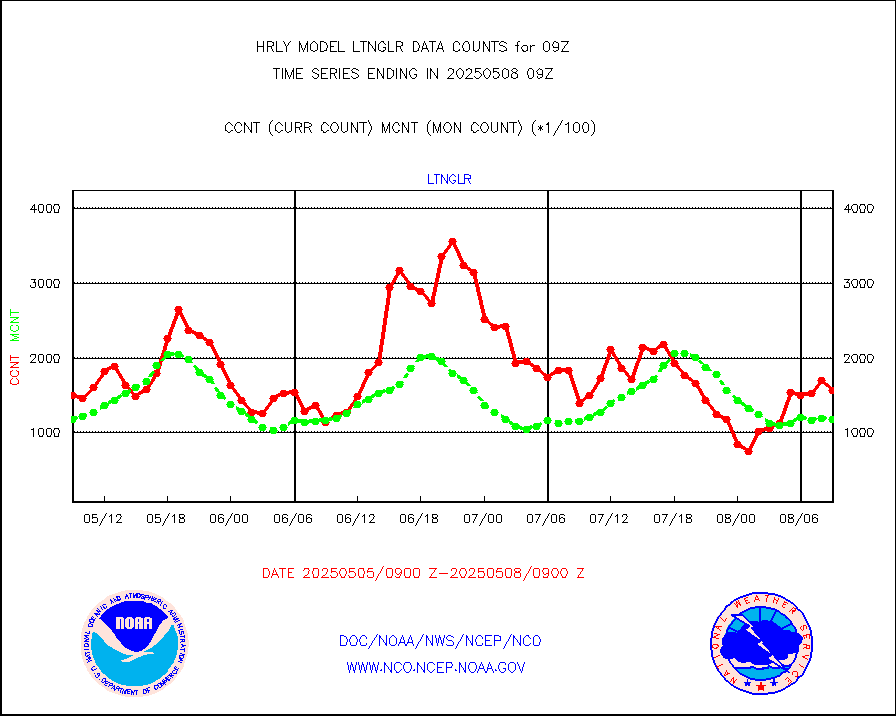
ltnglr |
LLDN Long-rng lightning from Vaisala via NOAAPORT |
145497 |
116530 |
124.9 % |
0808.50-0809.49 |
ltngsr |
NLDN Shrt-rng lightning from Vaisala via NOAAPORT |
2486 |
2470 |
100.6 % |
0808.50-0809.49 |
mbuoyb |
Moored buoys (decoded from BUFR) |
775 |
691 |
112.2 % |
0808.50-0809.50 |
mls |
Aura Microwave Limb Sounder (MLS) ozone data |
0 |
0 |
n/a |
0807.00-0807.99 |
msourb |
Mesonet/MADIS UrbaNet |
4403 |
4325 |
101.8 % |
0808.50-0809.49 |
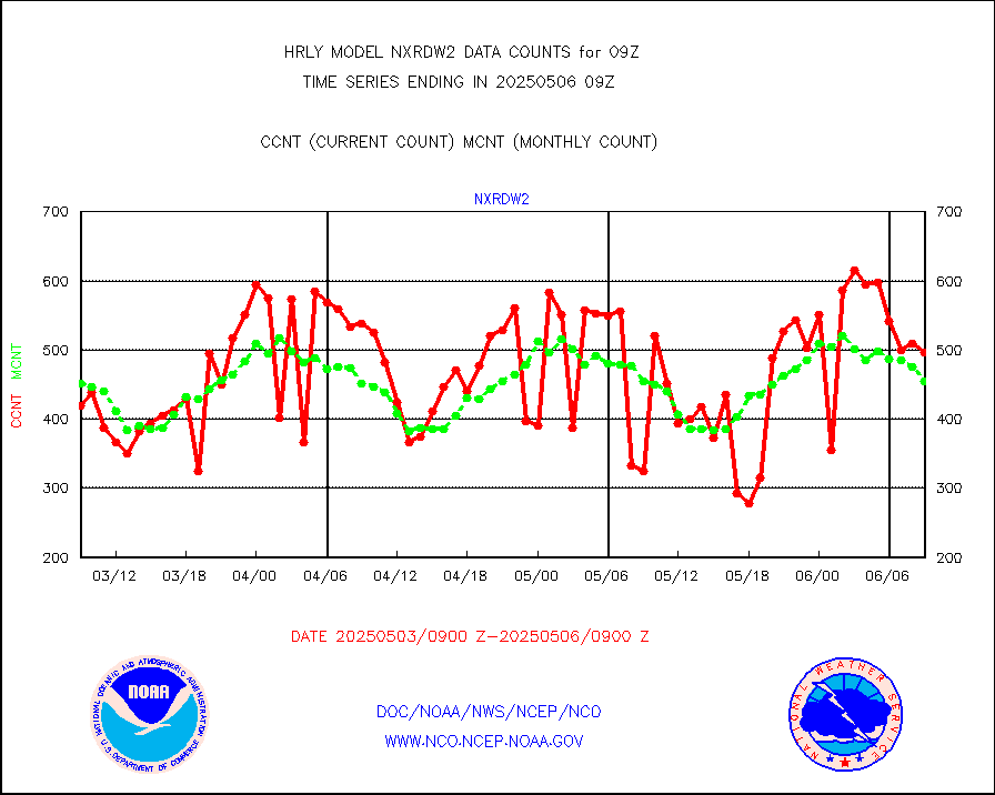
nxrdw2 |
NEXRAD Vel Azm Dsp(VAD) winds via Level 2 decoder |
571 |
556 |
102.7 % |
0808.50-0809.49 |
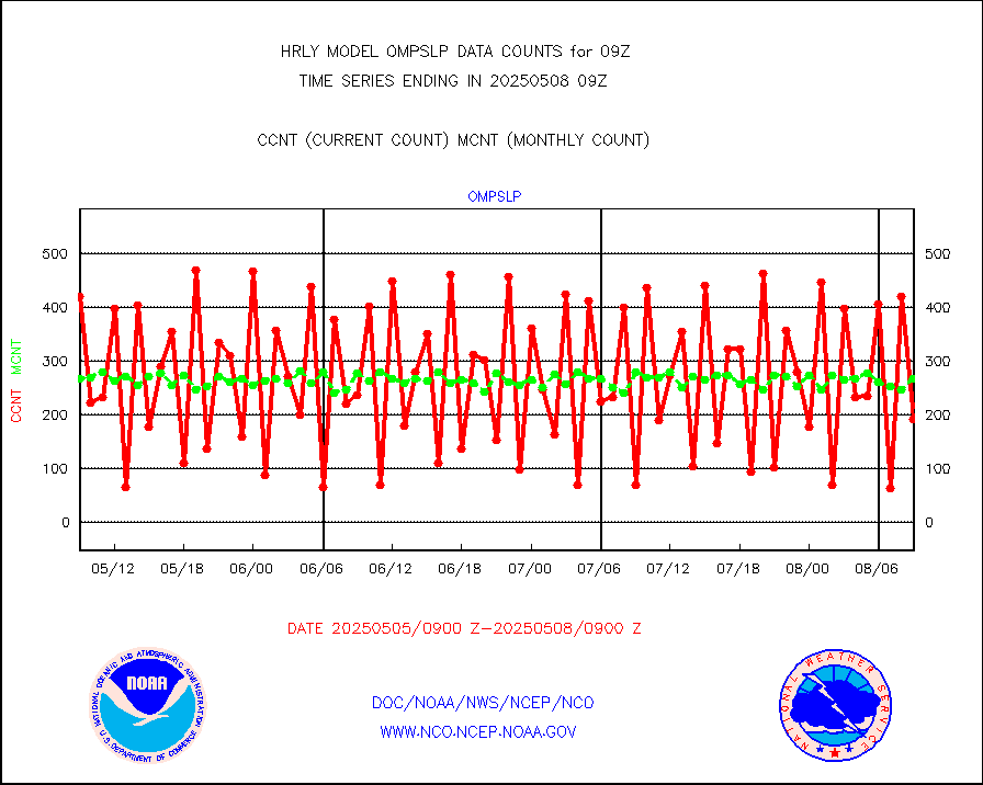
ompslp |
OMPS Limb Profiler ozone data (NPP) |
286 |
260 |
110.0 % |
0802.00-0802.99 |
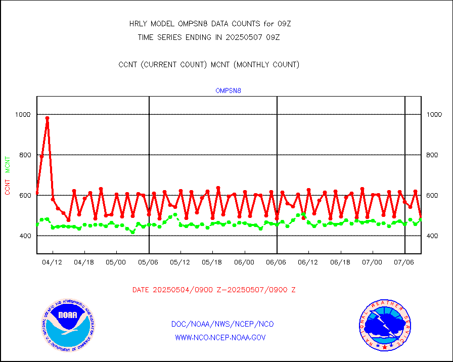
ompsn8 |
OMPS nadir profile ozone (Version 8 BUFR) |
585 |
558 |
104.8 % |
0807.00-0807.99 |
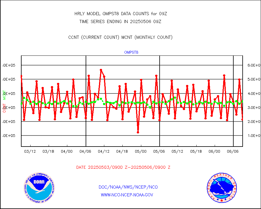
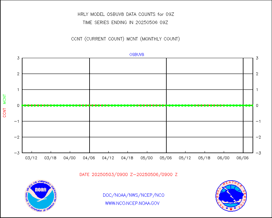
ompst8 |
OMPS total column ozone (Version 8 BUFR) |
220997 |
341035 |
64.8 % |
0807.00-0807.99 |
pirep |
Manual PIREP aircraft data (dcded from AIREP fmt) |
9 |
12 |
75.0 % |
0808.50-0809.49 |
prflrp |
Profilr winds from PIBAL (PILOT,PILOT SHIP/MOBIL) |
0 |
0 |
n/a |
0808.50-0809.49 |
raobm |
Rawinsonde - mobile land (from TEMP/PILOT MOBIL) |
0 |
0 |
n/a |
0808.50-0809.49 |
raobs |
Rawinsonde - ship (from TEMP SHIP, PILOT SHIP) |
0 |
0 |
n/a |
0808.50-0809.49 |
recco |
Flight level reconnaissance aircraft data |
0 |
0 |
n/a |
0808.50-0809.49 |
saphir |
Megha-Tropiques SAPHIR L1A2 brightness temps |
0 |
0 |
n/a |
0806.50-0807.49 |
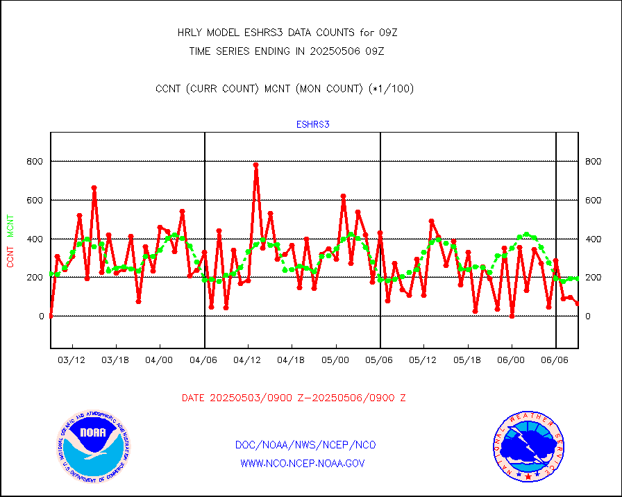
sevasr |
METEOSAT-10 2nd Gen SEVIRI All Sky Radiance(proc) |
75512 |
75439 |
100.1 % |
0808.50-0809.49 |
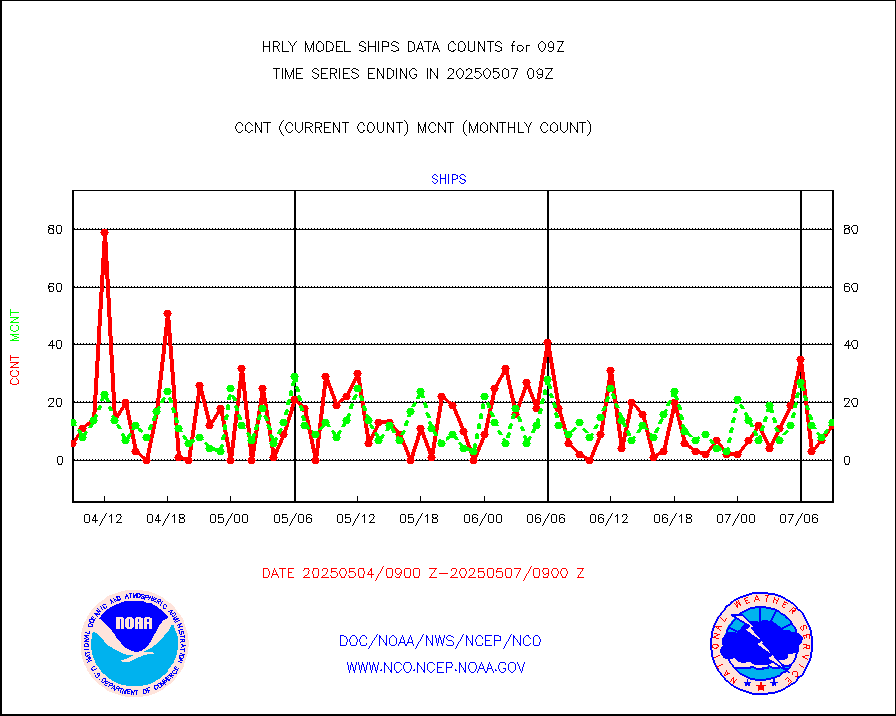
ships |
Ship - manual and automatic, restricted |
0 |
6 |
0.0 % |
0808.50-0809.49 |
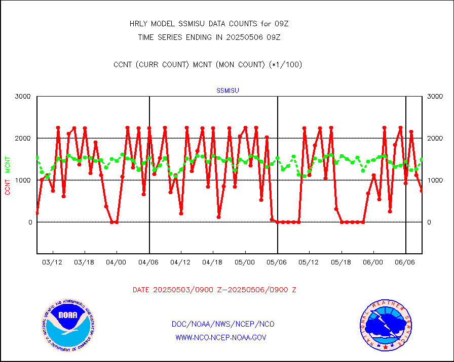
ssmisu |
DMSP SSM/IS 1C radiance data (Unified Pre-Proc.) |
225300 |
140005 |
160.9 % |
0807.50-0808.49 |
sstvcw |
NPP/NOAA-20 VIIRS SST - CLEAR & OVER WATER |
300689 |
256389 |
117.3 % |
0808.50-0809.49 |
sstvpw |
NPP/NOAA-20 VIIRS SST - PROBABLY CLR & OVER WATER |
36167 |
26321 |
137.4 % |
0808.50-0809.49 |
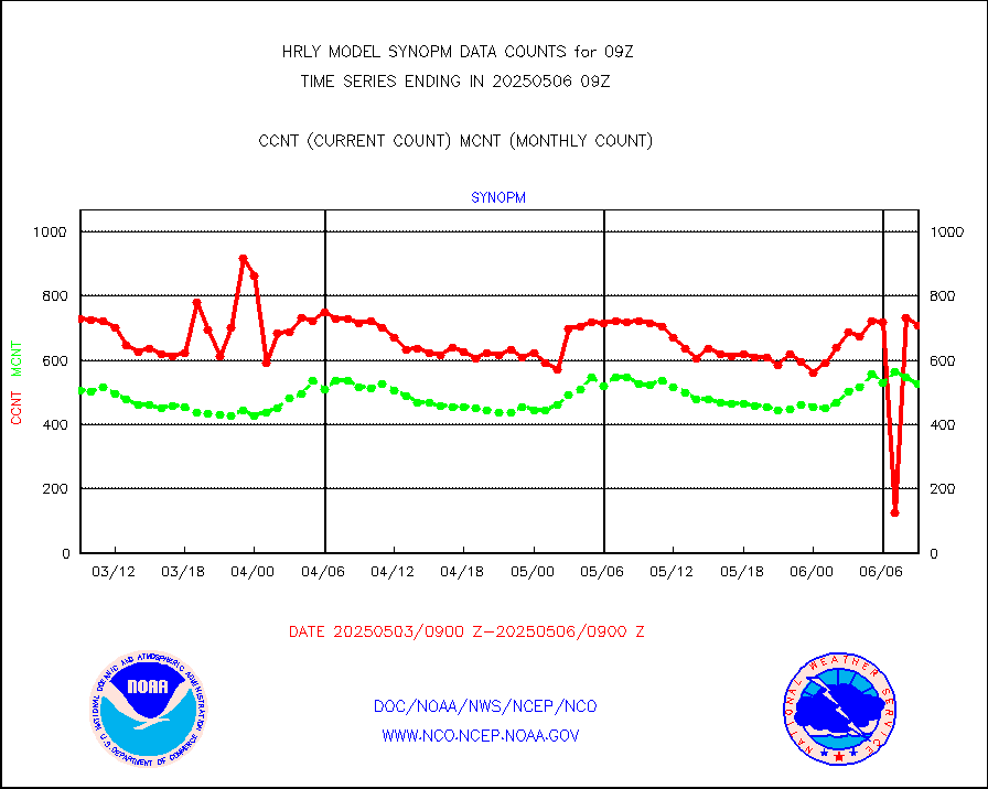
synopm |
Synoptic - mobile manual and automatic |
544 |
465 |
117.0 % |
0808.50-0809.49 |
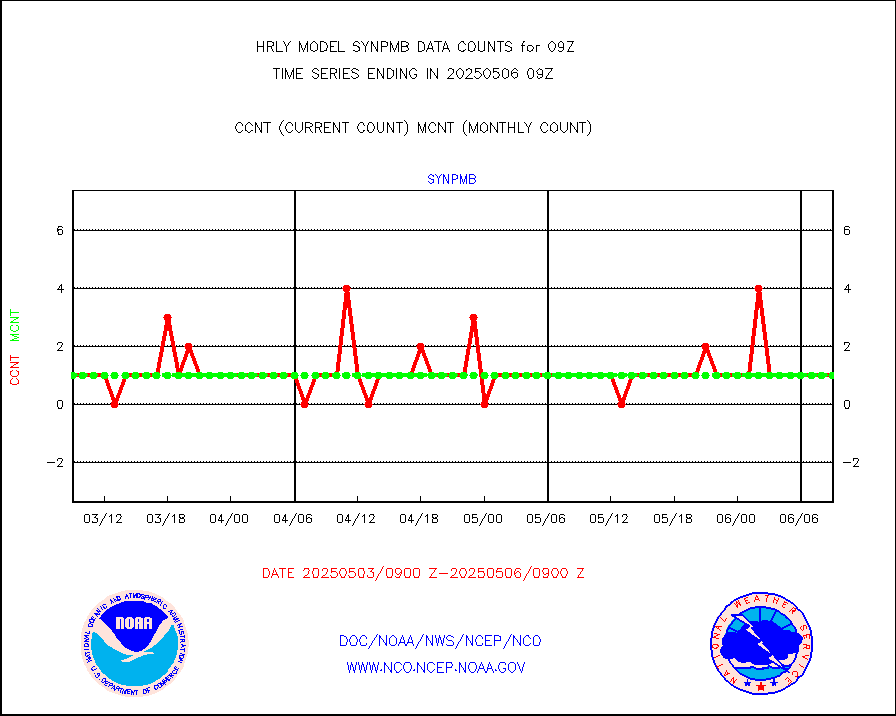
synpmb |
Synoptic - mobile manual & auto (decoded fr BUFR) |
1 |
1 |
100.0 % |
0808.50-0809.49 |
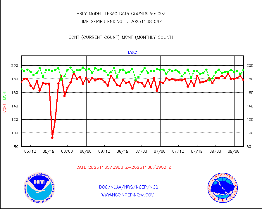
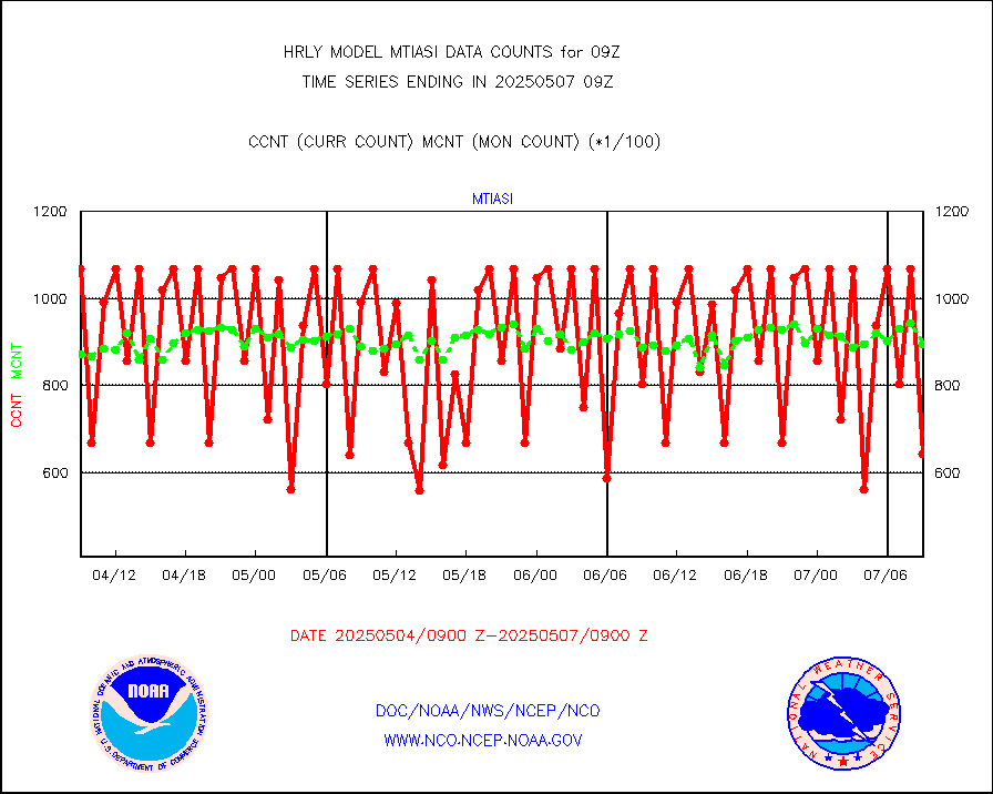
tesac |
CTD probe, Argo prflng float, mooring (TESAC fmt) |
210 |
184 |
114.1 % |
0808.50-0809.49 |
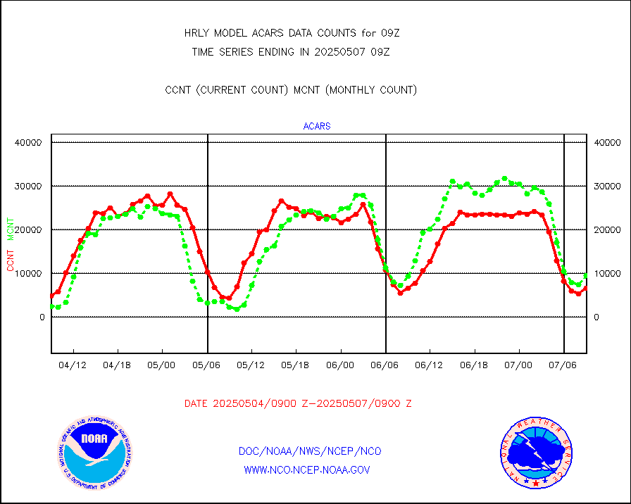
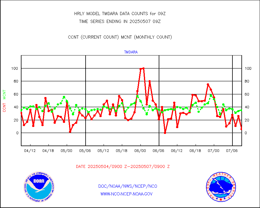
tmdara |
TAMDAR aircft data-all types(from Panasonic,BUFR) |
356 |
370 |
96.2 % |
0808.50-0809.49 |
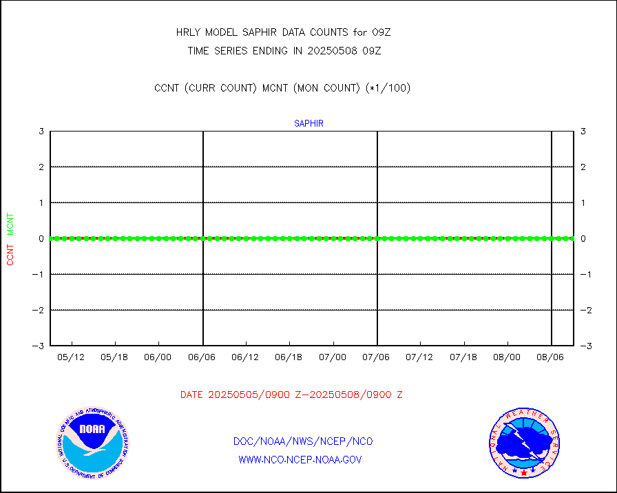
trkob |
ThermoSalinoGraph (TSG) TRACKOB format) |
64 |
33 |
193.9 % |
0807.50-0808.49 |
visin |
INSAT/KALPANA India visible derived cloud motion |
0 |
0 |
n/a |
0806.50-0807.49 |
visin2 |
INDIA SATWIND, INSAT VIS channel |
2545 |
1105 |
230.3 % |
0808.00-0808.99 |
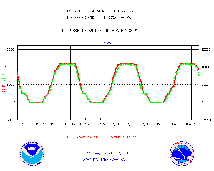
visja |
MTSAT/JMA visible derived cloud motion |
5738 |
7066 |
81.2 % |
0806.50-0807.49 |
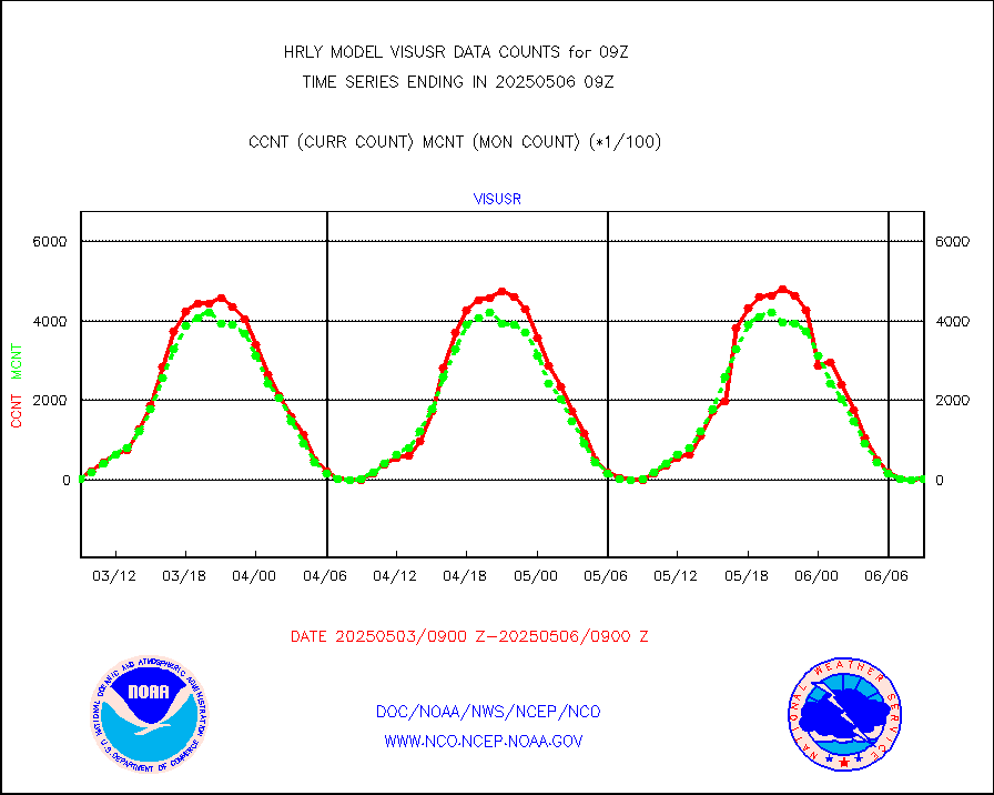
visusr |
GOES-16&up/NESDIS visible derived cloud motion |
3118 |
2819 |
110.6 % |
0808.00-0808.99 |
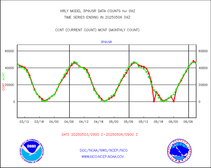
vseunb |
METEOSAT/EUMETSAT visible drv cld motion NBseq |
33878 |
32128 |
105.4 % |
0807.50-0808.49 |


