| Critical Data with Normal Counts |
|---|
| Type | Description | Hourly Count | Monthly Average | Percent (%) of Monthly Mean | UTC Time Window |
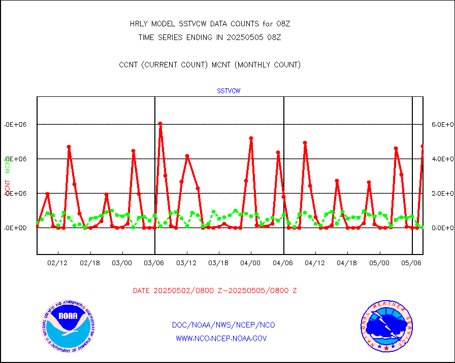
1bamua |
NOAA 15-19 & METOP 1-2 AMSU-A NCEP-proc. br.temps |
43805 |
52634 |
83.2 % |
2006.00-2006.99 |
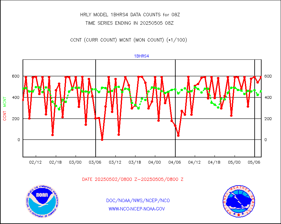
1bhrs4 |
NOAA 18-19 & METOP 1-2 HIRS-4 NCEP-proc. br.temps |
26676 |
46398 |
57.5 % |
2006.00-2006.99 |
1bmhs |
NOAA 18-19 & METOP 1-2 MHS NCEP-proces. br. temps |
308117 |
304420 |
101.2 % |
2006.00-2006.99 |
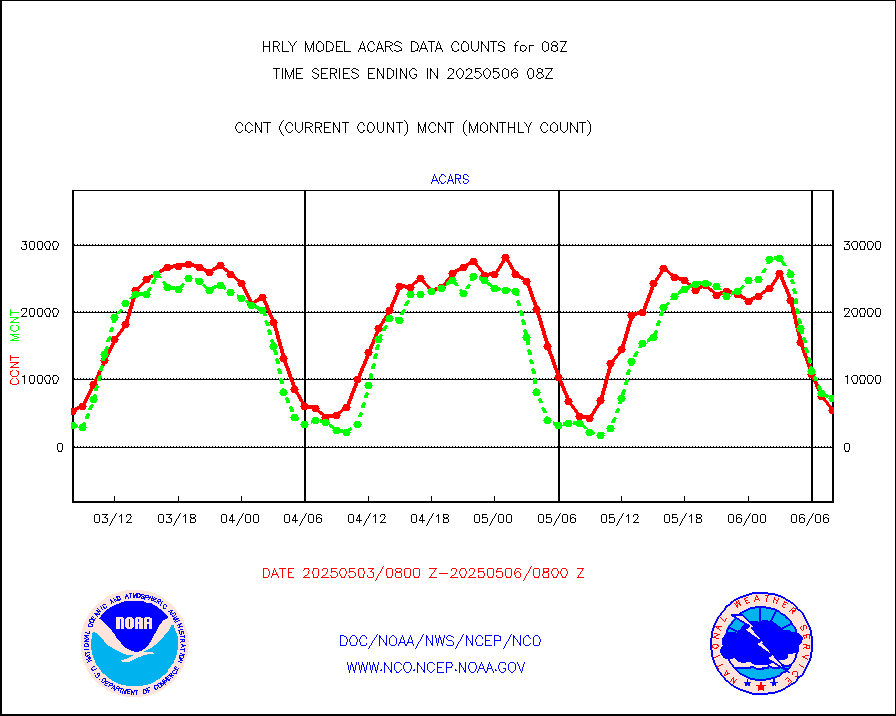
acars |
MDCRS ACARS acft data from ARINC(dcded from BUFR) |
2652 |
2353 |
112.7 % |
2007.50-2008.49 |
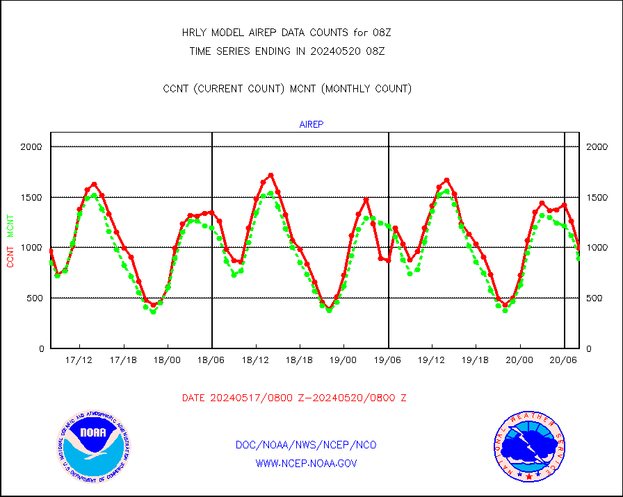
airep |
Manual AIREP aircraft data (dcded from AIREP fmt) |
996 |
891 |
111.8 % |
2007.50-2008.49 |
airsev |
AQUA AIRS/AMSU-A/HSB brightness temps- every FOV |
0 |
0 |
n/a |
2005.50-2006.49 |
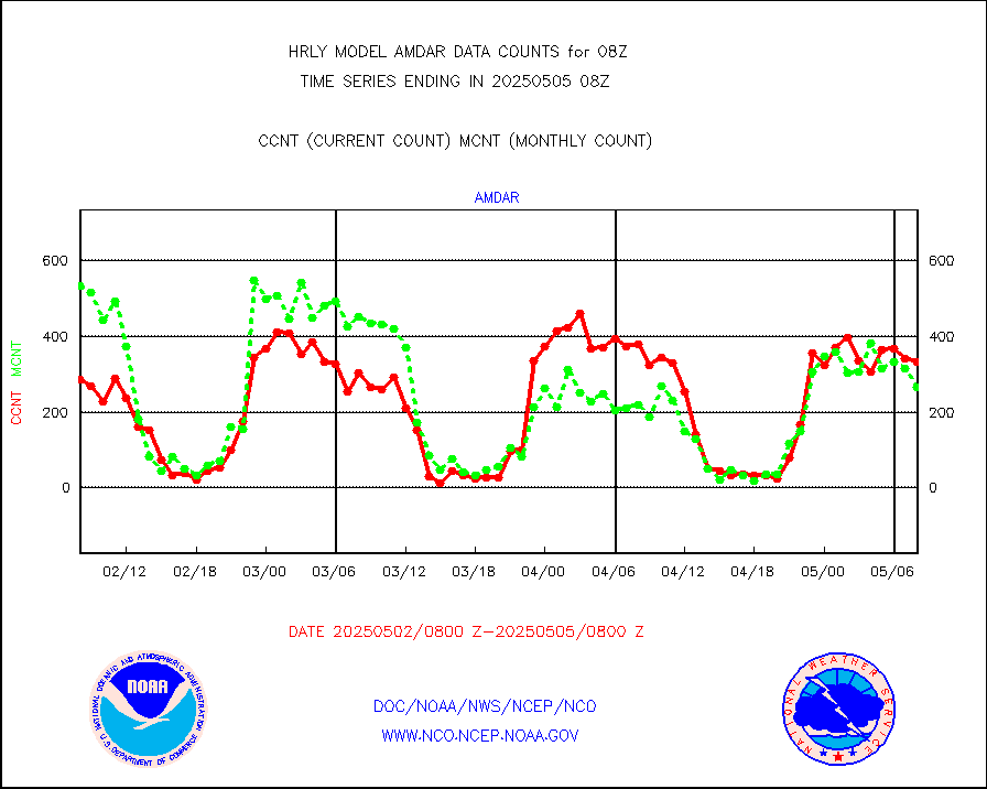
amdar |
AMDAR aircraft data (decoded from AMDAR format) |
217 |
240 |
90.4 % |
2007.50-2008.49 |
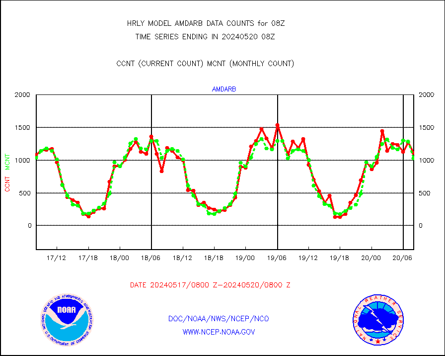
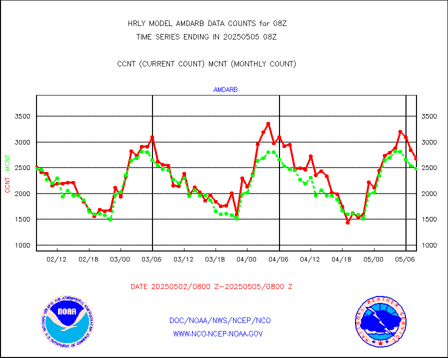
amdarb |
AMDAR aircraft data (decoded from BUFR) |
1114 |
1026 |
108.6 % |
2007.50-2008.49 |
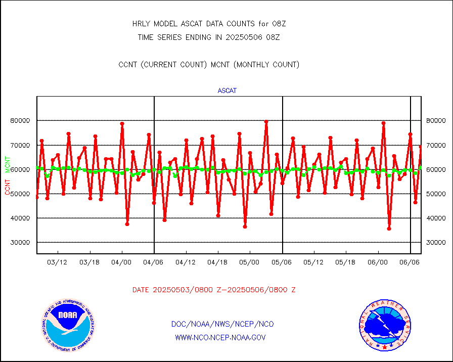
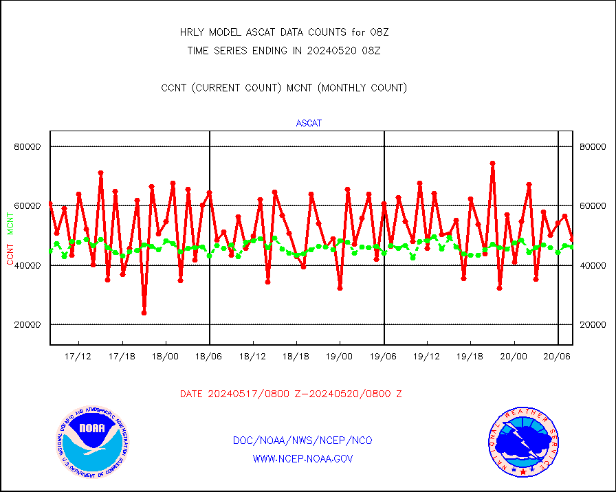
ascat |
METOP 1-2 ASCAT products |
48636 |
46088 |
105.5 % |
2006.50-2007.49 |
atms |
NPP/NOAA-20 ATMS brightness temperatures |
299136 |
348058 |
85.9 % |
2006.50-2007.49 |
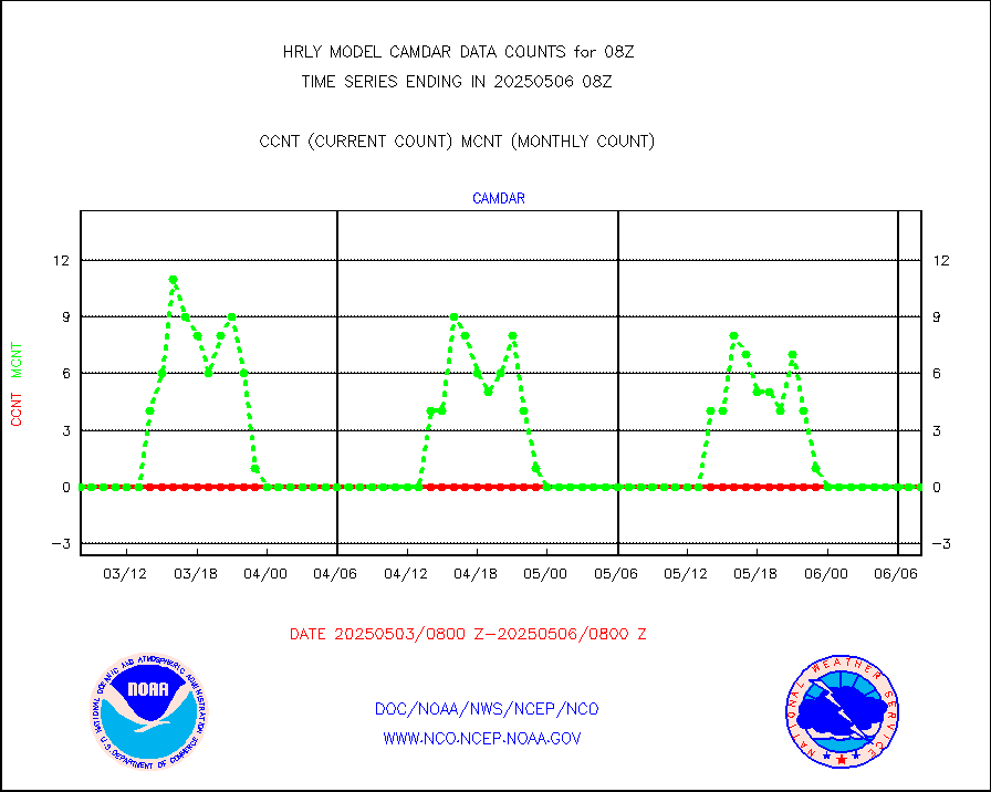
camdar |
Canadian AMDAR aircraft data (decoded from BUFR) |
0 |
0 |
n/a |
2007.50-2008.49 |
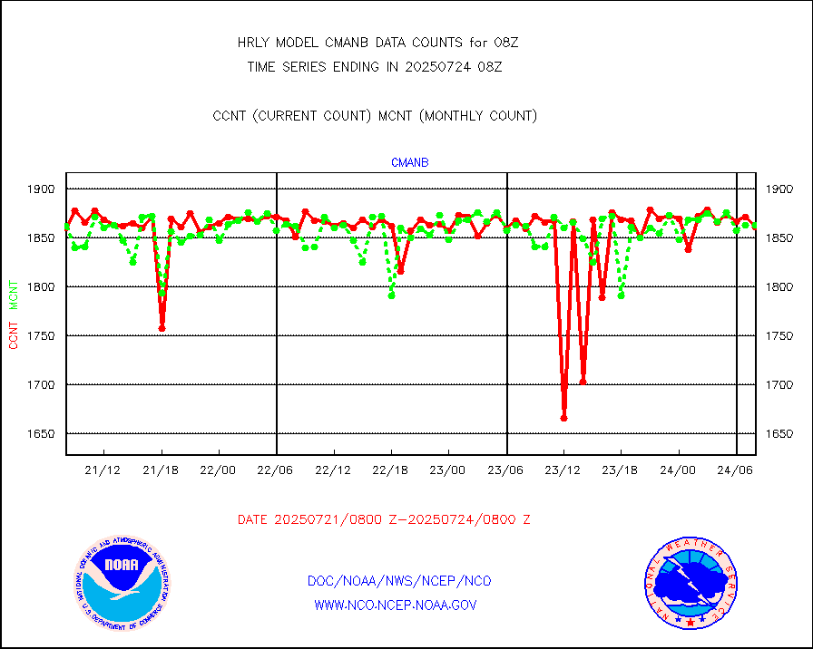
cmanb |
Surface Marine CMAN rpts decoded from BUFR format |
1838 |
1812 |
101.4 % |
2007.50-2008.50 |
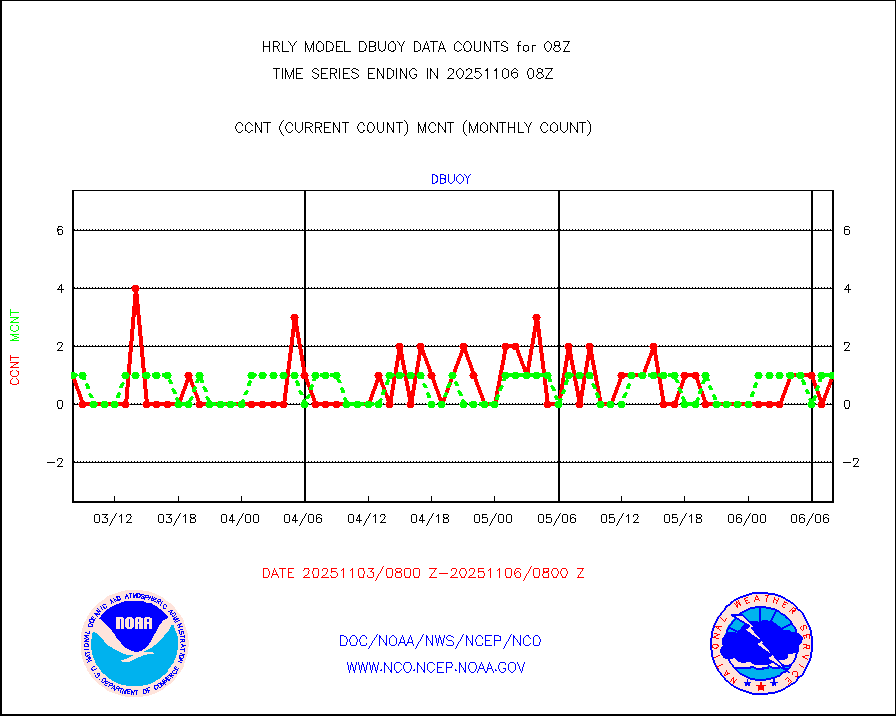
dbuoy |
Buoys decoded from FM-18 fmt (moored or drifting) |
39 |
39 |
100.0 % |
2007.50-2008.49 |
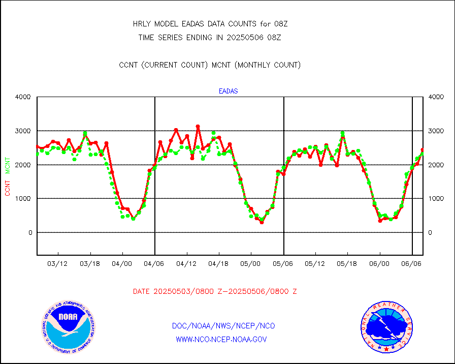
eadas |
E-AMDAR (European AMDAR acft decoded from BUFR) |
1583 |
1889 |
83.8 % |
2007.50-2008.49 |
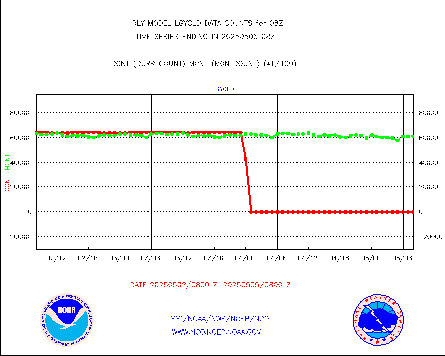
esamua |
NOAA 15-19 & METOP 1-2 AMSU-A proc btmps frm RARS |
17960 |
16220 |
110.7 % |
2007.50-2008.49 |
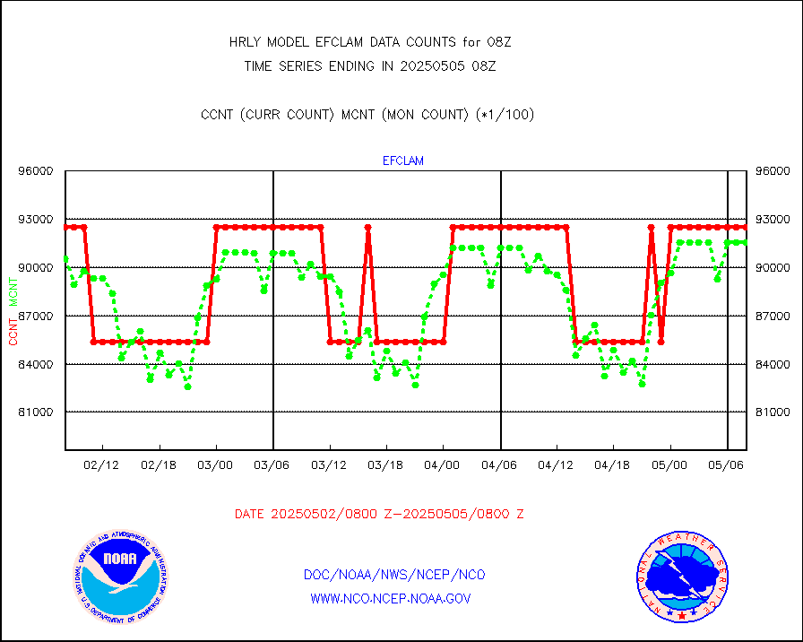
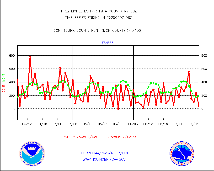
eshrs3 |
NOAA 15-19 & METOP 1-2 HIRS-3/4 pr btmps frm RARS |
44312 |
36117 |
122.7 % |
2007.50-2008.49 |
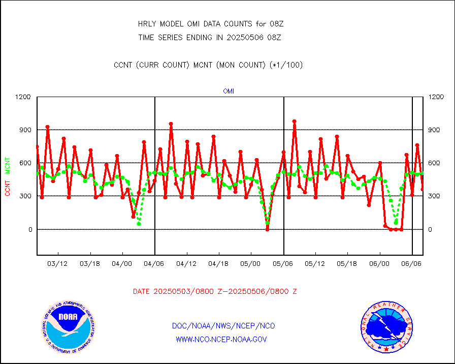
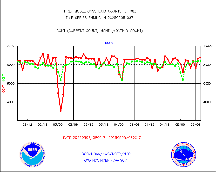
gnss |
Grnd-based Gbl Navigation Sat System (GNSS) data |
9289 |
9036 |
102.8 % |
2007.00-2007.99 |
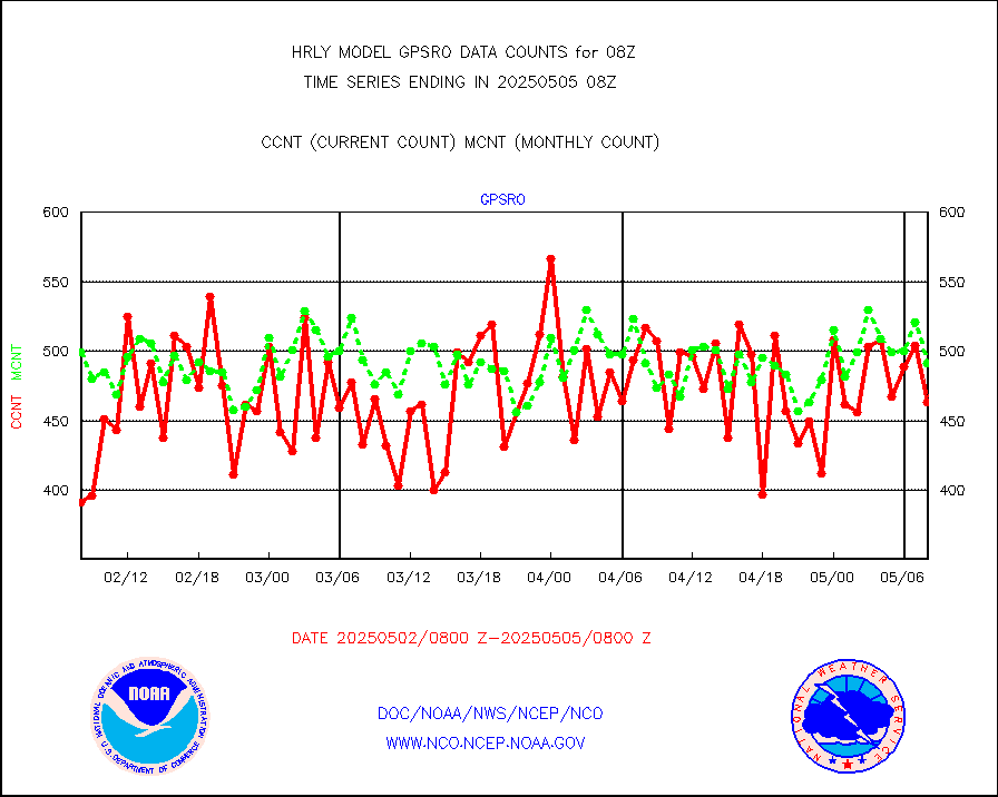
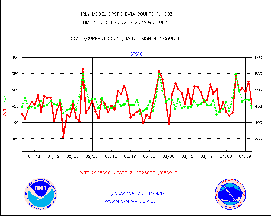
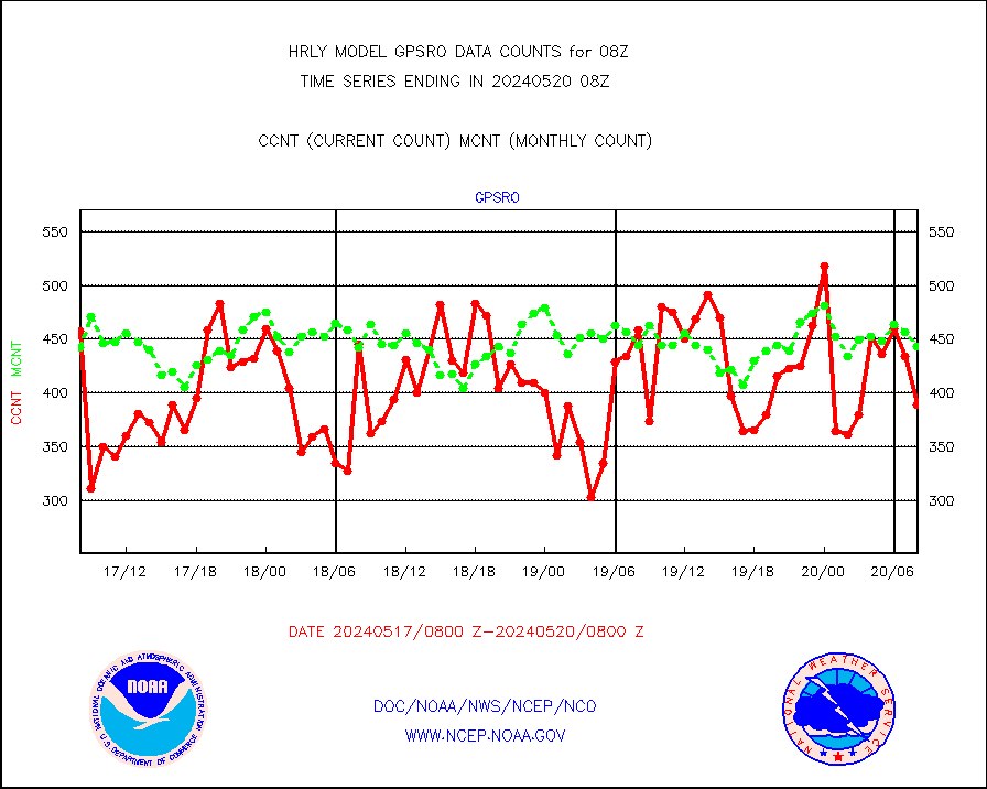
gpsro |
GPS radio occultation data |
389 |
443 |
87.8 % |
2005.50-2006.49 |
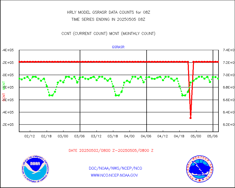
gsrasr |
GOES-16/17 All Sky Radiances (proc.) |
360476 |
360476 |
100.0 % |
2007.50-2008.49 |
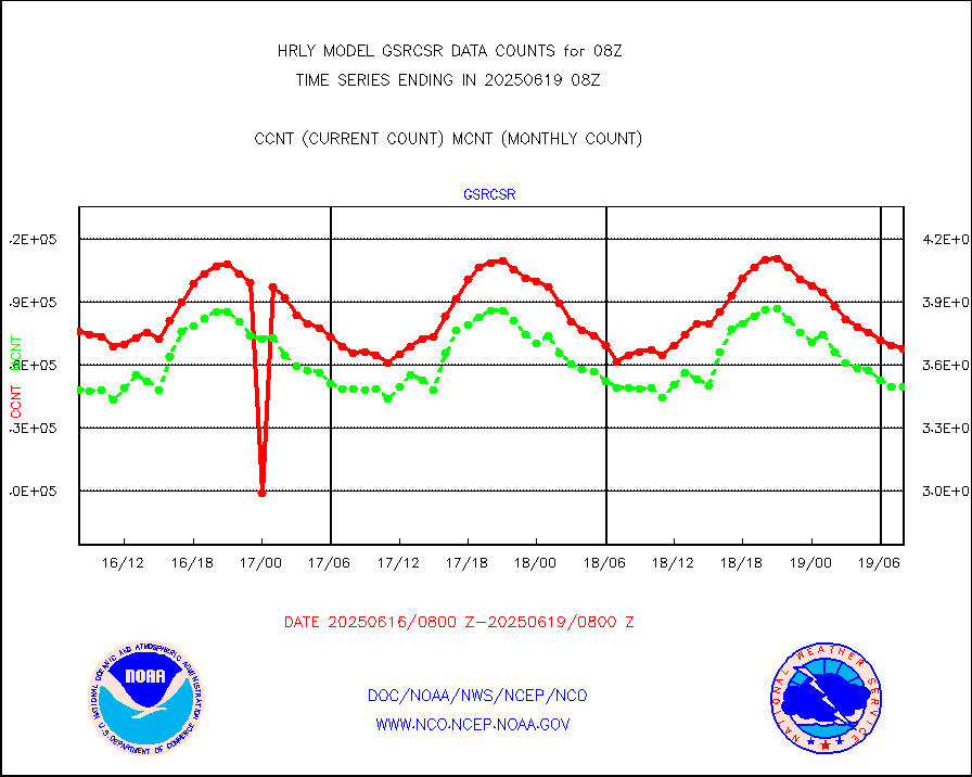
gsrcsr |
GOES-16/17 Clear Sky Radiances (proc.) |
153829 |
165264 |
93.1 % |
2007.50-2008.49 |
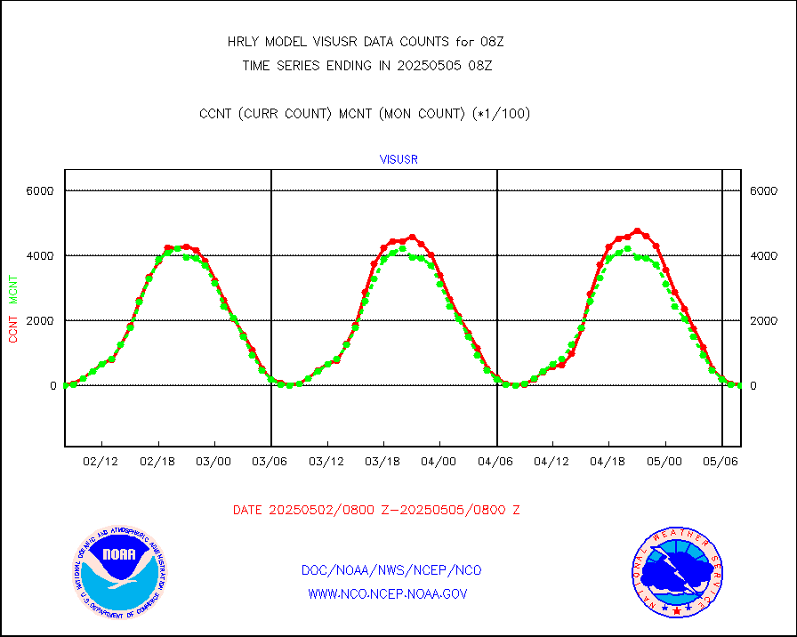
h20ja |
MTSAT/JMA water vapor imager derived cloud motion |
20749 |
19525 |
106.3 % |
2005.50-2006.49 |
h20mo |
MODIS (AQUA/TERRA) wvpr imager derived cld motion |
0 |
0 |
n/a |
2004.00-2004.99 |
h2tusr |
GOES-16&up/NESDIS wv imgr/cld-top derived cld mtn |
25614 |
25799 |
99.3 % |
2007.00-2007.99 |
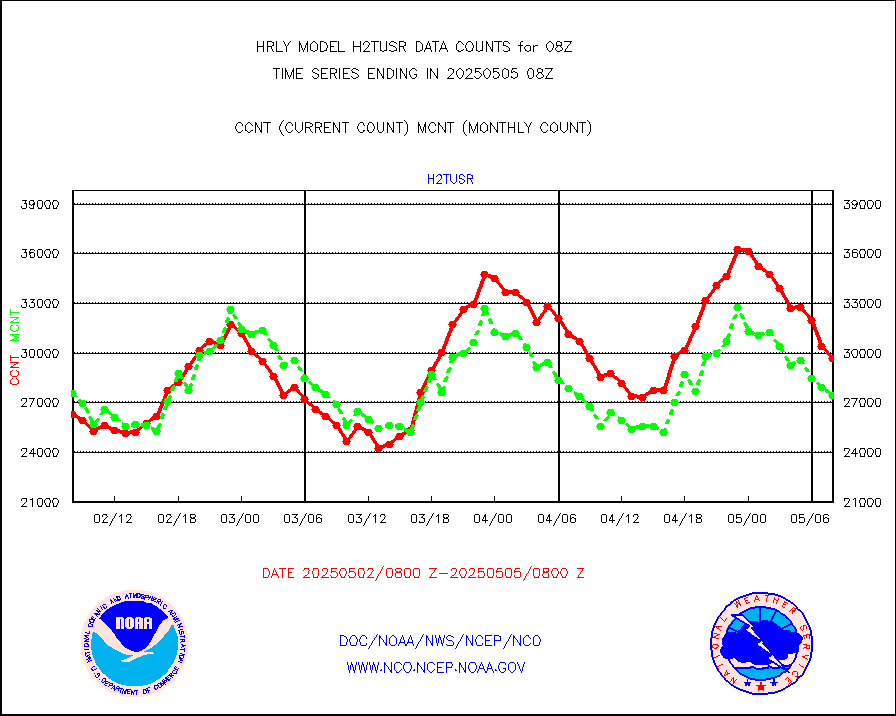
ifeunb |
METEOSAT/EUMETSAT ir lg-wave drv cld motion NBseq |
20916 |
21276 |
98.3 % |
2006.50-2007.49 |
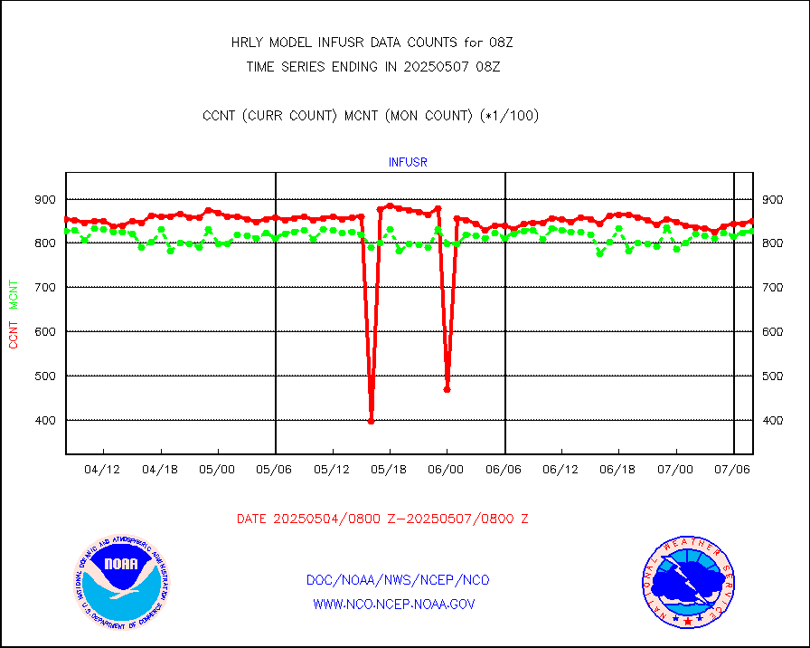
infja |
MTSAT/JMA infrared long-wave derived cloud motion |
16800 |
16241 |
103.4 % |
2005.50-2006.49 |
infmo |
MODIS (AQUA/TERRA) ir l-wave derived cloud motion |
0 |
0 |
n/a |
2004.00-2004.99 |
infusr |
GOES-16&up/NESDIS ir long-wave derived cld motion |
75735 |
80231 |
94.4 % |
2007.00-2007.99 |
lgycld |
GOES/NASA(Langley) hi-res. (1x1 f-o-v) cloud data |
4212383 |
3510480 |
120.0 % |
2007.50-2008.49 |
mbuoy |
Buoys decoded from FM-13 format (moored) |
119 |
111 |
107.2 % |
2007.50-2008.49 |
metar |
Aviation - METAR |
7844 |
7960 |
98.5 % |
2007.50-2008.49 |
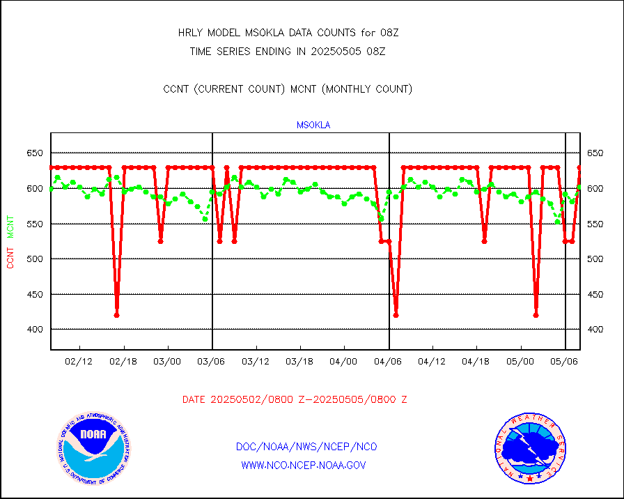
mso470 |
Mesonet/MADIS Colorado E-470 (Interstate 470) |
14 |
20 |
70.0 % |
2007.50-2008.49 |
msoalk |
Mesonet/MADIS Alaska Department of Transportation |
105 |
107 |
98.1 % |
2007.50-2008.49 |
msoapg |
Mesonet/MADIS U.S. Army Aberdeen Proving Grounds |
0 |
0 |
n/a |
2007.50-2008.49 |
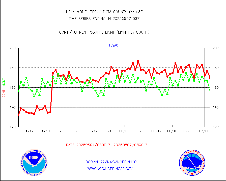
msoapr |
Mesonet/MADIS Citizen Weather Observers Program |
43241 |
48032 |
90.0 % |
2007.50-2008.49 |
msoaws |
Mesonet/MADIS AWS Convergence Technologies, Inc. |
24290 |
25513 |
95.2 % |
2007.50-2008.49 |
msoawx |
Mesonet/MADIS "Anything Weather" |
0 |
0 |
n/a |
2007.50-2008.49 |
msocol |
Mesonet/MADIS Colorado Dept. of Transportation |
0 |
0 |
n/a |
2007.50-2008.49 |
msodcn |
Mesonet/MADIS DC Net |
0 |
0 |
n/a |
2007.50-2008.49 |
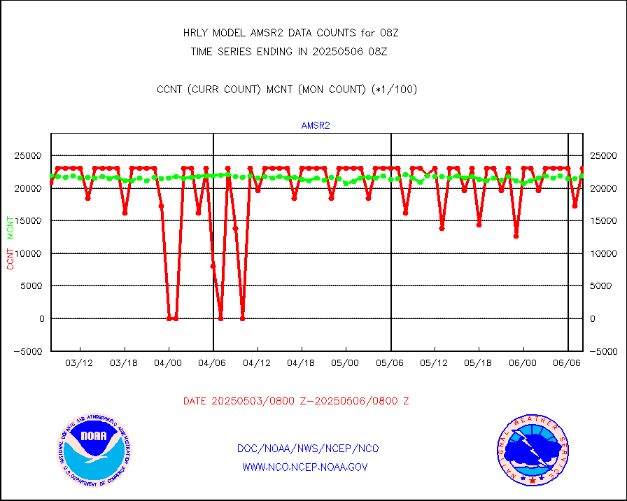
msoden |
Mesonet/MADIS Denver Urban Drainage & Flood Cntrl |
250 |
247 |
101.2 % |
2007.50-2008.49 |
msofla |
Mesonet/MADIS Florida (FAWN & USF) |
4 |
4 |
100.0 % |
2007.50-2008.49 |
msoflt |
Mesonet/MADIS Florida Dept. of Transportation |
0 |
0 |
n/a |
2007.50-2008.49 |
msogeo |
Mesonet/MADIS Georgia Dept. of Transportation |
0 |
0 |
n/a |
2007.50-2008.49 |
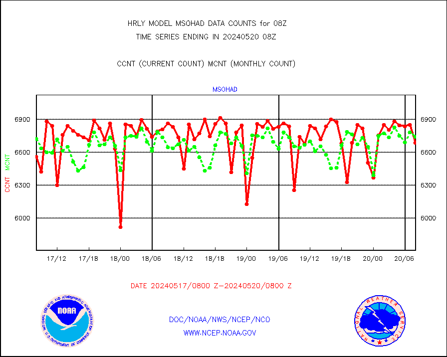
msohad |
Mesonet/MADIS NWS Hydromet Auto Data System(HADS) |
6687 |
6740 |
99.2 % |
2007.50-2008.49 |
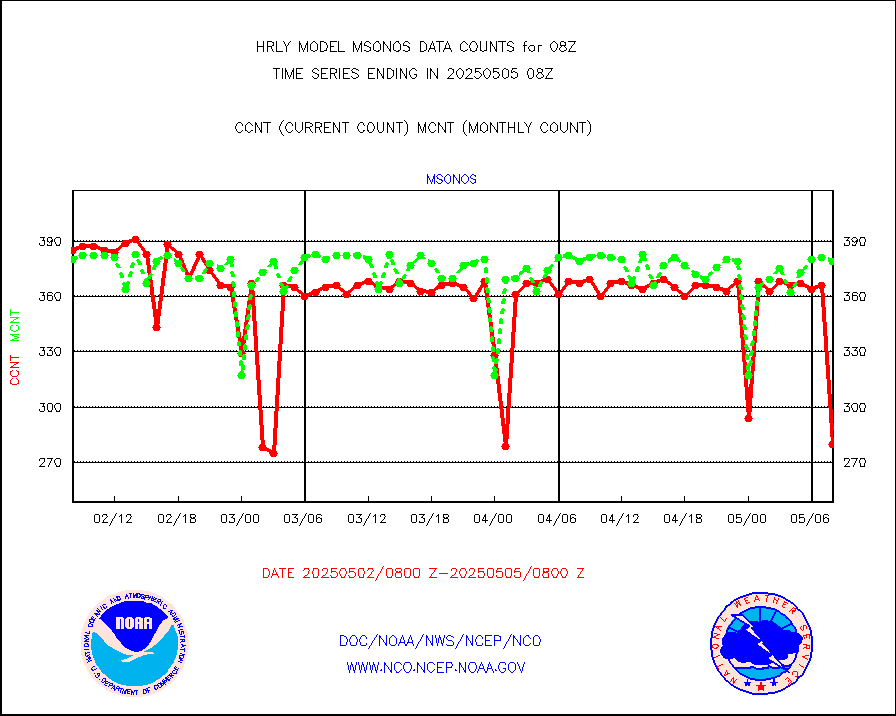
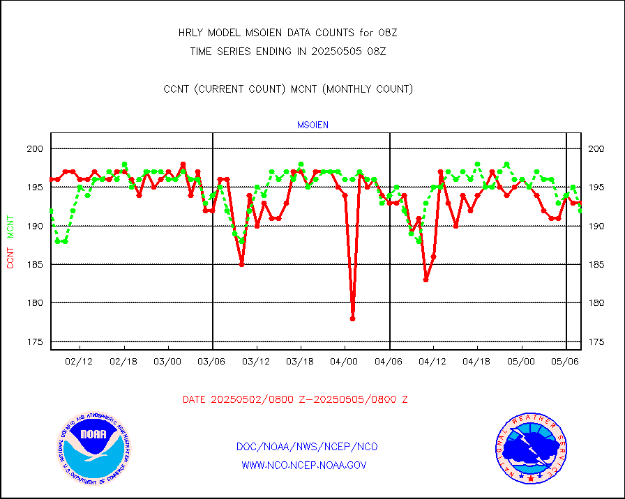
msoien |
Mesonet/MADIS Iowa Environmental |
178 |
184 |
96.7 % |
2007.50-2008.49 |
msoind |
Mesonet/MADIS Indiana Dept. of Transportation |
0 |
0 |
n/a |
2007.50-2008.49 |
msoiow |
Mesonet/MADIS Iowa Department of Transportation |
0 |
0 |
n/a |
2007.50-2008.49 |
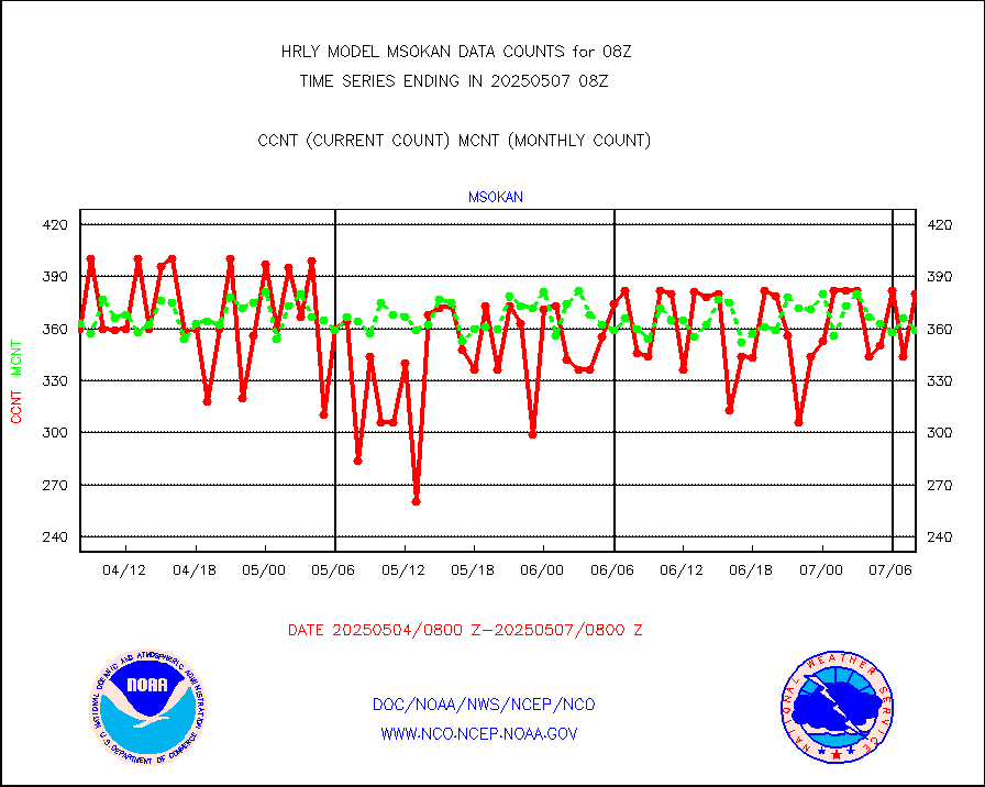
msokan |
Mesonet/MADIS Kansas Department of Transportation |
332 |
349 |
95.1 % |
2007.50-2008.49 |
msokla |
Mesonet/MADIS Oklahoma Mesonet |
318 |
318 |
100.0 % |
2007.50-2008.49 |
msolju |
Mesonet/MADIS Louisiana State/Jackson State Univ. |
0 |
0 |
n/a |
2007.50-2008.49 |
msomca |
Mesonet/MADIS Missouri Commercial Agricult Wx Net |
298 |
295 |
101.0 % |
2007.50-2008.49 |
msomin |
Mesonet/MADIS Minnesota Dept. of Transportation |
0 |
0 |
n/a |
2007.50-2008.49 |
msonos |
Mesonet/MADIS NOS-Phys Oceanographic Realtime Sys |
386 |
384 |
100.5 % |
2007.50-2008.49 |
msoraw |
Mesonet/MADIS NFIC Remote Automated Wx Stns(RAWS) |
1915 |
1836 |
104.3 % |
2007.50-2008.49 |
msovir |
Mesonet/MADIS Virginia Dept. of Transportation |
129 |
224 |
57.6 % |
2007.50-2008.49 |
msowfy |
Mesonet/MADIS "Weather for You" |
0 |
0 |
n/a |
2007.50-2008.49 |
msowis |
Mesonet/MADIS Wisconsin Dept. of Transportation |
0 |
0 |
n/a |
2007.50-2008.49 |
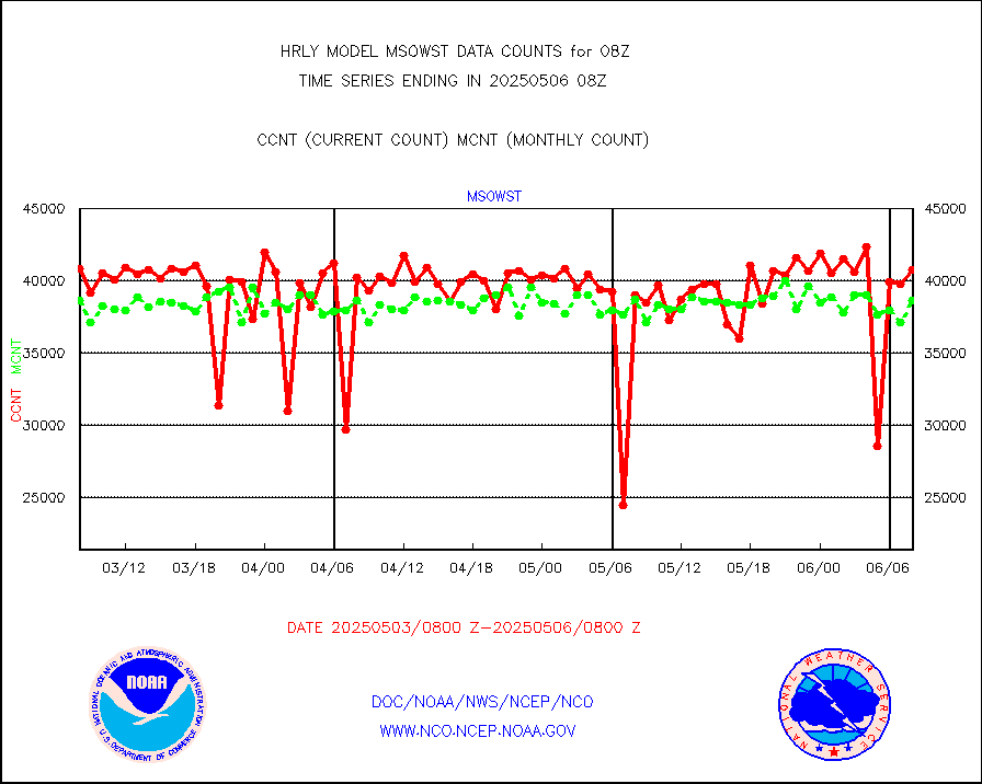
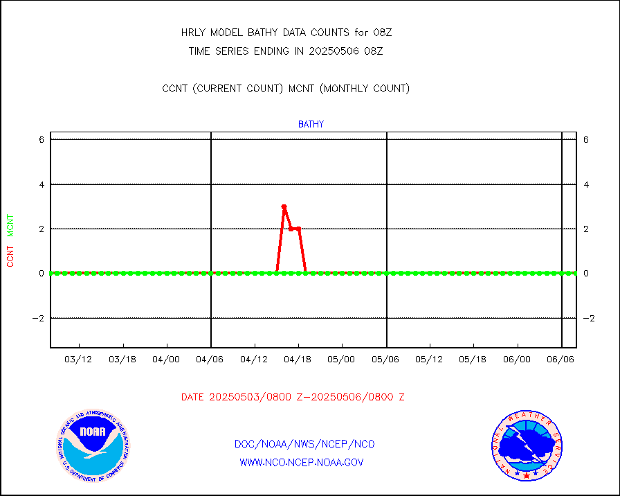
msowst |
Mesonet/MADIS MesoWest (many subproviders) |
46471 |
46003 |
101.0 % |
2007.50-2008.49 |
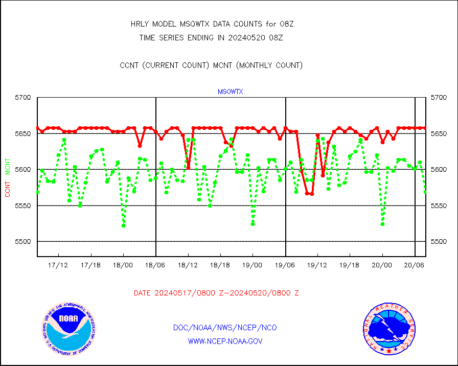
msowtx |
Mesonet/MADIS West Texas |
5658 |
5569 |
101.6 % |
2007.50-2008.49 |
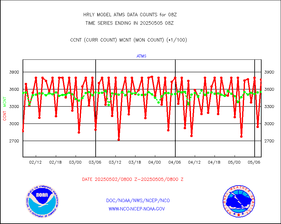
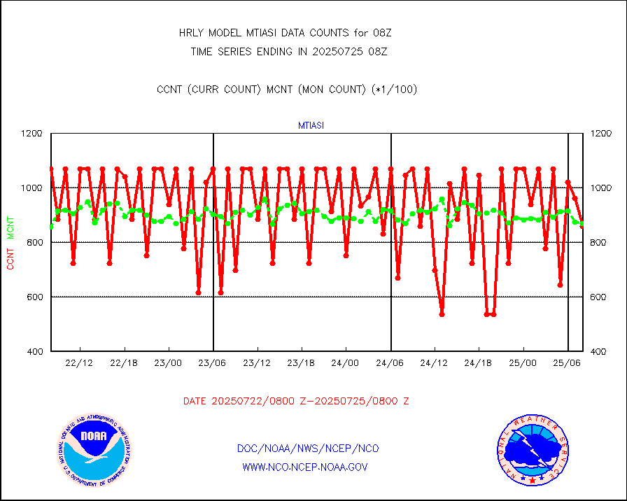
mtiasi |
METOP 1-2 IASI 1C radiance data (varbl. channels) |
99252 |
79664 |
124.6 % |
2006.00-2006.99 |
nxrdw |
NEXRAD Vel Azm Dsp(VAD) winds via radar coded msg |
0 |
0 |
n/a |
2007.50-2008.49 |
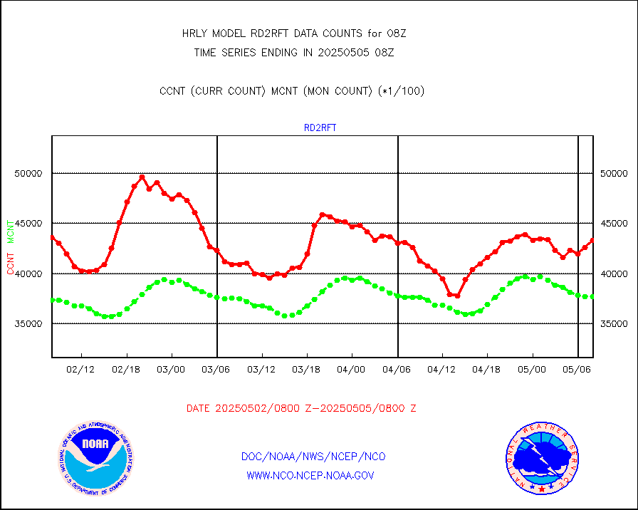
omi |
Aura Ozone Monitoring Instrument (OMI) data |
98640 |
39956 |
246.9 % |
2005.50-2006.49 |
osbuv8 |
NOAA 16-19 Solar Backscatter UV-2 rad frm V8 BUFR |
0 |
0 |
n/a |
2006.00-2006.99 |
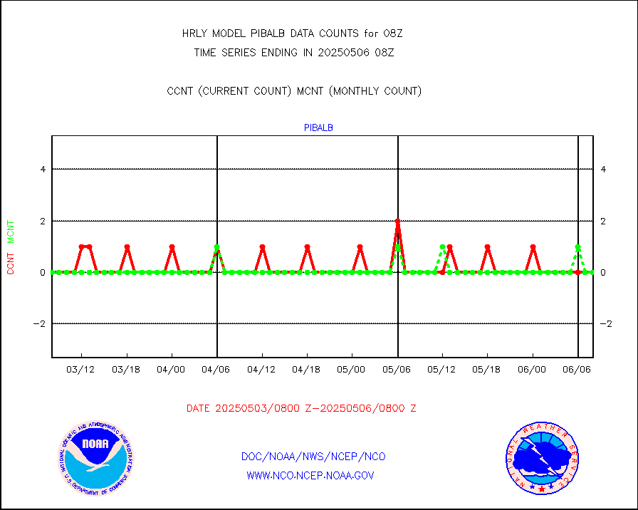
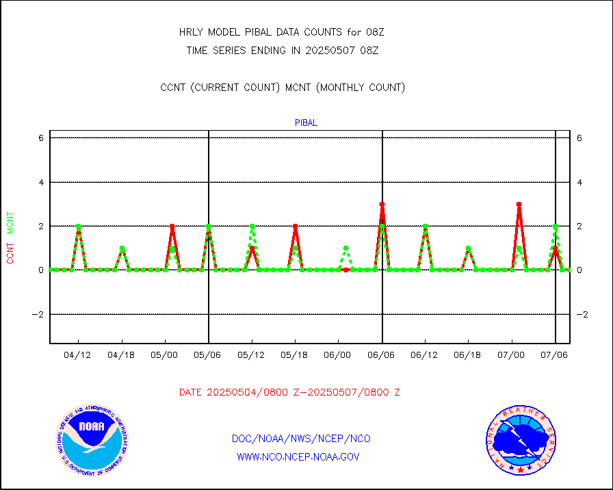
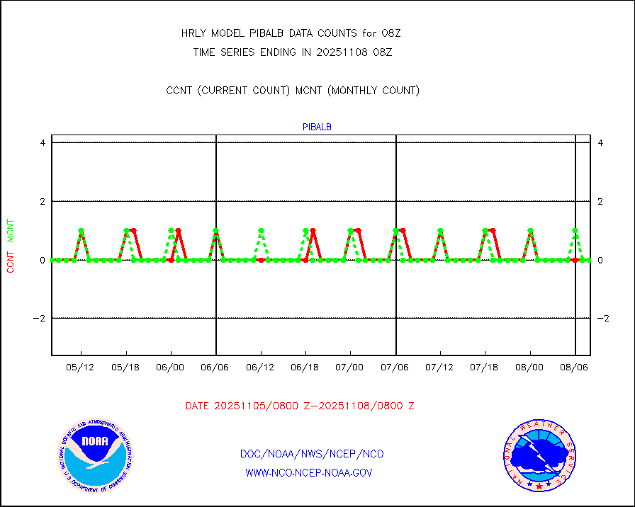
pibal |
PIBAL (from PILOT, PILOT SHIP, PILOT MOBIL) |
0 |
0 |
n/a |
2007.50-2008.49 |
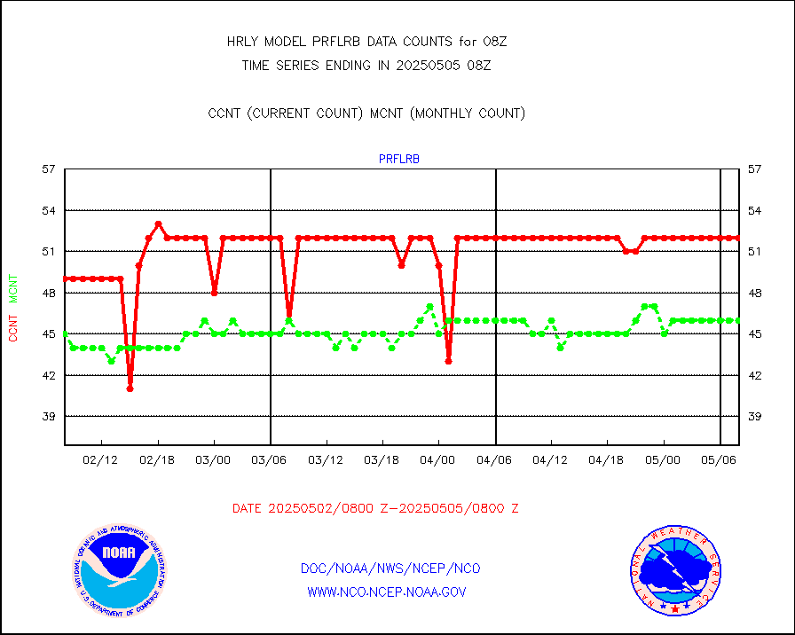
prflrb |
Multi-Agency Profiler (MAP) and SODAR winds |
35 |
41 |
85.4 % |
2007.50-2008.49 |
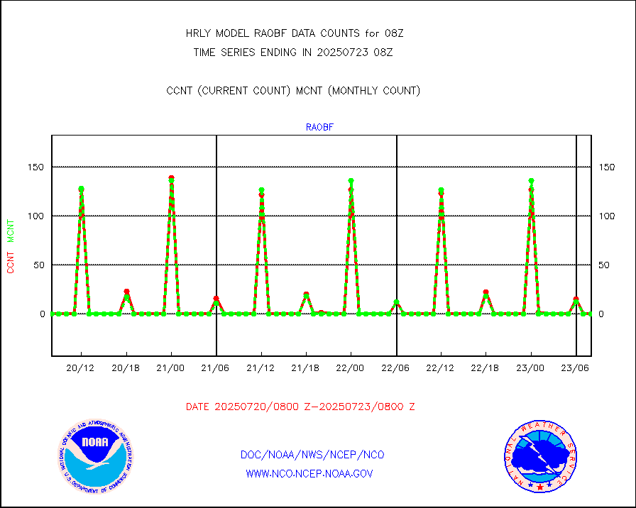
raobf |
Rawinsonde - fixed land (from TEMP or PILOT) |
0 |
0 |
n/a |
2007.50-2008.49 |
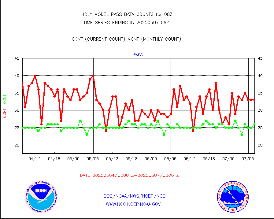
rass |
RASS temperatures (NOAA and Multi-Agency) |
23 |
25 |
92.0 % |
2007.50-2008.49 |
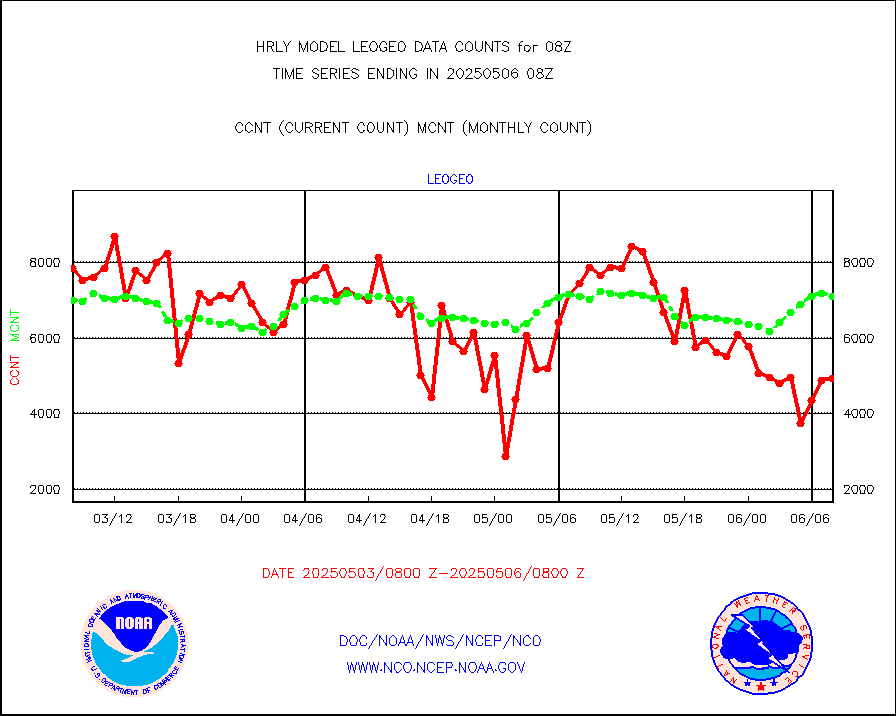
rd2rft |
NEXRAD reflectivity (Lvl 2 - GTS) |
3827394 |
3932147 |
97.3 % |
2007.50-2008.49 |
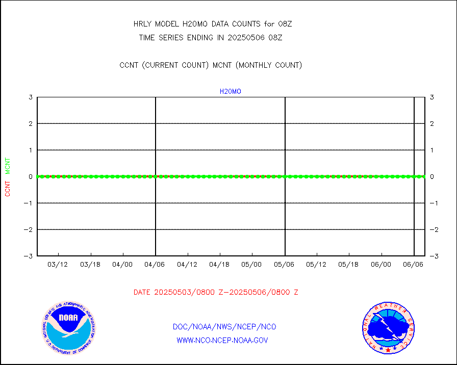
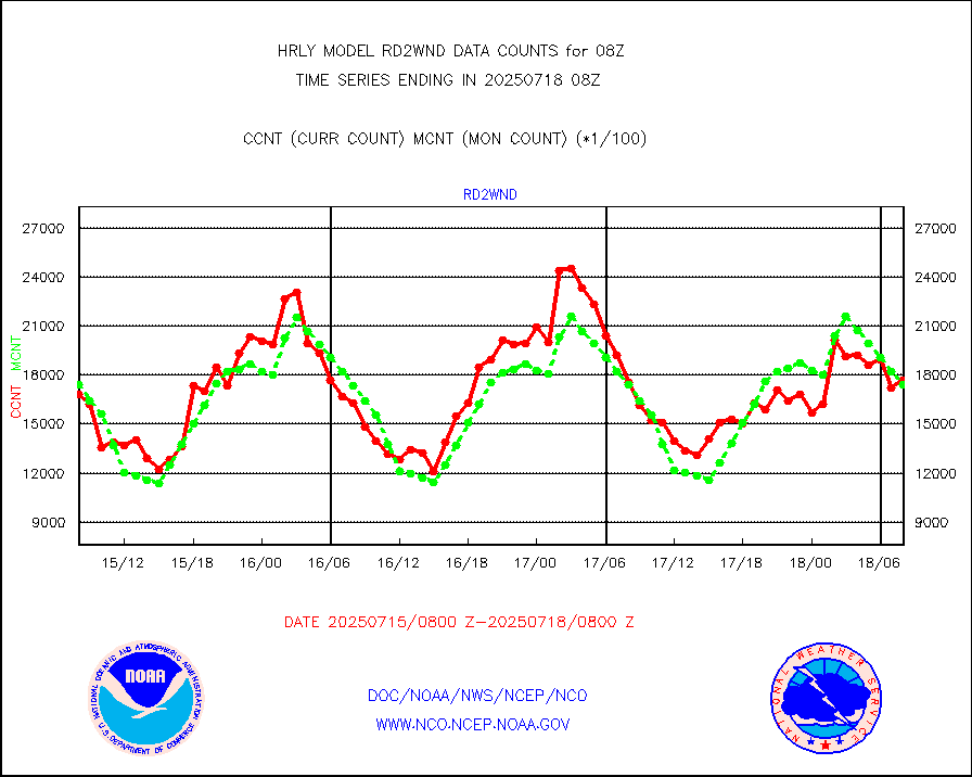
rd2wnd |
NEXRAD radial wind (Level 2 - GTS) |
1479207 |
1338813 |
110.5 % |
2007.50-2008.49 |
sevcsr |
METEOSAT-10 2nd Gen SEVIRI Clr Sky Radiance(proc) |
0 |
0 |
n/a |
2007.50-2008.49 |
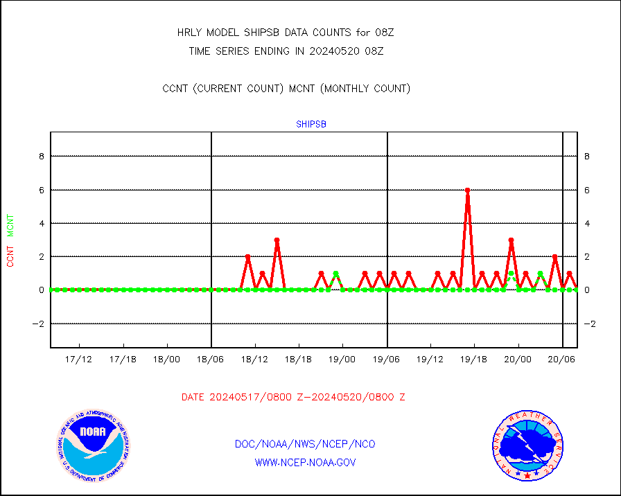
shipsb |
Ship - manual and automatic, restricted (BUFR) |
0 |
0 |
n/a |
2007.50-2008.50 |
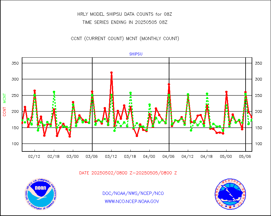
shipsu |
Ship - manual and automatic, unrestricted |
122 |
119 |
102.5 % |
2007.50-2008.50 |
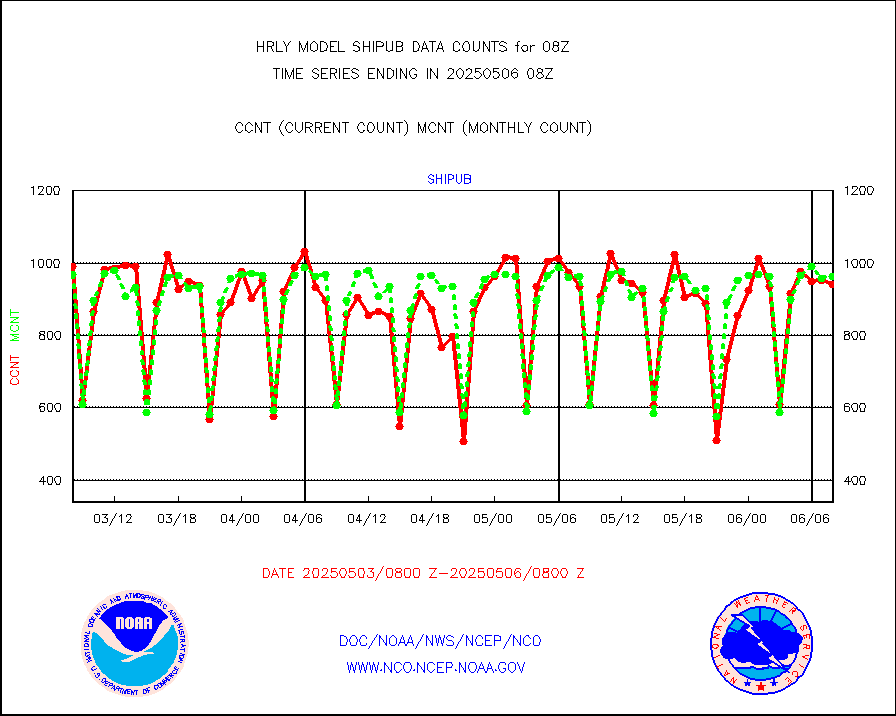
shipub |
Ship - manual and automatic, unrestricted (BUFR) |
785 |
845 |
92.9 % |
2007.50-2008.50 |
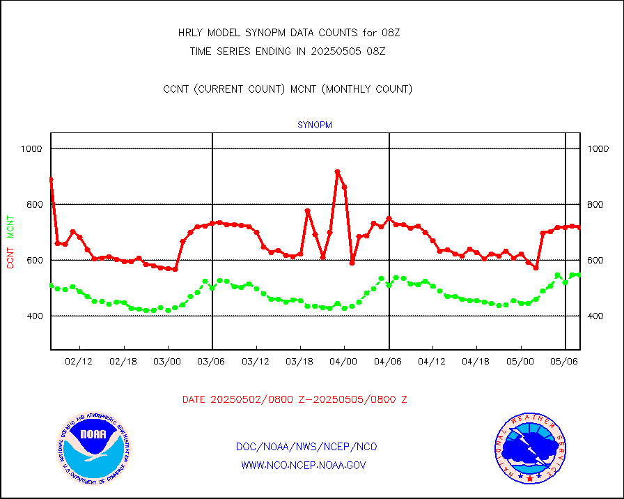
synop |
Synoptic - fixed manual and automatic |
941 |
885 |
106.3 % |
2007.50-2008.49 |
synopb |
Synoptic - fixed manual & auto (decoded fr BUFR) |
4151 |
4170 |
99.5 % |
2007.50-2008.49 |
synopr |
Synoptic - restricted (WMO Res 40) manual & auto. |
0 |
0 |
n/a |
2007.50-2008.49 |
synpbr |
Synoptic - restricted (WMO Res 40)(decoded BUFR) |
404 |
398 |
101.5 % |
2007.50-2008.49 |
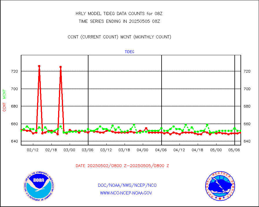
tideg |
Tide gauge reports decoded from CREX format |
648 |
642 |
100.9 % |
2007.00-2007.99 |
| Data Types of Opportunity with Normal Counts |
|---|
| Type | Description | Hourly Count | Monthly Average | Percent (%) of Monthly Mean | UTC Time Window |
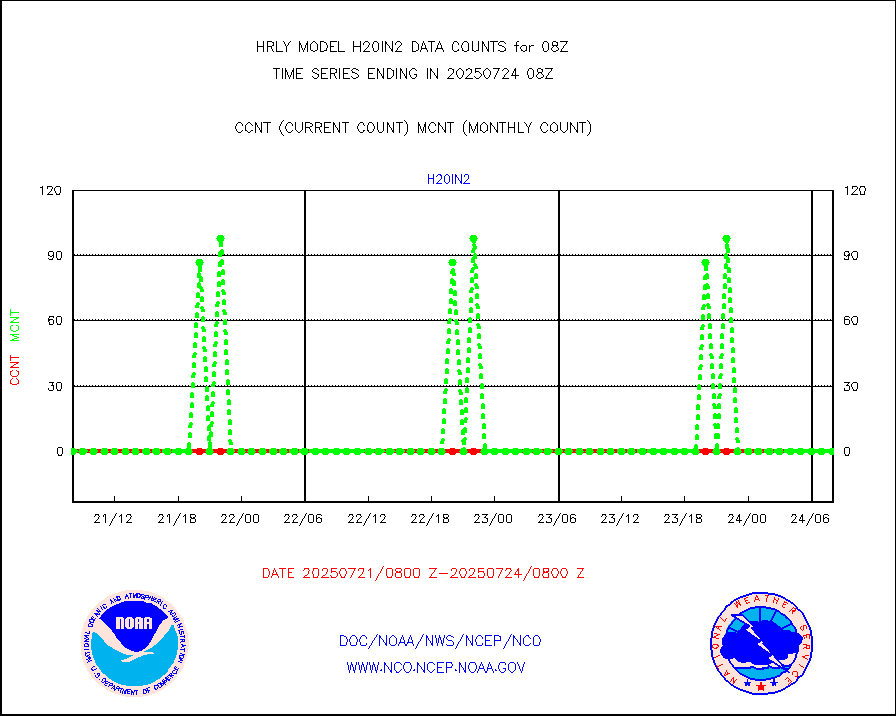
3p9usr |
GOES-16&up/NESDIS ir short-wv derived cld motion |
39525 |
45738 |
86.4 % |
2007.00-2007.99 |
acarsa |
MDCRS ACARS acft data (ARINC via AFWA)(AIREP fmt) |
0 |
0 |
n/a |
2007.50-2008.49 |
ahicsr |
Himawari Clear Sky Radiance |
0 |
0 |
n/a |
2007.00-2007.99 |
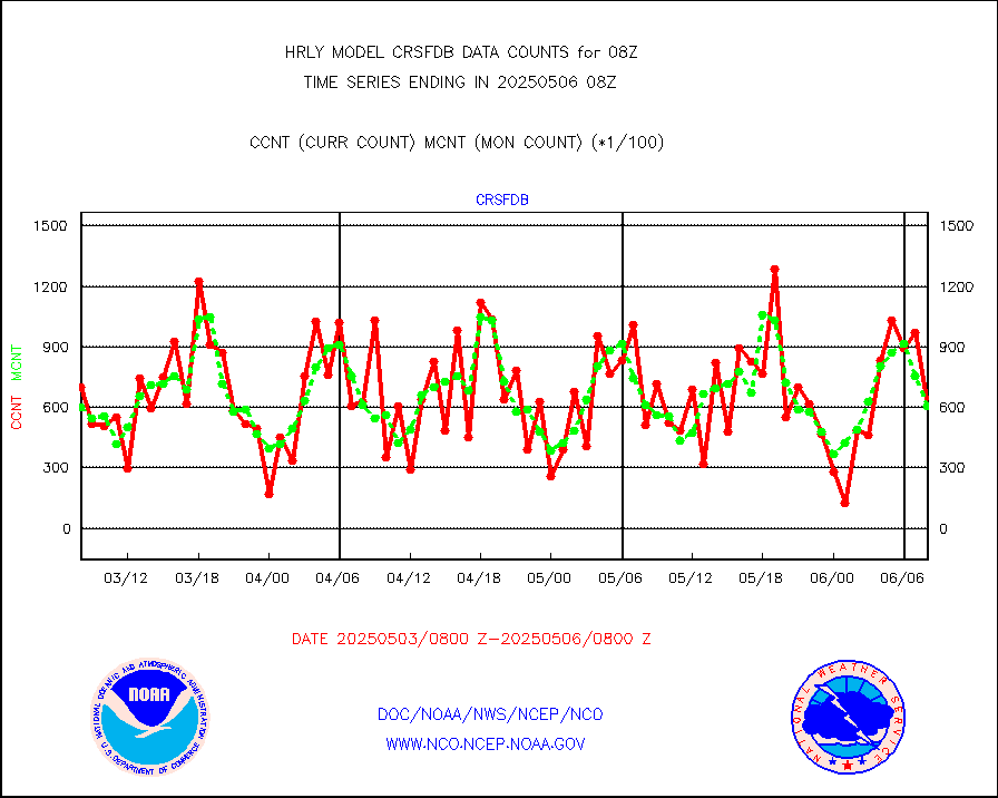
amsr2 |
GCOM-W AMSR2 1B brightness temperatures |
2309472 |
2171027 |
106.4 % |
2006.00-2006.99 |
atmsdb |
NPP/NOAA-20 ATMS bright. temps-direct b-cast SSEC |
111744 |
85162 |
131.2 % |
2006.50-2007.49 |
atovs |
POES/NESDIS - processed ATOVS soundings/radiances |
0 |
0 |
n/a |
2006.00-2006.99 |
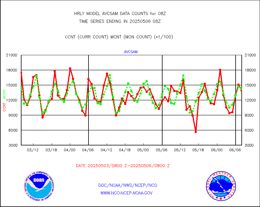
avcsam |
A.M.(N17,M2,M3) AVHRR GAC NCEP-proc clr&sea btmps |
1227413 |
1256661 |
97.7 % |
2005.50-2006.49 |
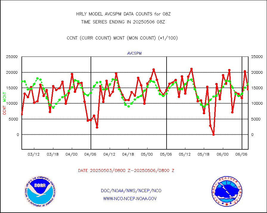
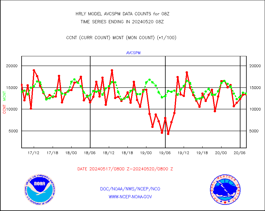
avcspm |
P.M.(N18-19) AVHRR GAC NCEP-proc clr & sea btemps |
1342649 |
1362892 |
98.5 % |
2005.50-2006.49 |
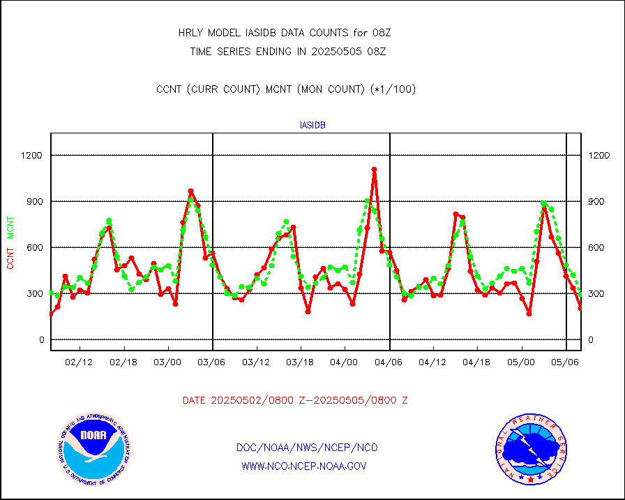
bathy |
eXpendable BathyThermograph, mooring (BATHY fmt) |
0 |
0 |
n/a |
2001.00-2001.99 |
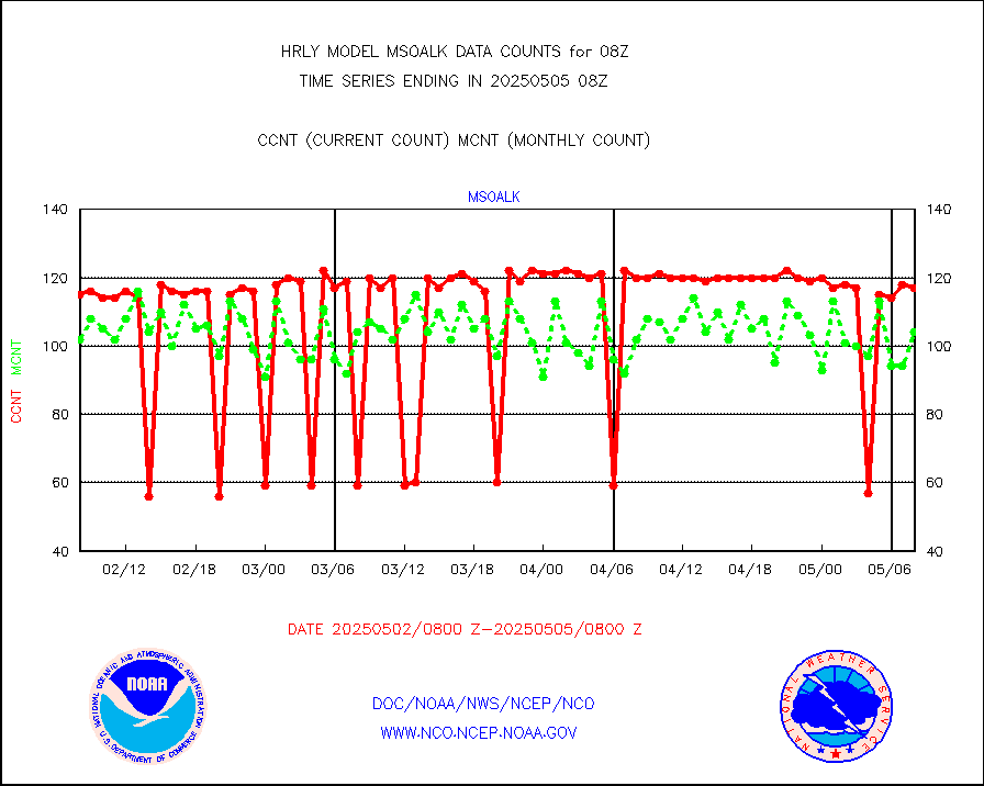
coopmd |
Coop/MADIS NEPP & HCN-Modernization NOAA COOP Obs |
27 |
27 |
100.0 % |
2007.50-2008.49 |
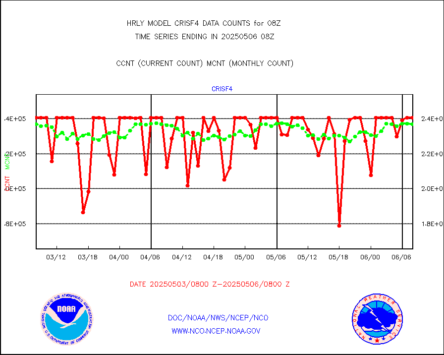
crisf4 |
NPP/NOAA-20 CrIS full spctrl radn (431 ch subset) |
228330 |
230479 |
99.1 % |
2006.50-2007.49 |
crsfdb |
NPP/NOAA-20 CrIS full spctrl radn dir brdcst SSEC |
150444 |
108533 |
138.6 % |
2006.50-2007.49 |
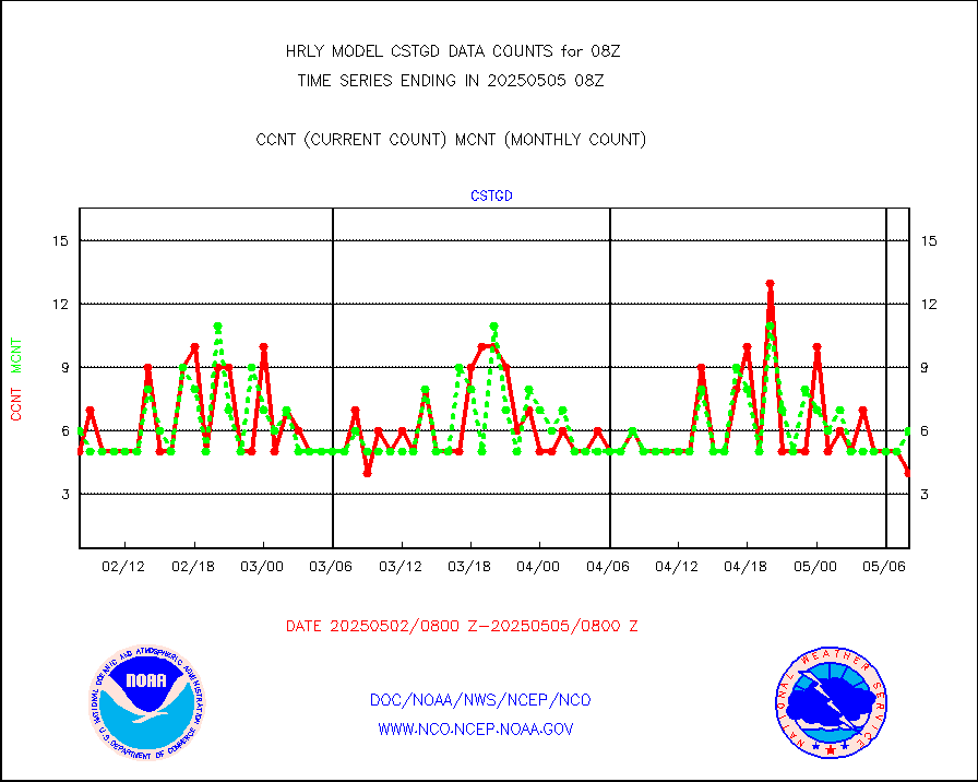
cstgd |
Coast Guard |
3 |
4 |
75.0 % |
2007.50-2008.50 |
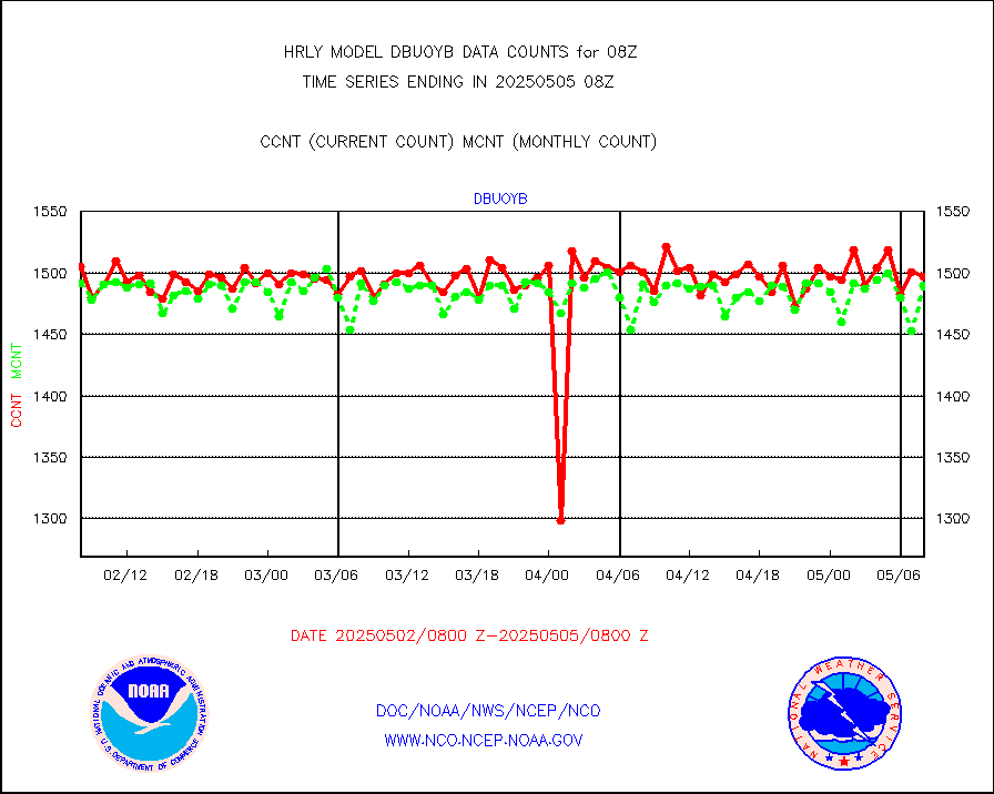
dbuoyb |
Drifting buoys (decoded from BUFR) |
1431 |
1400 |
102.2 % |
2007.50-2008.50 |
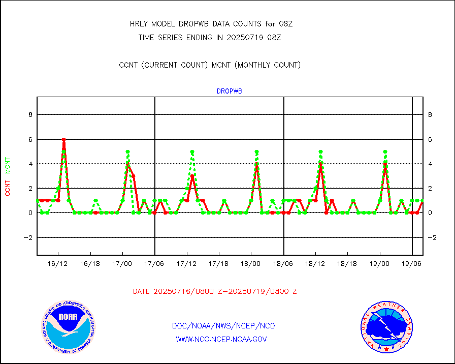
dropw |
Dropwinsonde (from TEMP DROP) |
0 |
0 |
n/a |
2007.50-2008.49 |
efclam |
GOES imager effective cloud amount data (U.Wisc.) |
8280518 |
8279187 |
100.0 % |
2007.50-2008.49 |
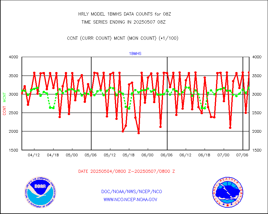
esatms |
NPP Adv. Tech. MW Sndr (ATMS) br. temps from RARS |
148344 |
101476 |
146.2 % |
2006.50-2007.49 |
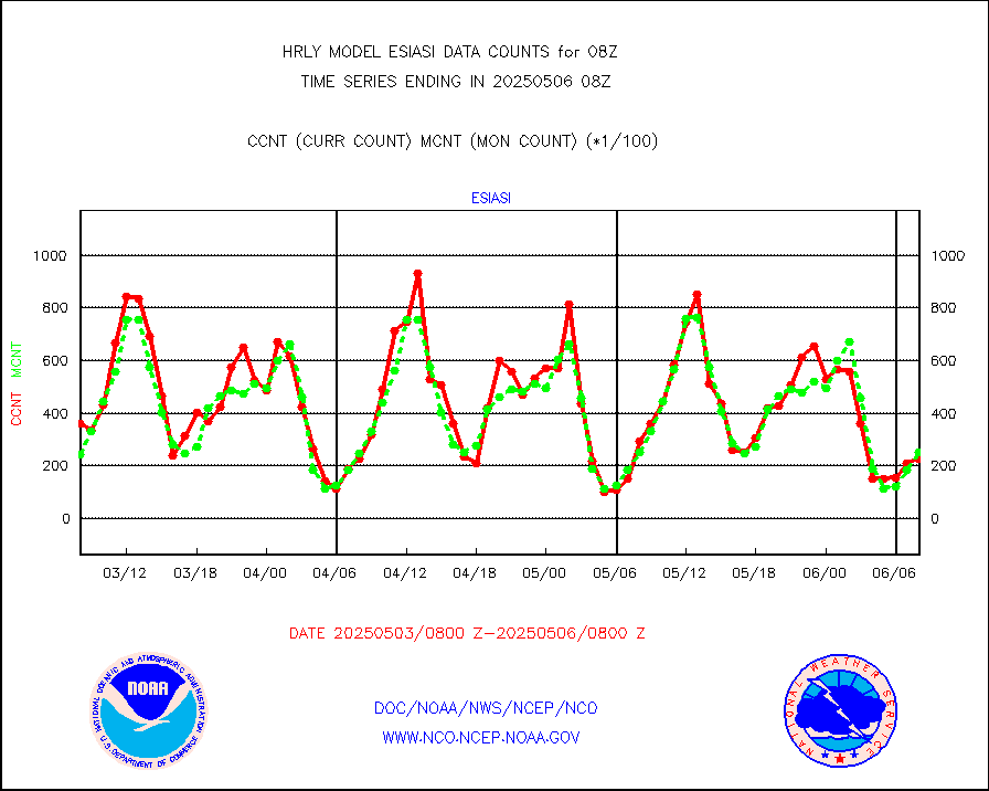
esiasi |
METOP 1-2 IASI 1C radiance data vbl chn from RARS |
50182 |
32691 |
153.5 % |
2007.00-2007.99 |
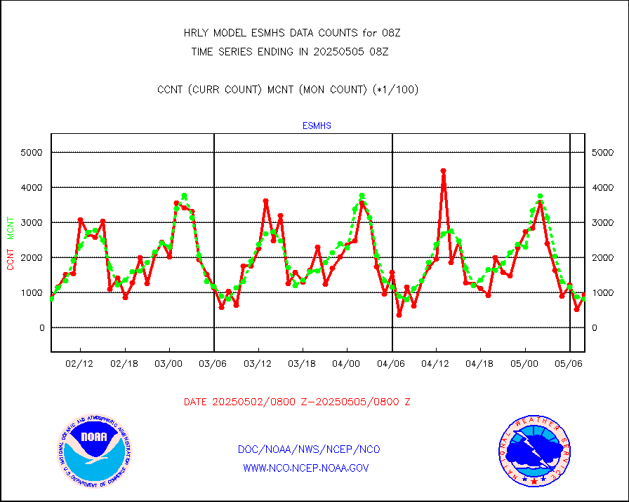
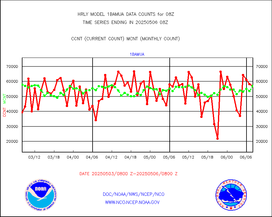
esmhs |
NOAA 18-19 & METOP 1-2 MHS proc. btemps from RARS |
86744 |
110477 |
78.5 % |
2007.50-2008.49 |
geoimr |
GOES/NESDIS (11x17 f-o-v) imager clear radiances |
0 |
0 |
n/a |
2007.00-2007.99 |
gome |
METOP 1-2 Global Ozone Monitoring Exp.-2 (GOME-2) |
3349 |
7094 |
47.2 % |
2006.50-2007.49 |
h20in2 |
INDIA SATWIND, INSAT WV channel |
1581 |
5827 |
27.1 % |
2007.00-2007.99 |
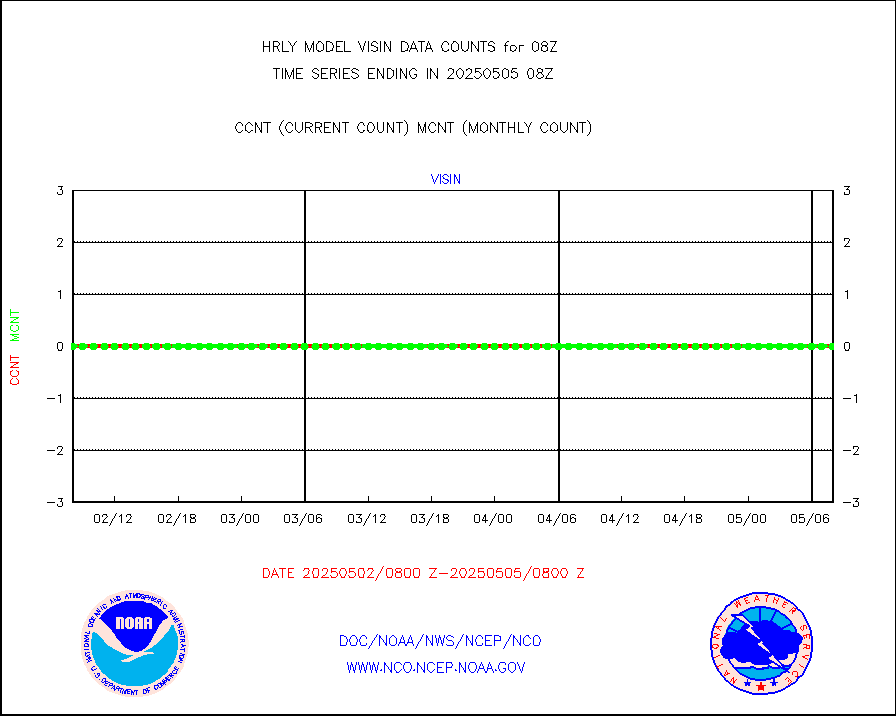
h2dusr |
GOES-16&up/NESDIS wv imgr/deep-lyr derivd cld mtn |
14506 |
15496 |
93.6 % |
2007.00-2007.99 |
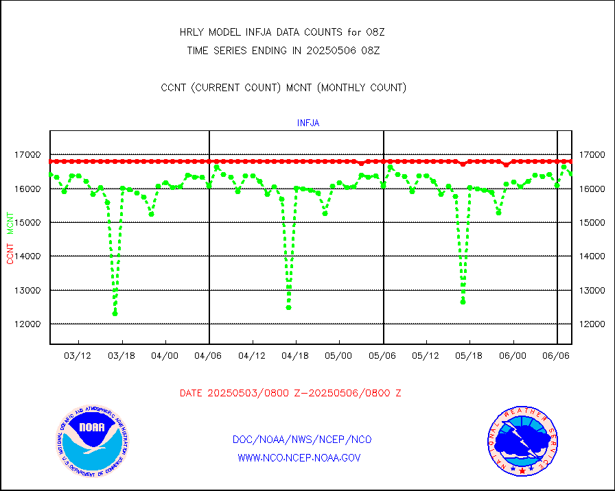
h2eunb |
METEOSAT/EUMETSAT wvpr imgr drv cld motion NBseq |
38155 |
40391 |
94.5 % |
2006.50-2007.49 |
hdob |
High Density OBs from reconnaissance acft data |
0 |
2 |
0.0 % |
2007.50-2008.49 |
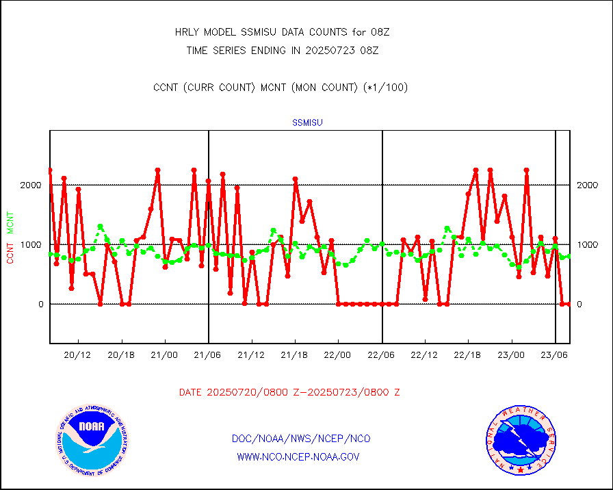
iasidb |
METOP 1-2 IASI 1C radiances-direct broadcast SSEC |
31248 |
21650 |
144.3 % |
2006.50-2007.49 |
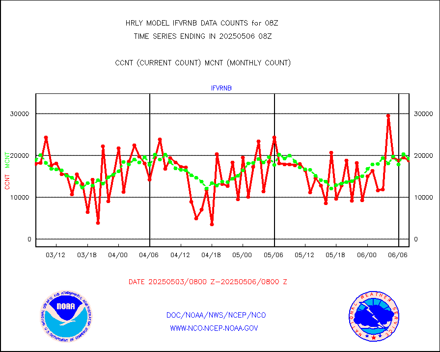
ifvrnb |
VIIRS (NPP/NOAA-20) ir lg-wv drv cloud motion(NB) |
28656 |
19500 |
147.0 % |
2004.00-2004.99 |
infav |
AVHRR (NOAA/METOP) ir lg-wave derived cld motion |
0 |
0 |
n/a |
2004.00-2004.99 |
infav1 |
AVHRR (METOP) ir lg-wave derived cld motion |
0 |
0 |
n/a |
2007.50-2008.50 |
infin |
INSAT/KALPANA India ir lg-wave derived cld motion |
0 |
0 |
n/a |
2005.50-2006.49 |
infin2 |
INDIA SATWIND, INSAT IR channel |
1339 |
6113 |
21.9 % |
2007.00-2007.99 |
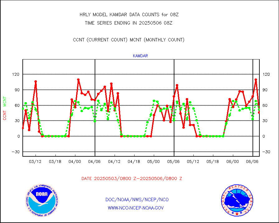
kamdar |
Korean AMDAR aircraft data (decoded from BUFR) |
2 |
50 |
4.0 % |
2007.50-2008.49 |
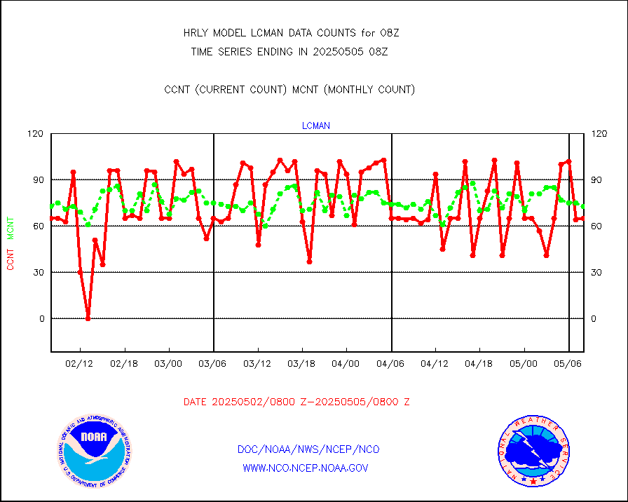
lcman |
Land-based CMAN stations decoded from CMAN format |
75 |
80 |
93.8 % |
2007.50-2008.49 |
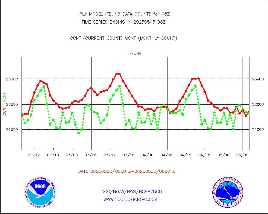
leogeo |
LEO-GEO satellite AMVs from UWisc. |
7315 |
5426 |
134.8 % |
2004.00-2004.99 |
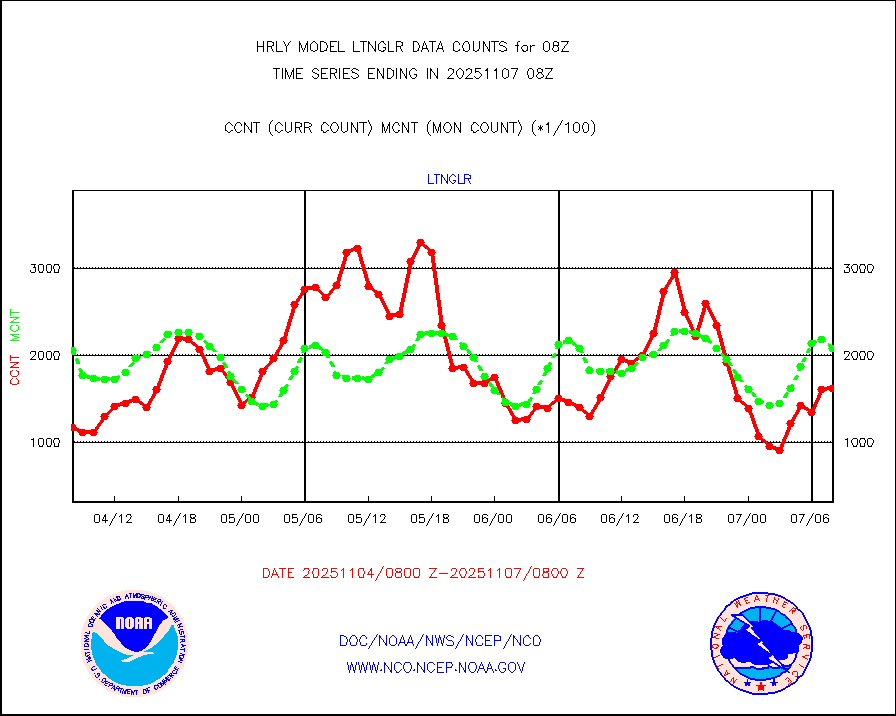
ltnglr |
LLDN Long-rng lightning from Vaisala via NOAAPORT |
100533 |
130430 |
77.1 % |
2007.50-2008.49 |
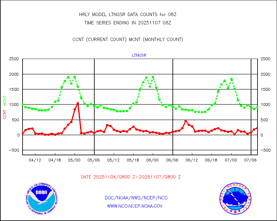
ltngsr |
NLDN Shrt-rng lightning from Vaisala via NOAAPORT |
4333 |
2996 |
144.6 % |
2007.50-2008.49 |
mbuoyb |
Moored buoys (decoded from BUFR) |
816 |
752 |
108.5 % |
2007.50-2008.50 |
mls |
Aura Microwave Limb Sounder (MLS) ozone data |
0 |
0 |
n/a |
2006.00-2006.99 |
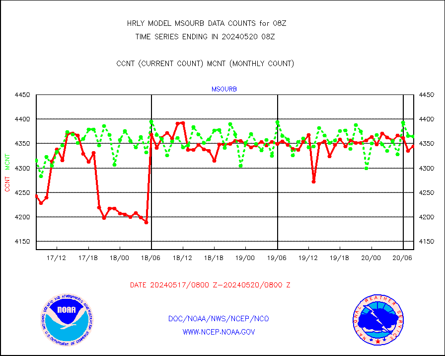
msourb |
Mesonet/MADIS UrbaNet |
4344 |
4365 |
99.5 % |
2007.50-2008.49 |
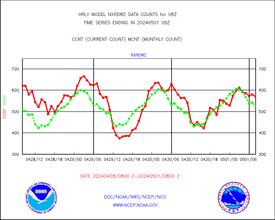
nxrdw2 |
NEXRAD Vel Azm Dsp(VAD) winds via Level 2 decoder |
650 |
591 |
110.0 % |
2007.50-2008.49 |
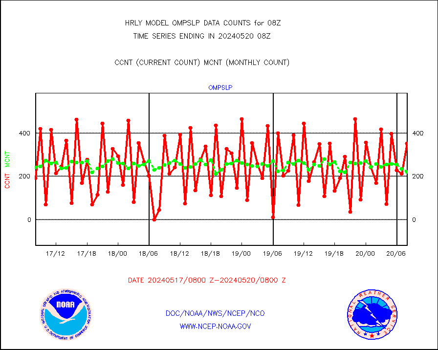
ompslp |
OMPS Limb Profiler ozone data (NPP) |
353 |
222 |
159.0 % |
2001.00-2001.99 |
ompsn8 |
OMPS nadir profile ozone (Version 8 BUFR) |
579 |
554 |
104.5 % |
2006.00-2006.99 |
ompst8 |
OMPS total column ozone (Version 8 BUFR) |
419808 |
339209 |
123.8 % |
2006.00-2006.99 |
pirep |
Manual PIREP aircraft data (dcded from AIREP fmt) |
12 |
11 |
109.1 % |
2007.50-2008.49 |
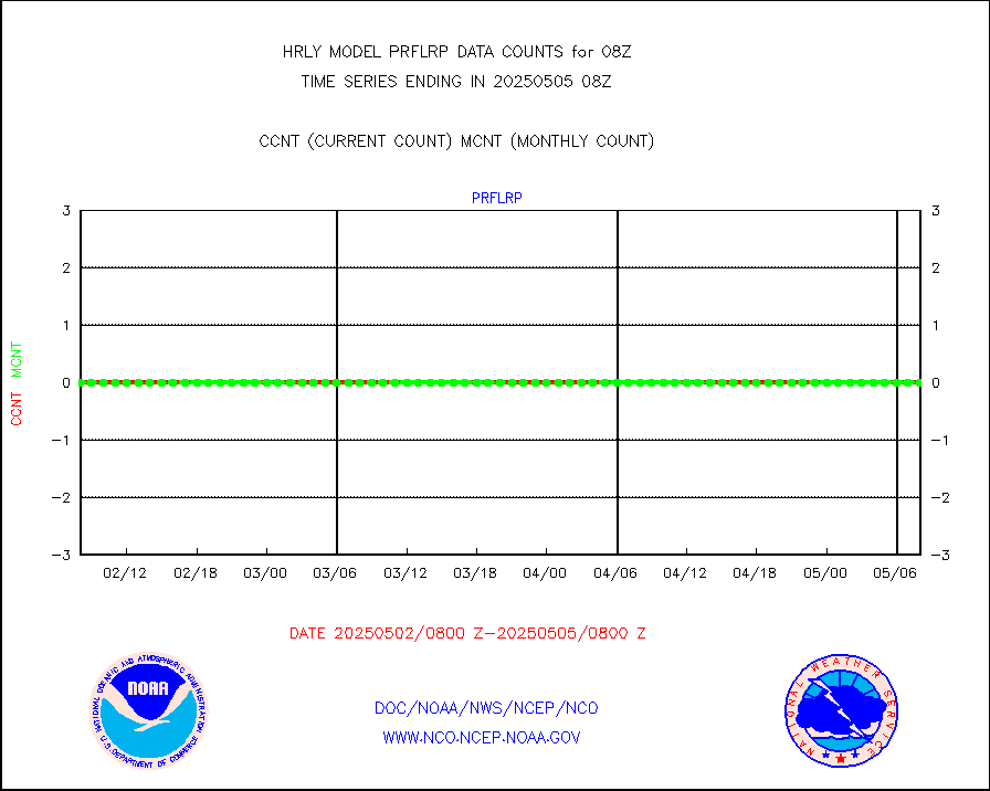
prflrp |
Profilr winds from PIBAL (PILOT,PILOT SHIP/MOBIL) |
0 |
0 |
n/a |
2007.50-2008.49 |
raobm |
Rawinsonde - mobile land (from TEMP/PILOT MOBIL) |
0 |
0 |
n/a |
2007.50-2008.49 |
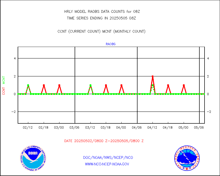
raobs |
Rawinsonde - ship (from TEMP SHIP, PILOT SHIP) |
0 |
0 |
n/a |
2007.50-2008.49 |
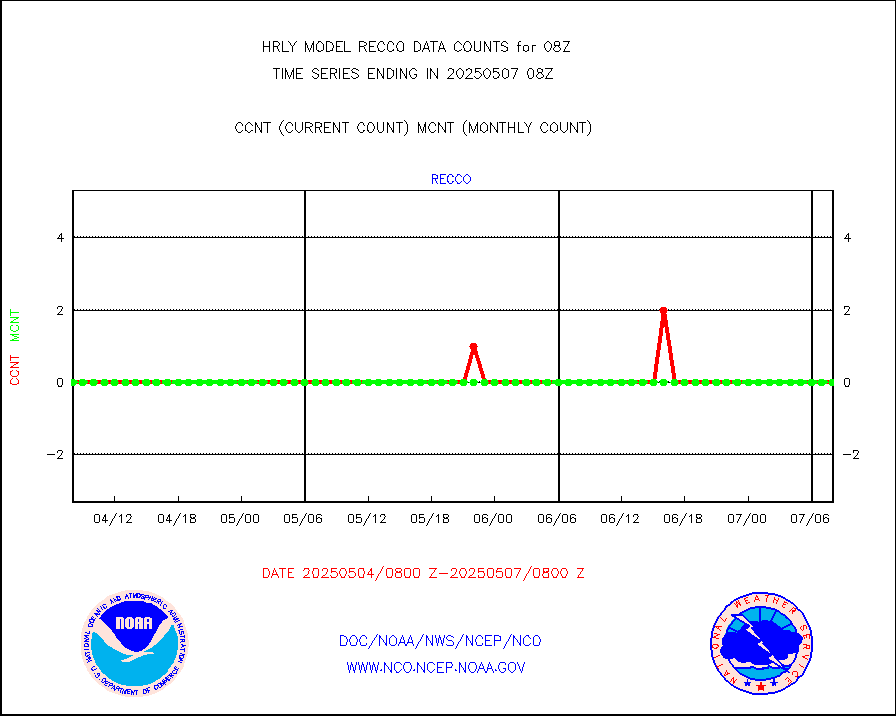
recco |
Flight level reconnaissance aircraft data |
0 |
0 |
n/a |
2007.50-2008.49 |
saphir |
Megha-Tropiques SAPHIR L1A2 brightness temps |
0 |
0 |
n/a |
2005.50-2006.49 |
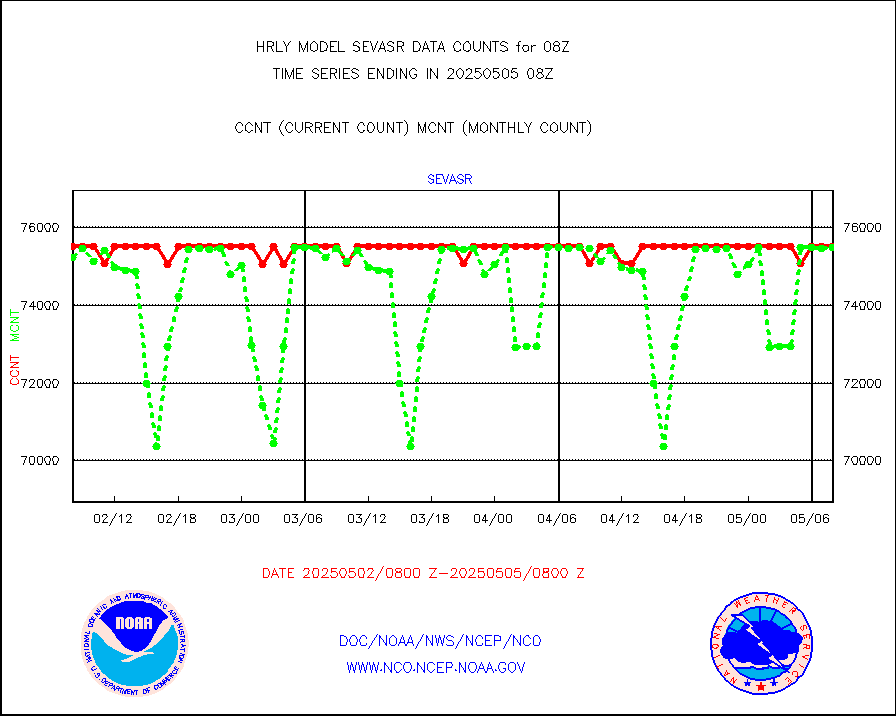
sevasr |
METEOSAT-10 2nd Gen SEVIRI All Sky Radiance(proc) |
75512 |
75453 |
100.1 % |
2007.50-2008.49 |
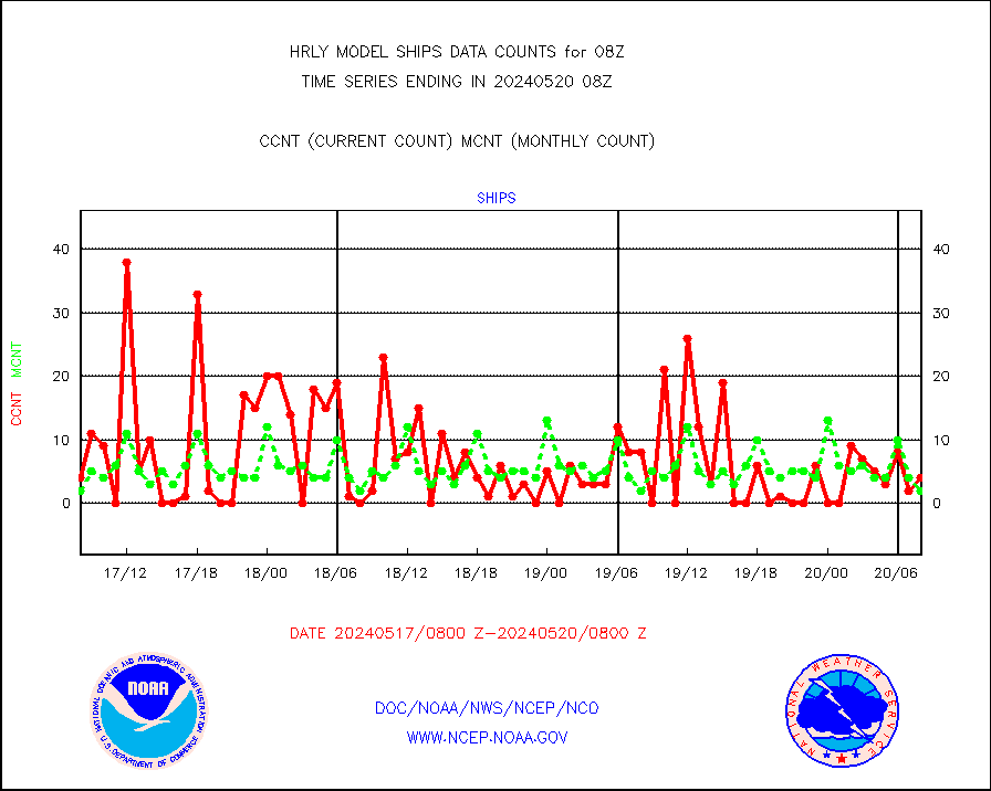
ships |
Ship - manual and automatic, restricted |
4 |
2 |
200.0 % |
2007.50-2008.49 |
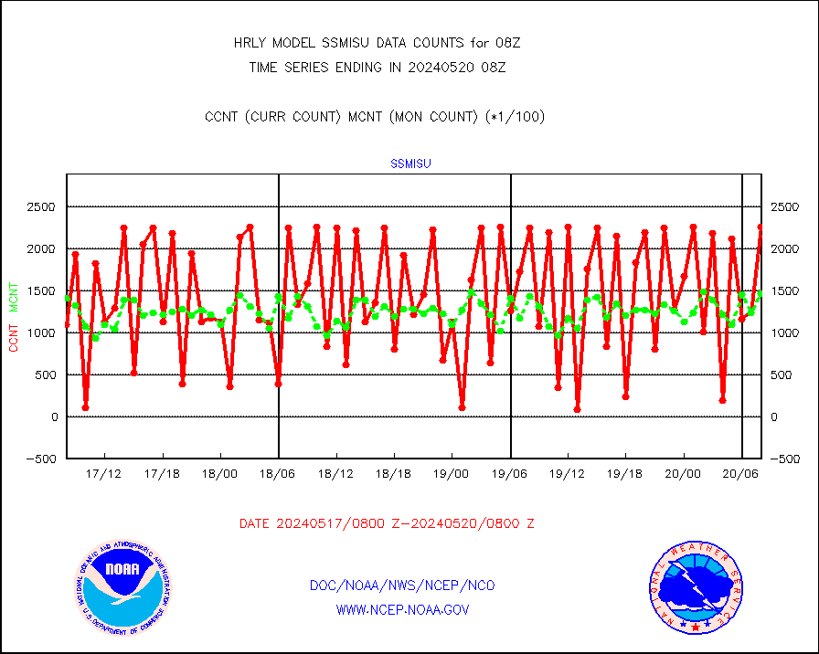
ssmisu |
DMSP SSM/IS 1C radiance data (Unified Pre-Proc.) |
225360 |
146536 |
153.8 % |
2006.50-2007.49 |
synopm |
Synoptic - mobile manual and automatic |
592 |
582 |
101.7 % |
2007.50-2008.49 |
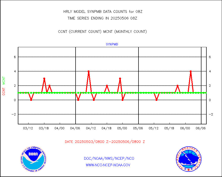
synpmb |
Synoptic - mobile manual & auto (decoded fr BUFR) |
1 |
1 |
100.0 % |
2007.50-2008.49 |
tesac |
CTD probe, Argo prflng float, mooring (TESAC fmt) |
202 |
188 |
107.4 % |
2007.50-2008.49 |
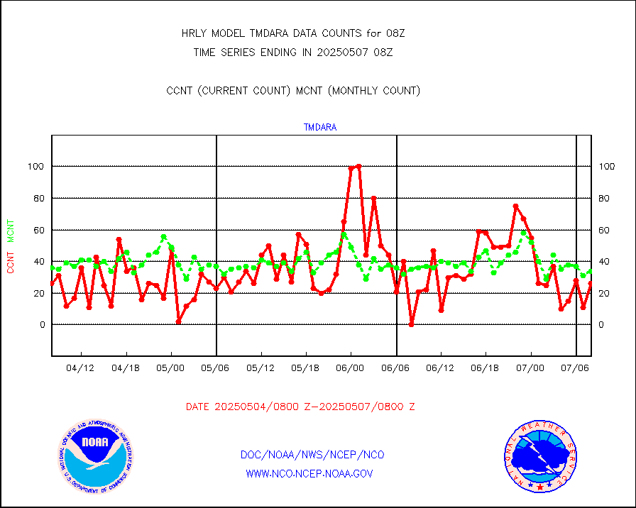
tmdara |
TAMDAR aircft data-all types(from Panasonic,BUFR) |
272 |
385 |
70.6 % |
2007.50-2008.49 |
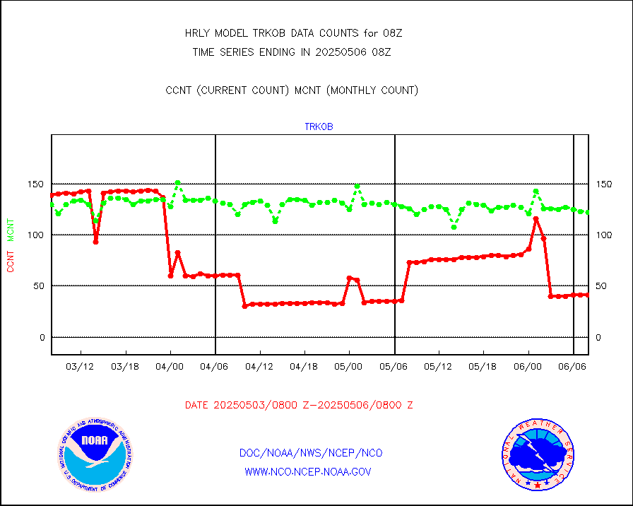
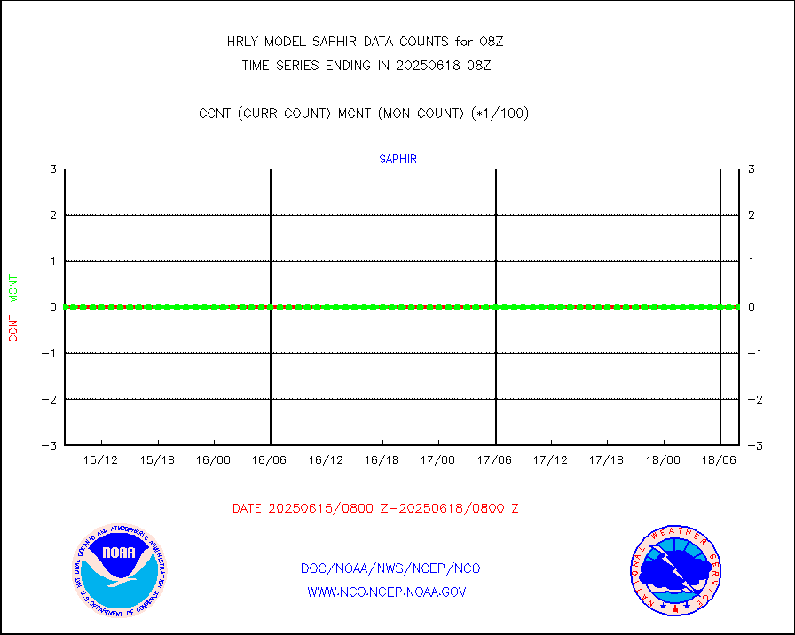
trkob |
ThermoSalinoGraph (TSG) TRACKOB format) |
90 |
45 |
200.0 % |
2006.50-2007.49 |
visin |
INSAT/KALPANA India visible derived cloud motion |
0 |
0 |
n/a |
2005.50-2006.49 |
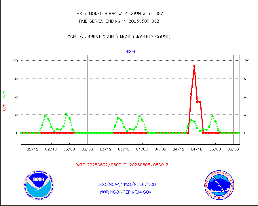
visin2 |
INDIA SATWIND, INSAT VIS channel |
481 |
1047 |
45.9 % |
2007.00-2007.99 |
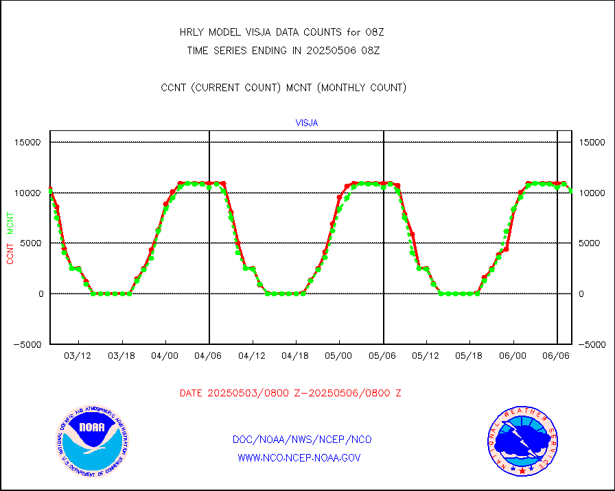
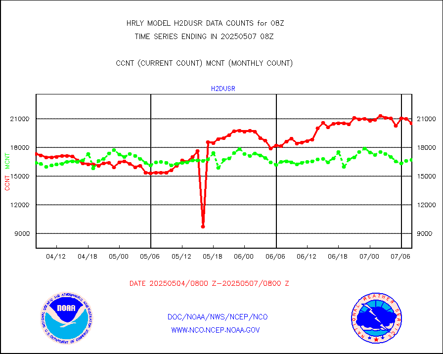
visja |
MTSAT/JMA visible derived cloud motion |
9308 |
9553 |
97.4 % |
2005.50-2006.49 |
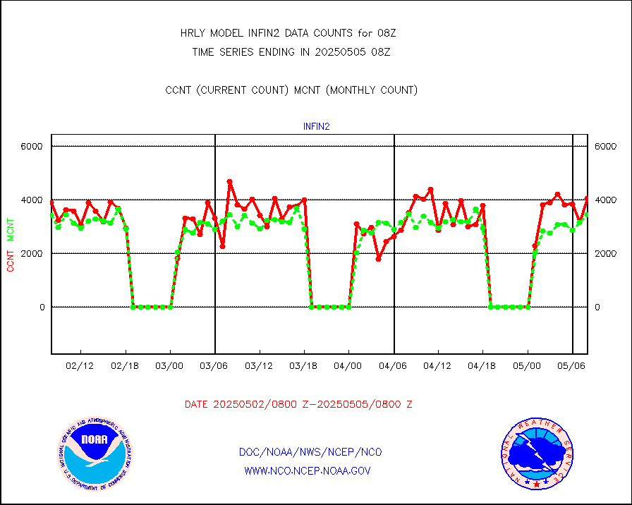
visusr |
GOES-16&up/NESDIS visible derived cloud motion |
0 |
0 |
n/a |
2007.00-2007.99 |
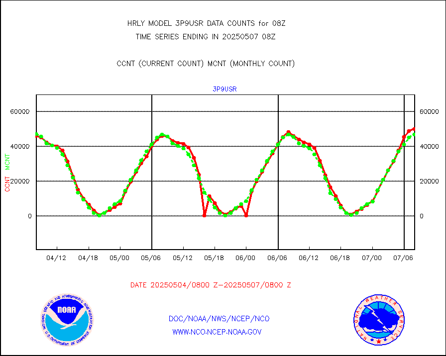
vseunb |
METEOSAT/EUMETSAT visible drv cld motion NBseq |
29856 |
27582 |
108.2 % |
2006.50-2007.49 |


