| Critical Data with Normal Counts |
|---|
| Type | Description | Hourly Count | Monthly Average | Percent (%) of Monthly Mean | UTC Time Window |
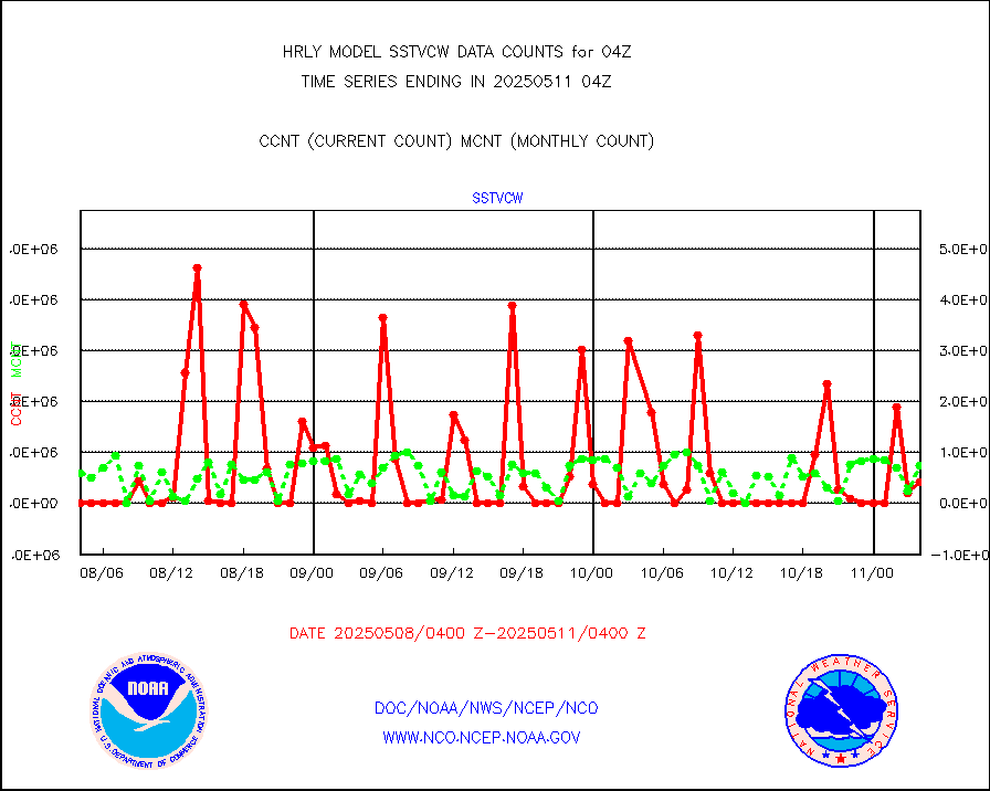
1bamua |
NOAA 15-19 & METOP 1-2 AMSU-A NCEP-proc. br.temps |
61575 |
54075 |
113.9 % |
2002.00-2002.99 |
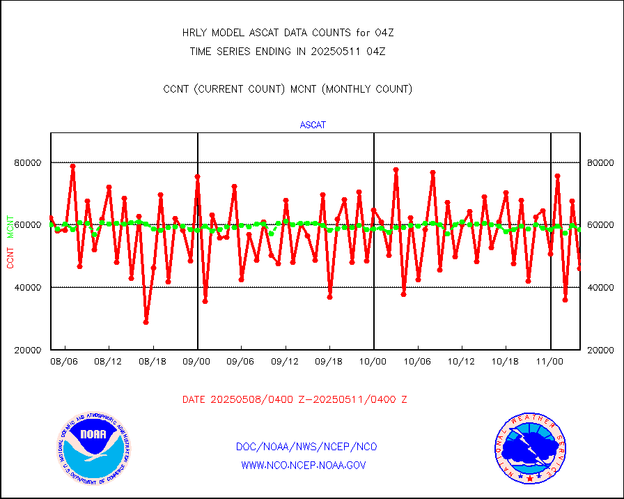
1bhrs4 |
NOAA 18-19 & METOP 1-2 HIRS-4 NCEP-proc. br.temps |
52719 |
47367 |
111.3 % |
2002.00-2002.99 |
1bmhs |
NOAA 18-19 & METOP 1-2 MHS NCEP-proces. br. temps |
356209 |
301507 |
118.1 % |
2002.00-2002.99 |
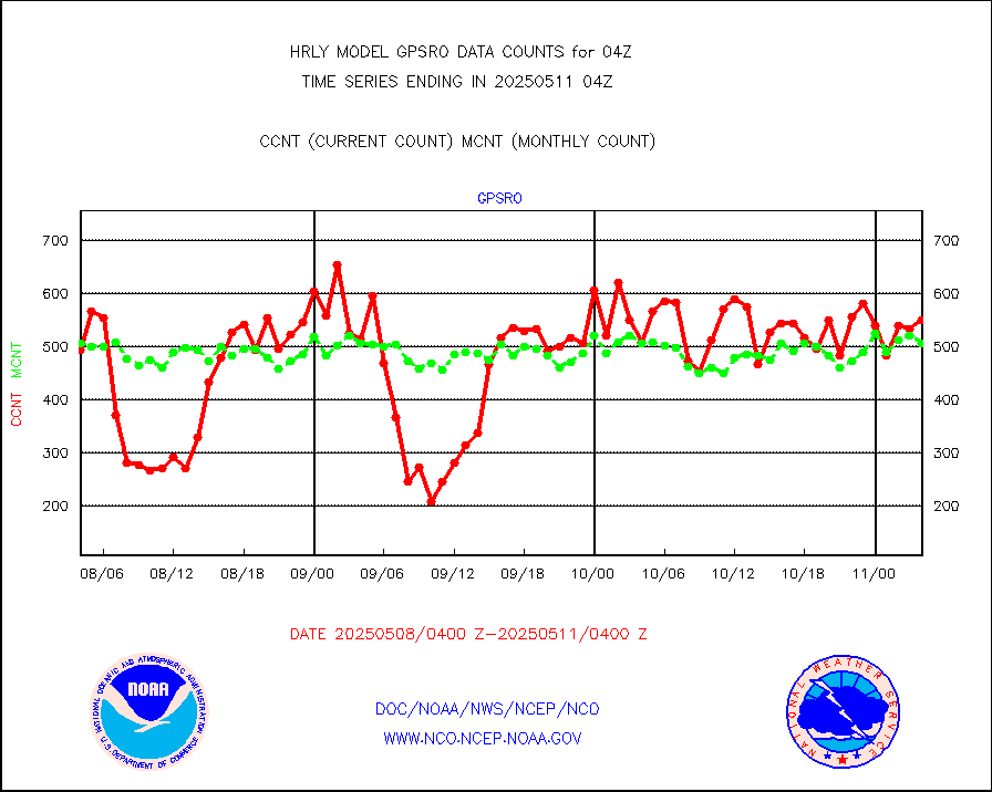
acars |
MDCRS ACARS acft data from ARINC(dcded from BUFR) |
16156 |
7024 |
230.0 % |
2003.50-2004.49 |
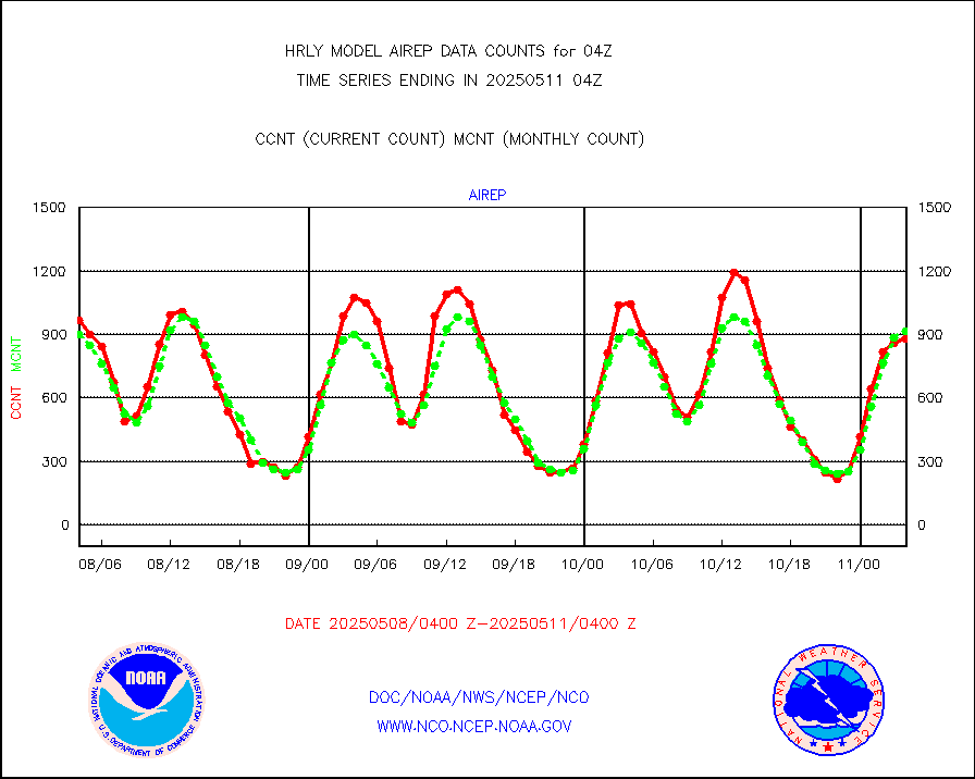
airep |
Manual AIREP aircraft data (dcded from AIREP fmt) |
1368 |
1302 |
105.1 % |
2003.50-2004.49 |
airsev |
AQUA AIRS/AMSU-A/HSB brightness temps- every FOV |
0 |
0 |
n/a |
2001.50-2002.49 |
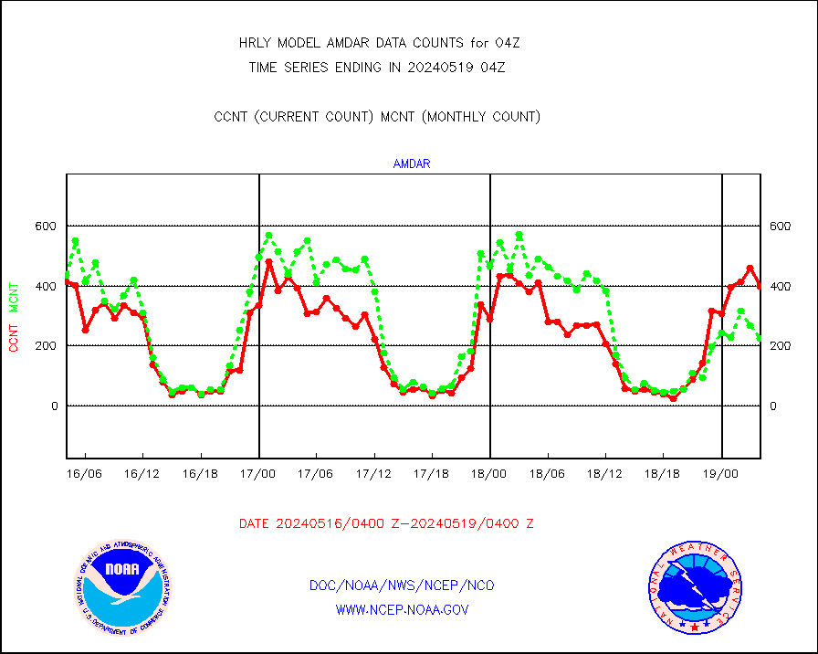
amdar |
AMDAR aircraft data (decoded from AMDAR format) |
407 |
376 |
108.2 % |
2003.50-2004.49 |
amdarb |
AMDAR aircraft data (decoded from BUFR) |
1249 |
1188 |
105.1 % |
2003.50-2004.49 |
ascat |
METOP 1-2 ASCAT products |
57876 |
46962 |
123.2 % |
2002.50-2003.49 |
atms |
NPP/NOAA-20 ATMS brightness temperatures |
379872 |
352294 |
107.8 % |
2002.50-2003.49 |
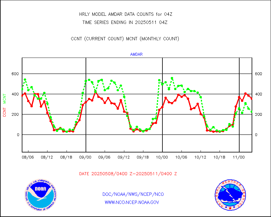
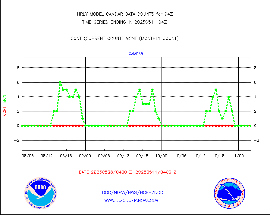
camdar |
Canadian AMDAR aircraft data (decoded from BUFR) |
0 |
1 |
0.0 % |
2003.50-2004.49 |
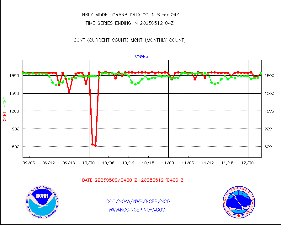
cmanb |
Surface Marine CMAN rpts decoded from BUFR format |
1802 |
1827 |
98.6 % |
2003.50-2004.50 |
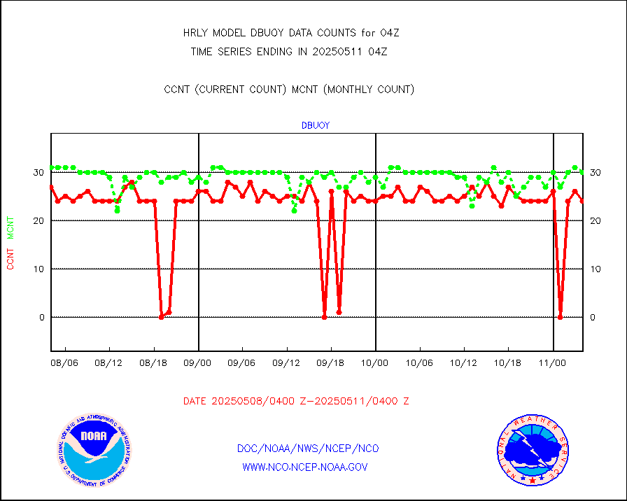
dbuoy |
Buoys decoded from FM-18 fmt (moored or drifting) |
39 |
37 |
105.4 % |
2003.50-2004.49 |
eadas |
E-AMDAR (European AMDAR acft decoded from BUFR) |
545 |
600 |
90.8 % |
2003.50-2004.49 |
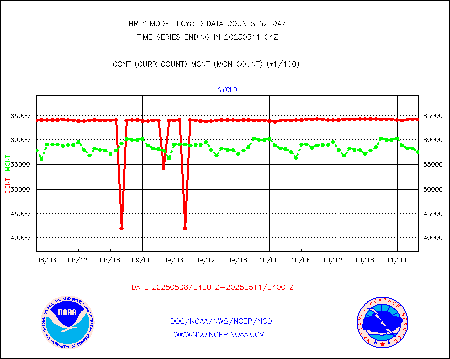
esamua |
NOAA 15-19 & METOP 1-2 AMSU-A proc btmps frm RARS |
31148 |
30825 |
101.0 % |
2003.50-2004.49 |
eshrs3 |
NOAA 15-19 & METOP 1-2 HIRS-3/4 pr btmps frm RARS |
62682 |
61339 |
102.2 % |
2003.50-2004.49 |
gnss |
Grnd-based Gbl Navigation Sat System (GNSS) data |
9341 |
8997 |
103.8 % |
2003.00-2003.99 |
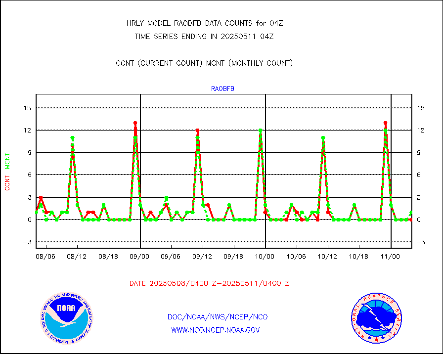
gpsro |
GPS radio occultation data |
452 |
453 |
99.8 % |
2001.50-2002.49 |
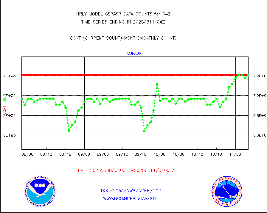
gsrasr |
GOES-16/17 All Sky Radiances (proc.) |
360476 |
360476 |
100.0 % |
2003.50-2004.49 |
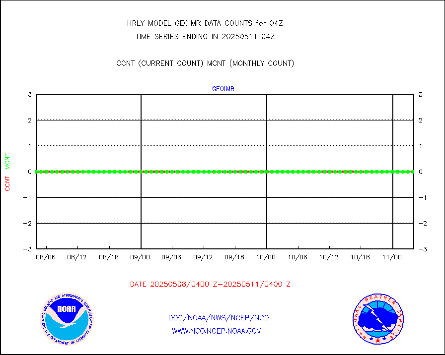
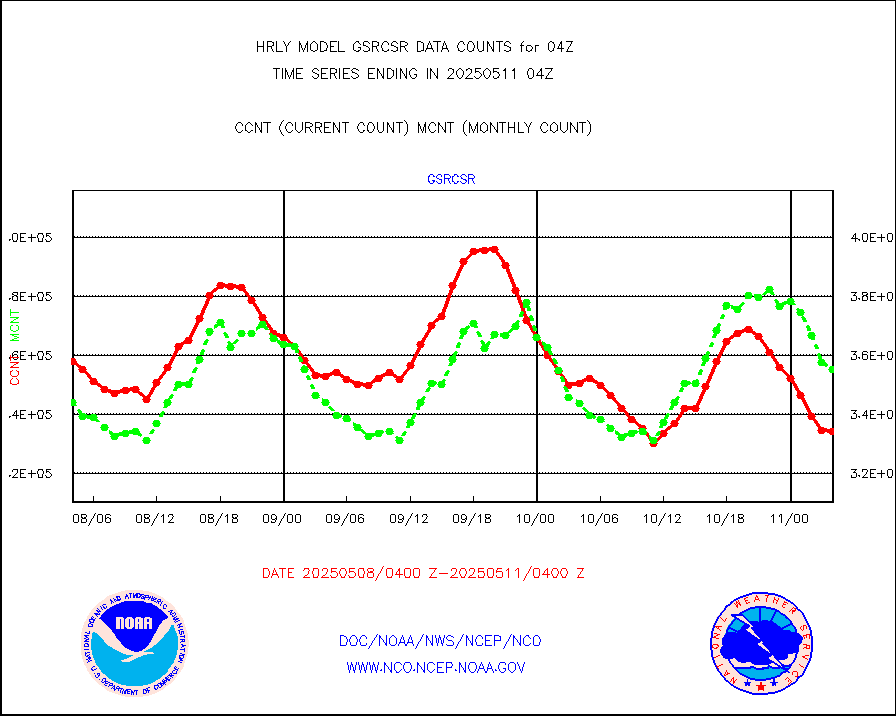
gsrcsr |
GOES-16/17 Clear Sky Radiances (proc.) |
157725 |
169041 |
93.3 % |
2003.50-2004.49 |
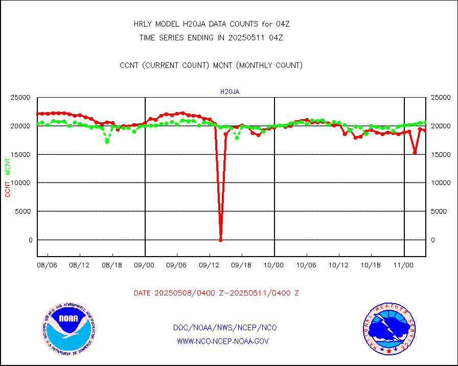
h20ja |
MTSAT/JMA water vapor imager derived cloud motion |
19661 |
18924 |
103.9 % |
2001.50-2002.49 |
h20mo |
MODIS (AQUA/TERRA) wvpr imager derived cld motion |
0 |
0 |
n/a |
2000.00-2000.99 |
h2tusr |
GOES-16&up/NESDIS wv imgr/cld-top derived cld mtn |
25797 |
27364 |
94.3 % |
2003.00-2003.99 |
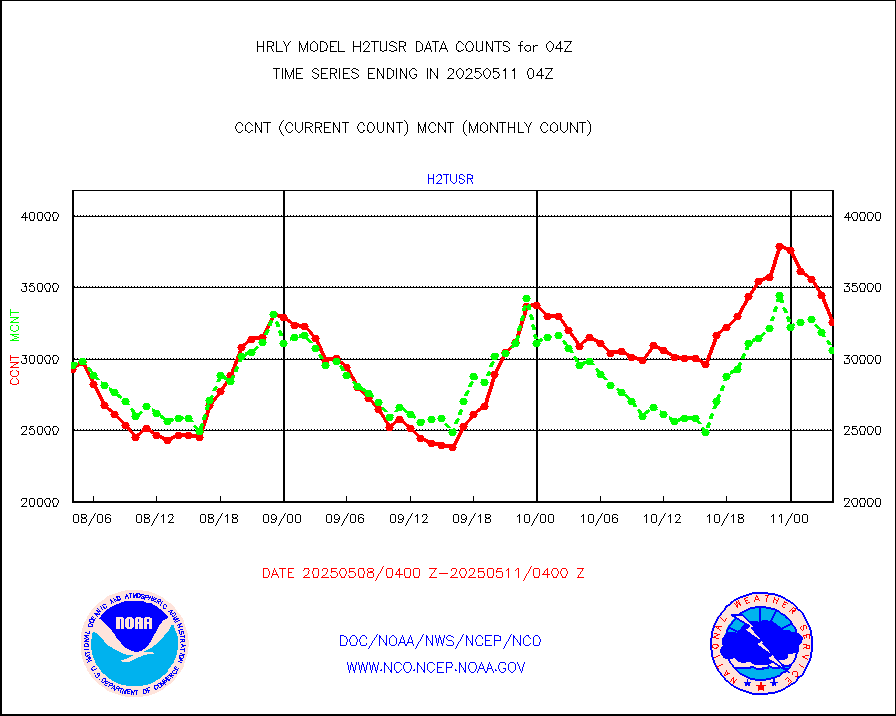
ifeunb |
METEOSAT/EUMETSAT ir lg-wave drv cld motion NBseq |
21154 |
21508 |
98.4 % |
2002.50-2003.49 |
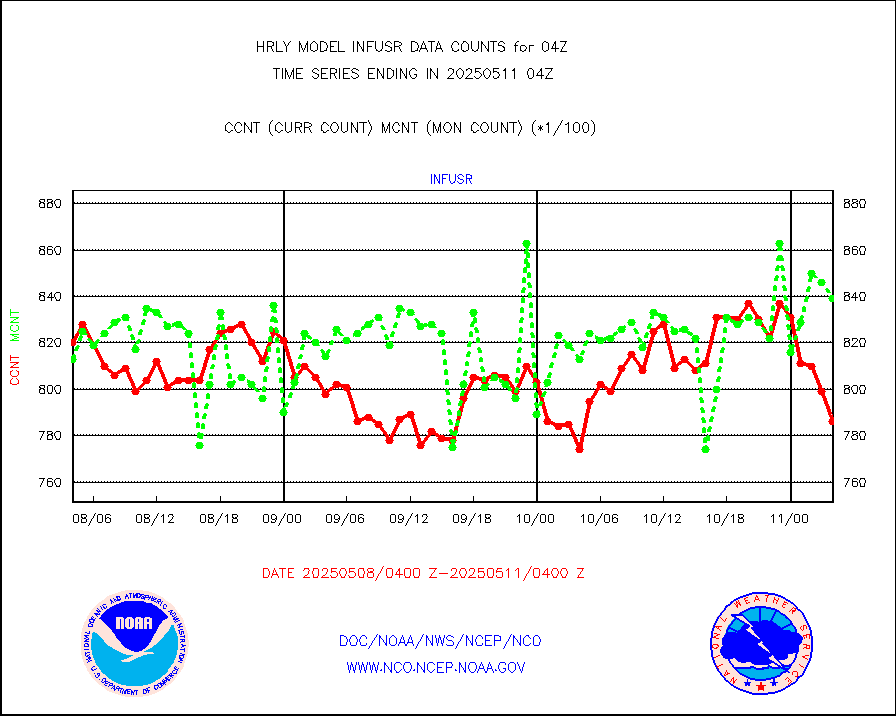
infja |
MTSAT/JMA infrared long-wave derived cloud motion |
16288 |
16002 |
101.8 % |
2001.50-2002.49 |
infmo |
MODIS (AQUA/TERRA) ir l-wave derived cloud motion |
0 |
0 |
n/a |
2000.00-2000.99 |
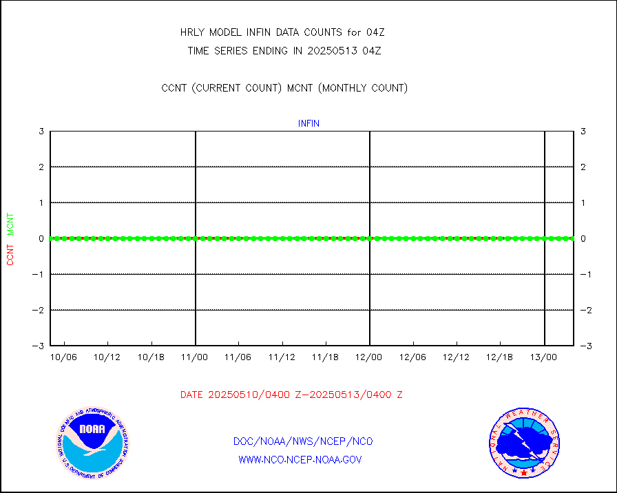
infusr |
GOES-16&up/NESDIS ir long-wave derived cld motion |
73734 |
79946 |
92.2 % |
2003.00-2003.99 |
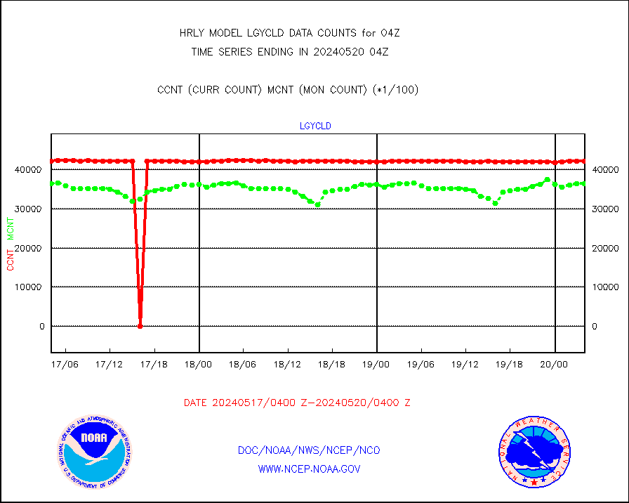
lgycld |
GOES/NASA(Langley) hi-res. (1x1 f-o-v) cloud data |
4215054 |
3651012 |
115.4 % |
2003.50-2004.49 |
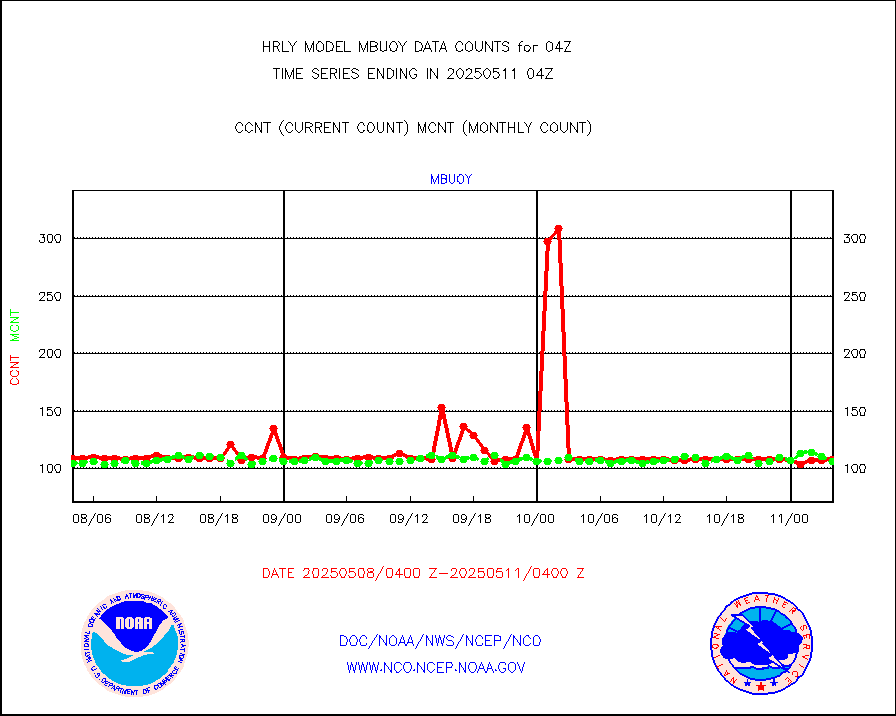
mbuoy |
Buoys decoded from FM-13 format (moored) |
120 |
111 |
108.1 % |
2003.50-2004.49 |
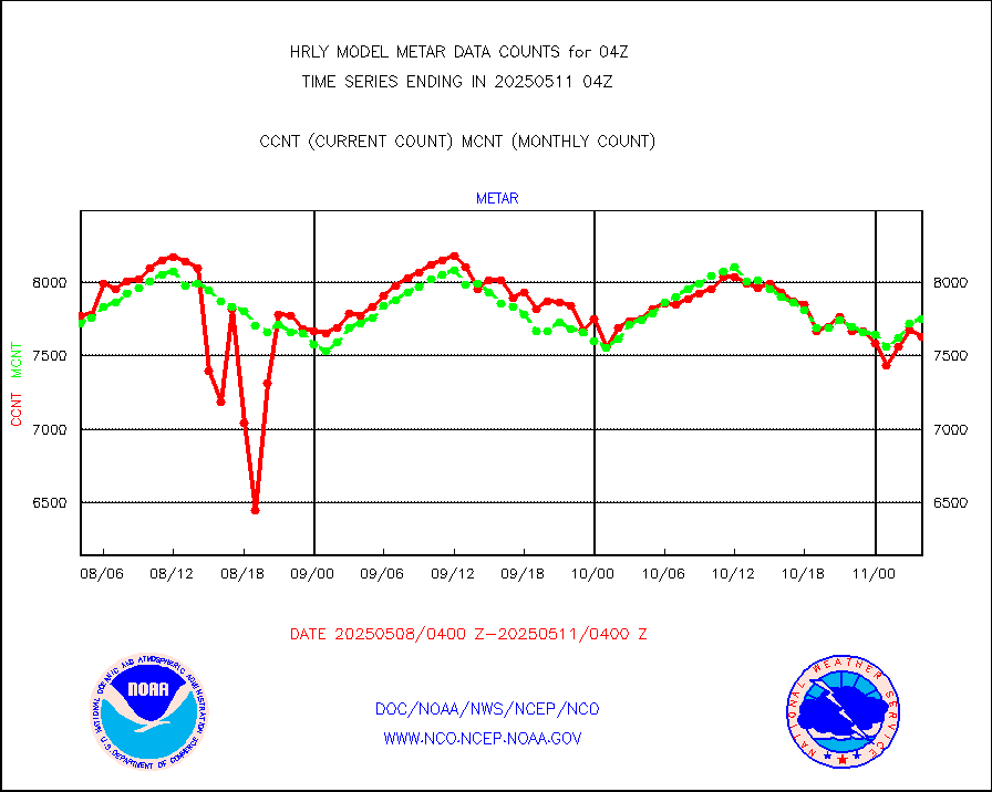
metar |
Aviation - METAR |
7518 |
7658 |
98.2 % |
2003.50-2004.49 |
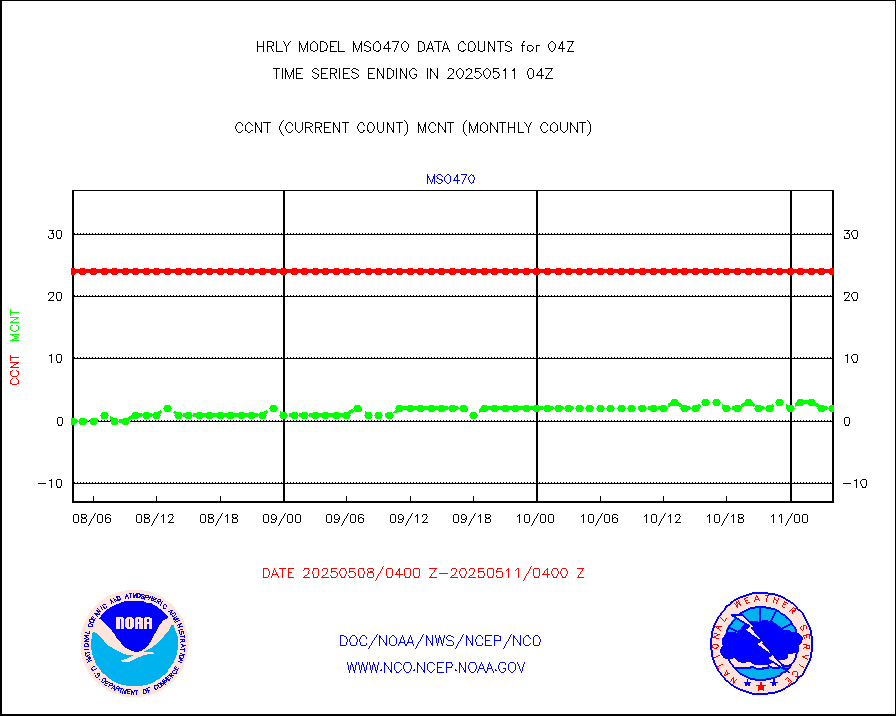
mso470 |
Mesonet/MADIS Colorado E-470 (Interstate 470) |
21 |
20 |
105.0 % |
2003.50-2004.49 |
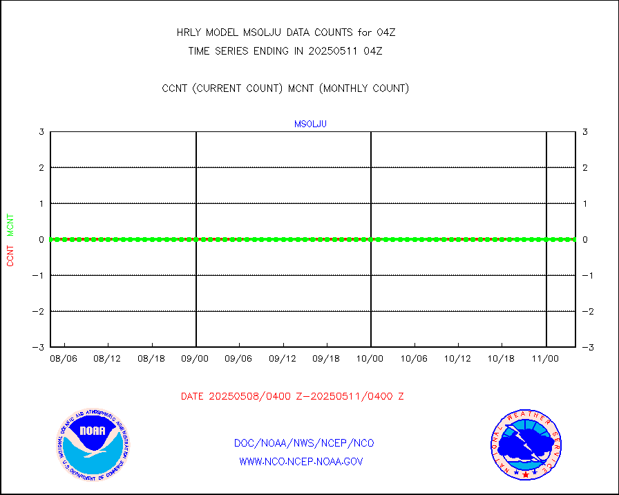
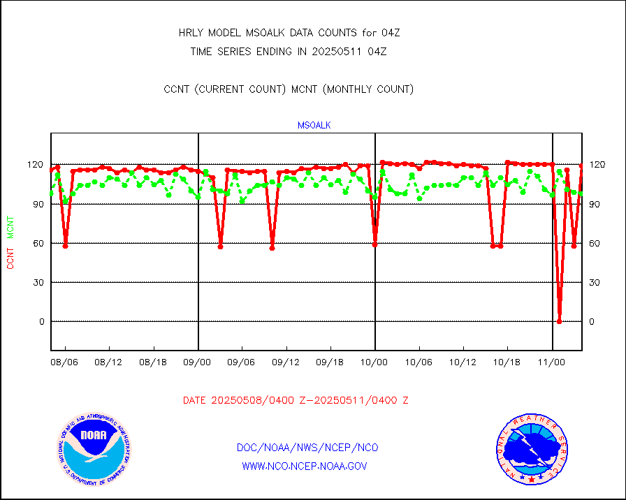
msoalk |
Mesonet/MADIS Alaska Department of Transportation |
108 |
107 |
100.9 % |
2003.50-2004.49 |
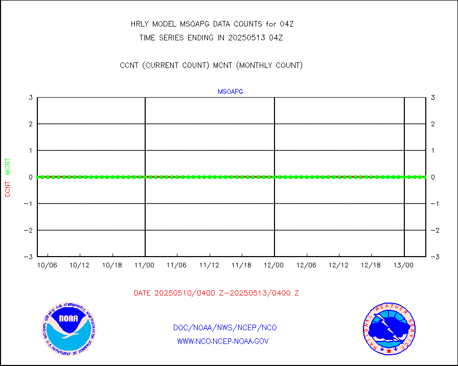
msoapg |
Mesonet/MADIS U.S. Army Aberdeen Proving Grounds |
0 |
0 |
n/a |
2003.50-2004.49 |
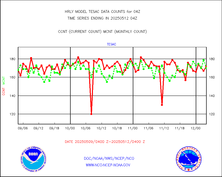
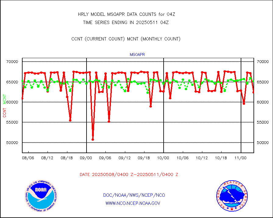
msoapr |
Mesonet/MADIS Citizen Weather Observers Program |
46461 |
48615 |
95.6 % |
2003.50-2004.49 |
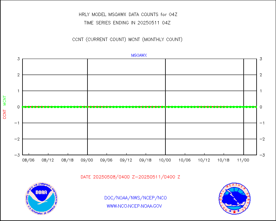
msoaws |
Mesonet/MADIS AWS Convergence Technologies, Inc. |
24263 |
25432 |
95.4 % |
2003.50-2004.49 |
msoawx |
Mesonet/MADIS "Anything Weather" |
0 |
0 |
n/a |
2003.50-2004.49 |
msocol |
Mesonet/MADIS Colorado Dept. of Transportation |
0 |
0 |
n/a |
2003.50-2004.49 |
msodcn |
Mesonet/MADIS DC Net |
0 |
0 |
n/a |
2003.50-2004.49 |
msoden |
Mesonet/MADIS Denver Urban Drainage & Flood Cntrl |
250 |
250 |
100.0 % |
2003.50-2004.49 |
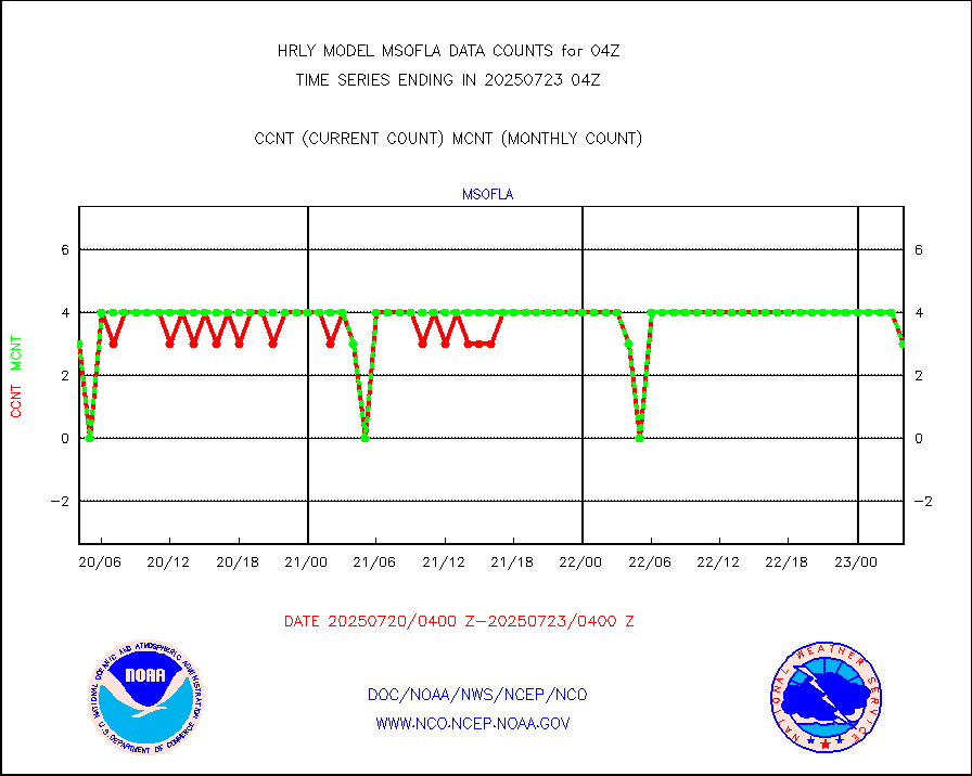
msofla |
Mesonet/MADIS Florida (FAWN & USF) |
3 |
3 |
100.0 % |
2003.50-2004.49 |
msoflt |
Mesonet/MADIS Florida Dept. of Transportation |
0 |
0 |
n/a |
2003.50-2004.49 |
msogeo |
Mesonet/MADIS Georgia Dept. of Transportation |
0 |
0 |
n/a |
2003.50-2004.49 |
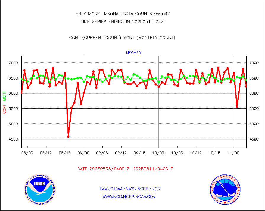
msohad |
Mesonet/MADIS NWS Hydromet Auto Data System(HADS) |
6879 |
6828 |
100.7 % |
2003.50-2004.49 |
msoien |
Mesonet/MADIS Iowa Environmental |
183 |
187 |
97.9 % |
2003.50-2004.49 |
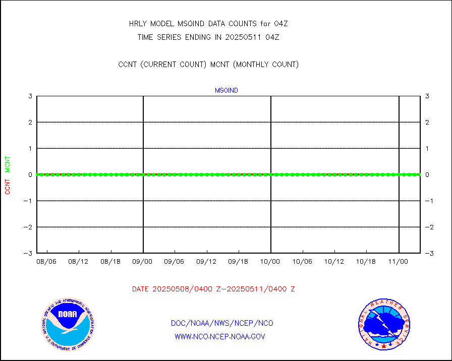
msoind |
Mesonet/MADIS Indiana Dept. of Transportation |
0 |
0 |
n/a |
2003.50-2004.49 |
msoiow |
Mesonet/MADIS Iowa Department of Transportation |
0 |
0 |
n/a |
2003.50-2004.49 |
msokan |
Mesonet/MADIS Kansas Department of Transportation |
253 |
372 |
68.0 % |
2003.50-2004.49 |
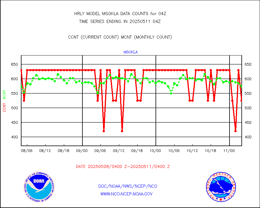
msokla |
Mesonet/MADIS Oklahoma Mesonet |
318 |
350 |
90.9 % |
2003.50-2004.49 |
msolju |
Mesonet/MADIS Louisiana State/Jackson State Univ. |
0 |
0 |
n/a |
2003.50-2004.49 |
msomca |
Mesonet/MADIS Missouri Commercial Agricult Wx Net |
302 |
295 |
102.4 % |
2003.50-2004.49 |
msomin |
Mesonet/MADIS Minnesota Dept. of Transportation |
0 |
0 |
n/a |
2003.50-2004.49 |
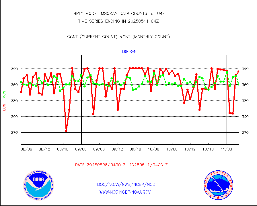
msonos |
Mesonet/MADIS NOS-Phys Oceanographic Realtime Sys |
391 |
381 |
102.6 % |
2003.50-2004.49 |
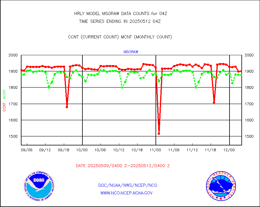
msoraw |
Mesonet/MADIS NFIC Remote Automated Wx Stns(RAWS) |
1860 |
1877 |
99.1 % |
2003.50-2004.49 |
msovir |
Mesonet/MADIS Virginia Dept. of Transportation |
205 |
227 |
90.3 % |
2003.50-2004.49 |
msowfy |
Mesonet/MADIS "Weather for You" |
0 |
0 |
n/a |
2003.50-2004.49 |
msowis |
Mesonet/MADIS Wisconsin Dept. of Transportation |
0 |
0 |
n/a |
2003.50-2004.49 |
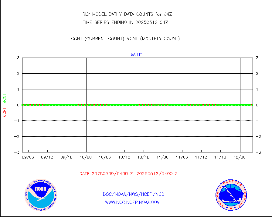
msowst |
Mesonet/MADIS MesoWest (many subproviders) |
47174 |
46146 |
102.2 % |
2003.50-2004.49 |
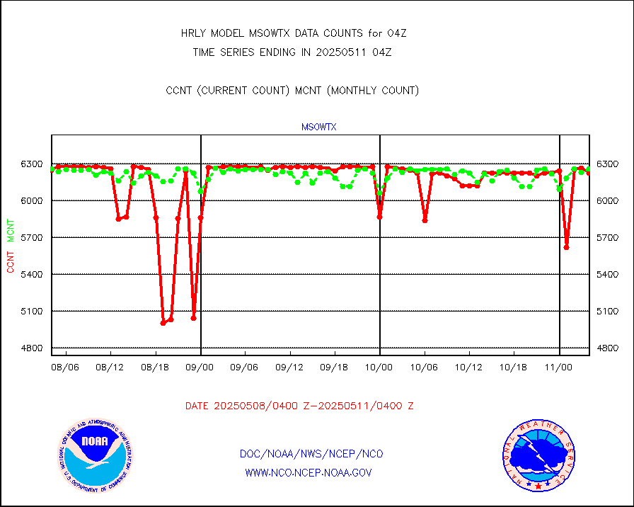
msowtx |
Mesonet/MADIS West Texas |
5658 |
5614 |
100.8 % |
2003.50-2004.49 |
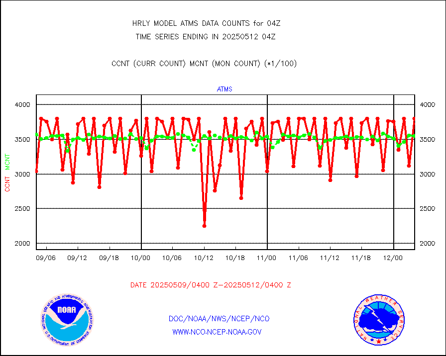
mtiasi |
METOP 1-2 IASI 1C radiance data (varbl. channels) |
106932 |
84319 |
126.8 % |
2002.00-2002.99 |
nxrdw |
NEXRAD Vel Azm Dsp(VAD) winds via radar coded msg |
0 |
0 |
n/a |
2003.50-2004.49 |
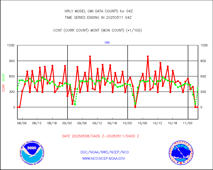
omi |
Aura Ozone Monitoring Instrument (OMI) data |
28800 |
31332 |
91.9 % |
2001.50-2002.49 |
osbuv8 |
NOAA 16-19 Solar Backscatter UV-2 rad frm V8 BUFR |
0 |
0 |
n/a |
2002.00-2002.99 |
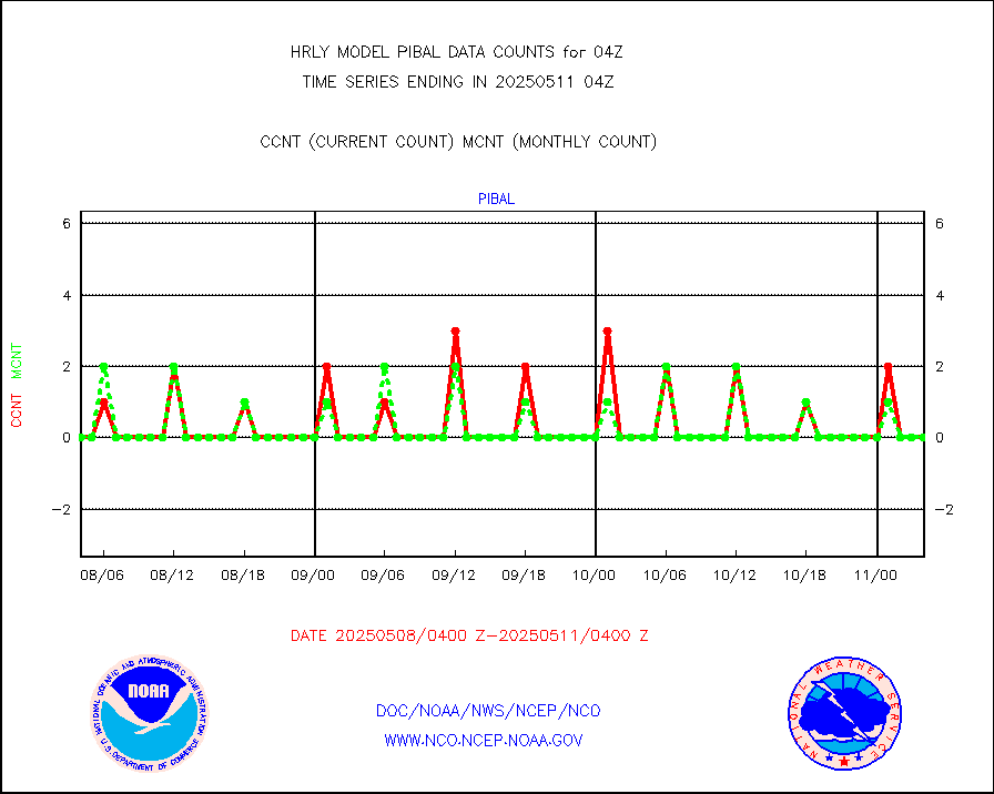
pibal |
PIBAL (from PILOT, PILOT SHIP, PILOT MOBIL) |
0 |
0 |
n/a |
2003.50-2004.49 |
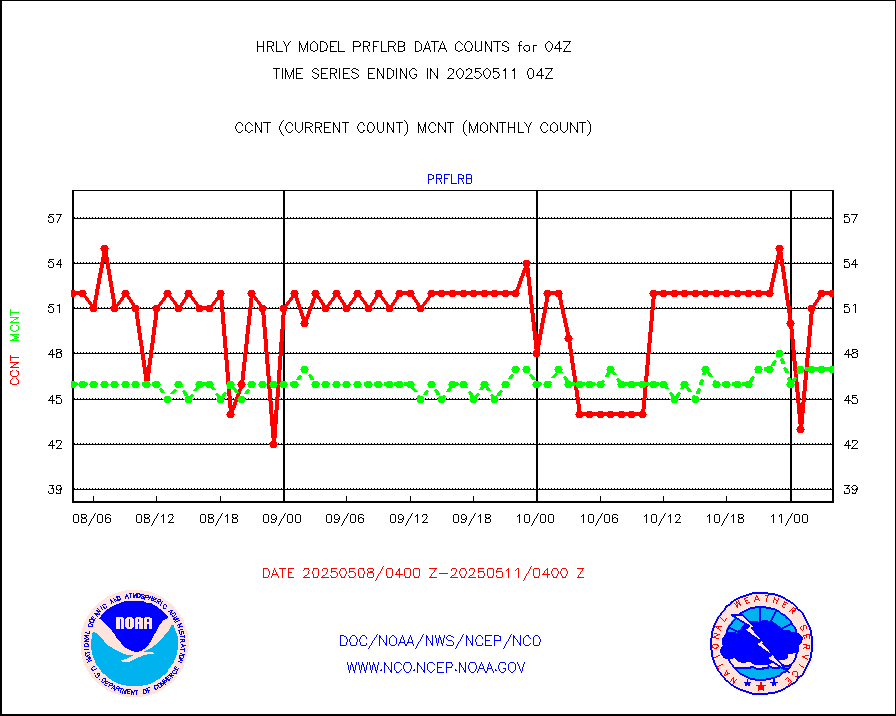
prflrb |
Multi-Agency Profiler (MAP) and SODAR winds |
35 |
42 |
83.3 % |
2003.50-2004.49 |
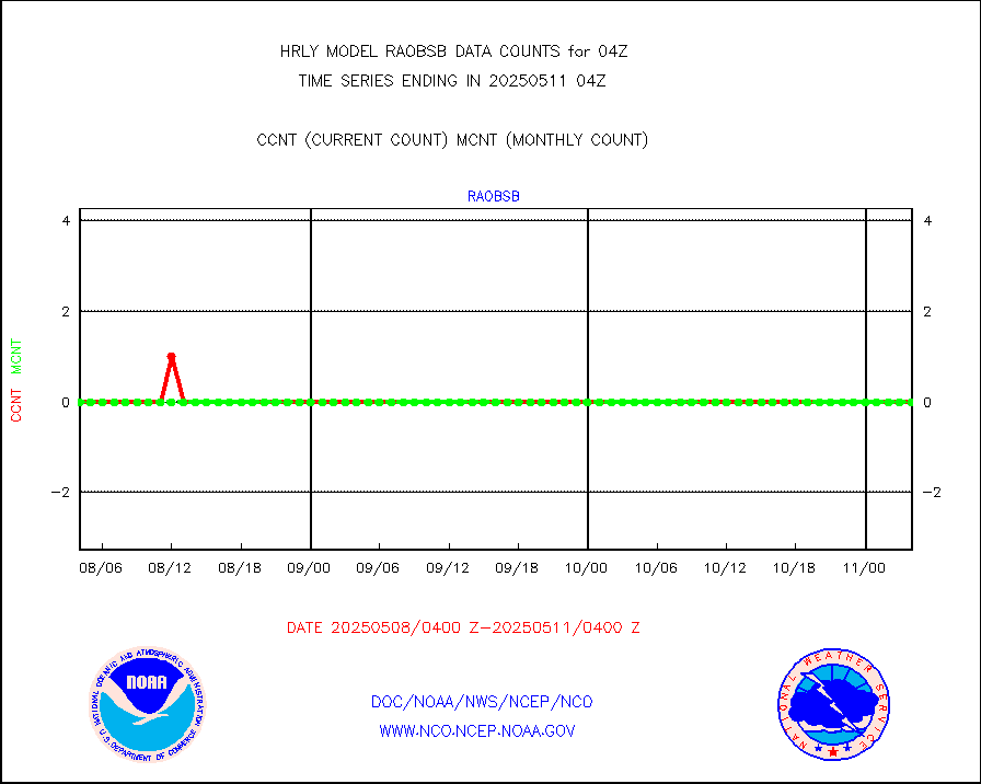
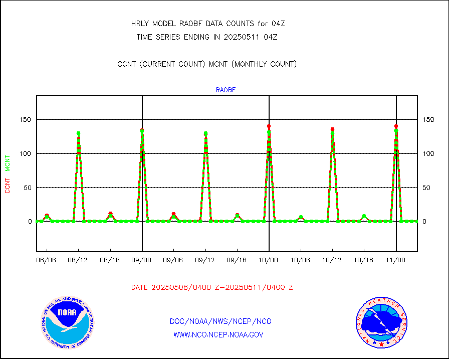
raobf |
Rawinsonde - fixed land (from TEMP or PILOT) |
0 |
0 |
n/a |
2003.50-2004.49 |
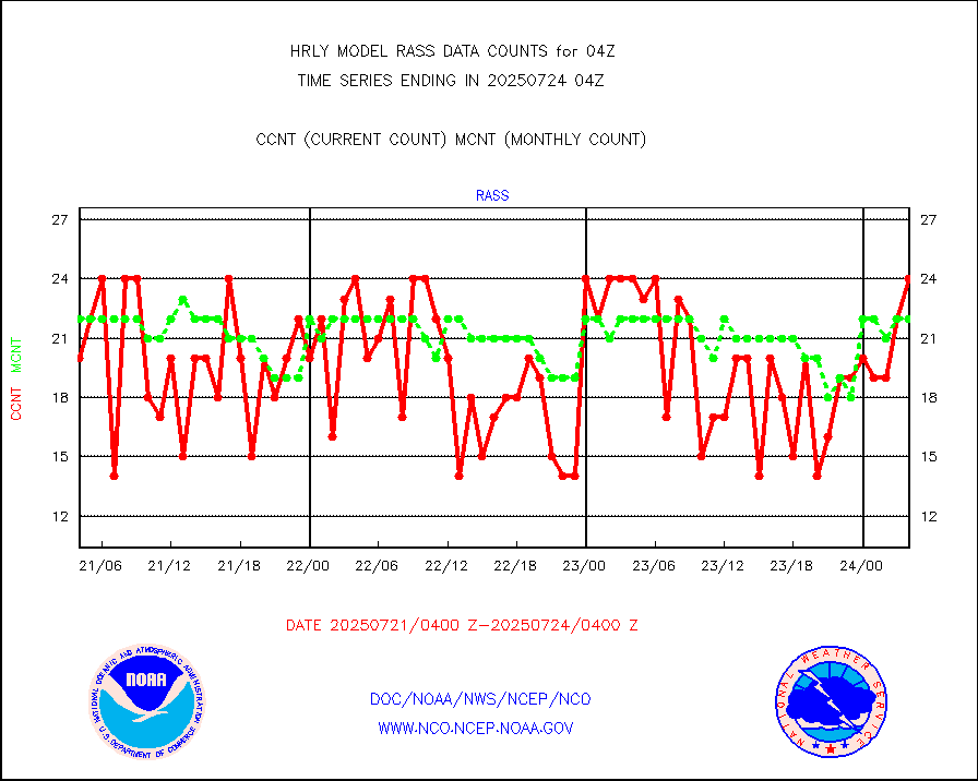
rass |
RASS temperatures (NOAA and Multi-Agency) |
21 |
27 |
77.8 % |
2003.50-2004.49 |
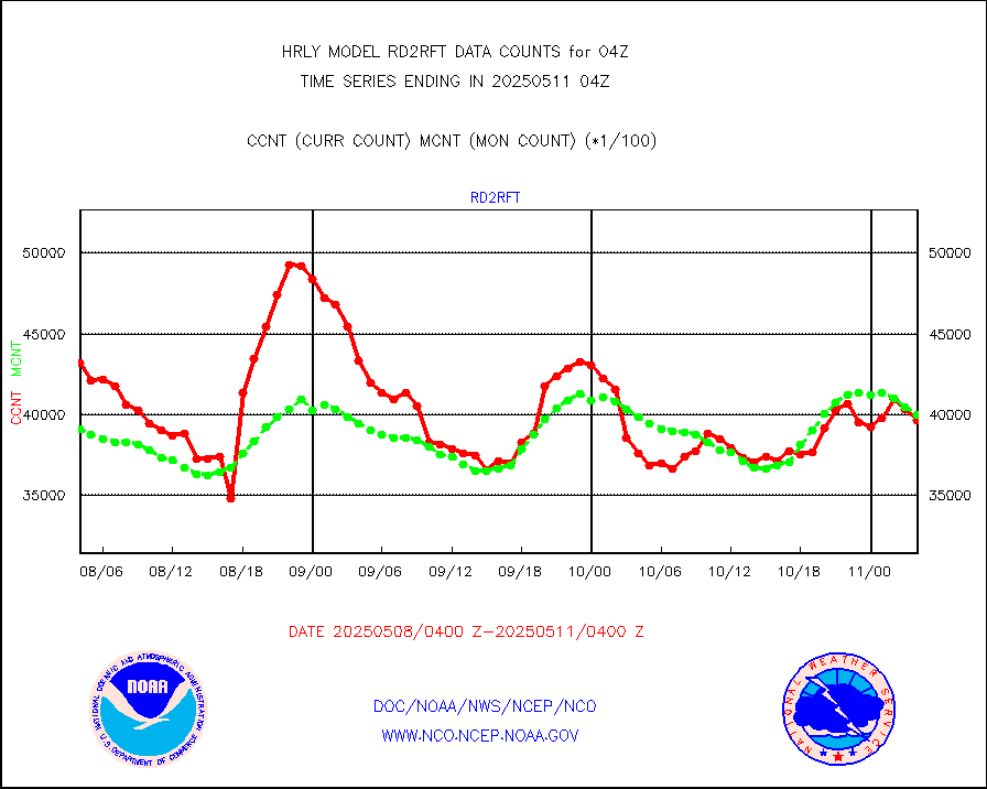
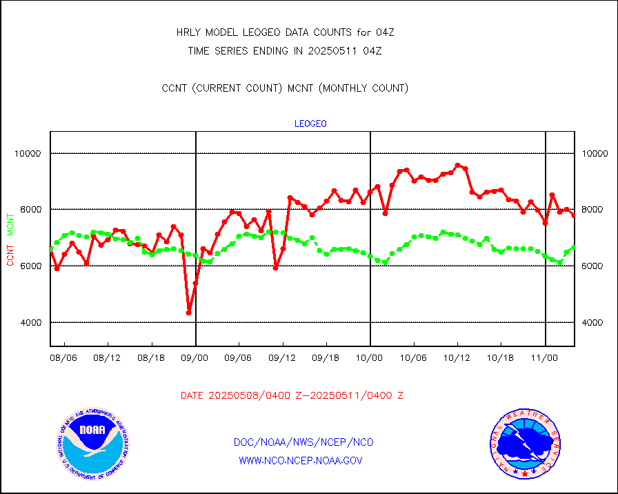
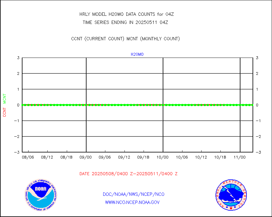
rd2rft |
NEXRAD reflectivity (Lvl 2 - GTS) |
3908869 |
4055580 |
96.4 % |
2003.50-2004.49 |
rd2wnd |
NEXRAD radial wind (Level 2 - GTS) |
1535263 |
1529046 |
100.4 % |
2003.50-2004.49 |
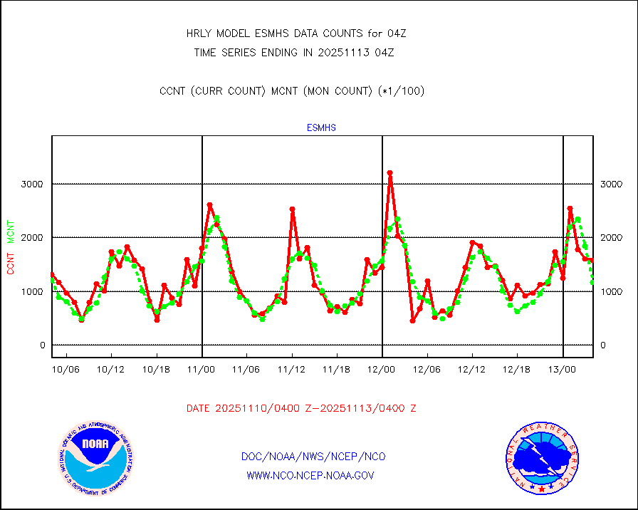
sevcsr |
METEOSAT-10 2nd Gen SEVIRI Clr Sky Radiance(proc) |
0 |
0 |
n/a |
2003.50-2004.49 |
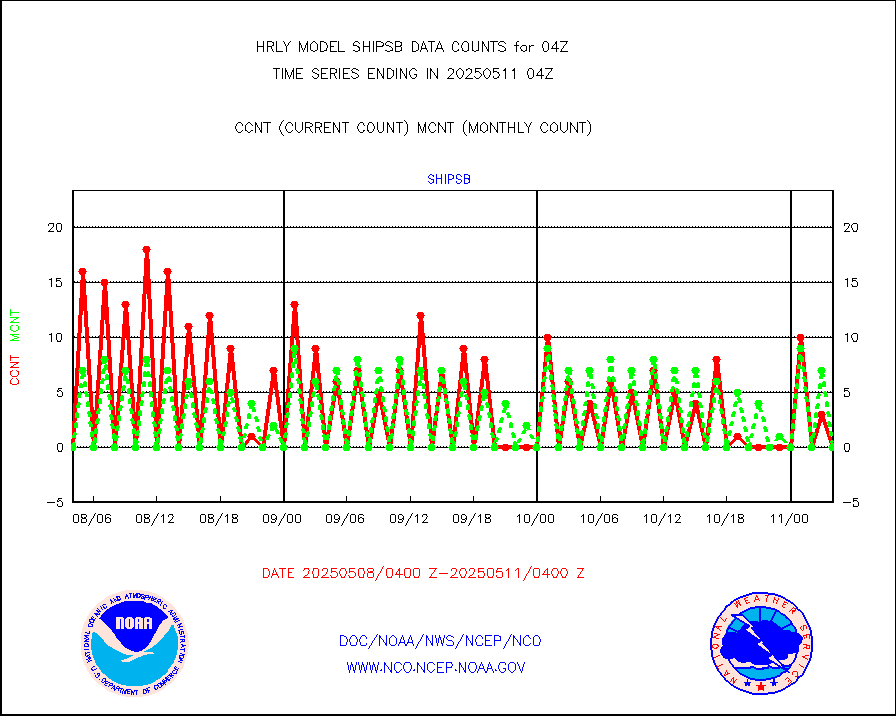
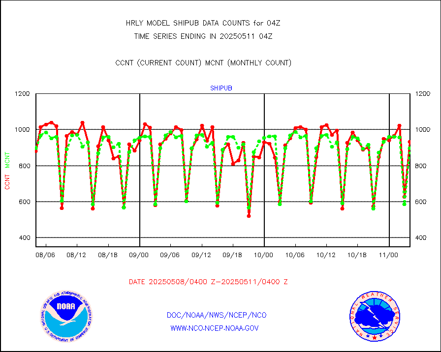
shipsb |
Ship - manual and automatic, restricted (BUFR) |
0 |
0 |
n/a |
2003.50-2004.50 |
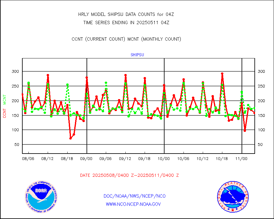
shipsu |
Ship - manual and automatic, unrestricted |
107 |
118 |
90.7 % |
2003.50-2004.50 |
shipub |
Ship - manual and automatic, unrestricted (BUFR) |
823 |
759 |
108.4 % |
2003.50-2004.50 |
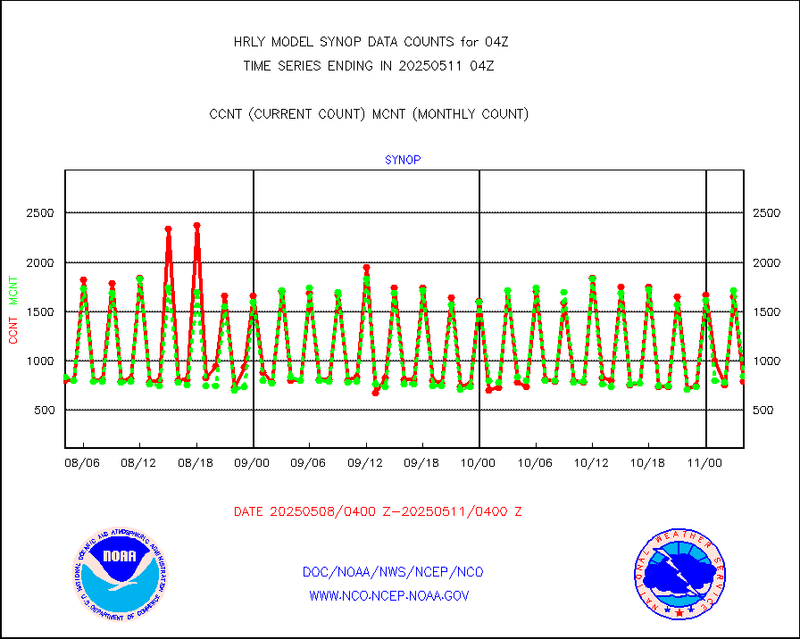
synop |
Synoptic - fixed manual and automatic |
950 |
892 |
106.5 % |
2003.50-2004.49 |
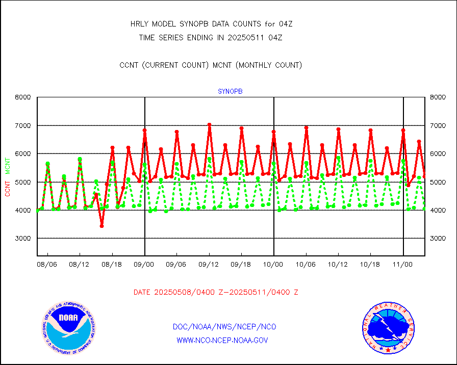
synopb |
Synoptic - fixed manual & auto (decoded fr BUFR) |
4094 |
4128 |
99.2 % |
2003.50-2004.49 |
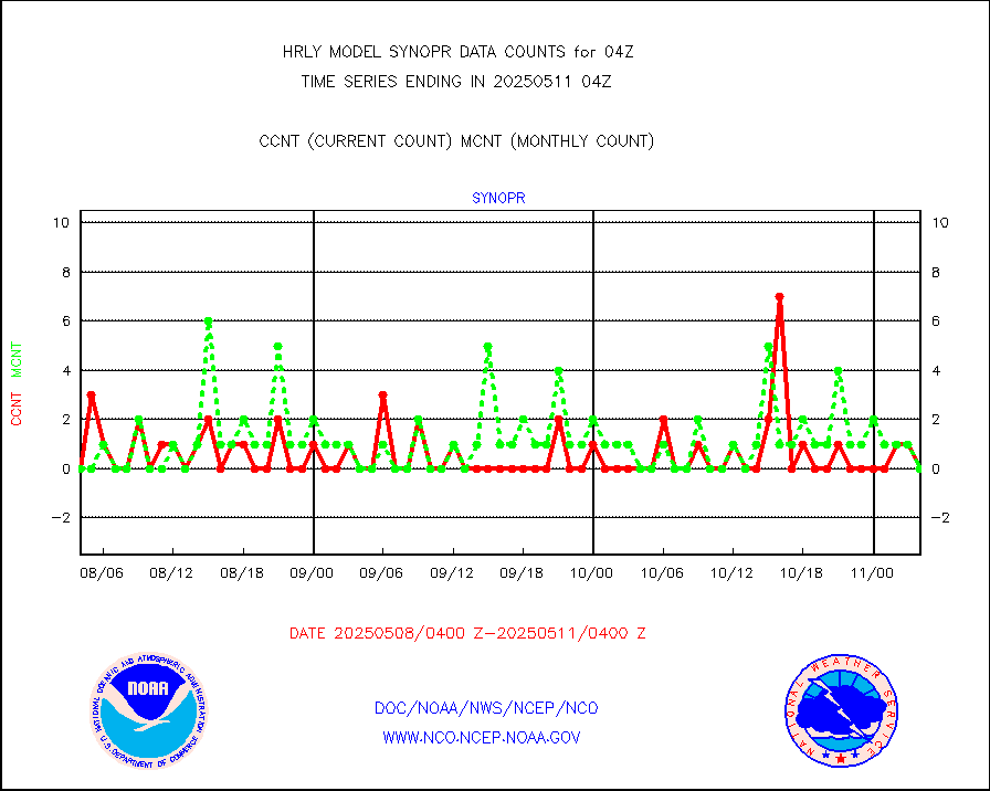
synopr |
Synoptic - restricted (WMO Res 40) manual & auto. |
0 |
1 |
0.0 % |
2003.50-2004.49 |
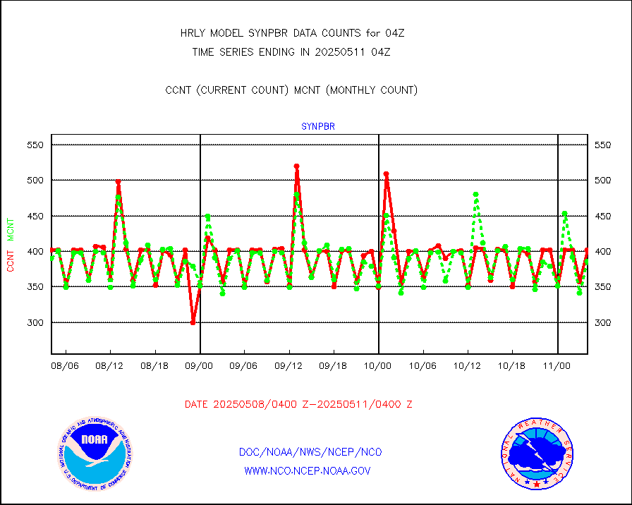
synpbr |
Synoptic - restricted (WMO Res 40)(decoded BUFR) |
391 |
396 |
98.7 % |
2003.50-2004.49 |
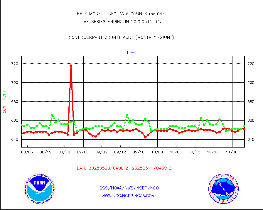
tideg |
Tide gauge reports decoded from CREX format |
647 |
642 |
100.8 % |
2003.00-2003.99 |
| Data Types of Opportunity with Normal Counts |
|---|
| Type | Description | Hourly Count | Monthly Average | Percent (%) of Monthly Mean | UTC Time Window |
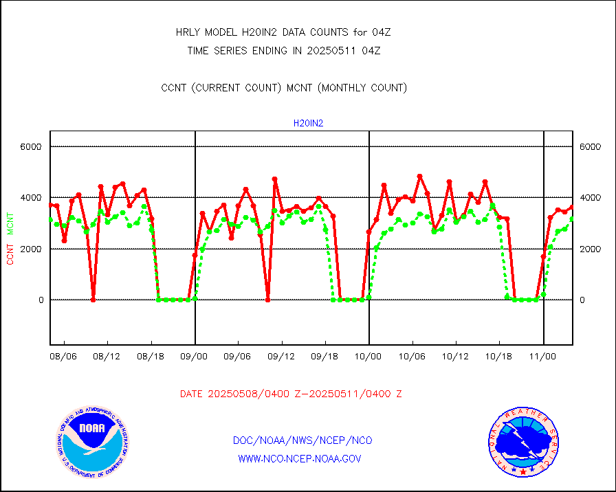
3p9usr |
GOES-16&up/NESDIS ir short-wv derived cld motion |
27707 |
31802 |
87.1 % |
2003.00-2003.99 |
acarsa |
MDCRS ACARS acft data (ARINC via AFWA)(AIREP fmt) |
0 |
0 |
n/a |
2003.50-2004.49 |
ahicsr |
Himawari Clear Sky Radiance |
0 |
0 |
n/a |
2003.00-2003.99 |
amsr2 |
GCOM-W AMSR2 1B brightness temperatures |
2309472 |
2170833 |
106.4 % |
2002.00-2002.99 |
atmsdb |
NPP/NOAA-20 ATMS bright. temps-direct b-cast SSEC |
103827 |
108683 |
95.5 % |
2002.50-2003.49 |
atovs |
POES/NESDIS - processed ATOVS soundings/radiances |
0 |
0 |
n/a |
2002.00-2002.99 |
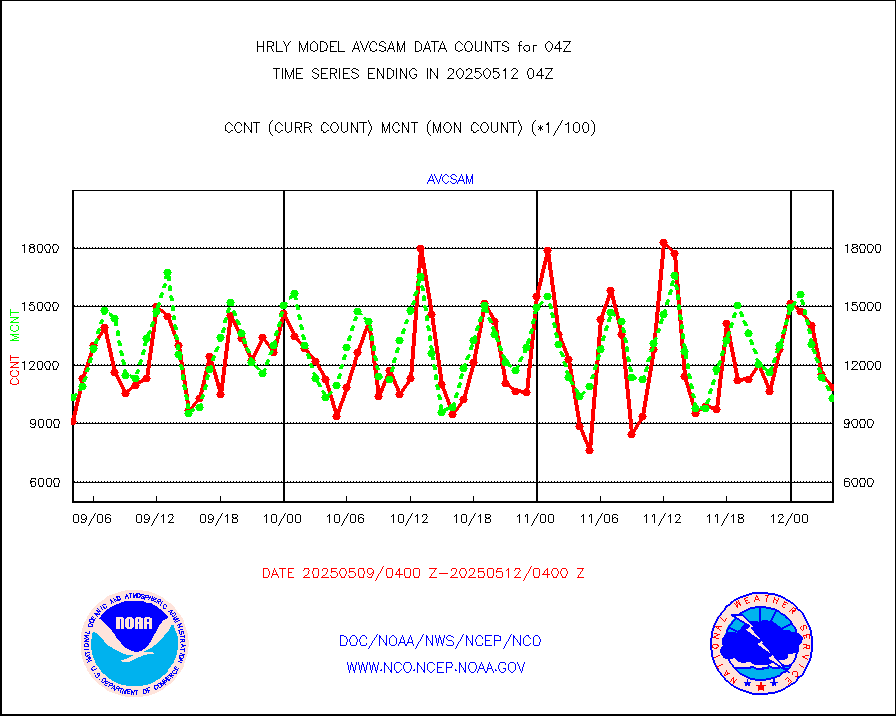
avcsam |
A.M.(N17,M2,M3) AVHRR GAC NCEP-proc clr&sea btmps |
1004980 |
1111758 |
90.4 % |
2001.50-2002.49 |
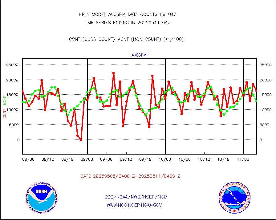
avcspm |
P.M.(N18-19) AVHRR GAC NCEP-proc clr & sea btemps |
1069673 |
1364806 |
78.4 % |
2001.50-2002.49 |
bathy |
eXpendable BathyThermograph, mooring (BATHY fmt) |
0 |
0 |
n/a |
1921.00-1921.99 |
coopmd |
Coop/MADIS NEPP & HCN-Modernization NOAA COOP Obs |
27 |
27 |
100.0 % |
2003.50-2004.49 |
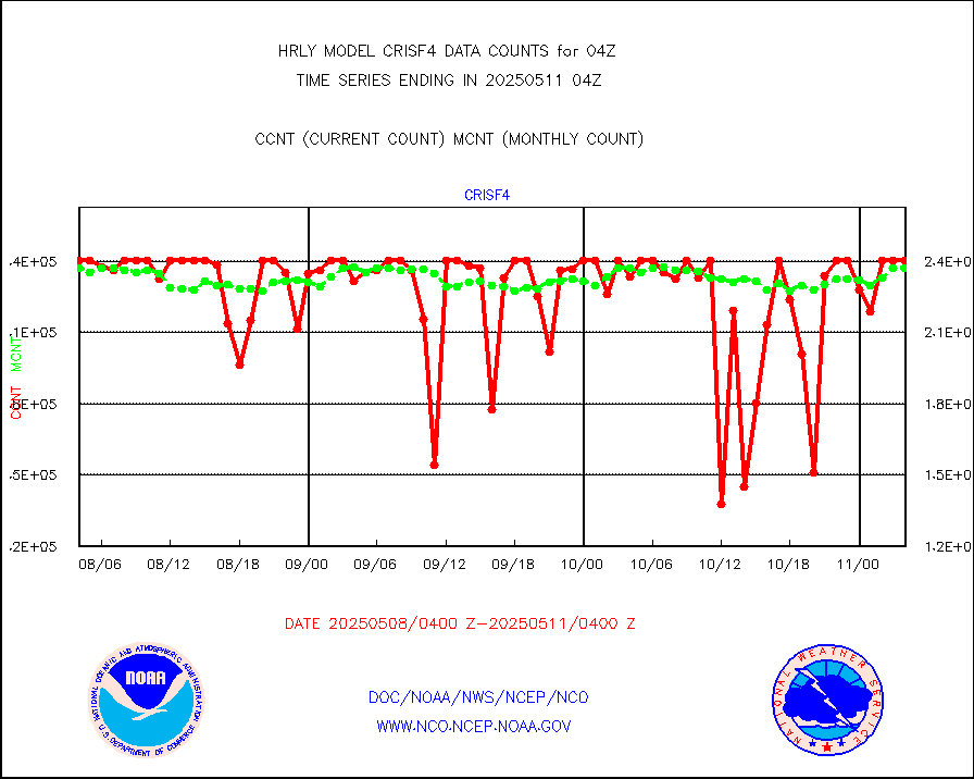
crisf4 |
NPP/NOAA-20 CrIS full spctrl radn (431 ch subset) |
218520 |
234359 |
93.2 % |
2002.50-2003.49 |
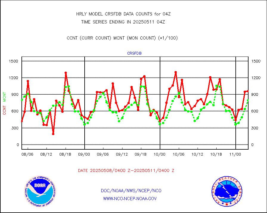
crsfdb |
NPP/NOAA-20 CrIS full spctrl radn dir brdcst SSEC |
104914 |
118602 |
88.5 % |
2002.50-2003.49 |
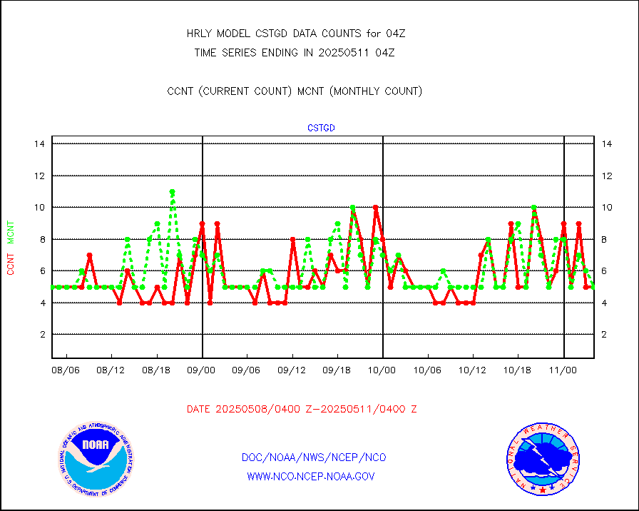
cstgd |
Coast Guard |
3 |
3 |
100.0 % |
2003.50-2004.50 |
dbuoyb |
Drifting buoys (decoded from BUFR) |
1432 |
1410 |
101.6 % |
2003.50-2004.50 |
dropw |
Dropwinsonde (from TEMP DROP) |
0 |
0 |
n/a |
2003.50-2004.49 |
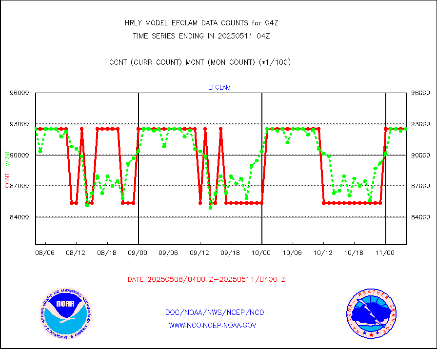
efclam |
GOES imager effective cloud amount data (U.Wisc.) |
8295499 |
8267155 |
100.3 % |
2003.50-2004.49 |
esatms |
NPP Adv. Tech. MW Sndr (ATMS) br. temps from RARS |
139111 |
127471 |
109.1 % |
2002.50-2003.49 |
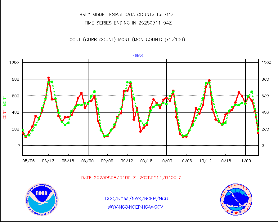
esiasi |
METOP 1-2 IASI 1C radiance data vbl chn from RARS |
32681 |
31758 |
102.9 % |
2003.00-2003.99 |
esmhs |
NOAA 18-19 & METOP 1-2 MHS proc. btemps from RARS |
212516 |
201877 |
105.3 % |
2003.50-2004.49 |
geoimr |
GOES/NESDIS (11x17 f-o-v) imager clear radiances |
0 |
0 |
n/a |
2003.00-2003.99 |
gome |
METOP 1-2 Global Ozone Monitoring Exp.-2 (GOME-2) |
11965 |
7522 |
159.1 % |
2002.50-2003.49 |
h20in2 |
INDIA SATWIND, INSAT WV channel |
6180 |
5628 |
109.8 % |
2003.00-2003.99 |
h2dusr |
GOES-16&up/NESDIS wv imgr/deep-lyr derivd cld mtn |
15067 |
16214 |
92.9 % |
2003.00-2003.99 |
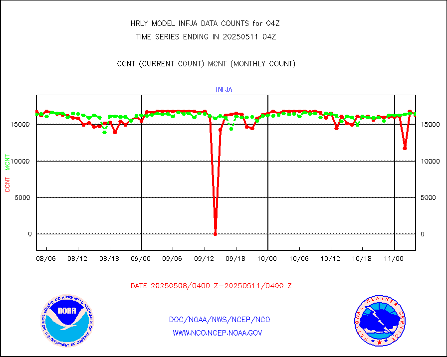
h2eunb |
METEOSAT/EUMETSAT wvpr imgr drv cld motion NBseq |
38211 |
40674 |
93.9 % |
2002.50-2003.49 |
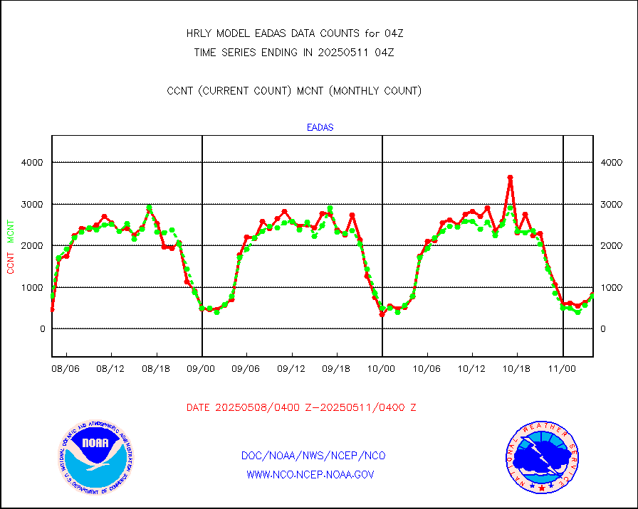
hdob |
High Density OBs from reconnaissance acft data |
0 |
3 |
0.0 % |
2003.50-2004.49 |
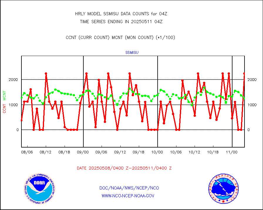
iasidb |
METOP 1-2 IASI 1C radiances-direct broadcast SSEC |
59057 |
75522 |
78.2 % |
2002.50-2003.49 |
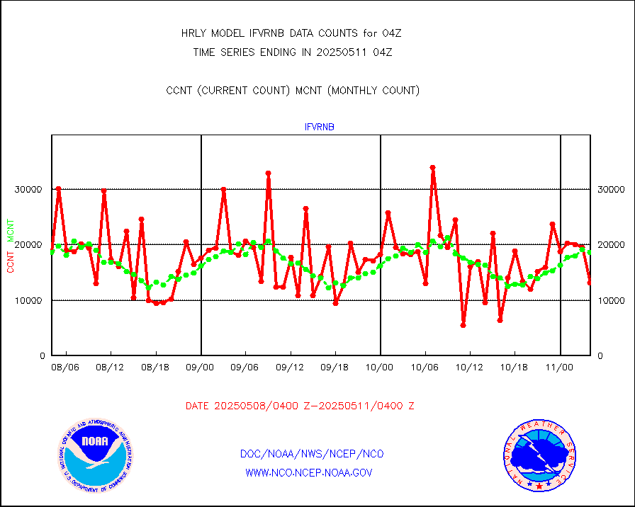
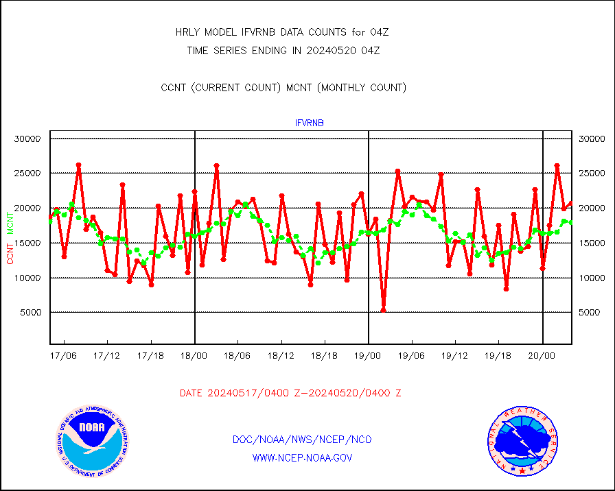
ifvrnb |
VIIRS (NPP/NOAA-20) ir lg-wv drv cloud motion(NB) |
20680 |
17955 |
115.2 % |
2000.00-2000.99 |
infav |
AVHRR (NOAA/METOP) ir lg-wave derived cld motion |
0 |
0 |
n/a |
2000.00-2000.99 |
infav1 |
AVHRR (METOP) ir lg-wave derived cld motion |
0 |
0 |
n/a |
2003.50-2004.50 |
infin |
INSAT/KALPANA India ir lg-wave derived cld motion |
0 |
0 |
n/a |
2001.50-2002.49 |
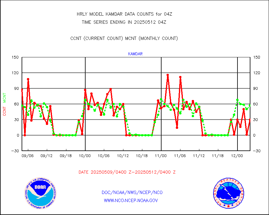
infin2 |
INDIA SATWIND, INSAT IR channel |
6961 |
5697 |
122.2 % |
2003.00-2003.99 |
kamdar |
Korean AMDAR aircraft data (decoded from BUFR) |
43 |
74 |
58.1 % |
2003.50-2004.49 |
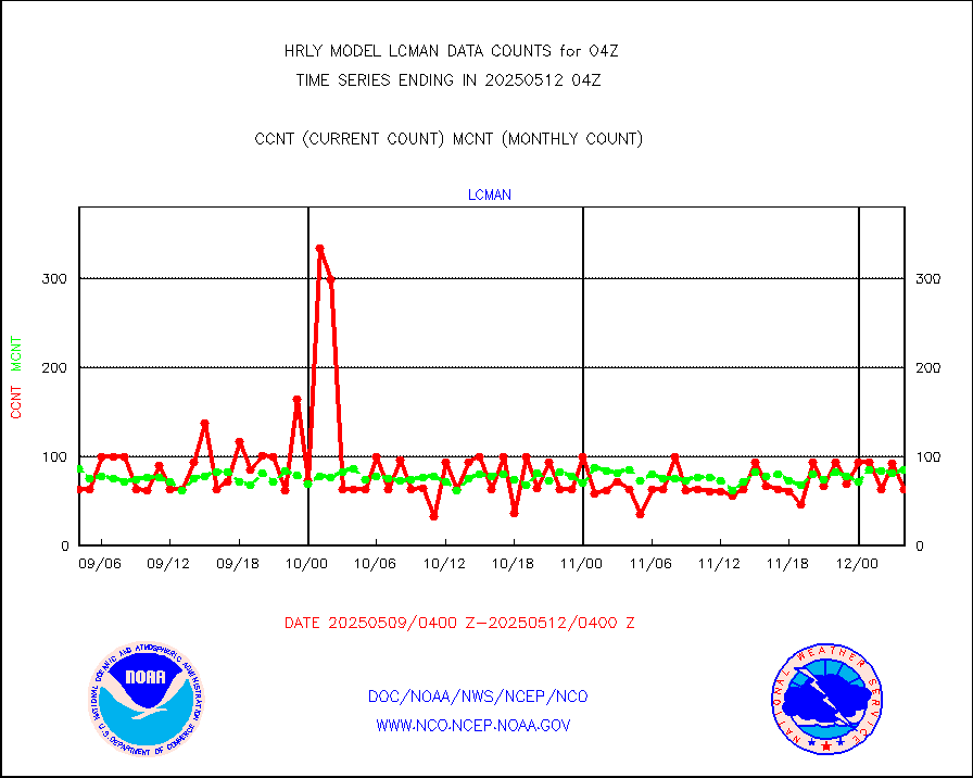
lcman |
Land-based CMAN stations decoded from CMAN format |
95 |
78 |
121.8 % |
2003.50-2004.49 |
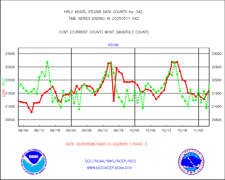
leogeo |
LEO-GEO satellite AMVs from UWisc. |
0 |
4447 |
0.0 % |
2000.00-2000.99 |
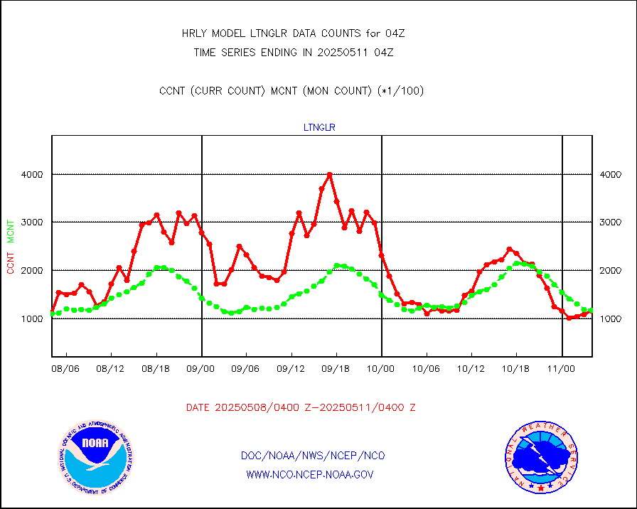
ltnglr |
LLDN Long-rng lightning from Vaisala via NOAAPORT |
122699 |
135719 |
90.4 % |
2003.50-2004.49 |
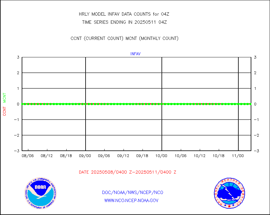
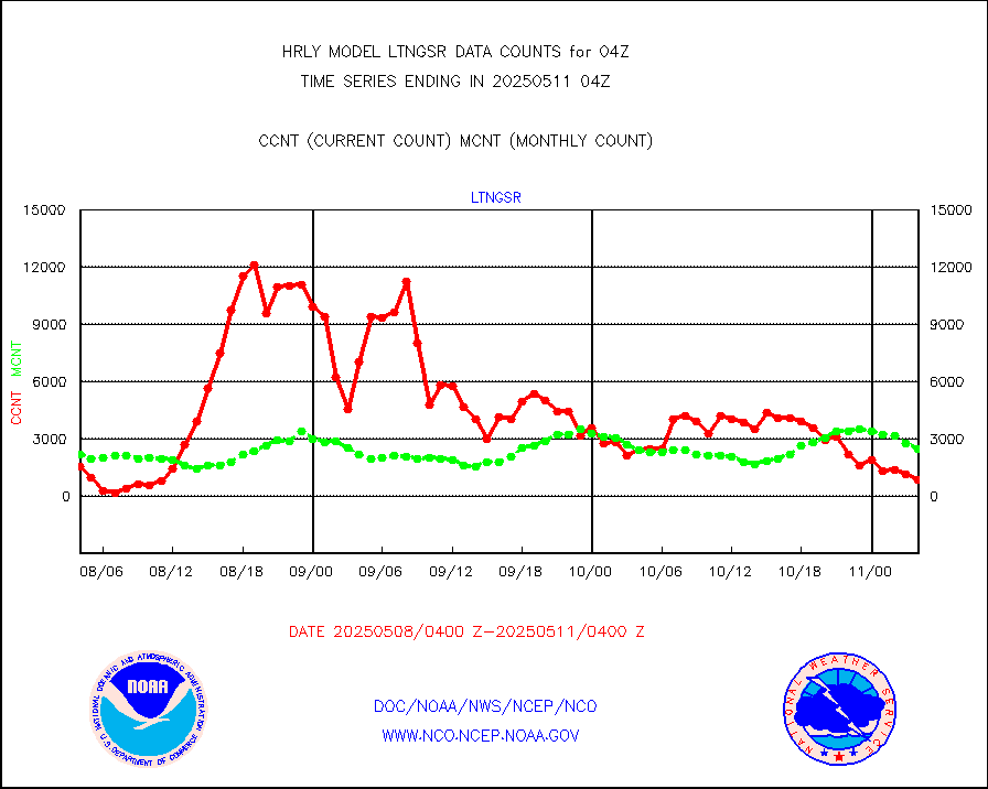
ltngsr |
NLDN Shrt-rng lightning from Vaisala via NOAAPORT |
6665 |
4729 |
140.9 % |
2003.50-2004.49 |
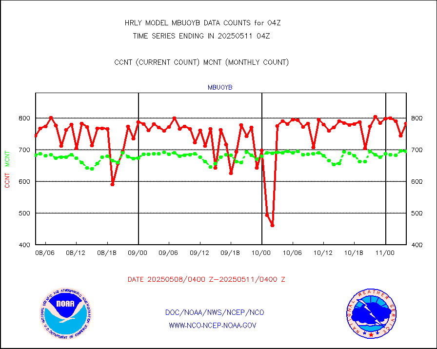
mbuoyb |
Moored buoys (decoded from BUFR) |
813 |
738 |
110.2 % |
2003.50-2004.50 |
mls |
Aura Microwave Limb Sounder (MLS) ozone data |
0 |
0 |
n/a |
2002.00-2002.99 |
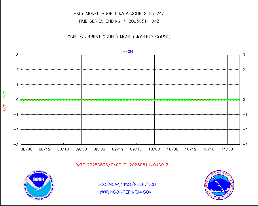
msourb |
Mesonet/MADIS UrbaNet |
4357 |
4356 |
100.0 % |
2003.50-2004.49 |
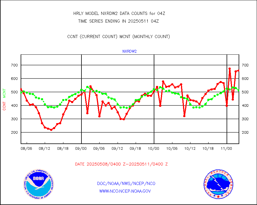
nxrdw2 |
NEXRAD Vel Azm Dsp(VAD) winds via Level 2 decoder |
671 |
659 |
101.8 % |
2003.50-2004.49 |
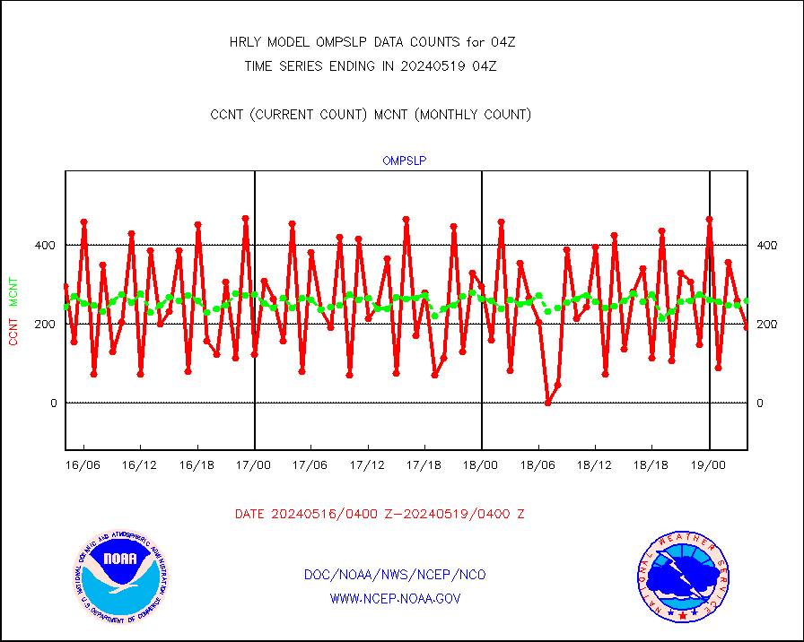
ompslp |
OMPS Limb Profiler ozone data (NPP) |
72 |
256 |
28.1 % |
1921.00-1921.99 |
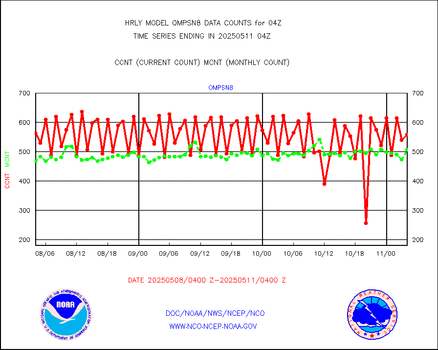
ompsn8 |
OMPS nadir profile ozone (Version 8 BUFR) |
510 |
558 |
91.4 % |
2002.00-2002.99 |
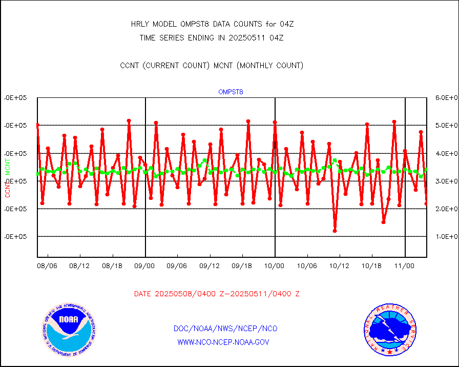
ompst8 |
OMPS total column ozone (Version 8 BUFR) |
353376 |
329544 |
107.2 % |
2002.00-2002.99 |
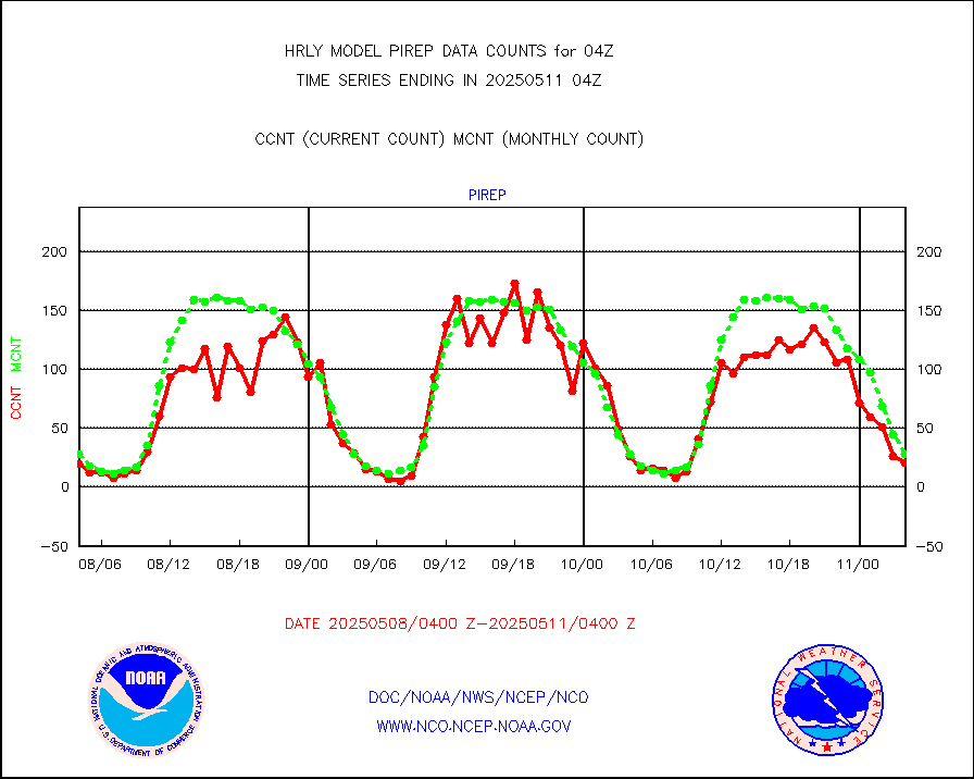
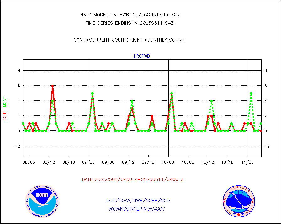
pirep |
Manual PIREP aircraft data (dcded from AIREP fmt) |
22 |
26 |
84.6 % |
2003.50-2004.49 |
prflrp |
Profilr winds from PIBAL (PILOT,PILOT SHIP/MOBIL) |
0 |
0 |
n/a |
2003.50-2004.49 |
raobm |
Rawinsonde - mobile land (from TEMP/PILOT MOBIL) |
0 |
0 |
n/a |
2003.50-2004.49 |
raobs |
Rawinsonde - ship (from TEMP SHIP, PILOT SHIP) |
0 |
0 |
n/a |
2003.50-2004.49 |
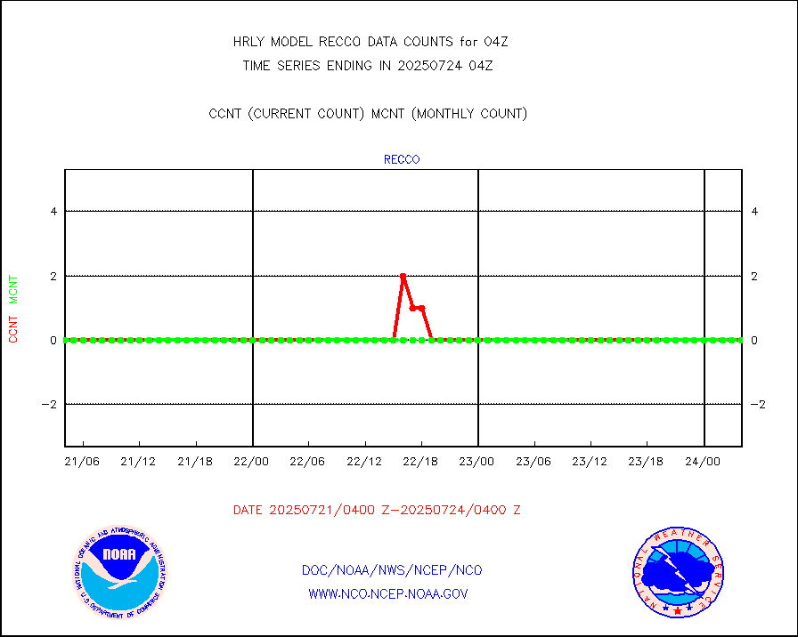
recco |
Flight level reconnaissance aircraft data |
0 |
0 |
n/a |
2003.50-2004.49 |
saphir |
Megha-Tropiques SAPHIR L1A2 brightness temps |
0 |
0 |
n/a |
2001.50-2002.49 |
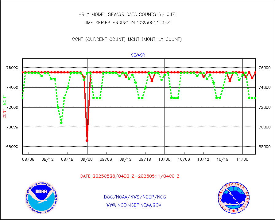
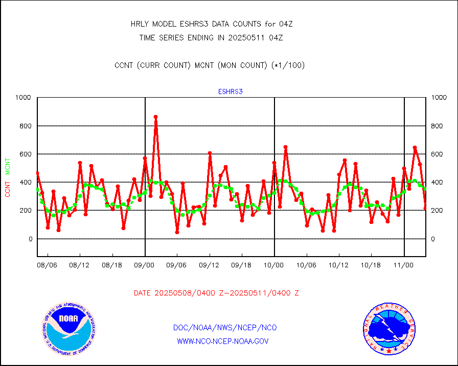
sevasr |
METEOSAT-10 2nd Gen SEVIRI All Sky Radiance(proc) |
75512 |
69175 |
109.2 % |
2003.50-2004.49 |
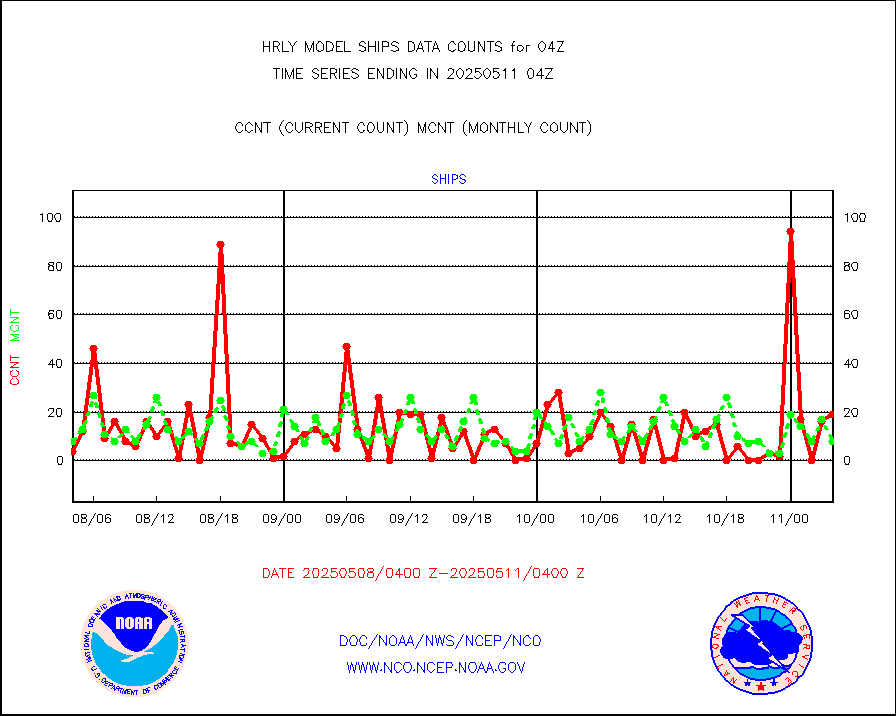
ships |
Ship - manual and automatic, restricted |
5 |
4 |
125.0 % |
2003.50-2004.49 |
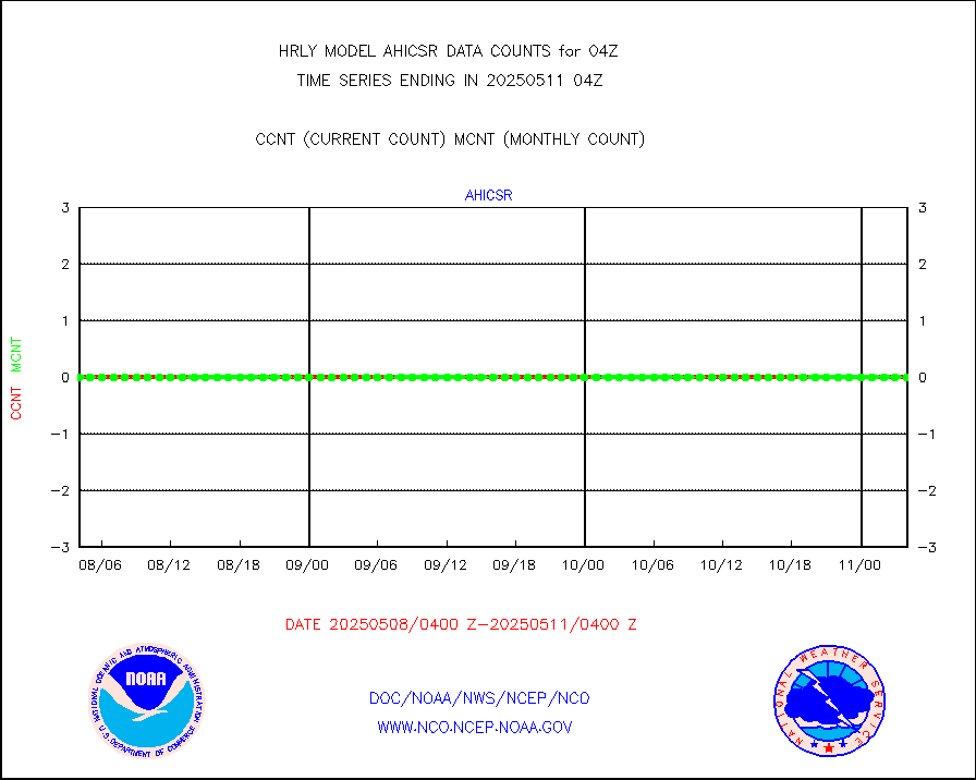
ssmisu |
DMSP SSM/IS 1C radiance data (Unified Pre-Proc.) |
19140 |
121556 |
15.7 % |
2002.50-2003.49 |
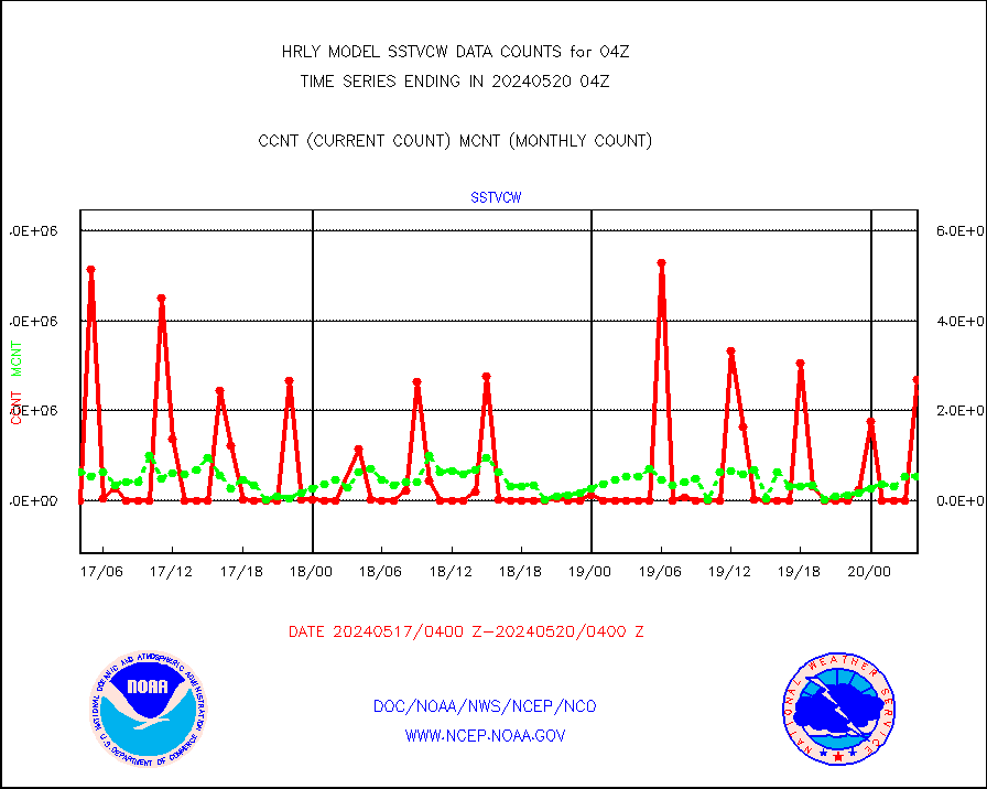
sstvcw |
NPP/NOAA-20 VIIRS SST - CLEAR & OVER WATER |
2692384 |
529560 |
508.4 % |
2003.50-2004.49 |
sstvpw |
NPP/NOAA-20 VIIRS SST - PROBABLY CLR & OVER WATER |
1146127 |
101451 |
n/a |
2003.50-2004.49 |
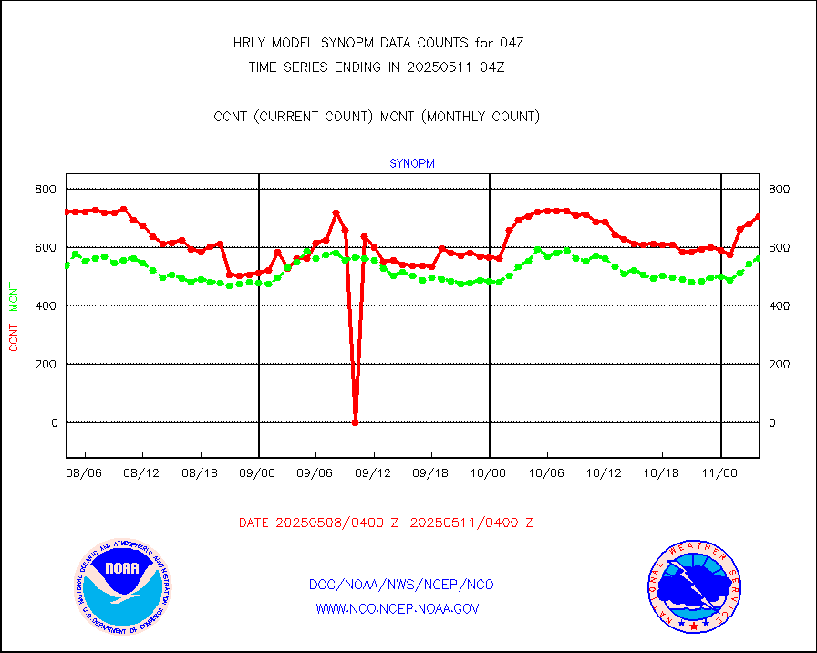
synopm |
Synoptic - mobile manual and automatic |
506 |
546 |
92.7 % |
2003.50-2004.49 |
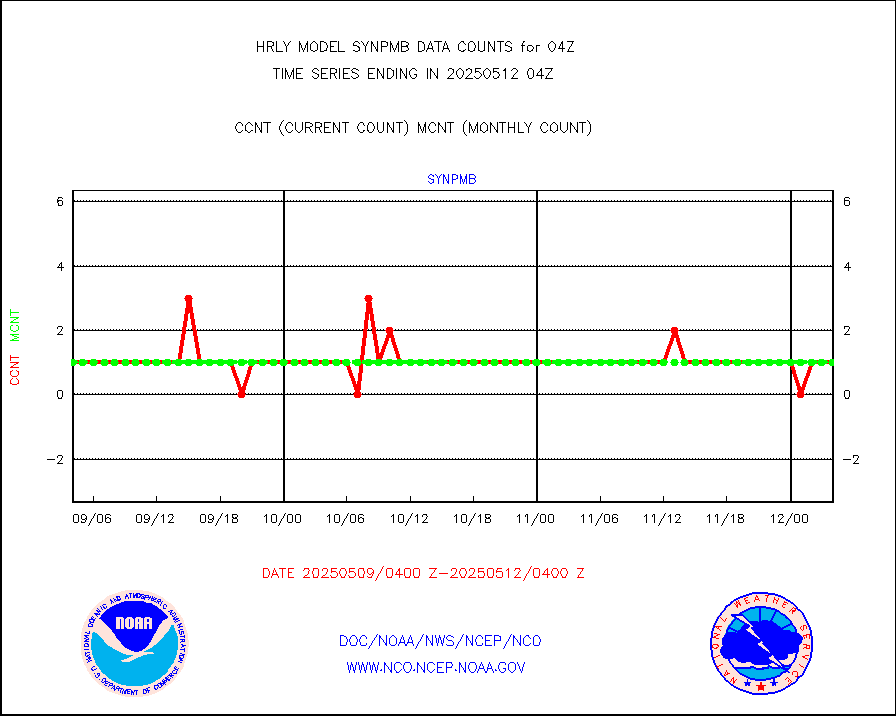
synpmb |
Synoptic - mobile manual & auto (decoded fr BUFR) |
0 |
1 |
0.0 % |
2003.50-2004.49 |
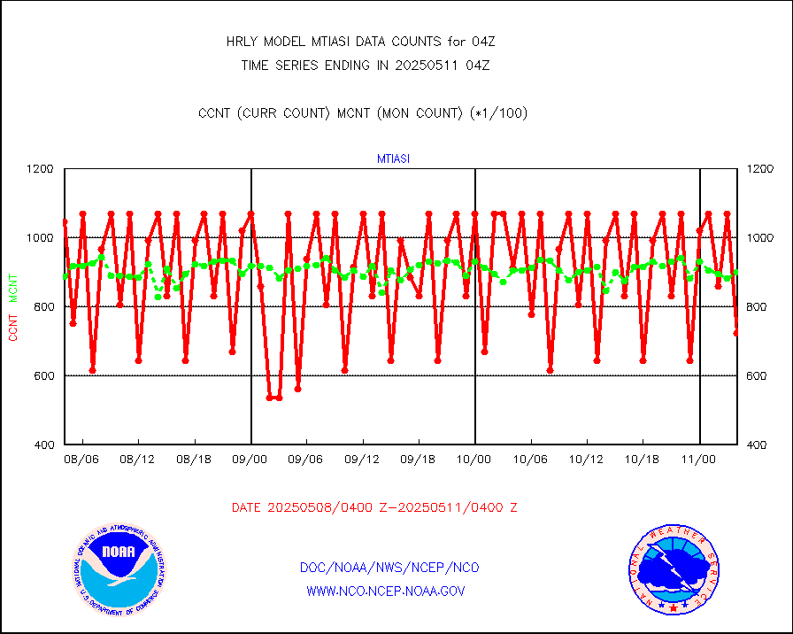
tesac |
CTD probe, Argo prflng float, mooring (TESAC fmt) |
192 |
190 |
101.1 % |
2003.50-2004.49 |
tmdara |
TAMDAR aircft data-all types(from Panasonic,BUFR) |
313 |
363 |
86.2 % |
2003.50-2004.49 |
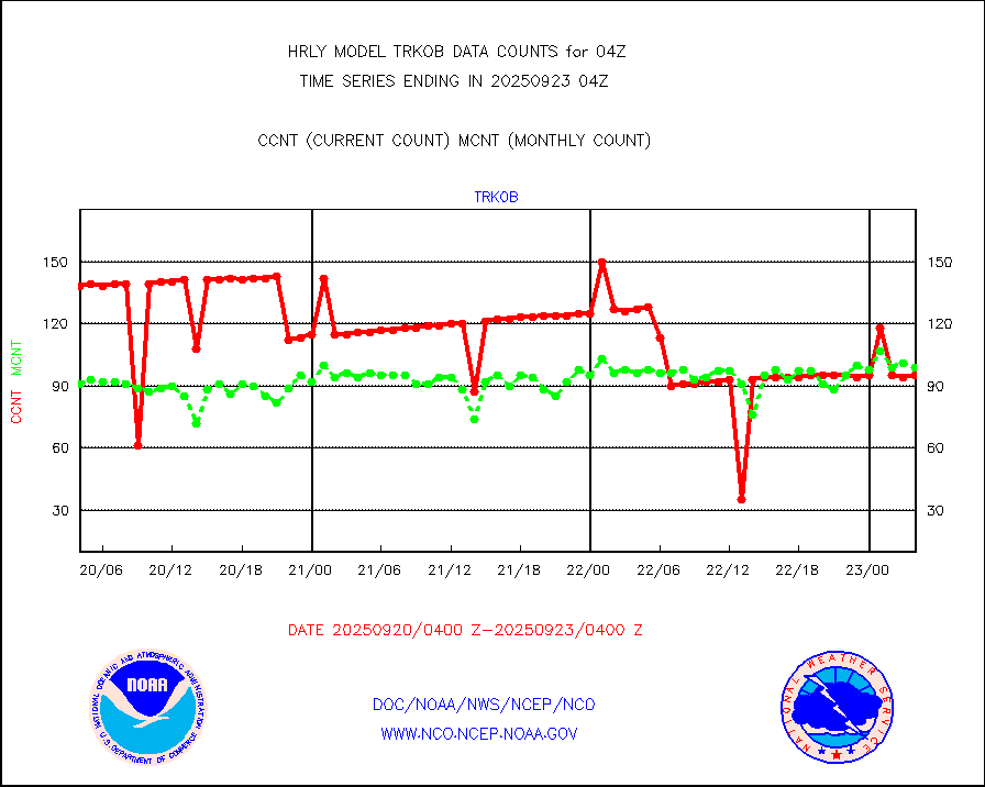
trkob |
ThermoSalinoGraph (TSG) TRACKOB format) |
90 |
44 |
204.5 % |
2002.50-2003.49 |
visin |
INSAT/KALPANA India visible derived cloud motion |
0 |
0 |
n/a |
2001.50-2002.49 |
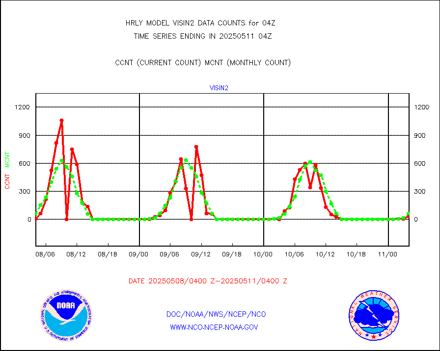
visin2 |
INDIA SATWIND, INSAT VIS channel |
58 |
109 |
53.2 % |
2003.00-2003.99 |
visja |
MTSAT/JMA visible derived cloud motion |
10920 |
10774 |
101.4 % |
2001.50-2002.49 |
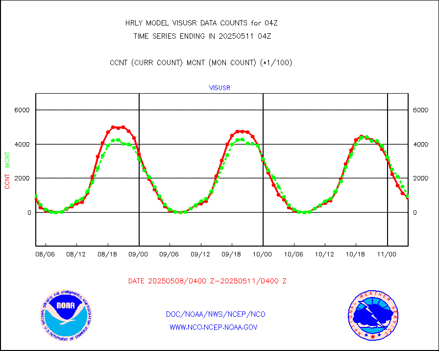
visusr |
GOES-16&up/NESDIS visible derived cloud motion |
72630 |
82461 |
88.1 % |
2003.00-2003.99 |
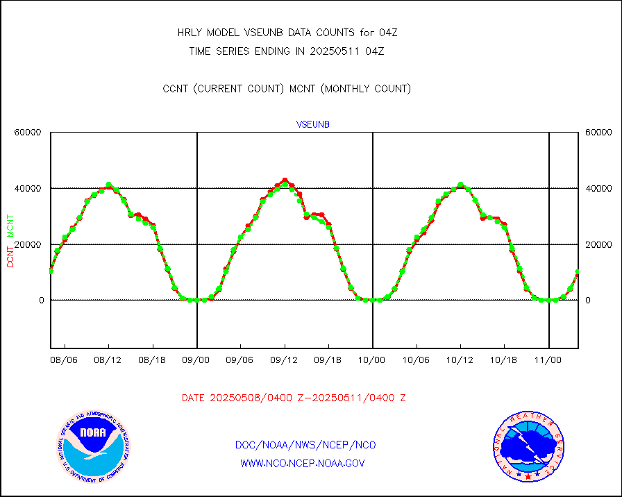
vseunb |
METEOSAT/EUMETSAT visible drv cld motion NBseq |
9383 |
8991 |
104.4 % |
2002.50-2003.49 |


