| Critical Data with Normal Counts |
|---|
| Type | Description | Hourly Count | Monthly Average | Percent (%) of Monthly Mean | UTC Time Window |
1bamua |
NOAA 15-19 & METOP 1-2 AMSU-A NCEP-proc. br.temps |
47696 |
53926 |
88.4 % |
2001.00-2001.99 |
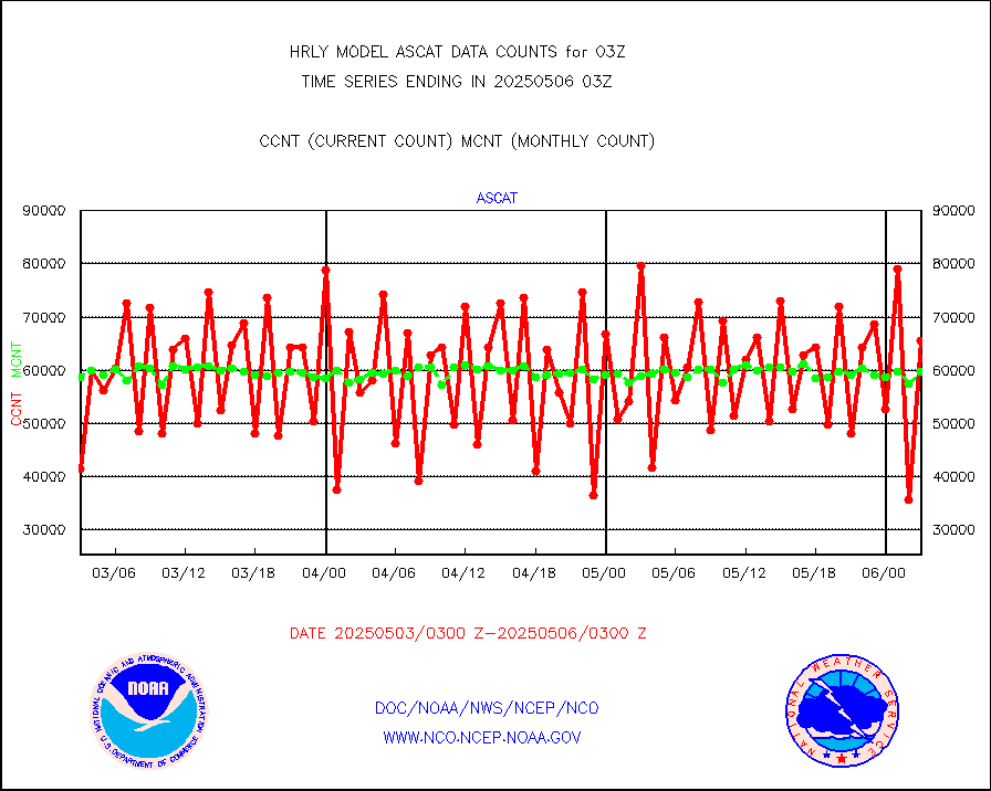
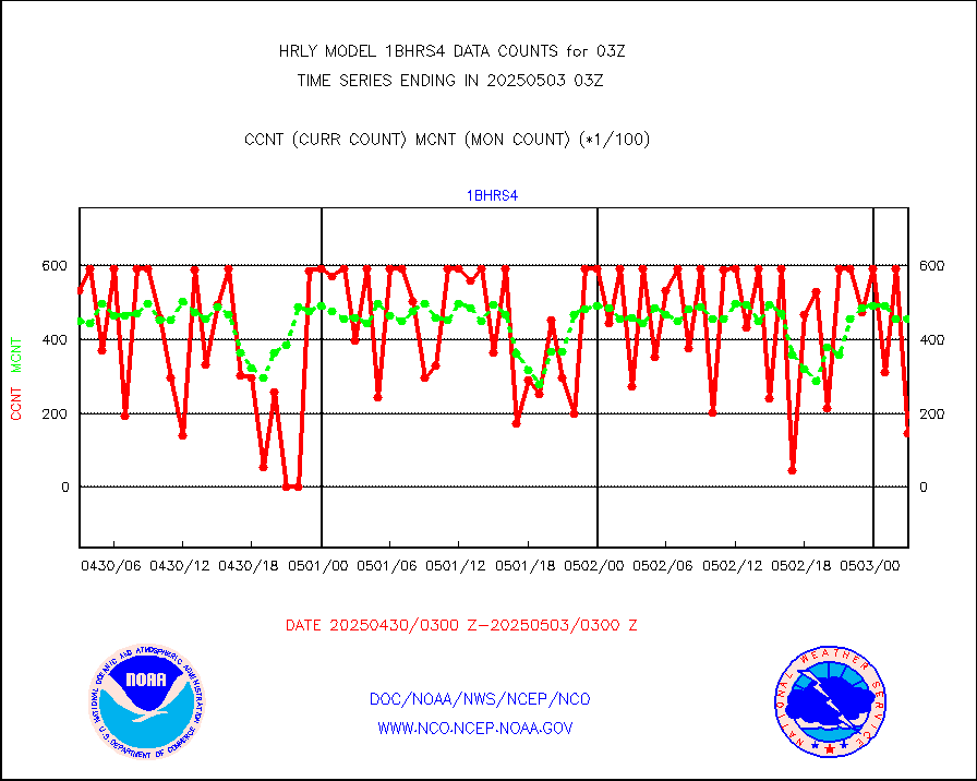
1bhrs4 |
NOAA 18-19 & METOP 1-2 HIRS-4 NCEP-proc. br.temps |
44426 |
47739 |
93.1 % |
2001.00-2001.99 |
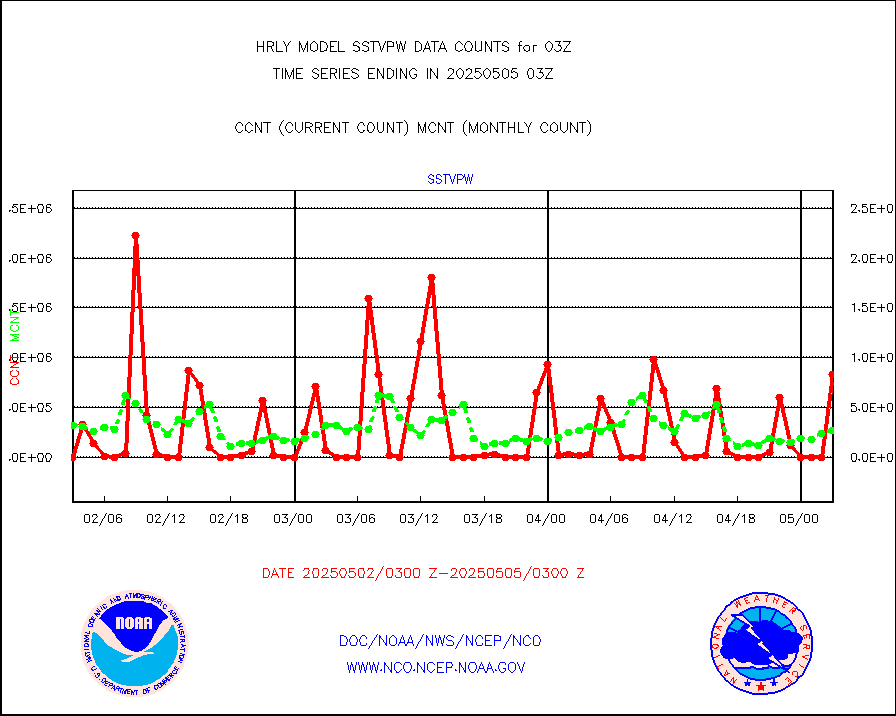
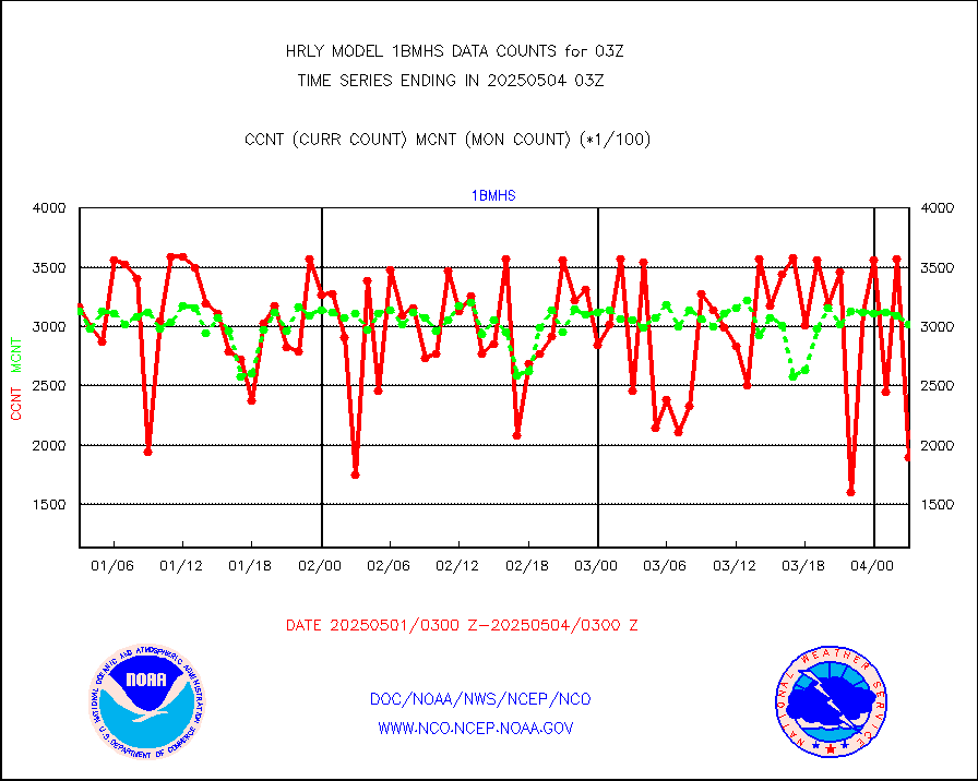
1bmhs |
NOAA 18-19 & METOP 1-2 MHS NCEP-proces. br. temps |
271408 |
300039 |
90.5 % |
2001.00-2001.99 |
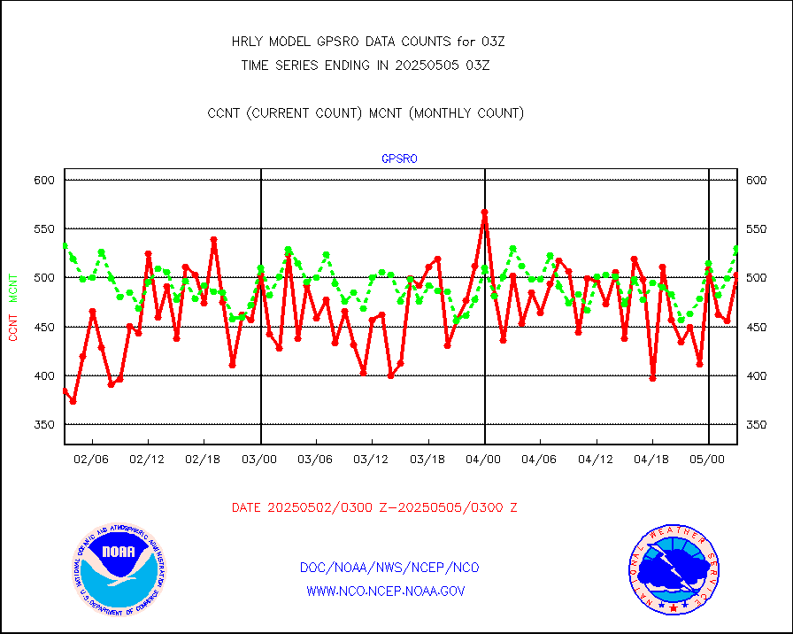
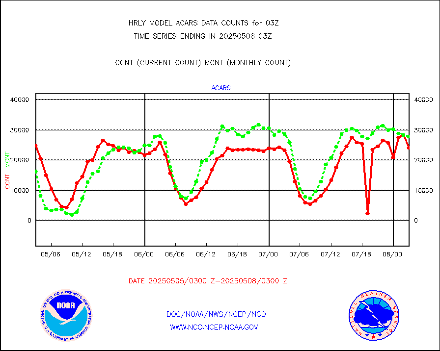
acars |
MDCRS ACARS acft data from ARINC(dcded from BUFR) |
18843 |
14037 |
134.2 % |
2002.50-2003.49 |
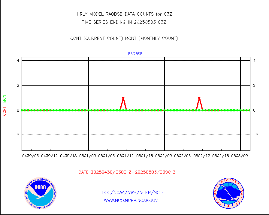
airep |
Manual AIREP aircraft data (dcded from AIREP fmt) |
1440 |
1316 |
109.4 % |
2002.50-2003.49 |
airsev |
AQUA AIRS/AMSU-A/HSB brightness temps- every FOV |
0 |
0 |
n/a |
2000.50-2001.49 |
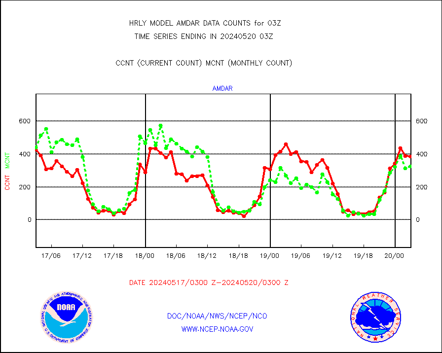
amdar |
AMDAR aircraft data (decoded from AMDAR format) |
386 |
325 |
118.8 % |
2002.50-2003.49 |
amdarb |
AMDAR aircraft data (decoded from BUFR) |
1143 |
1320 |
86.6 % |
2002.50-2003.49 |
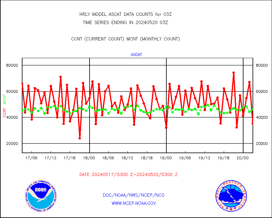
ascat |
METOP 1-2 ASCAT products |
35364 |
46047 |
76.8 % |
2001.50-2002.49 |
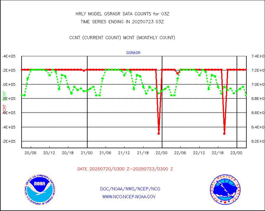
atms |
NPP/NOAA-20 ATMS brightness temperatures |
292896 |
348544 |
84.0 % |
2001.50-2002.49 |
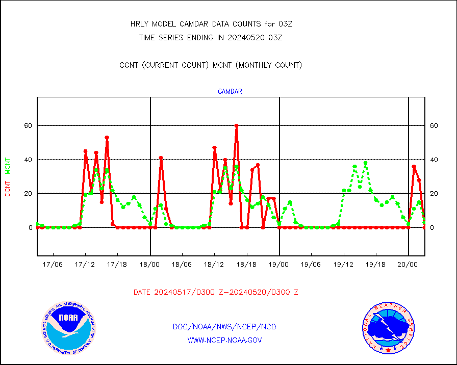
camdar |
Canadian AMDAR aircraft data (decoded from BUFR) |
0 |
3 |
0.0 % |
2002.50-2003.49 |
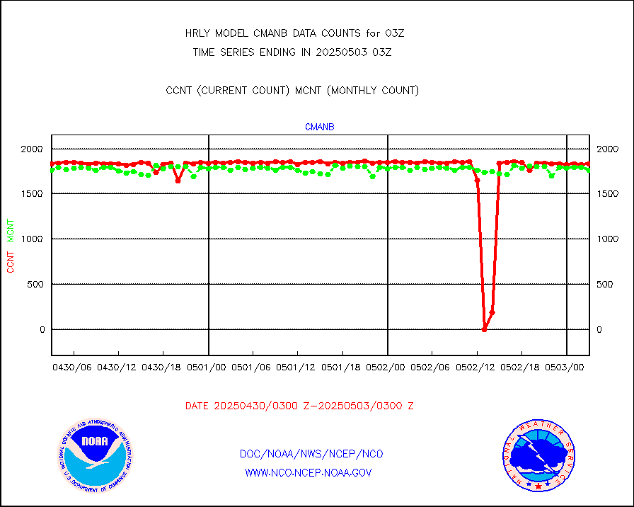
cmanb |
Surface Marine CMAN rpts decoded from BUFR format |
1853 |
1825 |
101.5 % |
2002.50-2003.50 |
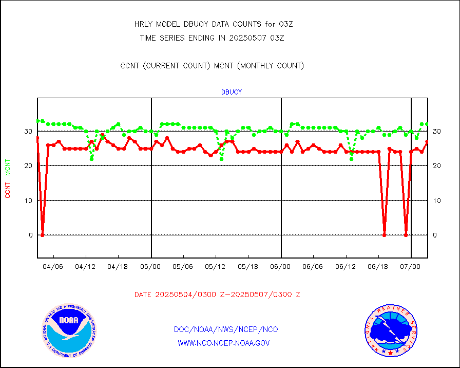
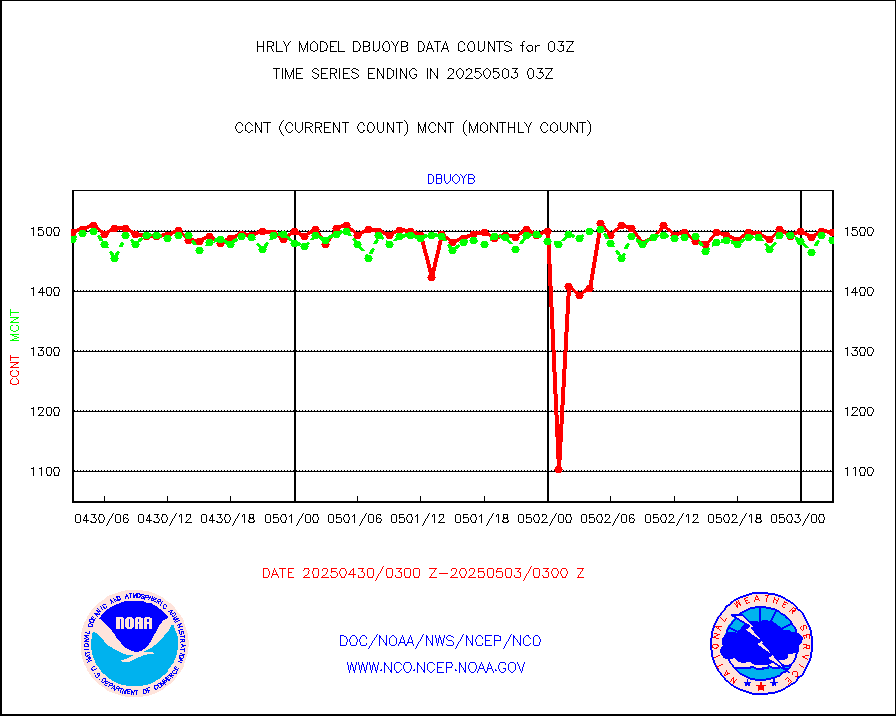
dbuoy |
Buoys decoded from FM-18 fmt (moored or drifting) |
39 |
37 |
105.4 % |
2002.50-2003.49 |
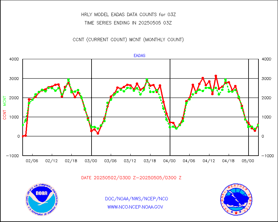
eadas |
E-AMDAR (European AMDAR acft decoded from BUFR) |
640 |
544 |
117.6 % |
2002.50-2003.49 |
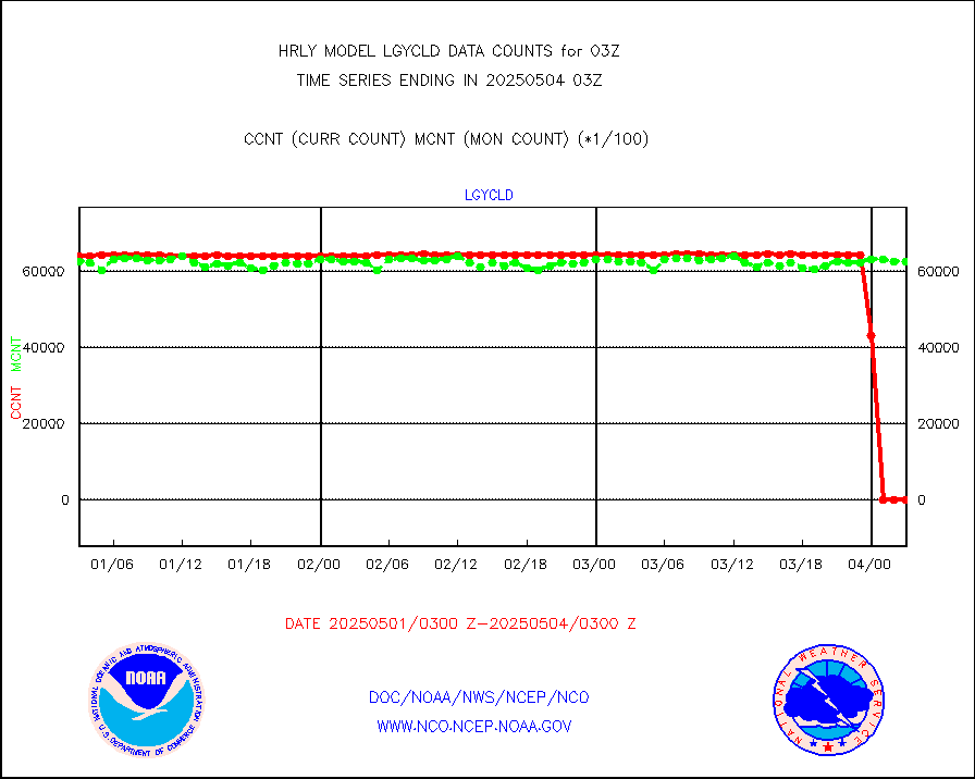
esamua |
NOAA 15-19 & METOP 1-2 AMSU-A proc btmps frm RARS |
42661 |
39028 |
109.3 % |
2002.50-2003.49 |
eshrs3 |
NOAA 15-19 & METOP 1-2 HIRS-3/4 pr btmps frm RARS |
80337 |
76542 |
105.0 % |
2002.50-2003.49 |
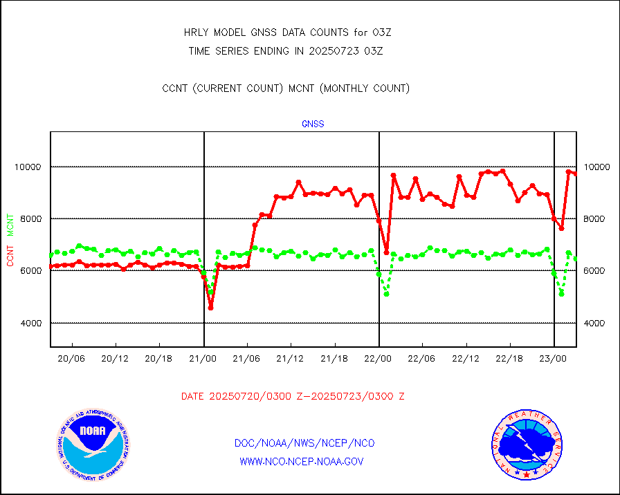
gnss |
Grnd-based Gbl Navigation Sat System (GNSS) data |
9490 |
9079 |
104.5 % |
2002.00-2002.99 |
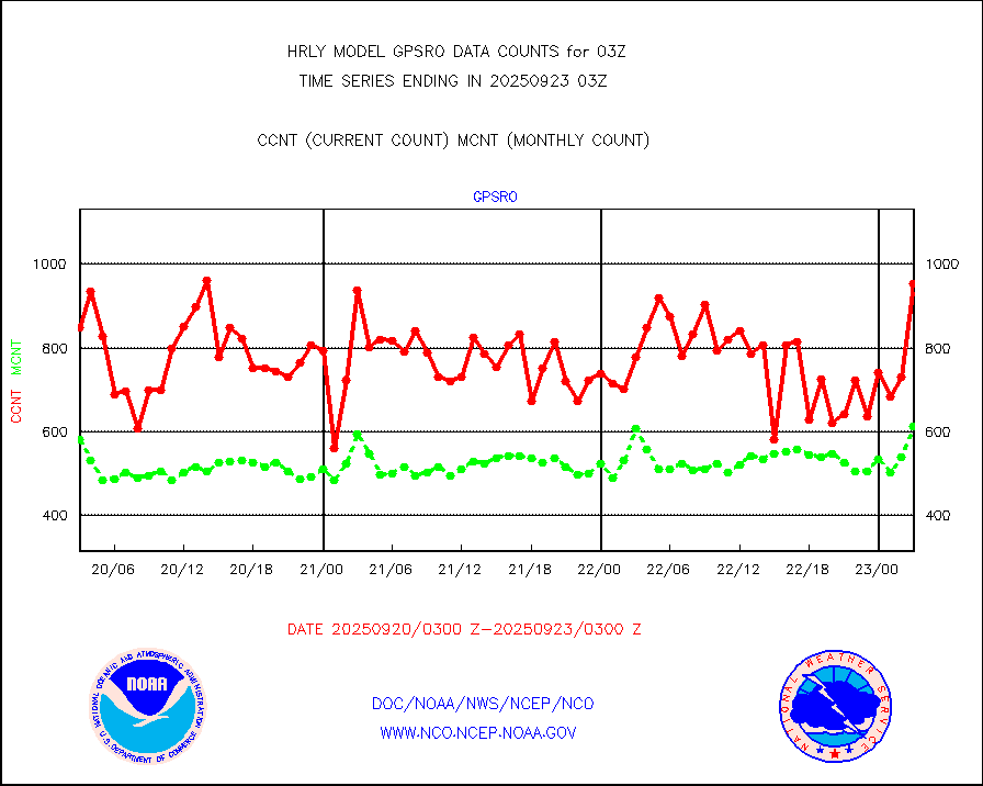
gpsro |
GPS radio occultation data |
380 |
449 |
84.6 % |
2000.50-2001.49 |
gsrasr |
GOES-16/17 All Sky Radiances (proc.) |
360476 |
360476 |
100.0 % |
2002.50-2003.49 |
gsrcsr |
GOES-16/17 Clear Sky Radiances (proc.) |
160400 |
172330 |
93.1 % |
2002.50-2003.49 |
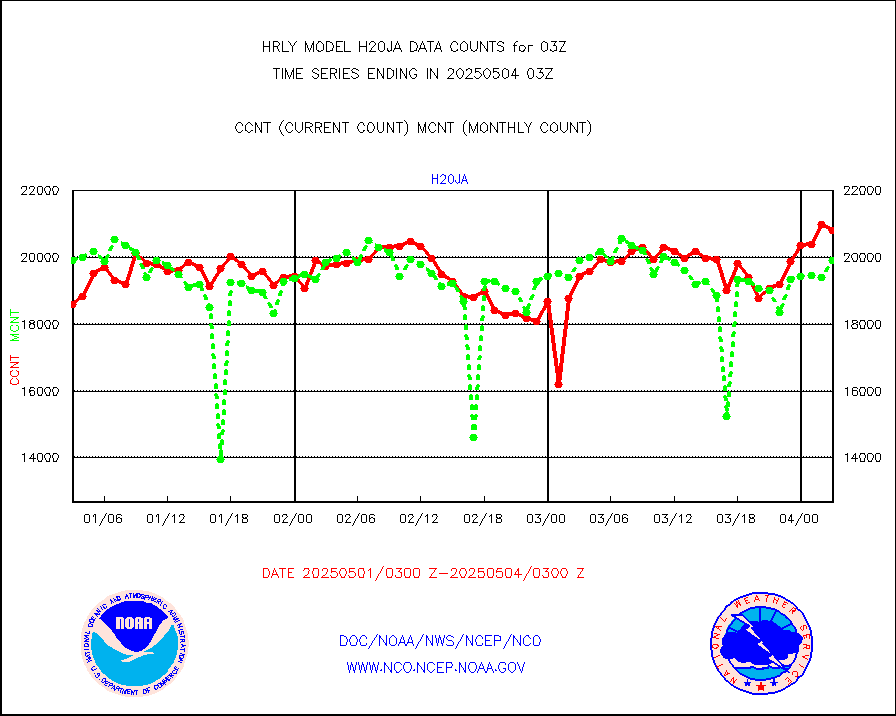
h20ja |
MTSAT/JMA water vapor imager derived cloud motion |
19651 |
18757 |
104.8 % |
2000.50-2001.49 |
h20mo |
MODIS (AQUA/TERRA) wvpr imager derived cld motion |
0 |
0 |
n/a |
1923.00-1923.99 |
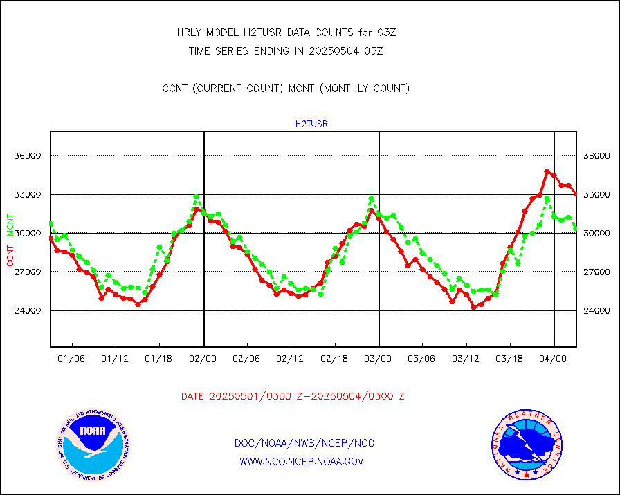
h2tusr |
GOES-16&up/NESDIS wv imgr/cld-top derived cld mtn |
27314 |
27376 |
99.8 % |
2002.00-2002.99 |
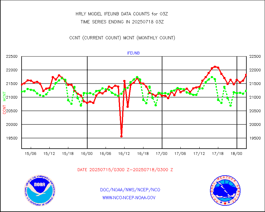
ifeunb |
METEOSAT/EUMETSAT ir lg-wave drv cld motion NBseq |
20973 |
21407 |
98.0 % |
2001.50-2002.49 |
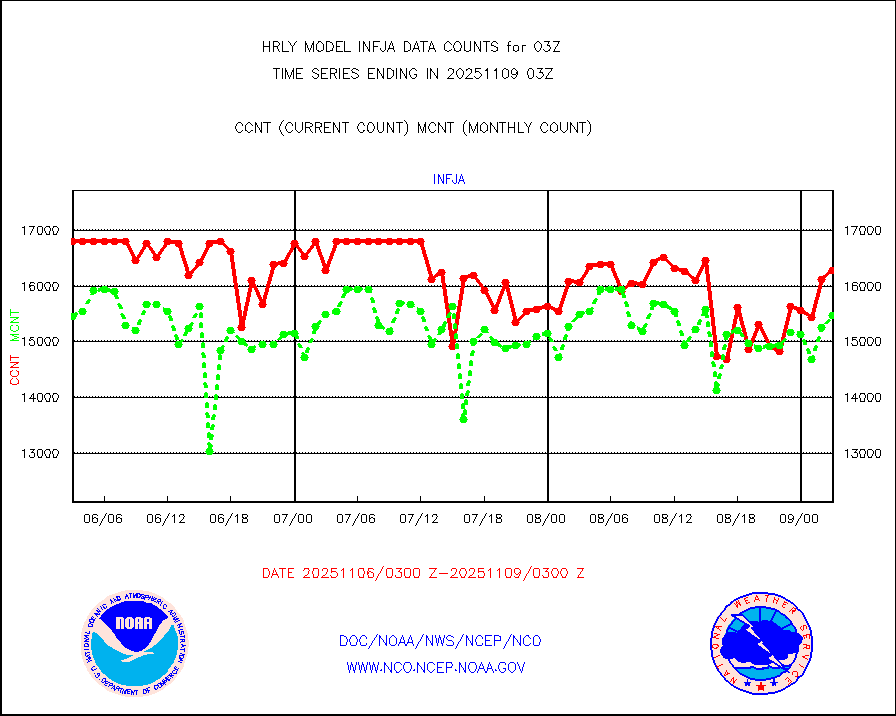
infja |
MTSAT/JMA infrared long-wave derived cloud motion |
16800 |
15878 |
105.8 % |
2000.50-2001.49 |
infmo |
MODIS (AQUA/TERRA) ir l-wave derived cloud motion |
0 |
0 |
n/a |
1923.00-1923.99 |
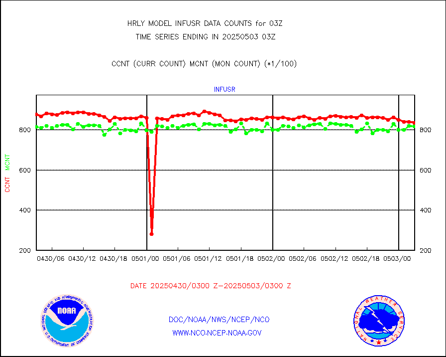
infusr |
GOES-16&up/NESDIS ir long-wave derived cld motion |
75059 |
78392 |
95.7 % |
2002.00-2002.99 |
lgycld |
GOES/NASA(Langley) hi-res. (1x1 f-o-v) cloud data |
4216243 |
3648072 |
115.6 % |
2002.50-2003.49 |
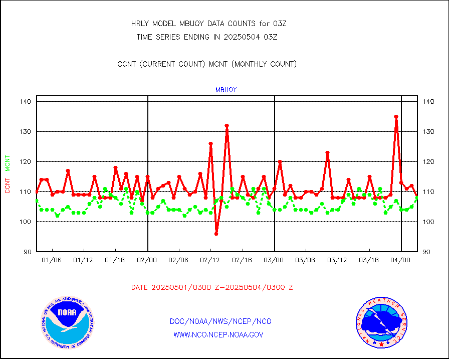
mbuoy |
Buoys decoded from FM-13 format (moored) |
124 |
114 |
108.8 % |
2002.50-2003.49 |
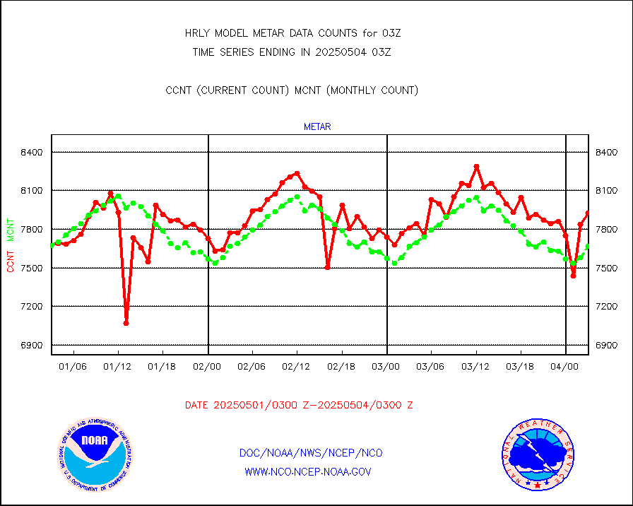
metar |
Aviation - METAR |
7415 |
7648 |
97.0 % |
2002.50-2003.49 |
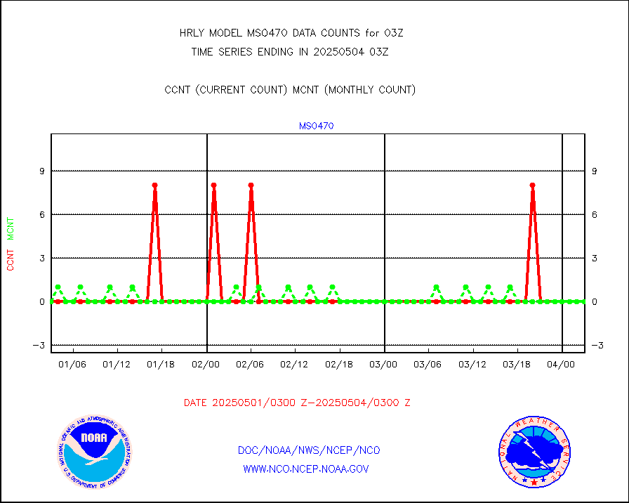
mso470 |
Mesonet/MADIS Colorado E-470 (Interstate 470) |
21 |
20 |
105.0 % |
2002.50-2003.49 |
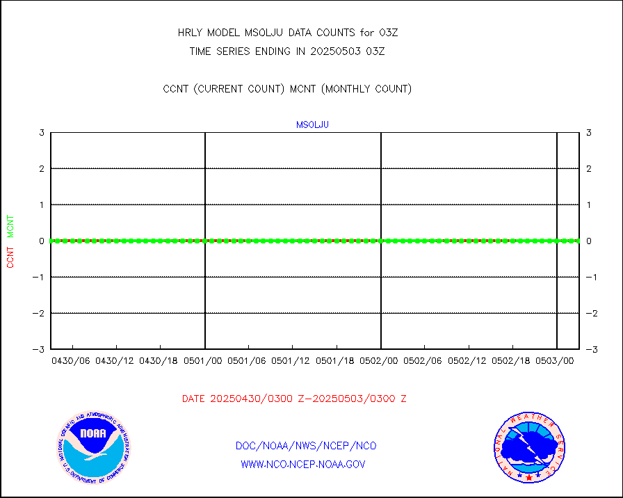
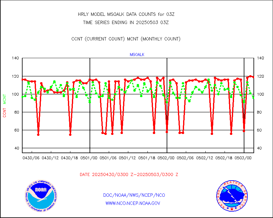
msoalk |
Mesonet/MADIS Alaska Department of Transportation |
107 |
108 |
99.1 % |
2002.50-2003.49 |
msoapg |
Mesonet/MADIS U.S. Army Aberdeen Proving Grounds |
0 |
0 |
n/a |
2002.50-2003.49 |
msoapr |
Mesonet/MADIS Citizen Weather Observers Program |
46372 |
48036 |
96.5 % |
2002.50-2003.49 |
msoaws |
Mesonet/MADIS AWS Convergence Technologies, Inc. |
25448 |
25421 |
100.1 % |
2002.50-2003.49 |
msoawx |
Mesonet/MADIS "Anything Weather" |
0 |
0 |
n/a |
2002.50-2003.49 |
msocol |
Mesonet/MADIS Colorado Dept. of Transportation |
0 |
0 |
n/a |
2002.50-2003.49 |
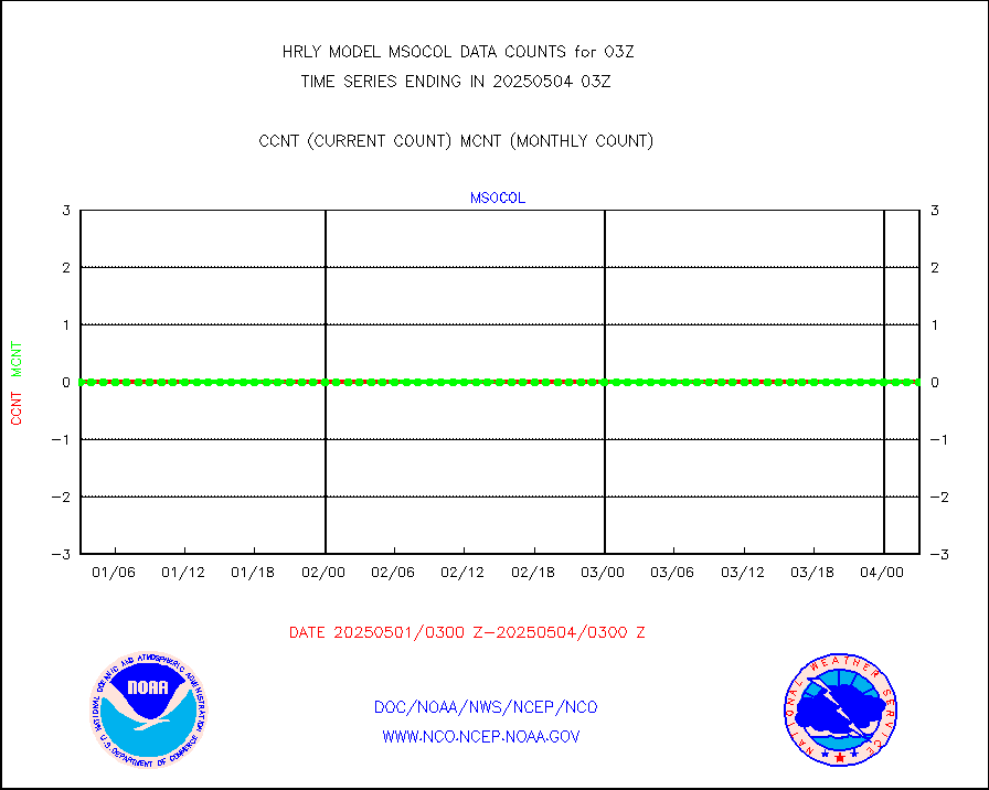
msodcn |
Mesonet/MADIS DC Net |
0 |
0 |
n/a |
2002.50-2003.49 |
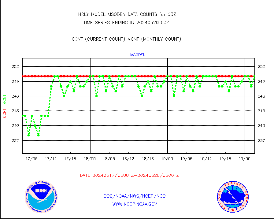
msoden |
Mesonet/MADIS Denver Urban Drainage & Flood Cntrl |
250 |
250 |
100.0 % |
2002.50-2003.49 |
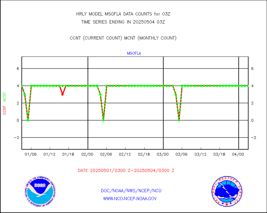
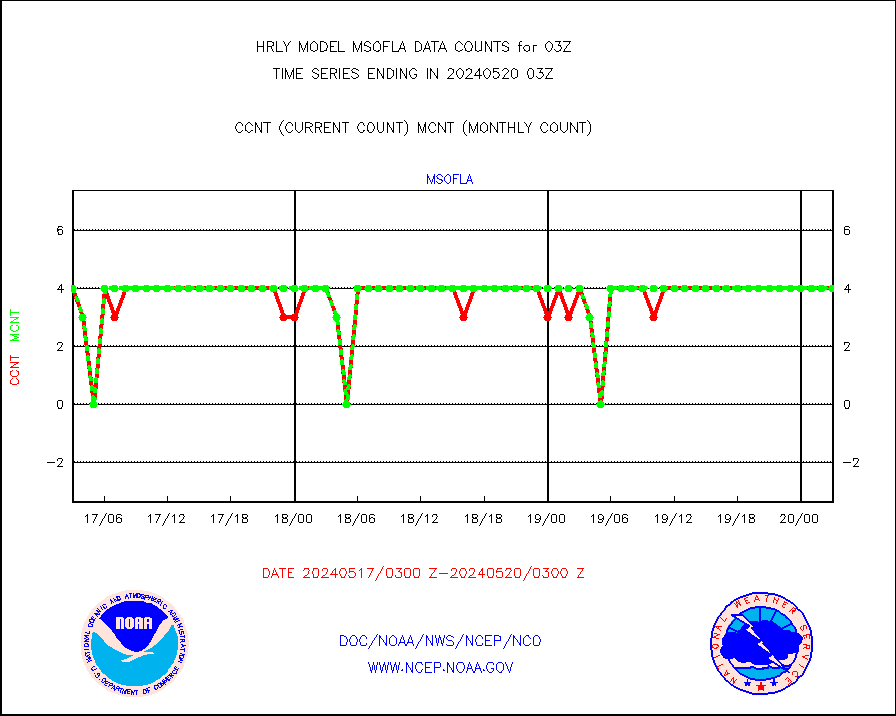
msofla |
Mesonet/MADIS Florida (FAWN & USF) |
4 |
4 |
100.0 % |
2002.50-2003.49 |
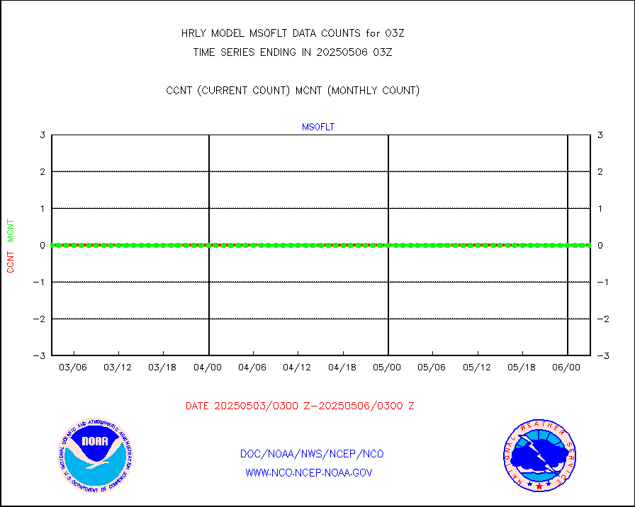
msoflt |
Mesonet/MADIS Florida Dept. of Transportation |
0 |
0 |
n/a |
2002.50-2003.49 |
msogeo |
Mesonet/MADIS Georgia Dept. of Transportation |
0 |
0 |
n/a |
2002.50-2003.49 |
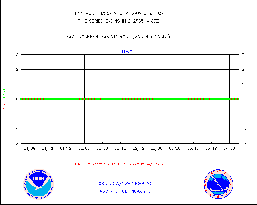
msohad |
Mesonet/MADIS NWS Hydromet Auto Data System(HADS) |
6805 |
6737 |
101.0 % |
2002.50-2003.49 |
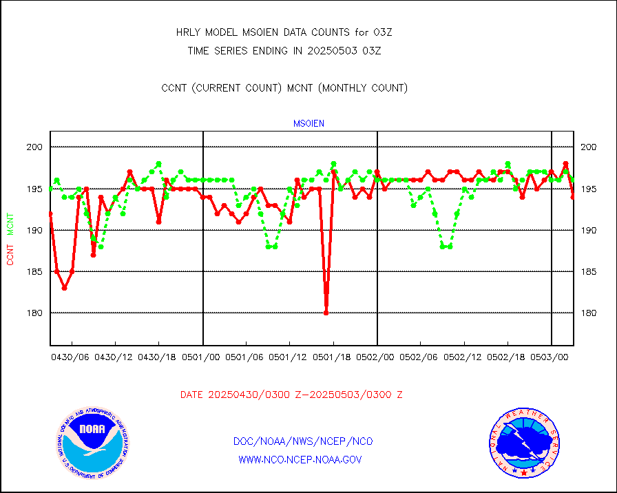
msoien |
Mesonet/MADIS Iowa Environmental |
182 |
187 |
97.3 % |
2002.50-2003.49 |
msoind |
Mesonet/MADIS Indiana Dept. of Transportation |
0 |
0 |
n/a |
2002.50-2003.49 |
msoiow |
Mesonet/MADIS Iowa Department of Transportation |
0 |
0 |
n/a |
2002.50-2003.49 |
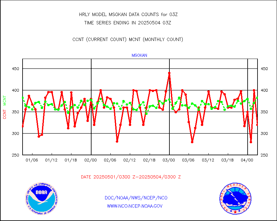
msokan |
Mesonet/MADIS Kansas Department of Transportation |
400 |
364 |
109.9 % |
2002.50-2003.49 |
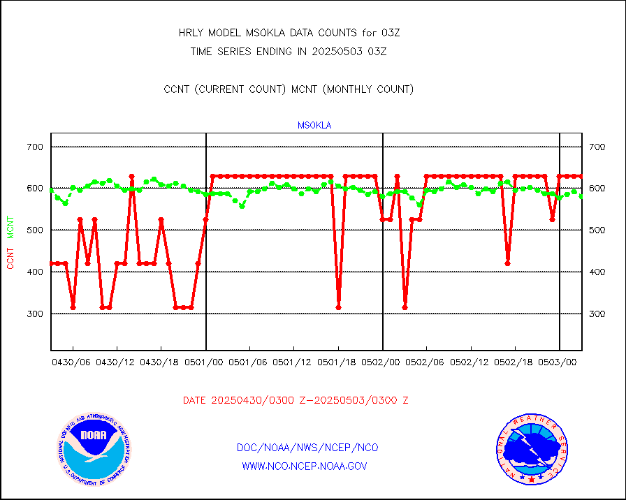
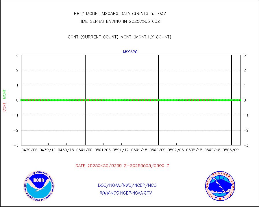
msokla |
Mesonet/MADIS Oklahoma Mesonet |
318 |
325 |
97.8 % |
2002.50-2003.49 |
msolju |
Mesonet/MADIS Louisiana State/Jackson State Univ. |
0 |
0 |
n/a |
2002.50-2003.49 |
msomca |
Mesonet/MADIS Missouri Commercial Agricult Wx Net |
300 |
297 |
101.0 % |
2002.50-2003.49 |
msomin |
Mesonet/MADIS Minnesota Dept. of Transportation |
0 |
0 |
n/a |
2002.50-2003.49 |
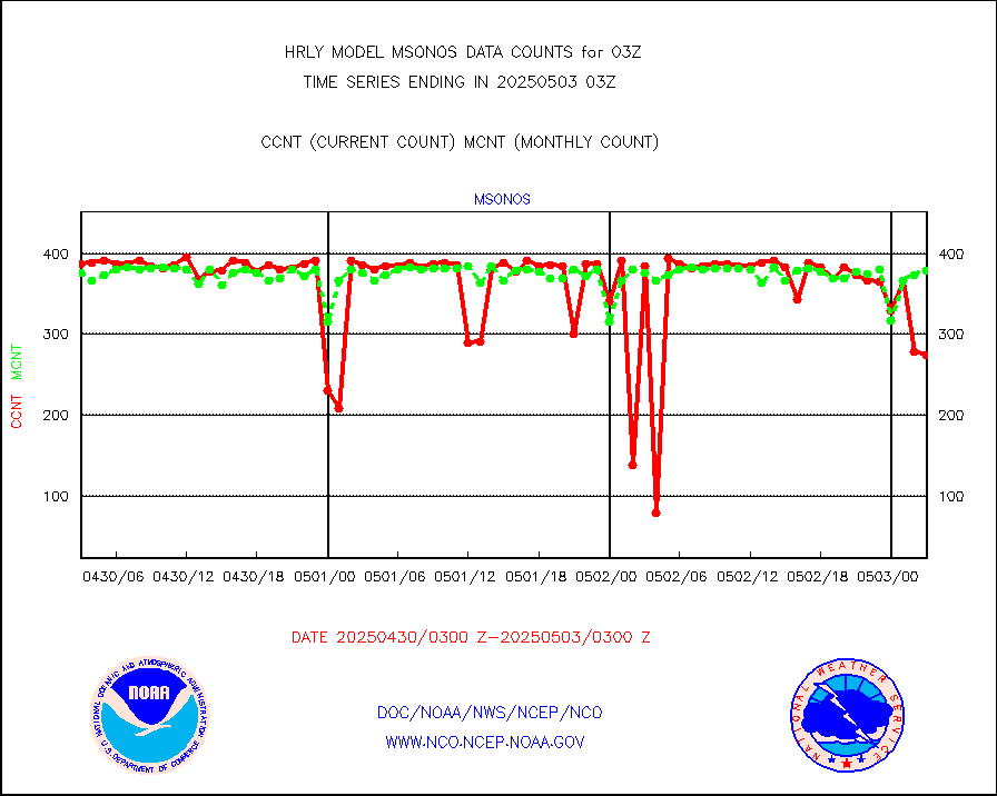
msonos |
Mesonet/MADIS NOS-Phys Oceanographic Realtime Sys |
387 |
383 |
101.0 % |
2002.50-2003.49 |
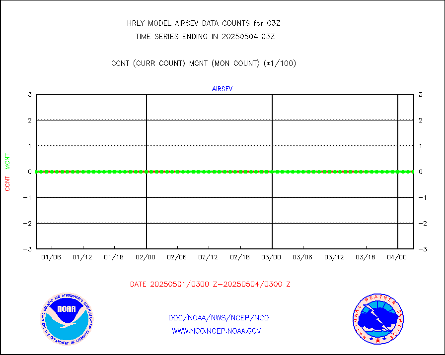
msoraw |
Mesonet/MADIS NFIC Remote Automated Wx Stns(RAWS) |
1925 |
1858 |
103.6 % |
2002.50-2003.49 |
msovir |
Mesonet/MADIS Virginia Dept. of Transportation |
205 |
228 |
89.9 % |
2002.50-2003.49 |
msowfy |
Mesonet/MADIS "Weather for You" |
0 |
0 |
n/a |
2002.50-2003.49 |
msowis |
Mesonet/MADIS Wisconsin Dept. of Transportation |
0 |
0 |
n/a |
2002.50-2003.49 |
msowst |
Mesonet/MADIS MesoWest (many subproviders) |
46657 |
46374 |
100.6 % |
2002.50-2003.49 |
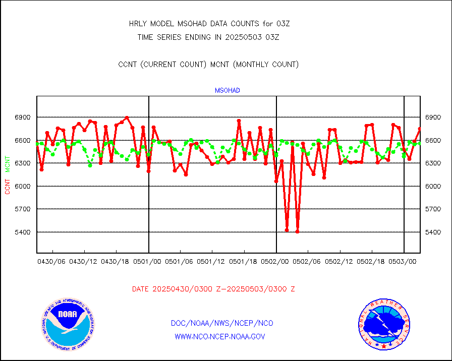
msowtx |
Mesonet/MADIS West Texas |
5658 |
5614 |
100.8 % |
2002.50-2003.49 |
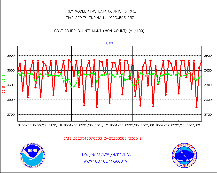
mtiasi |
METOP 1-2 IASI 1C radiance data (varbl. channels) |
91212 |
86111 |
105.9 % |
2001.00-2001.99 |
nxrdw |
NEXRAD Vel Azm Dsp(VAD) winds via radar coded msg |
0 |
0 |
n/a |
2002.50-2003.49 |
osbuv8 |
NOAA 16-19 Solar Backscatter UV-2 rad frm V8 BUFR |
0 |
0 |
n/a |
2001.00-2001.99 |
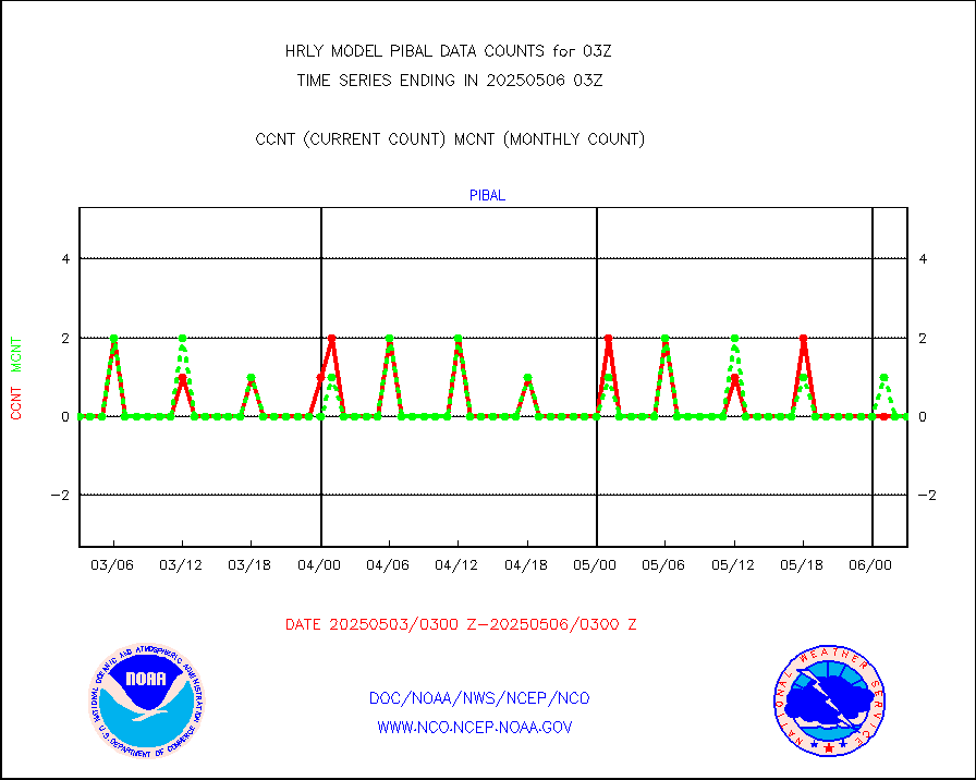
pibal |
PIBAL (from PILOT, PILOT SHIP, PILOT MOBIL) |
0 |
0 |
n/a |
2002.50-2003.49 |
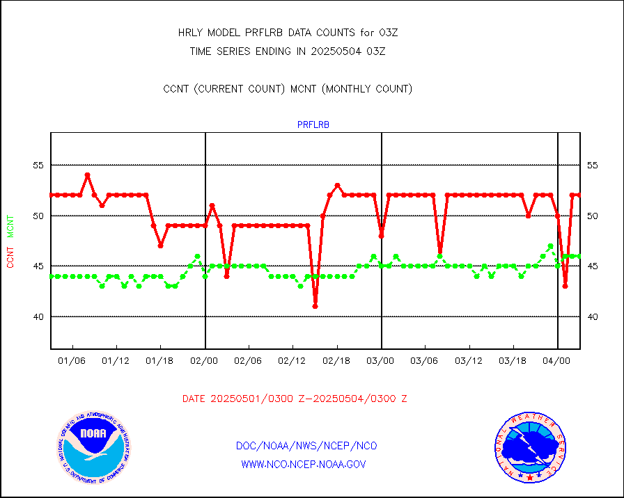
prflrb |
Multi-Agency Profiler (MAP) and SODAR winds |
35 |
42 |
83.3 % |
2002.50-2003.49 |
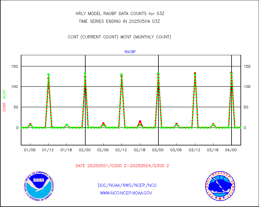
raobf |
Rawinsonde - fixed land (from TEMP or PILOT) |
0 |
0 |
n/a |
2002.50-2003.49 |
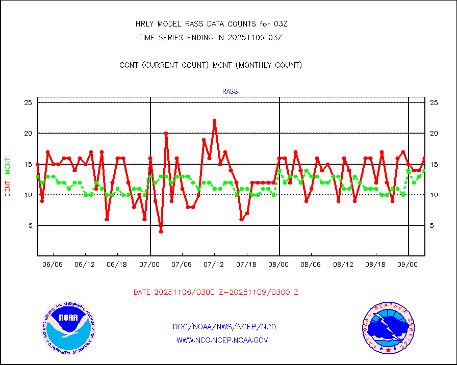
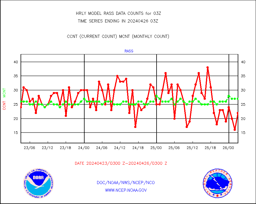
rass |
RASS temperatures (NOAA and Multi-Agency) |
24 |
27 |
88.9 % |
2002.50-2003.49 |
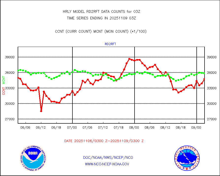
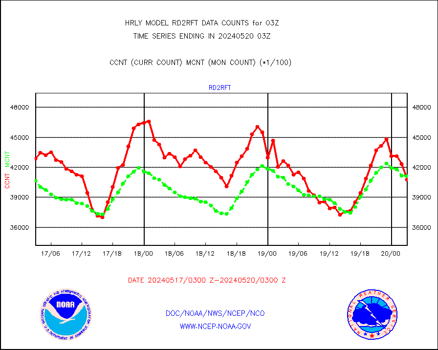
rd2rft |
NEXRAD reflectivity (Lvl 2 - GTS) |
4075711 |
4111659 |
99.1 % |
2002.50-2003.49 |
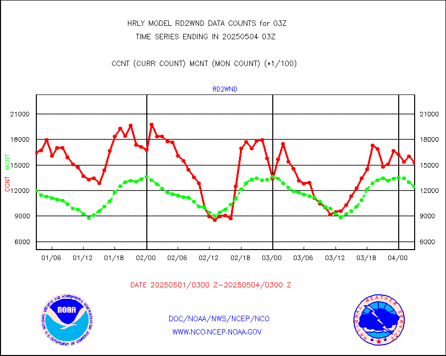
rd2wnd |
NEXRAD radial wind (Level 2 - GTS) |
1567370 |
1549418 |
101.2 % |
2002.50-2003.49 |
sevcsr |
METEOSAT-10 2nd Gen SEVIRI Clr Sky Radiance(proc) |
0 |
0 |
n/a |
2002.50-2003.49 |
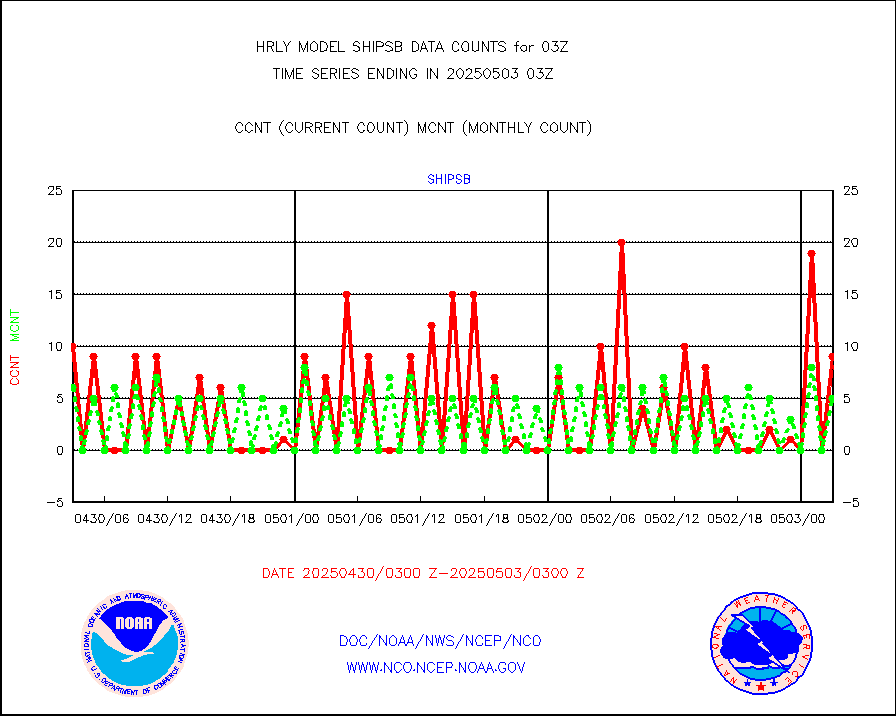
shipsb |
Ship - manual and automatic, restricted (BUFR) |
1 |
1 |
100.0 % |
2002.50-2003.50 |
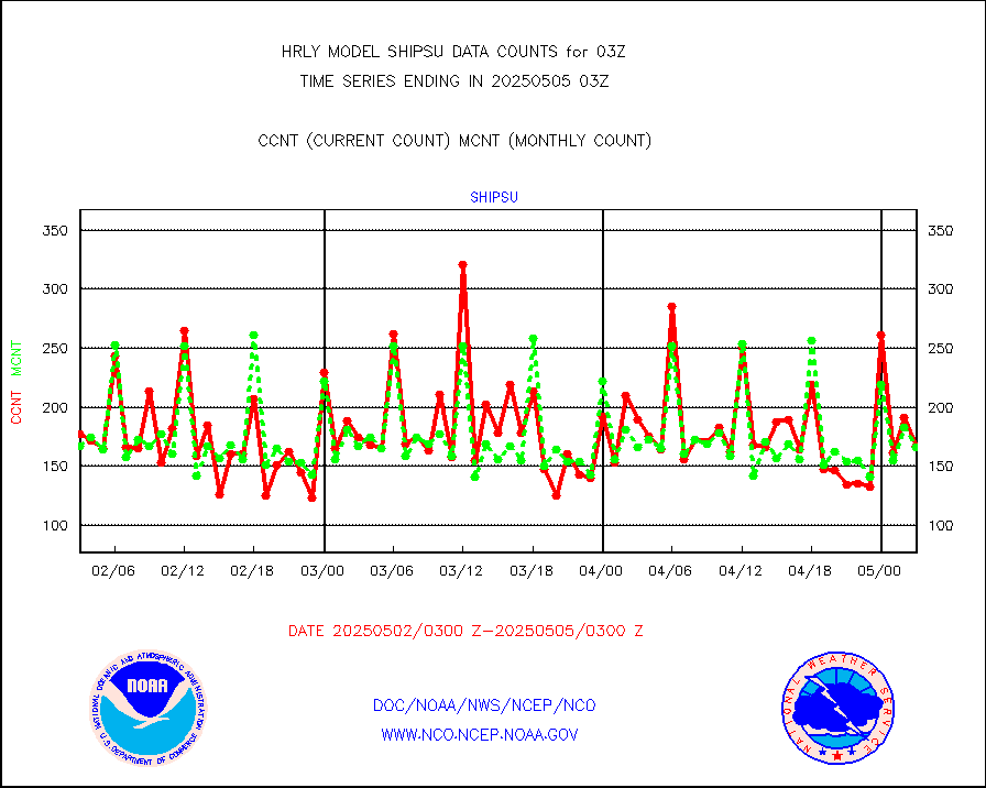
shipsu |
Ship - manual and automatic, unrestricted |
128 |
119 |
107.6 % |
2002.50-2003.50 |
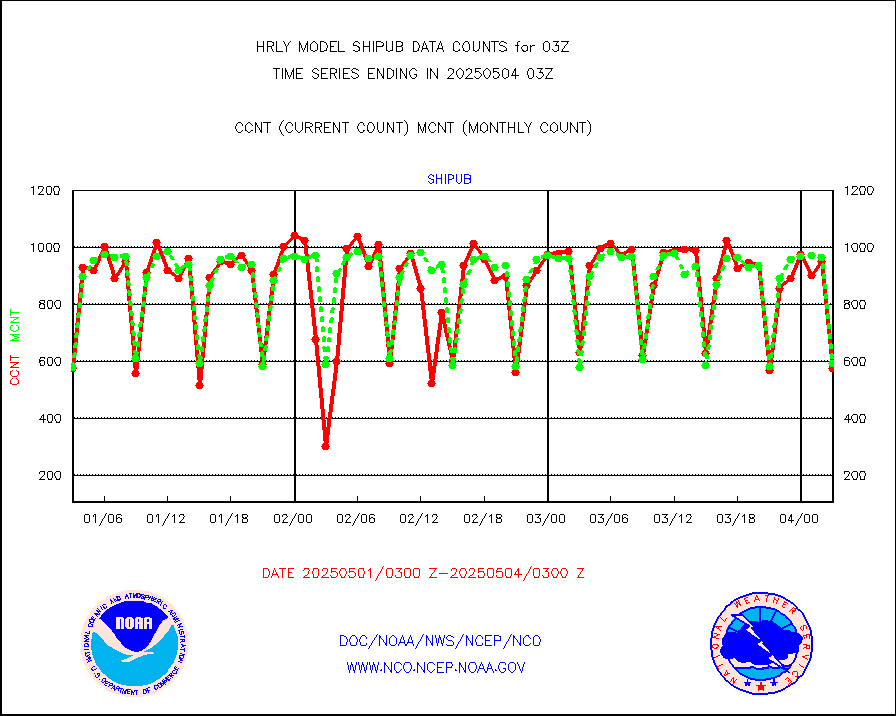
shipub |
Ship - manual and automatic, unrestricted (BUFR) |
461 |
443 |
104.1 % |
2002.50-2003.50 |
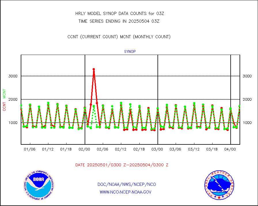
synop |
Synoptic - fixed manual and automatic |
2118 |
2011 |
105.3 % |
2002.50-2003.49 |
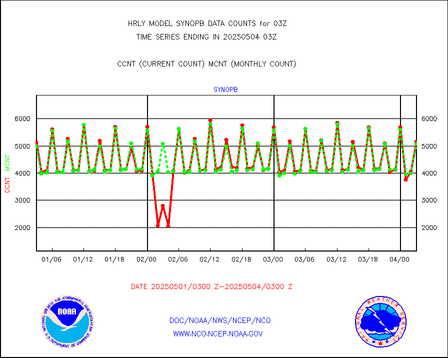
synopb |
Synoptic - fixed manual & auto (decoded fr BUFR) |
5221 |
5240 |
99.6 % |
2002.50-2003.49 |
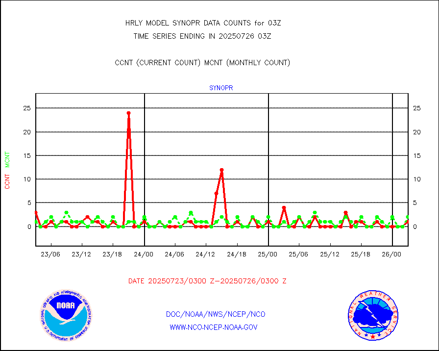
synopr |
Synoptic - restricted (WMO Res 40) manual & auto. |
1 |
4 |
25.0 % |
2002.50-2003.49 |
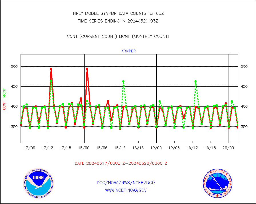
synpbr |
Synoptic - restricted (WMO Res 40)(decoded BUFR) |
348 |
354 |
98.3 % |
2002.50-2003.49 |
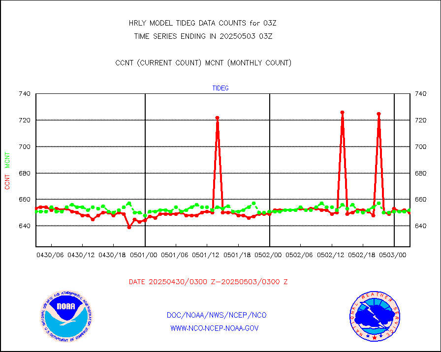
tideg |
Tide gauge reports decoded from CREX format |
646 |
641 |
100.8 % |
2002.00-2002.99 |
| Data Types of Opportunity with Normal Counts |
|---|
| Type | Description | Hourly Count | Monthly Average | Percent (%) of Monthly Mean | UTC Time Window |
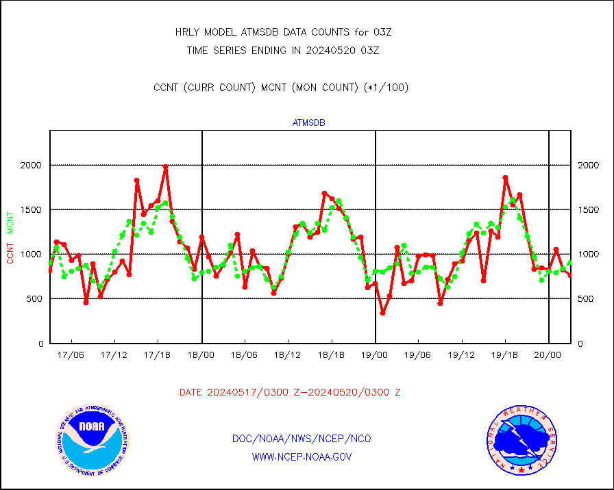
3p9usr |
GOES-16&up/NESDIS ir short-wv derived cld motion |
24000 |
26151 |
91.8 % |
2002.00-2002.99 |
acarsa |
MDCRS ACARS acft data (ARINC via AFWA)(AIREP fmt) |
0 |
0 |
n/a |
2002.50-2003.49 |
ahicsr |
Himawari Clear Sky Radiance |
0 |
0 |
n/a |
2002.00-2002.99 |
amsr2 |
GCOM-W AMSR2 1B brightness temperatures |
1442448 |
2199863 |
65.6 % |
2001.00-2001.99 |
atmsdb |
NPP/NOAA-20 ATMS bright. temps-direct b-cast SSEC |
76590 |
91194 |
84.0 % |
2001.50-2002.49 |
atovs |
POES/NESDIS - processed ATOVS soundings/radiances |
0 |
0 |
n/a |
2001.00-2001.99 |
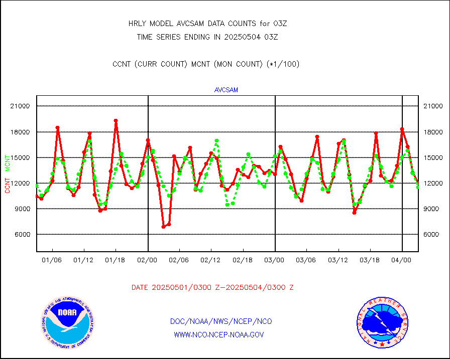
avcsam |
A.M.(N17,M2,M3) AVHRR GAC NCEP-proc clr&sea btmps |
1132168 |
1235202 |
91.7 % |
2000.50-2001.49 |
avcspm |
P.M.(N18-19) AVHRR GAC NCEP-proc clr & sea btemps |
1562318 |
1524024 |
102.5 % |
2000.50-2001.49 |
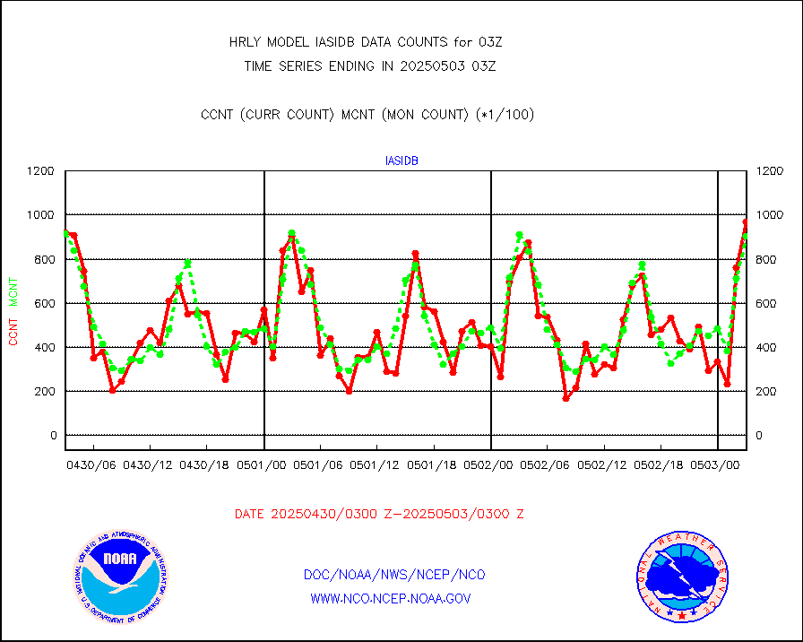
bathy |
eXpendable BathyThermograph, mooring (BATHY fmt) |
0 |
0 |
n/a |
1920.00-1920.99 |
coopmd |
Coop/MADIS NEPP & HCN-Modernization NOAA COOP Obs |
27 |
27 |
100.0 % |
2002.50-2003.49 |
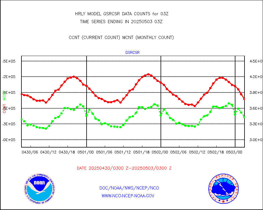
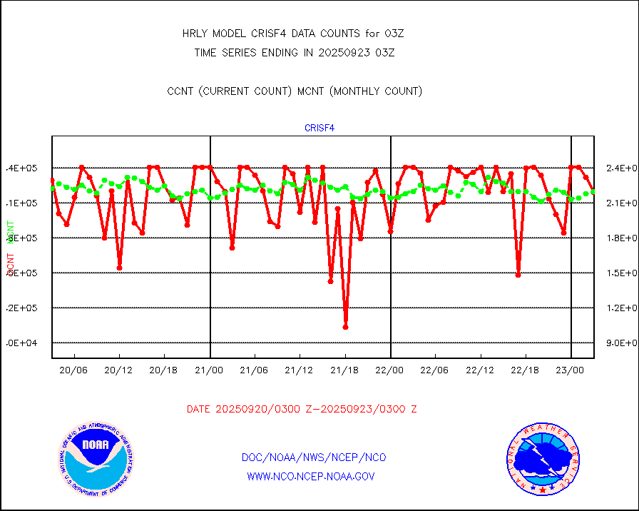
crisf4 |
NPP/NOAA-20 CrIS full spctrl radn (431 ch subset) |
226710 |
234522 |
96.7 % |
2001.50-2002.49 |
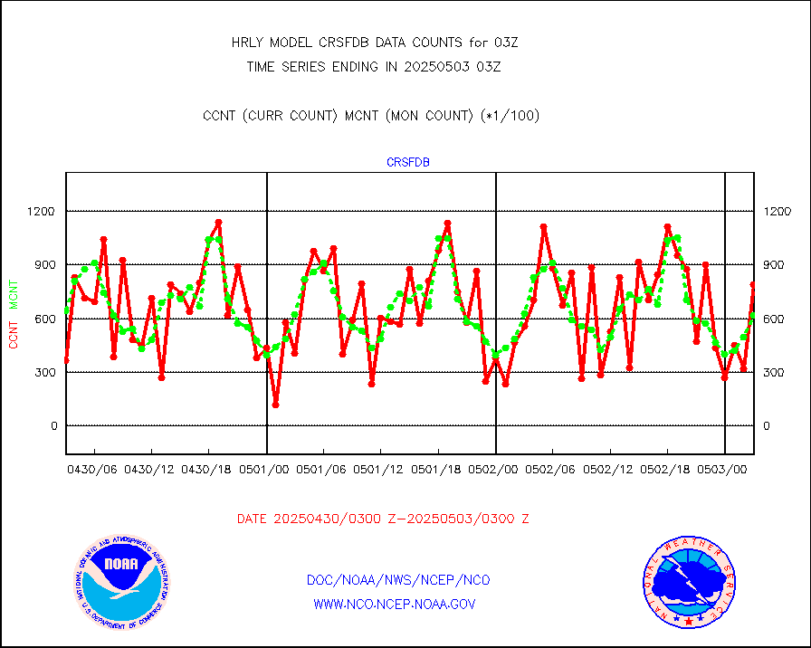
crsfdb |
NPP/NOAA-20 CrIS full spctrl radn dir brdcst SSEC |
105210 |
97779 |
107.6 % |
2001.50-2002.49 |
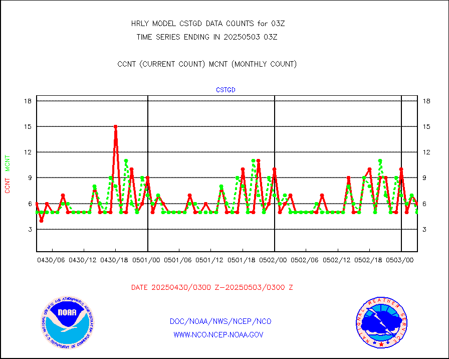
cstgd |
Coast Guard |
3 |
4 |
75.0 % |
2002.50-2003.50 |
dbuoyb |
Drifting buoys (decoded from BUFR) |
1415 |
1408 |
100.5 % |
2002.50-2003.50 |
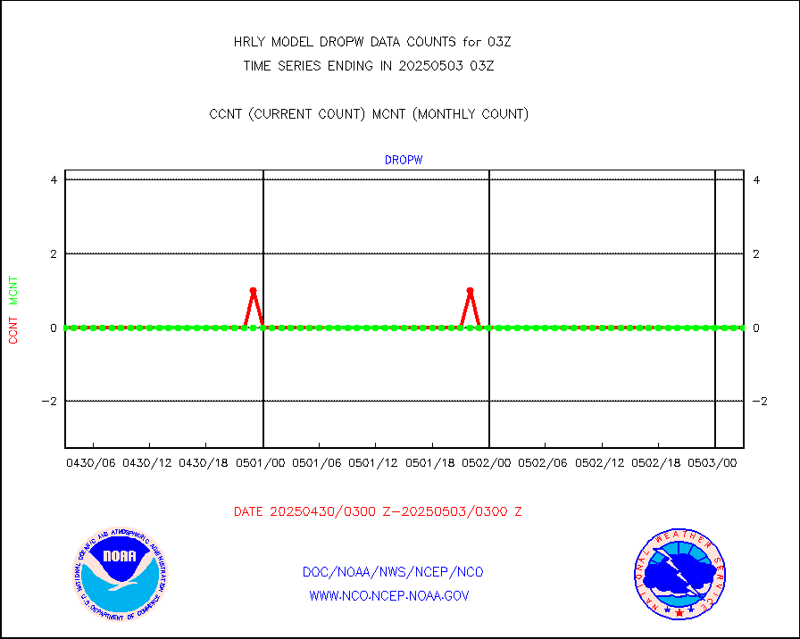
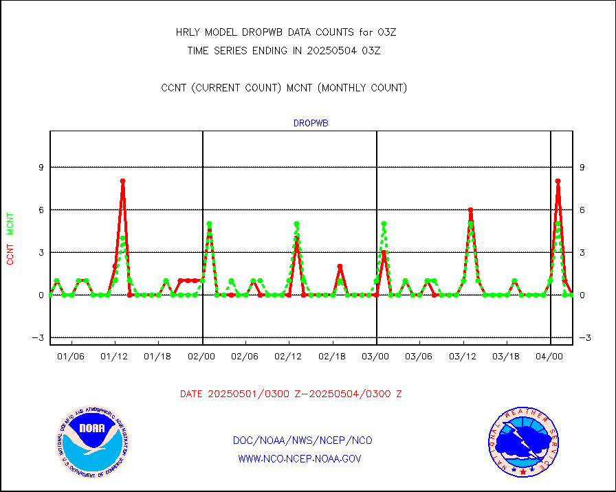
dropw |
Dropwinsonde (from TEMP DROP) |
0 |
0 |
n/a |
2002.50-2003.49 |
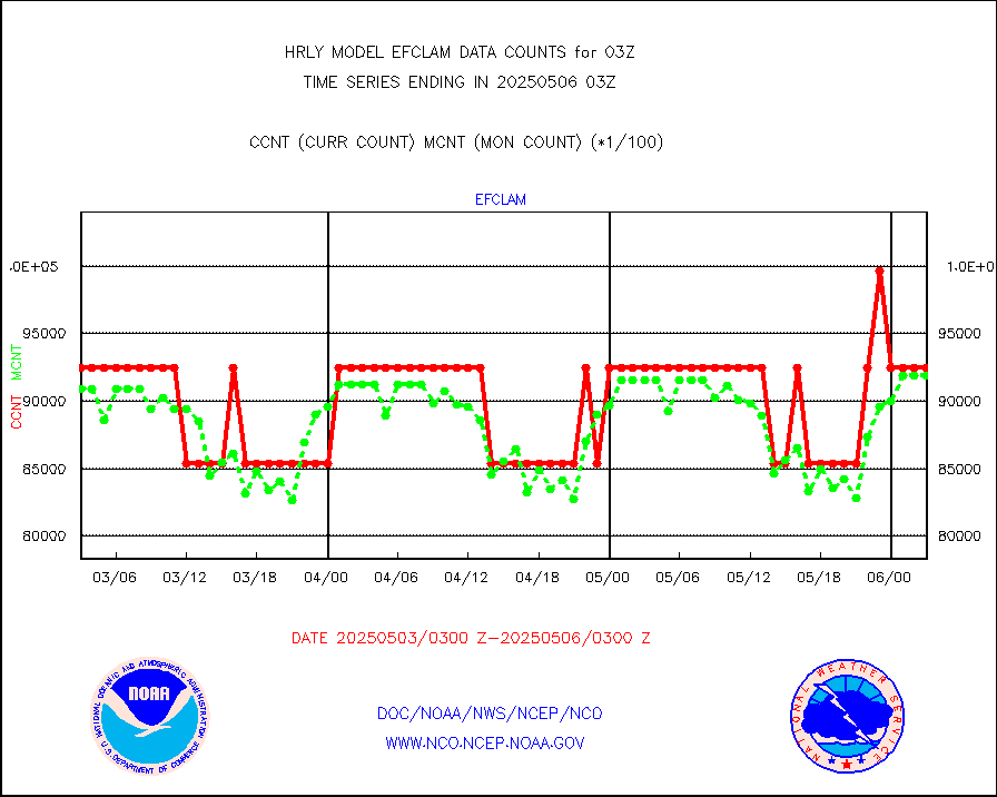
efclam |
GOES imager effective cloud amount data (U.Wisc.) |
8296980 |
8290867 |
100.1 % |
2002.50-2003.49 |
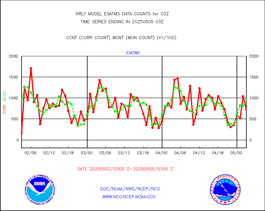
esatms |
NPP Adv. Tech. MW Sndr (ATMS) br. temps from RARS |
126512 |
94998 |
133.2 % |
2001.50-2002.49 |
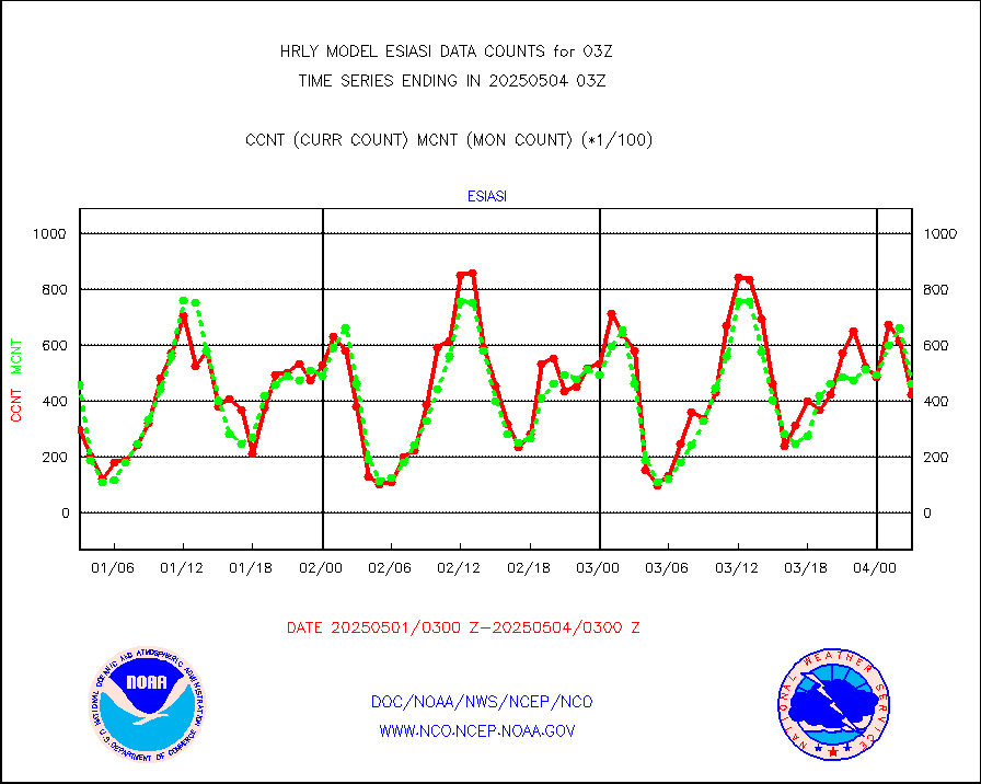
esiasi |
METOP 1-2 IASI 1C radiance data vbl chn from RARS |
76371 |
65578 |
116.5 % |
2002.00-2002.99 |
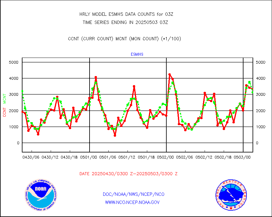
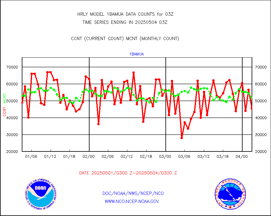
esmhs |
NOAA 18-19 & METOP 1-2 MHS proc. btemps from RARS |
357763 |
290617 |
123.1 % |
2002.50-2003.49 |
geoimr |
GOES/NESDIS (11x17 f-o-v) imager clear radiances |
0 |
0 |
n/a |
2002.00-2002.99 |
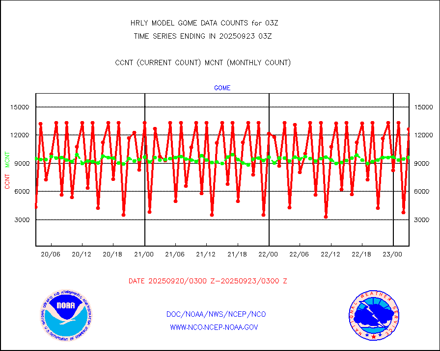
gome |
METOP 1-2 Global Ozone Monitoring Exp.-2 (GOME-2) |
1741 |
7047 |
24.7 % |
2001.50-2002.49 |
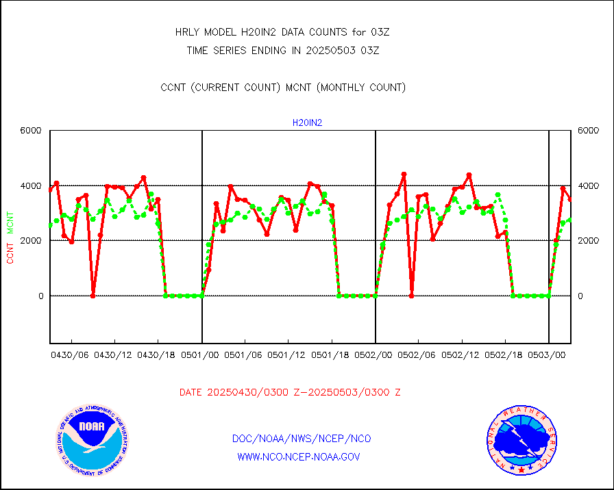
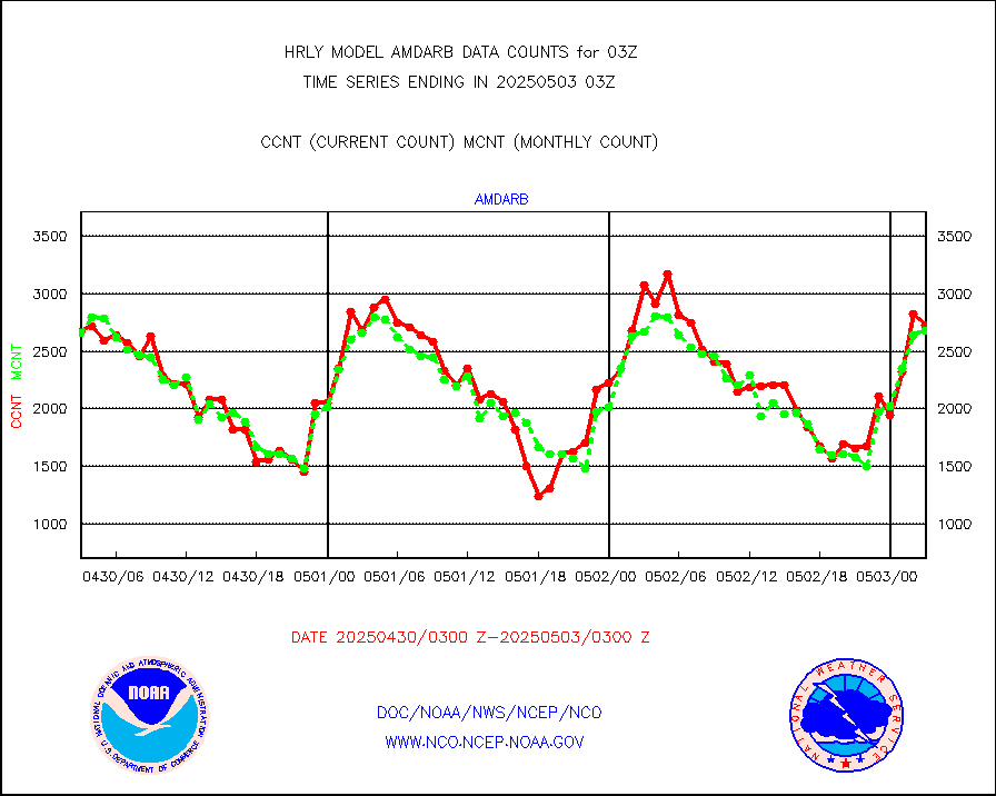
h20in2 |
INDIA SATWIND, INSAT WV channel |
4141 |
4853 |
85.3 % |
2002.00-2002.99 |
h2dusr |
GOES-16&up/NESDIS wv imgr/deep-lyr derivd cld mtn |
15469 |
16606 |
93.2 % |
2002.00-2002.99 |
h2eunb |
METEOSAT/EUMETSAT wvpr imgr drv cld motion NBseq |
38275 |
40725 |
94.0 % |
2001.50-2002.49 |
hdob |
High Density OBs from reconnaissance acft data |
0 |
4 |
0.0 % |
2002.50-2003.49 |
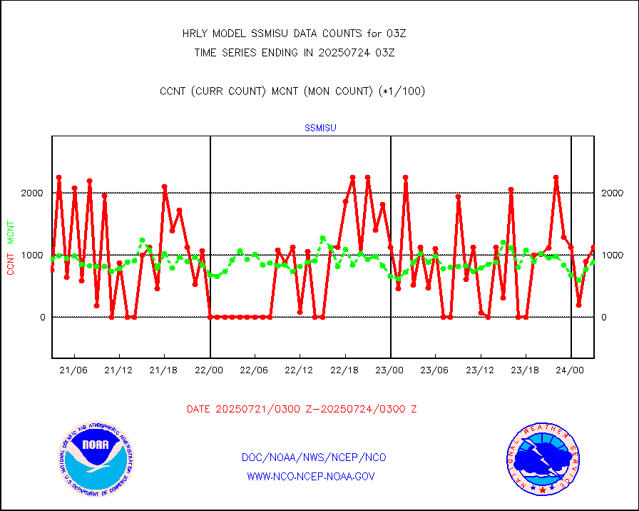
iasidb |
METOP 1-2 IASI 1C radiances-direct broadcast SSEC |
86611 |
71025 |
121.9 % |
2001.50-2002.49 |
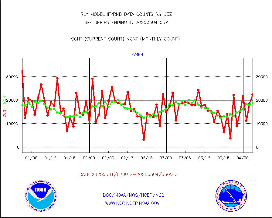
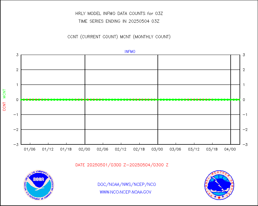
ifvrnb |
VIIRS (NPP/NOAA-20) ir lg-wv drv cloud motion(NB) |
19895 |
18160 |
109.6 % |
1923.00-1923.99 |
infav |
AVHRR (NOAA/METOP) ir lg-wave derived cld motion |
0 |
0 |
n/a |
1923.00-1923.99 |
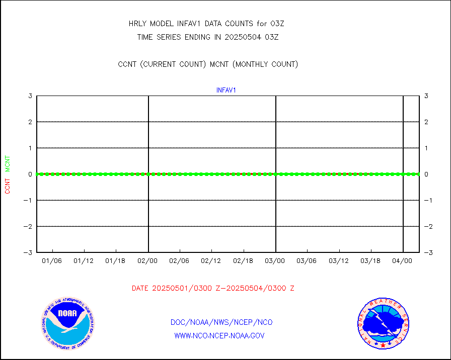
infav1 |
AVHRR (METOP) ir lg-wave derived cld motion |
0 |
0 |
n/a |
2002.50-2003.50 |
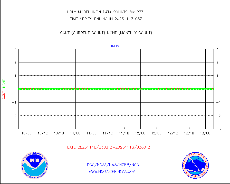
infin |
INSAT/KALPANA India ir lg-wave derived cld motion |
0 |
0 |
n/a |
2000.50-2001.49 |
infin2 |
INDIA SATWIND, INSAT IR channel |
4429 |
5211 |
85.0 % |
2002.00-2002.99 |
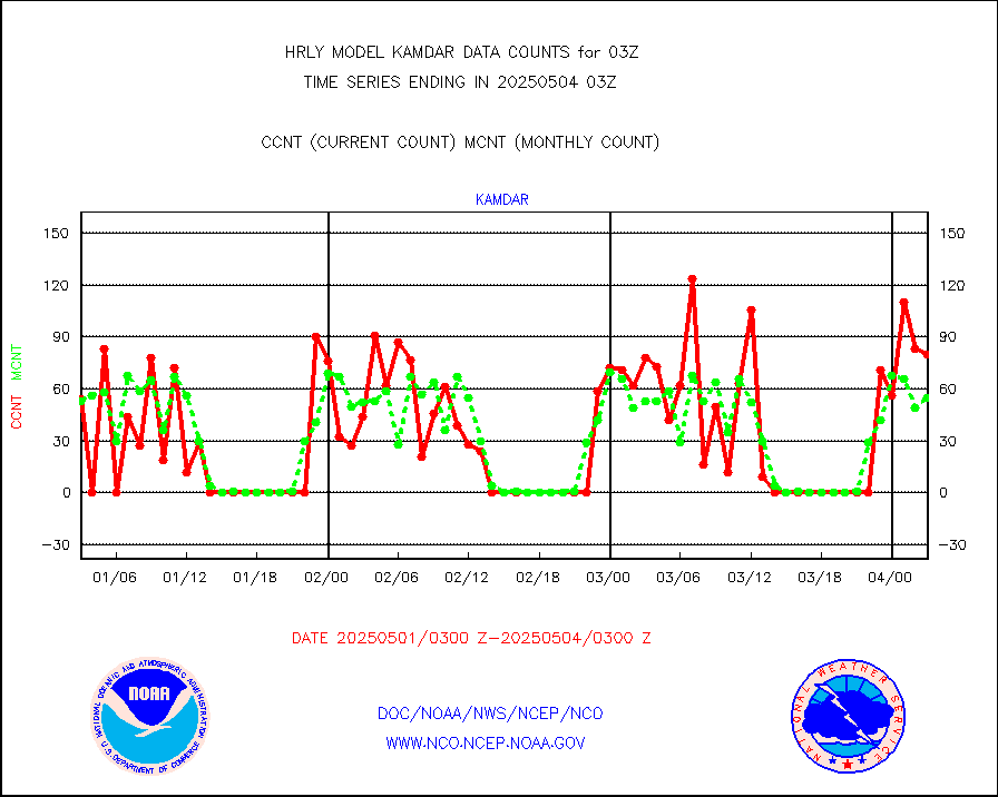
kamdar |
Korean AMDAR aircraft data (decoded from BUFR) |
77 |
61 |
126.2 % |
2002.50-2003.49 |
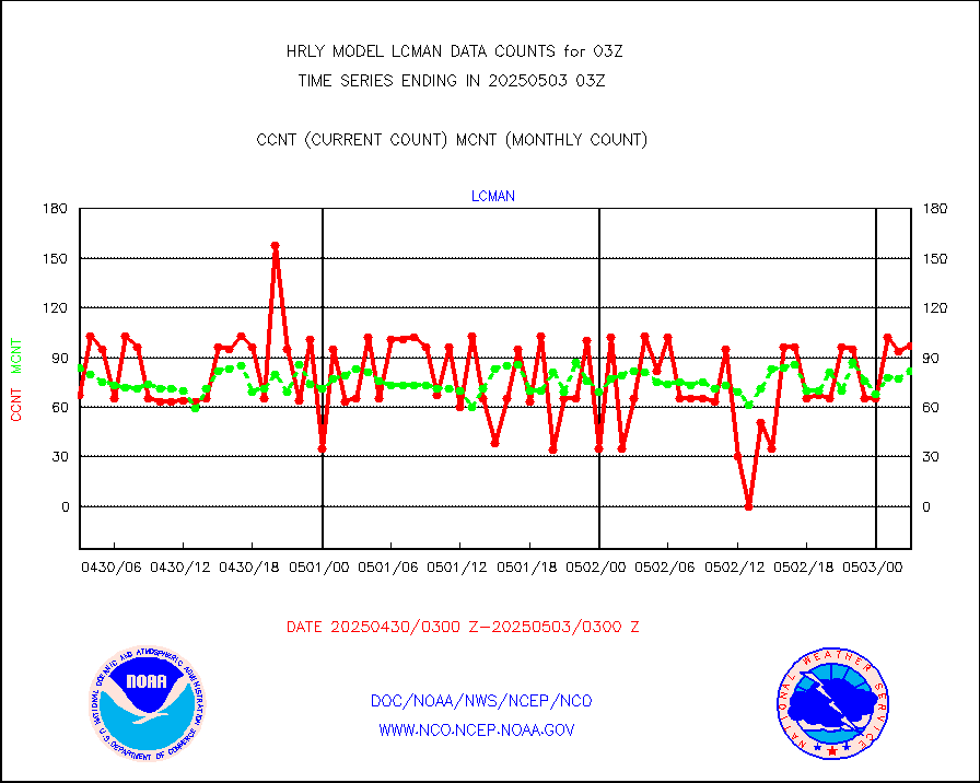
lcman |
Land-based CMAN stations decoded from CMAN format |
96 |
81 |
118.5 % |
2002.50-2003.49 |
leogeo |
LEO-GEO satellite AMVs from UWisc. |
6458 |
5029 |
128.4 % |
1923.00-1923.99 |
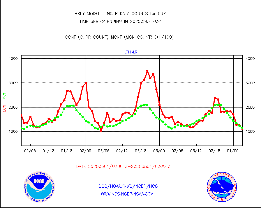
ltnglr |
LLDN Long-rng lightning from Vaisala via NOAAPORT |
128637 |
145865 |
88.2 % |
2002.50-2003.49 |
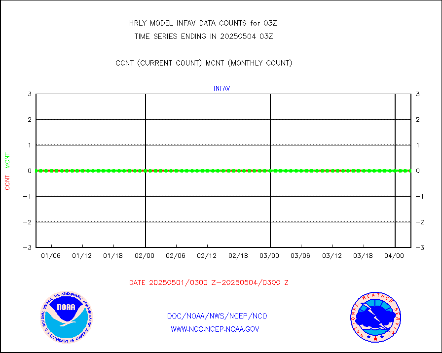
ltngsr |
NLDN Shrt-rng lightning from Vaisala via NOAAPORT |
8517 |
4898 |
173.9 % |
2002.50-2003.49 |
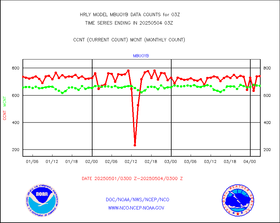
mbuoyb |
Moored buoys (decoded from BUFR) |
819 |
743 |
110.2 % |
2002.50-2003.50 |
mls |
Aura Microwave Limb Sounder (MLS) ozone data |
0 |
0 |
n/a |
2001.00-2001.99 |
msourb |
Mesonet/MADIS UrbaNet |
4363 |
4335 |
100.6 % |
2002.50-2003.49 |
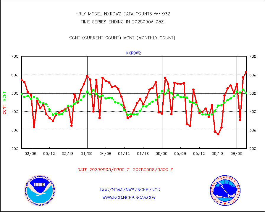
nxrdw2 |
NEXRAD Vel Azm Dsp(VAD) winds via Level 2 decoder |
672 |
664 |
101.2 % |
2002.50-2003.49 |
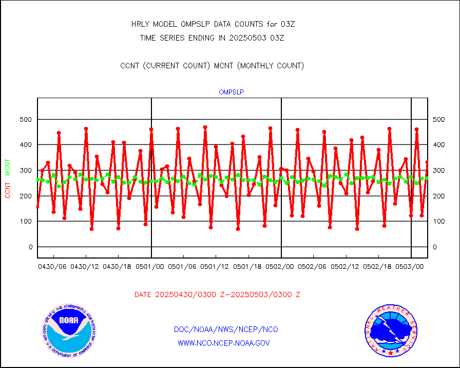
ompslp |
OMPS Limb Profiler ozone data (NPP) |
419 |
244 |
171.7 % |
1920.00-1920.99 |
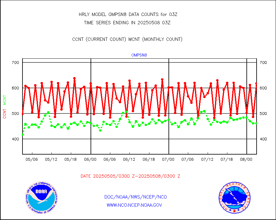
ompsn8 |
OMPS nadir profile ozone (Version 8 BUFR) |
589 |
535 |
110.1 % |
2001.00-2001.99 |
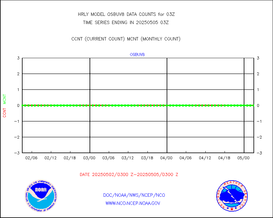
ompst8 |
OMPS total column ozone (Version 8 BUFR) |
388815 |
319905 |
121.5 % |
2001.00-2001.99 |
pirep |
Manual PIREP aircraft data (dcded from AIREP fmt) |
26 |
38 |
68.4 % |
2002.50-2003.49 |
prflrp |
Profilr winds from PIBAL (PILOT,PILOT SHIP/MOBIL) |
0 |
0 |
n/a |
2002.50-2003.49 |
raobm |
Rawinsonde - mobile land (from TEMP/PILOT MOBIL) |
0 |
0 |
n/a |
2002.50-2003.49 |
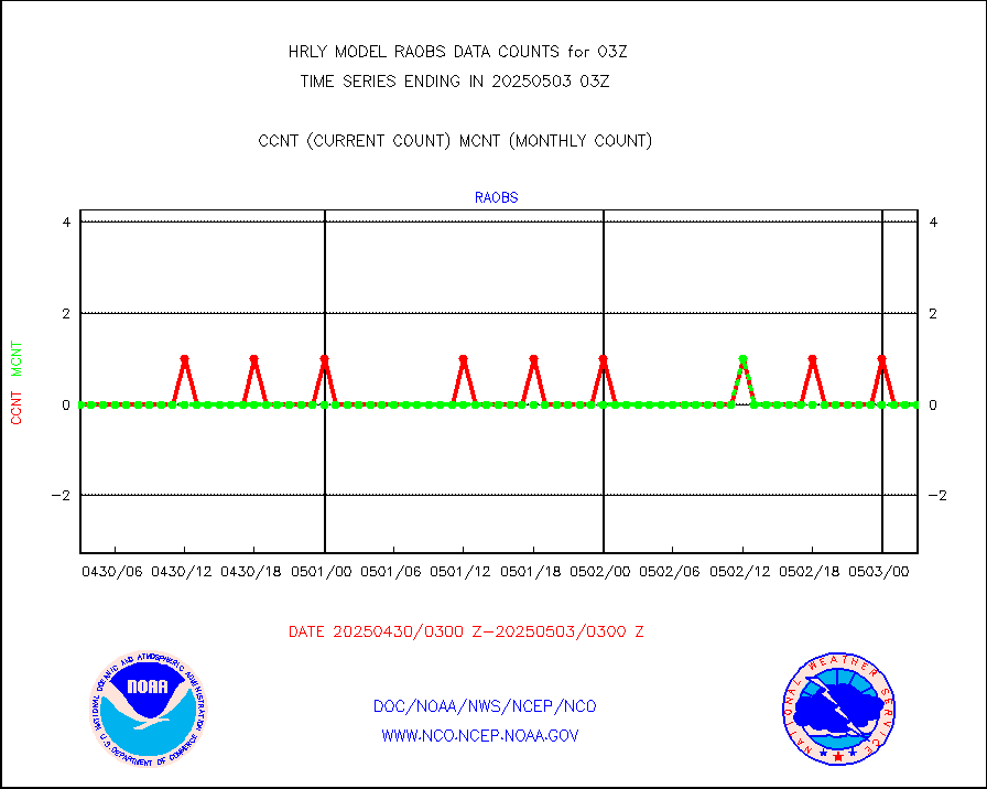
raobs |
Rawinsonde - ship (from TEMP SHIP, PILOT SHIP) |
0 |
0 |
n/a |
2002.50-2003.49 |
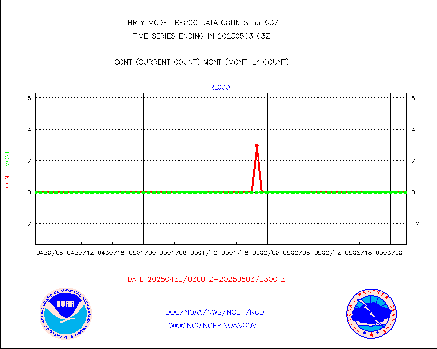
recco |
Flight level reconnaissance aircraft data |
0 |
0 |
n/a |
2002.50-2003.49 |
saphir |
Megha-Tropiques SAPHIR L1A2 brightness temps |
0 |
0 |
n/a |
2000.50-2001.49 |
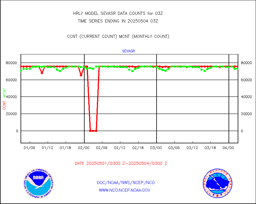
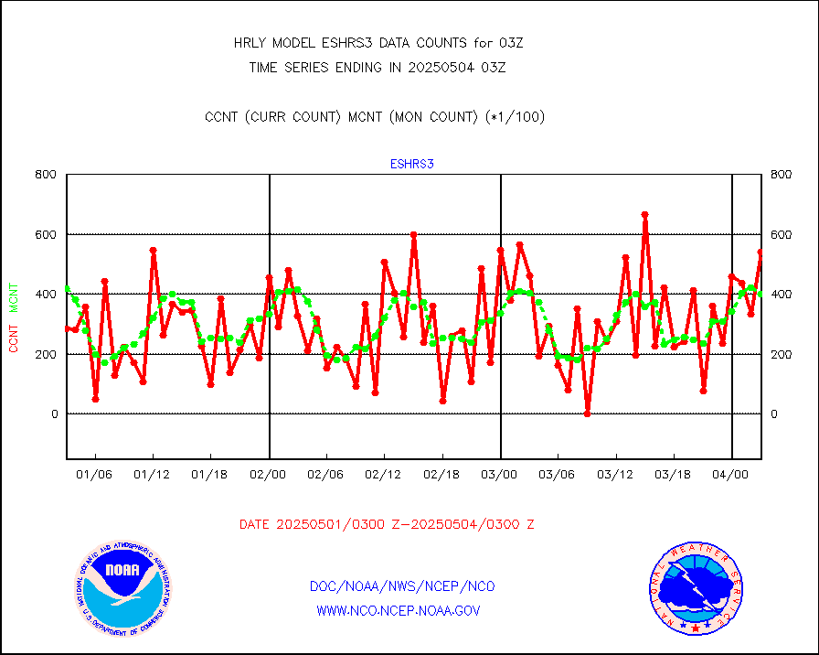
sevasr |
METEOSAT-10 2nd Gen SEVIRI All Sky Radiance(proc) |
75512 |
75454 |
100.1 % |
2002.50-2003.49 |
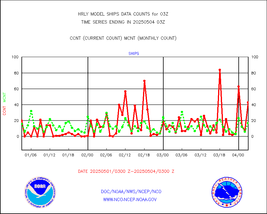
ships |
Ship - manual and automatic, restricted |
7 |
6 |
116.7 % |
2002.50-2003.49 |
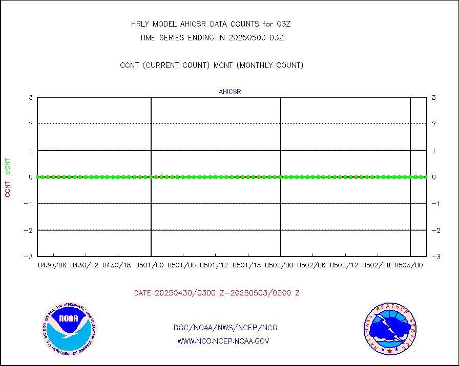
ssmisu |
DMSP SSM/IS 1C radiance data (Unified Pre-Proc.) |
217860 |
138348 |
157.5 % |
2001.50-2002.49 |
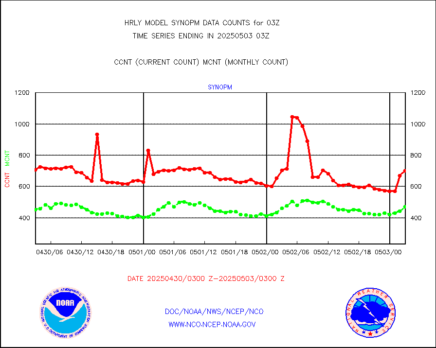
synopm |
Synoptic - mobile manual and automatic |
492 |
600 |
82.0 % |
2002.50-2003.49 |
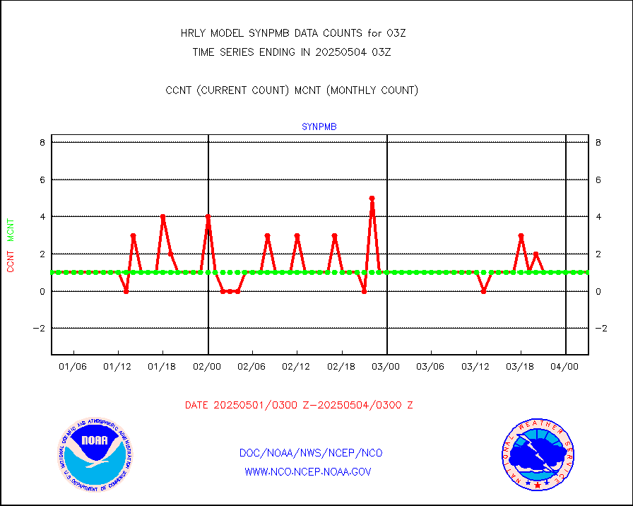
synpmb |
Synoptic - mobile manual & auto (decoded fr BUFR) |
0 |
1 |
0.0 % |
2002.50-2003.49 |
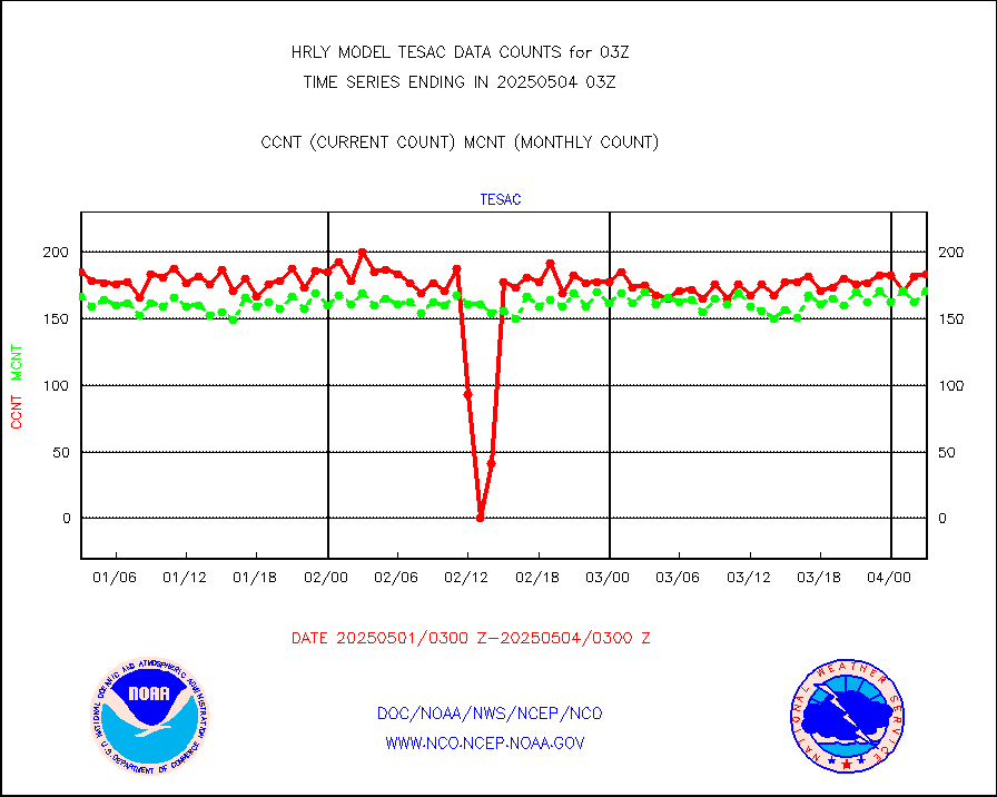
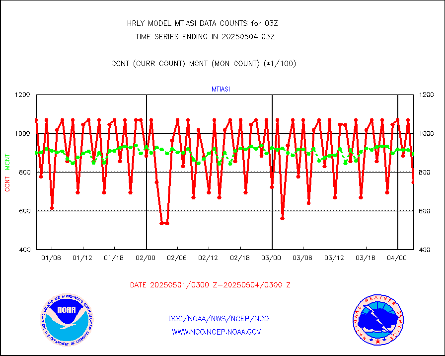
tesac |
CTD probe, Argo prflng float, mooring (TESAC fmt) |
212 |
201 |
105.5 % |
2002.50-2003.49 |
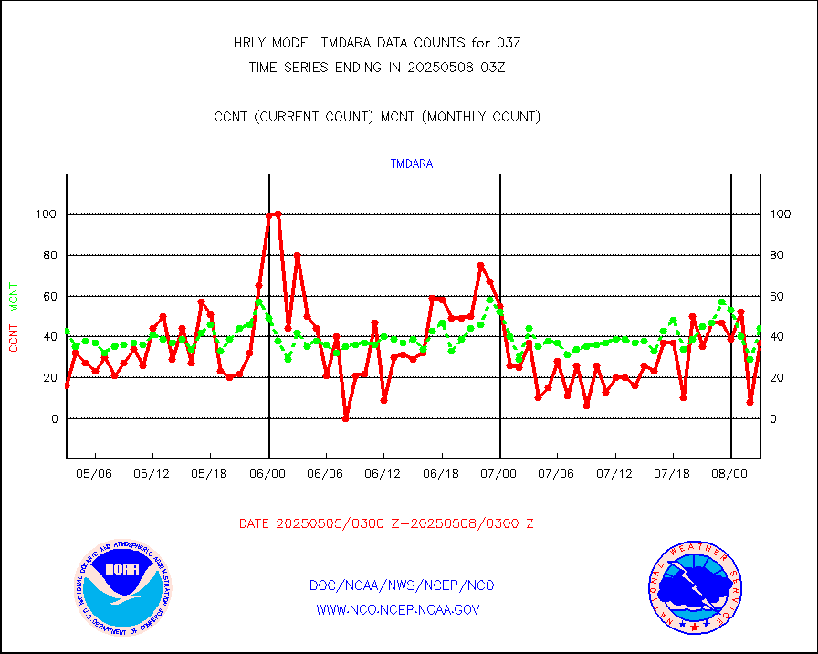
tmdara |
TAMDAR aircft data-all types(from Panasonic,BUFR) |
369 |
373 |
98.9 % |
2002.50-2003.49 |
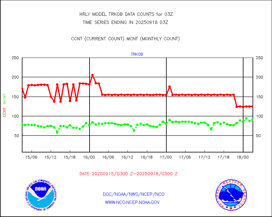
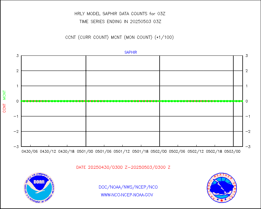
trkob |
ThermoSalinoGraph (TSG) TRACKOB format) |
60 |
44 |
136.4 % |
2001.50-2002.49 |
visin |
INSAT/KALPANA India visible derived cloud motion |
0 |
0 |
n/a |
2000.50-2001.49 |
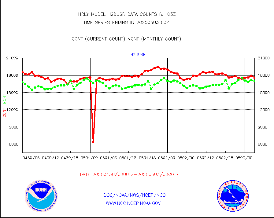
visja |
MTSAT/JMA visible derived cloud motion |
10920 |
10743 |
101.6 % |
2000.50-2001.49 |
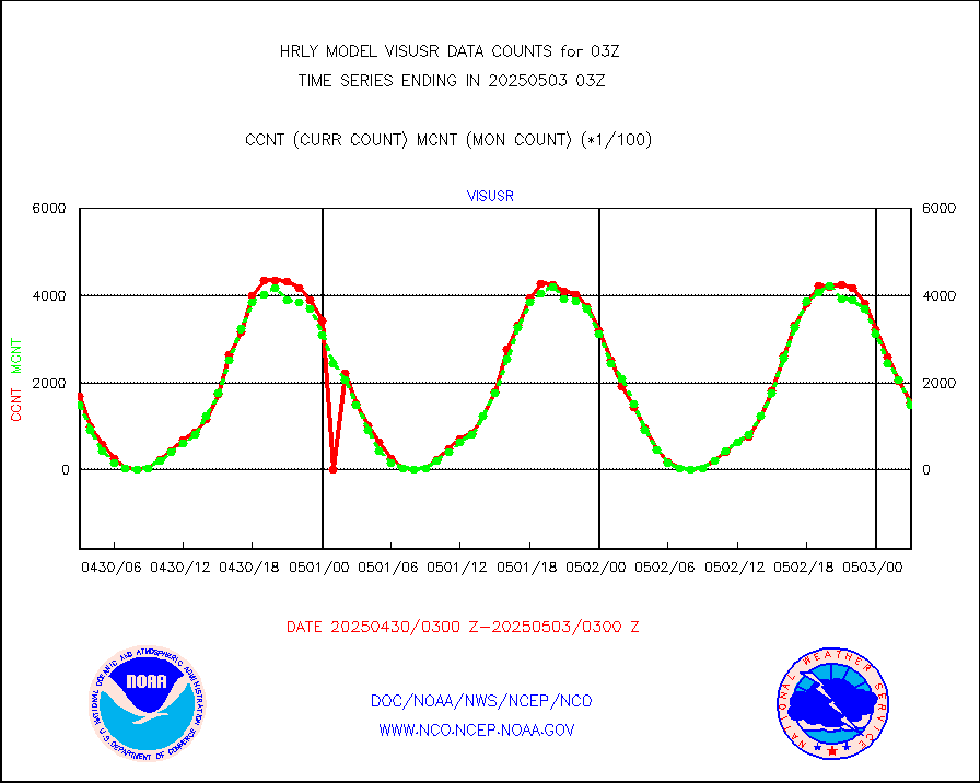
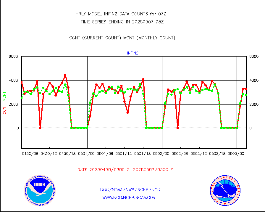
visusr |
GOES-16&up/NESDIS visible derived cloud motion |
138907 |
135661 |
102.4 % |
2002.00-2002.99 |
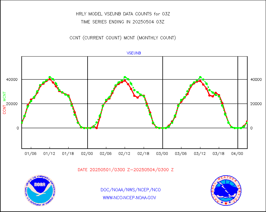
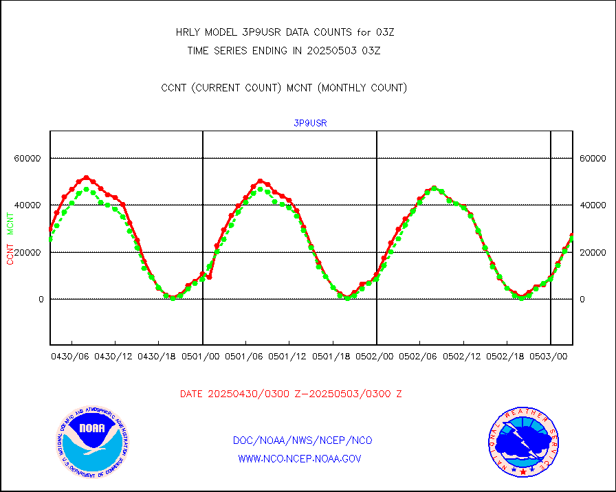
vseunb |
METEOSAT/EUMETSAT visible drv cld motion NBseq |
4111 |
4034 |
101.9 % |
2001.50-2002.49 |


