| Critical Data with Normal Counts |
|---|
| Type | Description | Hourly Count | Monthly Average | Percent (%) of Monthly Mean | UTC Time Window |
1bamua |
NOAA 15-19 & METOP 1-2 AMSU-A NCEP-proc. br.temps |
48728 |
53608 |
90.9 % |
1923.00-1923.99 |
1bhrs4 |
NOAA 18-19 & METOP 1-2 HIRS-4 NCEP-proc. br.temps |
33338 |
46579 |
71.6 % |
1923.00-1923.99 |
1bmhs |
NOAA 18-19 & METOP 1-2 MHS NCEP-proces. br. temps |
332614 |
298804 |
111.3 % |
1923.00-1923.99 |
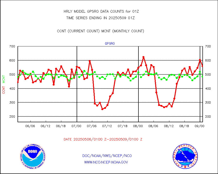
acars |
MDCRS ACARS acft data from ARINC(dcded from BUFR) |
21071 |
20019 |
105.3 % |
2000.50-2001.49 |
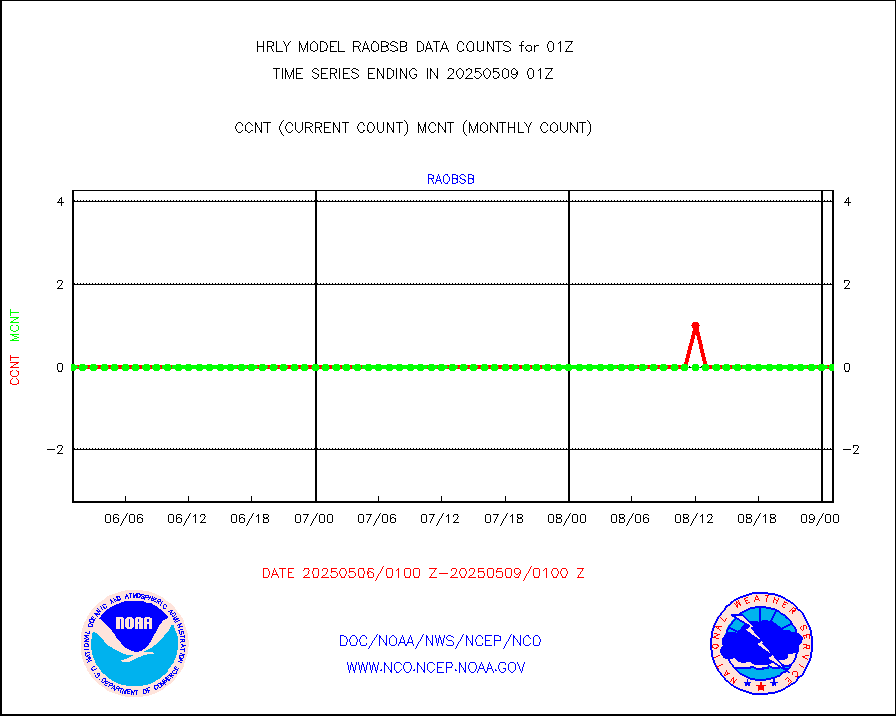
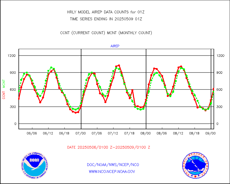
airep |
Manual AIREP aircraft data (dcded from AIREP fmt) |
1073 |
944 |
113.7 % |
2000.50-2001.49 |
airsev |
AQUA AIRS/AMSU-A/HSB brightness temps- every FOV |
0 |
0 |
n/a |
1922.50-1923.49 |
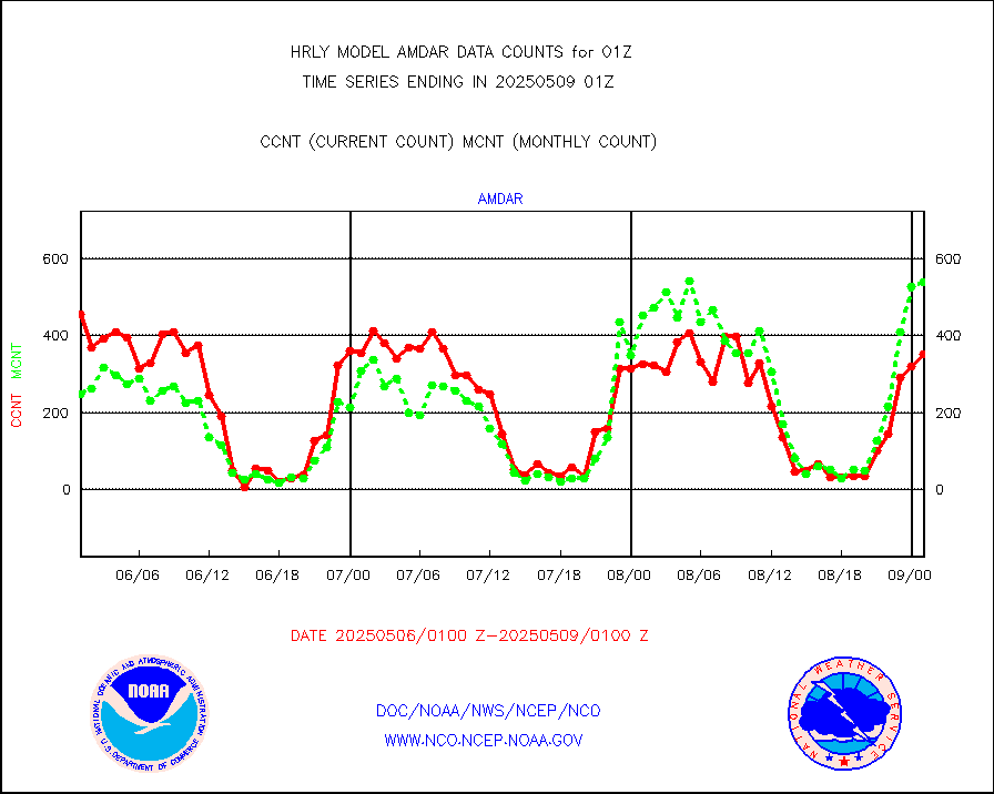
amdar |
AMDAR aircraft data (decoded from AMDAR format) |
436 |
387 |
112.7 % |
2000.50-2001.49 |
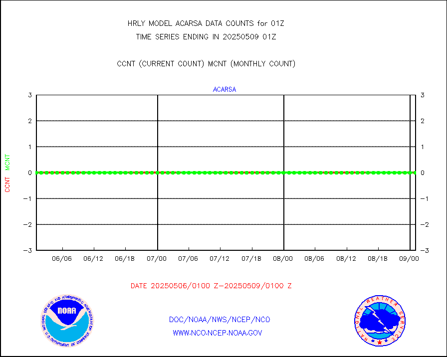
amdarb |
AMDAR aircraft data (decoded from BUFR) |
964 |
1050 |
91.8 % |
2000.50-2001.49 |
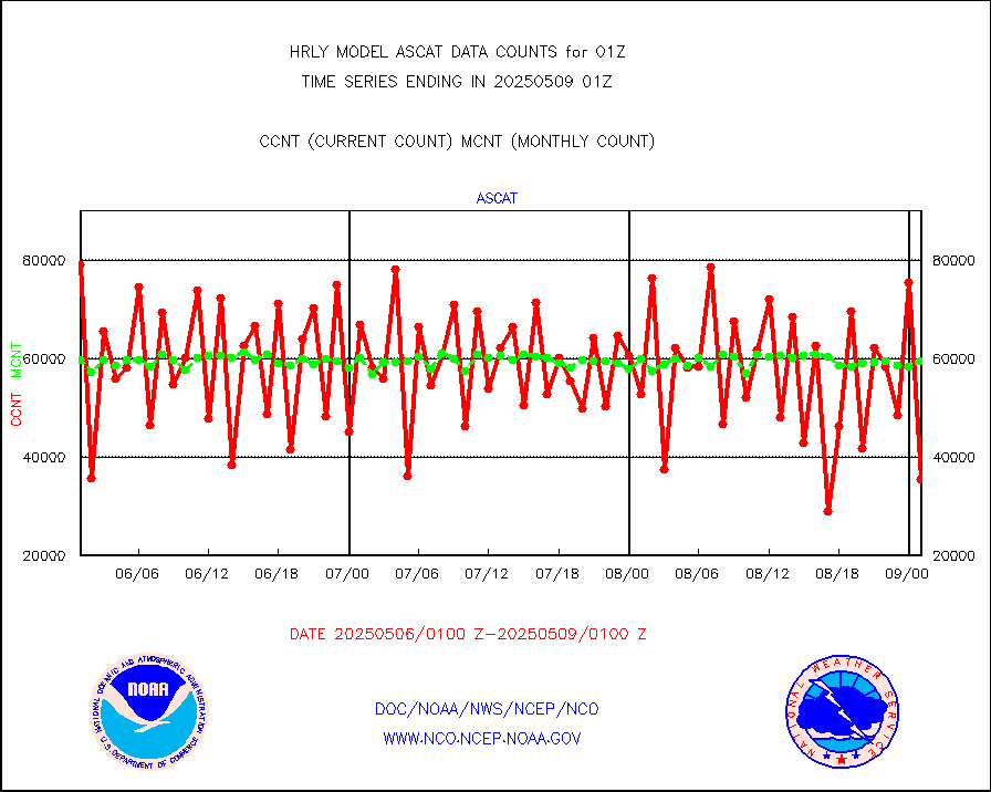
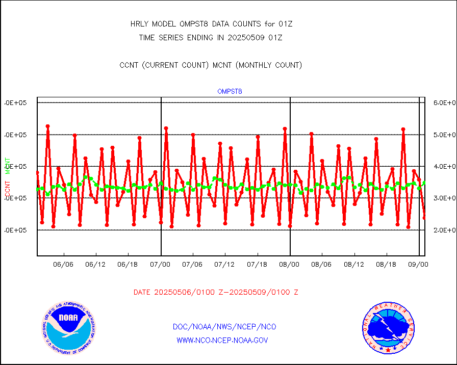
ascat |
METOP 1-2 ASCAT products |
54810 |
48569 |
112.8 % |
1923.50-2000.49 |
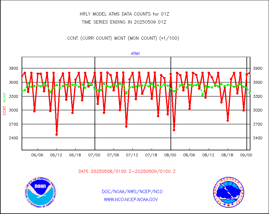
atms |
NPP/NOAA-20 ATMS brightness temperatures |
319392 |
306790 |
104.1 % |
1923.50-2000.49 |
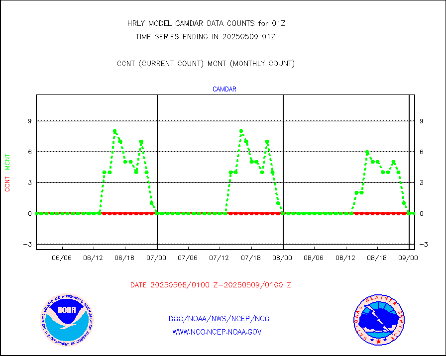
camdar |
Canadian AMDAR aircraft data (decoded from BUFR) |
36 |
11 |
327.3 % |
2000.50-2001.49 |
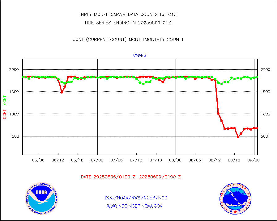
cmanb |
Surface Marine CMAN rpts decoded from BUFR format |
1833 |
1815 |
101.0 % |
2000.50-2001.50 |
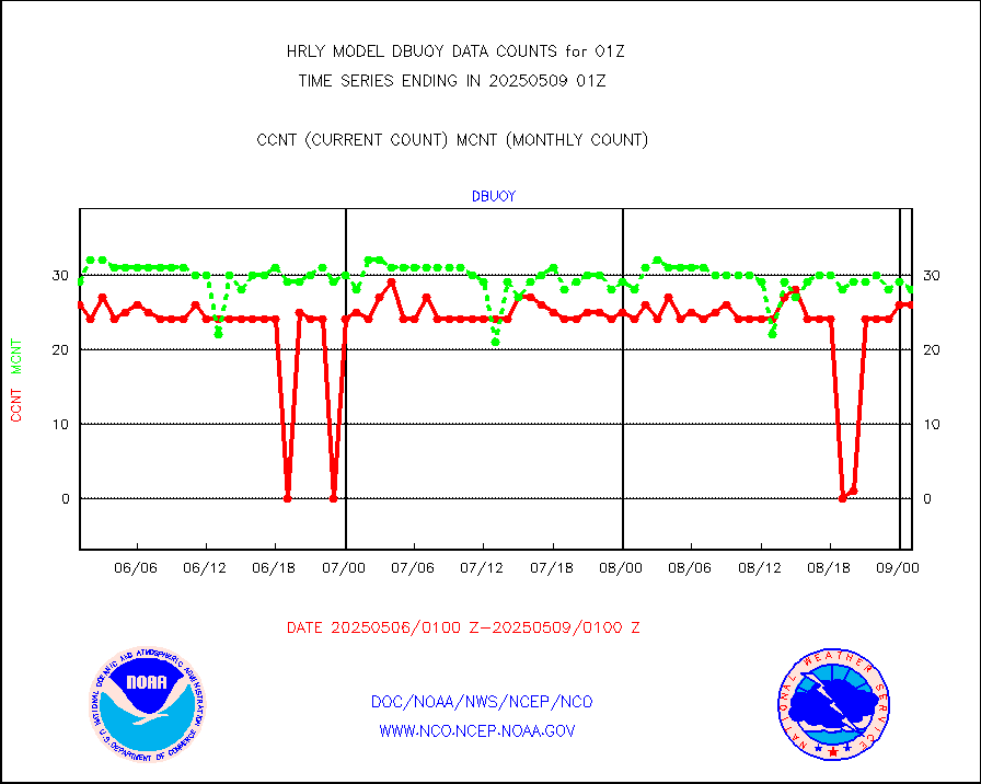
dbuoy |
Buoys decoded from FM-18 fmt (moored or drifting) |
39 |
37 |
105.4 % |
2000.50-2001.49 |
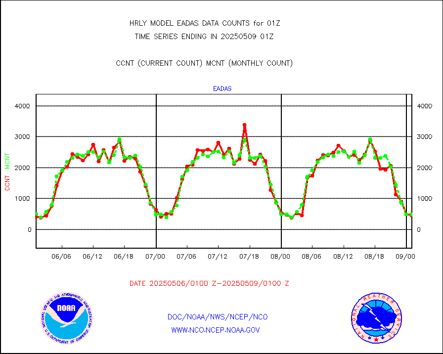
eadas |
E-AMDAR (European AMDAR acft decoded from BUFR) |
493 |
404 |
122.0 % |
2000.50-2001.49 |
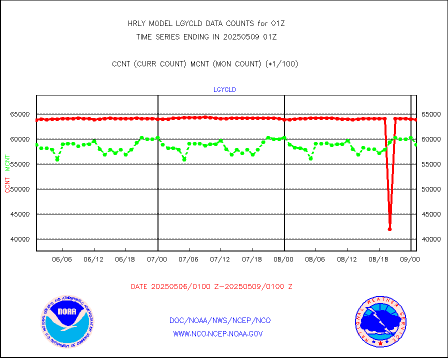
esamua |
NOAA 15-19 & METOP 1-2 AMSU-A proc btmps frm RARS |
44534 |
43625 |
102.1 % |
2000.50-2001.49 |
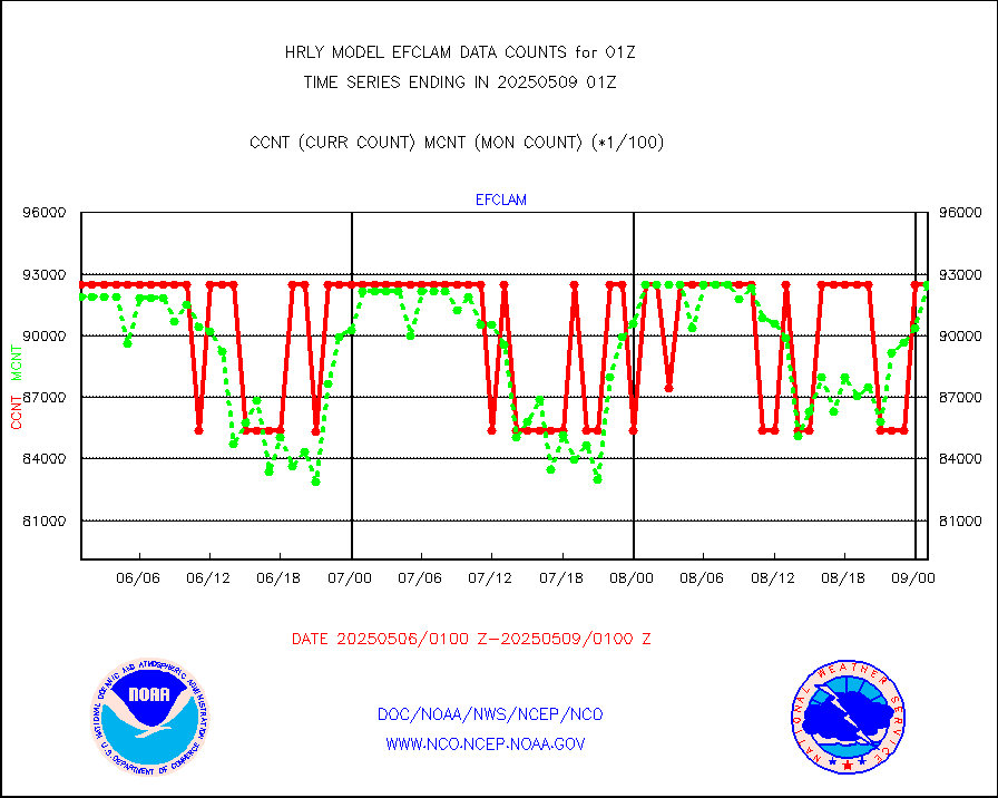
eshrs3 |
NOAA 15-19 & METOP 1-2 HIRS-3/4 pr btmps frm RARS |
83588 |
82310 |
101.6 % |
2000.50-2001.49 |
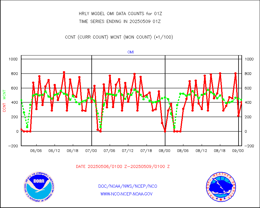
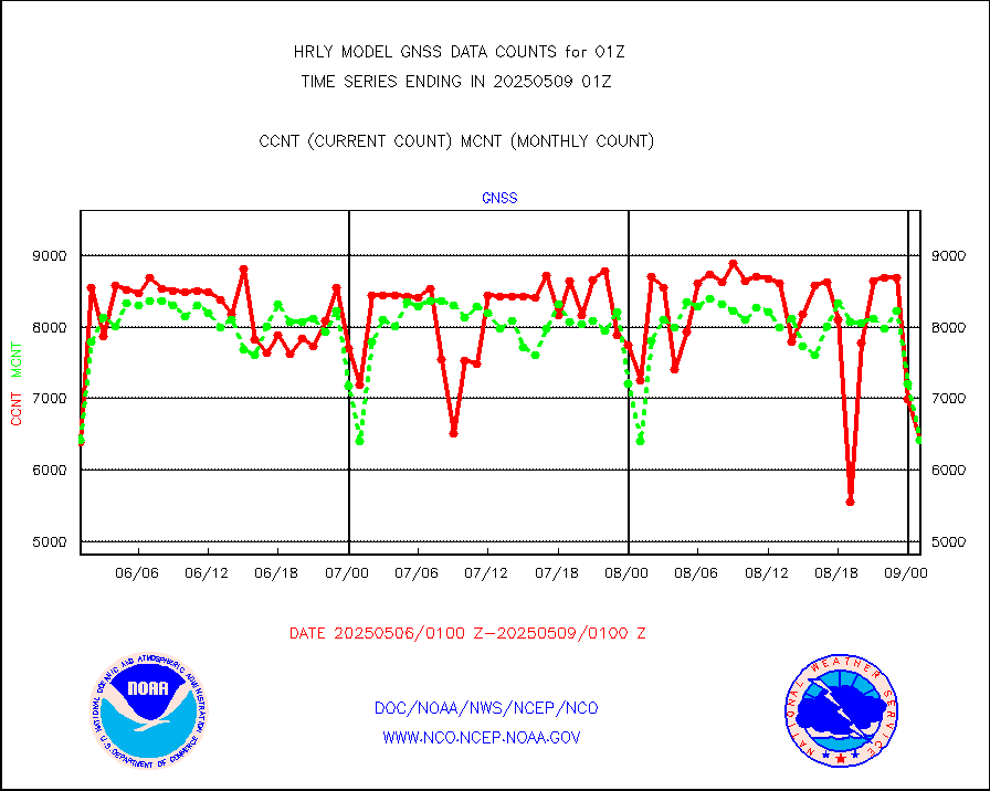
gnss |
Grnd-based Gbl Navigation Sat System (GNSS) data |
7631 |
7150 |
106.7 % |
2000.00-2000.99 |
gpsro |
GPS radio occultation data |
364 |
453 |
80.4 % |
1922.50-1923.49 |
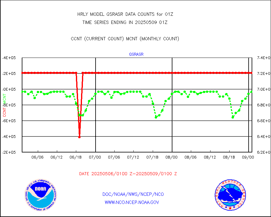
gsrasr |
GOES-16/17 All Sky Radiances (proc.) |
720952 |
702929 |
102.6 % |
2000.50-2001.49 |
gsrcsr |
GOES-16/17 Clear Sky Radiances (proc.) |
331269 |
347553 |
95.3 % |
2000.50-2001.49 |
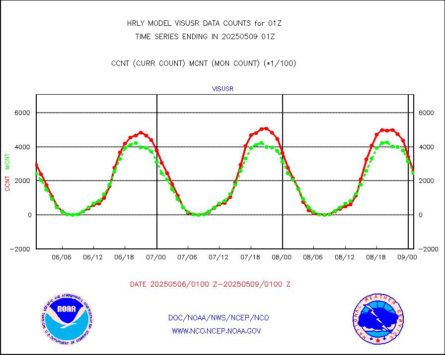
h20ja |
MTSAT/JMA water vapor imager derived cloud motion |
19626 |
18569 |
105.7 % |
1922.50-1923.49 |
h20mo |
MODIS (AQUA/TERRA) wvpr imager derived cld motion |
0 |
0 |
n/a |
1921.00-1921.99 |
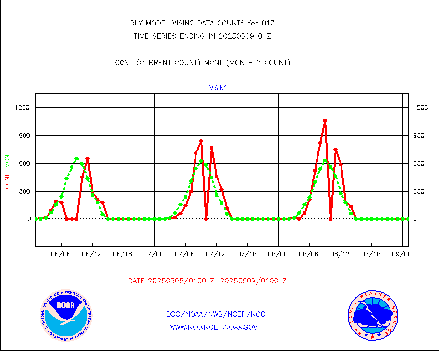
h2tusr |
GOES-16&up/NESDIS wv imgr/cld-top derived cld mtn |
28166 |
28108 |
100.2 % |
2000.00-2000.99 |
ifeunb |
METEOSAT/EUMETSAT ir lg-wave drv cld motion NBseq |
21223 |
21327 |
99.5 % |
1923.50-2000.49 |
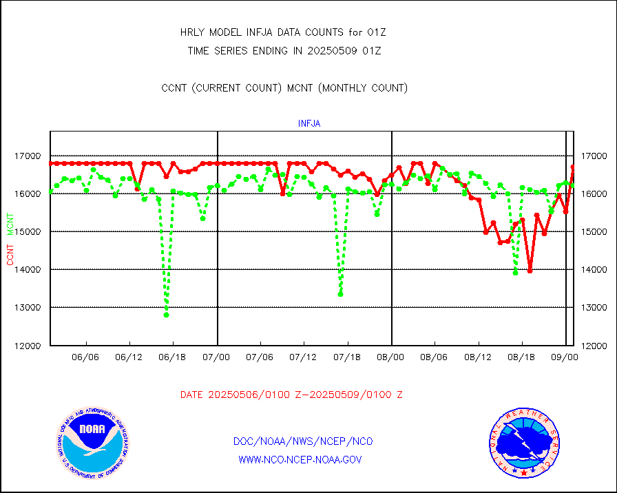
infja |
MTSAT/JMA infrared long-wave derived cloud motion |
16431 |
15837 |
103.8 % |
1922.50-1923.49 |
infmo |
MODIS (AQUA/TERRA) ir l-wave derived cloud motion |
0 |
0 |
n/a |
1921.00-1921.99 |
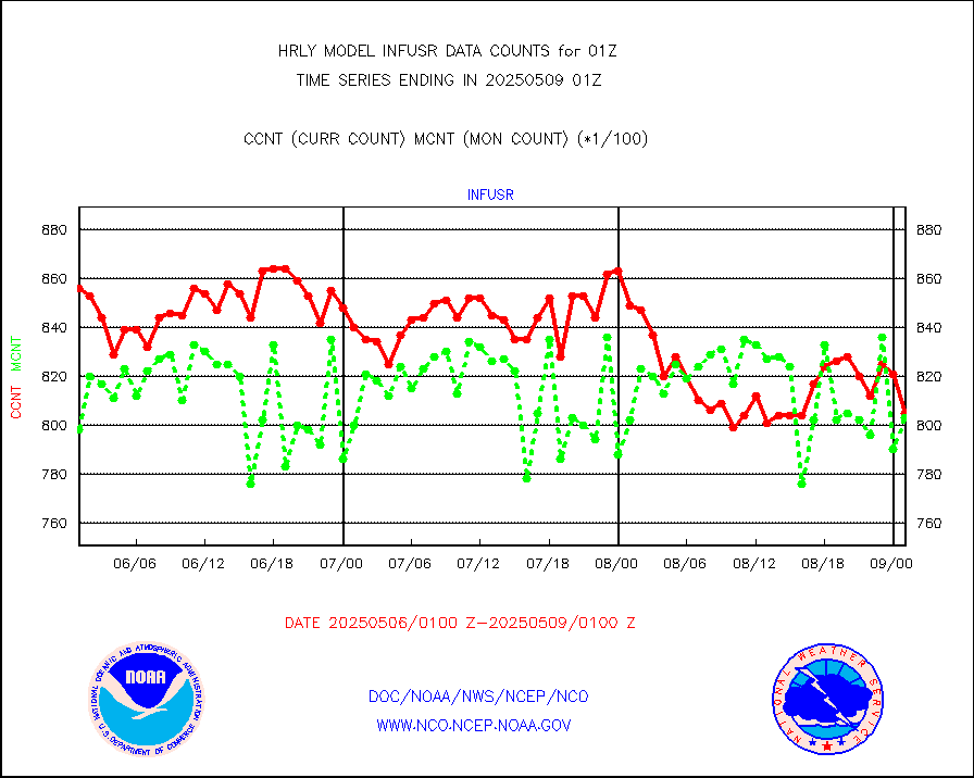
infusr |
GOES-16&up/NESDIS ir long-wave derived cld motion |
75502 |
77833 |
97.0 % |
2000.00-2000.99 |
lgycld |
GOES/NASA(Langley) hi-res. (1x1 f-o-v) cloud data |
4191892 |
3561914 |
117.7 % |
2000.50-2001.49 |
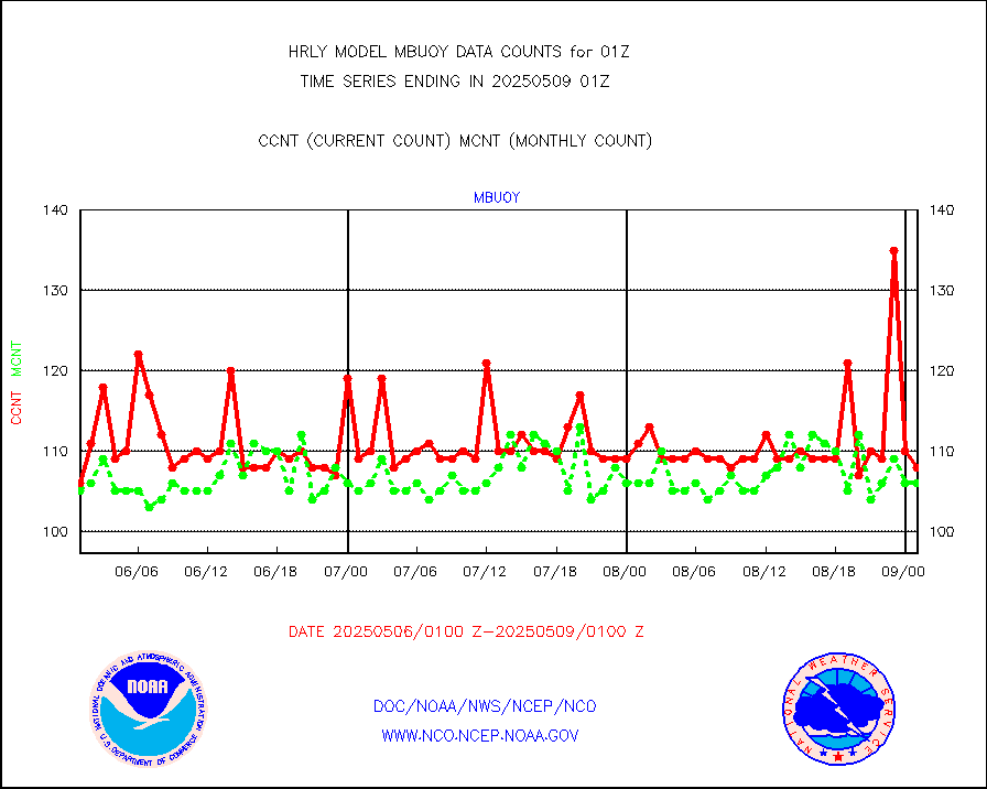
mbuoy |
Buoys decoded from FM-13 format (moored) |
118 |
110 |
107.3 % |
2000.50-2001.49 |
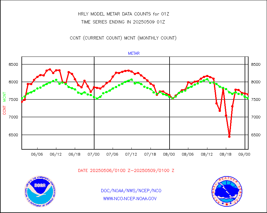
metar |
Aviation - METAR |
7288 |
7536 |
96.7 % |
2000.50-2001.49 |
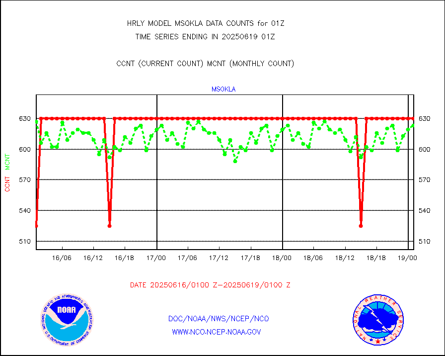
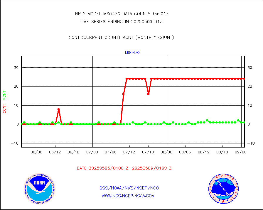
mso470 |
Mesonet/MADIS Colorado E-470 (Interstate 470) |
21 |
20 |
105.0 % |
2000.50-2001.49 |
msoalk |
Mesonet/MADIS Alaska Department of Transportation |
107 |
108 |
99.1 % |
2000.50-2001.49 |
msoapg |
Mesonet/MADIS U.S. Army Aberdeen Proving Grounds |
0 |
0 |
n/a |
2000.50-2001.49 |
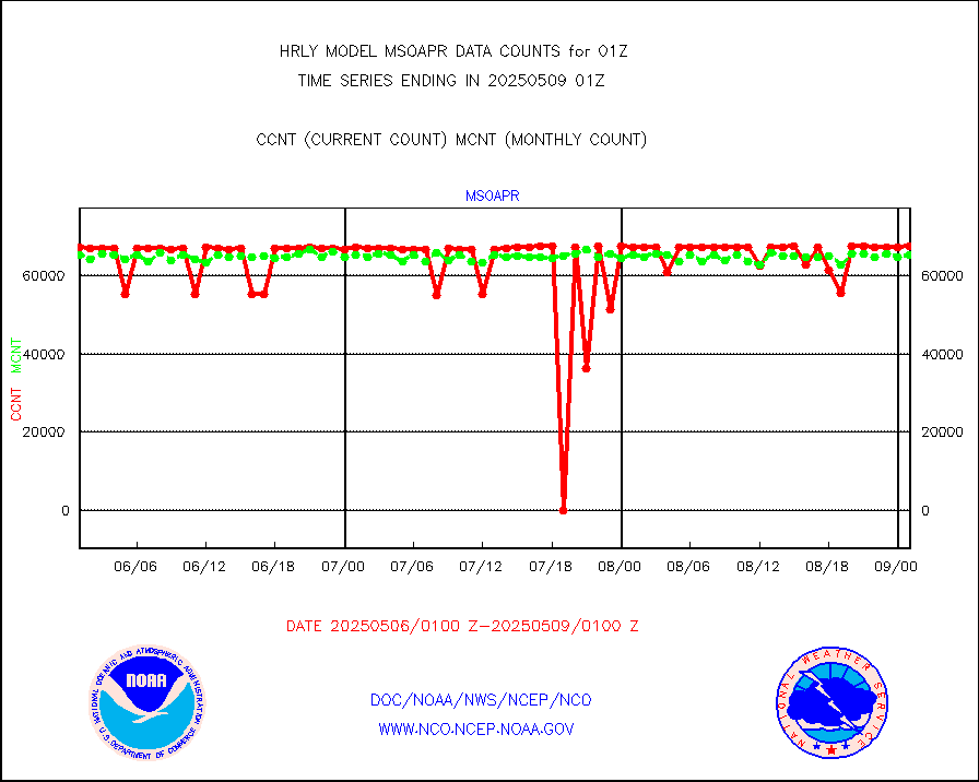
msoapr |
Mesonet/MADIS Citizen Weather Observers Program |
50107 |
48422 |
103.5 % |
2000.50-2001.49 |
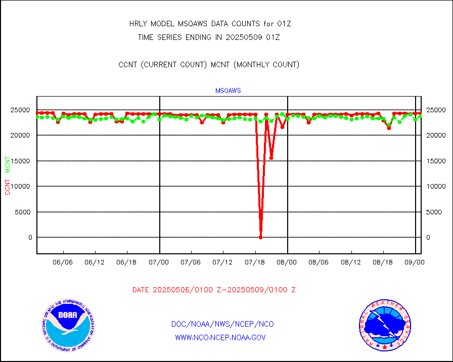
msoaws |
Mesonet/MADIS AWS Convergence Technologies, Inc. |
25678 |
25600 |
100.3 % |
2000.50-2001.49 |
msoawx |
Mesonet/MADIS "Anything Weather" |
0 |
0 |
n/a |
2000.50-2001.49 |
msocol |
Mesonet/MADIS Colorado Dept. of Transportation |
0 |
0 |
n/a |
2000.50-2001.49 |
msodcn |
Mesonet/MADIS DC Net |
0 |
0 |
n/a |
2000.50-2001.49 |
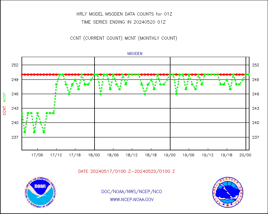
msoden |
Mesonet/MADIS Denver Urban Drainage & Flood Cntrl |
250 |
250 |
100.0 % |
2000.50-2001.49 |
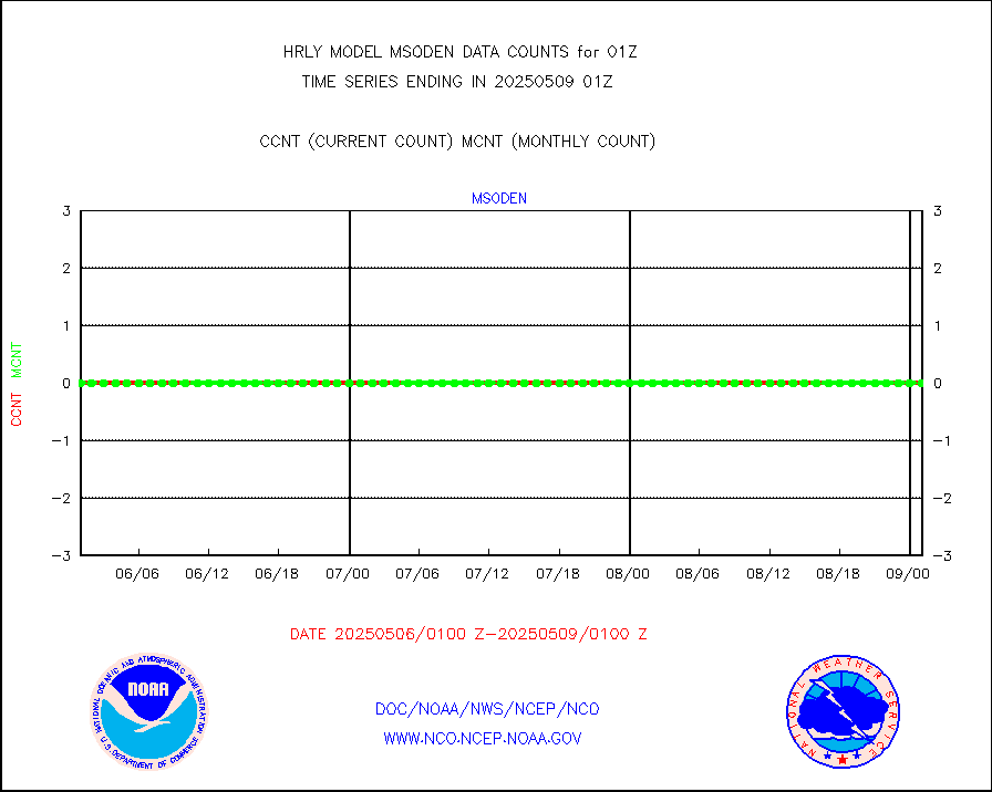
msofla |
Mesonet/MADIS Florida (FAWN & USF) |
4 |
4 |
100.0 % |
2000.50-2001.49 |
msoflt |
Mesonet/MADIS Florida Dept. of Transportation |
0 |
0 |
n/a |
2000.50-2001.49 |
msogeo |
Mesonet/MADIS Georgia Dept. of Transportation |
0 |
0 |
n/a |
2000.50-2001.49 |
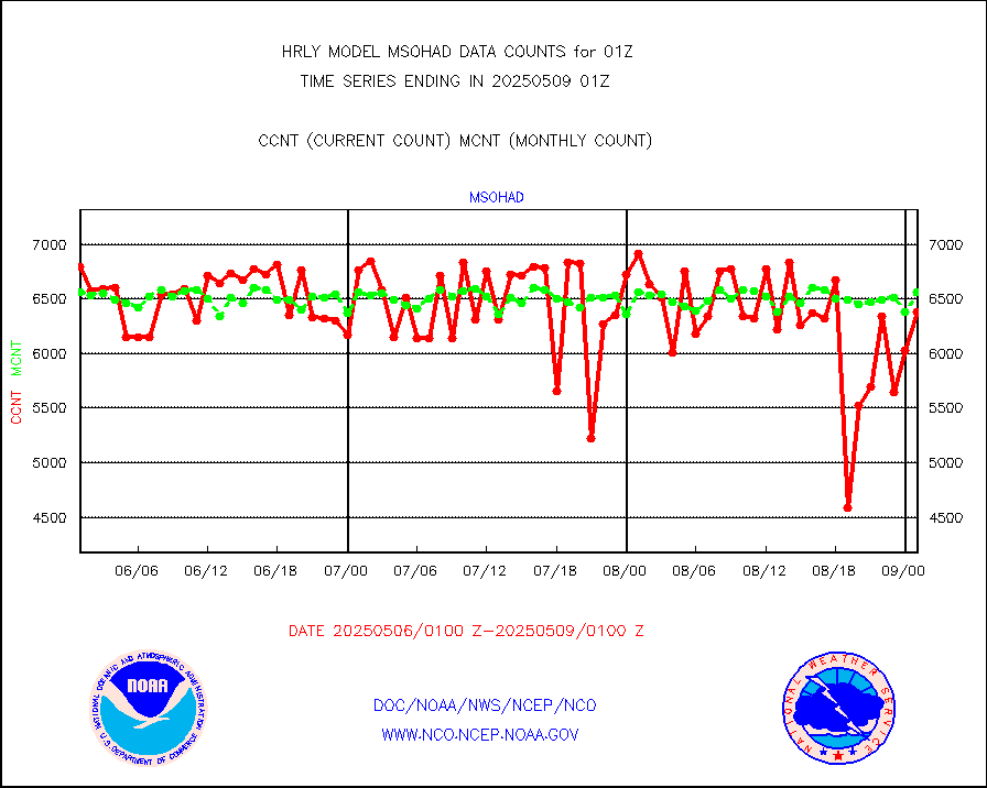
msohad |
Mesonet/MADIS NWS Hydromet Auto Data System(HADS) |
6754 |
6747 |
100.1 % |
2000.50-2001.49 |
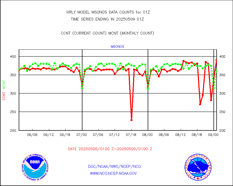
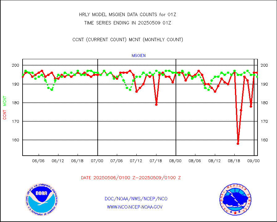
msoien |
Mesonet/MADIS Iowa Environmental |
184 |
187 |
98.4 % |
2000.50-2001.49 |
msoind |
Mesonet/MADIS Indiana Dept. of Transportation |
0 |
0 |
n/a |
2000.50-2001.49 |
msoiow |
Mesonet/MADIS Iowa Department of Transportation |
0 |
0 |
n/a |
2000.50-2001.49 |
msokan |
Mesonet/MADIS Kansas Department of Transportation |
331 |
362 |
91.4 % |
2000.50-2001.49 |
msokla |
Mesonet/MADIS Oklahoma Mesonet |
318 |
322 |
98.8 % |
2000.50-2001.49 |
msolju |
Mesonet/MADIS Louisiana State/Jackson State Univ. |
0 |
0 |
n/a |
2000.50-2001.49 |
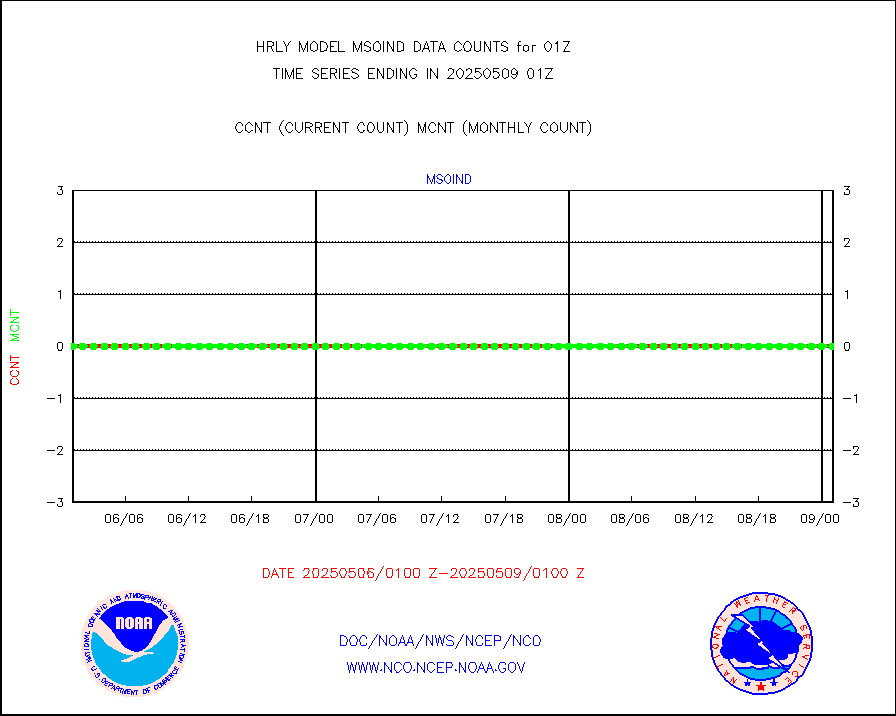
msomca |
Mesonet/MADIS Missouri Commercial Agricult Wx Net |
299 |
295 |
101.4 % |
2000.50-2001.49 |
msomin |
Mesonet/MADIS Minnesota Dept. of Transportation |
0 |
0 |
n/a |
2000.50-2001.49 |
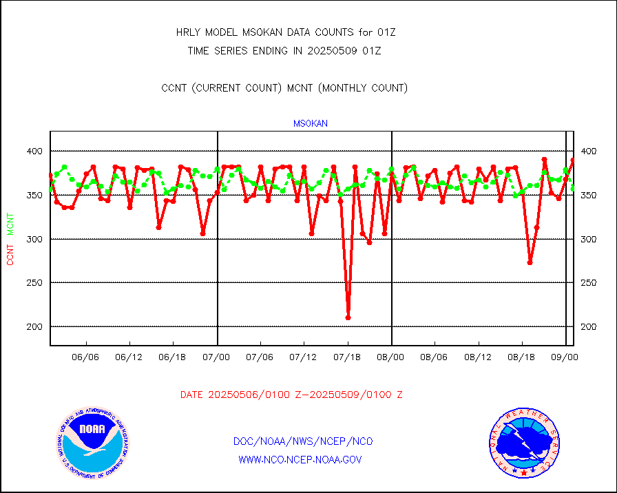
msonos |
Mesonet/MADIS NOS-Phys Oceanographic Realtime Sys |
393 |
376 |
104.5 % |
2000.50-2001.49 |
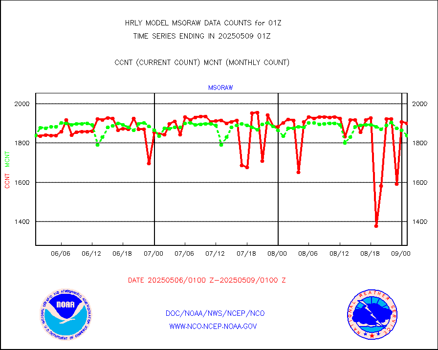
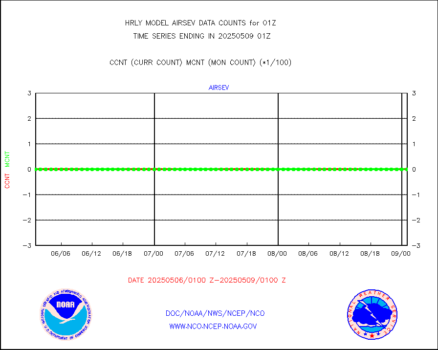
msoraw |
Mesonet/MADIS NFIC Remote Automated Wx Stns(RAWS) |
1897 |
1871 |
101.4 % |
2000.50-2001.49 |
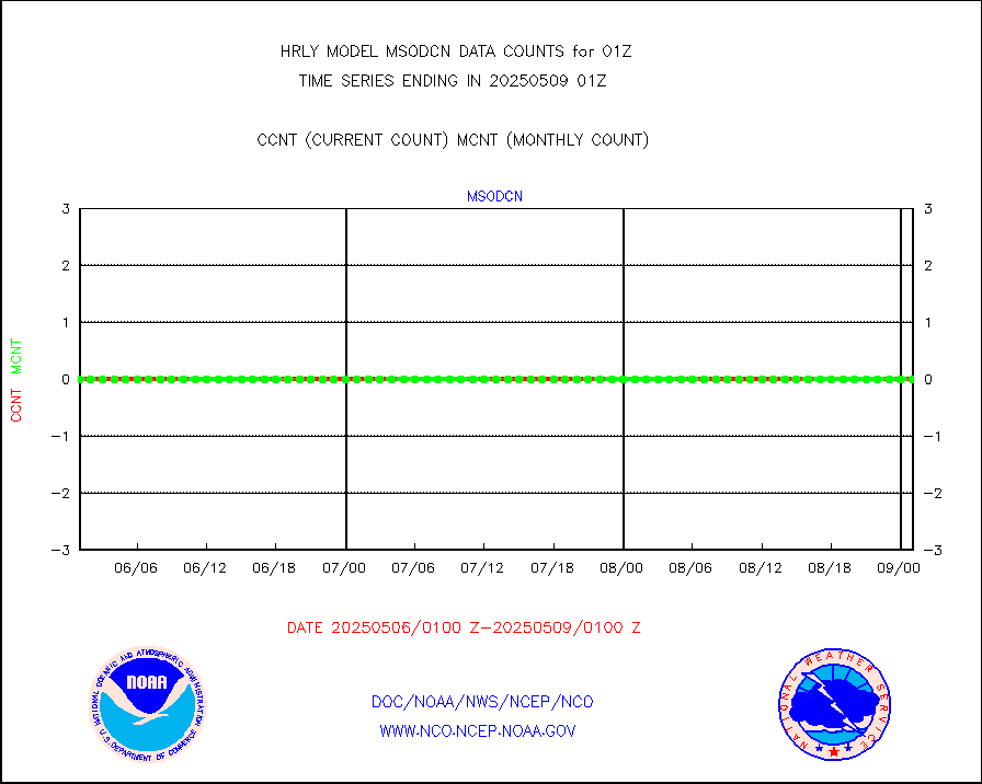
msovir |
Mesonet/MADIS Virginia Dept. of Transportation |
207 |
228 |
90.8 % |
2000.50-2001.49 |
msowfy |
Mesonet/MADIS "Weather for You" |
0 |
0 |
n/a |
2000.50-2001.49 |
msowis |
Mesonet/MADIS Wisconsin Dept. of Transportation |
0 |
0 |
n/a |
2000.50-2001.49 |
msowst |
Mesonet/MADIS MesoWest (many subproviders) |
46512 |
46470 |
100.1 % |
2000.50-2001.49 |
msowtx |
Mesonet/MADIS West Texas |
5653 |
5602 |
100.9 % |
2000.50-2001.49 |
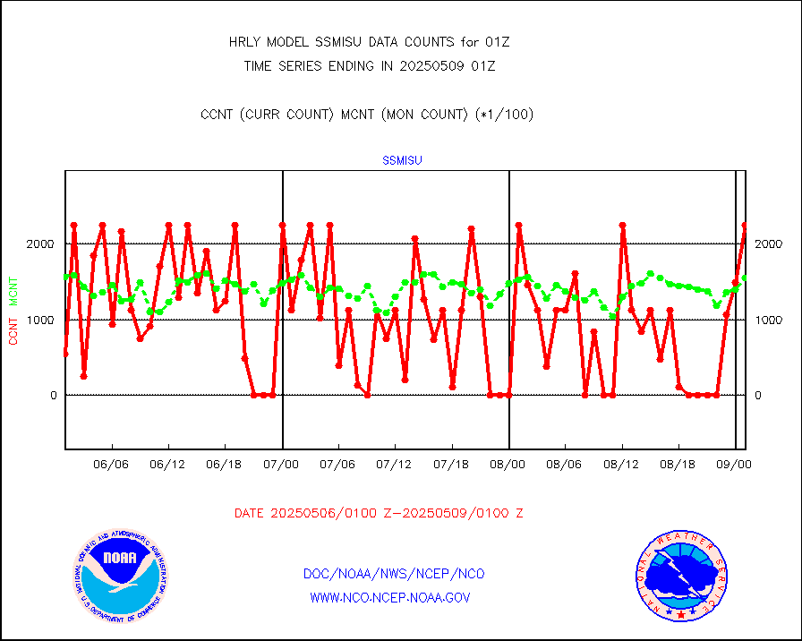
mtiasi |
METOP 1-2 IASI 1C radiance data (varbl. channels) |
106936 |
83611 |
127.9 % |
1923.00-1923.99 |
nxrdw |
NEXRAD Vel Azm Dsp(VAD) winds via radar coded msg |
0 |
0 |
n/a |
2000.50-2001.49 |
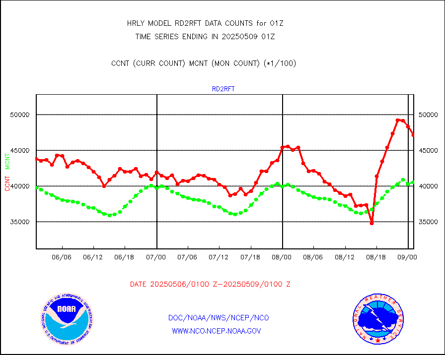
omi |
Aura Ozone Monitoring Instrument (OMI) data |
58560 |
33500 |
174.8 % |
1922.50-1923.49 |
osbuv8 |
NOAA 16-19 Solar Backscatter UV-2 rad frm V8 BUFR |
0 |
0 |
n/a |
1923.00-1923.99 |
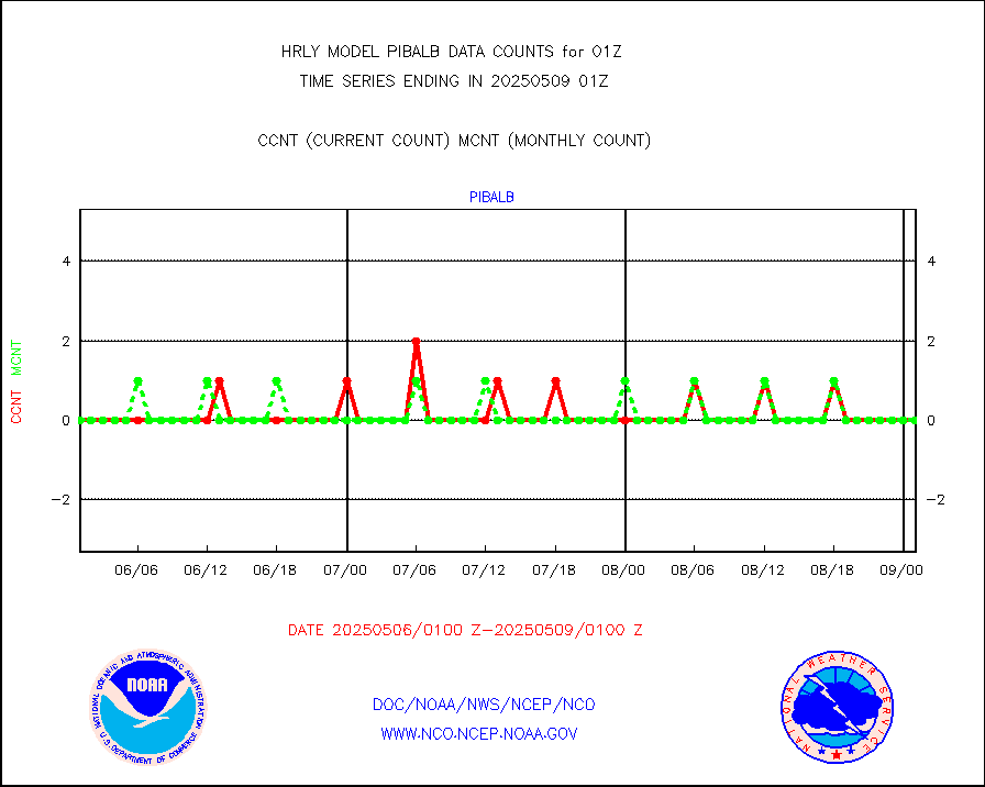
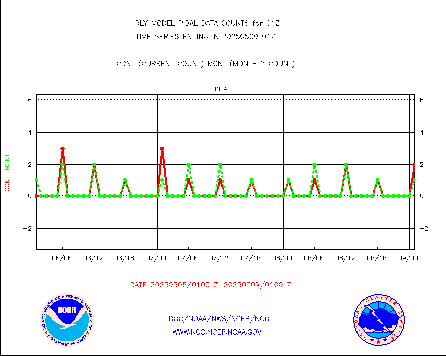
pibal |
PIBAL (from PILOT, PILOT SHIP, PILOT MOBIL) |
0 |
1 |
0.0 % |
2000.50-2001.49 |
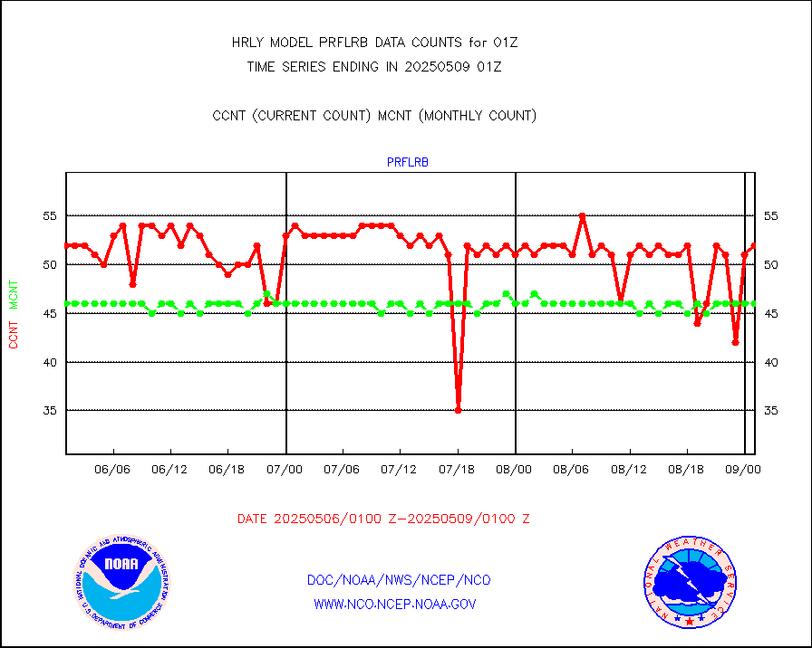
prflrb |
Multi-Agency Profiler (MAP) and SODAR winds |
35 |
42 |
83.3 % |
2000.50-2001.49 |
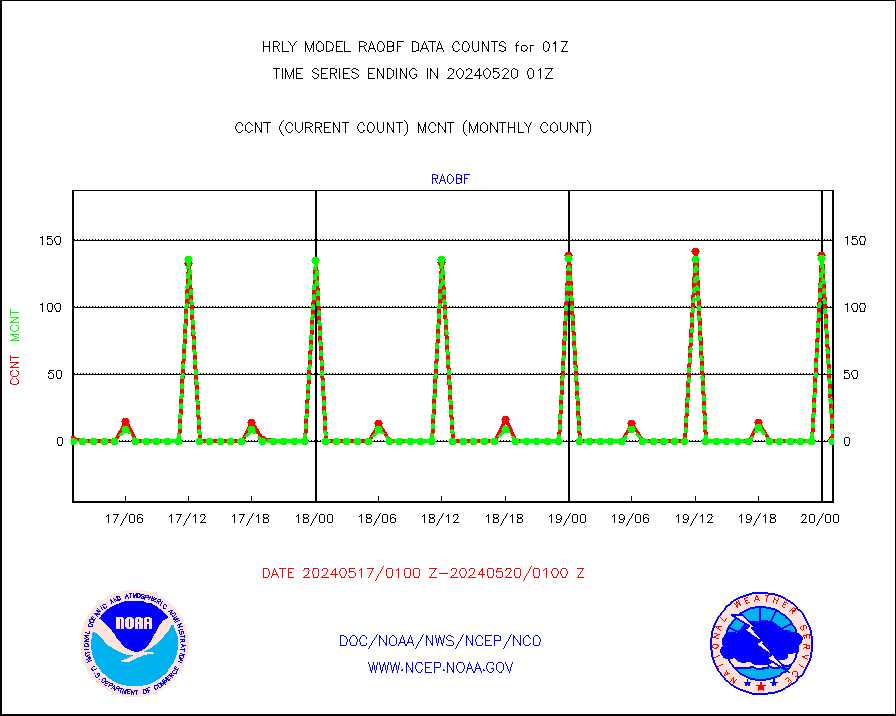
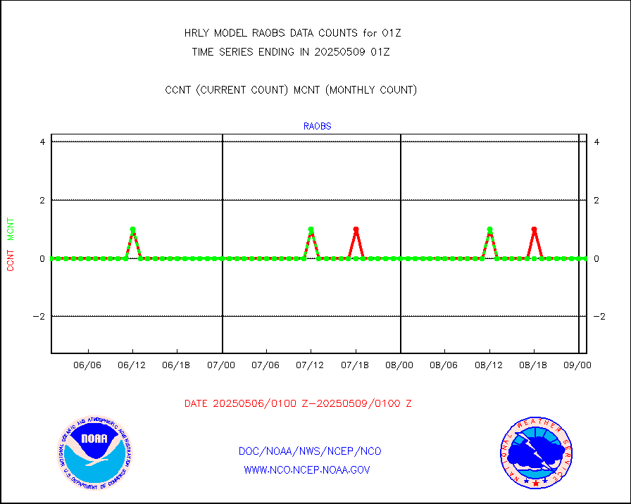
raobf |
Rawinsonde - fixed land (from TEMP or PILOT) |
1 |
0 |
n/a |
2000.50-2001.49 |
rass |
RASS temperatures (NOAA and Multi-Agency) |
24 |
26 |
92.3 % |
2000.50-2001.49 |
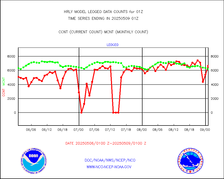
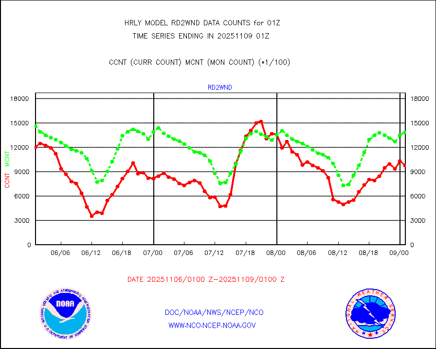
rd2rft |
NEXRAD reflectivity (Lvl 2 - GTS) |
4311635 |
4178636 |
103.2 % |
2000.50-2001.49 |
rd2wnd |
NEXRAD radial wind (Level 2 - GTS) |
1918208 |
1619667 |
118.4 % |
2000.50-2001.49 |
sevcsr |
METEOSAT-10 2nd Gen SEVIRI Clr Sky Radiance(proc) |
0 |
0 |
n/a |
2000.50-2001.49 |
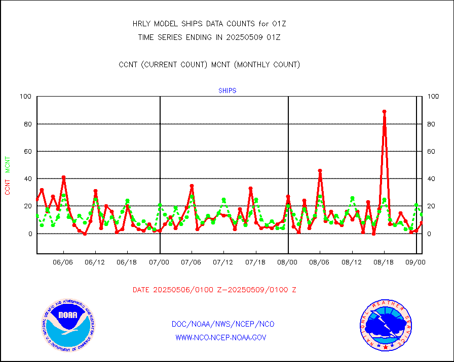
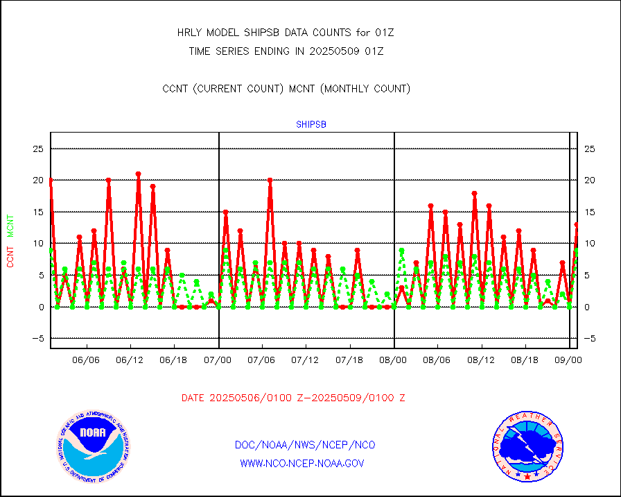
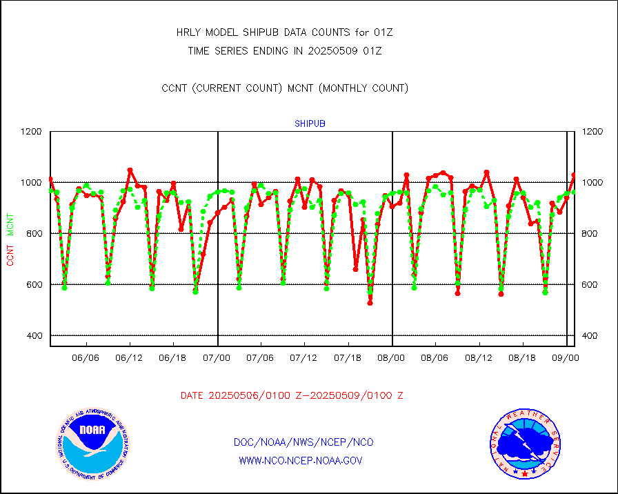
shipsb |
Ship - manual and automatic, restricted (BUFR) |
1 |
0 |
n/a |
2000.50-2001.50 |
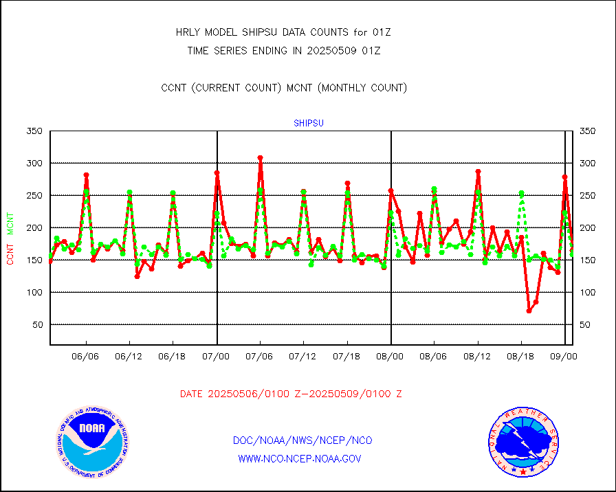
shipsu |
Ship - manual and automatic, unrestricted |
114 |
117 |
97.4 % |
2000.50-2001.50 |
shipub |
Ship - manual and automatic, unrestricted (BUFR) |
790 |
829 |
95.3 % |
2000.50-2001.50 |
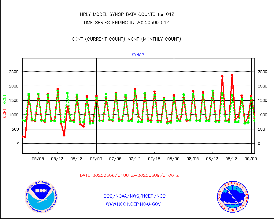
synop |
Synoptic - fixed manual and automatic |
989 |
877 |
112.8 % |
2000.50-2001.49 |
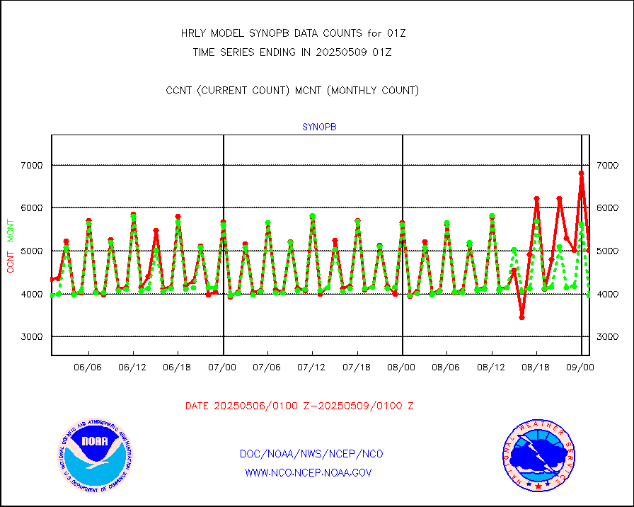
synopb |
Synoptic - fixed manual & auto (decoded fr BUFR) |
4003 |
4102 |
97.6 % |
2000.50-2001.49 |
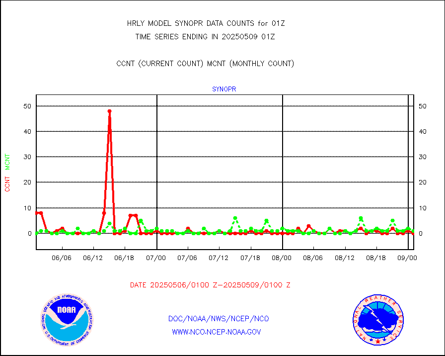
synopr |
Synoptic - restricted (WMO Res 40) manual & auto. |
0 |
0 |
n/a |
2000.50-2001.49 |
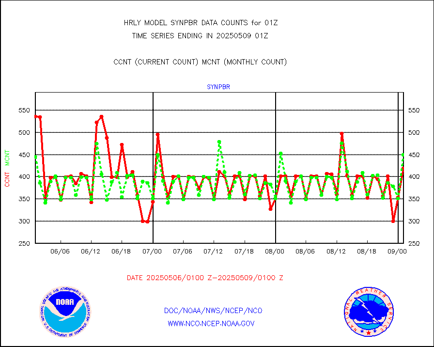
synpbr |
Synoptic - restricted (WMO Res 40)(decoded BUFR) |
397 |
413 |
96.1 % |
2000.50-2001.49 |
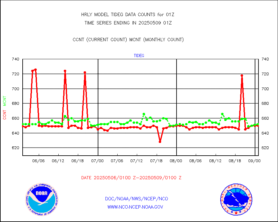
tideg |
Tide gauge reports decoded from CREX format |
645 |
641 |
100.6 % |
2000.00-2000.99 |
| Data Types of Opportunity with Normal Counts |
|---|
| Type | Description | Hourly Count | Monthly Average | Percent (%) of Monthly Mean | UTC Time Window |
3p9usr |
GOES-16&up/NESDIS ir short-wv derived cld motion |
12460 |
15022 |
82.9 % |
2000.00-2000.99 |
acarsa |
MDCRS ACARS acft data (ARINC via AFWA)(AIREP fmt) |
0 |
0 |
n/a |
2000.50-2001.49 |
ahicsr |
Himawari Clear Sky Radiance |
0 |
0 |
n/a |
2000.00-2000.99 |
amsr2 |
GCOM-W AMSR2 1B brightness temperatures |
2259900 |
1818191 |
124.3 % |
1923.00-1923.99 |
atmsdb |
NPP/NOAA-20 ATMS bright. temps-direct b-cast SSEC |
105193 |
79098 |
133.0 % |
1923.50-2000.49 |
atovs |
POES/NESDIS - processed ATOVS soundings/radiances |
0 |
0 |
n/a |
1923.00-1923.99 |
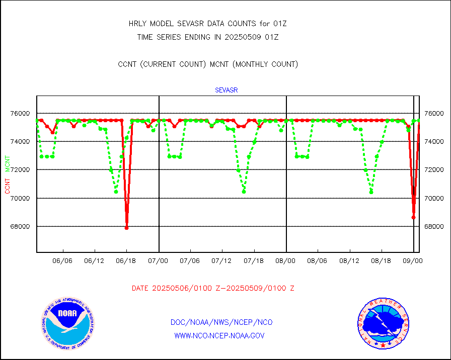
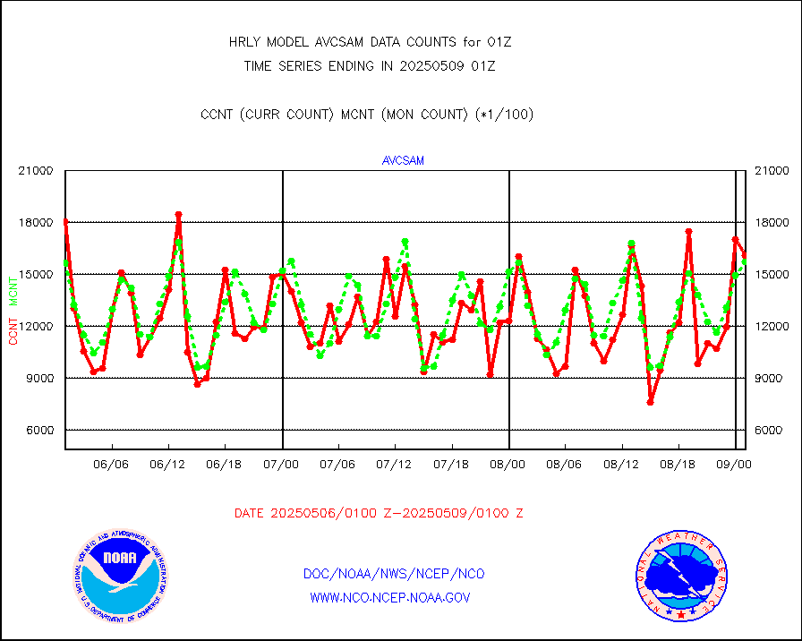
avcsam |
A.M.(N17,M2,M3) AVHRR GAC NCEP-proc clr&sea btmps |
1510765 |
1519584 |
99.4 % |
1922.50-1923.49 |
avcspm |
P.M.(N18-19) AVHRR GAC NCEP-proc clr & sea btemps |
1656787 |
1655322 |
100.1 % |
1922.50-1923.49 |
bathy |
eXpendable BathyThermograph, mooring (BATHY fmt) |
0 |
0 |
n/a |
1918.00-1918.99 |
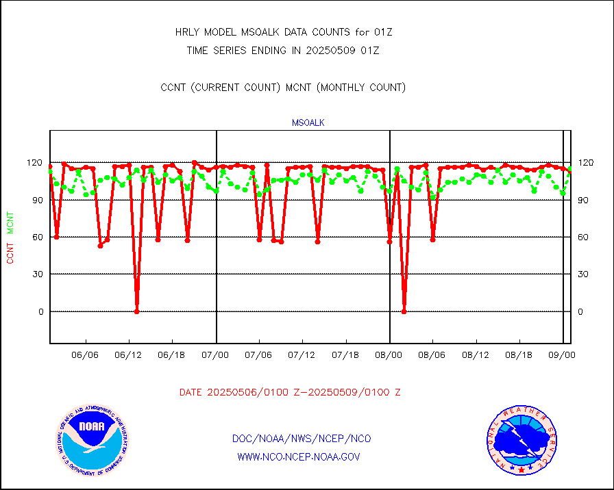
coopmd |
Coop/MADIS NEPP & HCN-Modernization NOAA COOP Obs |
27 |
27 |
100.0 % |
2000.50-2001.49 |
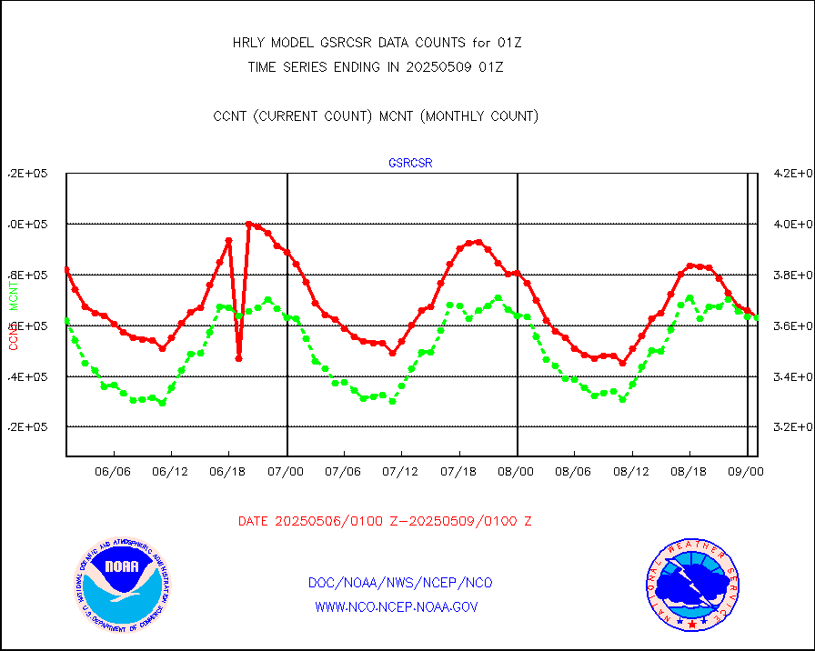
crisf4 |
NPP/NOAA-20 CrIS full spctrl radn (431 ch subset) |
240534 |
208321 |
115.5 % |
1923.50-2000.49 |
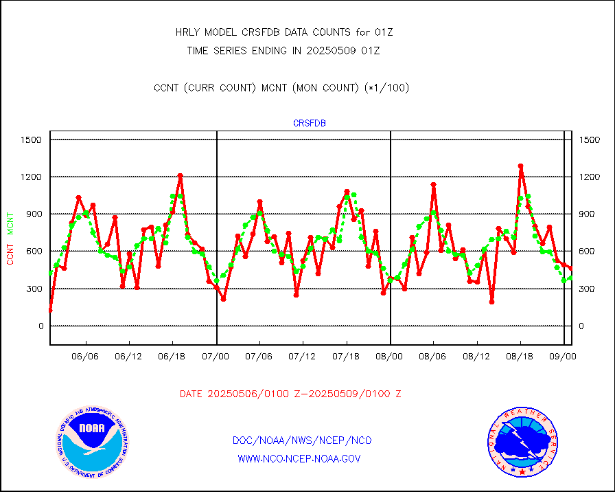
crsfdb |
NPP/NOAA-20 CrIS full spctrl radn dir brdcst SSEC |
79434 |
81701 |
97.2 % |
1923.50-2000.49 |
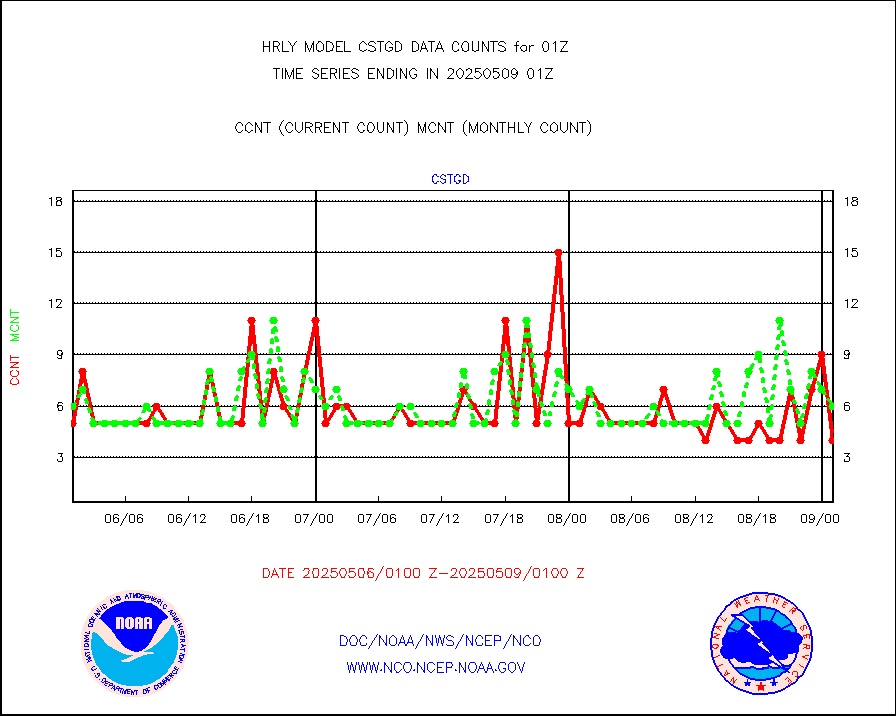
cstgd |
Coast Guard |
3 |
4 |
75.0 % |
2000.50-2001.50 |
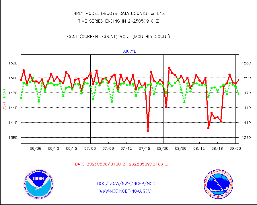
dbuoyb |
Drifting buoys (decoded from BUFR) |
1405 |
1397 |
100.6 % |
2000.50-2001.50 |
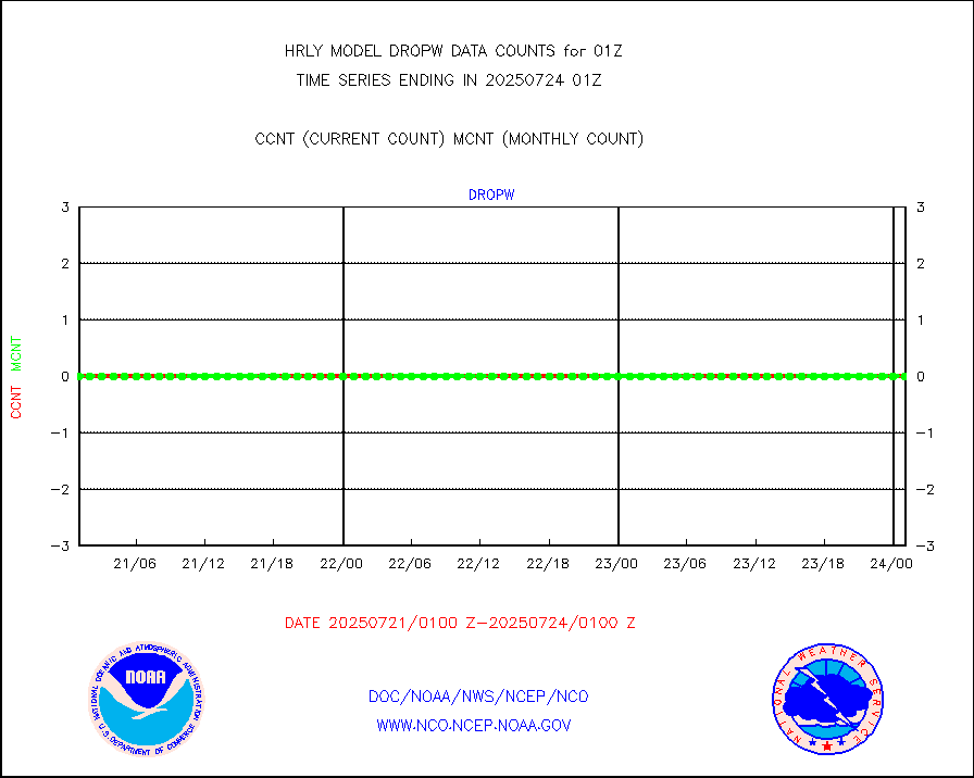
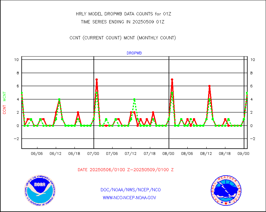
dropw |
Dropwinsonde (from TEMP DROP) |
0 |
0 |
n/a |
2000.50-2001.49 |
efclam |
GOES imager effective cloud amount data (U.Wisc.) |
8298518 |
8196343 |
101.2 % |
2000.50-2001.49 |
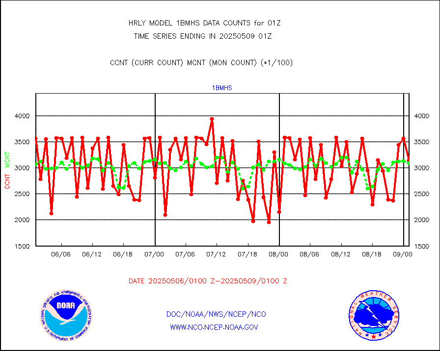
esatms |
NPP Adv. Tech. MW Sndr (ATMS) br. temps from RARS |
63260 |
77347 |
81.8 % |
1923.50-2000.49 |
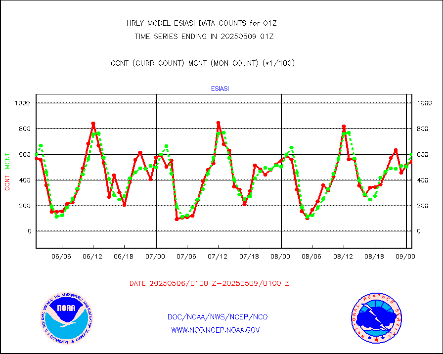
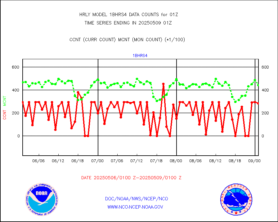
esiasi |
METOP 1-2 IASI 1C radiance data vbl chn from RARS |
77793 |
72505 |
107.3 % |
2000.00-2000.99 |
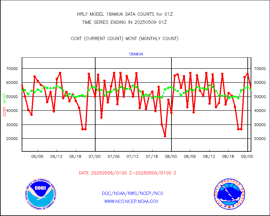
esmhs |
NOAA 18-19 & METOP 1-2 MHS proc. btemps from RARS |
344859 |
355550 |
97.0 % |
2000.50-2001.49 |
geoimr |
GOES/NESDIS (11x17 f-o-v) imager clear radiances |
0 |
0 |
n/a |
2000.00-2000.99 |
gome |
METOP 1-2 Global Ozone Monitoring Exp.-2 (GOME-2) |
5510 |
7351 |
75.0 % |
1923.50-2000.49 |
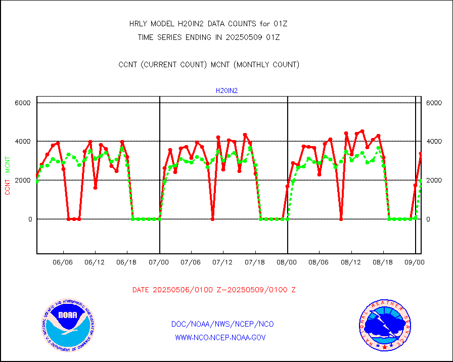
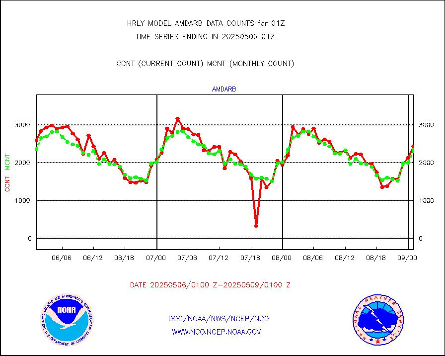
h20in2 |
INDIA SATWIND, INSAT WV channel |
10964 |
4537 |
241.7 % |
2000.00-2000.99 |
h2dusr |
GOES-16&up/NESDIS wv imgr/deep-lyr derivd cld mtn |
15677 |
16513 |
94.9 % |
2000.00-2000.99 |
h2eunb |
METEOSAT/EUMETSAT wvpr imgr drv cld motion NBseq |
38548 |
40681 |
94.8 % |
1923.50-2000.49 |
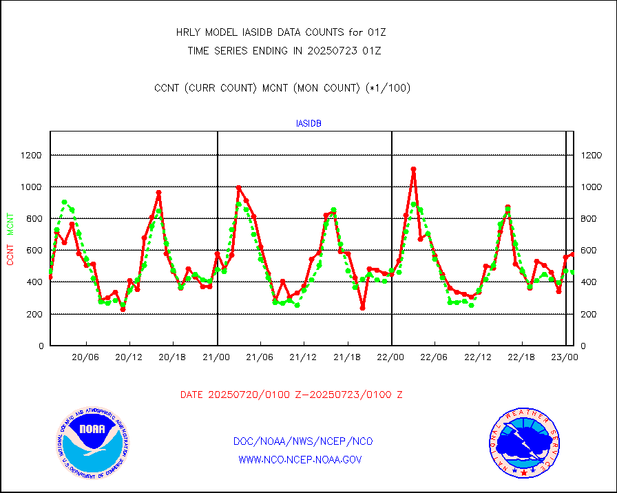
iasidb |
METOP 1-2 IASI 1C radiances-direct broadcast SSEC |
30012 |
27392 |
109.6 % |
1923.50-2000.49 |
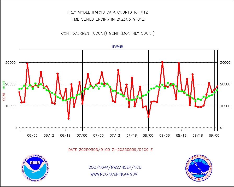
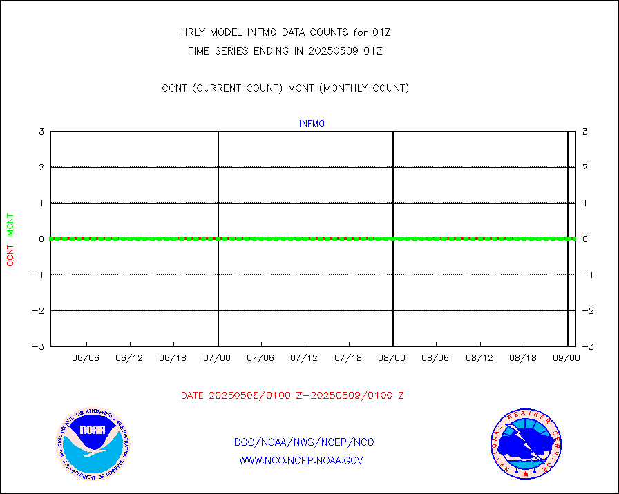
ifvrnb |
VIIRS (NPP/NOAA-20) ir lg-wv drv cloud motion(NB) |
17597 |
16417 |
107.2 % |
1921.00-1921.99 |
infav |
AVHRR (NOAA/METOP) ir lg-wave derived cld motion |
0 |
0 |
n/a |
1921.00-1921.99 |
infav1 |
AVHRR (METOP) ir lg-wave derived cld motion |
0 |
0 |
n/a |
2000.50-2001.50 |
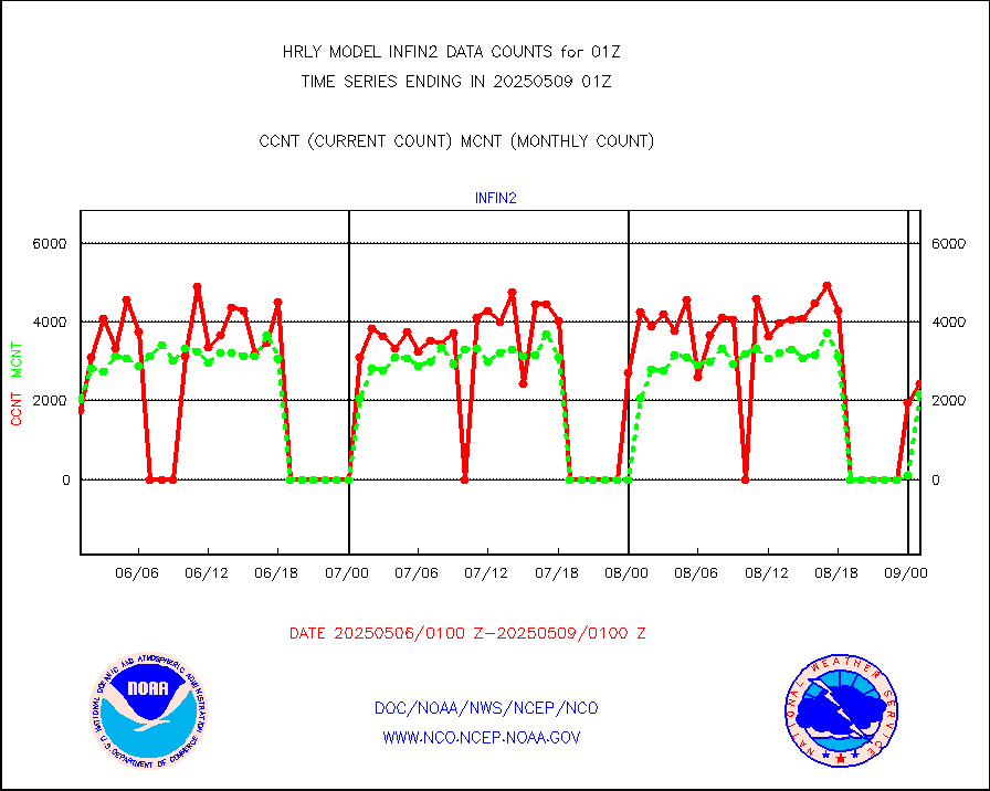
infin |
INSAT/KALPANA India ir lg-wave derived cld motion |
0 |
0 |
n/a |
1922.50-1923.49 |
infin2 |
INDIA SATWIND, INSAT IR channel |
13340 |
5068 |
263.2 % |
2000.00-2000.99 |
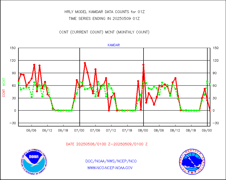
kamdar |
Korean AMDAR aircraft data (decoded from BUFR) |
91 |
54 |
168.5 % |
2000.50-2001.49 |
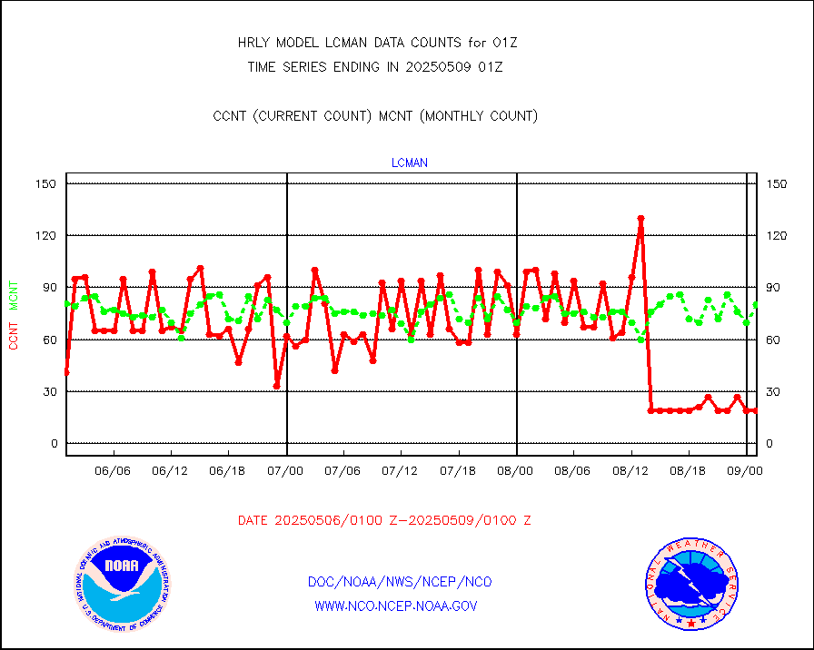
lcman |
Land-based CMAN stations decoded from CMAN format |
90 |
79 |
113.9 % |
2000.50-2001.49 |
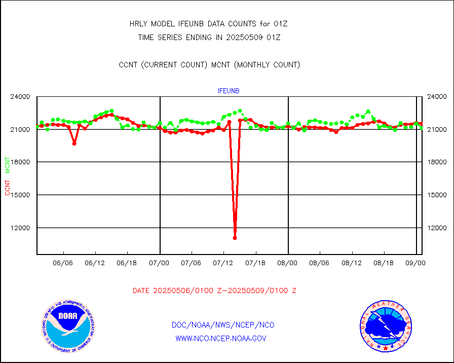
leogeo |
LEO-GEO satellite AMVs from UWisc. |
6294 |
5229 |
120.4 % |
1921.00-1921.99 |
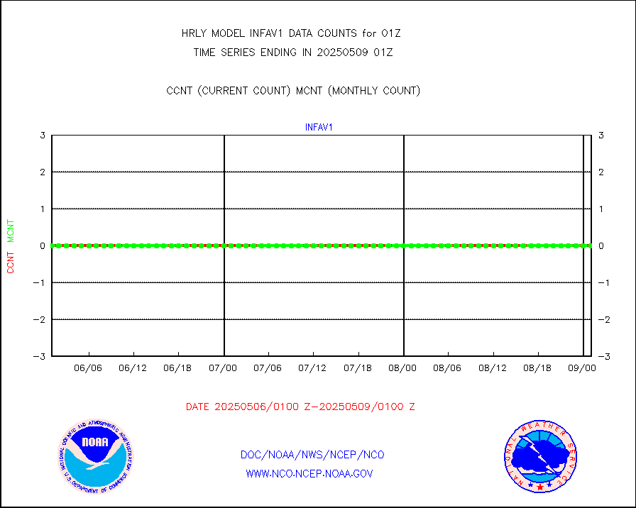
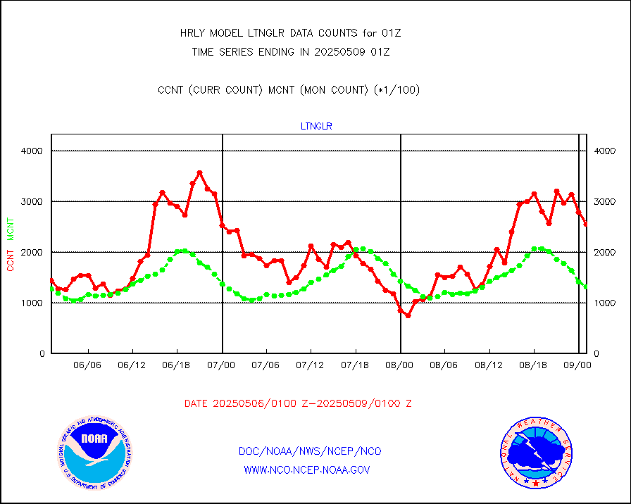
ltnglr |
LLDN Long-rng lightning from Vaisala via NOAAPORT |
185683 |
183617 |
101.1 % |
2000.50-2001.49 |
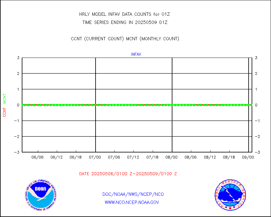
ltngsr |
NLDN Shrt-rng lightning from Vaisala via NOAAPORT |
10653 |
5112 |
208.4 % |
2000.50-2001.49 |
mbuoyb |
Moored buoys (decoded from BUFR) |
798 |
725 |
110.1 % |
2000.50-2001.50 |
mls |
Aura Microwave Limb Sounder (MLS) ozone data |
0 |
0 |
n/a |
1923.00-1923.99 |
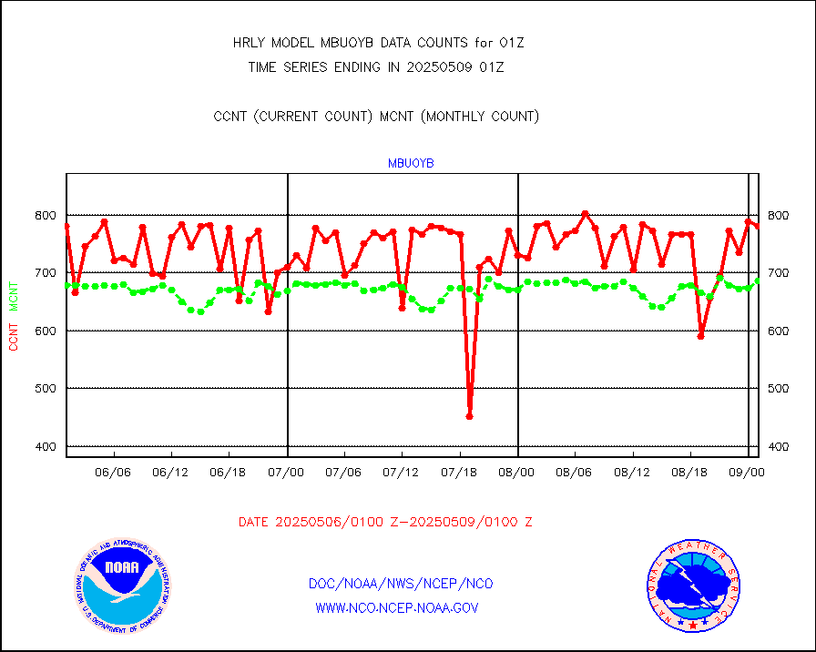
msourb |
Mesonet/MADIS UrbaNet |
4348 |
4368 |
99.5 % |
2000.50-2001.49 |
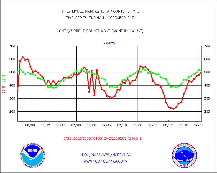
nxrdw2 |
NEXRAD Vel Azm Dsp(VAD) winds via Level 2 decoder |
696 |
626 |
111.2 % |
2000.50-2001.49 |
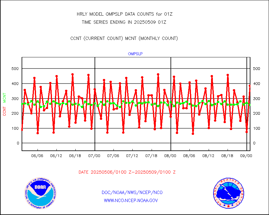
ompslp |
OMPS Limb Profiler ozone data (NPP) |
241 |
244 |
98.8 % |
1918.00-1918.99 |
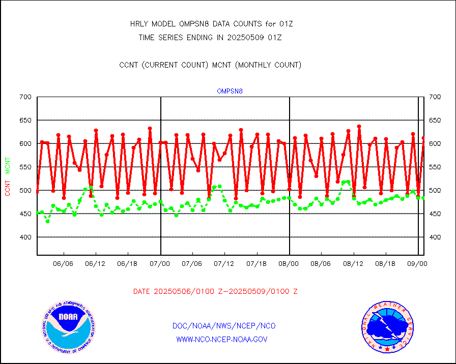
ompsn8 |
OMPS nadir profile ozone (Version 8 BUFR) |
574 |
507 |
113.2 % |
1923.00-1923.99 |
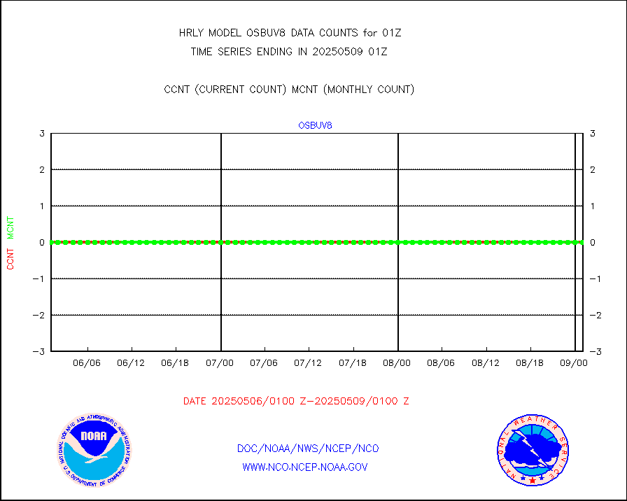
ompst8 |
OMPS total column ozone (Version 8 BUFR) |
522781 |
303134 |
172.5 % |
1923.00-1923.99 |
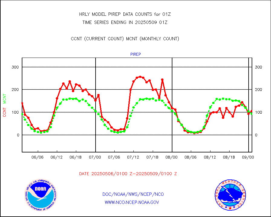
pirep |
Manual PIREP aircraft data (dcded from AIREP fmt) |
51 |
78 |
65.4 % |
2000.50-2001.49 |
prflrp |
Profilr winds from PIBAL (PILOT,PILOT SHIP/MOBIL) |
0 |
0 |
n/a |
2000.50-2001.49 |
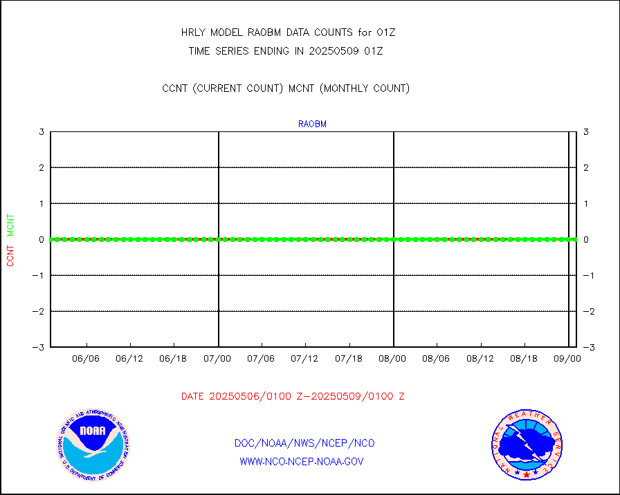
raobm |
Rawinsonde - mobile land (from TEMP/PILOT MOBIL) |
0 |
0 |
n/a |
2000.50-2001.49 |
raobs |
Rawinsonde - ship (from TEMP SHIP, PILOT SHIP) |
0 |
0 |
n/a |
2000.50-2001.49 |
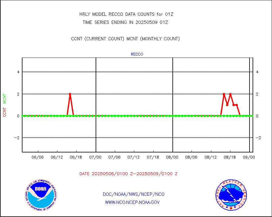
recco |
Flight level reconnaissance aircraft data |
0 |
0 |
n/a |
2000.50-2001.49 |
saphir |
Megha-Tropiques SAPHIR L1A2 brightness temps |
0 |
0 |
n/a |
1922.50-1923.49 |
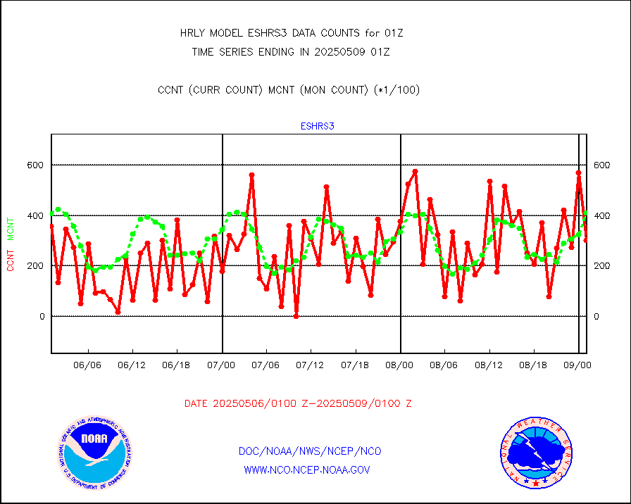
sevasr |
METEOSAT-10 2nd Gen SEVIRI All Sky Radiance(proc) |
75512 |
75482 |
100.0 % |
2000.50-2001.49 |
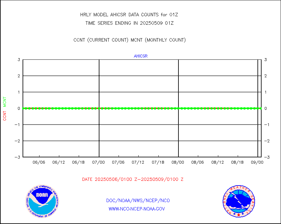
ssmisu |
DMSP SSM/IS 1C radiance data (Unified Pre-Proc.) |
225300 |
123182 |
182.9 % |
1923.50-2000.49 |
sstvcw |
NPP/NOAA-20 VIIRS SST - CLEAR & OVER WATER |
24 |
354200 |
0.0 % |
2000.50-2001.49 |
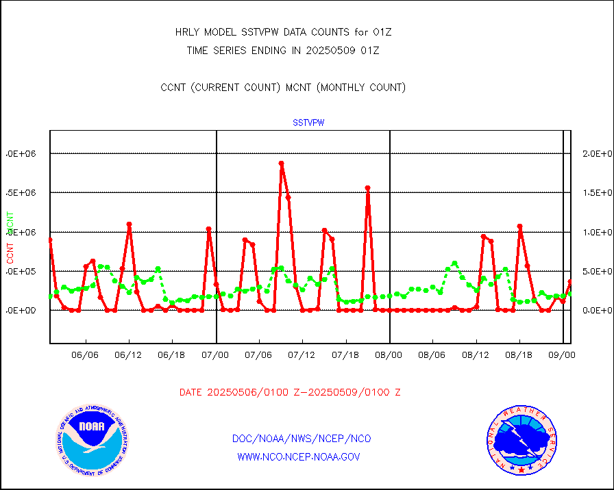
sstvpw |
NPP/NOAA-20 VIIRS SST - PROBABLY CLR & OVER WATER |
25 |
138599 |
0.0 % |
2000.50-2001.49 |
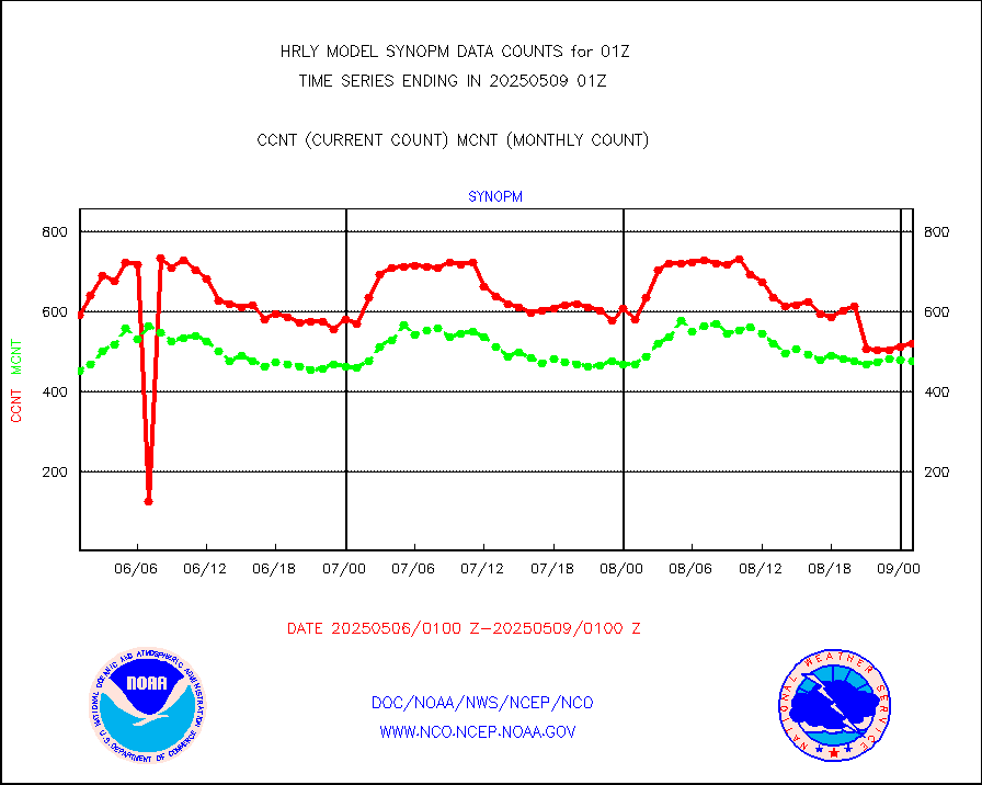
synopm |
Synoptic - mobile manual and automatic |
662 |
653 |
101.4 % |
2000.50-2001.49 |
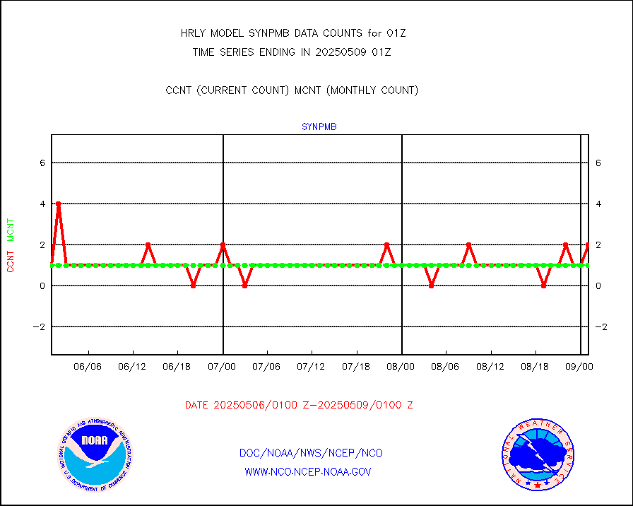
synpmb |
Synoptic - mobile manual & auto (decoded fr BUFR) |
0 |
1 |
0.0 % |
2000.50-2001.49 |
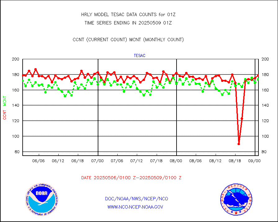
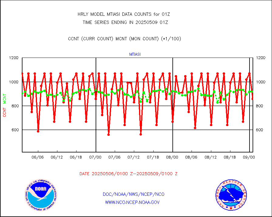
tesac |
CTD probe, Argo prflng float, mooring (TESAC fmt) |
212 |
195 |
108.7 % |
2000.50-2001.49 |
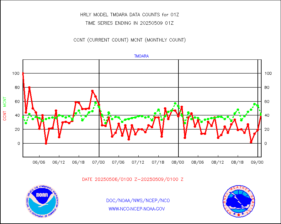
tmdara |
TAMDAR aircft data-all types(from Panasonic,BUFR) |
349 |
335 |
104.2 % |
2000.50-2001.49 |
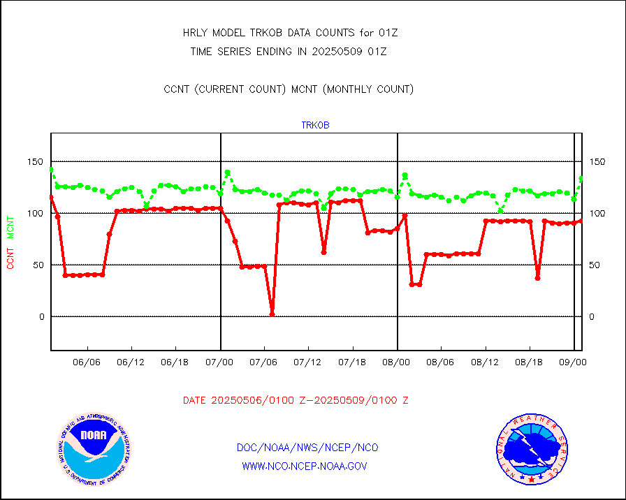
trkob |
ThermoSalinoGraph (TSG) TRACKOB format) |
120 |
70 |
171.4 % |
1923.50-2000.49 |
visin |
INSAT/KALPANA India visible derived cloud motion |
0 |
0 |
n/a |
1922.50-1923.49 |
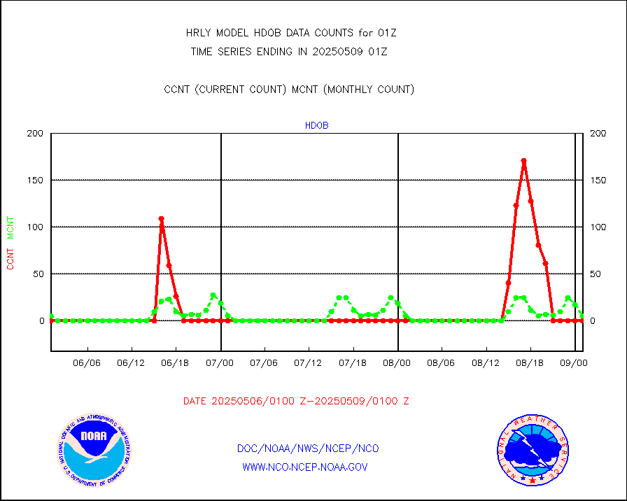
visin2 |
INDIA SATWIND, INSAT VIS channel |
0 |
0 |
n/a |
2000.00-2000.99 |
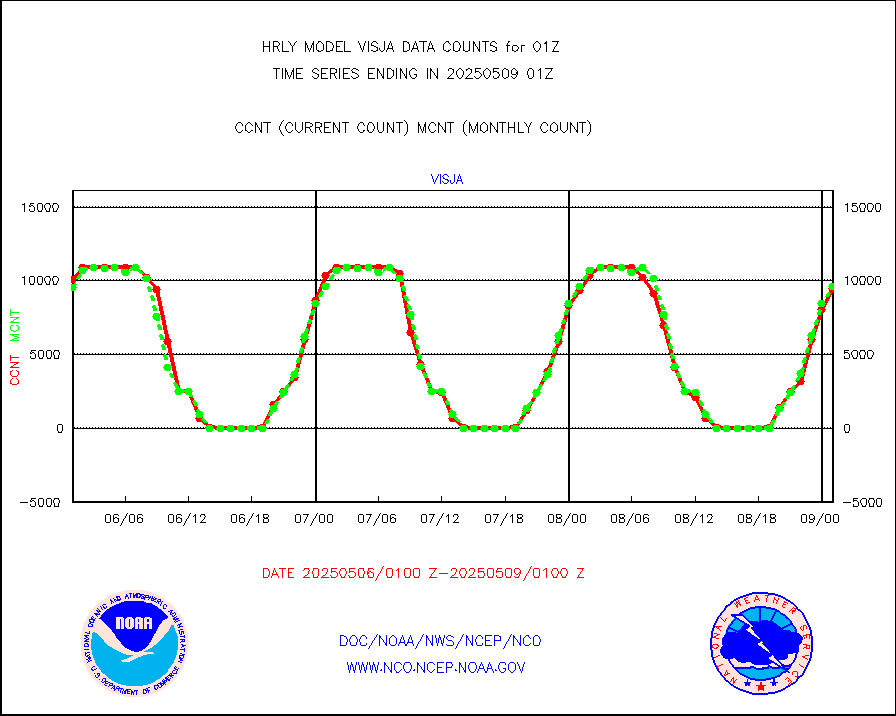
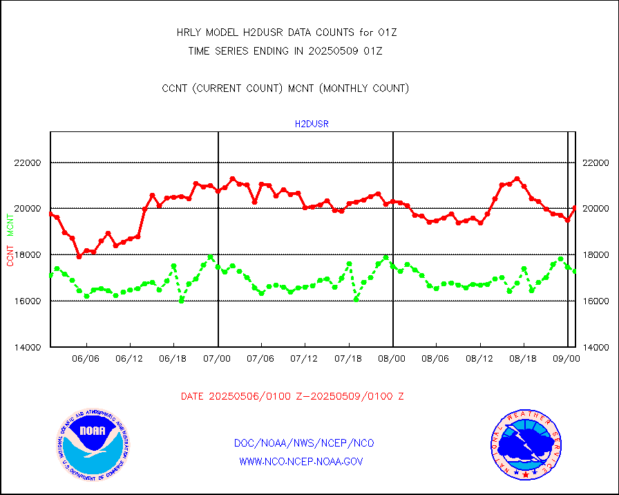
visja |
MTSAT/JMA visible derived cloud motion |
9579 |
9687 |
98.9 % |
1922.50-1923.49 |
visusr |
GOES-16&up/NESDIS visible derived cloud motion |
231486 |
235204 |
98.4 % |
2000.00-2000.99 |
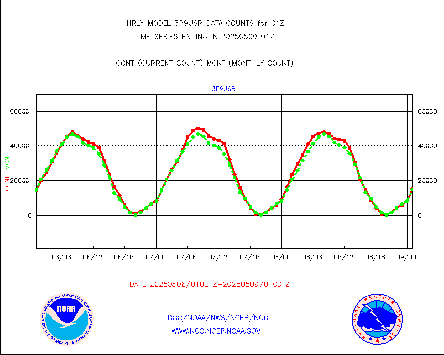
vseunb |
METEOSAT/EUMETSAT visible drv cld motion NBseq |
0 |
23 |
0.0 % |
1923.50-2000.49 |


