| Critical Data with Normal Counts |
|---|
| Type | Description | Hourly Count | Monthly Average | Percent (%) of Monthly Mean |
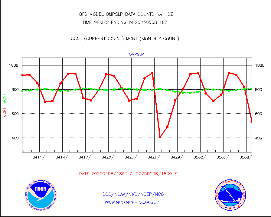
1bamua |
NOAA 15-19 & METOP 1-2 AMSU-A NCEP-proc. br.temps |
258981 |
277133 |
93.5 % |
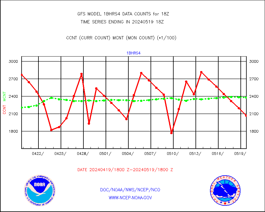
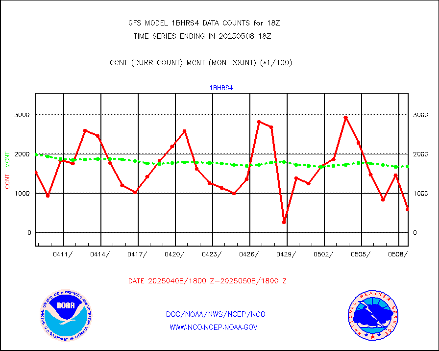
1bhrs4 |
NOAA 18-19 & METOP 1-2 HIRS-4 NCEP-proc. br.temps |
206938 |
237729 |
87.0 % |
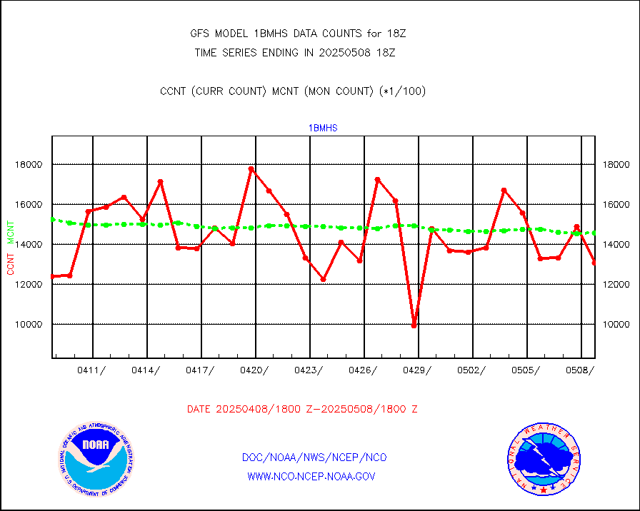
1bmhs |
NOAA 18-19 & METOP 1-2 MHS NCEP-proces. br. temps |
1491943 |
1572406 |
94.9 % |
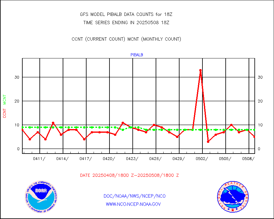
acars |
MDCRS ACARS acft data from ARINC(dcded from BUFR) |
137519 |
146882 |
93.6 % |
ahicsr |
Himawari Clear Sky Radiance |
254674 |
255406 |
99.7 % |
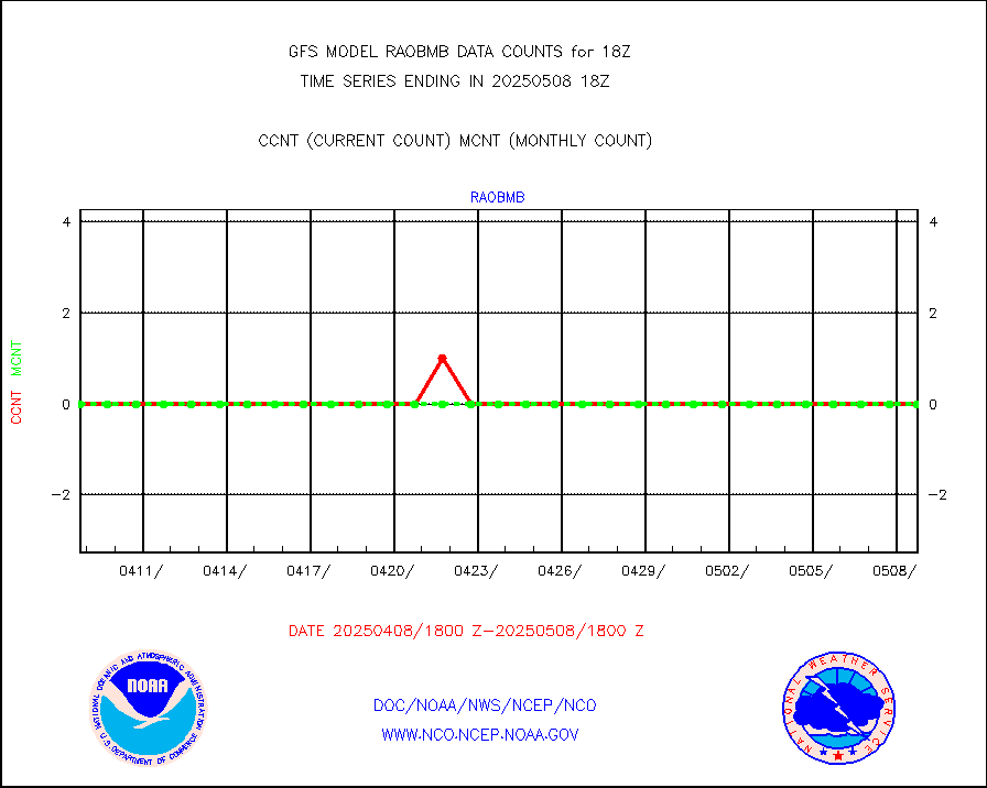
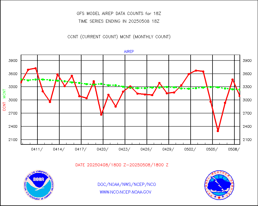
airep |
Manual AIREP aircraft data (dcded from AIREP fmt) |
6509 |
5820 |
111.8 % |
airsev |
AQUA AIRS/AMSU-A/HSB brightness temps- every FOV |
0 |
0 |
n/a |
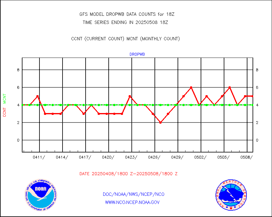
amdar |
AMDAR aircraft data (decoded from AMDAR format) |
386 |
397 |
97.2 % |
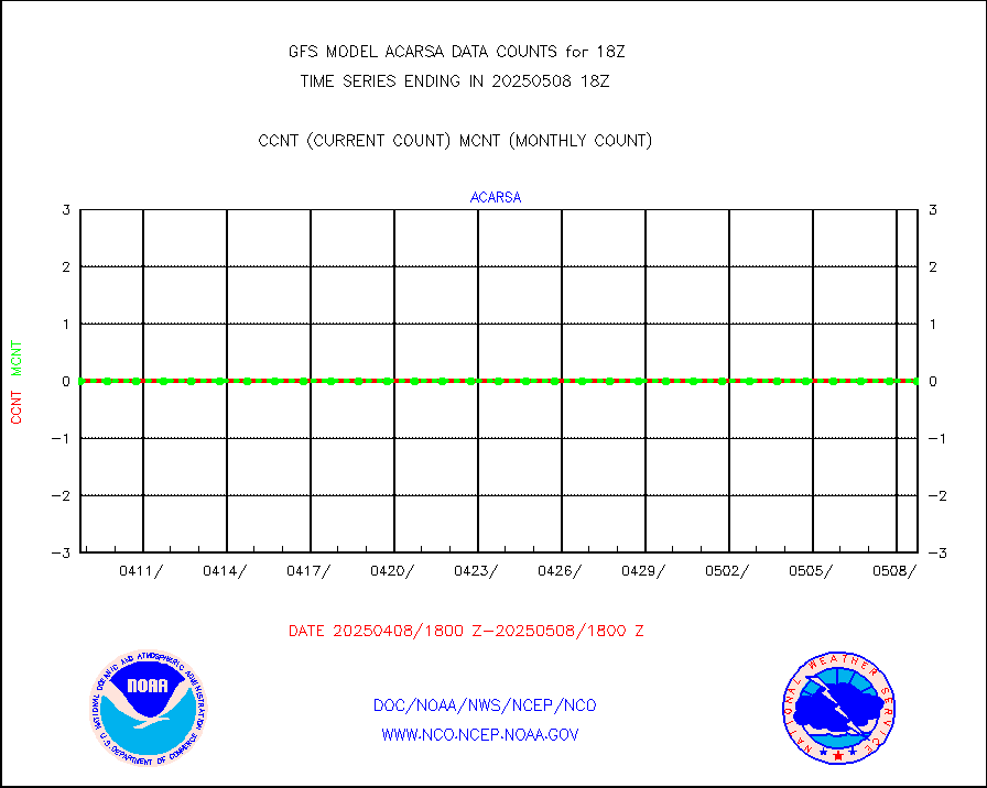
amdarb |
AMDAR aircraft data (decoded from BUFR) |
2152 |
2094 |
102.8 % |
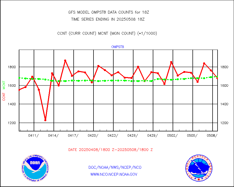
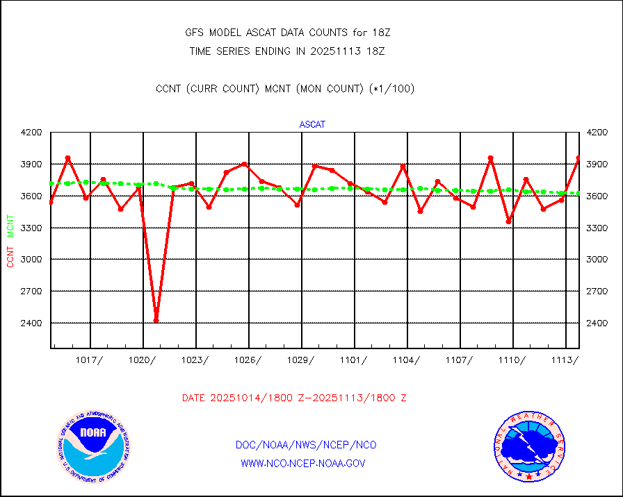
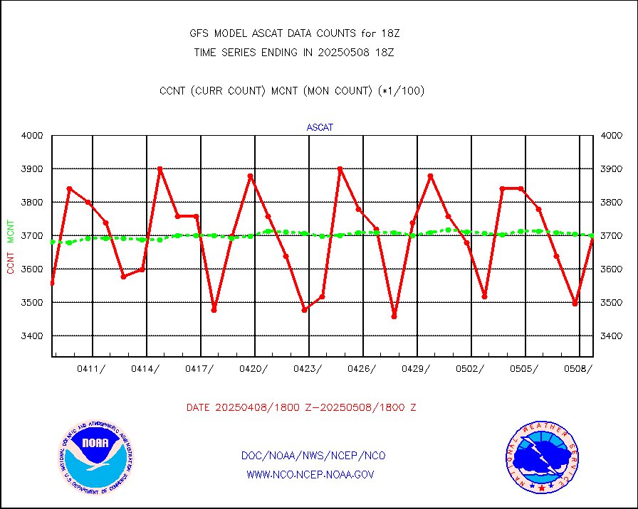
ascat |
METOP 1-2 ASCAT products |
327600 |
336857 |
97.3 % |
atms |
NPP/NOAA-20 ATMS brightness temperatures |
1907735 |
1910170 |
99.9 % |
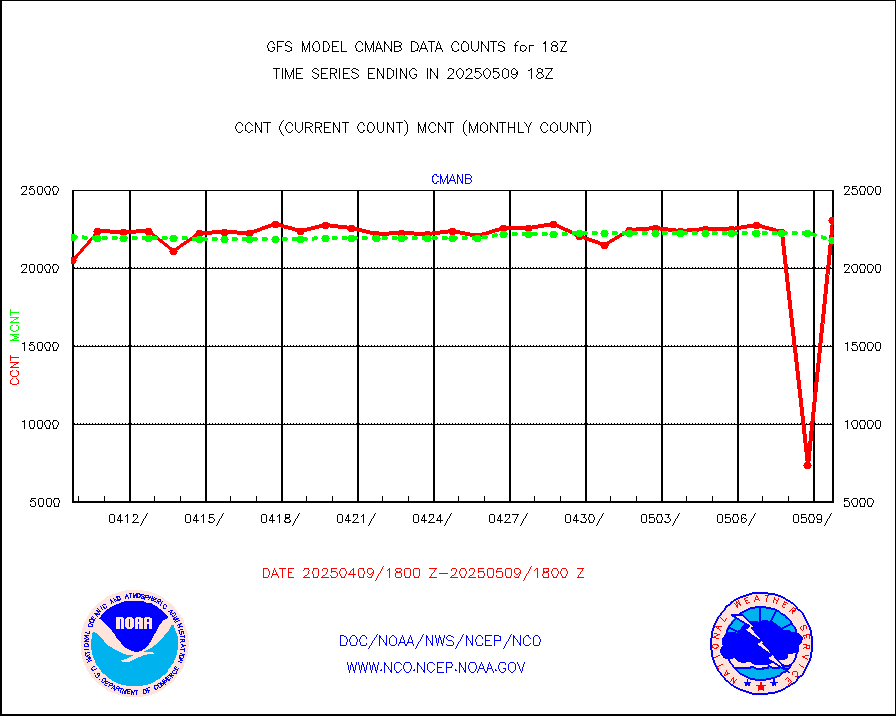
cmanb |
Surface Marine CMAN rpts decoded from BUFR format |
23424 |
22084 |
106.1 % |
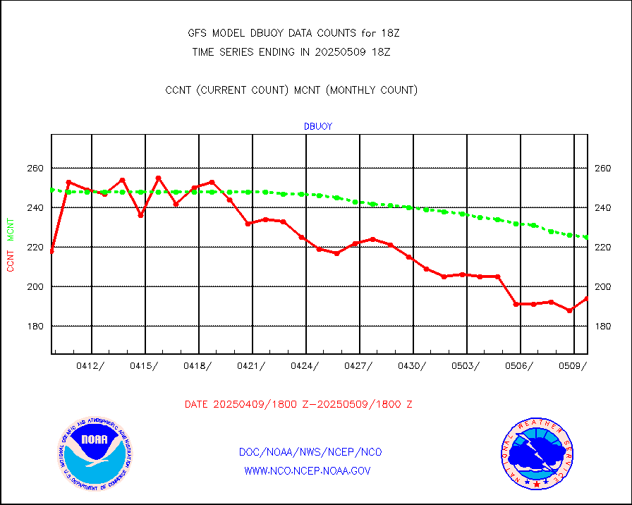
dbuoy |
Buoys decoded from FM-18 fmt (moored or drifting) |
268 |
272 |
98.5 % |
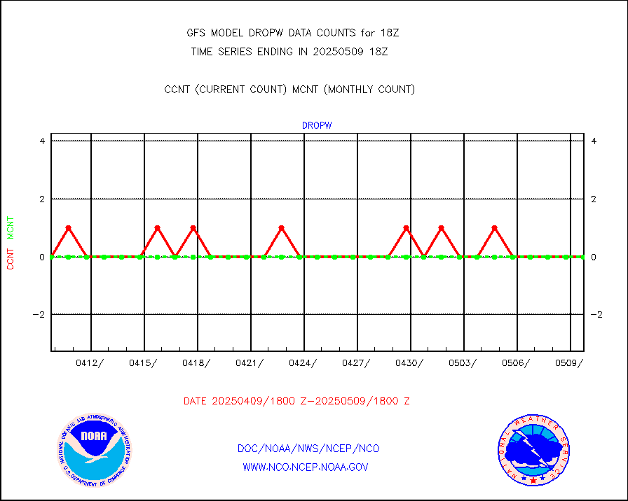
dropw |
Dropwinsonde (from TEMP DROP) |
0 |
0 |
n/a |
eadas |
E-AMDAR (European AMDAR acft decoded from BUFR) |
17352 |
16354 |
106.1 % |
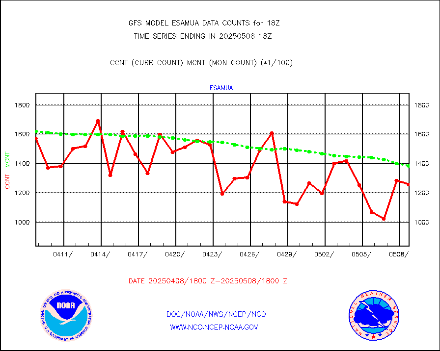
esamua |
NOAA 15-19 & METOP 1-2 AMSU-A proc btmps frm RARS |
182979 |
178570 |
102.5 % |
eshrs3 |
NOAA 15-19 & METOP 1-2 HIRS-3/4 pr btmps frm RARS |
505203 |
487578 |
103.6 % |
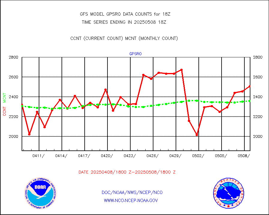
gpsro |
GPS radio occultation data |
1979 |
2224 |
89.0 % |
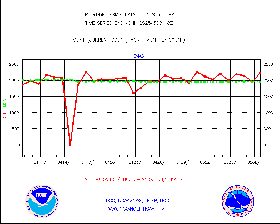
gsrasr |
GOES-16/17 All Sky Radiances (proc.) |
5226932 |
5782275 |
90.4 % |
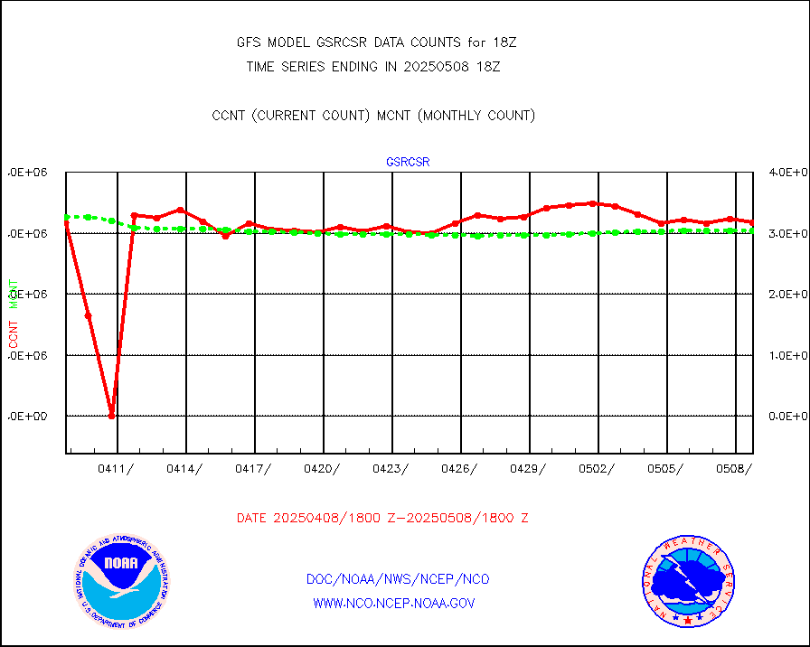
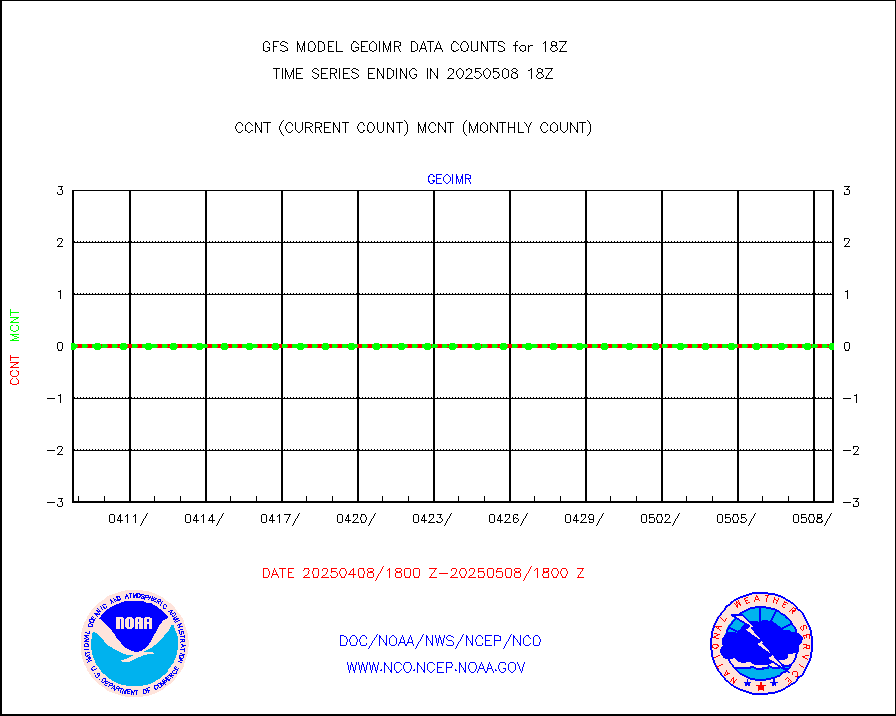
gsrcsr |
GOES-16/17 Clear Sky Radiances (proc.) |
2471614 |
2971142 |
83.2 % |
h20ja |
MTSAT/JMA water vapor imager derived cloud motion |
58573 |
54937 |
106.6 % |
h20mo |
MODIS (AQUA/TERRA) wvpr imager derived cld motion |
0 |
0 |
n/a |
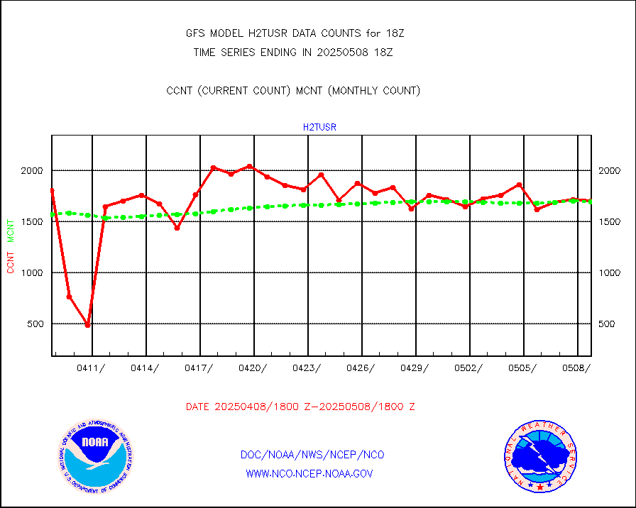
h2tusr |
GOES-16&up/NESDIS wv imgr/cld-top derived cld mtn |
142936 |
154834 |
92.3 % |
ifeunb |
METEOSAT/EUMETSAT ir lg-wave drv cld motion NBseq |
109548 |
108558 |
100.9 % |
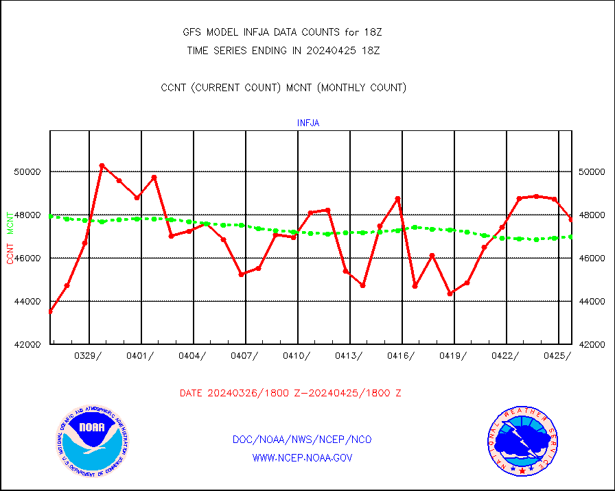
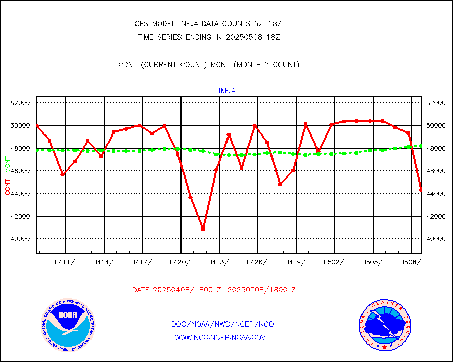
infja |
MTSAT/JMA infrared long-wave derived cloud motion |
46667 |
46974 |
99.3 % |
infmo |
MODIS (AQUA/TERRA) ir l-wave derived cloud motion |
0 |
0 |
n/a |
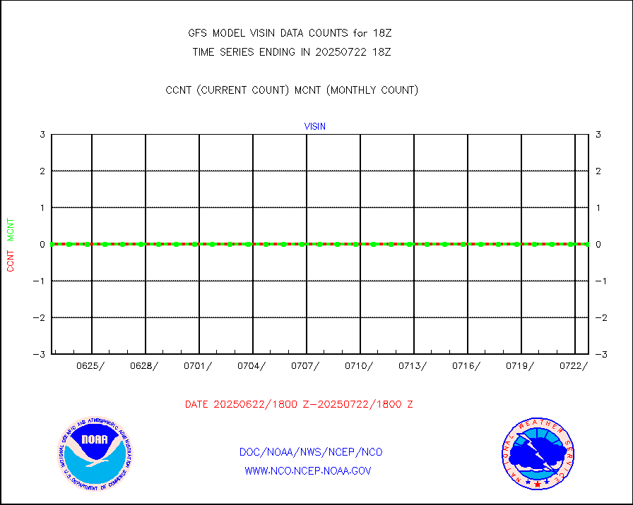
infusr |
GOES-16&up/NESDIS ir long-wave derived cld motion |
441409 |
481640 |
91.6 % |
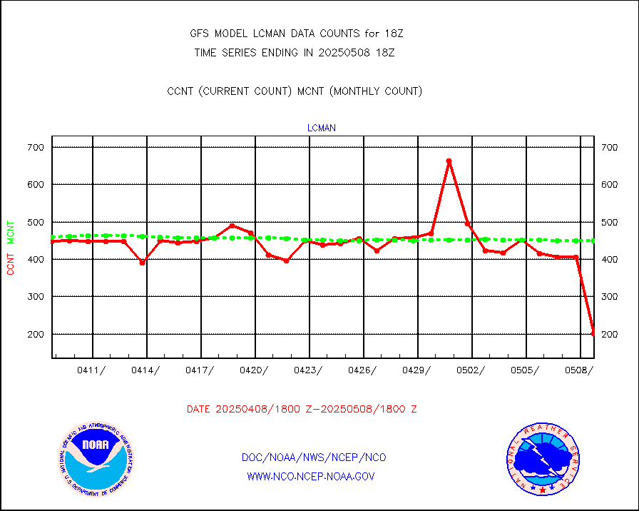
lcman |
Land-based CMAN stations decoded from CMAN format |
507 |
531 |
95.5 % |
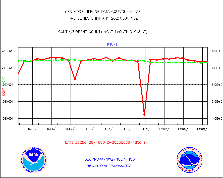
leogeo |
LEO-GEO satellite AMVs from UWisc. |
15985 |
13230 |
120.8 % |
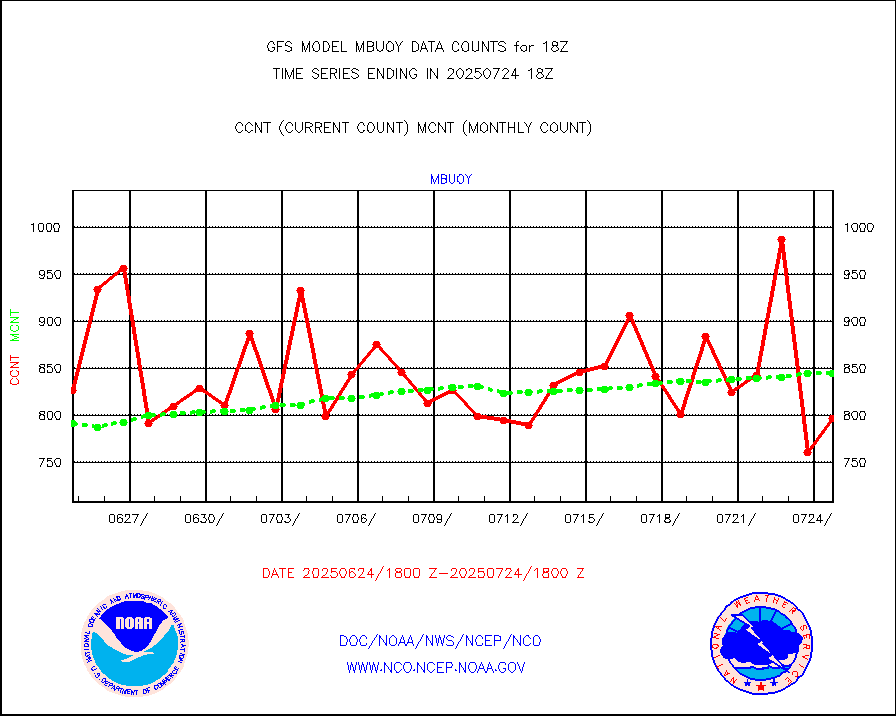
mbuoy |
Buoys decoded from FM-13 format (moored) |
782 |
764 |
102.4 % |
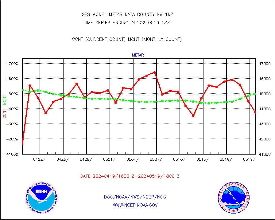
metar |
Aviation - METAR |
43758 |
45006 |
97.2 % |
mtiasi |
METOP 1-2 IASI 1C radiance data (varbl. channels) |
461544 |
446804 |
103.3 % |
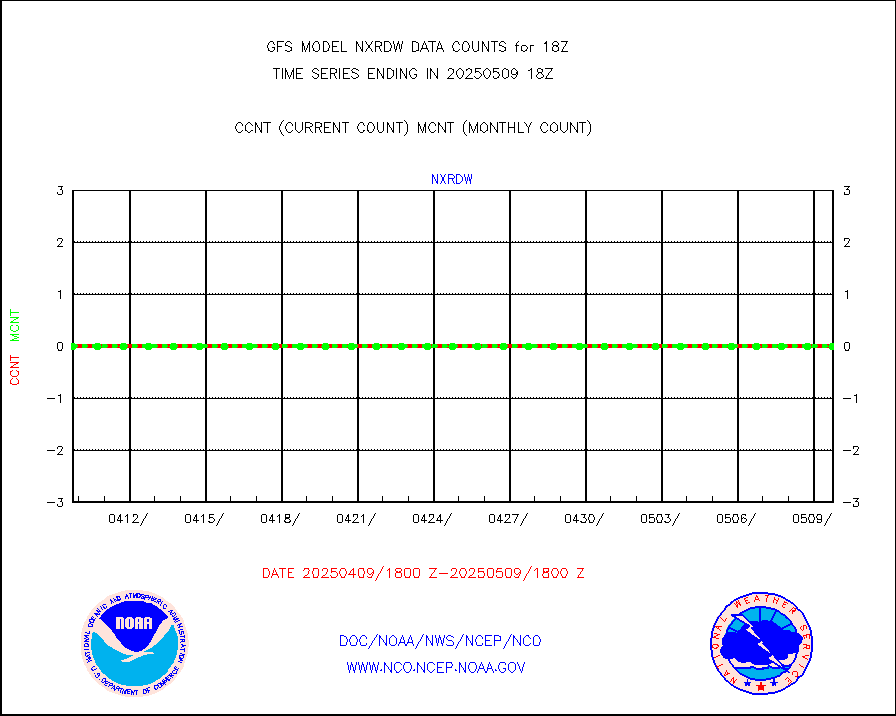
nxrdw |
NEXRAD Vel Azm Dsp(VAD) winds via radar coded msg |
0 |
0 |
n/a |
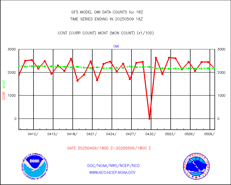
omi |
Aura Ozone Monitoring Instrument (OMI) data |
214680 |
179523 |
119.6 % |
osbuv8 |
NOAA 16-19 Solar Backscatter UV-2 rad frm V8 BUFR |
0 |
0 |
n/a |
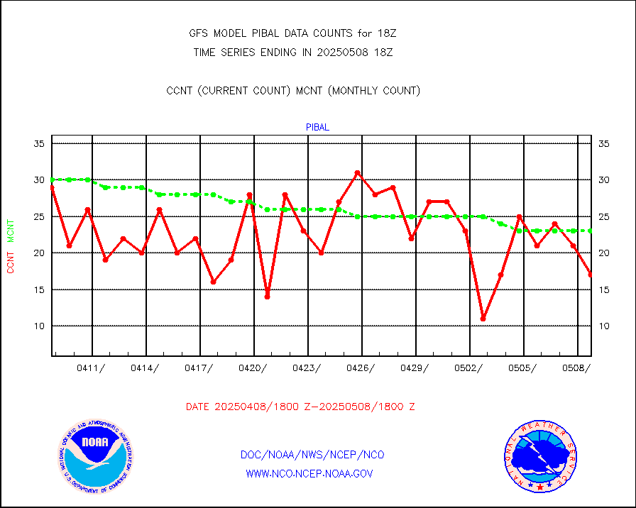
pibal |
PIBAL (from PILOT, PILOT SHIP, PILOT MOBIL) |
16 |
26 |
61.5 % |
prflrp |
Profilr winds from PIBAL (PILOT,PILOT SHIP/MOBIL) |
1 |
1 |
100.0 % |
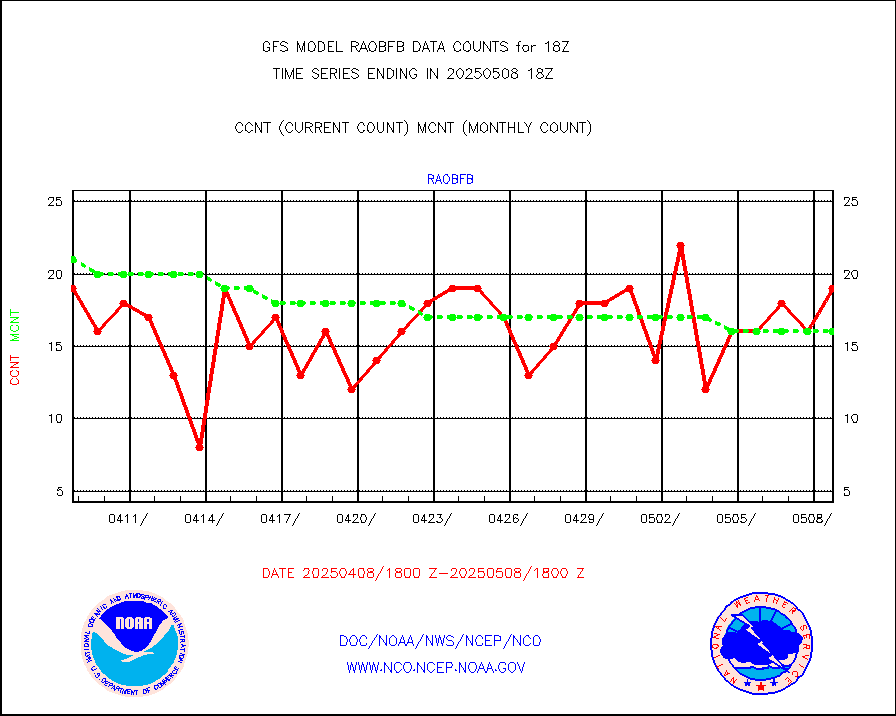
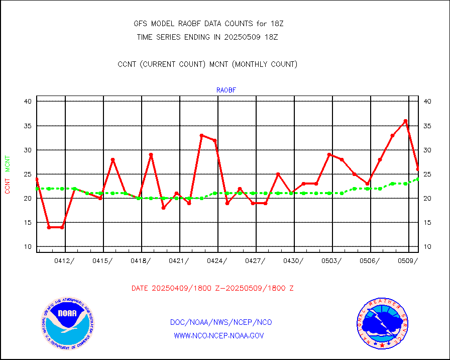
raobf |
Rawinsonde - fixed land (from TEMP or PILOT) |
33 |
27 |
122.2 % |
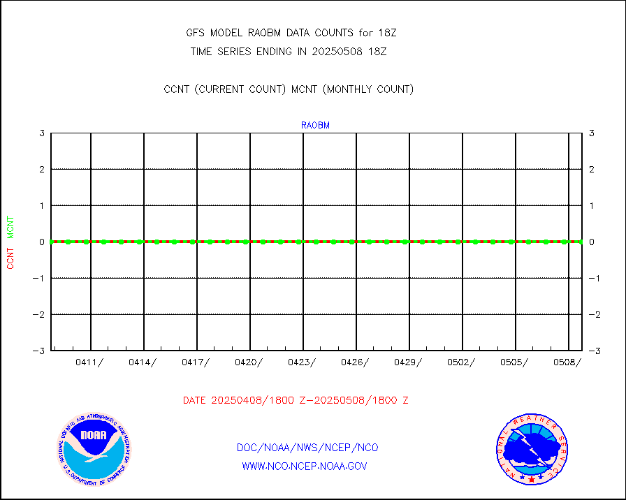
raobm |
Rawinsonde - mobile land (from TEMP/PILOT MOBIL) |
0 |
0 |
n/a |
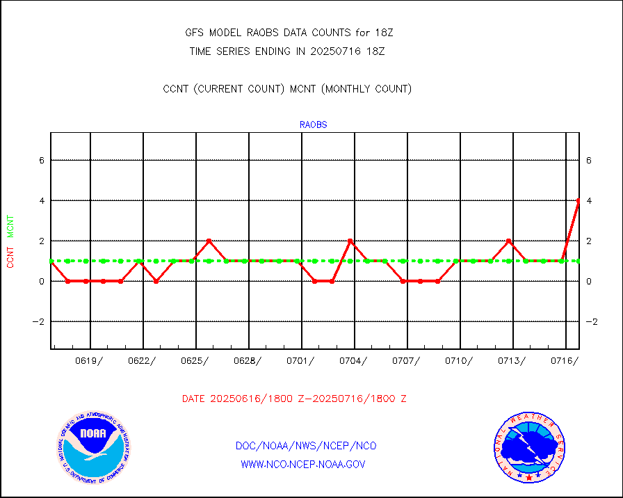
raobs |
Rawinsonde - ship (from TEMP SHIP, PILOT SHIP) |
0 |
0 |
n/a |
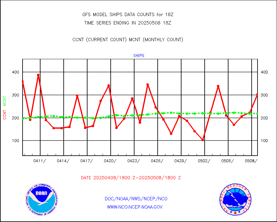
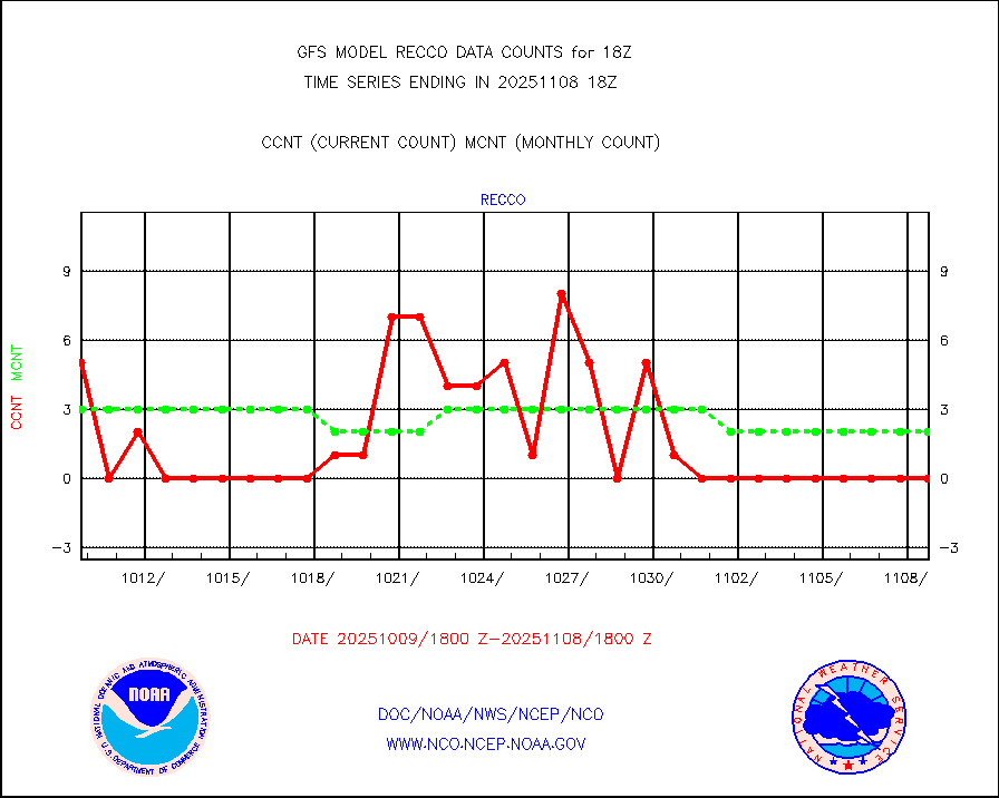
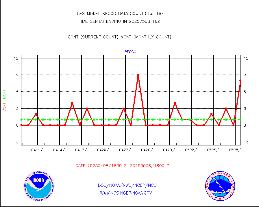
recco |
Flight level reconnaissance aircraft data |
0 |
2 |
0.0 % |
sevcsr |
METEOSAT-10 2nd Gen SEVIRI Clr Sky Radiance(proc) |
0 |
0 |
n/a |
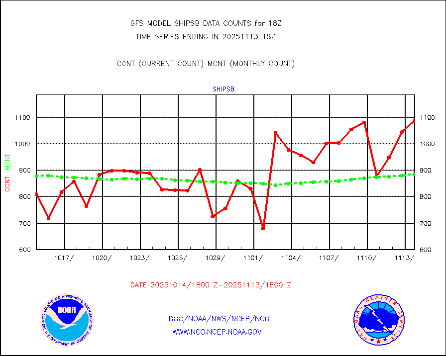
shipsb |
Ship - manual and automatic, restricted (BUFR) |
744 |
588 |
126.5 % |
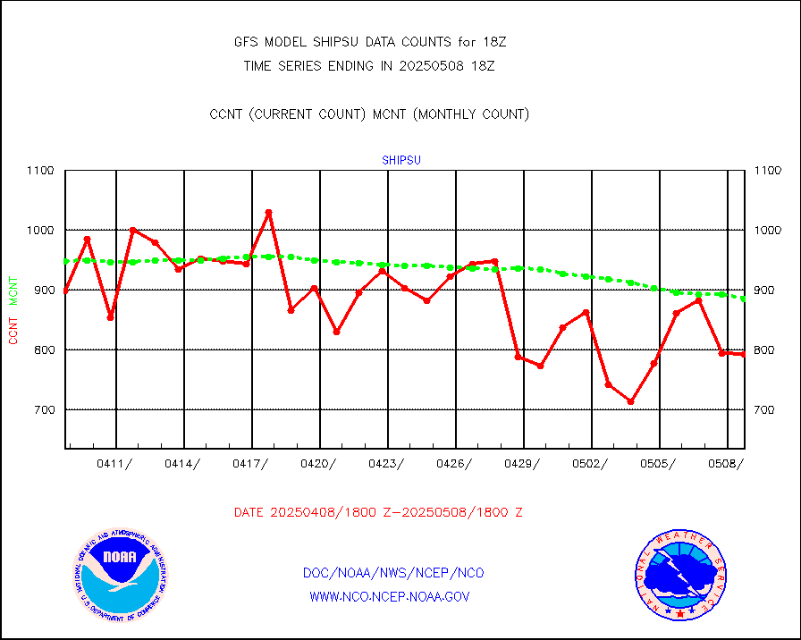
shipsu |
Ship - manual and automatic, unrestricted |
667 |
678 |
98.4 % |
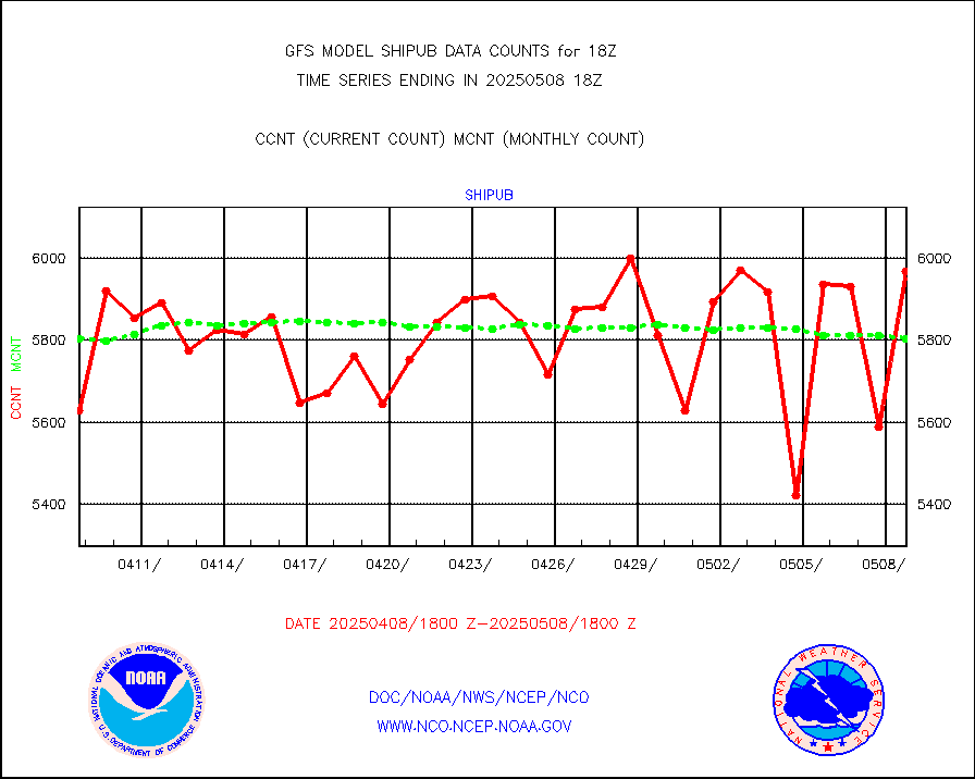
shipub |
Ship - manual and automatic, unrestricted (BUFR) |
5926 |
5880 |
100.8 % |
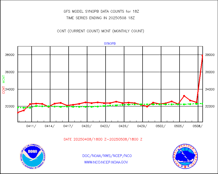
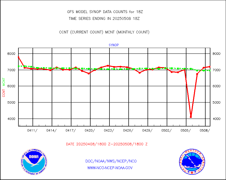
synopb |
Synoptic - fixed manual & auto (decoded fr BUFR) |
30974 |
31554 |
98.2 % |
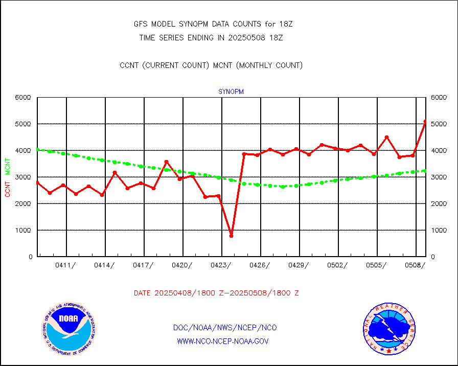
synopm |
Synoptic - mobile manual and automatic |
5620 |
5684 |
98.9 % |
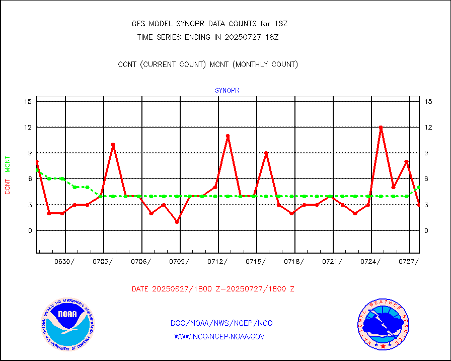
synopr |
Synoptic - restricted (WMO Res 40) manual & auto. |
10 |
8 |
125.0 % |
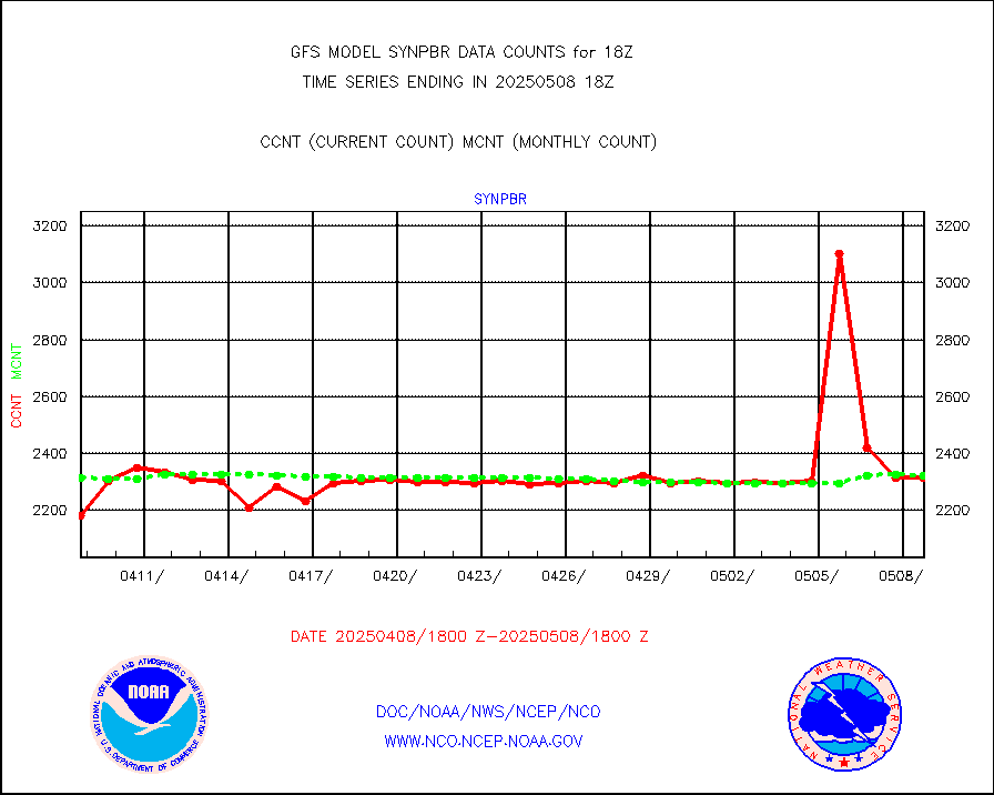
synpbr |
Synoptic - restricted (WMO Res 40)(decoded BUFR) |
2291 |
2308 |
99.3 % |
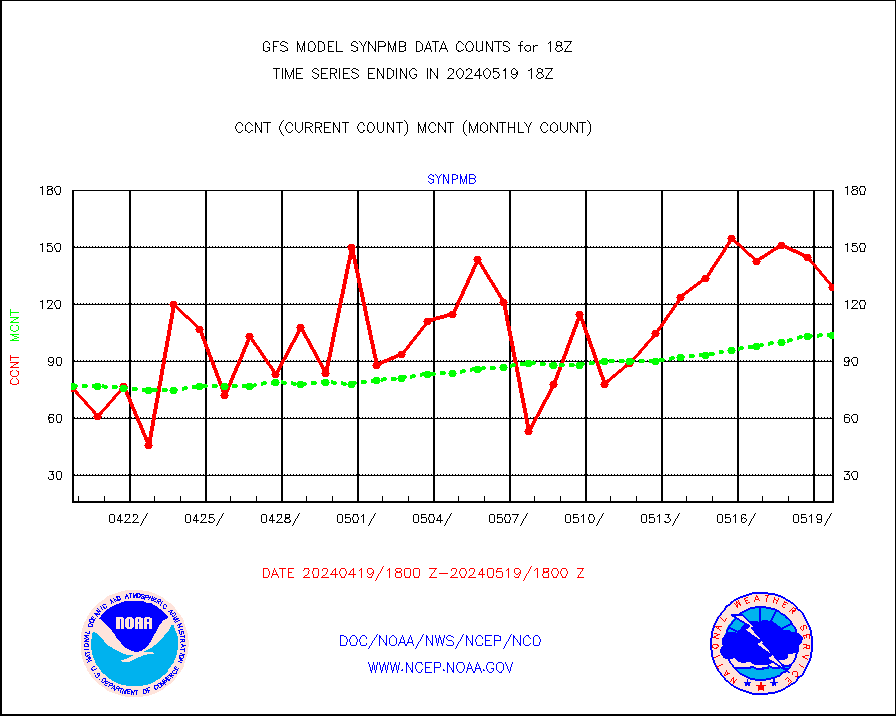
synpmb |
Synoptic - mobile manual & auto (decoded fr BUFR) |
129 |
104 |
124.0 % |
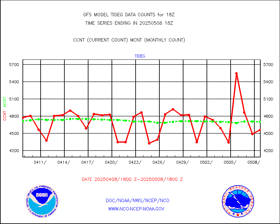
tideg |
Tide gauge reports decoded from CREX format |
4309 |
4588 |
93.9 % |
visja |
MTSAT/JMA visible derived cloud motion |
4203 |
3789 |
110.9 % |
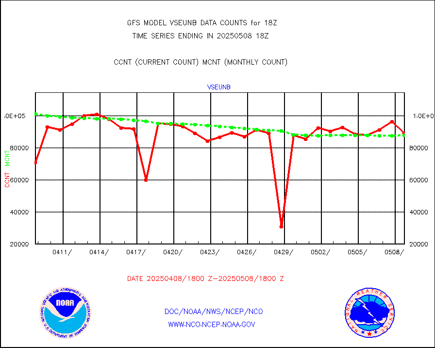
vseunb |
METEOSAT/EUMETSAT visible drv cld motion NBseq |
98608 |
90229 |
109.3 % |
| Data Types of Opportunity with Normal Counts |
|---|
| Type | Description | Hourly Count | Monthly Average | Percent (%) of Monthly Mean |
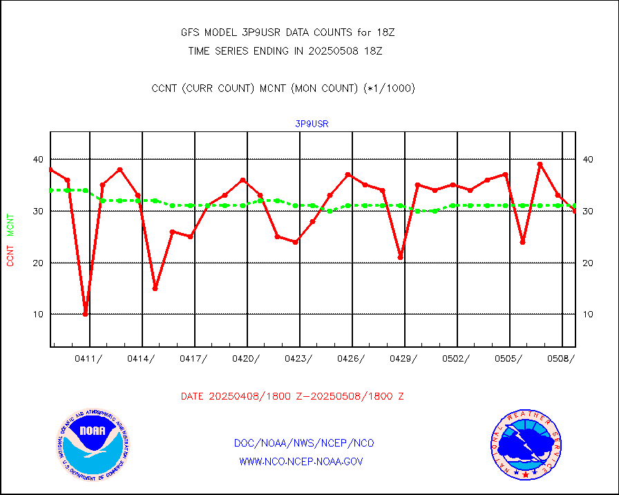
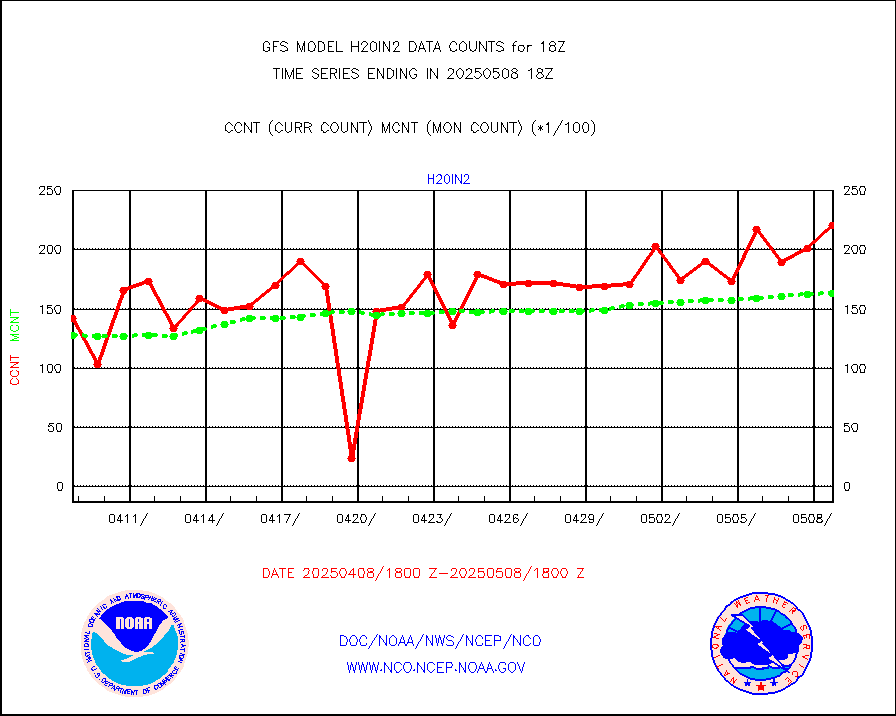
3p9usr |
GOES-16&up/NESDIS ir short-wv derived cld motion |
30155 |
30758 |
98.0 % |
acarsa |
MDCRS ACARS acft data (ARINC via AFWA)(AIREP fmt) |
0 |
0 |
n/a |
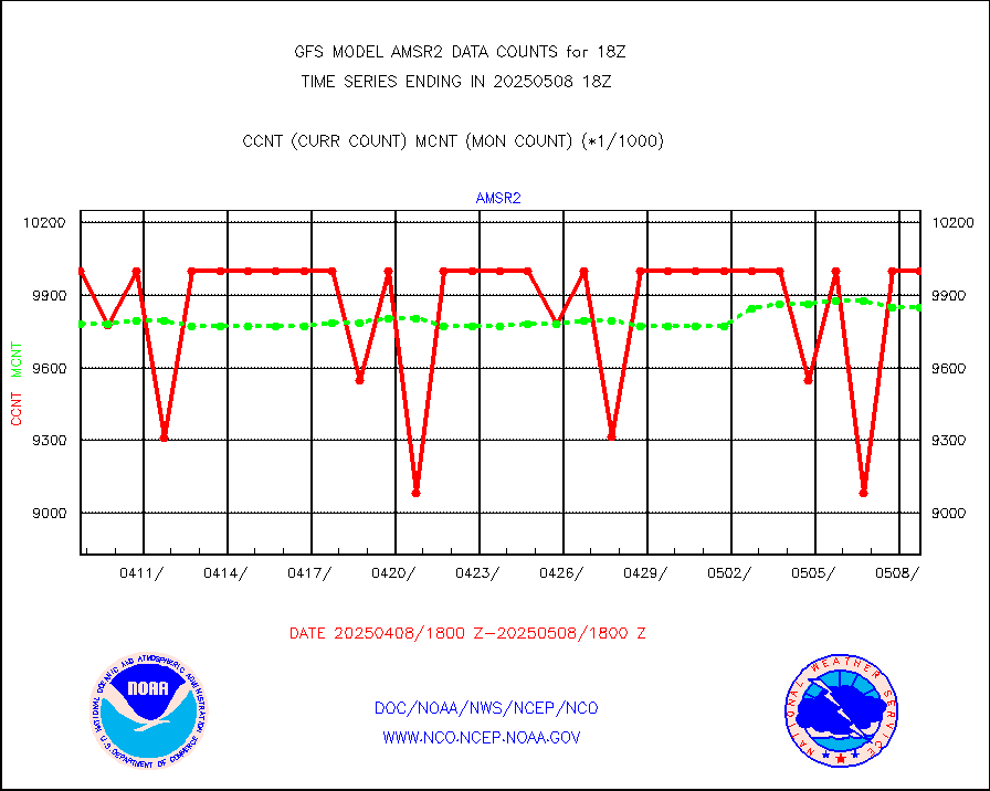
amsr2 |
GCOM-W AMSR2 1B brightness temperatures |
9141660 |
9748192 |
93.8 % |
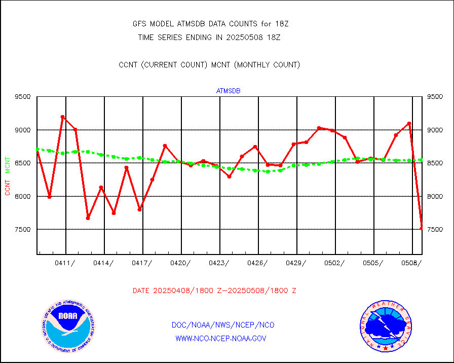
atmsdb |
NPP/NOAA-20 ATMS bright. temps-direct b-cast SSEC |
861284 |
786140 |
109.6 % |
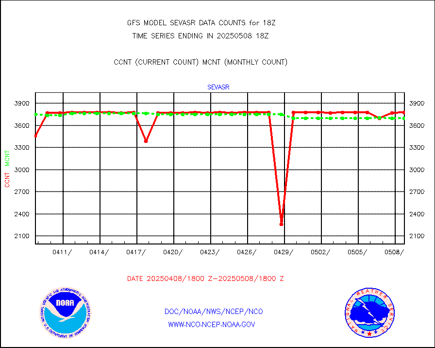
avcsam |
A.M.(N17,M2,M3) AVHRR GAC NCEP-proc clr&sea btmps |
5243629 |
5838851 |
89.8 % |
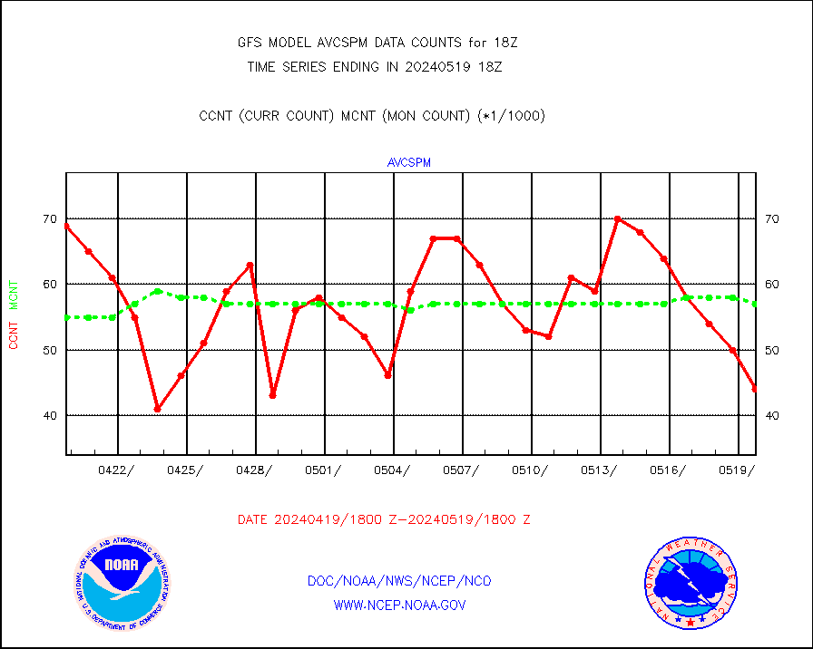
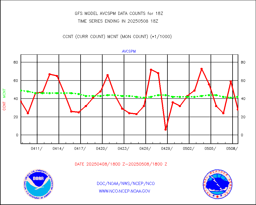
avcspm |
P.M.(N18-19) AVHRR GAC NCEP-proc clr & sea btemps |
4450988 |
5788262 |
76.9 % |
bathy |
eXpendable BathyThermograph, mooring (BATHY fmt) |
2 |
2 |
100.0 % |
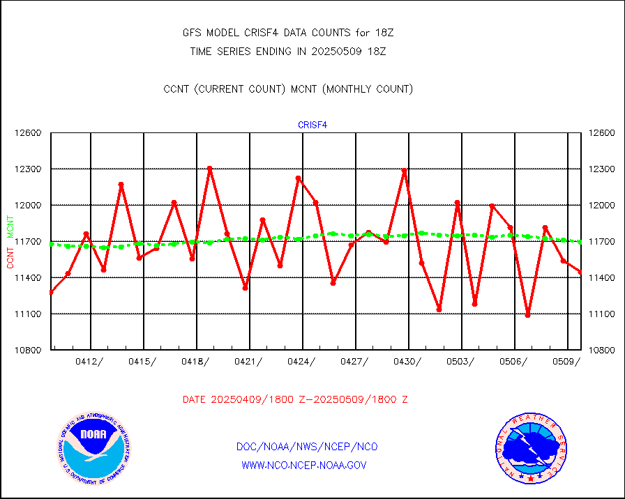
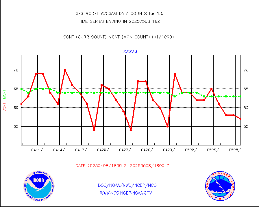
crisf4 |
NPP/NOAA-20 CrIS full spctrl radn (431 ch subset) |
1130256 |
1163889 |
97.1 % |
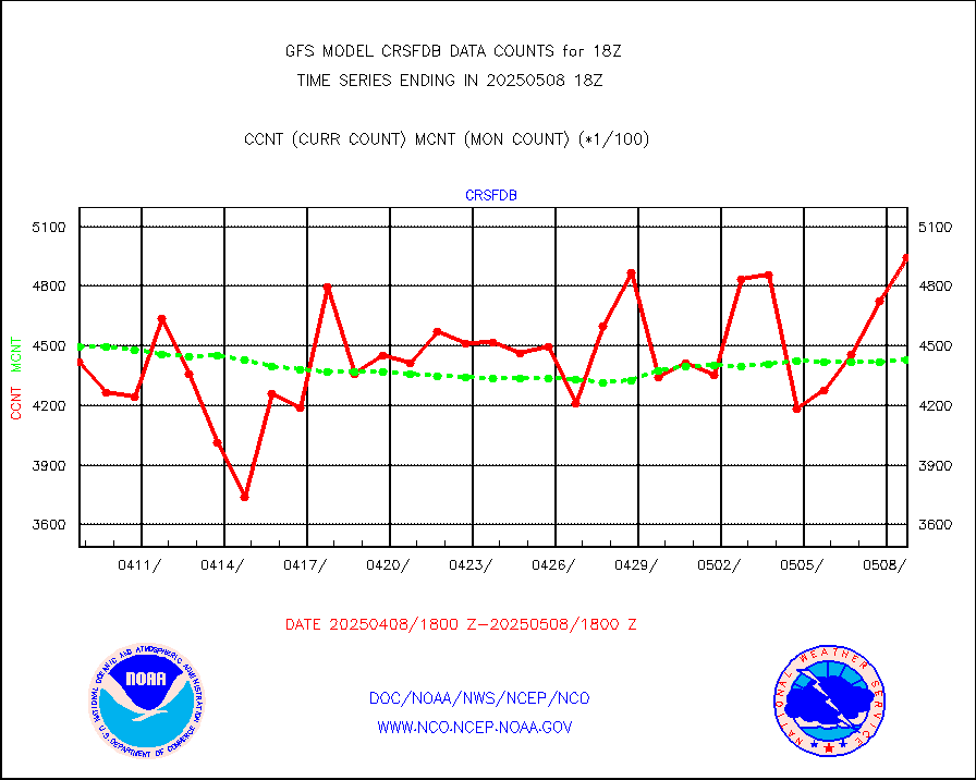
crsfdb |
NPP/NOAA-20 CrIS full spctrl radn dir brdcst SSEC |
687185 |
654548 |
105.0 % |
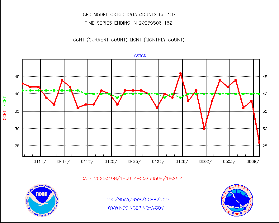
cstgd |
Coast Guard |
31 |
31 |
100.0 % |
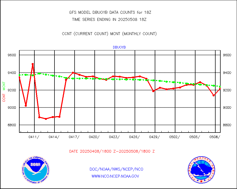
dbuoyb |
Drifting buoys (decoded from BUFR) |
8907 |
8715 |
102.2 % |
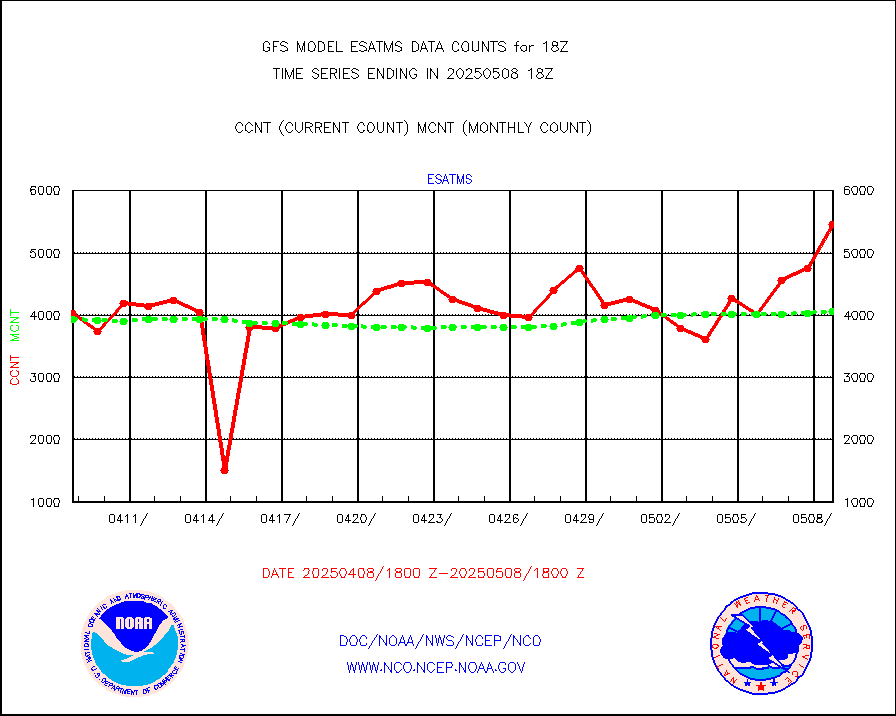
esatms |
NPP Adv. Tech. MW Sndr (ATMS) br. temps from RARS |
415394 |
472741 |
87.9 % |
esiasi |
METOP 1-2 IASI 1C radiance data vbl chn from RARS |
325536 |
292456 |
111.3 % |
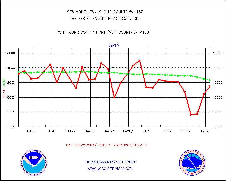
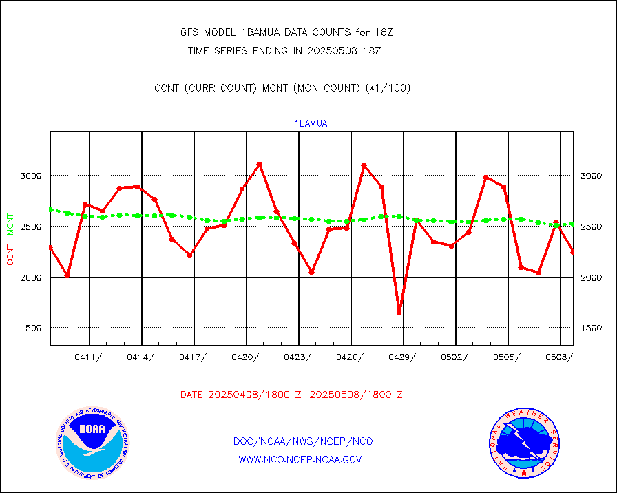
esmhs |
NOAA 18-19 & METOP 1-2 MHS proc. btemps from RARS |
1404817 |
1347769 |
104.2 % |
geoimr |
GOES/NESDIS (11x17 f-o-v) imager clear radiances |
0 |
0 |
n/a |
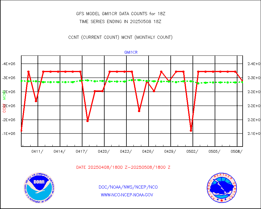
gmi1cr |
GPM GMI Level 1C-R brightness temperatures |
4581330 |
4576763 |
100.1 % |
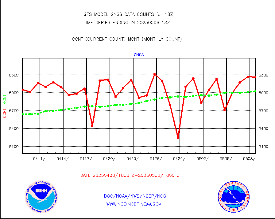
gnss |
Grnd-based Gbl Navigation Sat System (GNSS) data |
5489 |
5976 |
91.9 % |
gome |
METOP 1-2 Global Ozone Monitoring Exp.-2 (GOME-2) |
51591 |
56471 |
91.4 % |
h20in |
INSAT/KALPANA India wvpr derived cloud motion |
0 |
0 |
n/a |
h2dusr |
GOES-16&up/NESDIS wv imgr/deep-lyr derivd cld mtn |
80095 |
101520 |
78.9 % |
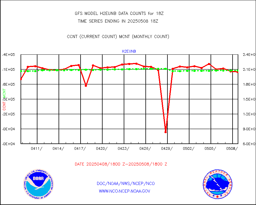
h2eunb |
METEOSAT/EUMETSAT wvpr imgr drv cld motion NBseq |
203167 |
209760 |
96.9 % |
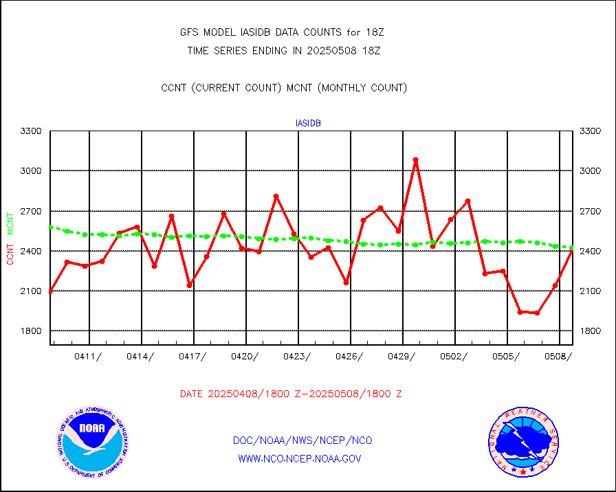
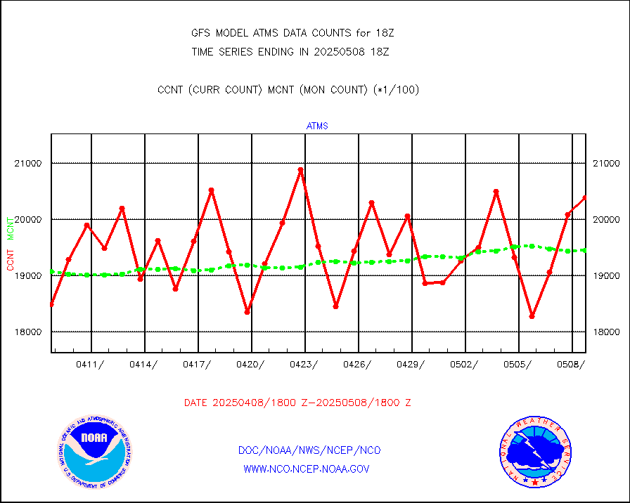
iasidb |
METOP 1-2 IASI 1C radiances-direct broadcast SSEC |
181831 |
171878 |
105.8 % |
ifvrnb |
VIIRS (NPP/NOAA-20) ir lg-wv drv cloud motion(NB) |
36873 |
38542 |
95.7 % |
infav |
AVHRR (NOAA/METOP) ir lg-wave derived cld motion |
0 |
0 |
n/a |
infav1 |
AVHRR (METOP) ir lg-wave derived cld motion |
16747 |
22179 |
75.5 % |
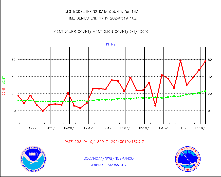
infin |
INSAT/KALPANA India ir lg-wave derived cld motion |
0 |
0 |
n/a |
kamdar |
Korean AMDAR aircraft data (decoded from BUFR) |
0 |
2 |
0.0 % |
mbuoyb |
Moored buoys (decoded from BUFR) |
6184 |
5572 |
111.0 % |
nxrdw2 |
NEXRAD Vel Azm Dsp(VAD) winds via Level 2 decoder |
3384 |
3231 |
104.7 % |
ompslp |
OMPS Limb Profiler ozone data (NPP) |
920 |
801 |
114.9 % |
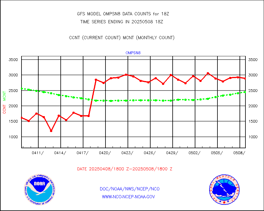
ompsn8 |
OMPS nadir profile ozone (Version 8 BUFR) |
2697 |
2781 |
97.0 % |
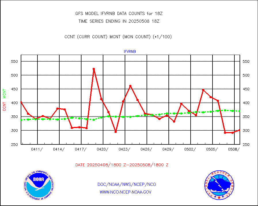
ompst8 |
OMPS total column ozone (Version 8 BUFR) |
1864565 |
1667849 |
111.8 % |
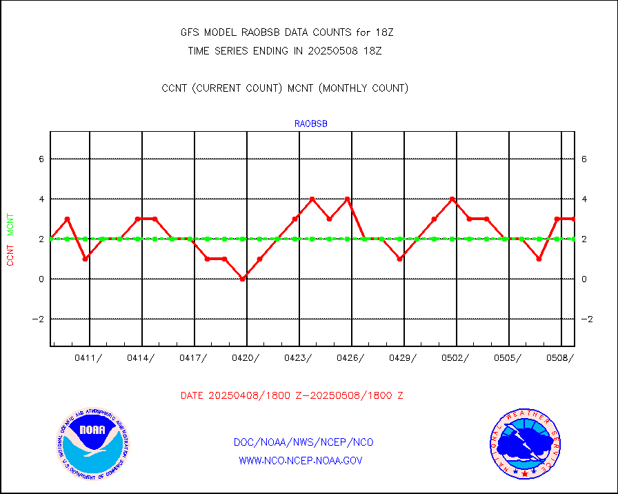
pirep |
Manual PIREP aircraft data (dcded from AIREP fmt) |
828 |
1013 |
81.7 % |
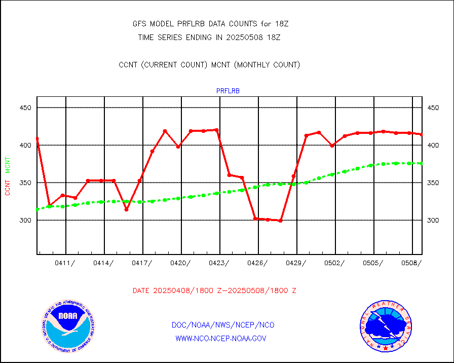
prflrb |
Multi-Agency Profiler (MAP) and SODAR winds |
269 |
326 |
82.5 % |
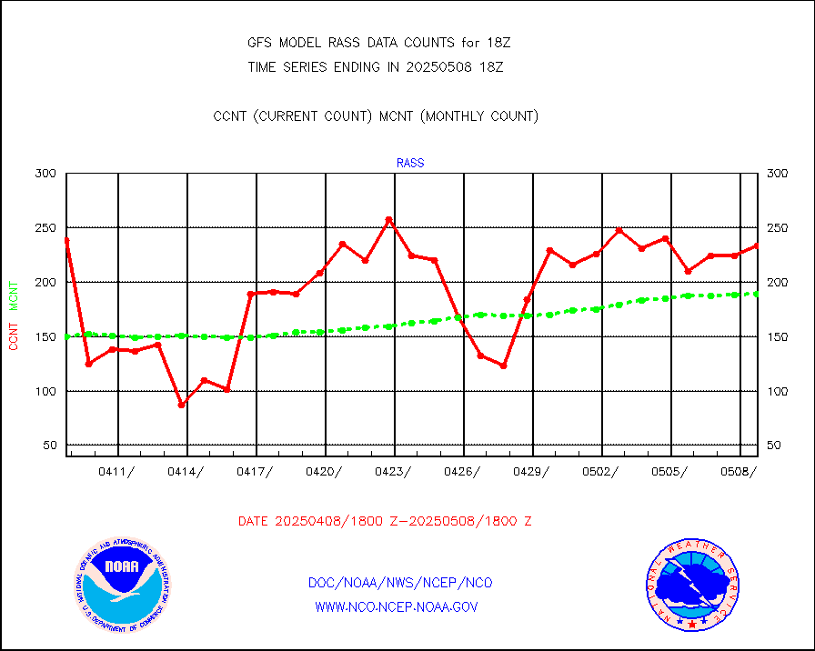
rass |
RASS temperatures (NOAA and Multi-Agency) |
160 |
186 |
86.0 % |
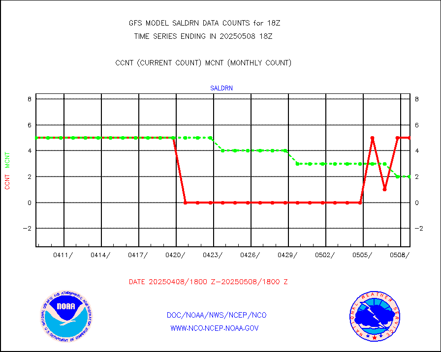
saldrn |
Surface Marine Saildrone (decoded from BUFR) |
5 |
5 |
100.0 % |
saphir |
Megha-Tropiques SAPHIR L1A2 brightness temps |
0 |
0 |
n/a |
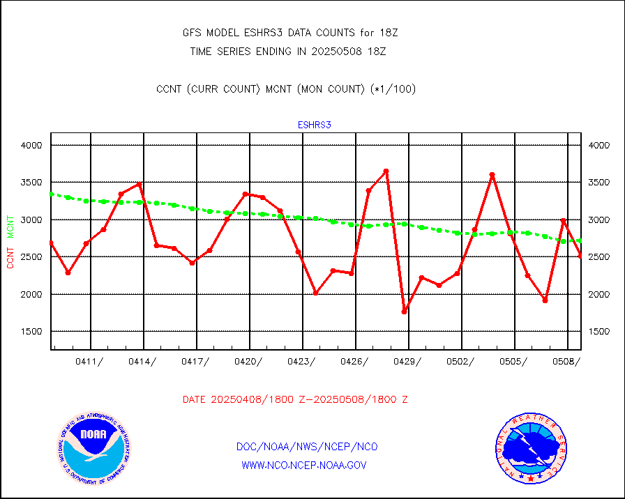
sevasr |
METEOSAT-10 2nd Gen SEVIRI All Sky Radiance(proc) |
377125 |
377283 |
100.0 % |
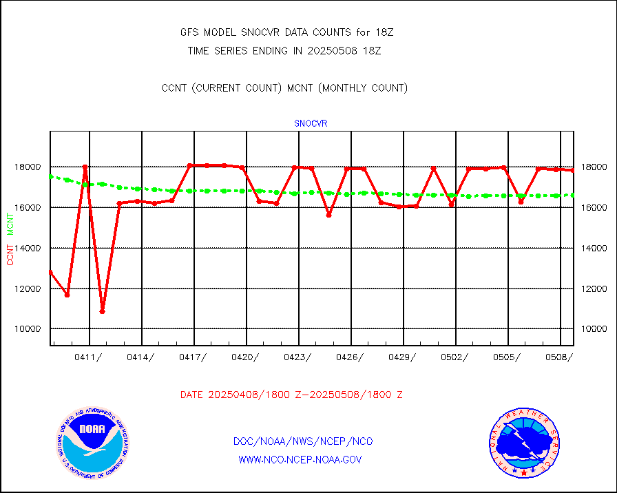
snocvr |
NOW COVER, DEPTH/DENSITY AND WATER EQUIVALENT |
19756 |
18995 |
104.0 % |
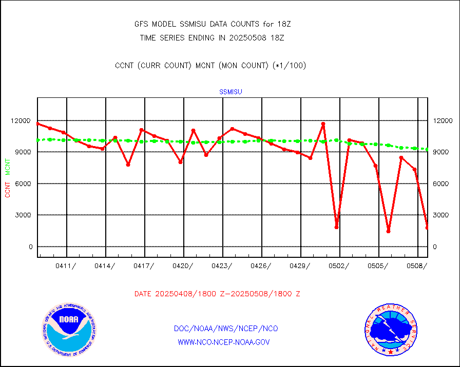
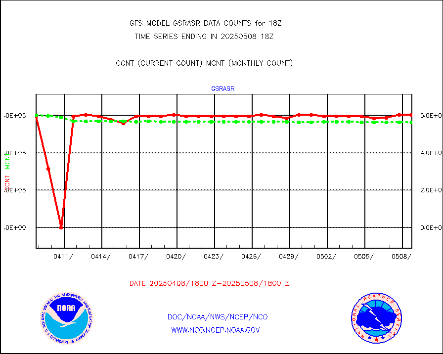
ssmisu |
DMSP SSM/IS 1C radiance data (Unified Pre-Proc.) |
1095586 |
906891 |
120.8 % |
sstvcw |
NPP/NOAA-20 VIIRS SST - CLEAR & OVER WATER |
9999999 |
9999999 |
100.0 % |
sstvpw |
NPP/NOAA-20 VIIRS SST - PROBABLY CLR & OVER WATER |
9999999 |
9999999 |
100.0 % |
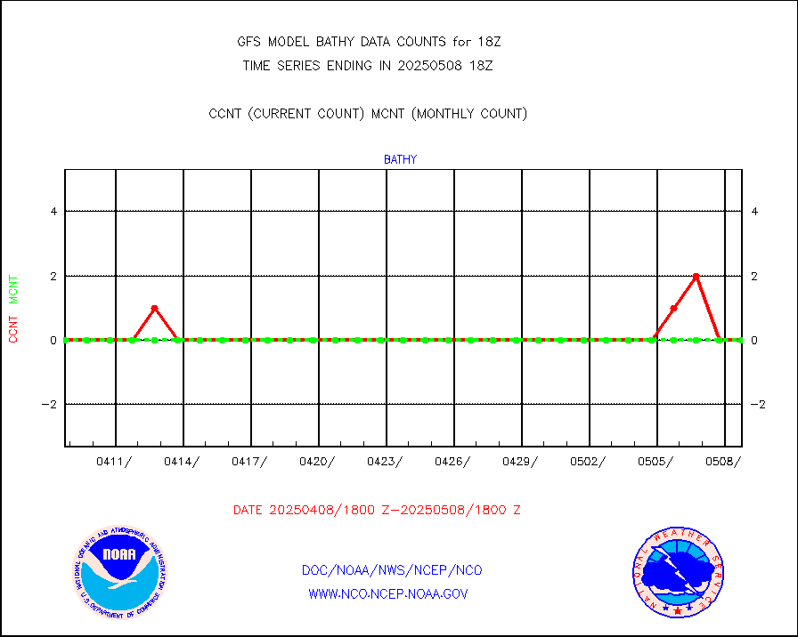
subpfl |
Sub-surface float and glider profile (BUFR) |
88 |
60 |
146.7 % |
synop |
Synoptic - fixed manual and automatic |
7891 |
8039 |
98.2 % |
tesac |
CTD probe, Argo prflng float, mooring (TESAC fmt) |
2314 |
2165 |
106.9 % |
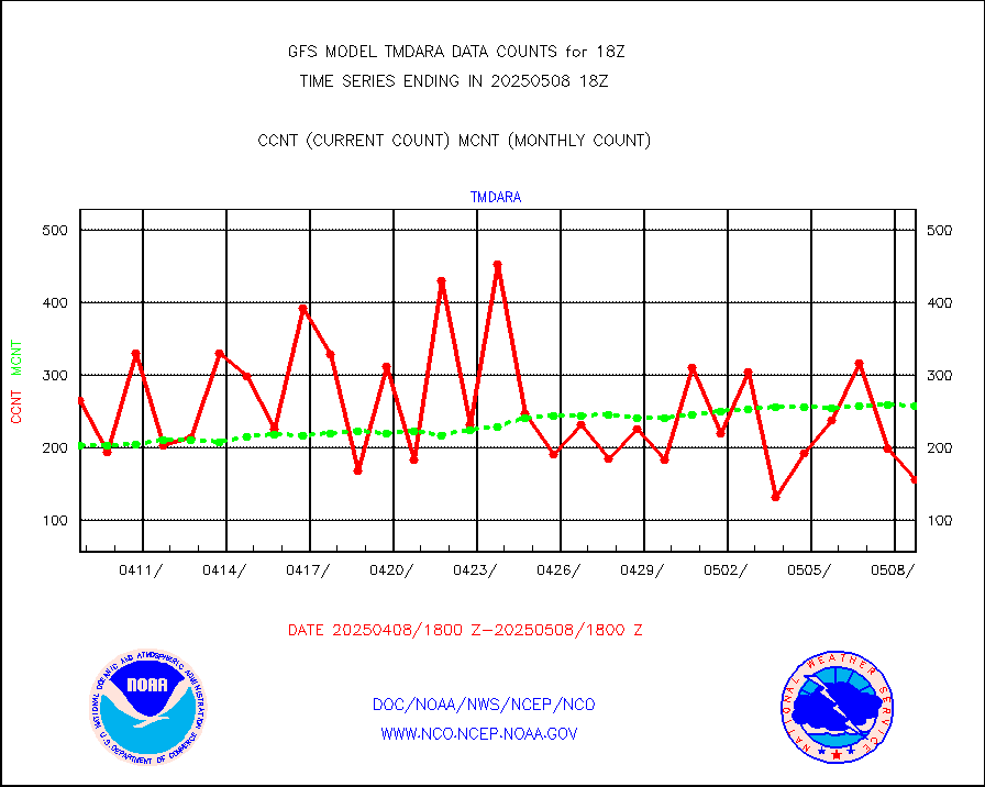
tmdara |
TAMDAR aircft data-all types(from Panasonic,BUFR) |
1281 |
1186 |
108.0 % |
visin |
INSAT/KALPANA India visible derived cloud motion |
0 |
0 |
n/a |
visin2 |
INDIA SATWIND, INSAT VIS channel |
0 |
0 |
n/a |
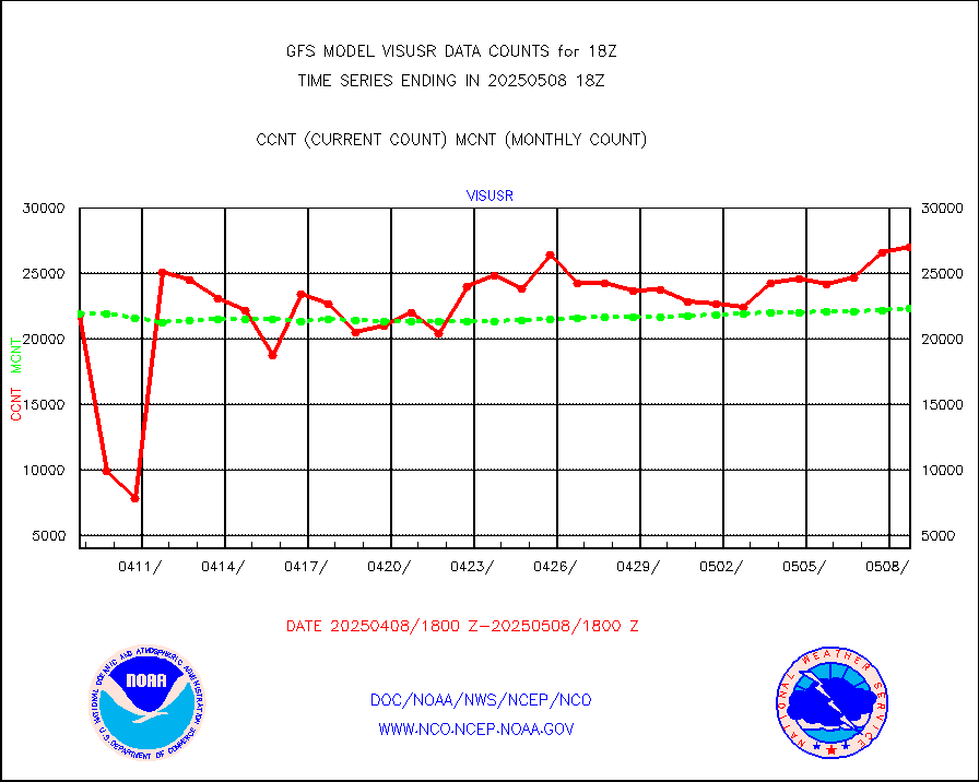
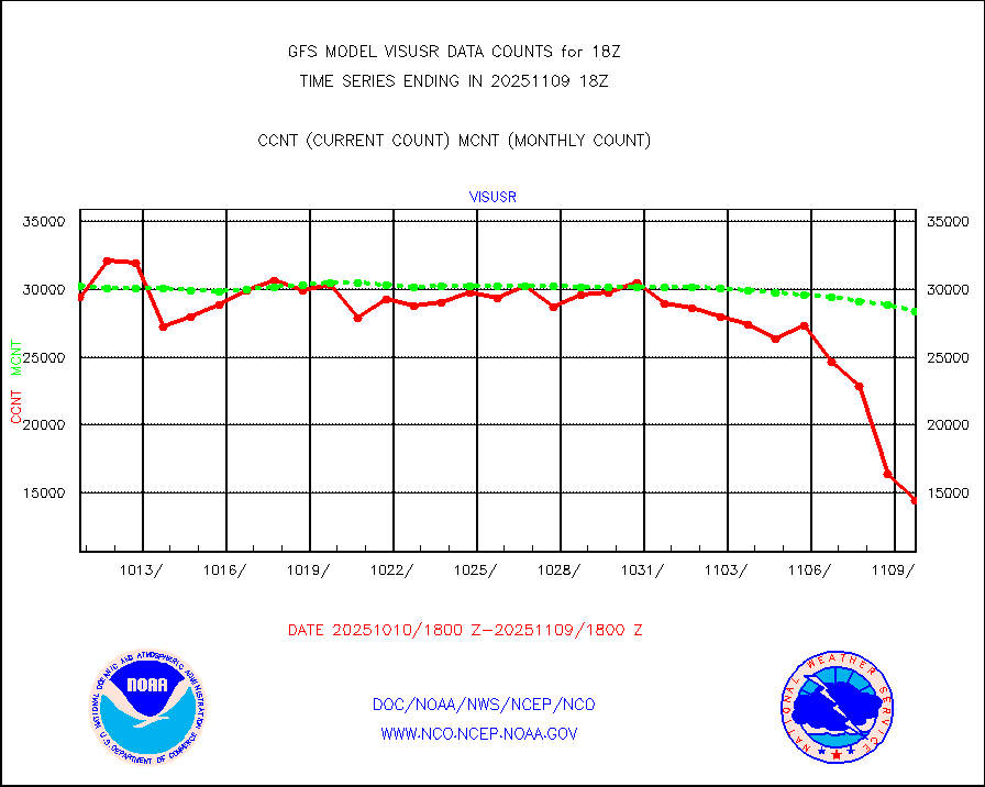
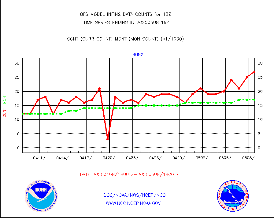
visusr |
GOES-16&up/NESDIS visible derived cloud motion |
2398968 |
2344637 |
102.3 % |


