| Critical Data with Normal Counts |
|---|
| Type | Description | Hourly Count | Monthly Average | Percent (%) of Monthly Mean |
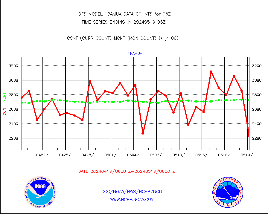
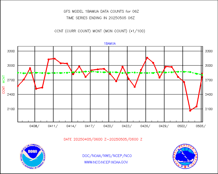
1bamua |
NOAA 15-19 & METOP 1-2 AMSU-A NCEP-proc. br.temps |
255519 |
270498 |
94.5 % |
1bhrs4 |
NOAA 18-19 & METOP 1-2 HIRS-4 NCEP-proc. br.temps |
190866 |
236338 |
80.8 % |
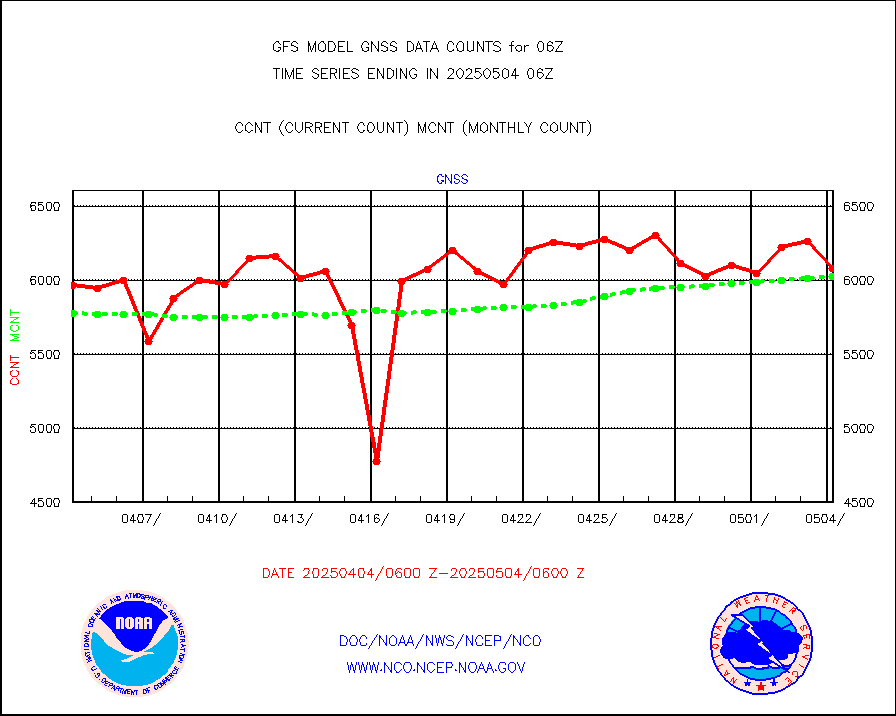
1bmhs |
NOAA 18-19 & METOP 1-2 MHS NCEP-proces. br. temps |
1657093 |
1566721 |
105.8 % |
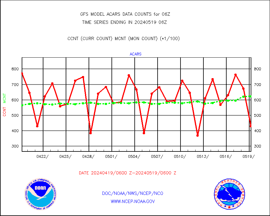
acars |
MDCRS ACARS acft data from ARINC(dcded from BUFR) |
59331 |
58269 |
101.8 % |
ahicsr |
Himawari Clear Sky Radiance |
250081 |
258477 |
96.8 % |
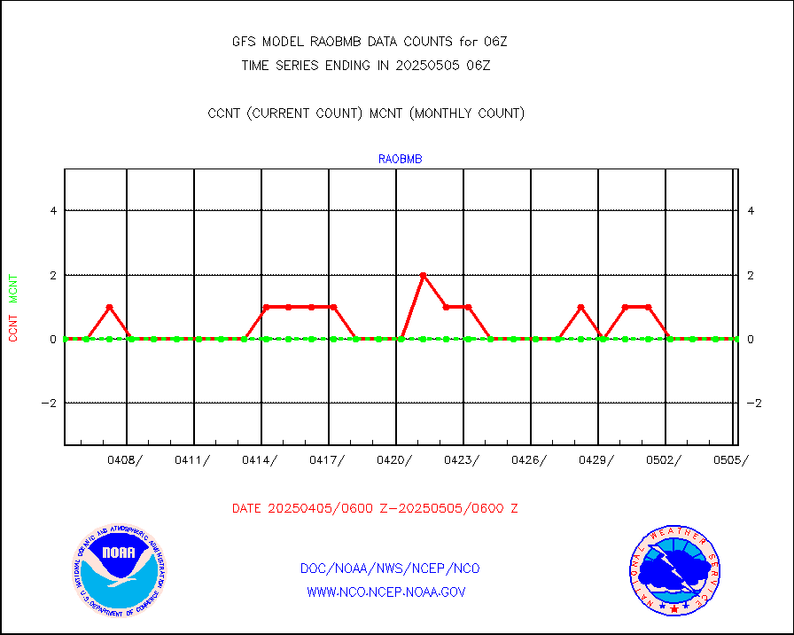
airep |
Manual AIREP aircraft data (dcded from AIREP fmt) |
6897 |
6733 |
102.4 % |
airsev |
AQUA AIRS/AMSU-A/HSB brightness temps- every FOV |
0 |
0 |
n/a |
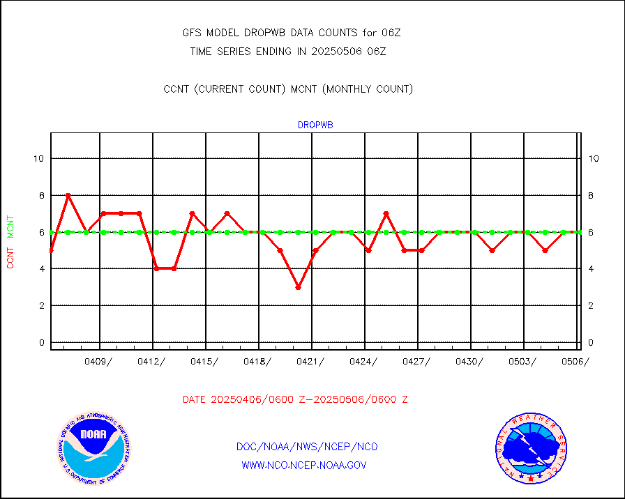
amdar |
AMDAR aircraft data (decoded from AMDAR format) |
4620 |
4423 |
104.5 % |
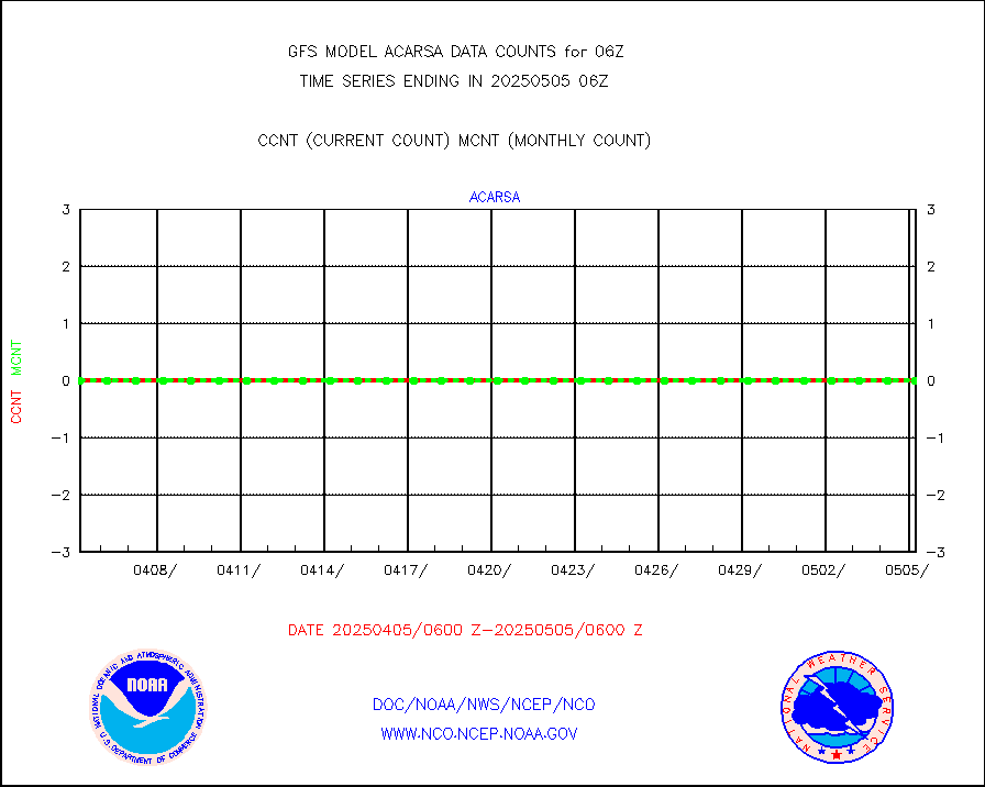
amdarb |
AMDAR aircraft data (decoded from BUFR) |
9635 |
10306 |
93.5 % |
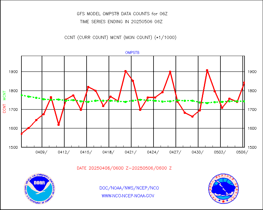
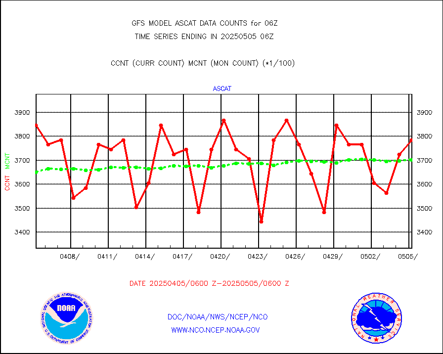
ascat |
METOP 1-2 ASCAT products |
322140 |
343785 |
93.7 % |
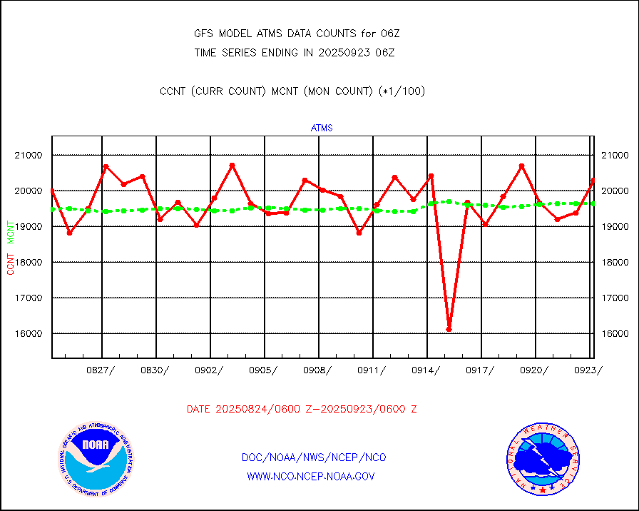
atms |
NPP/NOAA-20 ATMS brightness temperatures |
1920672 |
1944185 |
98.8 % |
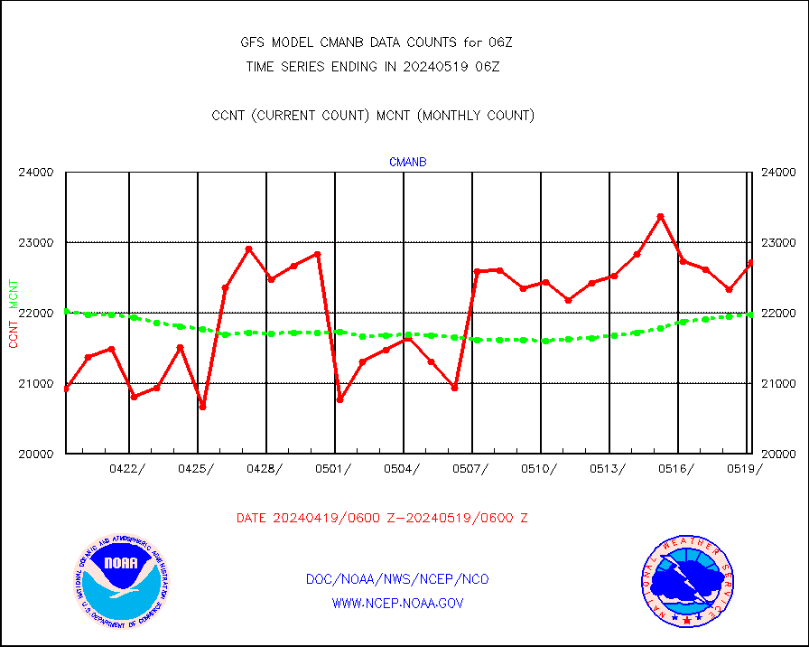
cmanb |
Surface Marine CMAN rpts decoded from BUFR format |
22342 |
21612 |
103.4 % |
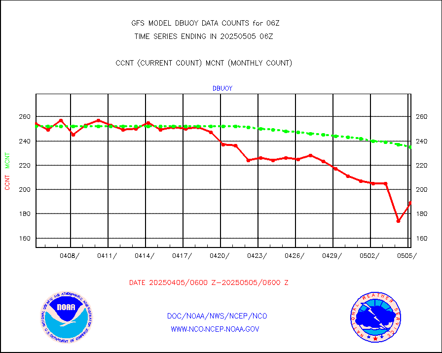
dbuoy |
Buoys decoded from FM-18 fmt (moored or drifting) |
273 |
264 |
103.4 % |
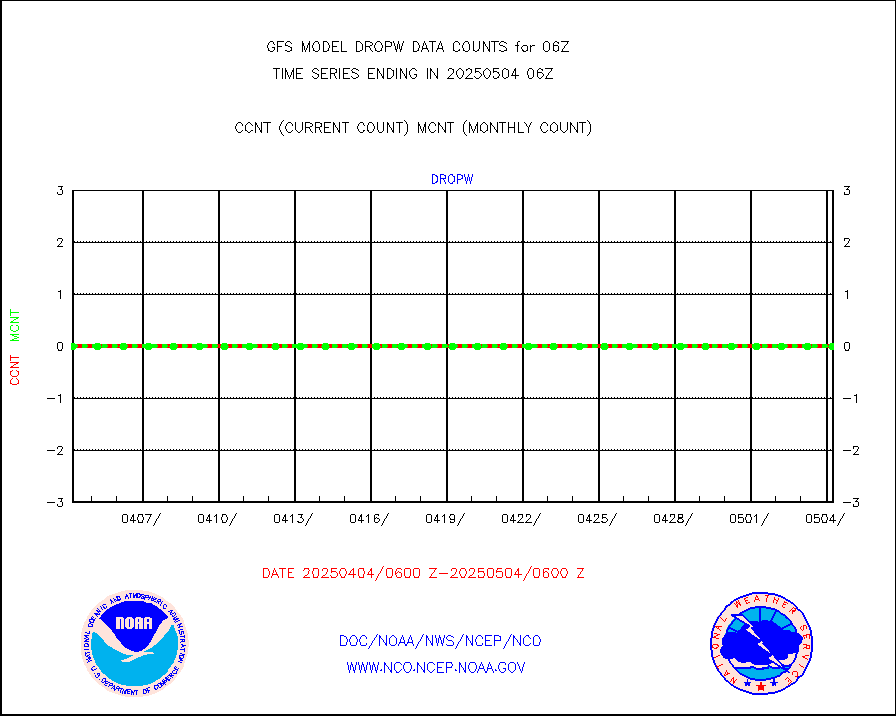
dropw |
Dropwinsonde (from TEMP DROP) |
0 |
0 |
n/a |
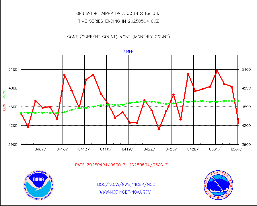
eadas |
E-AMDAR (European AMDAR acft decoded from BUFR) |
11940 |
11746 |
101.7 % |
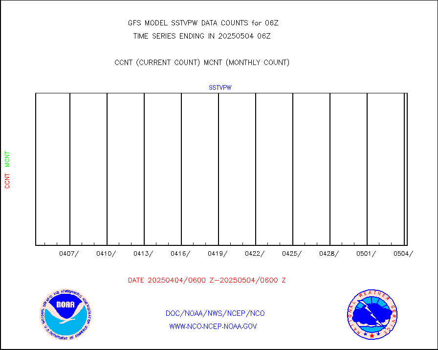
esamua |
NOAA 15-19 & METOP 1-2 AMSU-A proc btmps frm RARS |
170793 |
165242 |
103.4 % |
eshrs3 |
NOAA 15-19 & METOP 1-2 HIRS-3/4 pr btmps frm RARS |
475772 |
451079 |
105.5 % |
gpsro |
GPS radio occultation data |
2129 |
2319 |
91.8 % |
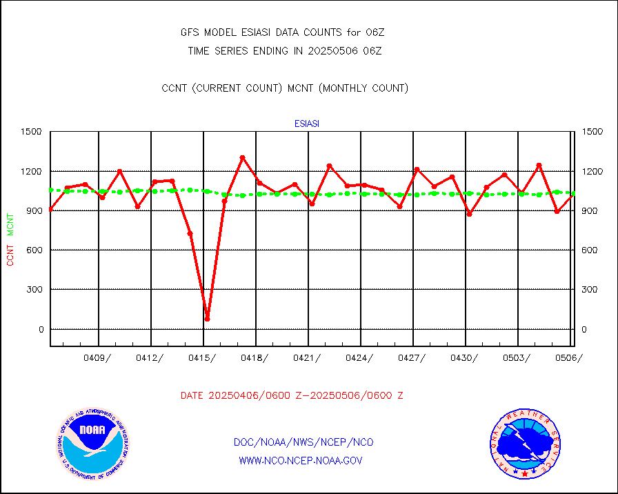
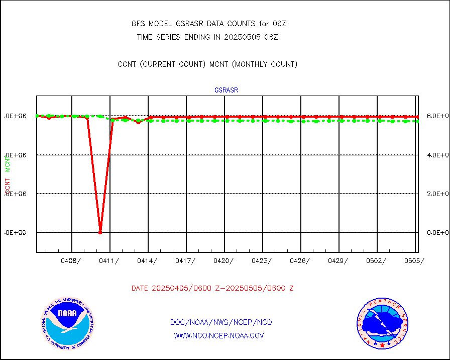
gsrasr |
GOES-16/17 All Sky Radiances (proc.) |
6037976 |
5990267 |
100.8 % |
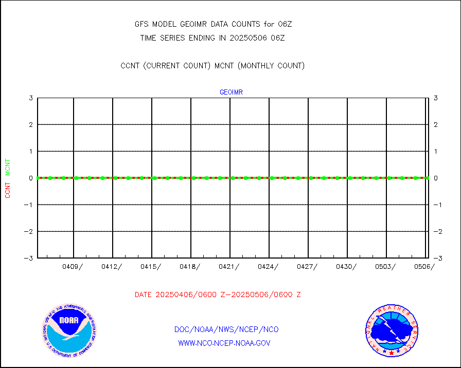
gsrcsr |
GOES-16/17 Clear Sky Radiances (proc.) |
2694232 |
2713310 |
99.3 % |
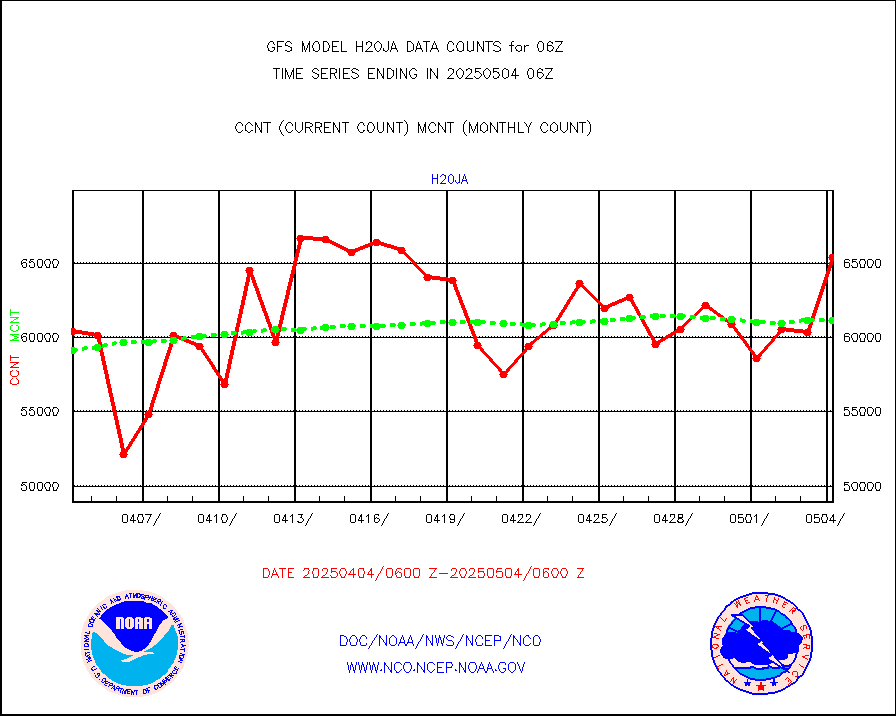
h20ja |
MTSAT/JMA water vapor imager derived cloud motion |
61448 |
58435 |
105.2 % |
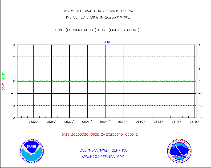
h20mo |
MODIS (AQUA/TERRA) wvpr imager derived cld motion |
0 |
0 |
n/a |
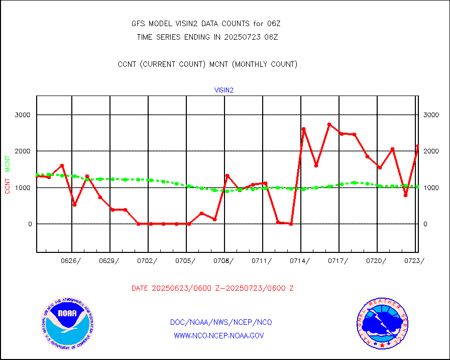
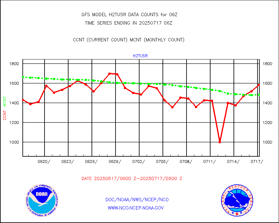
h2tusr |
GOES-16&up/NESDIS wv imgr/cld-top derived cld mtn |
167044 |
163680 |
102.1 % |
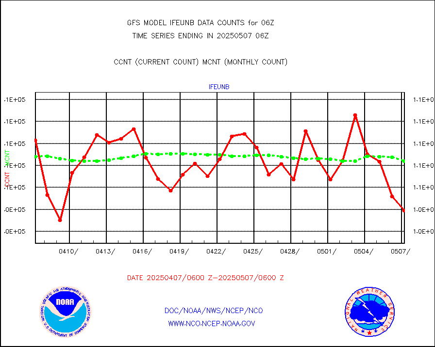
ifeunb |
METEOSAT/EUMETSAT ir lg-wave drv cld motion NBseq |
107699 |
105389 |
102.2 % |
infja |
MTSAT/JMA infrared long-wave derived cloud motion |
50400 |
48699 |
103.5 % |
infmo |
MODIS (AQUA/TERRA) ir l-wave derived cloud motion |
0 |
0 |
n/a |
infusr |
GOES-16&up/NESDIS ir long-wave derived cld motion |
454365 |
490626 |
92.6 % |
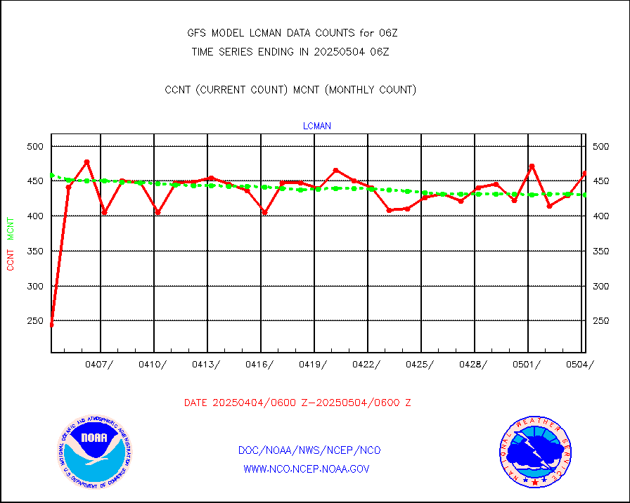
lcman |
Land-based CMAN stations decoded from CMAN format |
580 |
536 |
108.2 % |
leogeo |
LEO-GEO satellite AMVs from UWisc. |
16011 |
8496 |
188.5 % |
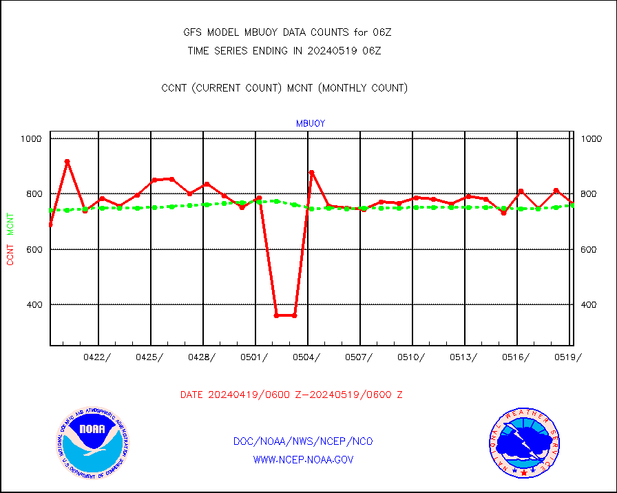
mbuoy |
Buoys decoded from FM-13 format (moored) |
766 |
749 |
102.3 % |
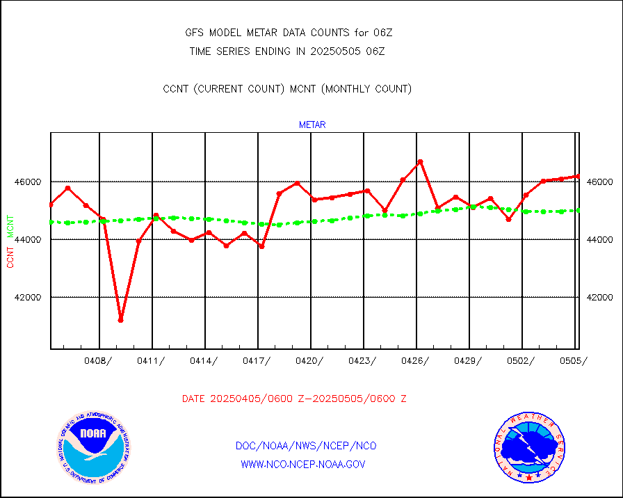
metar |
Aviation - METAR |
45536 |
44641 |
102.0 % |
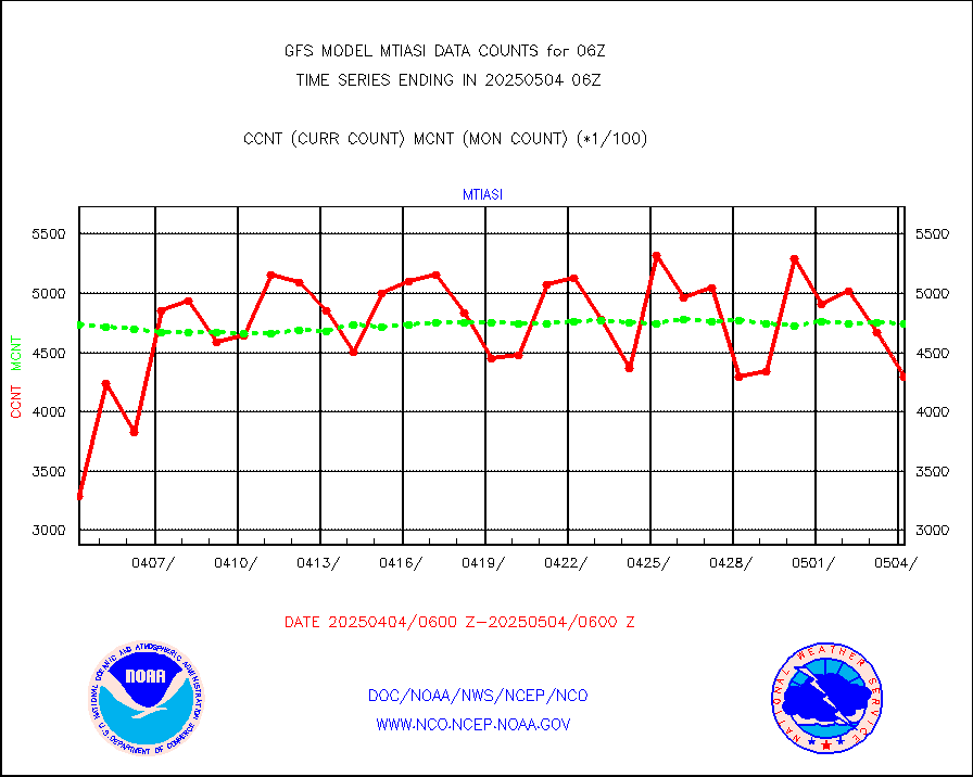
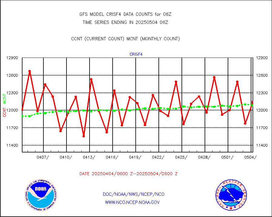
mtiasi |
METOP 1-2 IASI 1C radiance data (varbl. channels) |
418396 |
451107 |
92.7 % |
nxrdw |
NEXRAD Vel Azm Dsp(VAD) winds via radar coded msg |
0 |
0 |
n/a |
osbuv8 |
NOAA 16-19 Solar Backscatter UV-2 rad frm V8 BUFR |
0 |
0 |
n/a |
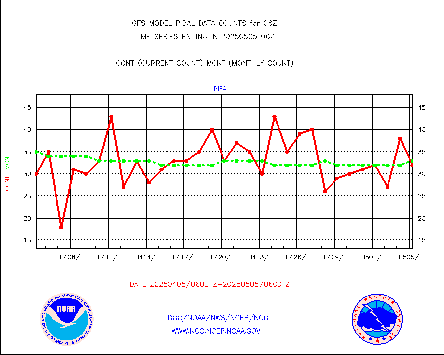
pibal |
PIBAL (from PILOT, PILOT SHIP, PILOT MOBIL) |
50 |
56 |
89.3 % |
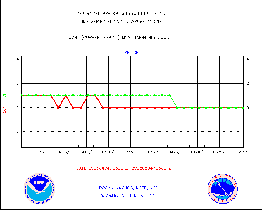
prflrp |
Profilr winds from PIBAL (PILOT,PILOT SHIP/MOBIL) |
0 |
1 |
0.0 % |
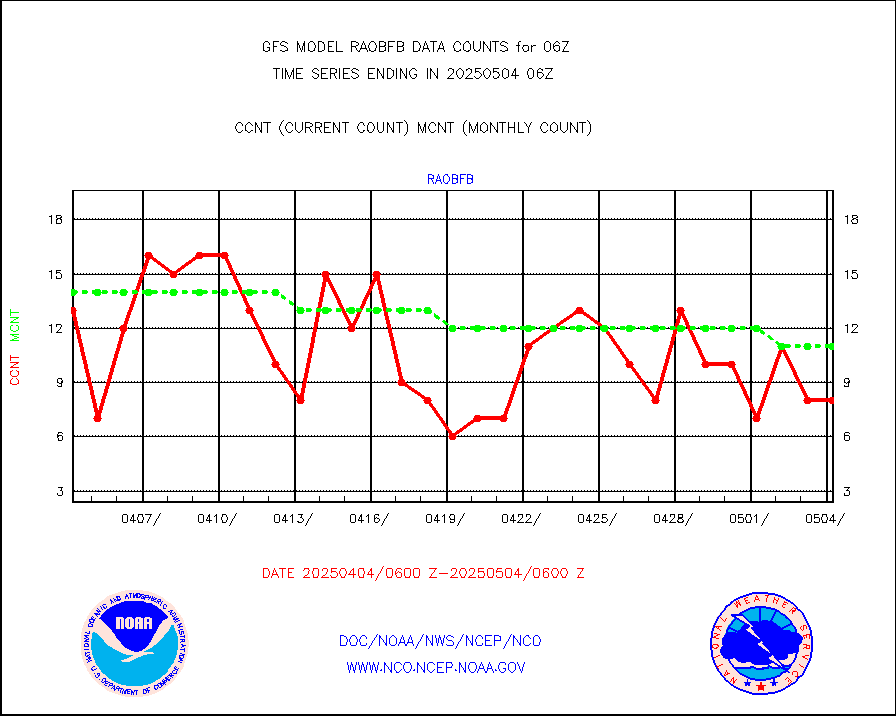
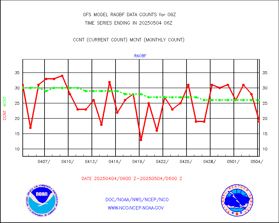
raobf |
Rawinsonde - fixed land (from TEMP or PILOT) |
33 |
31 |
106.5 % |
raobm |
Rawinsonde - mobile land (from TEMP/PILOT MOBIL) |
0 |
0 |
n/a |
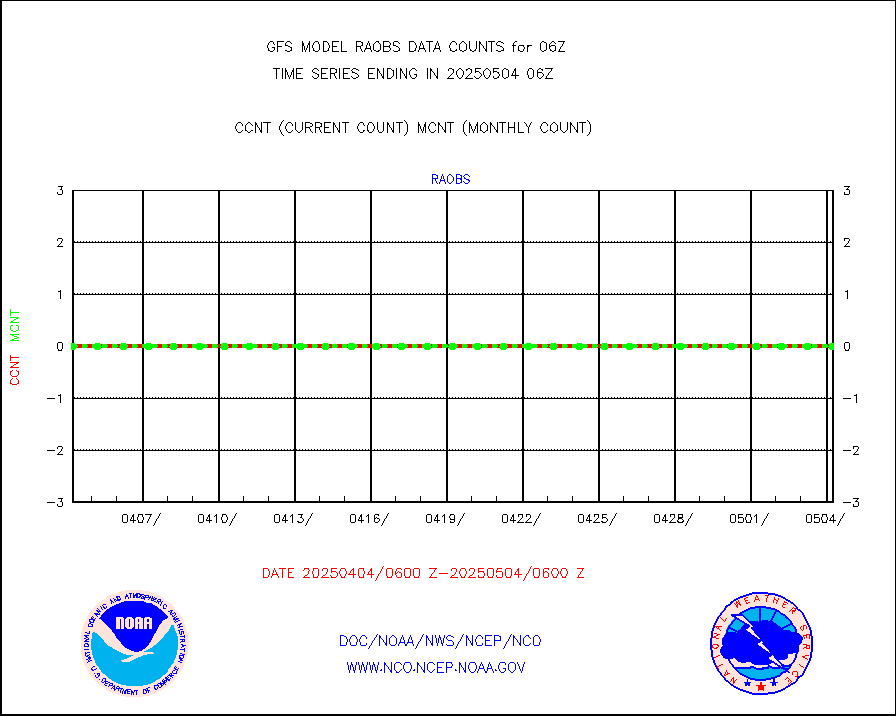
raobs |
Rawinsonde - ship (from TEMP SHIP, PILOT SHIP) |
0 |
0 |
n/a |
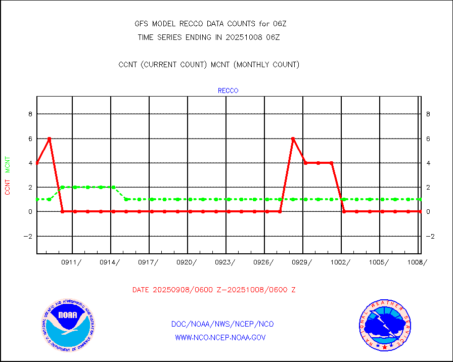
recco |
Flight level reconnaissance aircraft data |
0 |
0 |
n/a |
sevcsr |
METEOSAT-10 2nd Gen SEVIRI Clr Sky Radiance(proc) |
0 |
0 |
n/a |
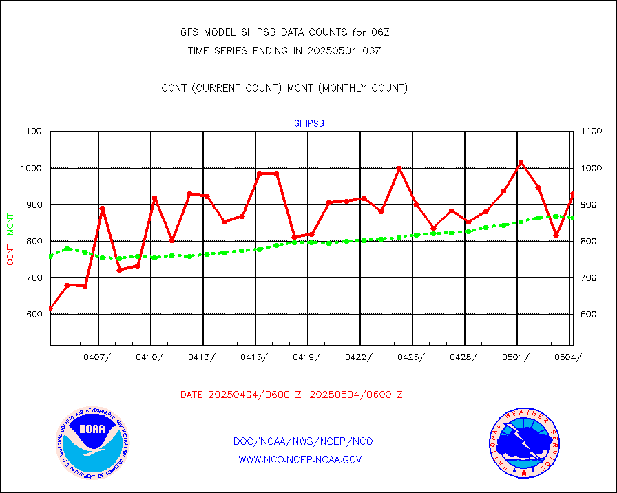
shipsb |
Ship - manual and automatic, restricted (BUFR) |
791 |
618 |
128.0 % |
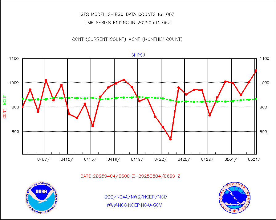
shipsu |
Ship - manual and automatic, unrestricted |
741 |
671 |
110.4 % |
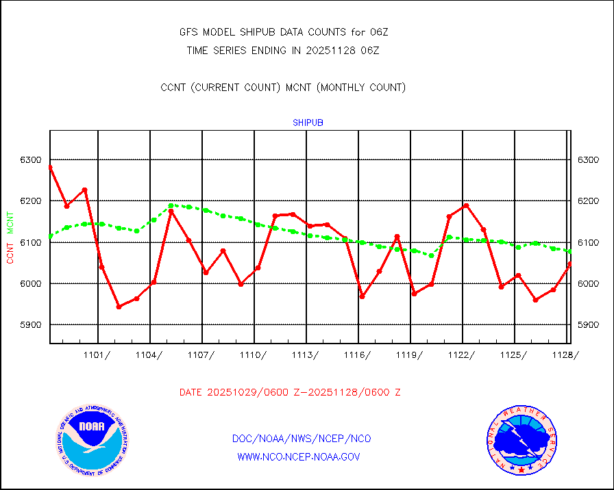
shipub |
Ship - manual and automatic, unrestricted (BUFR) |
5877 |
5863 |
100.2 % |
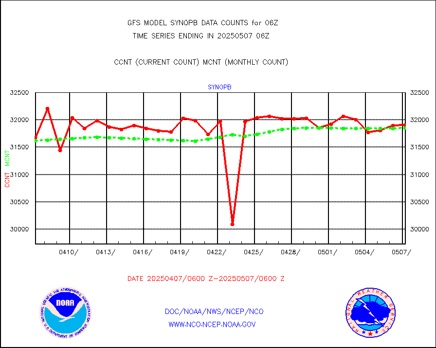
synopb |
Synoptic - fixed manual & auto (decoded fr BUFR) |
31360 |
30753 |
102.0 % |
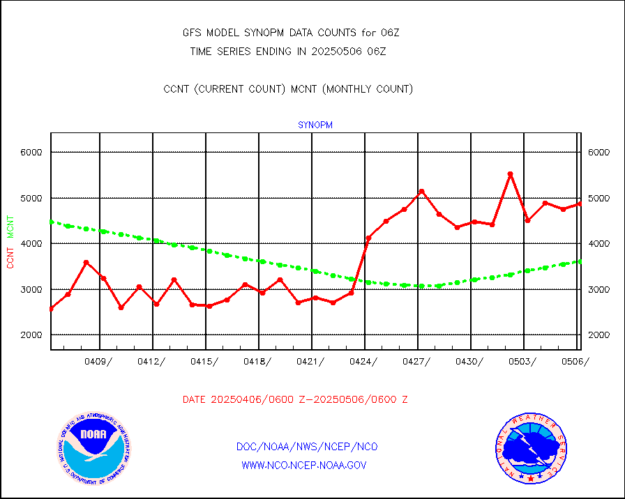
synopm |
Synoptic - mobile manual and automatic |
5792 |
4959 |
116.8 % |
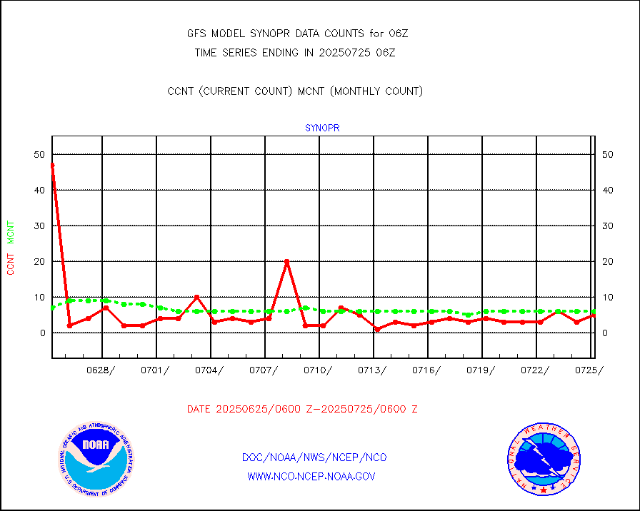
synopr |
Synoptic - restricted (WMO Res 40) manual & auto. |
13 |
4 |
325.0 % |
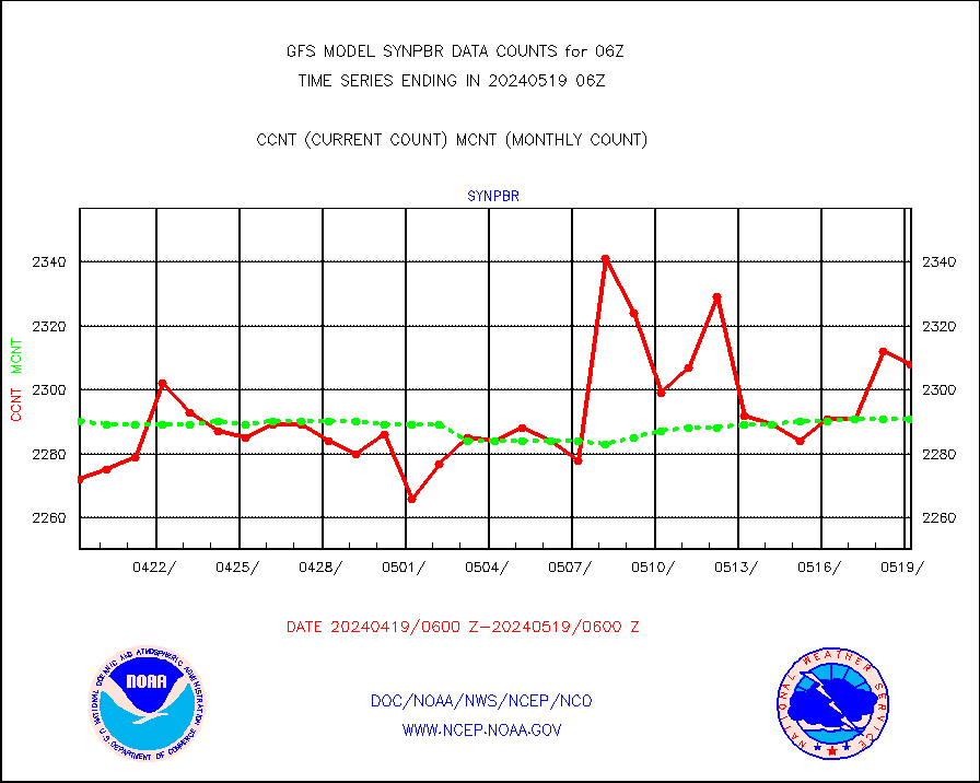
synpbr |
Synoptic - restricted (WMO Res 40)(decoded BUFR) |
2324 |
2285 |
101.7 % |
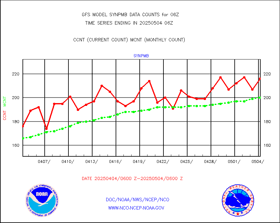
synpmb |
Synoptic - mobile manual & auto (decoded fr BUFR) |
54 |
34 |
158.8 % |
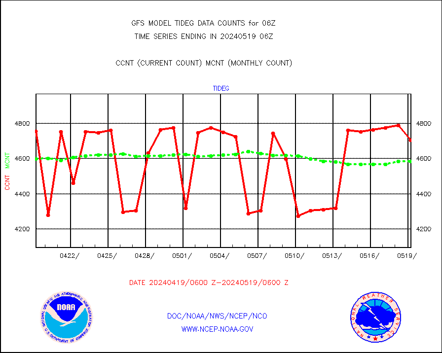
tideg |
Tide gauge reports decoded from CREX format |
4597 |
4618 |
99.5 % |
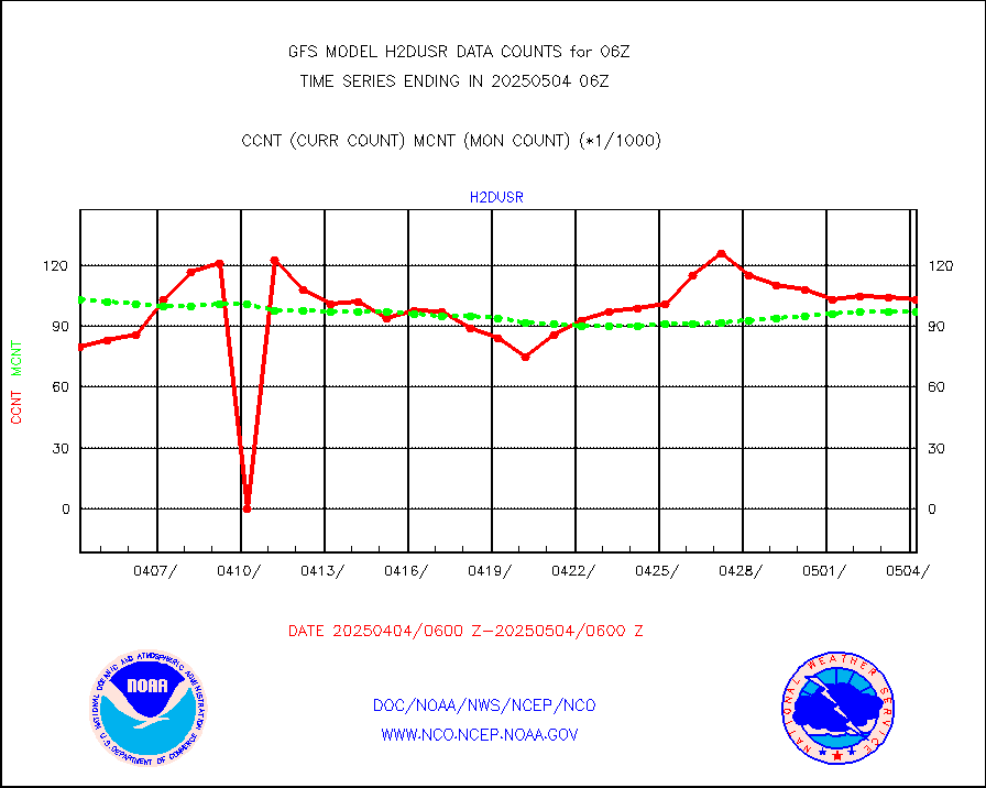
visja |
MTSAT/JMA visible derived cloud motion |
26817 |
27451 |
97.7 % |
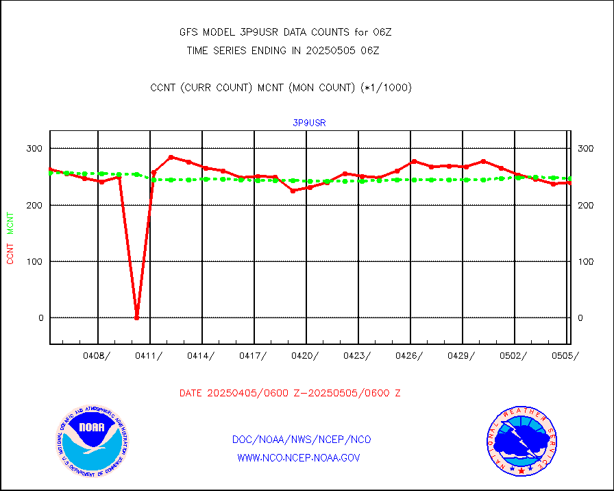
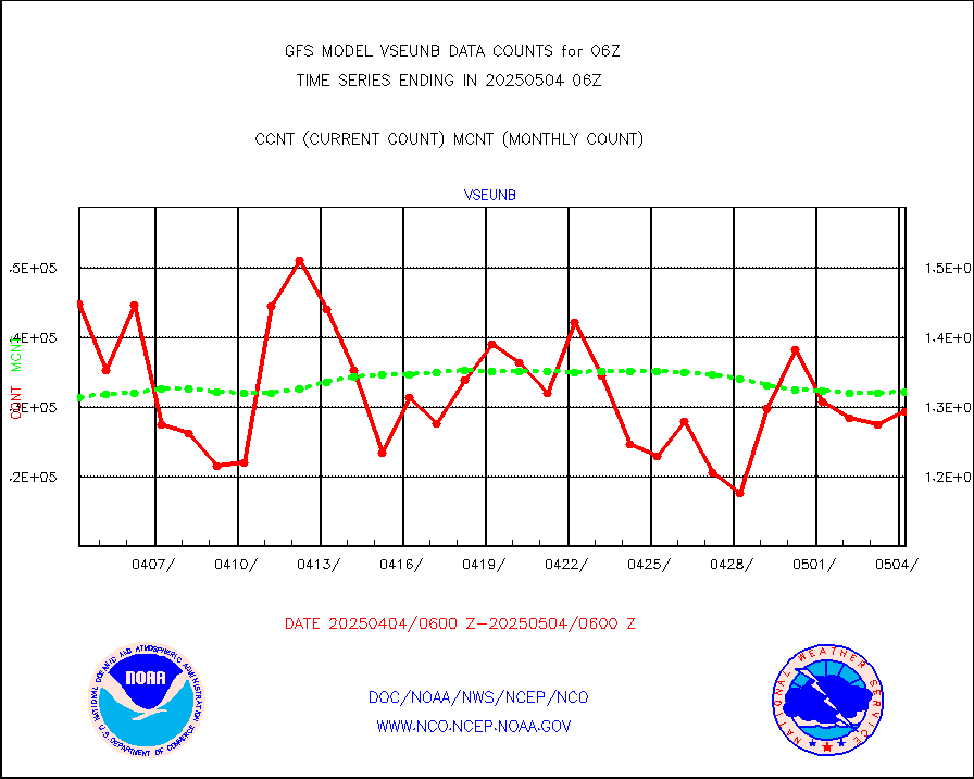
vseunb |
METEOSAT/EUMETSAT visible drv cld motion NBseq |
126988 |
114743 |
110.7 % |
| Data Types of Opportunity with Normal Counts |
|---|
| Type | Description | Hourly Count | Monthly Average | Percent (%) of Monthly Mean |
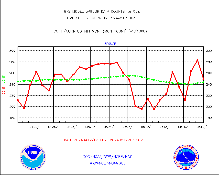
3p9usr |
GOES-16&up/NESDIS ir short-wv derived cld motion |
196762 |
253040 |
77.8 % |
acarsa |
MDCRS ACARS acft data (ARINC via AFWA)(AIREP fmt) |
0 |
0 |
n/a |
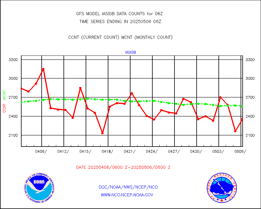
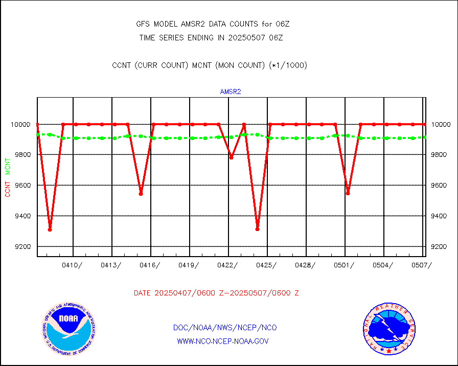
amsr2 |
GCOM-W AMSR2 1B brightness temperatures |
9999999 |
9891313 |
101.1 % |
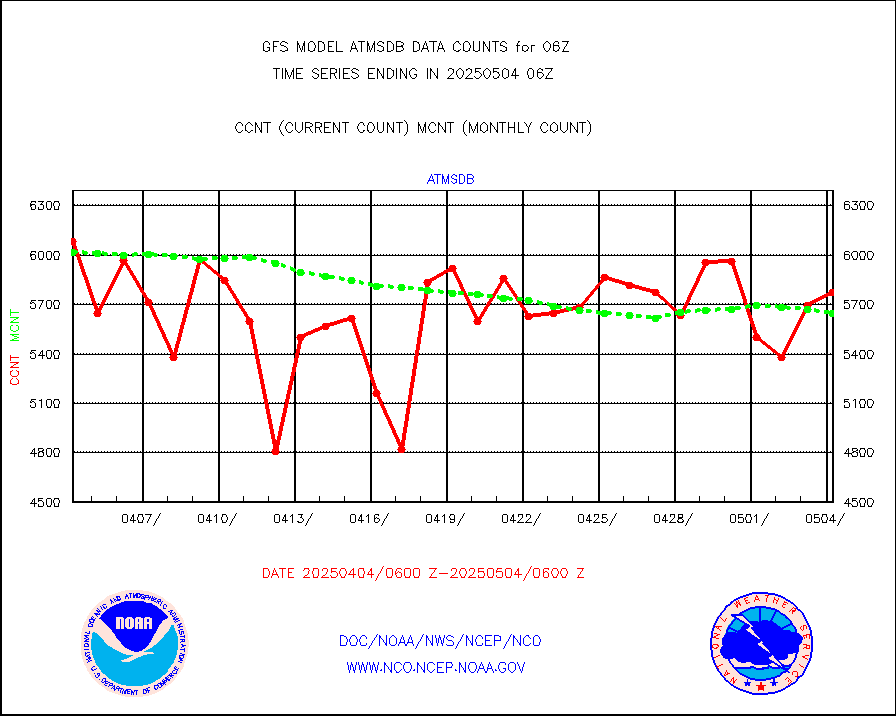
atmsdb |
NPP/NOAA-20 ATMS bright. temps-direct b-cast SSEC |
426492 |
448265 |
95.1 % |
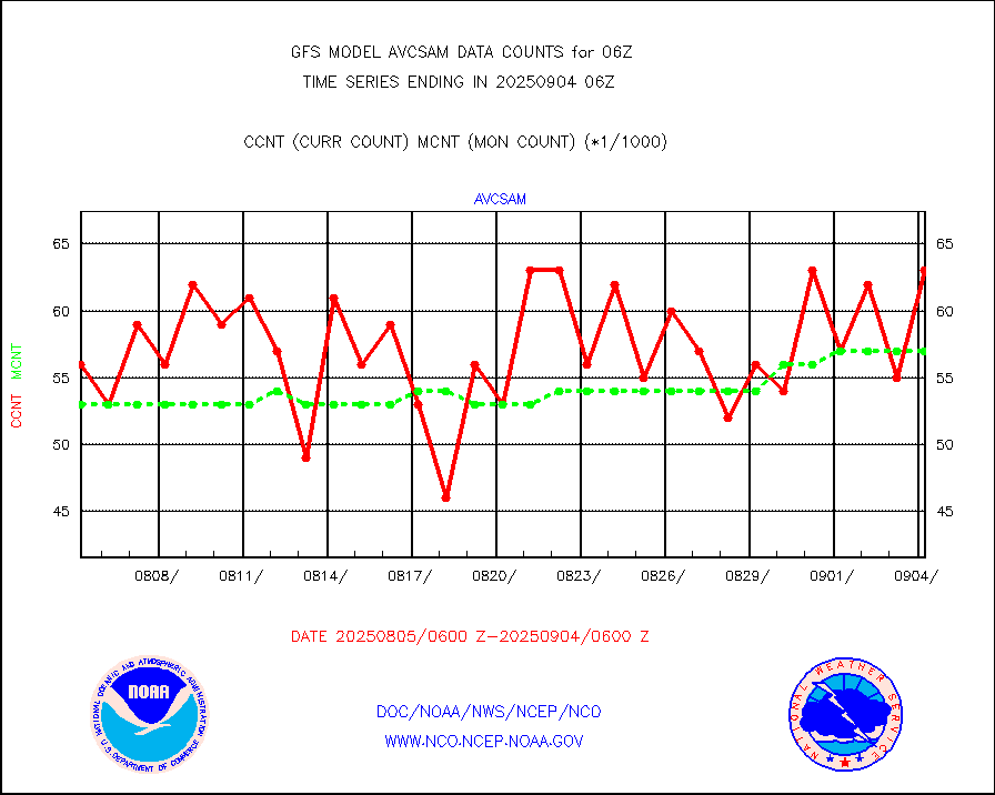
avcsam |
A.M.(N17,M2,M3) AVHRR GAC NCEP-proc clr&sea btmps |
6343471 |
5928333 |
107.0 % |
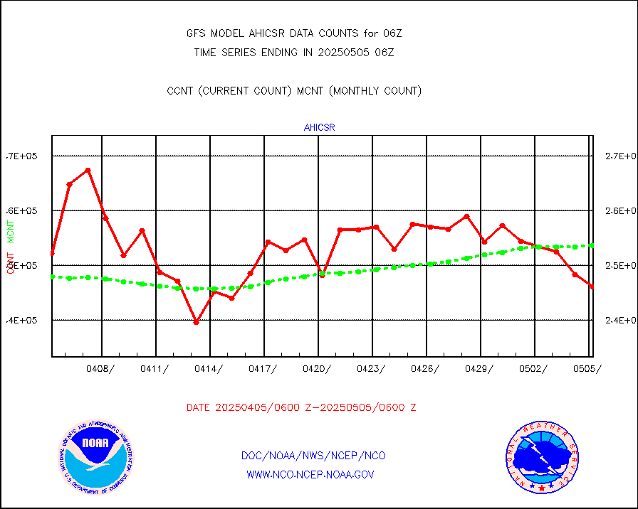
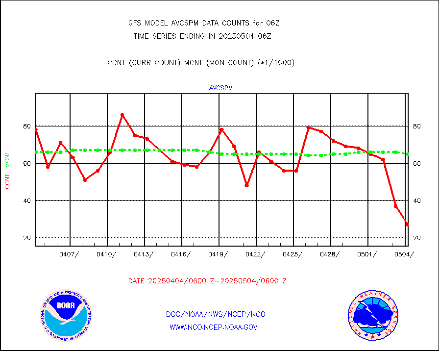
avcspm |
P.M.(N18-19) AVHRR GAC NCEP-proc clr & sea btemps |
4875378 |
6209243 |
78.5 % |
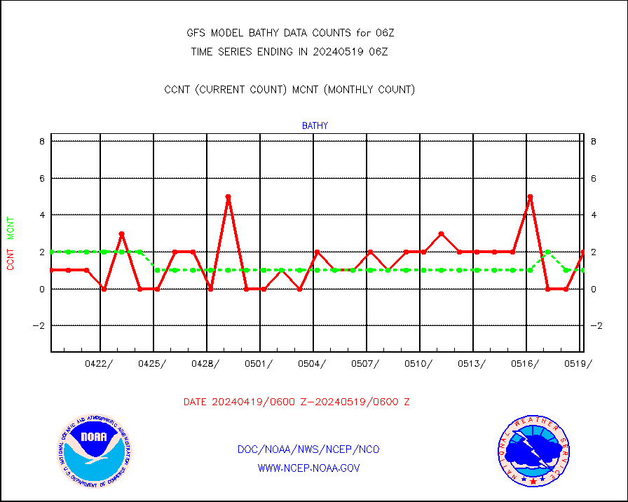
bathy |
eXpendable BathyThermograph, mooring (BATHY fmt) |
2 |
1 |
200.0 % |
camdar |
Canadian AMDAR aircraft data (decoded from BUFR) |
0 |
3 |
0.0 % |
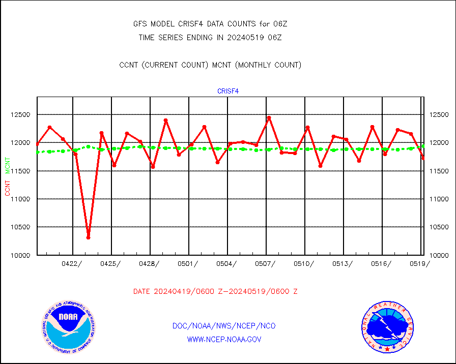
crisf4 |
NPP/NOAA-20 CrIS full spctrl radn (431 ch subset) |
1181556 |
1188774 |
99.4 % |
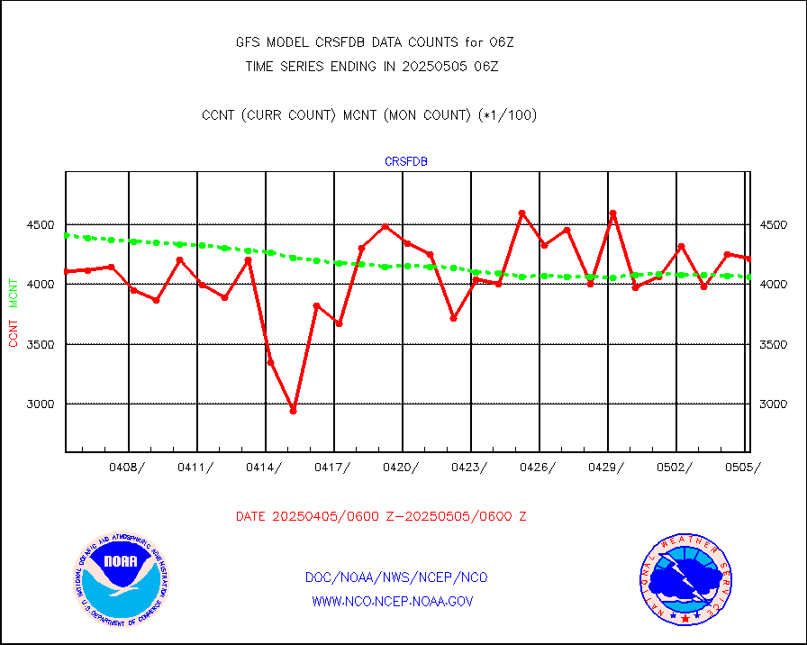
crsfdb |
NPP/NOAA-20 CrIS full spctrl radn dir brdcst SSEC |
612255 |
619753 |
98.8 % |
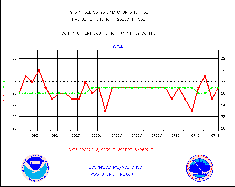
cstgd |
Coast Guard |
17 |
20 |
85.0 % |
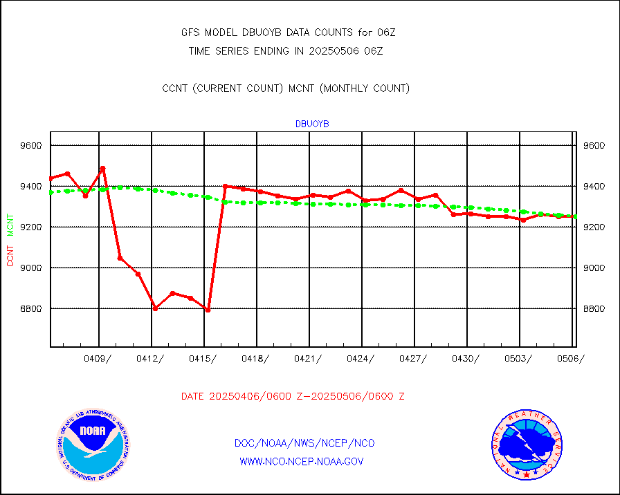
dbuoyb |
Drifting buoys (decoded from BUFR) |
8667 |
8421 |
102.9 % |
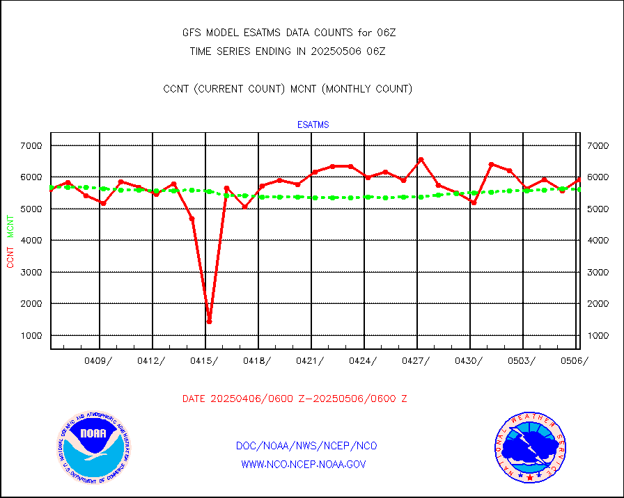
esatms |
NPP Adv. Tech. MW Sndr (ATMS) br. temps from RARS |
588386 |
608598 |
96.7 % |
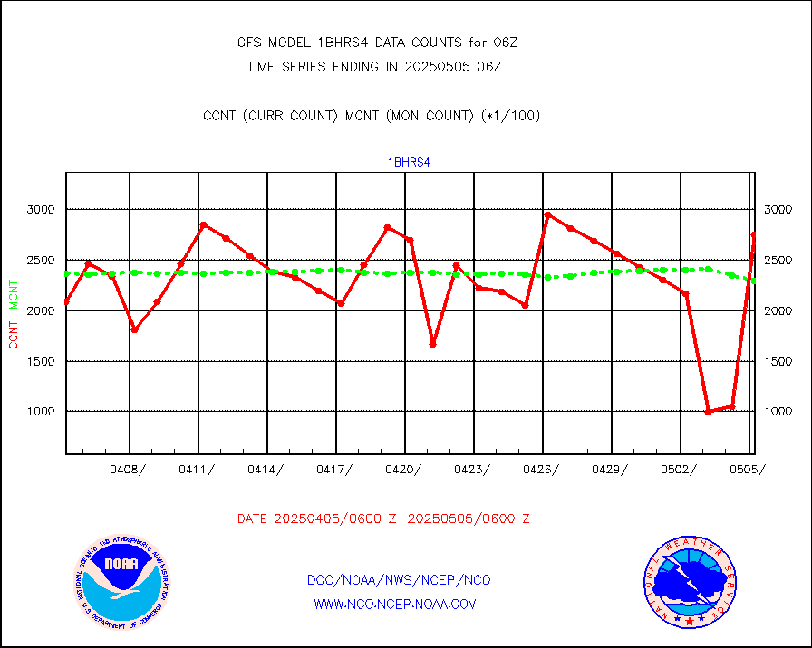
esiasi |
METOP 1-2 IASI 1C radiance data vbl chn from RARS |
207799 |
155326 |
133.8 % |
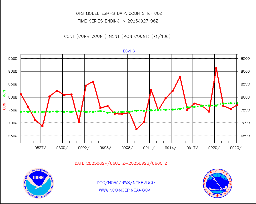
esmhs |
NOAA 18-19 & METOP 1-2 MHS proc. btemps from RARS |
1063059 |
1121930 |
94.8 % |
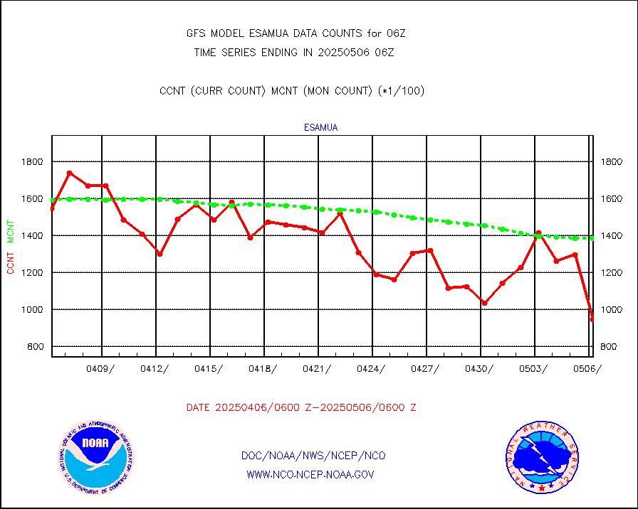
geoimr |
GOES/NESDIS (11x17 f-o-v) imager clear radiances |
0 |
0 |
n/a |
gmi1cr |
GPM GMI Level 1C-R brightness temperatures |
4652050 |
4576748 |
101.6 % |
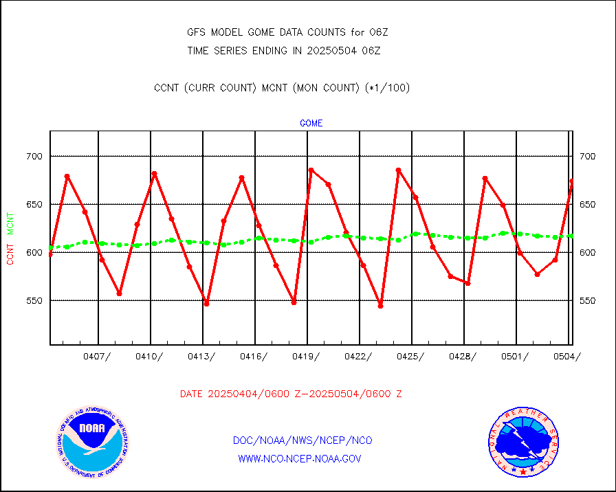
gnss |
Grnd-based Gbl Navigation Sat System (GNSS) data |
5795 |
5981 |
96.9 % |
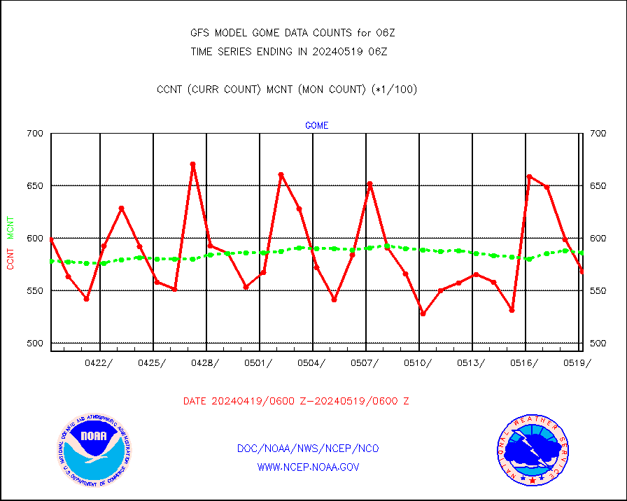
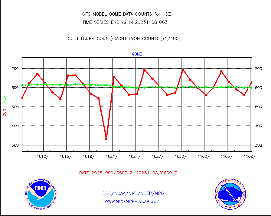
gome |
METOP 1-2 Global Ozone Monitoring Exp.-2 (GOME-2) |
56613 |
59078 |
95.8 % |
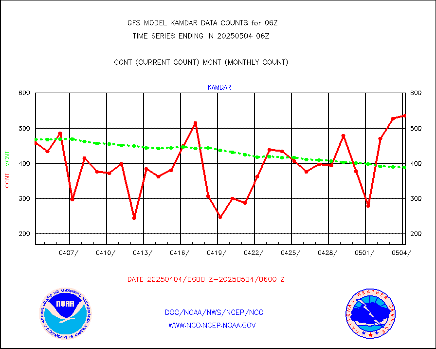
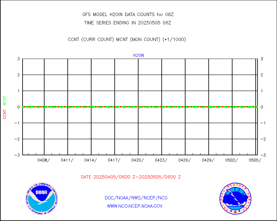
h20in |
INSAT/KALPANA India wvpr derived cloud motion |
0 |
0 |
n/a |
h20in2 |
INDIA SATWIND, INSAT WV channel |
65080 |
39643 |
164.2 % |
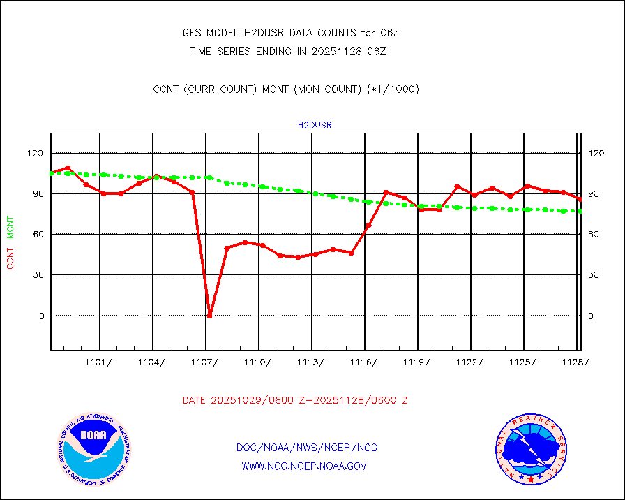
h2dusr |
GOES-16&up/NESDIS wv imgr/deep-lyr derivd cld mtn |
82516 |
94239 |
87.6 % |
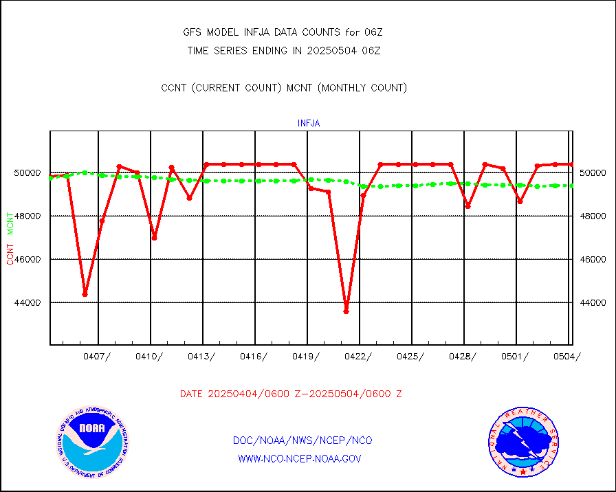
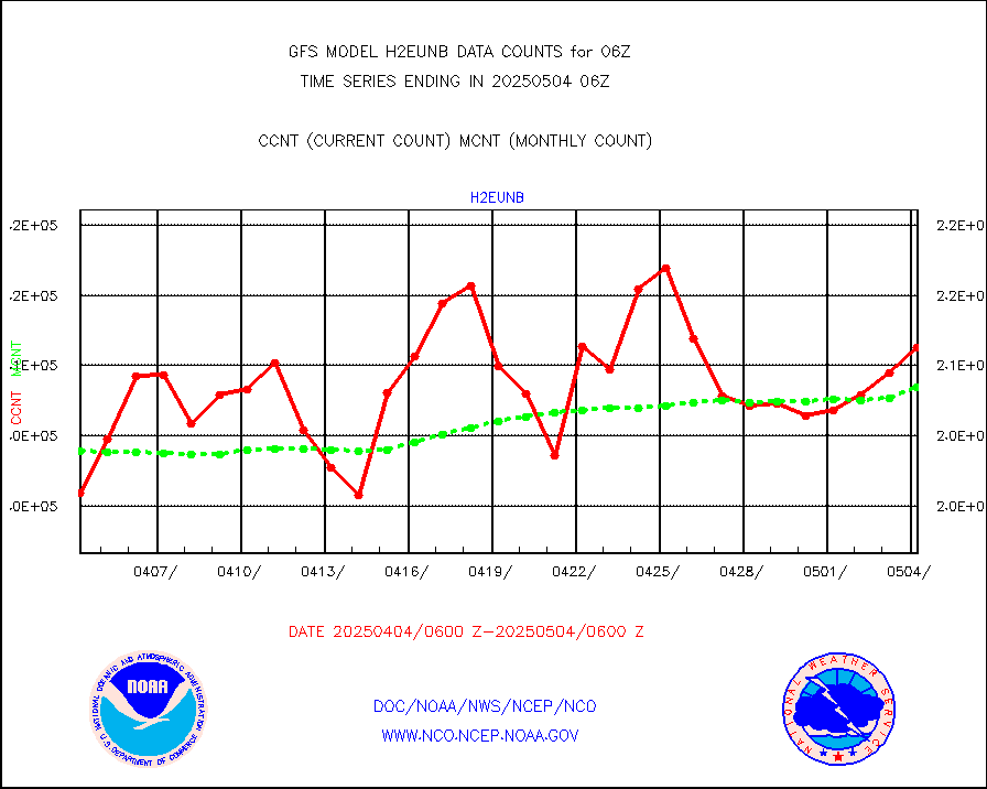
h2eunb |
METEOSAT/EUMETSAT wvpr imgr drv cld motion NBseq |
193669 |
203610 |
95.1 % |
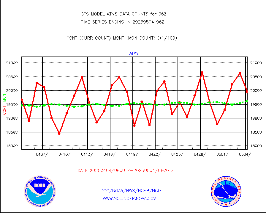
iasidb |
METOP 1-2 IASI 1C radiances-direct broadcast SSEC |
183311 |
192079 |
95.4 % |
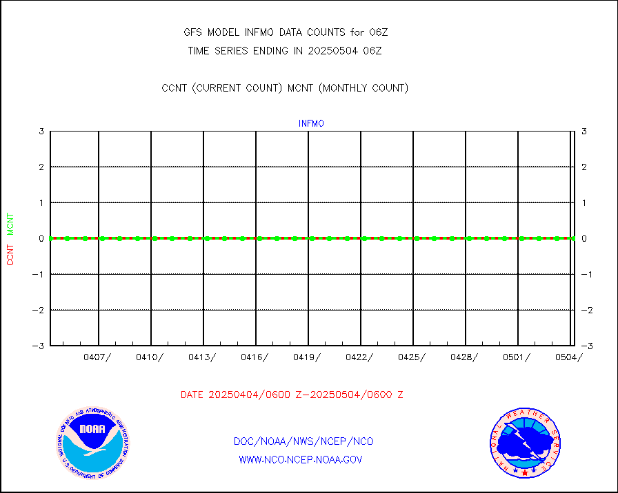
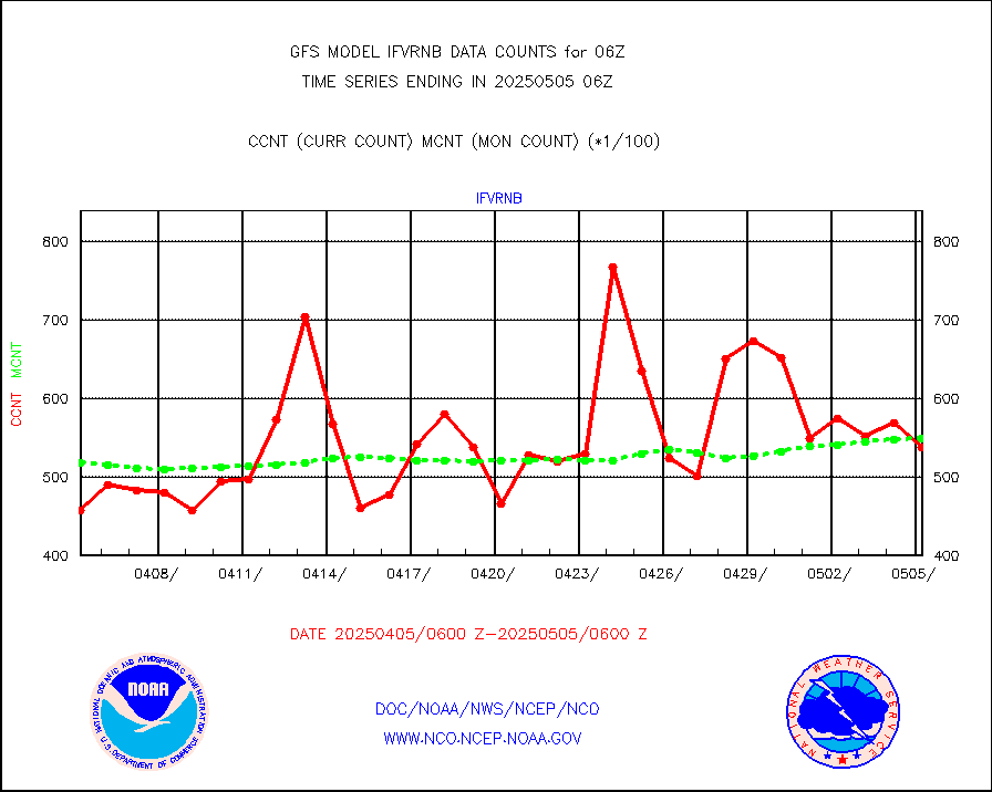
ifvrnb |
VIIRS (NPP/NOAA-20) ir lg-wv drv cloud motion(NB) |
51446 |
51315 |
100.3 % |
infav |
AVHRR (NOAA/METOP) ir lg-wave derived cld motion |
0 |
0 |
n/a |
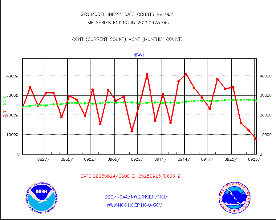
infav1 |
AVHRR (METOP) ir lg-wave derived cld motion |
19383 |
19651 |
98.6 % |
infin |
INSAT/KALPANA India ir lg-wave derived cld motion |
0 |
0 |
n/a |
infin2 |
INDIA SATWIND, INSAT IR channel |
66788 |
40536 |
164.8 % |
kamdar |
Korean AMDAR aircraft data (decoded from BUFR) |
352 |
443 |
79.5 % |
mbuoyb |
Moored buoys (decoded from BUFR) |
5707 |
5200 |
109.7 % |
nxrdw2 |
NEXRAD Vel Azm Dsp(VAD) winds via Level 2 decoder |
4061 |
4172 |
97.3 % |
ompslp |
OMPS Limb Profiler ozone data (NPP) |
903 |
782 |
115.5 % |
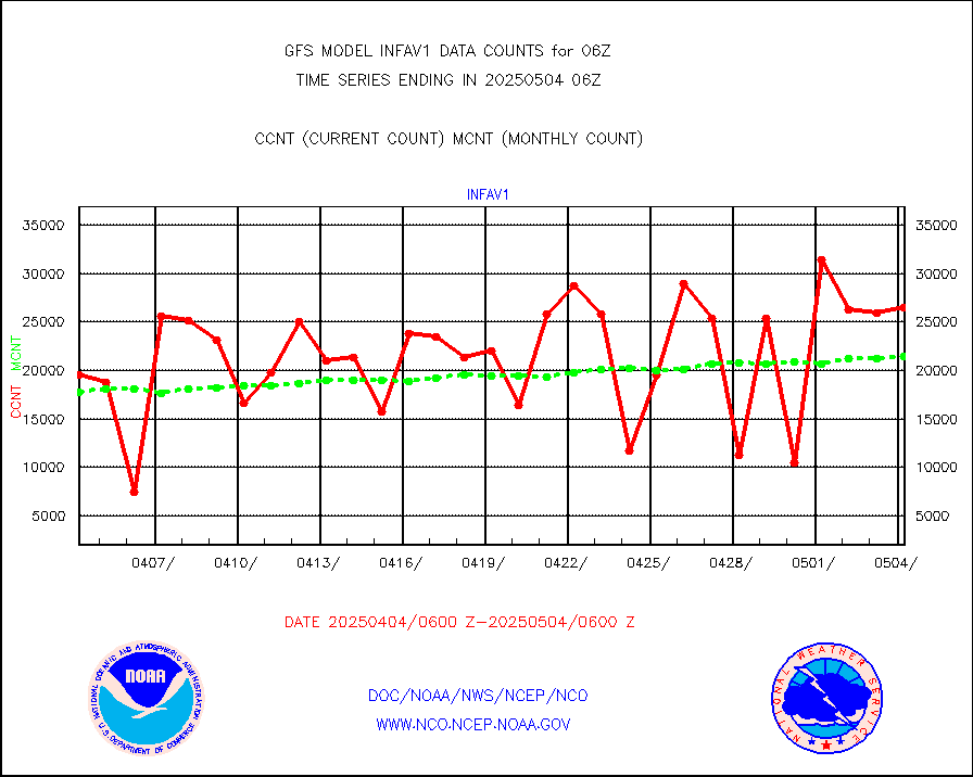
ompsn8 |
OMPS nadir profile ozone (Version 8 BUFR) |
2997 |
2867 |
104.5 % |
ompst8 |
OMPS total column ozone (Version 8 BUFR) |
1888351 |
1755214 |
107.6 % |
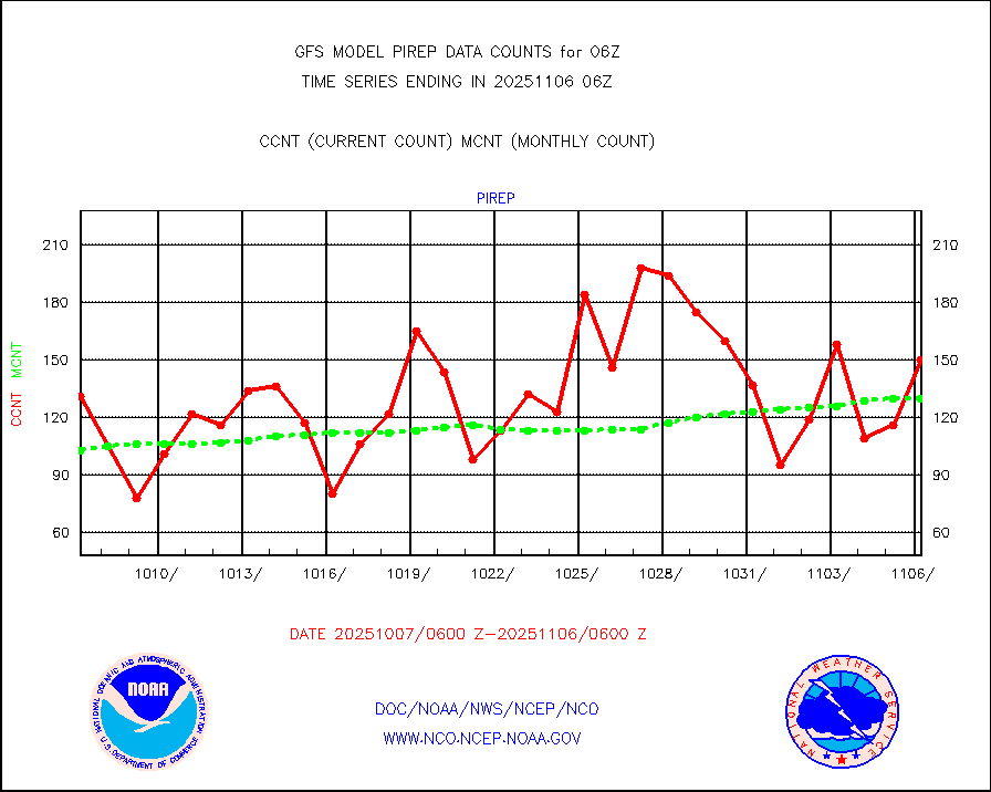
pirep |
Manual PIREP aircraft data (dcded from AIREP fmt) |
164 |
121 |
135.5 % |
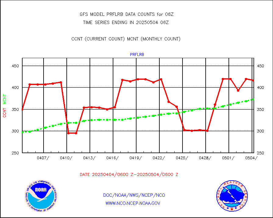
prflrb |
Multi-Agency Profiler (MAP) and SODAR winds |
366 |
313 |
116.9 % |
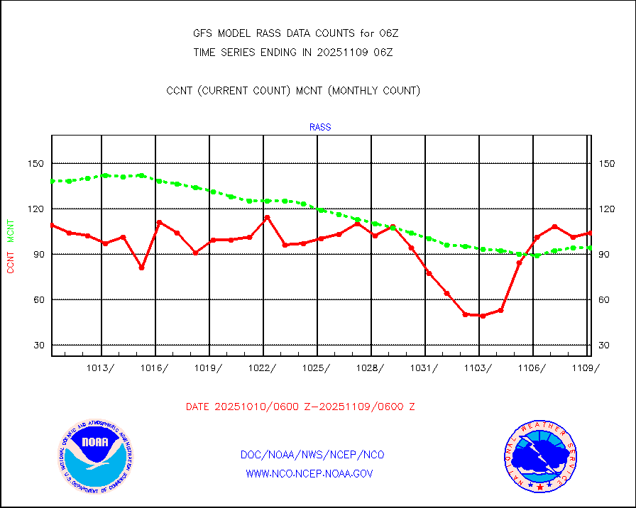
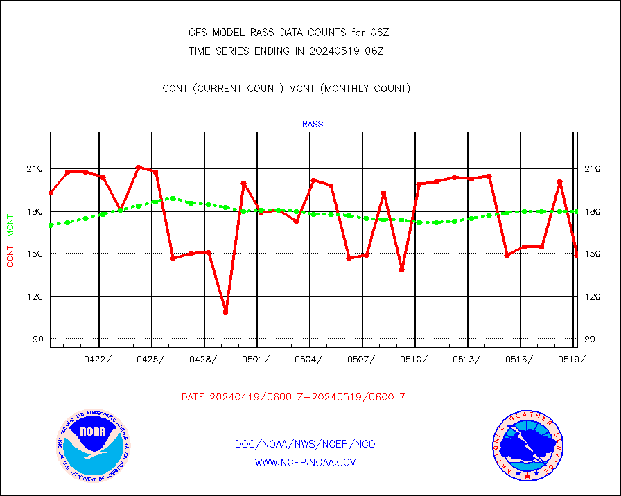
rass |
RASS temperatures (NOAA and Multi-Agency) |
139 |
174 |
79.9 % |
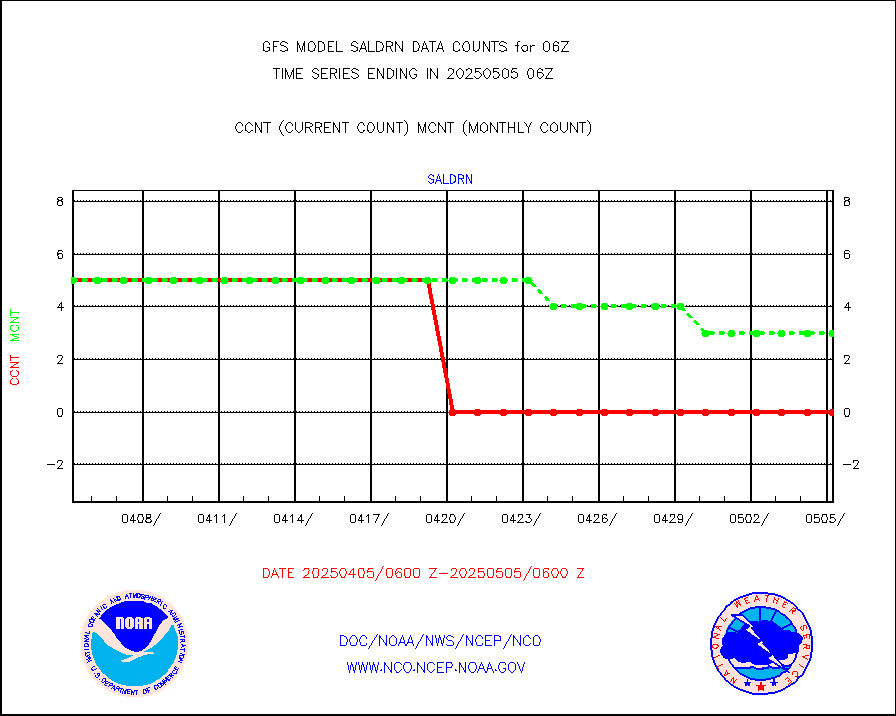
saldrn |
Surface Marine Saildrone (decoded from BUFR) |
5 |
5 |
100.0 % |
saphir |
Megha-Tropiques SAPHIR L1A2 brightness temps |
0 |
0 |
n/a |
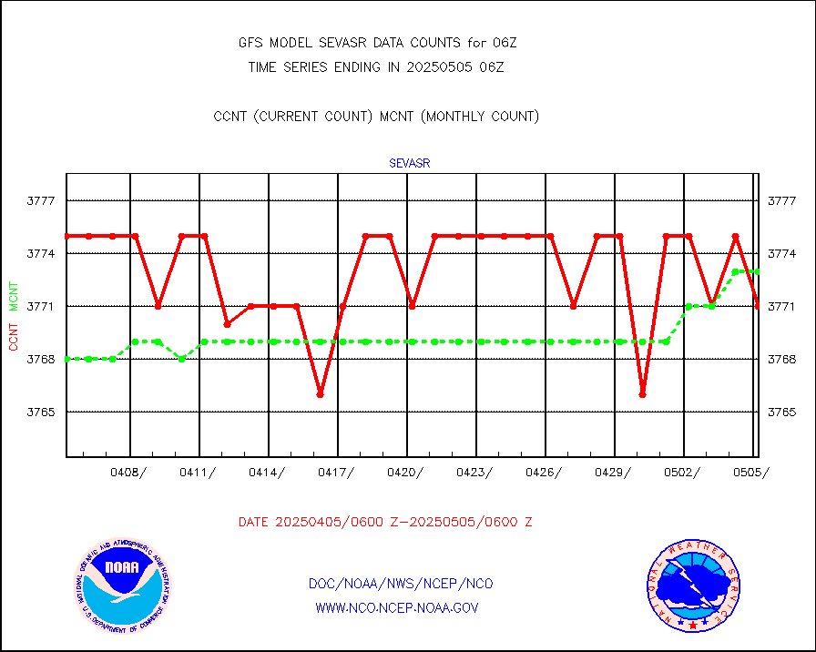
sevasr |
METEOSAT-10 2nd Gen SEVIRI All Sky Radiance(proc) |
377560 |
372214 |
101.4 % |
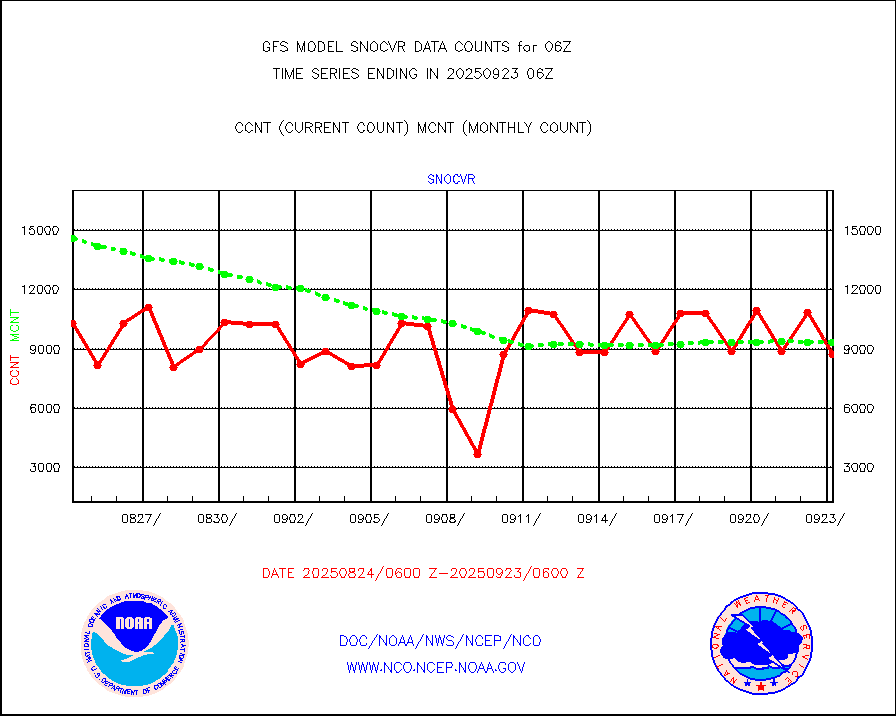
snocvr |
NOW COVER, DEPTH/DENSITY AND WATER EQUIVALENT |
22566 |
21892 |
103.1 % |
ssmisu |
DMSP SSM/IS 1C radiance data (Unified Pre-Proc.) |
674215 |
957622 |
70.4 % |
sstvcw |
NPP/NOAA-20 VIIRS SST - CLEAR & OVER WATER |
9999999 |
9333334 |
107.1 % |
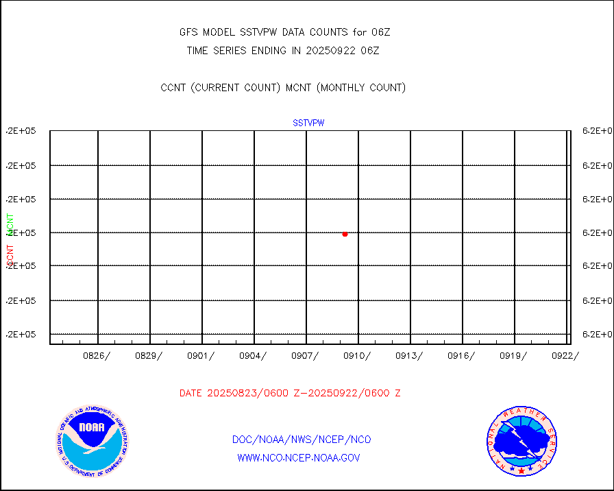
sstvpw |
NPP/NOAA-20 VIIRS SST - PROBABLY CLR & OVER WATER |
9999999 |
9999999 |
100.0 % |
subpfl |
Sub-surface float and glider profile (BUFR) |
65 |
61 |
106.6 % |
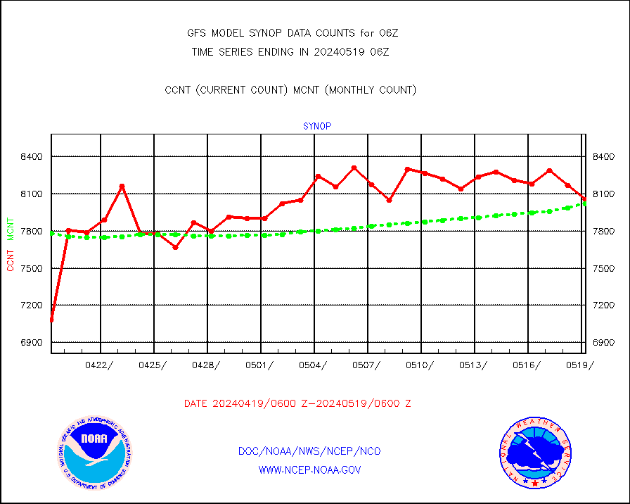
synop |
Synoptic - fixed manual and automatic |
8298 |
7859 |
105.6 % |
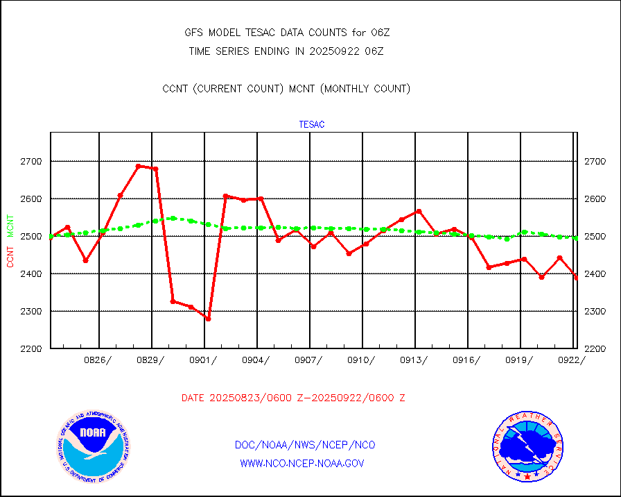
tesac |
CTD probe, Argo prflng float, mooring (TESAC fmt) |
2273 |
1981 |
114.7 % |
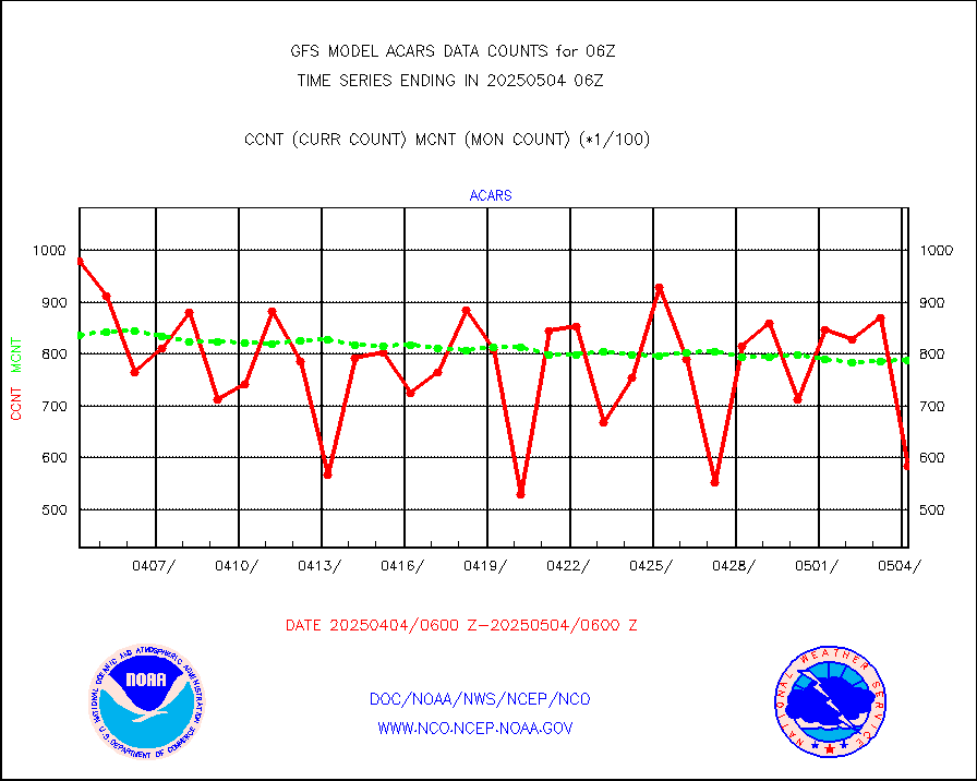
tmdara |
TAMDAR aircft data-all types(from Panasonic,BUFR) |
2453 |
2485 |
98.7 % |
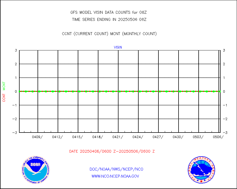
visin |
INSAT/KALPANA India visible derived cloud motion |
0 |
0 |
n/a |
visin2 |
INDIA SATWIND, INSAT VIS channel |
6539 |
3786 |
172.7 % |
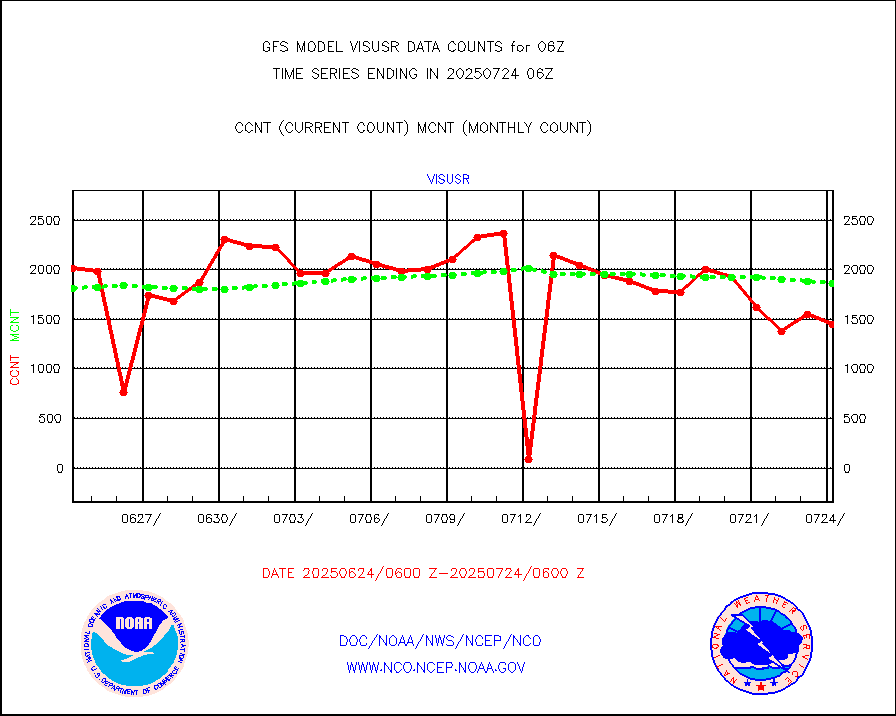
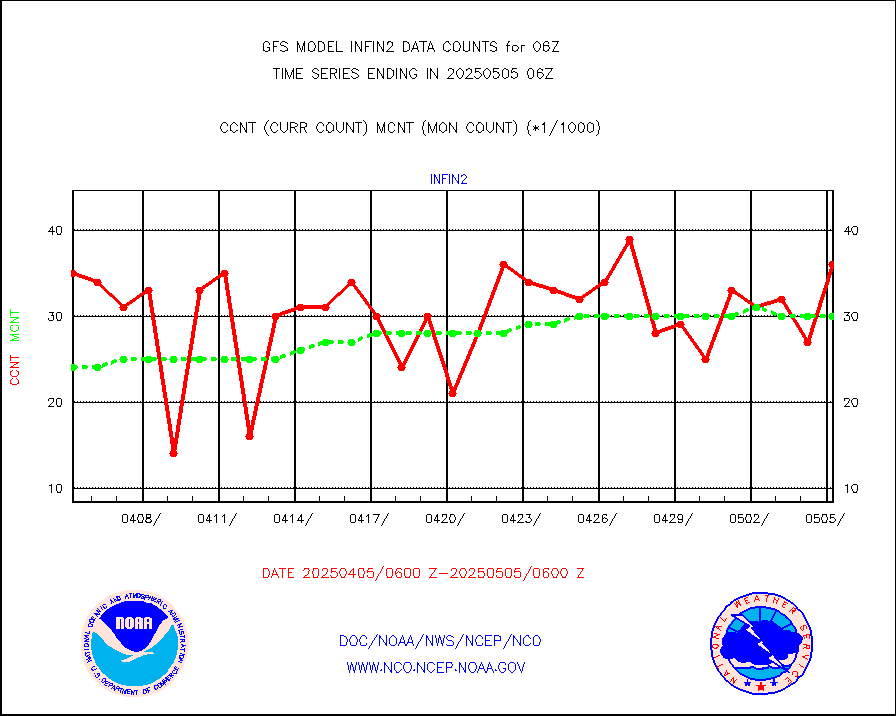
visusr |
GOES-16&up/NESDIS visible derived cloud motion |
171216 |
149025 |
114.9 % |


