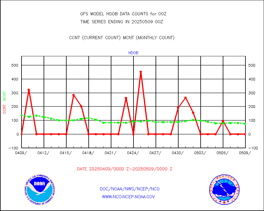
| Critical Data with Normal Counts |
|---|
| Type | Description | Hourly Count | Monthly Average | Percent (%) of Monthly Mean |
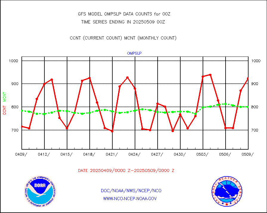
1bamua |
NOAA 15-19 & METOP 1-2 AMSU-A NCEP-proc. br.temps |
274222 |
271313 |
101.1 % |
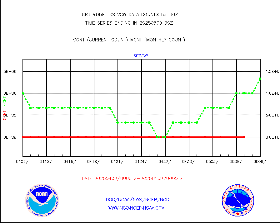
1bhrs4 |
NOAA 18-19 & METOP 1-2 HIRS-4 NCEP-proc. br.temps |
255098 |
231763 |
110.1 % |
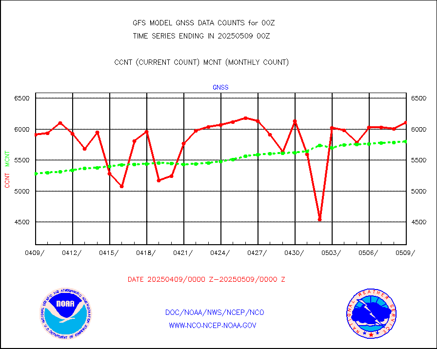
1bmhs |
NOAA 18-19 & METOP 1-2 MHS NCEP-proces. br. temps |
1675587 |
1560682 |
107.4 % |
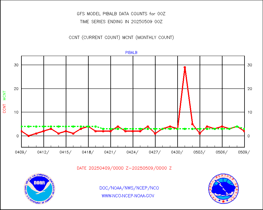
acars |
MDCRS ACARS acft data from ARINC(dcded from BUFR) |
139131 |
146847 |
94.7 % |
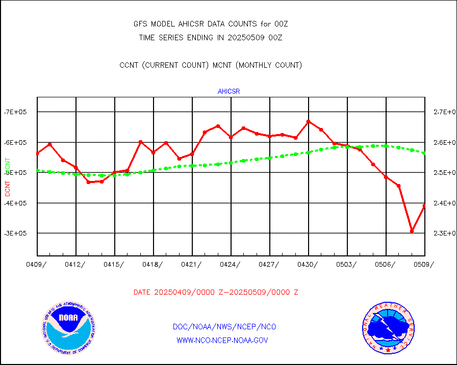
ahicsr |
Himawari Clear Sky Radiance |
262218 |
262584 |
99.9 % |
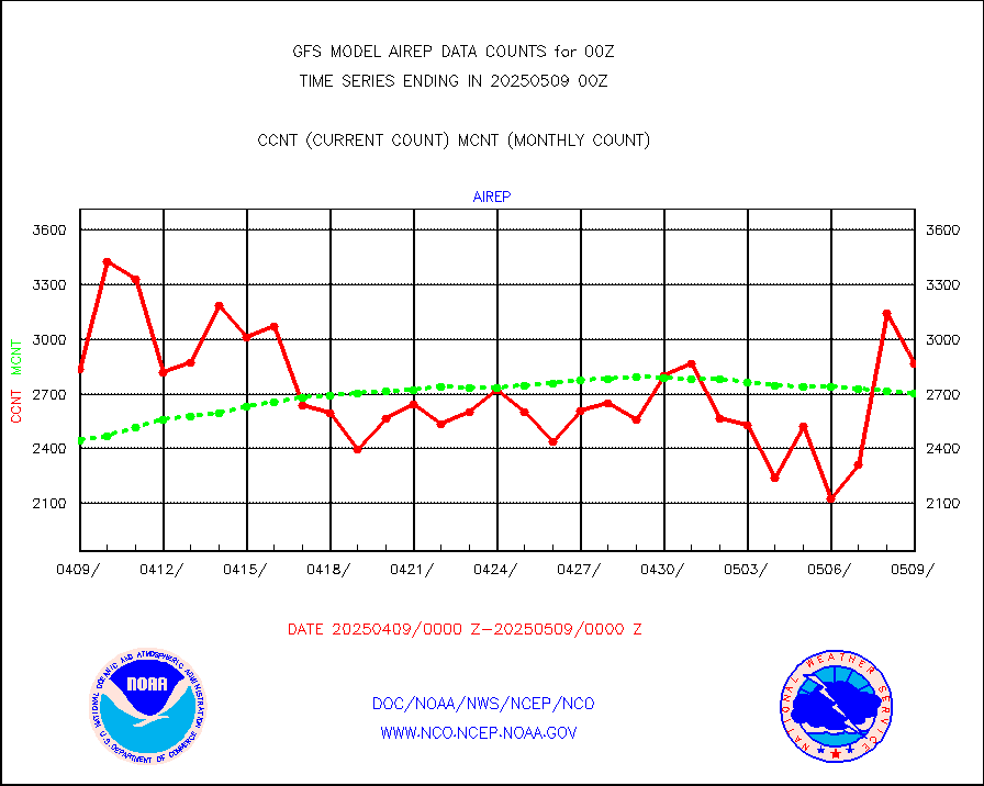
airep |
Manual AIREP aircraft data (dcded from AIREP fmt) |
5009 |
4498 |
111.4 % |
airsev |
AQUA AIRS/AMSU-A/HSB brightness temps- every FOV |
0 |
0 |
n/a |
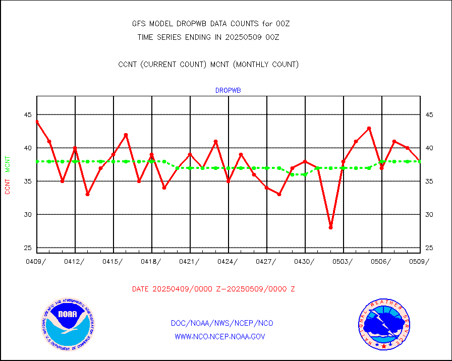
amdar |
AMDAR aircraft data (decoded from AMDAR format) |
3681 |
3528 |
104.3 % |
amdarb |
AMDAR aircraft data (decoded from BUFR) |
7540 |
7229 |
104.3 % |
ascat |
METOP 1-2 ASCAT products |
355152 |
346606 |
102.5 % |
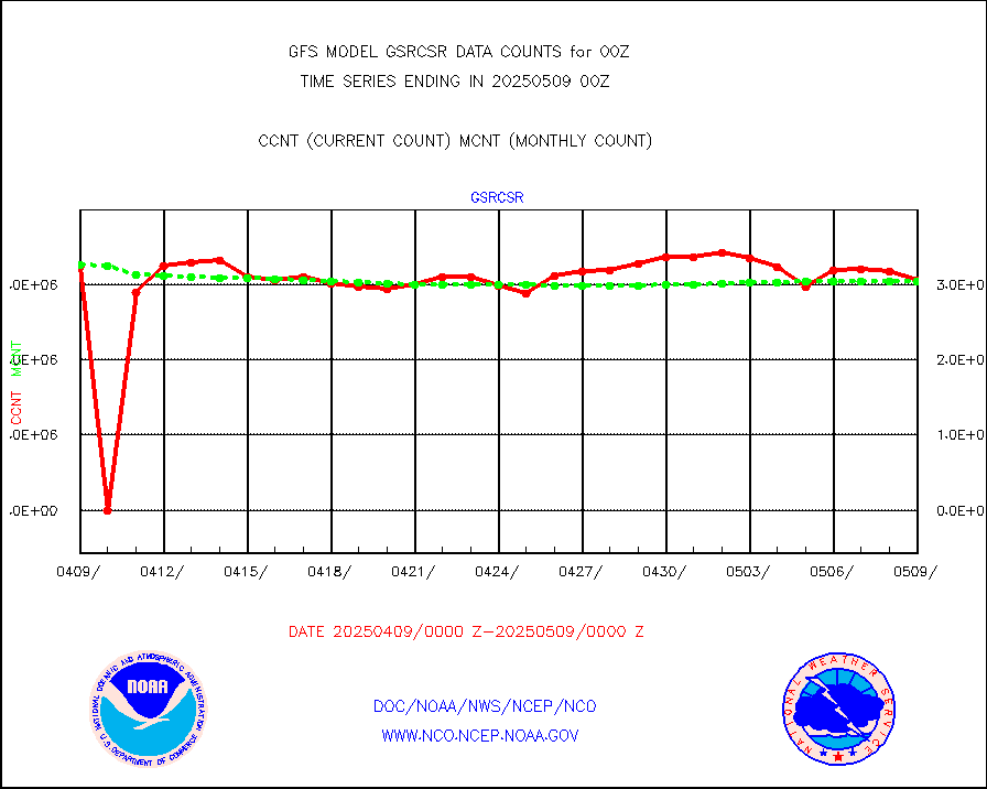
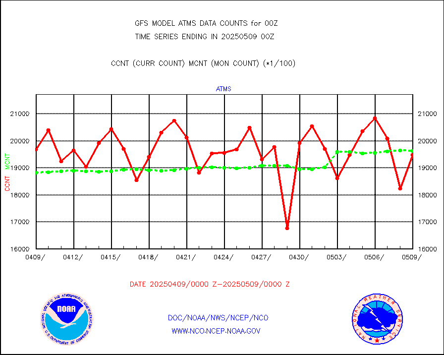
atms |
NPP/NOAA-20 ATMS brightness temperatures |
2011392 |
1894626 |
106.2 % |
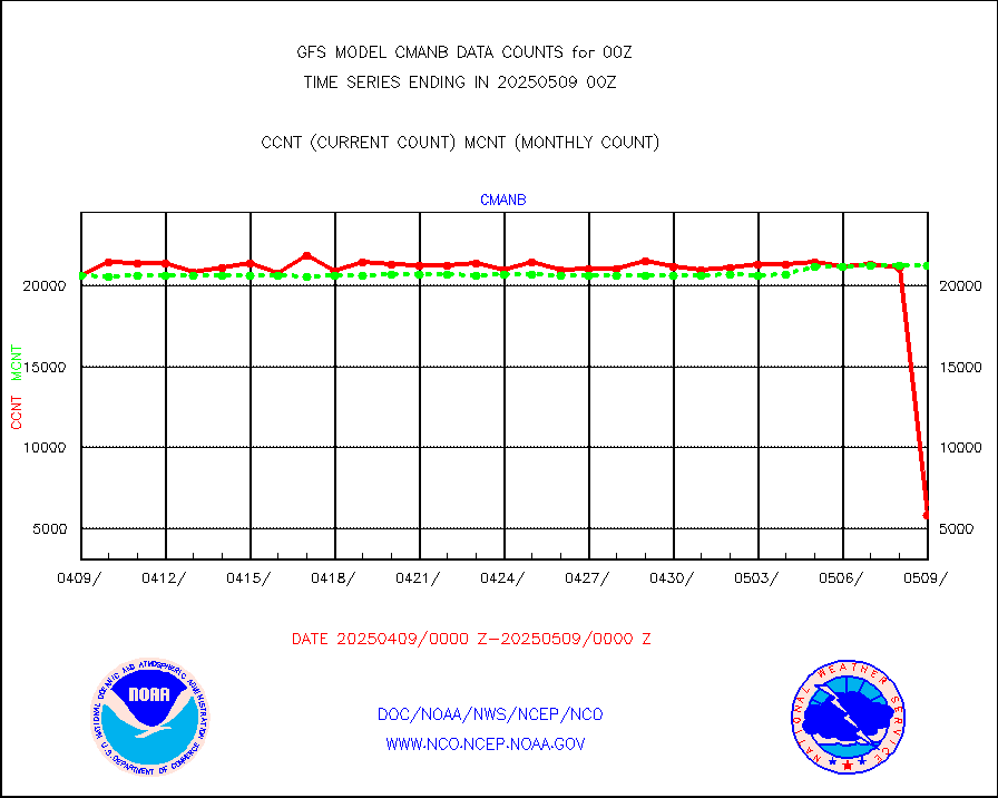
cmanb |
Surface Marine CMAN rpts decoded from BUFR format |
21506 |
21194 |
101.5 % |
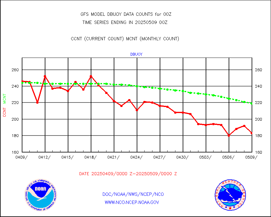
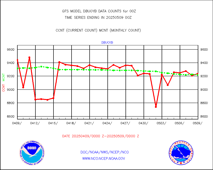
dbuoy |
Buoys decoded from FM-18 fmt (moored or drifting) |
283 |
283 |
100.0 % |
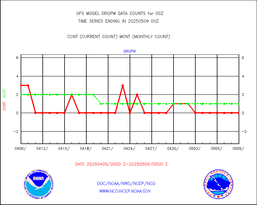
dropw |
Dropwinsonde (from TEMP DROP) |
0 |
0 |
n/a |
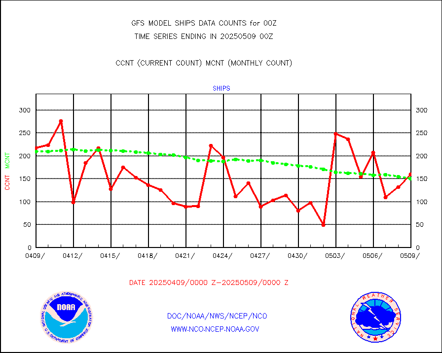
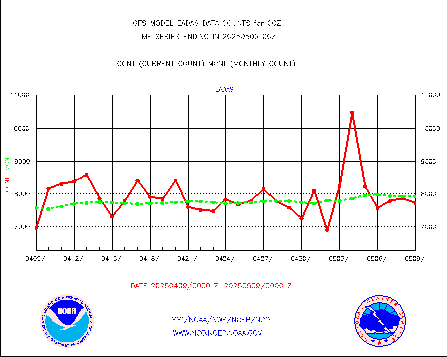
eadas |
E-AMDAR (European AMDAR acft decoded from BUFR) |
6815 |
5802 |
117.5 % |
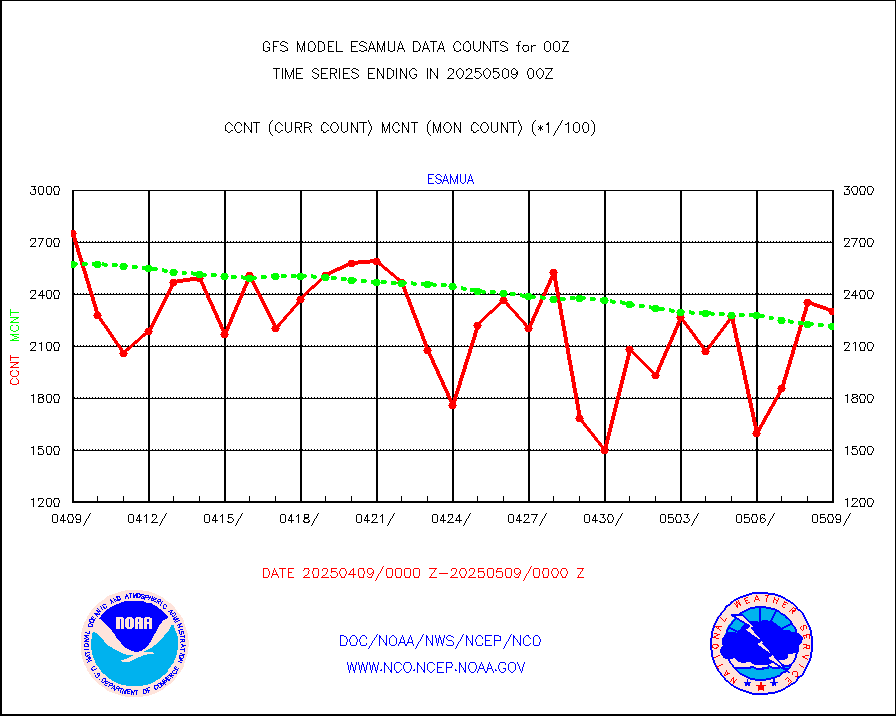
esamua |
NOAA 15-19 & METOP 1-2 AMSU-A proc btmps frm RARS |
306385 |
274407 |
111.7 % |
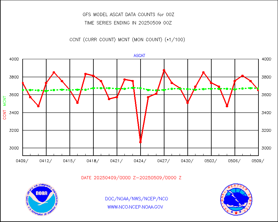
eshrs3 |
NOAA 15-19 & METOP 1-2 HIRS-3/4 pr btmps frm RARS |
704196 |
631609 |
111.5 % |
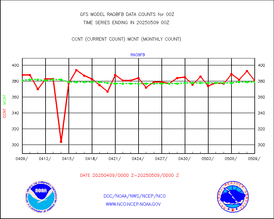
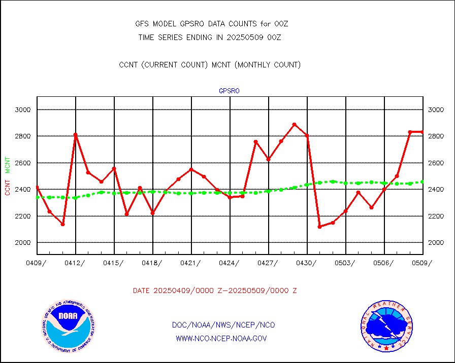
gpsro |
GPS radio occultation data |
2062 |
2306 |
89.4 % |
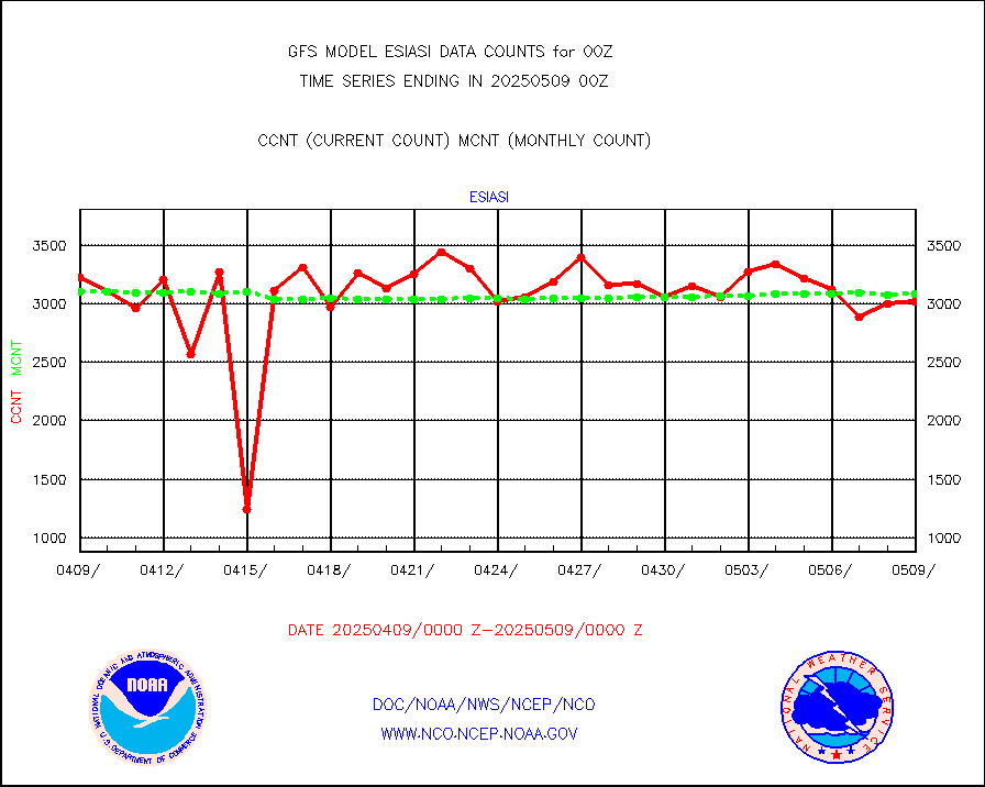
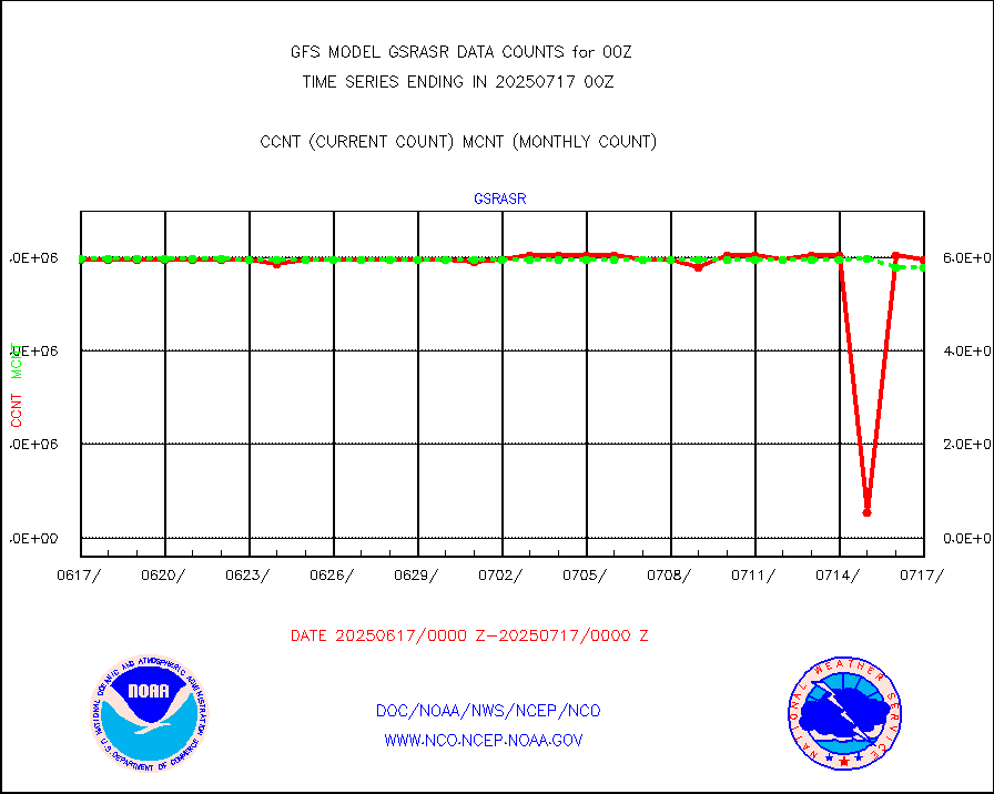
gsrasr |
GOES-16/17 All Sky Radiances (proc.) |
6037976 |
5860426 |
103.0 % |
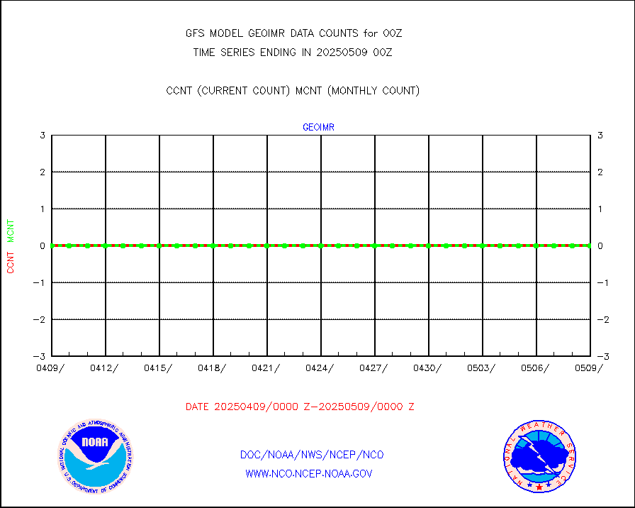
gsrcsr |
GOES-16/17 Clear Sky Radiances (proc.) |
2817033 |
2934421 |
96.0 % |
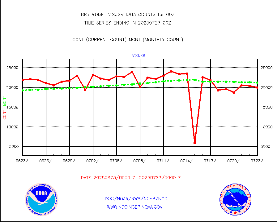
h20ja |
MTSAT/JMA water vapor imager derived cloud motion |
57867 |
56112 |
103.1 % |
h20mo |
MODIS (AQUA/TERRA) wvpr imager derived cld motion |
0 |
0 |
n/a |
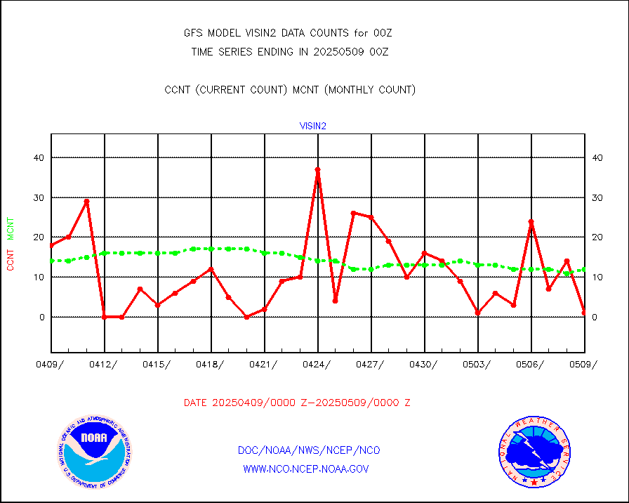
h2tusr |
GOES-16&up/NESDIS wv imgr/cld-top derived cld mtn |
171201 |
170892 |
100.2 % |
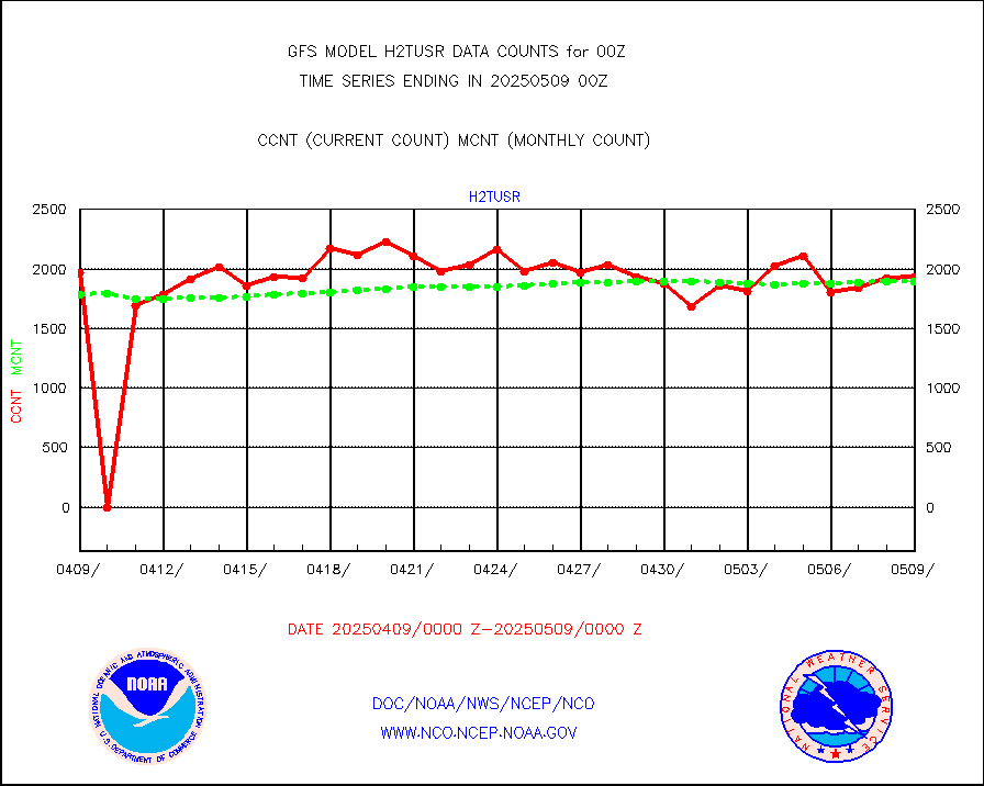
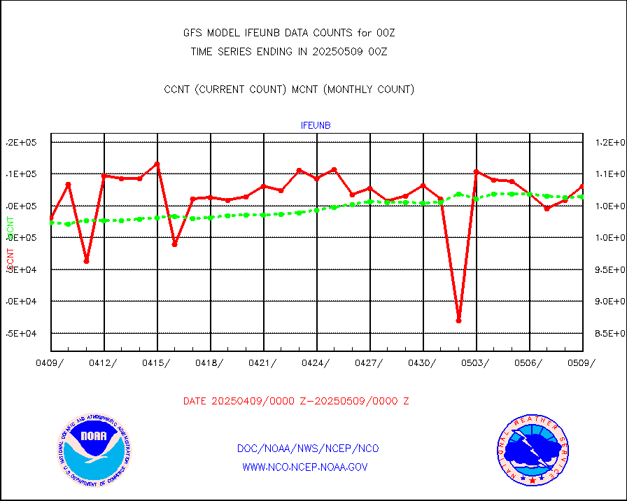
ifeunb |
METEOSAT/EUMETSAT ir lg-wave drv cld motion NBseq |
105567 |
106740 |
98.9 % |
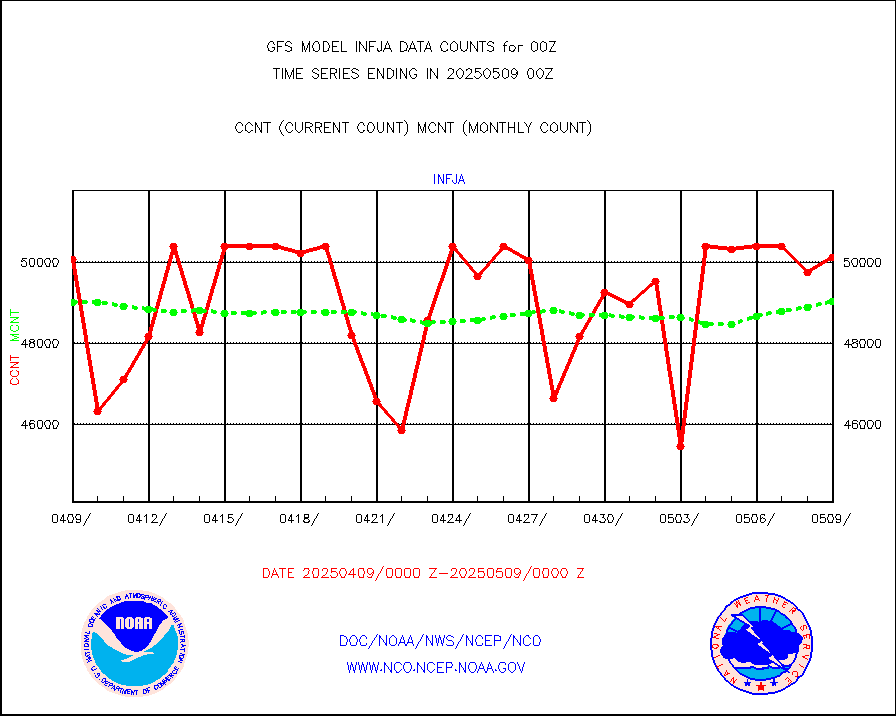
infja |
MTSAT/JMA infrared long-wave derived cloud motion |
47971 |
47678 |
100.6 % |
infmo |
MODIS (AQUA/TERRA) ir l-wave derived cloud motion |
0 |
0 |
n/a |
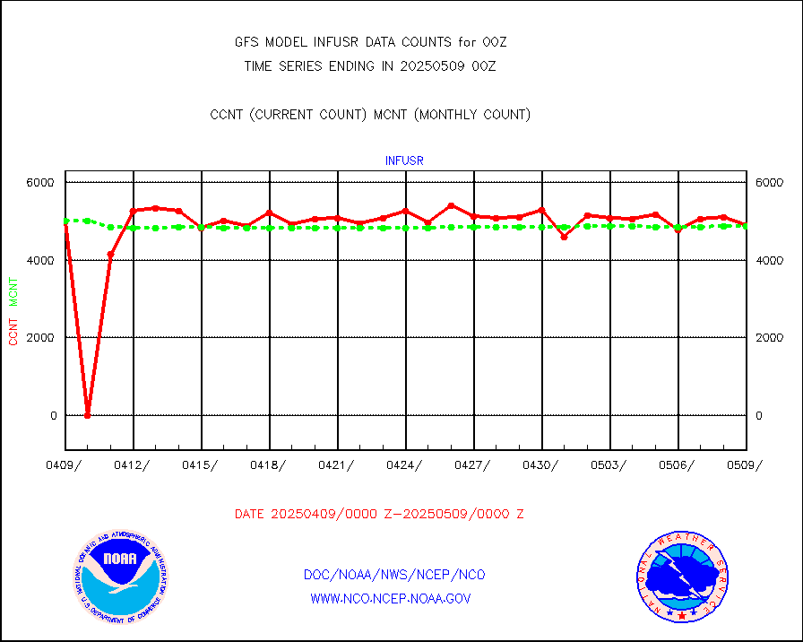
infusr |
GOES-16&up/NESDIS ir long-wave derived cld motion |
462655 |
477194 |
97.0 % |
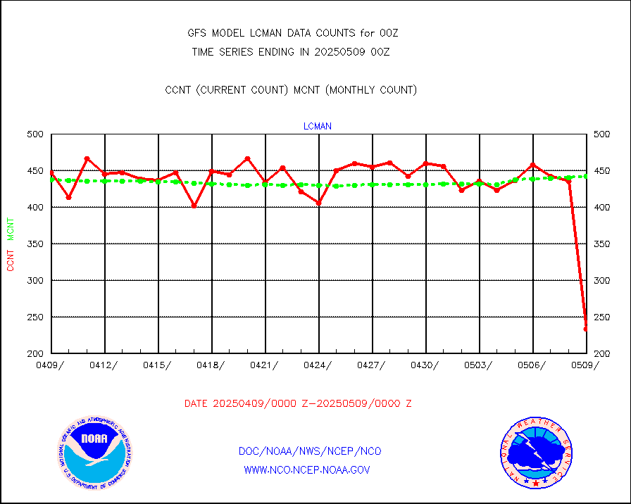
lcman |
Land-based CMAN stations decoded from CMAN format |
525 |
525 |
100.0 % |
leogeo |
LEO-GEO satellite AMVs from UWisc. |
16879 |
14348 |
117.6 % |
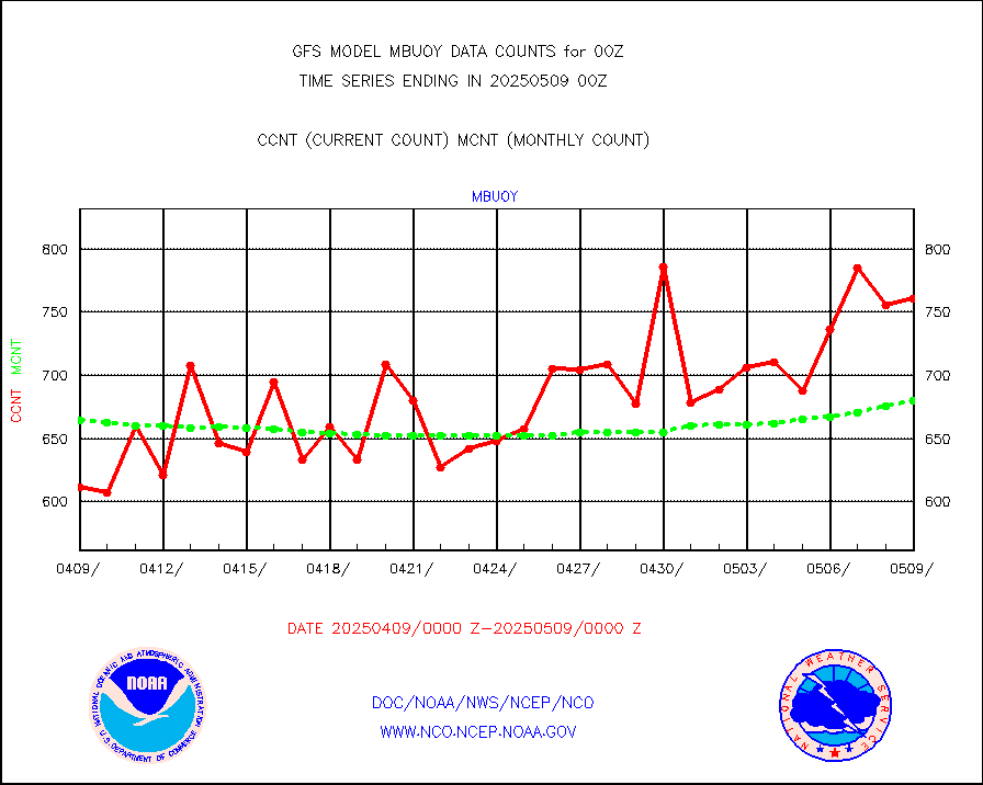
mbuoy |
Buoys decoded from FM-13 format (moored) |
787 |
753 |
104.5 % |
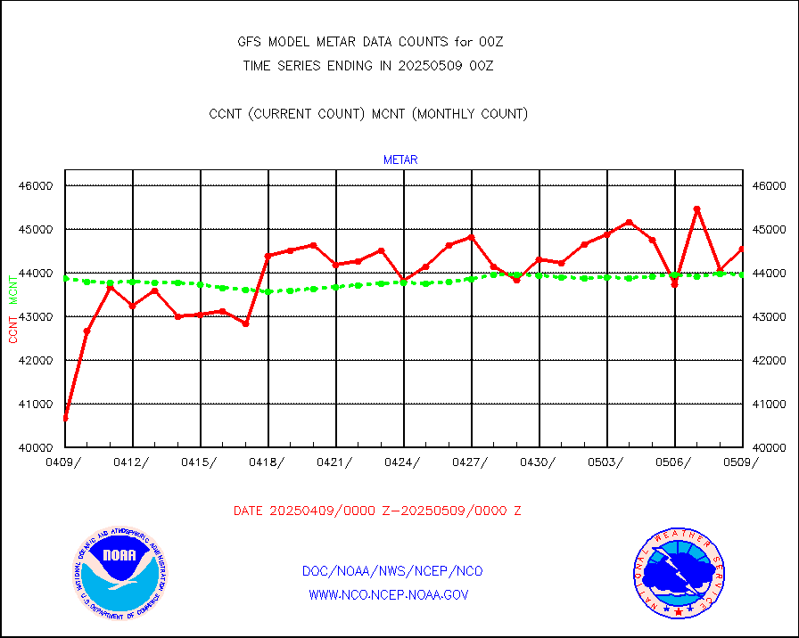
metar |
Aviation - METAR |
42408 |
43829 |
96.8 % |
mtiasi |
METOP 1-2 IASI 1C radiance data (varbl. channels) |
501980 |
460048 |
109.1 % |
nxrdw |
NEXRAD Vel Azm Dsp(VAD) winds via radar coded msg |
0 |
0 |
n/a |
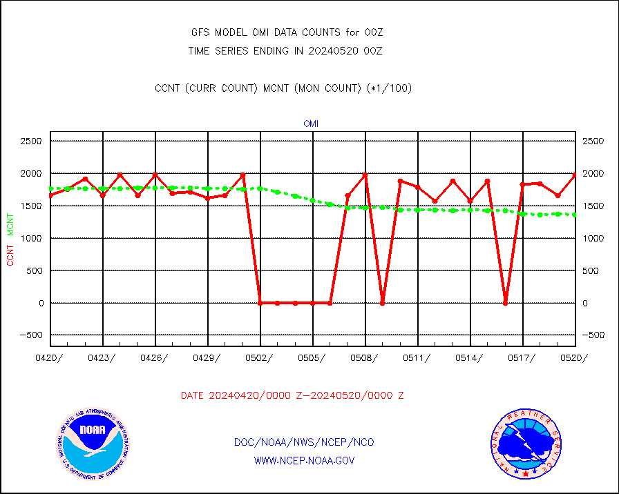
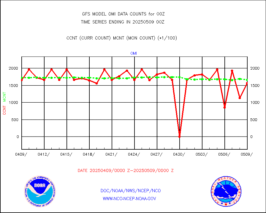
omi |
Aura Ozone Monitoring Instrument (OMI) data |
197220 |
135785 |
145.2 % |
osbuv8 |
NOAA 16-19 Solar Backscatter UV-2 rad frm V8 BUFR |
0 |
0 |
n/a |
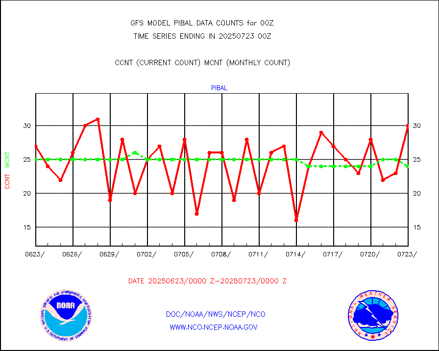
pibal |
PIBAL (from PILOT, PILOT SHIP, PILOT MOBIL) |
57 |
61 |
93.4 % |
prflrp |
Profilr winds from PIBAL (PILOT,PILOT SHIP/MOBIL) |
0 |
0 |
n/a |
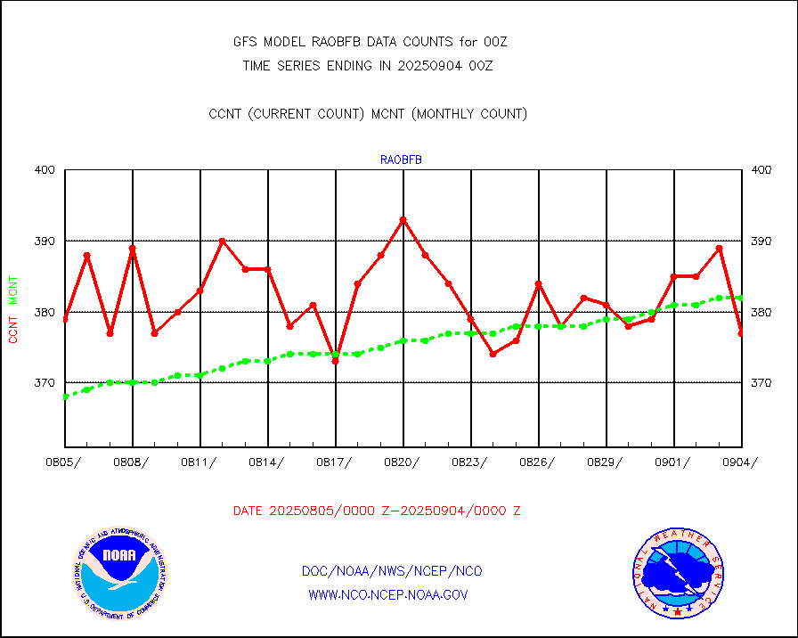
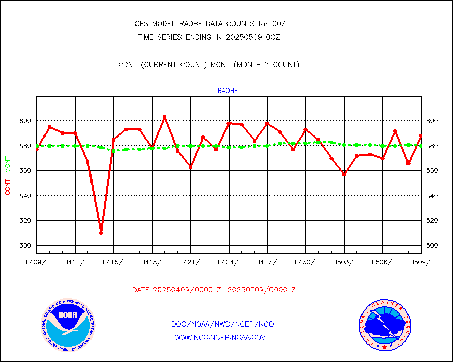
raobf |
Rawinsonde - fixed land (from TEMP or PILOT) |
592 |
595 |
99.5 % |
raobm |
Rawinsonde - mobile land (from TEMP/PILOT MOBIL) |
0 |
0 |
n/a |
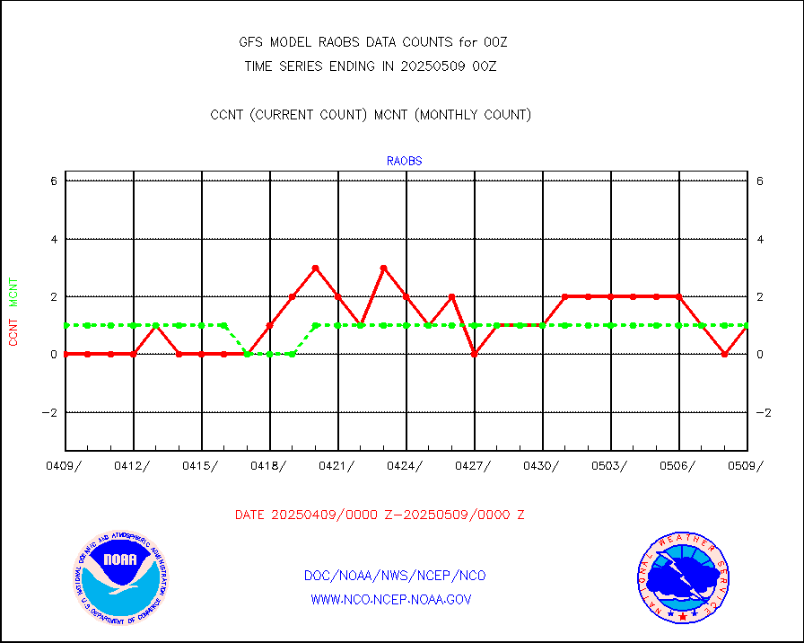
raobs |
Rawinsonde - ship (from TEMP SHIP, PILOT SHIP) |
0 |
1 |
0.0 % |
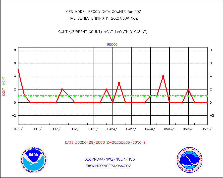
recco |
Flight level reconnaissance aircraft data |
0 |
2 |
0.0 % |
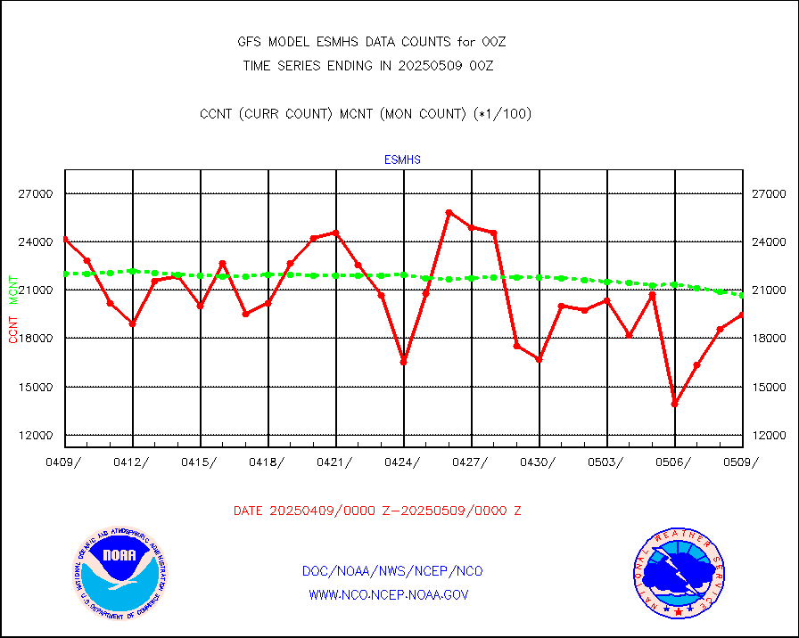
sevcsr |
METEOSAT-10 2nd Gen SEVIRI Clr Sky Radiance(proc) |
0 |
0 |
n/a |
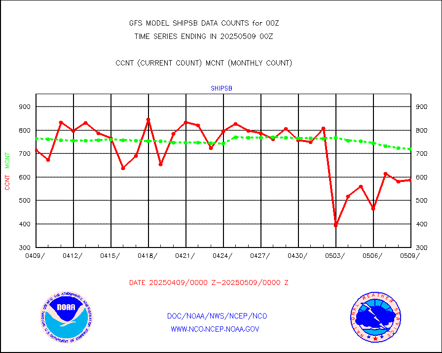
shipsb |
Ship - manual and automatic, restricted (BUFR) |
735 |
650 |
113.1 % |
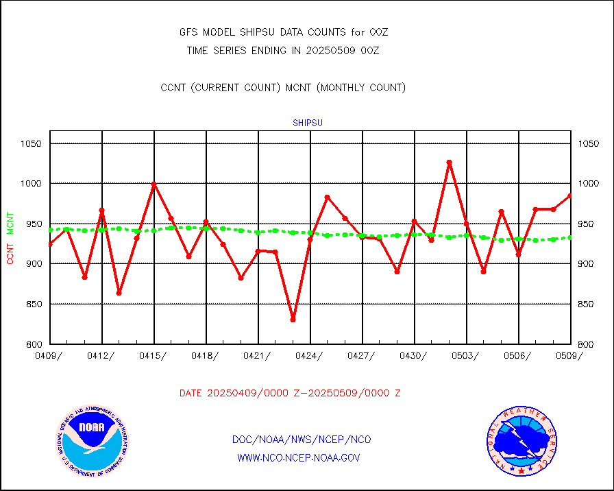
shipsu |
Ship - manual and automatic, unrestricted |
716 |
692 |
103.5 % |
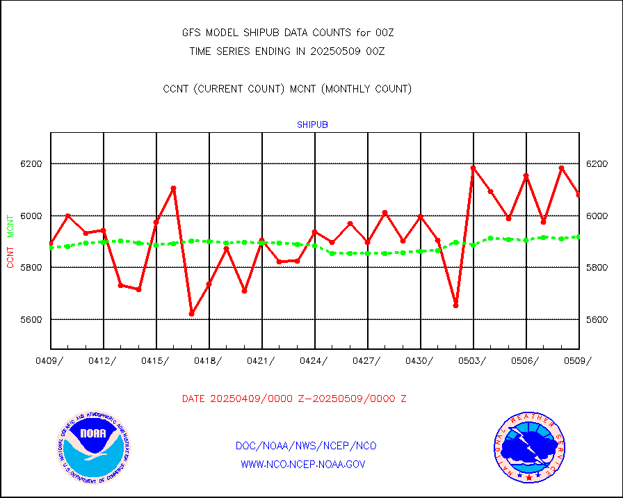
shipub |
Ship - manual and automatic, unrestricted (BUFR) |
6065 |
5848 |
103.7 % |
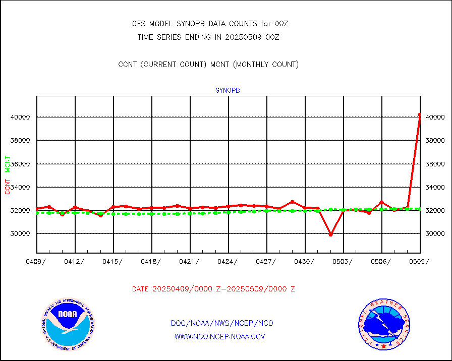
synopb |
Synoptic - fixed manual & auto (decoded fr BUFR) |
31112 |
31565 |
98.6 % |
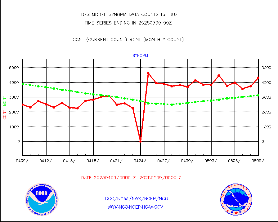
synopm |
Synoptic - mobile manual and automatic |
5615 |
5803 |
96.8 % |
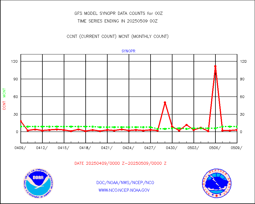
synopr |
Synoptic - restricted (WMO Res 40) manual & auto. |
1 |
5 |
20.0 % |
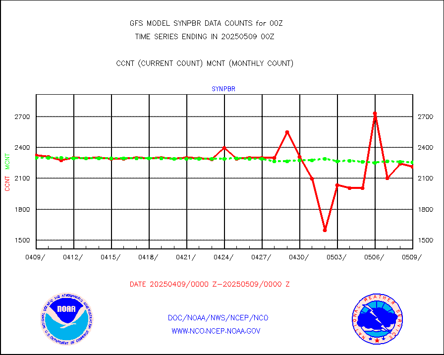
synpbr |
Synoptic - restricted (WMO Res 40)(decoded BUFR) |
2301 |
2297 |
100.2 % |
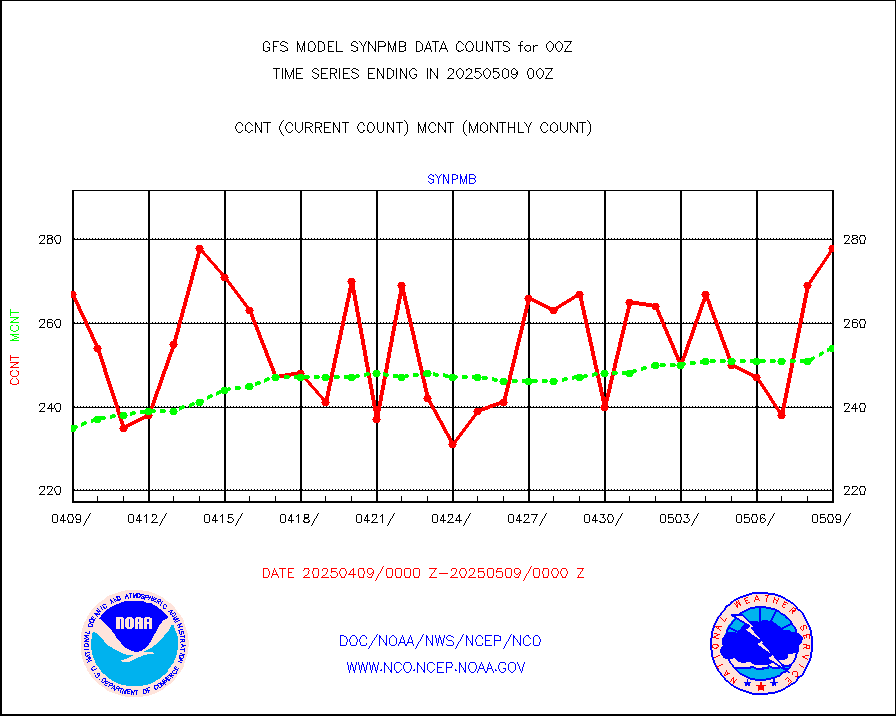
synpmb |
Synoptic - mobile manual & auto (decoded fr BUFR) |
97 |
83 |
116.9 % |
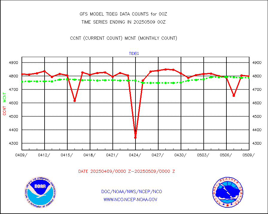
tideg |
Tide gauge reports decoded from CREX format |
4778 |
4669 |
102.3 % |
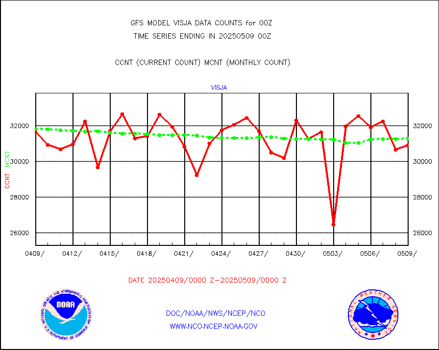
visja |
MTSAT/JMA visible derived cloud motion |
31264 |
31134 |
100.4 % |
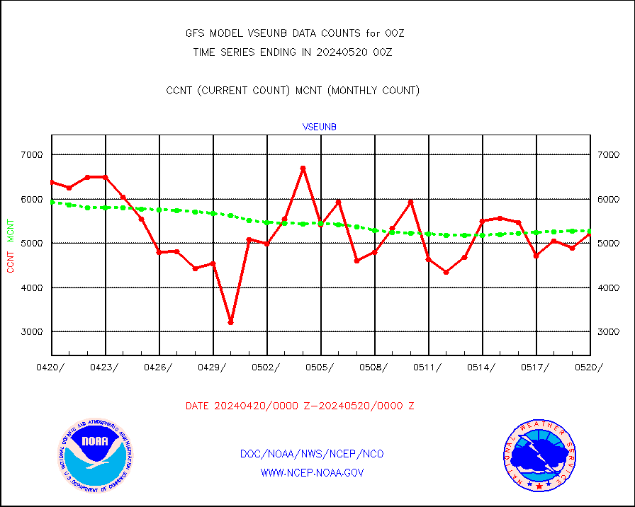
vseunb |
METEOSAT/EUMETSAT visible drv cld motion NBseq |
5209 |
5273 |
98.8 % |
| Data Types of Opportunity with Normal Counts |
|---|
| Type | Description | Hourly Count | Monthly Average | Percent (%) of Monthly Mean |
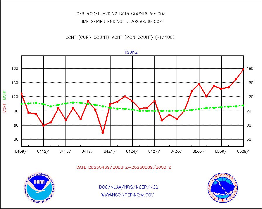
3p9usr |
GOES-16&up/NESDIS ir short-wv derived cld motion |
75322 |
82189 |
91.6 % |
acarsa |
MDCRS ACARS acft data (ARINC via AFWA)(AIREP fmt) |
0 |
0 |
n/a |
amsr2 |
GCOM-W AMSR2 1B brightness temperatures |
9999999 |
9832377 |
101.7 % |
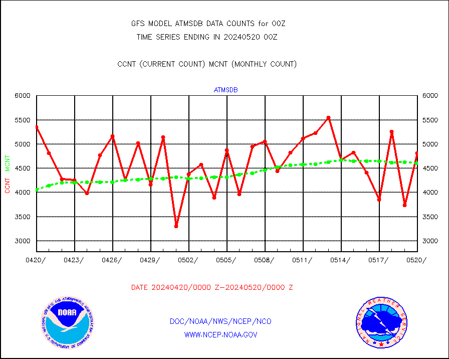
atmsdb |
NPP/NOAA-20 ATMS bright. temps-direct b-cast SSEC |
481170 |
460243 |
104.5 % |
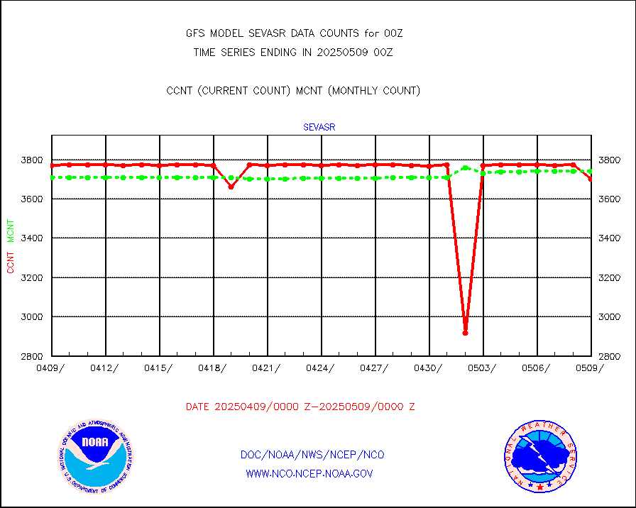
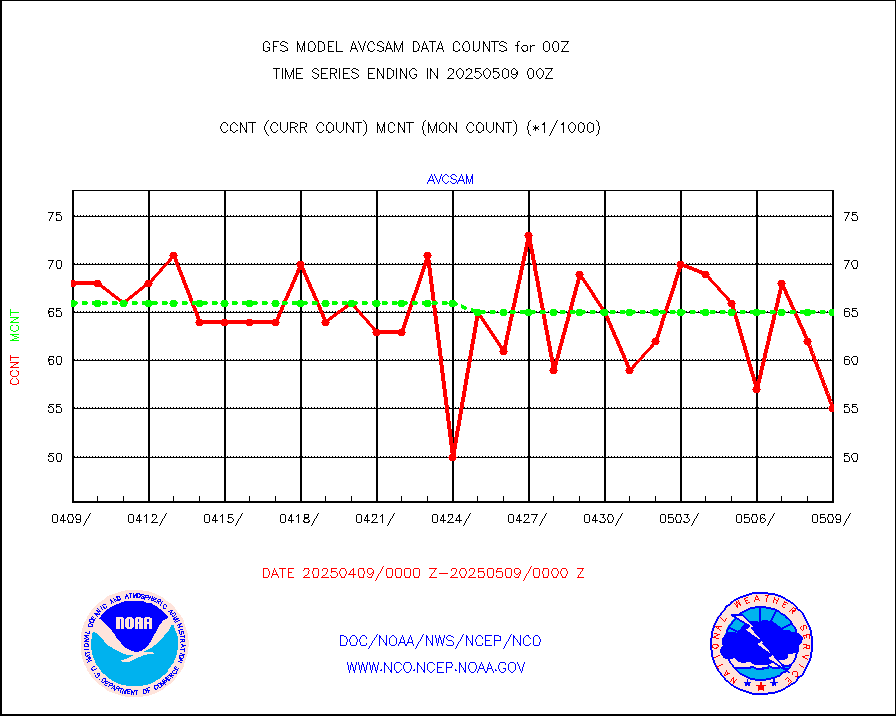
avcsam |
A.M.(N17,M2,M3) AVHRR GAC NCEP-proc clr&sea btmps |
6561635 |
6615315 |
99.2 % |
avcspm |
P.M.(N18-19) AVHRR GAC NCEP-proc clr & sea btemps |
6664149 |
6584838 |
101.2 % |
bathy |
eXpendable BathyThermograph, mooring (BATHY fmt) |
2 |
1 |
200.0 % |
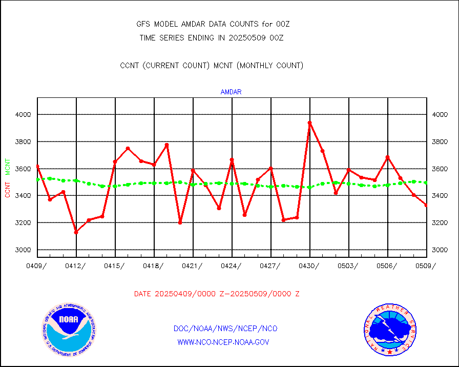
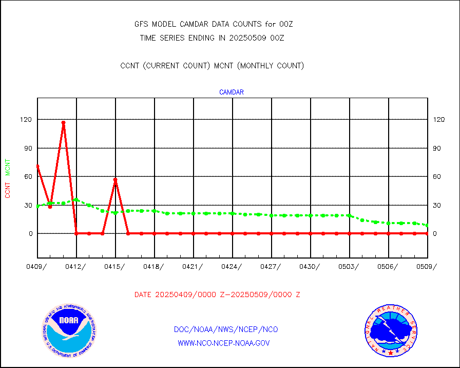
camdar |
Canadian AMDAR aircraft data (decoded from BUFR) |
69 |
75 |
92.0 % |
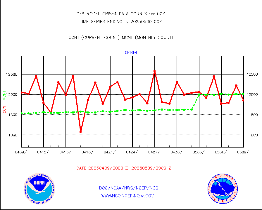
crisf4 |
NPP/NOAA-20 CrIS full spctrl radn (431 ch subset) |
1246896 |
1164365 |
107.1 % |
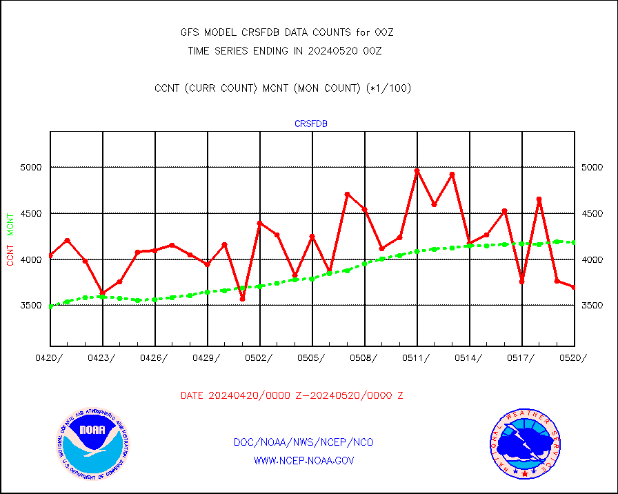
crsfdb |
NPP/NOAA-20 CrIS full spctrl radn dir brdcst SSEC |
370177 |
418587 |
88.4 % |
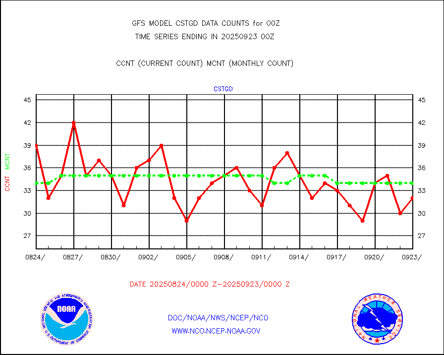
cstgd |
Coast Guard |
29 |
28 |
103.6 % |
dbuoyb |
Drifting buoys (decoded from BUFR) |
8713 |
8645 |
100.8 % |
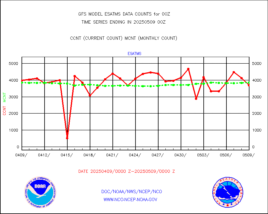
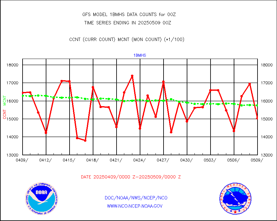
esatms |
NPP Adv. Tech. MW Sndr (ATMS) br. temps from RARS |
417721 |
408199 |
102.3 % |
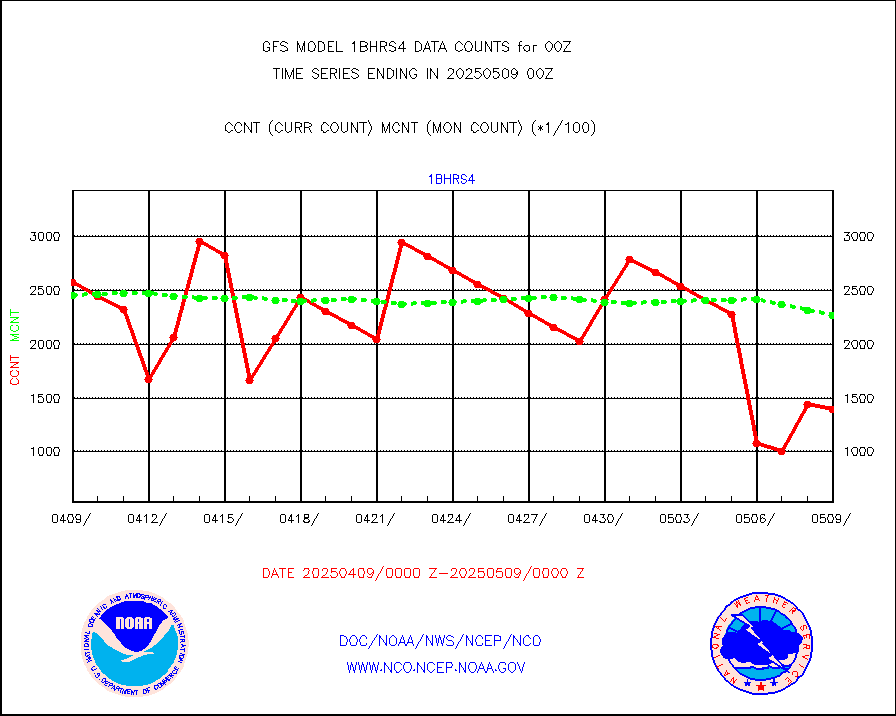
esiasi |
METOP 1-2 IASI 1C radiance data vbl chn from RARS |
389758 |
378003 |
103.1 % |
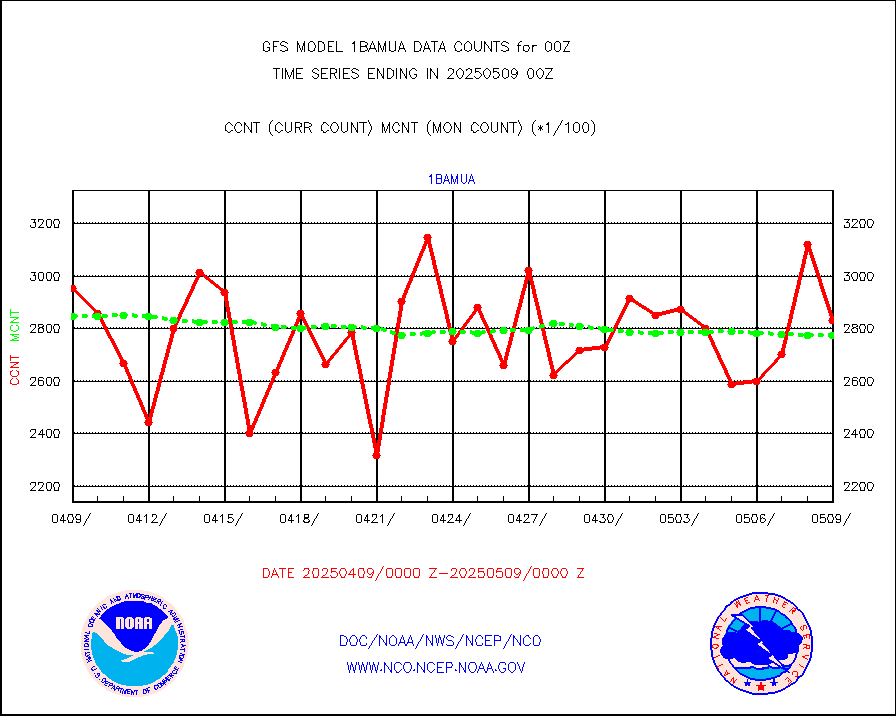
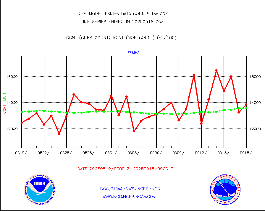
esmhs |
NOAA 18-19 & METOP 1-2 MHS proc. btemps from RARS |
2308471 |
2204282 |
104.7 % |
geoimr |
GOES/NESDIS (11x17 f-o-v) imager clear radiances |
0 |
0 |
n/a |
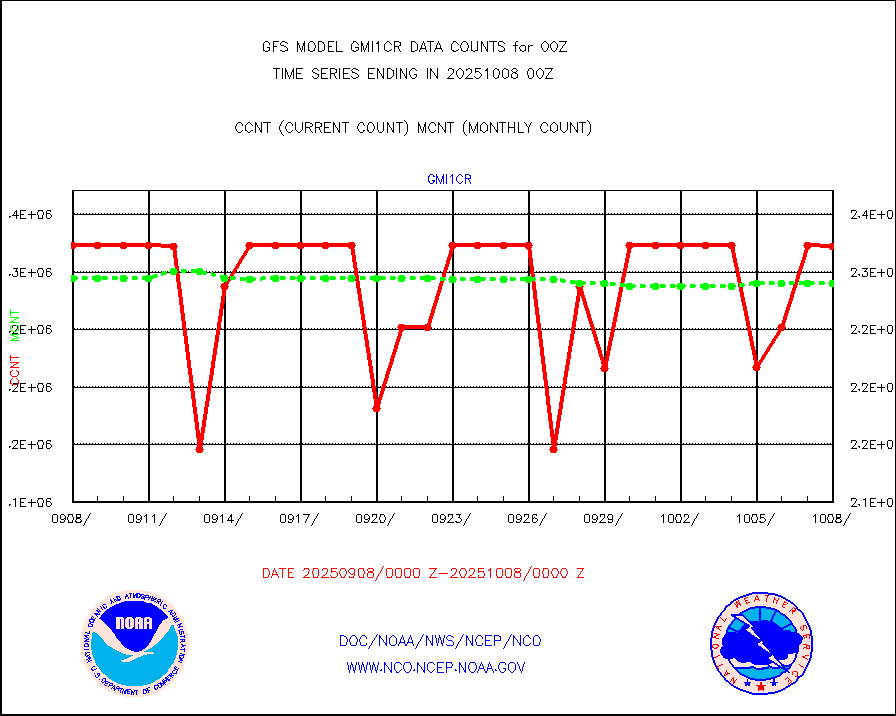
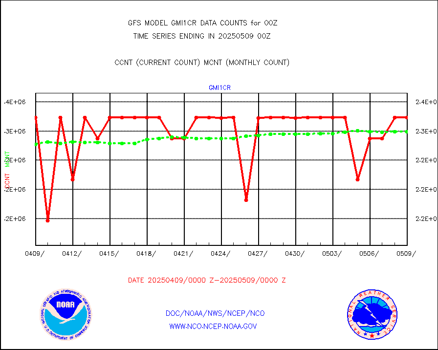
gmi1cr |
GPM GMI Level 1C-R brightness temperatures |
4652050 |
4593249 |
101.3 % |
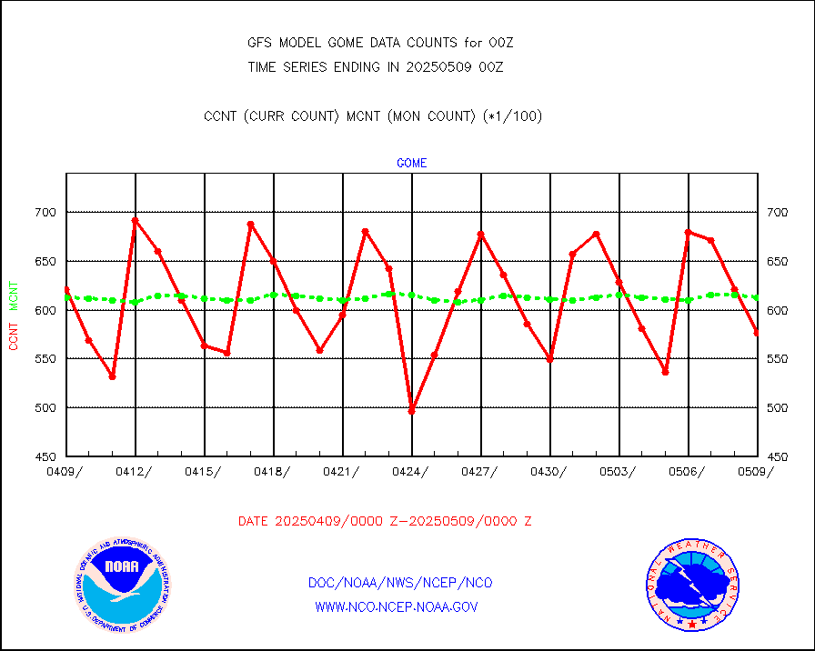
gnss |
Grnd-based Gbl Navigation Sat System (GNSS) data |
4931 |
5209 |
94.7 % |
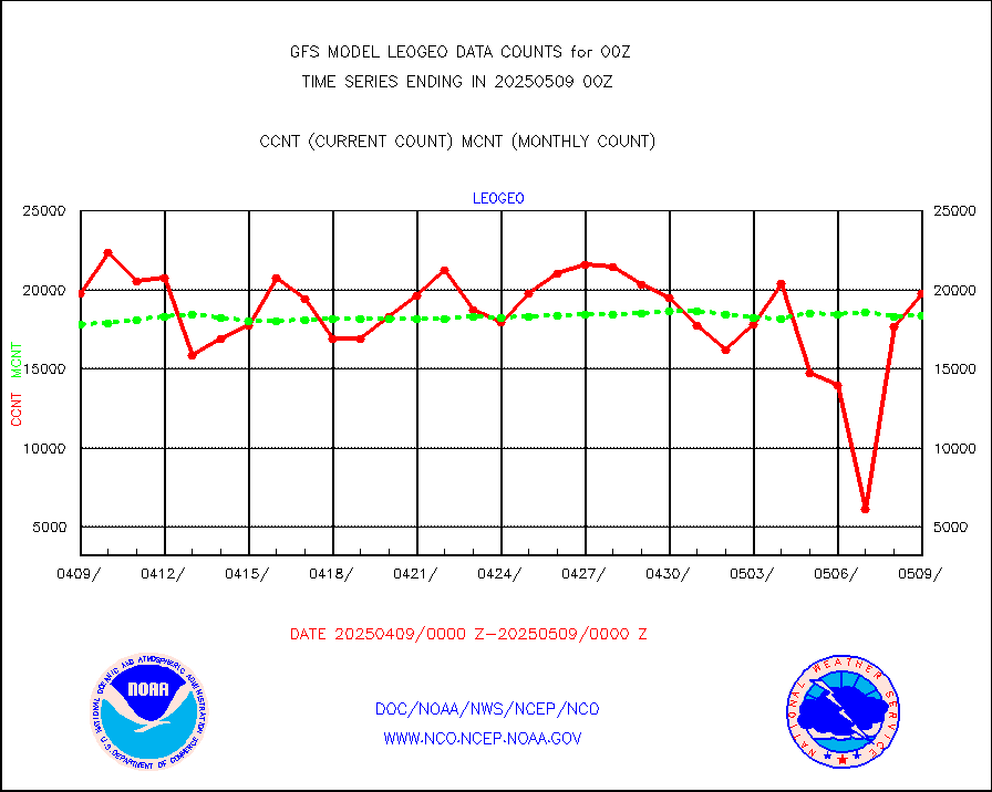
gome |
METOP 1-2 Global Ozone Monitoring Exp.-2 (GOME-2) |
62120 |
58539 |
106.1 % |
h20in |
INSAT/KALPANA India wvpr derived cloud motion |
0 |
0 |
n/a |
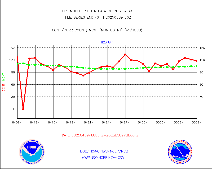
h2dusr |
GOES-16&up/NESDIS wv imgr/deep-lyr derivd cld mtn |
94795 |
101376 |
93.5 % |
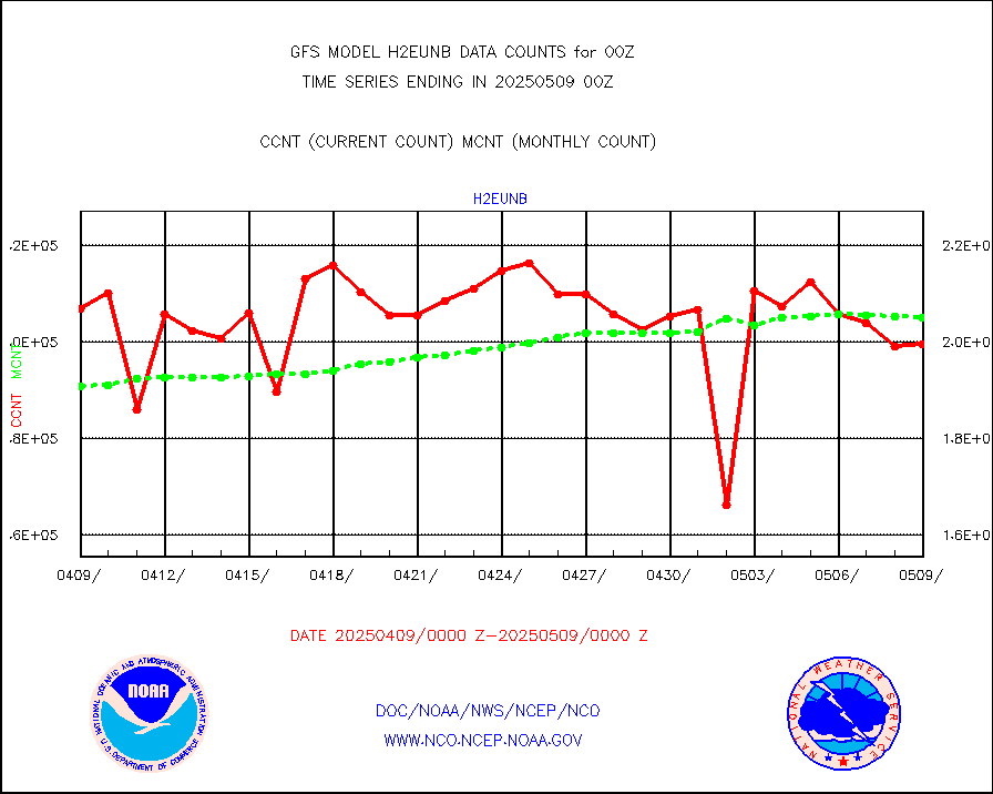
h2eunb |
METEOSAT/EUMETSAT wvpr imgr drv cld motion NBseq |
192977 |
204109 |
94.5 % |
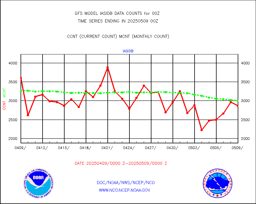
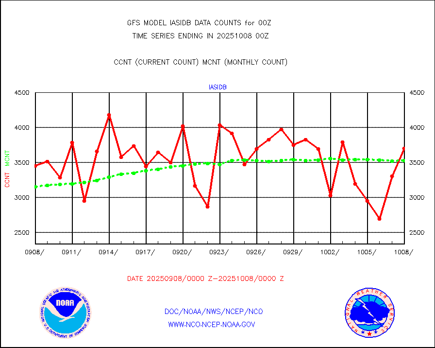
iasidb |
METOP 1-2 IASI 1C radiances-direct broadcast SSEC |
283920 |
239360 |
118.6 % |
ifvrnb |
VIIRS (NPP/NOAA-20) ir lg-wv drv cloud motion(NB) |
63956 |
45982 |
139.1 % |
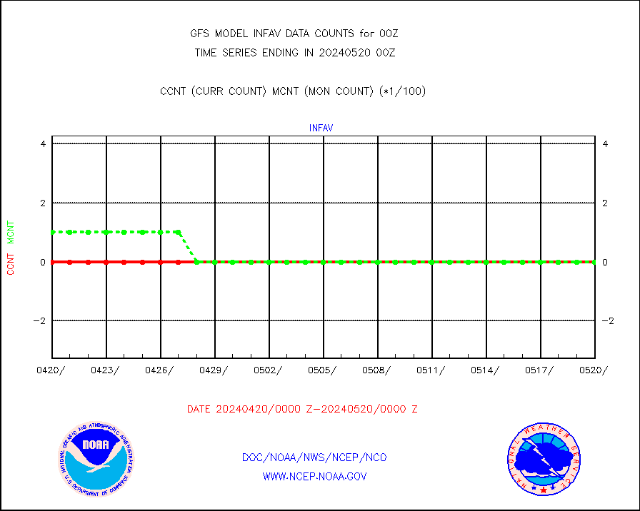
infav |
AVHRR (NOAA/METOP) ir lg-wave derived cld motion |
0 |
0 |
n/a |
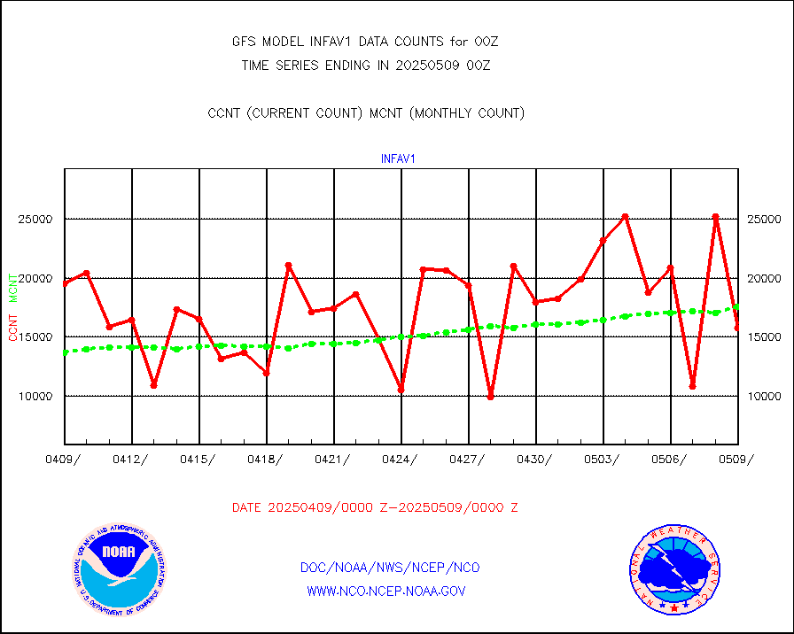
infav1 |
AVHRR (METOP) ir lg-wave derived cld motion |
17930 |
16522 |
108.5 % |
infin |
INSAT/KALPANA India ir lg-wave derived cld motion |
0 |
0 |
n/a |
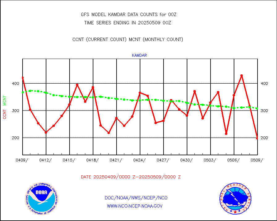
kamdar |
Korean AMDAR aircraft data (decoded from BUFR) |
305 |
322 |
94.7 % |
mbuoyb |
Moored buoys (decoded from BUFR) |
6151 |
5613 |
109.6 % |
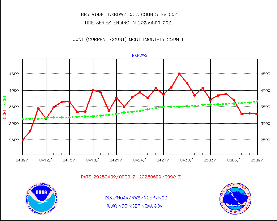
nxrdw2 |
NEXRAD Vel Azm Dsp(VAD) winds via Level 2 decoder |
4319 |
4073 |
106.0 % |
ompslp |
OMPS Limb Profiler ozone data (NPP) |
692 |
771 |
89.8 % |
ompsn8 |
OMPS nadir profile ozone (Version 8 BUFR) |
2999 |
2782 |
107.8 % |
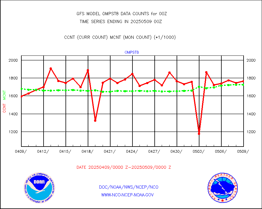
ompst8 |
OMPS total column ozone (Version 8 BUFR) |
1756476 |
1693619 |
103.7 % |
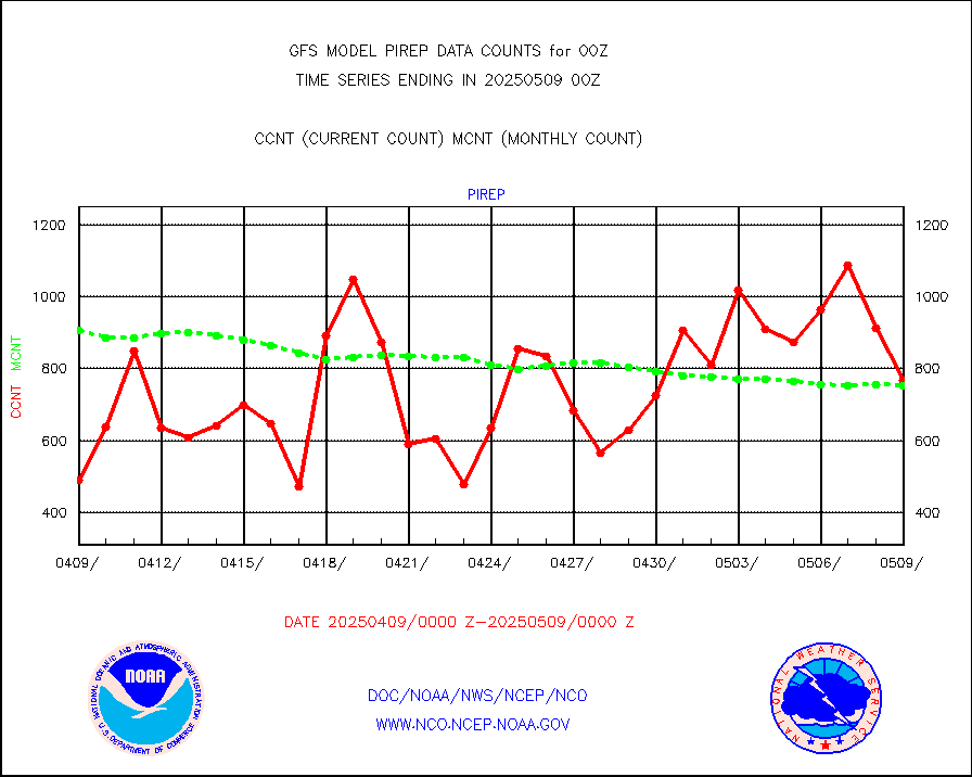
pirep |
Manual PIREP aircraft data (dcded from AIREP fmt) |
502 |
665 |
75.5 % |
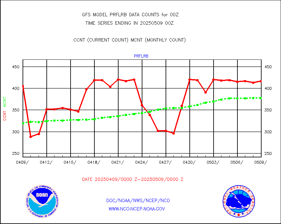
prflrb |
Multi-Agency Profiler (MAP) and SODAR winds |
269 |
324 |
83.0 % |
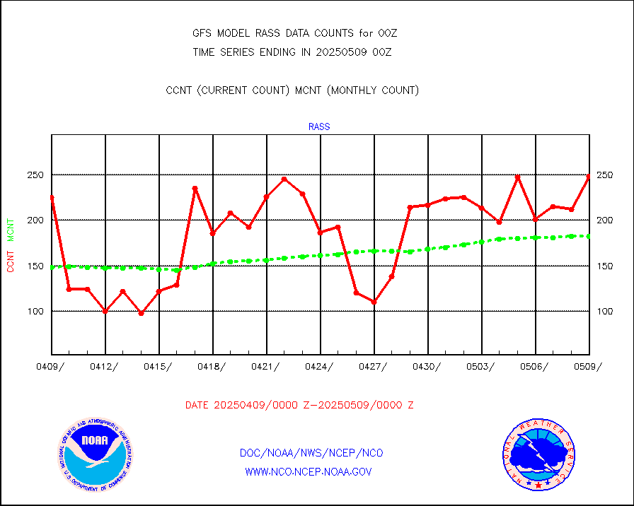
rass |
RASS temperatures (NOAA and Multi-Agency) |
156 |
187 |
83.4 % |
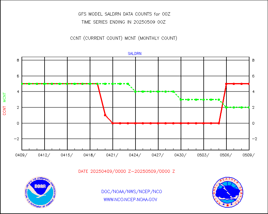
saldrn |
Surface Marine Saildrone (decoded from BUFR) |
5 |
5 |
100.0 % |
saphir |
Megha-Tropiques SAPHIR L1A2 brightness temps |
0 |
0 |
n/a |
sevasr |
METEOSAT-10 2nd Gen SEVIRI All Sky Radiance(proc) |
377560 |
377278 |
100.1 % |
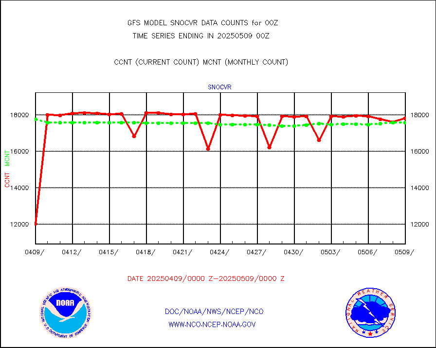
snocvr |
NOW COVER, DEPTH/DENSITY AND WATER EQUIVALENT |
18622 |
17906 |
104.0 % |
ssmisu |
DMSP SSM/IS 1C radiance data (Unified Pre-Proc.) |
1077780 |
950683 |
113.4 % |
sstvcw |
NPP/NOAA-20 VIIRS SST - CLEAR & OVER WATER |
9999999 |
9333333 |
107.1 % |
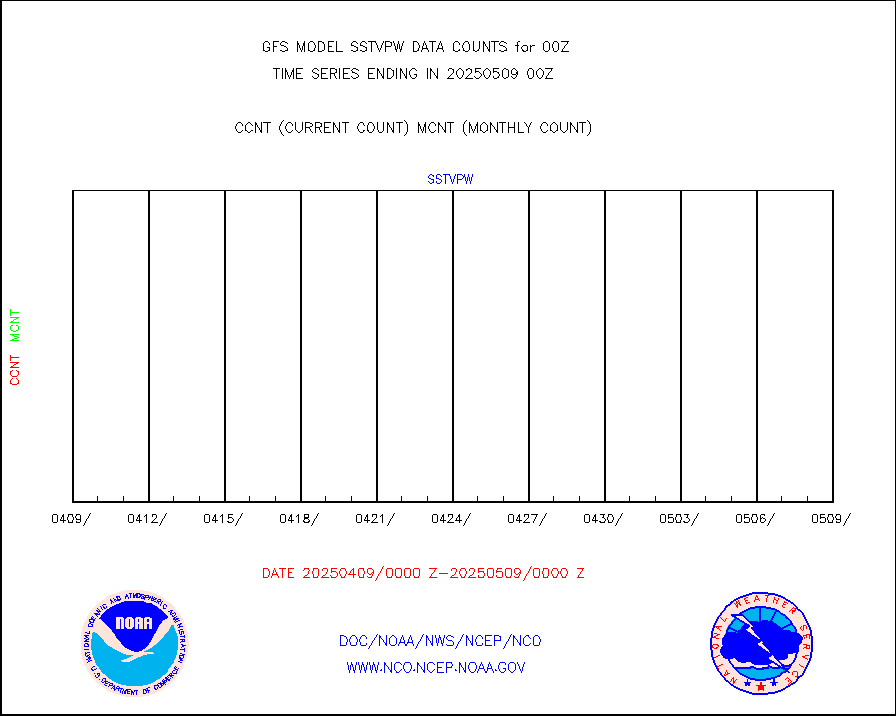
sstvpw |
NPP/NOAA-20 VIIRS SST - PROBABLY CLR & OVER WATER |
9999999 |
9666666 |
103.4 % |
subpfl |
Sub-surface float and glider profile (BUFR) |
72 |
69 |
104.3 % |
synop |
Synoptic - fixed manual and automatic |
7753 |
7680 |
101.0 % |
tesac |
CTD probe, Argo prflng float, mooring (TESAC fmt) |
2180 |
2075 |
105.1 % |
tmdara |
TAMDAR aircft data-all types(from Panasonic,BUFR) |
1687 |
1792 |
94.1 % |
visin |
INSAT/KALPANA India visible derived cloud motion |
0 |
0 |
n/a |
visusr |
GOES-16&up/NESDIS visible derived cloud motion |
1677320 |
1676068 |
100.1 % |


