| Critical Data with Normal Counts |
|---|
| Type | Description | Hourly Count | Monthly Average | Percent (%) of Monthly Mean |
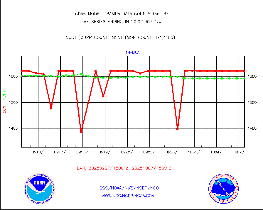
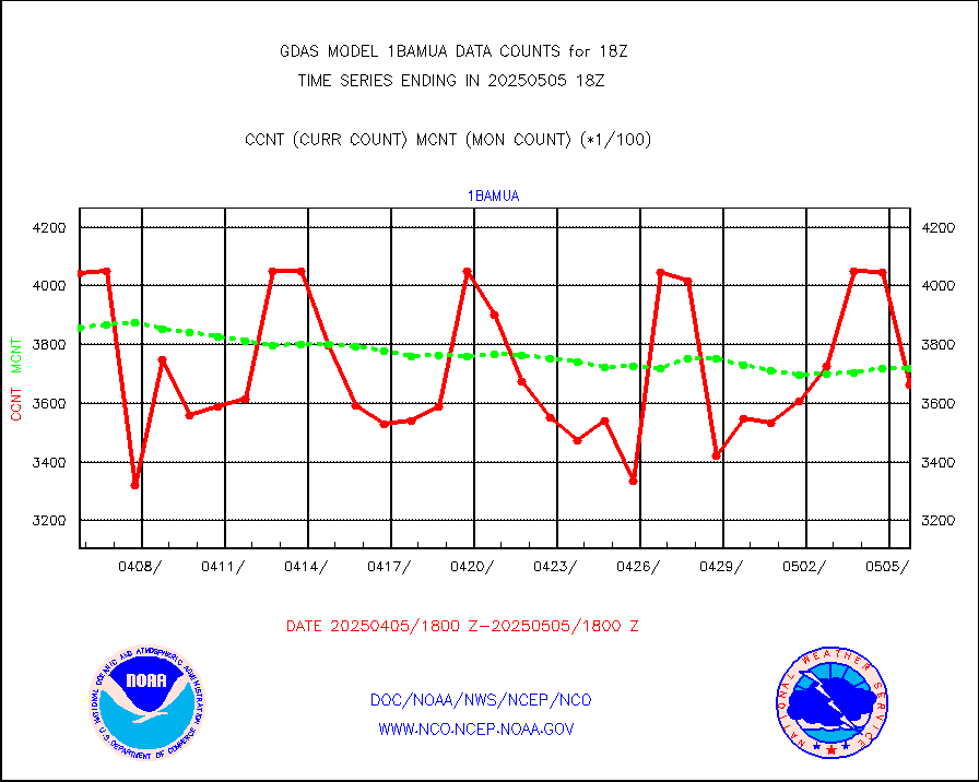
1bamua |
NOAA 15-19 & METOP 1-2 AMSU-A NCEP-proc. br.temps |
403892 |
391727 |
103.1 % |
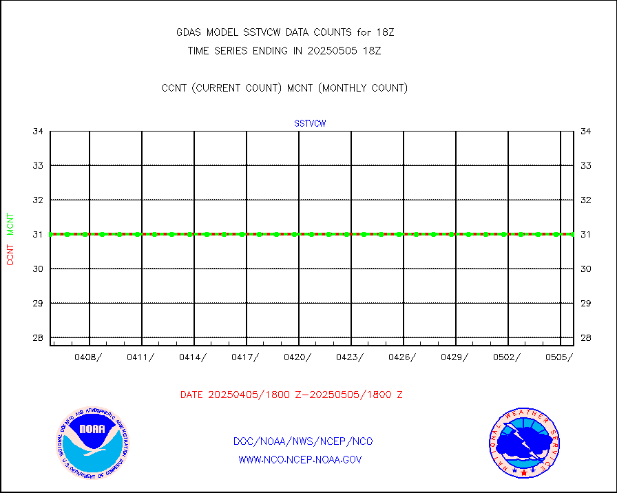
1bhrs4 |
NOAA 18-19 & METOP 1-2 HIRS-4 NCEP-proc. br.temps |
359128 |
351208 |
102.3 % |
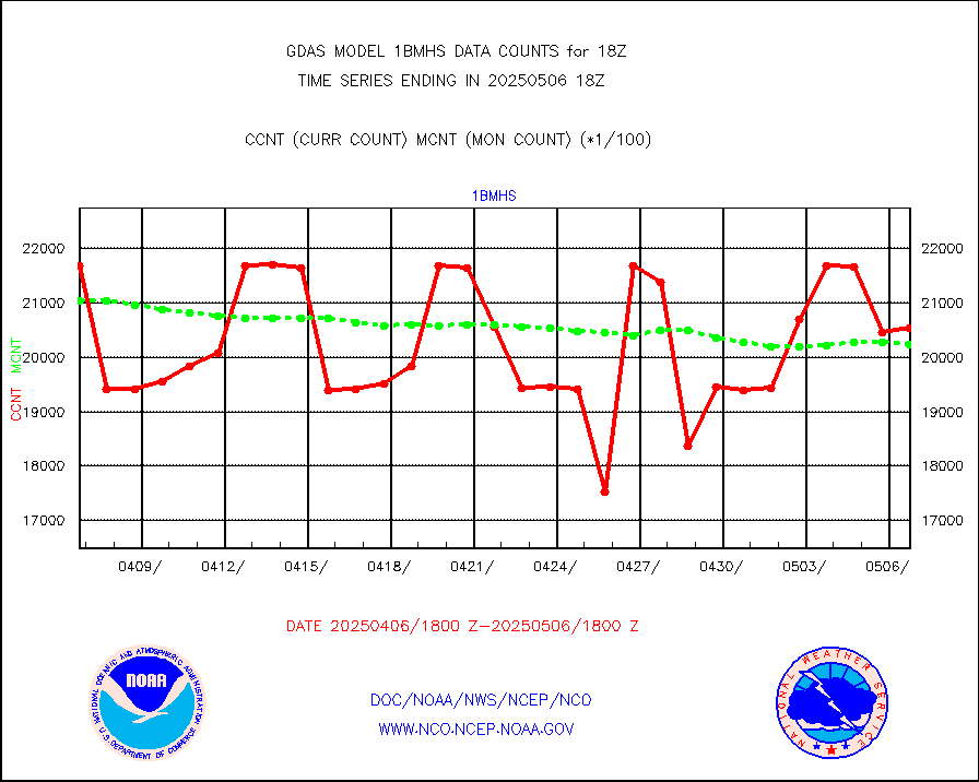
1bmhs |
NOAA 18-19 & METOP 1-2 MHS NCEP-proces. br. temps |
2163586 |
2132810 |
101.4 % |
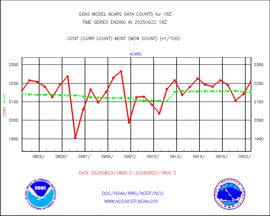
acars |
MDCRS ACARS acft data from ARINC(dcded from BUFR) |
152658 |
162490 |
93.9 % |
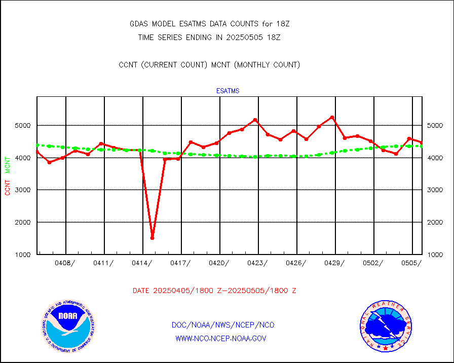
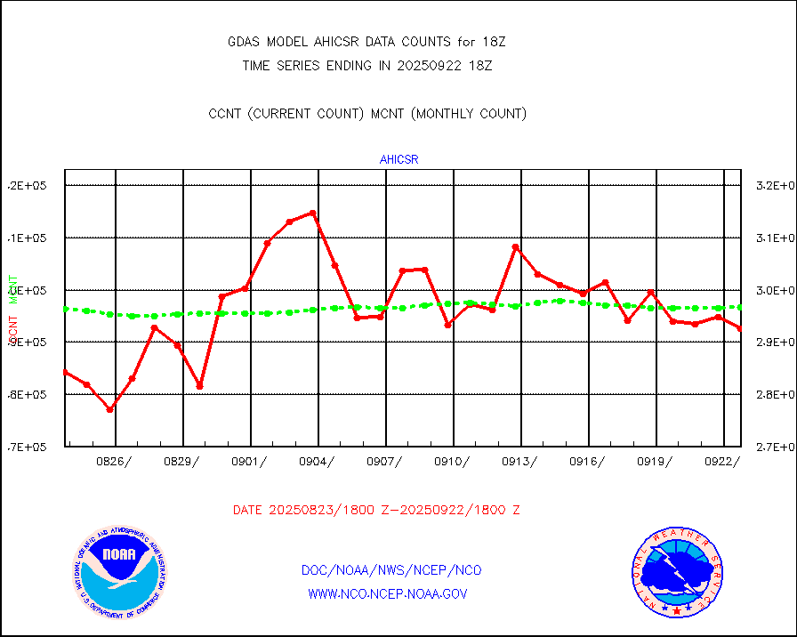
ahicsr |
Himawari Clear Sky Radiance |
306310 |
307207 |
99.7 % |
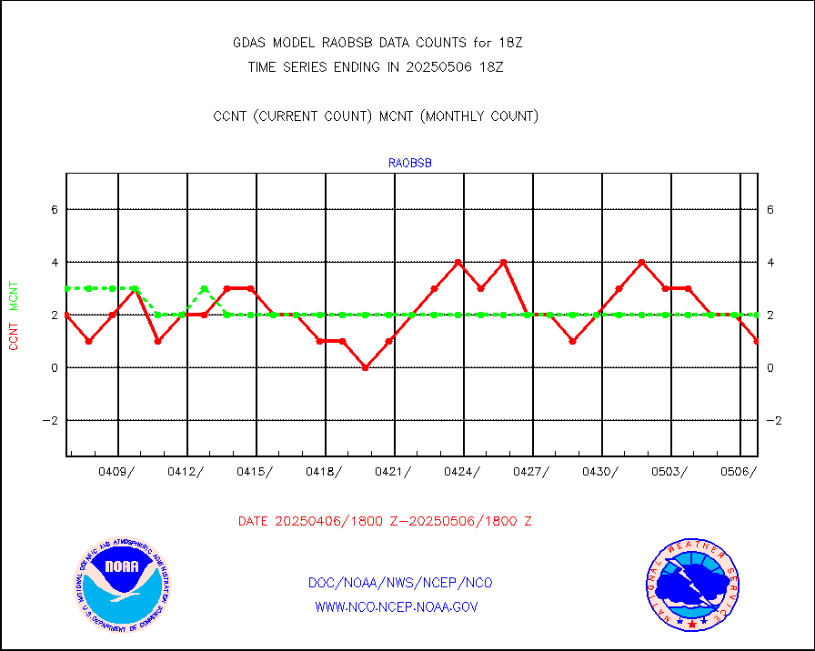
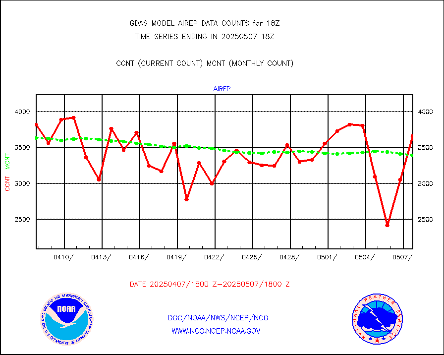
airep |
Manual AIREP aircraft data (dcded from AIREP fmt) |
6819 |
6134 |
111.2 % |
airsev |
AQUA AIRS/AMSU-A/HSB brightness temps- every FOV |
0 |
0 |
n/a |
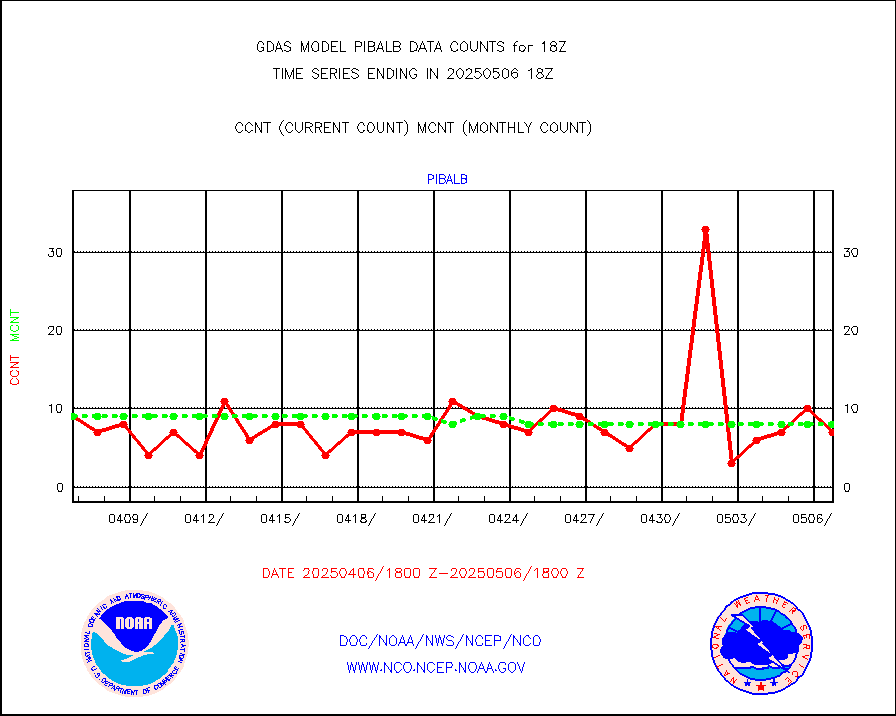
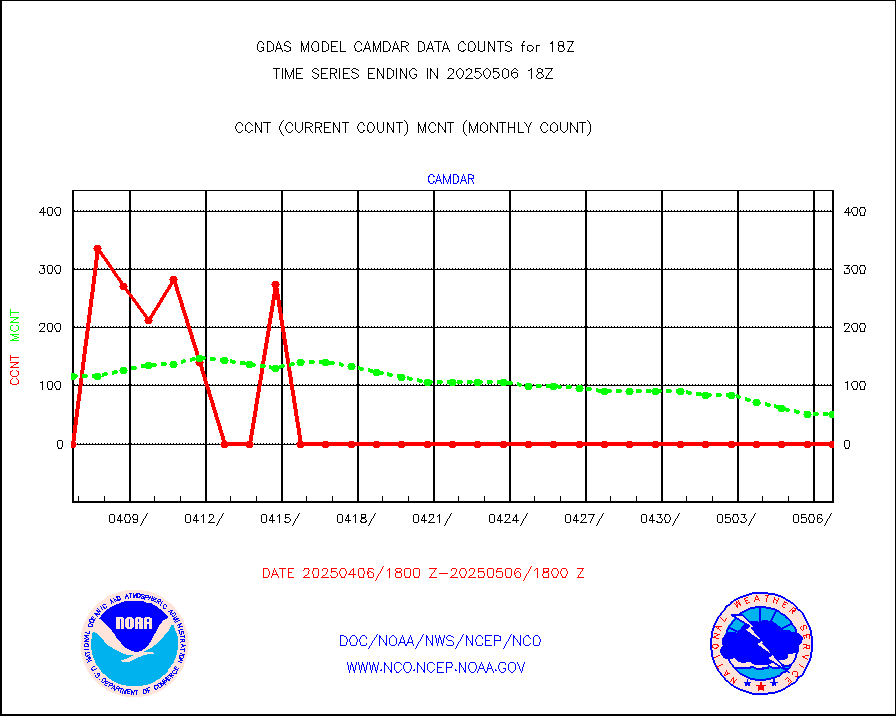
amdar |
AMDAR aircraft data (decoded from AMDAR format) |
877 |
791 |
110.9 % |
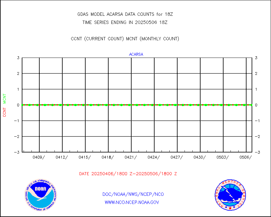
amdarb |
AMDAR aircraft data (decoded from BUFR) |
2856 |
2597 |
110.0 % |
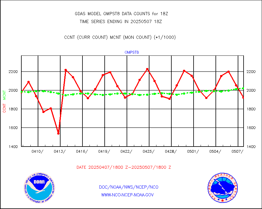
ascat |
METOP 1-2 ASCAT products |
466368 |
473166 |
98.6 % |
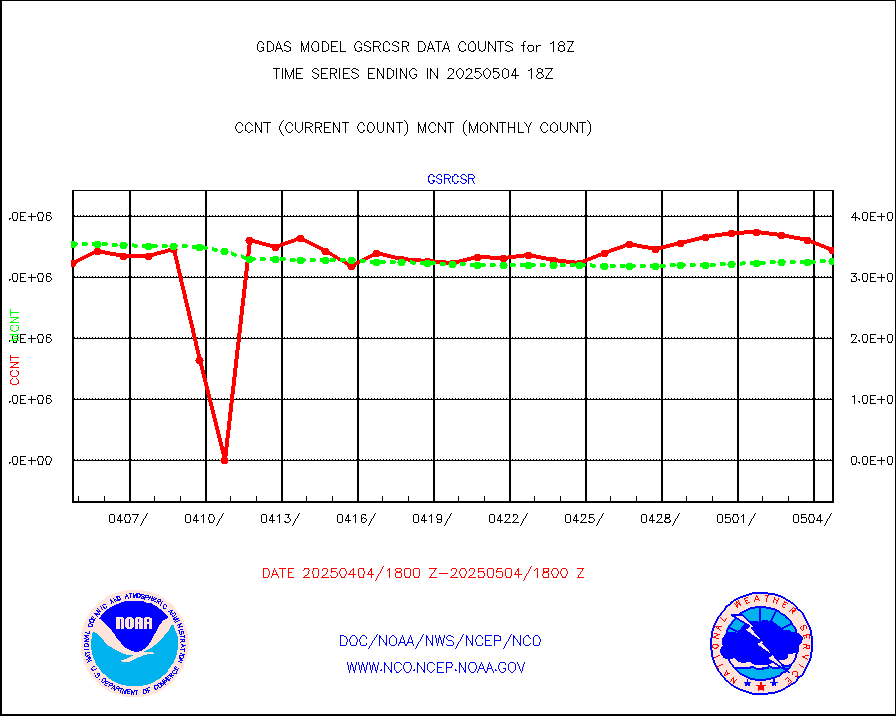
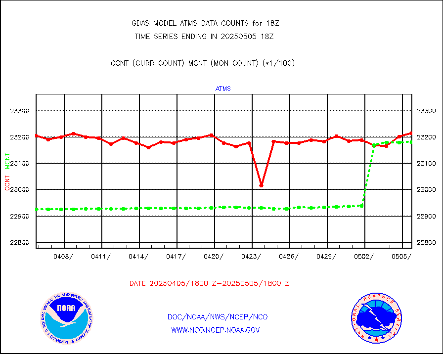
atms |
NPP/NOAA-20 ATMS brightness temperatures |
2316407 |
2299370 |
100.7 % |
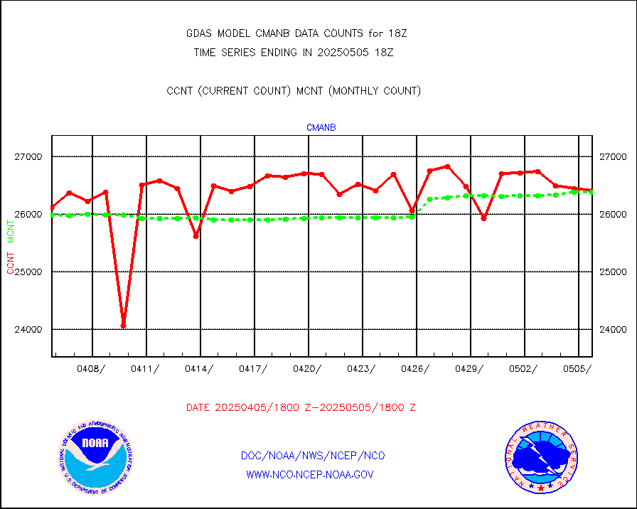
cmanb |
Surface Marine CMAN rpts decoded from BUFR format |
26996 |
25858 |
104.4 % |
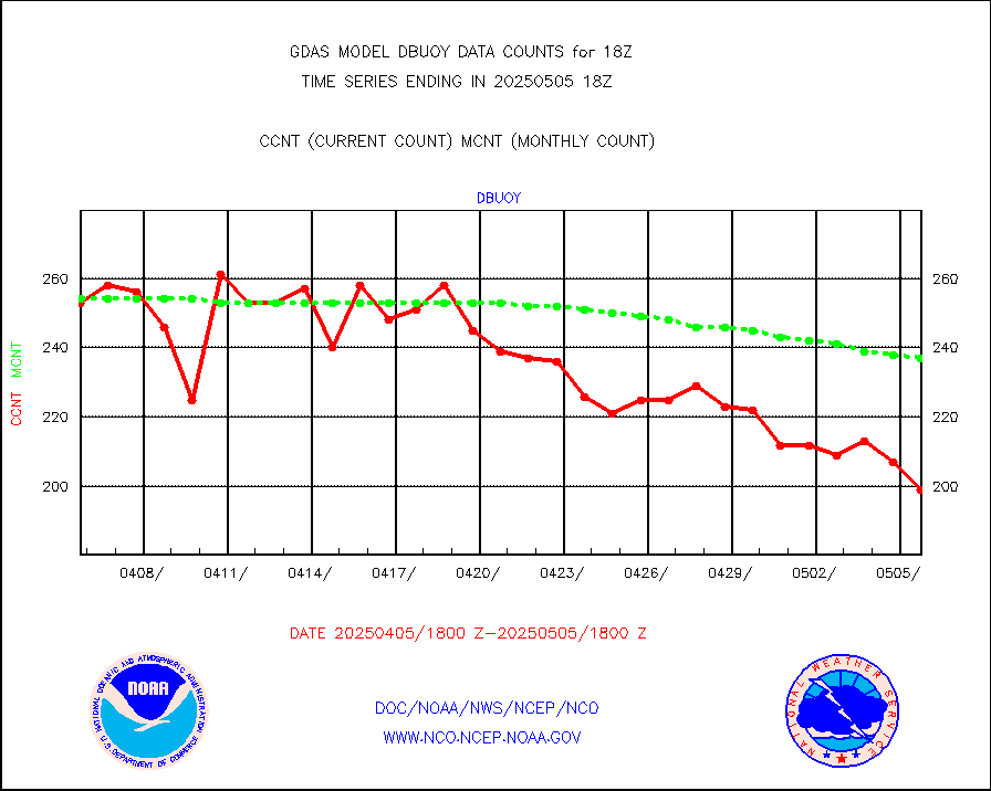
dbuoy |
Buoys decoded from FM-18 fmt (moored or drifting) |
273 |
277 |
98.6 % |
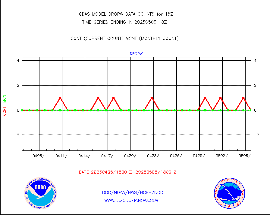
dropw |
Dropwinsonde (from TEMP DROP) |
0 |
0 |
n/a |
eadas |
E-AMDAR (European AMDAR acft decoded from BUFR) |
19371 |
18095 |
107.1 % |
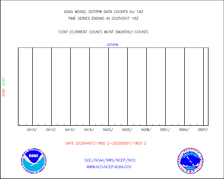
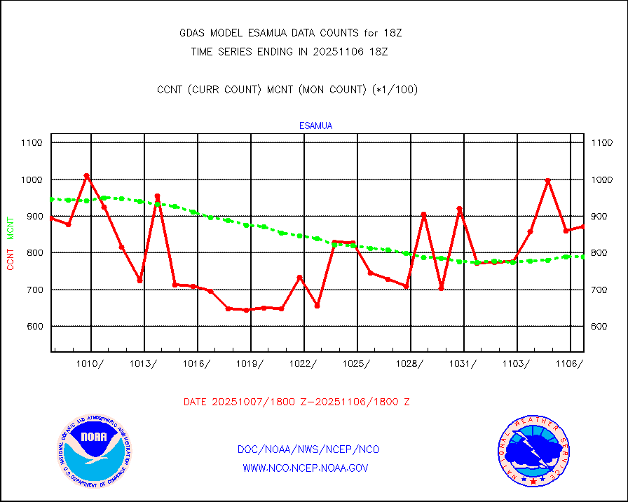
esamua |
NOAA 15-19 & METOP 1-2 AMSU-A proc btmps frm RARS |
200137 |
195311 |
102.5 % |
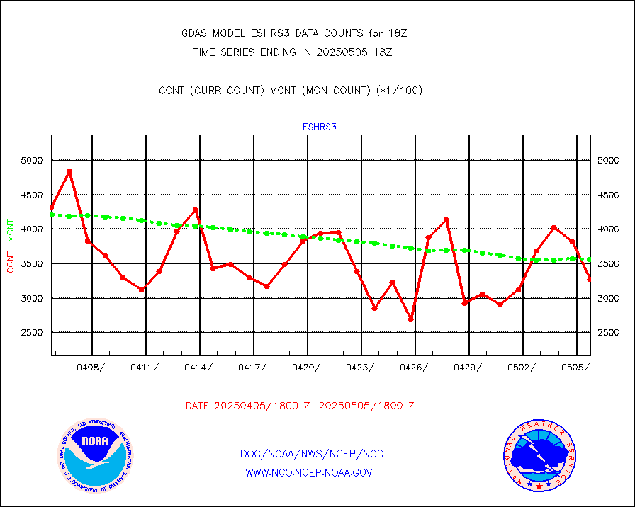
eshrs3 |
NOAA 15-19 & METOP 1-2 HIRS-3/4 pr btmps frm RARS |
613793 |
574341 |
106.9 % |
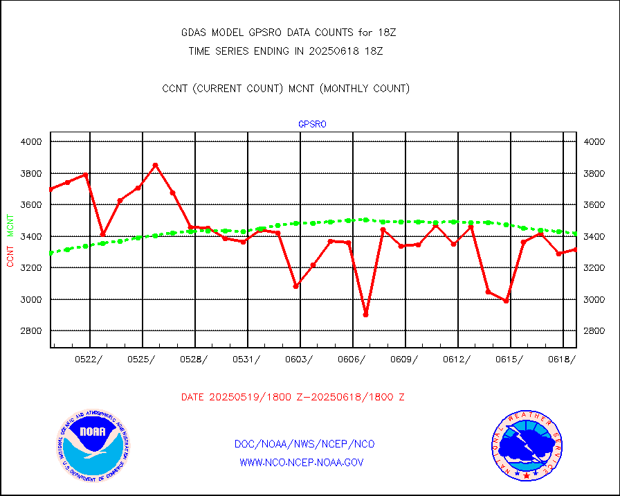
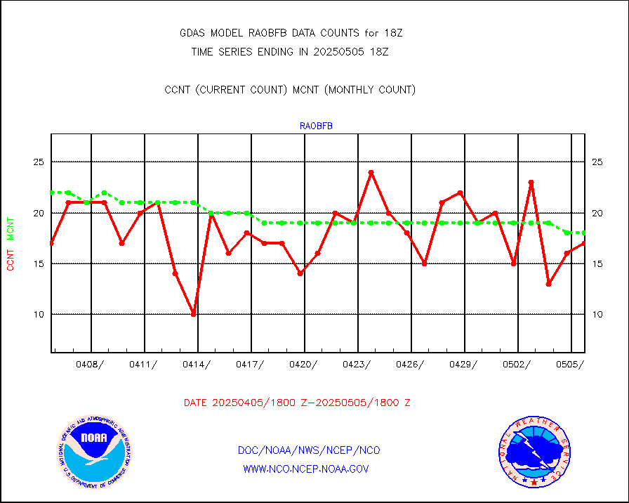
gpsro |
GPS radio occultation data |
2884 |
3107 |
92.8 % |
gsrasr |
GOES-16/17 All Sky Radiances (proc.) |
5677524 |
6359019 |
89.3 % |
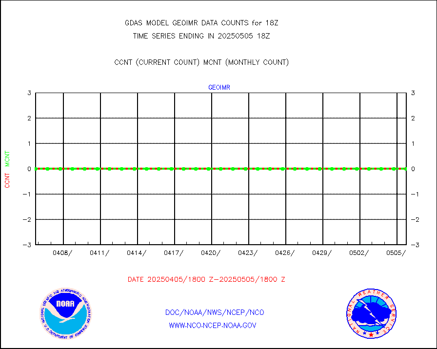
gsrcsr |
GOES-16/17 Clear Sky Radiances (proc.) |
2694103 |
3276896 |
82.2 % |
h20ja |
MTSAT/JMA water vapor imager derived cloud motion |
58573 |
54937 |
106.6 % |
h20mo |
MODIS (AQUA/TERRA) wvpr imager derived cld motion |
0 |
0 |
n/a |
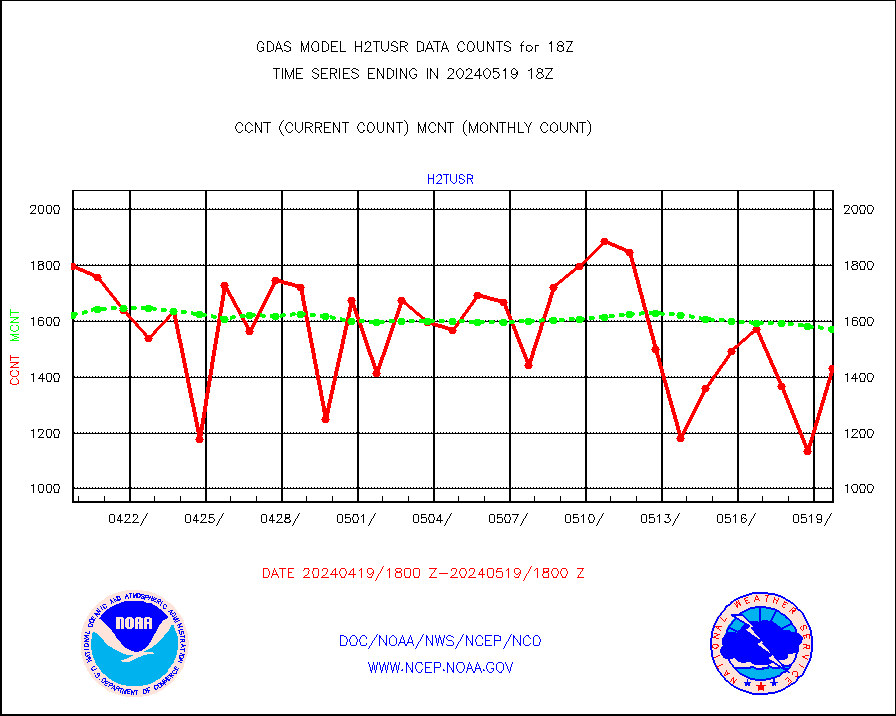
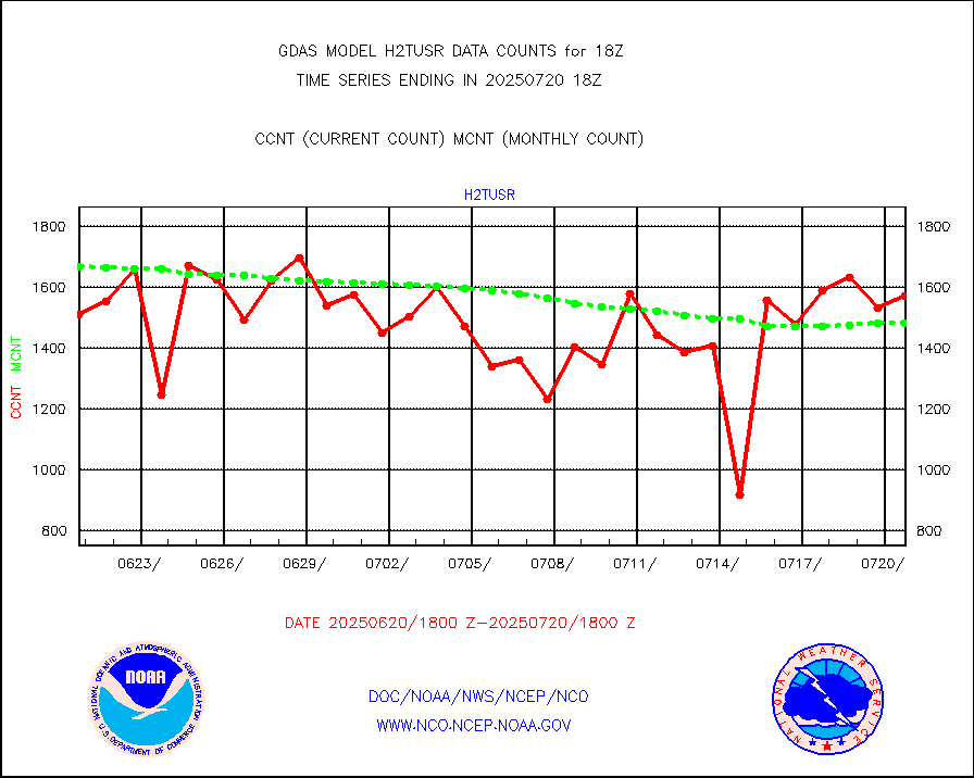
h2tusr |
GOES-16&up/NESDIS wv imgr/cld-top derived cld mtn |
142936 |
157051 |
91.0 % |
ifeunb |
METEOSAT/EUMETSAT ir lg-wave drv cld motion NBseq |
130893 |
129957 |
100.7 % |
infja |
MTSAT/JMA infrared long-wave derived cloud motion |
46667 |
46974 |
99.3 % |
infmo |
MODIS (AQUA/TERRA) ir l-wave derived cloud motion |
0 |
0 |
n/a |
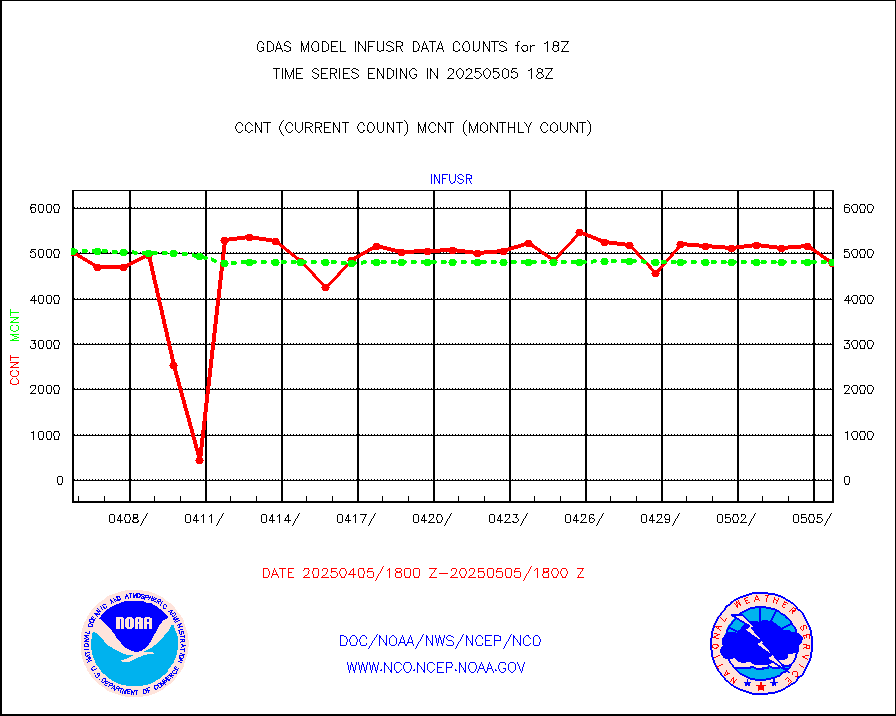
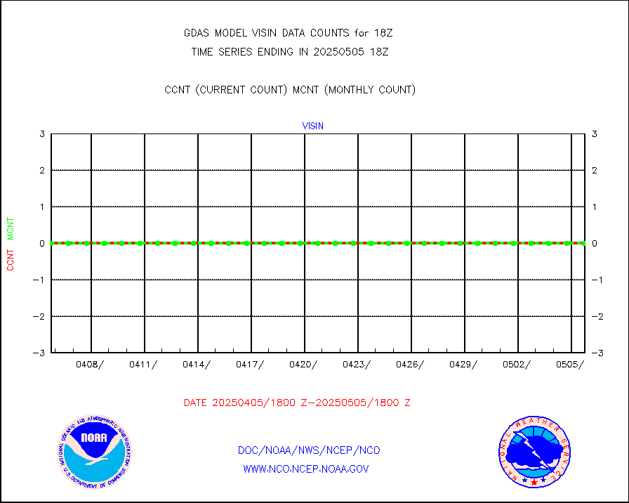
infusr |
GOES-16&up/NESDIS ir long-wave derived cld motion |
441409 |
481640 |
91.6 % |
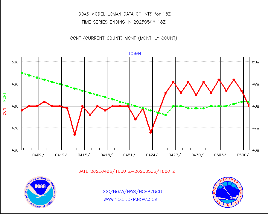
lcman |
Land-based CMAN stations decoded from CMAN format |
589 |
582 |
101.2 % |
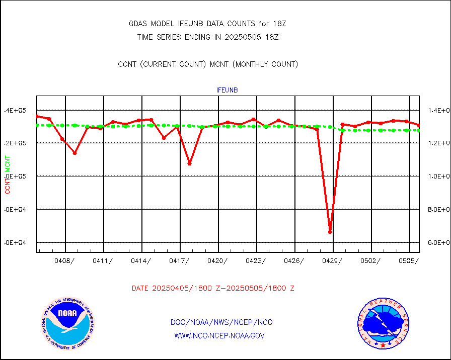
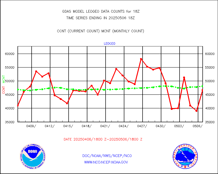
leogeo |
LEO-GEO satellite AMVs from UWisc. |
37647 |
34601 |
108.8 % |
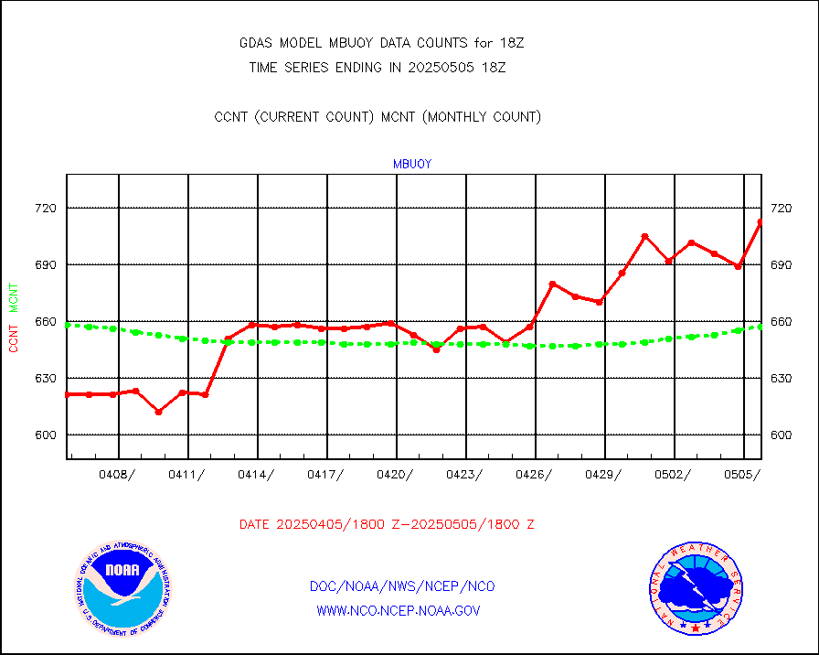
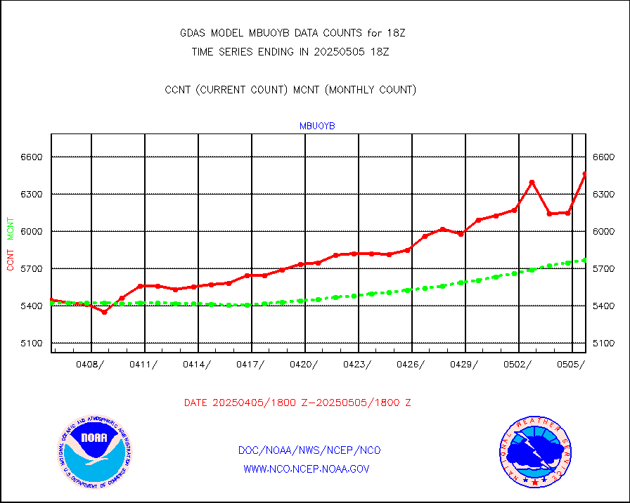
mbuoy |
Buoys decoded from FM-13 format (moored) |
777 |
746 |
104.2 % |
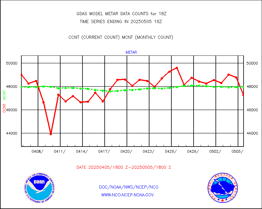
metar |
Aviation - METAR |
46603 |
48055 |
97.0 % |
mtiasi |
METOP 1-2 IASI 1C radiance data (varbl. channels) |
642604 |
636839 |
100.9 % |
nxrdw |
NEXRAD Vel Azm Dsp(VAD) winds via radar coded msg |
0 |
0 |
n/a |
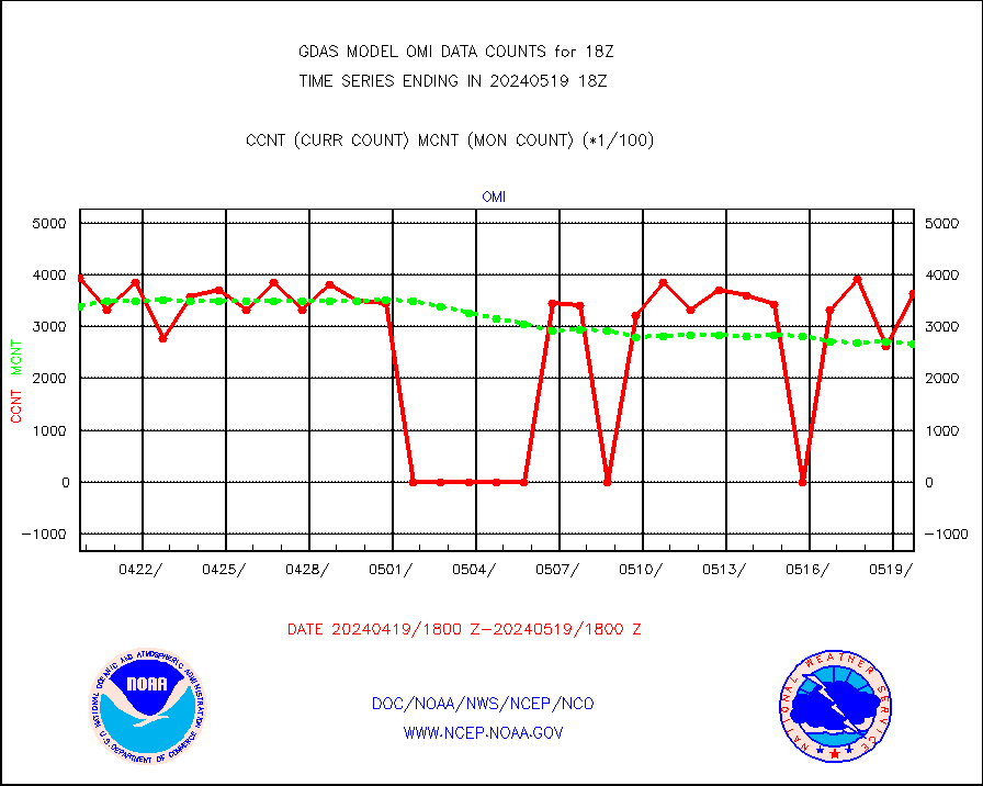
omi |
Aura Ozone Monitoring Instrument (OMI) data |
364800 |
267348 |
136.5 % |
osbuv8 |
NOAA 16-19 Solar Backscatter UV-2 rad frm V8 BUFR |
0 |
0 |
n/a |
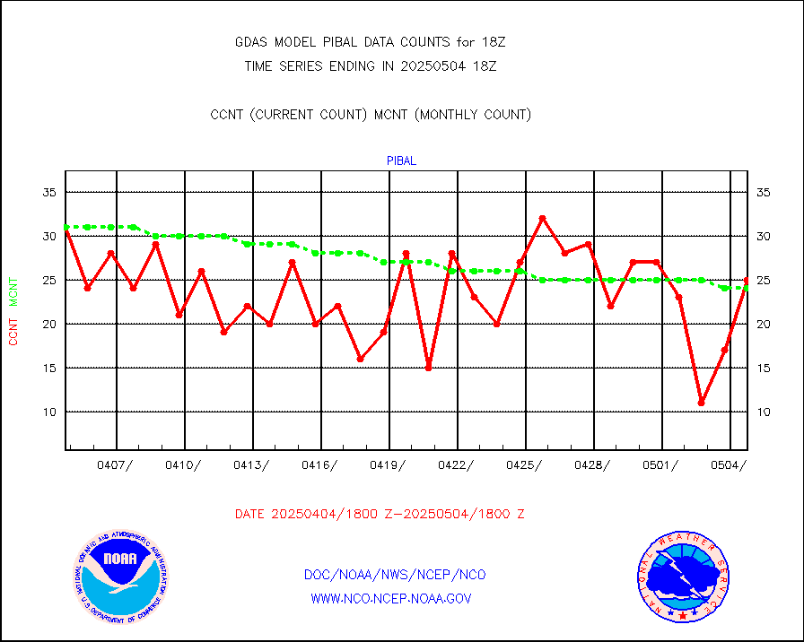
pibal |
PIBAL (from PILOT, PILOT SHIP, PILOT MOBIL) |
18 |
27 |
66.7 % |
prflrp |
Profilr winds from PIBAL (PILOT,PILOT SHIP/MOBIL) |
1 |
1 |
100.0 % |
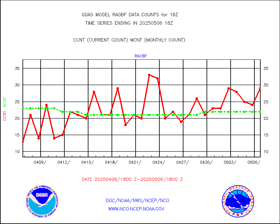
raobf |
Rawinsonde - fixed land (from TEMP or PILOT) |
36 |
27 |
133.3 % |
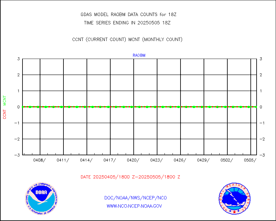
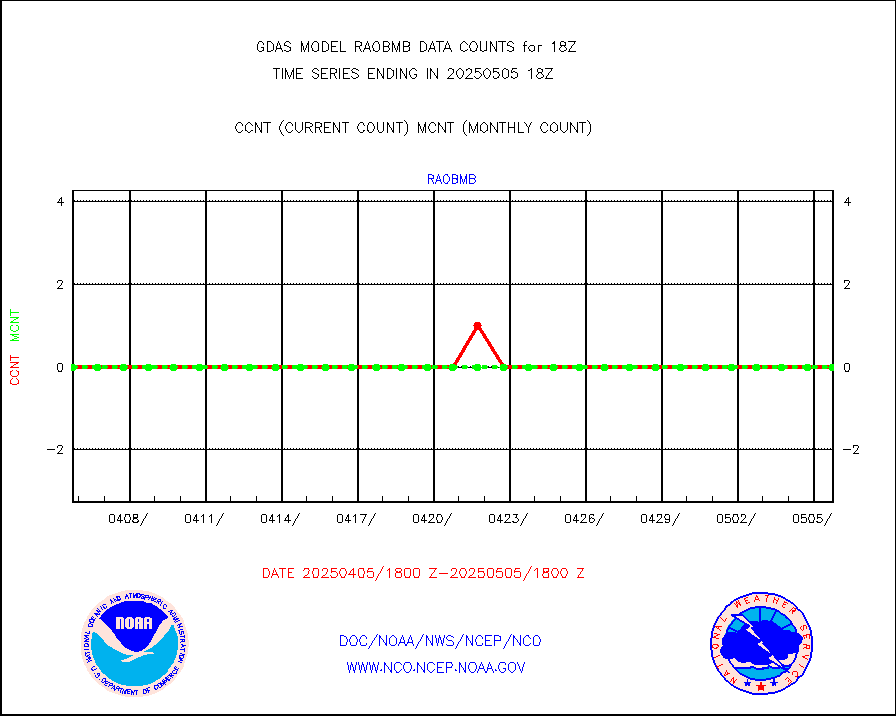
raobm |
Rawinsonde - mobile land (from TEMP/PILOT MOBIL) |
0 |
0 |
n/a |
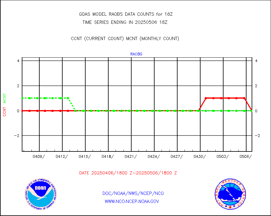
raobs |
Rawinsonde - ship (from TEMP SHIP, PILOT SHIP) |
0 |
0 |
n/a |
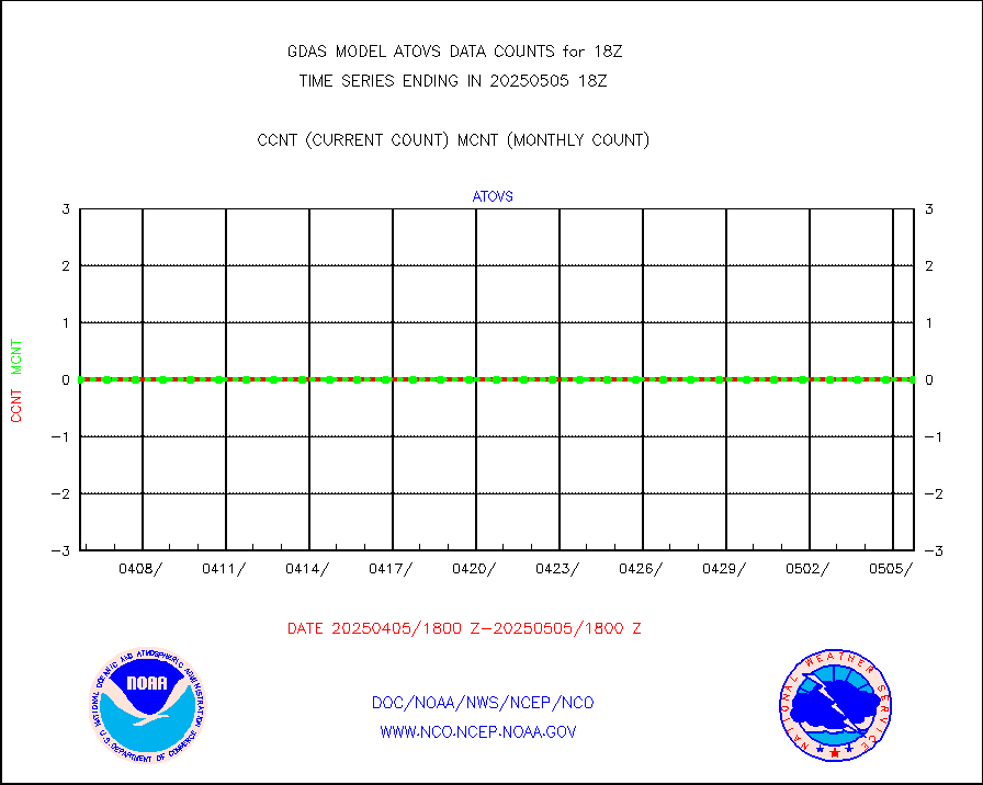
recco |
Flight level reconnaissance aircraft data |
0 |
2 |
0.0 % |
sevcsr |
METEOSAT-10 2nd Gen SEVIRI Clr Sky Radiance(proc) |
0 |
0 |
n/a |
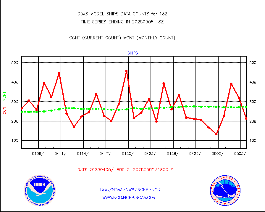
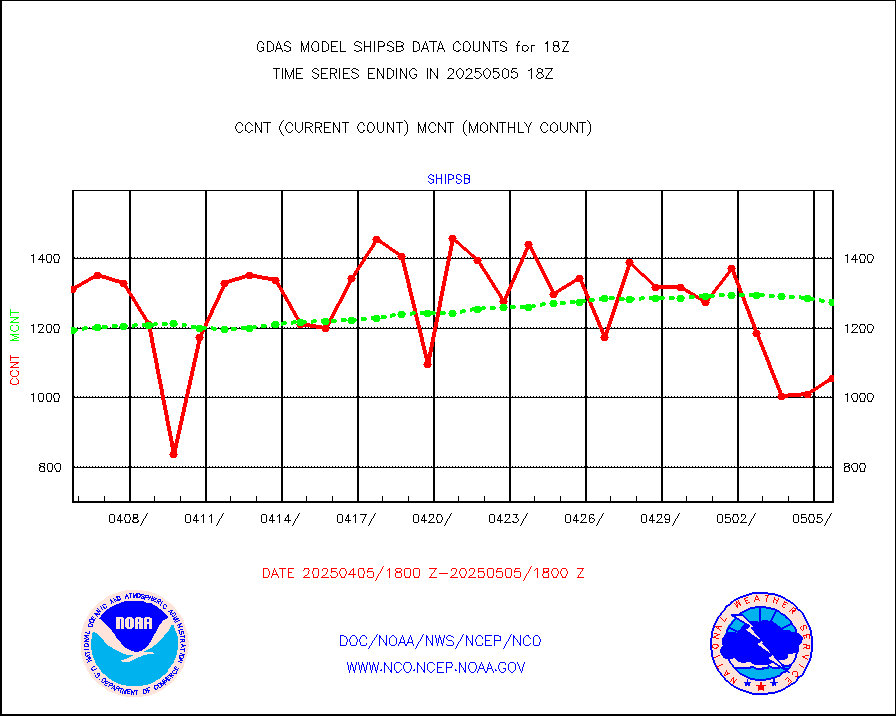
shipsb |
Ship - manual and automatic, restricted (BUFR) |
1149 |
954 |
120.4 % |
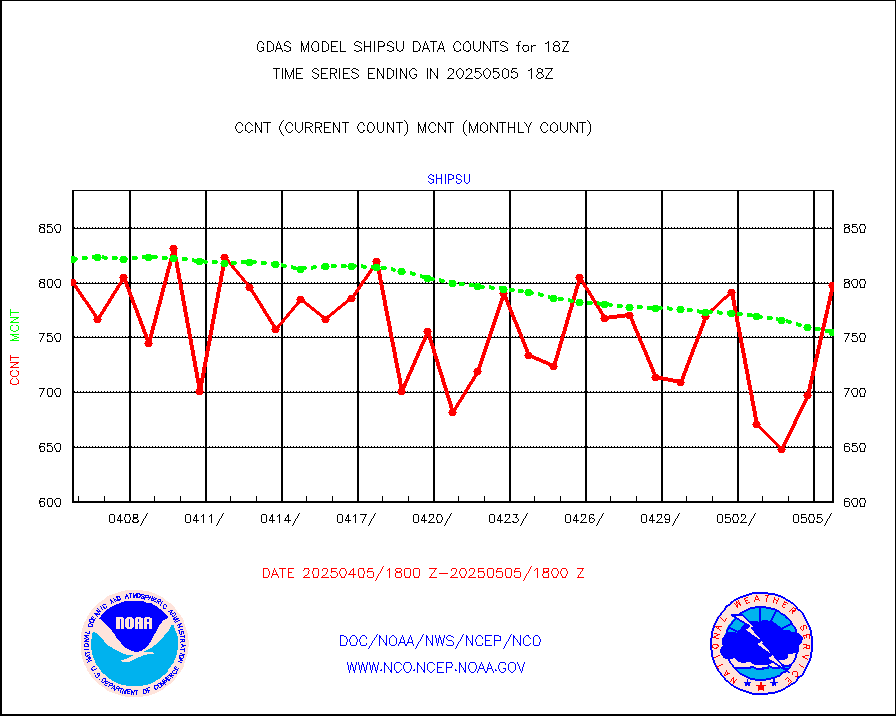
shipsu |
Ship - manual and automatic, unrestricted |
617 |
616 |
100.2 % |
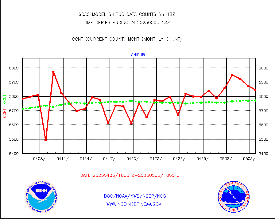
shipub |
Ship - manual and automatic, unrestricted (BUFR) |
6152 |
5960 |
103.2 % |
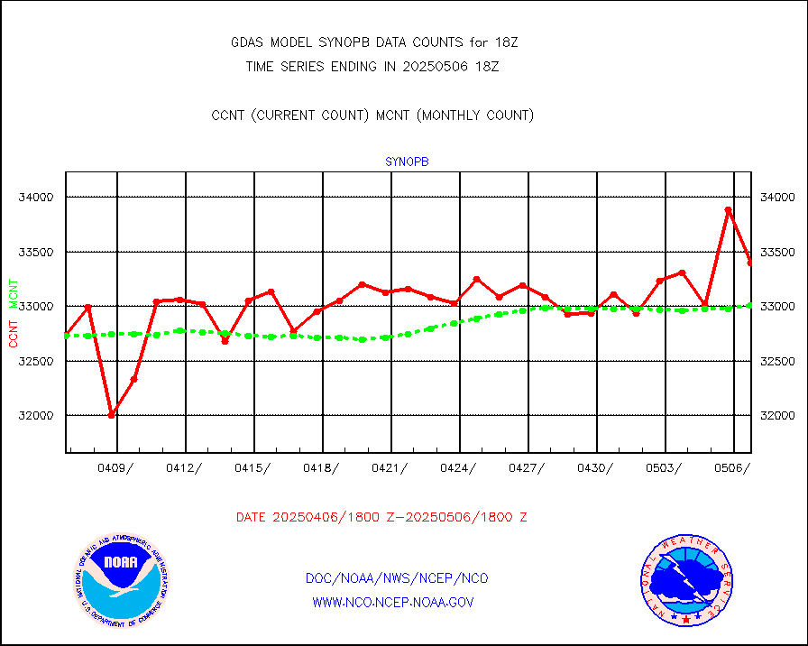
synopb |
Synoptic - fixed manual & auto (decoded fr BUFR) |
31793 |
32389 |
98.2 % |
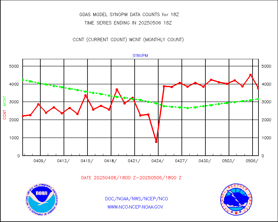
synopm |
Synoptic - mobile manual and automatic |
5653 |
5719 |
98.8 % |
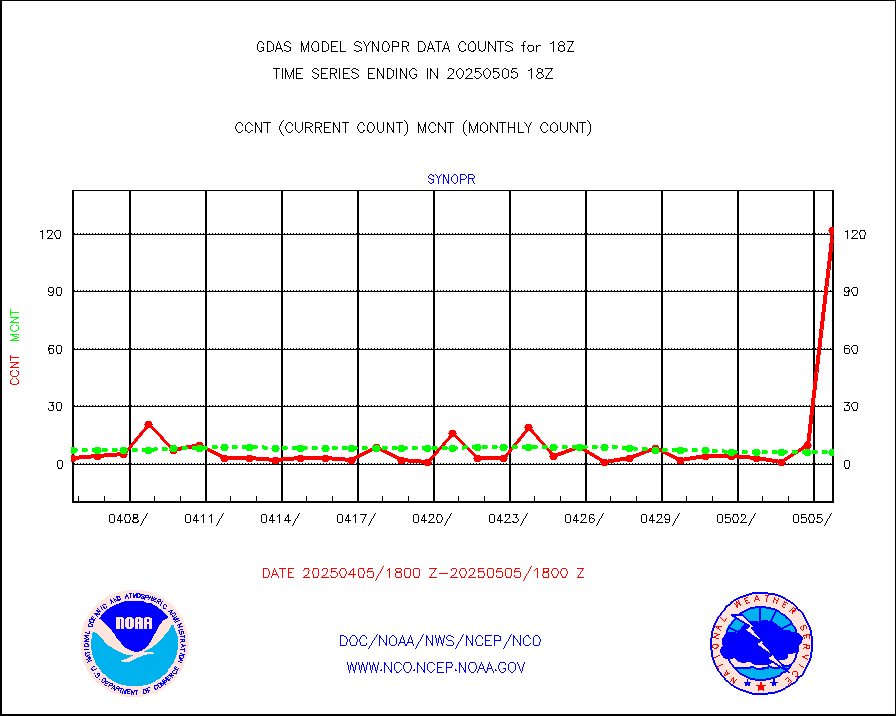
synopr |
Synoptic - restricted (WMO Res 40) manual & auto. |
10 |
8 |
125.0 % |
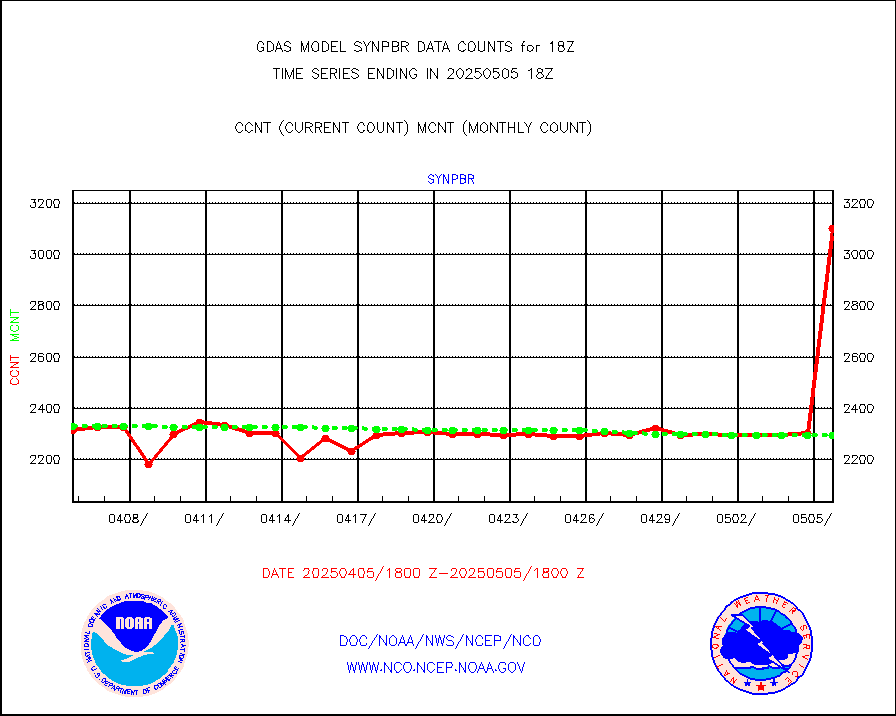
synpbr |
Synoptic - restricted (WMO Res 40)(decoded BUFR) |
2291 |
2303 |
99.5 % |
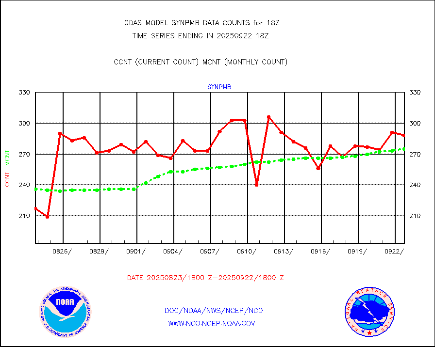
synpmb |
Synoptic - mobile manual & auto (decoded fr BUFR) |
146 |
119 |
122.7 % |
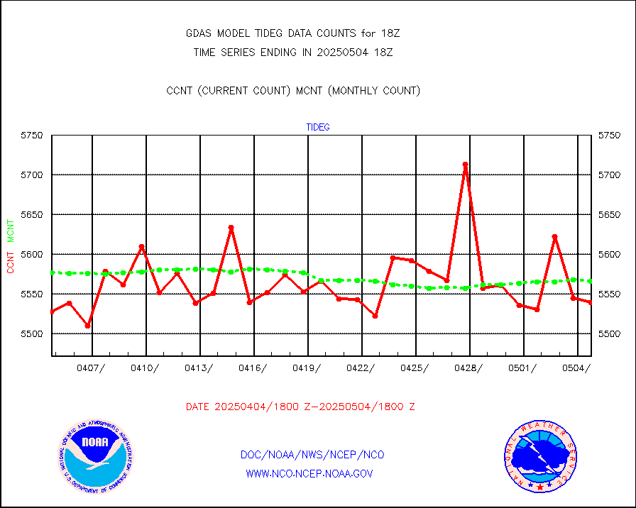
tideg |
Tide gauge reports decoded from CREX format |
5494 |
5477 |
100.3 % |
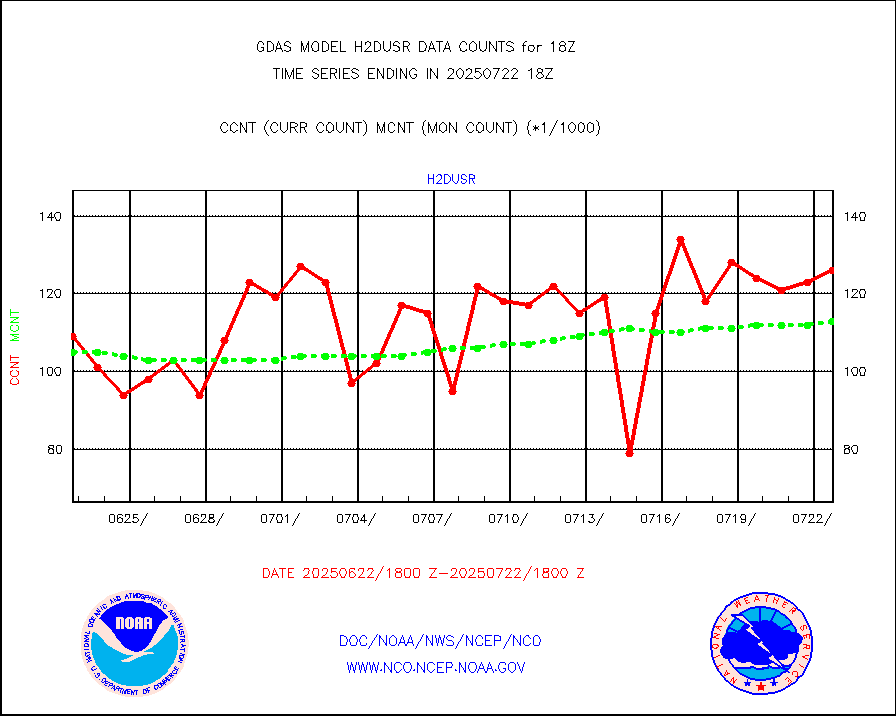
visja |
MTSAT/JMA visible derived cloud motion |
4203 |
3789 |
110.9 % |
vseunb |
METEOSAT/EUMETSAT visible drv cld motion NBseq |
99896 |
91499 |
109.2 % |
| Data Types of Opportunity with Normal Counts |
|---|
| Type | Description | Hourly Count | Monthly Average | Percent (%) of Monthly Mean |
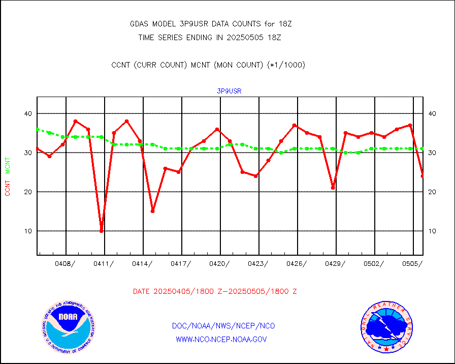
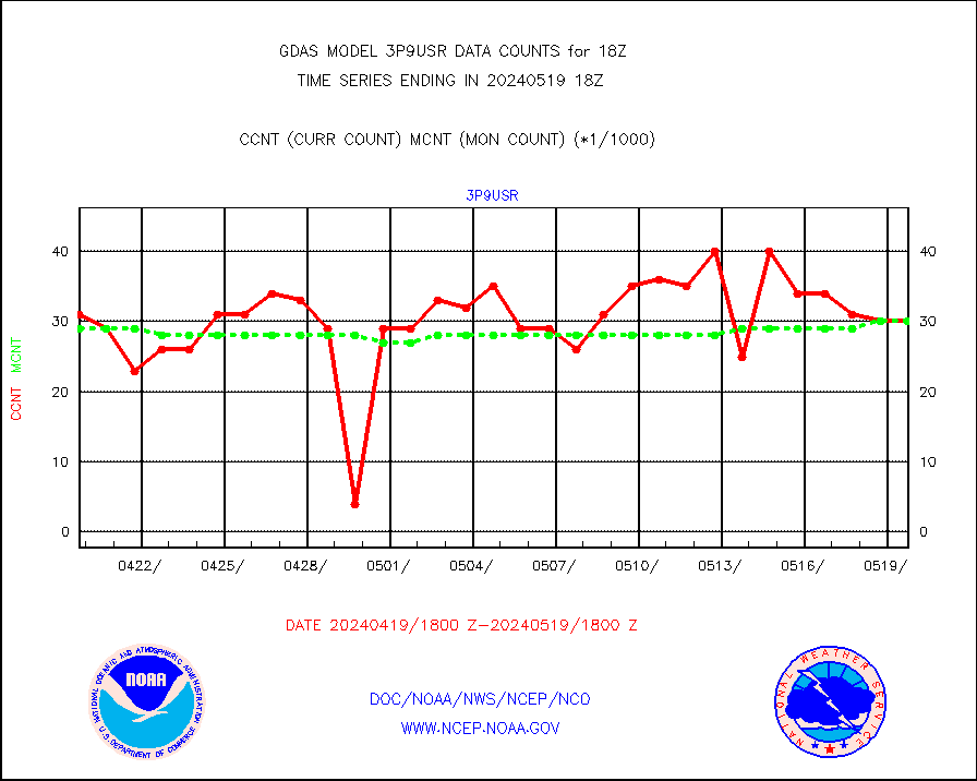
3p9usr |
GOES-16&up/NESDIS ir short-wv derived cld motion |
30155 |
30819 |
97.8 % |
acarsa |
MDCRS ACARS acft data (ARINC via AFWA)(AIREP fmt) |
0 |
0 |
n/a |
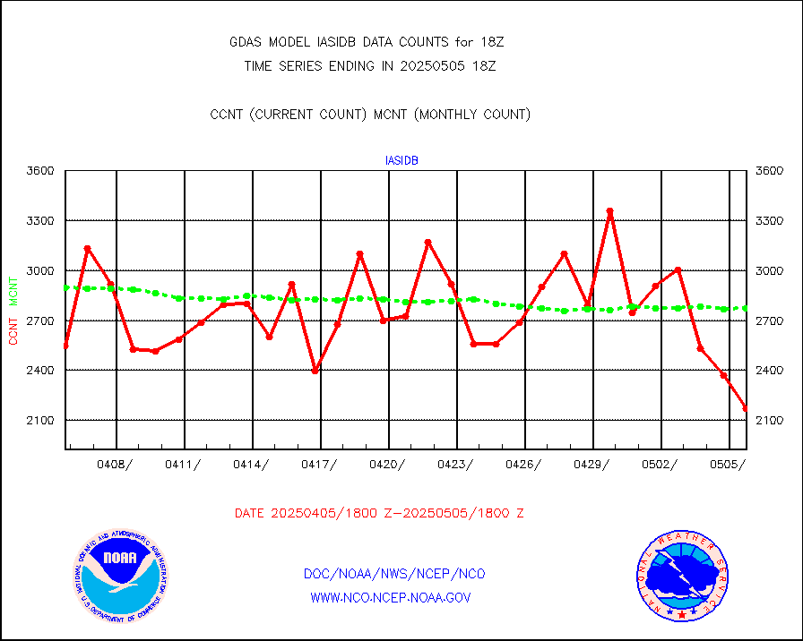
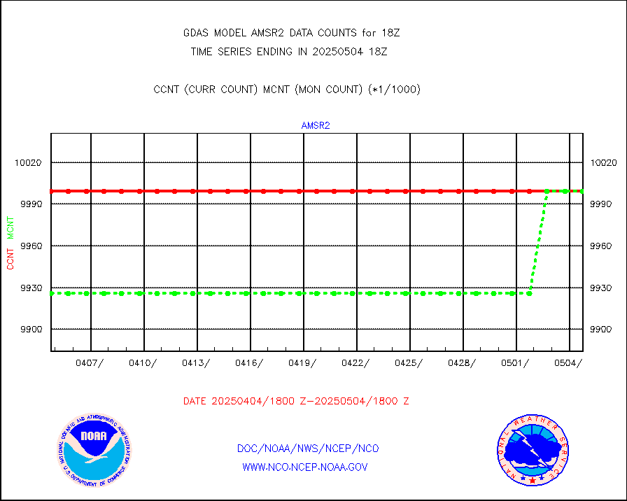
amsr2 |
GCOM-W AMSR2 1B brightness temperatures |
9999999 |
9999999 |
100.0 % |
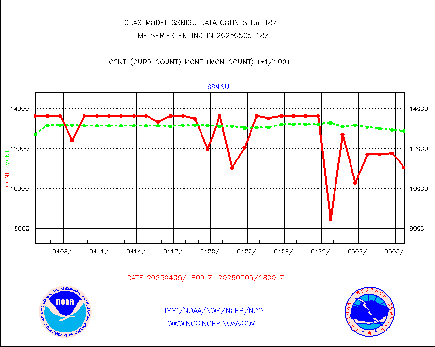
atmsdb |
NPP/NOAA-20 ATMS bright. temps-direct b-cast SSEC |
878852 |
836483 |
105.1 % |
atovs |
POES/NESDIS - processed ATOVS soundings/radiances |
0 |
0 |
n/a |
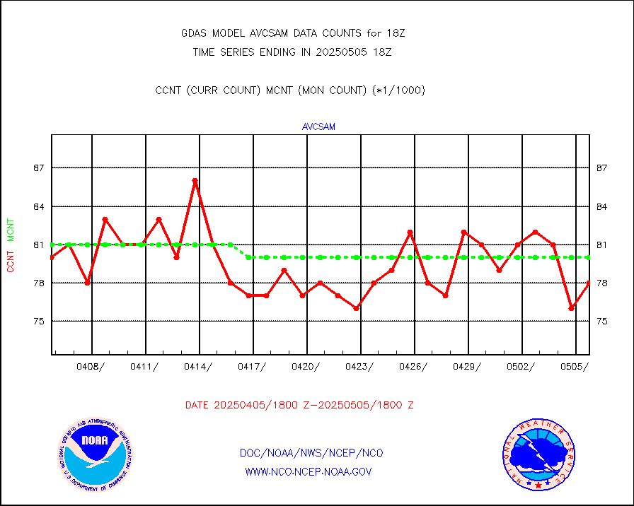
avcsam |
A.M.(N17,M2,M3) AVHRR GAC NCEP-proc clr&sea btmps |
6984992 |
7584996 |
92.1 % |
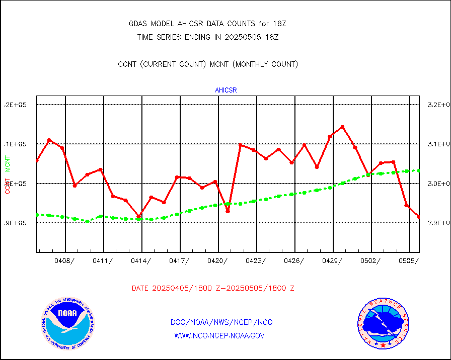
avcspm |
P.M.(N18-19) AVHRR GAC NCEP-proc clr & sea btemps |
7794572 |
8460772 |
92.1 % |
bathy |
eXpendable BathyThermograph, mooring (BATHY fmt) |
5 |
3 |
166.7 % |
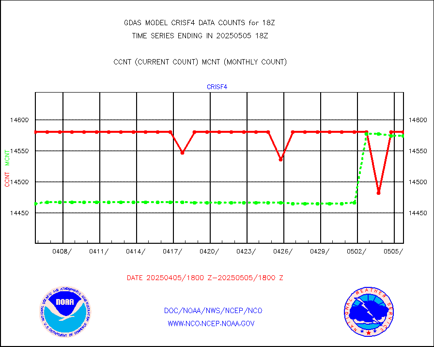
crisf4 |
NPP/NOAA-20 CrIS full spctrl radn (431 ch subset) |
1458000 |
1444861 |
100.9 % |
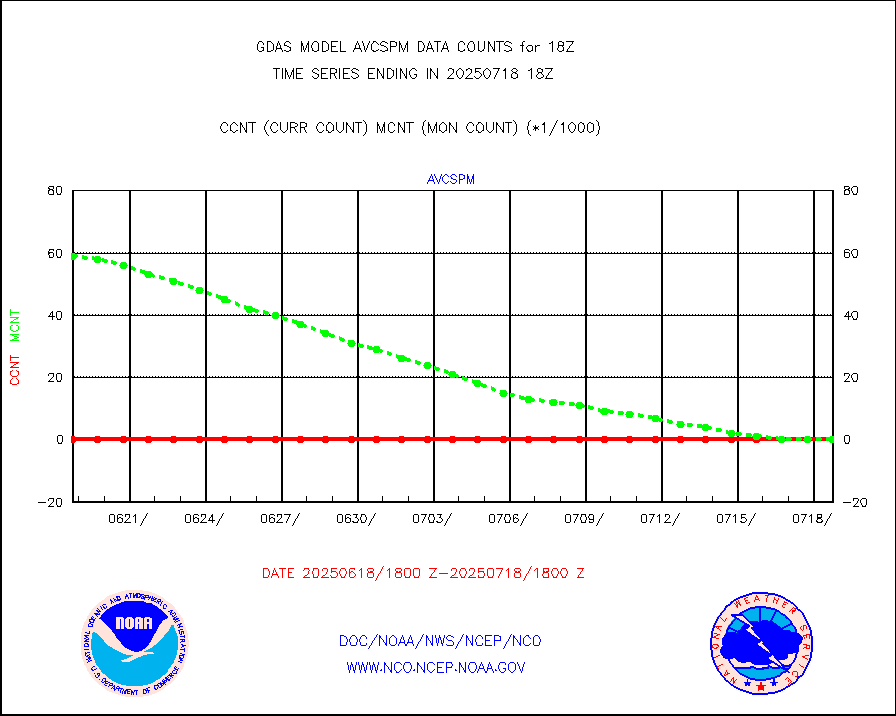
crsfdb |
NPP/NOAA-20 CrIS full spctrl radn dir brdcst SSEC |
719420 |
700472 |
102.7 % |
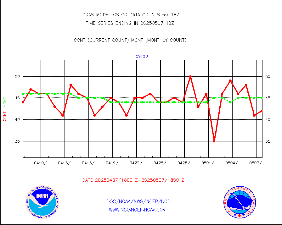
cstgd |
Coast Guard |
33 |
34 |
97.1 % |
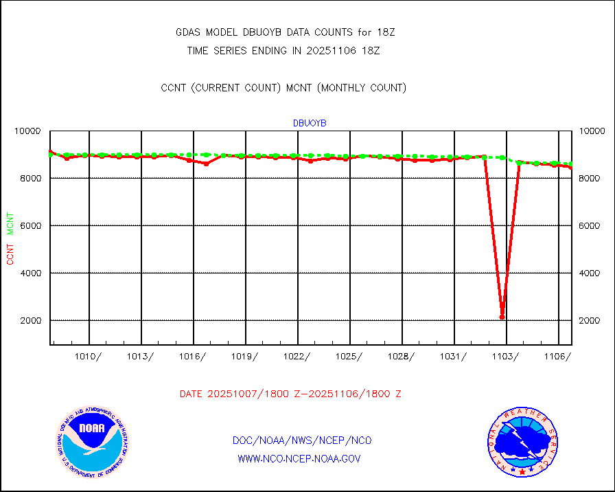
dbuoyb |
Drifting buoys (decoded from BUFR) |
9046 |
8887 |
101.8 % |
esatms |
NPP Adv. Tech. MW Sndr (ATMS) br. temps from RARS |
447650 |
507774 |
88.2 % |
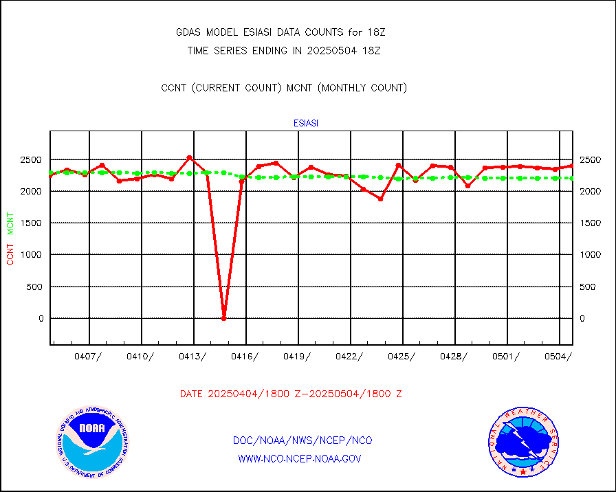
esiasi |
METOP 1-2 IASI 1C radiance data vbl chn from RARS |
368210 |
324424 |
113.5 % |
esmhs |
NOAA 18-19 & METOP 1-2 MHS proc. btemps from RARS |
1525983 |
1478546 |
103.2 % |
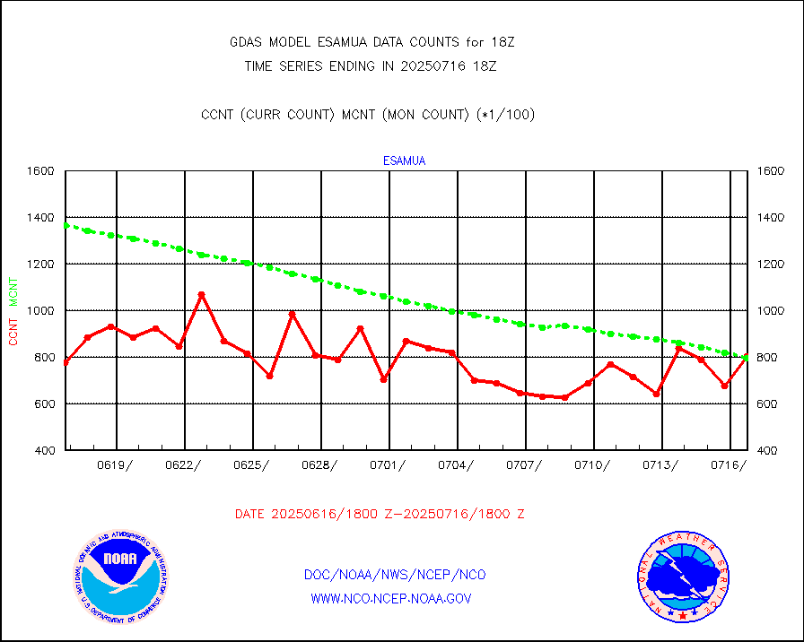
geoimr |
GOES/NESDIS (11x17 f-o-v) imager clear radiances |
0 |
0 |
n/a |
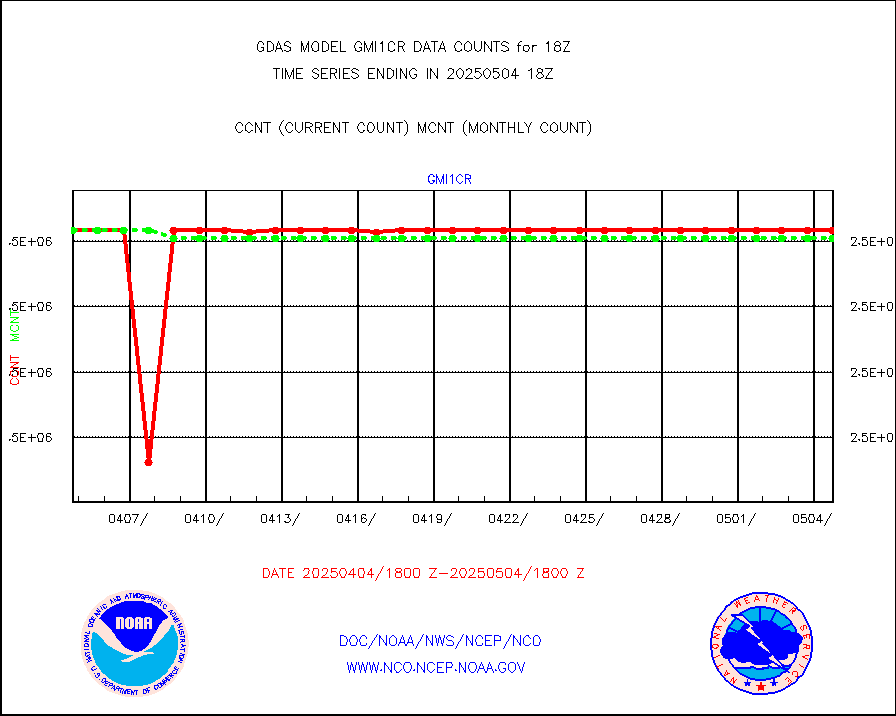
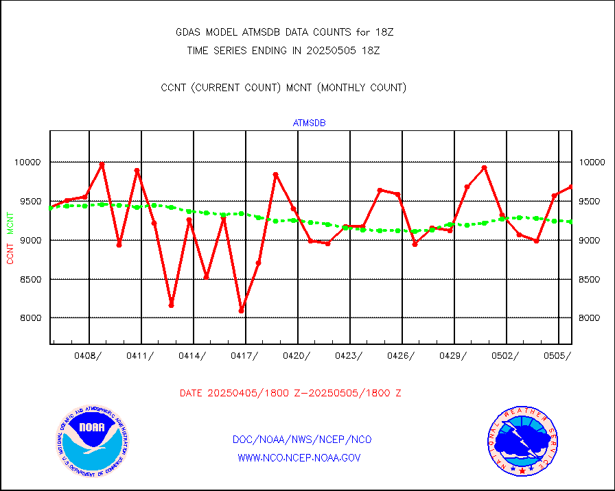
gmi1cr |
GPM GMI Level 1C-R brightness temperatures |
5083442 |
5083369 |
100.0 % |
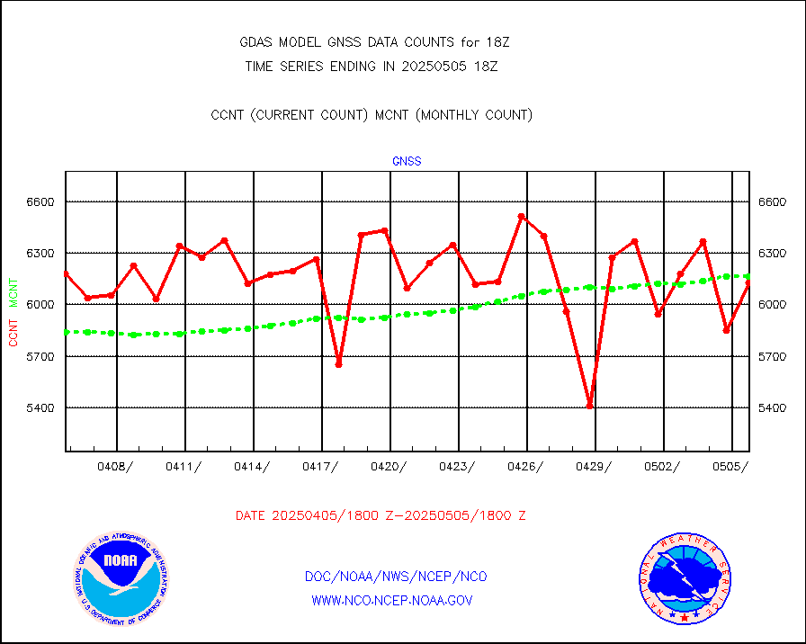
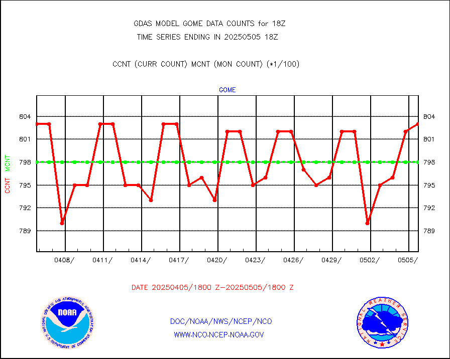
gnss |
Grnd-based Gbl Navigation Sat System (GNSS) data |
5523 |
6105 |
90.5 % |
gome |
METOP 1-2 Global Ozone Monitoring Exp.-2 (GOME-2) |
79157 |
79816 |
99.2 % |
h20in |
INSAT/KALPANA India wvpr derived cloud motion |
0 |
0 |
n/a |
h2dusr |
GOES-16&up/NESDIS wv imgr/deep-lyr derivd cld mtn |
80095 |
102029 |
78.5 % |
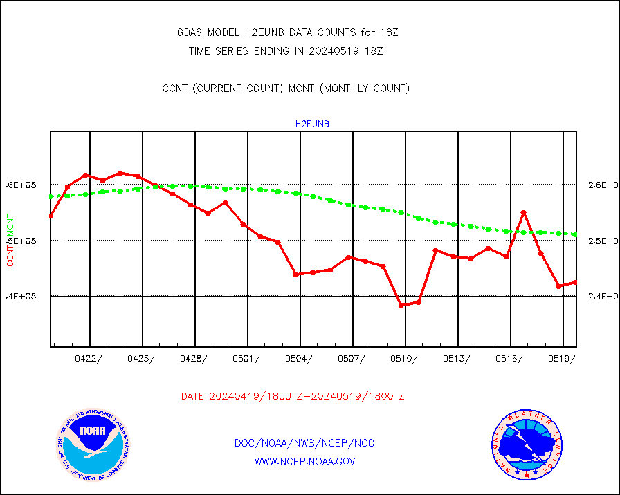
h2eunb |
METEOSAT/EUMETSAT wvpr imgr drv cld motion NBseq |
242513 |
251035 |
96.6 % |
iasidb |
METOP 1-2 IASI 1C radiances-direct broadcast SSEC |
196531 |
190332 |
103.3 % |
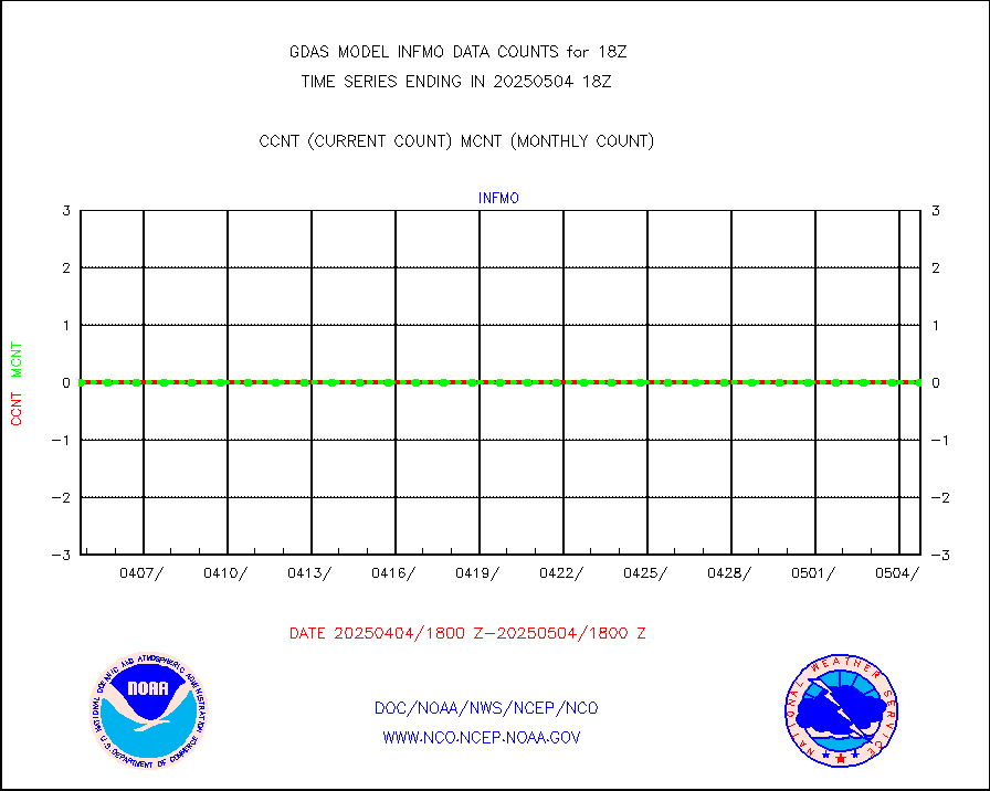
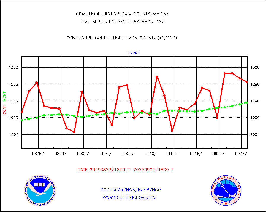
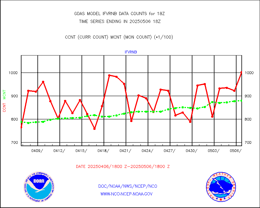
ifvrnb |
VIIRS (NPP/NOAA-20) ir lg-wv drv cloud motion(NB) |
102113 |
93351 |
109.4 % |
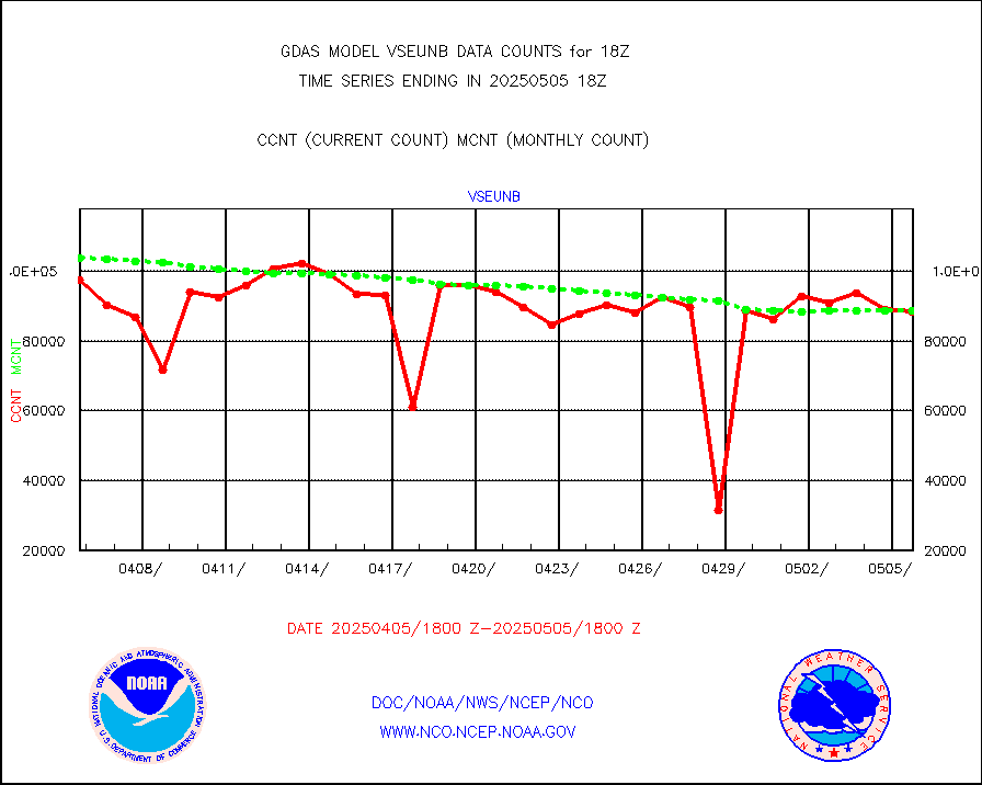
infav |
AVHRR (NOAA/METOP) ir lg-wave derived cld motion |
0 |
0 |
n/a |
infav1 |
AVHRR (METOP) ir lg-wave derived cld motion |
50647 |
54822 |
92.4 % |
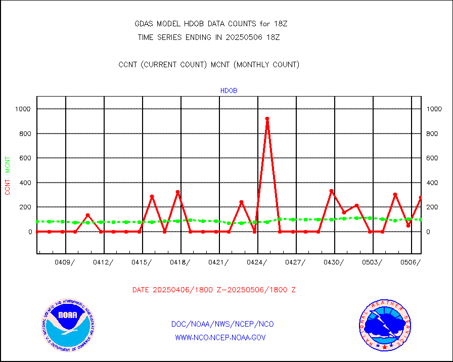
infin |
INSAT/KALPANA India ir lg-wave derived cld motion |
0 |
0 |
n/a |
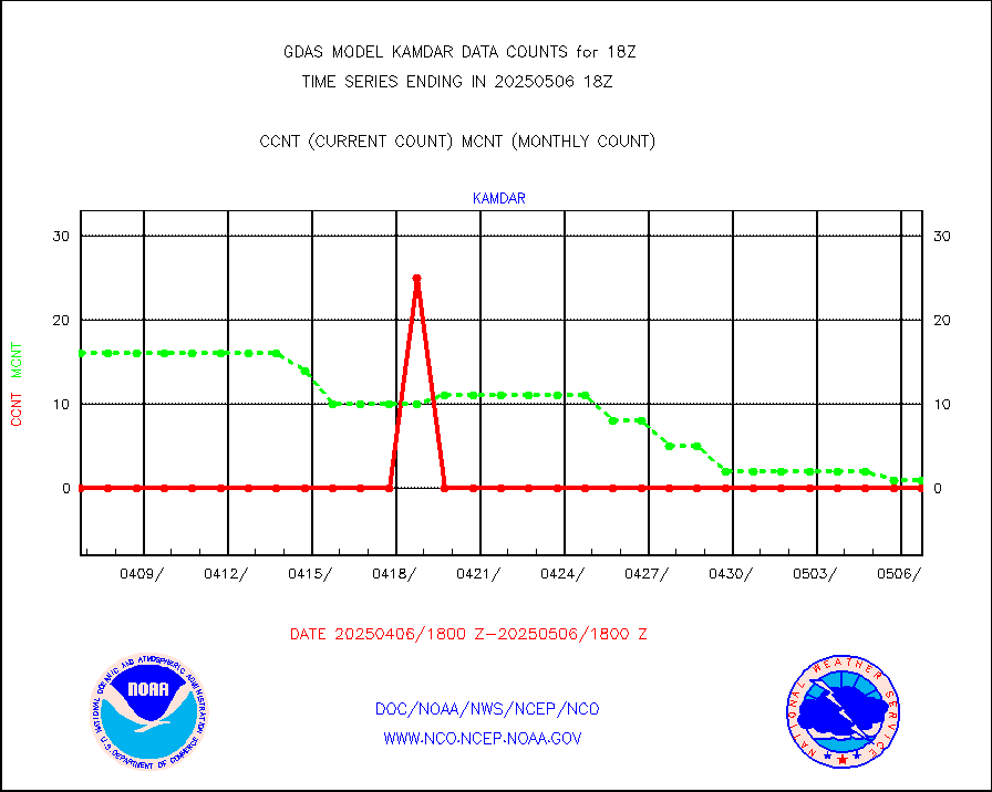
kamdar |
Korean AMDAR aircraft data (decoded from BUFR) |
0 |
2 |
0.0 % |
mbuoyb |
Moored buoys (decoded from BUFR) |
6752 |
6253 |
108.0 % |
nxrdw2 |
NEXRAD Vel Azm Dsp(VAD) winds via Level 2 decoder |
3654 |
3462 |
105.5 % |
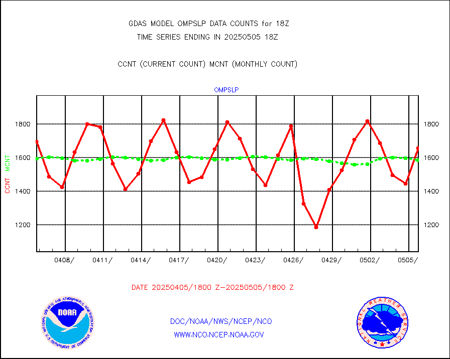
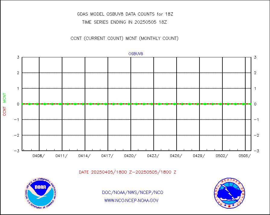
ompslp |
OMPS Limb Profiler ozone data (NPP) |
1748 |
1573 |
111.1 % |
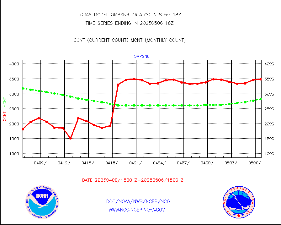
ompsn8 |
OMPS nadir profile ozone (Version 8 BUFR) |
3461 |
3354 |
103.2 % |
ompst8 |
OMPS total column ozone (Version 8 BUFR) |
2055626 |
2008999 |
102.3 % |
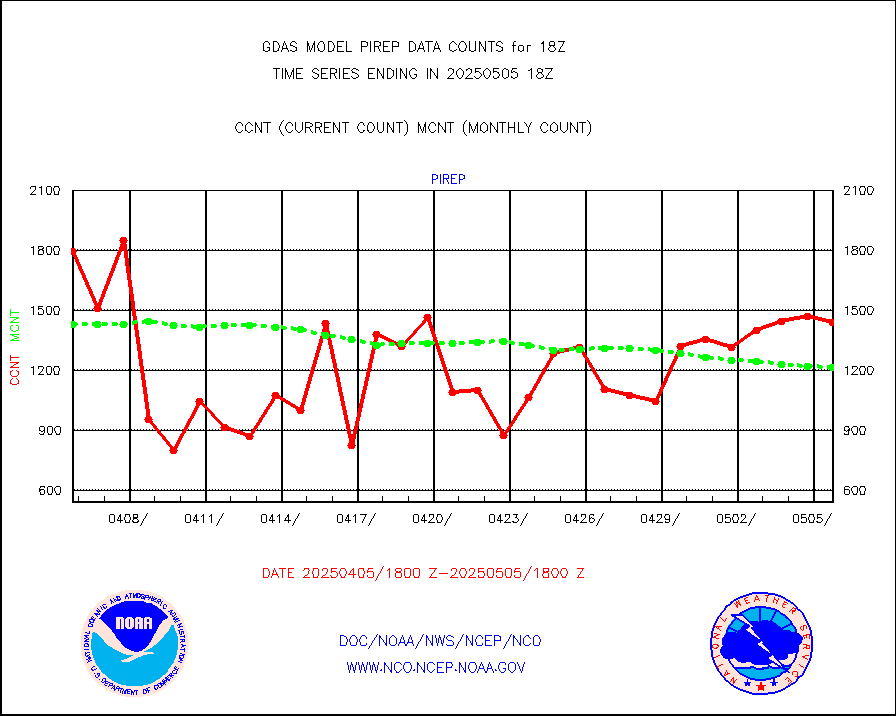
pirep |
Manual PIREP aircraft data (dcded from AIREP fmt) |
913 |
1121 |
81.4 % |
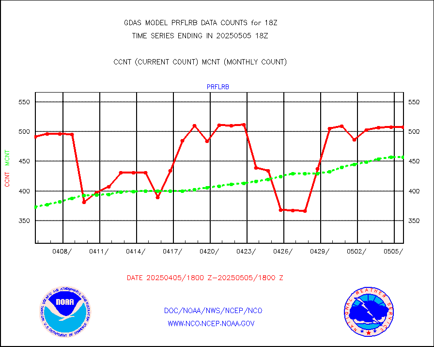
prflrb |
Multi-Agency Profiler (MAP) and SODAR winds |
320 |
395 |
81.0 % |
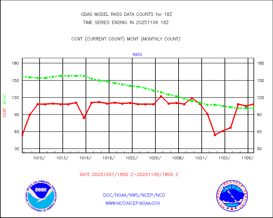
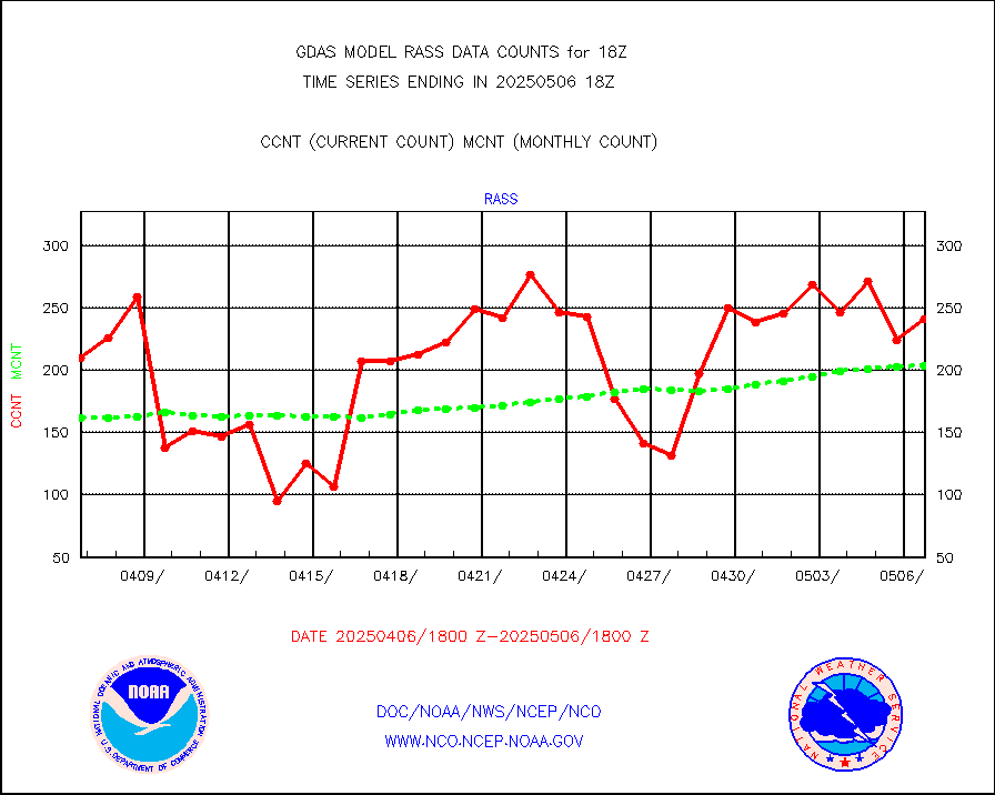
rass |
RASS temperatures (NOAA and Multi-Agency) |
168 |
201 |
83.6 % |
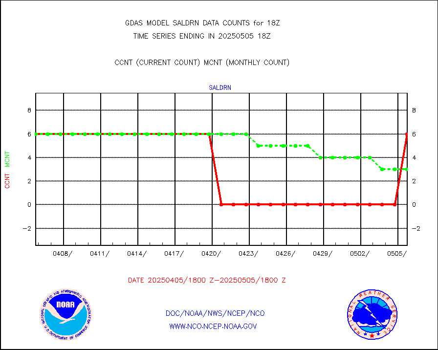
saldrn |
Surface Marine Saildrone (decoded from BUFR) |
6 |
6 |
100.0 % |
saphir |
Megha-Tropiques SAPHIR L1A2 brightness temps |
0 |
0 |
n/a |
sevasr |
METEOSAT-10 2nd Gen SEVIRI All Sky Radiance(proc) |
452198 |
452736 |
99.9 % |
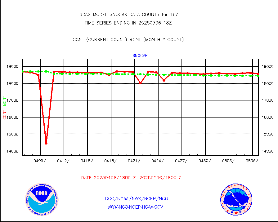
snocvr |
NOW COVER, DEPTH/DENSITY AND WATER EQUIVALENT |
20704 |
20285 |
102.1 % |
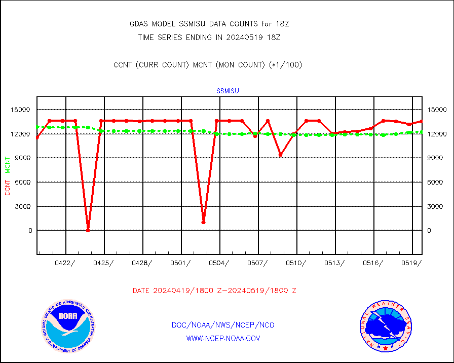
ssmisu |
DMSP SSM/IS 1C radiance data (Unified Pre-Proc.) |
1354559 |
1223477 |
110.7 % |
sstvpw |
NPP/NOAA-20 VIIRS SST - PROBABLY CLR & OVER WATER |
9999999 |
9999999 |
100.0 % |
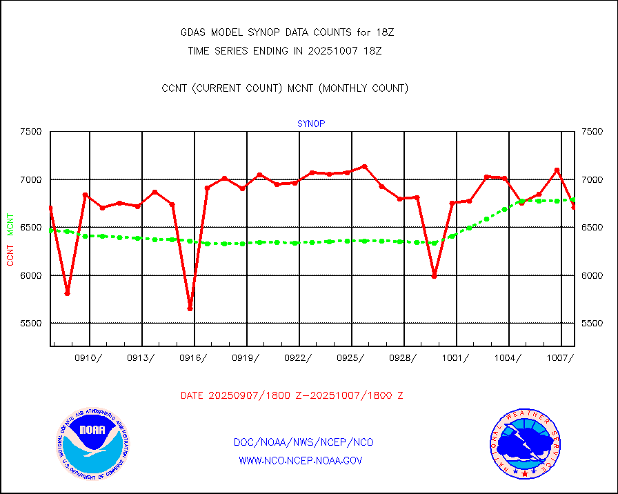
synop |
Synoptic - fixed manual and automatic |
8101 |
8138 |
99.5 % |
tesac |
CTD probe, Argo prflng float, mooring (TESAC fmt) |
2820 |
2664 |
105.9 % |
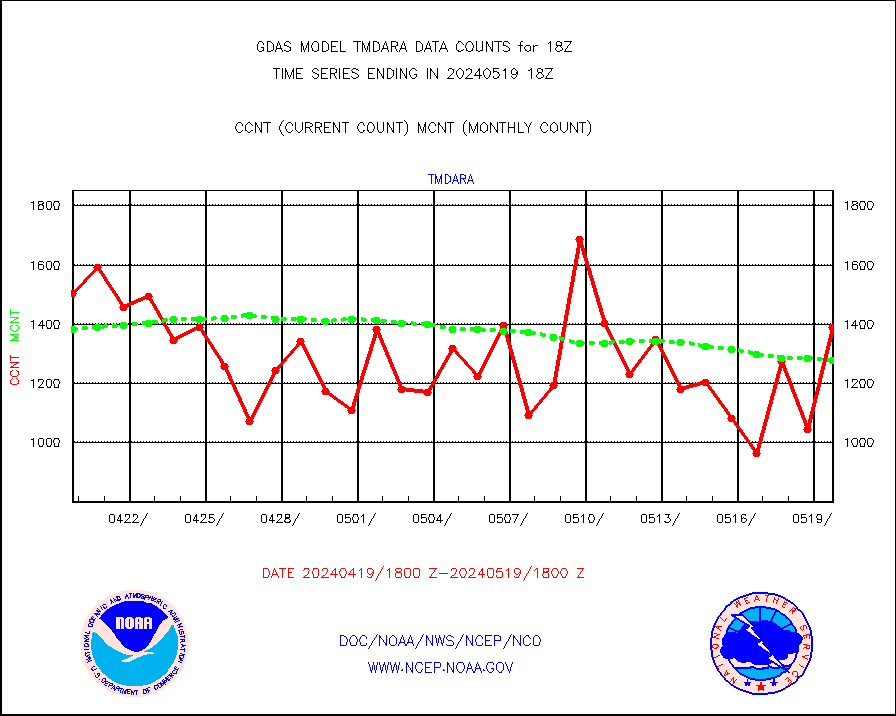
tmdara |
TAMDAR aircft data-all types(from Panasonic,BUFR) |
1390 |
1278 |
108.8 % |
visin |
INSAT/KALPANA India visible derived cloud motion |
0 |
0 |
n/a |
visin2 |
INDIA SATWIND, INSAT VIS channel |
0 |
0 |
n/a |
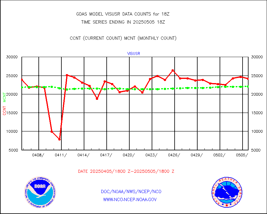
visusr |
GOES-16&up/NESDIS visible derived cloud motion |
2398968 |
2349358 |
102.1 % |


