| Critical Data with Normal Counts |
|---|
| Type | Description | Hourly Count | Monthly Average | Percent (%) of Monthly Mean |
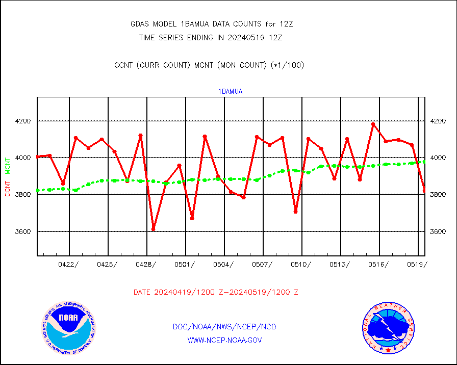
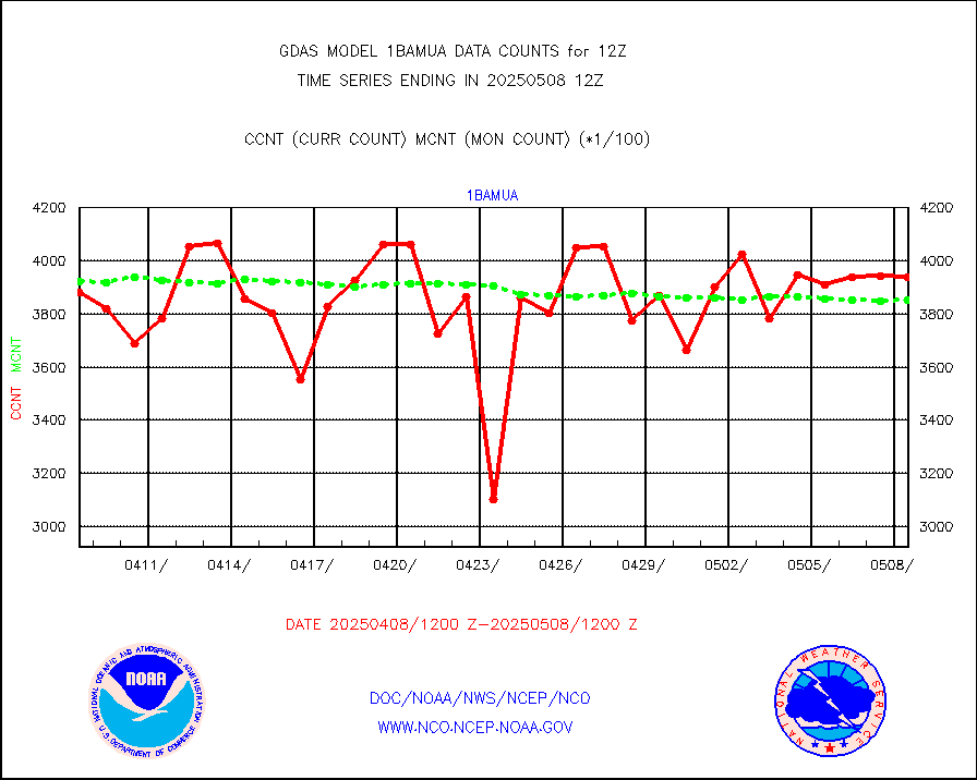
1bamua |
NOAA 15-19 & METOP 1-2 AMSU-A NCEP-proc. br.temps |
382133 |
397851 |
96.0 % |
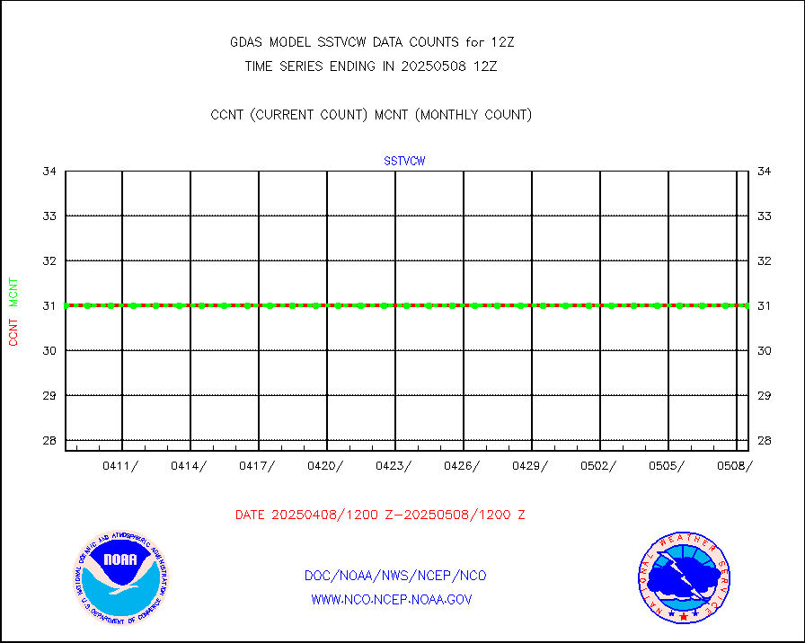
1bhrs4 |
NOAA 18-19 & METOP 1-2 HIRS-4 NCEP-proc. br.temps |
355152 |
353427 |
100.5 % |
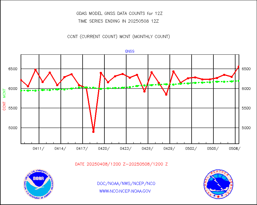
1bmhs |
NOAA 18-19 & METOP 1-2 MHS NCEP-proces. br. temps |
1988057 |
2149806 |
92.5 % |
acars |
MDCRS ACARS acft data from ARINC(dcded from BUFR) |
85937 |
100893 |
85.2 % |
ahicsr |
Himawari Clear Sky Radiance |
299551 |
302124 |
99.1 % |
airep |
Manual AIREP aircraft data (dcded from AIREP fmt) |
9297 |
8392 |
110.8 % |
airsev |
AQUA AIRS/AMSU-A/HSB brightness temps- every FOV |
0 |
0 |
n/a |
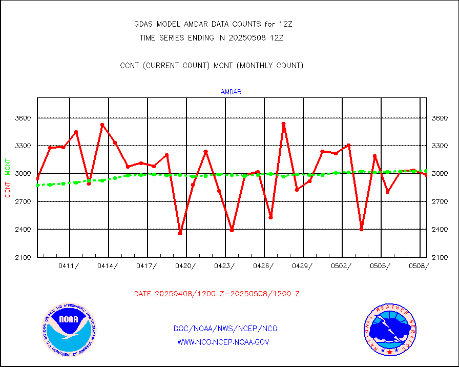
amdar |
AMDAR aircraft data (decoded from AMDAR format) |
2990 |
3054 |
97.9 % |
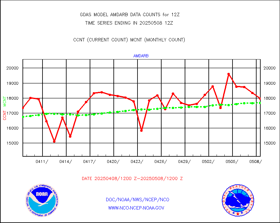
amdarb |
AMDAR aircraft data (decoded from BUFR) |
8307 |
7884 |
105.4 % |
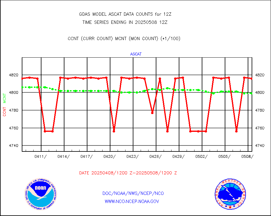
ascat |
METOP 1-2 ASCAT products |
475608 |
470012 |
101.2 % |
atms |
NPP/NOAA-20 ATMS brightness temperatures |
2318968 |
2317786 |
100.1 % |
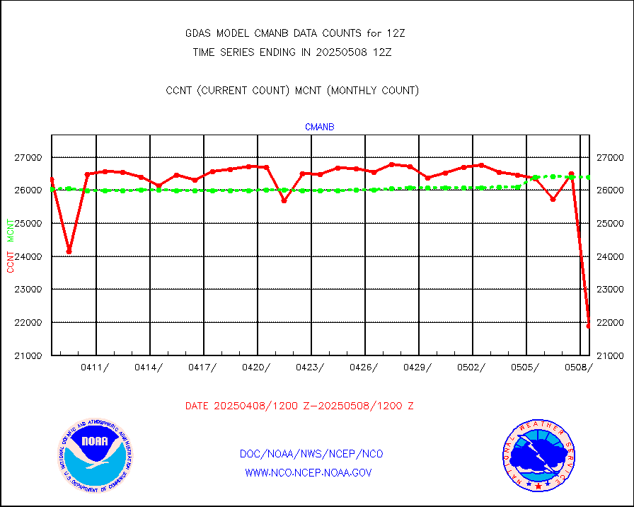
cmanb |
Surface Marine CMAN rpts decoded from BUFR format |
26901 |
25611 |
105.0 % |
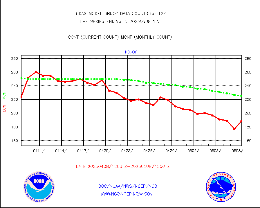
dbuoy |
Buoys decoded from FM-18 fmt (moored or drifting) |
285 |
287 |
99.3 % |
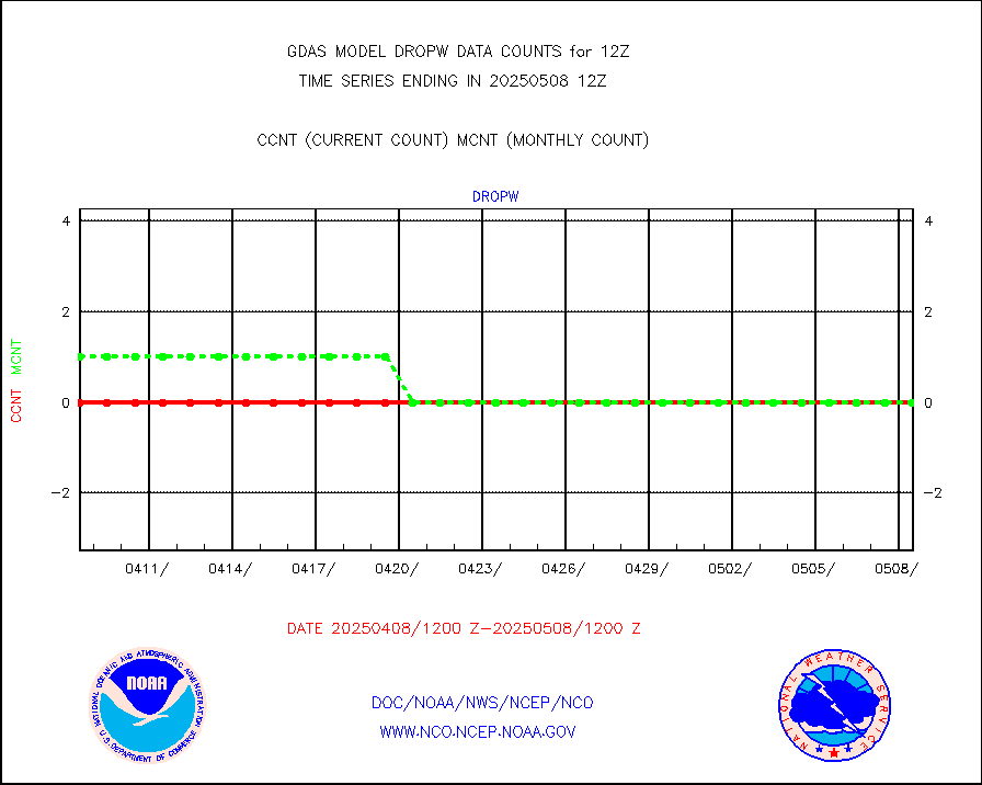
dropw |
Dropwinsonde (from TEMP DROP) |
0 |
0 |
n/a |
eadas |
E-AMDAR (European AMDAR acft decoded from BUFR) |
19177 |
18191 |
105.4 % |
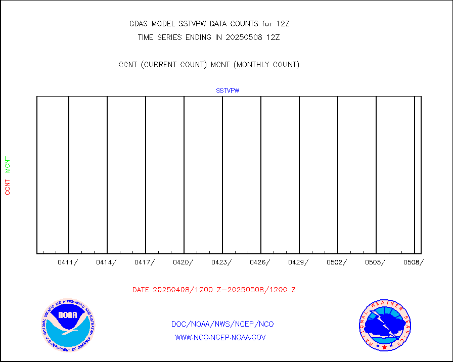
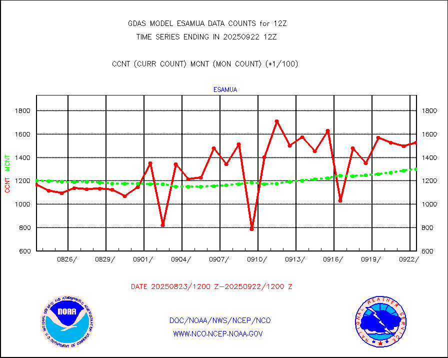
esamua |
NOAA 15-19 & METOP 1-2 AMSU-A proc btmps frm RARS |
263418 |
258104 |
102.1 % |
eshrs3 |
NOAA 15-19 & METOP 1-2 HIRS-3/4 pr btmps frm RARS |
728923 |
692074 |
105.3 % |
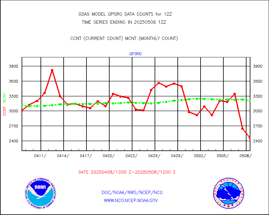
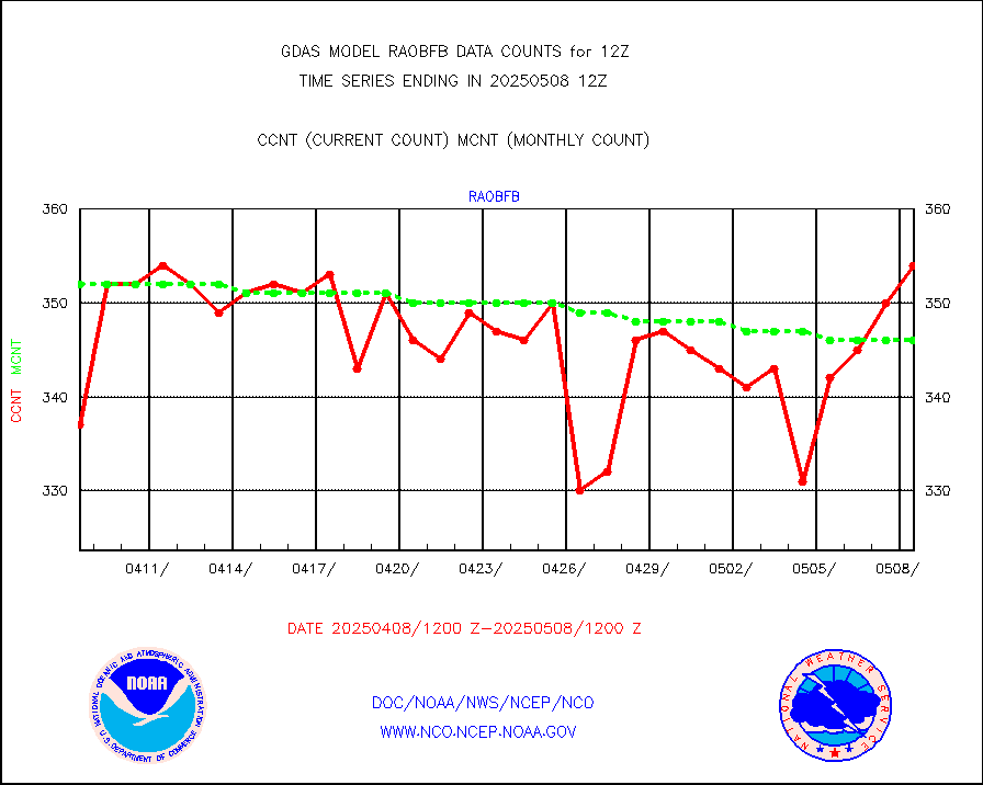
gpsro |
GPS radio occultation data |
2927 |
3015 |
97.1 % |
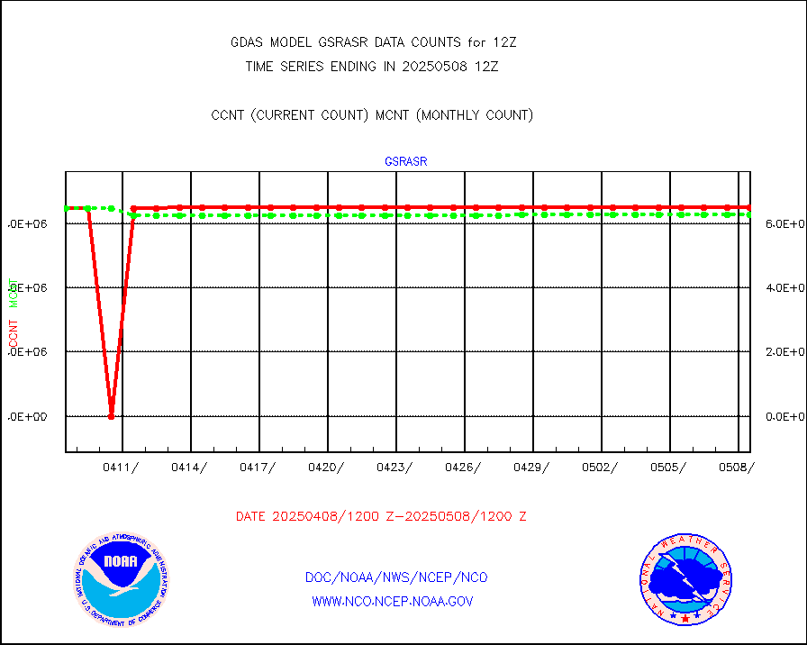
gsrasr |
GOES-16/17 All Sky Radiances (proc.) |
6488568 |
6402137 |
101.4 % |
gsrcsr |
GOES-16/17 Clear Sky Radiances (proc.) |
2892743 |
2998098 |
96.5 % |
h20ja |
MTSAT/JMA water vapor imager derived cloud motion |
59335 |
56034 |
105.9 % |
h20mo |
MODIS (AQUA/TERRA) wvpr imager derived cld motion |
0 |
0 |
n/a |
h2tusr |
GOES-16&up/NESDIS wv imgr/cld-top derived cld mtn |
136726 |
148258 |
92.2 % |
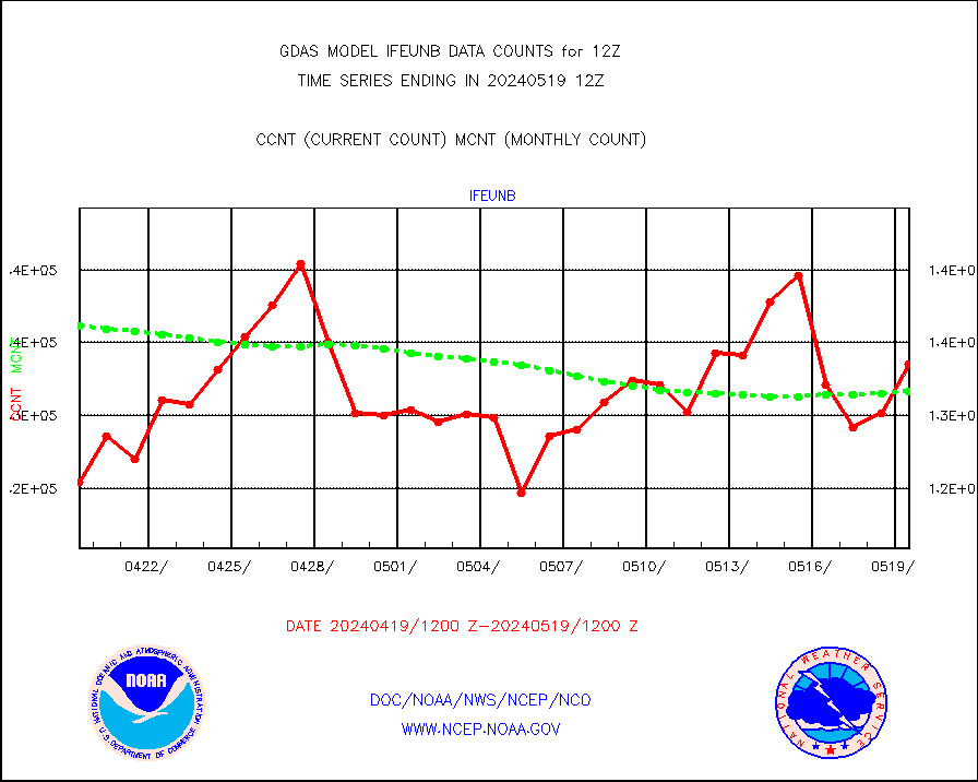
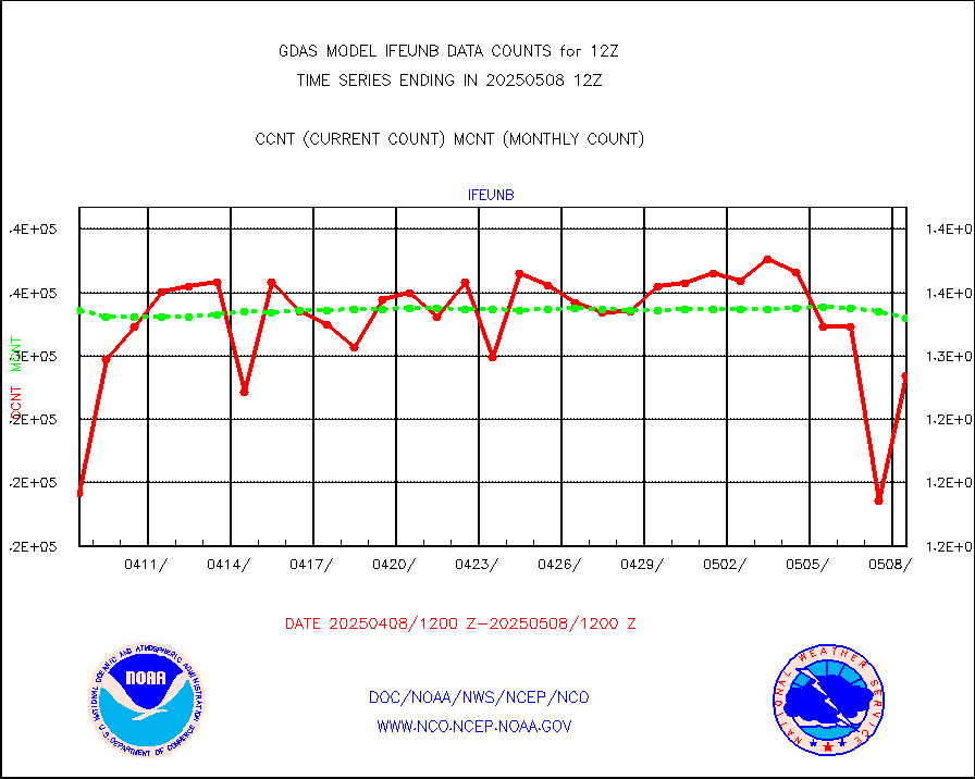
ifeunb |
METEOSAT/EUMETSAT ir lg-wave drv cld motion NBseq |
133562 |
131673 |
101.4 % |
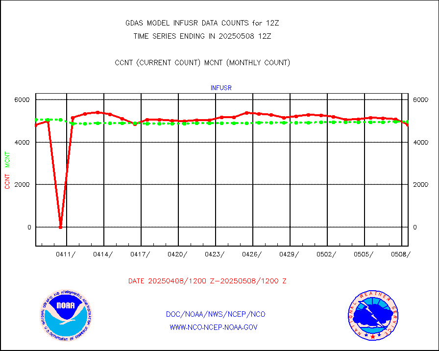
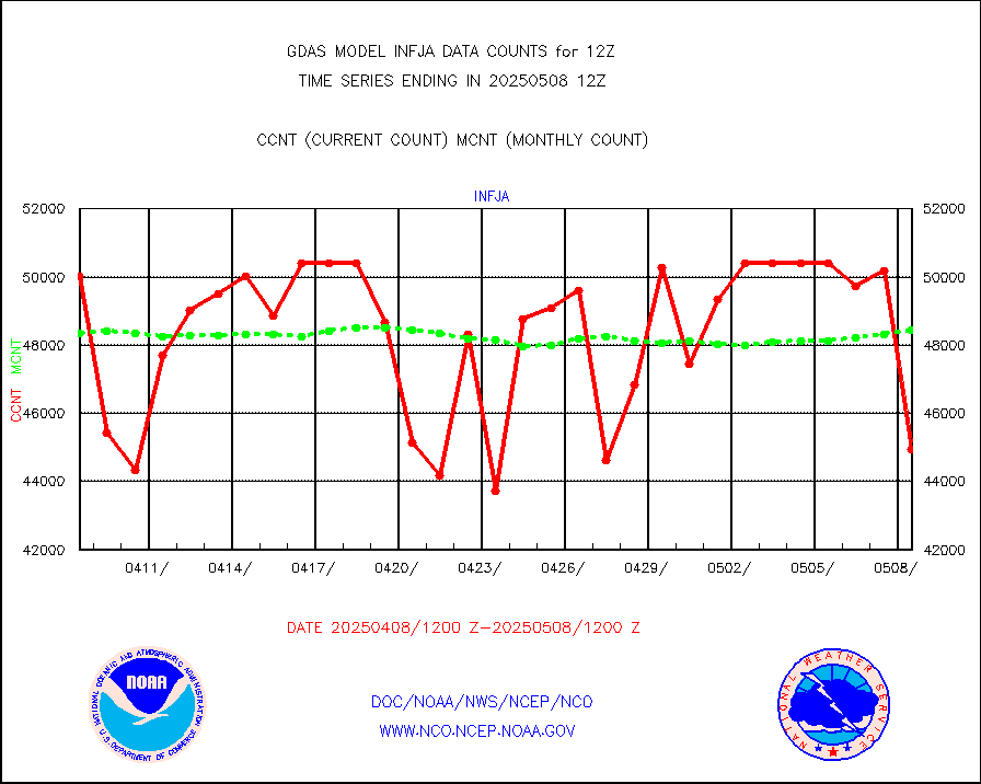
infja |
MTSAT/JMA infrared long-wave derived cloud motion |
48944 |
47567 |
102.9 % |
infmo |
MODIS (AQUA/TERRA) ir l-wave derived cloud motion |
0 |
0 |
n/a |
infusr |
GOES-16&up/NESDIS ir long-wave derived cld motion |
475917 |
484411 |
98.2 % |
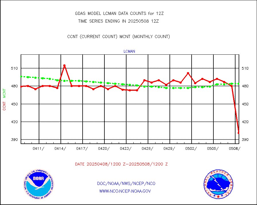
lcman |
Land-based CMAN stations decoded from CMAN format |
588 |
587 |
100.2 % |
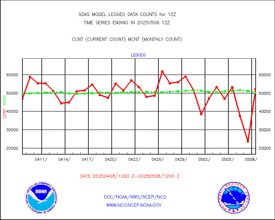
leogeo |
LEO-GEO satellite AMVs from UWisc. |
42327 |
35233 |
120.1 % |
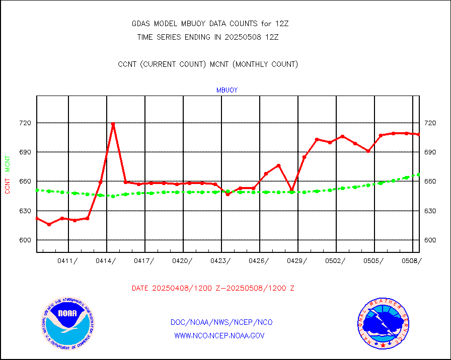
mbuoy |
Buoys decoded from FM-13 format (moored) |
778 |
743 |
104.7 % |
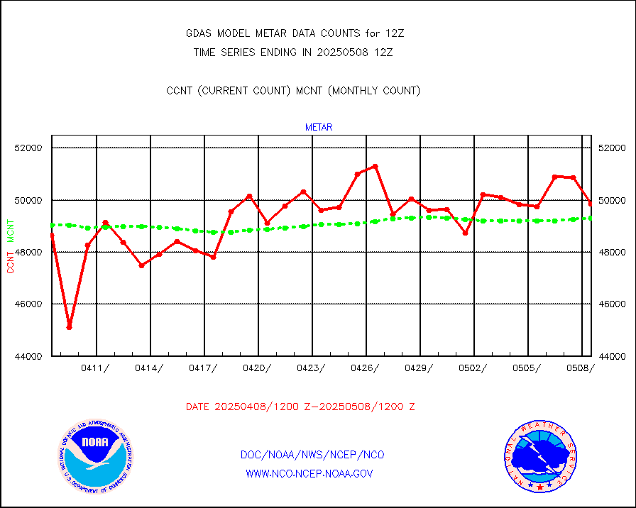
metar |
Aviation - METAR |
48105 |
49475 |
97.2 % |
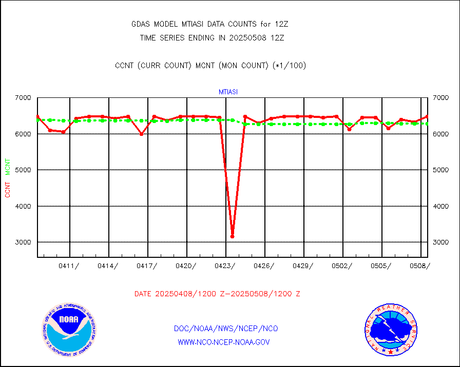
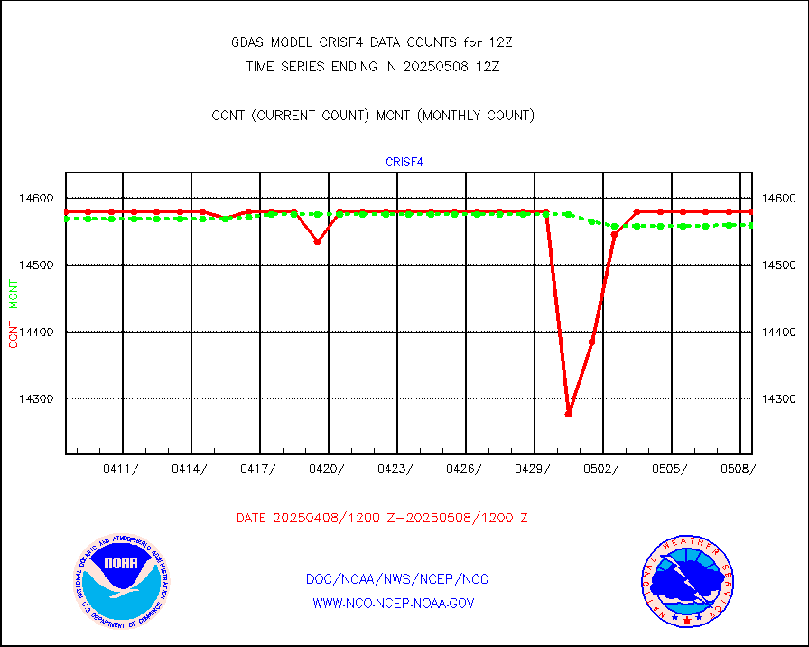
mtiasi |
METOP 1-2 IASI 1C radiance data (varbl. channels) |
553440 |
638731 |
86.6 % |
nxrdw |
NEXRAD Vel Azm Dsp(VAD) winds via radar coded msg |
0 |
0 |
n/a |
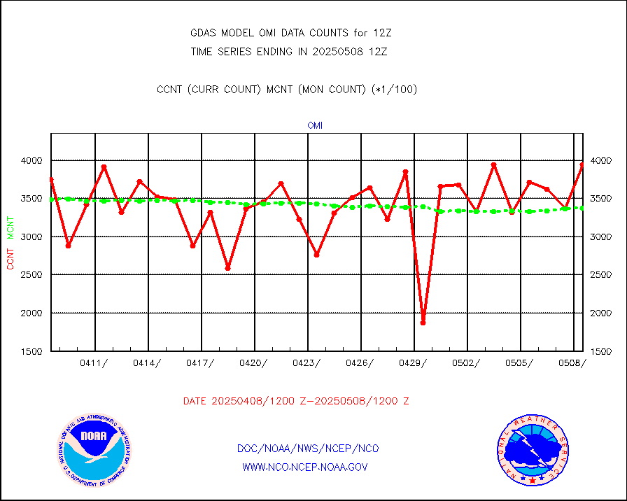
omi |
Aura Ozone Monitoring Instrument (OMI) data |
331261 |
281915 |
117.5 % |
osbuv8 |
NOAA 16-19 Solar Backscatter UV-2 rad frm V8 BUFR |
0 |
0 |
n/a |
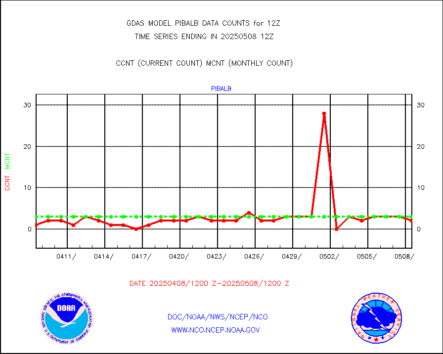
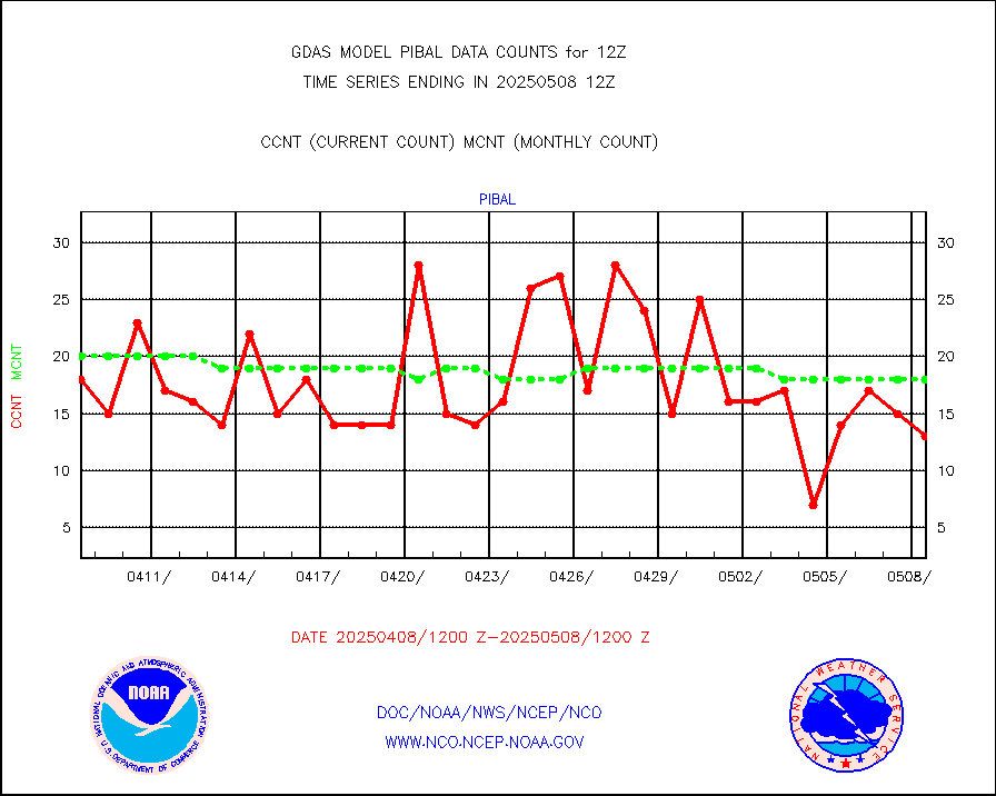
pibal |
PIBAL (from PILOT, PILOT SHIP, PILOT MOBIL) |
59 |
57 |
103.5 % |
prflrp |
Profilr winds from PIBAL (PILOT,PILOT SHIP/MOBIL) |
0 |
0 |
n/a |
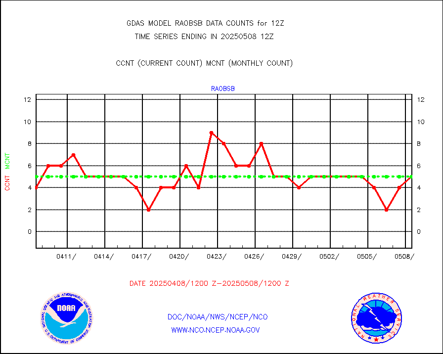
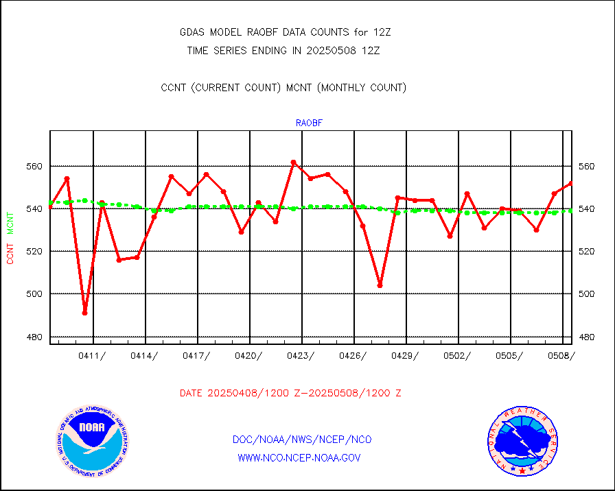
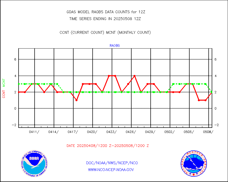
raobf |
Rawinsonde - fixed land (from TEMP or PILOT) |
560 |
570 |
98.2 % |
raobm |
Rawinsonde - mobile land (from TEMP/PILOT MOBIL) |
0 |
0 |
n/a |
raobs |
Rawinsonde - ship (from TEMP SHIP, PILOT SHIP) |
2 |
3 |
66.7 % |
recco |
Flight level reconnaissance aircraft data |
0 |
0 |
n/a |
sevcsr |
METEOSAT-10 2nd Gen SEVIRI Clr Sky Radiance(proc) |
0 |
0 |
n/a |
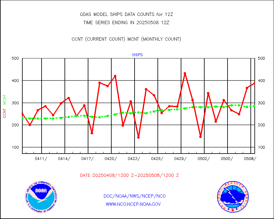
ships |
Ship - manual and automatic, restricted |
167 |
144 |
116.0 % |
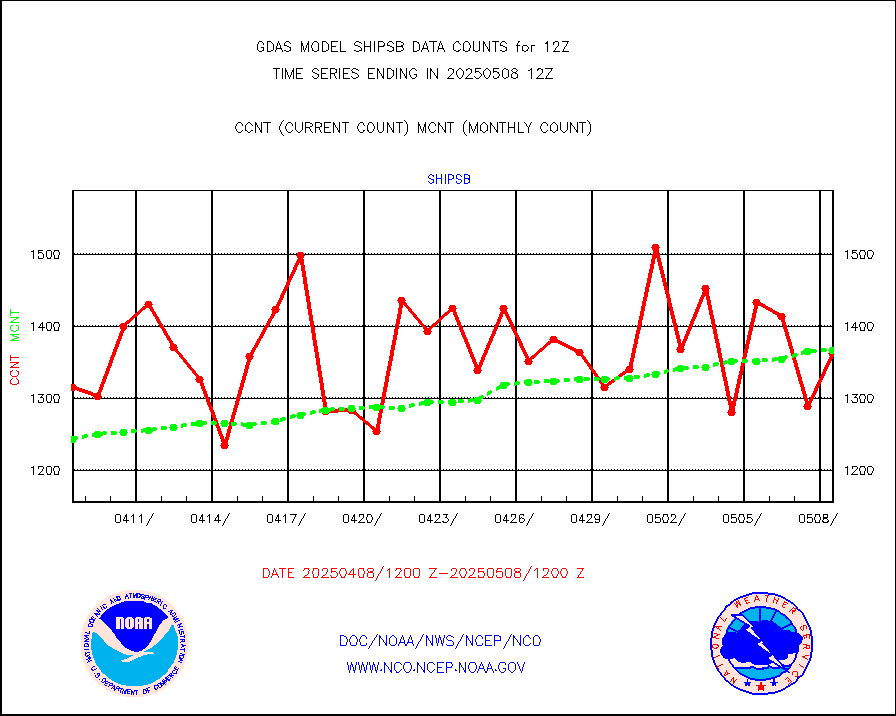
shipsb |
Ship - manual and automatic, restricted (BUFR) |
1039 |
1061 |
97.9 % |
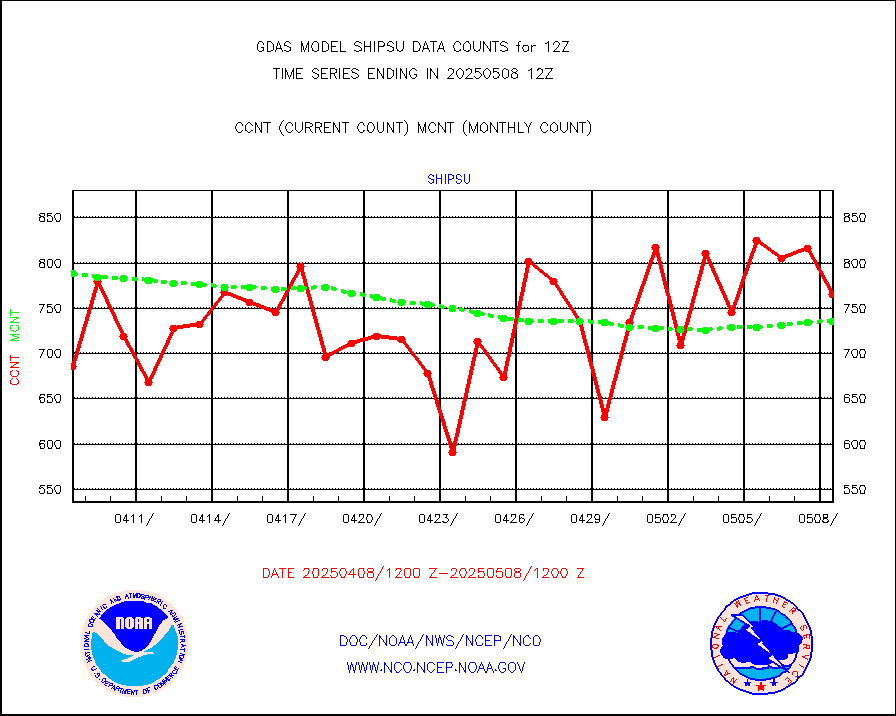
shipsu |
Ship - manual and automatic, unrestricted |
565 |
577 |
97.9 % |
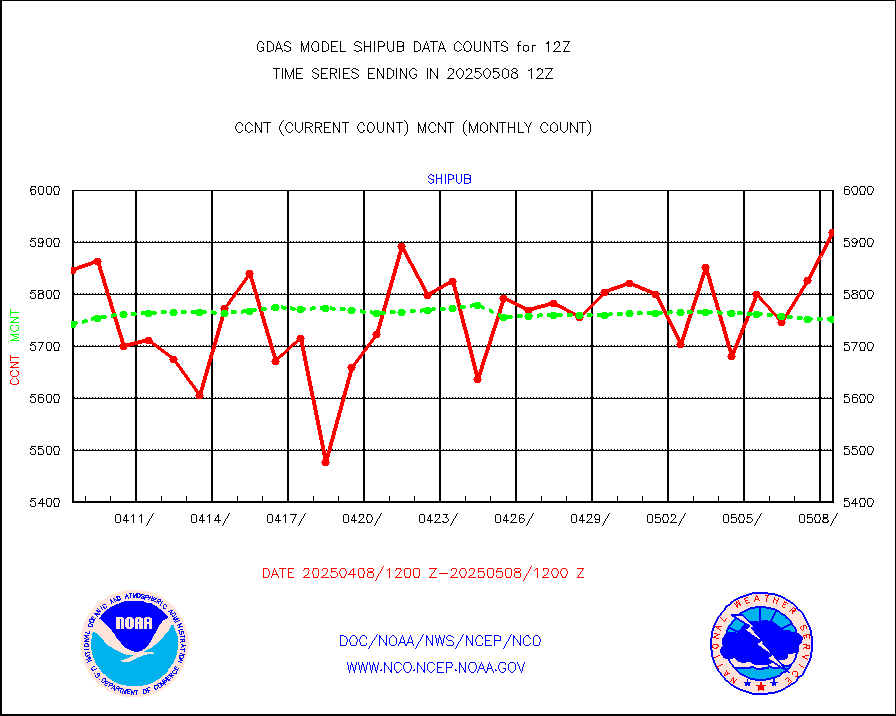
shipub |
Ship - manual and automatic, unrestricted (BUFR) |
6208 |
5944 |
104.4 % |
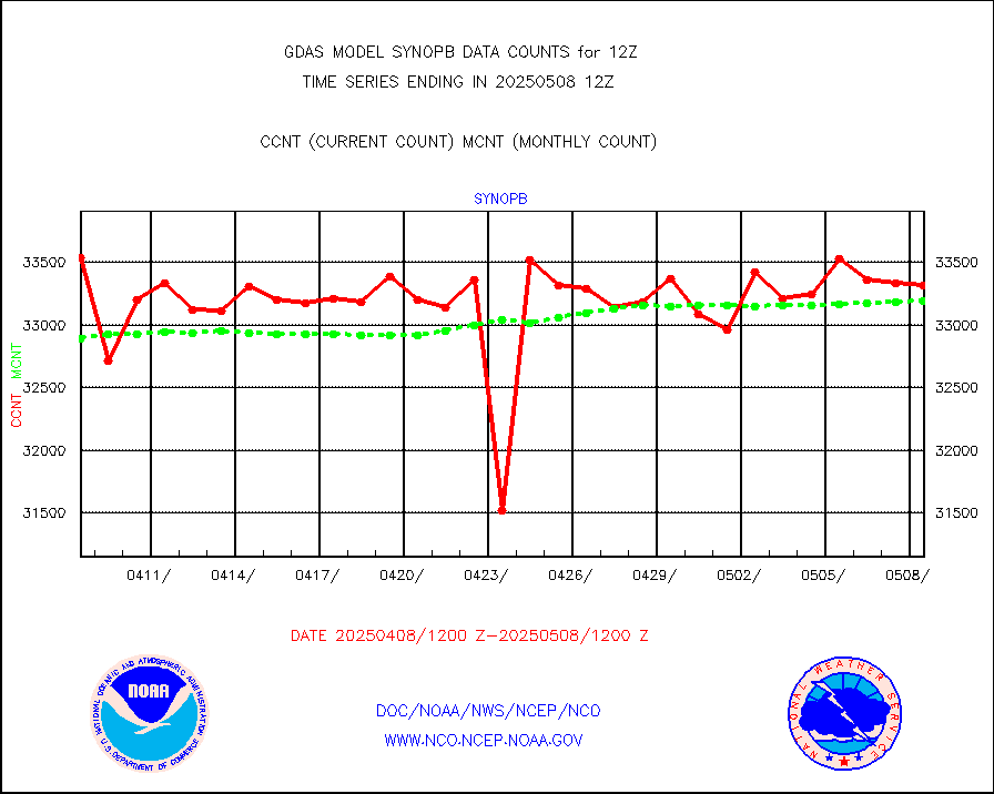
synopb |
Synoptic - fixed manual & auto (decoded fr BUFR) |
32117 |
32500 |
98.8 % |
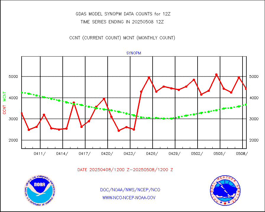
synopm |
Synoptic - mobile manual and automatic |
5737 |
5733 |
100.1 % |
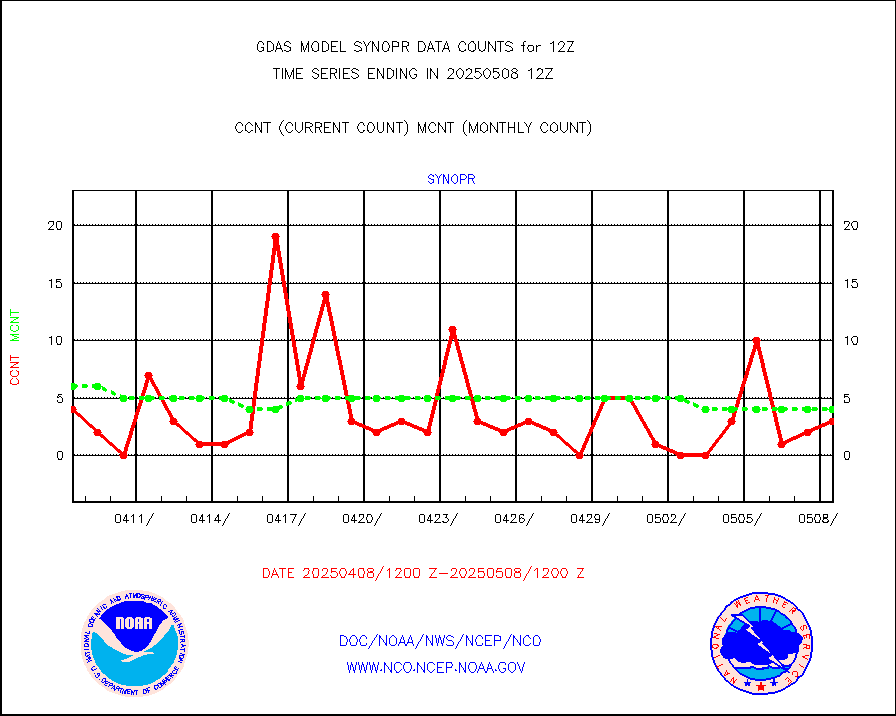
synopr |
Synoptic - restricted (WMO Res 40) manual & auto. |
3 |
6 |
50.0 % |
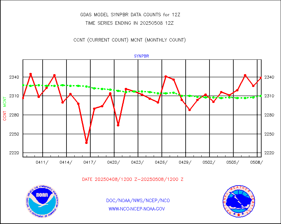
synpbr |
Synoptic - restricted (WMO Res 40)(decoded BUFR) |
2312 |
2298 |
100.6 % |
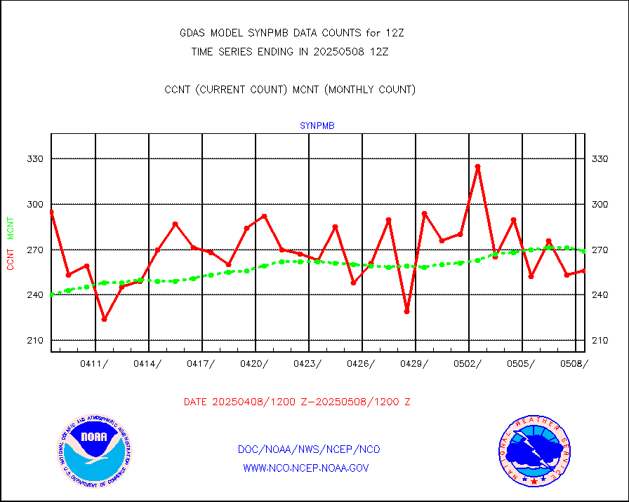
synpmb |
Synoptic - mobile manual & auto (decoded fr BUFR) |
131 |
83 |
157.8 % |
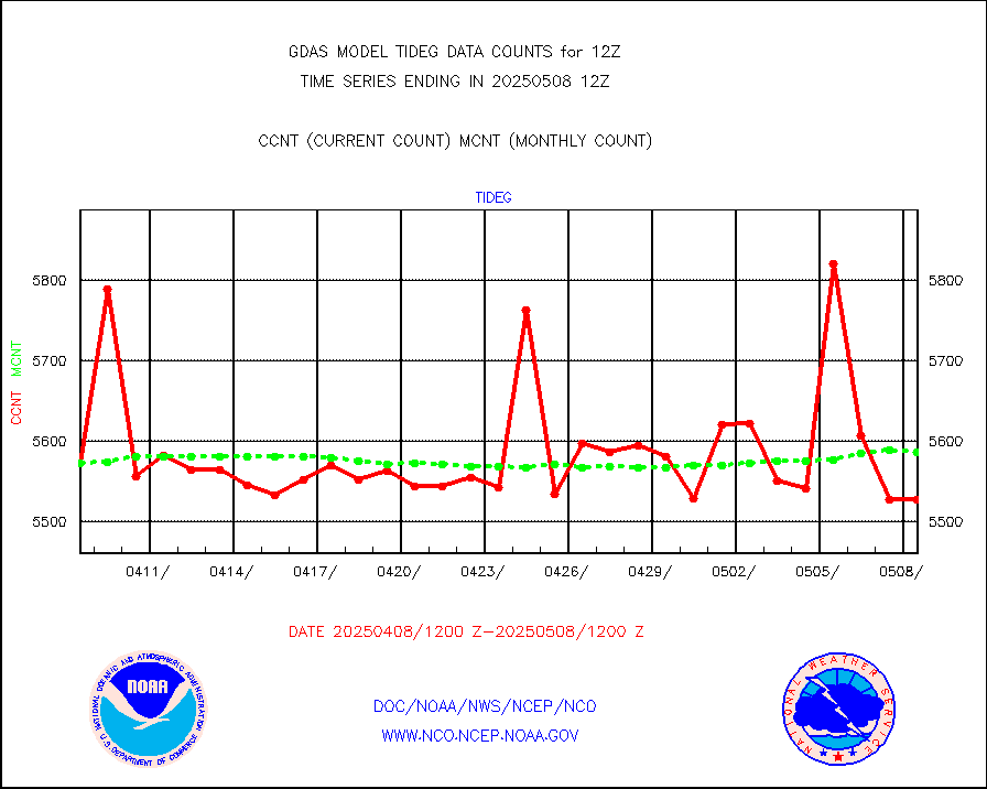
tideg |
Tide gauge reports decoded from CREX format |
5520 |
5484 |
100.7 % |
visja |
MTSAT/JMA visible derived cloud motion |
971 |
829 |
117.1 % |
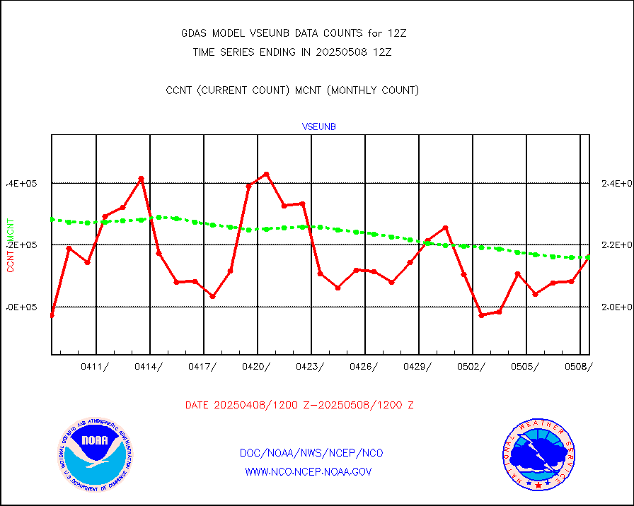
vseunb |
METEOSAT/EUMETSAT visible drv cld motion NBseq |
210106 |
204076 |
103.0 % |
| Data Types of Opportunity with Normal Counts |
|---|
| Type | Description | Hourly Count | Monthly Average | Percent (%) of Monthly Mean |
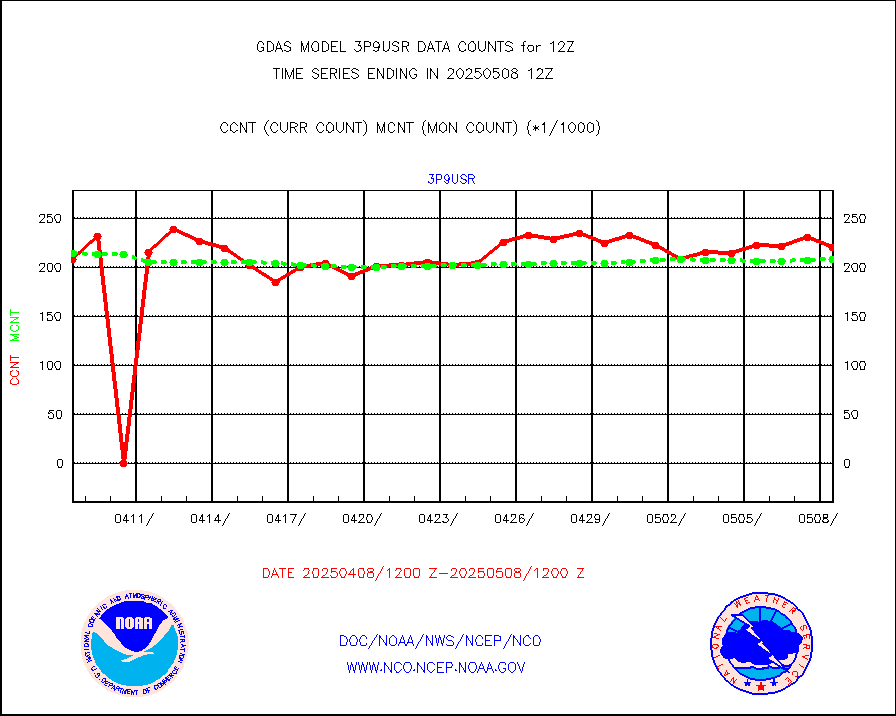
3p9usr |
GOES-16&up/NESDIS ir short-wv derived cld motion |
211410 |
208831 |
101.2 % |
acarsa |
MDCRS ACARS acft data (ARINC via AFWA)(AIREP fmt) |
0 |
0 |
n/a |
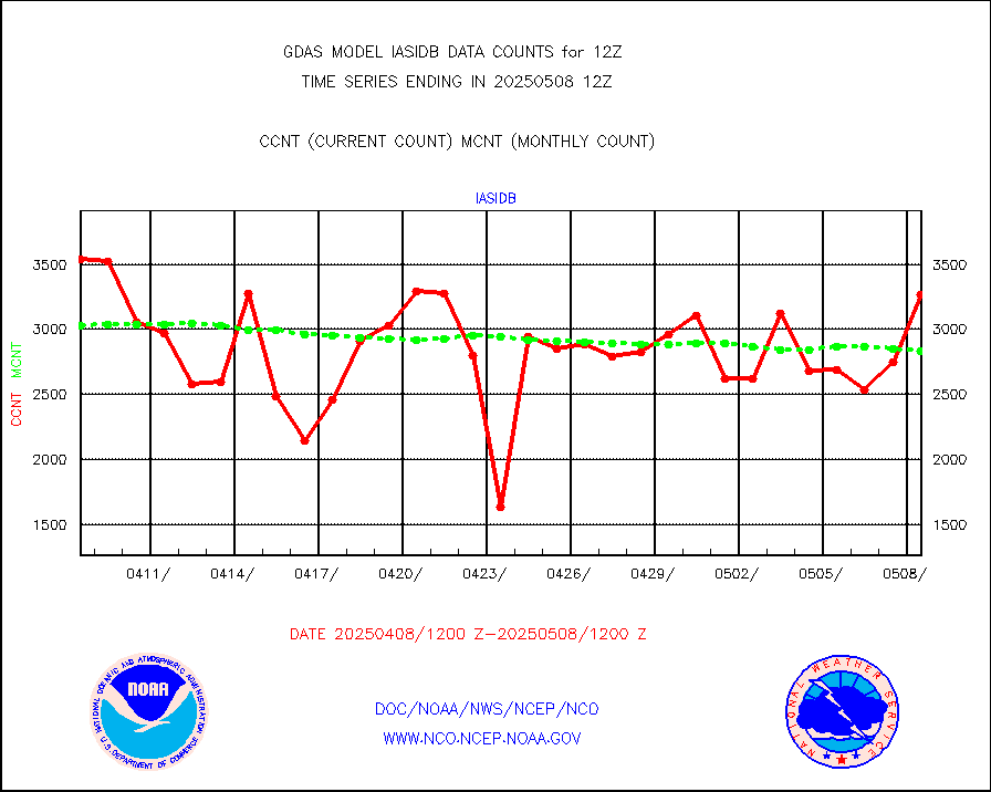
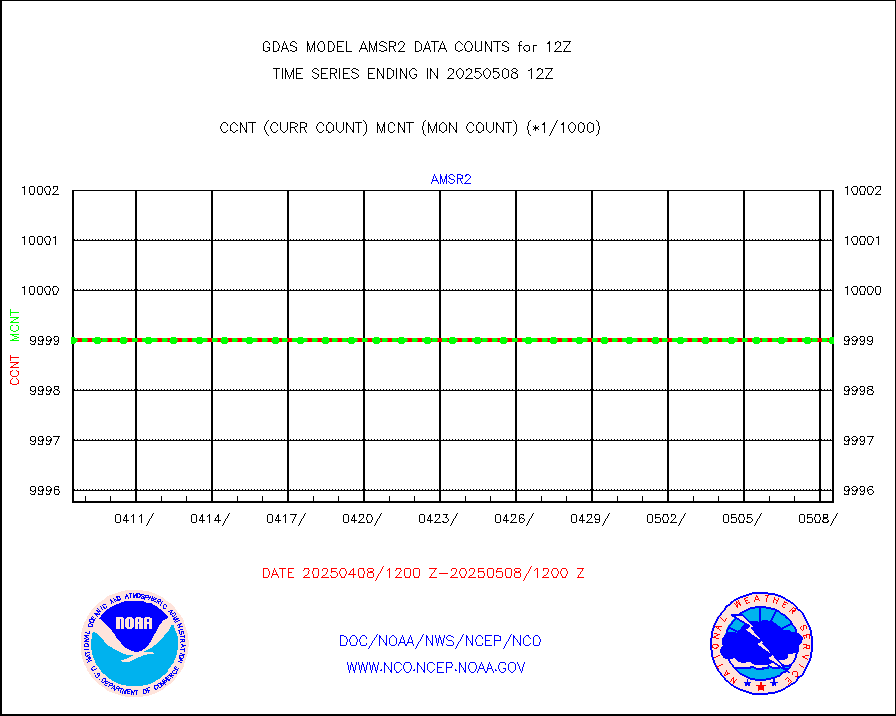
amsr2 |
GCOM-W AMSR2 1B brightness temperatures |
9999999 |
9816937 |
101.9 % |
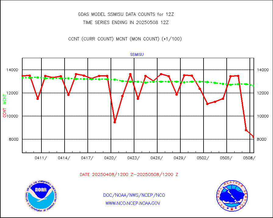
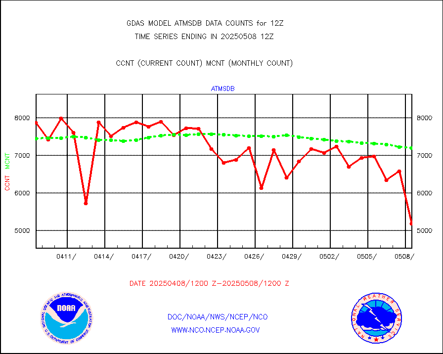
atmsdb |
NPP/NOAA-20 ATMS bright. temps-direct b-cast SSEC |
570240 |
666255 |
85.6 % |
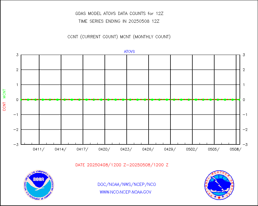
atovs |
POES/NESDIS - processed ATOVS soundings/radiances |
0 |
0 |
n/a |
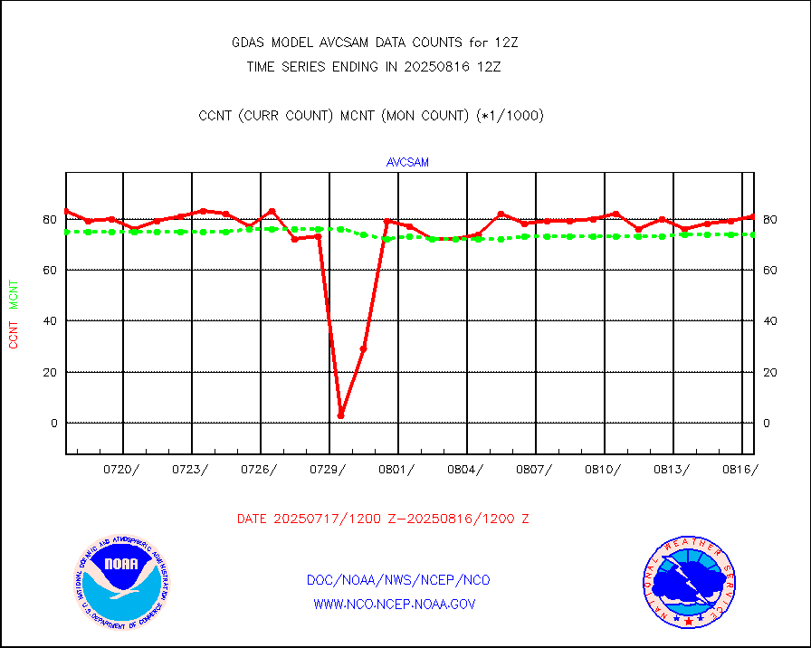
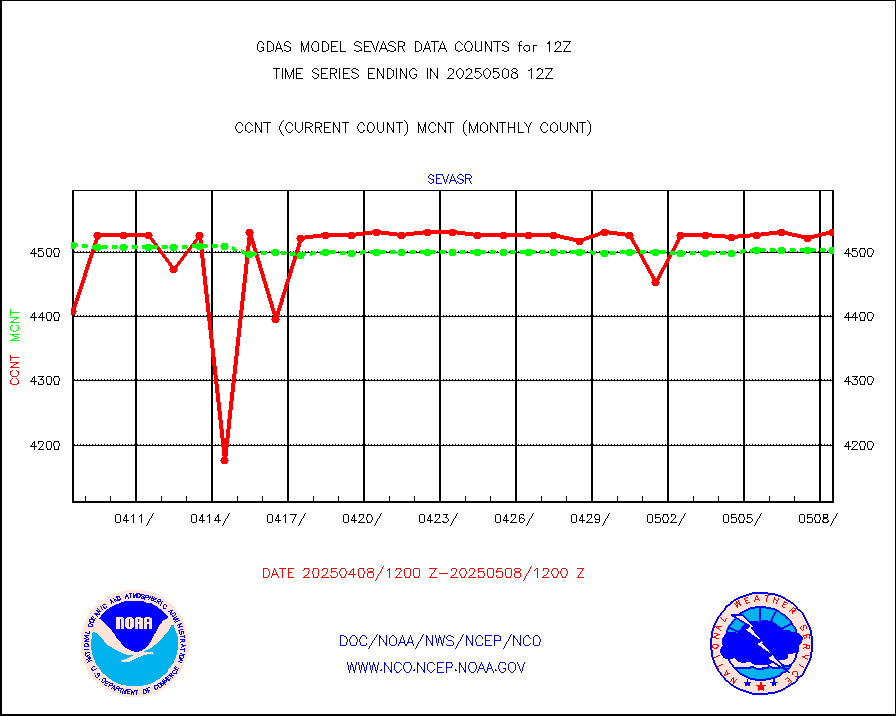
avcsam |
A.M.(N17,M2,M3) AVHRR GAC NCEP-proc clr&sea btmps |
6708707 |
7938002 |
84.5 % |
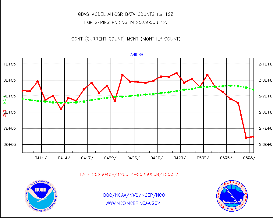
avcspm |
P.M.(N18-19) AVHRR GAC NCEP-proc clr & sea btemps |
9013693 |
9034510 |
99.8 % |
bathy |
eXpendable BathyThermograph, mooring (BATHY fmt) |
5 |
2 |
250.0 % |
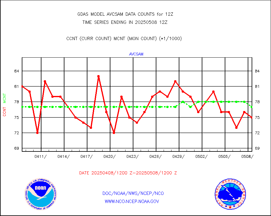
crisf4 |
NPP/NOAA-20 CrIS full spctrl radn (431 ch subset) |
1458000 |
1458000 |
100.0 % |
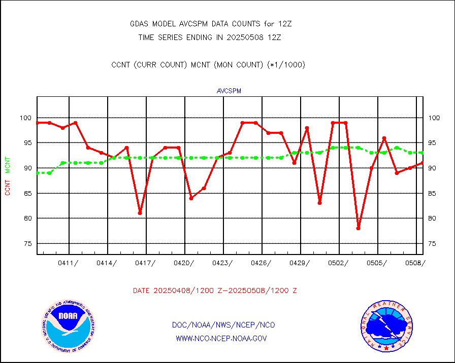
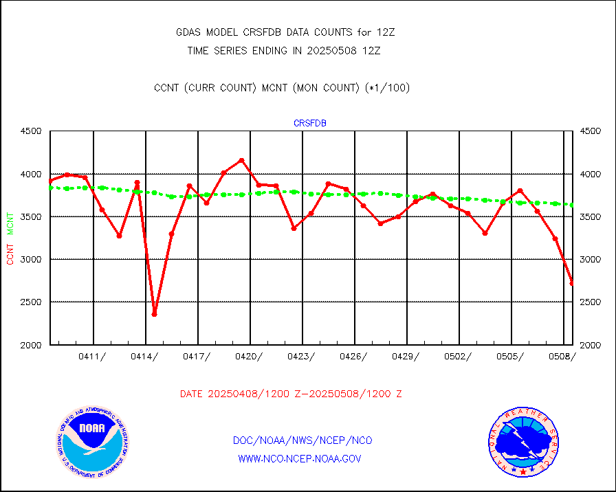
crsfdb |
NPP/NOAA-20 CrIS full spctrl radn dir brdcst SSEC |
643180 |
630302 |
102.0 % |
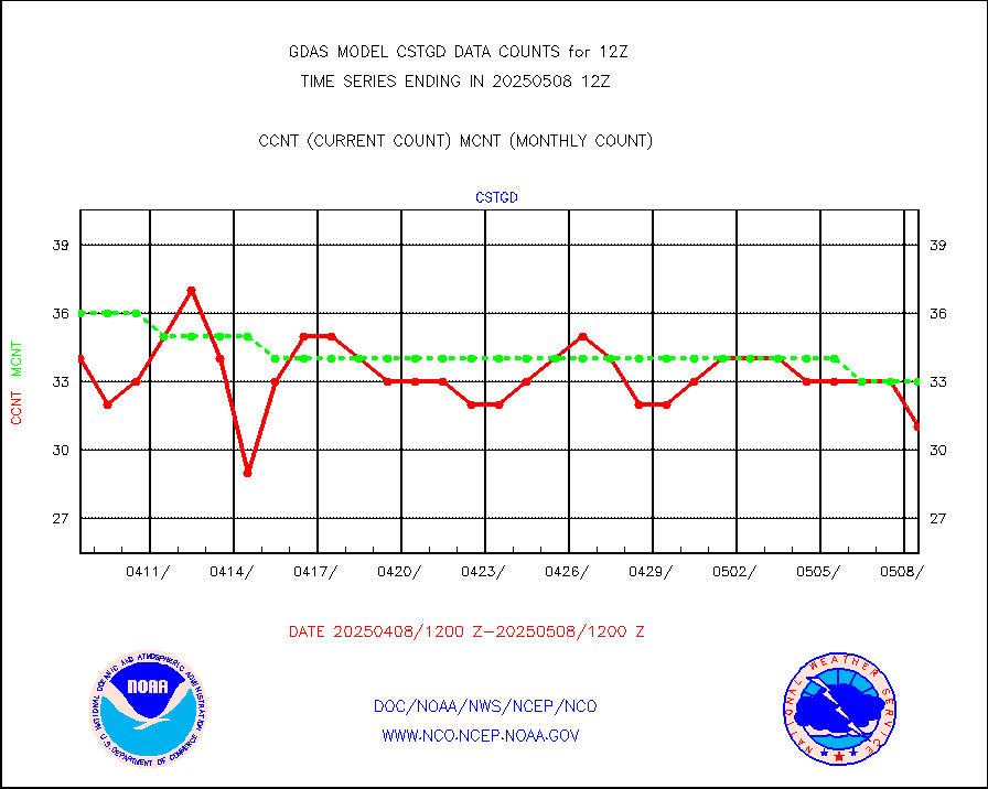
cstgd |
Coast Guard |
22 |
23 |
95.7 % |
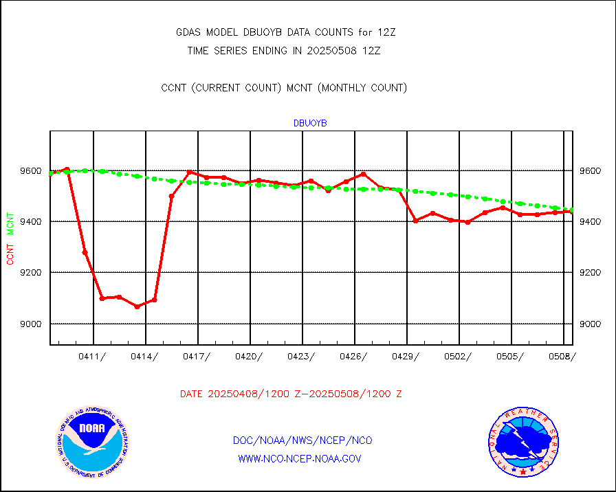
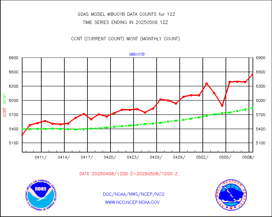
dbuoyb |
Drifting buoys (decoded from BUFR) |
9104 |
8851 |
102.9 % |
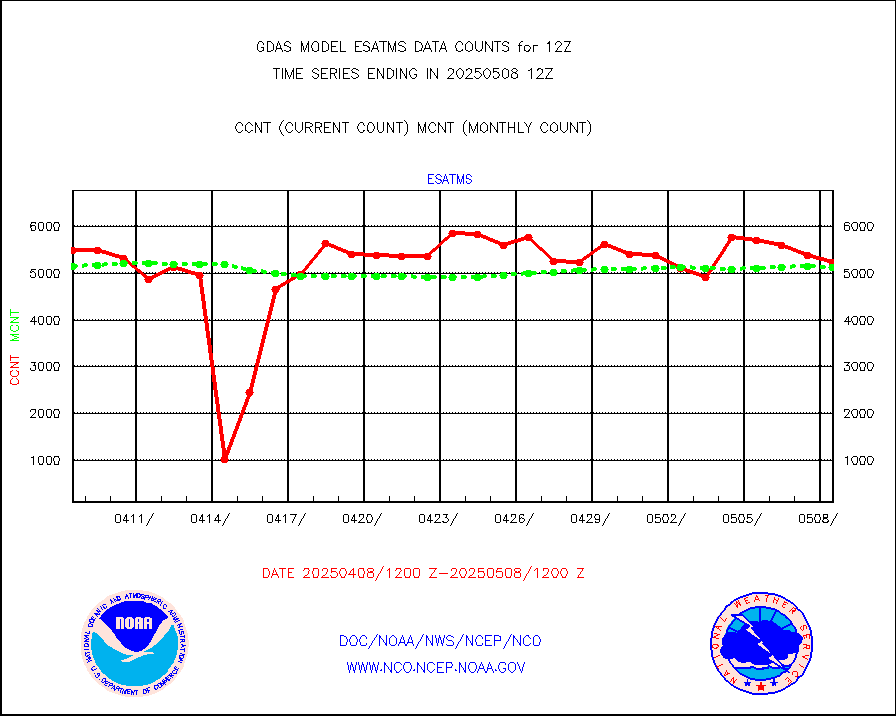
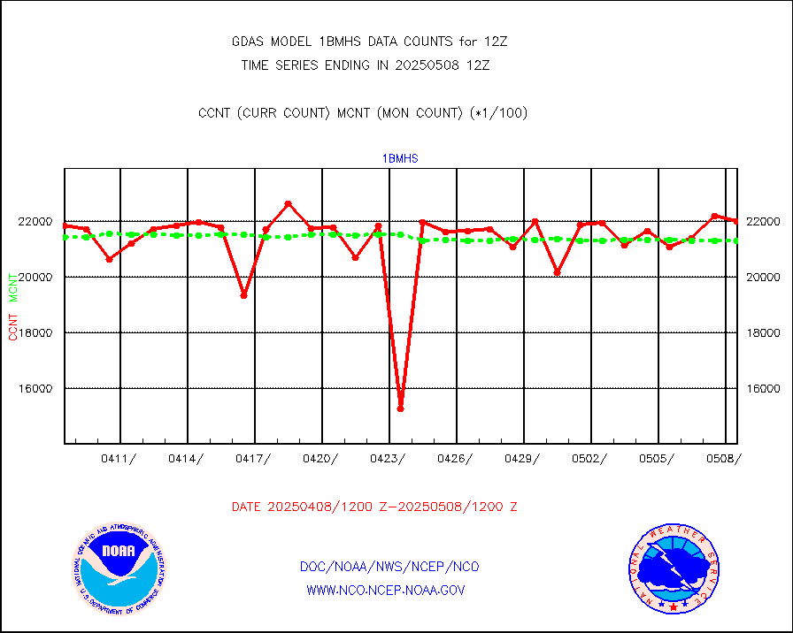
esatms |
NPP Adv. Tech. MW Sndr (ATMS) br. temps from RARS |
546681 |
555042 |
98.5 % |
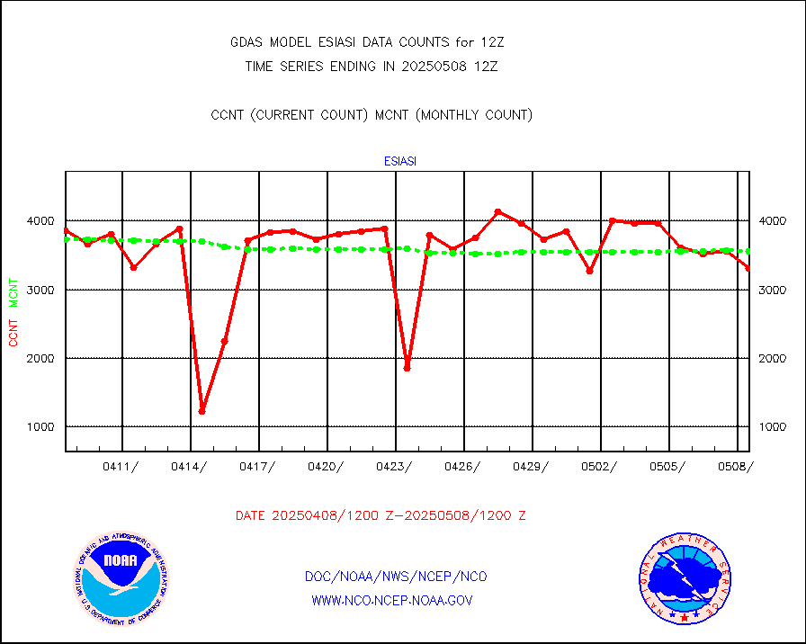
esiasi |
METOP 1-2 IASI 1C radiance data vbl chn from RARS |
456105 |
429944 |
106.1 % |
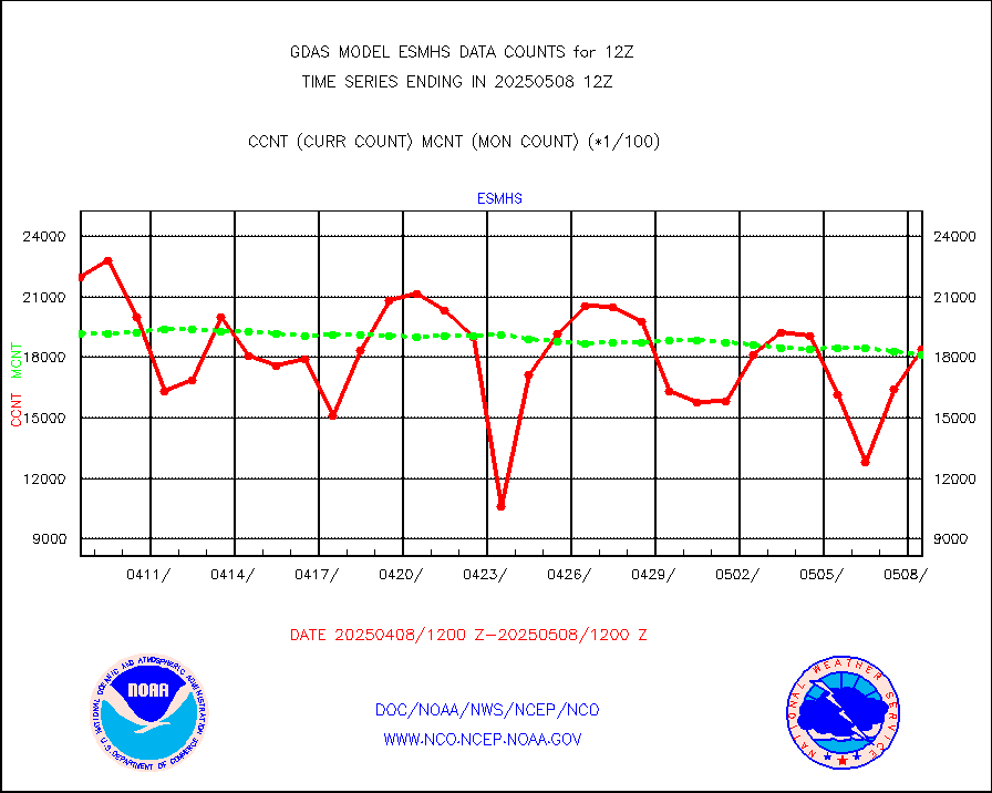
esmhs |
NOAA 18-19 & METOP 1-2 MHS proc. btemps from RARS |
1936472 |
2019708 |
95.9 % |
geoimr |
GOES/NESDIS (11x17 f-o-v) imager clear radiances |
0 |
0 |
n/a |
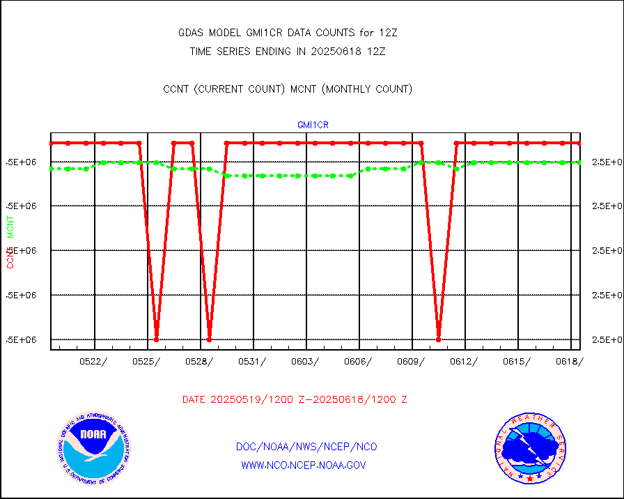
gmi1cr |
GPM GMI Level 1C-R brightness temperatures |
5083442 |
5083383 |
100.0 % |
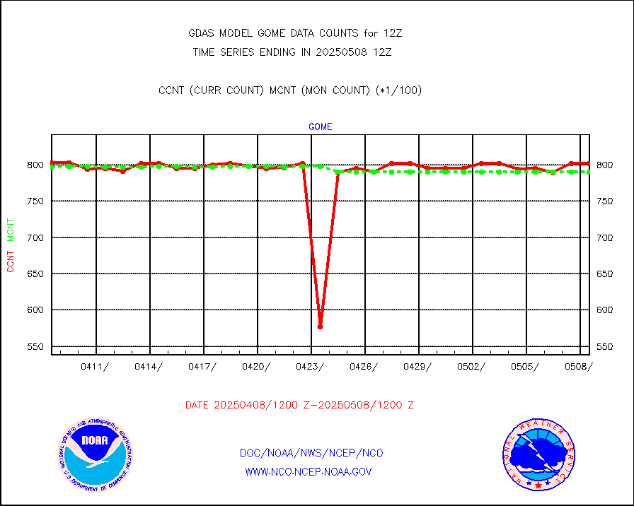
gnss |
Grnd-based Gbl Navigation Sat System (GNSS) data |
6084 |
6288 |
96.8 % |
gome |
METOP 1-2 Global Ozone Monitoring Exp.-2 (GOME-2) |
80660 |
79234 |
101.8 % |
h20in |
INSAT/KALPANA India wvpr derived cloud motion |
0 |
0 |
n/a |
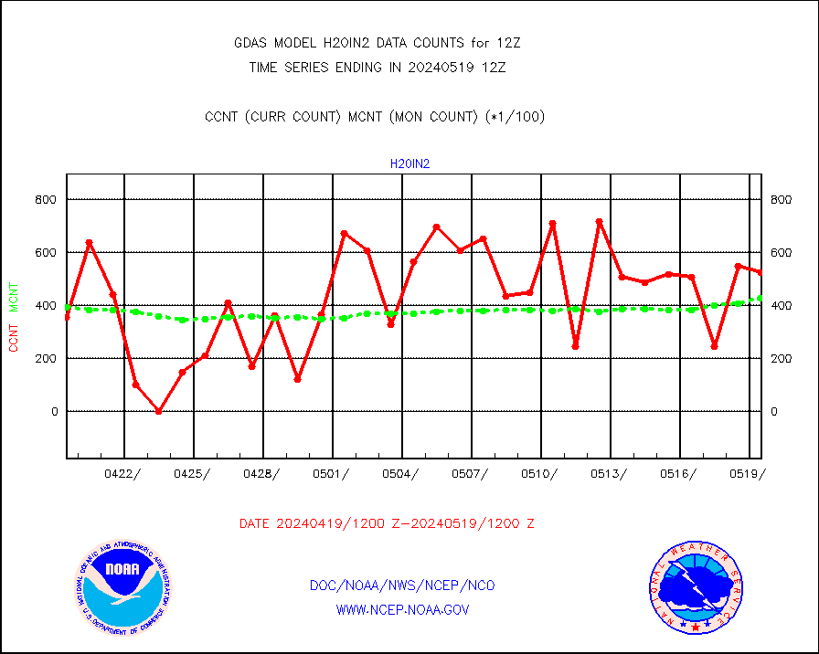
h20in2 |
INDIA SATWIND, INSAT WV channel |
52521 |
42706 |
123.0 % |
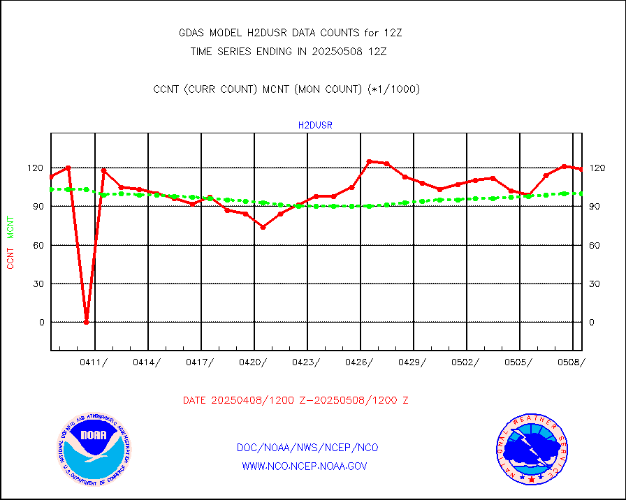
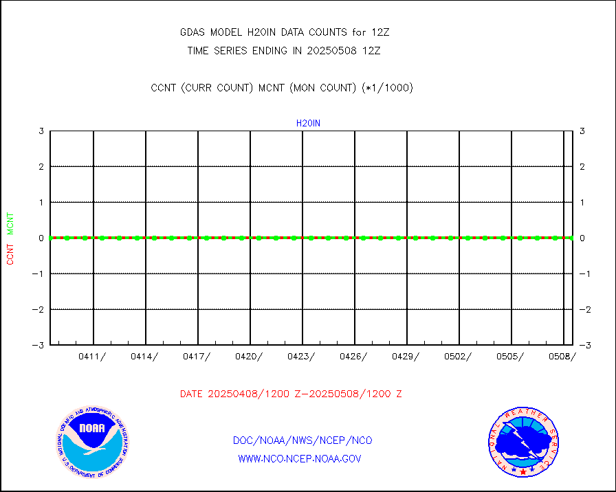
h2dusr |
GOES-16&up/NESDIS wv imgr/deep-lyr derivd cld mtn |
89054 |
95704 |
93.1 % |
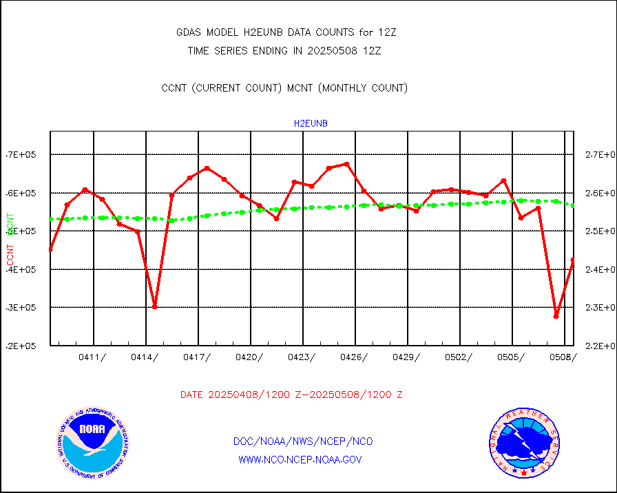
h2eunb |
METEOSAT/EUMETSAT wvpr imgr drv cld motion NBseq |
248617 |
254432 |
97.7 % |
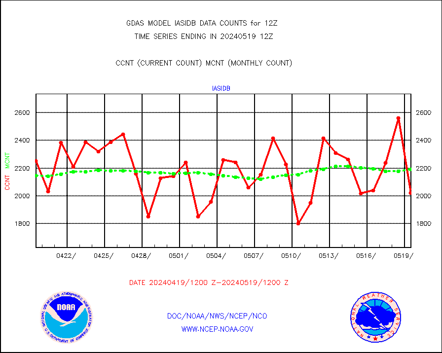
iasidb |
METOP 1-2 IASI 1C radiances-direct broadcast SSEC |
202200 |
219013 |
92.3 % |
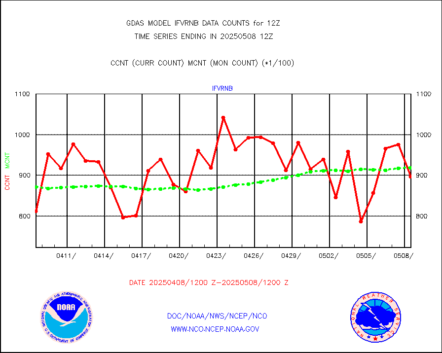
ifvrnb |
VIIRS (NPP/NOAA-20) ir lg-wv drv cloud motion(NB) |
91922 |
90406 |
101.7 % |
infav |
AVHRR (NOAA/METOP) ir lg-wave derived cld motion |
0 |
0 |
n/a |
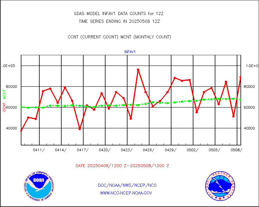
infav1 |
AVHRR (METOP) ir lg-wave derived cld motion |
51456 |
69500 |
74.0 % |
infin |
INSAT/KALPANA India ir lg-wave derived cld motion |
0 |
0 |
n/a |
infin2 |
INDIA SATWIND, INSAT IR channel |
49897 |
39101 |
127.6 % |
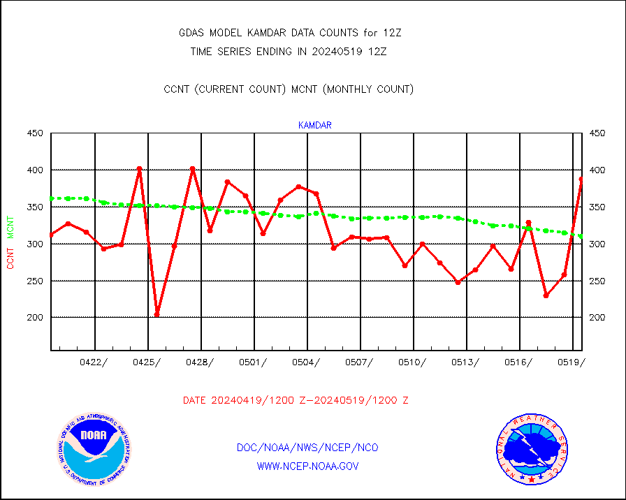
kamdar |
Korean AMDAR aircraft data (decoded from BUFR) |
388 |
310 |
125.2 % |
mbuoyb |
Moored buoys (decoded from BUFR) |
6759 |
6257 |
108.0 % |
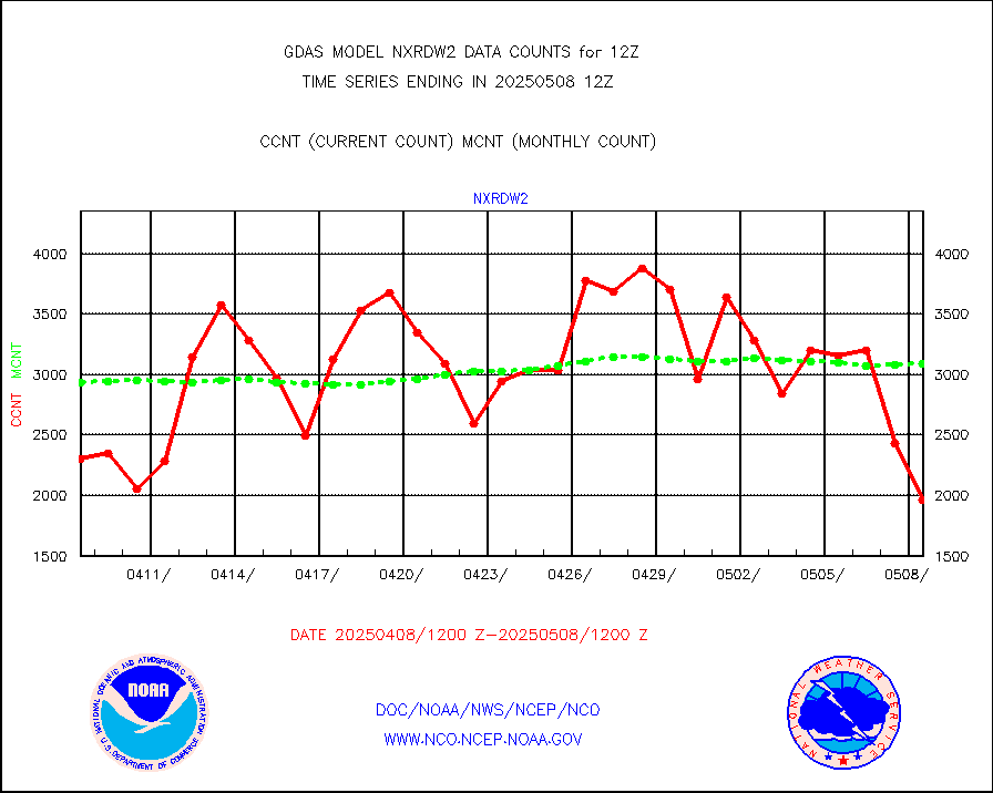
nxrdw2 |
NEXRAD Vel Azm Dsp(VAD) winds via Level 2 decoder |
4037 |
3459 |
116.7 % |
ompslp |
OMPS Limb Profiler ozone data (NPP) |
1118 |
1493 |
74.9 % |
ompsn8 |
OMPS nadir profile ozone (Version 8 BUFR) |
3562 |
3456 |
103.1 % |
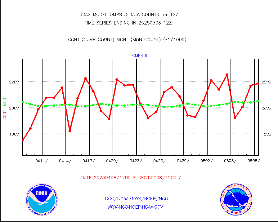
ompst8 |
OMPS total column ozone (Version 8 BUFR) |
2229764 |
2074061 |
107.5 % |
pirep |
Manual PIREP aircraft data (dcded from AIREP fmt) |
666 |
797 |
83.6 % |
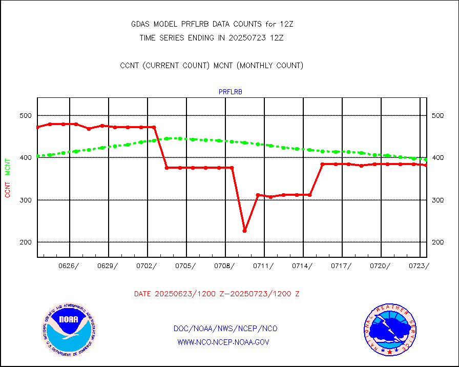
prflrb |
Multi-Agency Profiler (MAP) and SODAR winds |
320 |
388 |
82.5 % |
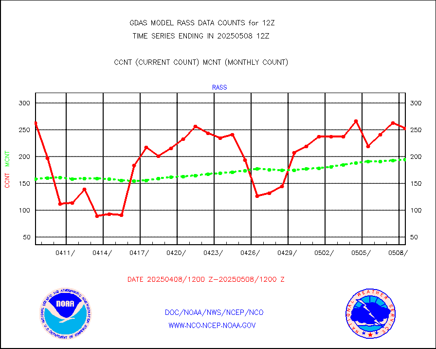
rass |
RASS temperatures (NOAA and Multi-Agency) |
165 |
195 |
84.6 % |
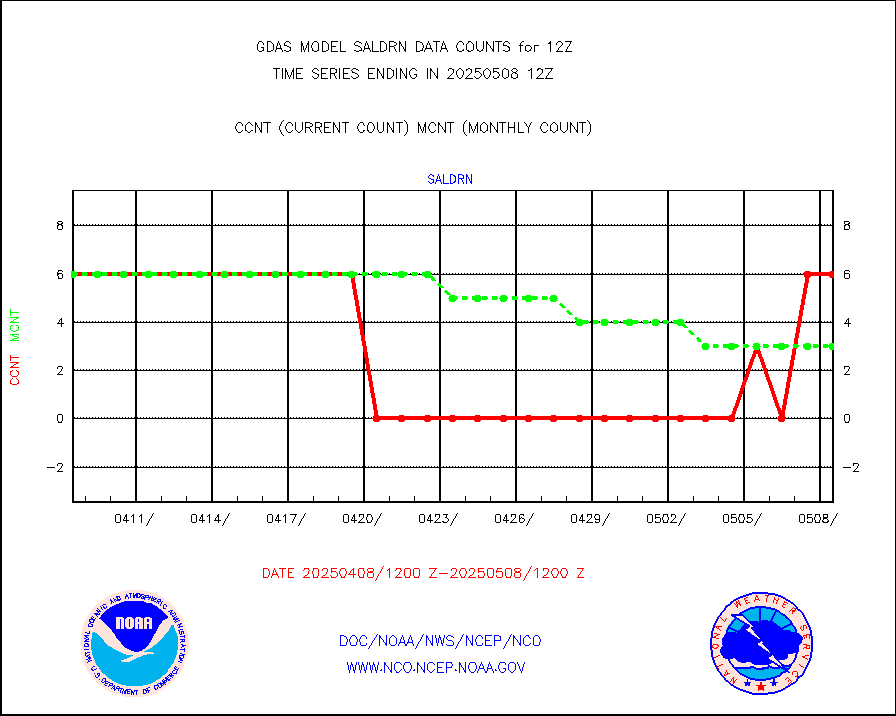
saldrn |
Surface Marine Saildrone (decoded from BUFR) |
6 |
6 |
100.0 % |
saphir |
Megha-Tropiques SAPHIR L1A2 brightness temps |
0 |
0 |
n/a |
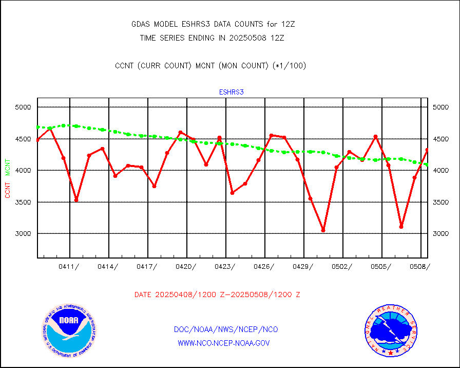
sevasr |
METEOSAT-10 2nd Gen SEVIRI All Sky Radiance(proc) |
452622 |
452731 |
100.0 % |
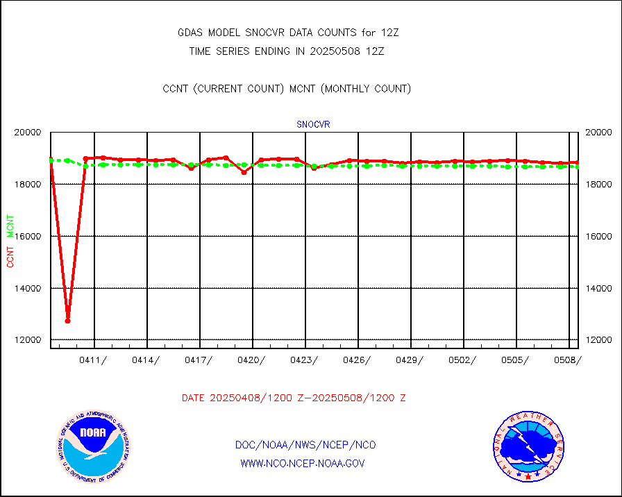
snocvr |
NOW COVER, DEPTH/DENSITY AND WATER EQUIVALENT |
20980 |
20472 |
102.5 % |
ssmisu |
DMSP SSM/IS 1C radiance data (Unified Pre-Proc.) |
1337160 |
1238243 |
108.0 % |
sstvcw |
NPP/NOAA-20 VIIRS SST - CLEAR & OVER WATER |
31 |
31 |
100.0 % |
sstvpw |
NPP/NOAA-20 VIIRS SST - PROBABLY CLR & OVER WATER |
9999999 |
9999999 |
100.0 % |
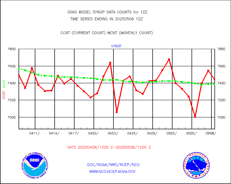
synop |
Synoptic - fixed manual and automatic |
8221 |
8434 |
97.5 % |
tesac |
CTD probe, Argo prflng float, mooring (TESAC fmt) |
2826 |
2626 |
107.6 % |
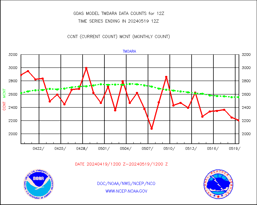
tmdara |
TAMDAR aircft data-all types(from Panasonic,BUFR) |
2203 |
2556 |
86.2 % |
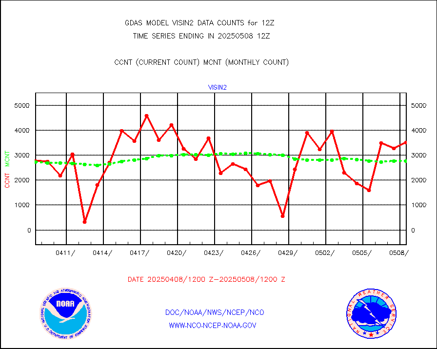
visin |
INSAT/KALPANA India visible derived cloud motion |
0 |
0 |
n/a |
visin2 |
INDIA SATWIND, INSAT VIS channel |
2870 |
3263 |
88.0 % |
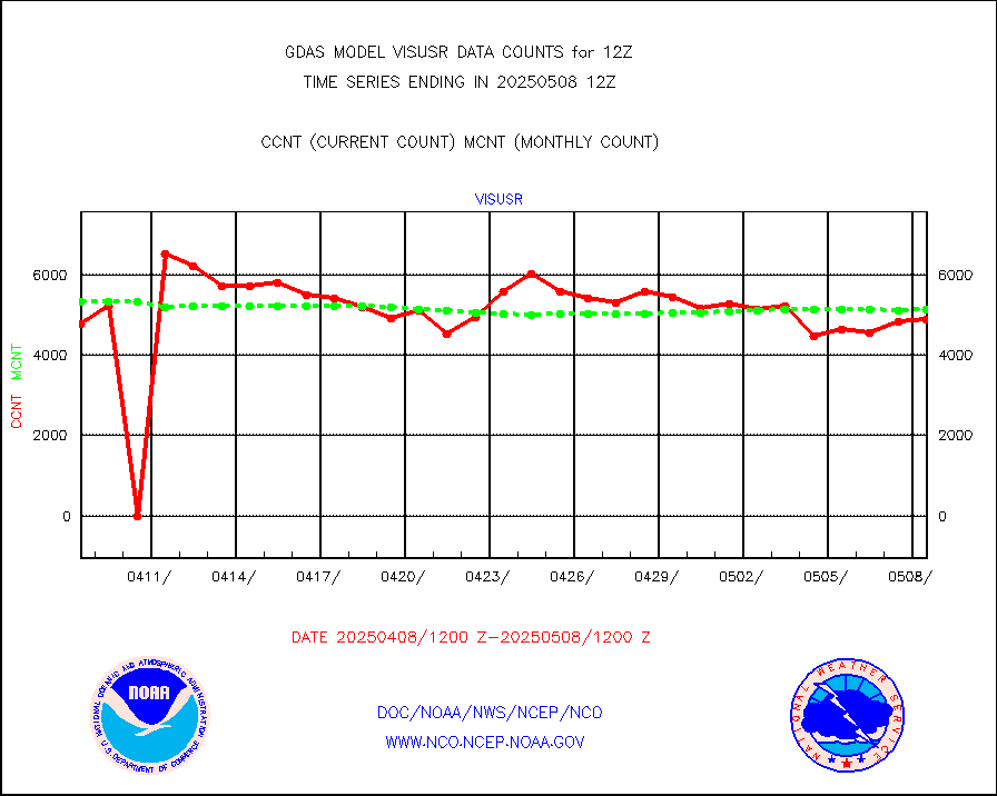
visusr |
GOES-16&up/NESDIS visible derived cloud motion |
553032 |
480313 |
115.1 % |


