| Critical Data with Normal Counts |
|---|
| Type | Description | Hourly Count | Monthly Average | Percent (%) of Monthly Mean |
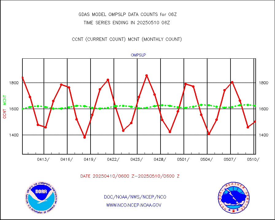
1bamua |
NOAA 15-19 & METOP 1-2 AMSU-A NCEP-proc. br.temps |
353170 |
382850 |
92.2 % |
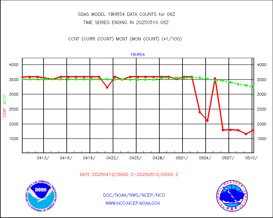
1bhrs4 |
NOAA 18-19 & METOP 1-2 HIRS-4 NCEP-proc. br.temps |
247558 |
343320 |
72.1 % |
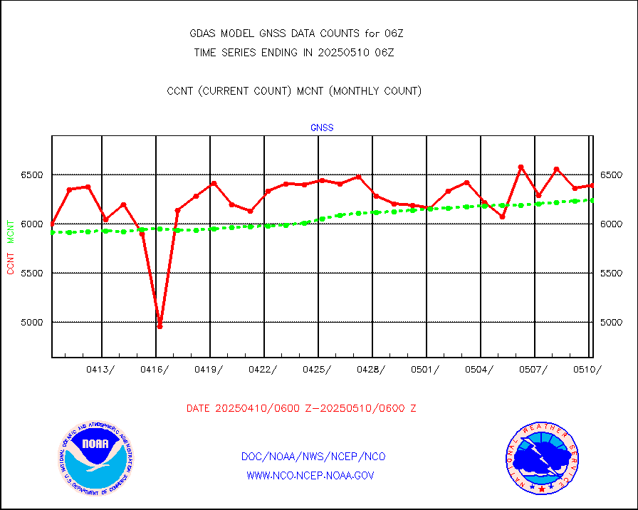
1bmhs |
NOAA 18-19 & METOP 1-2 MHS NCEP-proces. br. temps |
1713103 |
2139667 |
80.1 % |
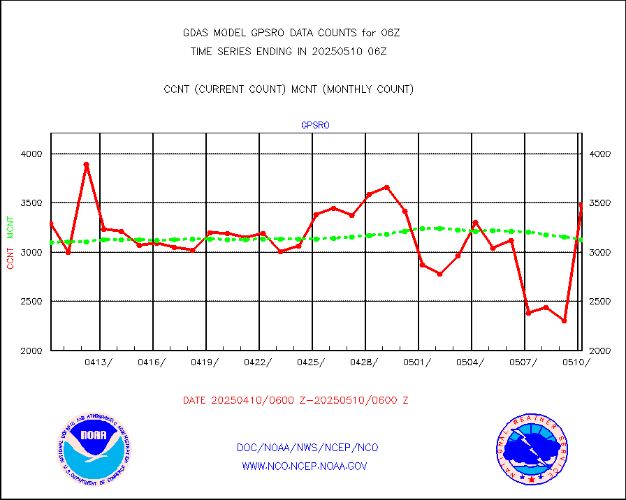
acars |
MDCRS ACARS acft data from ARINC(dcded from BUFR) |
44853 |
65610 |
68.4 % |
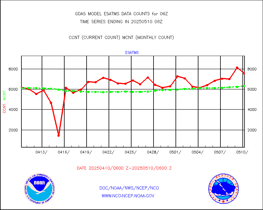
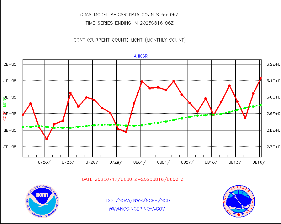
ahicsr |
Himawari Clear Sky Radiance |
306938 |
306995 |
100.0 % |
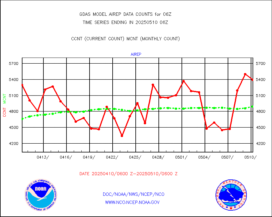
airep |
Manual AIREP aircraft data (dcded from AIREP fmt) |
7418 |
7664 |
96.8 % |
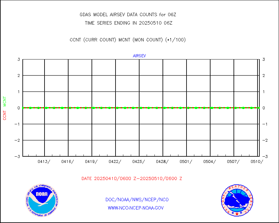
airsev |
AQUA AIRS/AMSU-A/HSB brightness temps- every FOV |
0 |
0 |
n/a |
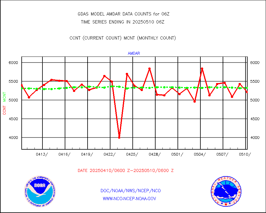
amdar |
AMDAR aircraft data (decoded from AMDAR format) |
5551 |
5435 |
102.1 % |
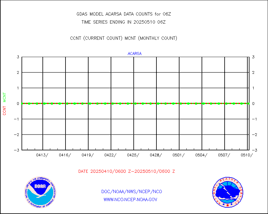
amdarb |
AMDAR aircraft data (decoded from BUFR) |
12642 |
11848 |
106.7 % |
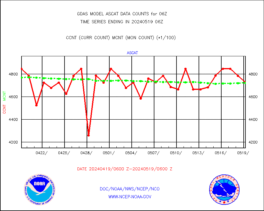
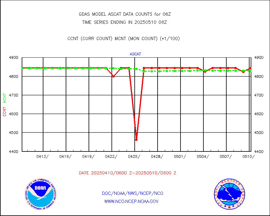
ascat |
METOP 1-2 ASCAT products |
472500 |
472206 |
100.1 % |
atms |
NPP/NOAA-20 ATMS brightness temperatures |
2317875 |
2315941 |
100.1 % |
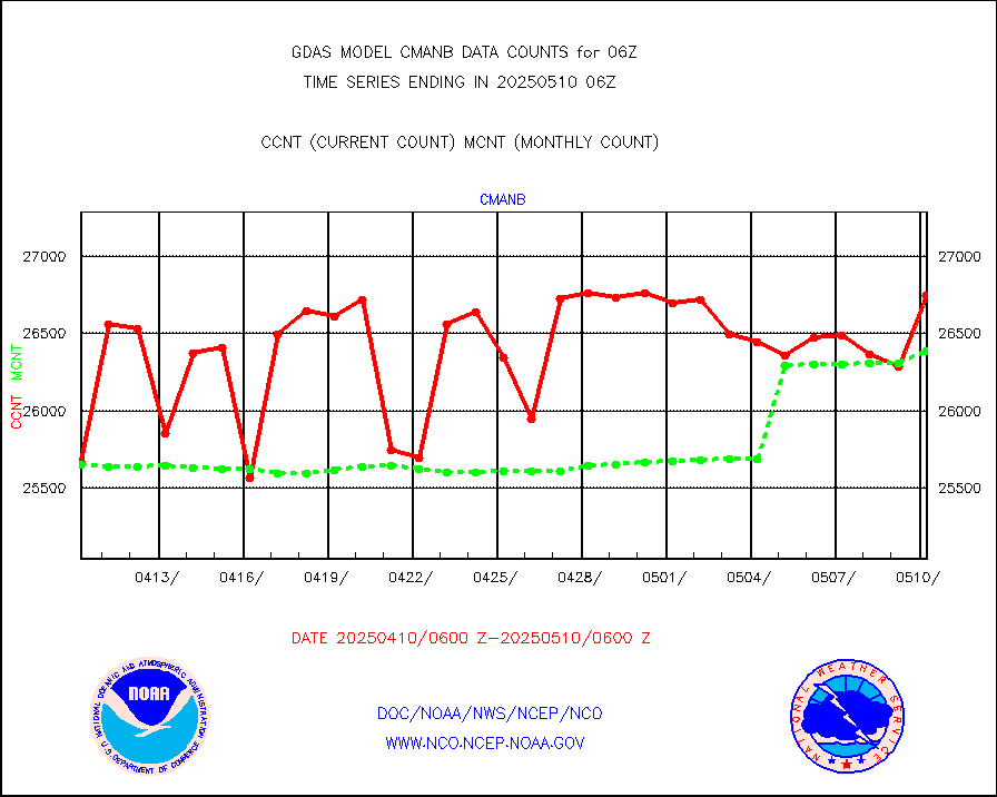
cmanb |
Surface Marine CMAN rpts decoded from BUFR format |
26975 |
25738 |
104.8 % |
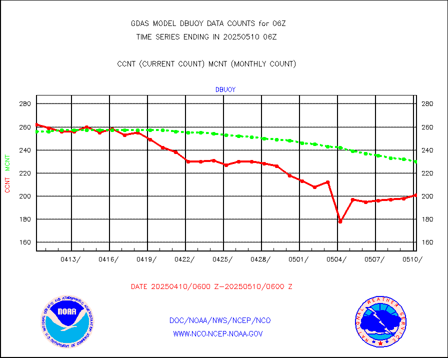
dbuoy |
Buoys decoded from FM-18 fmt (moored or drifting) |
275 |
277 |
99.3 % |
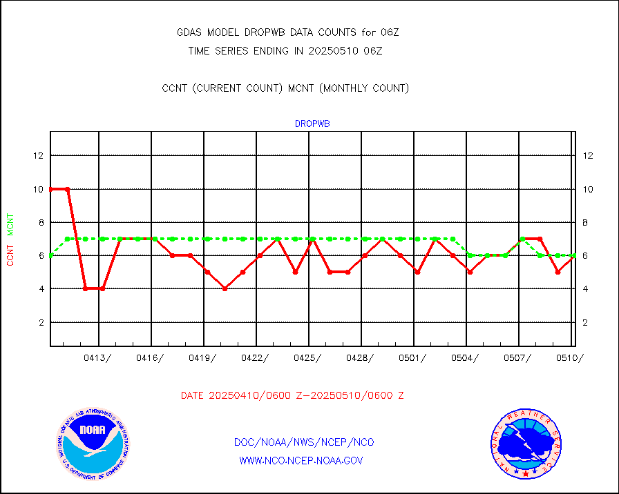
dropw |
Dropwinsonde (from TEMP DROP) |
0 |
0 |
n/a |
eadas |
E-AMDAR (European AMDAR acft decoded from BUFR) |
14686 |
14012 |
104.8 % |
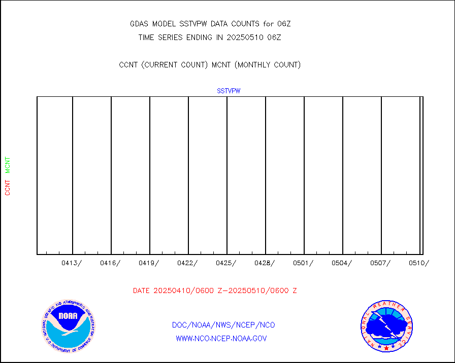
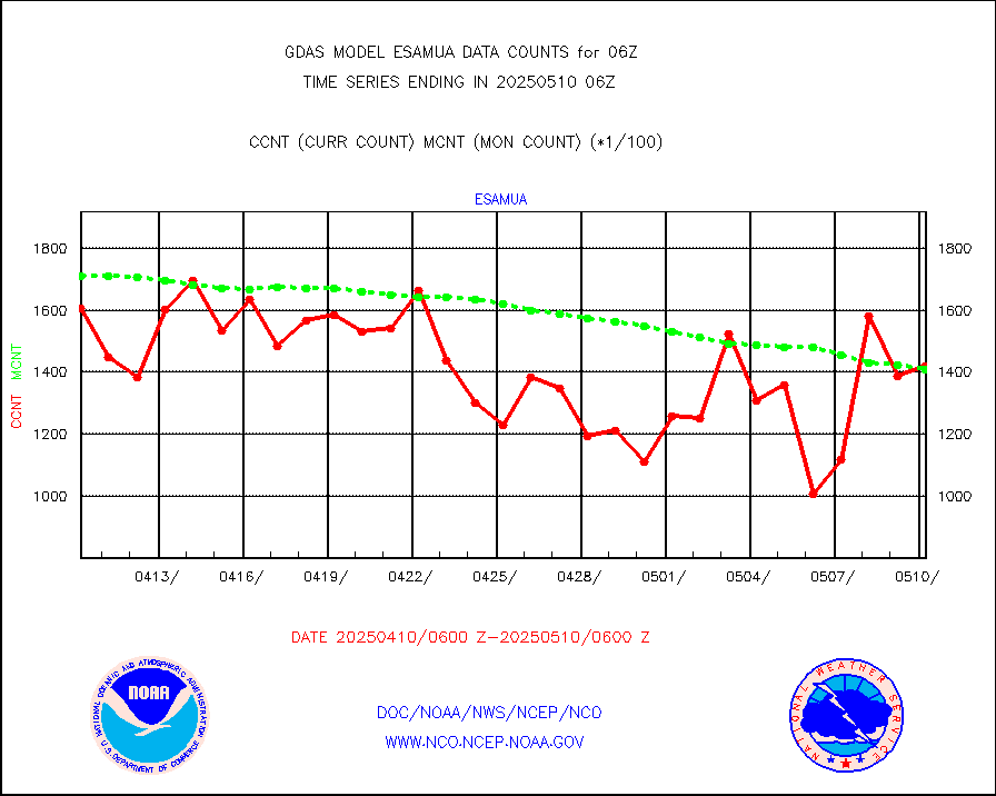
esamua |
NOAA 15-19 & METOP 1-2 AMSU-A proc btmps frm RARS |
184895 |
183003 |
101.0 % |
eshrs3 |
NOAA 15-19 & METOP 1-2 HIRS-3/4 pr btmps frm RARS |
455933 |
548838 |
83.1 % |
gpsro |
GPS radio occultation data |
3021 |
3189 |
94.7 % |
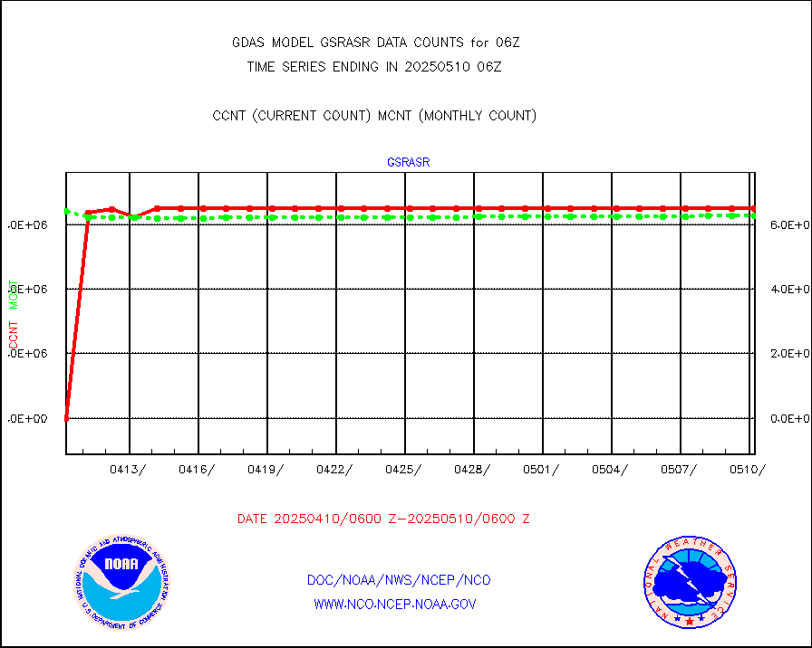
gsrasr |
GOES-16/17 All Sky Radiances (proc.) |
6488568 |
6463952 |
100.4 % |
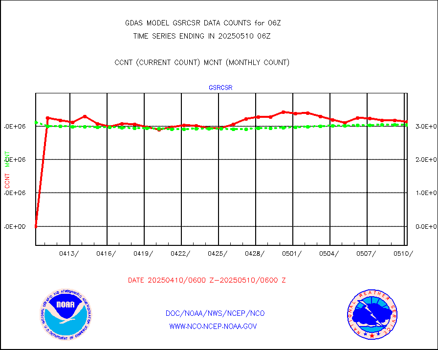
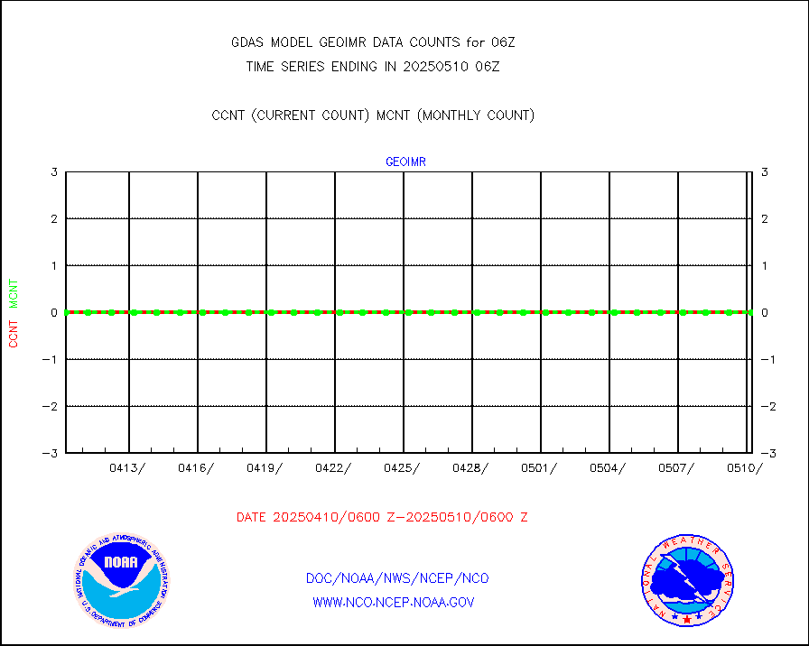
gsrcsr |
GOES-16/17 Clear Sky Radiances (proc.) |
2938512 |
2984569 |
98.5 % |
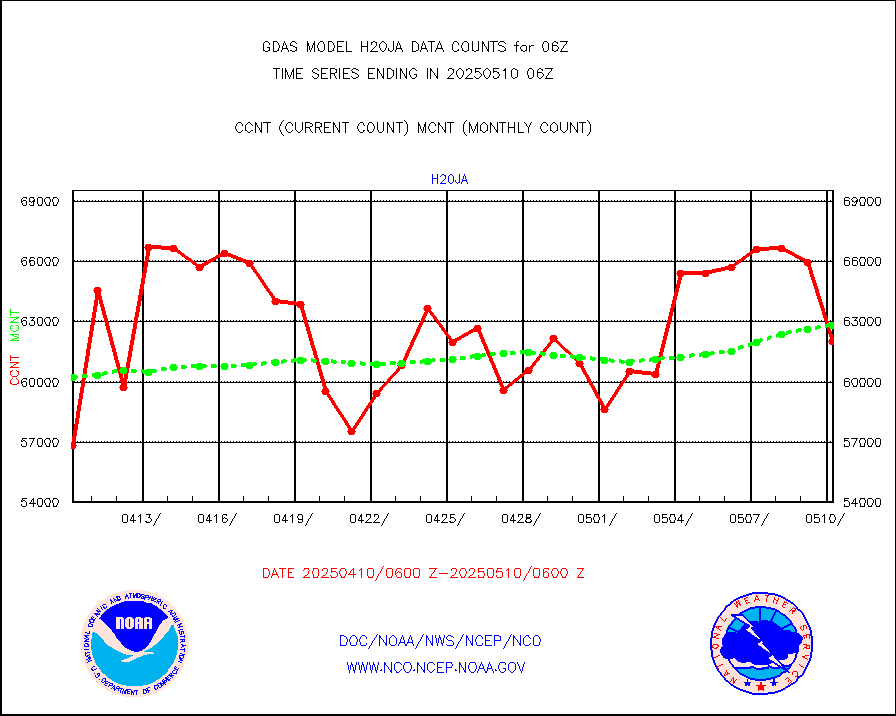
h20ja |
MTSAT/JMA water vapor imager derived cloud motion |
62246 |
58843 |
105.8 % |
h20mo |
MODIS (AQUA/TERRA) wvpr imager derived cld motion |
0 |
0 |
n/a |
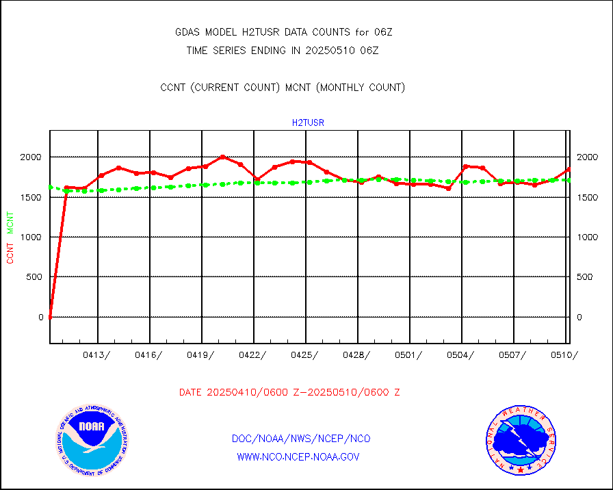
h2tusr |
GOES-16&up/NESDIS wv imgr/cld-top derived cld mtn |
140493 |
160398 |
87.6 % |
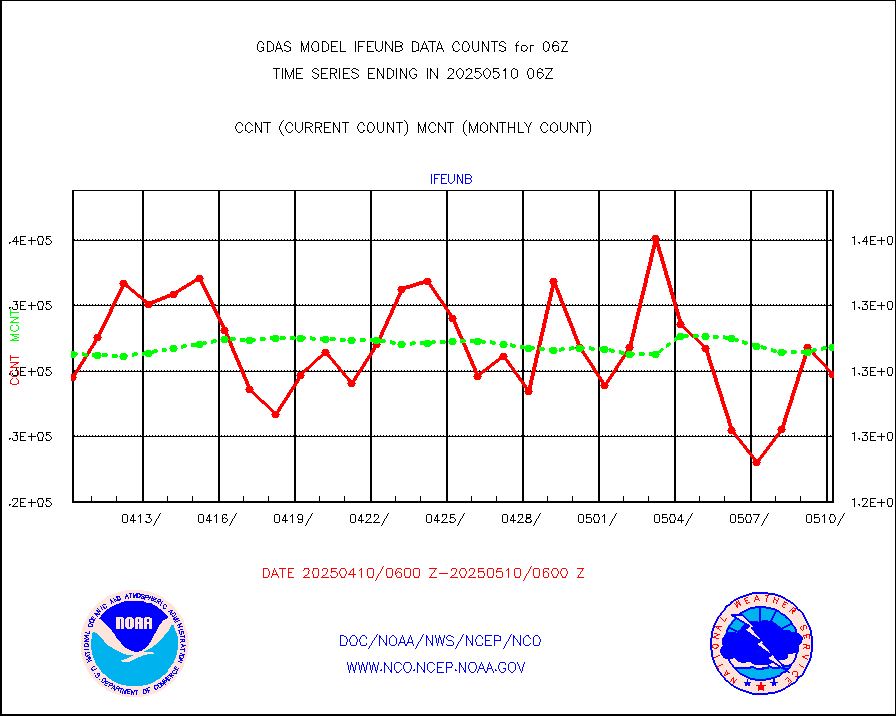
ifeunb |
METEOSAT/EUMETSAT ir lg-wave drv cld motion NBseq |
128150 |
126425 |
101.4 % |
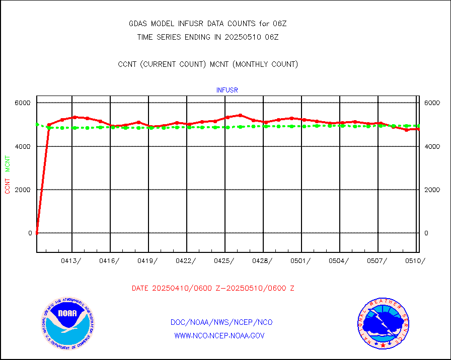
infja |
MTSAT/JMA infrared long-wave derived cloud motion |
47493 |
48770 |
97.4 % |
infmo |
MODIS (AQUA/TERRA) ir l-wave derived cloud motion |
0 |
0 |
n/a |
infusr |
GOES-16&up/NESDIS ir long-wave derived cld motion |
472683 |
480909 |
98.3 % |
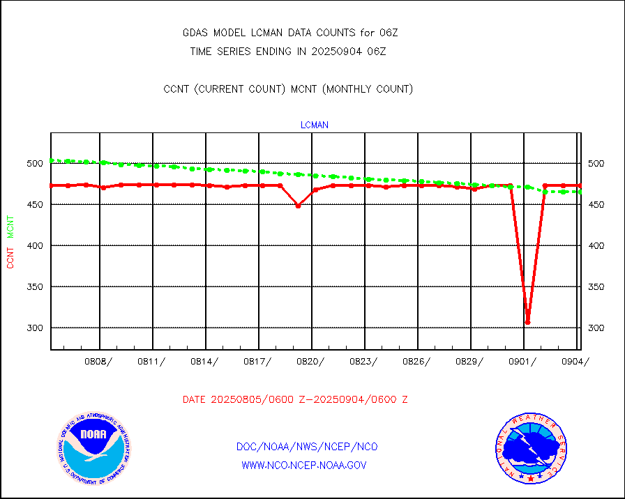
lcman |
Land-based CMAN stations decoded from CMAN format |
588 |
585 |
100.5 % |
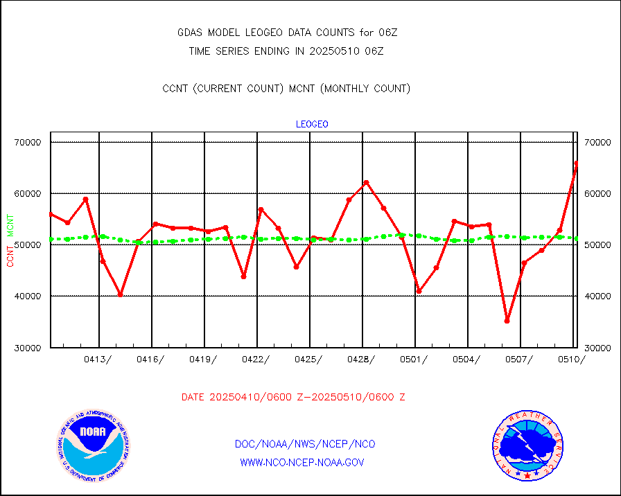
leogeo |
LEO-GEO satellite AMVs from UWisc. |
45404 |
38449 |
118.1 % |
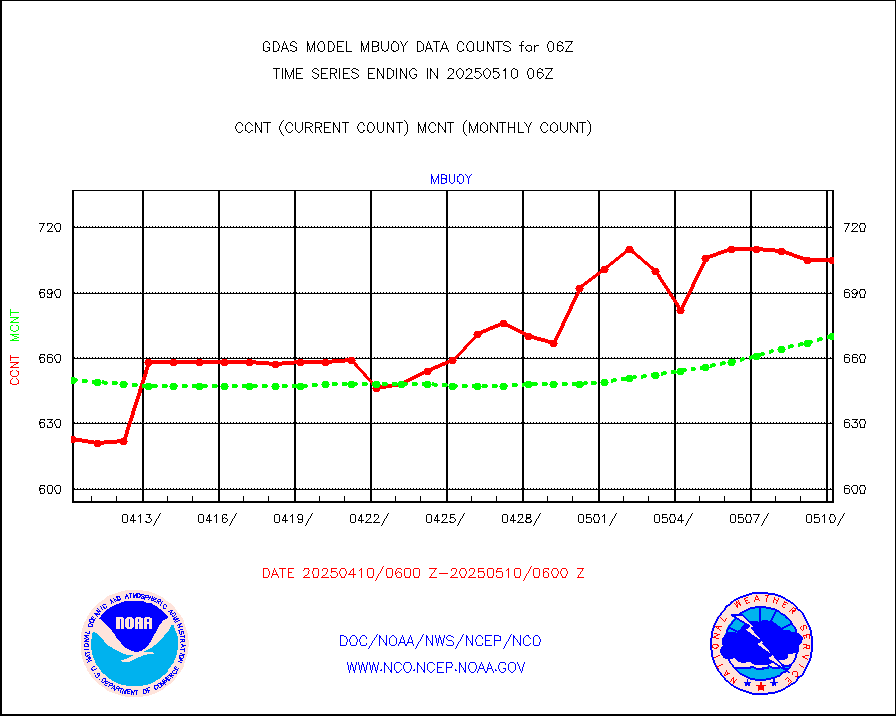
mbuoy |
Buoys decoded from FM-13 format (moored) |
777 |
728 |
106.7 % |
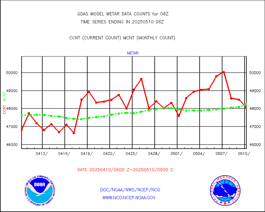
metar |
Aviation - METAR |
47163 |
47894 |
98.5 % |
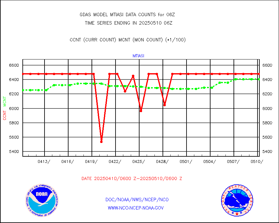
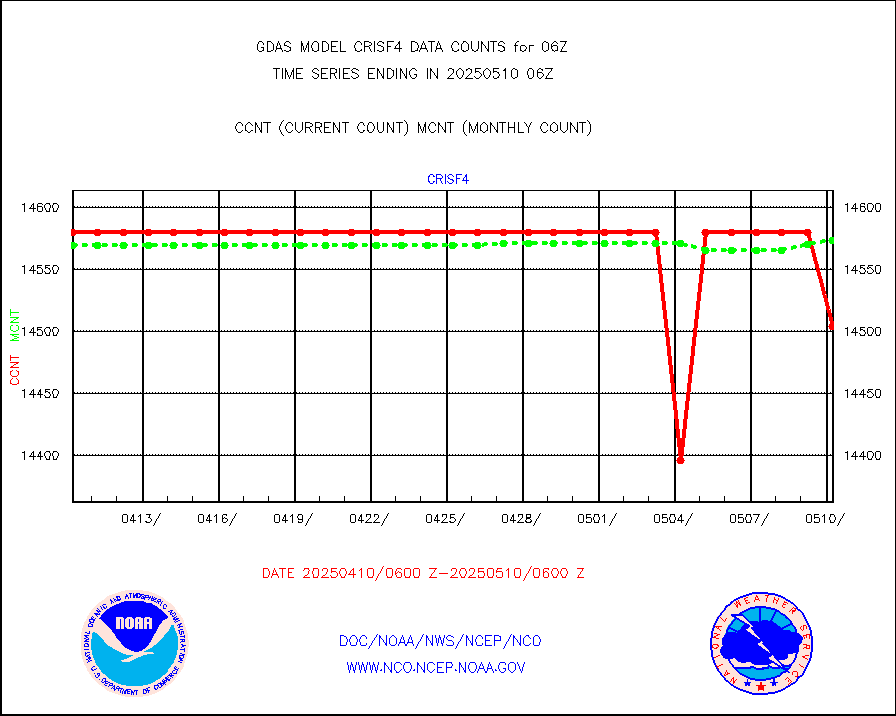
mtiasi |
METOP 1-2 IASI 1C radiance data (varbl. channels) |
645360 |
630436 |
102.4 % |
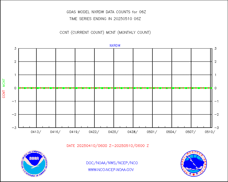
nxrdw |
NEXRAD Vel Azm Dsp(VAD) winds via radar coded msg |
0 |
0 |
n/a |
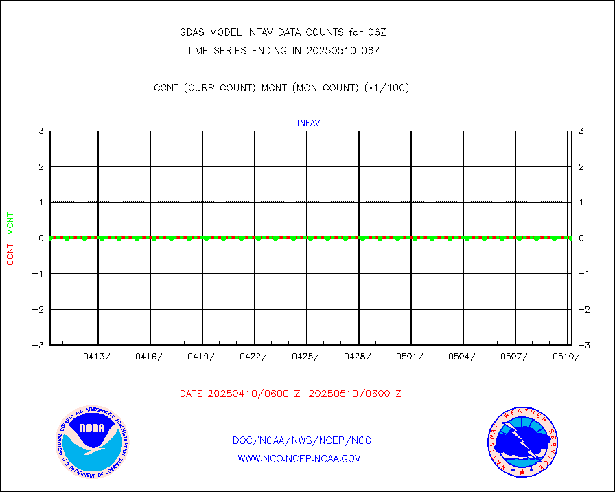
omi |
Aura Ozone Monitoring Instrument (OMI) data |
268320 |
255673 |
104.9 % |
osbuv8 |
NOAA 16-19 Solar Backscatter UV-2 rad frm V8 BUFR |
0 |
0 |
n/a |
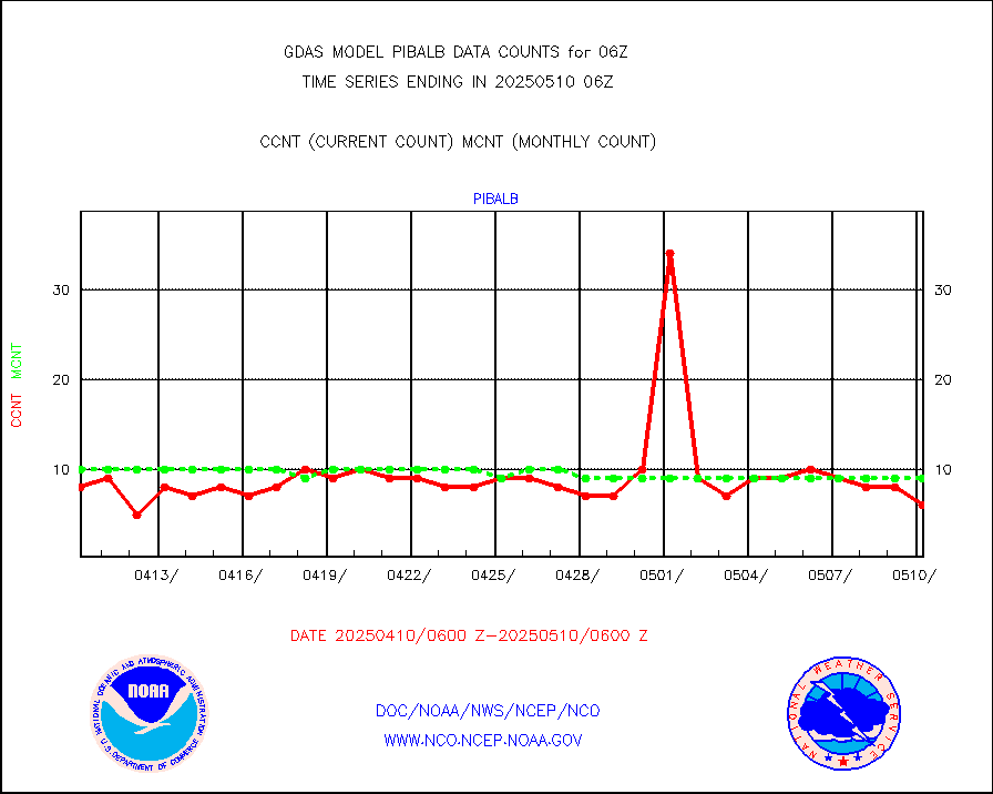
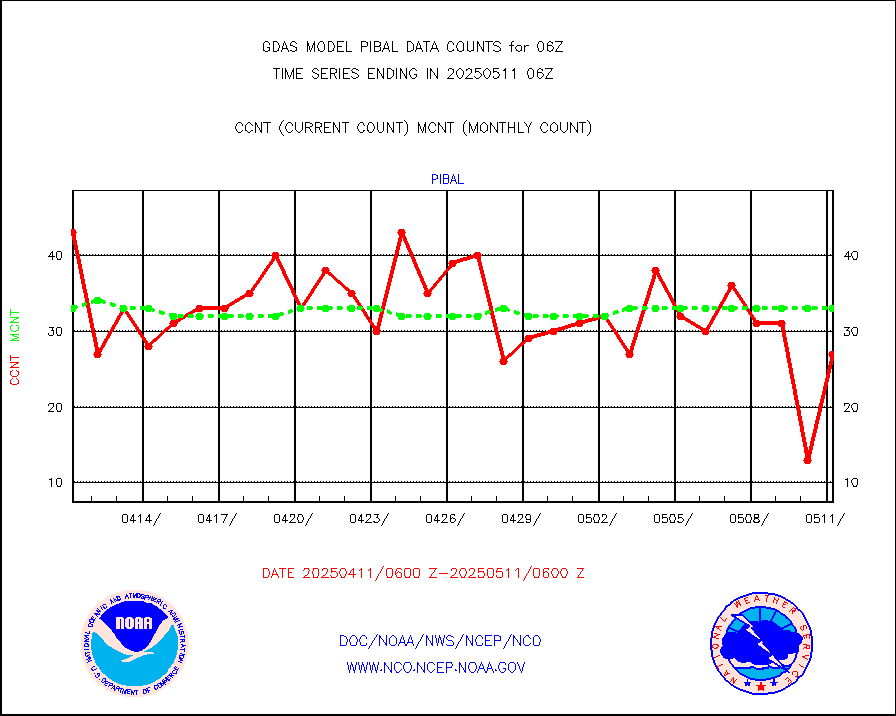
pibal |
PIBAL (from PILOT, PILOT SHIP, PILOT MOBIL) |
53 |
57 |
93.0 % |
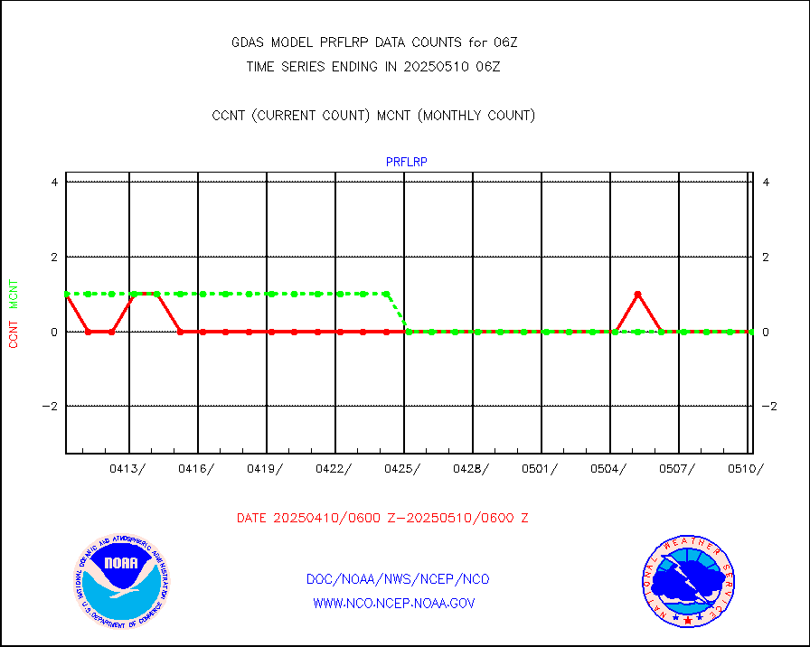
prflrp |
Profilr winds from PIBAL (PILOT,PILOT SHIP/MOBIL) |
1 |
1 |
100.0 % |
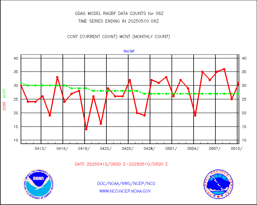
raobf |
Rawinsonde - fixed land (from TEMP or PILOT) |
32 |
32 |
100.0 % |
raobm |
Rawinsonde - mobile land (from TEMP/PILOT MOBIL) |
0 |
0 |
n/a |
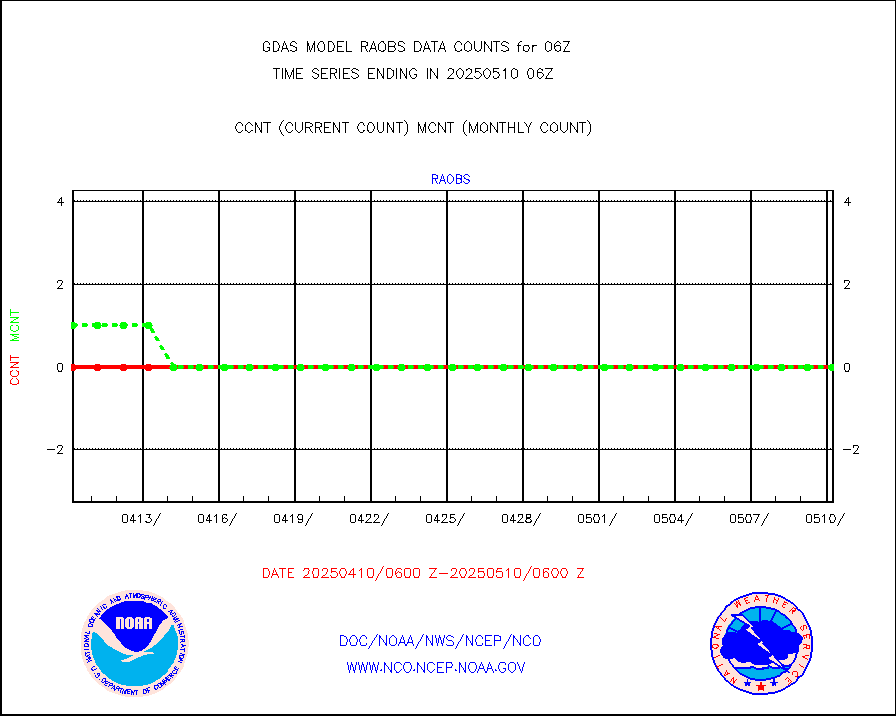
raobs |
Rawinsonde - ship (from TEMP SHIP, PILOT SHIP) |
0 |
0 |
n/a |
recco |
Flight level reconnaissance aircraft data |
0 |
0 |
n/a |
sevcsr |
METEOSAT-10 2nd Gen SEVIRI Clr Sky Radiance(proc) |
0 |
0 |
n/a |
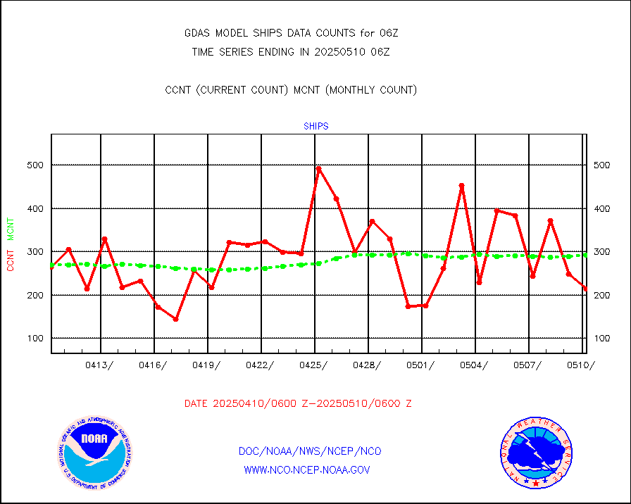
ships |
Ship - manual and automatic, restricted |
151 |
140 |
107.9 % |
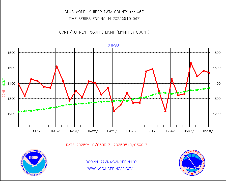
shipsb |
Ship - manual and automatic, restricted (BUFR) |
1210 |
1059 |
114.3 % |
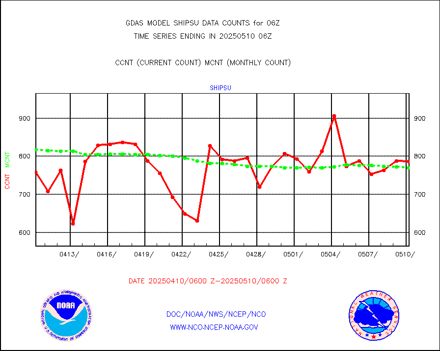
shipsu |
Ship - manual and automatic, unrestricted |
564 |
612 |
92.2 % |
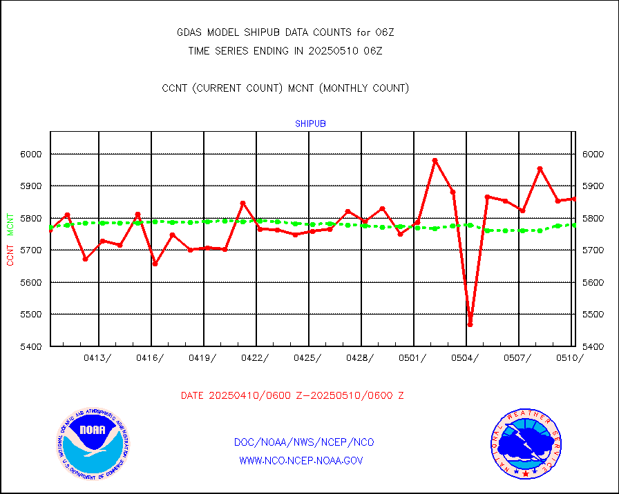
shipub |
Ship - manual and automatic, unrestricted (BUFR) |
6096 |
5958 |
102.3 % |
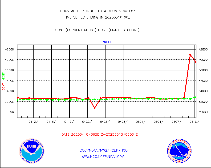
synopb |
Synoptic - fixed manual & auto (decoded fr BUFR) |
31229 |
31861 |
98.0 % |
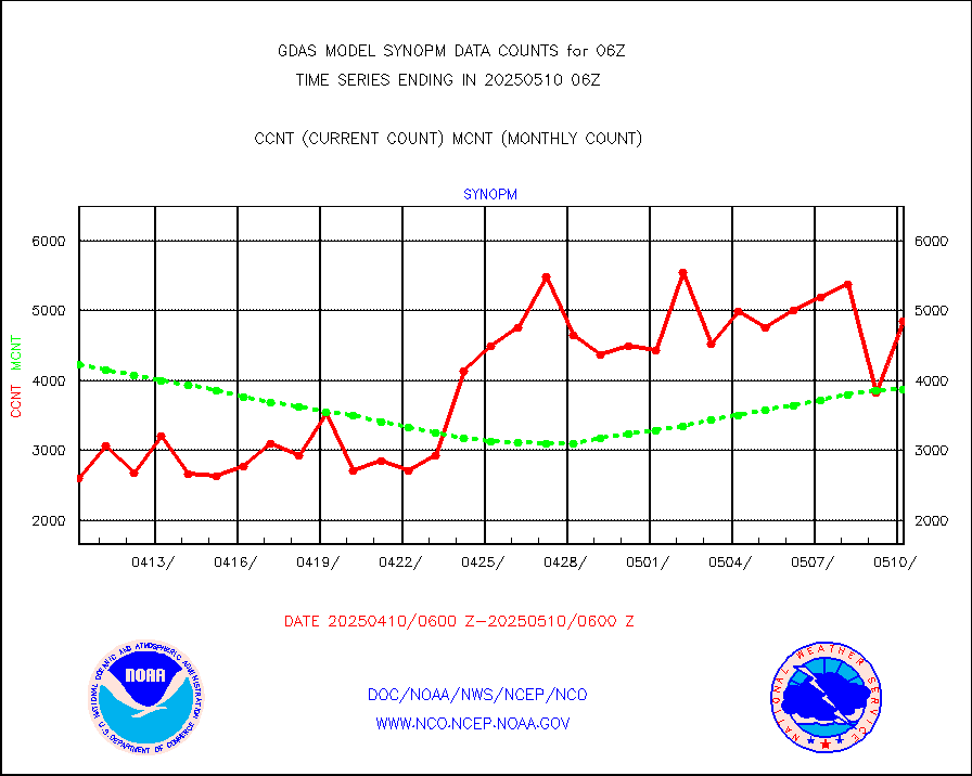
synopm |
Synoptic - mobile manual and automatic |
5889 |
5912 |
99.6 % |
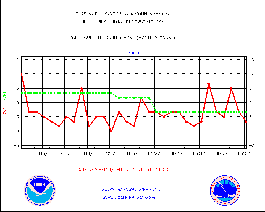
synopr |
Synoptic - restricted (WMO Res 40) manual & auto. |
3 |
6 |
50.0 % |
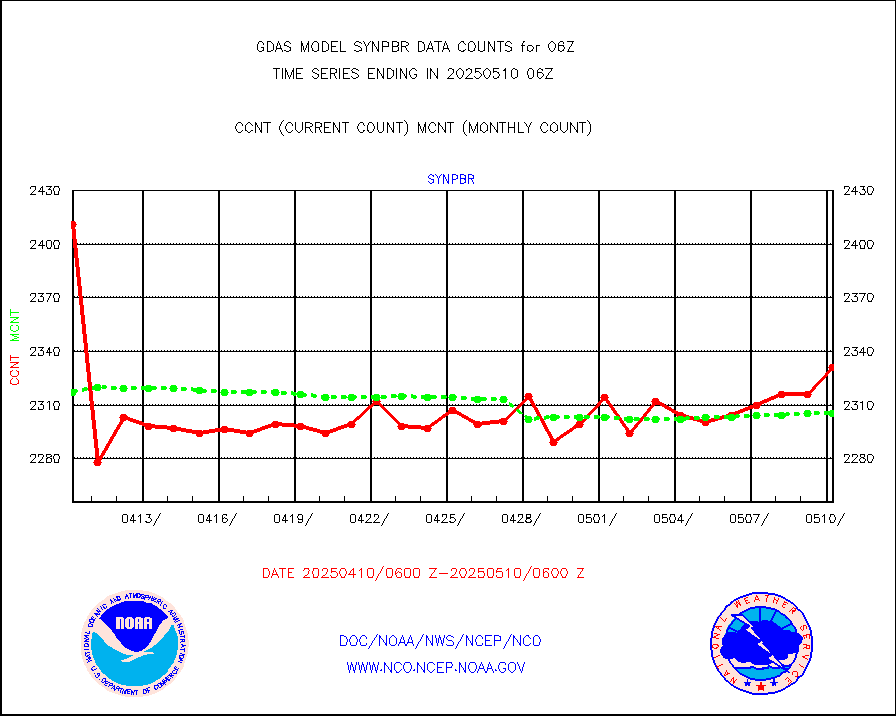
synpbr |
Synoptic - restricted (WMO Res 40)(decoded BUFR) |
2308 |
2292 |
100.7 % |
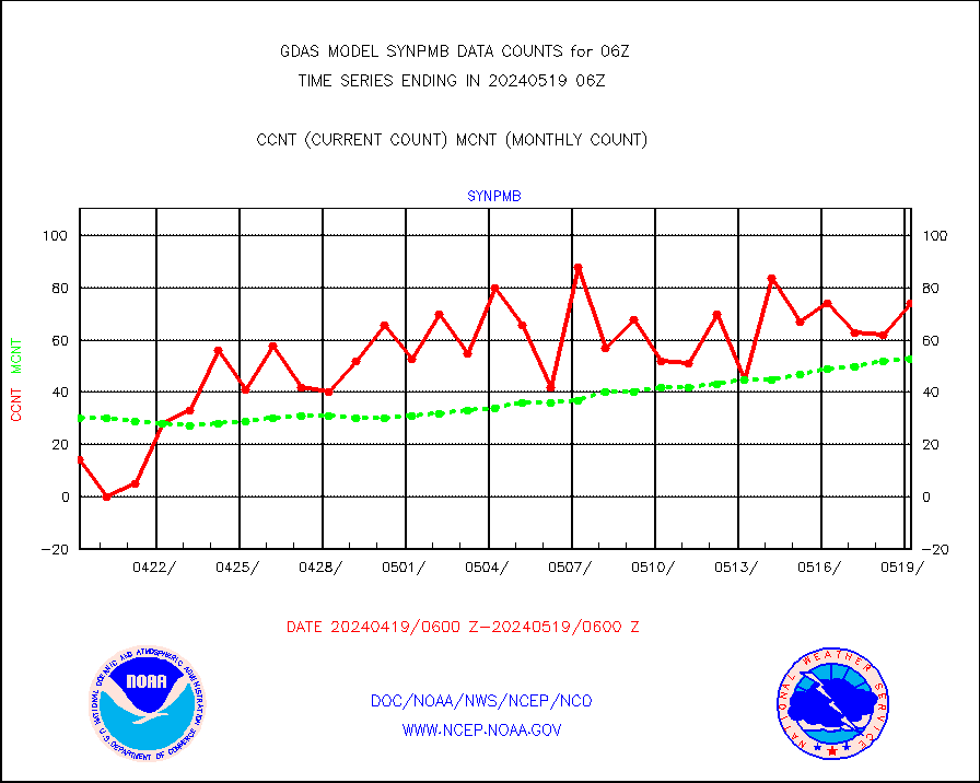
synpmb |
Synoptic - mobile manual & auto (decoded fr BUFR) |
74 |
53 |
139.6 % |
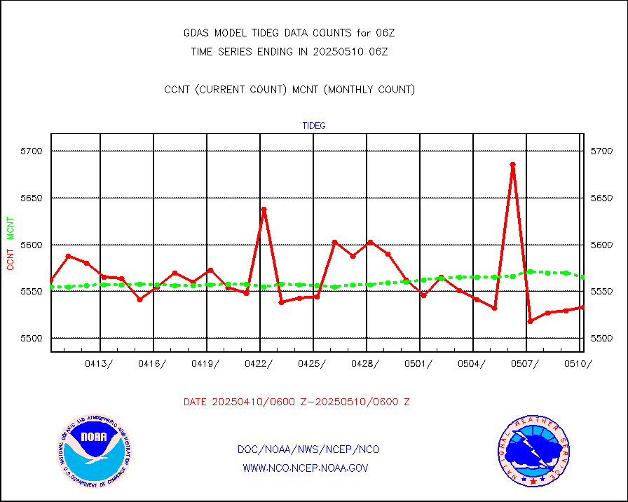
tideg |
Tide gauge reports decoded from CREX format |
5514 |
5486 |
100.5 % |
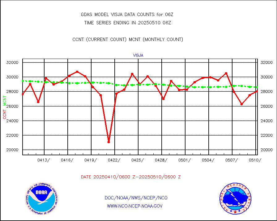
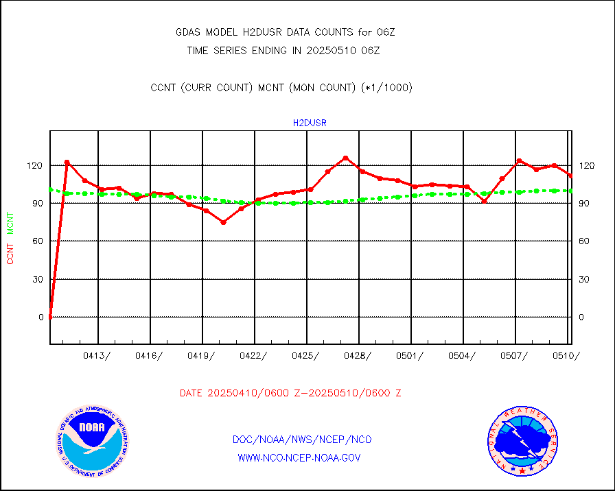
visja |
MTSAT/JMA visible derived cloud motion |
24063 |
27344 |
88.0 % |
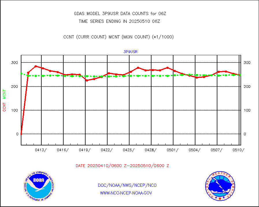
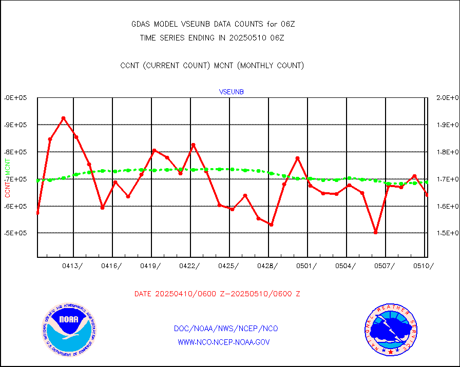
vseunb |
METEOSAT/EUMETSAT visible drv cld motion NBseq |
167012 |
154382 |
108.2 % |
| Data Types of Opportunity with Normal Counts |
|---|
| Type | Description | Hourly Count | Monthly Average | Percent (%) of Monthly Mean |
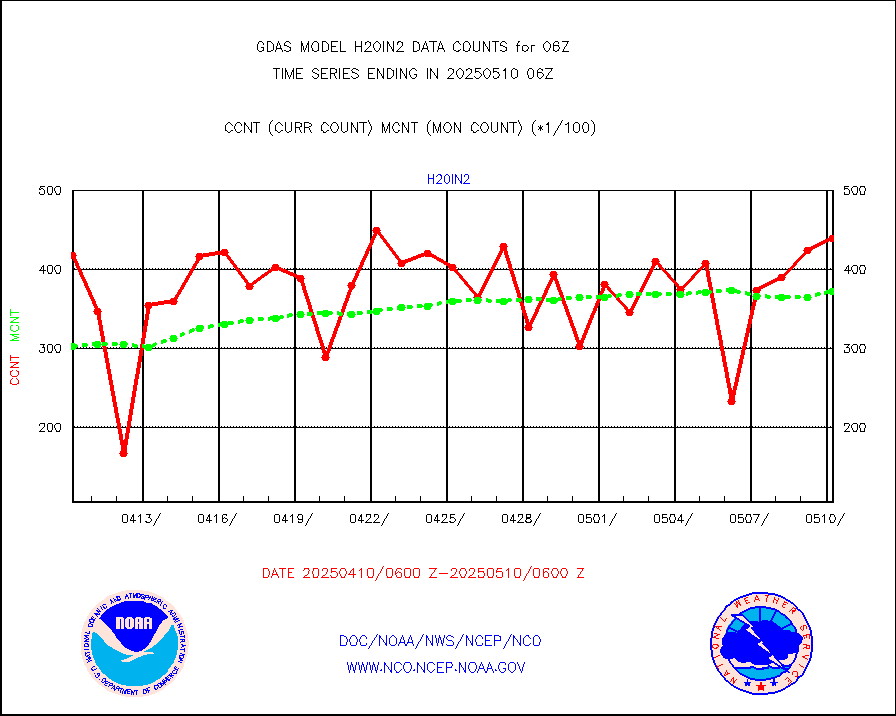
3p9usr |
GOES-16&up/NESDIS ir short-wv derived cld motion |
249586 |
244695 |
102.0 % |
acarsa |
MDCRS ACARS acft data (ARINC via AFWA)(AIREP fmt) |
0 |
0 |
n/a |
amsr2 |
GCOM-W AMSR2 1B brightness temperatures |
9999999 |
9947995 |
100.5 % |
atmsdb |
NPP/NOAA-20 ATMS bright. temps-direct b-cast SSEC |
517677 |
488329 |
106.0 % |
atovs |
POES/NESDIS - processed ATOVS soundings/radiances |
0 |
0 |
n/a |
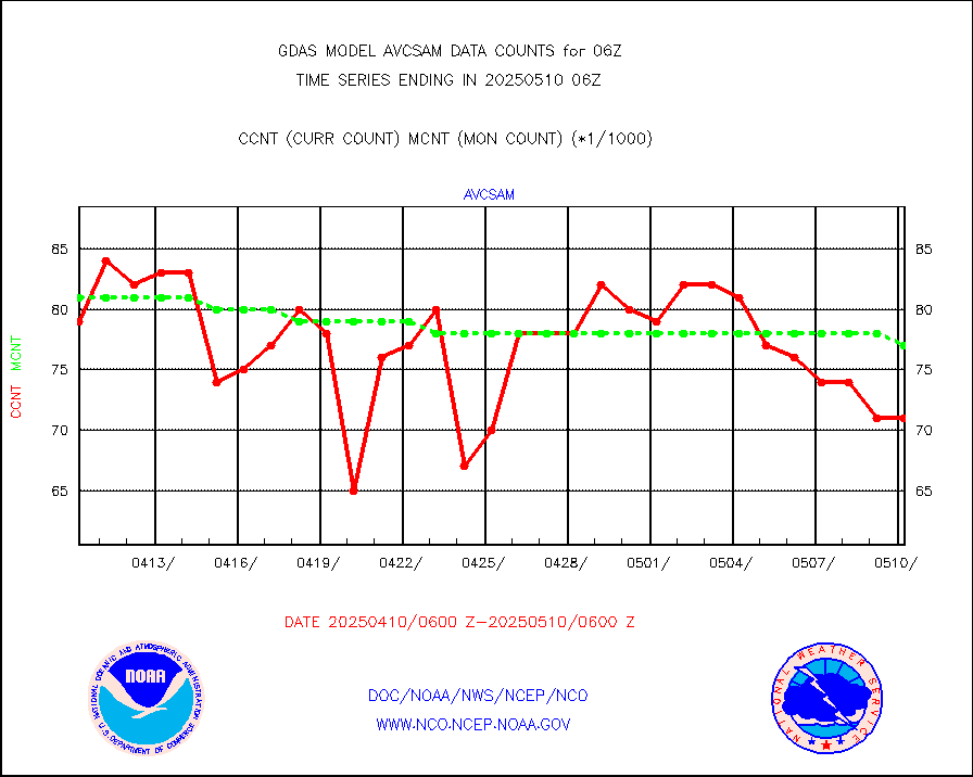
avcsam |
A.M.(N17,M2,M3) AVHRR GAC NCEP-proc clr&sea btmps |
7007329 |
7496472 |
93.5 % |
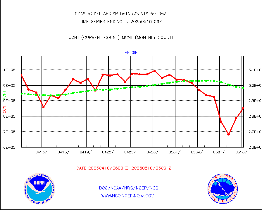
avcspm |
P.M.(N18-19) AVHRR GAC NCEP-proc clr & sea btemps |
5153740 |
8542006 |
60.3 % |
bathy |
eXpendable BathyThermograph, mooring (BATHY fmt) |
2 |
3 |
66.7 % |
camdar |
Canadian AMDAR aircraft data (decoded from BUFR) |
0 |
3 |
0.0 % |
crisf4 |
NPP/NOAA-20 CrIS full spctrl radn (431 ch subset) |
1458000 |
1457892 |
100.0 % |
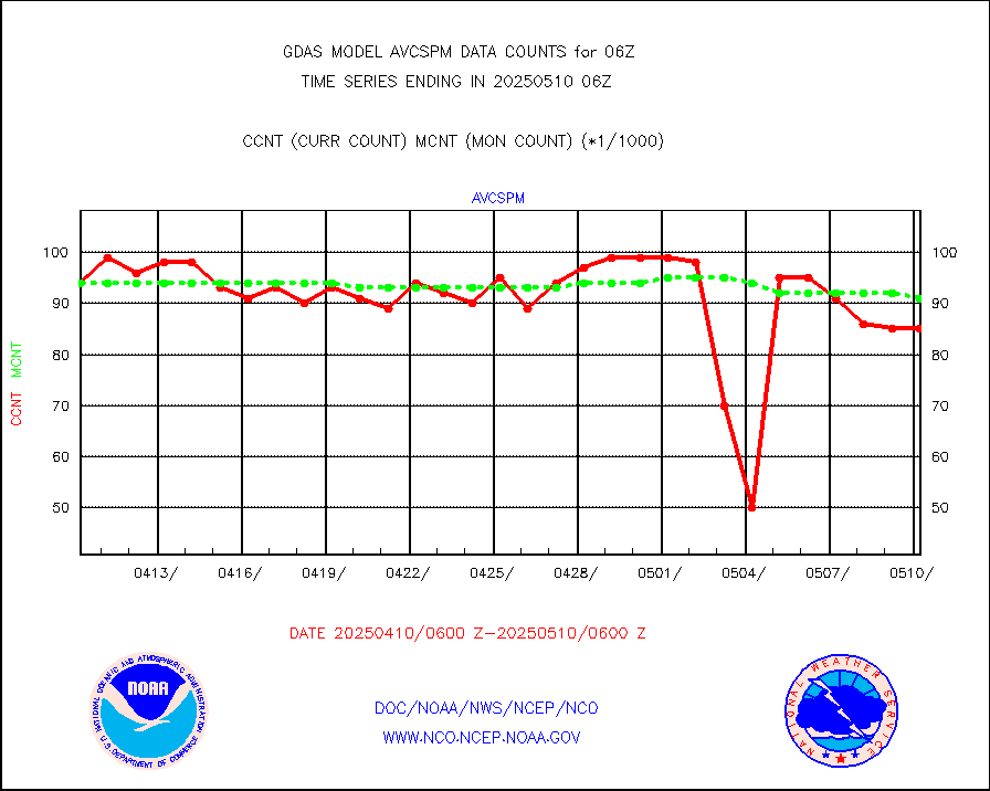
crsfdb |
NPP/NOAA-20 CrIS full spctrl radn dir brdcst SSEC |
708391 |
692536 |
102.3 % |
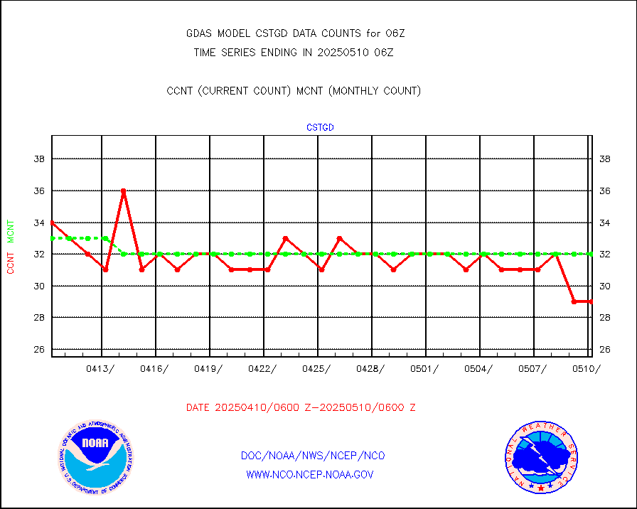
cstgd |
Coast Guard |
21 |
22 |
95.5 % |
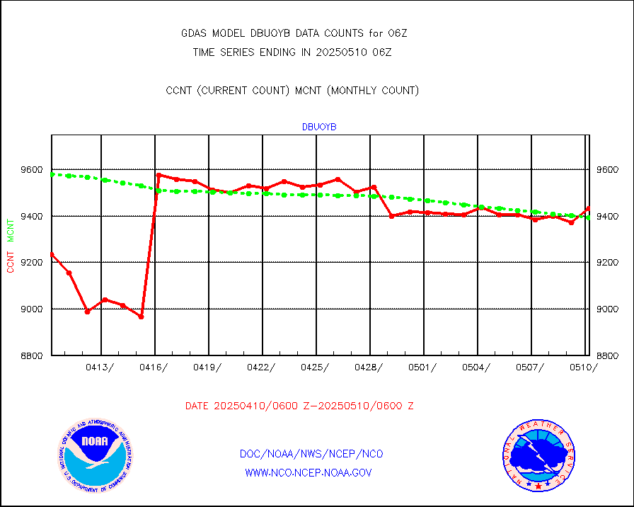
dbuoyb |
Drifting buoys (decoded from BUFR) |
8927 |
8870 |
100.6 % |
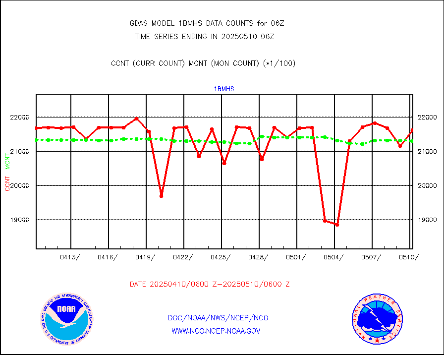
esatms |
NPP Adv. Tech. MW Sndr (ATMS) br. temps from RARS |
690426 |
666675 |
103.6 % |
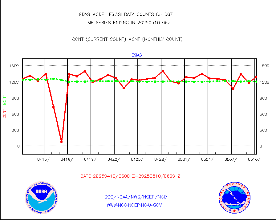
esiasi |
METOP 1-2 IASI 1C radiance data vbl chn from RARS |
203850 |
186023 |
109.6 % |
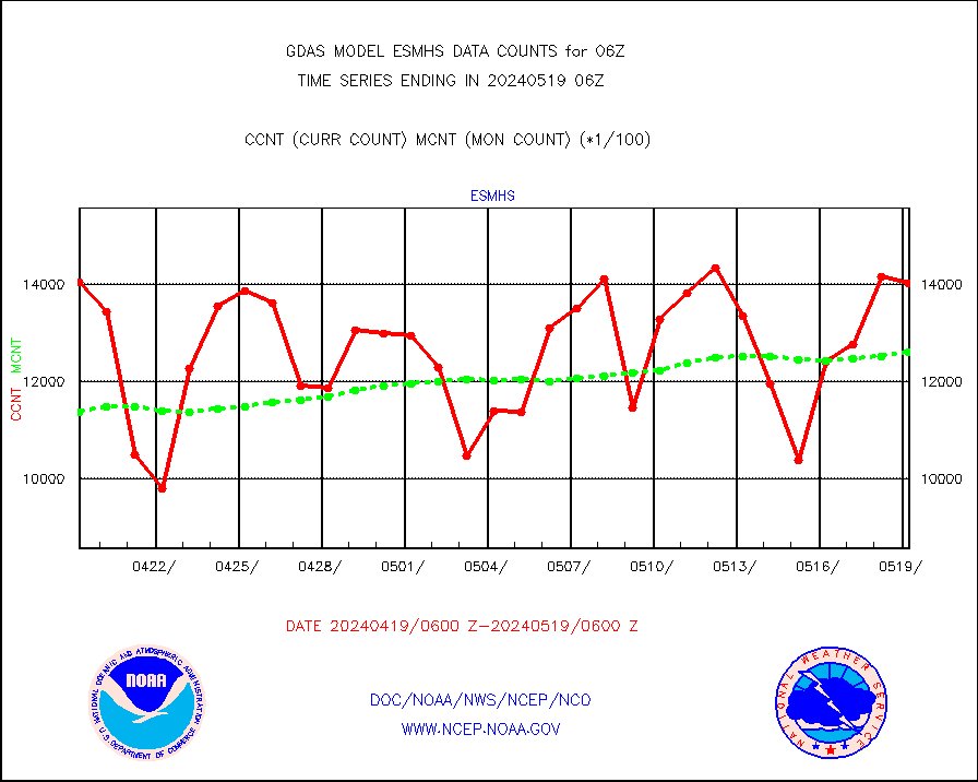
esmhs |
NOAA 18-19 & METOP 1-2 MHS proc. btemps from RARS |
1402880 |
1260164 |
111.3 % |
geoimr |
GOES/NESDIS (11x17 f-o-v) imager clear radiances |
0 |
0 |
n/a |
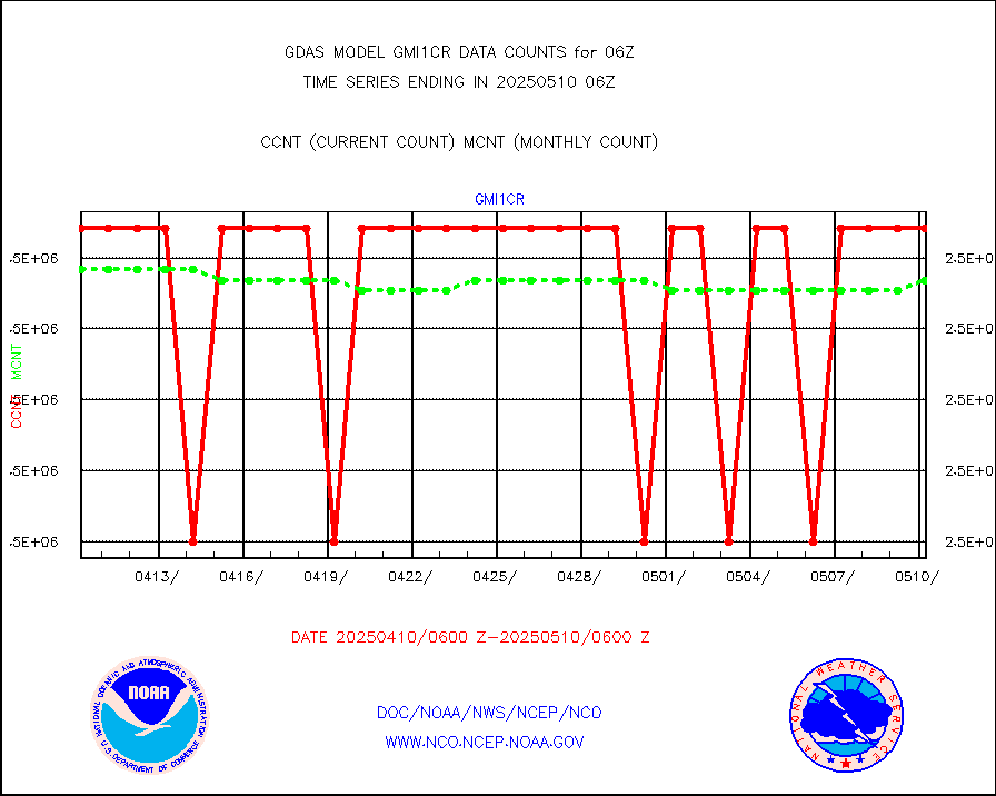
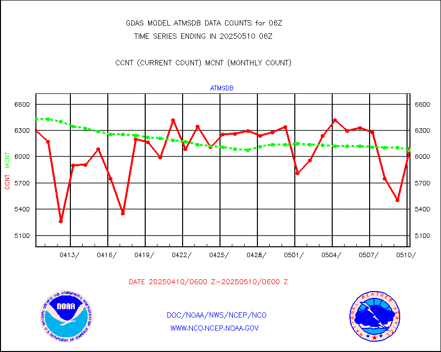
gmi1cr |
GPM GMI Level 1C-R brightness temperatures |
5083442 |
5083369 |
100.0 % |
gnss |
Grnd-based Gbl Navigation Sat System (GNSS) data |
6177 |
6156 |
100.3 % |
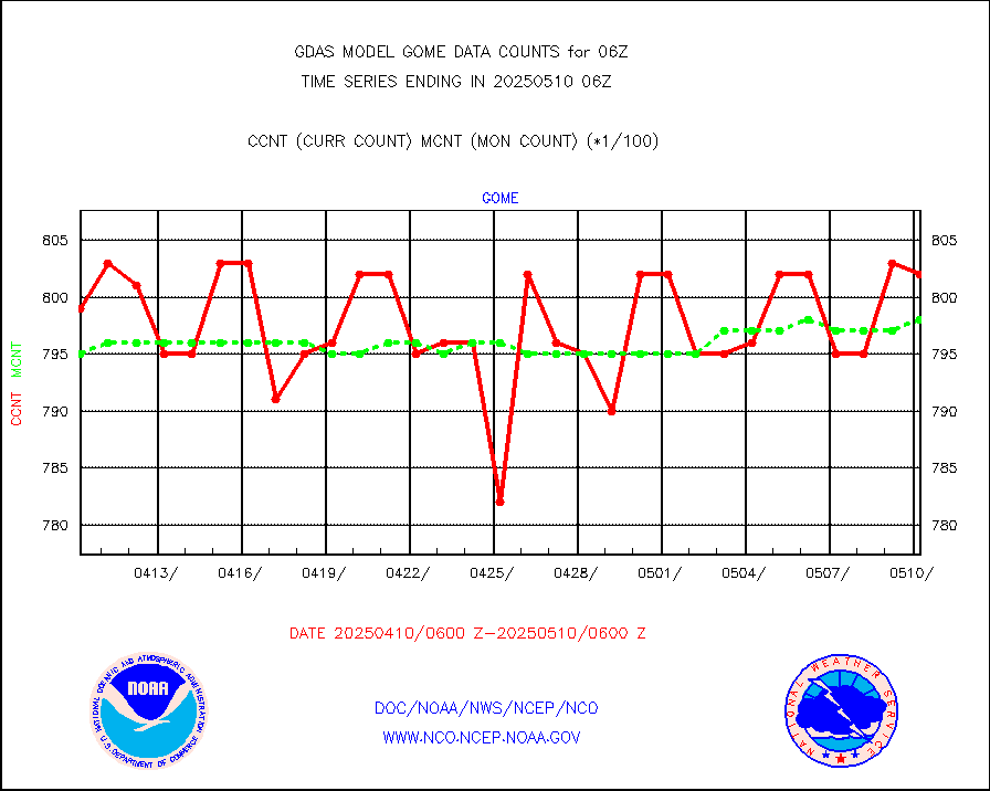
gome |
METOP 1-2 Global Ozone Monitoring Exp.-2 (GOME-2) |
79158 |
79661 |
99.4 % |
h20in |
INSAT/KALPANA India wvpr derived cloud motion |
0 |
0 |
n/a |
h20in2 |
INDIA SATWIND, INSAT WV channel |
49025 |
52930 |
92.6 % |
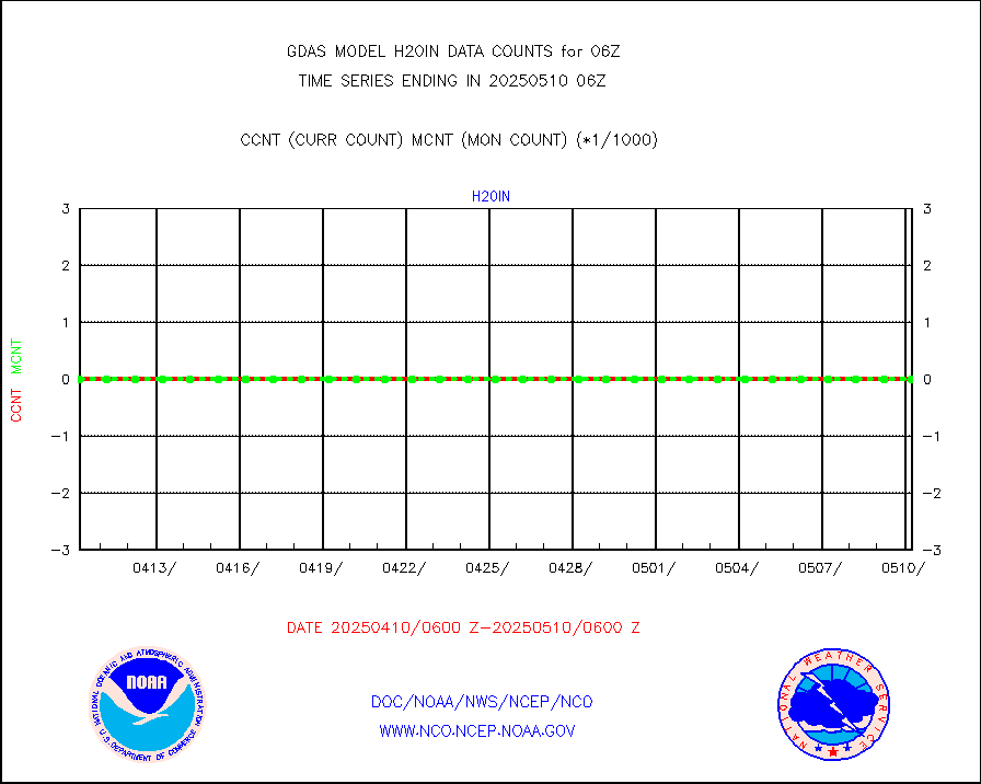
h2dusr |
GOES-16&up/NESDIS wv imgr/deep-lyr derivd cld mtn |
90122 |
94972 |
94.9 % |
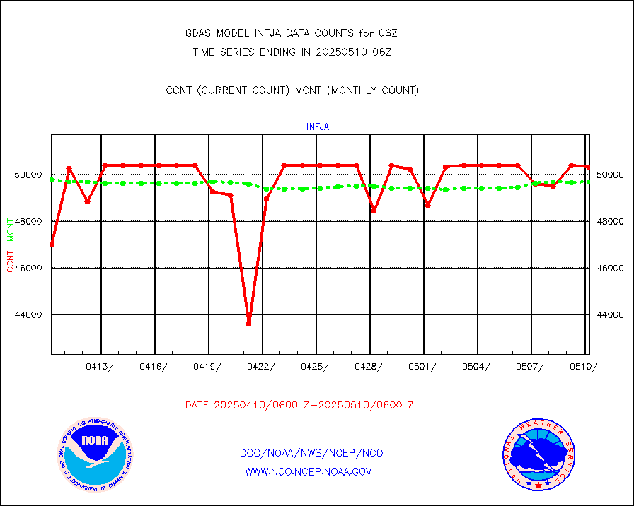
h2eunb |
METEOSAT/EUMETSAT wvpr imgr drv cld motion NBseq |
233775 |
241902 |
96.6 % |
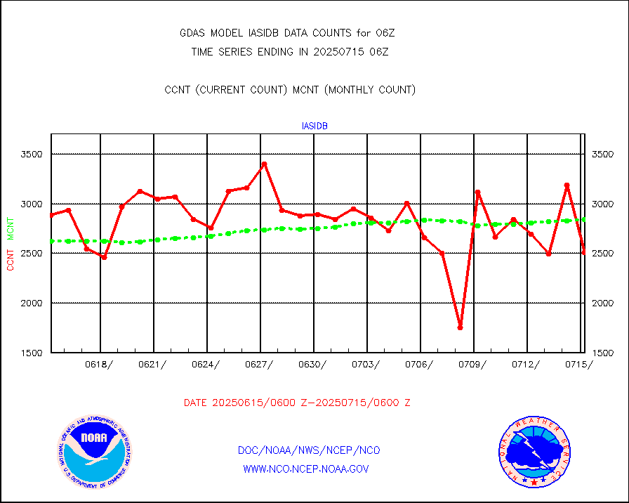
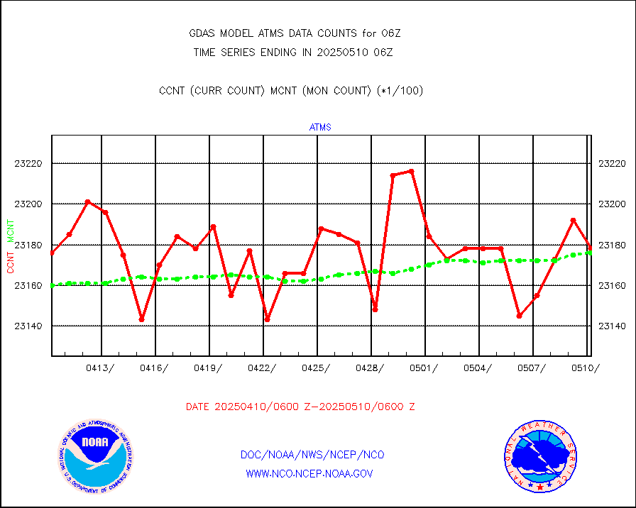
iasidb |
METOP 1-2 IASI 1C radiances-direct broadcast SSEC |
169760 |
206066 |
82.4 % |
ifvrnb |
VIIRS (NPP/NOAA-20) ir lg-wv drv cloud motion(NB) |
135298 |
110683 |
122.2 % |
infav |
AVHRR (NOAA/METOP) ir lg-wave derived cld motion |
0 |
0 |
n/a |
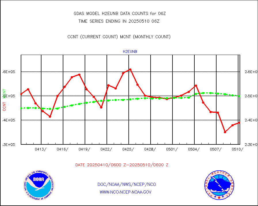
infav1 |
AVHRR (METOP) ir lg-wave derived cld motion |
69548 |
61574 |
113.0 % |
infin |
INSAT/KALPANA India ir lg-wave derived cld motion |
0 |
0 |
n/a |
infin2 |
INDIA SATWIND, INSAT IR channel |
51738 |
52826 |
97.9 % |
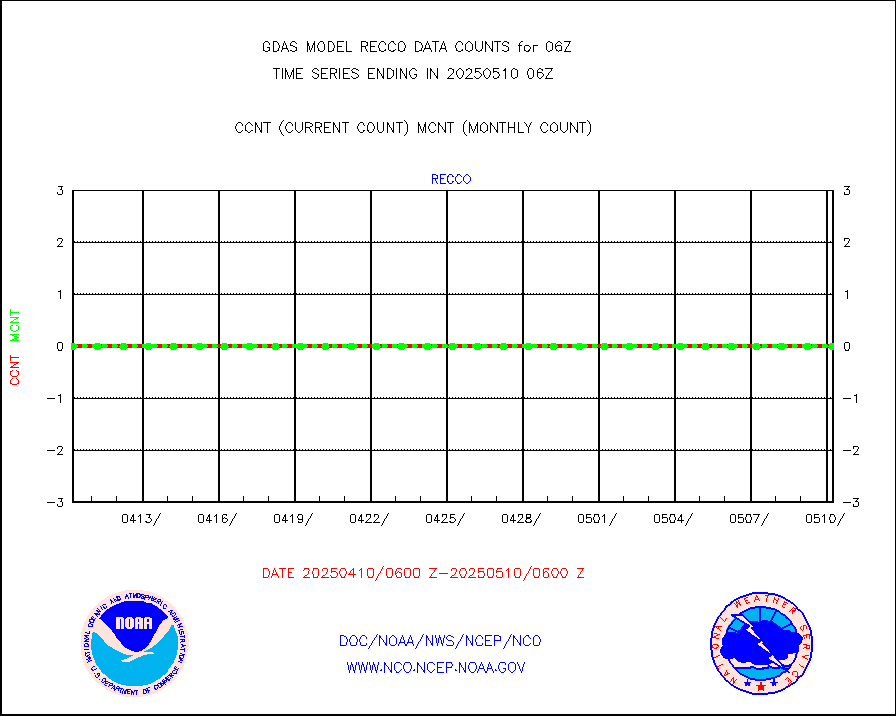
kamdar |
Korean AMDAR aircraft data (decoded from BUFR) |
297 |
480 |
61.9 % |
mbuoyb |
Moored buoys (decoded from BUFR) |
6787 |
6237 |
108.8 % |
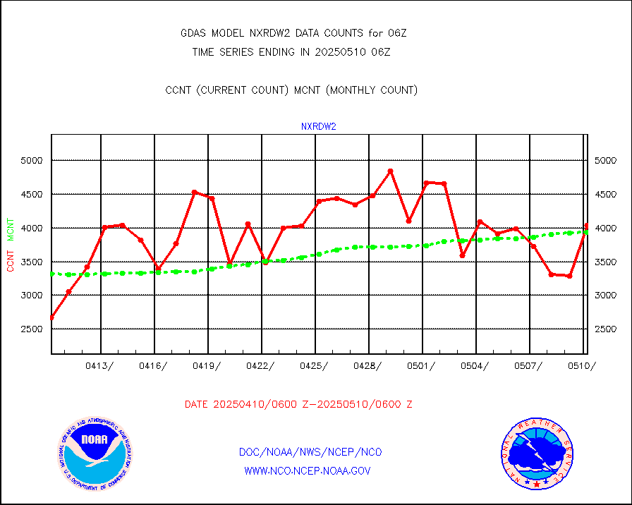
nxrdw2 |
NEXRAD Vel Azm Dsp(VAD) winds via Level 2 decoder |
5213 |
4538 |
114.9 % |
ompslp |
OMPS Limb Profiler ozone data (NPP) |
1716 |
1568 |
109.4 % |
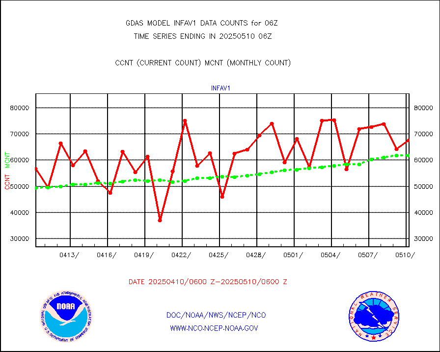
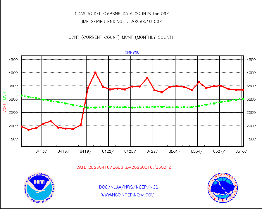
ompsn8 |
OMPS nadir profile ozone (Version 8 BUFR) |
3965 |
3469 |
114.3 % |
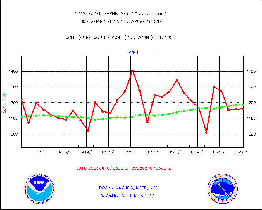
ompst8 |
OMPS total column ozone (Version 8 BUFR) |
2282987 |
2077092 |
109.9 % |
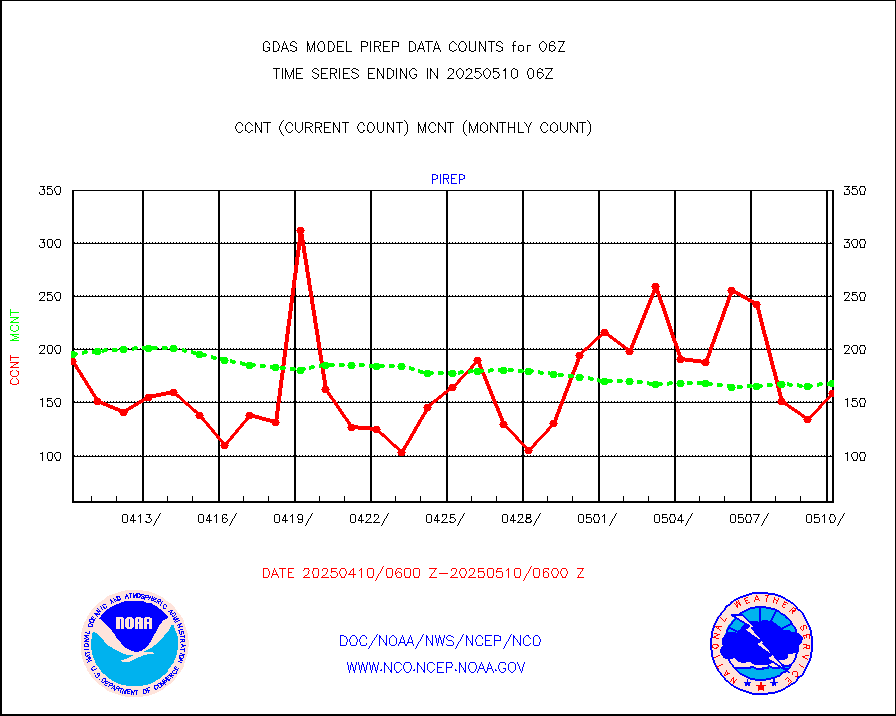
pirep |
Manual PIREP aircraft data (dcded from AIREP fmt) |
99 |
143 |
69.2 % |
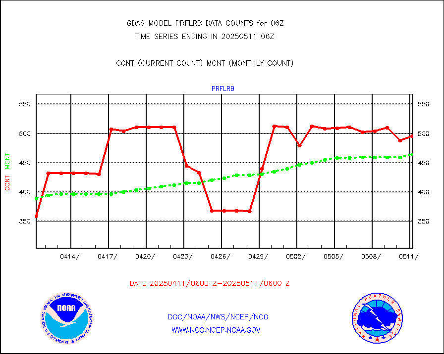
prflrb |
Multi-Agency Profiler (MAP) and SODAR winds |
320 |
392 |
81.6 % |
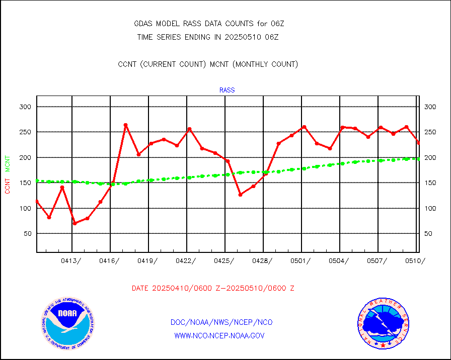
rass |
RASS temperatures (NOAA and Multi-Agency) |
163 |
194 |
84.0 % |
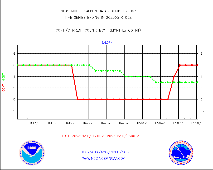
saldrn |
Surface Marine Saildrone (decoded from BUFR) |
6 |
6 |
100.0 % |
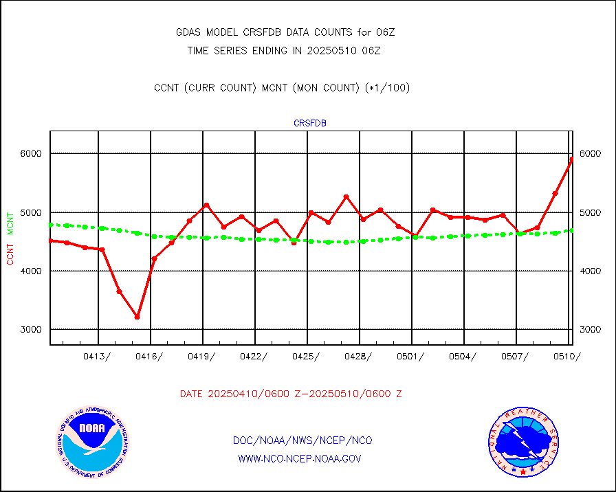
saphir |
Megha-Tropiques SAPHIR L1A2 brightness temps |
0 |
0 |
n/a |
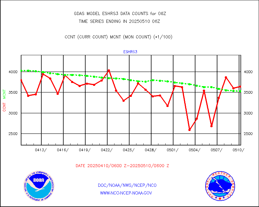
sevasr |
METEOSAT-10 2nd Gen SEVIRI All Sky Radiance(proc) |
453072 |
447770 |
101.2 % |
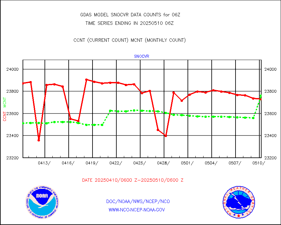
snocvr |
NOW COVER, DEPTH/DENSITY AND WATER EQUIVALENT |
25886 |
25414 |
101.9 % |
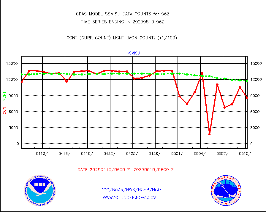
ssmisu |
DMSP SSM/IS 1C radiance data (Unified Pre-Proc.) |
1364760 |
1163244 |
117.3 % |
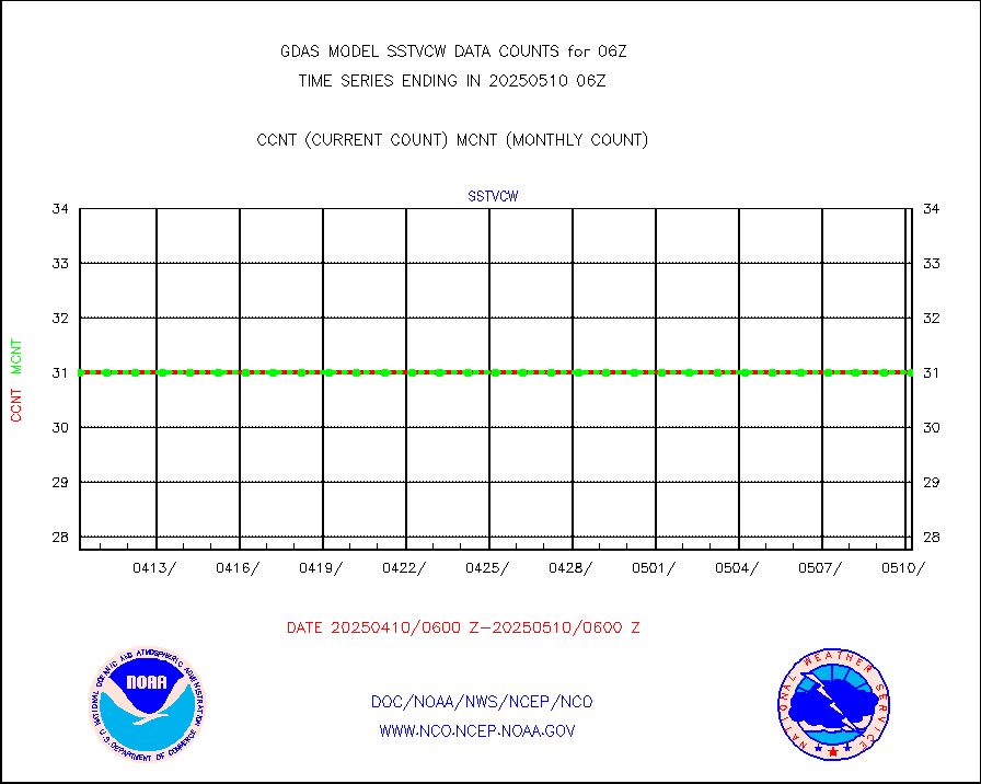
sstvcw |
NPP/NOAA-20 VIIRS SST - CLEAR & OVER WATER |
31 |
31 |
100.0 % |
sstvpw |
NPP/NOAA-20 VIIRS SST - PROBABLY CLR & OVER WATER |
9999999 |
9999999 |
100.0 % |
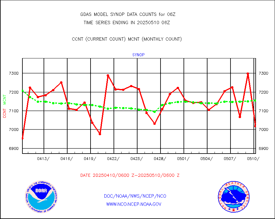
synop |
Synoptic - fixed manual and automatic |
8104 |
8101 |
100.0 % |
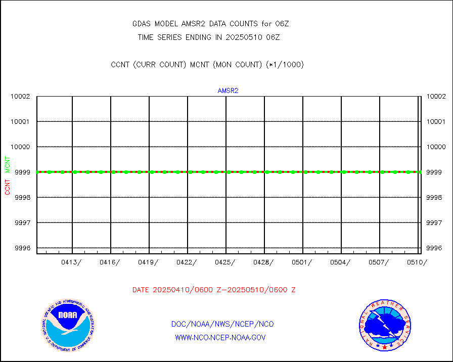
tesac |
CTD probe, Argo prflng float, mooring (TESAC fmt) |
2856 |
2642 |
108.1 % |
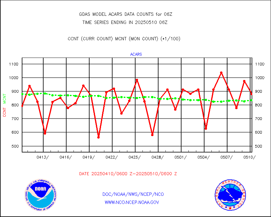
tmdara |
TAMDAR aircft data-all types(from Panasonic,BUFR) |
2305 |
2667 |
86.4 % |
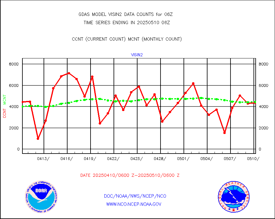
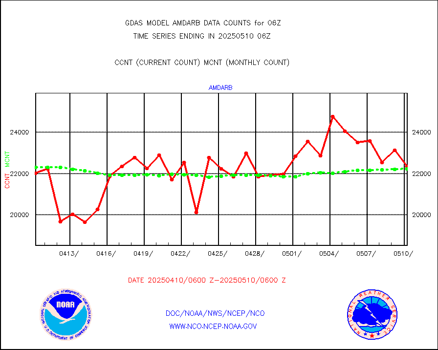
visin |
INSAT/KALPANA India visible derived cloud motion |
0 |
0 |
n/a |
visin2 |
INDIA SATWIND, INSAT VIS channel |
6707 |
5281 |
127.0 % |
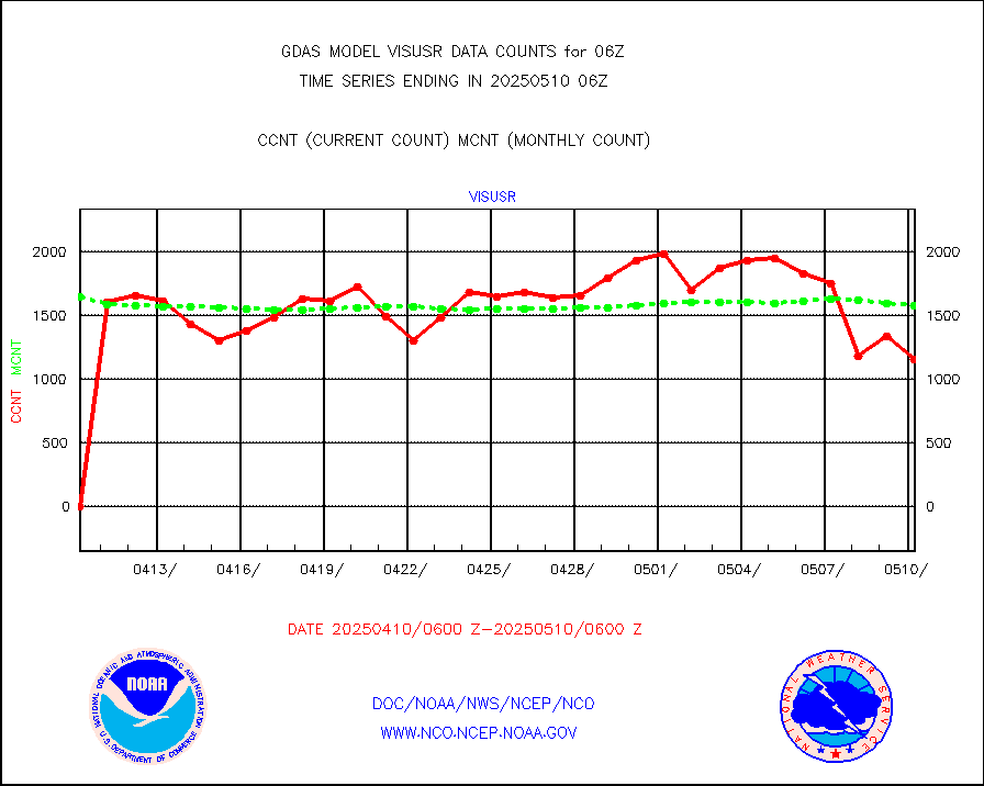
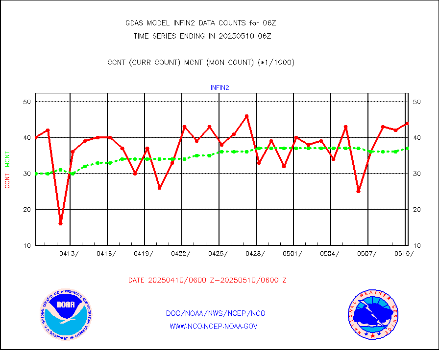
visusr |
GOES-16&up/NESDIS visible derived cloud motion |
157508 |
148124 |
106.3 % |


