| Critical Data with Normal Counts |
|---|
| Type | Description | Hourly Count | Monthly Average | Percent (%) of Monthly Mean |
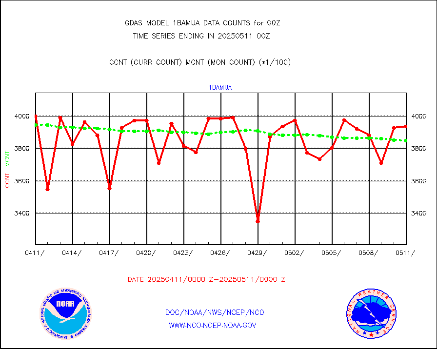
1bamua |
NOAA 15-19 & METOP 1-2 AMSU-A NCEP-proc. br.temps |
379104 |
384593 |
98.6 % |
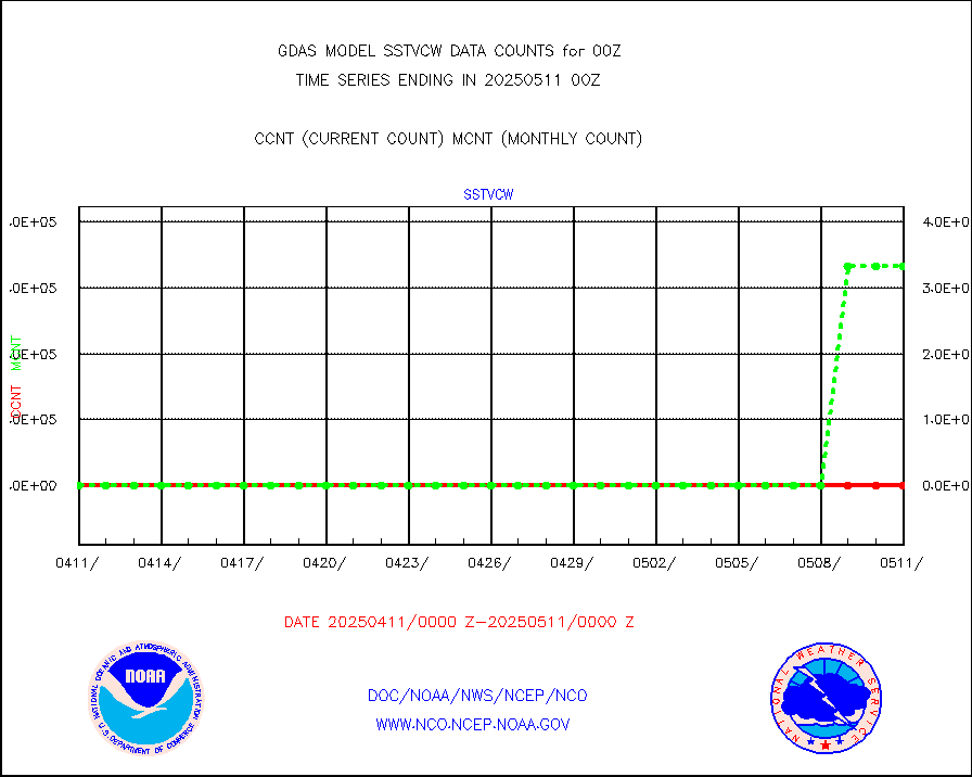
1bhrs4 |
NOAA 18-19 & METOP 1-2 HIRS-4 NCEP-proc. br.temps |
337288 |
351934 |
95.8 % |
1bmhs |
NOAA 18-19 & METOP 1-2 MHS NCEP-proces. br. temps |
2158239 |
2151065 |
100.3 % |
acars |
MDCRS ACARS acft data from ARINC(dcded from BUFR) |
153435 |
155518 |
98.7 % |
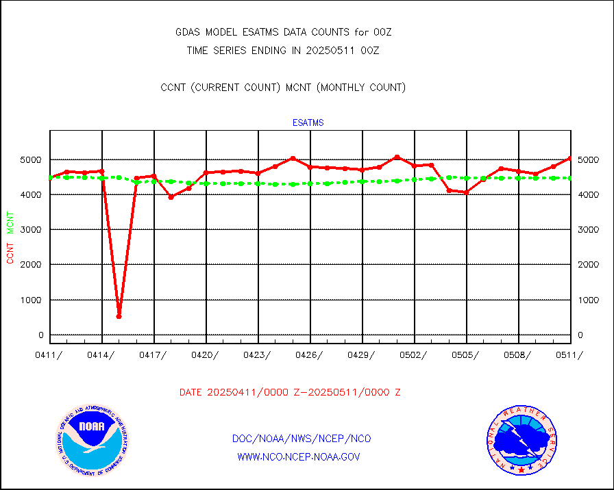
ahicsr |
Himawari Clear Sky Radiance |
300620 |
317496 |
94.7 % |
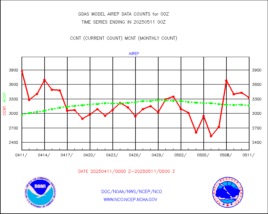
airep |
Manual AIREP aircraft data (dcded from AIREP fmt) |
5262 |
4874 |
108.0 % |
airsev |
AQUA AIRS/AMSU-A/HSB brightness temps- every FOV |
0 |
0 |
n/a |
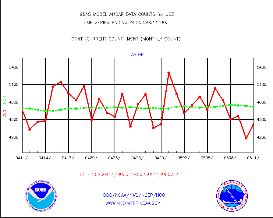
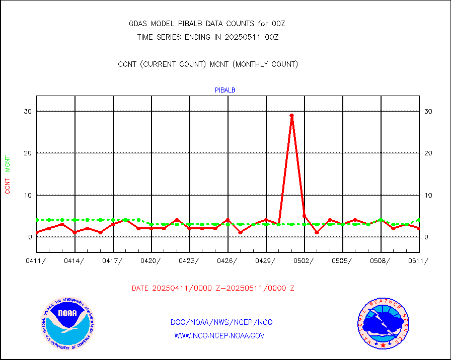
amdar |
AMDAR aircraft data (decoded from AMDAR format) |
4983 |
4896 |
101.8 % |
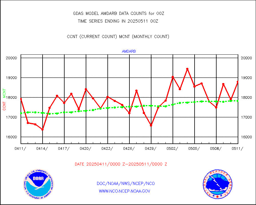
amdarb |
AMDAR aircraft data (decoded from BUFR) |
9072 |
9353 |
97.0 % |
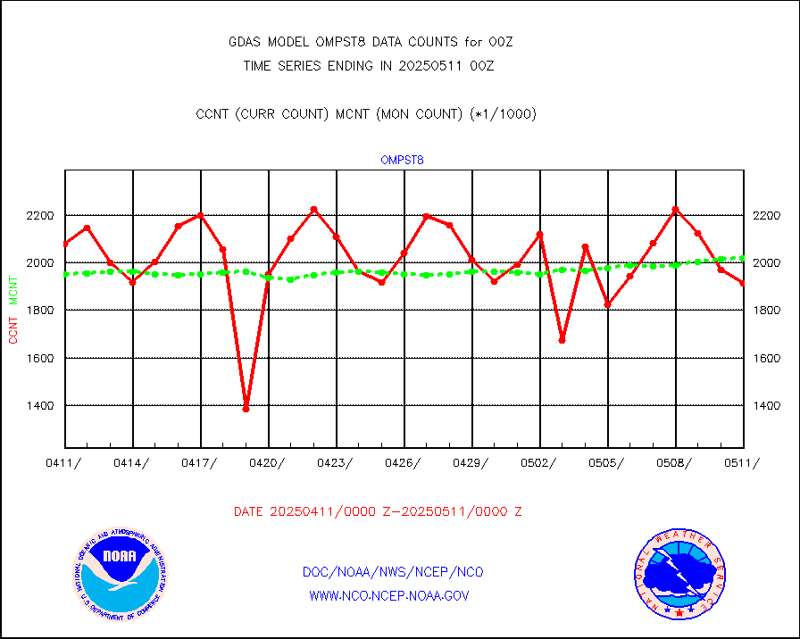
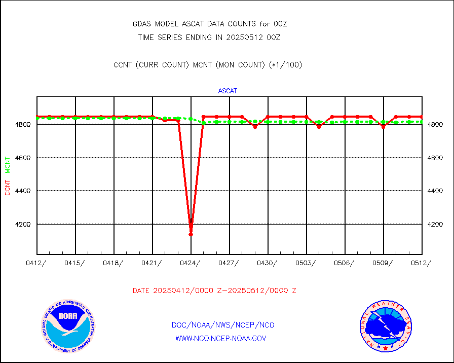
ascat |
METOP 1-2 ASCAT products |
470484 |
476111 |
98.8 % |
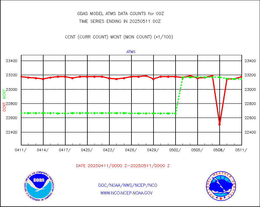
atms |
NPP/NOAA-20 ATMS brightness temperatures |
2086272 |
2316279 |
90.1 % |
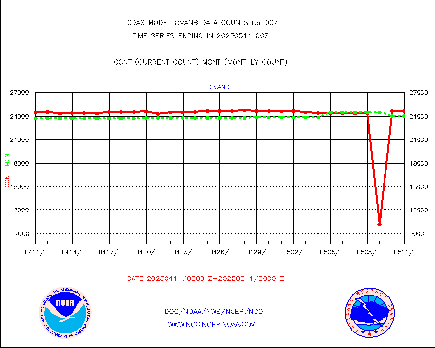
cmanb |
Surface Marine CMAN rpts decoded from BUFR format |
24733 |
24419 |
101.3 % |
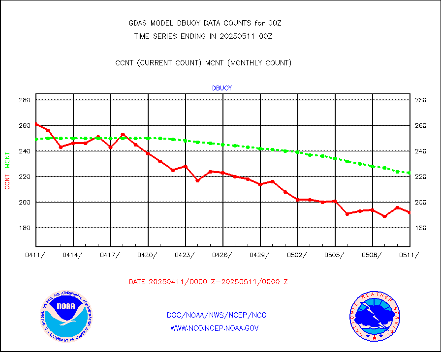
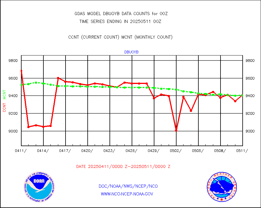
dbuoy |
Buoys decoded from FM-18 fmt (moored or drifting) |
264 |
285 |
92.6 % |
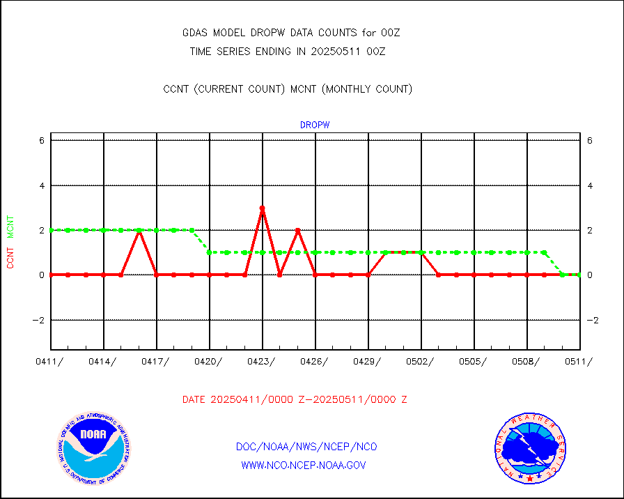
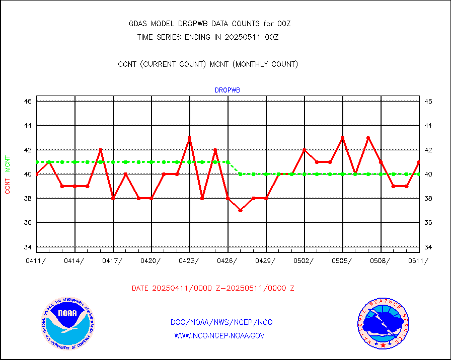
dropw |
Dropwinsonde (from TEMP DROP) |
0 |
0 |
n/a |
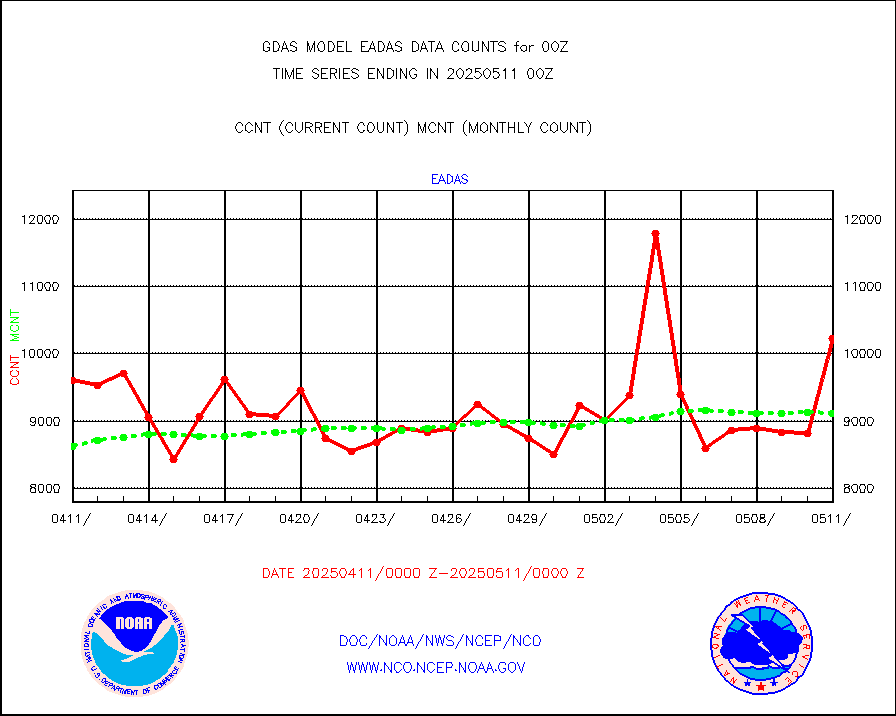
eadas |
E-AMDAR (European AMDAR acft decoded from BUFR) |
6354 |
6693 |
94.9 % |
esamua |
NOAA 15-19 & METOP 1-2 AMSU-A proc btmps frm RARS |
308838 |
302894 |
102.0 % |
eshrs3 |
NOAA 15-19 & METOP 1-2 HIRS-3/4 pr btmps frm RARS |
770970 |
746710 |
103.2 % |
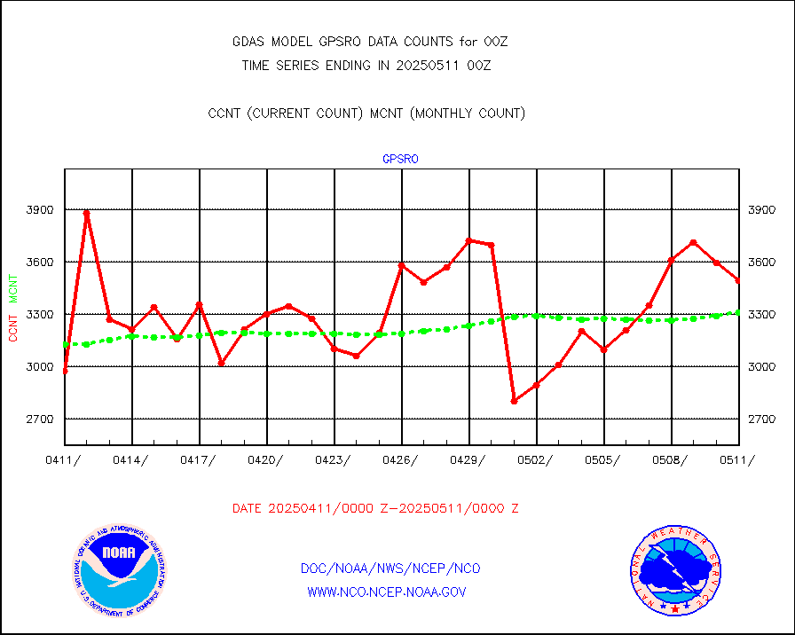
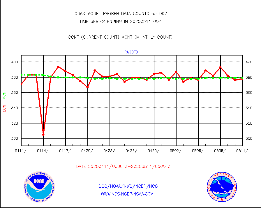
gpsro |
GPS radio occultation data |
3348 |
3129 |
107.0 % |
gsrasr |
GOES-16/17 All Sky Radiances (proc.) |
6488568 |
6407747 |
101.3 % |
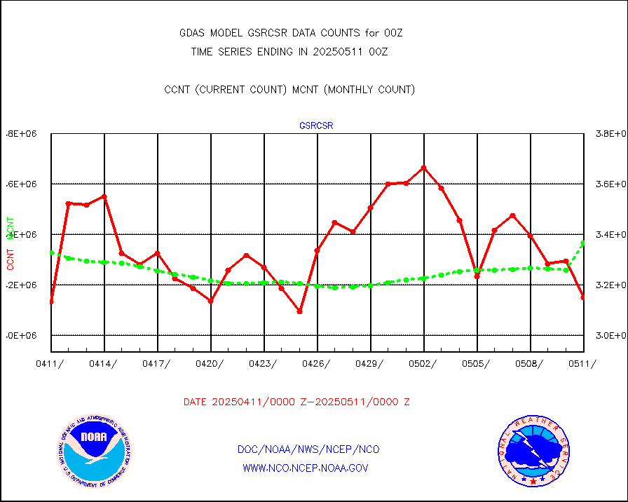
gsrcsr |
GOES-16/17 Clear Sky Radiances (proc.) |
3062315 |
3189501 |
96.0 % |
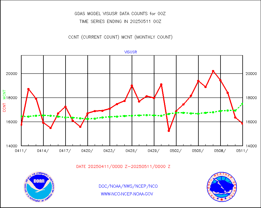
h20ja |
MTSAT/JMA water vapor imager derived cloud motion |
53640 |
56423 |
95.1 % |
h20mo |
MODIS (AQUA/TERRA) wvpr imager derived cld motion |
0 |
0 |
n/a |
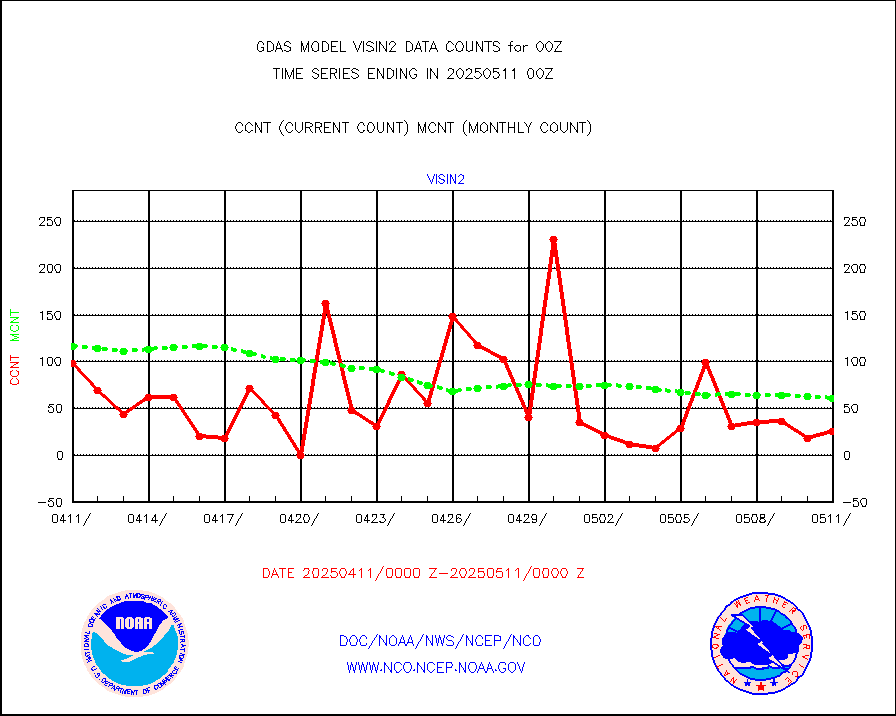
h2tusr |
GOES-16&up/NESDIS wv imgr/cld-top derived cld mtn |
186215 |
178064 |
104.6 % |
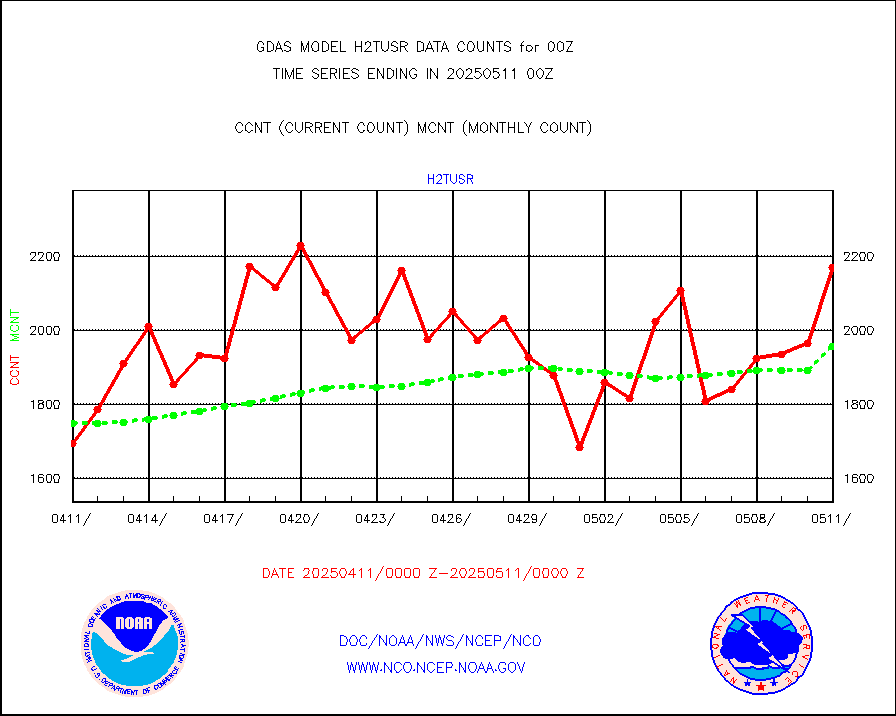
ifeunb |
METEOSAT/EUMETSAT ir lg-wave drv cld motion NBseq |
128695 |
128831 |
99.9 % |
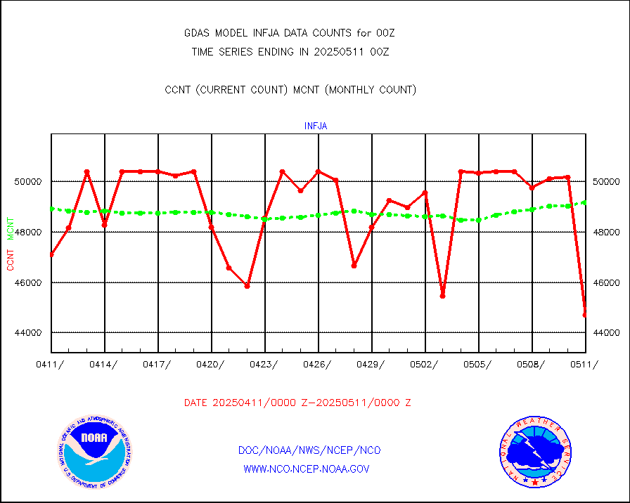
infja |
MTSAT/JMA infrared long-wave derived cloud motion |
48125 |
47812 |
100.7 % |
infmo |
MODIS (AQUA/TERRA) ir l-wave derived cloud motion |
0 |
0 |
n/a |
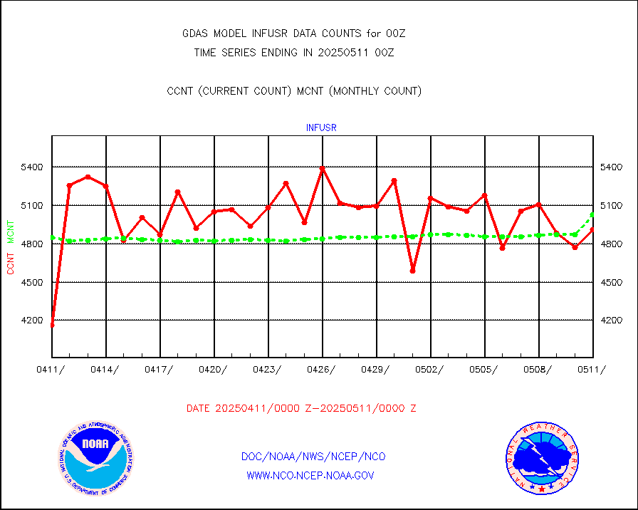
infusr |
GOES-16&up/NESDIS ir long-wave derived cld motion |
481220 |
494964 |
97.2 % |
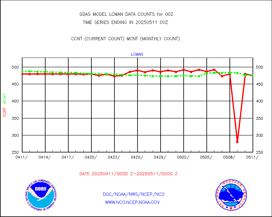
lcman |
Land-based CMAN stations decoded from CMAN format |
588 |
583 |
100.9 % |
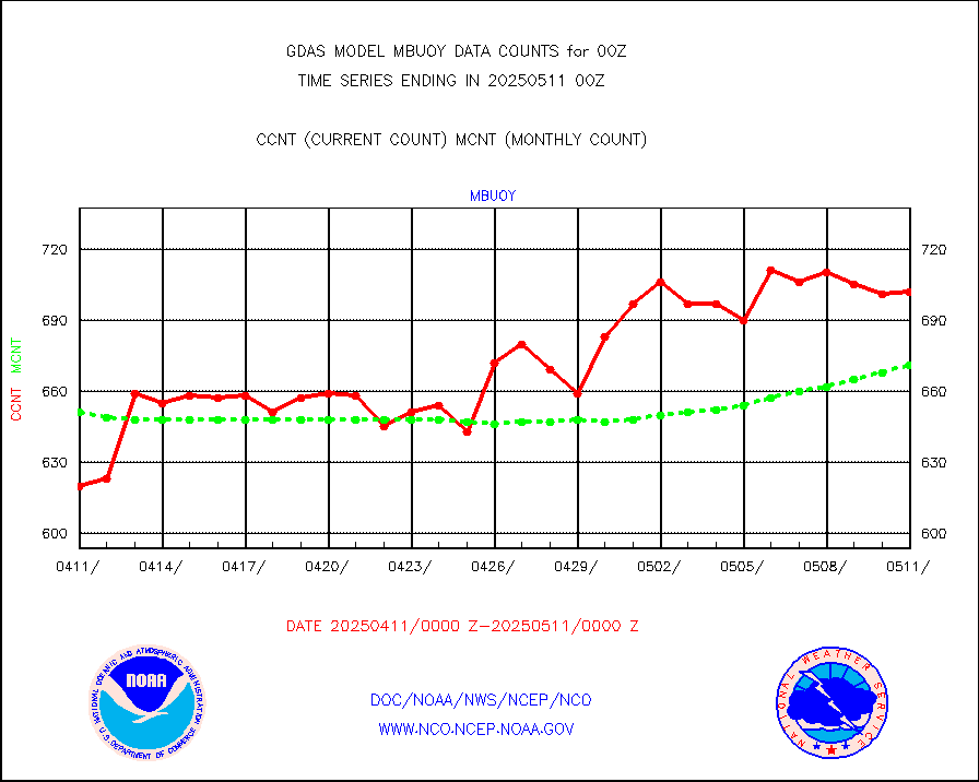
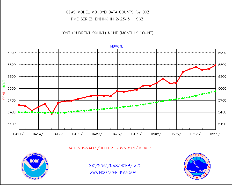
mbuoy |
Buoys decoded from FM-13 format (moored) |
745 |
711 |
104.8 % |
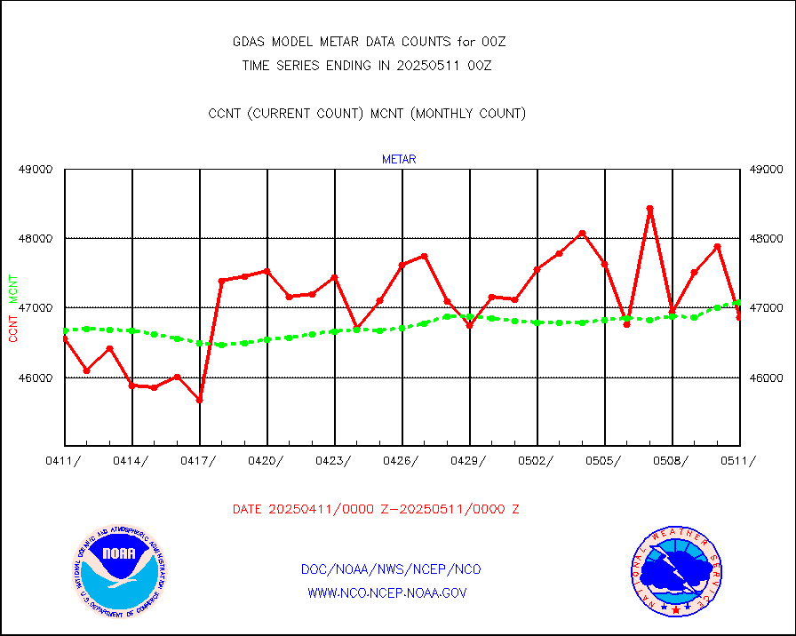
metar |
Aviation - METAR |
46747 |
46336 |
100.9 % |
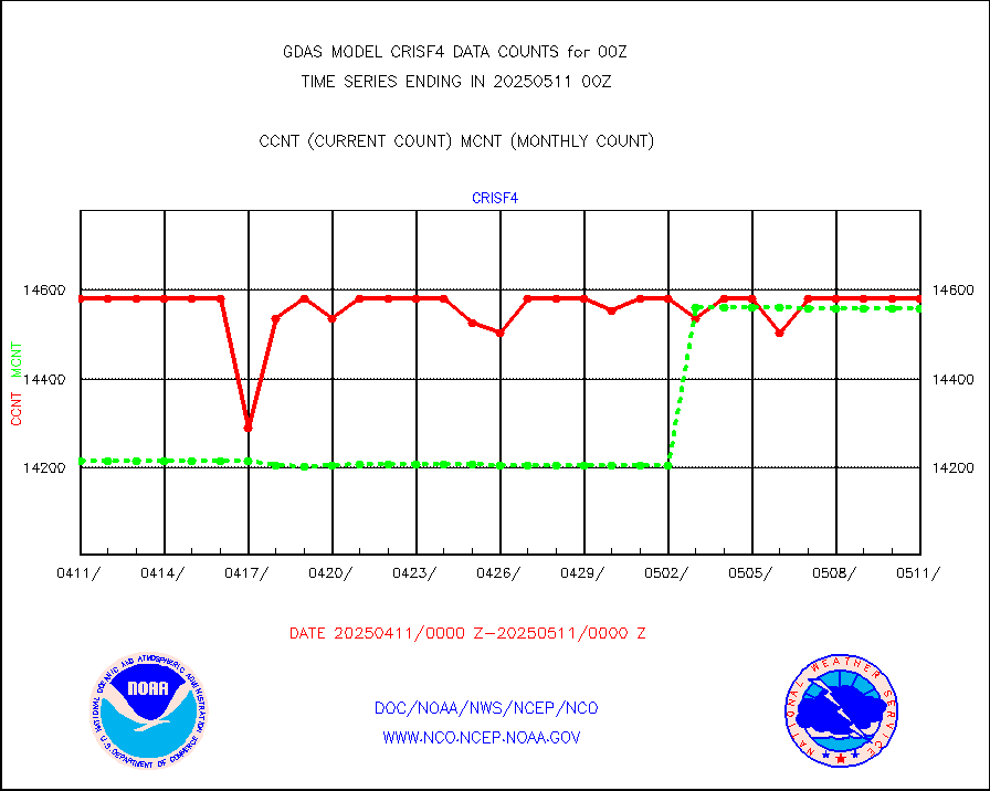
mtiasi |
METOP 1-2 IASI 1C radiance data (varbl. channels) |
645368 |
639633 |
100.9 % |
nxrdw |
NEXRAD Vel Azm Dsp(VAD) winds via radar coded msg |
0 |
0 |
n/a |
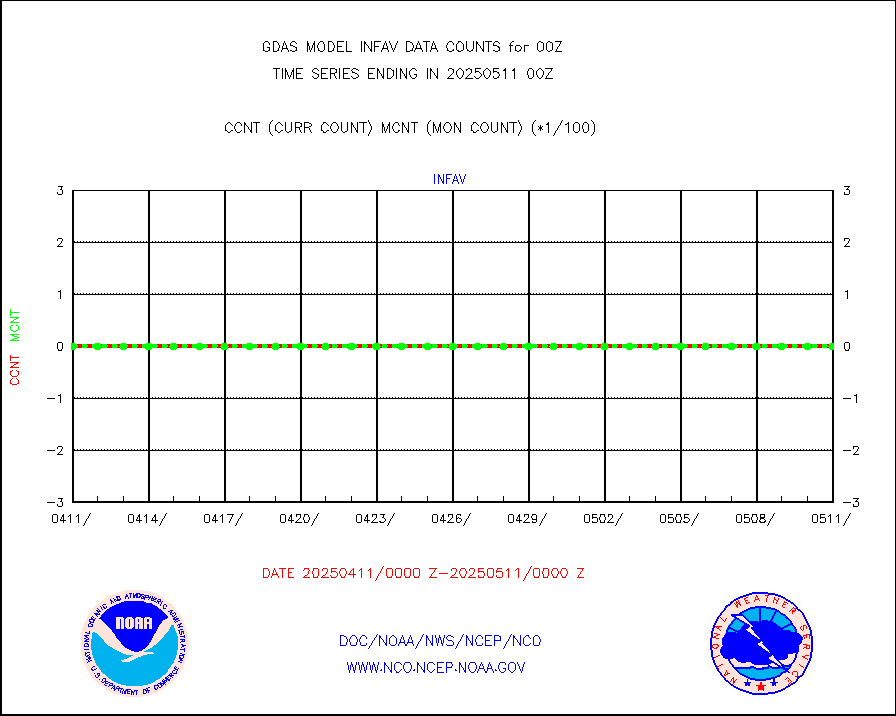
omi |
Aura Ozone Monitoring Instrument (OMI) data |
313023 |
217323 |
144.0 % |
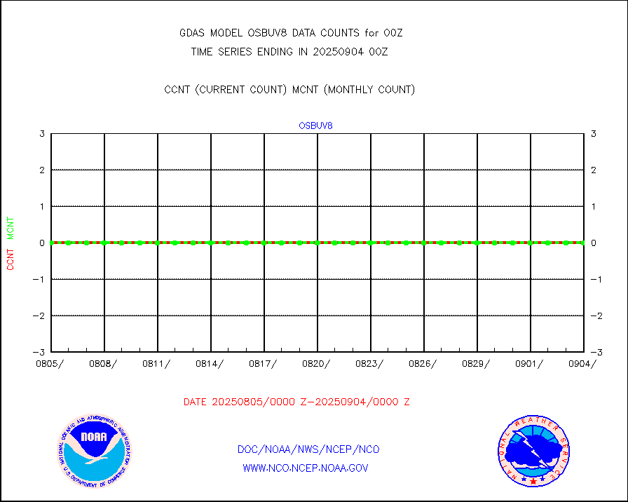
osbuv8 |
NOAA 16-19 Solar Backscatter UV-2 rad frm V8 BUFR |
0 |
0 |
n/a |
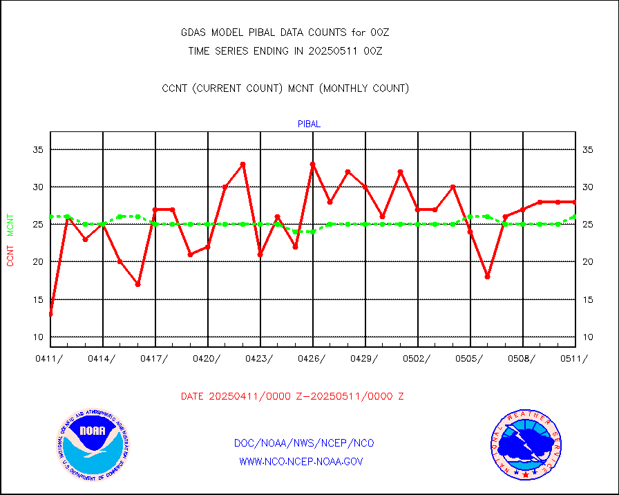
pibal |
PIBAL (from PILOT, PILOT SHIP, PILOT MOBIL) |
62 |
59 |
105.1 % |
prflrp |
Profilr winds from PIBAL (PILOT,PILOT SHIP/MOBIL) |
0 |
0 |
n/a |
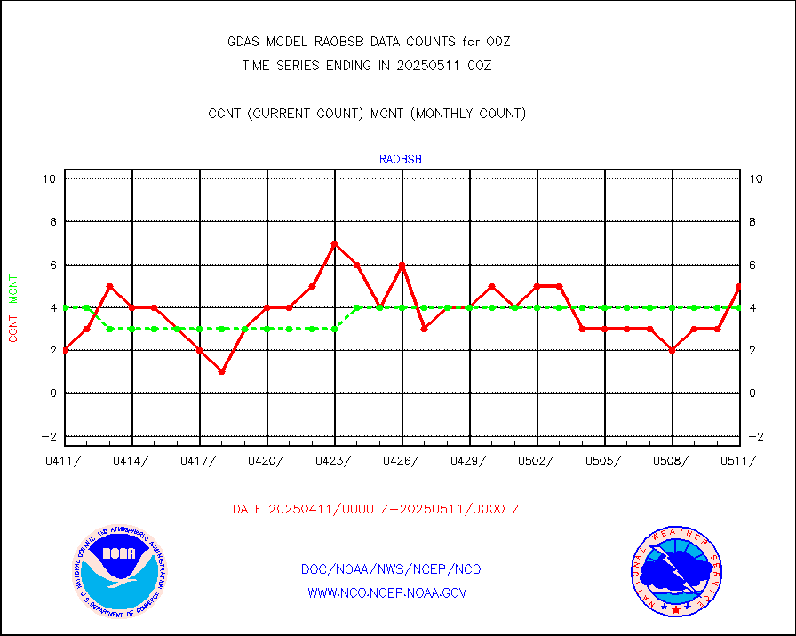
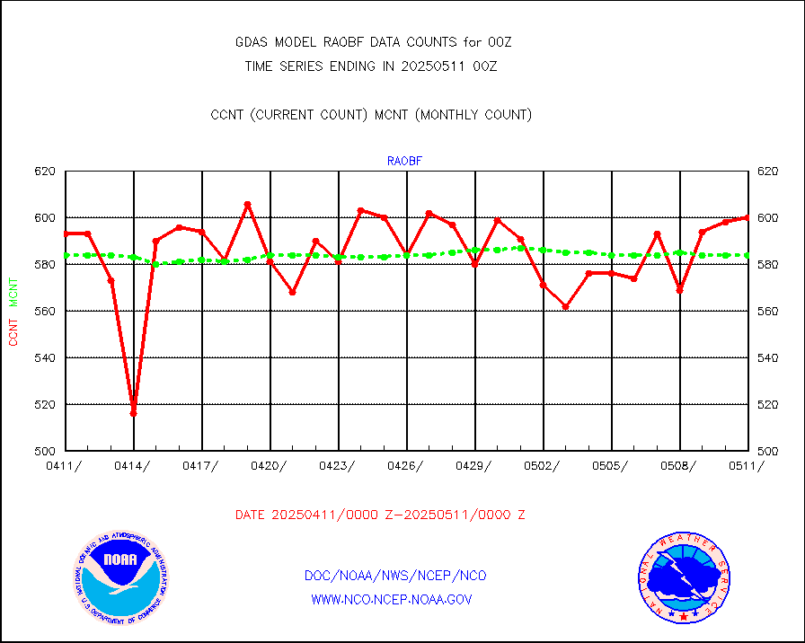
raobf |
Rawinsonde - fixed land (from TEMP or PILOT) |
604 |
601 |
100.5 % |
raobm |
Rawinsonde - mobile land (from TEMP/PILOT MOBIL) |
0 |
0 |
n/a |
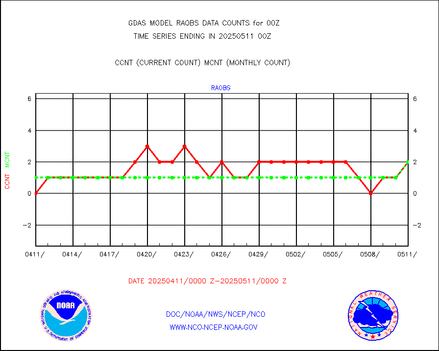
raobs |
Rawinsonde - ship (from TEMP SHIP, PILOT SHIP) |
2 |
1 |
200.0 % |
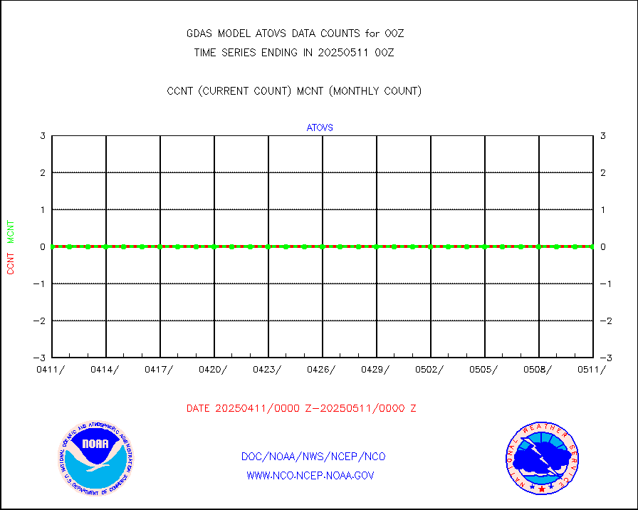
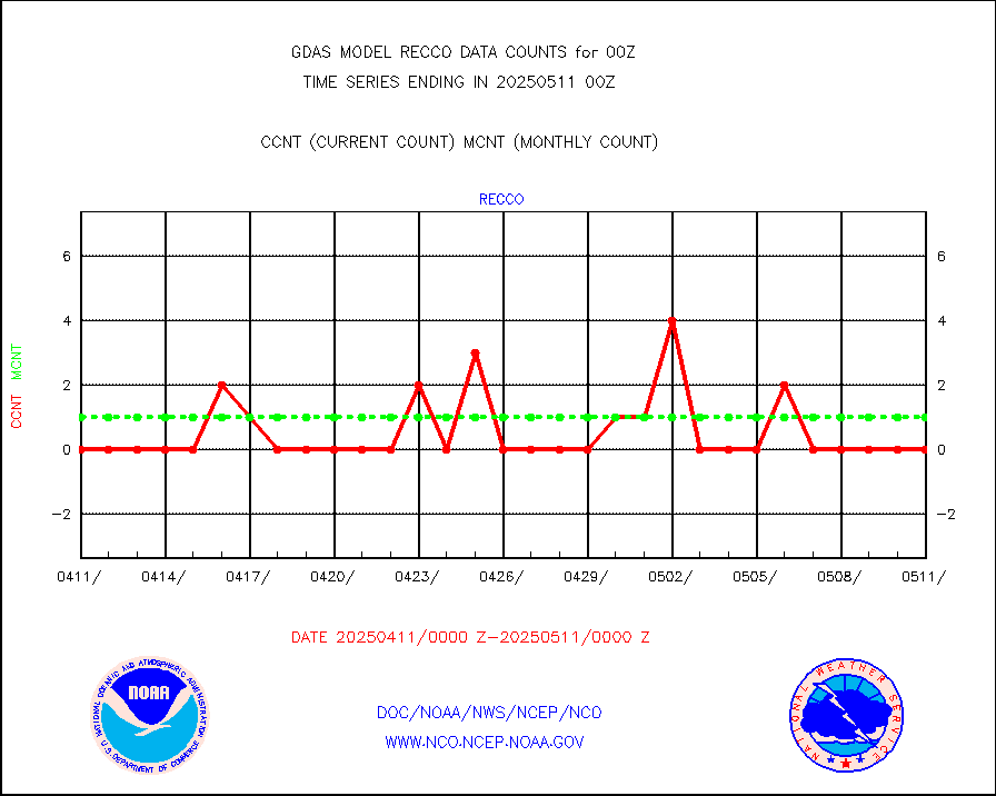
recco |
Flight level reconnaissance aircraft data |
0 |
1 |
0.0 % |
sevcsr |
METEOSAT-10 2nd Gen SEVIRI Clr Sky Radiance(proc) |
0 |
0 |
n/a |
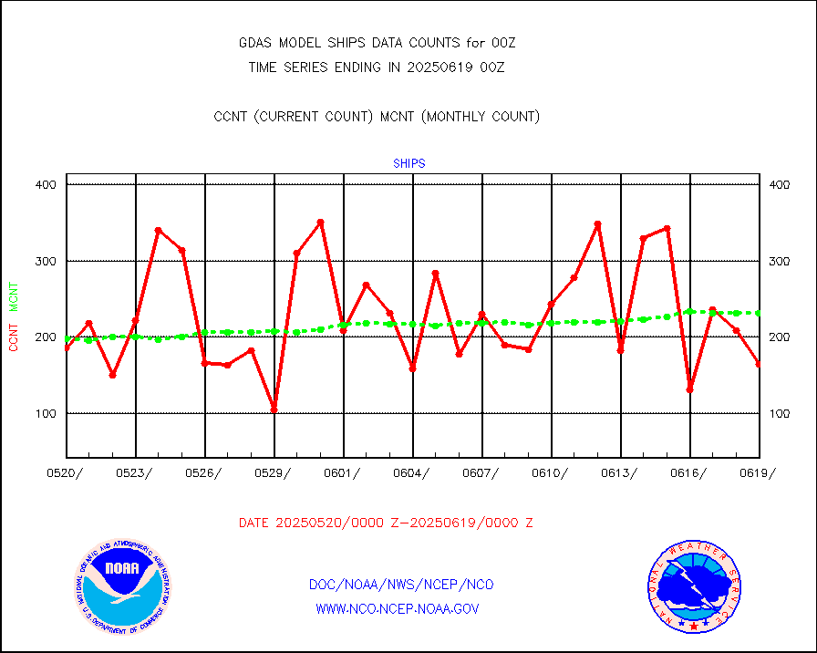
ships |
Ship - manual and automatic, restricted |
102 |
185 |
55.1 % |
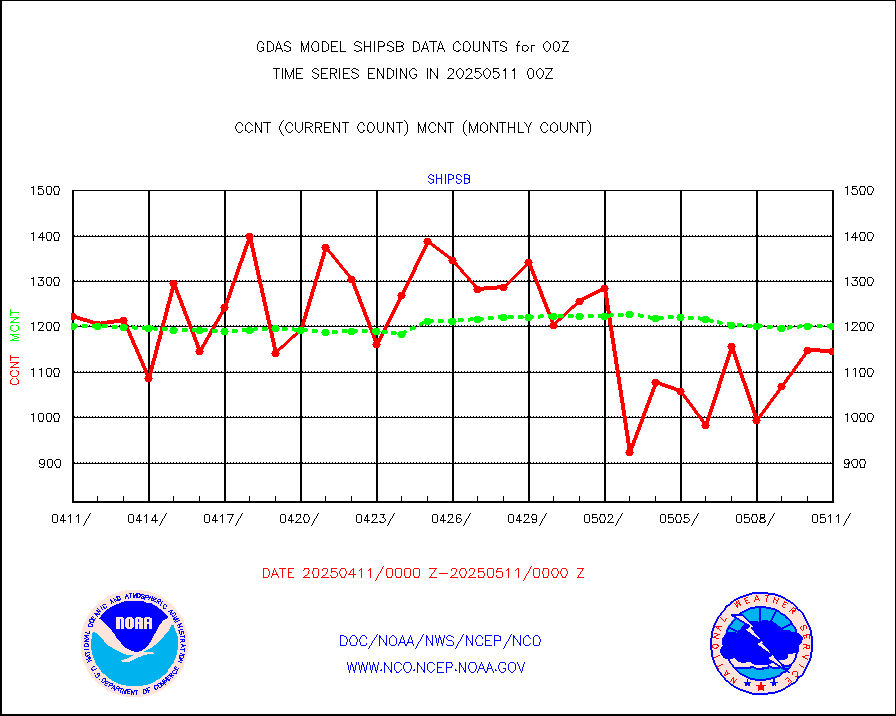
shipsb |
Ship - manual and automatic, restricted (BUFR) |
1180 |
948 |
124.5 % |
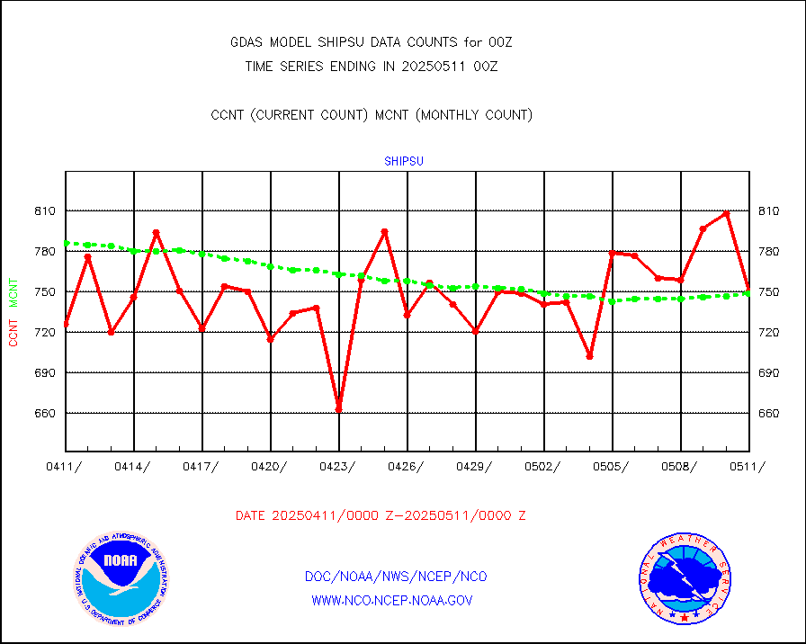
shipsu |
Ship - manual and automatic, unrestricted |
624 |
596 |
104.7 % |
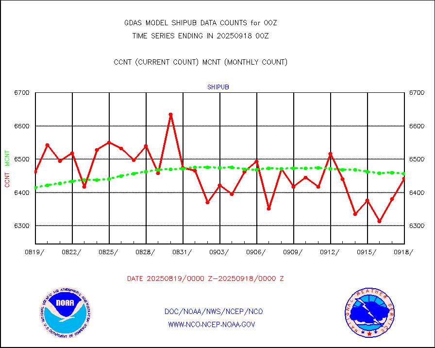
shipub |
Ship - manual and automatic, unrestricted (BUFR) |
6255 |
5860 |
106.7 % |
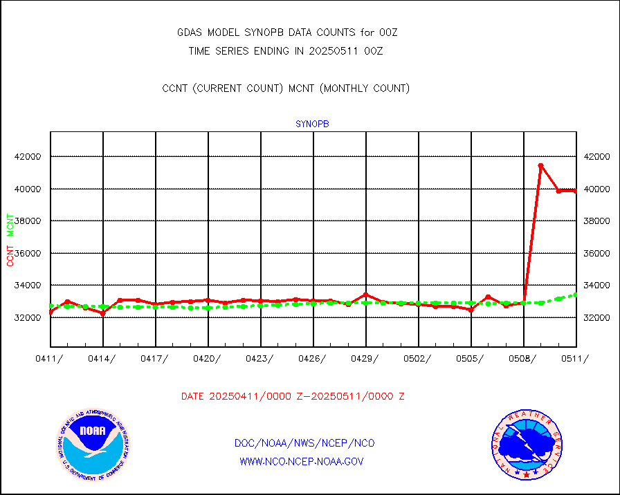
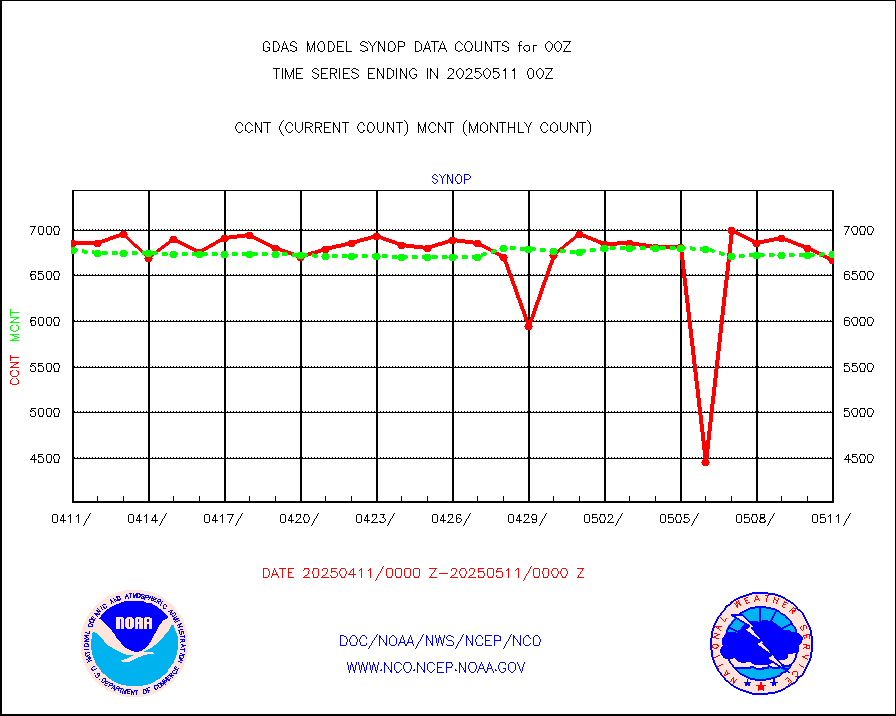
synopb |
Synoptic - fixed manual & auto (decoded fr BUFR) |
33203 |
31547 |
105.2 % |
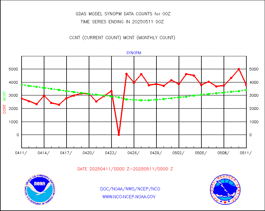
synopm |
Synoptic - mobile manual and automatic |
5970 |
5250 |
113.7 % |
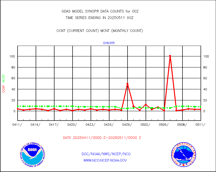
synopr |
Synoptic - restricted (WMO Res 40) manual & auto. |
52 |
3 |
n/a |
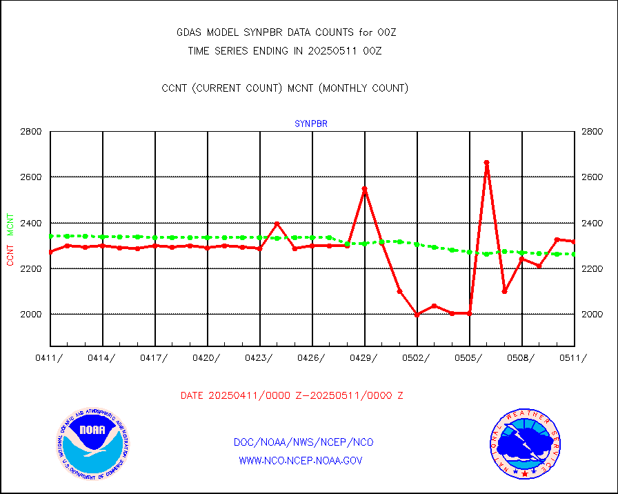
synpbr |
Synoptic - restricted (WMO Res 40)(decoded BUFR) |
2594 |
2281 |
113.7 % |
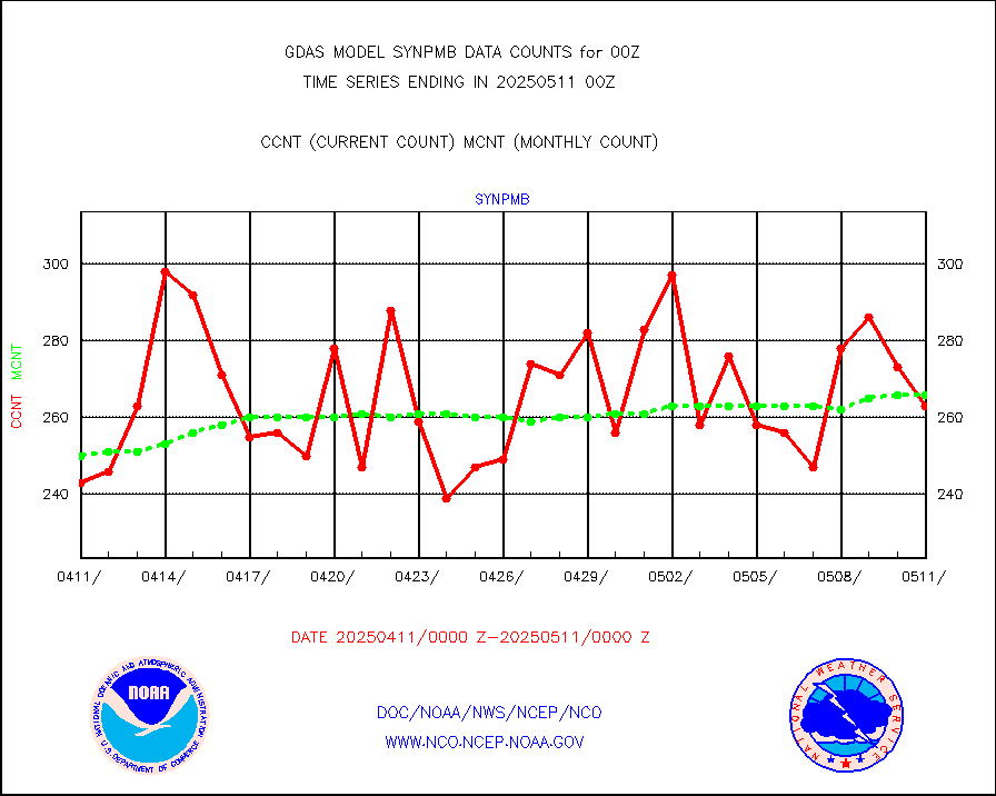
synpmb |
Synoptic - mobile manual & auto (decoded fr BUFR) |
69 |
73 |
94.5 % |
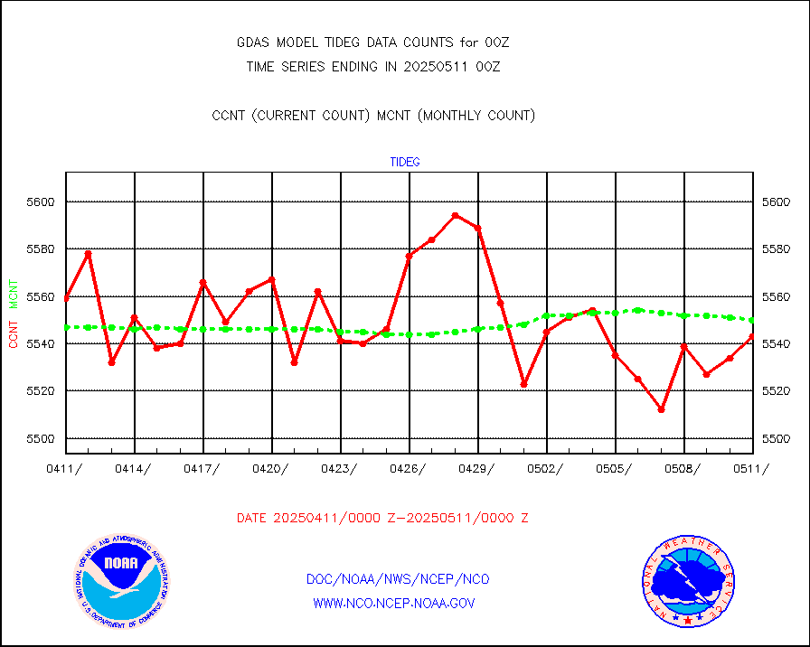
tideg |
Tide gauge reports decoded from CREX format |
5463 |
5472 |
99.8 % |
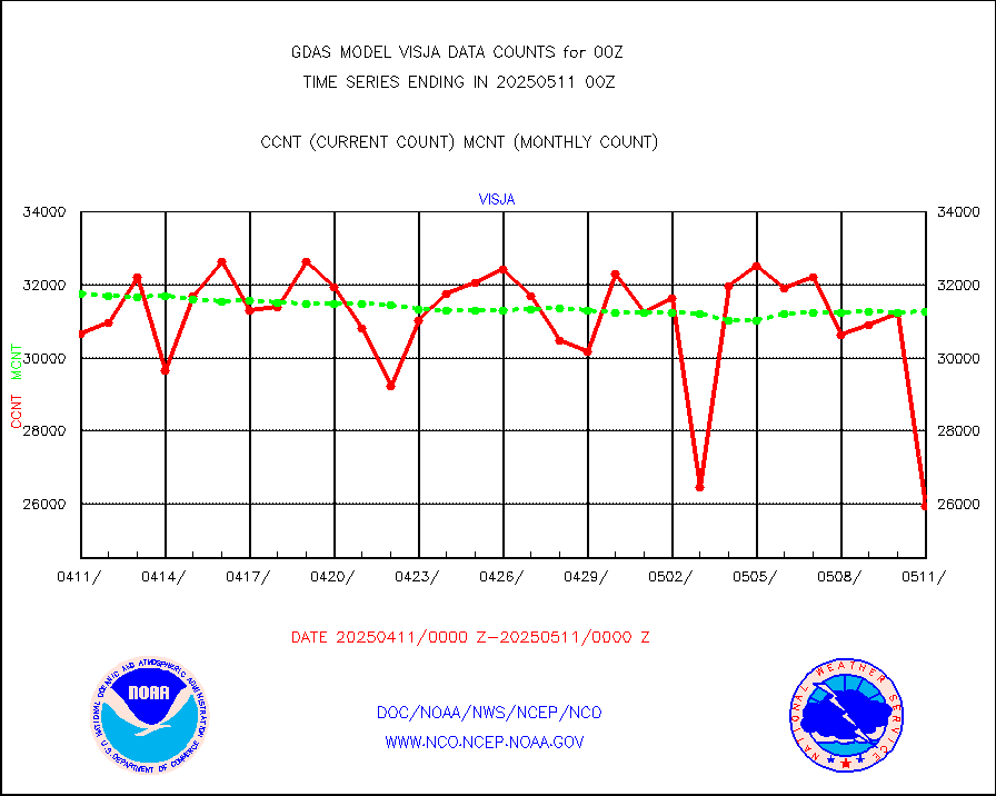
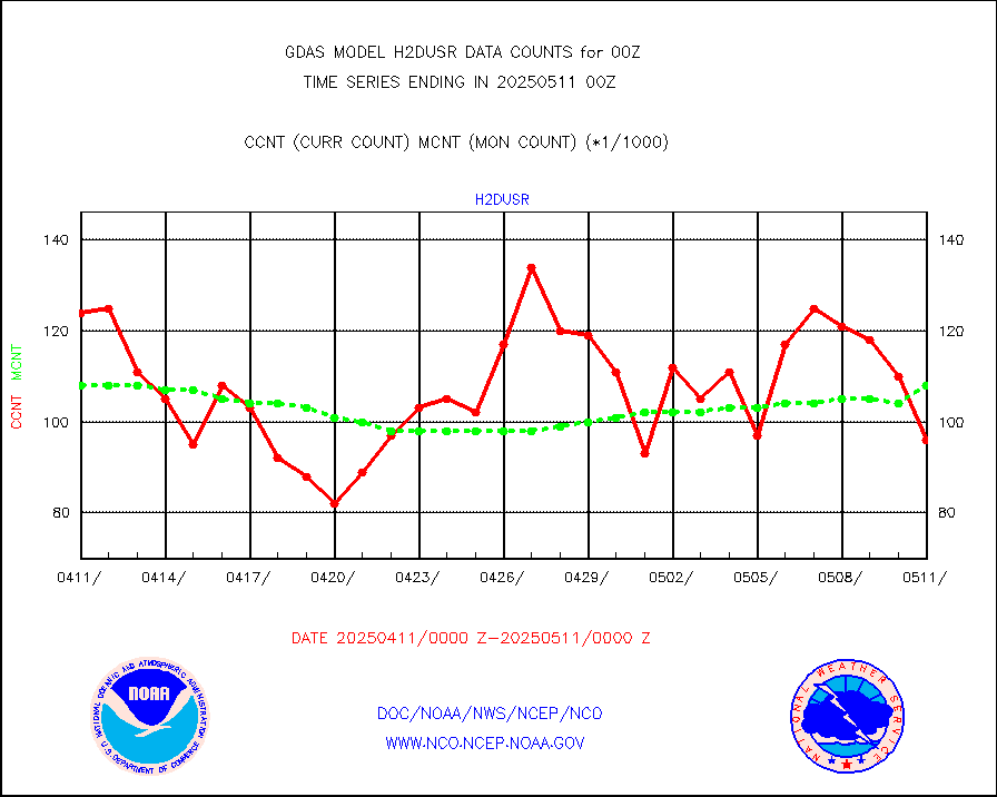
visja |
MTSAT/JMA visible derived cloud motion |
32272 |
31402 |
102.8 % |
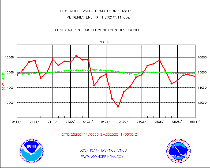
vseunb |
METEOSAT/EUMETSAT visible drv cld motion NBseq |
13051 |
13962 |
93.5 % |
| Data Types of Opportunity with Normal Counts |
|---|
| Type | Description | Hourly Count | Monthly Average | Percent (%) of Monthly Mean |
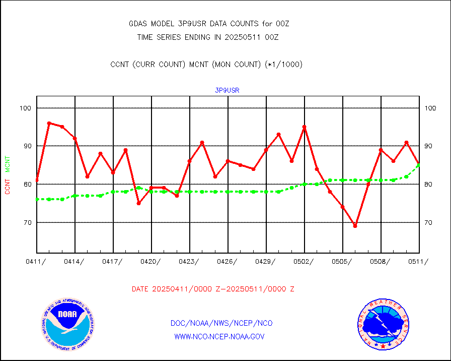
3p9usr |
GOES-16&up/NESDIS ir short-wv derived cld motion |
76927 |
83756 |
91.8 % |
acarsa |
MDCRS ACARS acft data (ARINC via AFWA)(AIREP fmt) |
0 |
0 |
n/a |
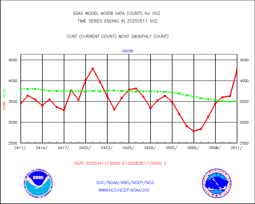
amsr2 |
GCOM-W AMSR2 1B brightness temperatures |
9999999 |
9999999 |
100.0 % |
atmsdb |
NPP/NOAA-20 ATMS bright. temps-direct b-cast SSEC |
513509 |
496026 |
103.5 % |
atovs |
POES/NESDIS - processed ATOVS soundings/radiances |
0 |
0 |
n/a |
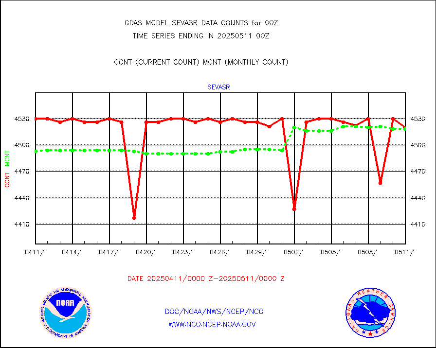
avcsam |
A.M.(N17,M2,M3) AVHRR GAC NCEP-proc clr&sea btmps |
8140347 |
8329646 |
97.7 % |
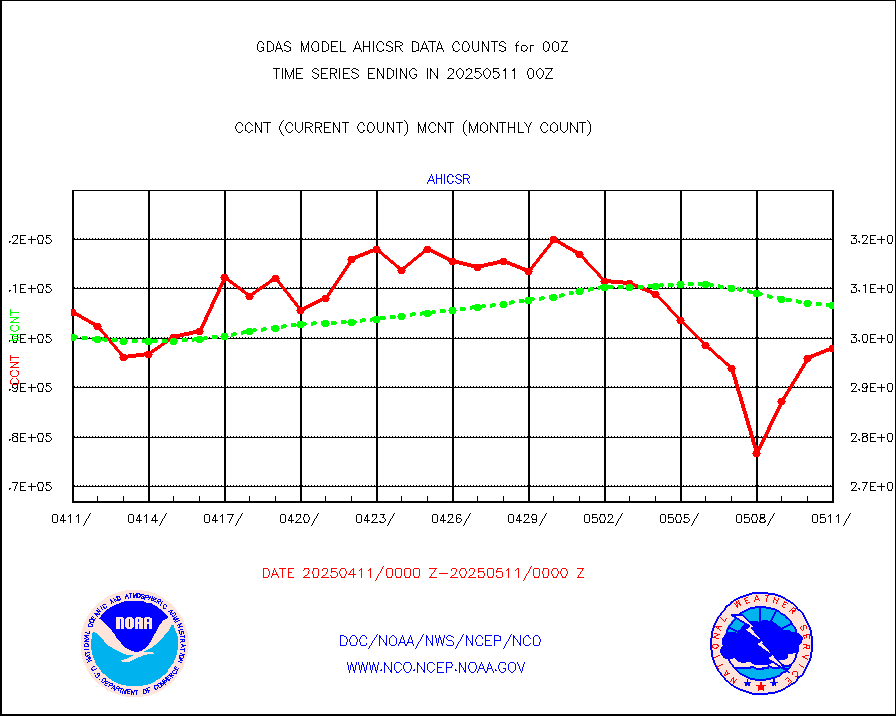
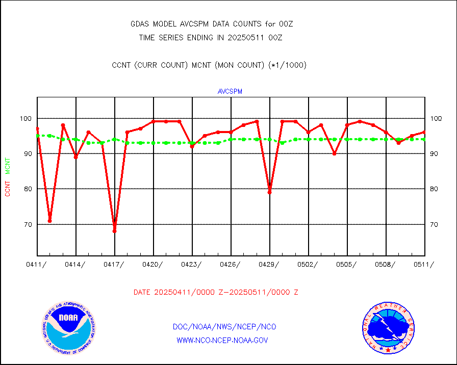
avcspm |
P.M.(N18-19) AVHRR GAC NCEP-proc clr & sea btemps |
9279481 |
9565404 |
97.0 % |
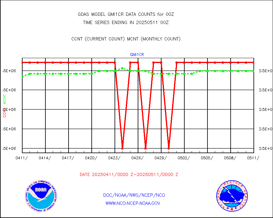
bathy |
eXpendable BathyThermograph, mooring (BATHY fmt) |
2 |
2 |
100.0 % |
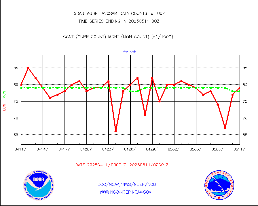
crisf4 |
NPP/NOAA-20 CrIS full spctrl radn (431 ch subset) |
1458000 |
1446443 |
100.8 % |
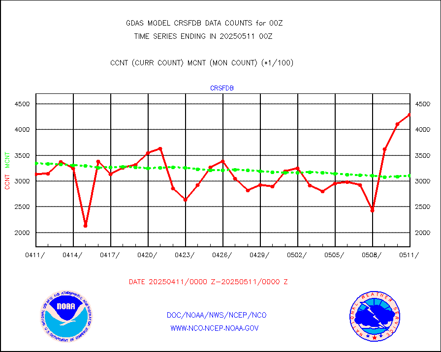
crsfdb |
NPP/NOAA-20 CrIS full spctrl radn dir brdcst SSEC |
557711 |
477004 |
116.9 % |
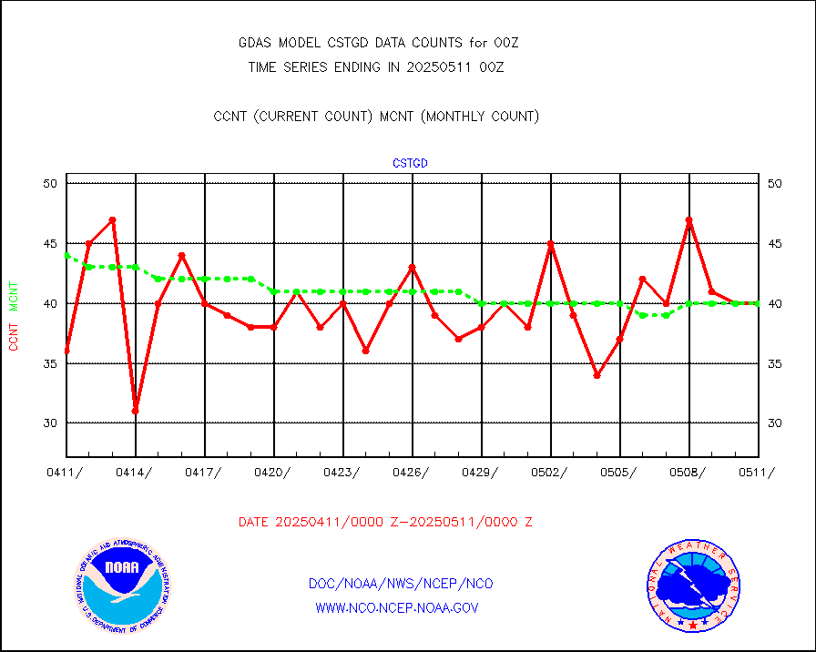
cstgd |
Coast Guard |
36 |
33 |
109.1 % |
dbuoyb |
Drifting buoys (decoded from BUFR) |
8536 |
8526 |
100.1 % |
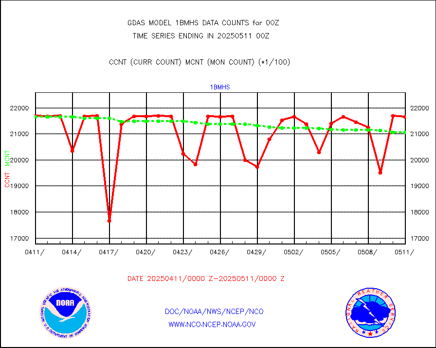
esatms |
NPP Adv. Tech. MW Sndr (ATMS) br. temps from RARS |
442705 |
455717 |
97.1 % |
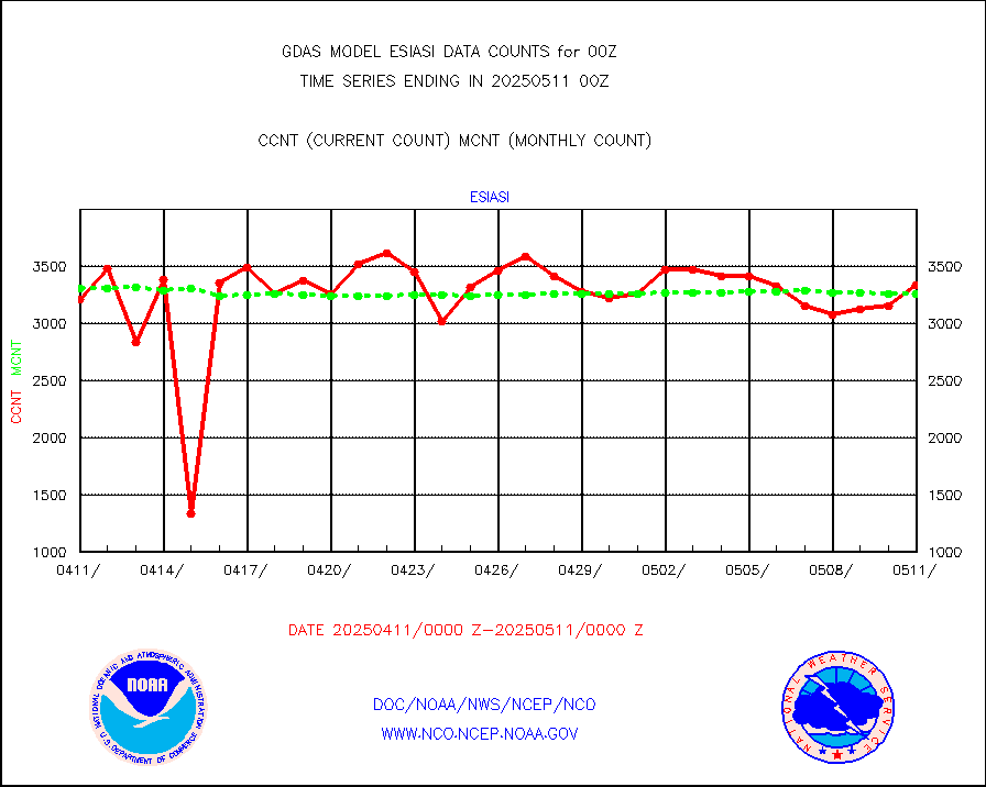
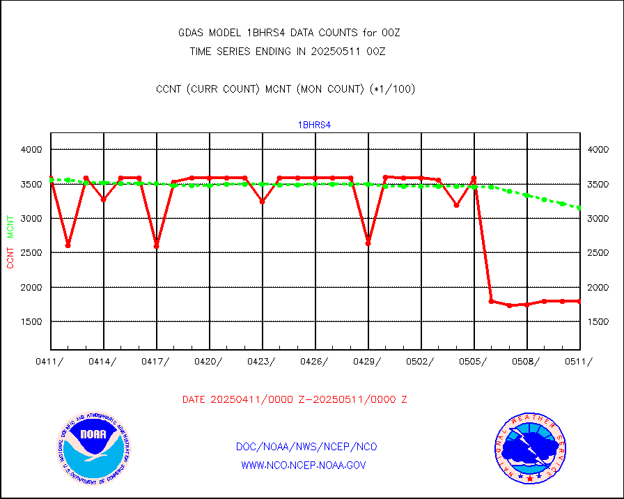
esiasi |
METOP 1-2 IASI 1C radiance data vbl chn from RARS |
478902 |
400066 |
119.7 % |
esmhs |
NOAA 18-19 & METOP 1-2 MHS proc. btemps from RARS |
2508429 |
2413051 |
104.0 % |
geoimr |
GOES/NESDIS (11x17 f-o-v) imager clear radiances |
0 |
0 |
n/a |
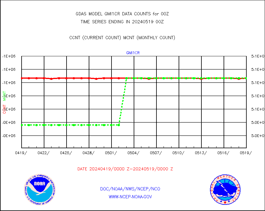
gmi1cr |
GPM GMI Level 1C-R brightness temperatures |
5083442 |
5083369 |
100.0 % |
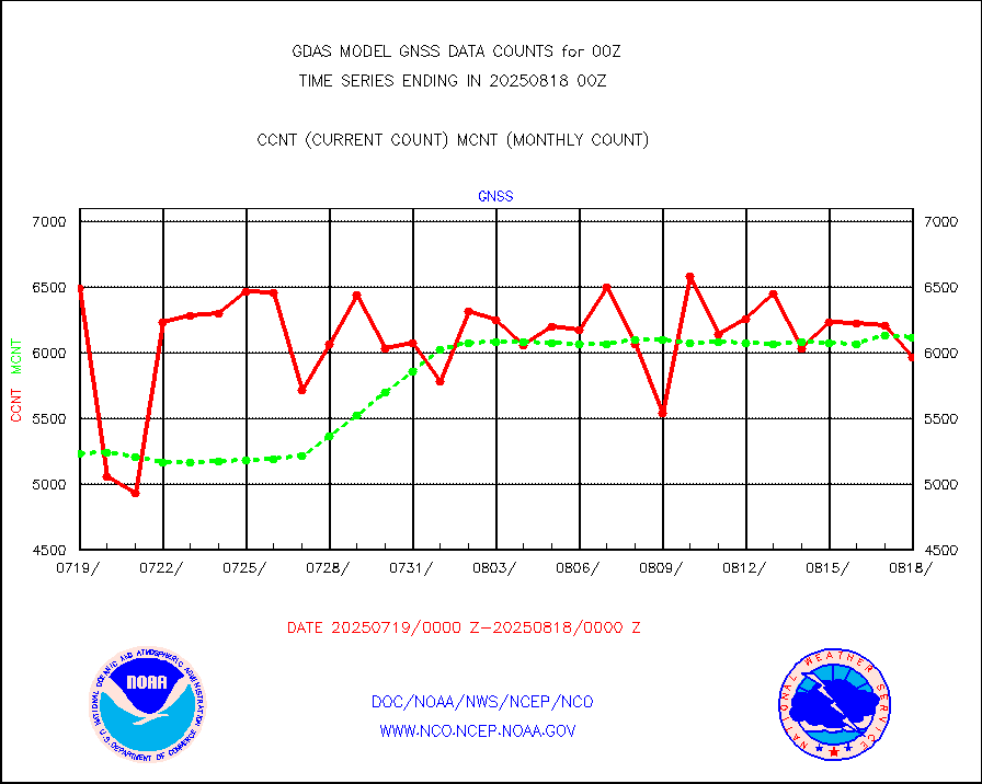
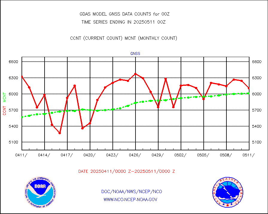
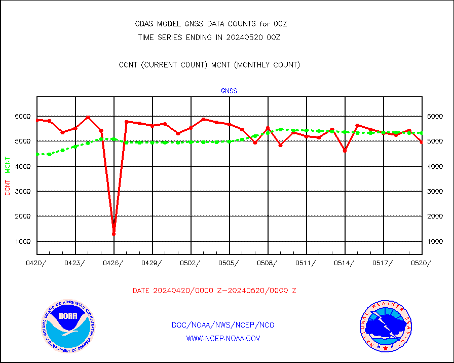
gnss |
Grnd-based Gbl Navigation Sat System (GNSS) data |
5533 |
5323 |
103.9 % |
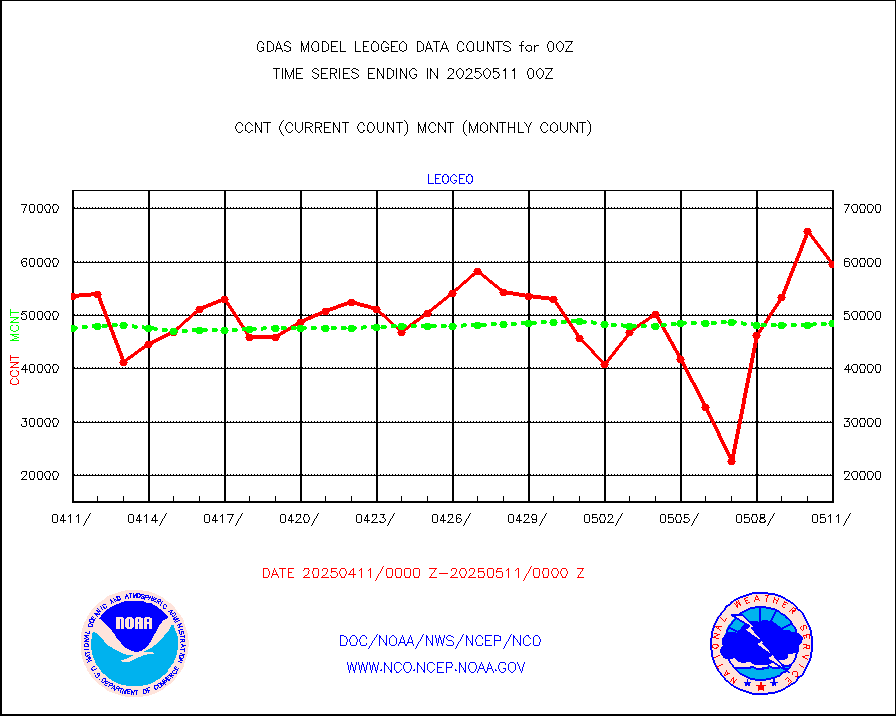
gome |
METOP 1-2 Global Ozone Monitoring Exp.-2 (GOME-2) |
79295 |
79819 |
99.3 % |
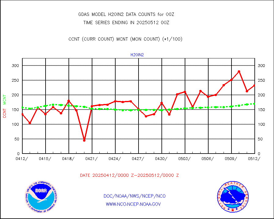
h20in |
INSAT/KALPANA India wvpr derived cloud motion |
0 |
0 |
n/a |
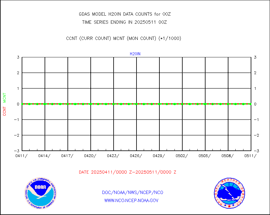
h2dusr |
GOES-16&up/NESDIS wv imgr/deep-lyr derivd cld mtn |
94295 |
103640 |
91.0 % |
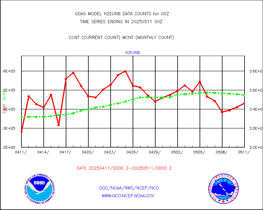
h2eunb |
METEOSAT/EUMETSAT wvpr imgr drv cld motion NBseq |
239072 |
249420 |
95.9 % |
hdob |
High Density OBs from reconnaissance acft data |
171 |
97 |
176.3 % |
iasidb |
METOP 1-2 IASI 1C radiances-direct broadcast SSEC |
285103 |
282987 |
100.7 % |
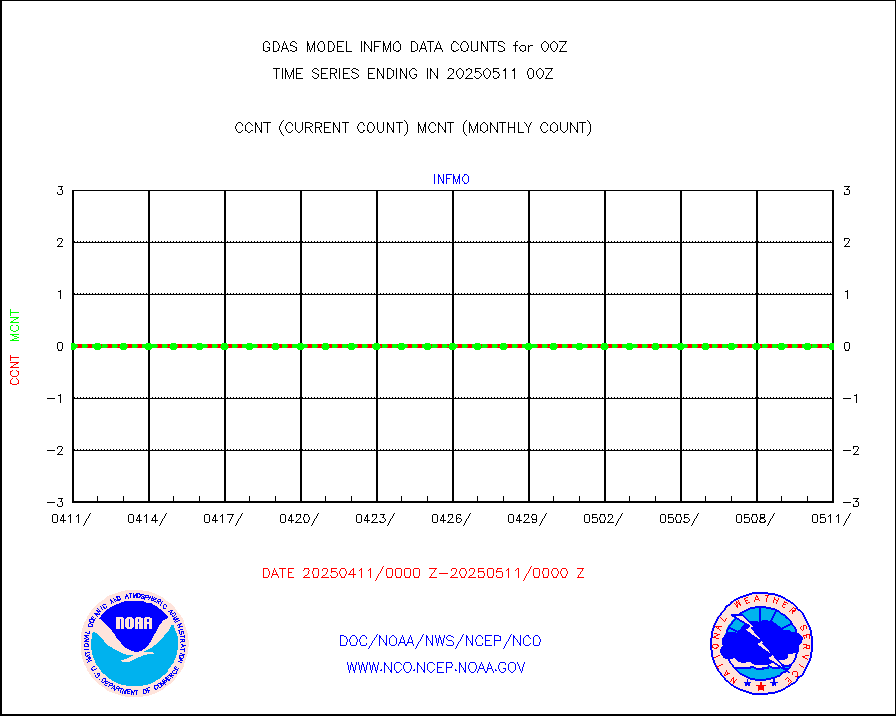
ifvrnb |
VIIRS (NPP/NOAA-20) ir lg-wv drv cloud motion(NB) |
96660 |
105863 |
91.3 % |
infav |
AVHRR (NOAA/METOP) ir lg-wave derived cld motion |
0 |
0 |
n/a |
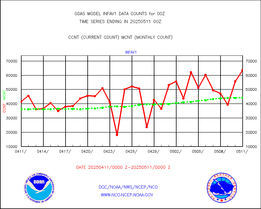
infav1 |
AVHRR (METOP) ir lg-wave derived cld motion |
51654 |
43913 |
117.6 % |
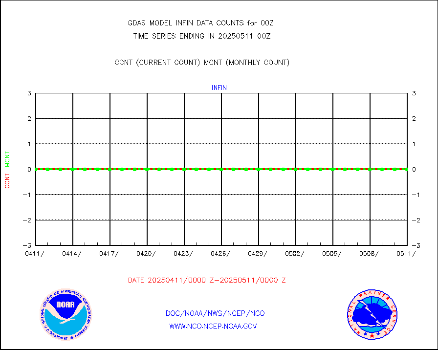
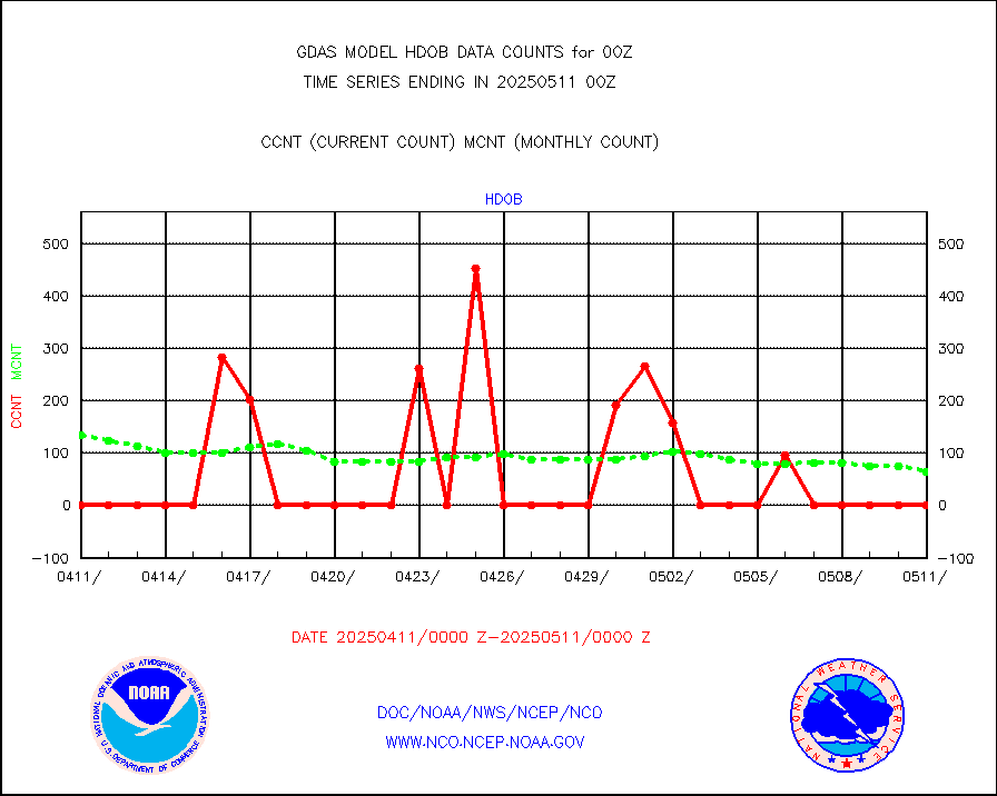
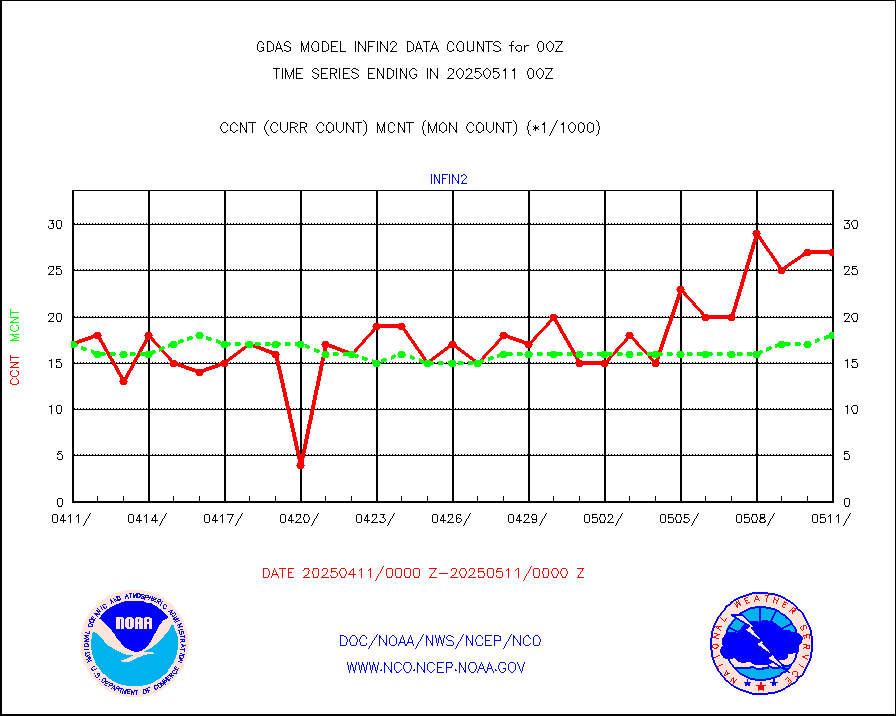
infin |
INSAT/KALPANA India ir lg-wave derived cld motion |
0 |
0 |
n/a |
kamdar |
Korean AMDAR aircraft data (decoded from BUFR) |
352 |
453 |
77.7 % |
mbuoyb |
Moored buoys (decoded from BUFR) |
6417 |
5771 |
111.2 % |
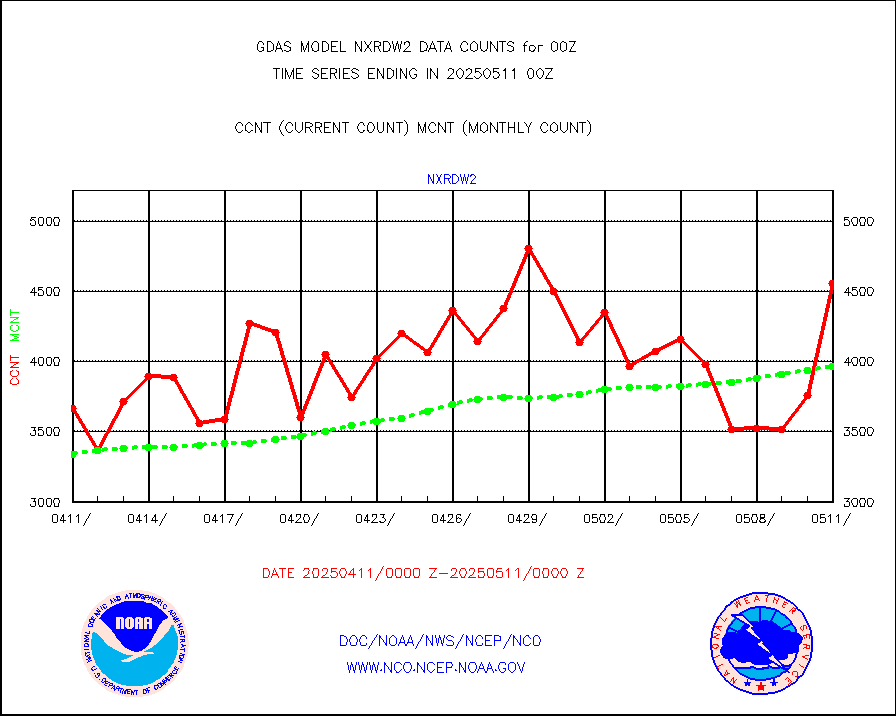
nxrdw2 |
NEXRAD Vel Azm Dsp(VAD) winds via Level 2 decoder |
5045 |
4358 |
115.8 % |
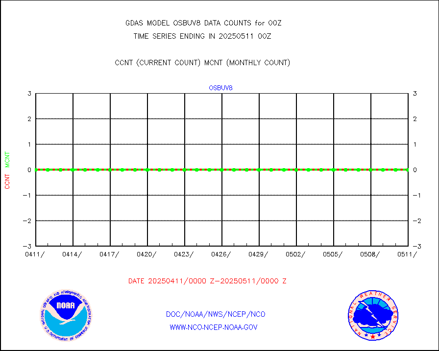
ompslp |
OMPS Limb Profiler ozone data (NPP) |
1115 |
1469 |
75.9 % |
ompsn8 |
OMPS nadir profile ozone (Version 8 BUFR) |
3308 |
3337 |
99.1 % |
ompst8 |
OMPS total column ozone (Version 8 BUFR) |
1906640 |
2006816 |
95.0 % |
pirep |
Manual PIREP aircraft data (dcded from AIREP fmt) |
798 |
676 |
118.0 % |
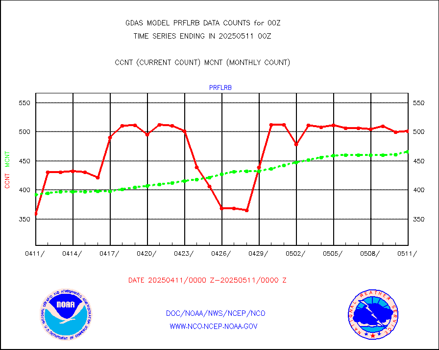
prflrb |
Multi-Agency Profiler (MAP) and SODAR winds |
439 |
380 |
115.5 % |
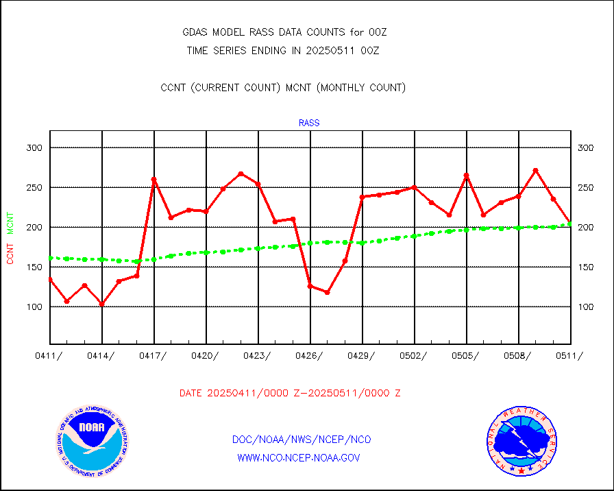
rass |
RASS temperatures (NOAA and Multi-Agency) |
215 |
193 |
111.4 % |
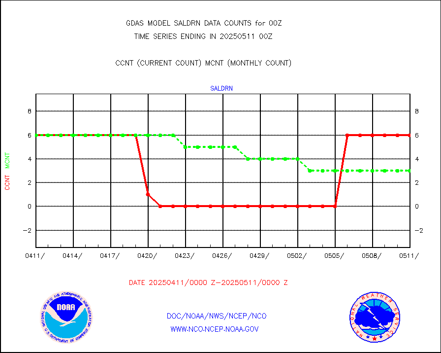
saldrn |
Surface Marine Saildrone (decoded from BUFR) |
6 |
6 |
100.0 % |
saphir |
Megha-Tropiques SAPHIR L1A2 brightness temps |
0 |
0 |
n/a |
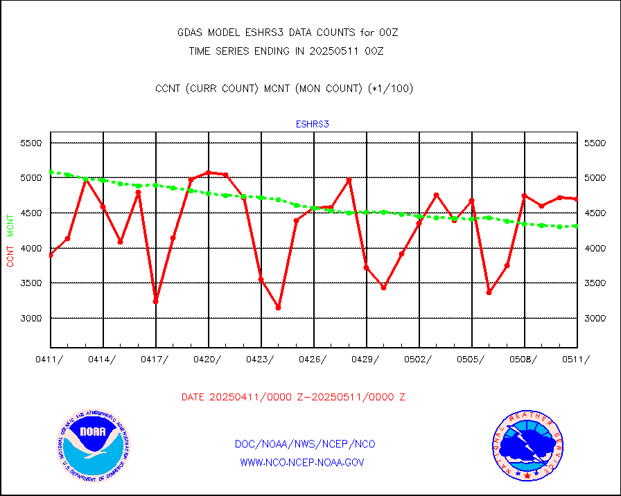
sevasr |
METEOSAT-10 2nd Gen SEVIRI All Sky Radiance(proc) |
453072 |
452732 |
100.1 % |
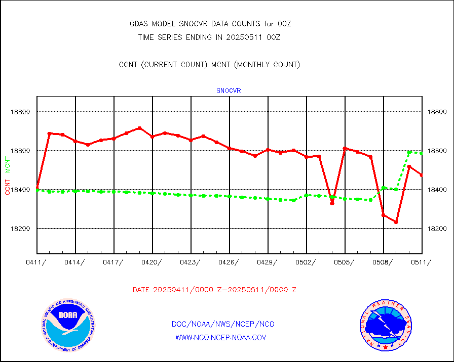
snocvr |
NOW COVER, DEPTH/DENSITY AND WATER EQUIVALENT |
19818 |
19281 |
102.8 % |
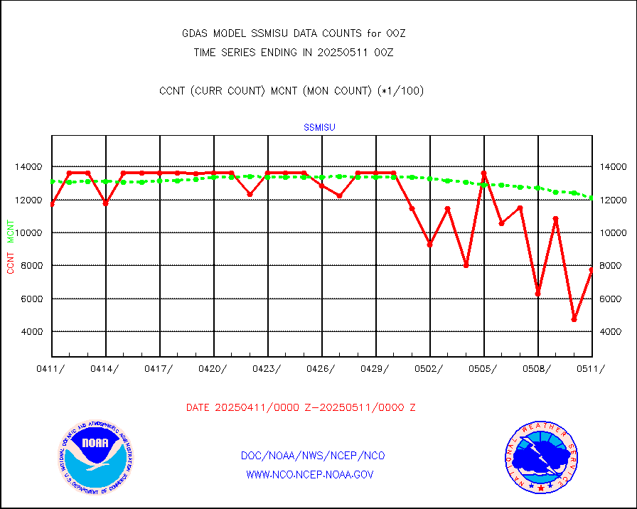
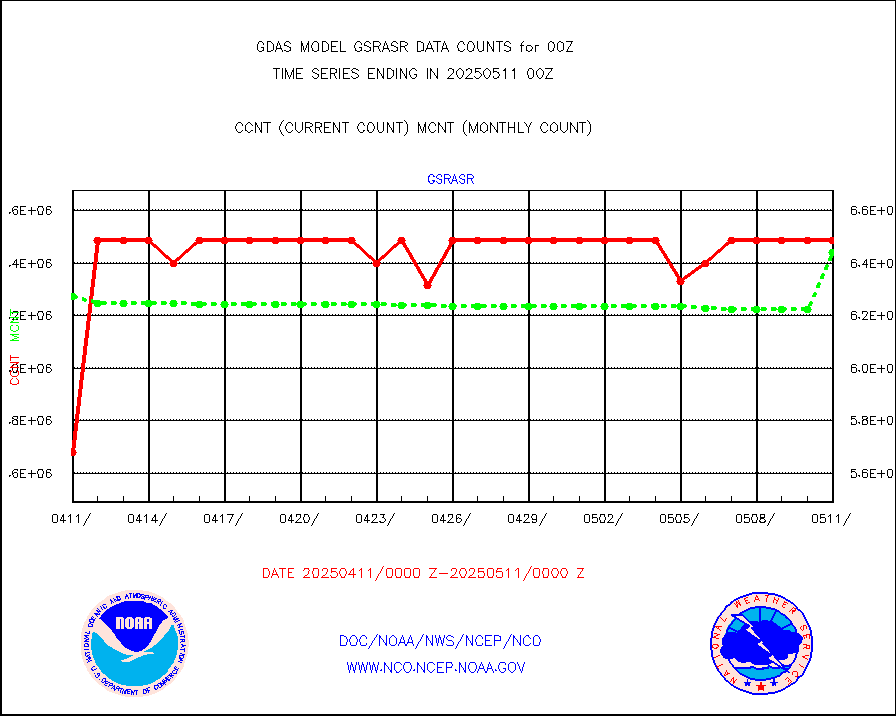
ssmisu |
DMSP SSM/IS 1C radiance data (Unified Pre-Proc.) |
1363440 |
1223604 |
111.4 % |
sstvpw |
NPP/NOAA-20 VIIRS SST - PROBABLY CLR & OVER WATER |
9999999 |
9999999 |
100.0 % |
synop |
Synoptic - fixed manual and automatic |
6462 |
7745 |
83.4 % |
tesac |
CTD probe, Argo prflng float, mooring (TESAC fmt) |
2621 |
2381 |
110.1 % |
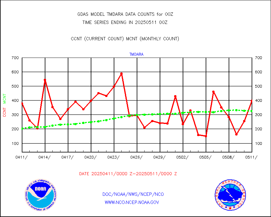
tmdara |
TAMDAR aircft data-all types(from Panasonic,BUFR) |
2092 |
2094 |
99.9 % |
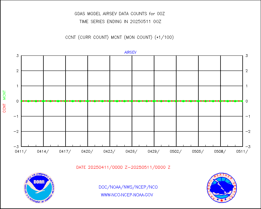
trkob |
ThermoSalinoGraph (TSG) TRACKOB format) |
404 |
285 |
141.8 % |
visin |
INSAT/KALPANA India visible derived cloud motion |
0 |
0 |
n/a |
visin2 |
INDIA SATWIND, INSAT VIS channel |
78 |
106 |
73.6 % |
visusr |
GOES-16&up/NESDIS visible derived cloud motion |
1628583 |
1721201 |
94.6 % |


